Road Information |
||
 |
||
| Total Mileage in State: | 187 miles | |
| Northern End: | At Ohio state line | |
| Southern End: | At Virginia state line | |
| Mileage covered in Photos: | 187 miles | |
| Counties covered in Photos: | Mercer, Raleigh, Fayette, Kanawha, Jackson, Wood | |
| Major Junctions in Photos: | I-64 East, near Beckley US 19, near North Beckley I-64 West, in Charleston I-79, in Charleston |
|
| Control Cities in Photos: | Princeton, Beckley, Charleston, Parkersburg | |
Northbound
- Section 1: Virginia Border to Chelyan (Exit 85)
- Section 2: Chelyan (Exit 85) to Ohio Border
Section 1: Virginia Border to Chelyan (Exit 85)
 |
Interstate 77 North at Exit 1: US 52 North - Bluefield (Photo taken 5/6/11). |
 |
West Virginia welcome sign as Interstate 77 North enters the state from Virginia. (Photo taken 5/6/11). |
 |
Interstate 77 North shield sign located near mile marker 1. (Photo taken 5/6/11). |
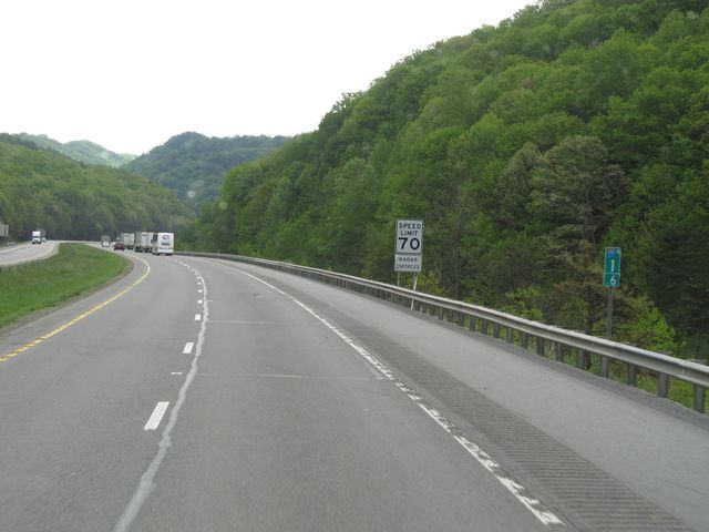 |
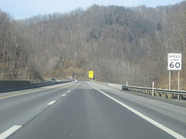
Interstate 77 North: Road view from mile marker 1.6. As you can also see here, the speed limit is 70 mph, which is standard on most rural West Virginia freeways. (Photo taken 5/6/11). |
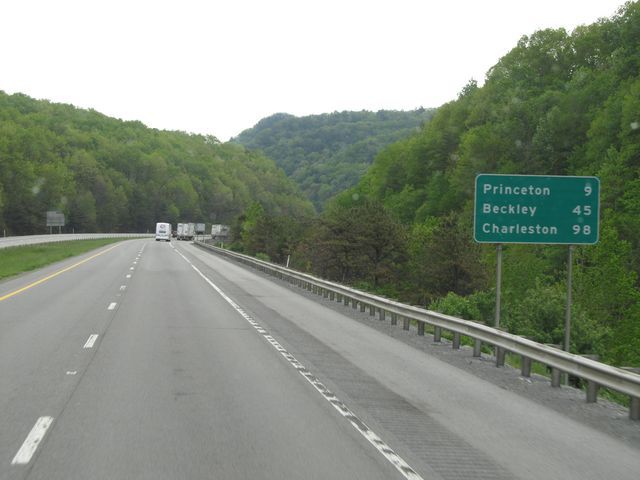 |
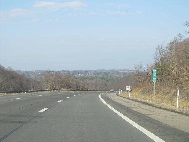
Mileage sign located near mile marker 2. It's 9 miles to Princeton, 45 miles to Beckley, and 98 miles to Charleston. (Photo taken 5/6/11). |
 |
Interstate 77 North: Road view from mile marker 2.5, as I-77 continues its downgrade which starts when you cross into the state. (Photo taken 5/6/11). |
 |
Interstate 77 North at Exit 7: CR 27 - Twelvemile Rd. This exit is a northbound-only exit with no re-entry to I-77 North. (Photo taken 5/6/11). |
 |
Interstate 77 North: Road view from near mile marker 7. (Photo taken 5/6/11). |
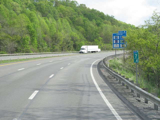 |
Interstate 77 North: Road view from mile marker 7.4 as I-77 starts to climb up toward Princeton. (Photo taken 5/6/11). |
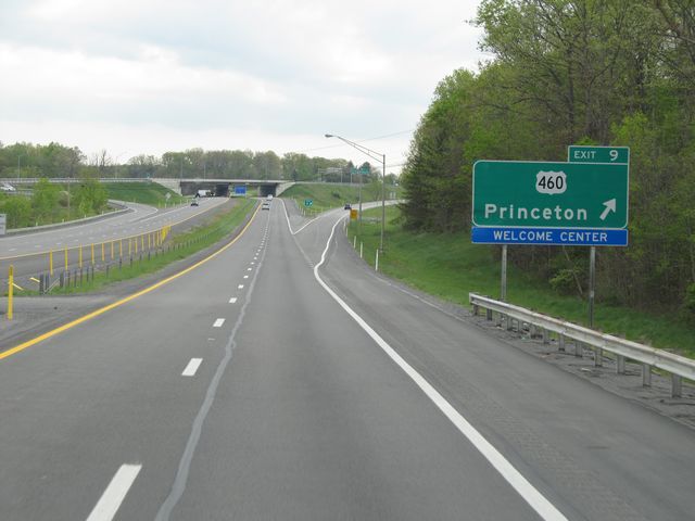 |
Interstate 77 North at Exit 9: US 460 - Princeton / Welcome Center. The Rest Area/Welcome Center is located off this exit. Trucks are not allowed at the Welcome Center. (Photo taken 5/6/11). |
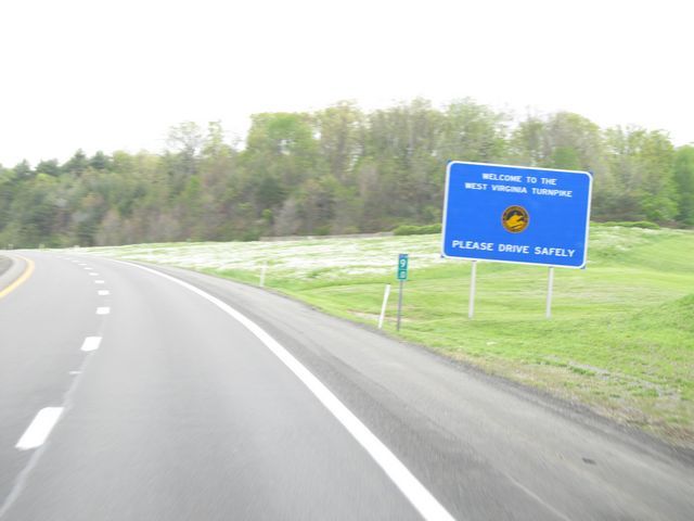 |
Sign at mile marker 9 indicating that you are entering the West Virginia Turnpike. Interstate 77 remains part of the turnpike until you are near Charleston. (Photo taken 5/6/11). |
 |
Interstate 77 North: Road view from mile marker 12. (Photo taken 5/6/11). |
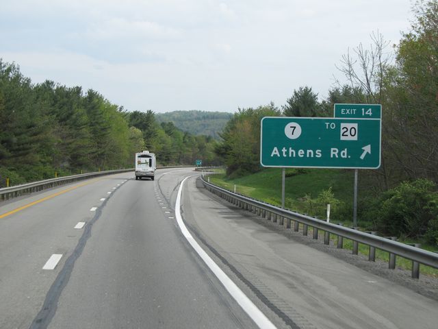 |
Interstate 77 North at Exit 14: CR 7 / To WV 20 - Athens Rd (Photo taken 5/6/11). |
 |
Interstate 77 North: Road view from mile marker 15. (Photo taken 5/6/11). |
 |
Warning sign at mile marker 15.5 warning truck drivers of a sharp curve 1/4 mile ahead. The recommended speed for the curve is 55 mph. (Photo taken 5/6/11). |
 |
Interstate 77 North: Road view from mile marker 16.5. (Photo taken 5/6/11). |
 |
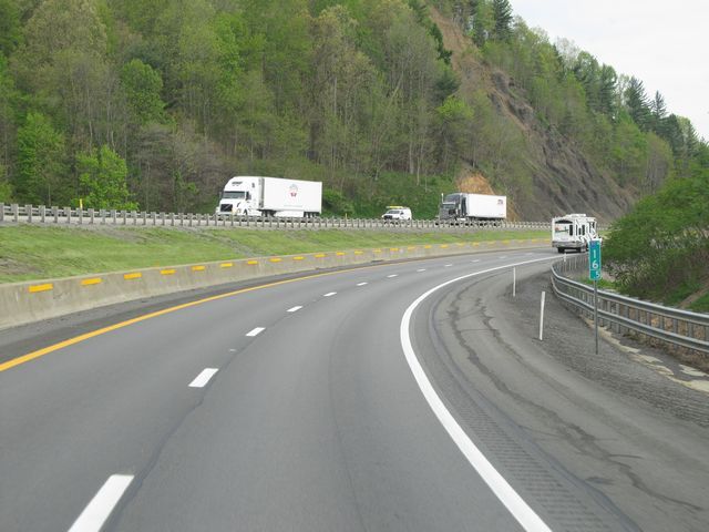
Interstate 77 North at the Rest Area / Service Plaza / Weigh Station located near mile marker 18. (Photo taken 5/6/11). |
 |
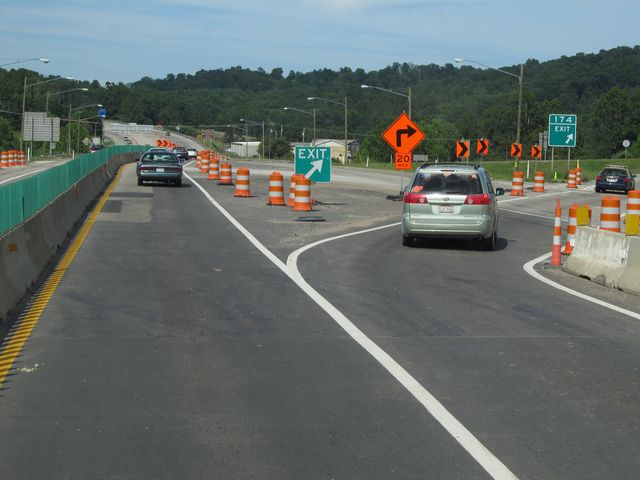
Interstate 77 North at Exit 20: US 19 - Camp Creek (Photo taken 5/6/11). |
 |
Interstate 77 North: Road view from near mile marker 20, as a 3rd northbound lane appears in preparation for the sharp upgrade just around the curve in the distance. (Photo taken 5/6/11). |
 |
Interstate 77 North: Road view from mile marker 21, as the aforementioned sharp upgrade begins. This mountain you are climbing in this picture is known as Flat Top. (Photo taken 5/6/11). |
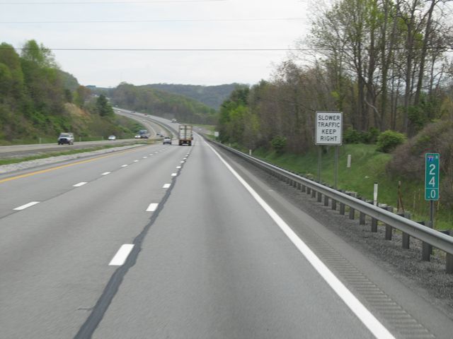 |
Interstate 77 North: Road view from mile marker 24. (Photo taken 5/6/11). |
 |
Interstate 77 North: Road view from mile marker 26.5, as you finally reach the peak of Flat Top at an elevation of 3,252 feet. (Photo taken 5/6/11). |
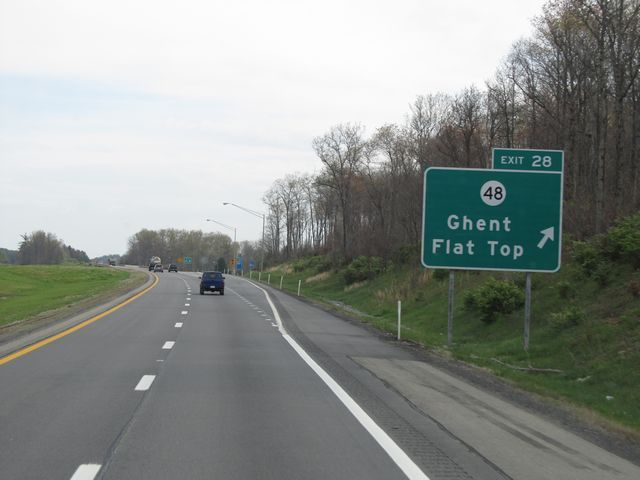 |
Interstate 77 North at Exit 28: CR 48 - Ghent / Flat Top (Photo taken 5/6/11). |
 |
Interstate 77 North approaching the first northbound Toll Plaza on the West Virginia Turnpike - 1/2 mile. (Photo taken 5/6/11). |
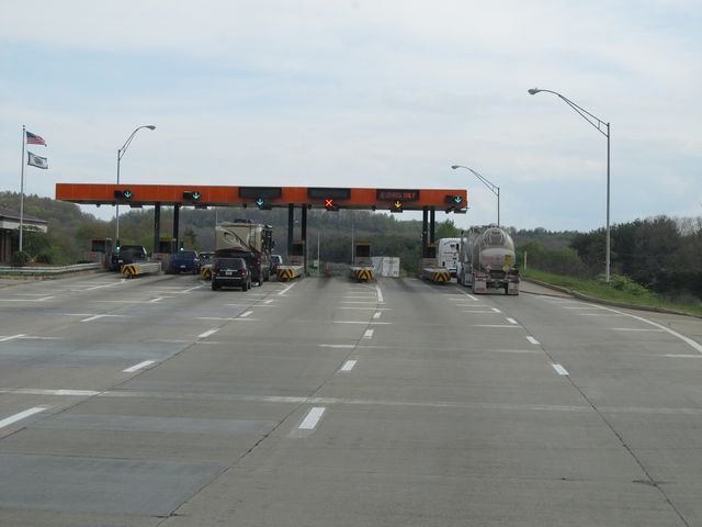 |
A closer view of the Toll Plaza, located near mile marker 30. (Photo taken 5/6/11). |
 |
Mileage sign located near mile marker 30.5, just after passing through the Toll Plaza. From this point, it's 7 miles to the junction of Interstate 64, 18 miles to Beckley, and 68 miles to Charleston. (Photo taken 5/6/11). |
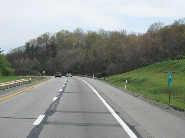 |
Interstate 77 North: Road view from mile marker 31.5. (Photo taken 5/6/11). |
 |
Interstate 77 North: Road view from mile marker 32.5. (Photo taken 5/6/11). |
 |
Interstate 77 North: Road view from mile marker 35.5. (Photo taken 5/6/11). |
 |
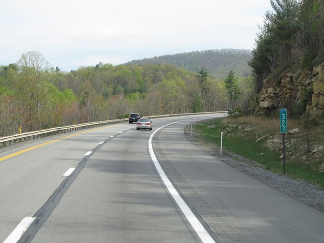
Interstate 77 North approaching Exit 40 - 1 mile. Be warned that the rightmost lane in this picture, which is oftentimes used as a climbing lane for trucks, turns into an Exit Only lane at the top of the hill. (Photo taken 5/6/11). |
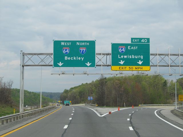 |
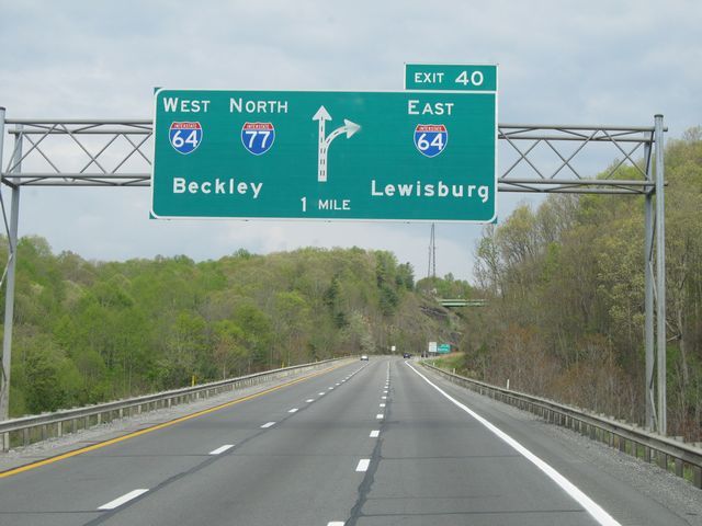
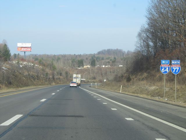
Interstate 77 North at Exit 40: Interstate 64 East - Lewisburg (Photo taken 5/6/11). |
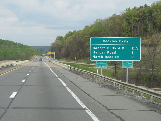 |
Sign near mile marker 40 listing the distances to the upcoming Beckley exits. (Photo taken 5/6/11). |
 |
Interstate 77 North / Interstate 64 West: Road view from mile marker 40. I-77 and I-64 run together from this point all the way to Charleston, near the northern end of the West Virginia Turnpike. (Photo taken 1/31/11). |
 |
Interstate 77 North / Interstate 64 West shield signs located just past mile marker 40. (Photo taken 1/31/11). |
 |
Speed limit sign located near mile marker 41. The speed limit on most rural West Virginia Interstate highways is 70 mph. (Photo taken 1/31/11). |
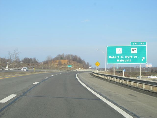 |
Interstate 77 North / Interstate 64 West at Exit 42: WV 16 / WV 97 - Robert C. Byrd Dr / Mabscott (Photo taken 1/31/11). |
 |
Interstate 77 North / Interstate 64 West at Exit 44: WV 3 - Harper Rd / Beckley (Photo taken 1/31/11). |
 |
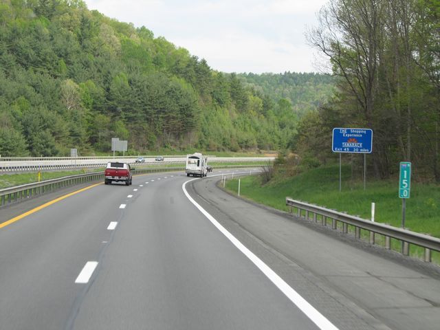
Interstate 77 North / Interstate 64 West at Exit 45: Tamarack (The Best of West Virginia) / Travel Plaza (Photo taken 1/31/11). |
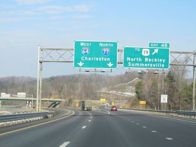 |
Interstate 77 North / Interstate 64 West at Exit 48: To US 19 - North Beckley / Summersville (Photo taken 1/31/11). |
 |
Interstate 77 North / Interstate 64 West: Road view from mile marker 48. (Photo taken 1/31/11). |
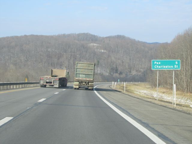 |
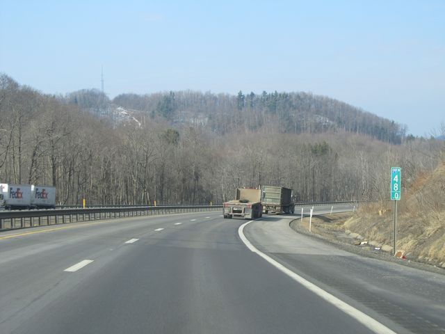
Mileage sign located near mile marker 49. From here, it's 5 miles to Pax and 51 miles to Charleston. (Photo taken 1/31/11). |
 |
Interstate 77 North / Interstate 64 West: Road view from near mile marker 53. (Photo taken 1/31/11). |
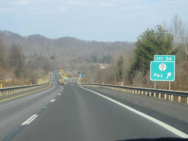 |
Interstate 77 North / Interstate 64 West at Exit 54: CR 23/2 - Pax (Photo taken 1/31/11). |
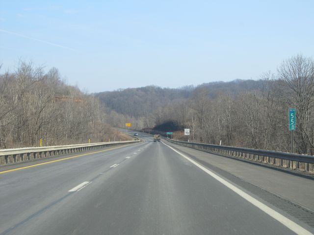 |
Interstate 77 North / Interstate 64 West: Road view from mile marker 55. (Photo taken 1/31/11). |
 |
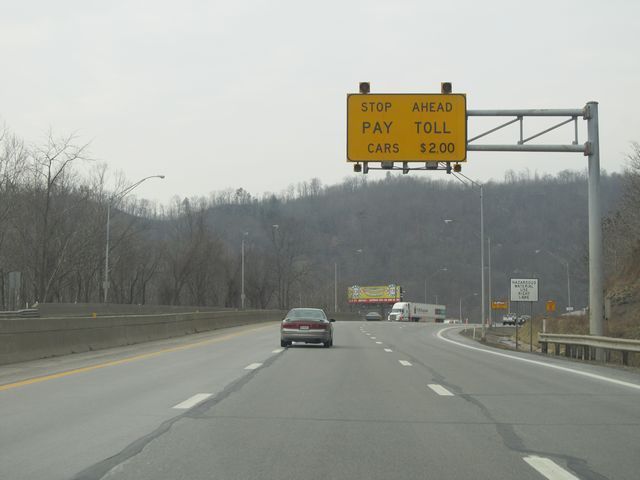
Interstate 77 North / Interstate 64 West approaching one of the Toll Plazas on the WV Turnpike - 1 mile. At this point in time, the toll due for cars was $2.00. West Virginia accepts EZ Pass at their Toll Plazas also. (Photo taken 1/31/11). |
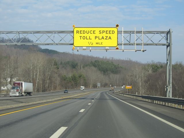 |
Sign warning motorists to reduce speed, as the Toll Plaza is now 1/2 mile ahead. (Photo taken 1/31/11). |
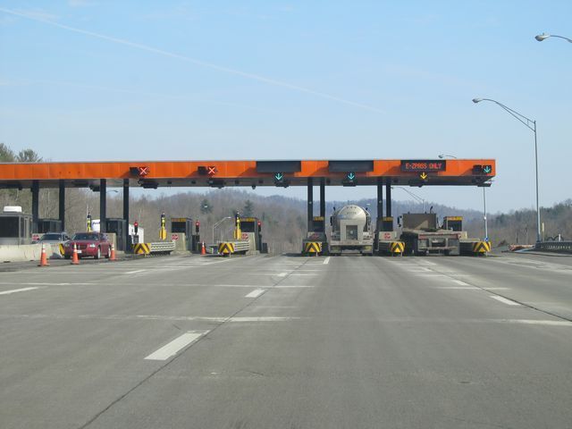 |
A view of the Toll Plaza, near mile marker 56. (Photo taken 1/31/11). |
 |
Interstate 77 North / Interstate 64 West: Road view from mile marker 57.5. (Photo taken 1/31/11). |
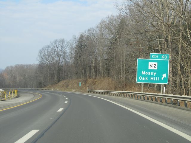 |
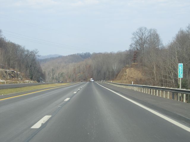
Interstate 77 North / Interstate 64 West at Exit 60: WV 612 - Mossy / Oak Hill (Photo taken 1/31/11). |
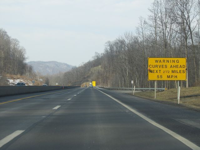 |
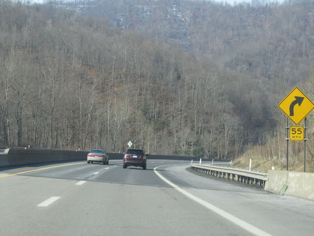
Warning sign near mile marker 61, alerting motorists of sharp curves ahead in the next 2 1/2 miles. The recommended speed around these curves is 55 mph. (Photo taken 1/31/11). |
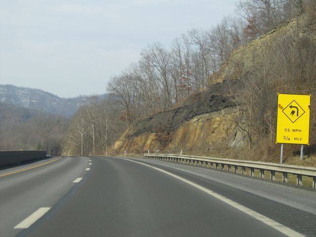 |
Another warning sign stating that the first of several sharp curves is 3/4 mile ahead. (Photo taken 1/31/11). |
 |
Interstate 77 North / Interstate 64 West: Road view from mile marker 62. (Photo taken 1/31/11). |
 |
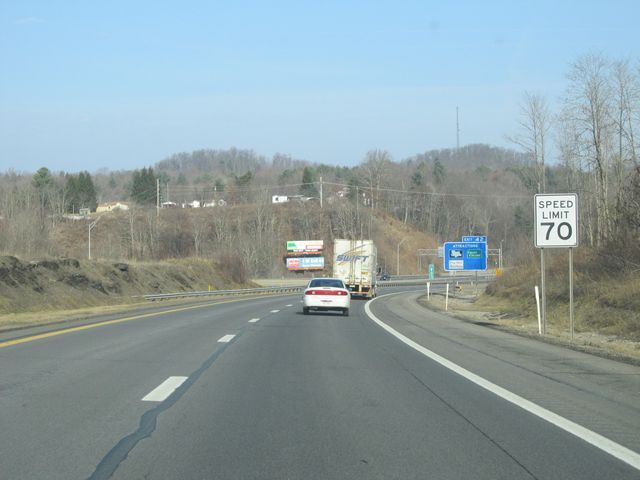
The speed limit drops from 70 mph to 60 mph during this stretch of sharp curves. (Photo taken 1/31/11). |
 |
Interstate 77 North / Interstate 64 West as it traverses around one of the many 55 mph curves during this stretch. This one is near mile marker 63. (Photo taken 1/31/11). |
 |
Interstate 77 North / Interstate 64 West: Road view from near mile marker 64. (Photo taken 1/31/11). |
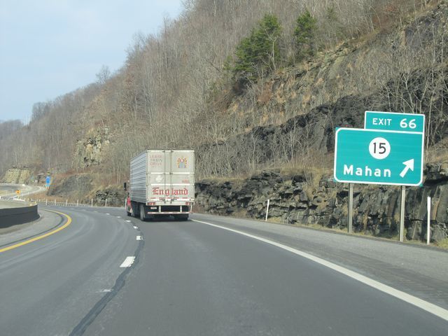 |
Interstate 77 North / Interstate 64 West at Exit 66: CR 15 - Mahan (Photo taken 1/31/11). |
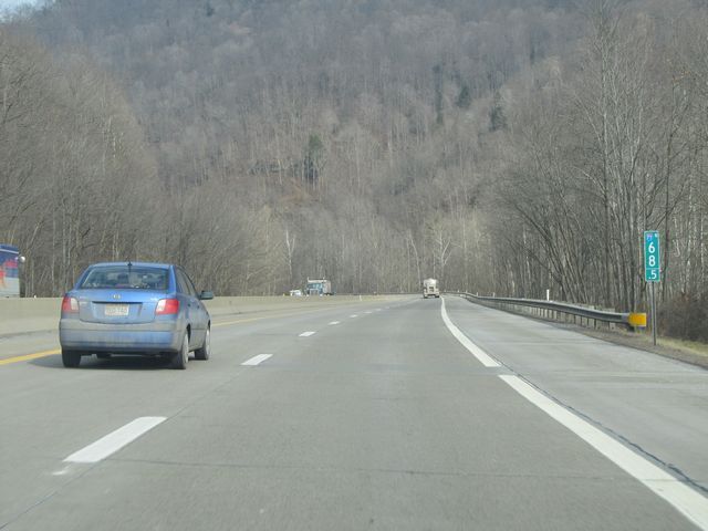 |
Interstate 77 North / Interstate 64 West: Road view from mile marker 68.5. (Photo taken 1/31/11). |
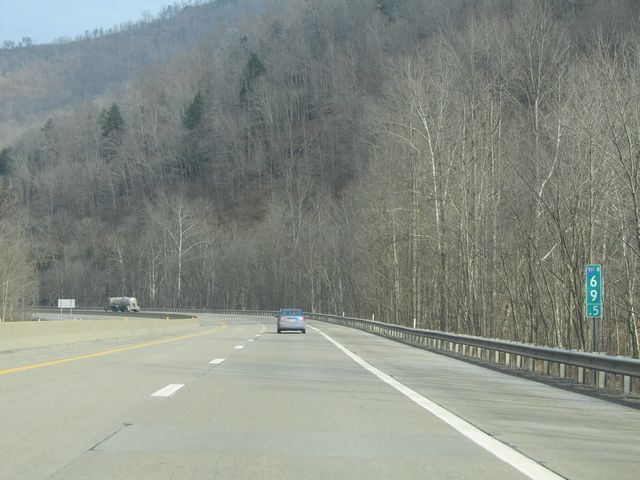 |
Interstate 77 North / Interstate 64 West: Another road view, this time from mile marker 69.5. (Photo taken 1/31/11). |
 |
Interstate 77 North / Interstate 64 West at the Service Plaza located near mile marker 72. (Photo taken 1/31/11). |
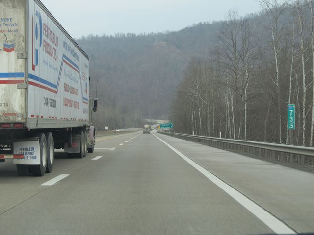 |
Interstate 77 North / Interstate 64 West: Road view from mile marker 73.5. (Photo taken 1/31/11). |
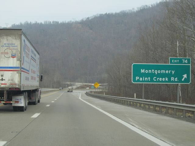 |
Interstate 77 North / Interstate 64 West at Exit 74: Montgomery / Paint Creek Rd (Photo taken 1/31/11). |
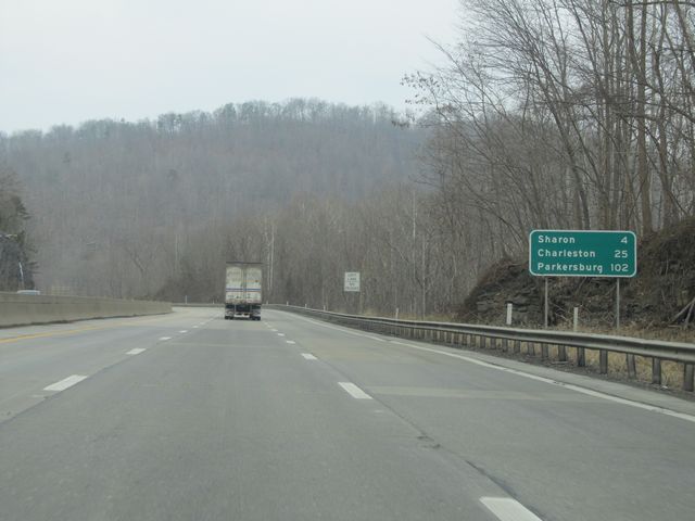 |
Mileage sign located near mile marker 75. It's 4 miles to Sharon, 25 miles to Charleston, and 102 miles to Parkersburg. (Photo taken 1/31/11). |
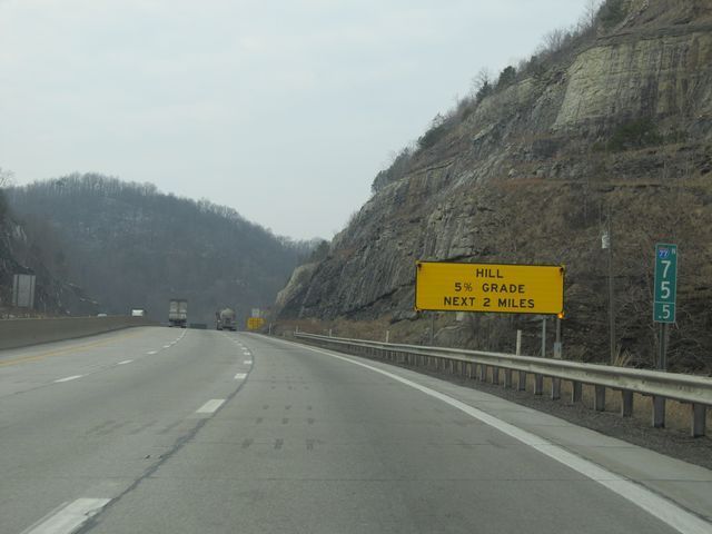 |
Warning sign located at mile marker 75.5. The sign is alerting drivers of a 5% downgrade which lasts for the next 2 miles. (Photo taken 1/31/11). |
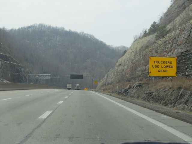 |
Another warning sign just past mile marker 75.5 alerting truck drivers that they should downshift and use engine braking to go down the hill for the next 2 miles. (Photo taken 1/31/11). |
 |
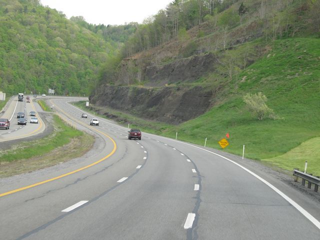
Yet another warning sign near mile marker 77 alerting truck drivers of the risk of rollover around the upcoming curve. The recommended speed is 55 mph. (Photo taken 1/31/11). |
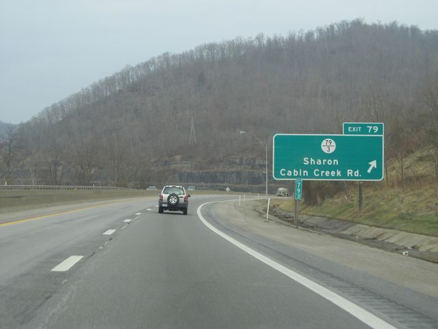 |
Interstate 77 North / Interstate 64 West at Exit 79: CR 79/3 - Sharon / Cabin Creek Rd (Photo taken 1/31/11). |
 |
Interstate 77 North / Interstate 64 West: Road view from mile marker 80. (Photo taken 1/31/11). |
 |
Interstate 77 North / Interstate 64 West: Road view from mile marker 80.5. (Photo taken 1/31/11). |
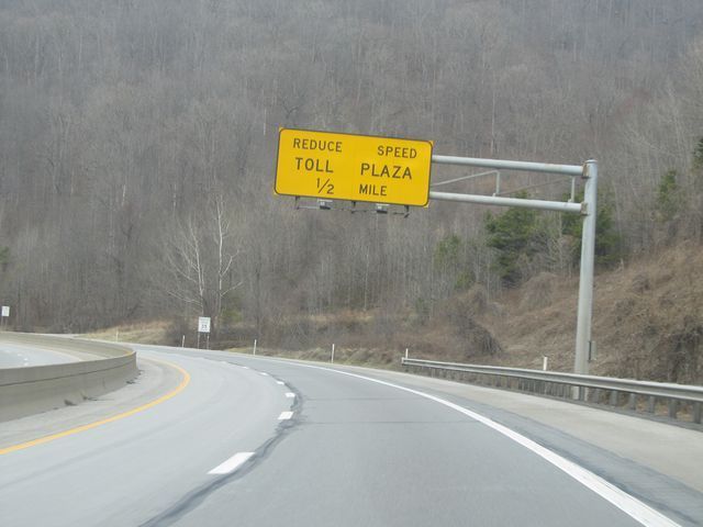 |
Warning sign located near mile marker 90, alerting motorists to reduce their speed in preparation for approaching the Toll Plaza 1/2 mile ahead. (Photo taken 1/31/11). |
 |
Interstate 77 North / Interstate 64 West approaching the Toll Plaza near mile marker 90.5. Once again, the toll at this point in time was $2.00 for cars. (Photo taken 1/31/11). |
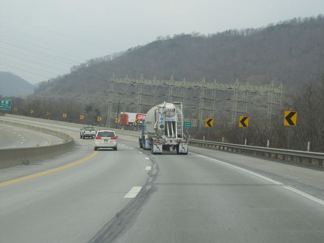 |
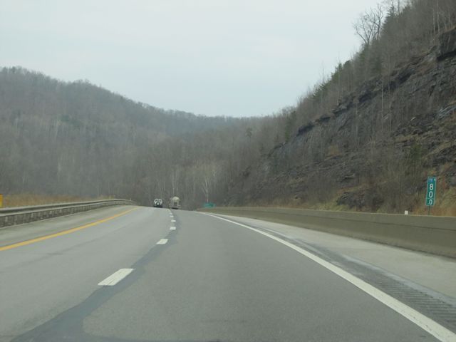
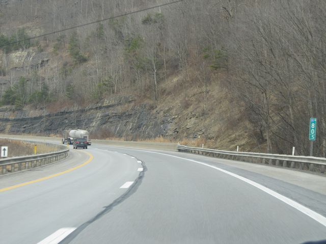
Interstate 77 North / Interstate 64 West: Road view from near mile marker 84. (Photo taken 1/31/11). |
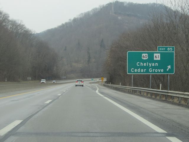 |
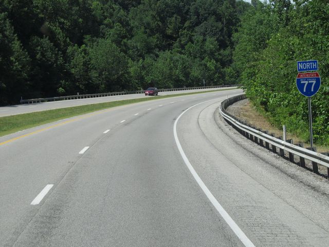
Interstate 77 North / Interstate 64 West at Exit 85: US 60 / WV 61 - Chelyan / Cedar Grove (Photo taken 1/31/11). |
Section 2: Chelyan (Exit 85) to Ohio Border
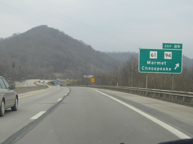 |
Interstate 77 North / Interstate 64 West at Exit 89: WV 61 / WV 94 - Marmet / Chesapeake (Photo taken 1/31/11). |
 |
Interstate 77 North / Interstate 64 West: Road view from mile marker 91.5. (Photo taken 1/31/11). |
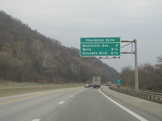 |
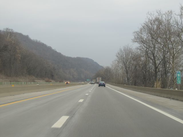
Sign listing the distances to the upcoming Charleston exits. (Photo taken 1/31/11). |
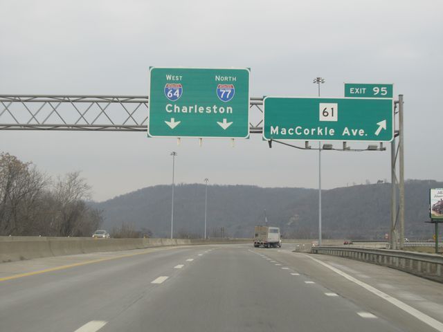 |
Interstate 77 North / Interstate 64 West at Exit 95: WV 61 - MacCorkle Ave (Photo taken 1/31/11). |
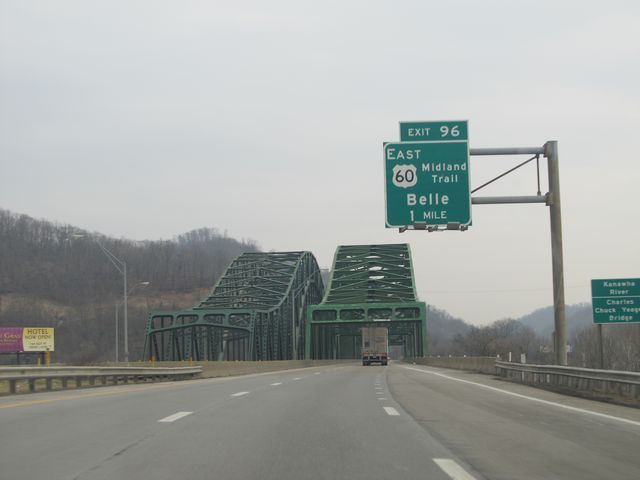 |
Interstate 77 North / Interstate 64 West approaching Exit 96 - 1 mile. You're also approaching the Chuck Yeager Bridge, which crosses the Kanawha River. (Photo taken 1/31/11). |
 |
View as you cross the Chuck Yeager Bridge over the Kanawha River. (Photo taken 1/31/11). |
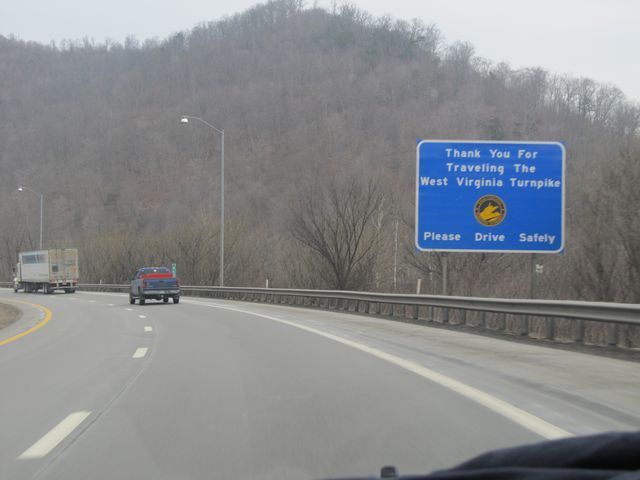 |
Sign located near mile marker 96, thanking you for traveling the West Virginia Turnpike. As you may have guessed, this marks the northern end of the turnpike. (Photo taken 1/31/11). |
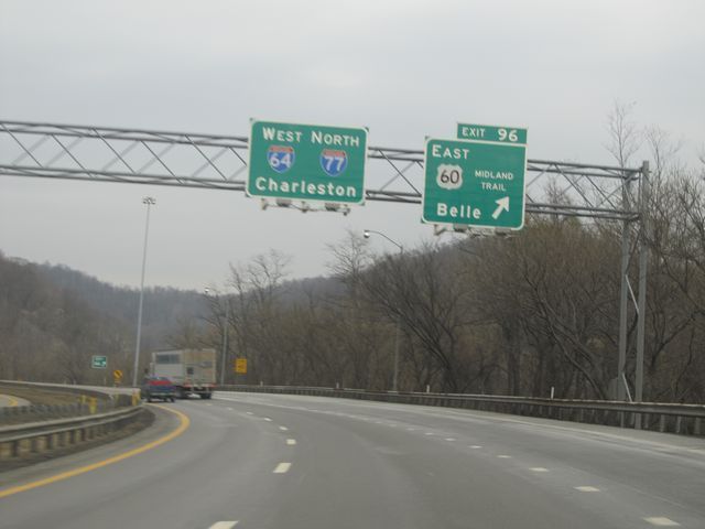 |
Interstate 77 North / Interstate 64 West at Exit 96: US 60 (Midland Trail) East - Belle (Photo taken 1/31/11). |
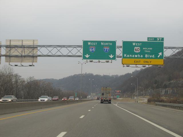 |
Interstate 77 North / Interstate 64 West at Exit 97: US 60 (Midland Trail) West - Kanawha Blvd (Photo taken 1/31/11). |
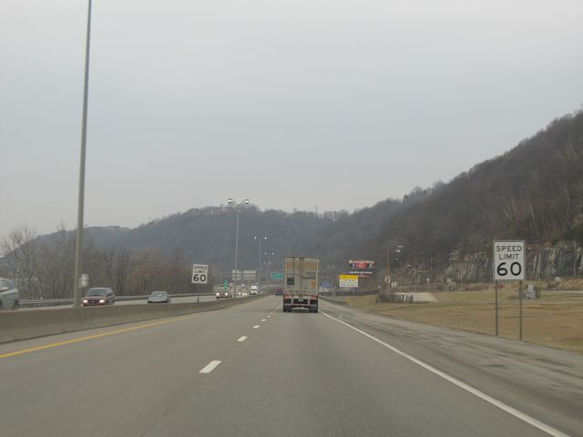 |
The speed limit now drops to 60 mph as you approach downtown Charleston. (Photo taken 1/31/11). |
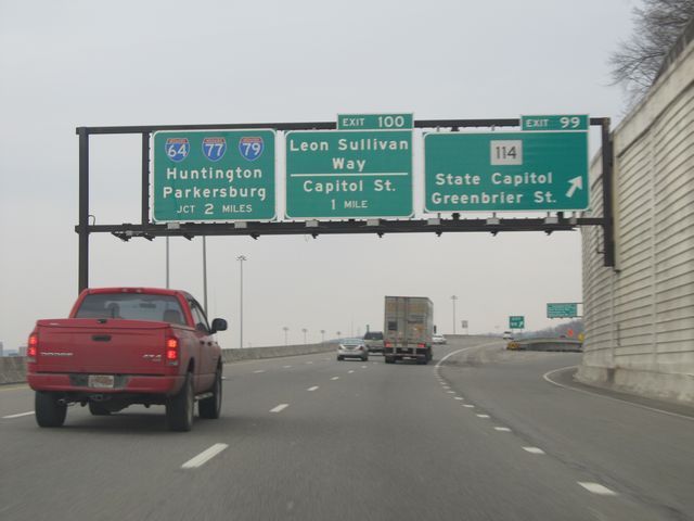 |
Interstate 77 North / Interstate 64 West at Exit 99: WV 114 - State Capitol / Greenbrier St (Photo taken 1/31/11). |
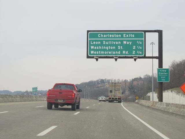 |
Sign listing the distances to more of the upcoming Charleston exits. (Photo taken 1/31/11). |
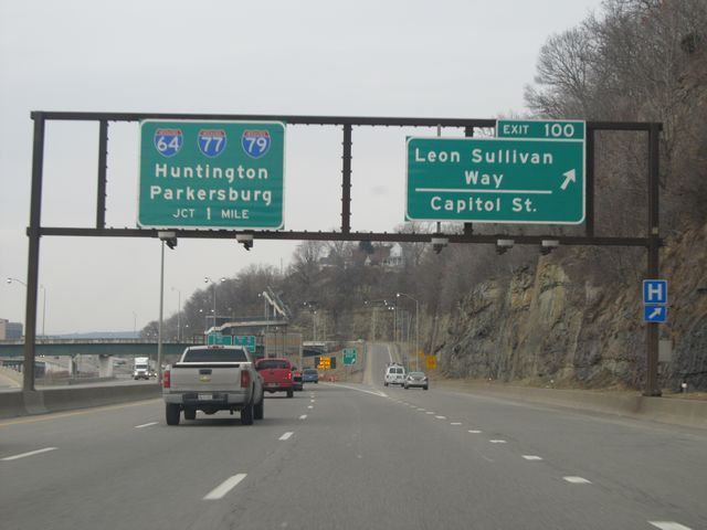 |
Interstate 77 North / Interstate 64 West at Exit 99: Leon Sullivan Way / Capitol St (Photo taken 1/31/11). |
 |
Interstate 77 North / Interstate 64 West approaching Exit 101 - 1/4 mile. (Photo taken 1/31/11). |
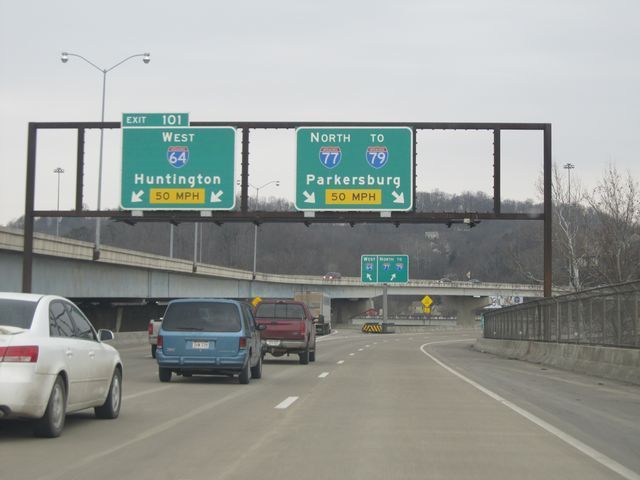 |
Interstate 77 North at Exit 101: Interstate 64 West - Huntington (Photo taken 1/31/11). |
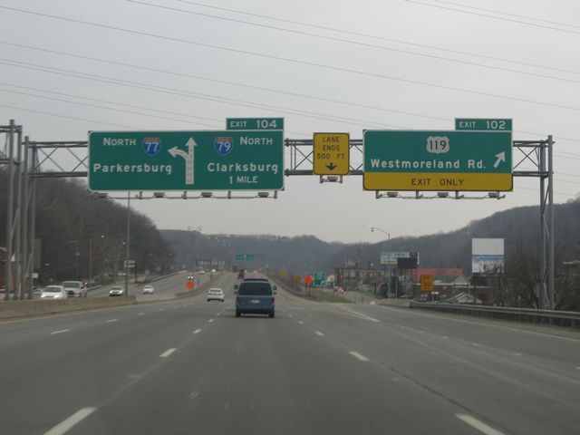 |
Interstate 77 North at Exit 102: US 119 - Westmoreland Rd (Photo taken 1/31/11). |
 |
Interstate 77 North approaching Exit 104 - 1/2 mile. (Photo taken 1/31/11). |
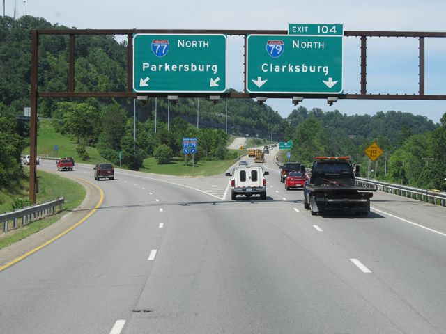 |
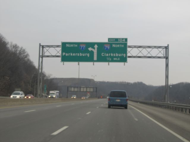
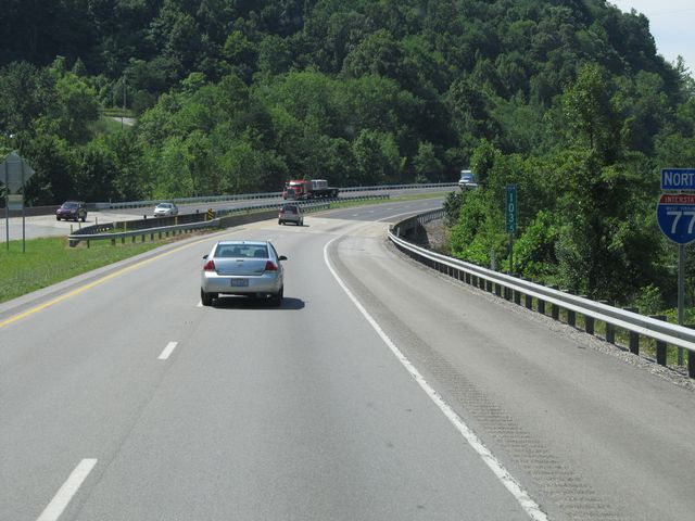
Interstate 77 North at Exit 104: Interstate 79 North - Clarksburg (Photo taken 7/14/11). |
 |
Interstate 77 North: Road view from mile marker 103.5. (Photo taken 7/14/11). |
 |
Speed limit sign located near mile marker 104. The speed limit increases back to 70 mph as you leave the Charleston area to the north. (Photo taken 7/14/11). |
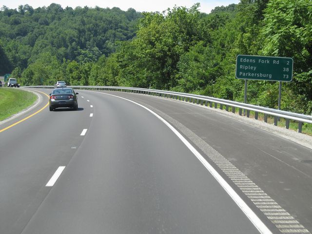 |
Mileage sign located near mile marker 104. From here, it's 2 miles to the Edens Fork Rd exit, 38 miles to Ripley, and 73 miles to Parkersburg. (Photo taken 7/14/11). |
 |
Interstate 77 North: Road view from mile marker 104. (Photo taken 7/14/11). |
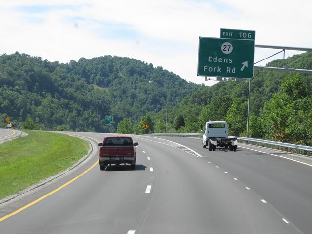 |
Interstate 77 North at Exit 106: CR 27 - Edens Fork Rd (Photo taken 7/14/11). |
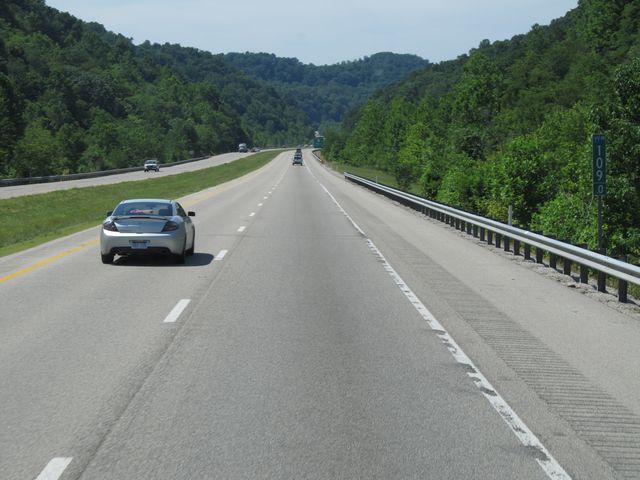 |
Interstate 77 North: Road view from mile marker 109. (Photo taken 7/14/11). |
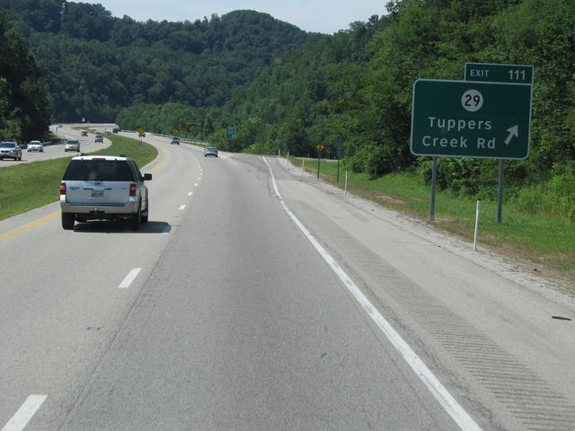 |
Interstate 77 North at Exit 111: CR 29 - Tuppers Creek Rd (Photo taken 7/14/11). |
 |
Interstate 77 North shield sign located near mile marker 112. (Photo taken 7/14/11). |
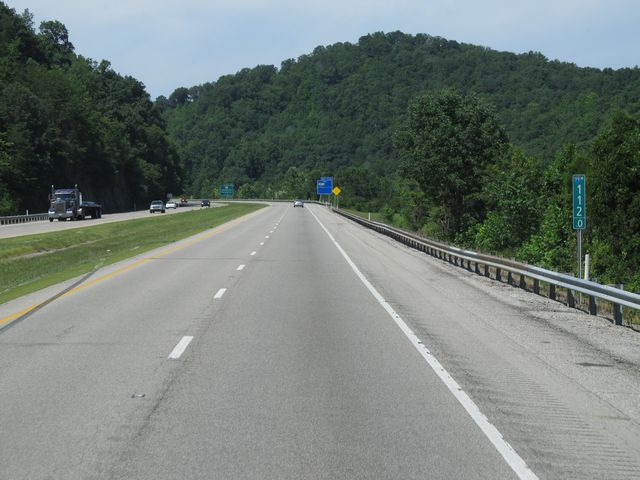 |
Interstate 77 North: Road view from mile marker 112. (Photo taken 7/14/11). |
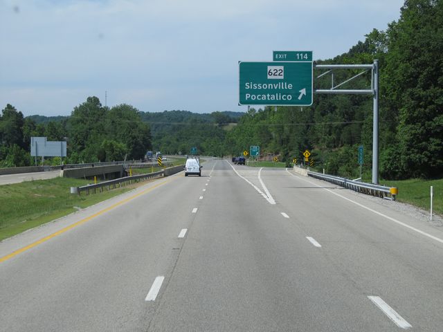 |
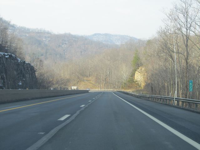
Interstate 77 North at Exit 114: WV 622 - Sissonville / Pocatalico (Photo taken 7/14/11). |
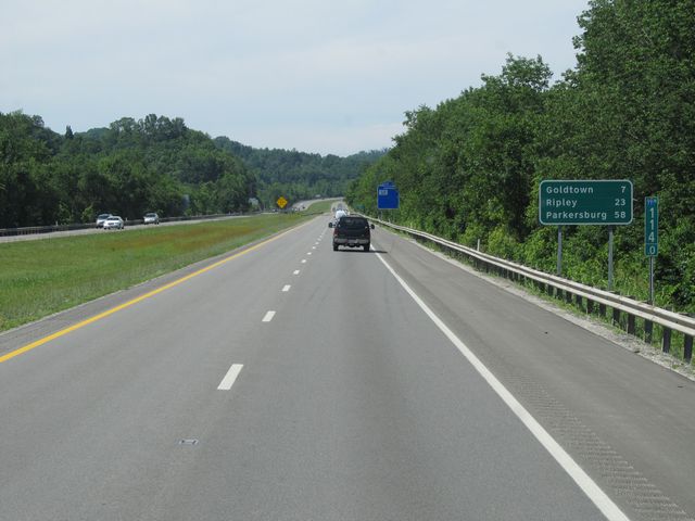 |
Mileage sign at mile marker 114. It's 7 miles to Goldtown while Ripley lies 23 miles ahead and Parkersburg is 58 miles ahead. (Photo taken 7/14/11). |
 |
Interstate 77 North at Exit 116: CR 21 - Haines Branch Rd (Photo taken 7/14/11). |
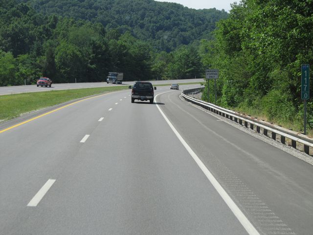 |
Interstate 77 North: Road view from mile marker 117. (Photo taken 7/14/11). |
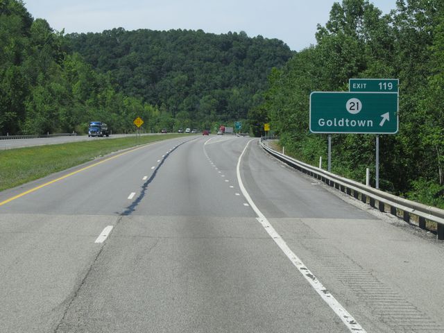 |
Interstate 77 North at Exit 119: CR 21 - Goldtown (Photo taken 7/14/11). |
 |
Interstate 77 North: Road view from mile marker 120.5. (Photo taken 7/14/11). |
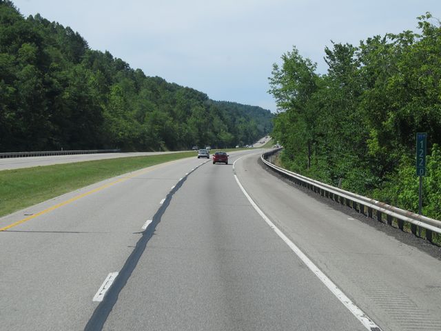 |
Interstate 77 North: Road view from mile marker 122. (Photo taken 7/14/11). |
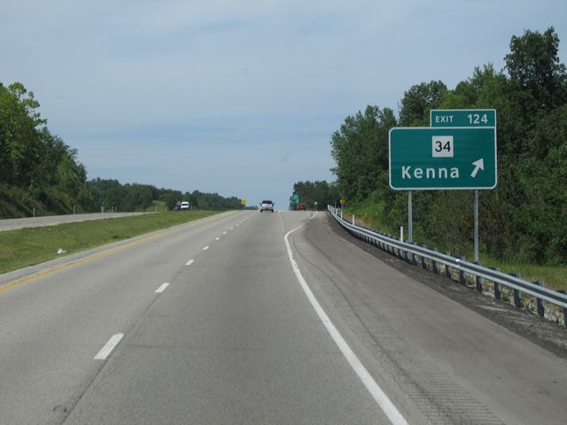 |
Interstate 77 North at Exit 124: WV 34 - Kenna (Photo taken 7/14/11). |
 |
Interstate 77 North: Road view from mile marker 125.5. (Photo taken 7/14/11). |
 |
Interstate 77 North: Road view from mile marker 126. (Photo taken 7/14/11). |
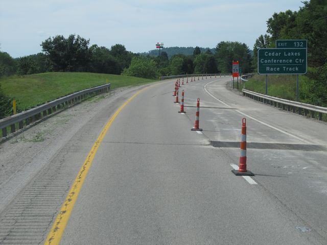 |
Use Exit 132 to get to the Cedar Lakes Conference Center and the Race Track. (Photo taken 7/14/11). |
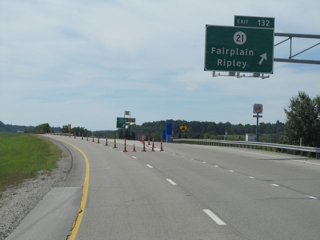 |
Interstate 77 North at Exit 132: CR 21 - Fairplain / Ripley (Photo taken 7/14/11). |
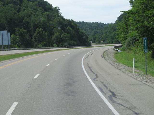 |
Interstate 77 North: Road view from mile marker 134. (Photo taken 7/14/11). |
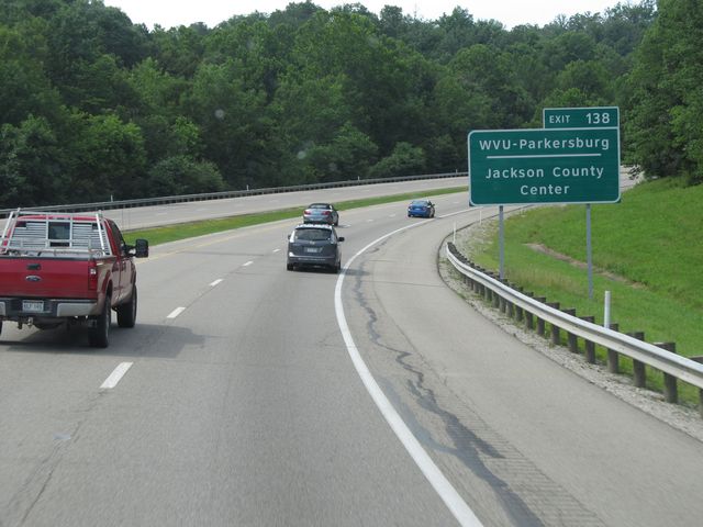 |
Use Exit 138 for WVU - Parkersburg and the Jackson County Center. (Photo taken 7/14/11). |
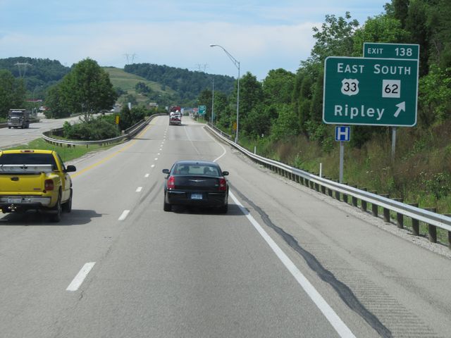 |
Interstate 77 North at Exit 138: US 33 East / WV 62 South - Ripley (Photo taken 7/14/11). |
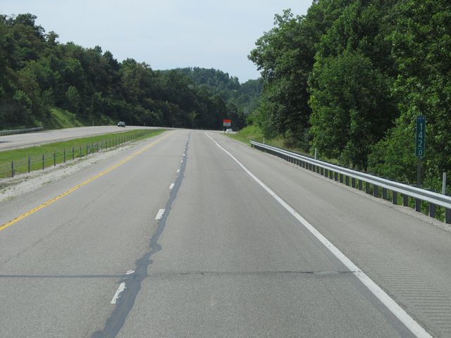 |
Interstate 77 North: Road view from mile marker 142. (Photo taken 7/14/11). |
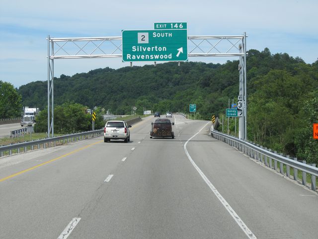 |
Interstate 77 North at Exit 146: WV 2 South - Silverton / Ravenswood (Photo taken 7/14/11). |
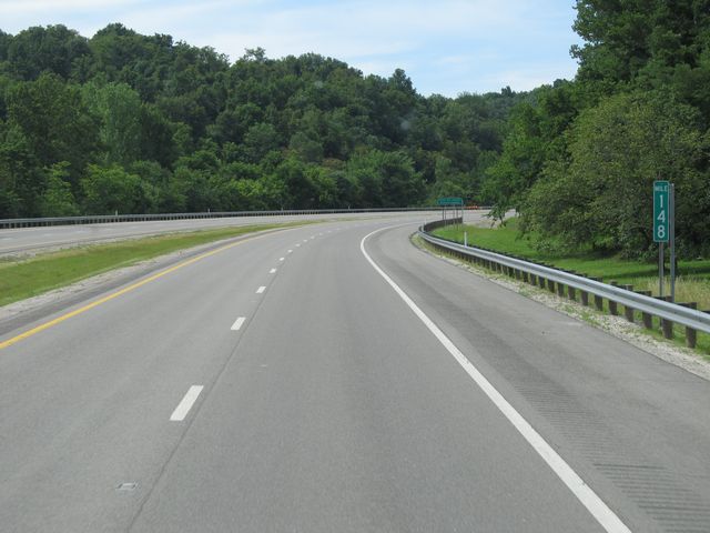 |
Interstate 77 North: Road view from mile marker 148. (Photo taken 7/14/11). |
 |
Interstate 77 North: Road view from mile marker 150. (Photo taken 7/14/11). |
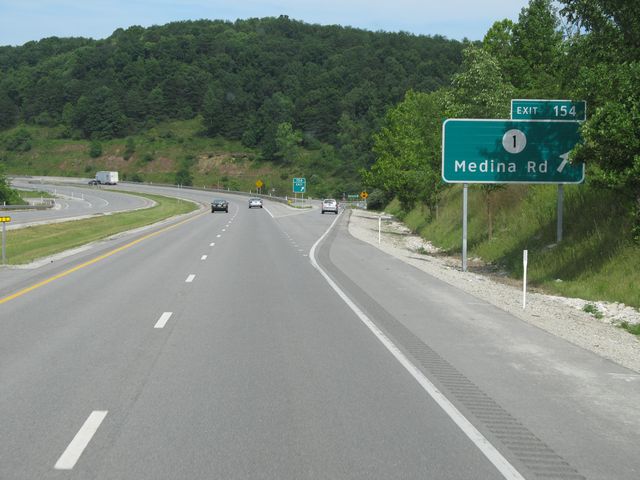 |
Interstate 77 North at Exit 154: CR 1 - Medina Rd (Photo taken 7/14/11). |
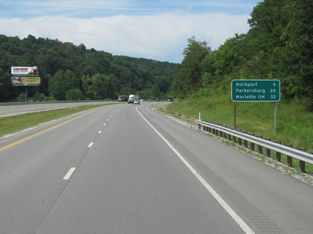 |
Mileage sign located near mile marker 155. It's 6 miles to Rockport, 20 miles to Parkersburg, and 32 miles to Marietta, OH. (Photo taken 7/14/11). |
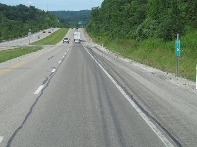 |
Interstate 77 North: Road view from mile marker 161. (Photo taken 7/14/11). |
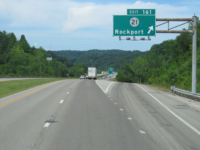 |
Interstate 77 North at Exit 161: CR 21 - Rockport (Photo taken 7/14/11). |
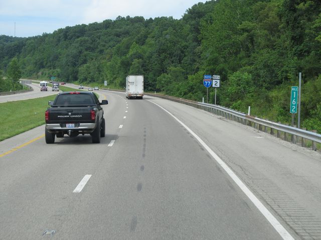 |
Interstate 77 North: Road view from mile marker 162. (Photo taken 7/14/11). |
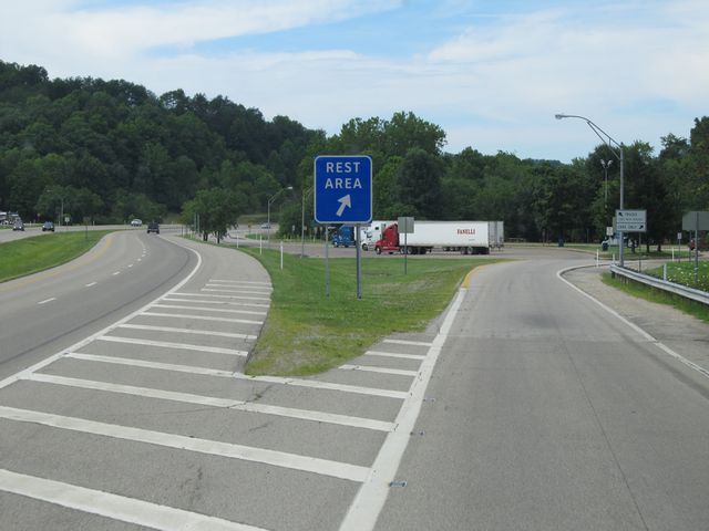 |
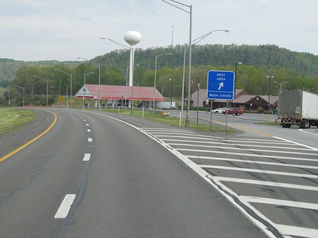
Interstate 77 North at the Rest Area located near mile marker 165. (Photo taken 7/14/11). |
 |
Use Exit 170 to get to the Race Track. (Photo taken 7/14/11). |
 |
Interstate 77 North at the Weigh Station located near mile marker 169. (Photo taken 7/14/11). |
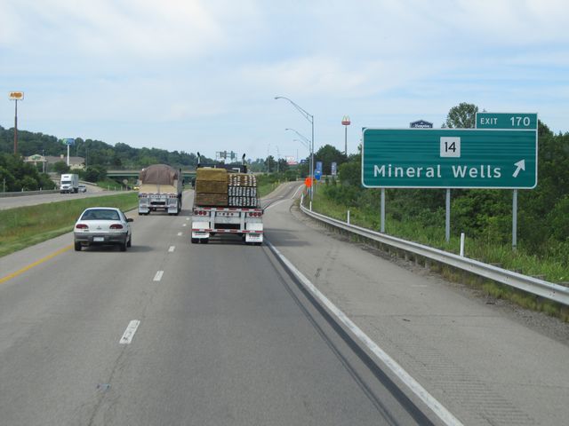 |
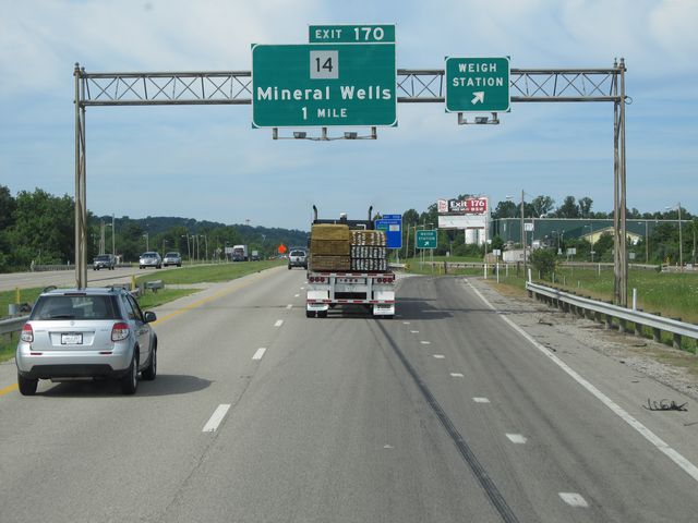
Interstate 77 North at Exit 170: WV 14 - Mineral Wells (Photo taken 7/14/11). |
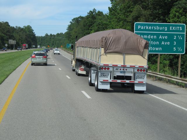 |
Sign listing the distances to the upcoming Parkersburg exits. (Photo taken 7/14/11). |
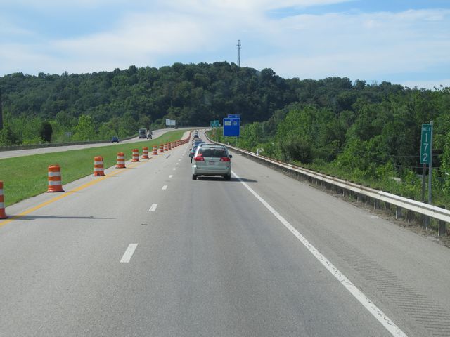 |
Interstate 77 North: Road view from mile marker 172. (Photo taken 7/14/11). |
 |
Interstate 77 North at Exit 173: WV 95 - Camden Ave / Downtown (Photo taken 7/14/11). |
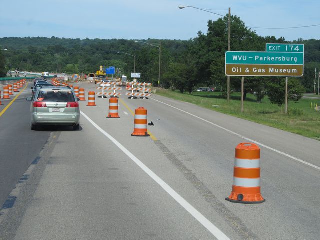 |
Use Exit 174 to get to WVU - Parkersburg and the Oil and Gas Museum. (Photo taken 7/14/11). |
 |
Interstate 77 North at Exit 174: WV 47 - Staunton Ave (Photo taken 7/14/11). |
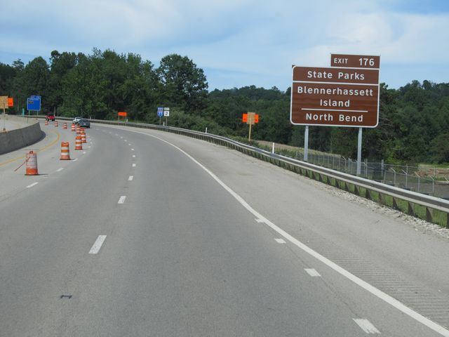 |
Use Exit 176 to get to Blennerhassett Island and North Bend State Parks. (Photo taken 7/14/11). |
.JPG) |
Interstate 77 North at Exit 176: US 50 - 7th Street (Photo taken 7/14/11). |
 |
Interstate 77 North: Road view from mile marker 177. (Photo taken 7/14/11). |
.JPG) |
Use Exit 179 to get to the Mid-Ohio Valley Regional Airport and Ohio Valley University. (Photo taken 7/14/11). |
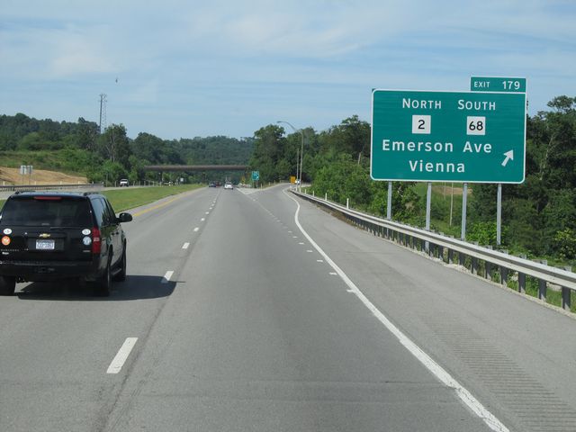 |
Interstate 77 North at Exit 179: WV 2 North / WV 68 South - Emerson Ave / Vienna (Photo taken 7/14/11). |
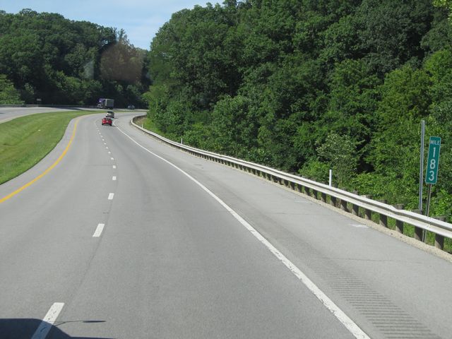 |
Interstate 77 North: Road view from mile marker 183. (Photo taken 7/14/11). |
.JPG) |
Interstate 77 North at Exit 185: WV 14 / WV 31 - Williamstown (Photo taken 7/14/11). |
.JPG) |
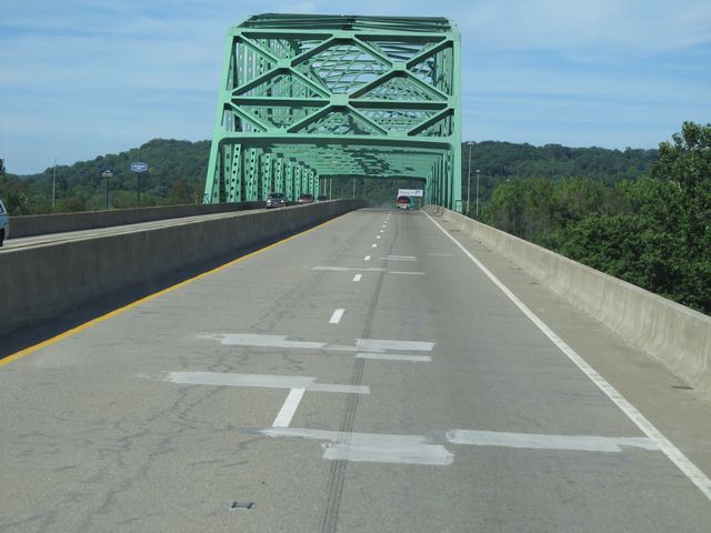
Interstate 77 North as it prepares to cross the Ohio River, near mile marker 187. (Photo taken 7/14/11). |
 |
Interstate 77 North as it crosses the Ohio River and into Ohio. (Photo taken 7/14/11). |