Road Information |
||
 |
||
| Total Mileage in State: | 26 miles | |
| Northern End: | At I-70, in Medway | |
| Southern End: | At I-75, in Miamisburg | |
| Mileage covered in Photos: | 26 miles | |
| Counties covered in Photos: | Montgomery, Greene, Clark | |
| Major Junctions in Photos: | US 35, in Beavercreek I-70, in Medway |
|
| Control Cities in Photos: | Miamisburg, Centerville, Beavercreek, Fairborn, Medway | |
Northbound
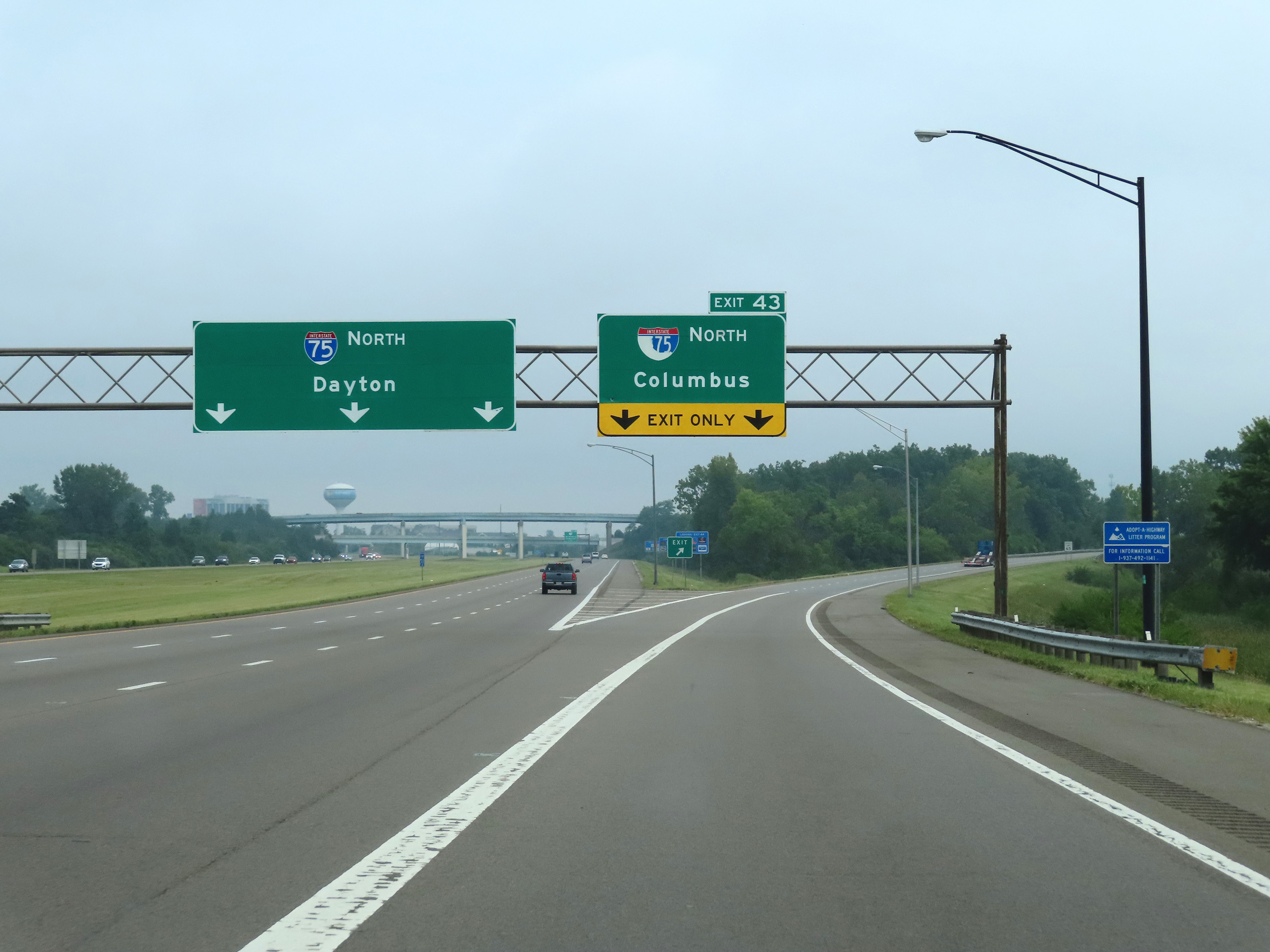 |
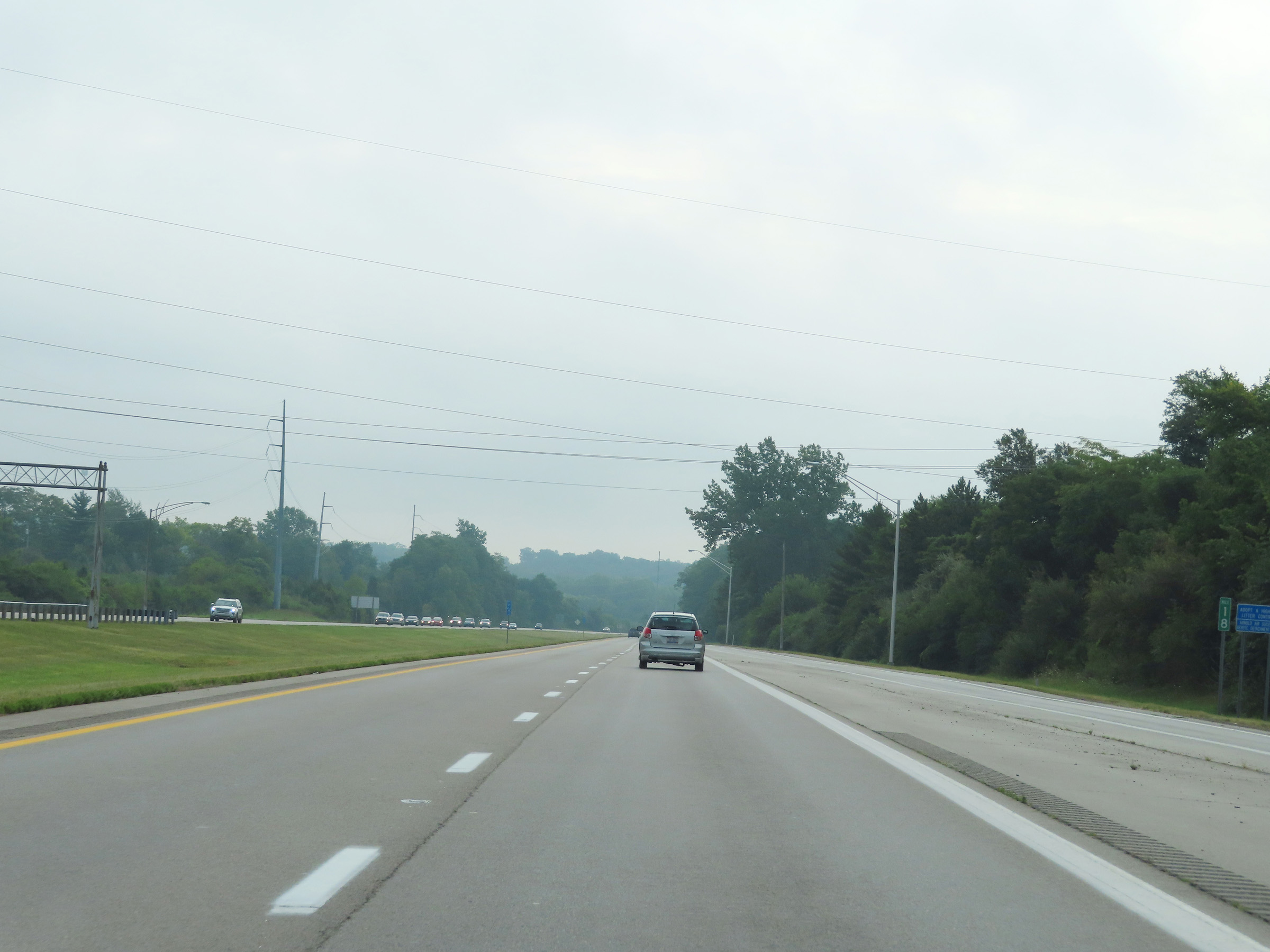
Interstate 675 North begins at Exit 43 on Interstate 75 North in Montgomery County, seen here. (Photo taken 8/21/22). |
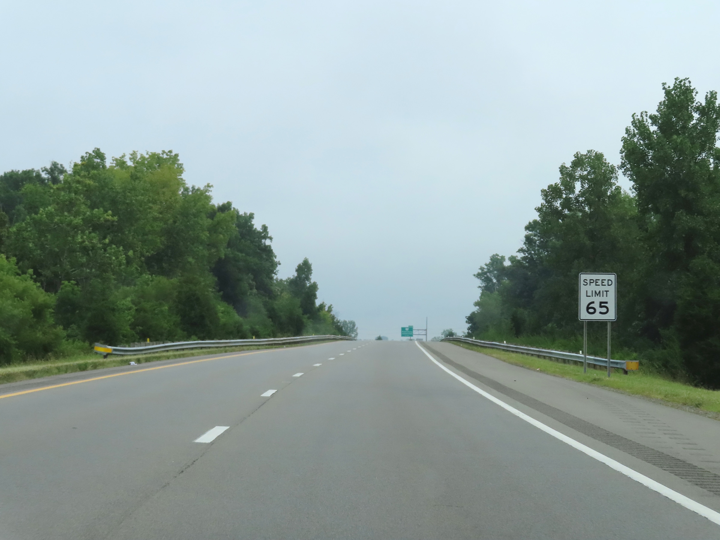 |
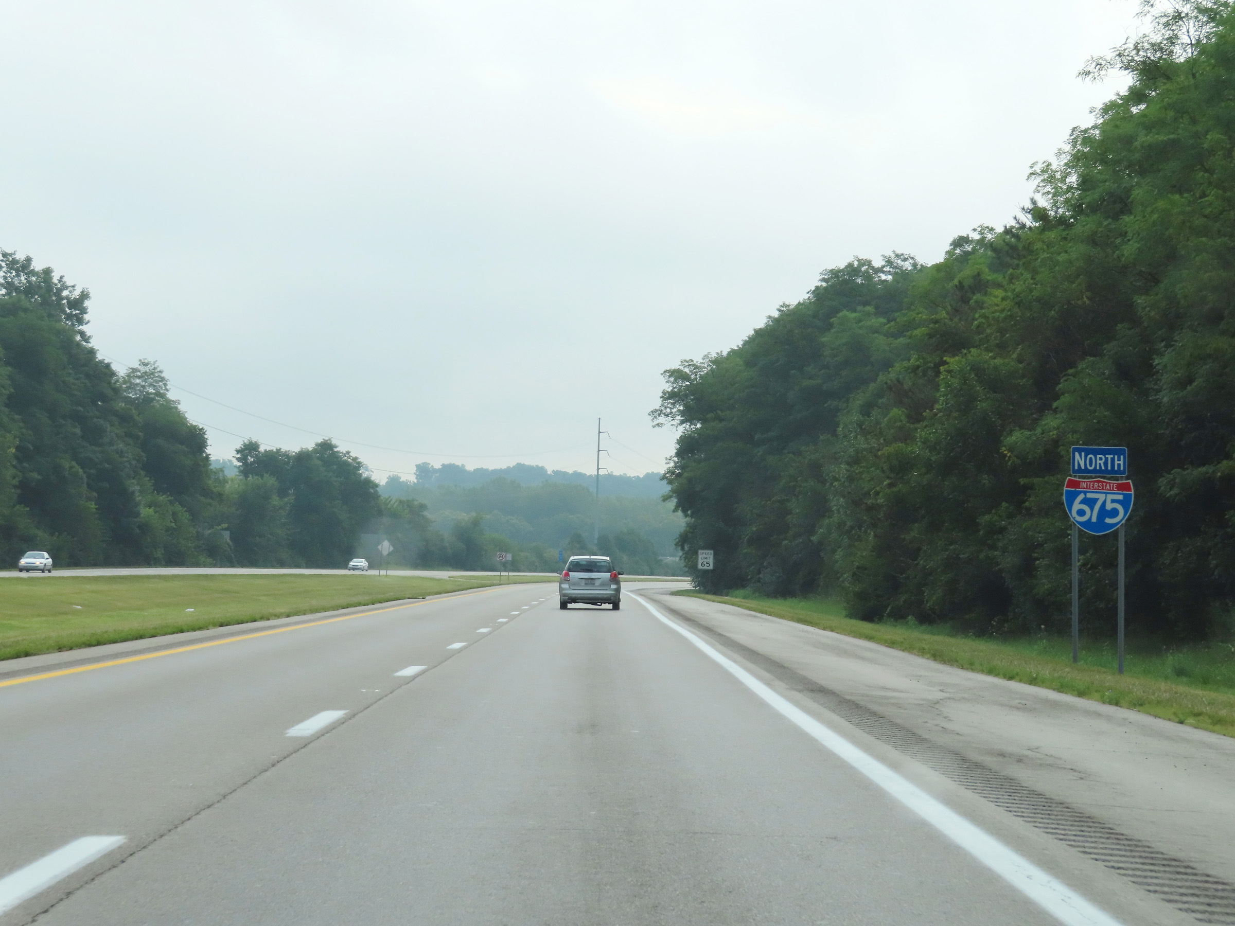
The speed limit on Interstate 675 North starts out at 65 mph. (Photo taken 8/21/22). |
 |
Advance signage for Exit 2, which will be the first exit on Interstate 675 North. The ramp from Interstate 75 North to I-675 North maintains two lanes for a bit longer. (Photo taken 8/21/22). |
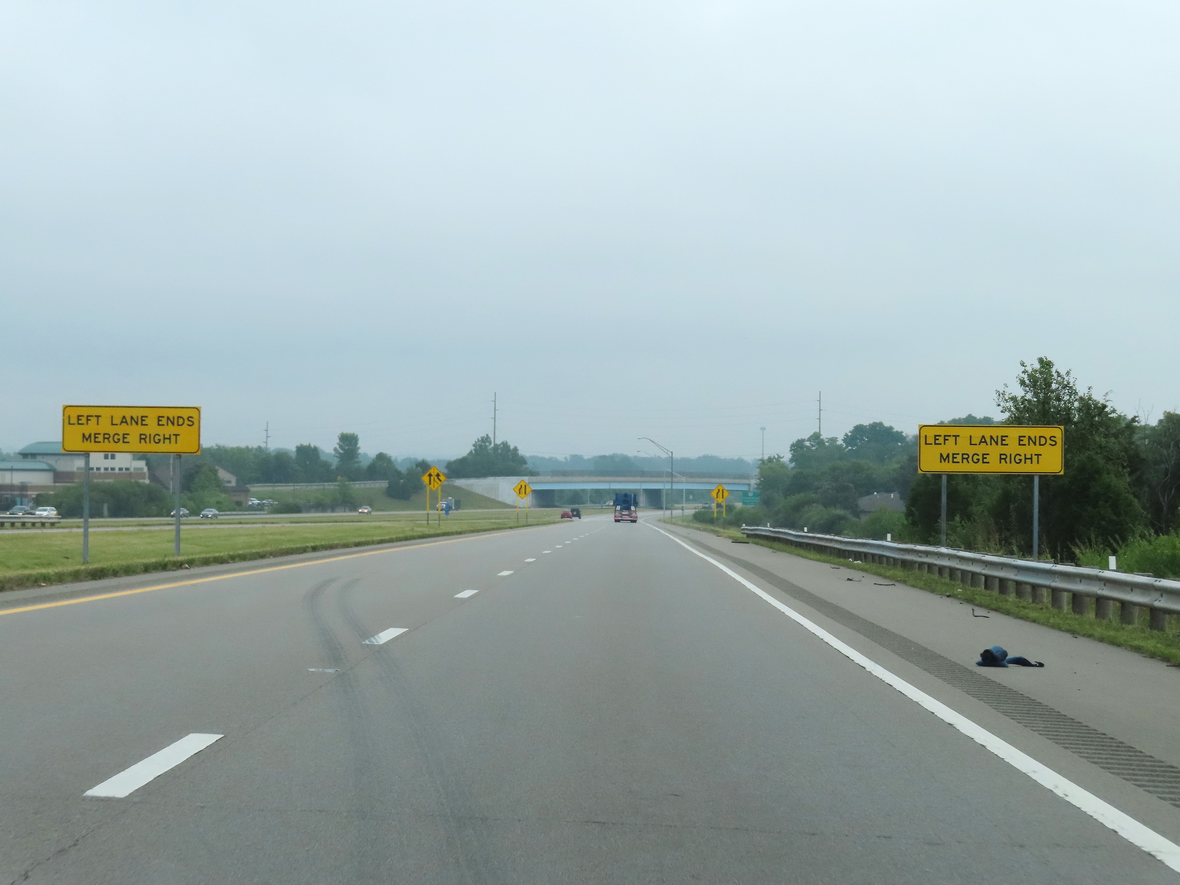 |
Ahead, the left lane will come to an end as the ramp from Interstate 75 North prepares to merge with the ramp from Interstate 75 South. (Photo taken 8/21/22). |
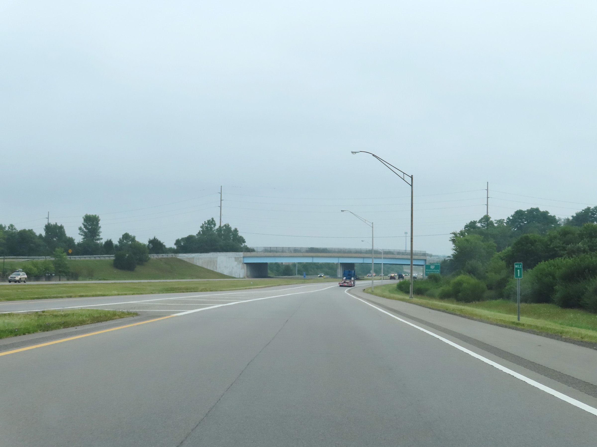 |
View on Interstate 675 North at mile marker 1, as the left lane of the ramp from Interstate 75 North comes to an end. We see the single-lane ramp from Interstate 75 South on the left, and the two ramps will merge together ahead to give I-675 North two thru lanes. (Photo taken 8/21/22). |
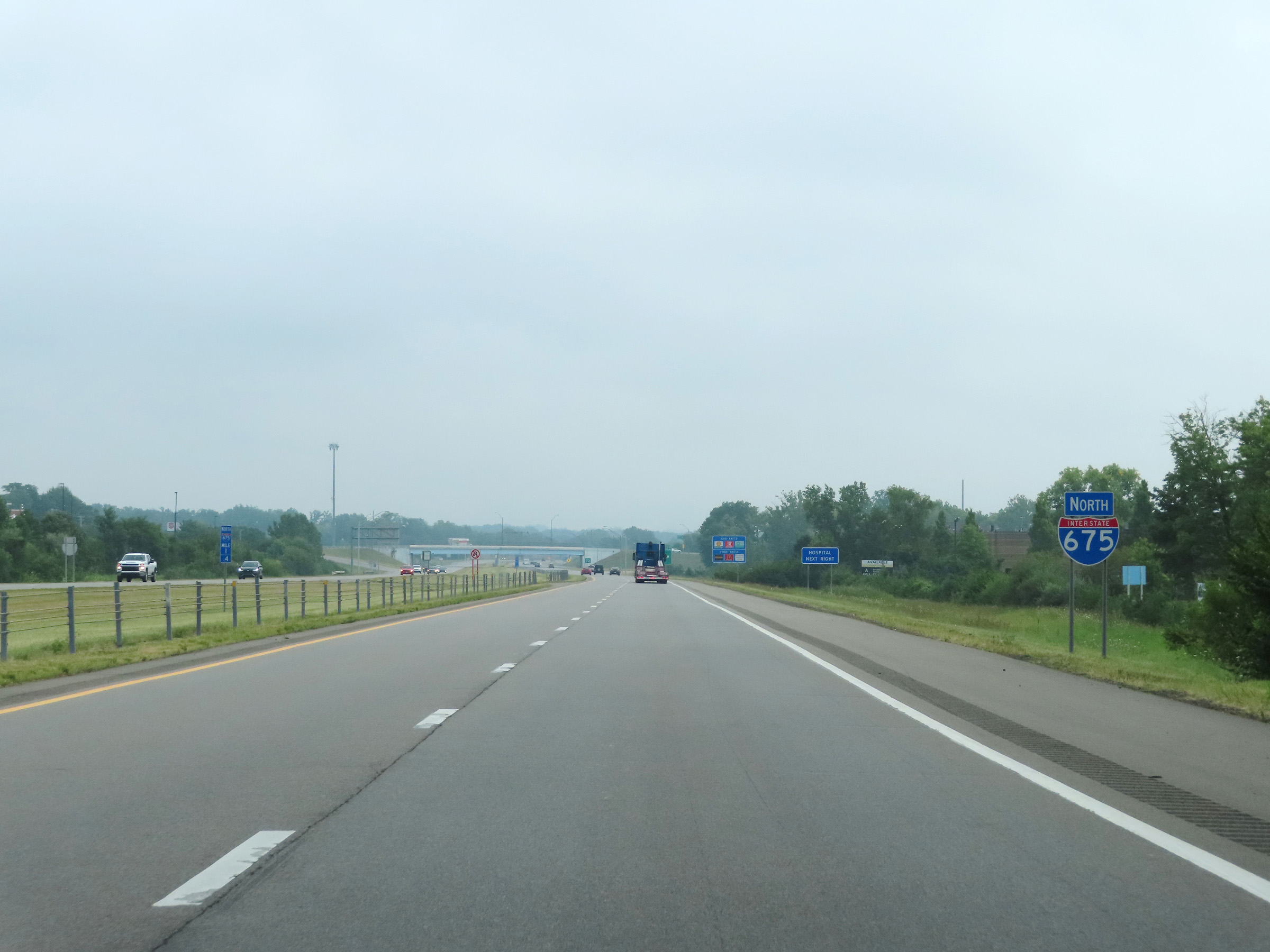 |
Interstate 675 North reassurance shield, as the ramps from Interstate 75 North and South come together to form two thru lanes. (Photo taken 8/21/22). |
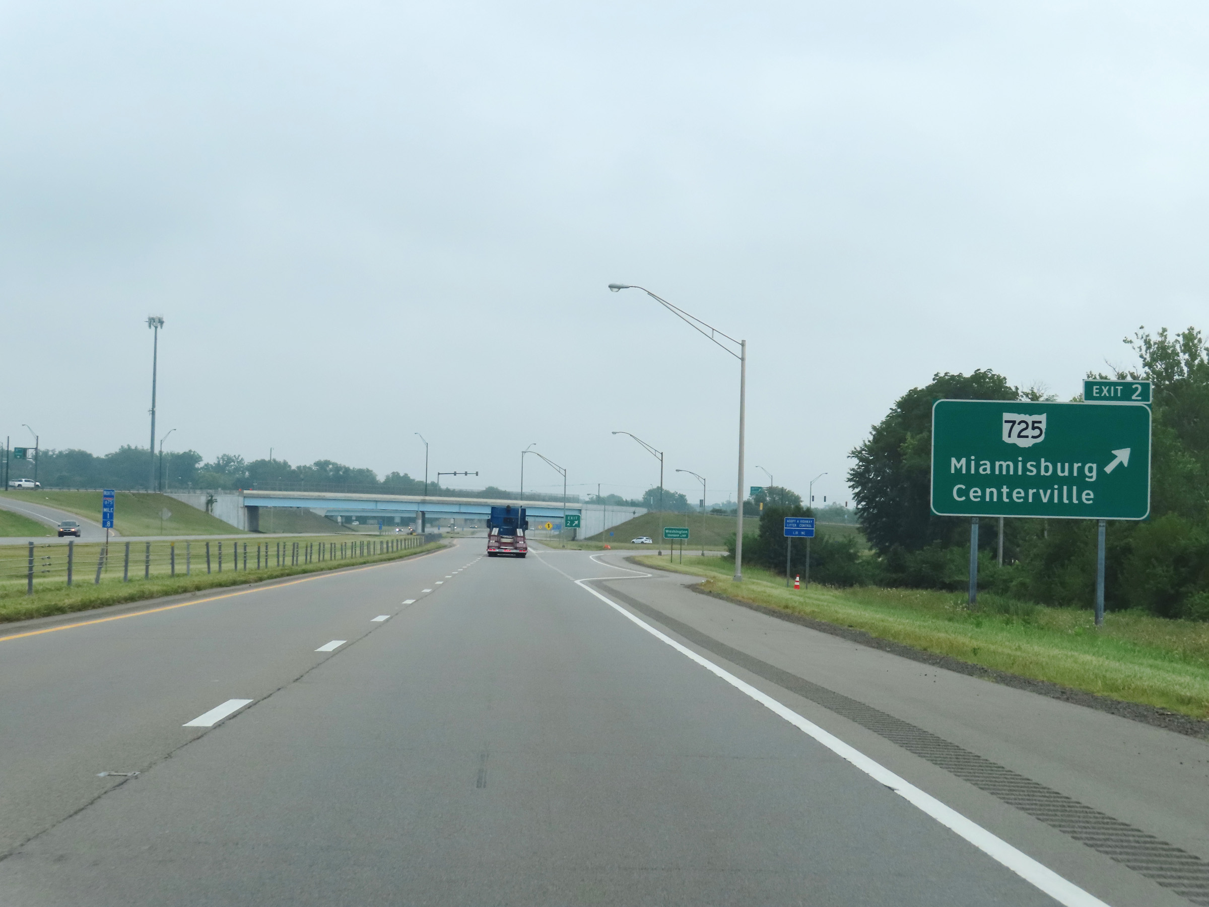 |
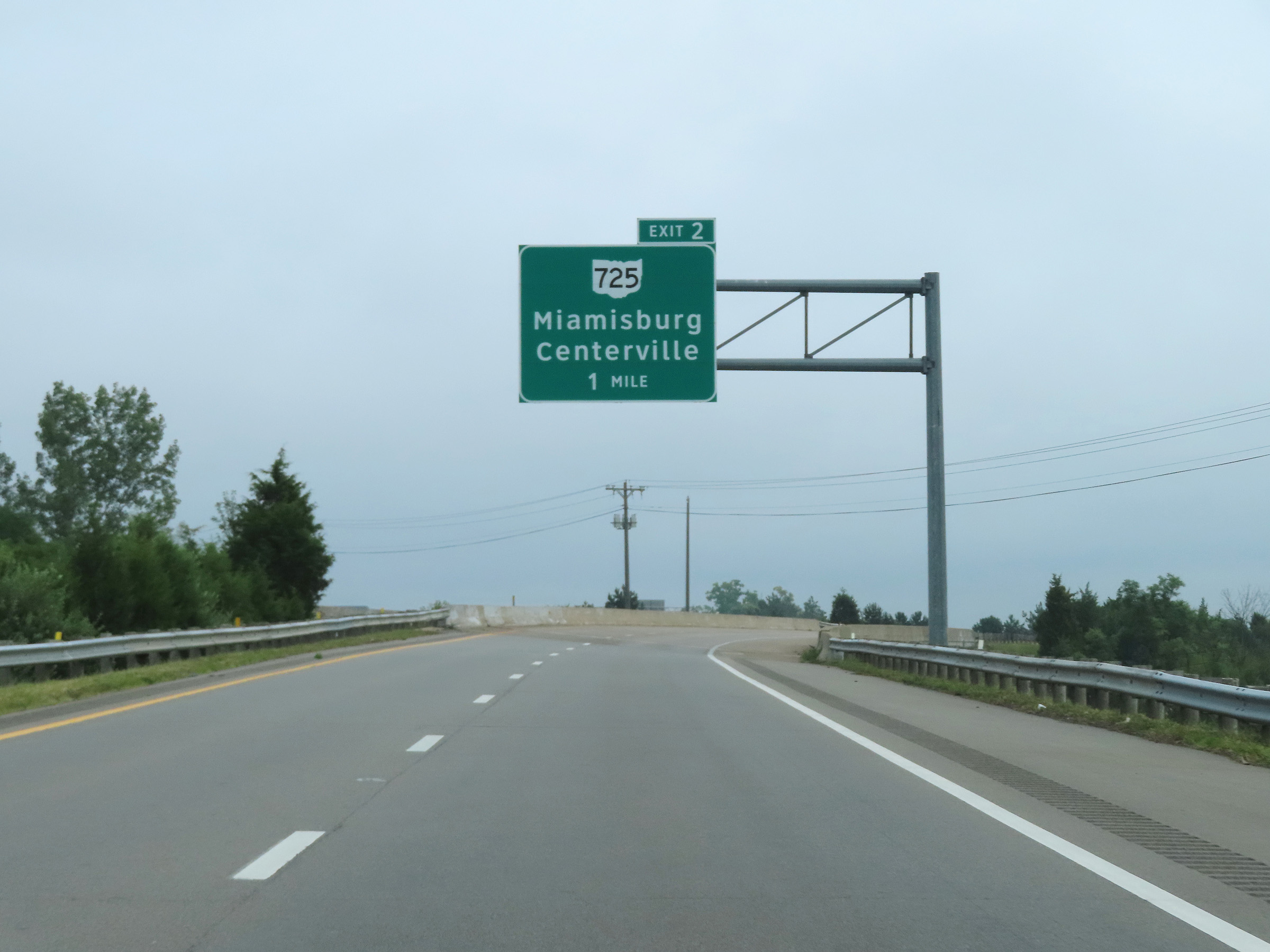
Interstate 675 North at Exit 2: OH 725 - Miamisburg / Centerville (Photo taken 8/21/22). |
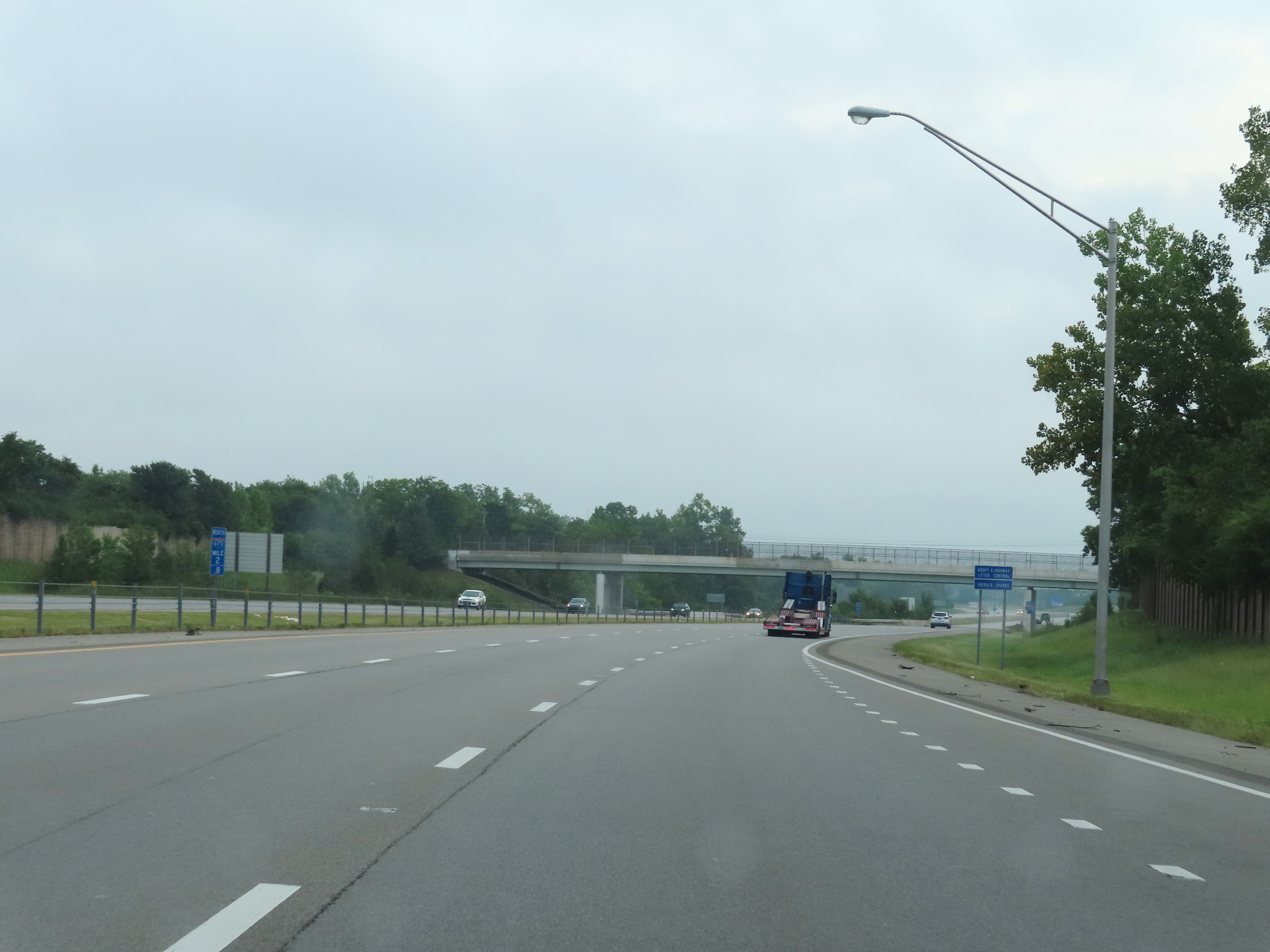 |
View on Interstate 675 North at mile marker 2.8. (Photo taken 8/21/22). |
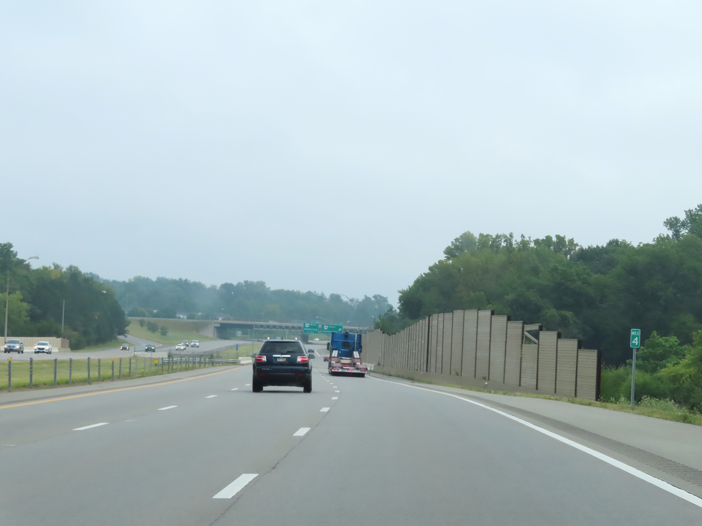 |
Mile marker 4 on Interstate 675 North in Montgomery County. (Photo taken 8/21/22). |
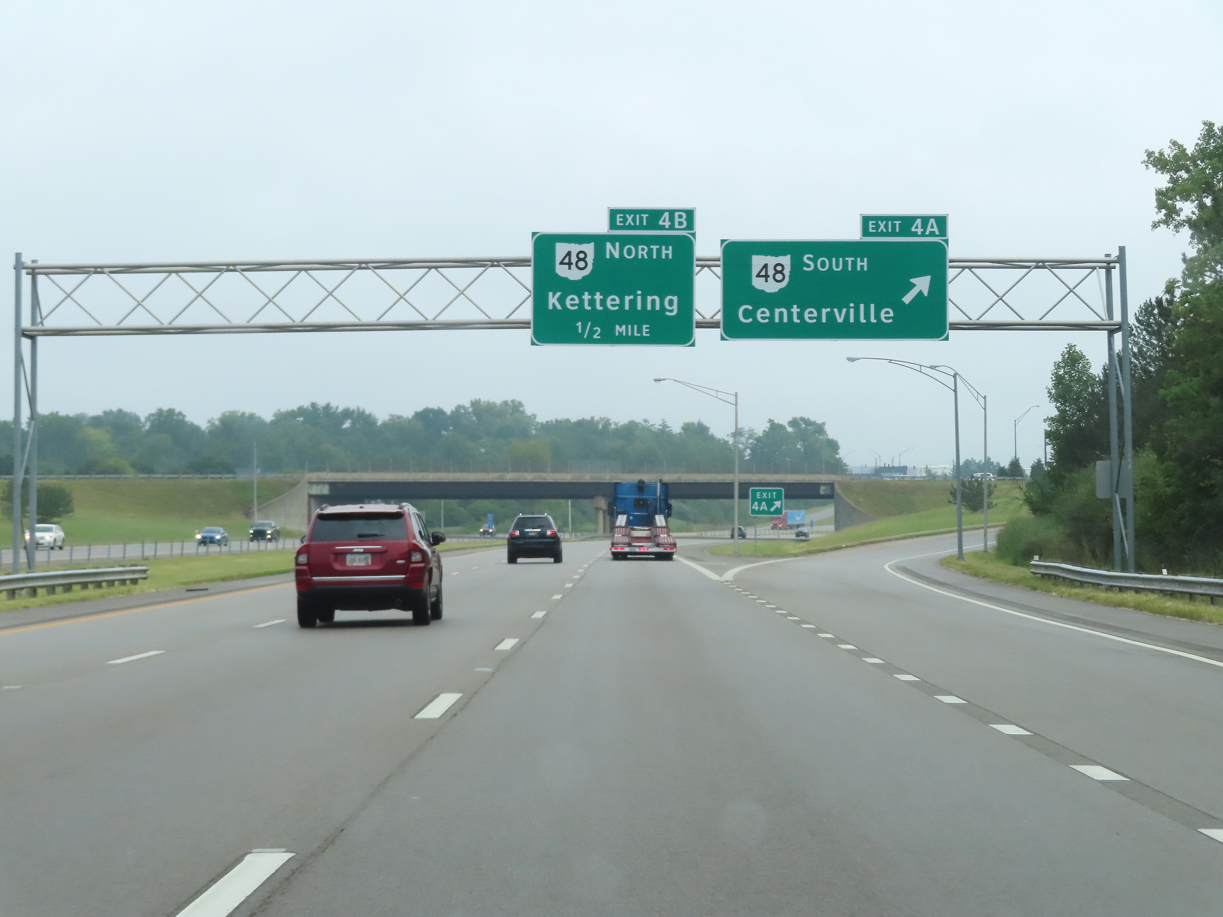 |
Interstate 675 North at Exit 4A: OH 48 South - Centerville (Photo taken 8/21/22). |
 |
Interstate 675 North at Exit 4B: OH 48 North - Kettering (Photo taken 8/21/22). |
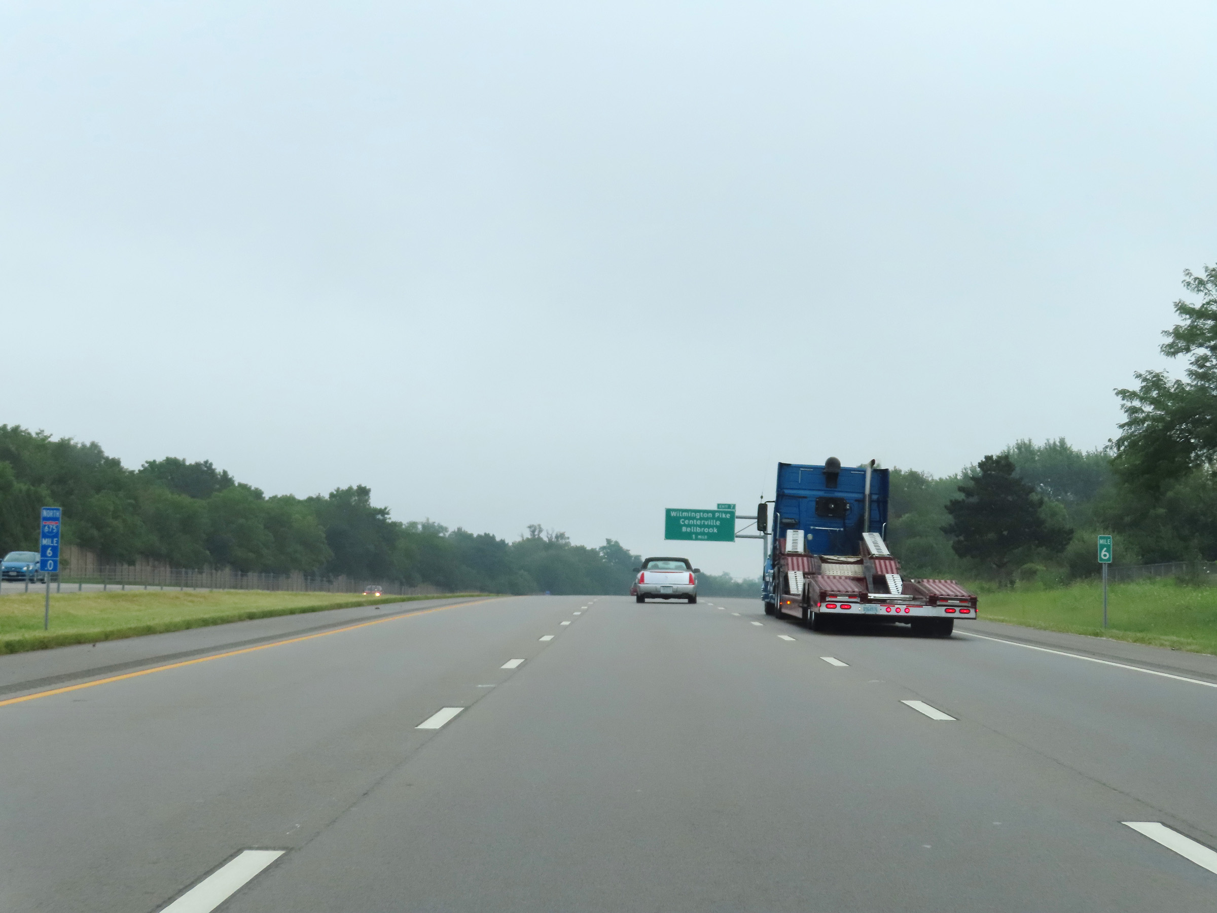 |
View on Interstate 675 North at mile marker 6. (Photo taken 8/21/22). |
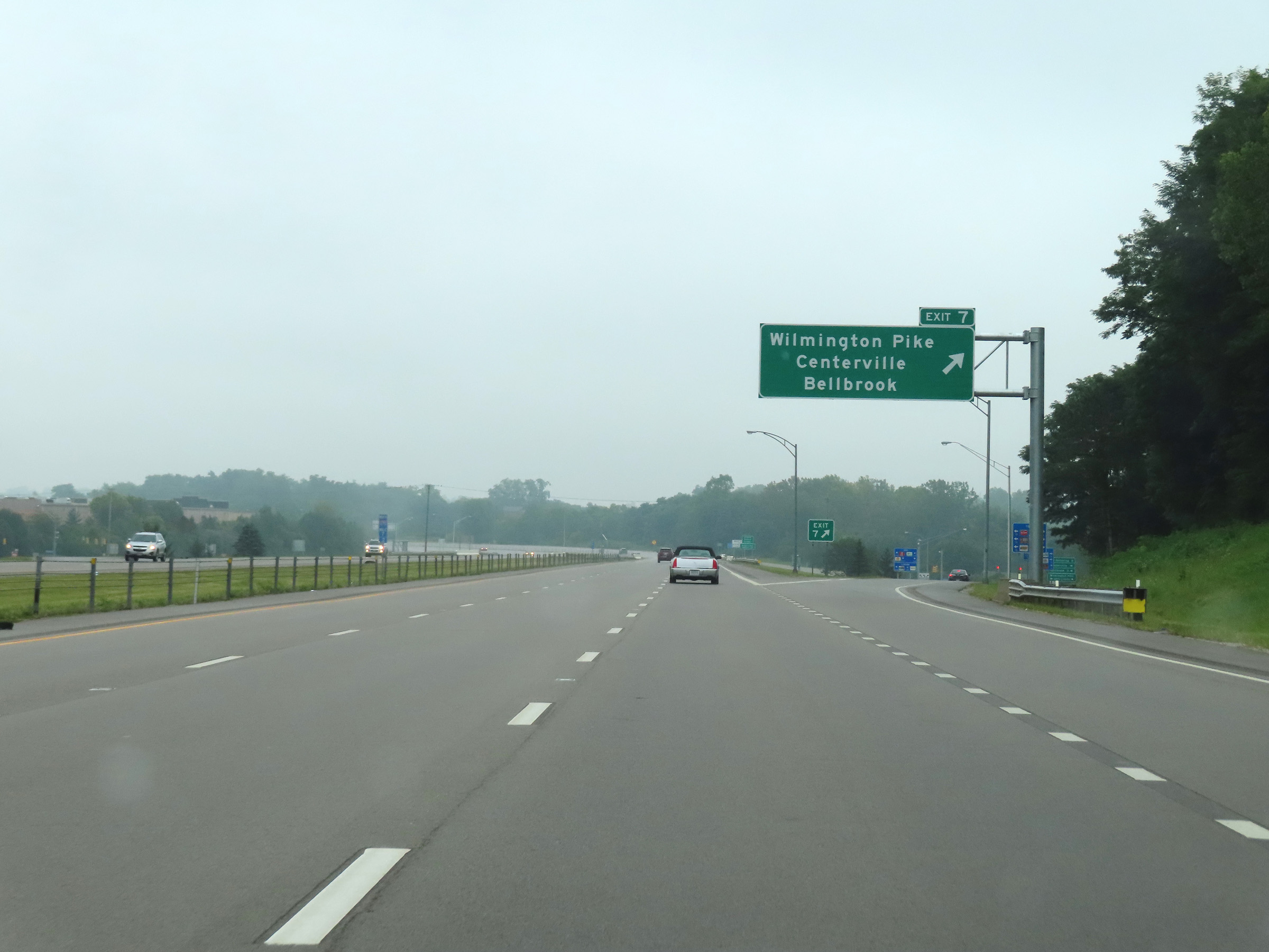 |
Interstate 675 North at Exit 7: Wilmington Pike / Centerville / Bellbrook (Photo taken 8/21/22). |
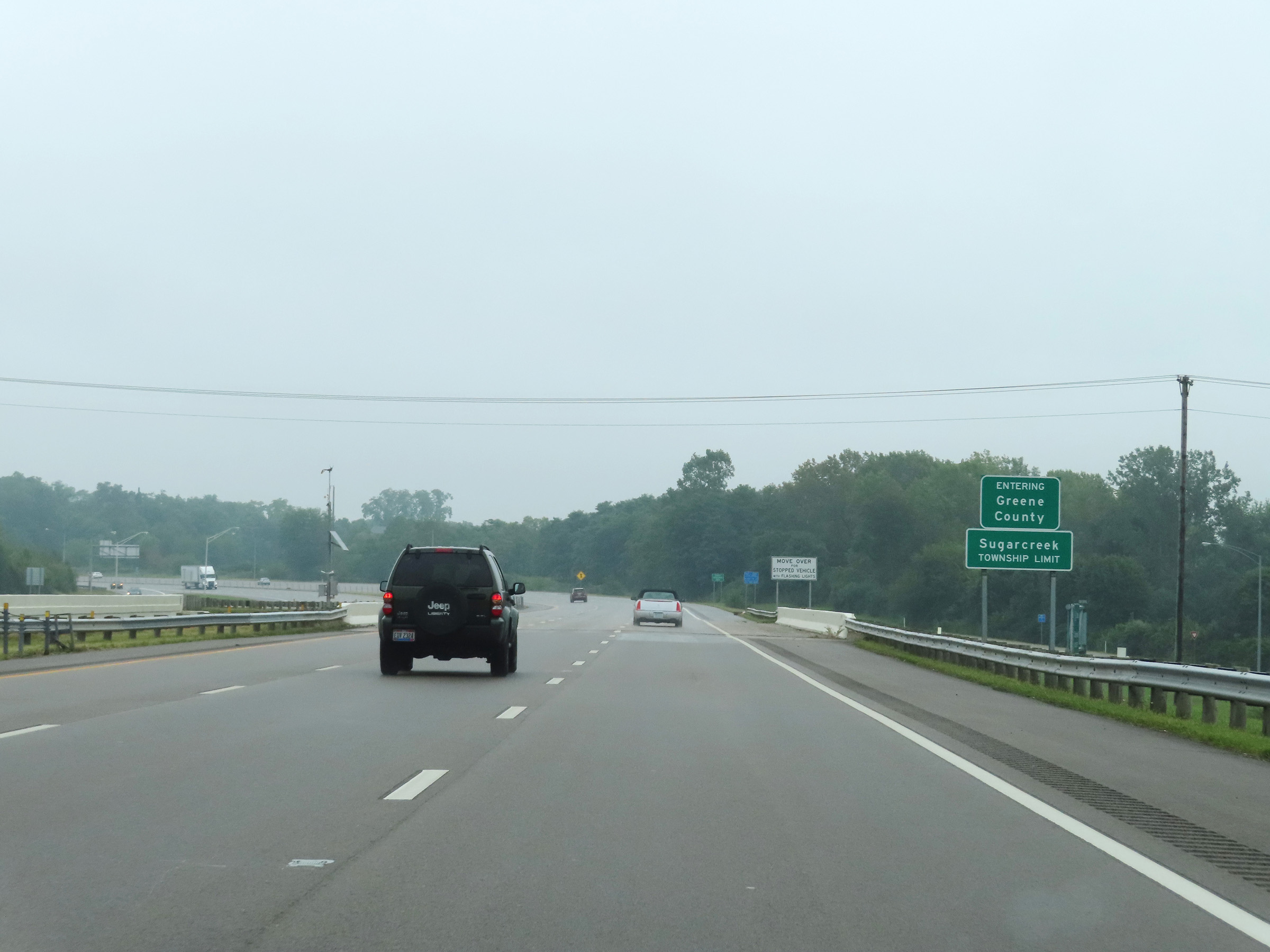 |
Interstate 675 North as it enters Greene County. (Photo taken 8/21/22). |
 |
Mile marker 8.2 on Interstate 675 North, as it begins to curve in a more northerly direction after heading mostly eastbound for its first 8 miles. (Photo taken 8/21/22). |
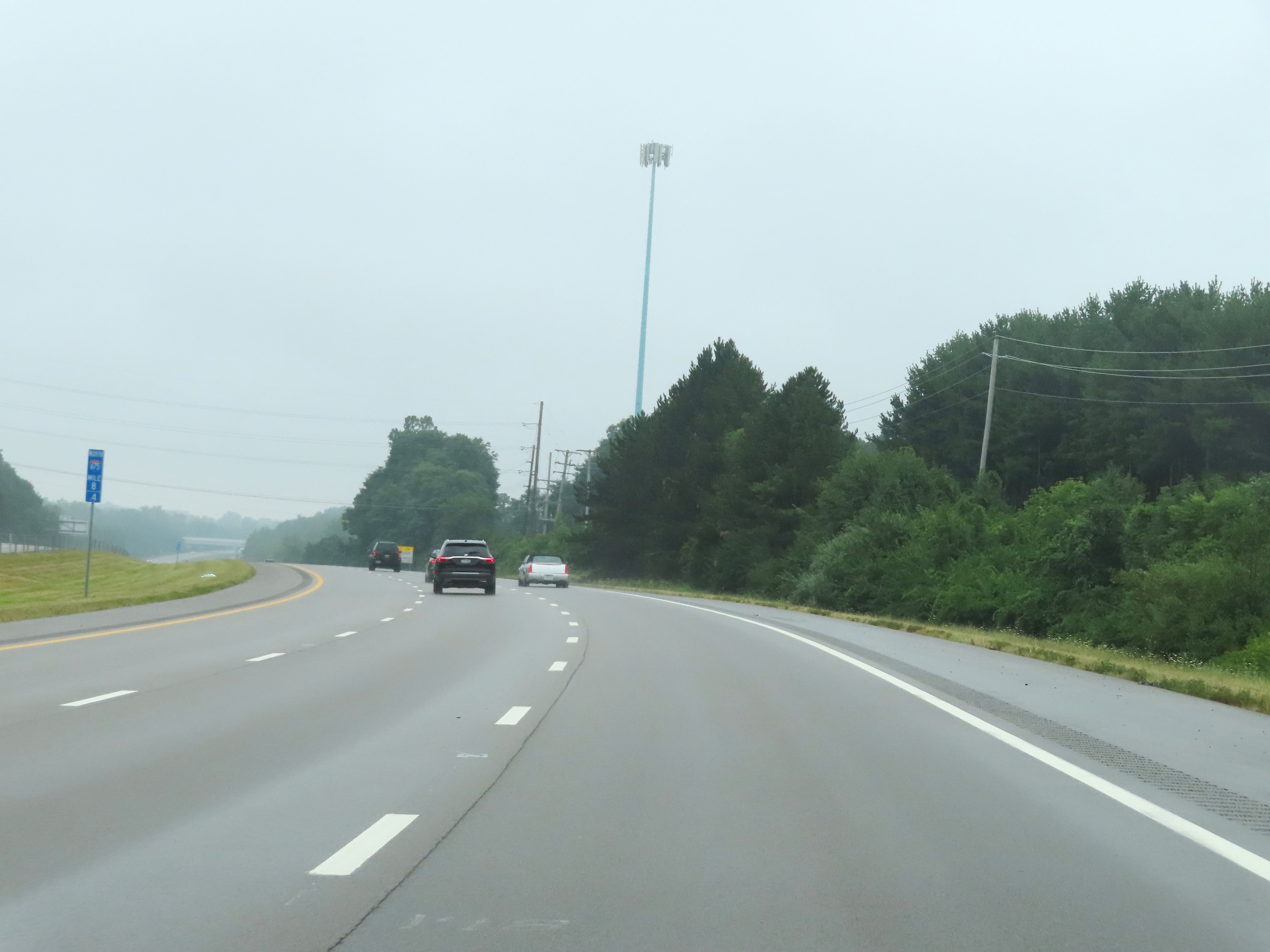 |
View on Interstate 675 North at mile marker 8.4, as it continues to curve to the north after entering Greene County. (Photo taken 8/21/22). |
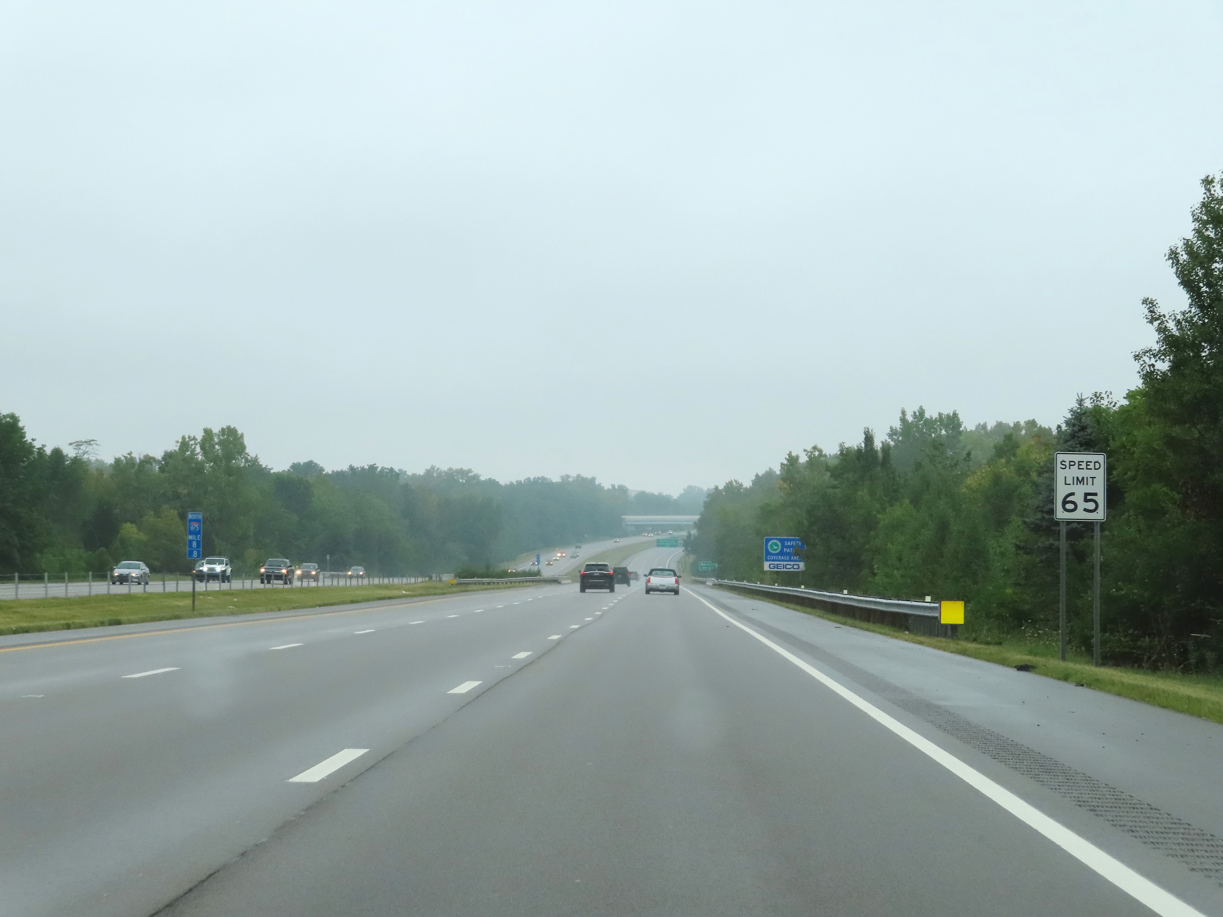 |
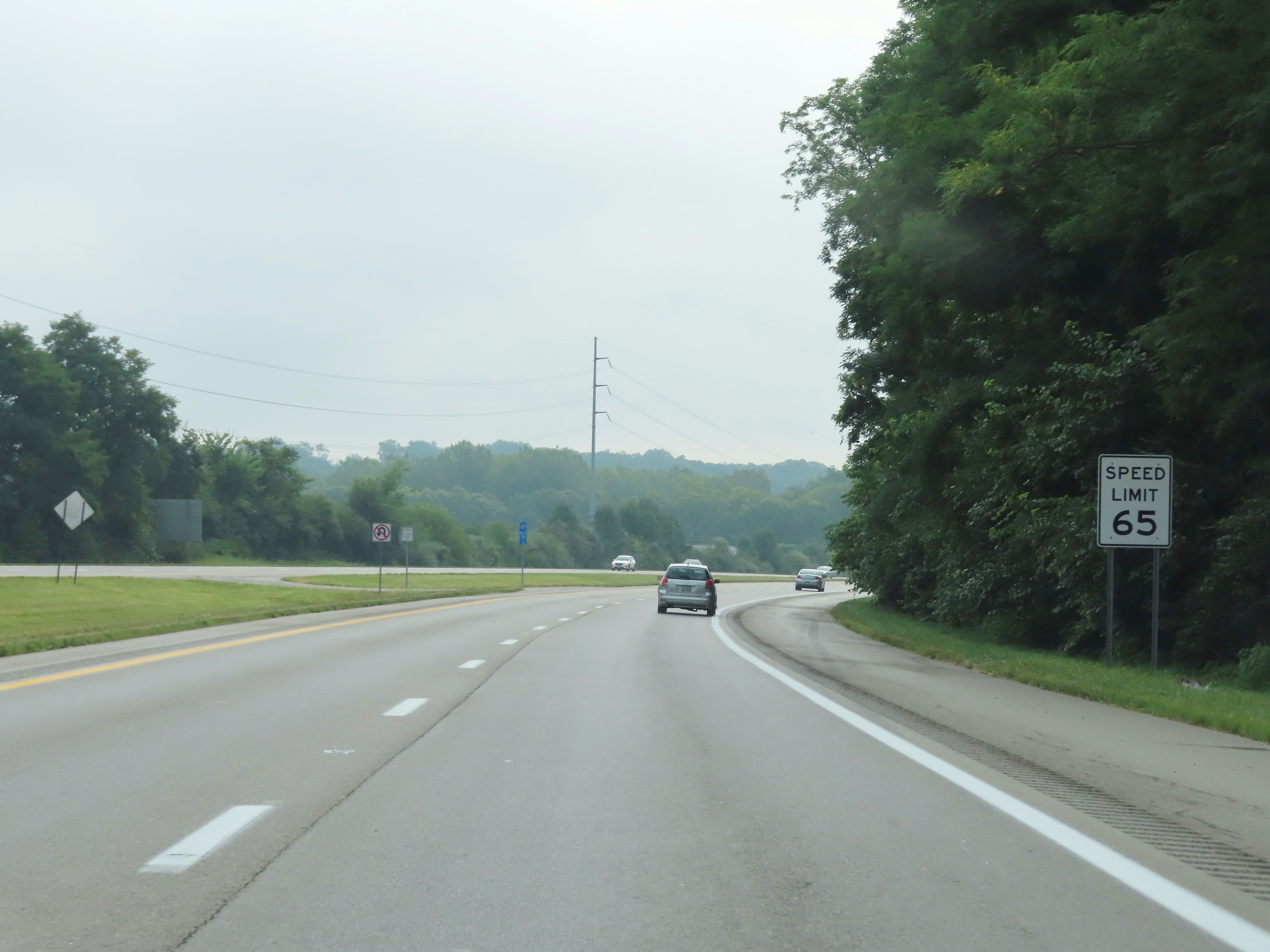
The speed limit remains 65 mph for all traffic on Interstate 675 North. (Photo taken 8/21/22). |
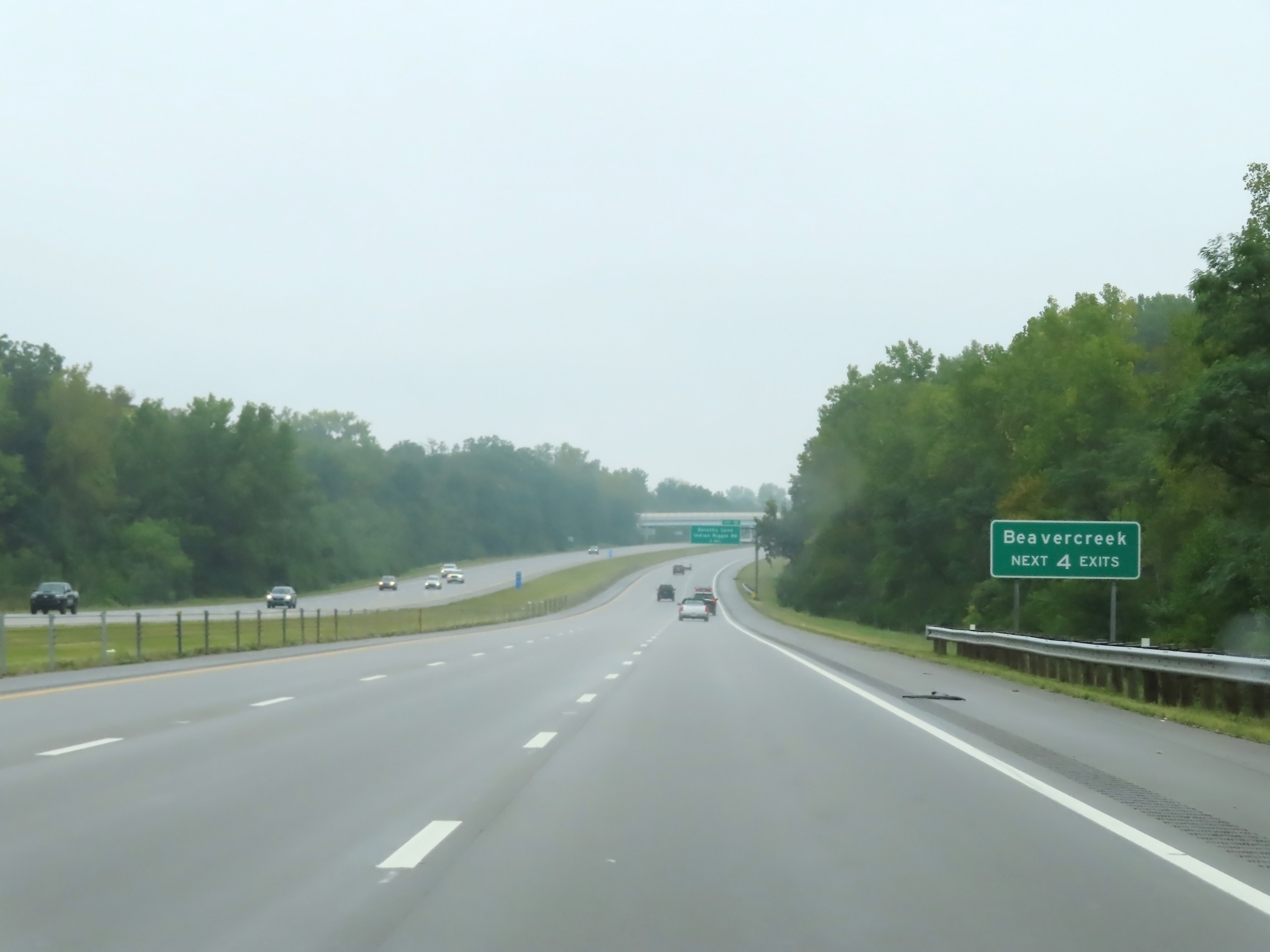 |
Take any of the next 4 exits to Beavercreek. (Photo taken 8/21/22). |
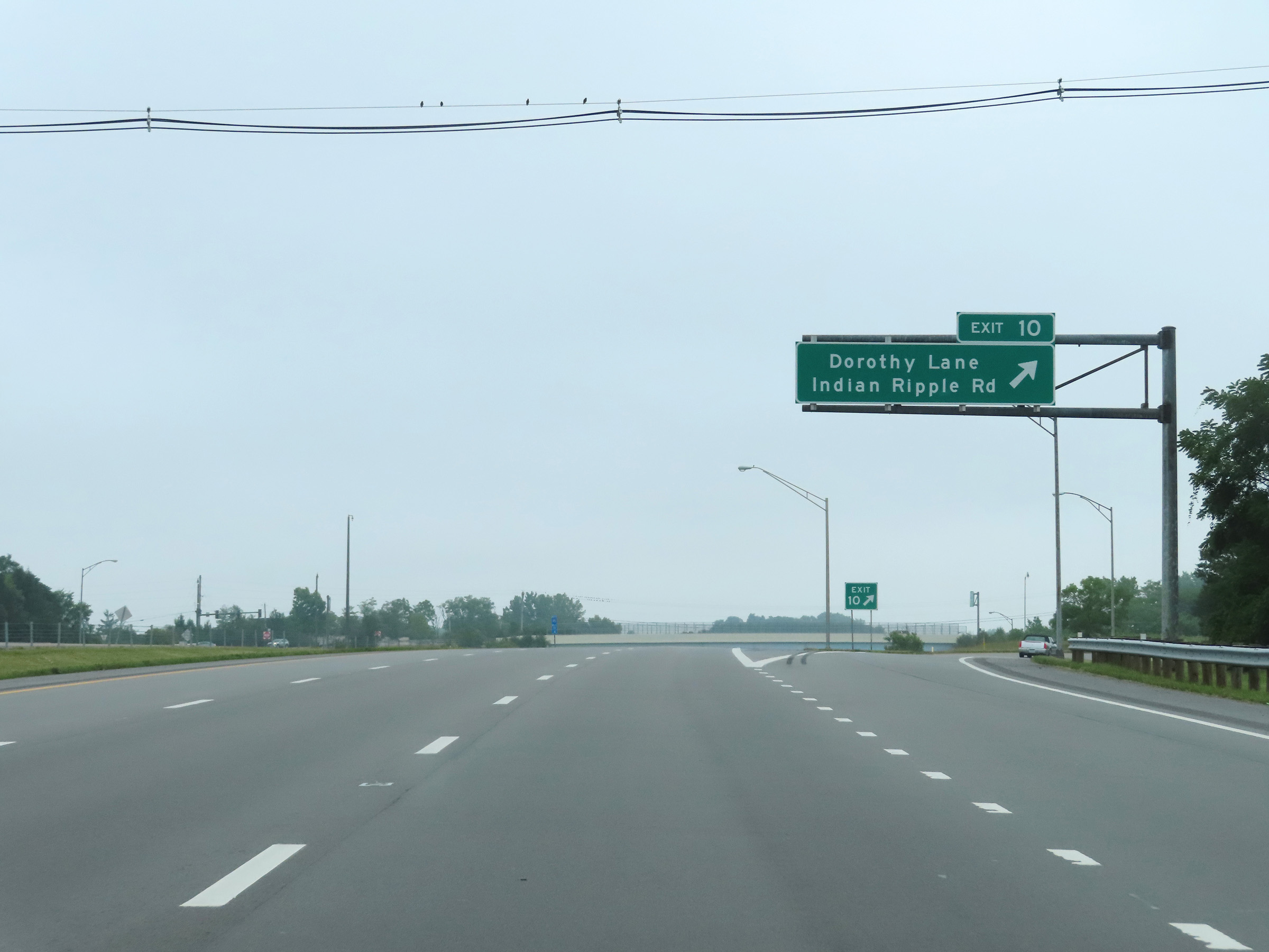 |
Interstate 675 North at Exit 10: Dorothy Lane / Indian Ripple Rd (Photo taken 8/21/22). |
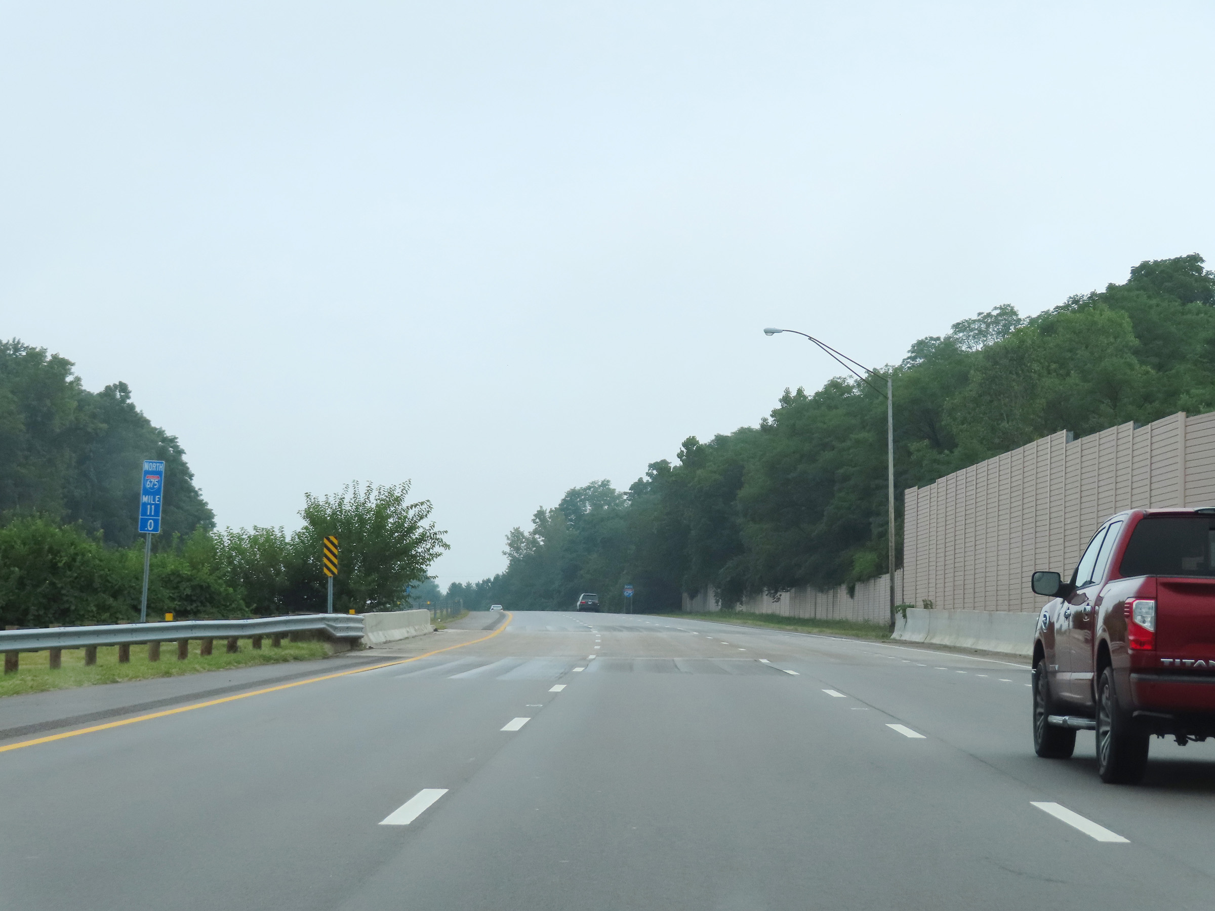 |
Mile marker 11 on Interstate 675 North in Greene County. (Photo taken 8/21/22). |
 |
Mileage sign on Interstate 675 North. It's 4 miles to Wright-Patterson Air Force Base and 15 miles to the junction of Interstate 70. (Photo taken 8/21/22). |
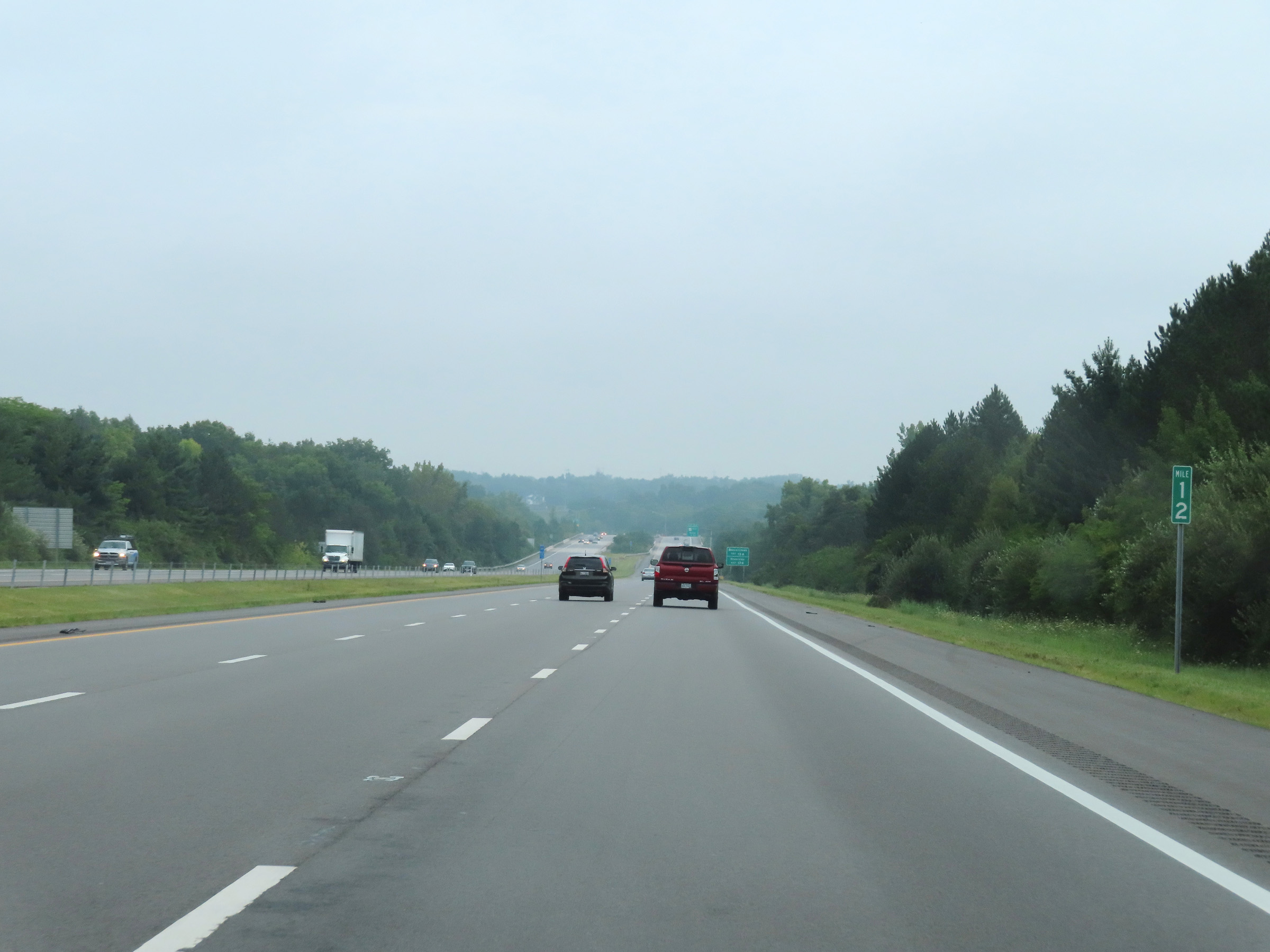 |
View on Interstate 675 North at mile marker 12. (Photo taken 8/21/22). |
 |
Take Exit 13A to Beavercreek, and Exit 13B to Riverside. (Photo taken 8/21/22). |
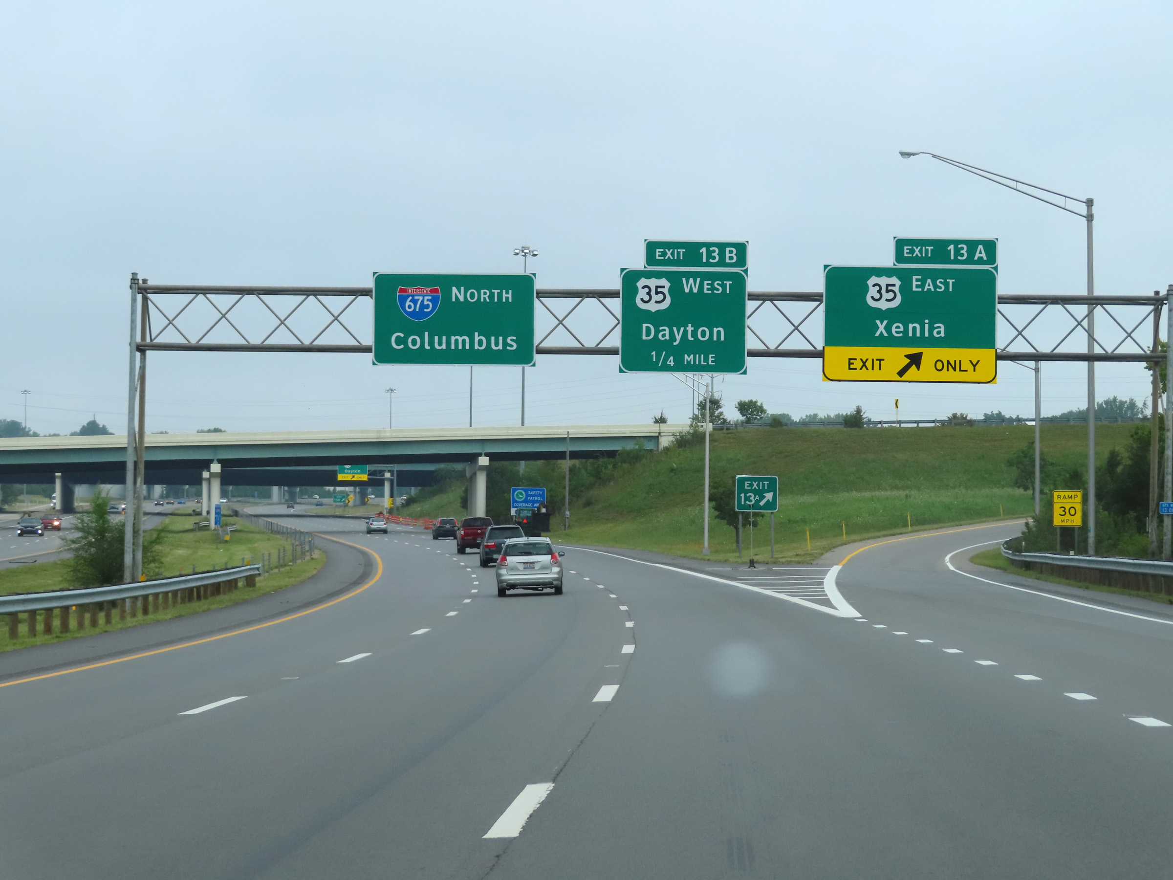 |
Interstate 675 North at Exit 13A: US 35 East - Xenia (Photo taken 8/21/22). |
 |
Interstate 675 North at Exit 13B: US 35 West - Dayton (Photo taken 8/21/22). |
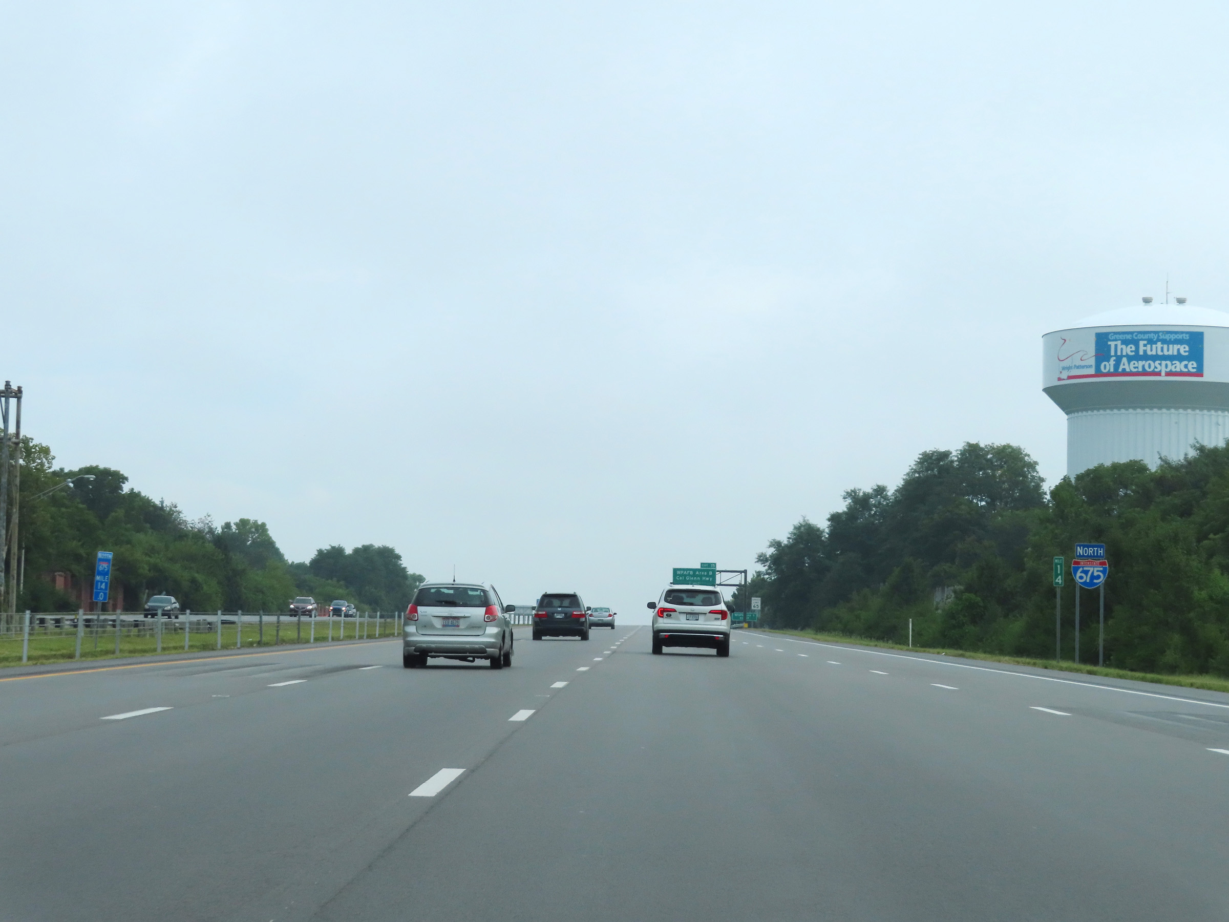 |
Another Interstate 675 North reassurance shield at mile marker 14. (Photo taken 8/21/22). |
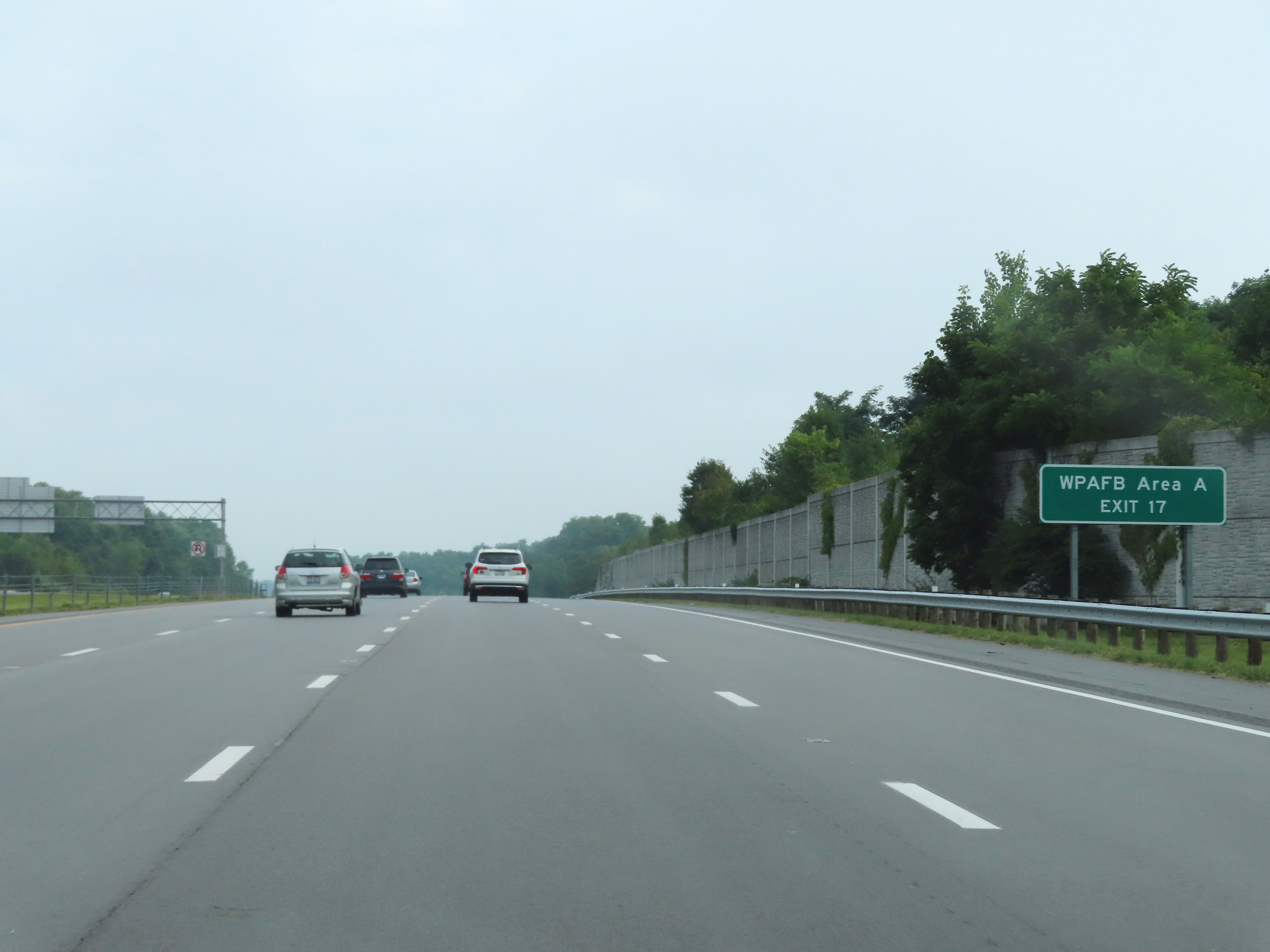 |
Take Exit 17 to Wright-Patterson Air Force Base Area A. (Photo taken 8/21/22). |
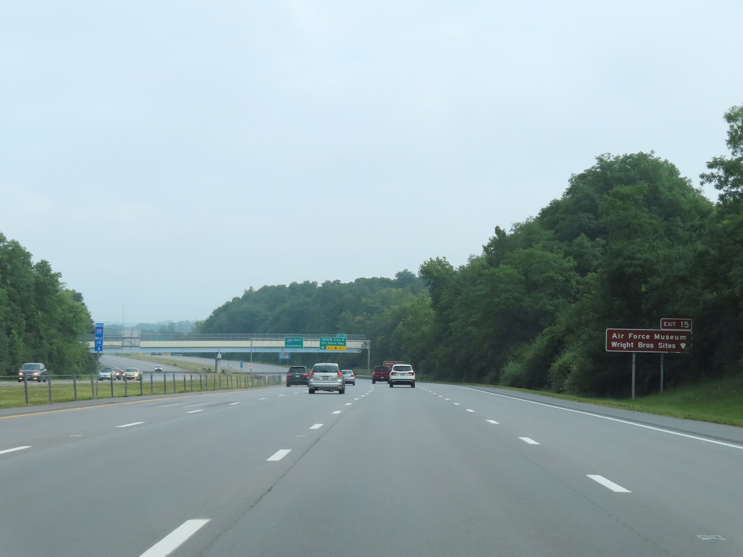 |
Take Exit 15 to the Air Force Museum and Wright Brothers Sites. (Photo taken 8/21/22). |
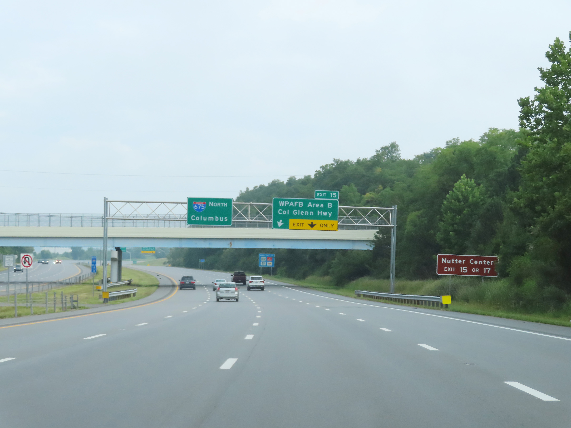 |
Traffic to Nutter Center can use either Exit 15 or Exit 17. (Photo taken 8/21/22). |
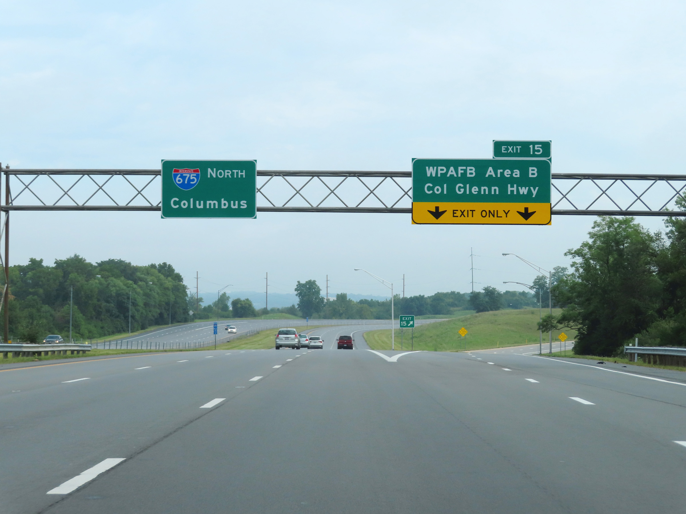 |
Interstate 675 North at Exit 15: Wright-Patterson Air Force Base Area B / Col Glenn Hwy (Photo taken 8/21/22). |
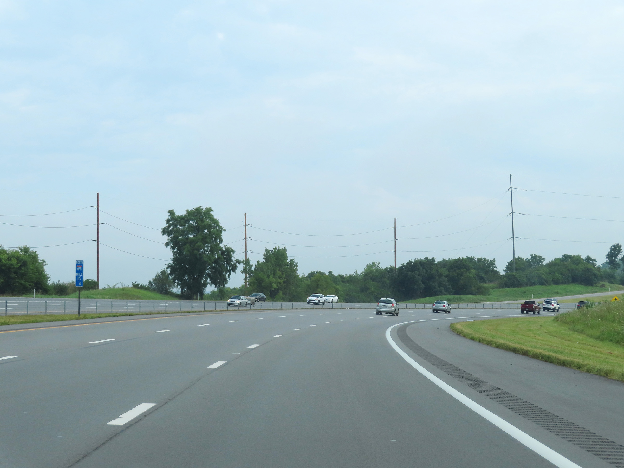 |
View on Interstate 675 North at mile marker 15.4, as it once again curves to the east. (Photo taken 8/21/22). |
 |
Take any of the next 4 exits to Fairborn. (Photo taken 8/21/22). |
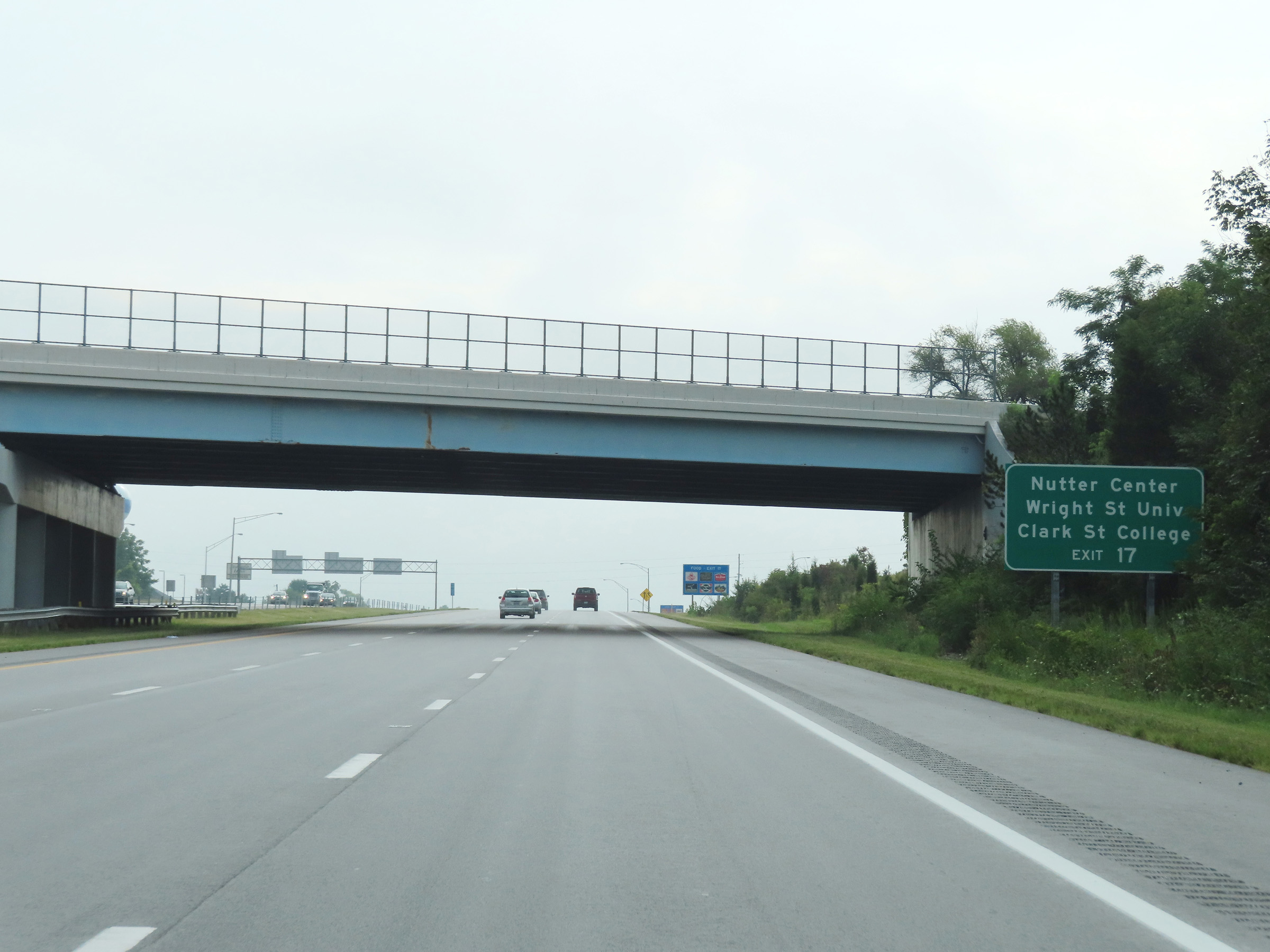 |
Take Exit 17 to Nutter Center, Wright State University, and Clark State College. (Photo taken 8/21/22). |
 |
Interstate 675 North at Exit 17: OH 844 - North Fairfield Rd / WPAFB Area A (Photo taken 8/21/22). |
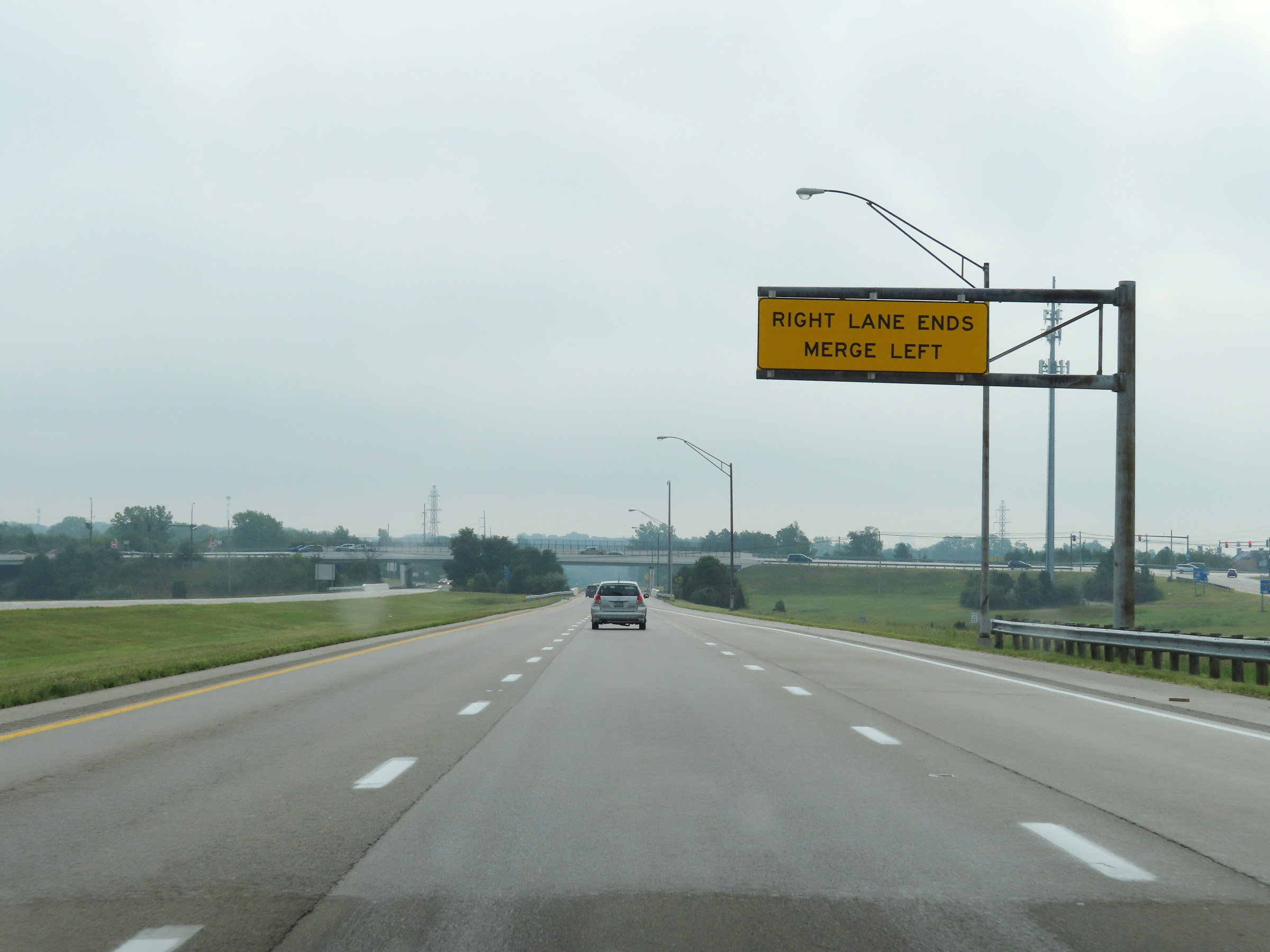 |
Norht of Exit 17, the right lane of Interstate 675 North comes to an end leaving it with two thru lanes once again. (Photo taken 8/21/22). |
 |
Interstate 675 North at mile marker 18. (Photo taken 8/21/22). |
 |
Interstate 675 North reassurance shield. (Photo taken 8/21/22). |
 |
The speed limit remains 65 mph on Interstate 675 North. (Photo taken 8/21/22). |
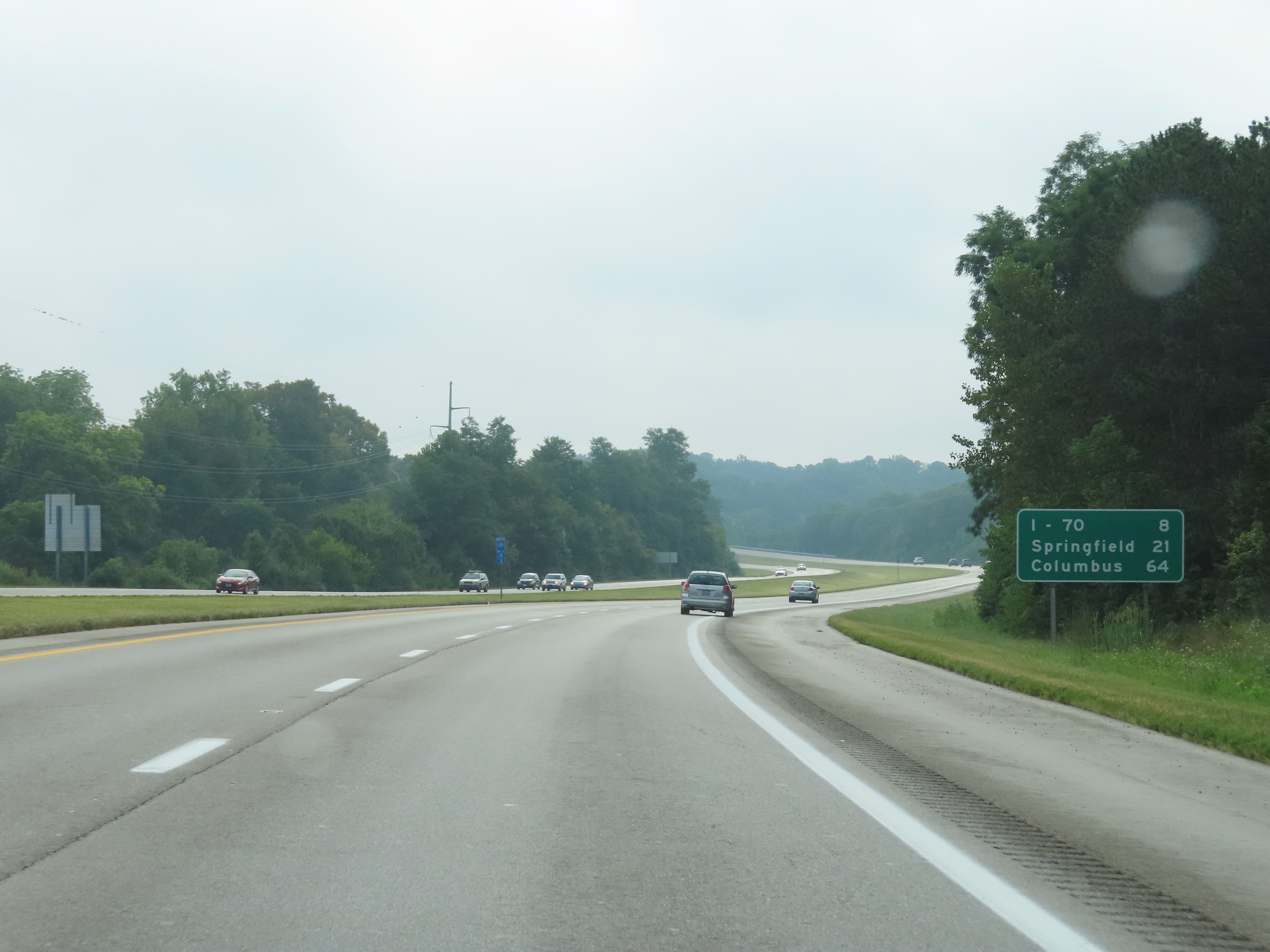 |
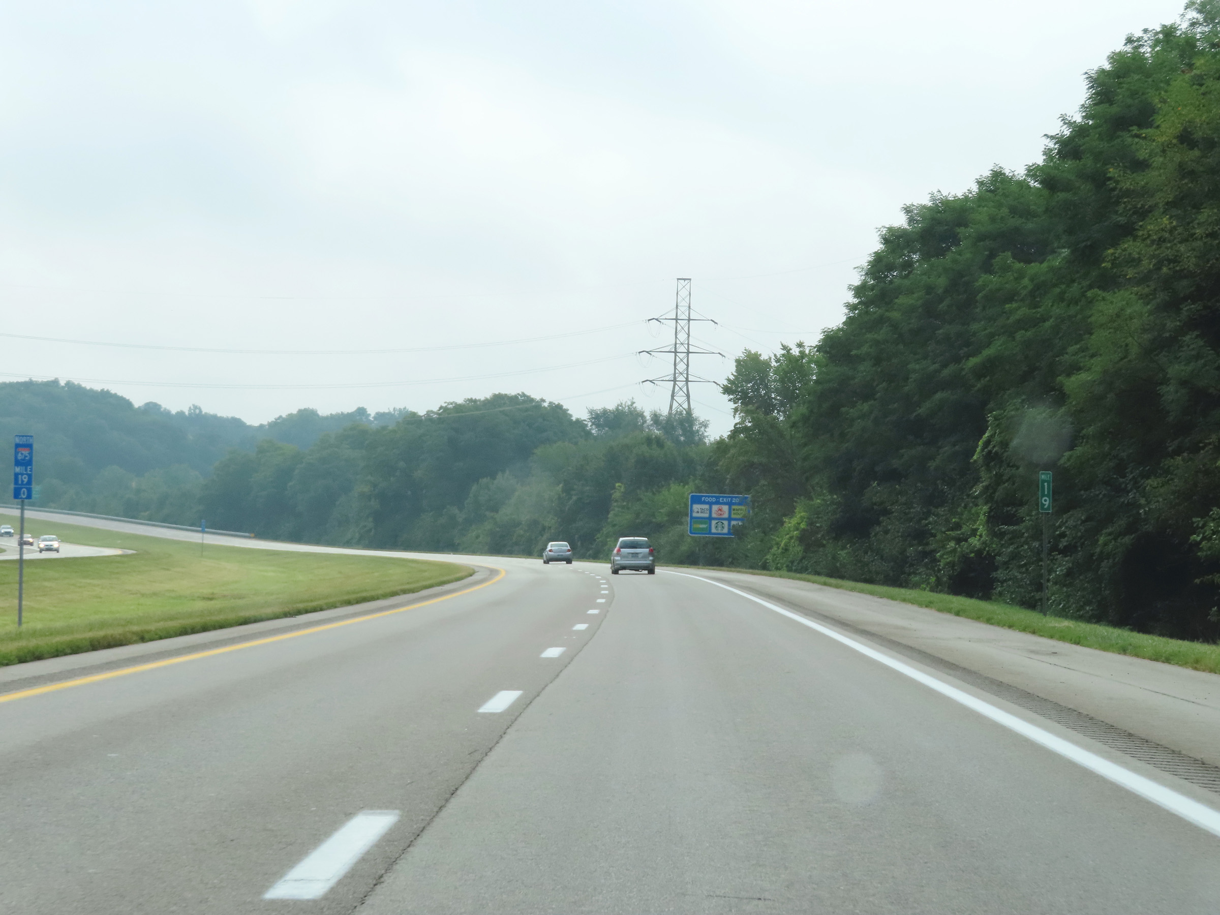
Mileage sign at mile marker 18.8. It's 8 miles to the junction of Interstate 70, 21 miles to Springfield, and 64 miles to Columbus. (Photo taken 8/21/22). |
 |
At mile marker 19, Interstate 675 North begins to curve back to the north and head straight toward Interstate 70. (Photo taken 8/21/22). |
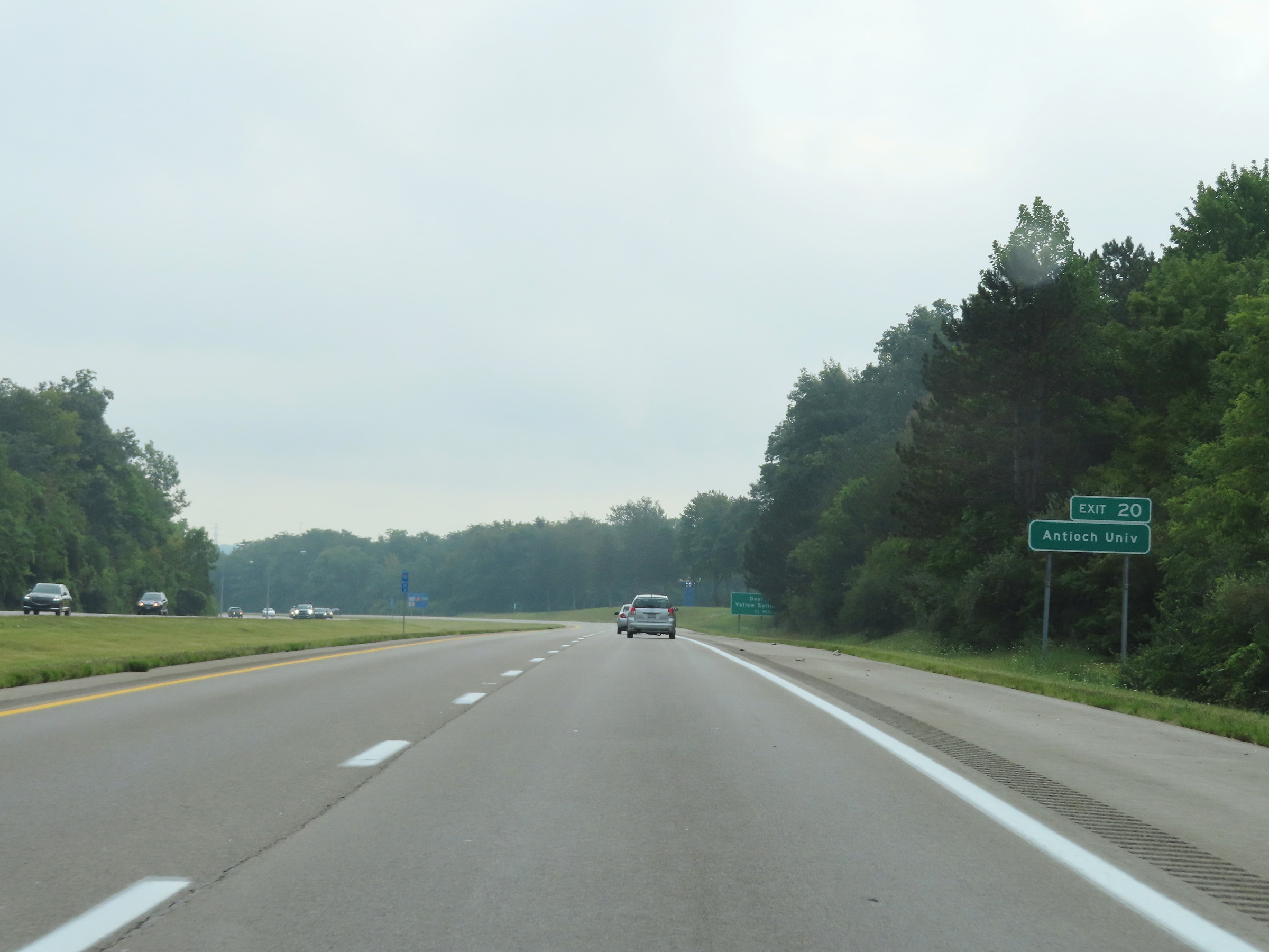 |
Take Exit 20 to Antioch University. (Photo taken 8/21/22). |
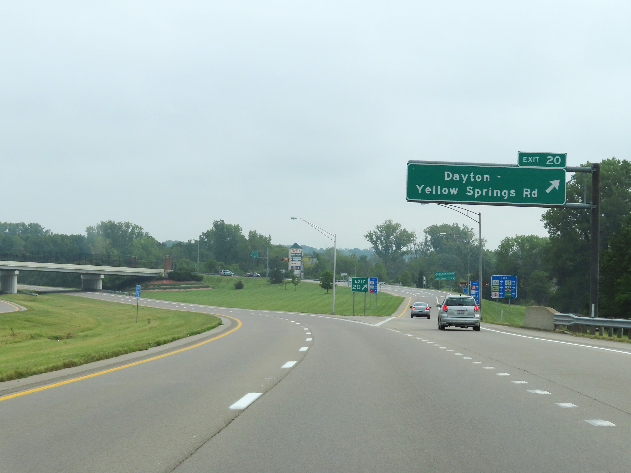 |
Interstate 675 North at Exit 20: Dayton-Yellow Springs Rd (Photo taken 8/21/22). |
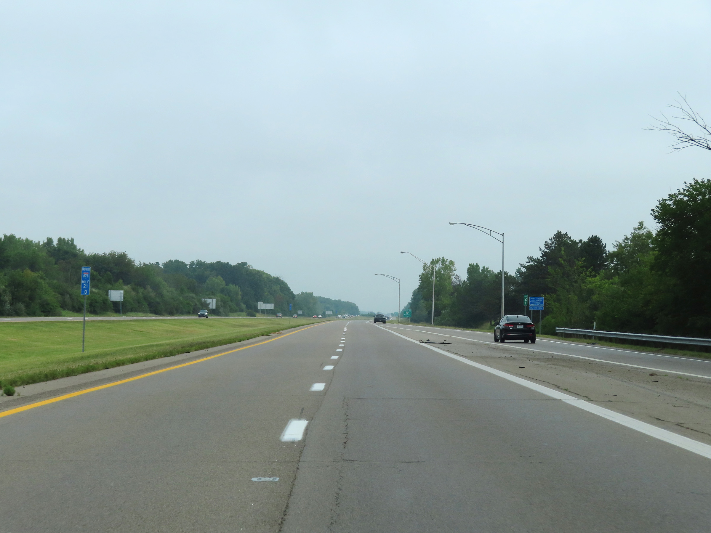 |
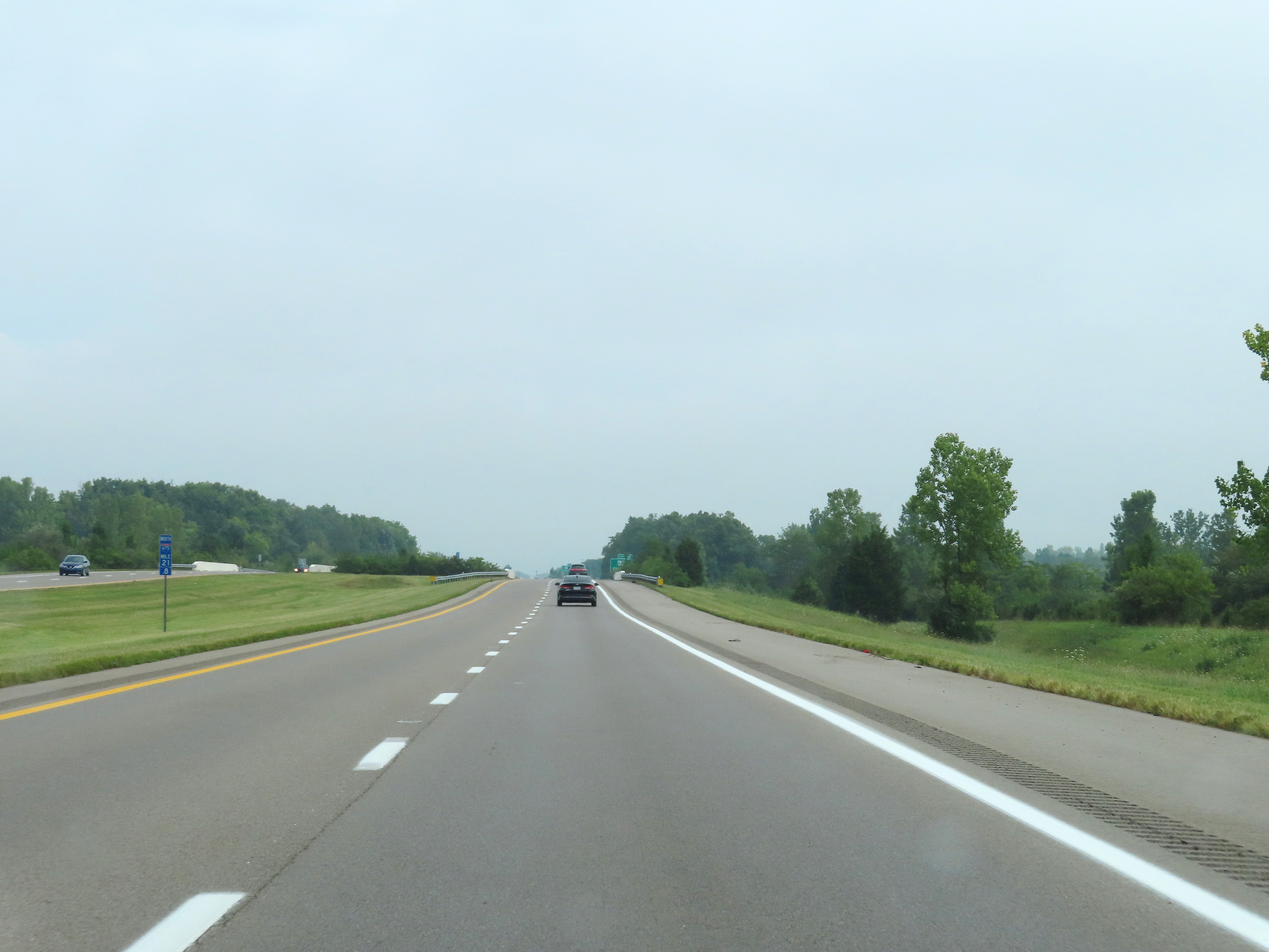
View on Interstate 675 North at mile marker 21. (Photo taken 8/21/22). |
 |
Mile marker 21.8 on Interstate 675 North in Greene County. (Photo taken 8/21/22). |
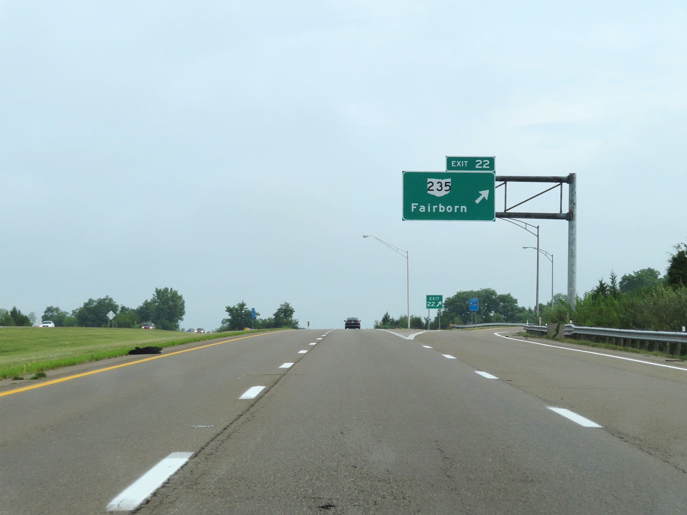 |
Interstate 675 North at Exit 22: OH 235 - Fairborn (Photo taken 8/21/22). |
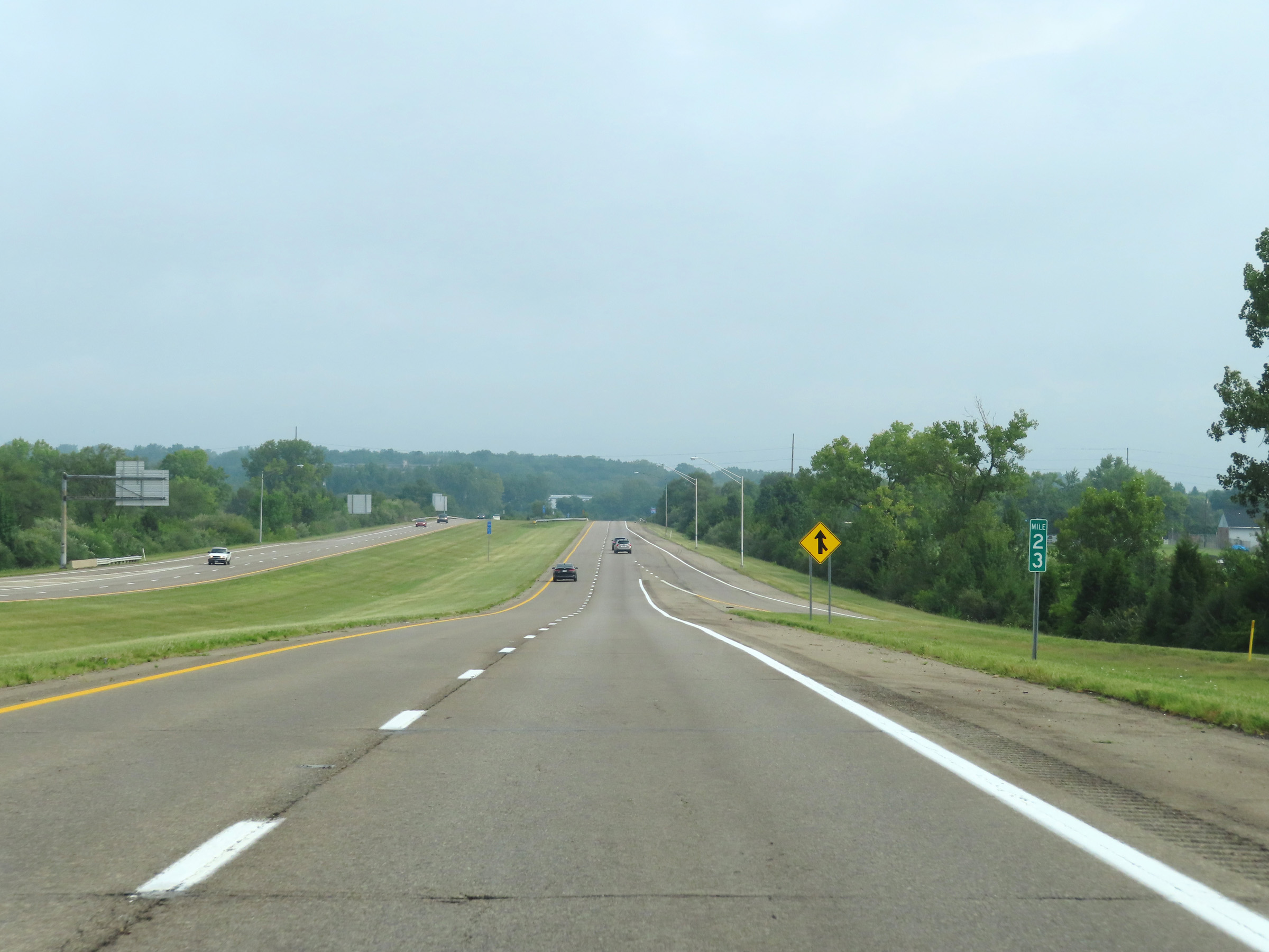 |
View on Interstate 675 North at mile marker 23. (Photo taken 8/21/22). |
 |
Interstate 675 North at mile marker 24.2. (Photo taken 8/21/22). |
 |
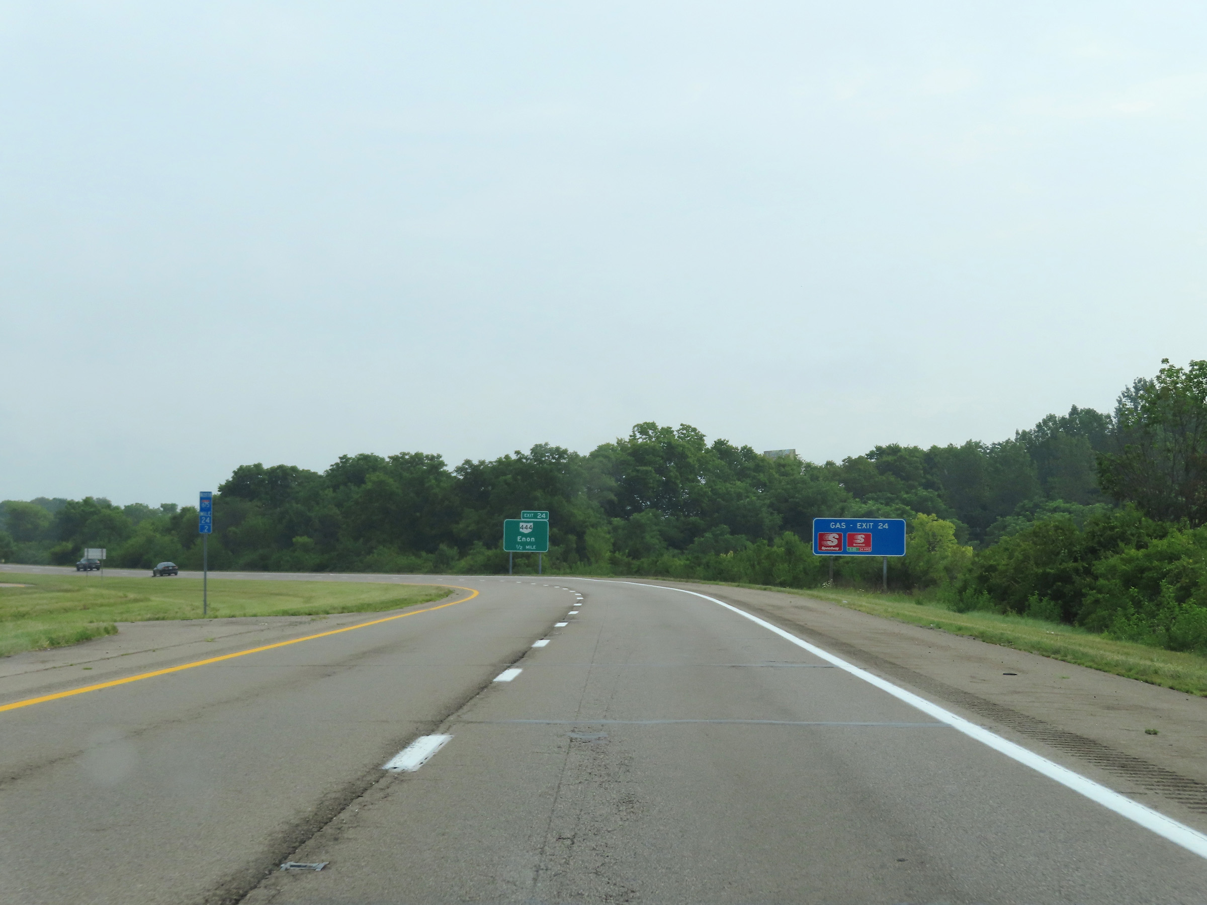
Interstate 675 North at Exit 24: OH 444 - Enon (Photo taken 8/21/22). |
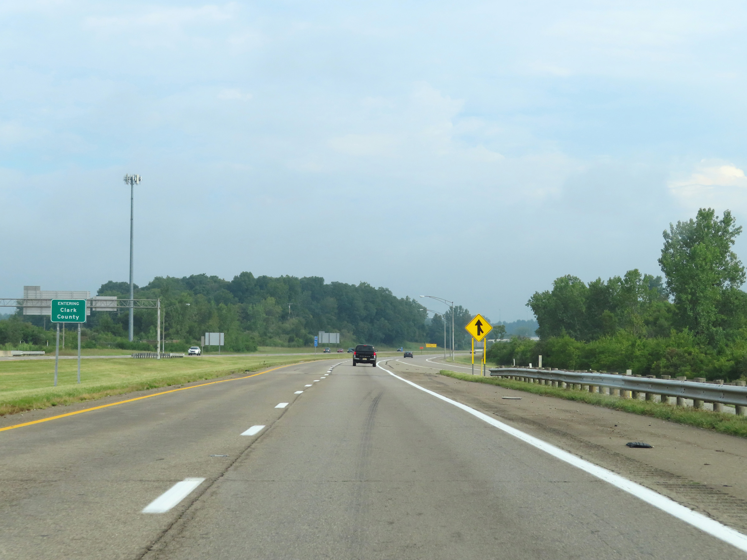 |
North of Exit 24, Interstate 675 North enters Clark County. (Photo taken 8/21/22). |
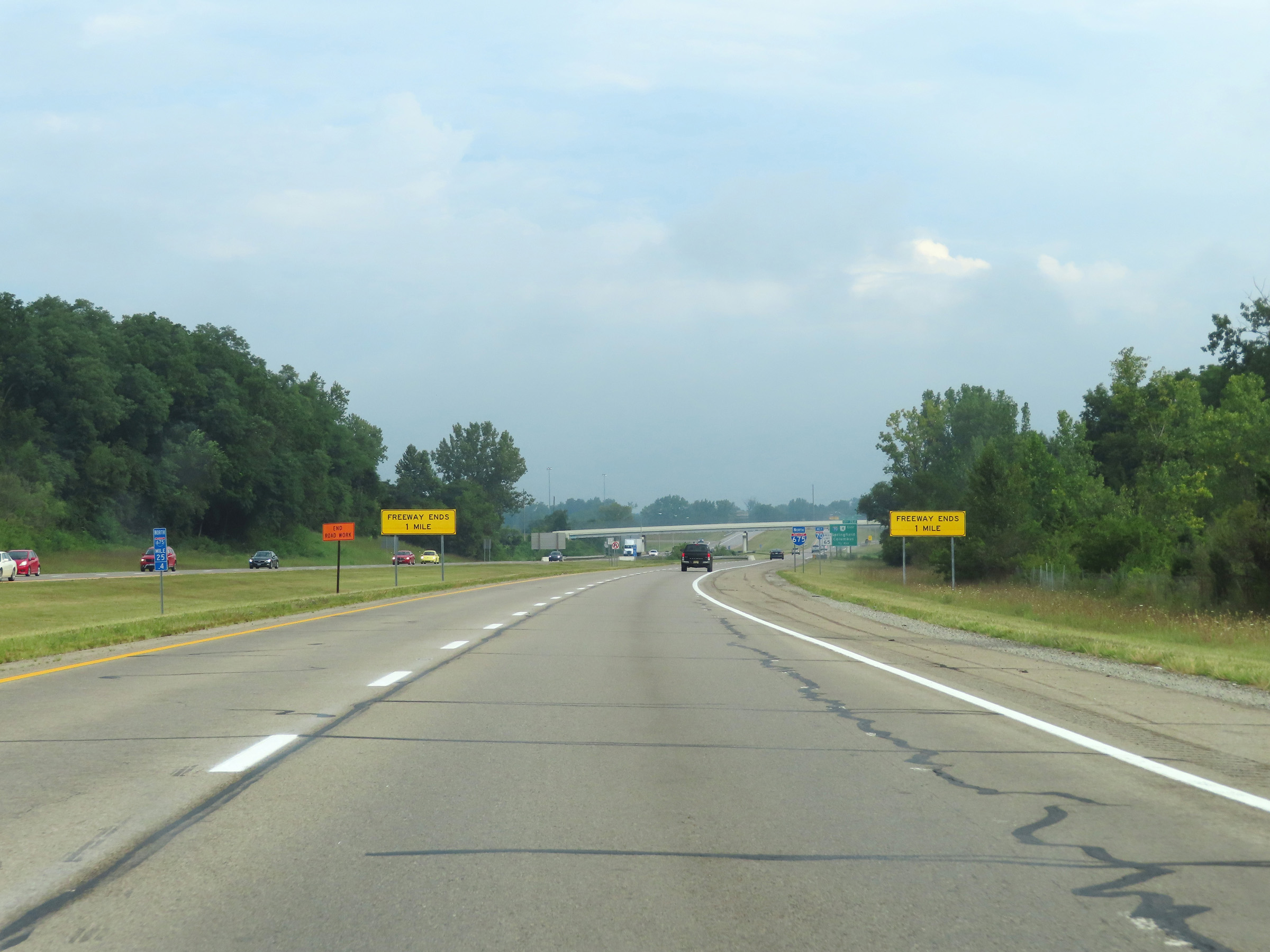 |
As this signage at mile marker 25.4 shows, Interstate 675 North will reach its northern terminus 1 mile ahead just beyond the junction of Interstate 70. (Photo taken 8/21/22). |
 |
One final Interstate 675 North reassurance shield. (Photo taken 8/21/22). |
 |
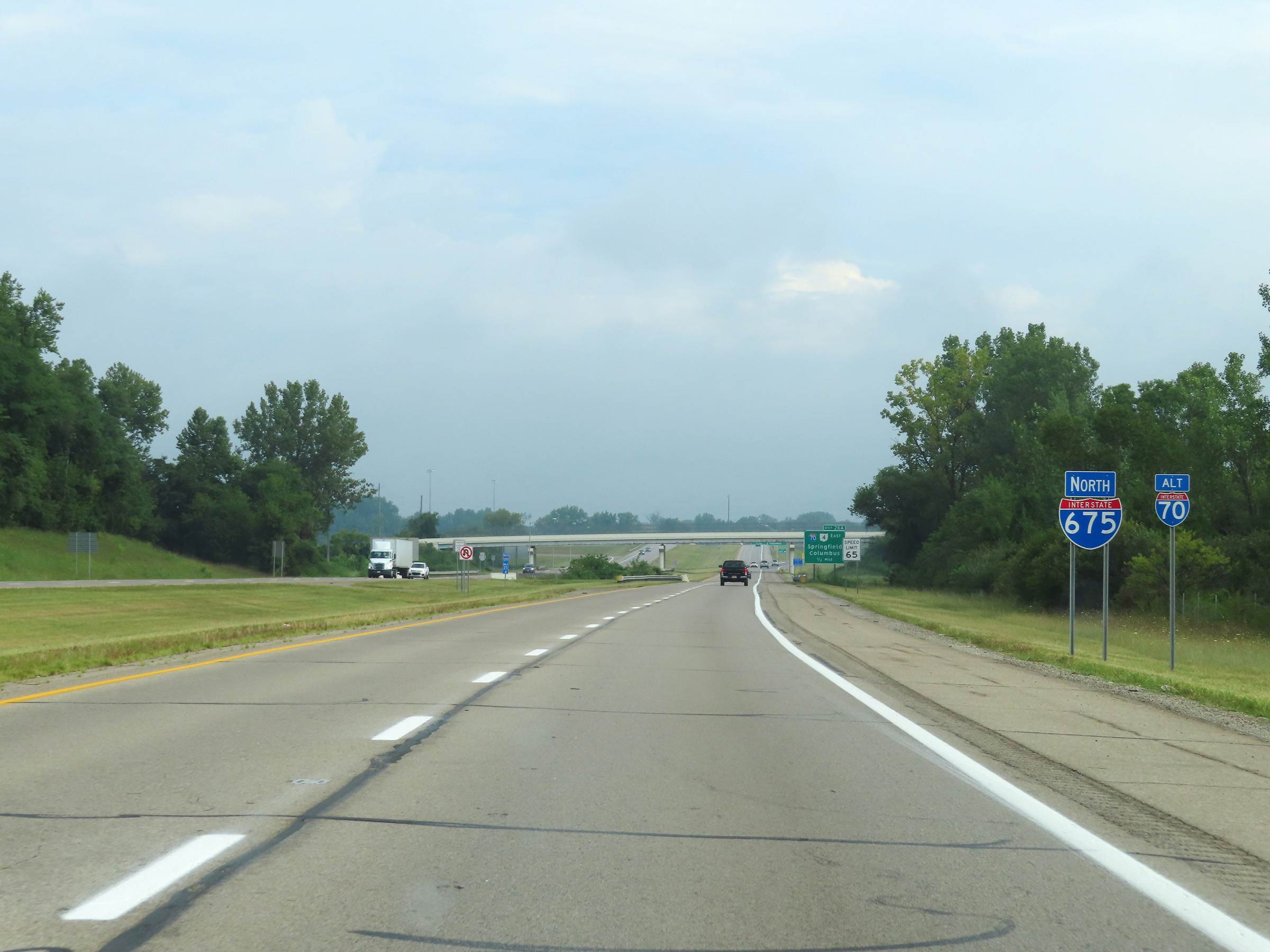
Interstate 675 North approaching Exit 26A - 1/2 mile. (Photo taken 8/21/22). |
 |
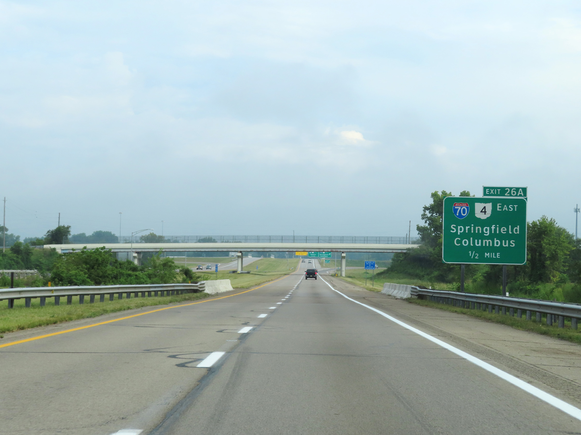
Interstate 675 North at Exit 26A: Interstate 70 East / OH 4 East - Springfield / Columbus (Photo taken 8/21/22). |
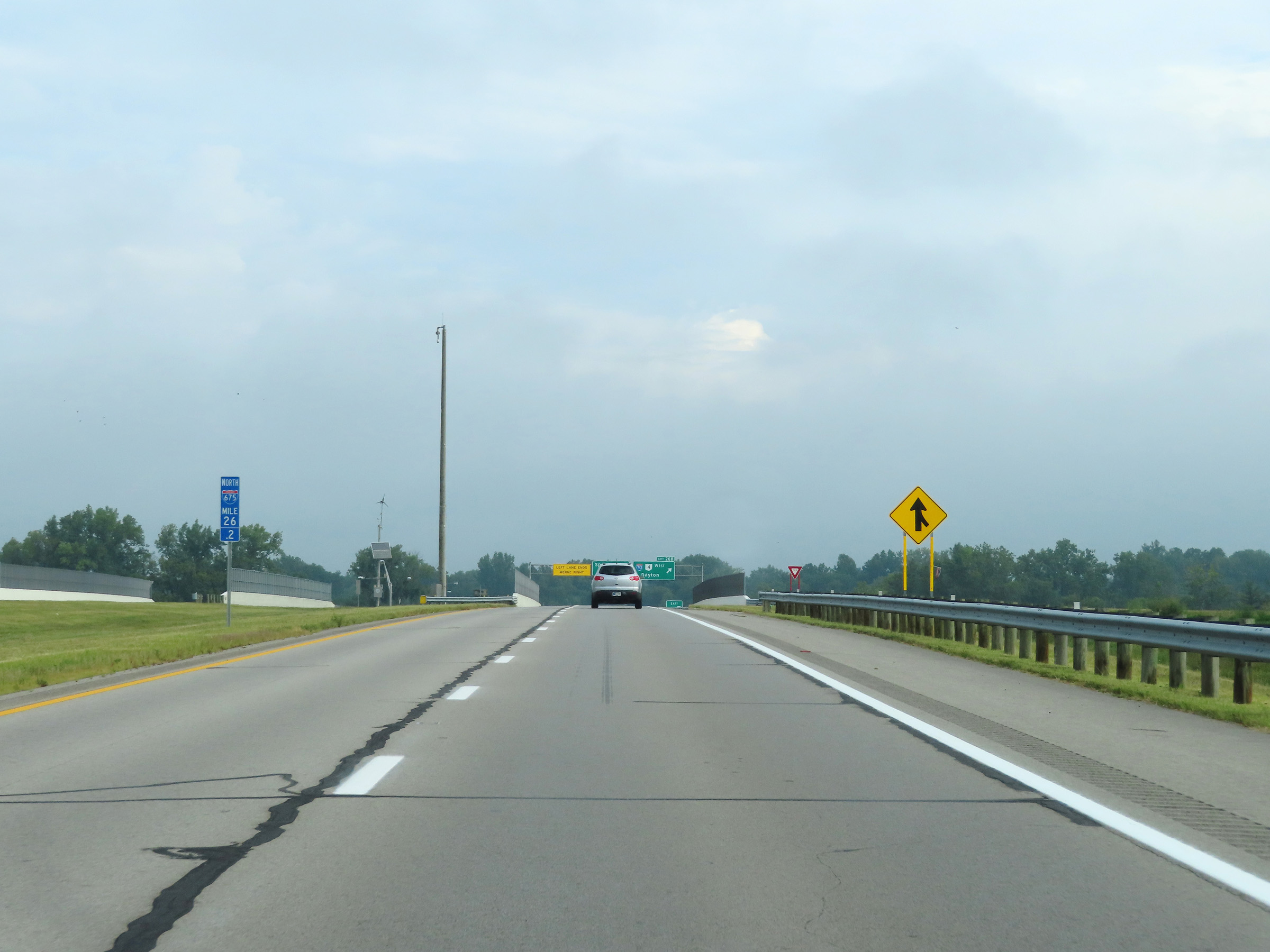 |
View on Interstate 675 North at mile marker 26.2, as it prepares to pass over Interstate 70. (Photo taken 8/21/22). |
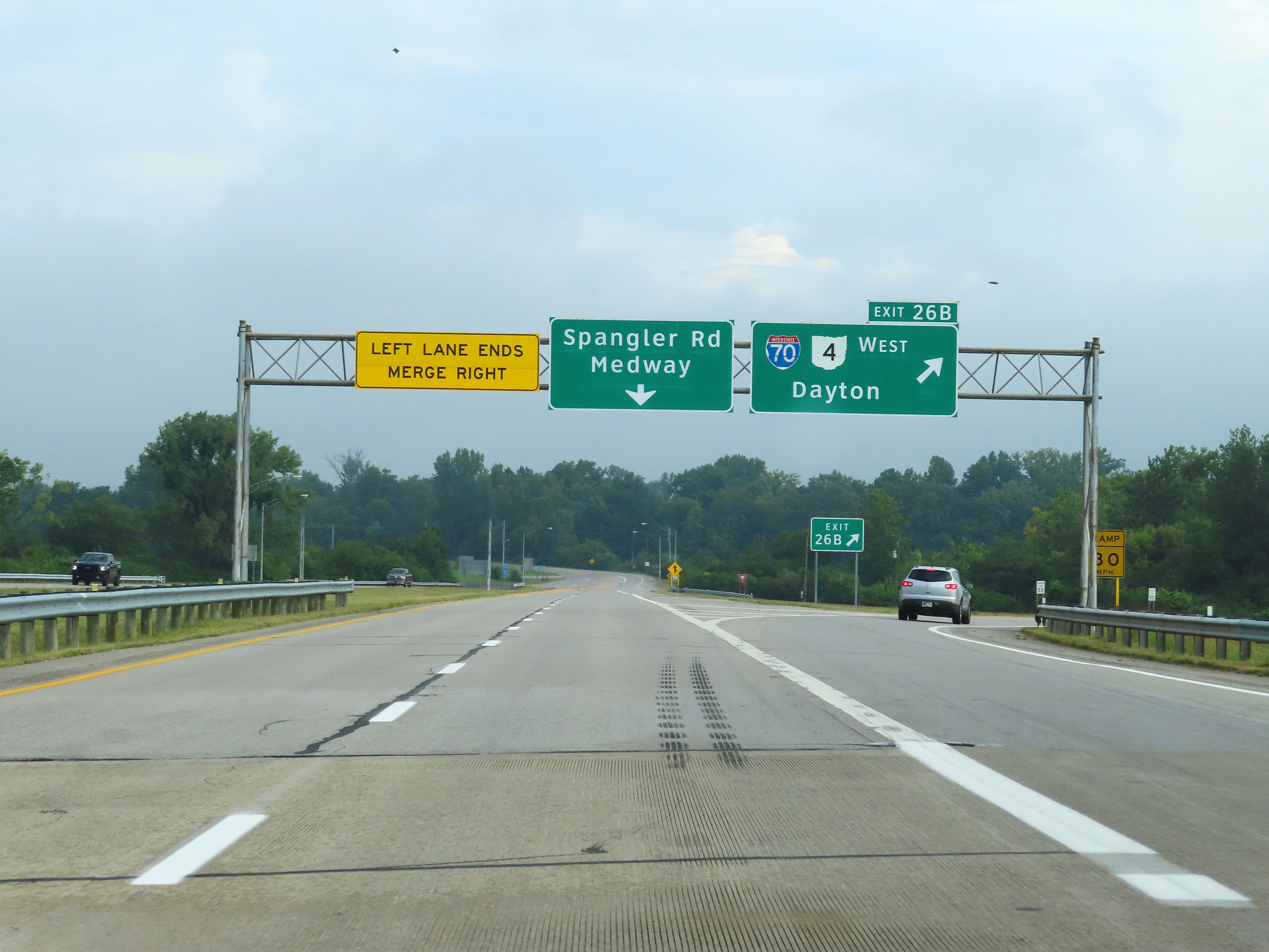 |
Interstate 675 North at Exit 26B: Interstate 70 West / OH 4 West - Dayton (Photo taken 8/21/22). |
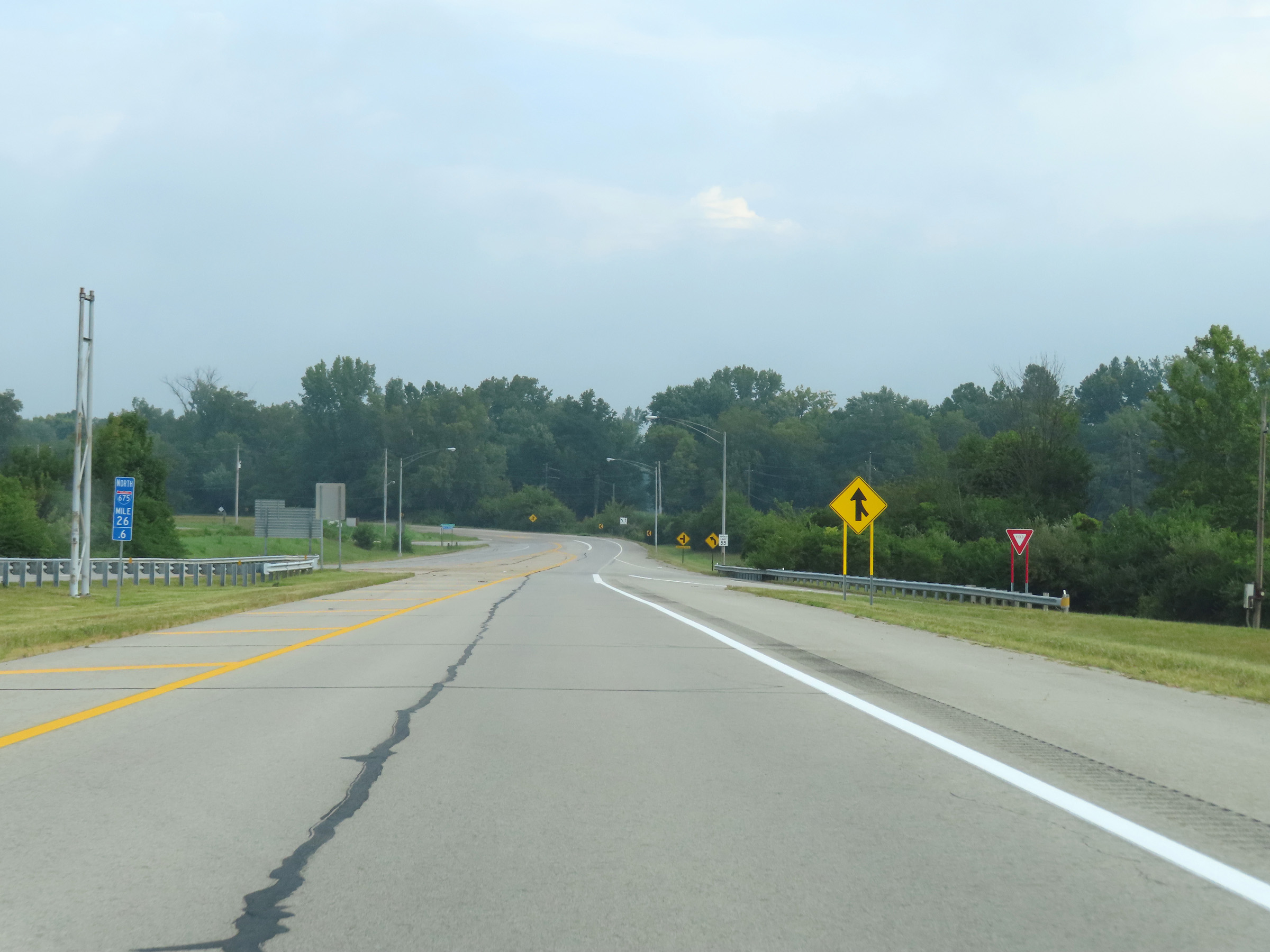 |
At mile marker 26.6, Interstate 675 North reaches its northern terminus just beyond the junction of Interstate 70. It is reduced to a single lane which continues north as Spangler Rd toward Medway. (Photo taken 8/21/22). |
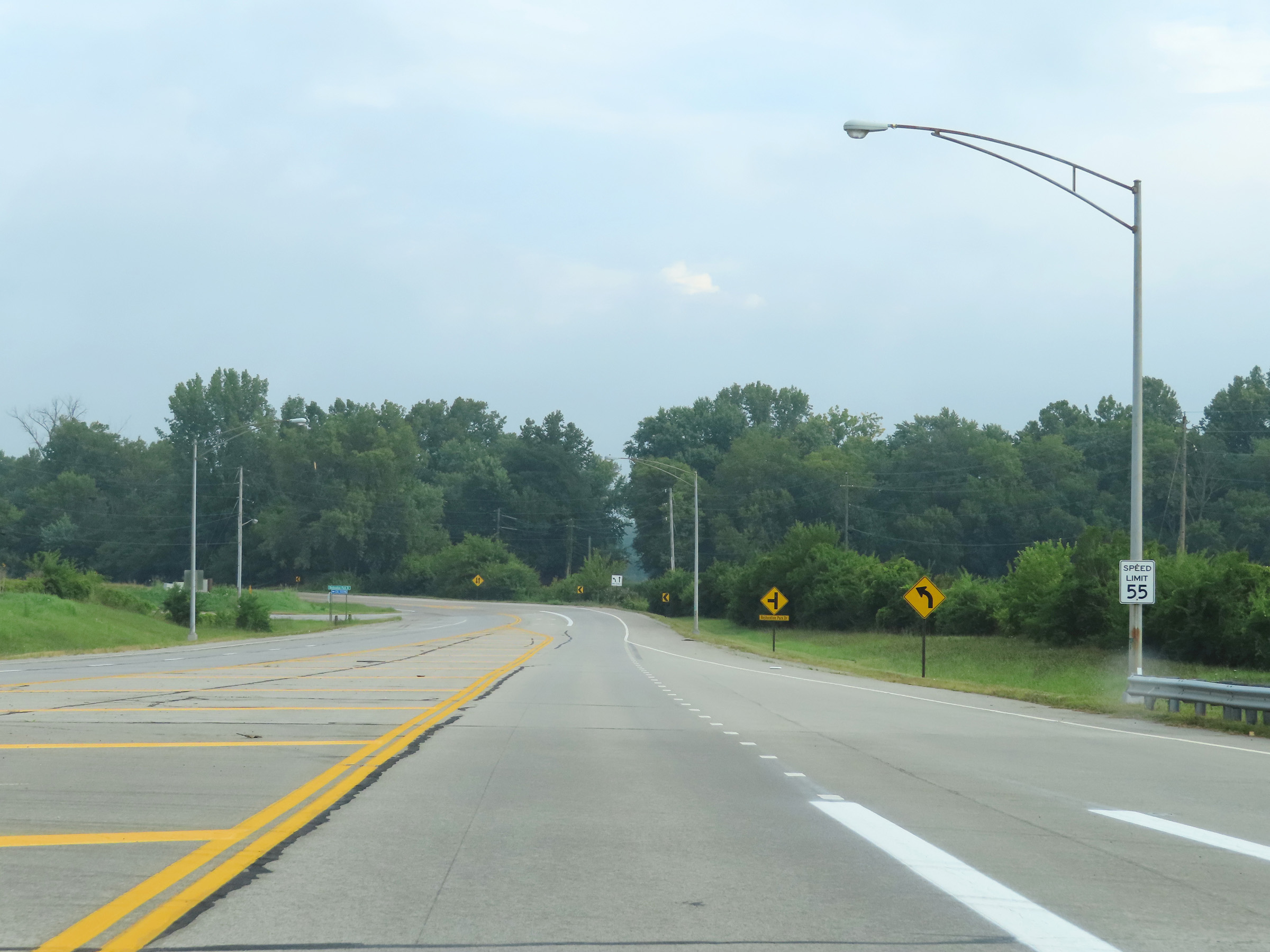 |
The speed limit is reduced to 55 mph at the northern terminus of Interstate 675, as its remaining single lane becomes Spangler Rd. (Photo taken 8/21/22). |