Road Information |
||
 |
||
| Total Mileage in State: | 10 miles | |
| Eastern End: | At I-270, near Gahanna | |
| Western End: | At I-70, in Columbus | |
| Mileage covered in Photos: | 10 miles | |
| Counties covered in Photos: | Franklin | |
| Major Junctions in Photos: | I-71, in Columbus | |
| Control Cities in Photos: | Columbus | |
Eastbound
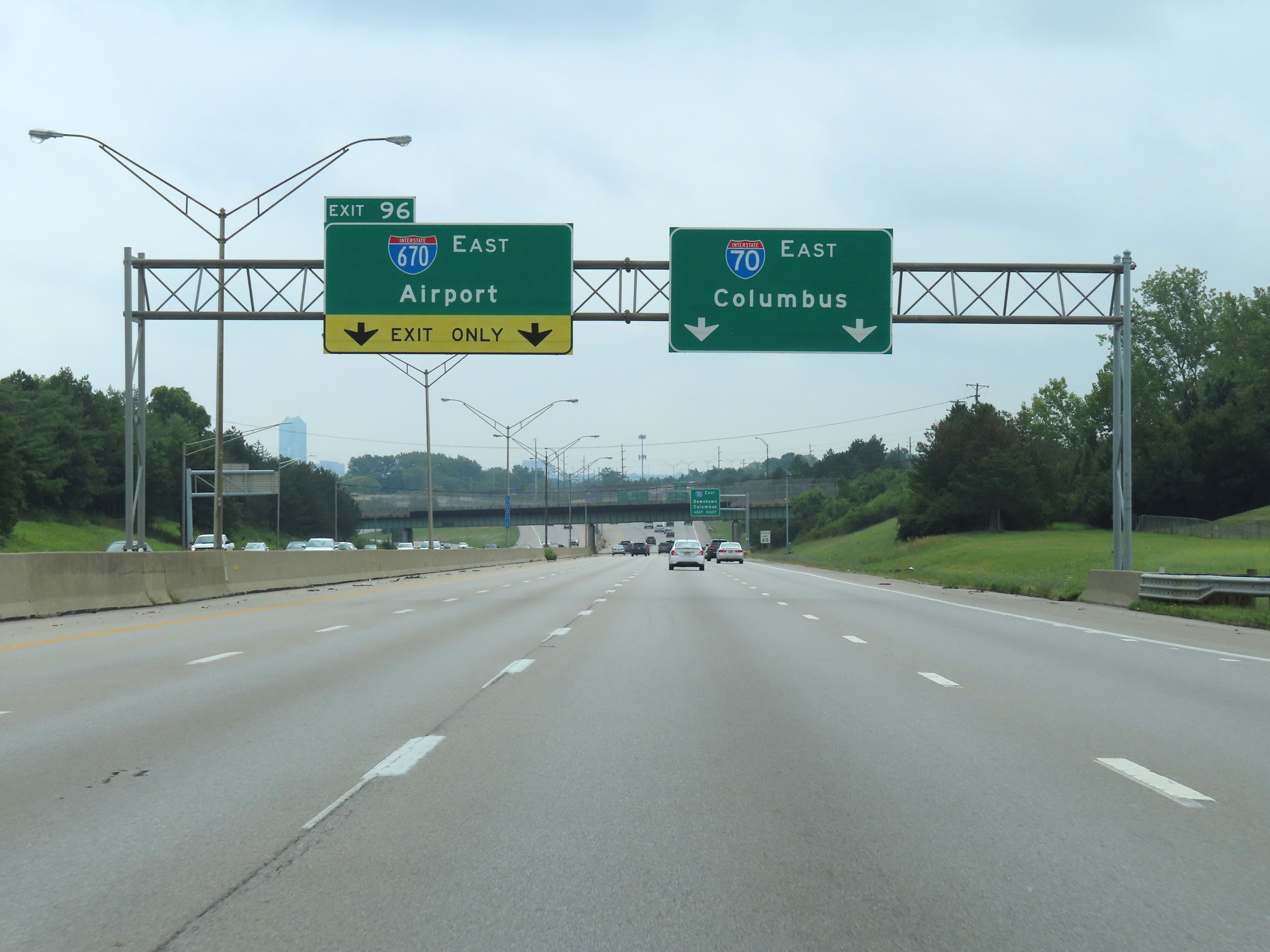 |
Interstate 70 East approaching downtown Columbus and Exit 96, at which point Interstate 670 East will begin on the left ahead. (Photo taken 8/21/22). |
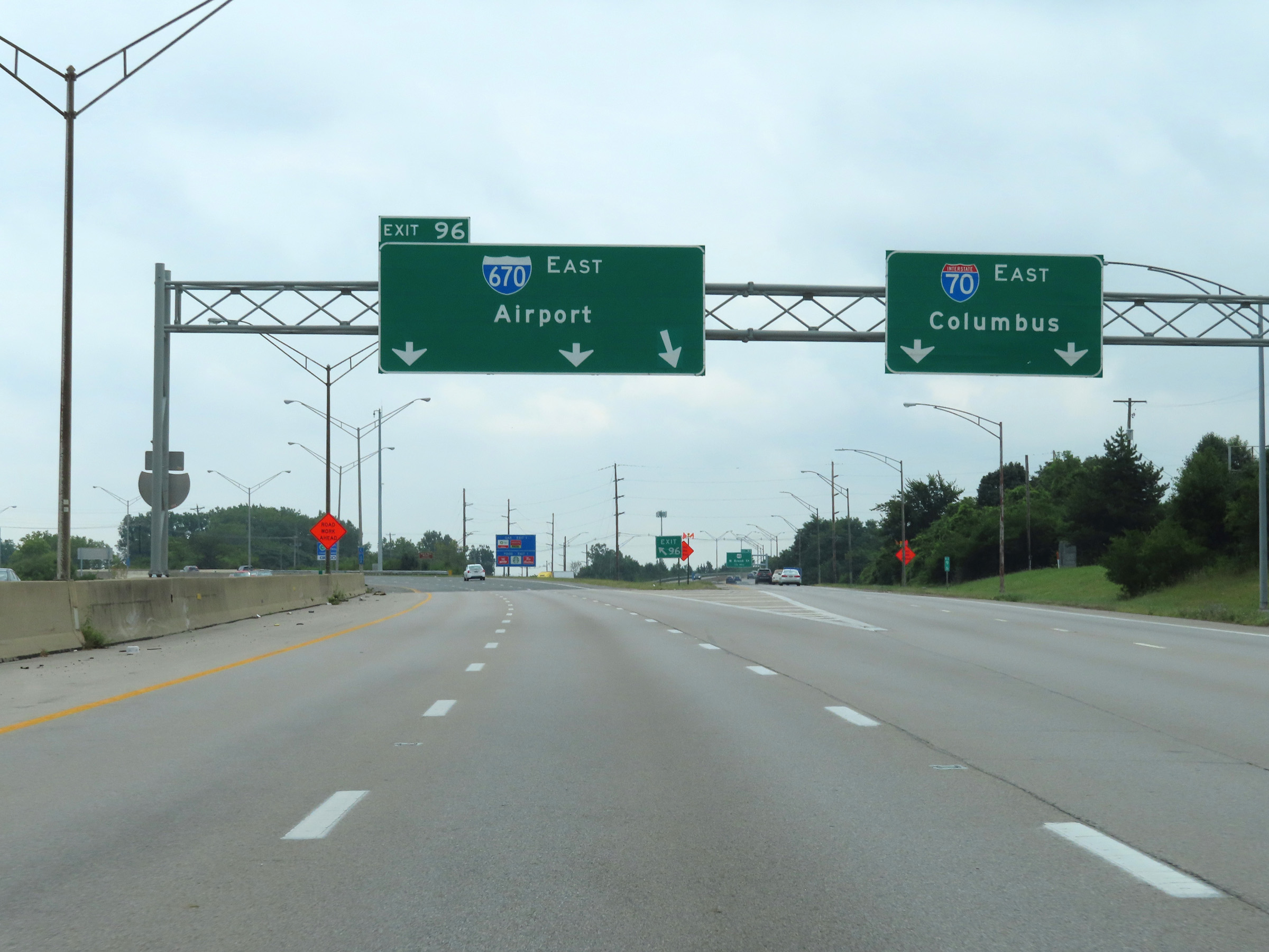 |
Interstate 670 East as it begins at Exit 96 on the left on Interstate 70 East in Columbus. (Photo taken 8/21/22). |
 |
View on Interstate 670 East at mile marker 0.6. (Photo taken 8/21/22). |
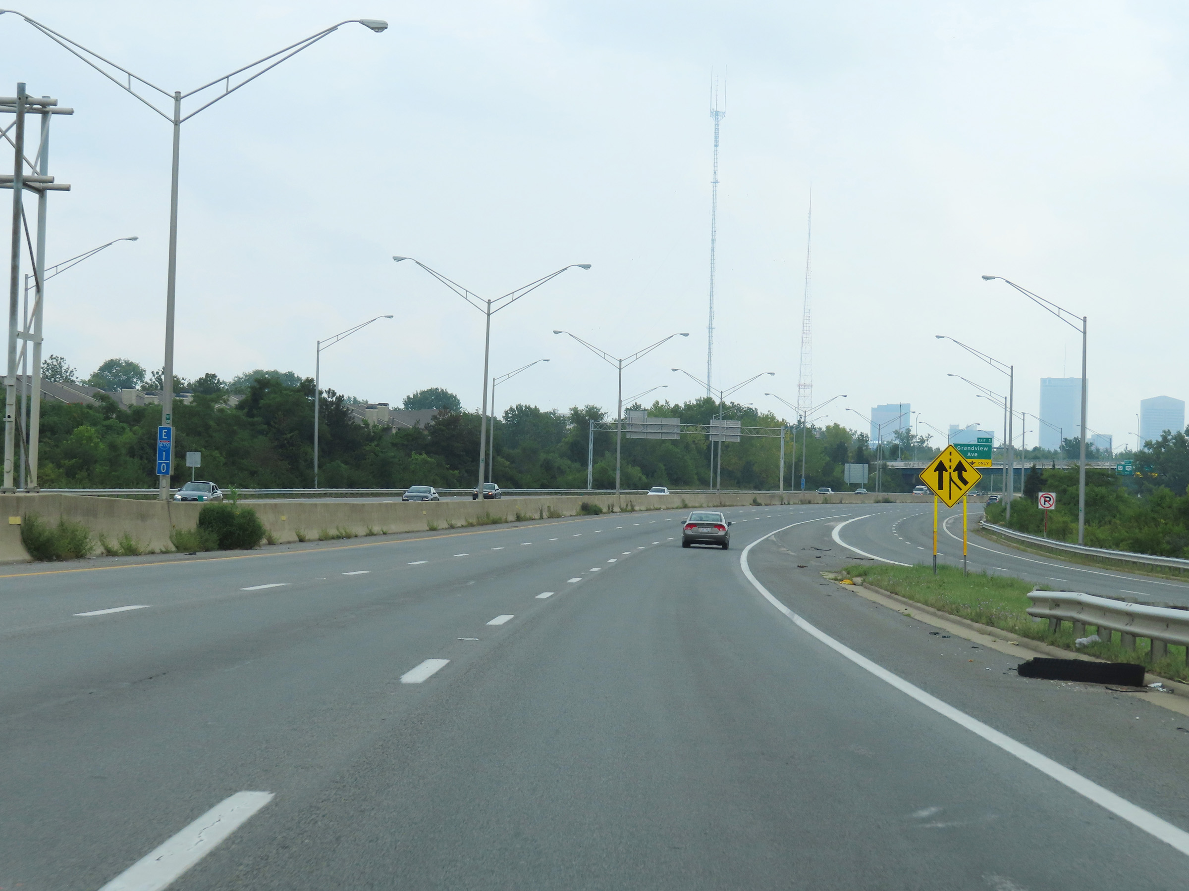 |
Interstate 670 East at mile marker 1. (Photo taken 8/21/22). |
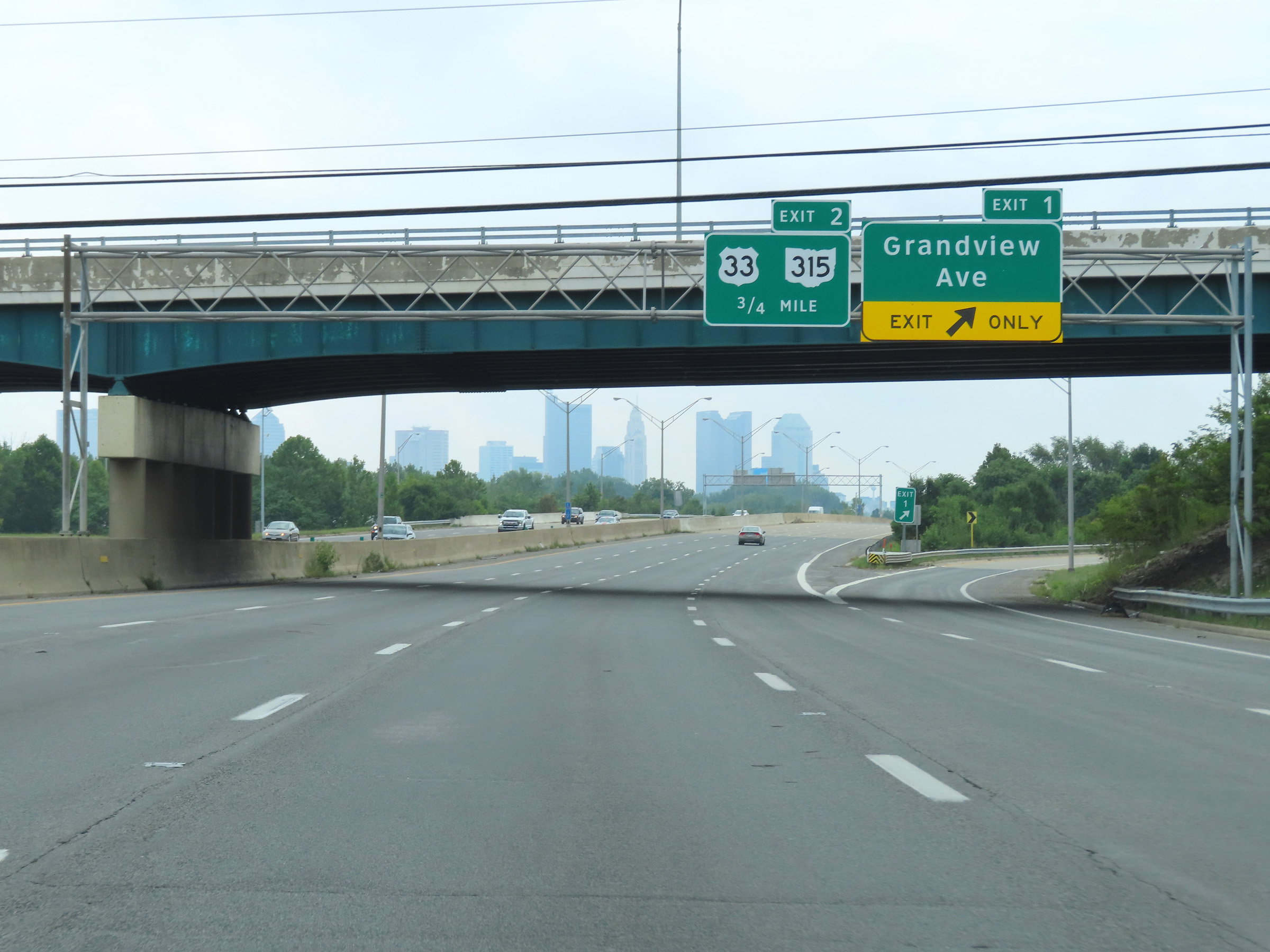 |
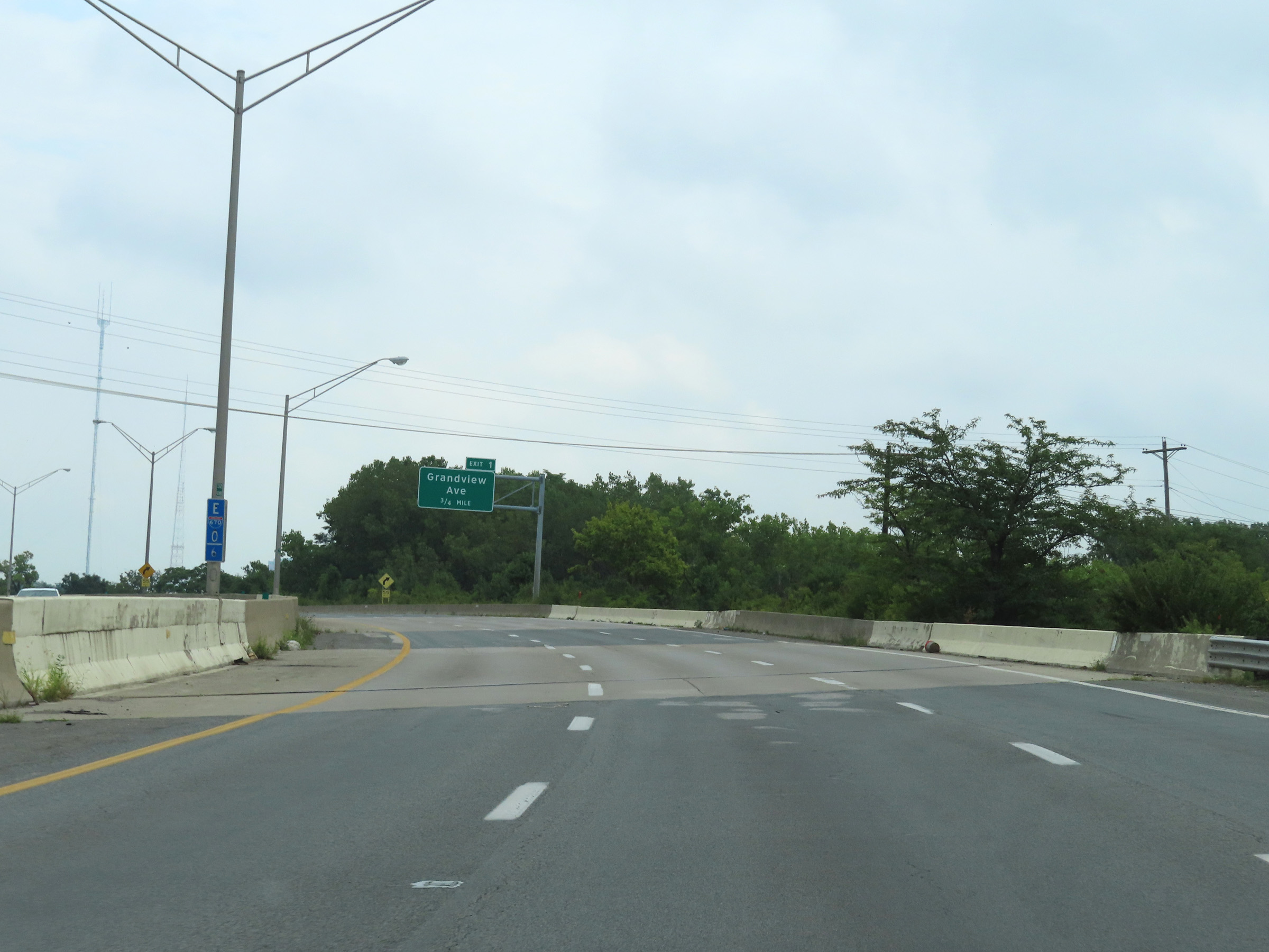
Interstate 670 East at Exit 1: Grandview Ave (Photo taken 8/21/22). |
 |
View on Interstate 670 East at mile marker 2. (Photo taken 8/21/22). |
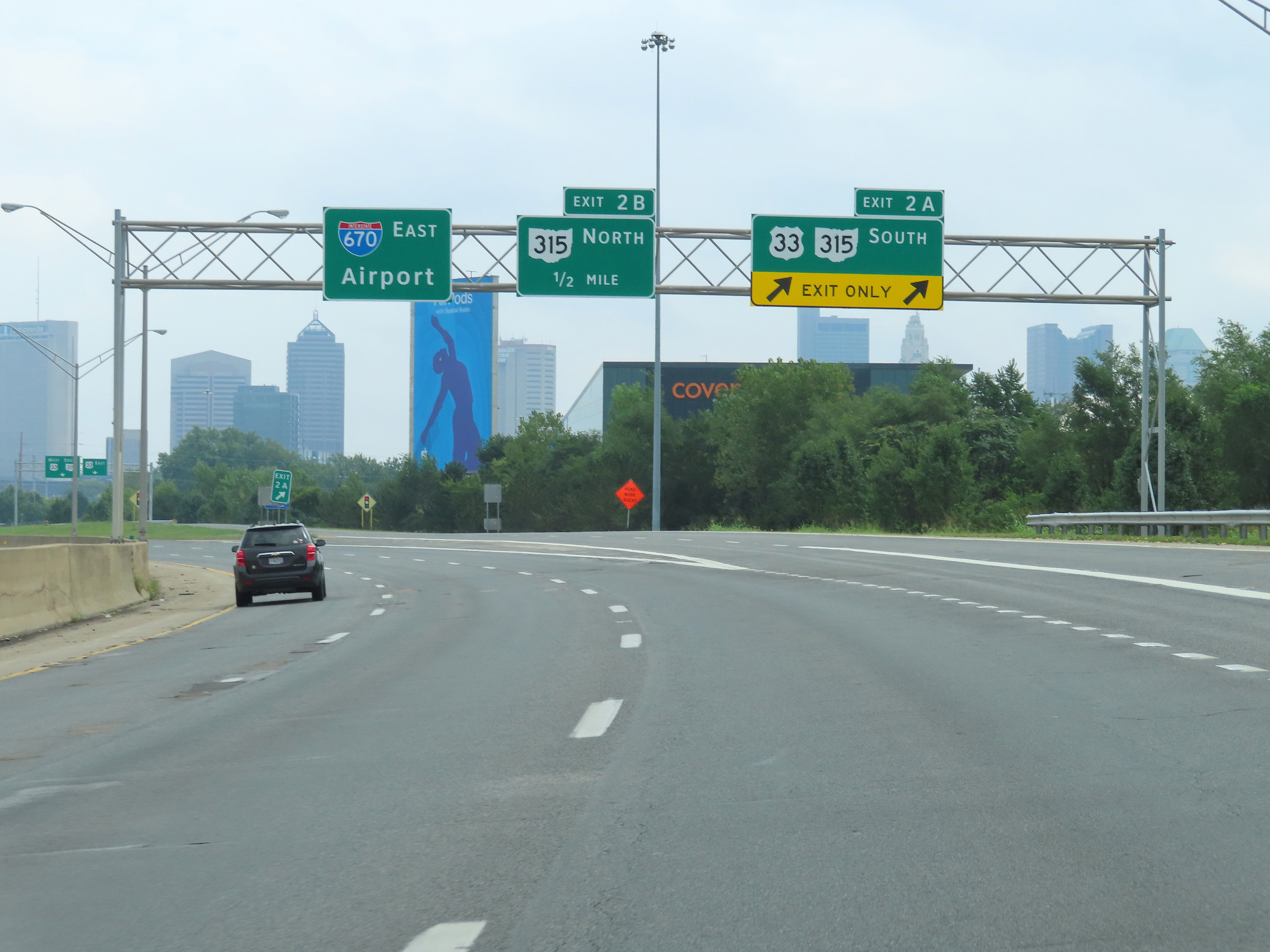 |
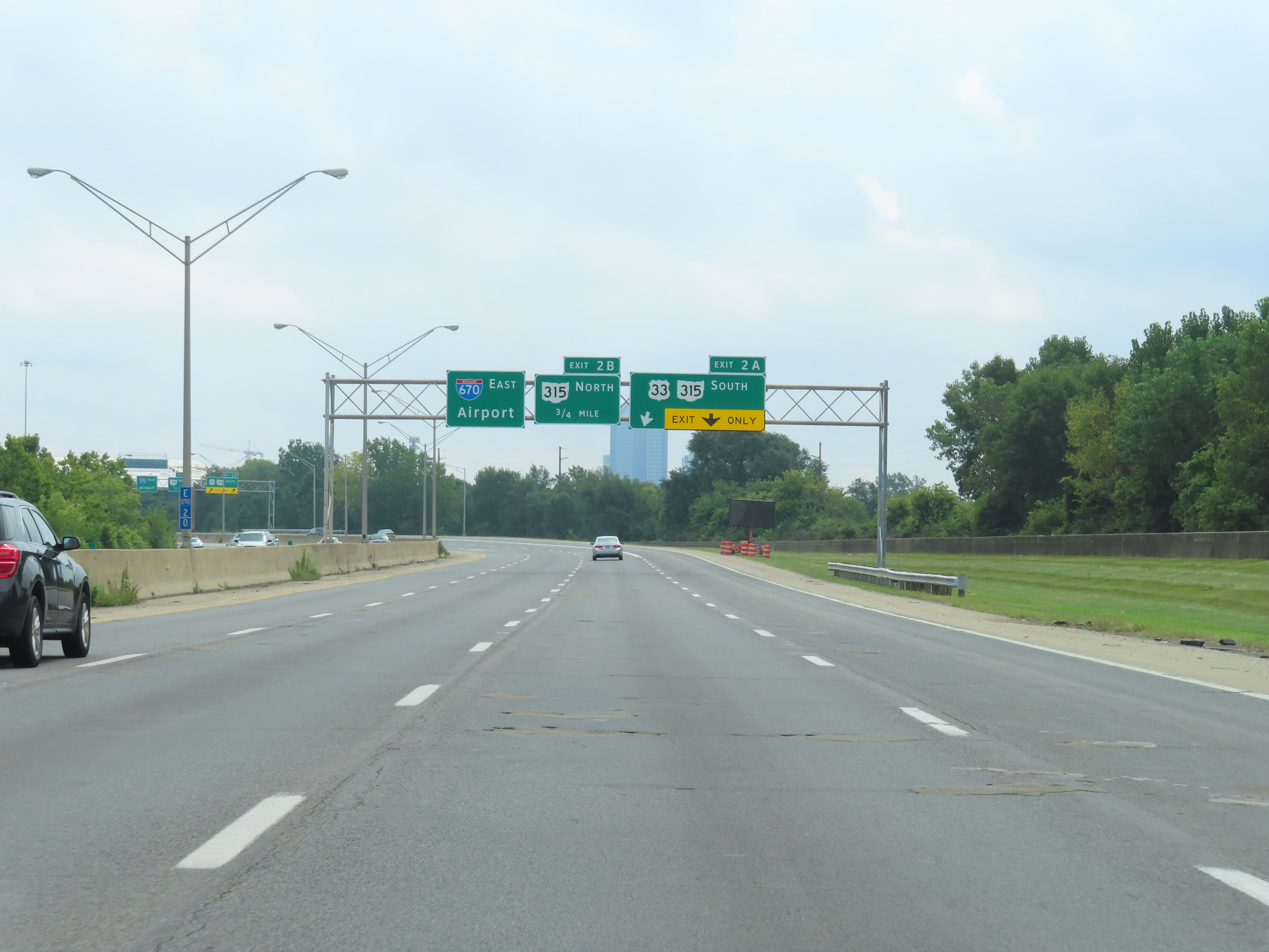
Interstate 670 East at Exit 2A: US 33 / OH 315 South (Photo taken 8/21/22). |
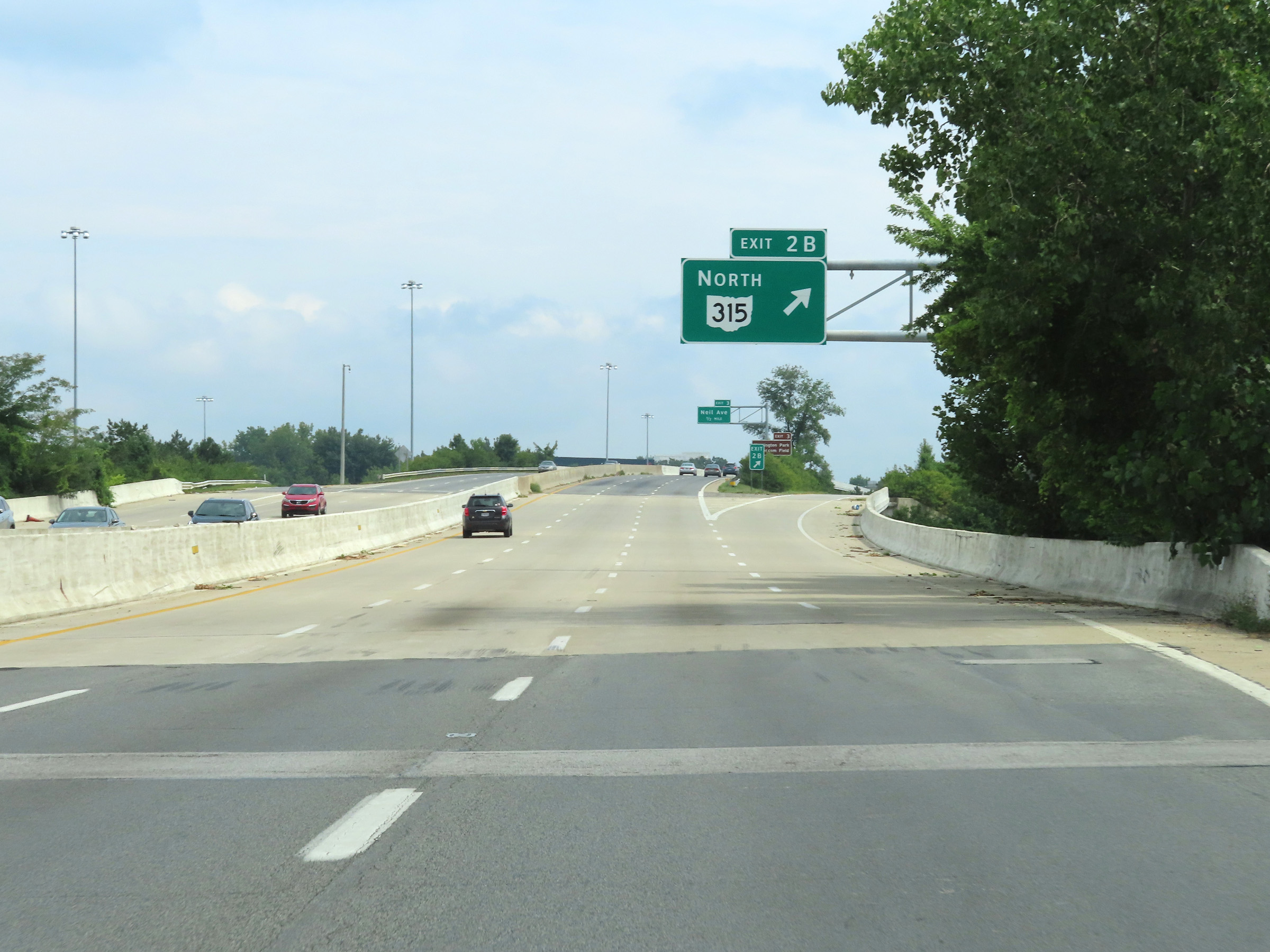 |
Interstate 670 East at Exit 2B: OH 315 North (Photo taken 8/21/22). |
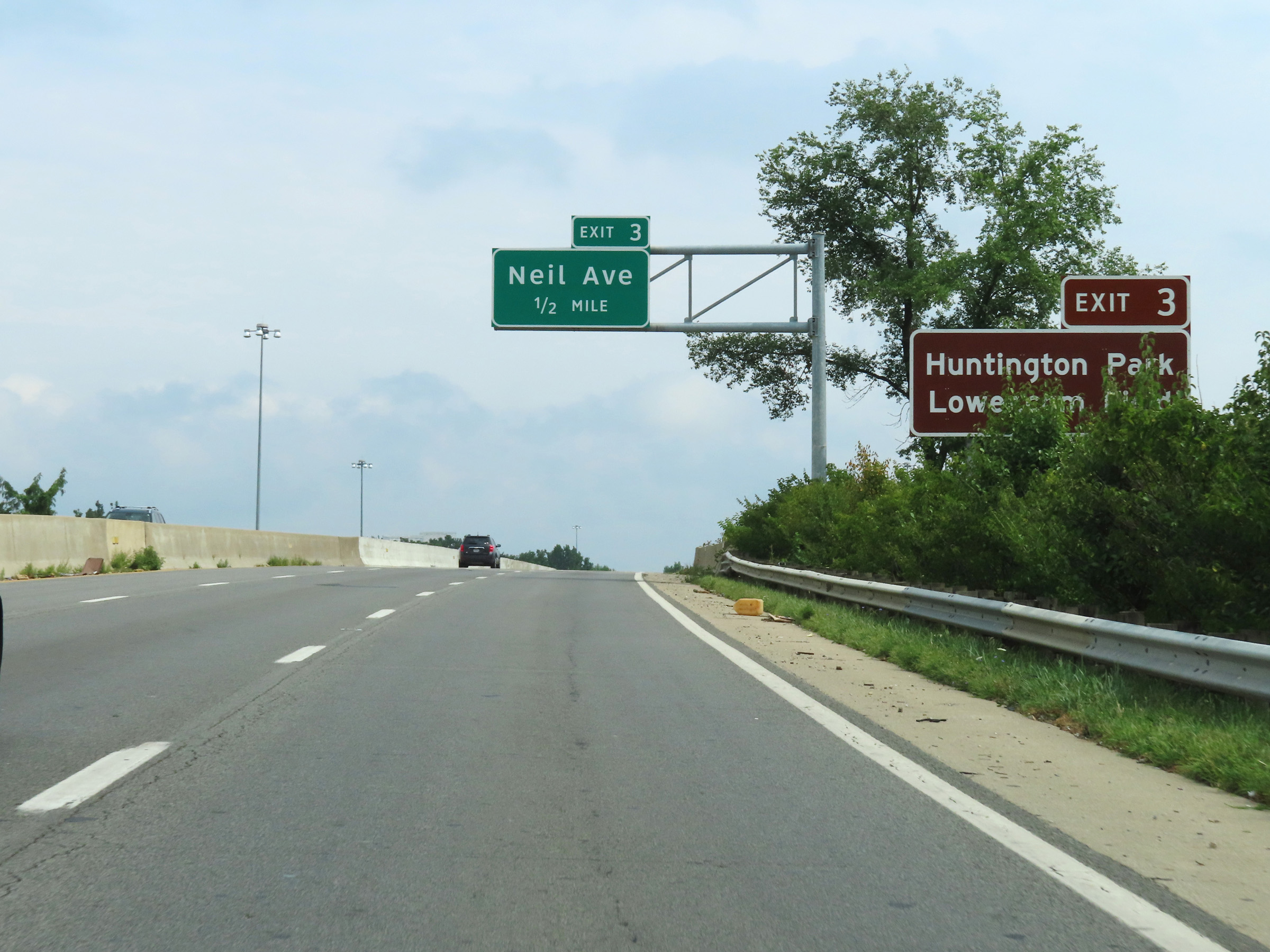 |
Take Exit 3 to Huntington Park and Lower.com Field. (Photo taken 8/21/22). |
 |
As Interstate 670 East approaches downtown Columbus at mile marker 3, the speed limit decreases to 55 mph. (Photo taken 8/21/22). |
 |
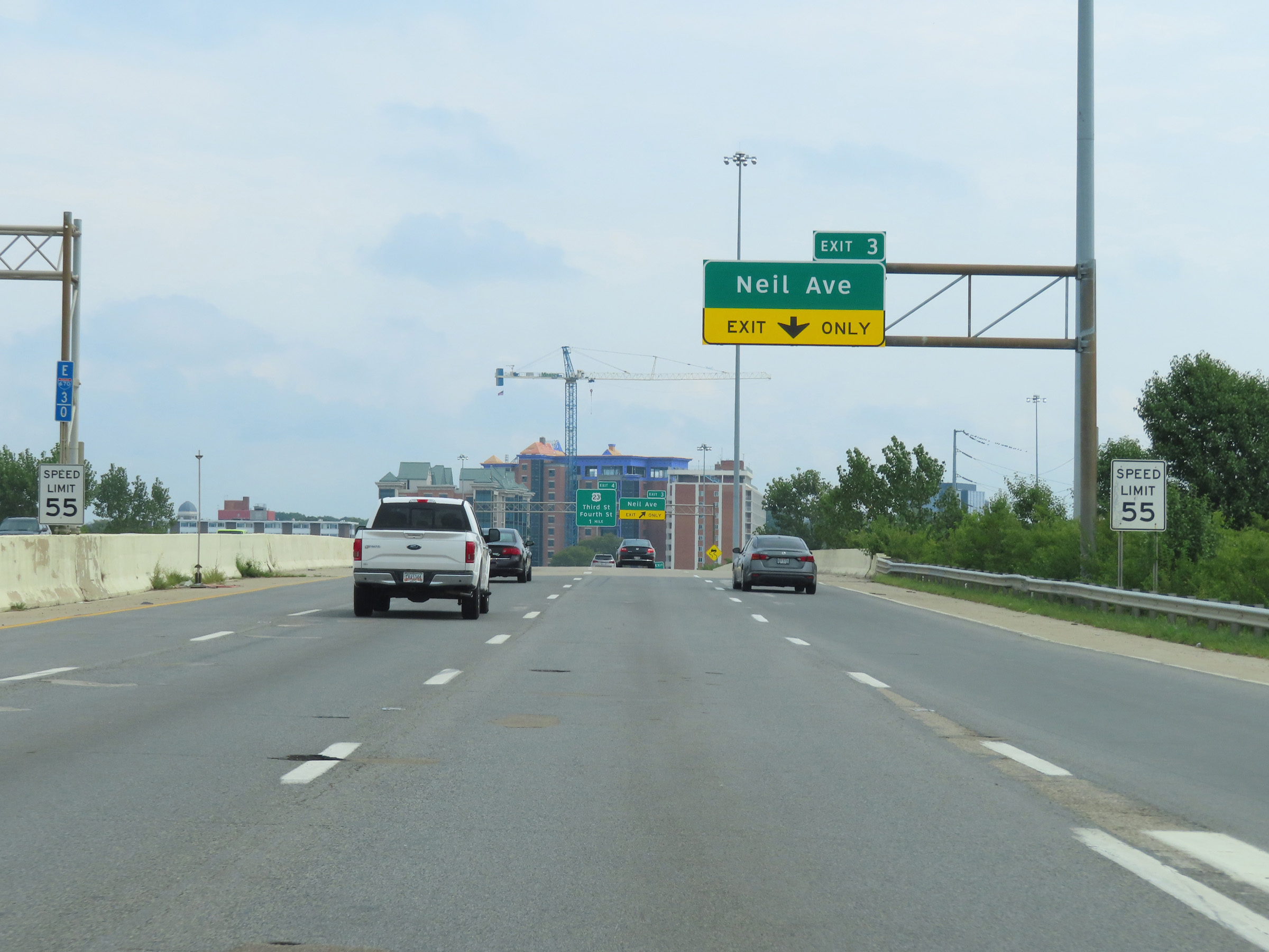
Interstate 670 East at Exit 3: Neil Ave (Photo taken 8/21/22). |
 |
Advance signage for Exit 5, which is the junction of Interstate 71 - 1 mile ahead. (Photo taken 8/21/22). |
 |
View on Interstate 670 East in downtown Columbus. (Photo taken 8/21/22). |
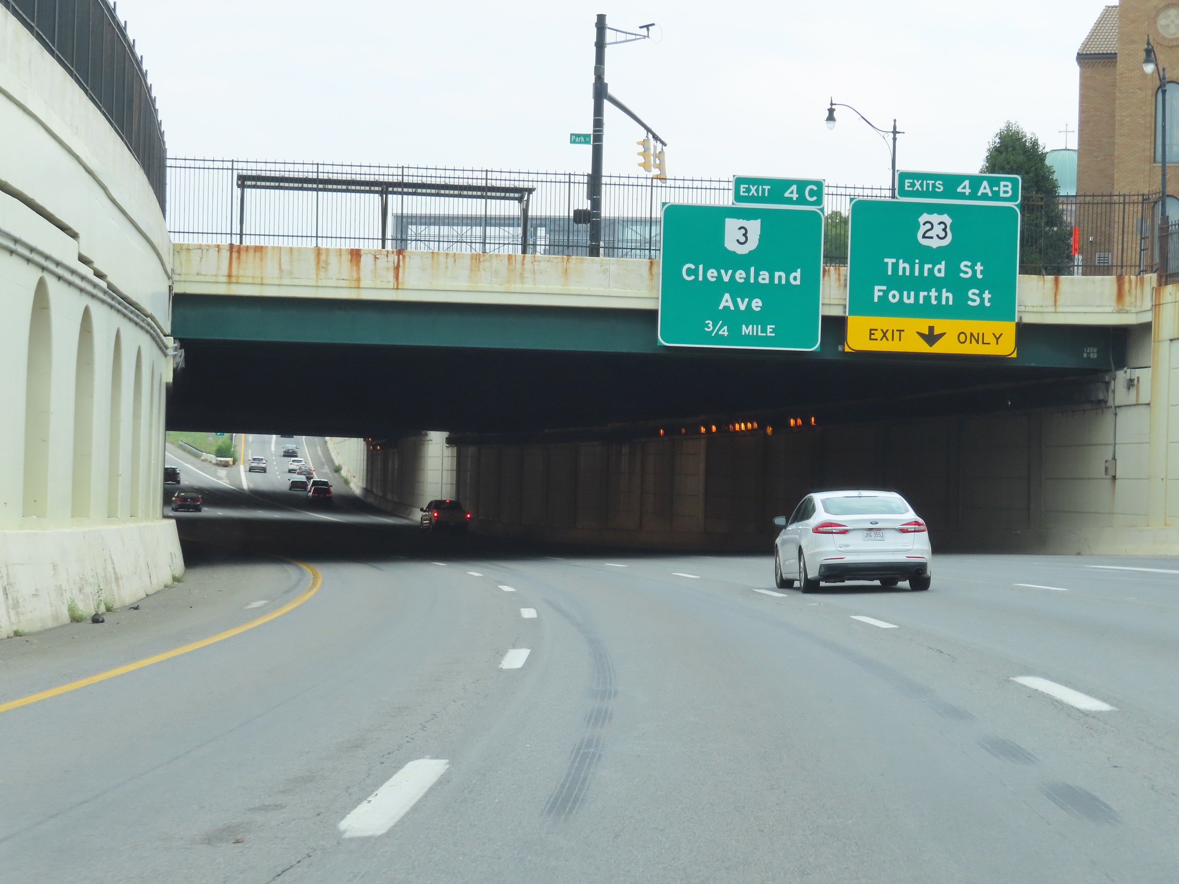 |
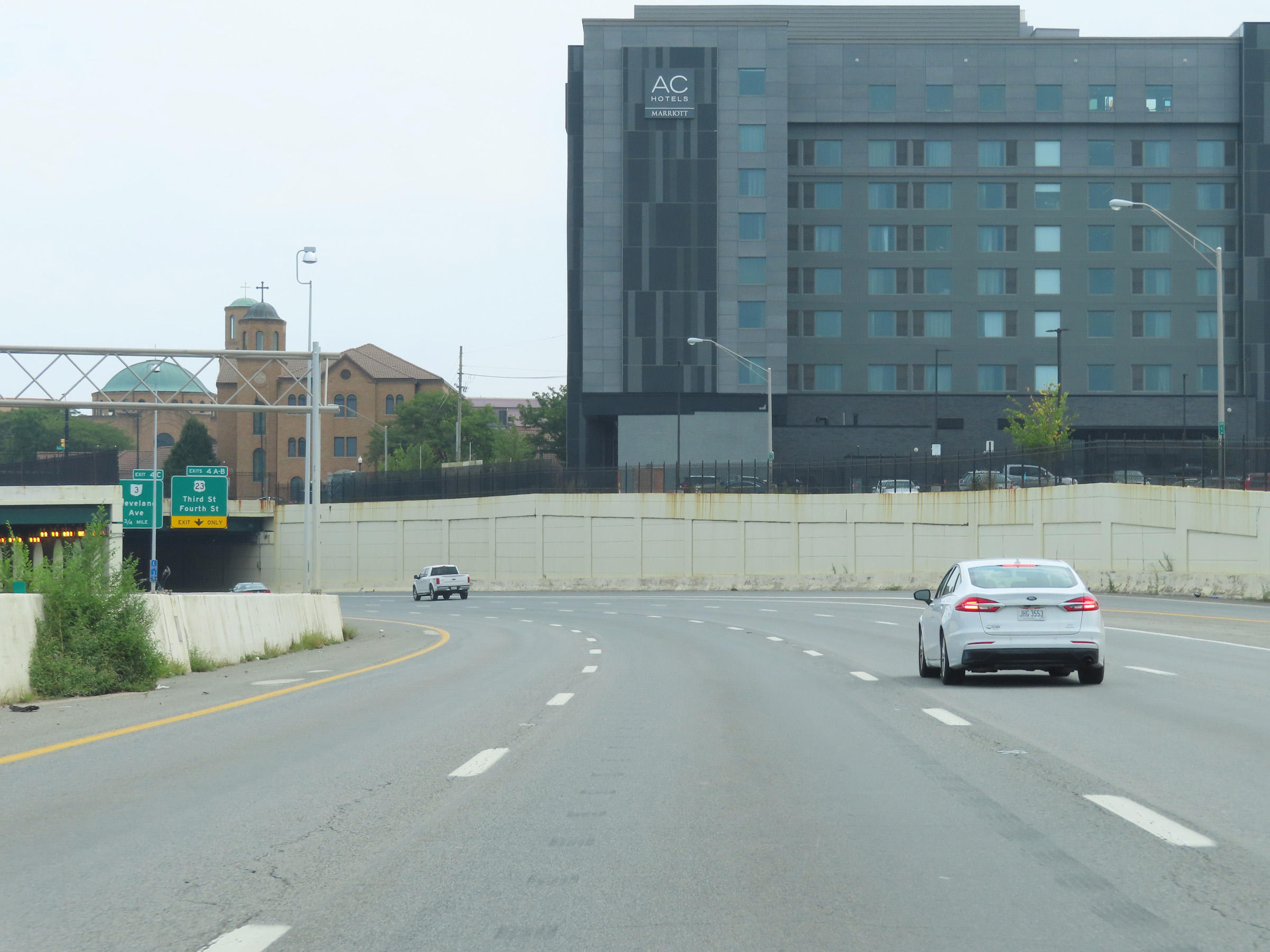
The right lane will be an Exit Only lane for Exits 4A-B ahead, which is immediately on the other side of this brief tunnel under Park St which we see ahead. (Photo taken 8/21/22). |
 |
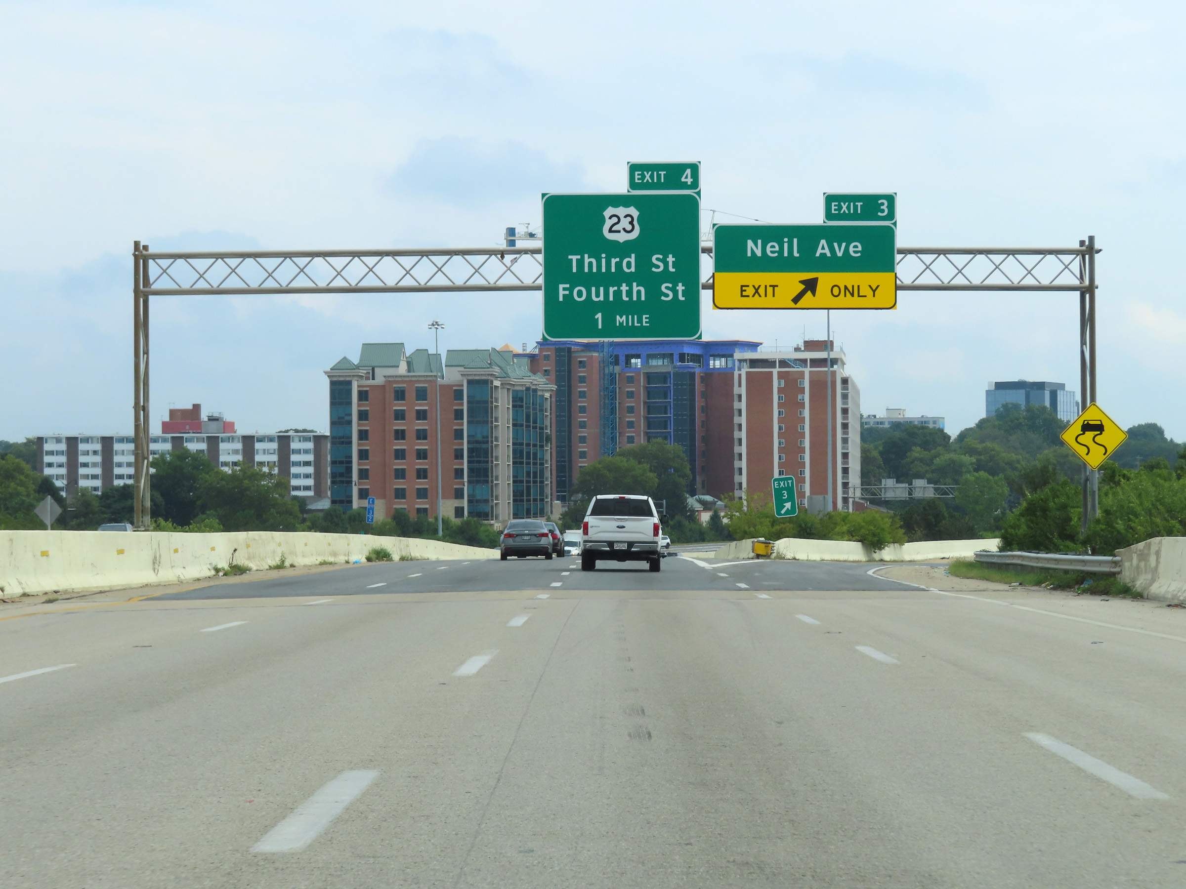
Interstate 670 East at Exit 4A: US 23 South - Third St; Exit 4B: US 23 North - Fourth St (Photo taken 8/21/22). |
 |
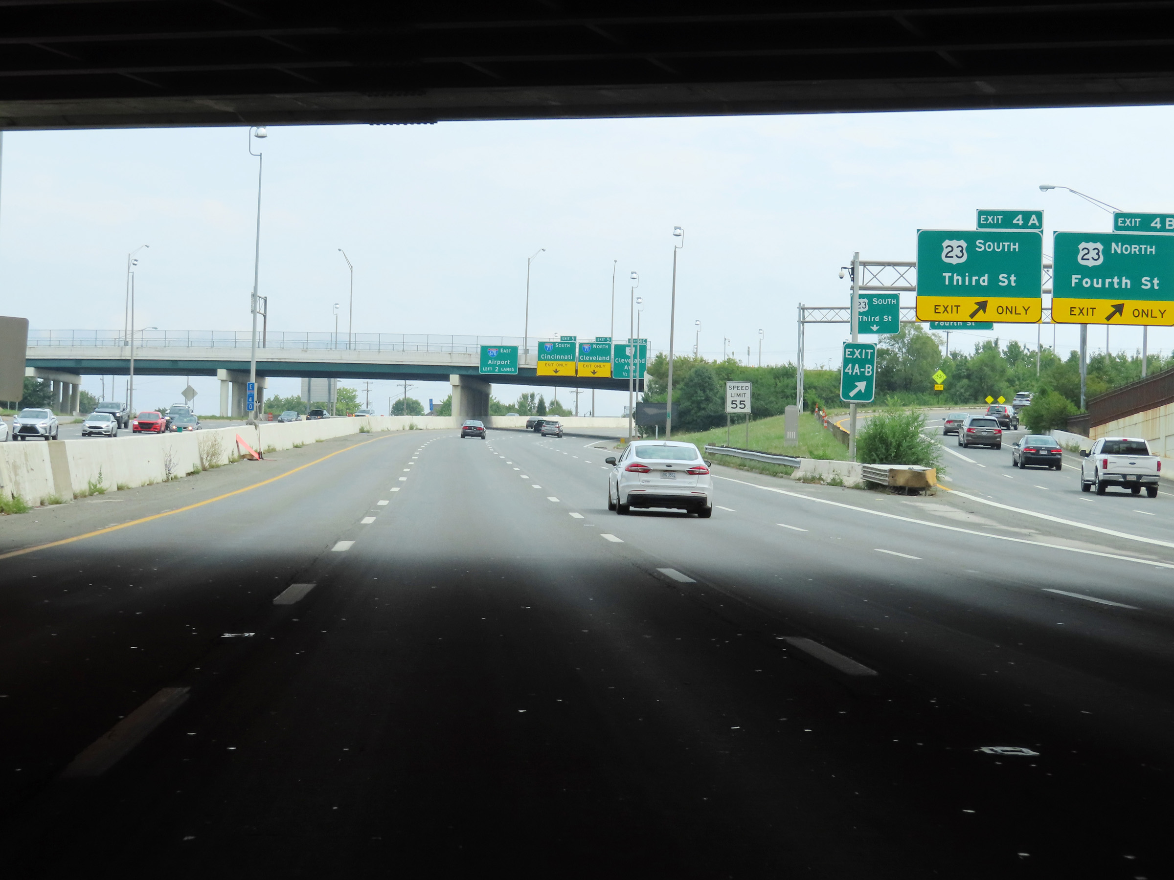
The two right lanes will become Exit Only lanes to Interstate 71 via Exit 5 ahead. Interstate 670 East thru traffic must use the two left lanes. (Photo taken 8/21/22). |
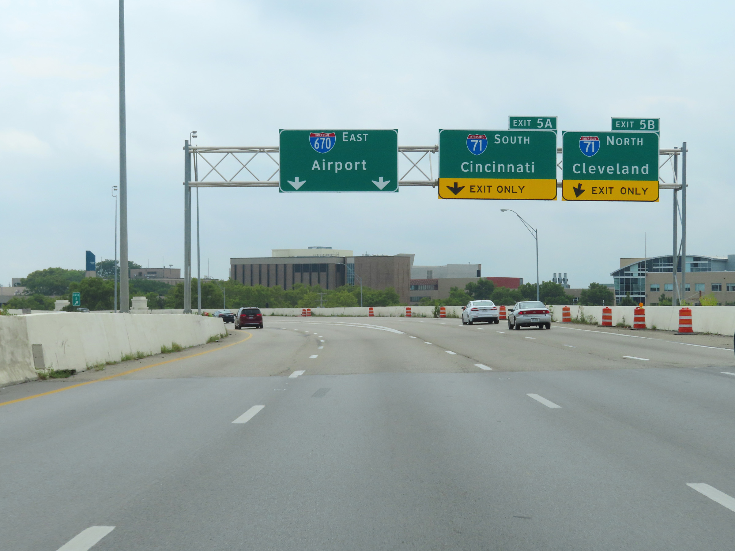 |
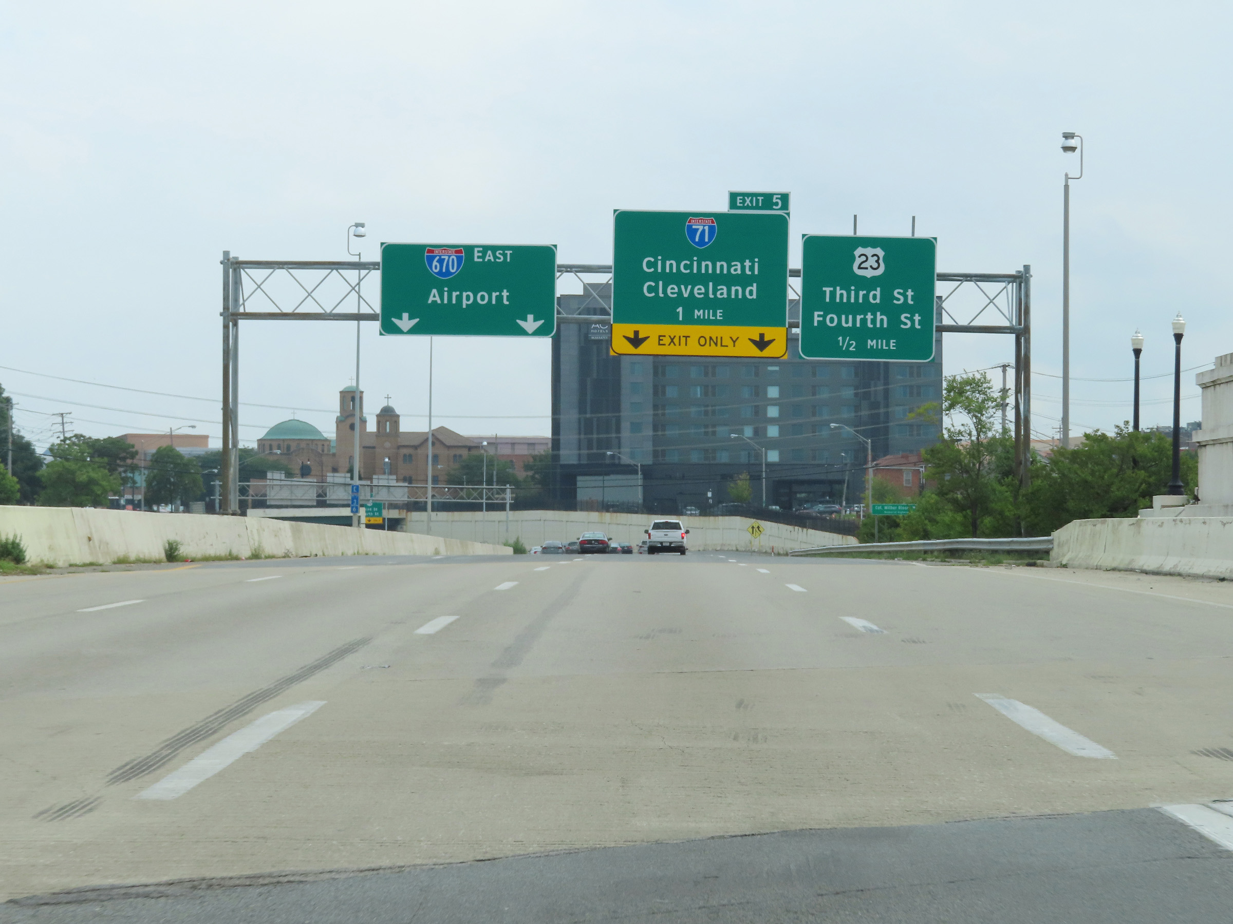
Interstate 670 East at Exit 5A: Interstate 71 South - Cincinnati; Exit 5B: Interstate 71 North - Cleveland (Photo taken 8/21/22). |
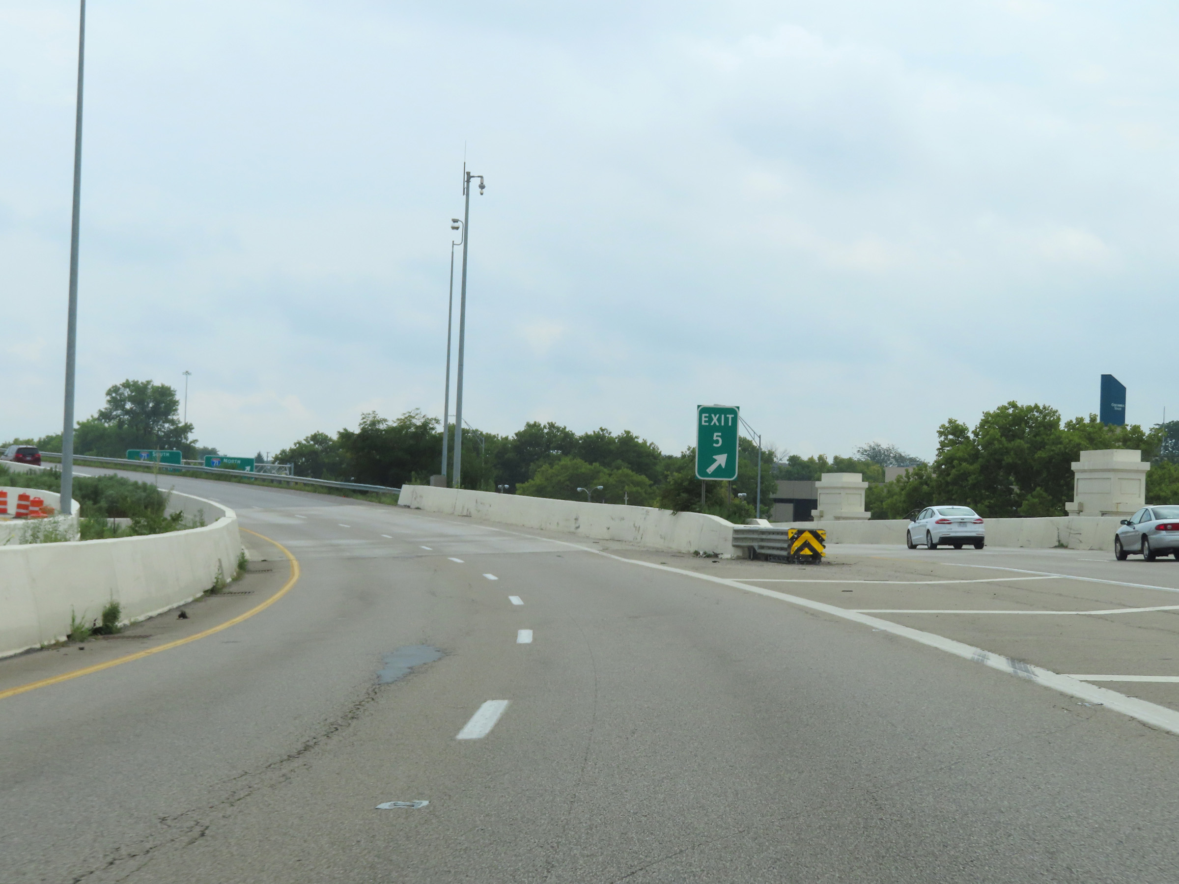 |
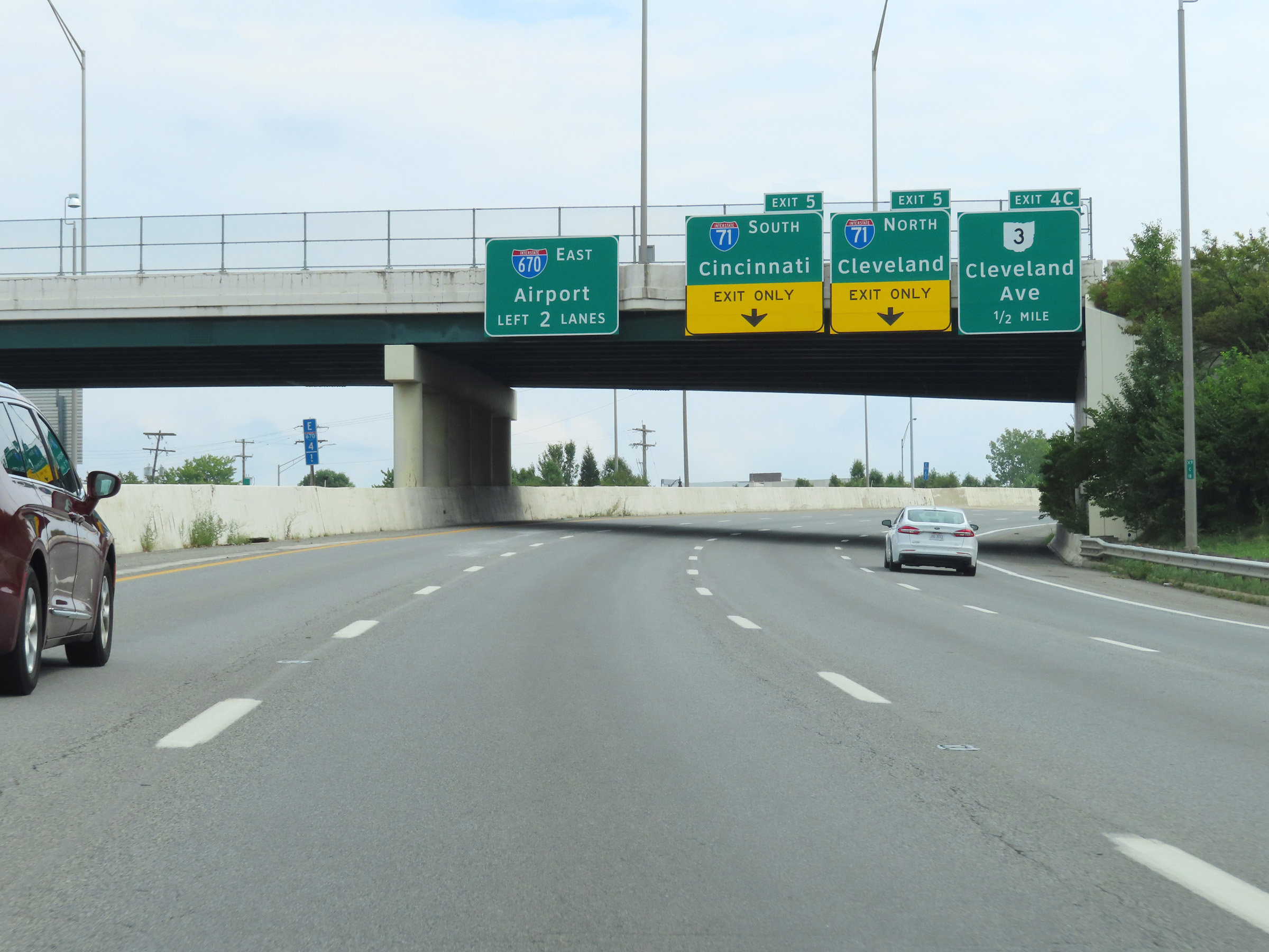
A view of the ramp to Interstate 71 via Exits 5A-B. (Photo taken 8/21/22). |
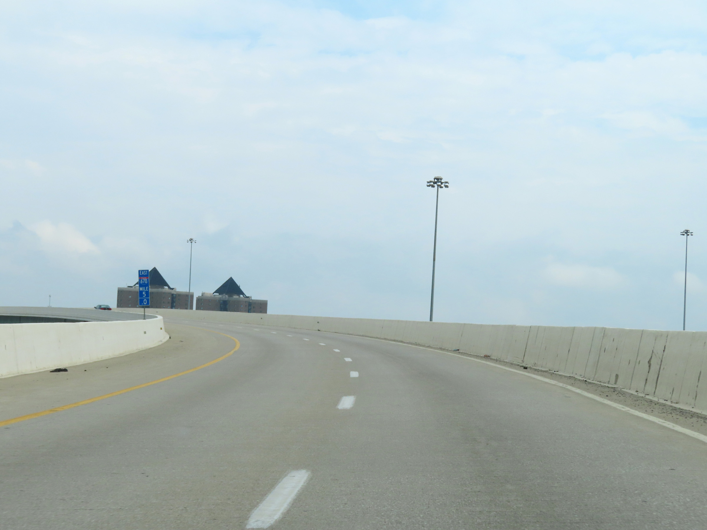 |
View on Interstate 670 East at mile marker 5. (Photo taken 8/21/22). |
 |
East of mile marker 5, variable speed limits are used on Interstate 670 East. At the time, the speed limit increased to 65 mph. (Photo taken 8/21/22). |
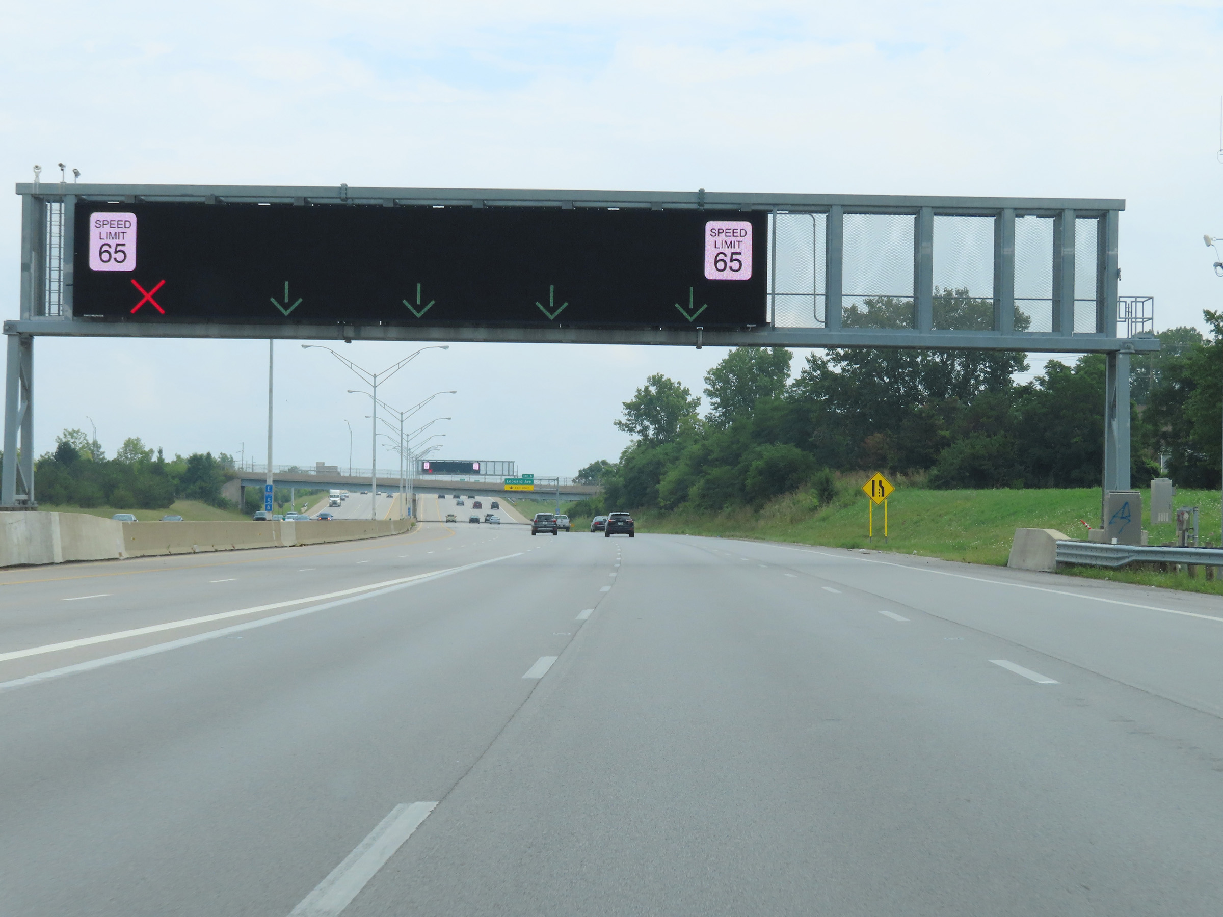 |
Overhead electronic signage is used on Interstate 670 East, beginning at mile marker 5.6. The overhead signage is primarily used for lane control. (Photo taken 8/21/22). |
 |
Interstate 670 East reassurance shield approaching Exit 6. (Photo taken 8/21/22). |
 |
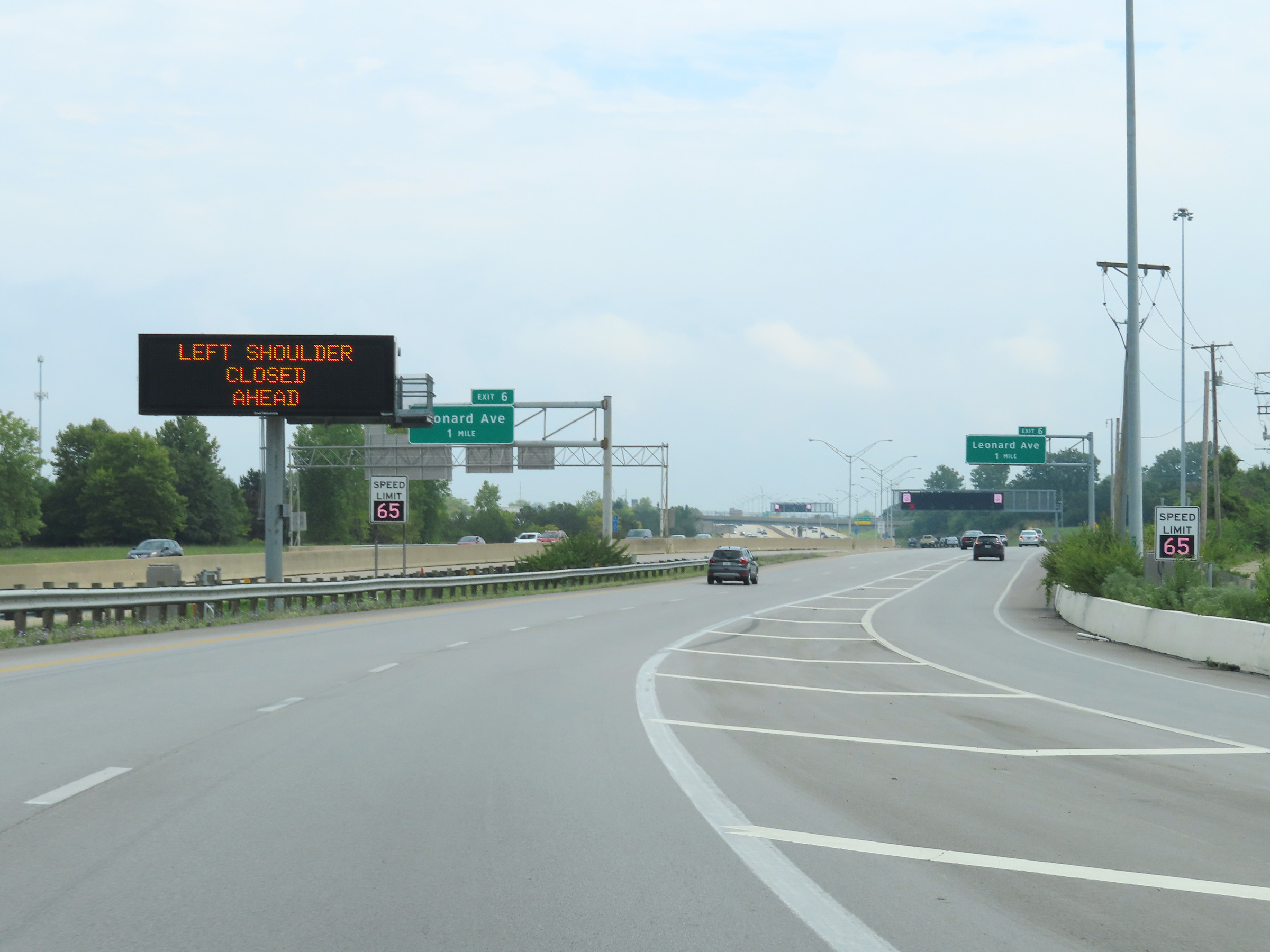
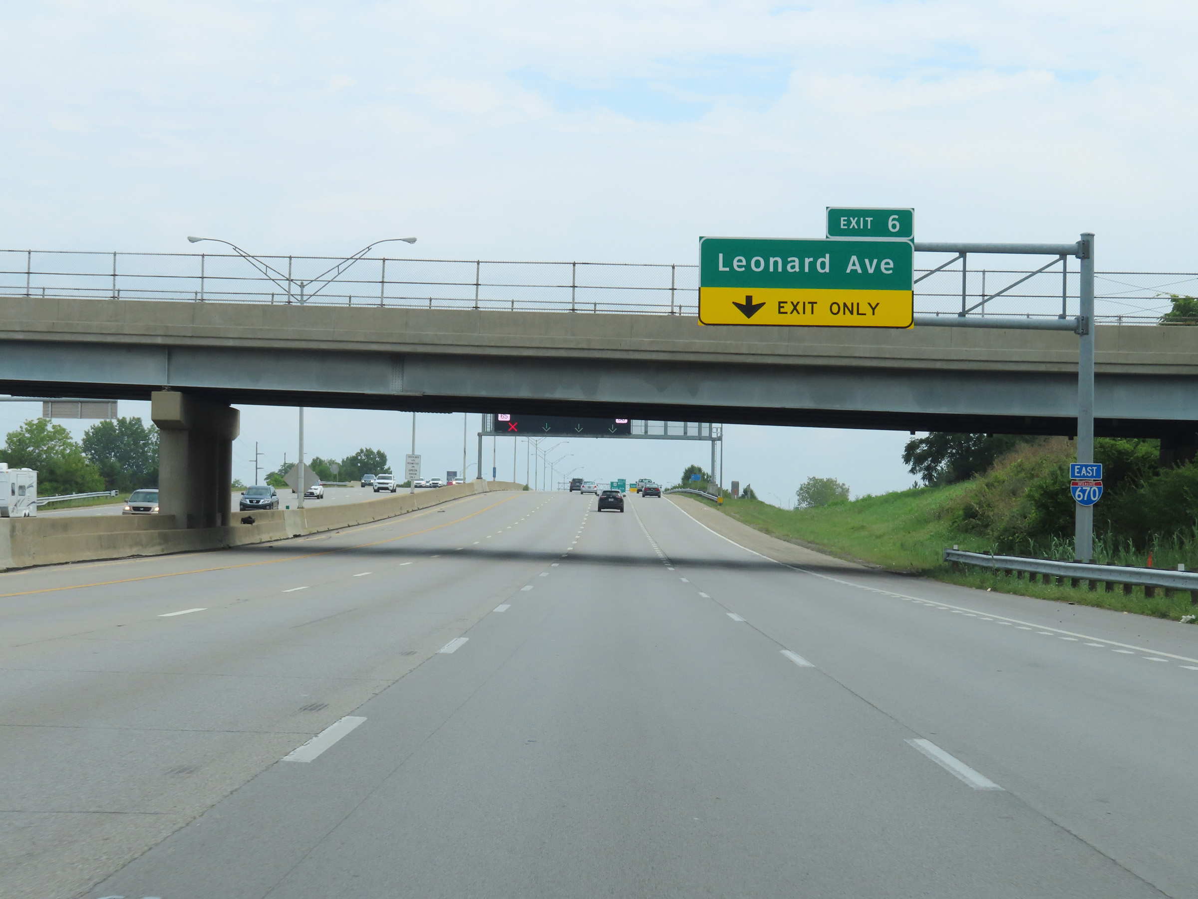
Interstate 670 East at Exit 6: Leonard Ave (Photo taken 8/21/22). |
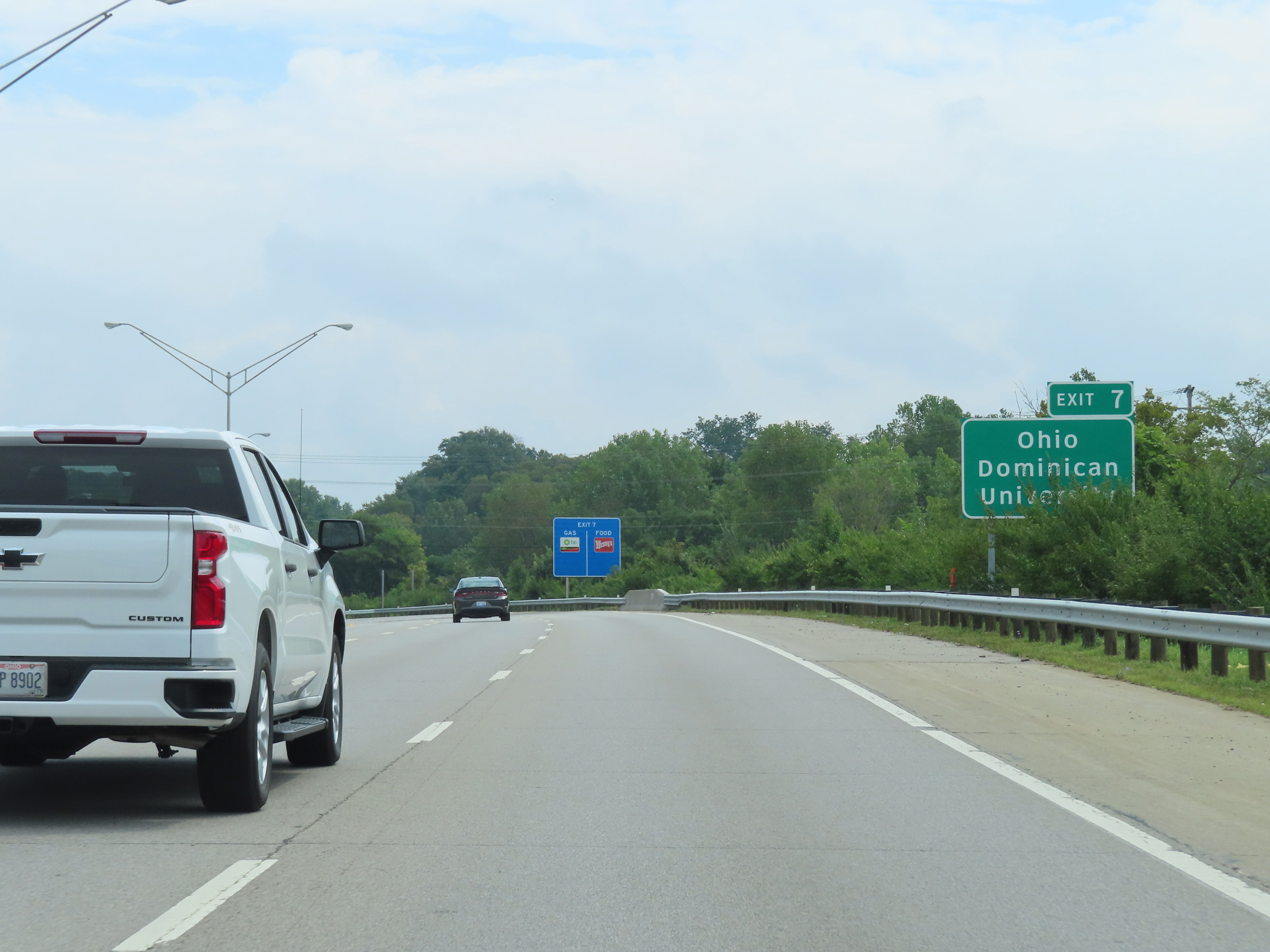 |
Take Exit 7 to Ohio Dominican University. (Photo taken 8/21/22). |
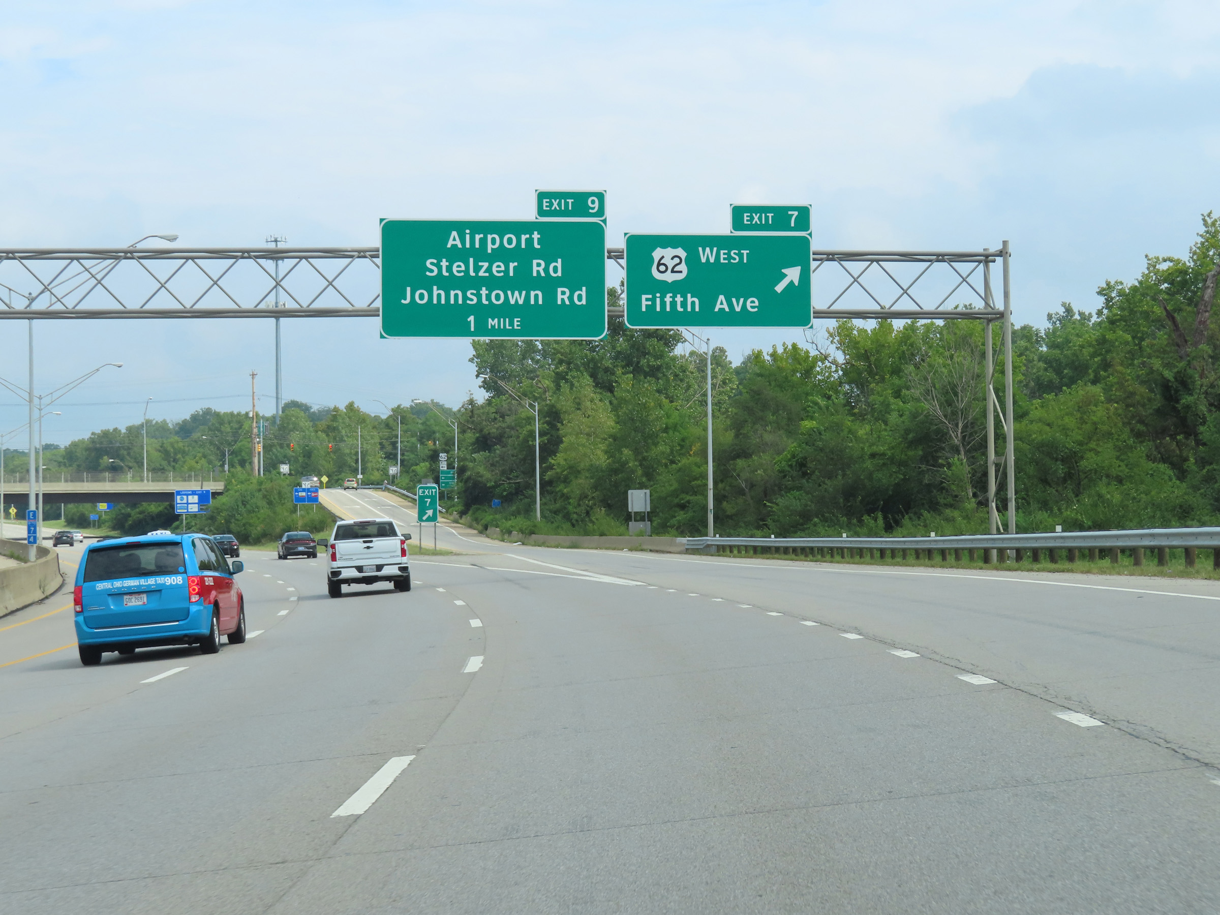 |
Interstate 670 East at Exit 7: US 62 West - Fifth Ave (Photo taken 8/21/22). |
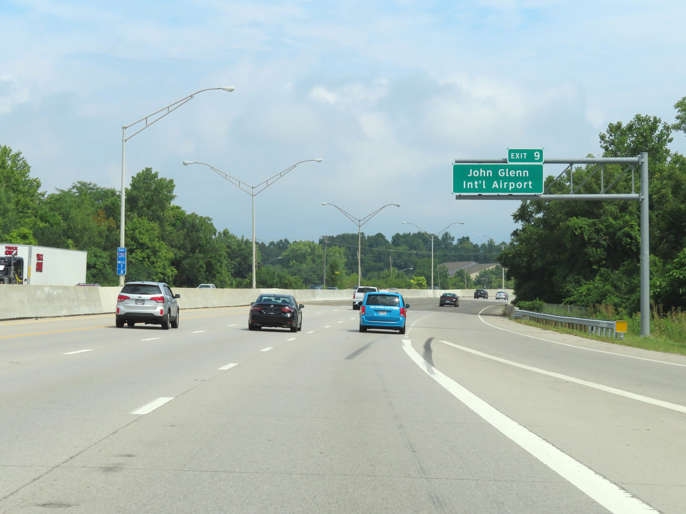 |
Take Exit 9 to John Glenn International Airport. (Photo taken 8/21/22). |
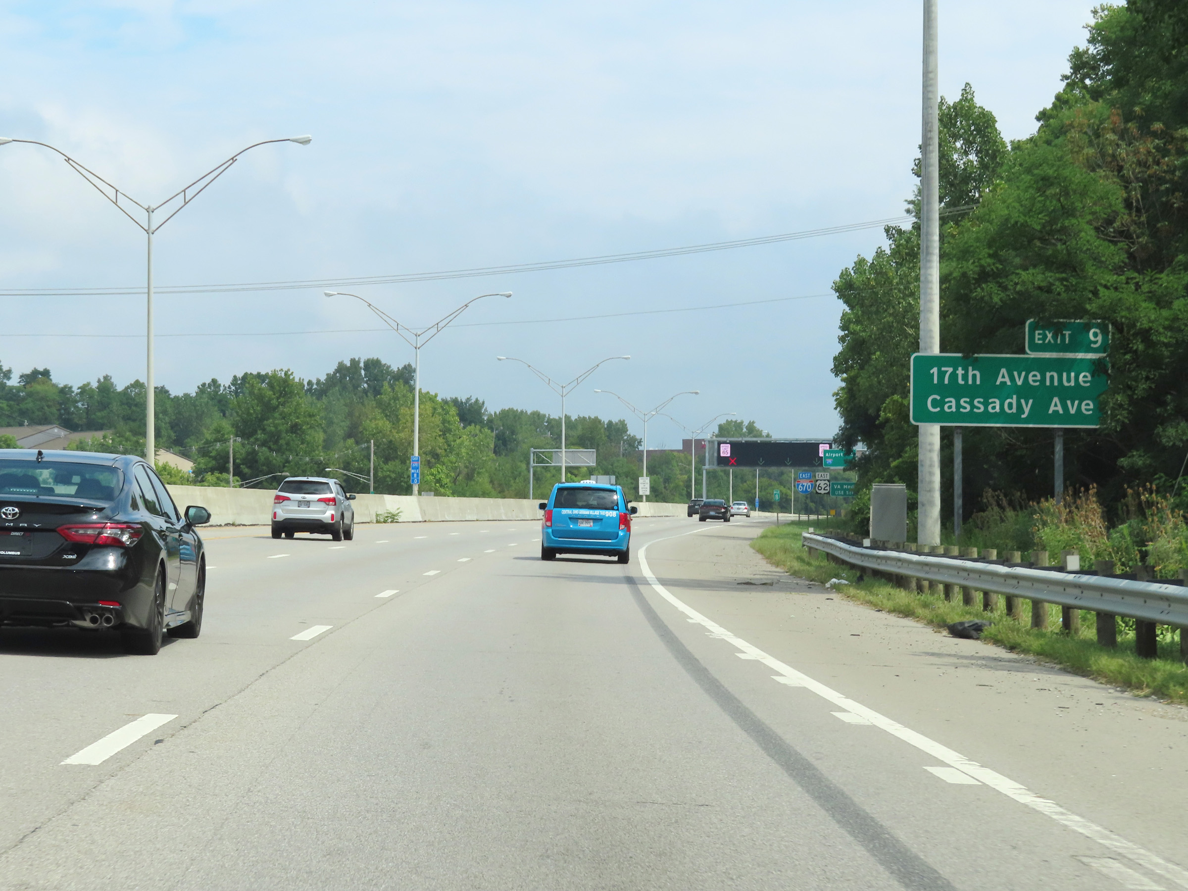 |
Also take Exit 9 to 17th Avenue and Cassady Ave (Photo taken 8/21/22). |
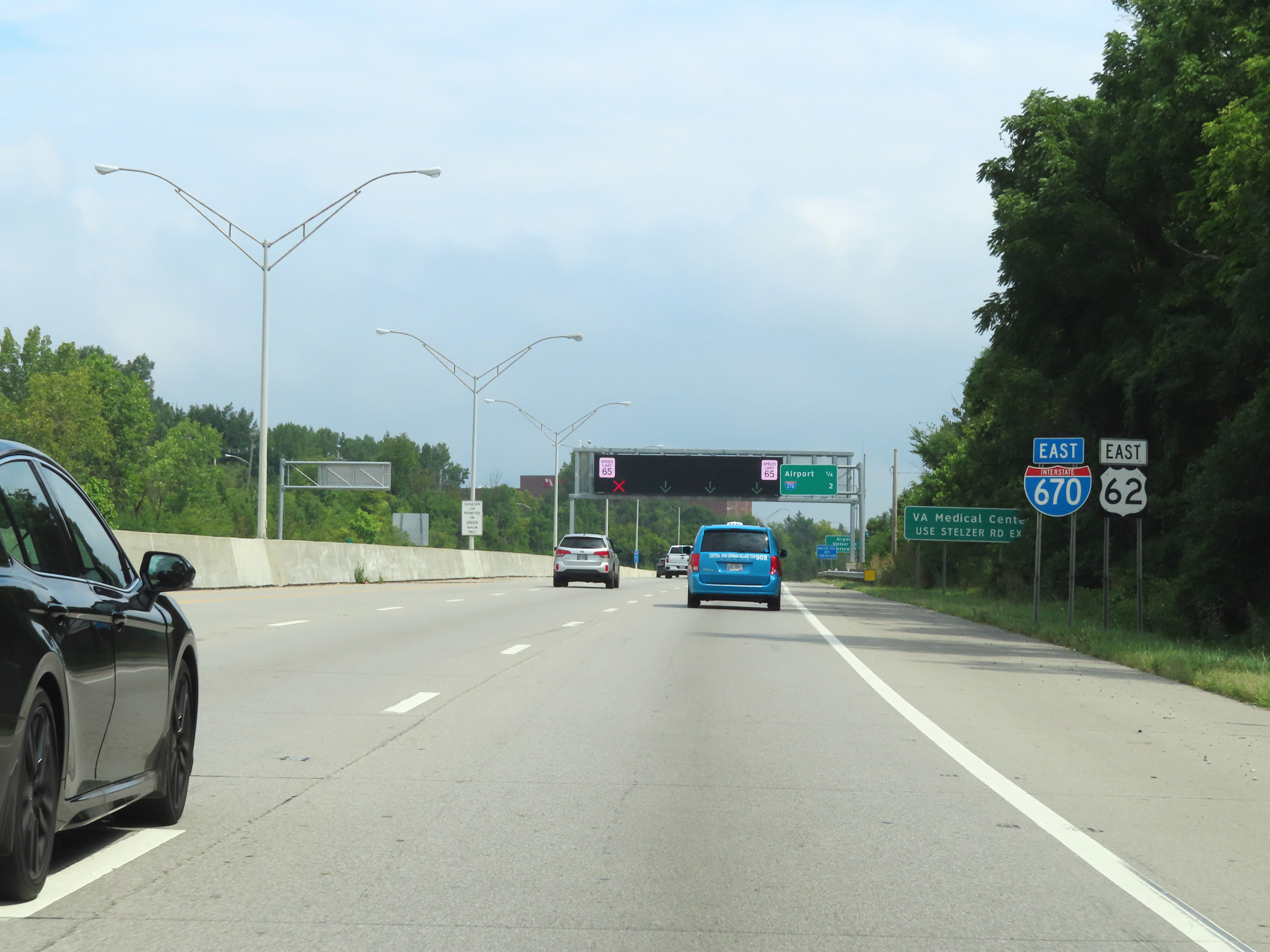 |
Another Interstate 670 East reassurance shield. Traffic to the VA Medical Center should use Exit 9 and follow Stelzer Rd. (Photo taken 8/21/22). |
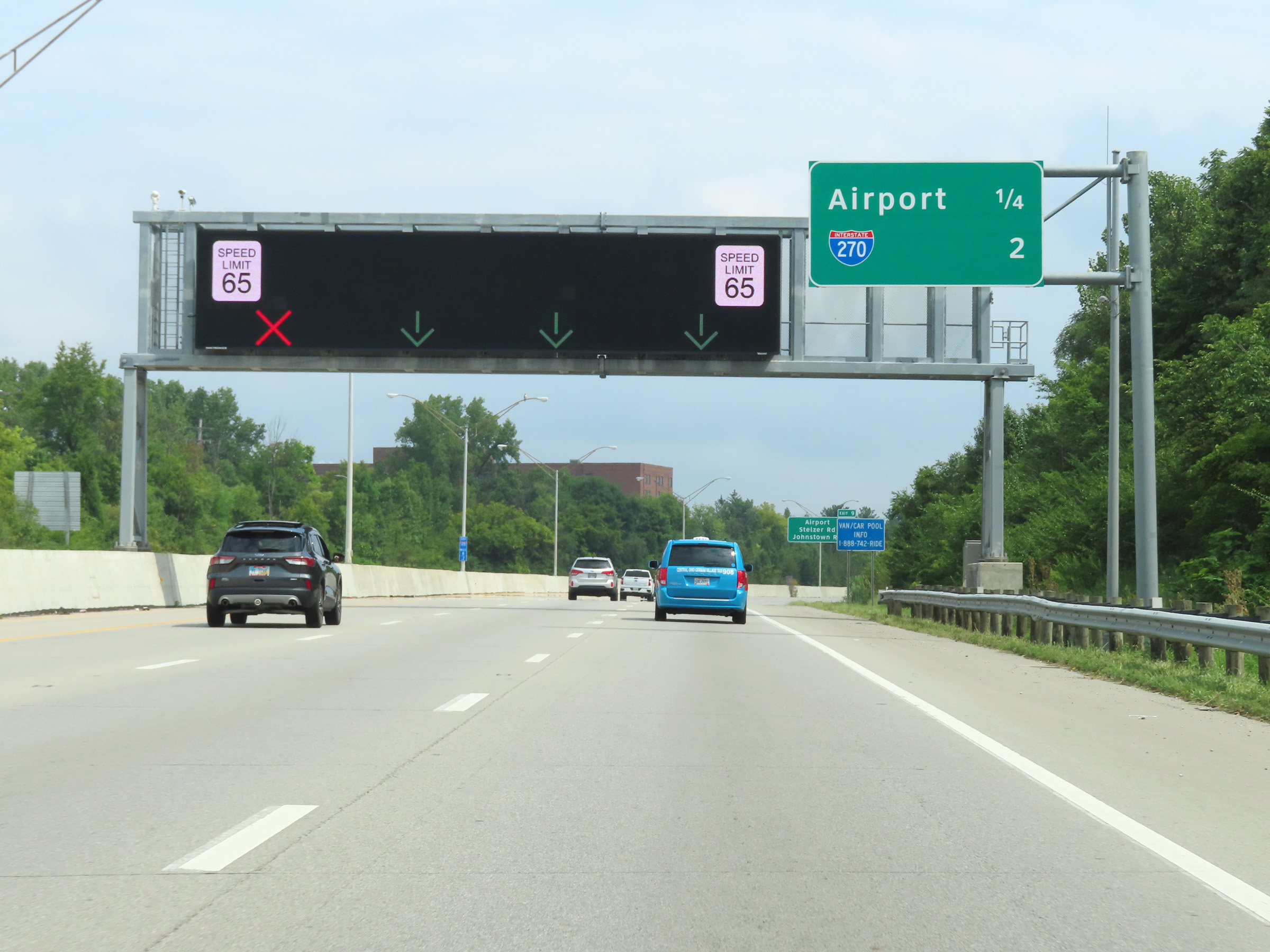 |
More electronic overhead signage approaching Exit 9, showing the currently open lanes on Interstate 670 East. We also see an overhead mileage sign showing the distances to the two remaining interchanges on I-670 East. (Photo taken 8/21/22). |
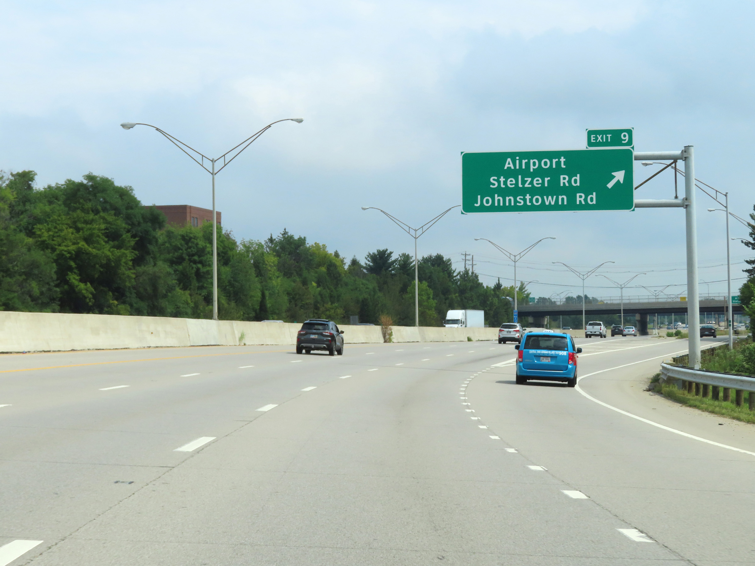 |
Interstate 670 East at Exit 9: Airport / Stelzer Rd / Johnstown Rd (Photo taken 8/21/22). |
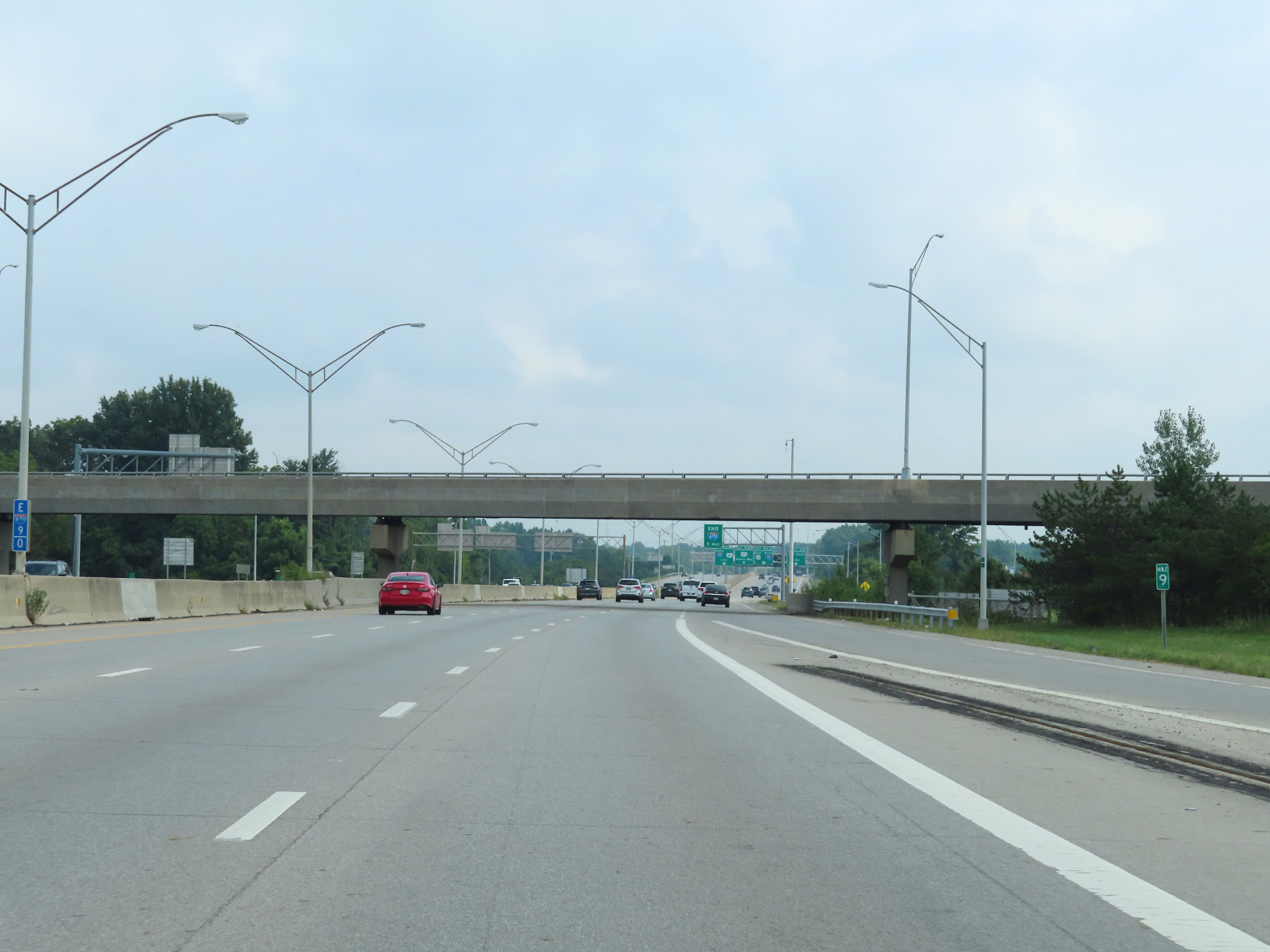 |
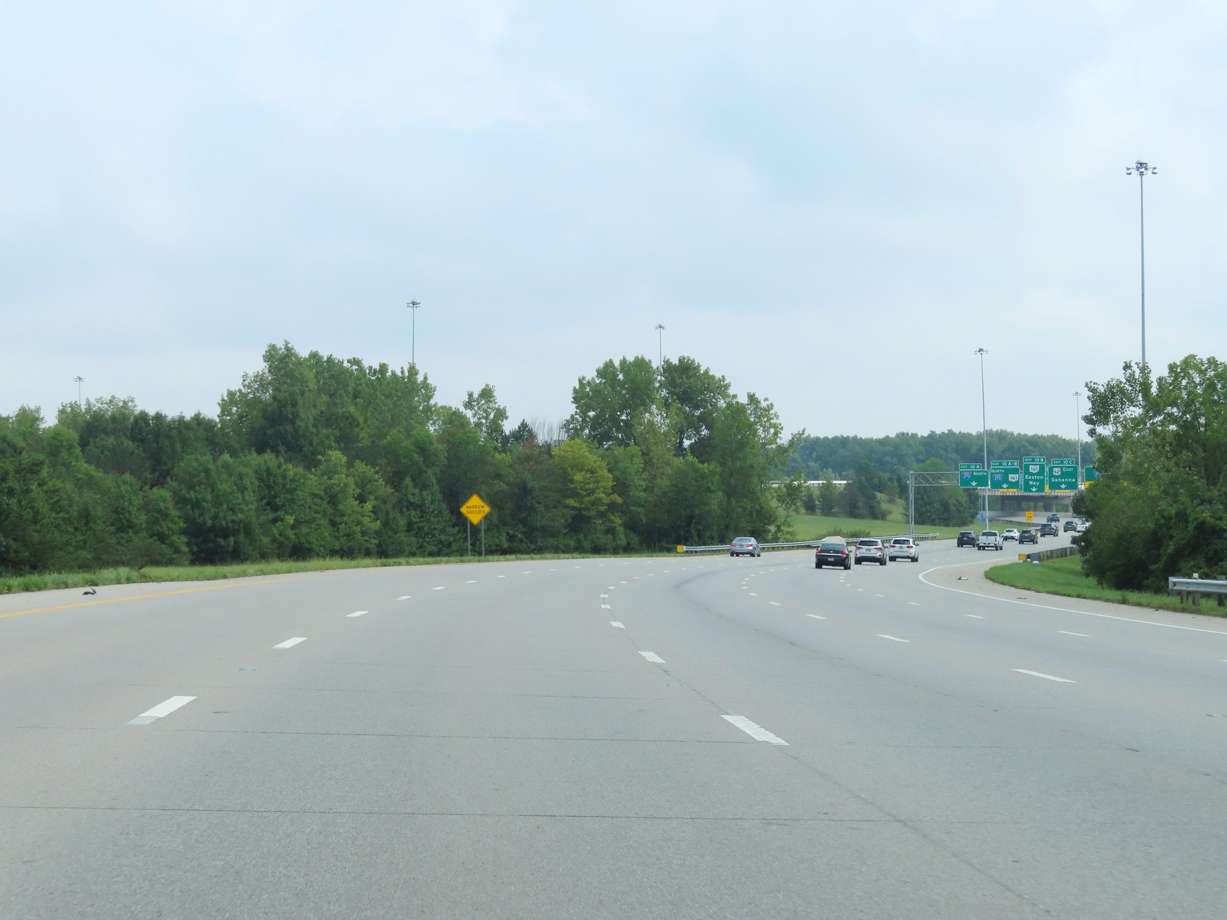
View on Interstate 670 East at mile marker 9. (Photo taken 8/21/22). |
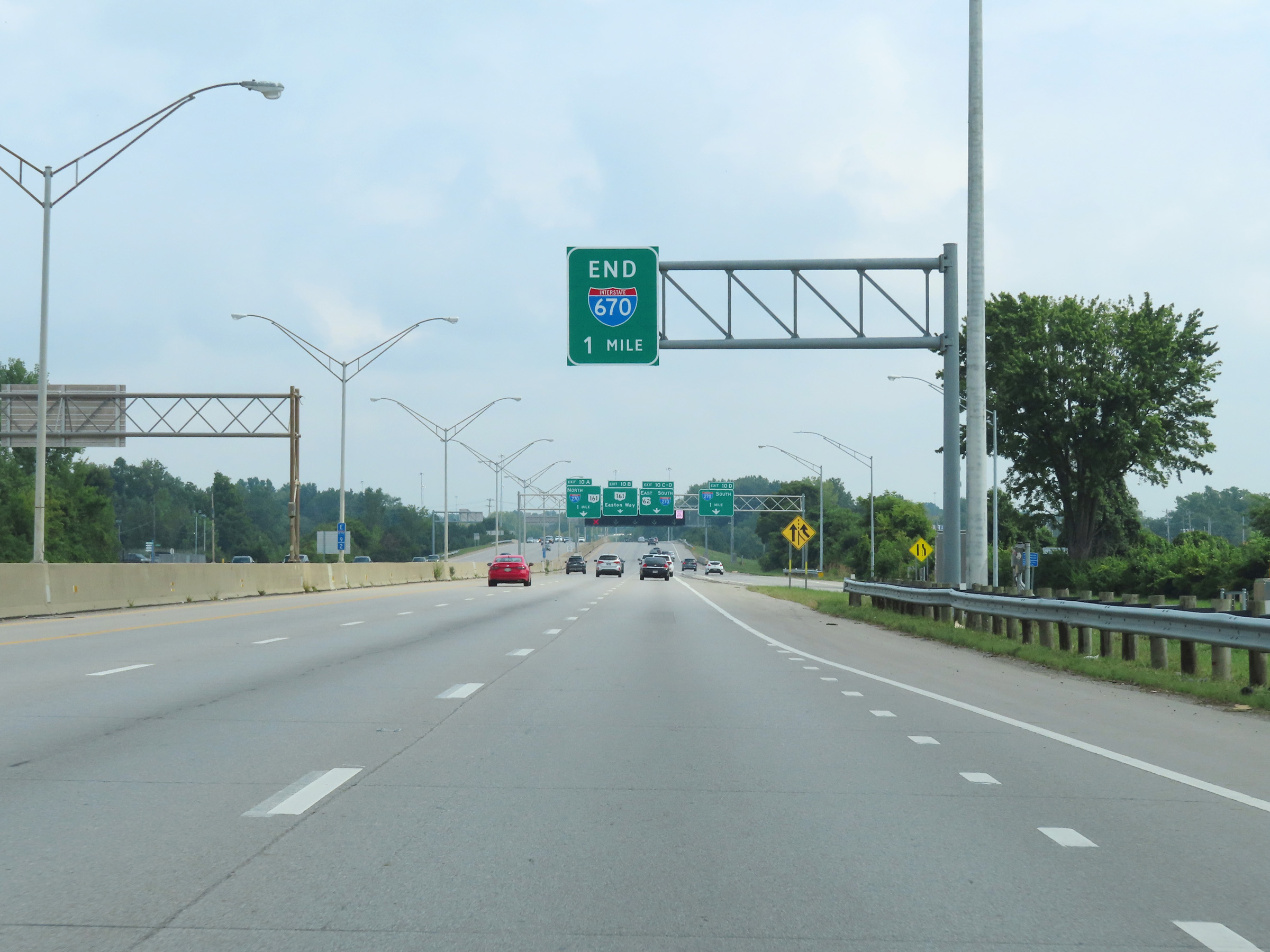 |
As this overhead signage shows, Interstate 670 East will end 1 mile ahead at the junction of Interstate 270 / US 62 East. (Photo taken 8/21/22). |
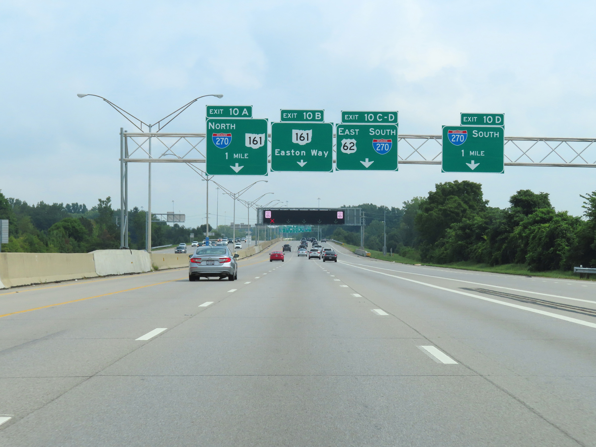 |
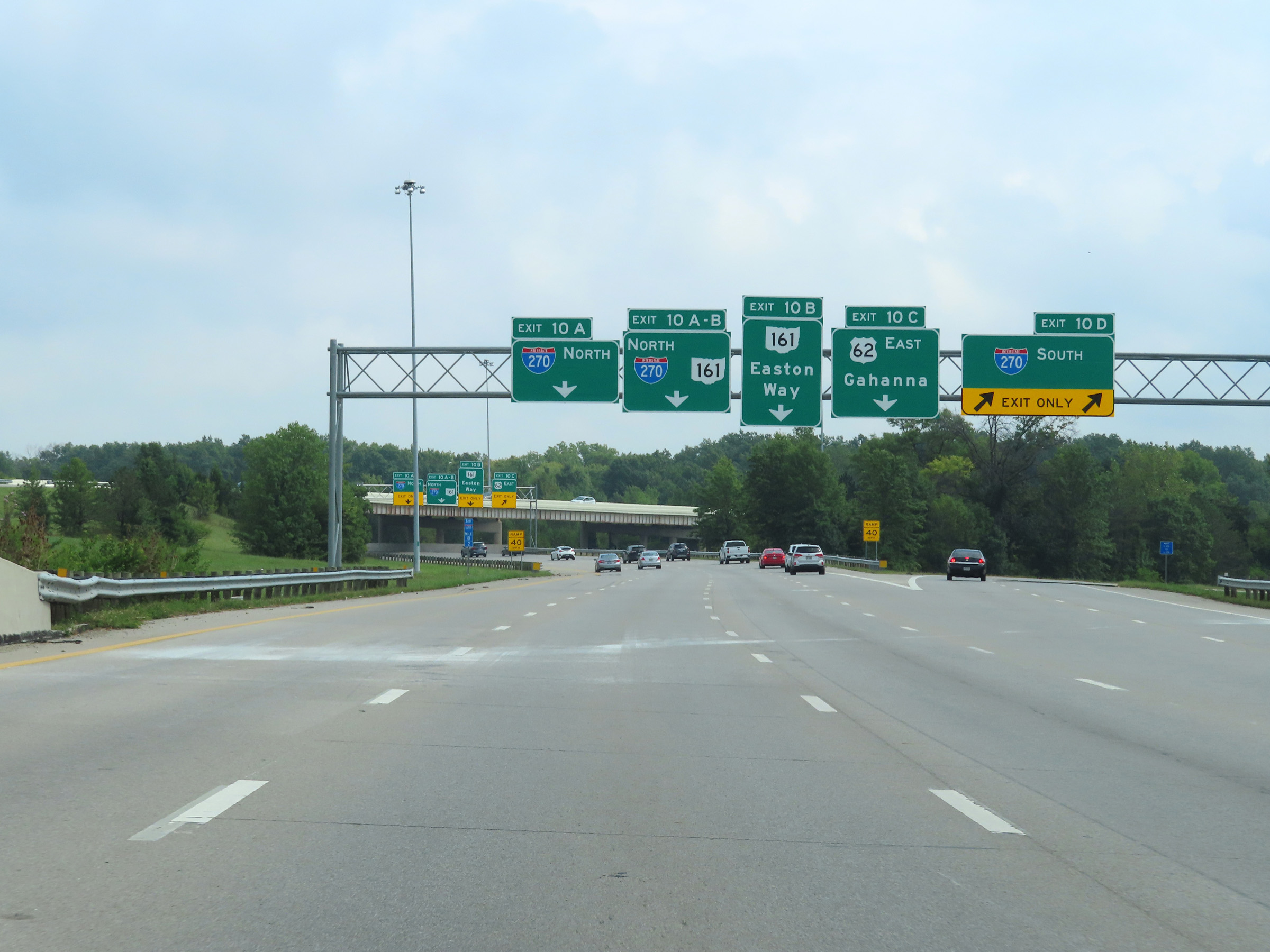
Advance signage for Exits 10A-B-C-D on Interstate 670 East, 1 mile ahead. Traffic to Interstate 270 Outer Loop (North) should keep left, Interstate 270 Inner Loop (South) traffic should keep right, andthose to OH 161 and US 62 East should remain in the center lanes. (Photo taken 8/21/22). |
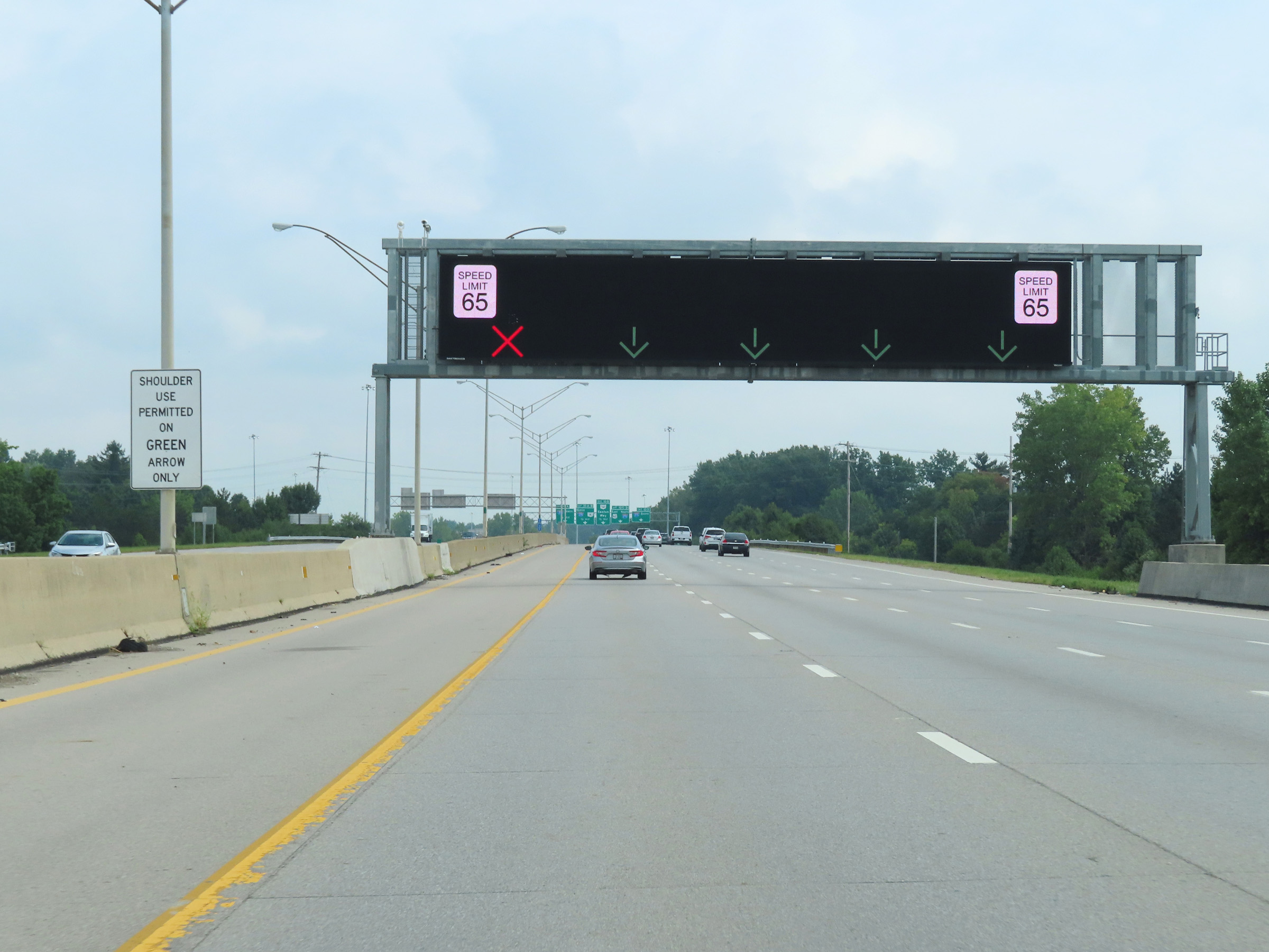 |
As this sign on the median shows, the shoulder is sometimes used as an extra lane on Interstate 670 East when the overhead electronic lane control signage shows a green arrow over it. (Photo taken 8/21/22). |
 |
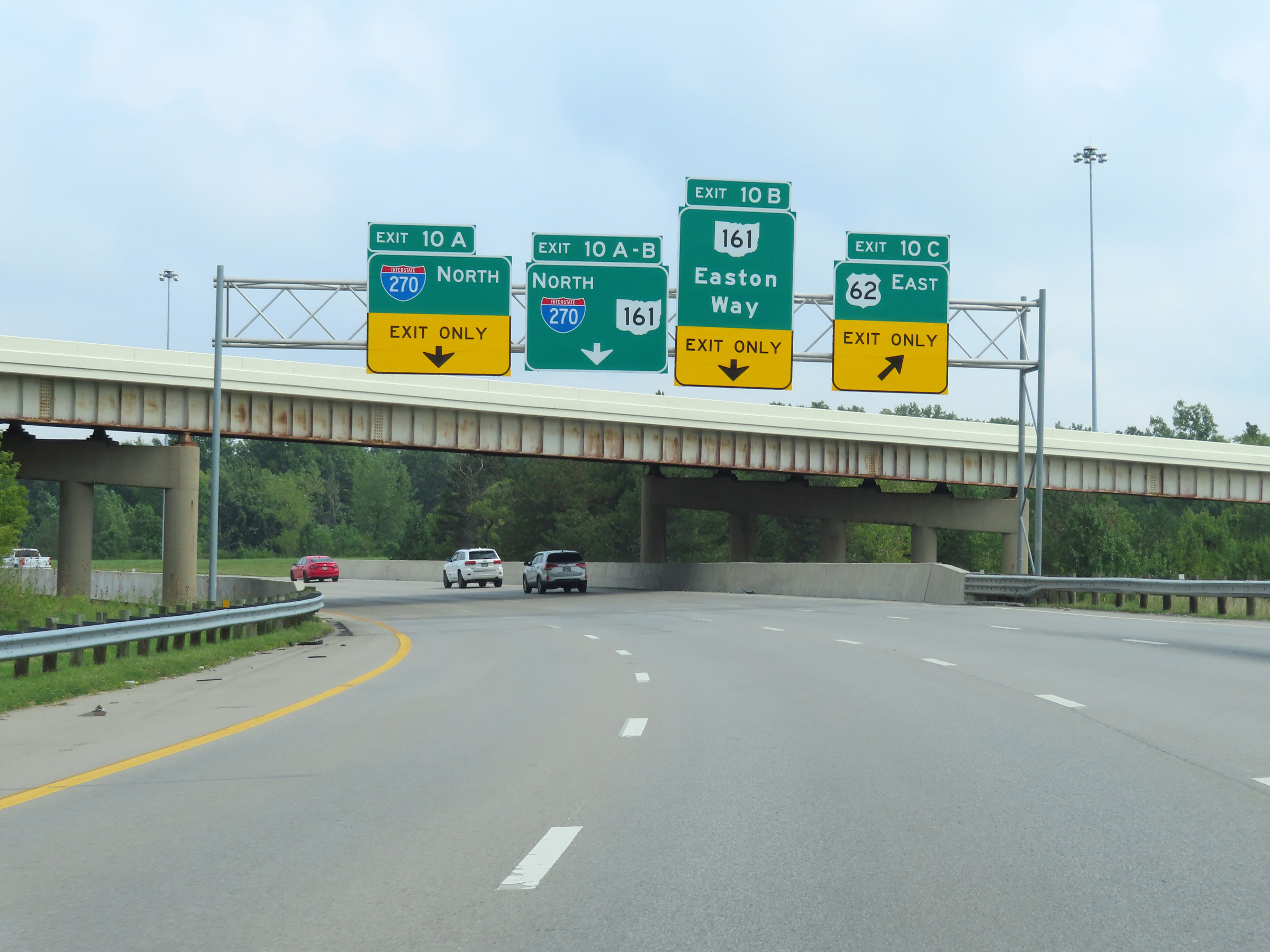
More advance signage for Exits 10A-B-C-D on Interstate 670 East, 1/2 mile from its eastern terminus. (Photo taken 8/21/22). |
 |
View on Interstate 670 East approaching its eastern terminus at the junction of Interstate 270, US 62 East, and OH 161. It's a busy interchange, but is well signed. (Photo taken 8/21/22). |
 |
Interstate 670 East at Exit 10D: Interstate 270 South (Photo taken 8/21/22). |
 |
Interstate 670 East at Exit 10C: US 62 East - Gahanna (Photo taken 8/21/22). |
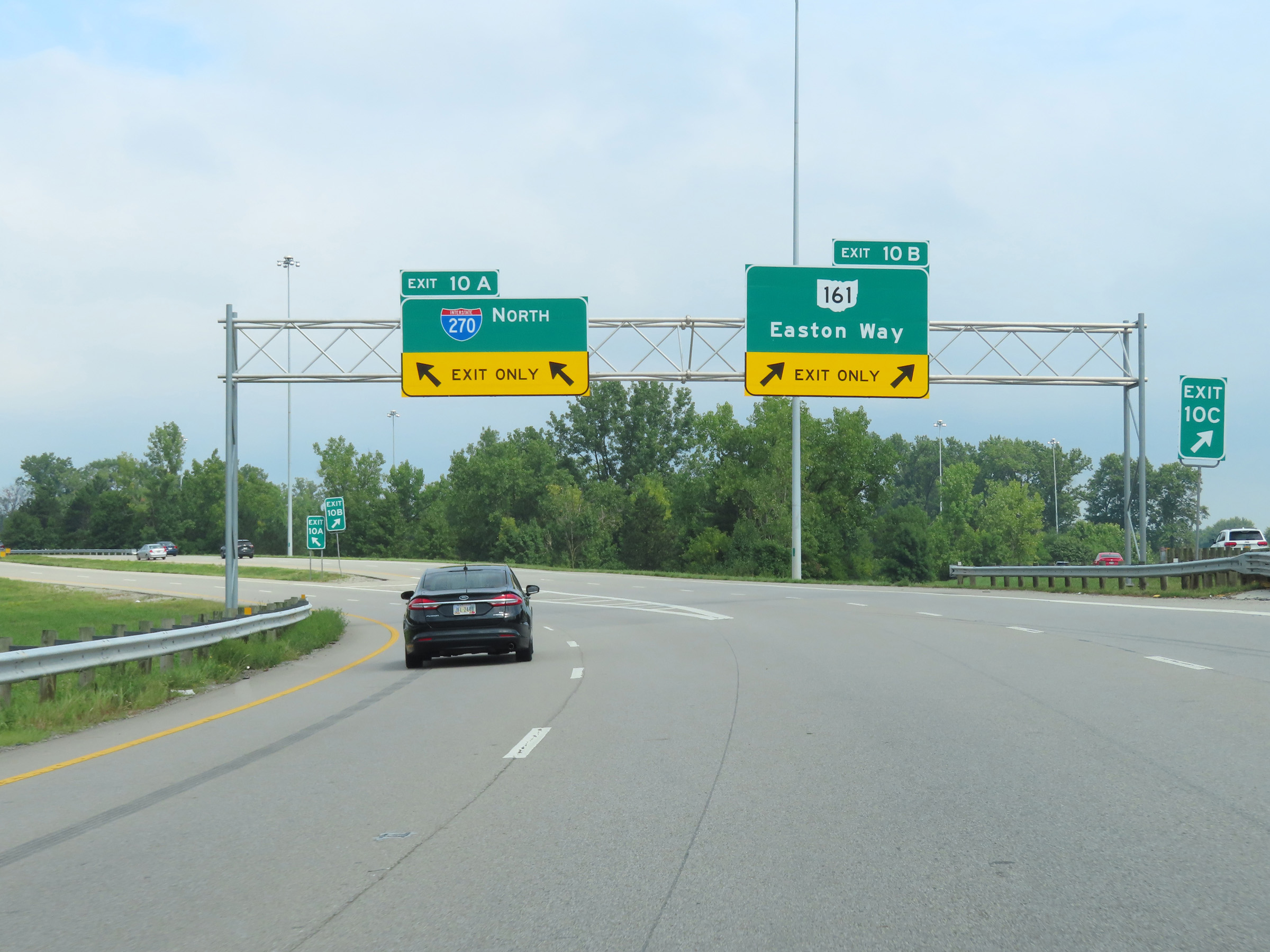 |
Interstate 670 East at Exit 10B: OH 161 - Easton Way (Photo taken 8/21/22). |
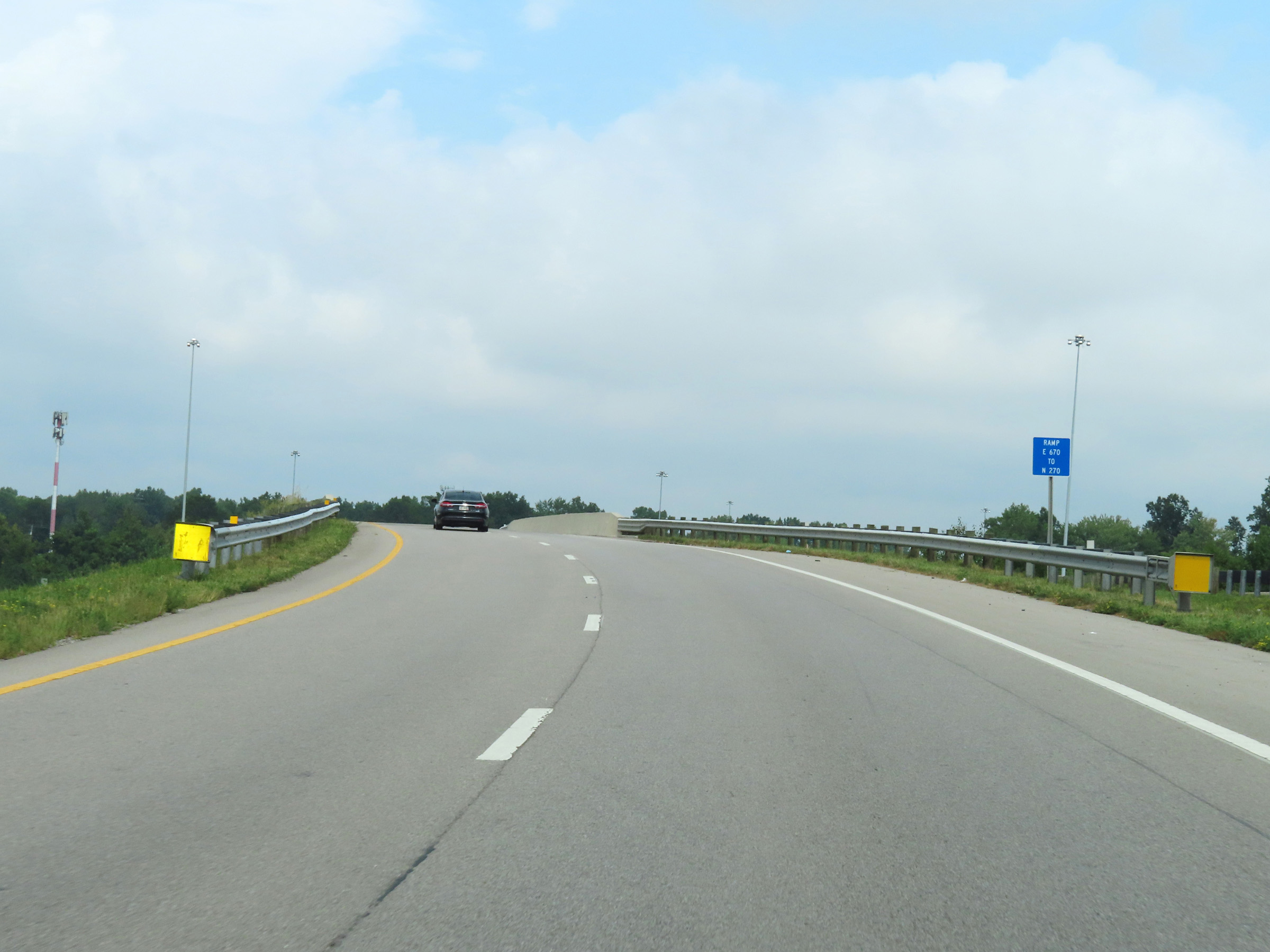 |
The two remaining lanes of Interstate 670 East become the ramp for Exit 10 to Interstate 270 Outer Loop (North). (Photo taken 8/21/22). |
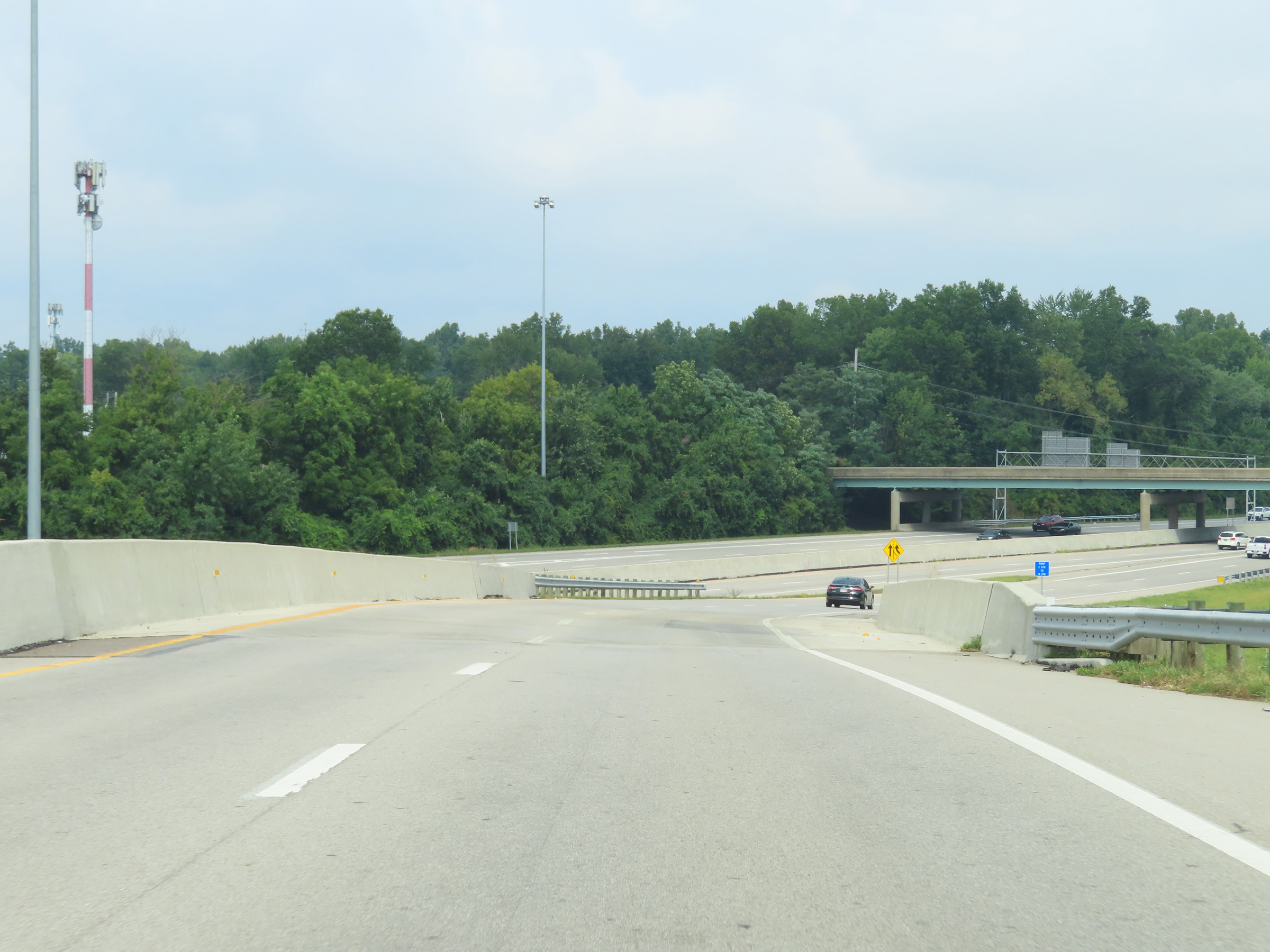 |
Interstate 670 East as Interstate 270 Outer Loop (North) traffic comes into view ahead. (Photo taken 8/21/22). |
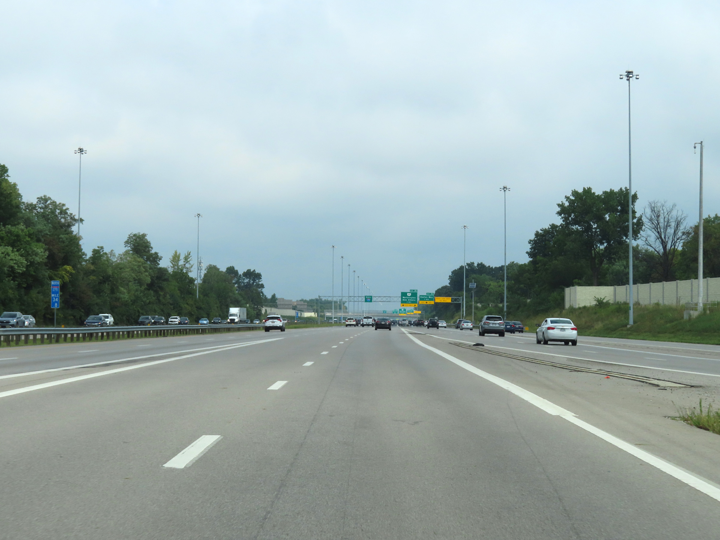 |
The ramp from Interstate 670 East to Interstate 270 Outer Loop (North) joins I-270 North at mile marker 34.8. (Photo taken 8/21/22). |