Road Information |
||
 |
||
| Total Mileage in State: | 20 miles | |
| Northern End: | At I-64, in Hampton | |
| Southern End: | At I-64/I-264, in Chesapeake | |
| Mileage covered in Photos: | 20 miles | |
| Counties covered in Photos: | Hampton (city), Newport News (city), Hampton Roads, Suffolk (city), Chesapeake (city) | |
| Major Junctions in Photos: | US 60, in Newport News US 17/VA 164, in Suffolk US 13/US 58/ US 460, in Chesapeake I-64/I-264, in Chesapeake |
|
| Control Cities in Photos: | Hampton, Newport News, Suffolk, Chesapeake | |
Southbound
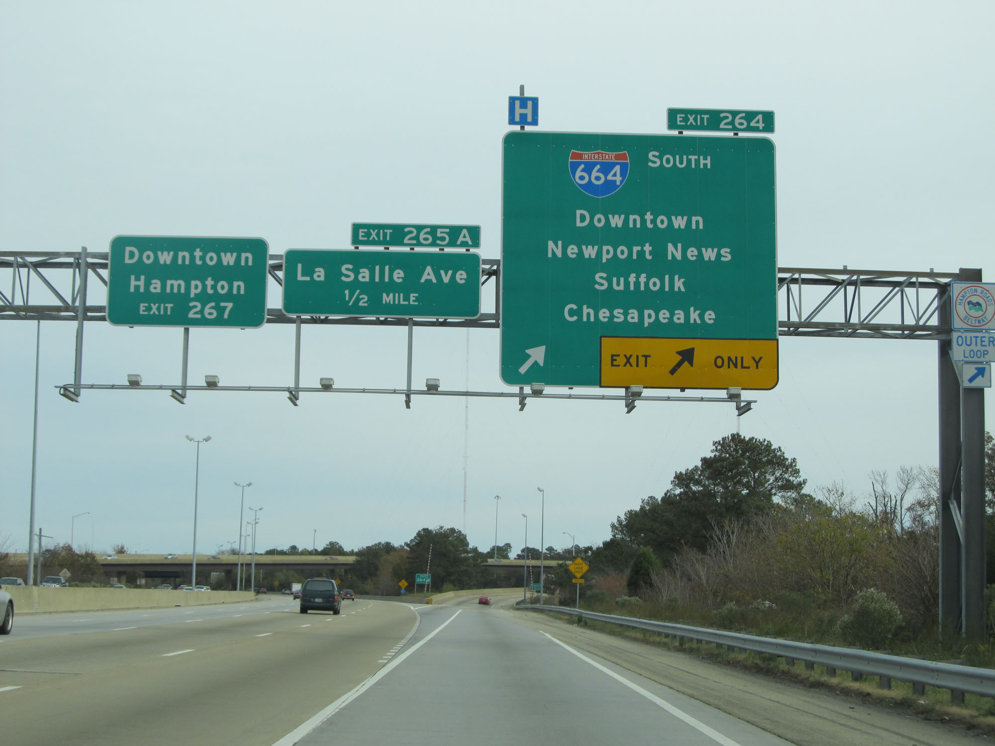 |
Interstate 664 South begins at Exit 264 on Interstate 64 East. (Photo taken 11/8/15). |
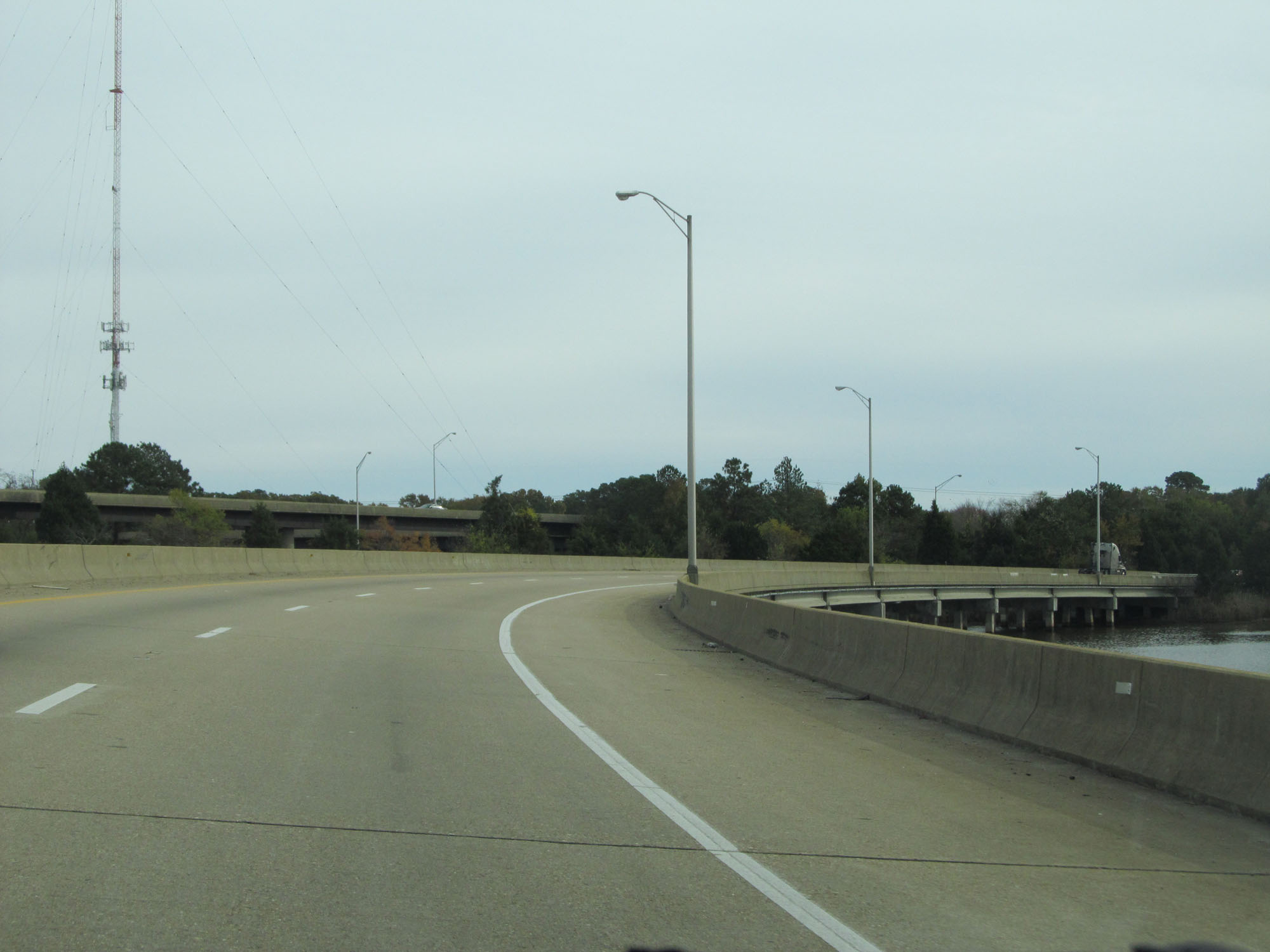 |
View on the ramp to Interstate 664 South from Interstate 64 East. (Photo taken 11/8/15). |
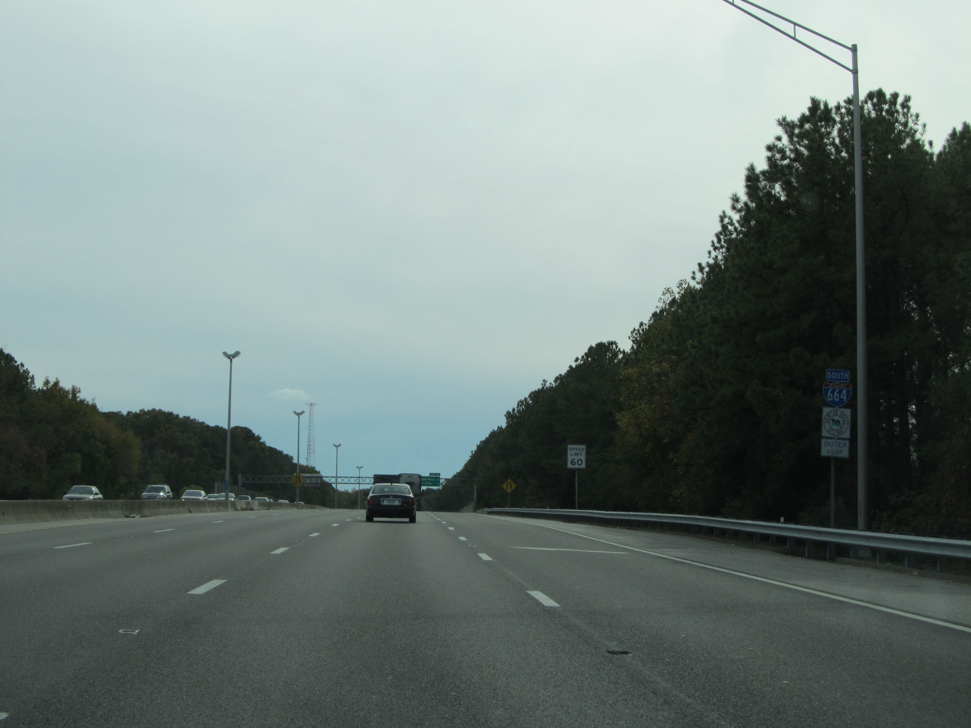 |
Interstate 664 South reassurance shield. The speed limit on I-664 South starts out at 60 mph. (Photo taken 11/8/15). |
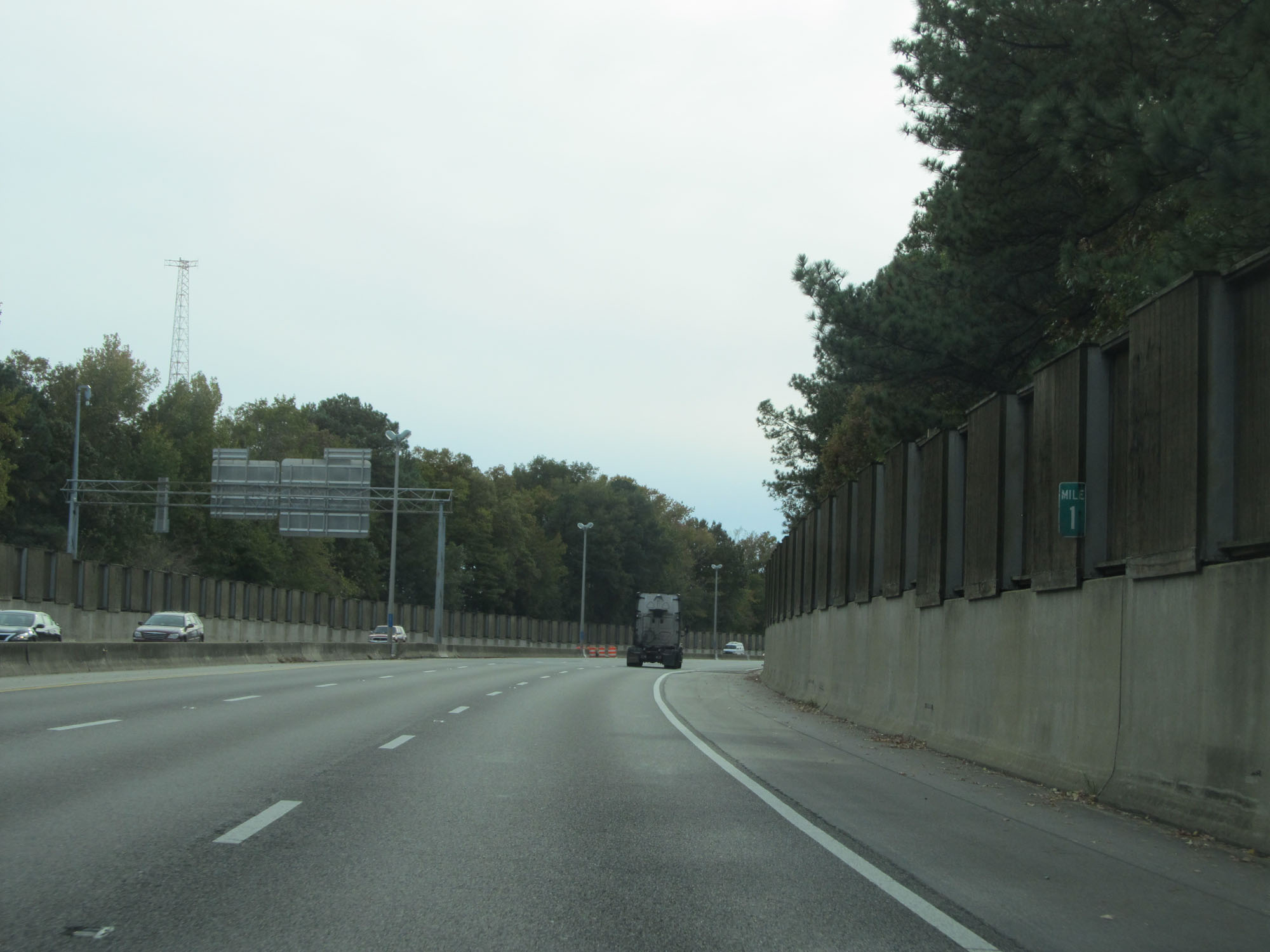 |
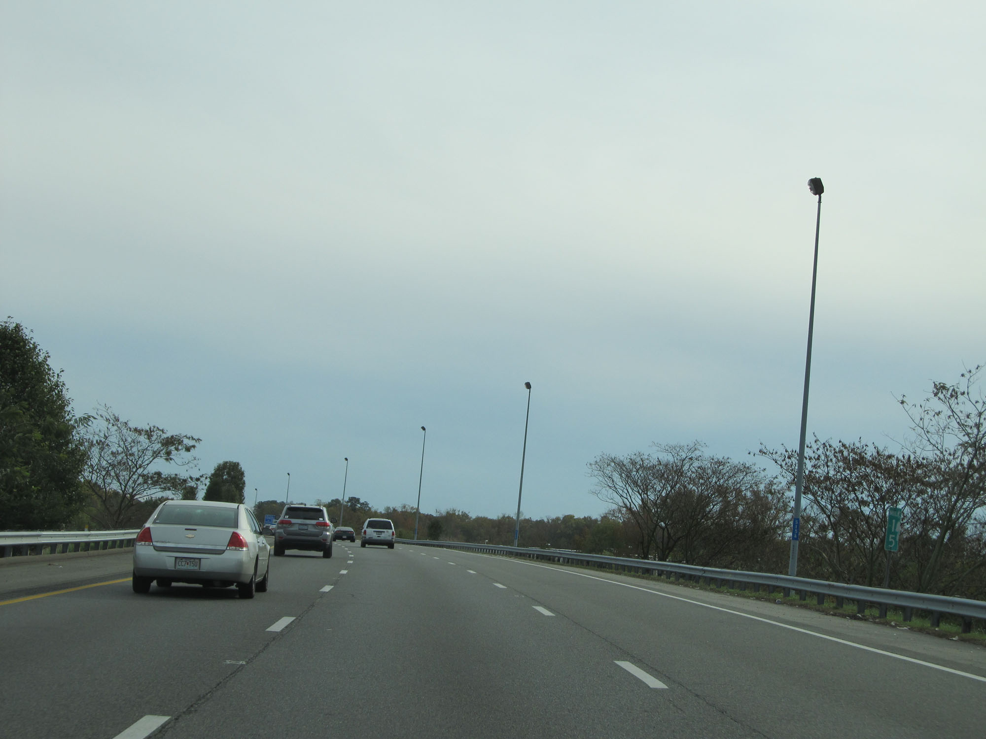
Interstate 664 South at mile marker 1. I-664 is odd in that its mileage and exit numbers increase as you go south, which is the opposite of how Interstate highway numbering usually is. (Photo taken 11/8/15). |
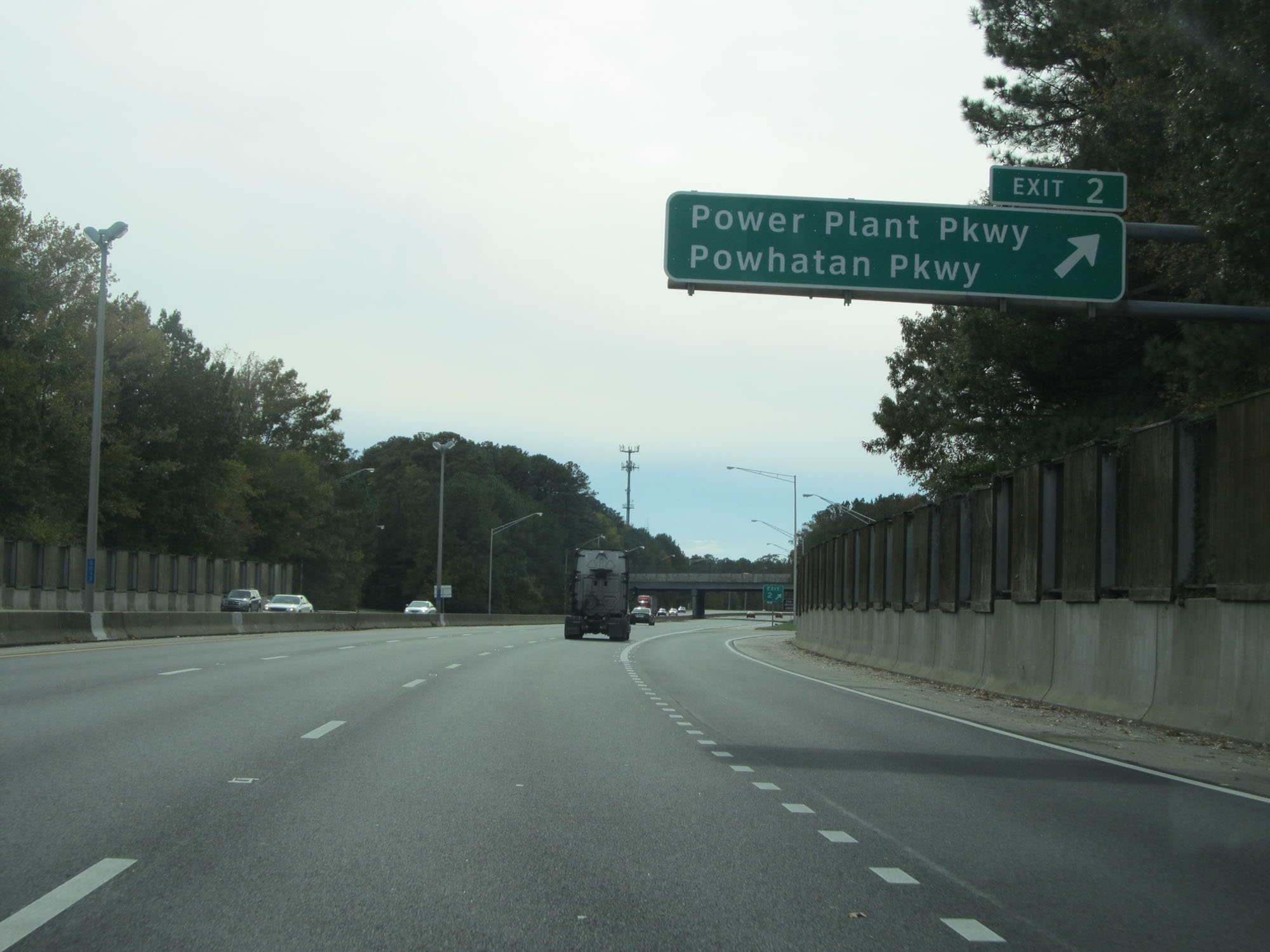 |
Interstate 664 South at Exit 2: Power Plant Pkwy / Powhatan Pkwy (Photo taken 11/8/15). |
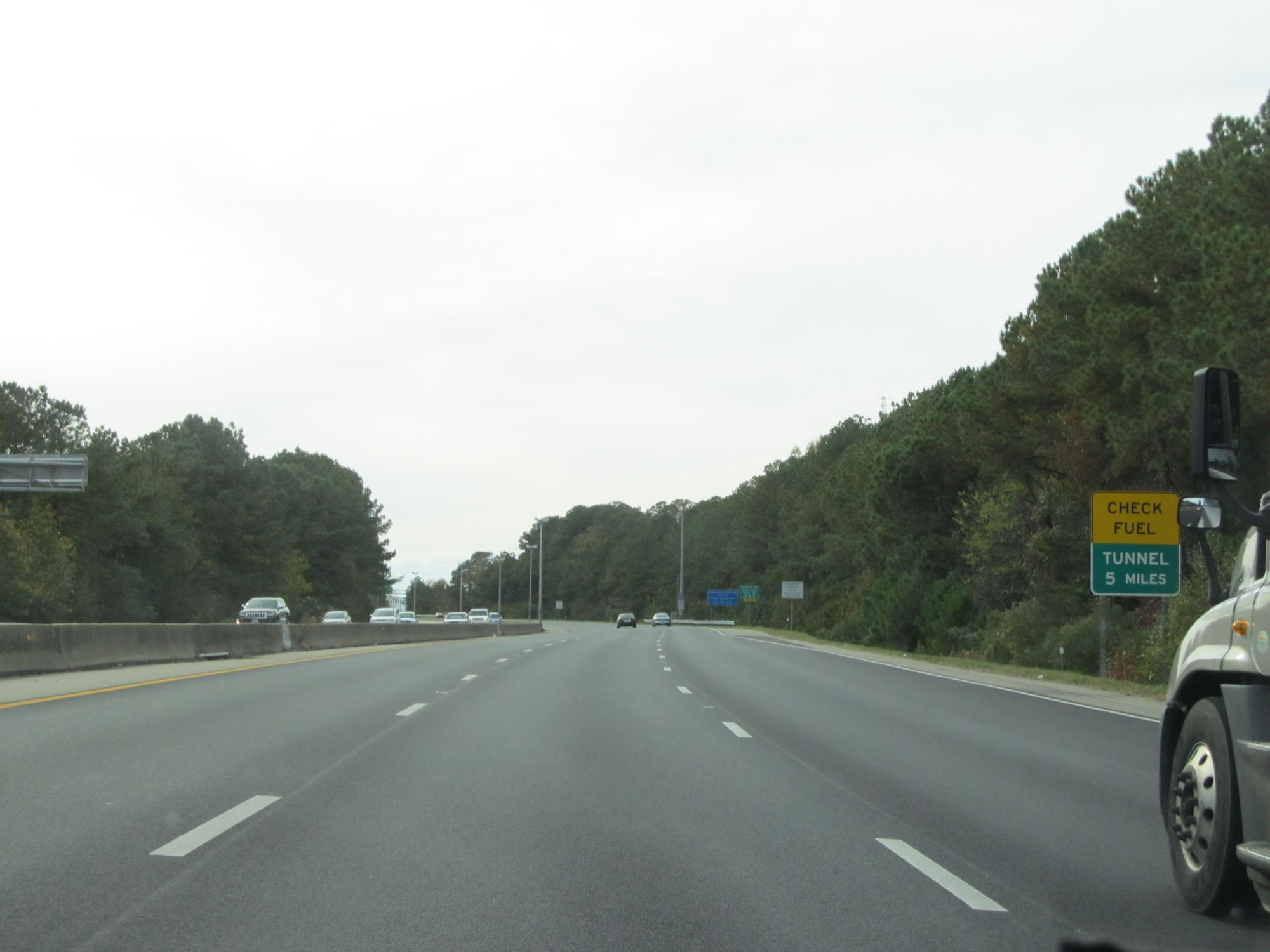 |
The Monitor-Merrimac Memorial Bridge-Tunnel is 5 miles ahead. This sign urges motorists to check their fuel levels. (Photo taken 11/8/15). |
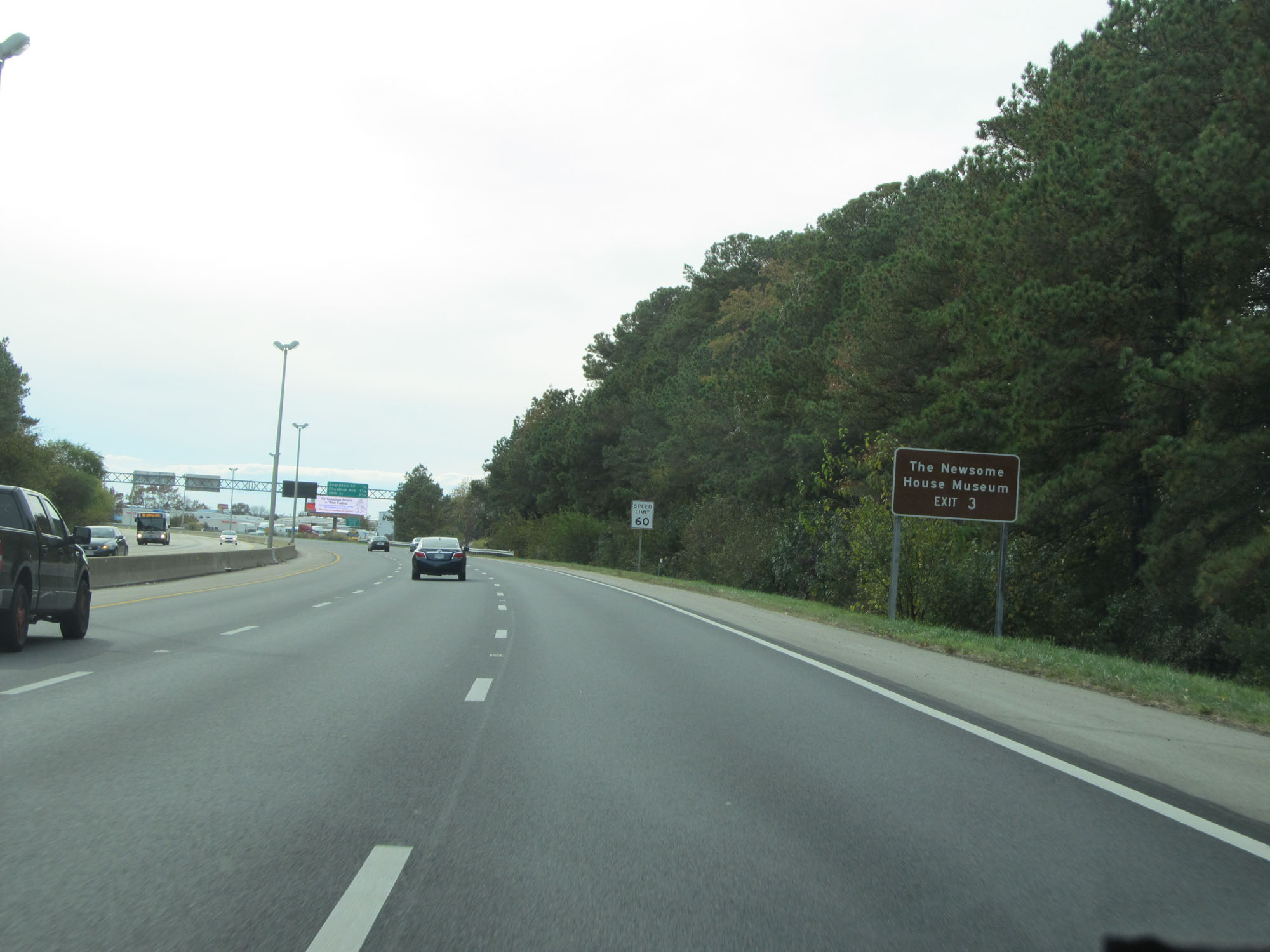 |
Take Exit 3 to The Newsome House Museum. (Photo taken 11/8/15). |
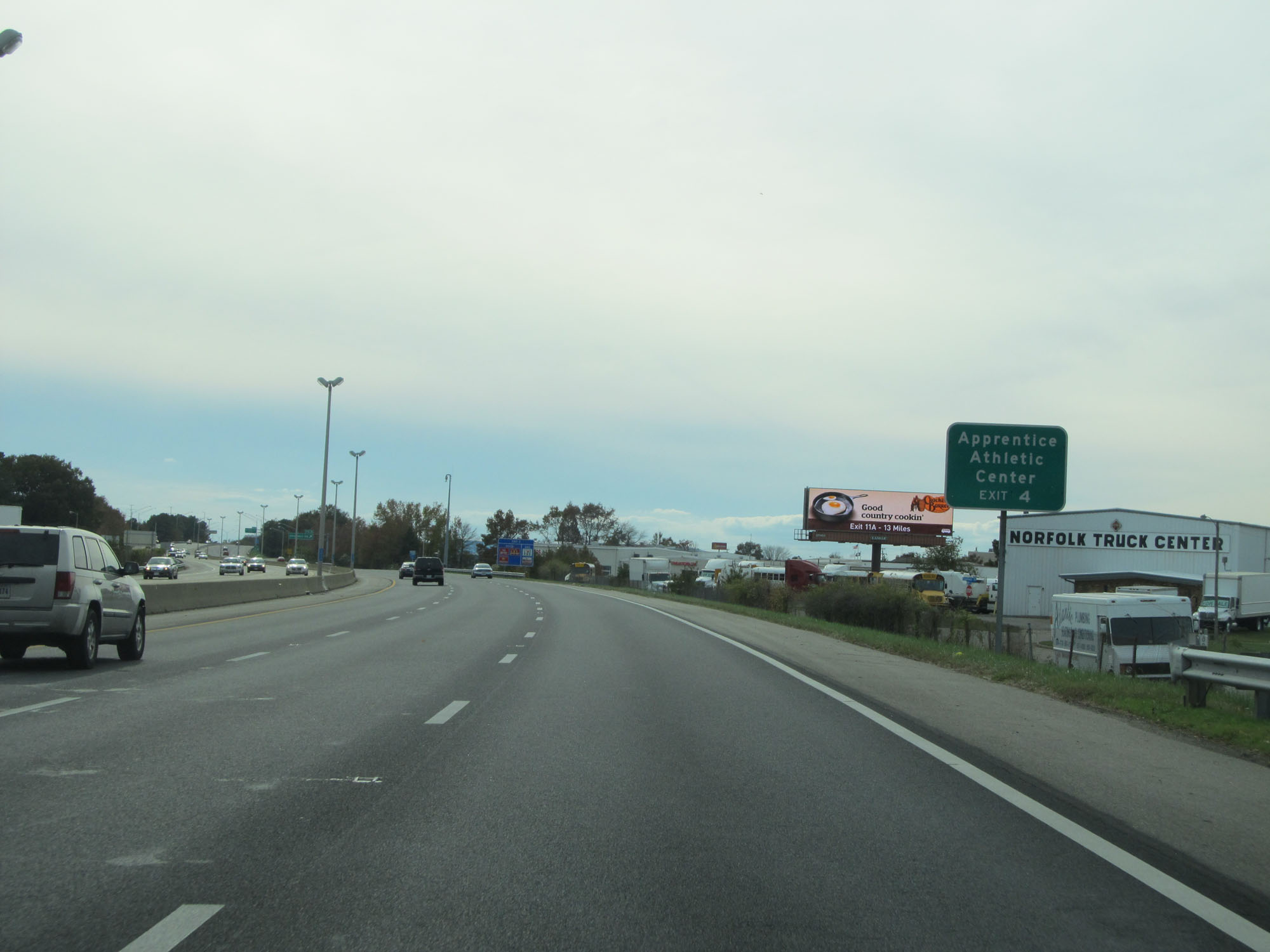 |
Take Exit 4 to Apprentice Athletic Center. (Photo taken 11/8/15). |
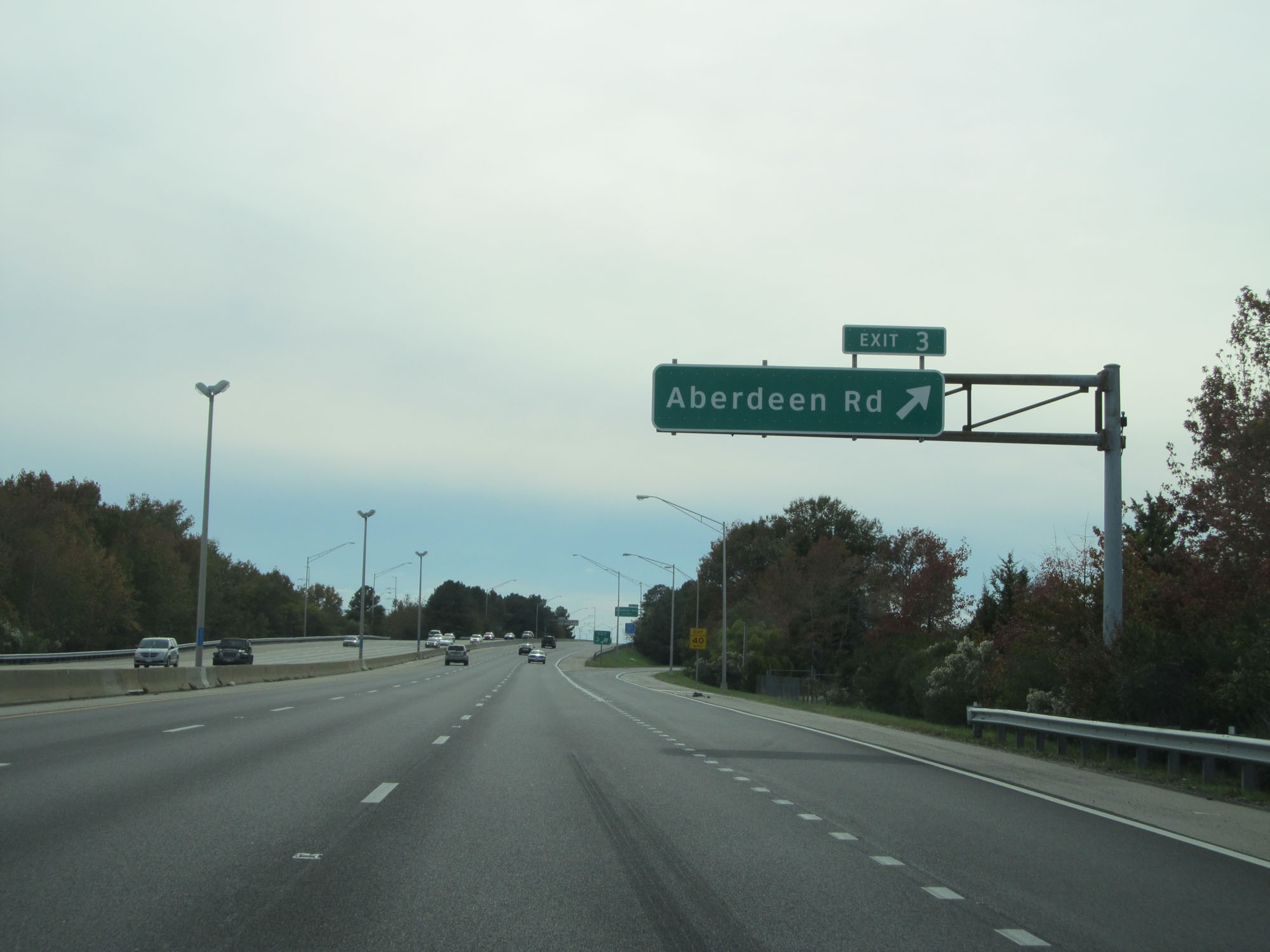 |
Interstate 664 South at Exit 3: Aberdeen Rd (Photo taken 11/8/15). |
 |
Interstate 664 South at Exit 4: Chestnut Ave (Photo taken 11/8/15). |
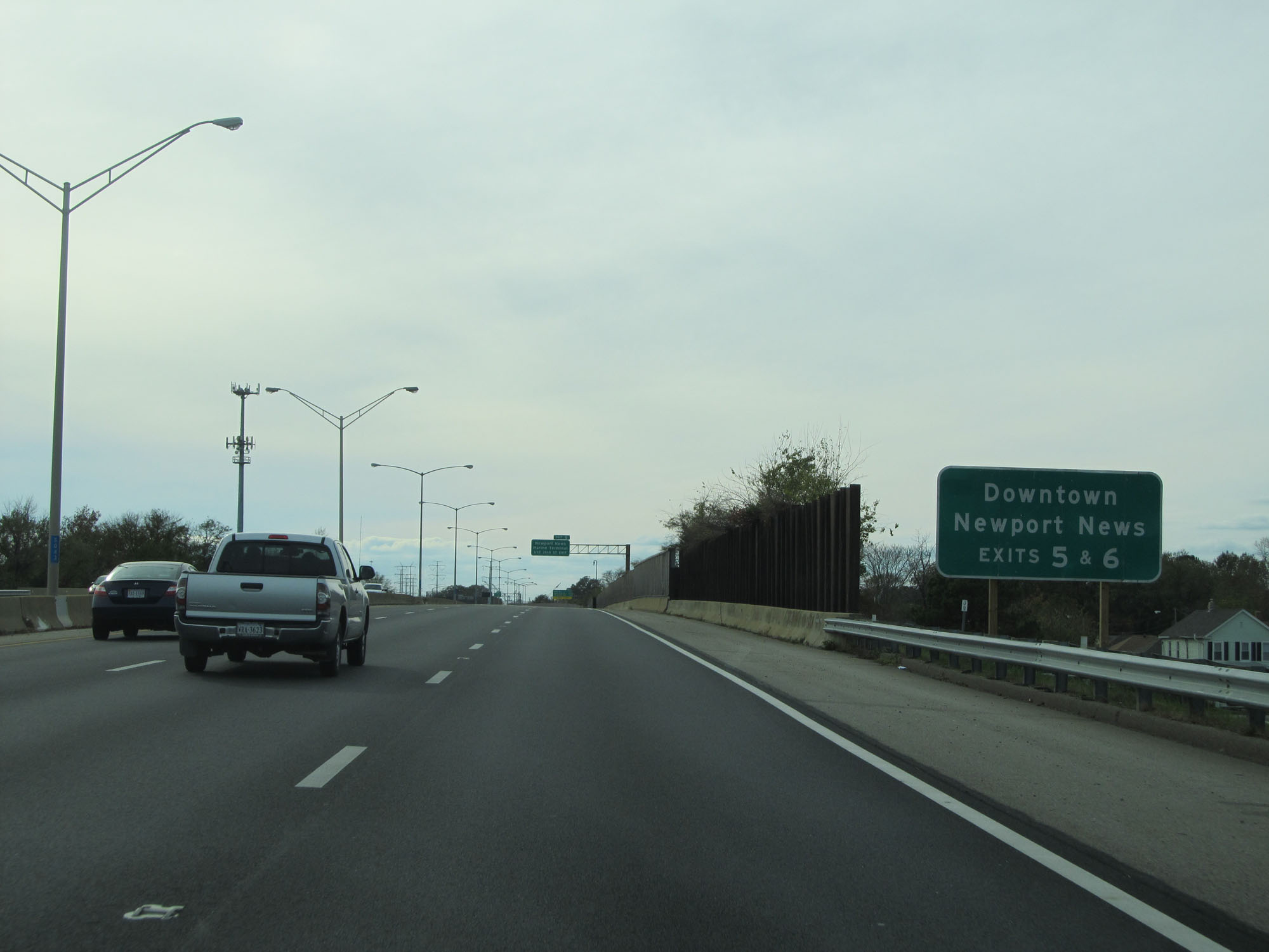 |
Take Exits 5 and 6 to downtown Newport News. (Photo taken 11/8/15). |
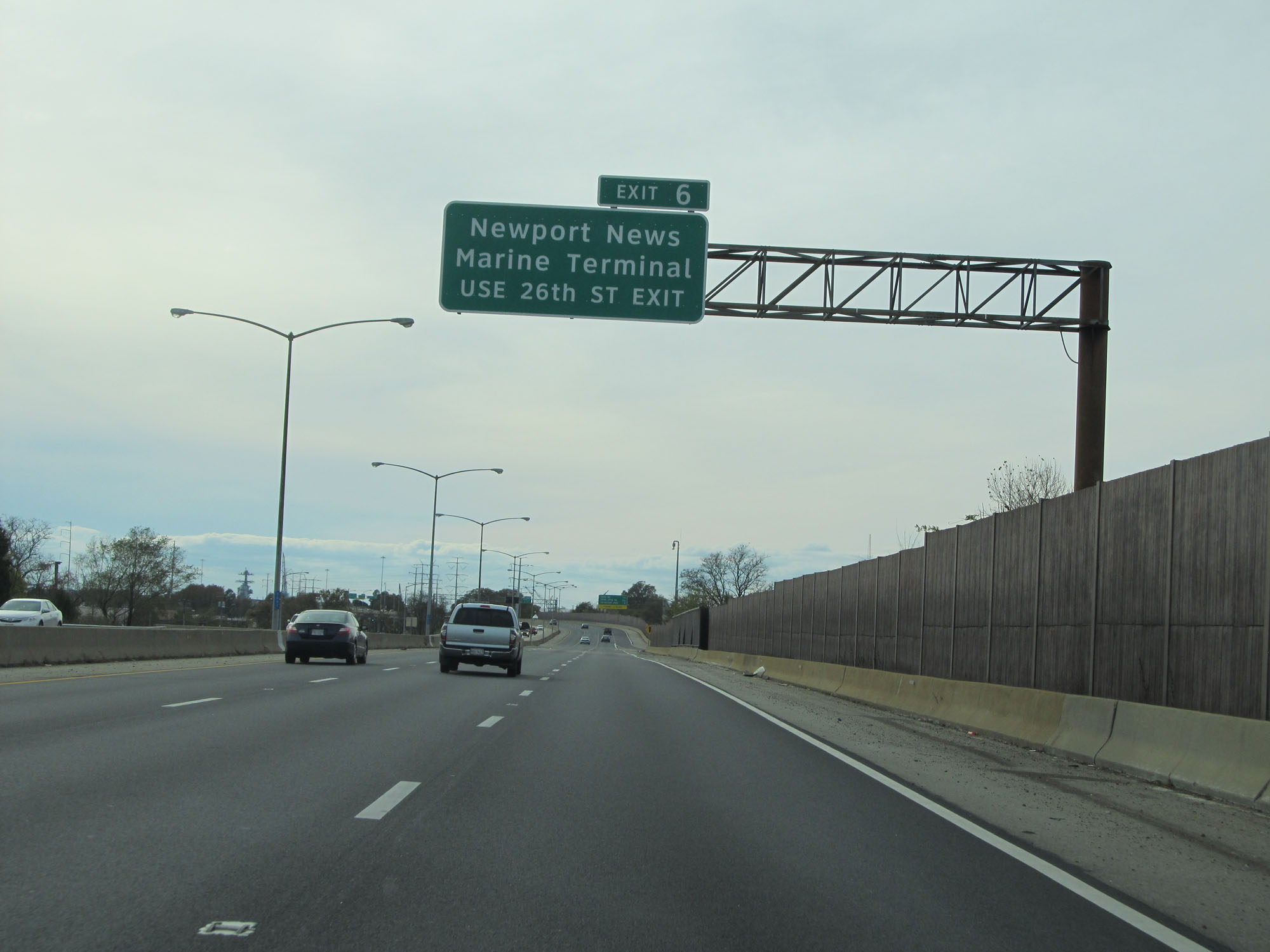 |
Take Exit 6 to the Newport News Marine Terminal. (Photo taken 11/8/15). |
 |
The Monitor-Merrimac Memorial Bridge-Tunnel now lies 3 miles ahead. (Photo taken 11/8/15). |
 |
Interstate 664 South approaching Exit 5 - 1/4 mile. (Photo taken 11/8/15). |
 |
Interstate 664 South at Exit 5: 35th St (Photo taken 11/8/15). |
 |
All vehicles over 14'6" high and 10'6" wide must stop for inspection 1 1/4 miles ahead, prior to entering the Monitor-Merrimac Memorial Tunnel. (Photo taken 11/8/15). |
 |
Interstate 664 South at Exit 6: 26th St / 27th St (Photo taken 11/8/15). |
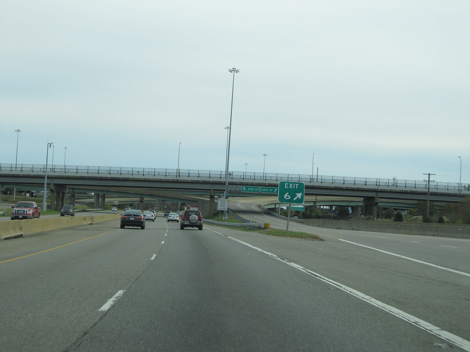 |
Gore point signage for Exit 6. (Photo taken 11/8/15). |
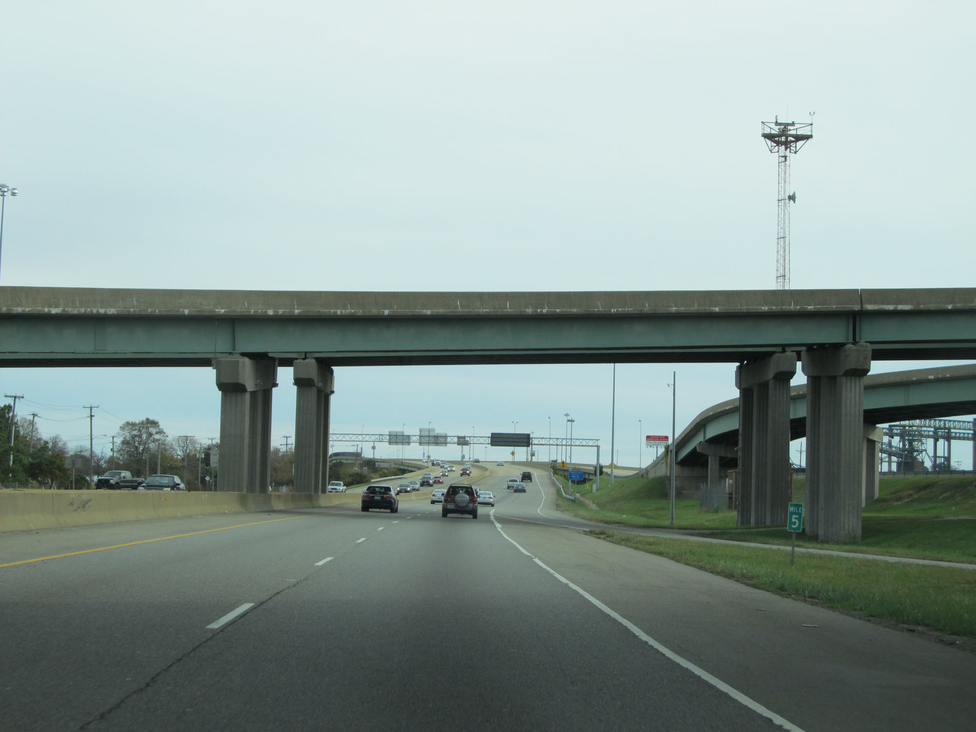 |
Interstate 664 South at mile marker 5. (Photo taken 11/8/15). |
 |
Approaching the Monitor-Merrimac Bridge-Tunnel, variable speed limits are used. (Photo taken 11/8/15). |
 |
Interstate 664 South reassurance shield. (Photo taken 11/8/15). |
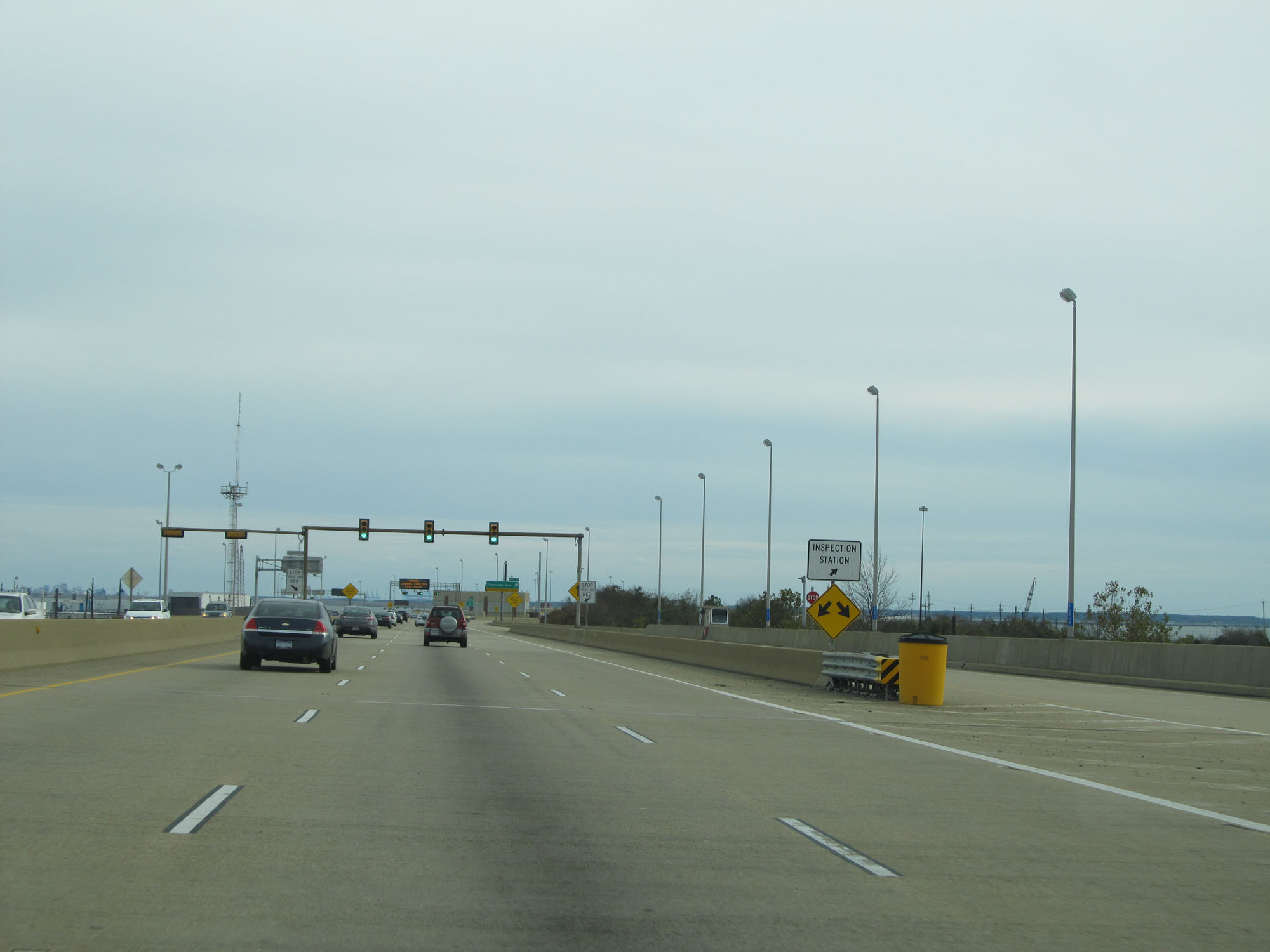 |
Inspection Station on Interstate 664 South approaching the entrance to the Monitor-Merrimac Memorial Tunnel. (Photo taken 11/8/15). |
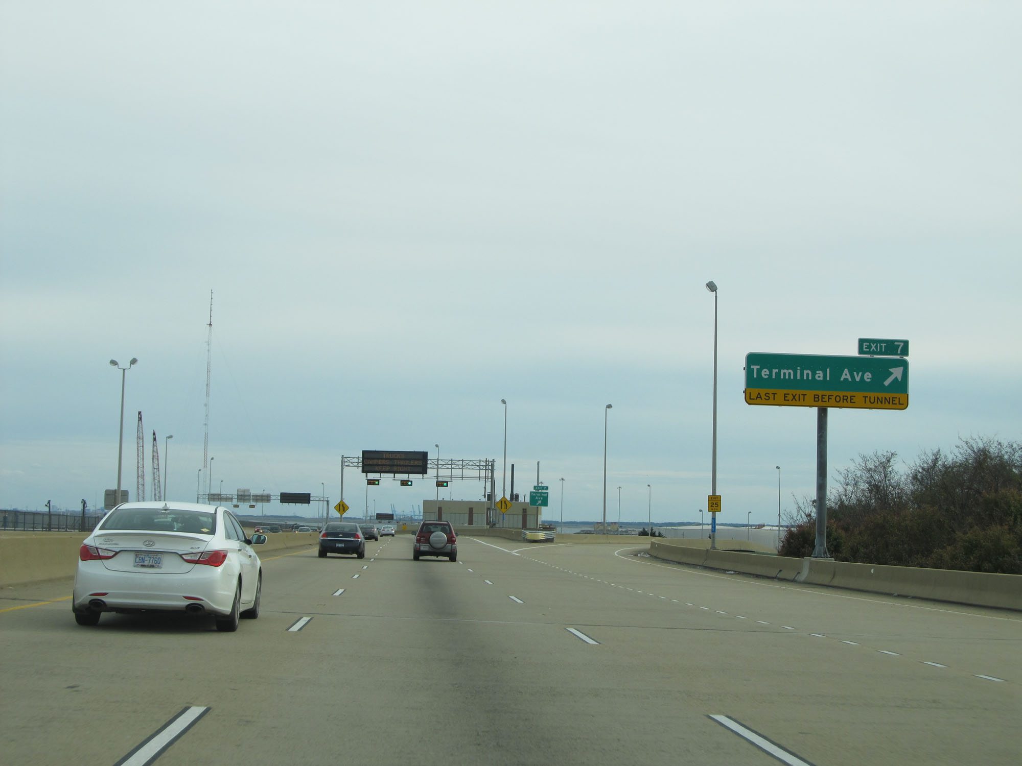 |
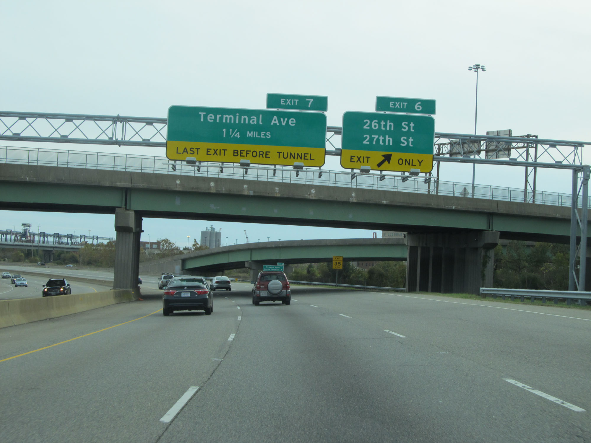
Interstate 664 South at Exit 7: Terminal Ave (Photo taken 11/8/15). |
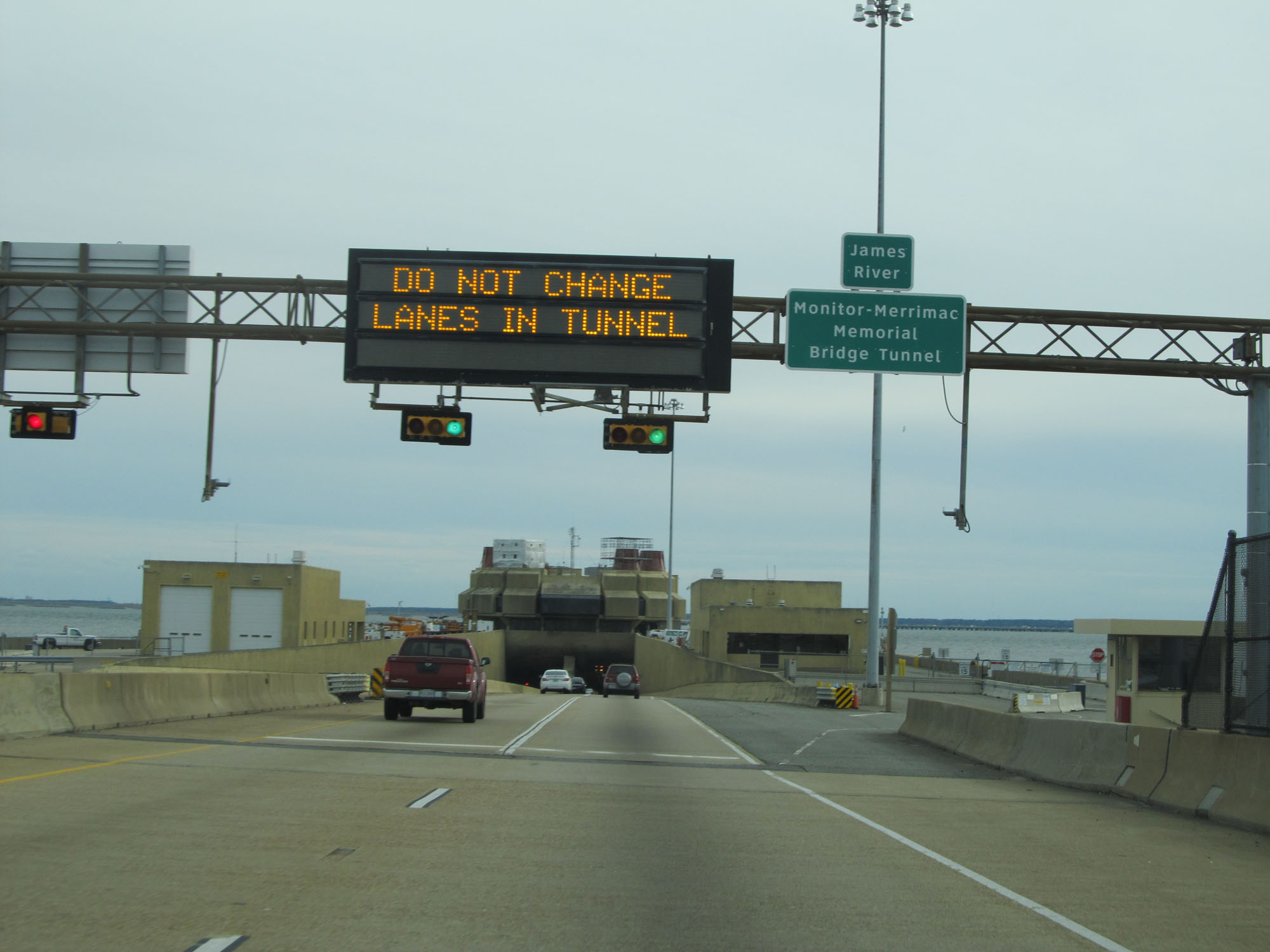 |
Interstate 664 South approaching the entrance to the Monitor-Merrimac Memorial Bridge-Tunnel. (Photo taken 11/8/15). |
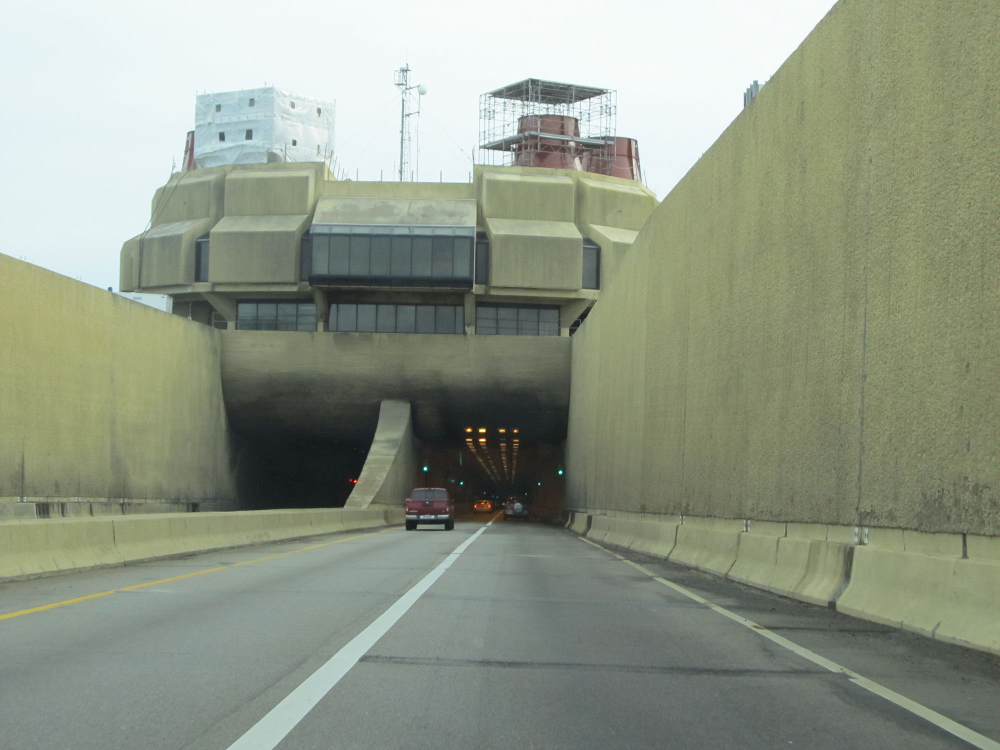 |
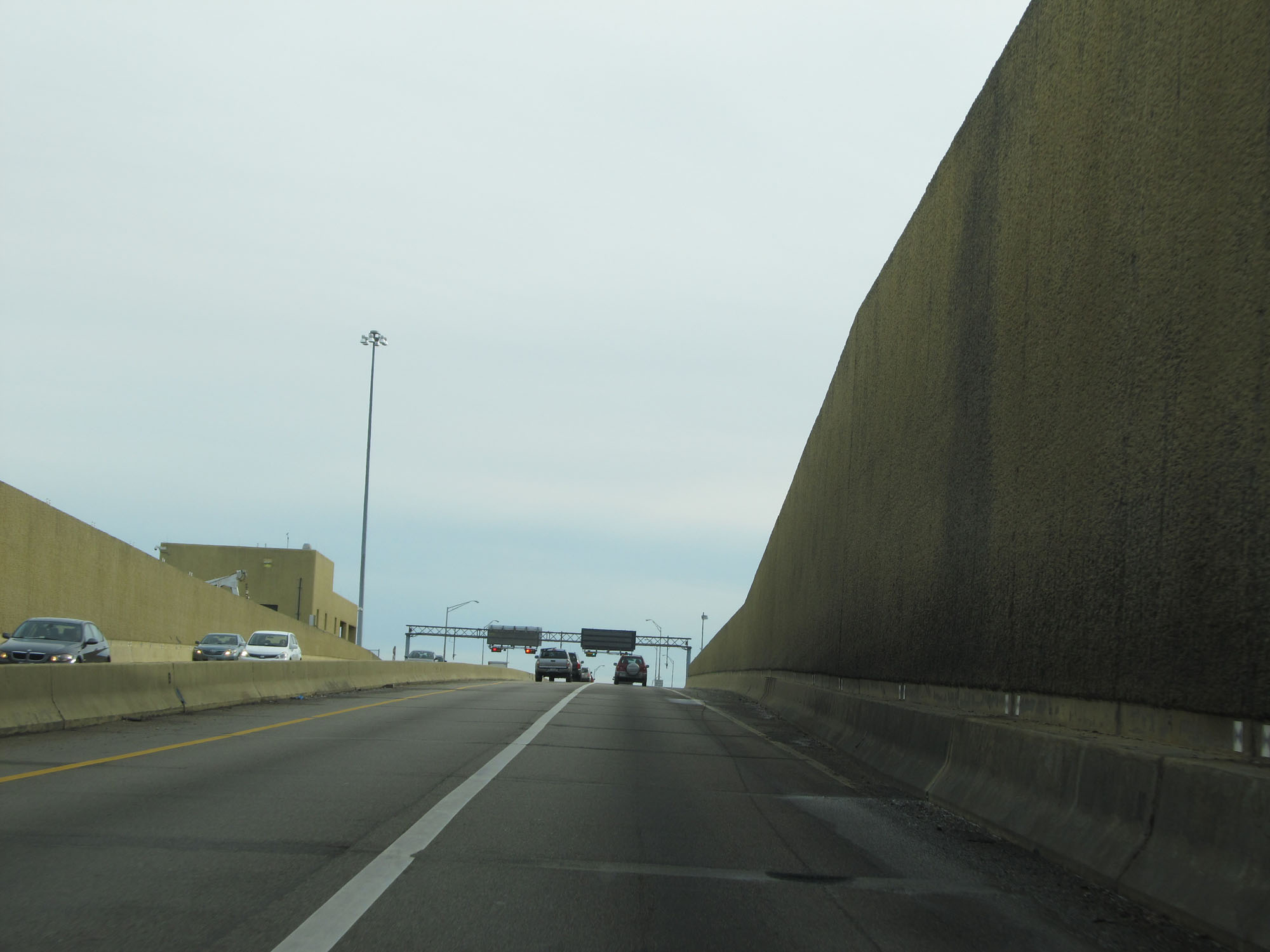
Interstate 664 South at the entrance to the Monitor-Merrimac Memorial Bridge-Tunnel. (Photo taken 11/8/15). |
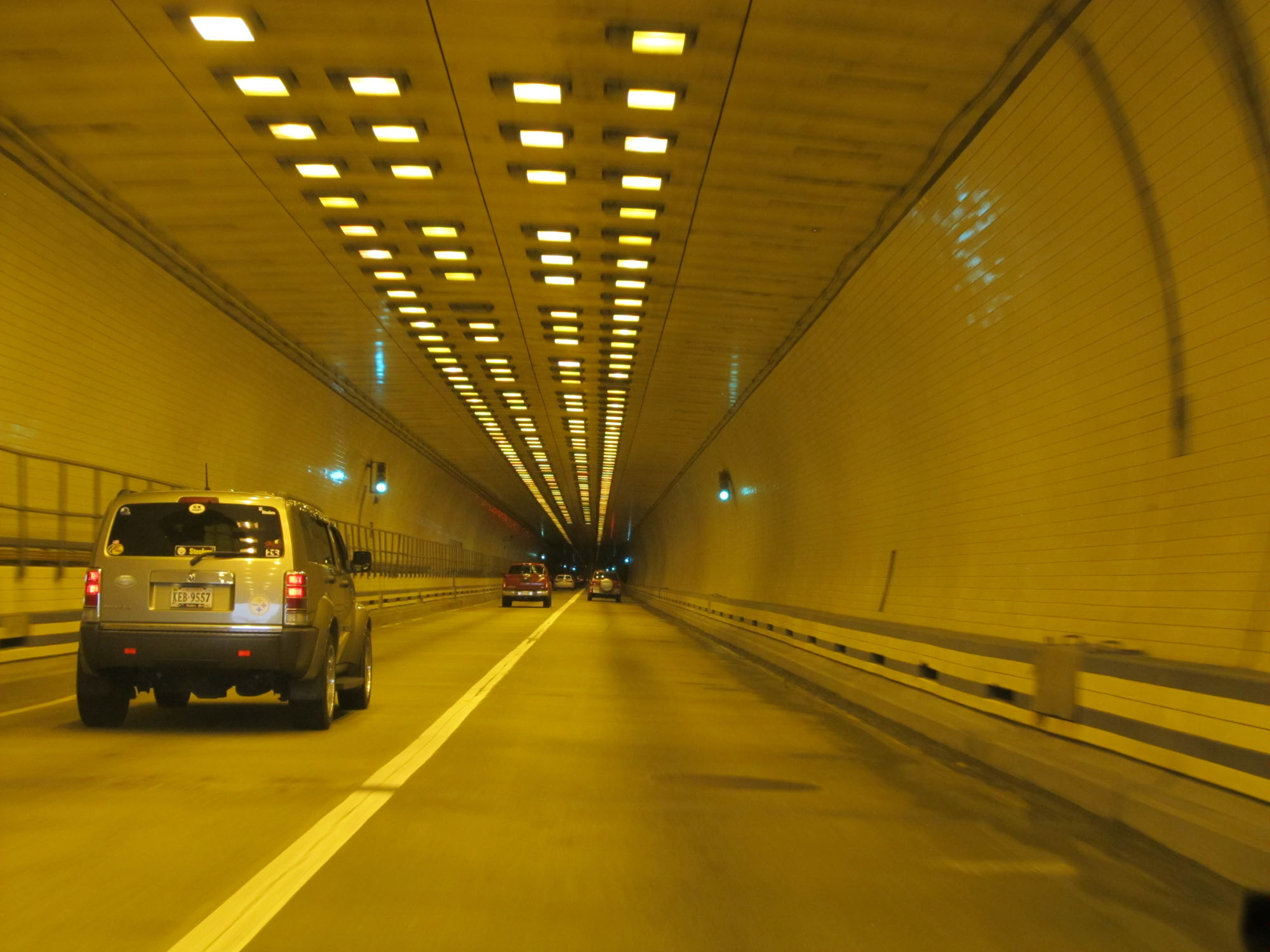 |
View inside the Monitor-Merrimac Memorial Tunnel on Interstate 664 South. (Photo taken 11/8/15). |
 |
Interstate 664 South as it exits the Monitor-Merrimac Memorial Tunnel onto the bridge portion. (Photo taken 11/8/15). |
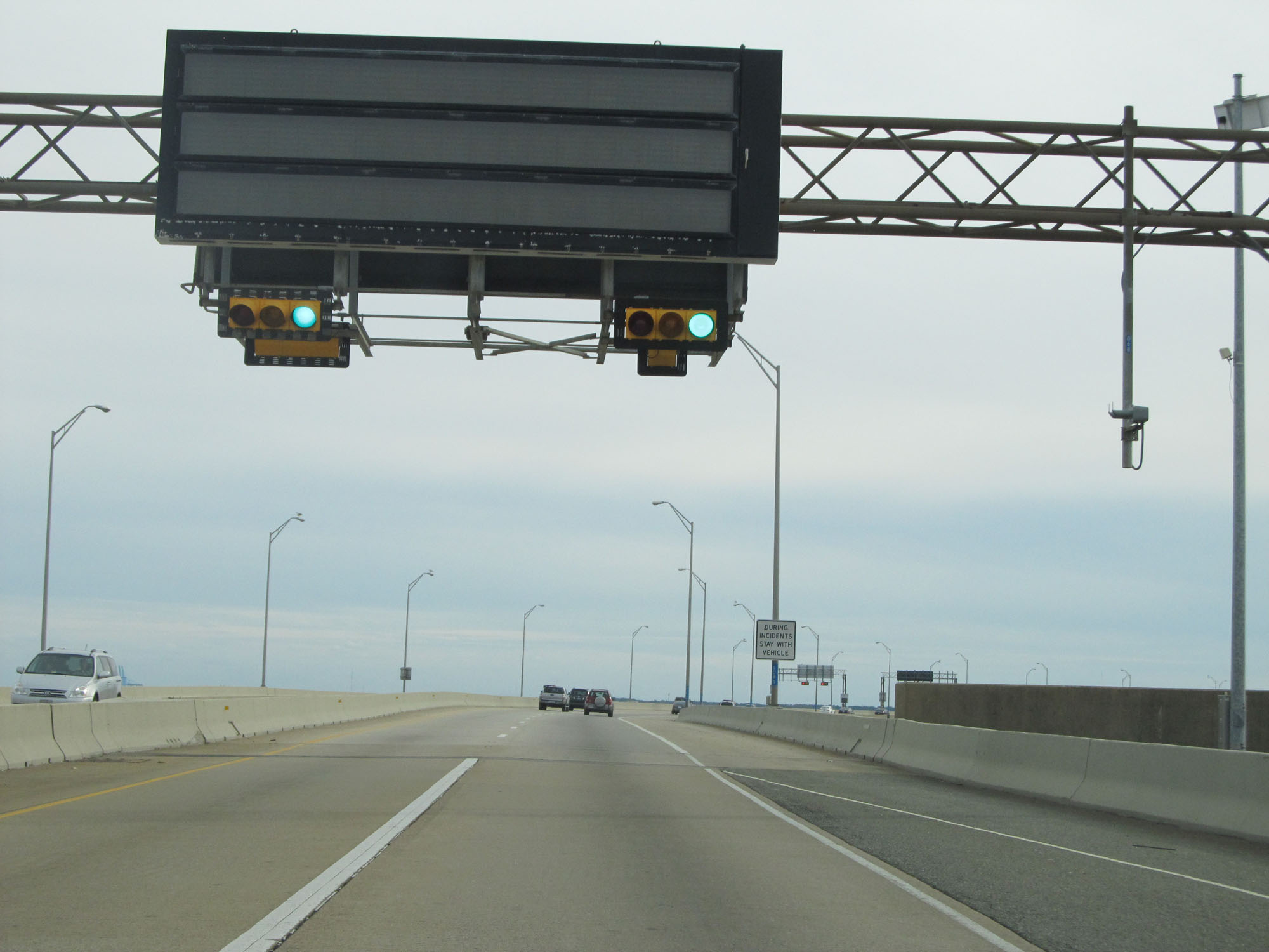 |
Traffic signals like the ones seen here are posted on the Monitor-Merrimac Memorial Bridge-Tunnel. (Photo taken 11/8/15). |
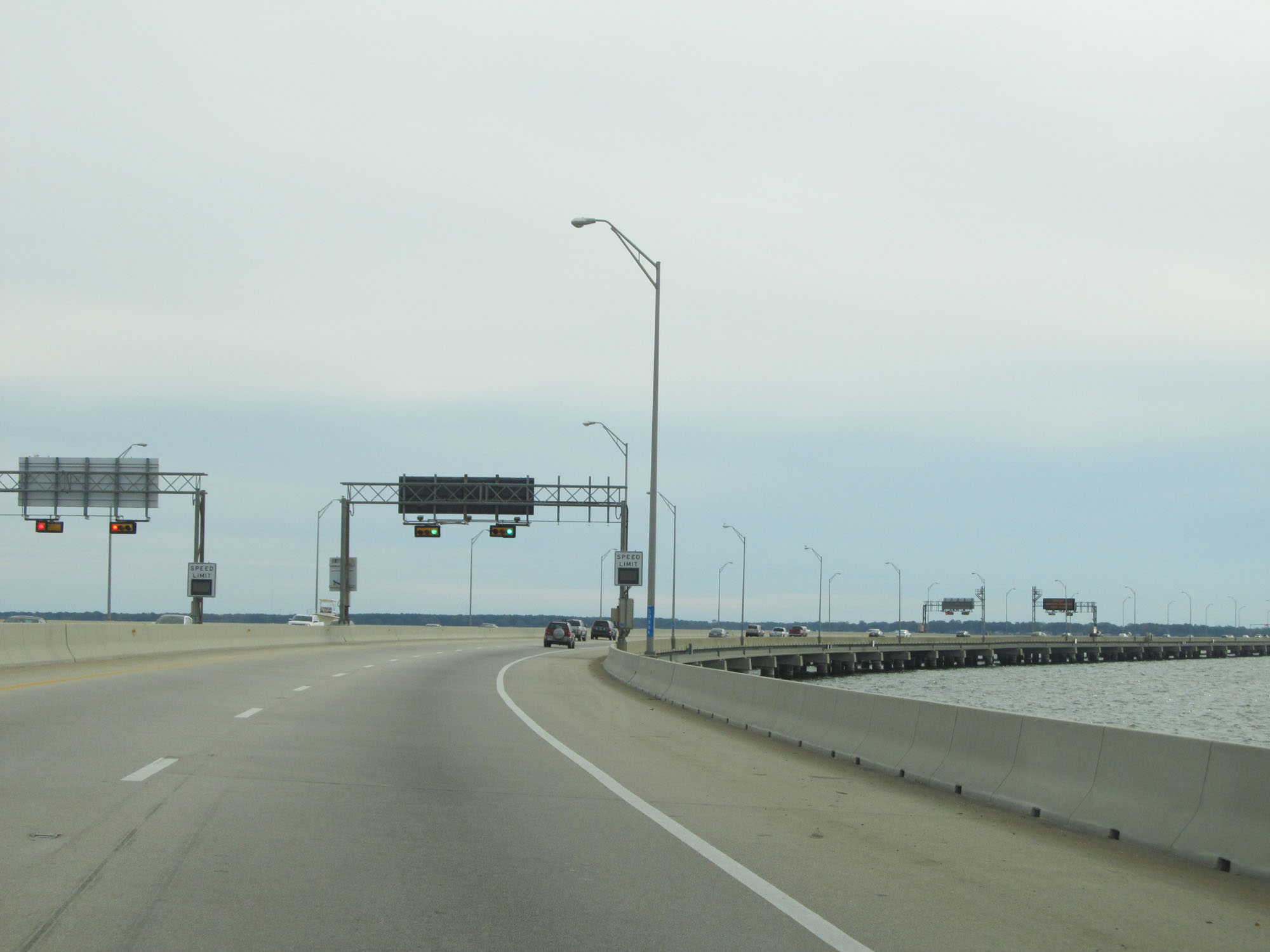 |
View on the Monitor-Merrimac Memorial Bridge-Tunnel. (Photo taken 11/8/15). |
 |
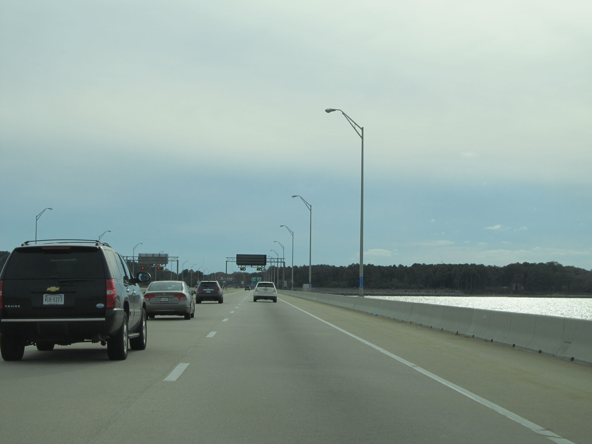
Another view on Interstate 664 South crossing the Monitor-Merrimac Memorial Bridge-Tunnel. (Photo taken 11/8/15). |
 |
Interstate 664 South entering the Suffolk city limits. (Photo taken 11/8/15). |
 |
Interstate 664 South at mile marker 9. (Photo taken 11/8/15). |
 |
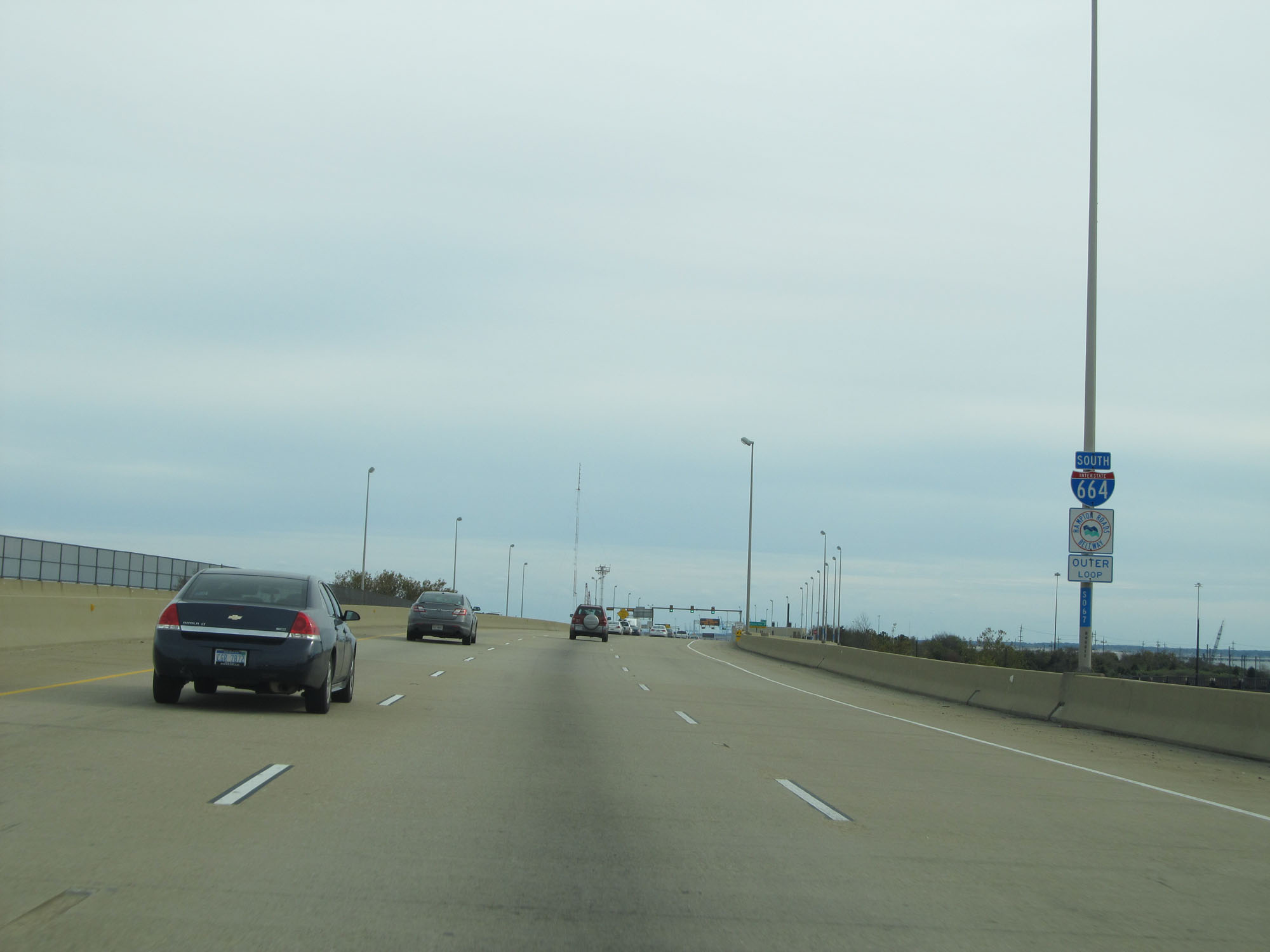
View on Interstate 664 South as it nears the southern end of the Monitor-Merrimac Memorial Bridge-Tunnel. (Photo taken 11/8/15). |
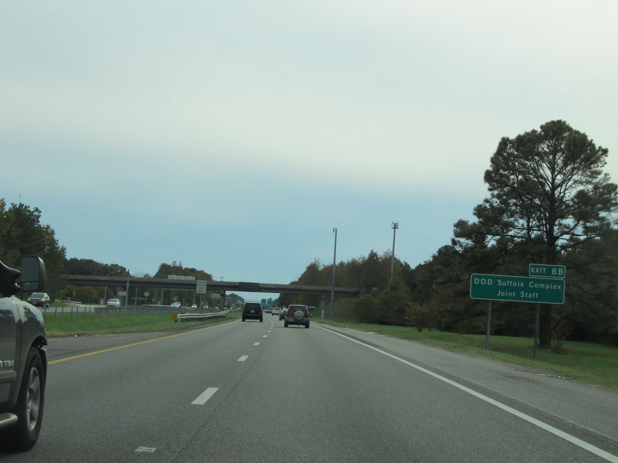 |
Take Exit 8B to DOD Suffolk Complex Joint Staff. (Photo taken 11/8/15). |
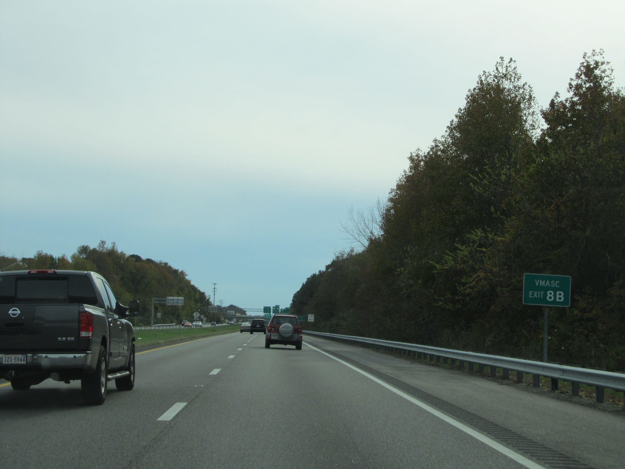 |
Take Exit 8B to VMASC as well. (Photo taken 11/8/15). |
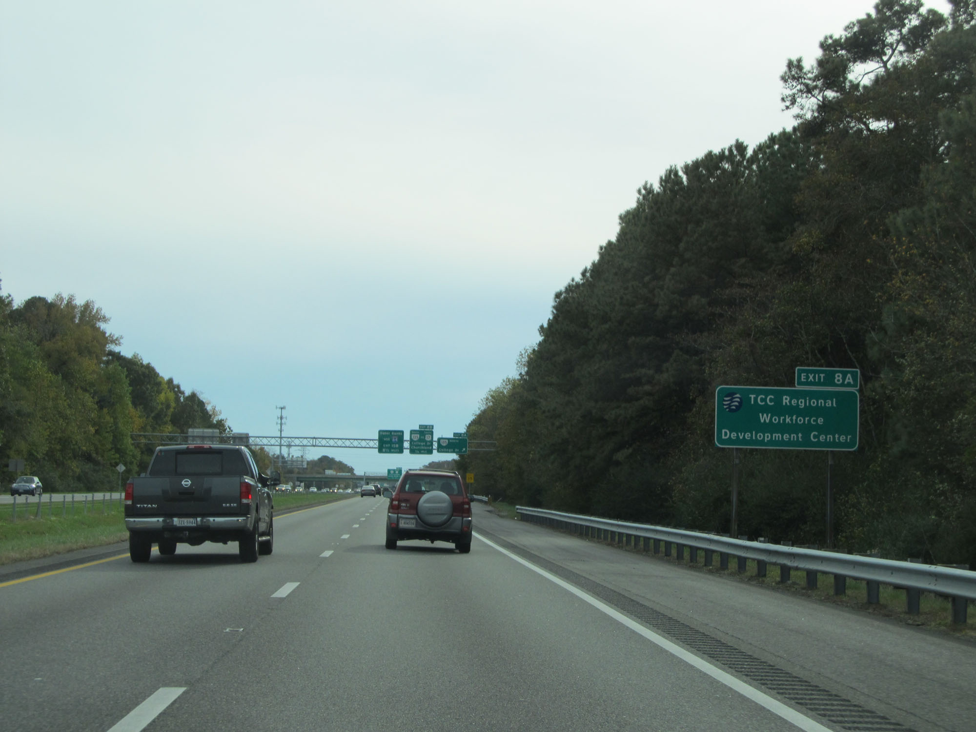 |
Take Exit 8A to TCC Regional Workforce Development Center. (Photo taken 11/8/15). |
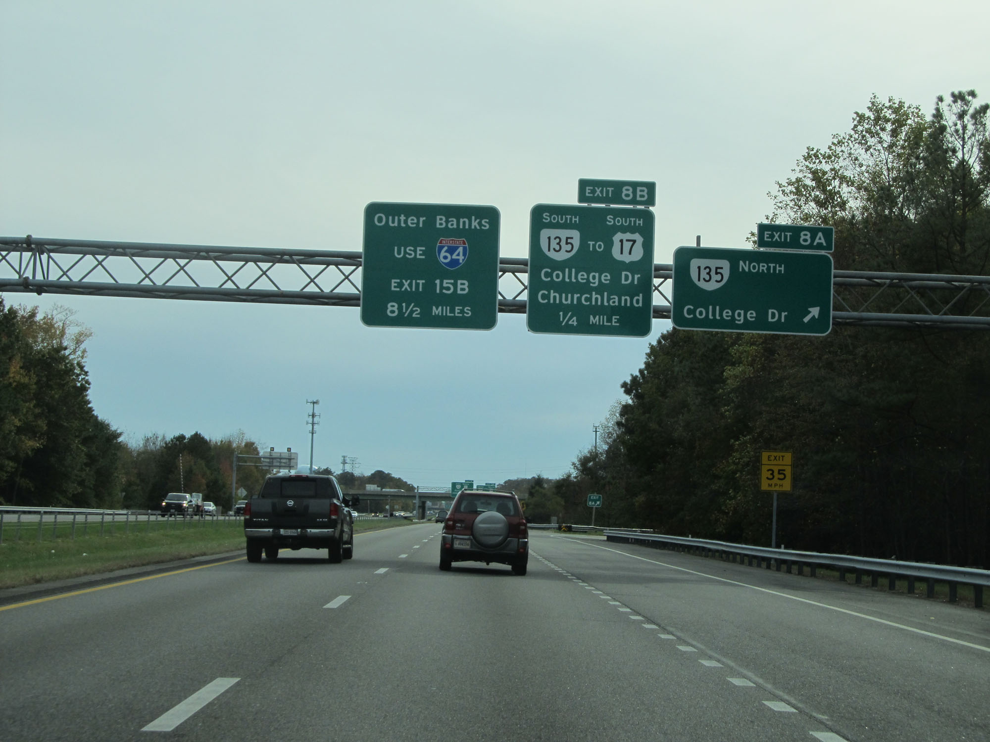 |
Interstate 664 South at Exit 8A: VA 135 North - College Dr (Photo taken 11/8/15). |
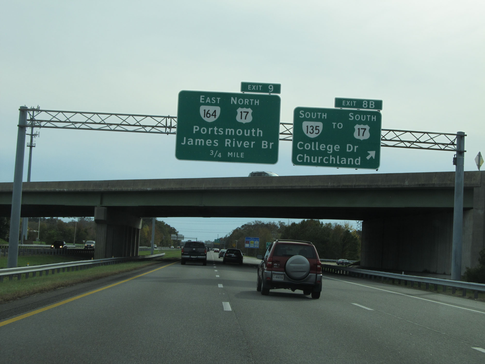 |
Interstate 664 South at Exit 8B: VA 135 South / To US 17 South - College Dr / Churchland (Photo taken 11/8/15). |
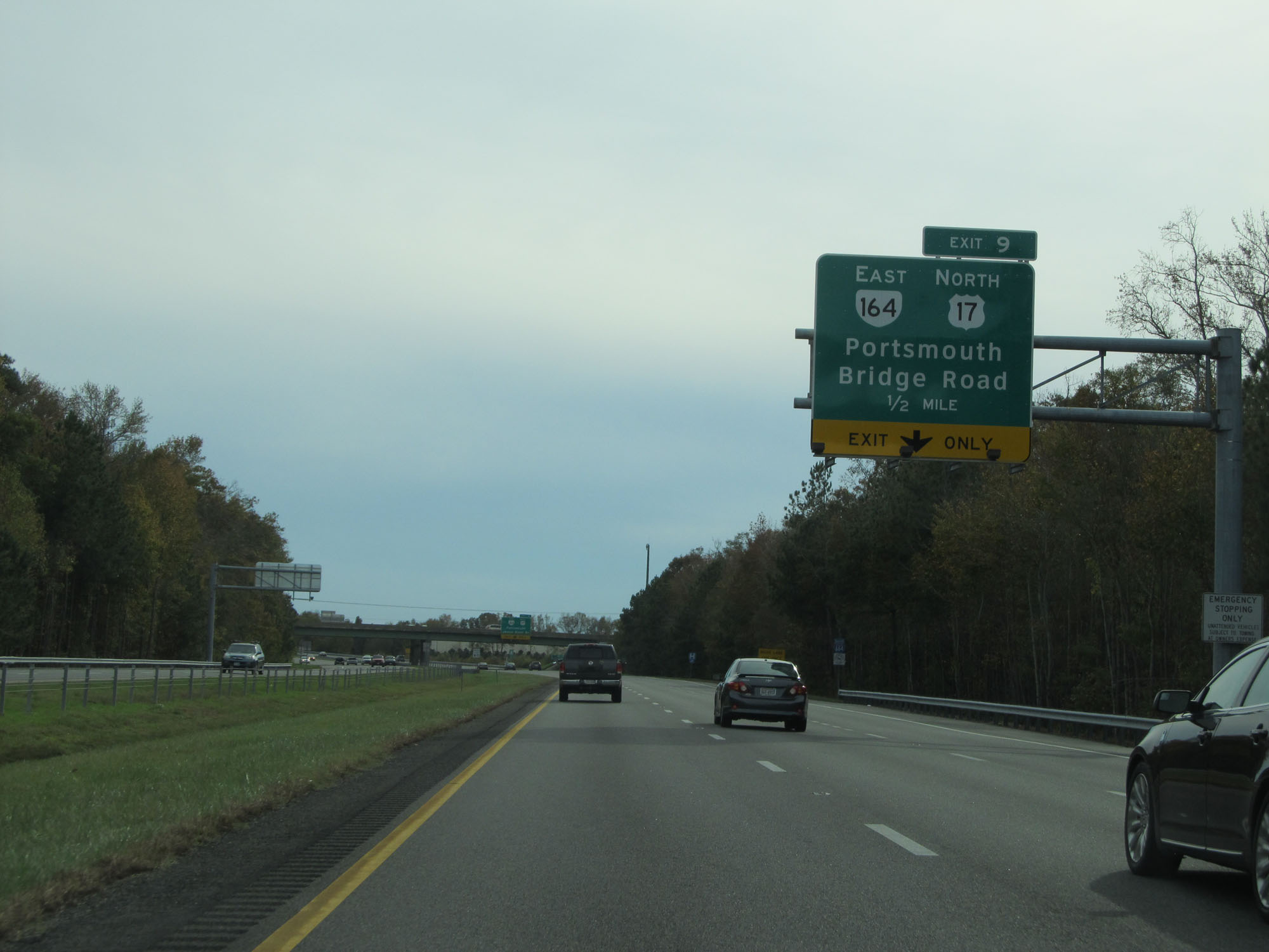 |
Interstate 664 South approaching Exit 9 - 1/2 mile. (Photo taken 11/8/15). |
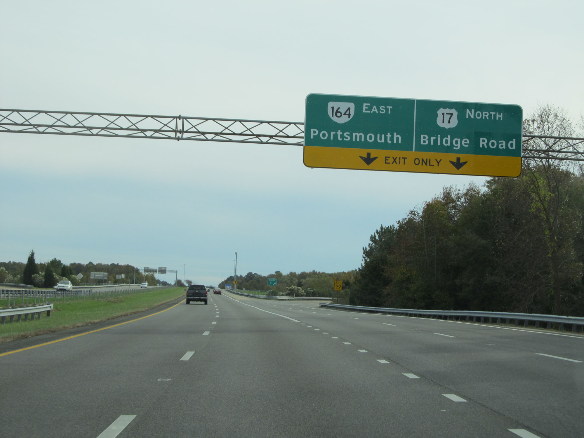 |
Interstate 664 South at Exit 9: VA 164 East / US 17 North - Portsmouth / Bridge Road (Photo taken 11/8/15). |
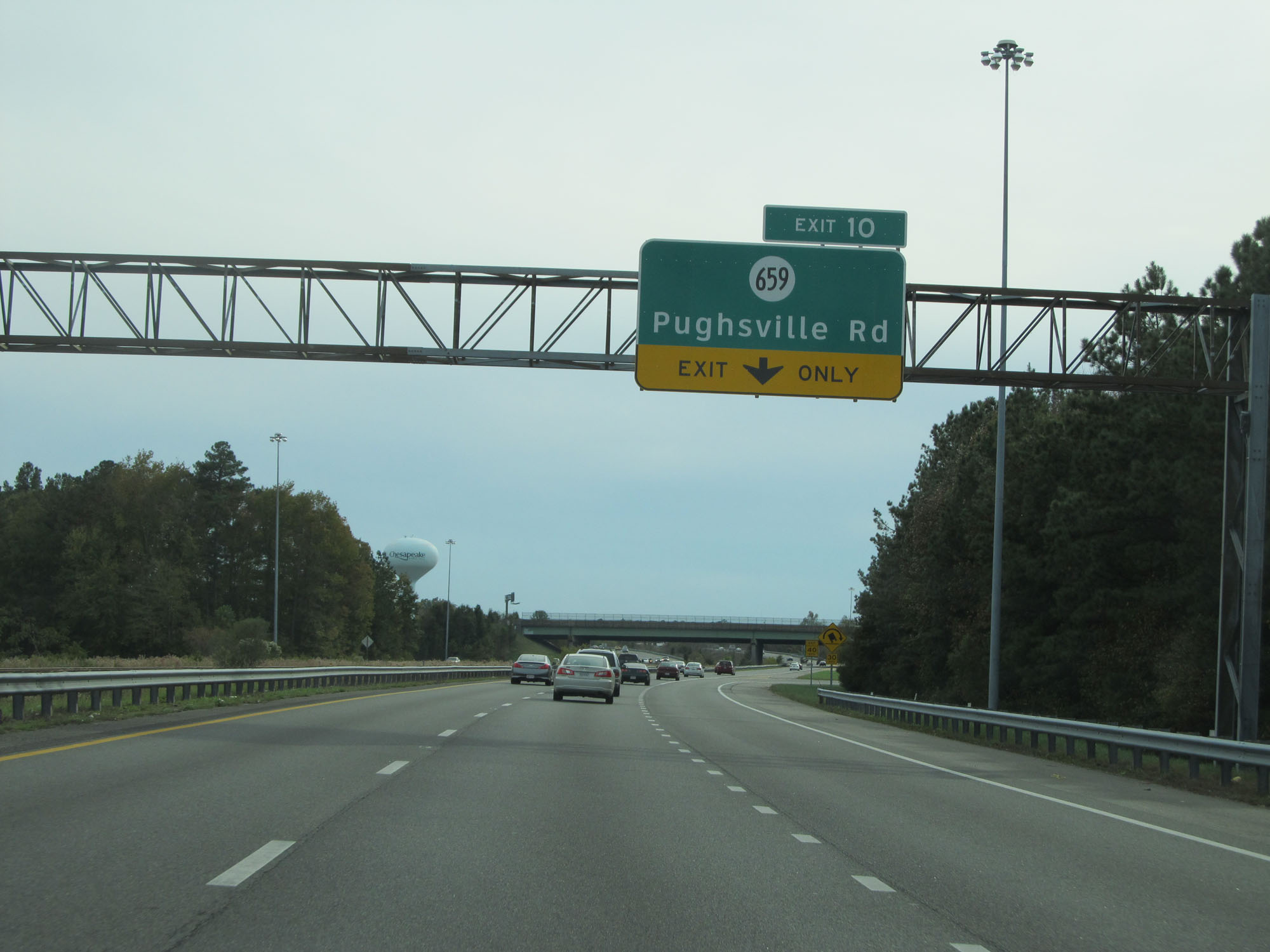 |
Interstate 664 South at Exit 10: SR 659 - Pughsville Rd (Photo taken 11/8/15). |
 |
Interstate 664 South at mile marker 15. (Photo taken 11/8/15). |
 |
Interstate 664 South reassurance shield. (Photo taken 11/8/15). |
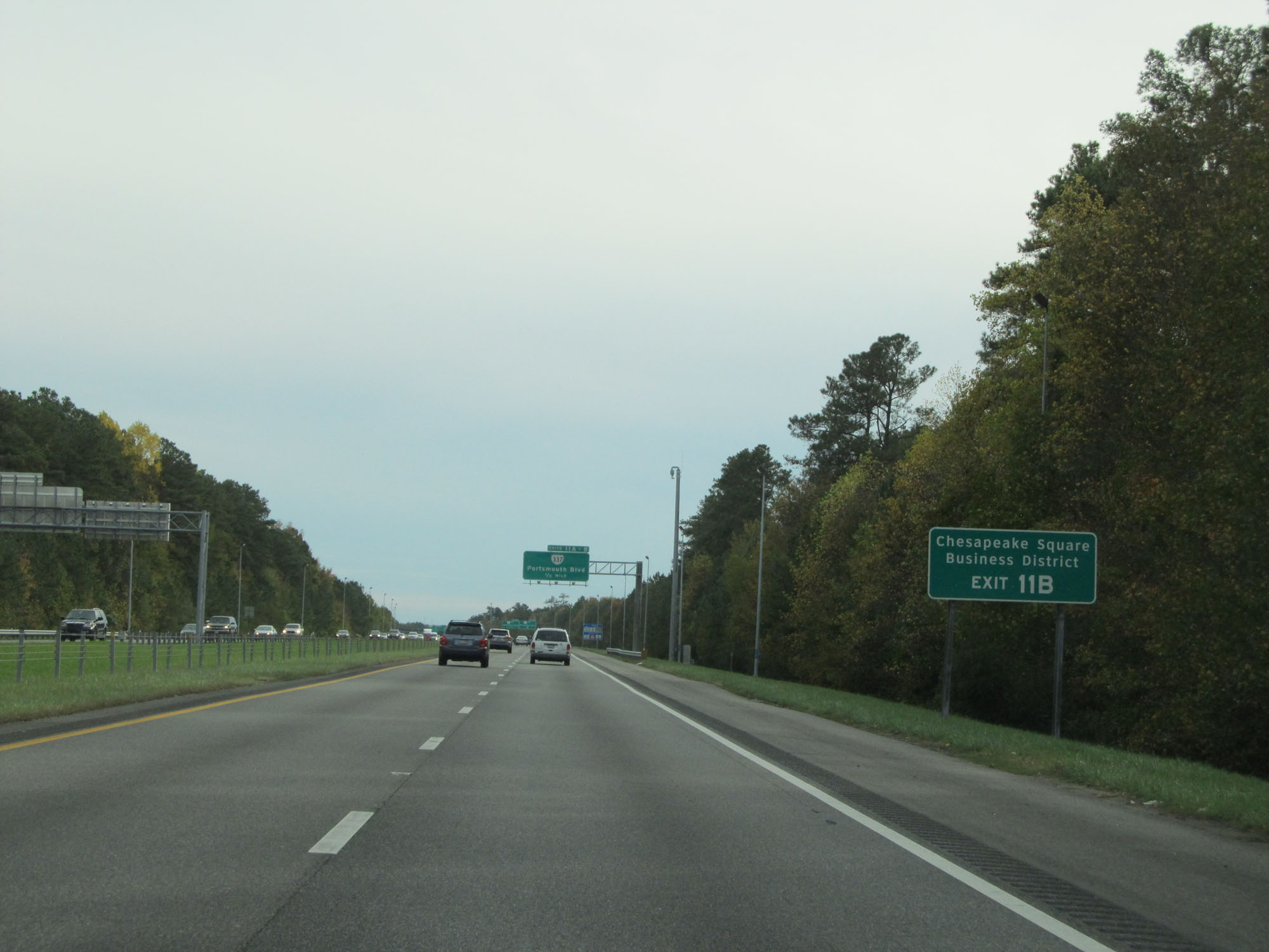 |
Take Exit 11B to Chesapeake Square Business District. (Photo taken 11/8/15). |
 |
Interstate 664 South at Exit 11A: VA 337 West - Portsmouth Blvd (Photo taken 11/8/15). |
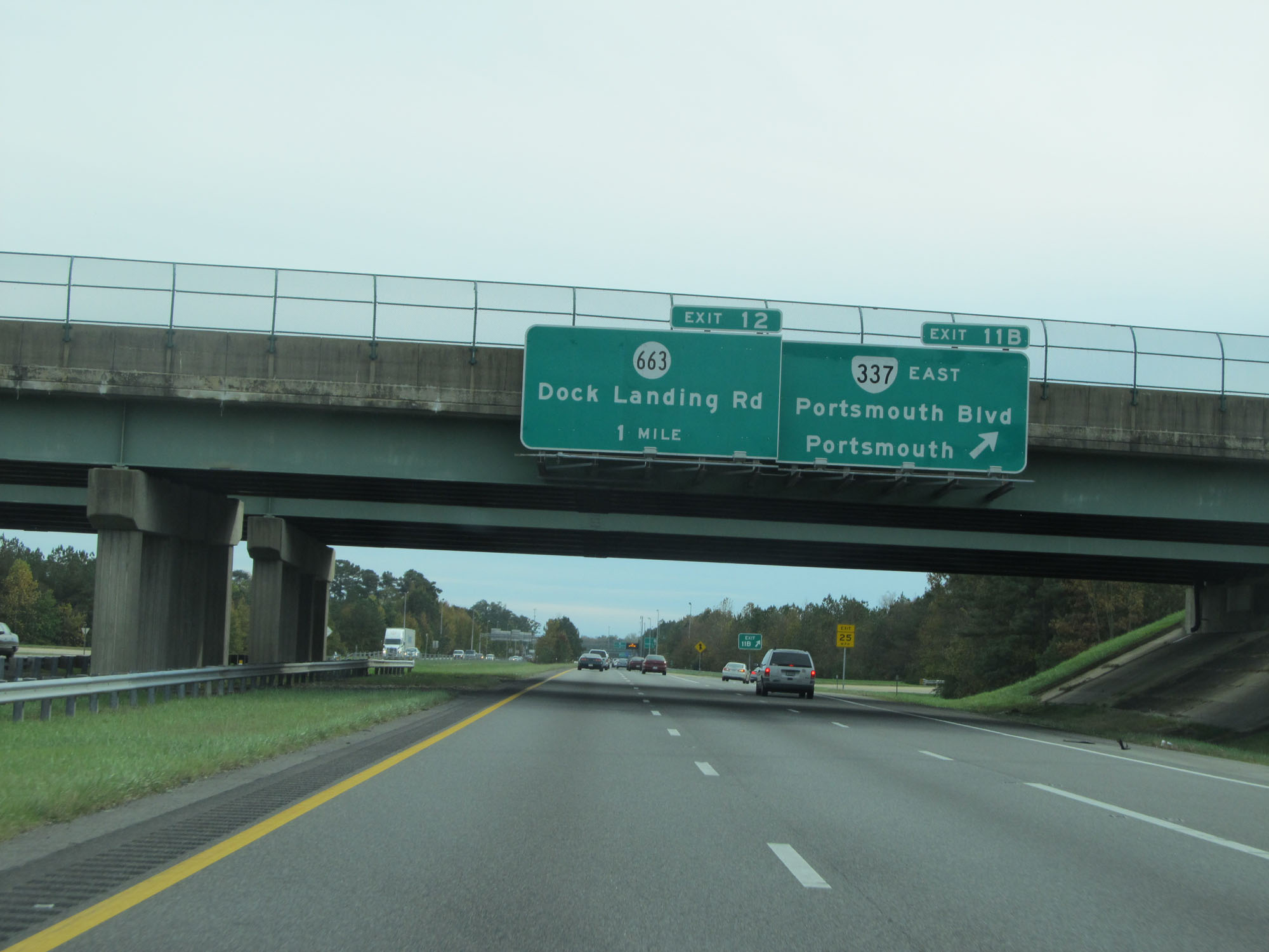 |
Interstate 664 South at Exit 11B: VA 337 East - Portsmouth Blvd / Portsmouth (Photo taken 11/8/15). |
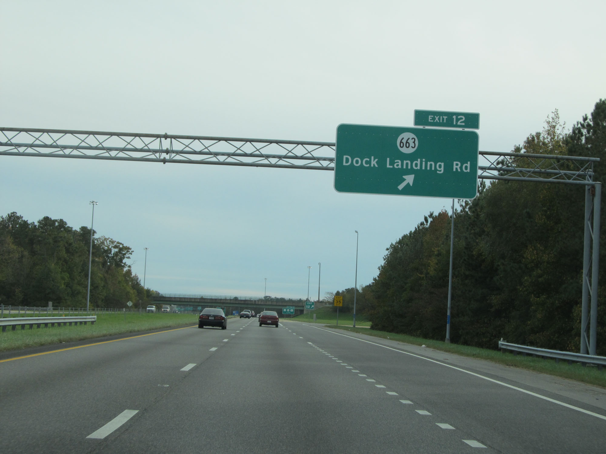 |
Interstate 664 South at Exit 12: SR 663 - Dock Landing Rd (Photo taken 11/8/15). |
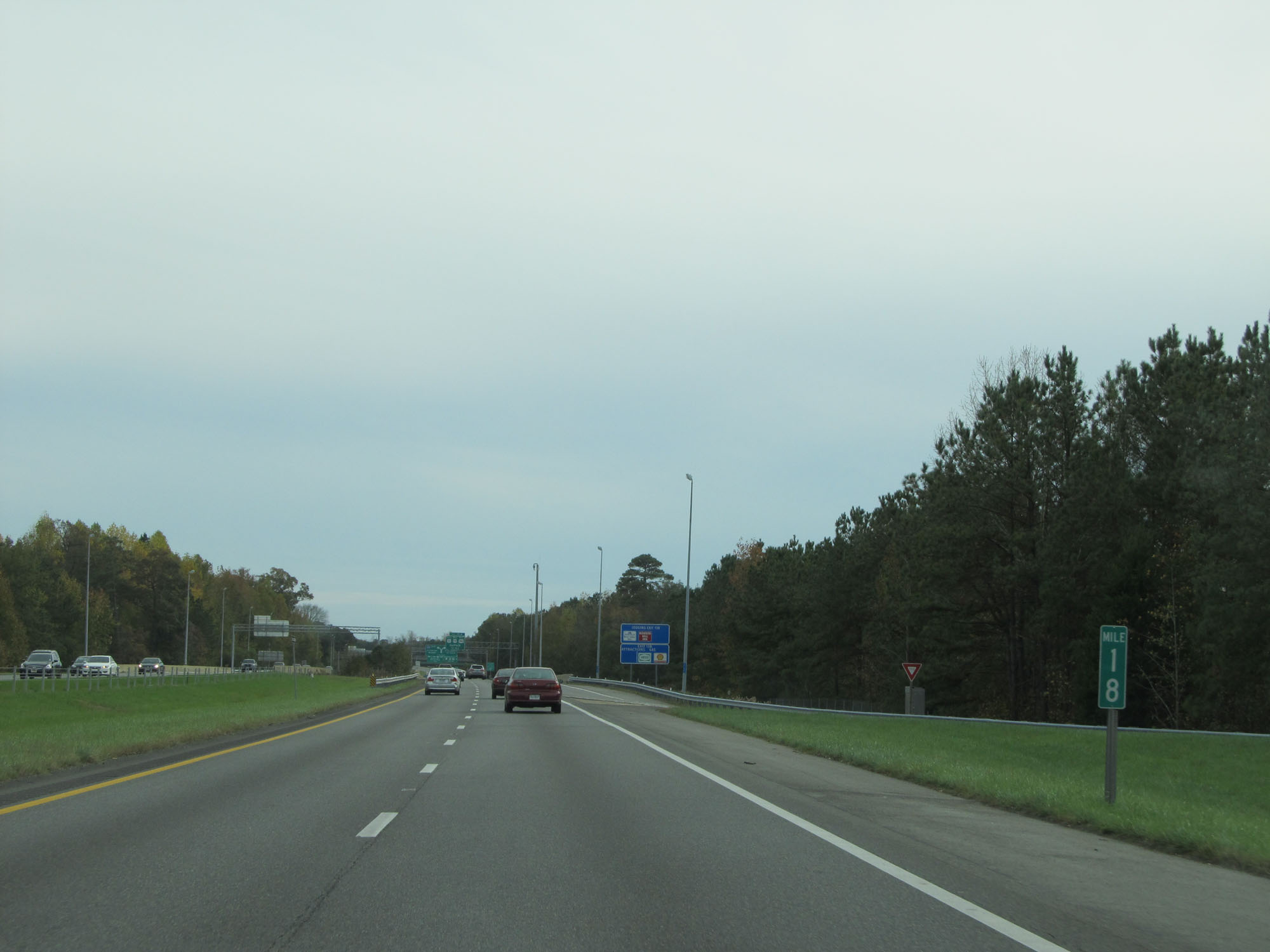 |
Interstate 664 South at mile marker 18. (Photo taken 11/8/15). |
 |
Interstate 664 South at Exit 13A: US 13 South / US 58 West / US 460 West - Suffolk (Photo taken 11/8/15). |
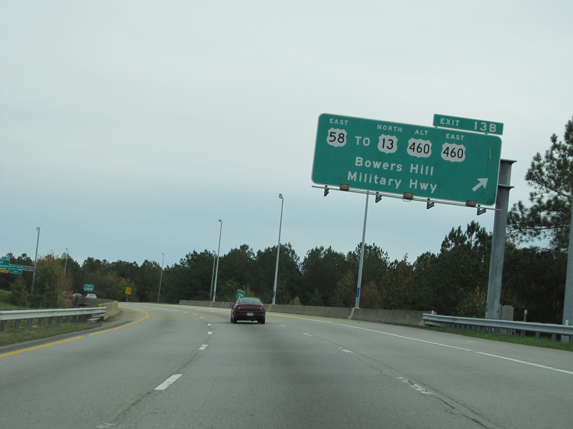 |
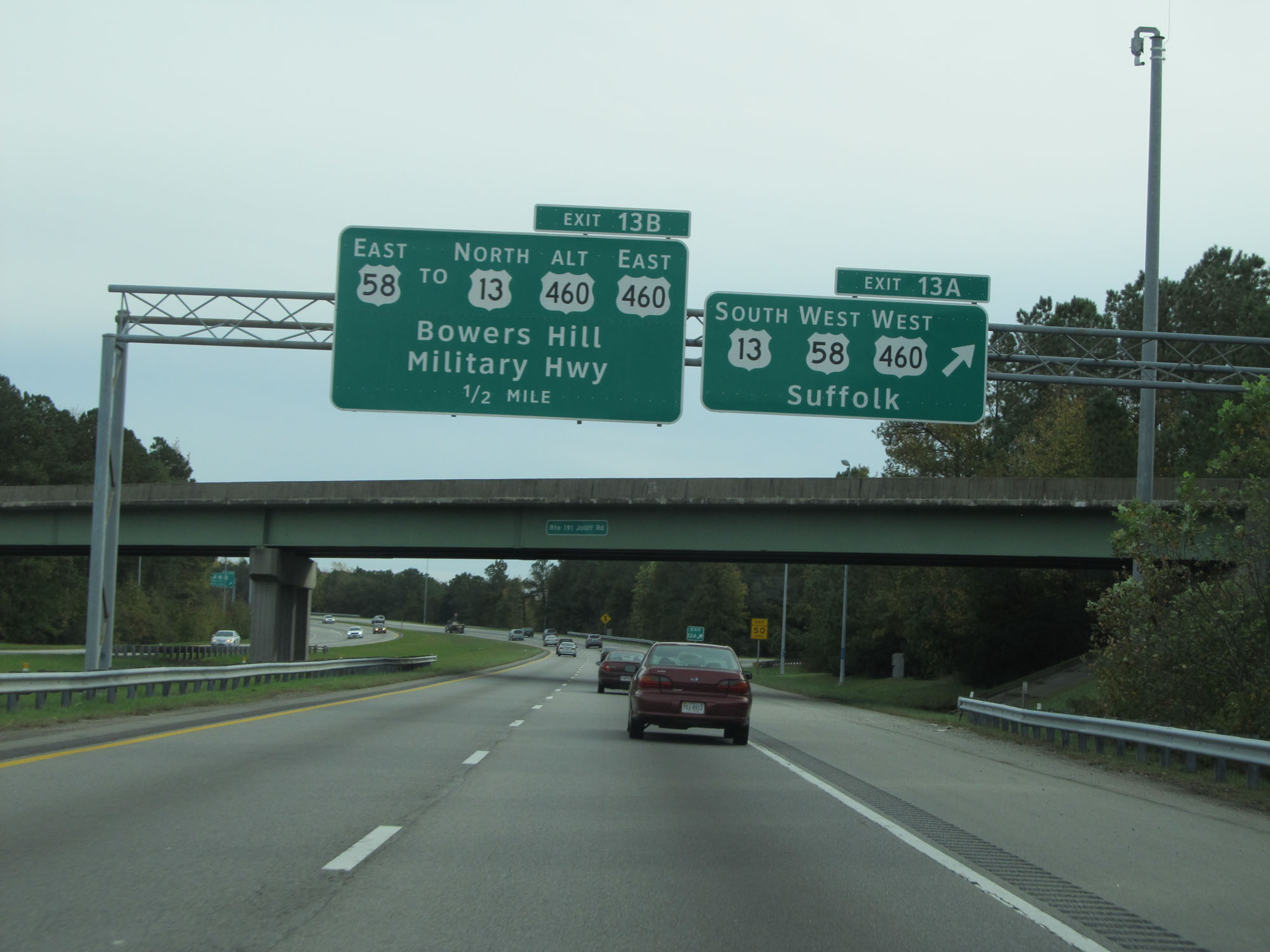
Interstate 664 South at Exit 13B: US 58 East / To US 13 North / To US 460 Alt / To US 460 East - Bowers Hill / Military Hwy (Photo taken 11/8/15). |
 |
Interstate 664 South approaching Exits 15A-B - 1 mile. (Photo taken 11/8/15). |
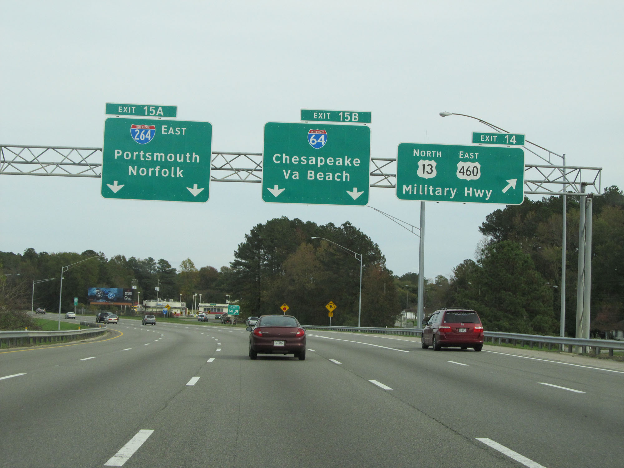 |
Interstate 664 South at Exit 14: US 13 North / US 460 East - Military Hwy (Photo taken 11/8/15). |
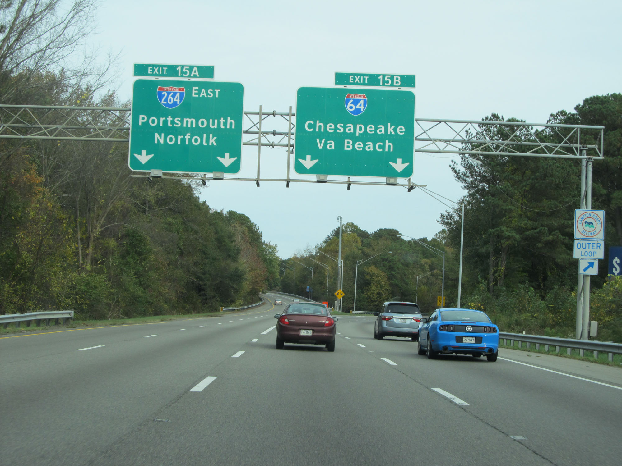 |
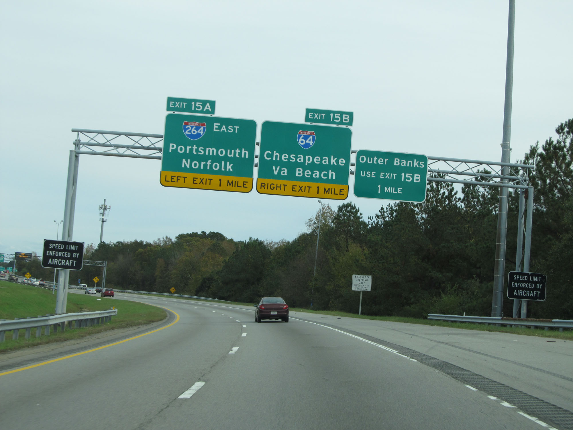
Interstate 664 South at Exit 15A: Interstate 264 East - Portsmouth / Norfolk; Exit 15B: Interstate 64 - Chesapeake / Virginia Beach (Photo taken 11/8/15). |
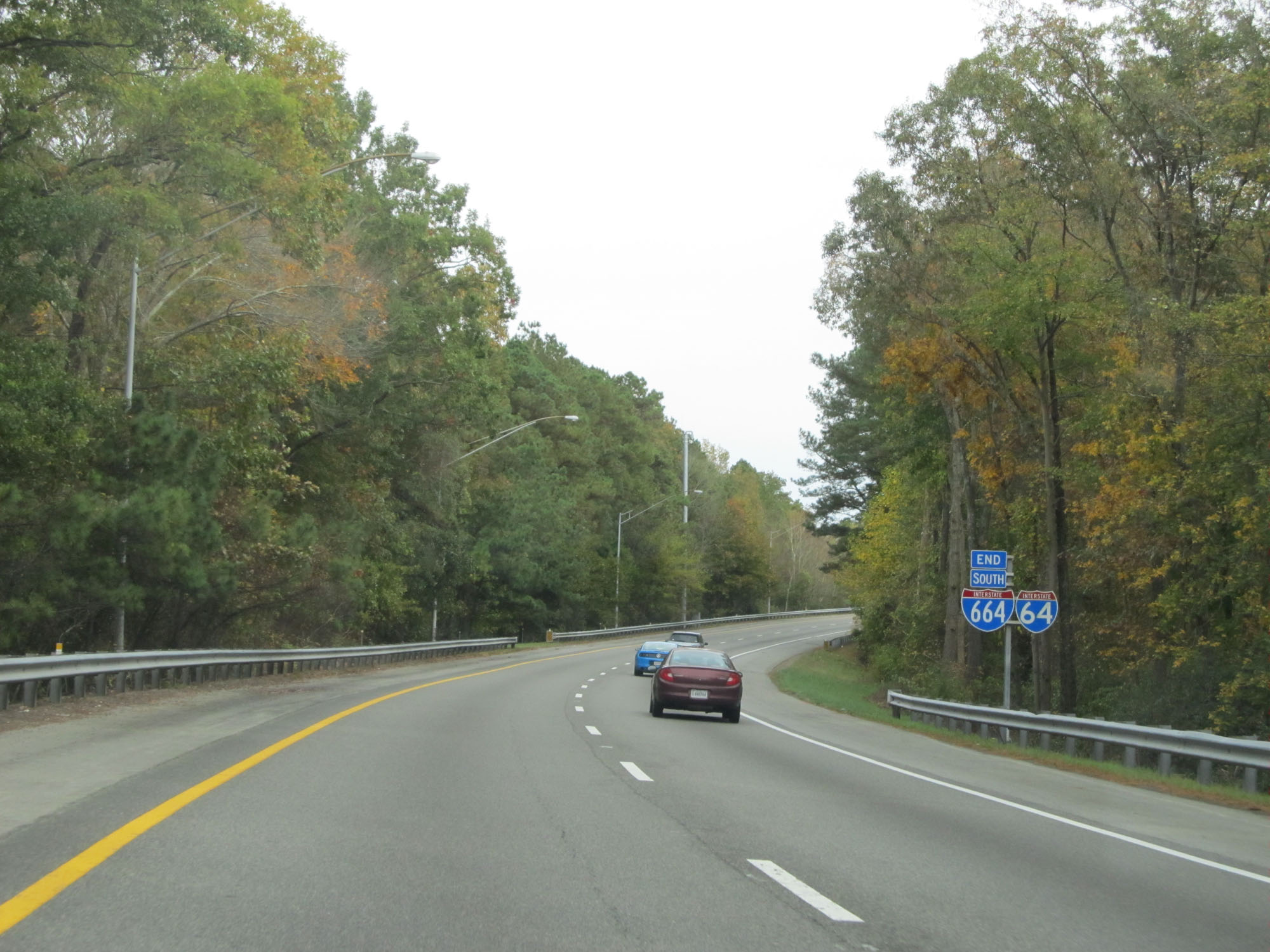 |
Interstate 664 South END shield on the ramp for Exit 15B to Interstate 64. (Photo taken 11/8/15). |