Road Information |
||
 |
||
| Total Mileage in State: | 244 miles | |
| Eastern End: | At Pennsylvania state line | |
| Western End: | At Indiana state line | |
| Mileage covered in Photos: | 244 miles | |
| Counties covered in Photos: | Ashtabula, Lake, Cuyahoga, Lorain, Erie, Sandusky, Ottawa, Wood, Lucas, Fulton, Williams | |
| Major Junctions in Photos: | I-271, in Willoughby Hills I-77, in Cleveland I-71, in Cleveland I-80 (OH Turnpike), in Elyria I-280, in Perrysburg I-75, in Rossford |
|
| Control Cities in Photos: | Ashtabula, Cleveland, Elyria, Fremont, Perrysburg, Maumee, Montpelier | |
Westbound
- Section 1: Pennsylvania Border to Cleveland (Exit 176)
- Section 2: Cleveland (Exit 176) to Elyria (Exit 140)
- Section 3: Elyria (Exit 140) to Maumee (Exit 59)
- Section 4: Maumee (Exit 59) to Indiana Border
Section 1: Pennsylvania Border to Cleveland (Exit 176)
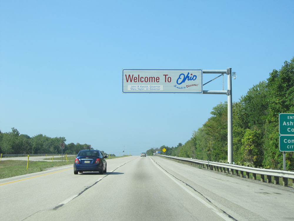 |
Ohio welcome sign as Interstate 90 West enters the Buckeye State from Pennsylvania. (Photo taken 9/6/15). |
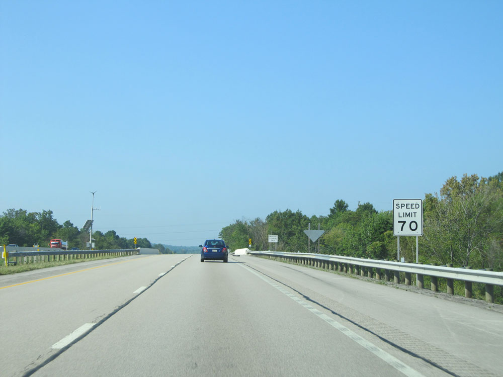 |
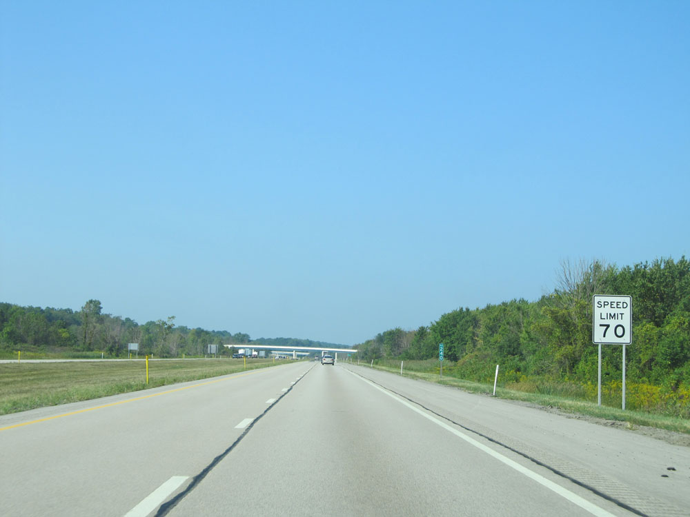
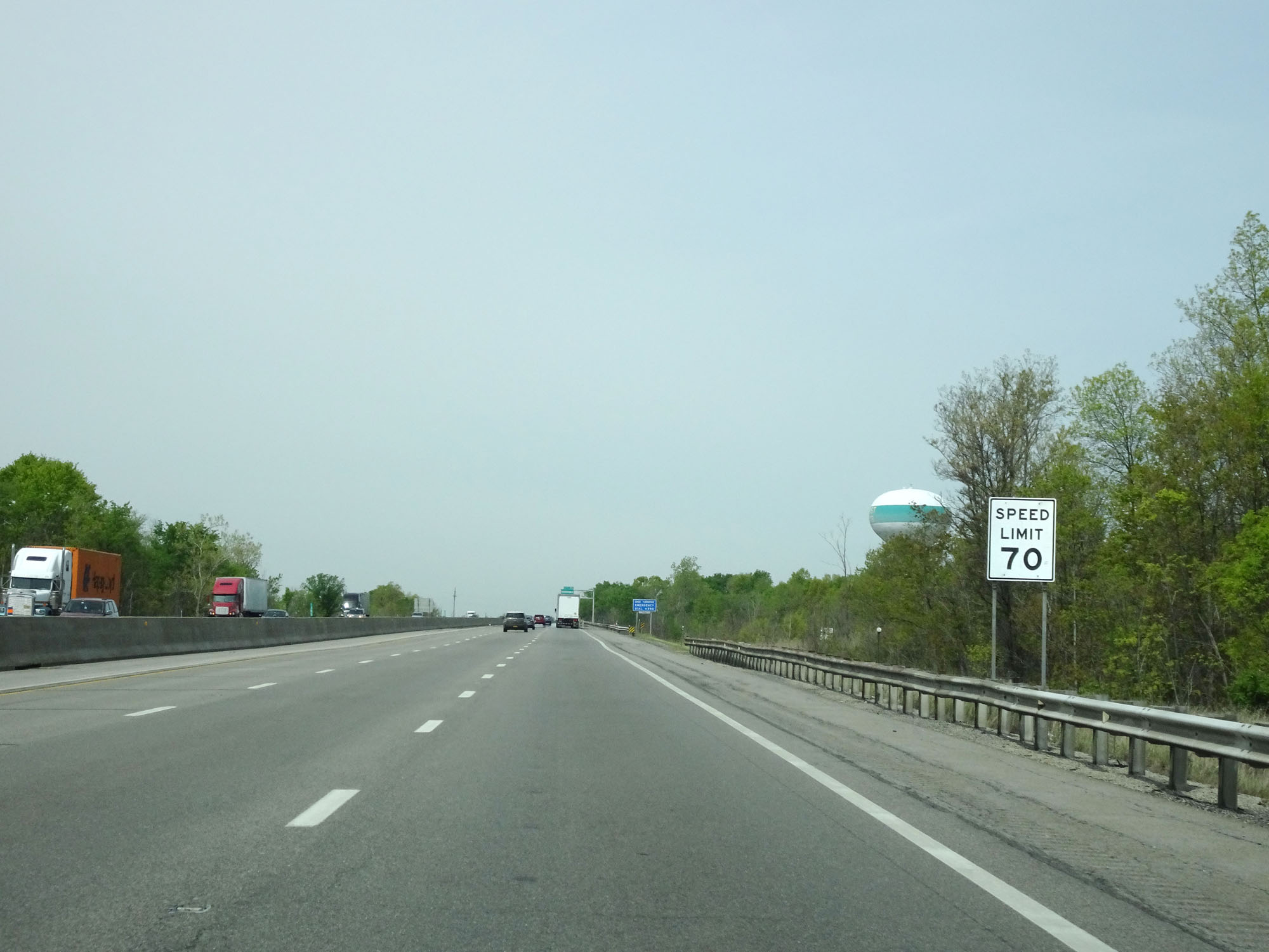
Speed limit sign upon entering Ohio. The speed limit on most rural Interstates in Ohio is 70 mph, as seen here. (Photo taken 9/6/15). |
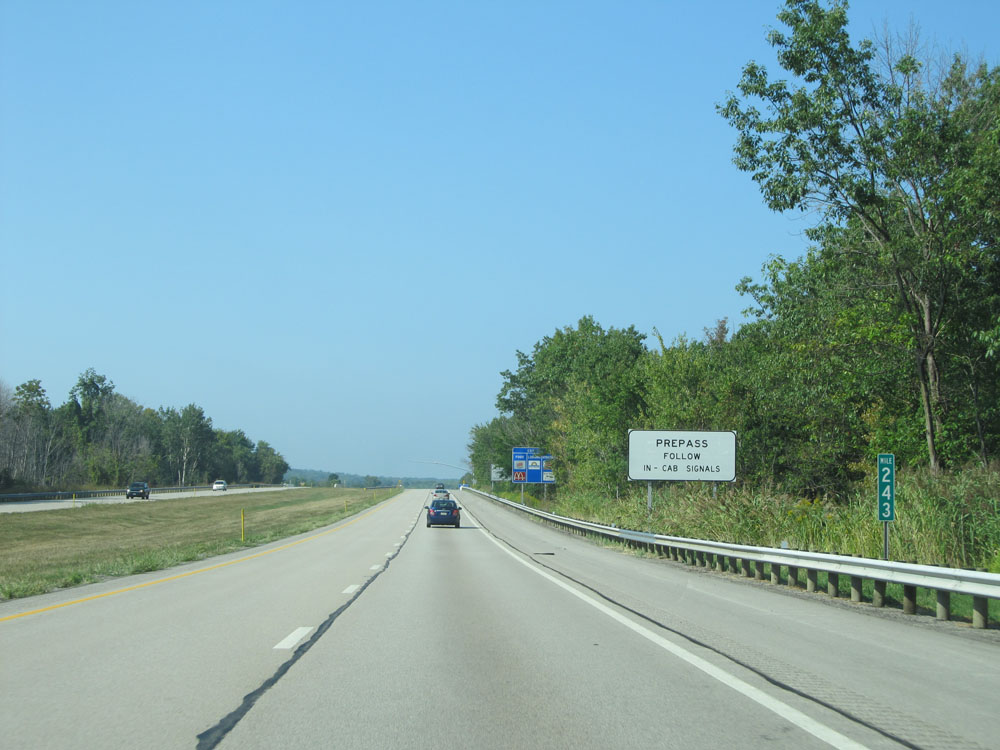 |
Interstate 90 West at mile marker 243. (Photo taken 9/6/15). |
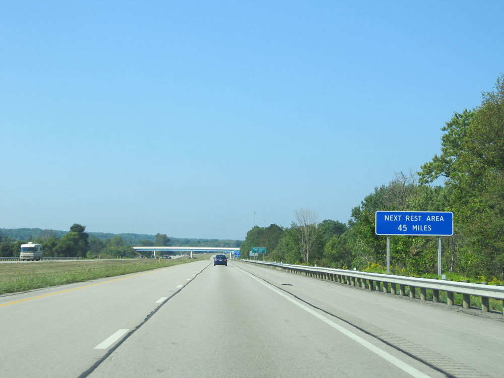 |
The next Rest Area after the upcoming one is 45 miles ahead. (Photo taken 9/6/15). |
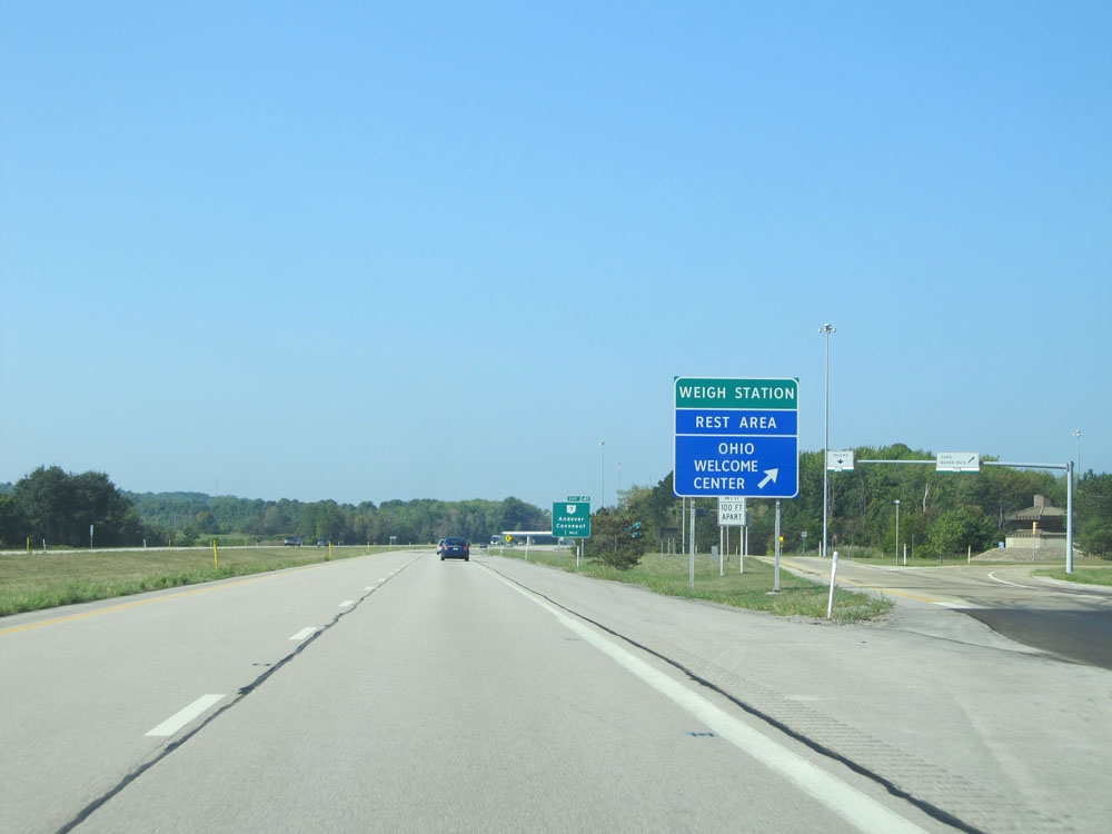 |
Interstate 90 West at the Weigh Station / Rest Area / Ohio Welcome Center located at mile marker 242. (Photo taken 9/6/15). |
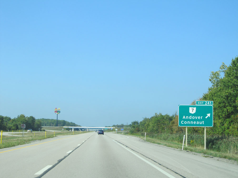 |
Interstate 90 West at Exit 241: OH 7 - Andover / Conneaut (Photo taken 9/6/15). |
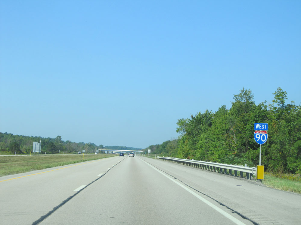 |
Interstate 90 West assurance shield. (Photo taken 9/6/15). |
 |
Speed limit assurance sign west of Exit 241. Speed Limit - 70 mph. (Photo taken 9/6/15). |
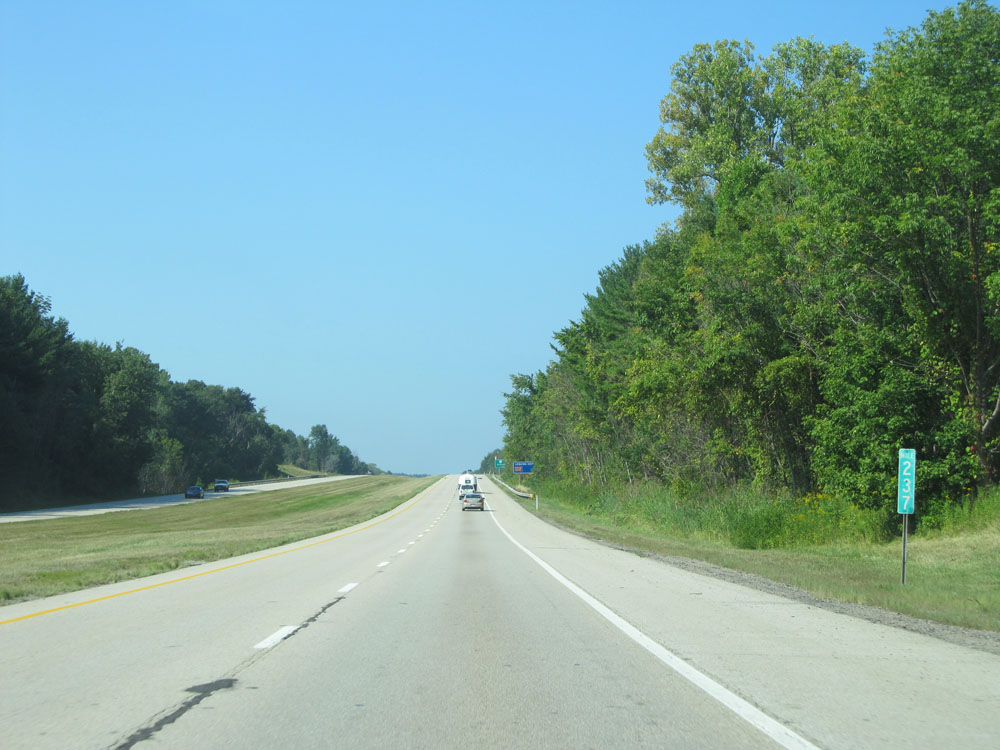 |
Interstate 90 West at mile marker 237. (Photo taken 9/6/15). |
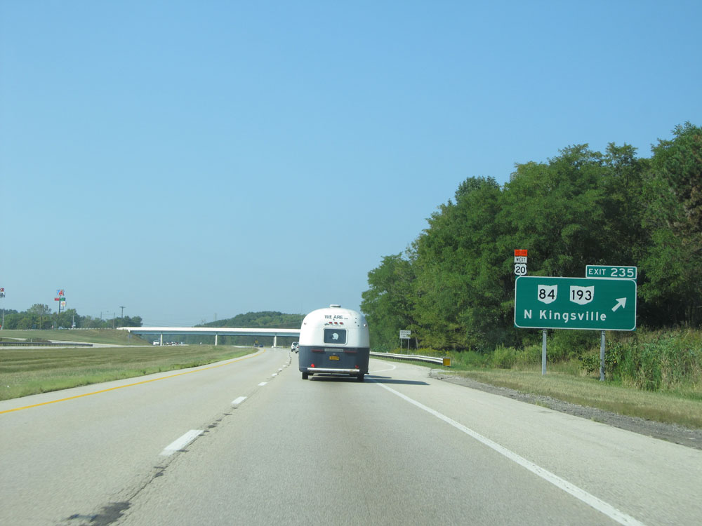 |
Interstate 90 West at Exit 235: OH 84 / OH 193 - North Kingsville (Photo taken 9/6/15). |
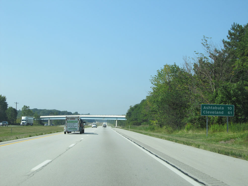 |
Mileage/distance sign west of Exit 235. It's 10 miles to Ashtabula and 61 miles to Cleveland. (Photo taken 9/6/15). |
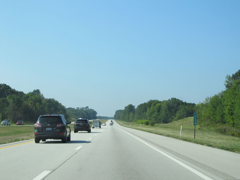 |
Interstate 90 West at mile marker 234. (Photo taken 9/6/15). |
 |
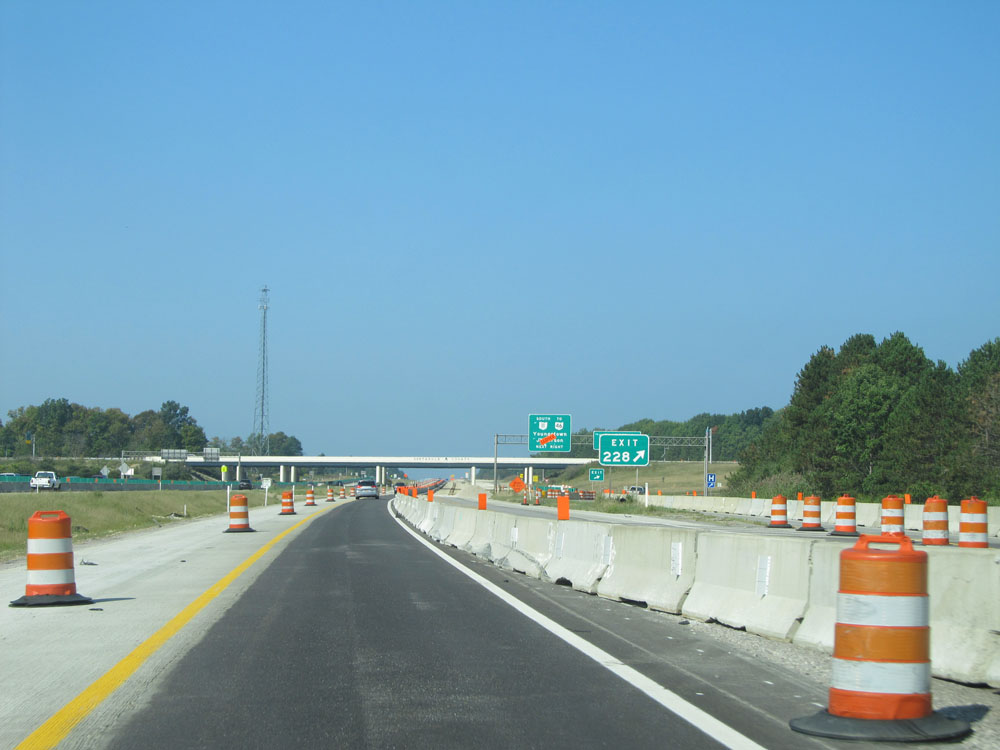
Interstate 90 West approaching Exit 228 - 1 mile. (Photo taken 9/6/15). |
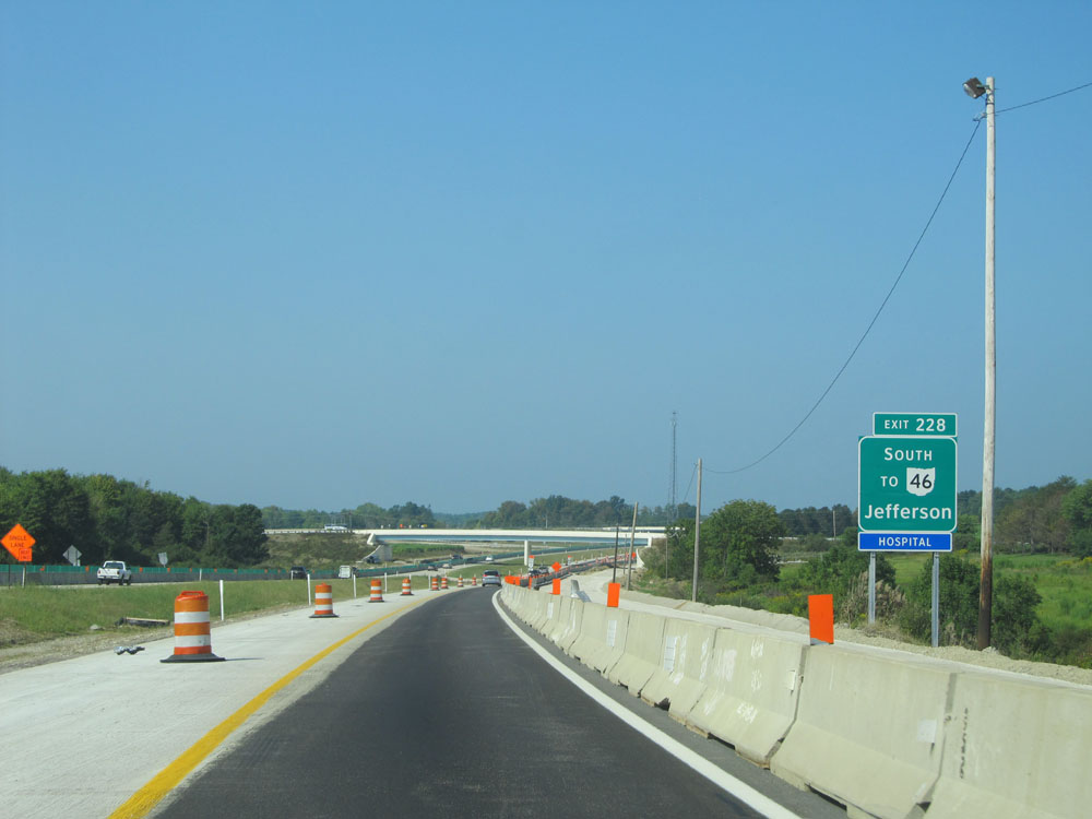 |
Take Exit 228 to OH 46 South toward Jefferson. (Photo taken 9/6/15). |
 |
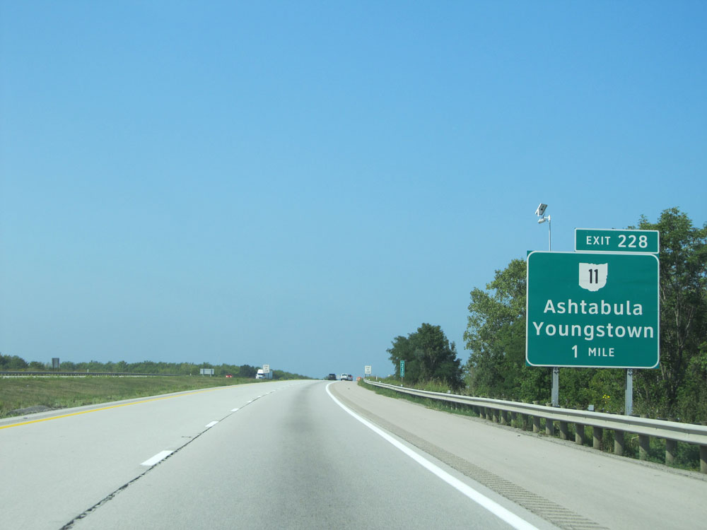
Interstate 90 West at Exit 228: OH 11 - Ashtabula / Youngstown (Photo taken 9/6/15). |
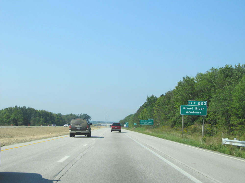 |
Take Exit 223 to Grand River Academy. (Photo taken 9/6/15). |
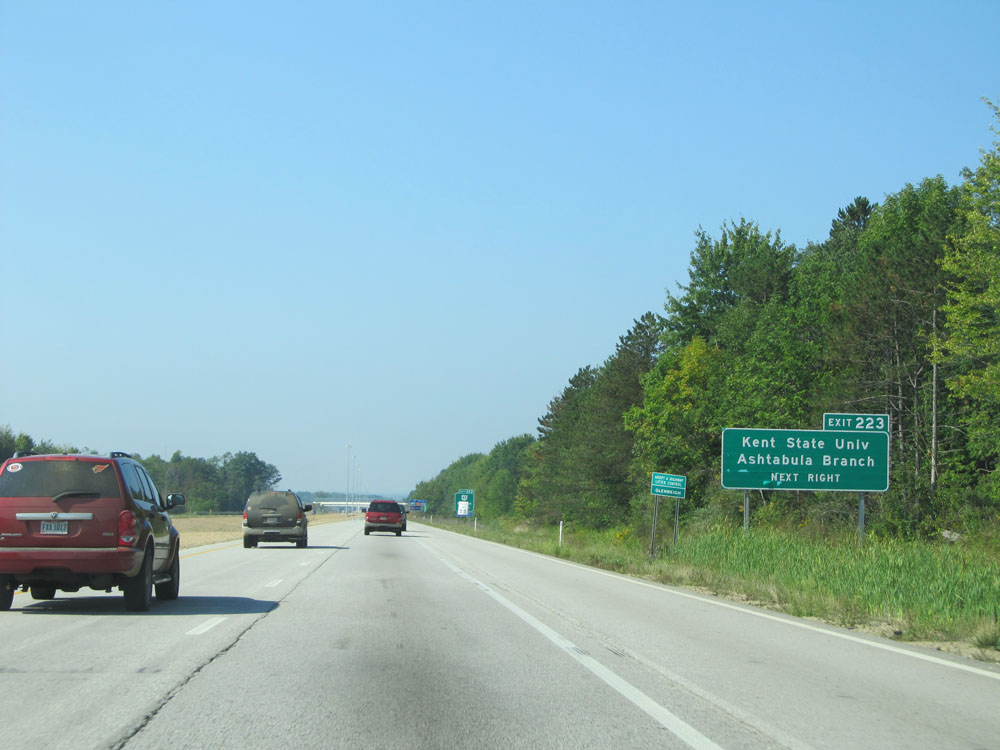 |
Also take Exit 223 to Kent State University's Ashtabula Branch. (Photo taken 9/6/15). |
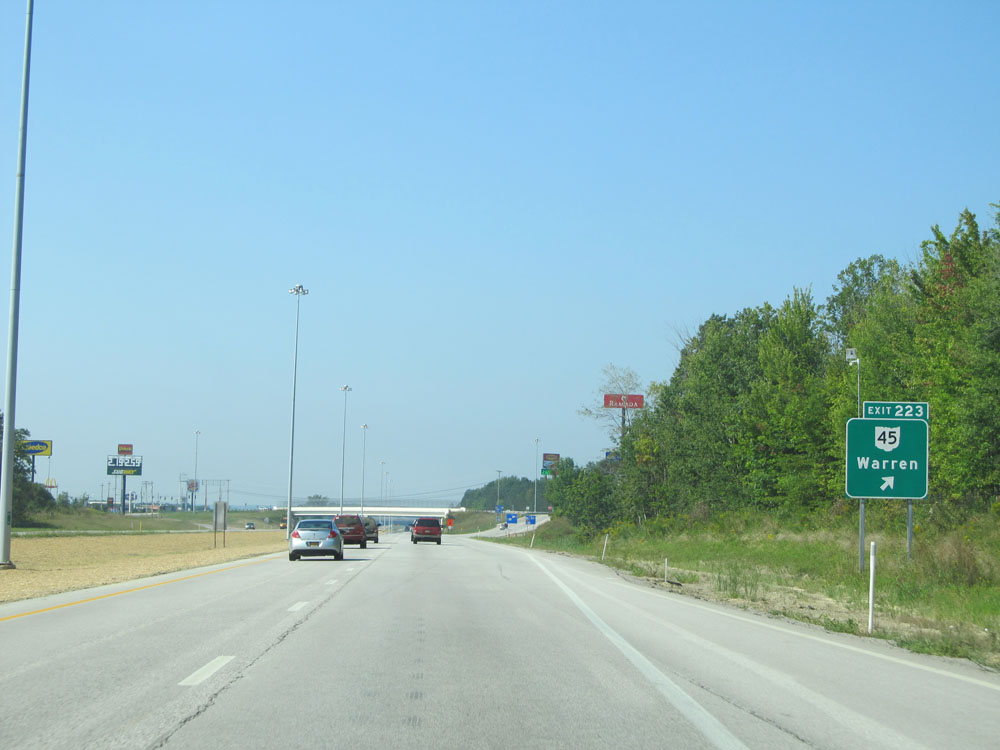 |
Interstate 90 West at Exit 223: OH 45 - Warren (Photo taken 9/6/15). |
 |
Interstate 90 West assurance shield just beyond Exit 223. (Photo taken 9/6/15). |
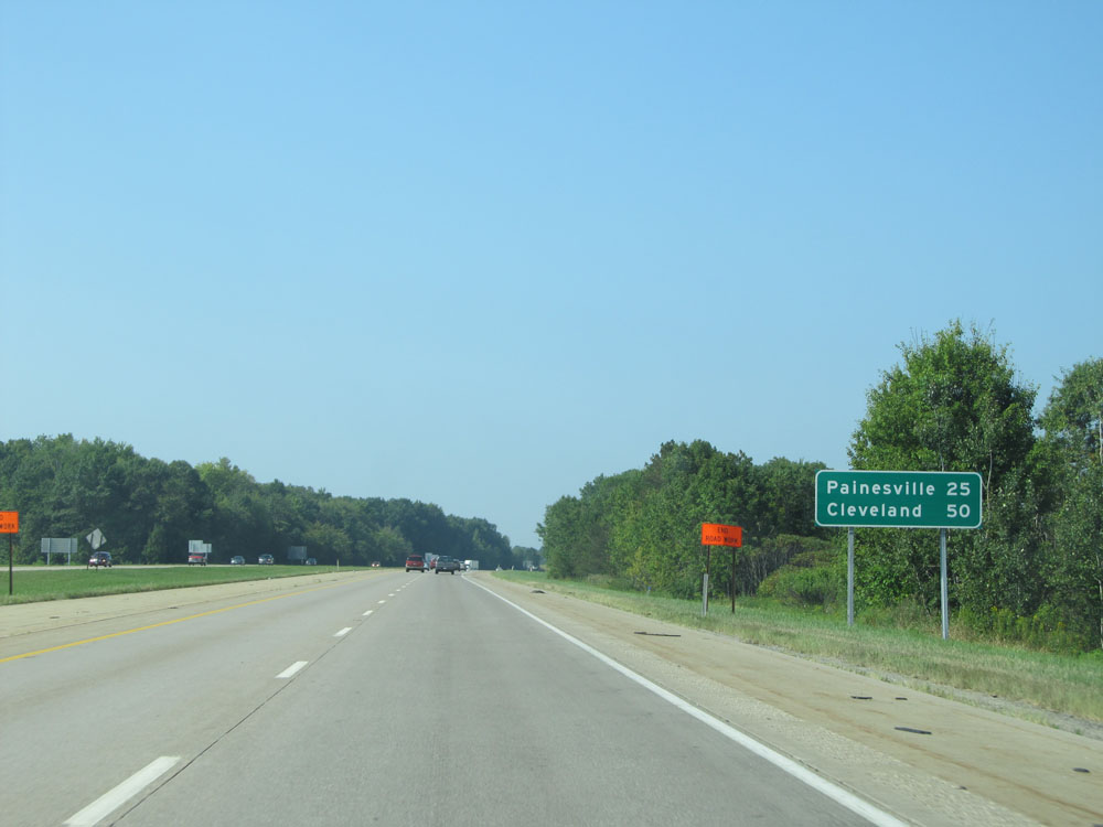 |
Mileage sign on Interstate 90 West. It's 25 miles to Painesville and 50 miles to Cleveland. (Photo taken 9/6/15). |
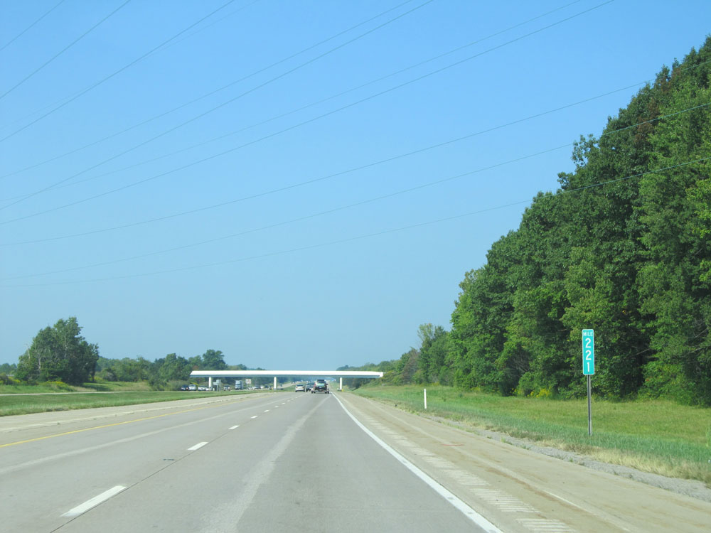 |
Interstate 90 West at mile marker 221. (Photo taken 9/6/15). |
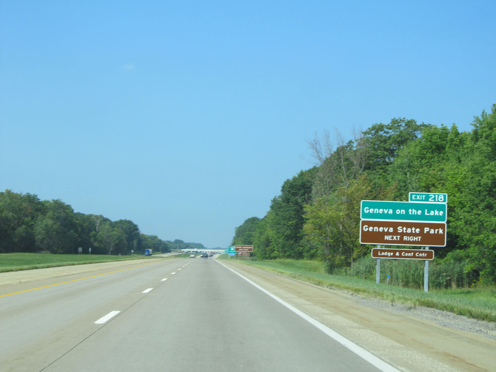 |
Take Exit 218 to Geneva on the Lake and Geneva State Park. (Photo taken 9/6/15). |
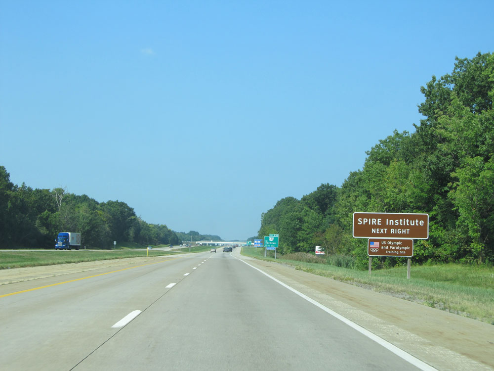 |
Also take Exit 218 to SPIRE Institute. (Photo taken 9/6/15). |
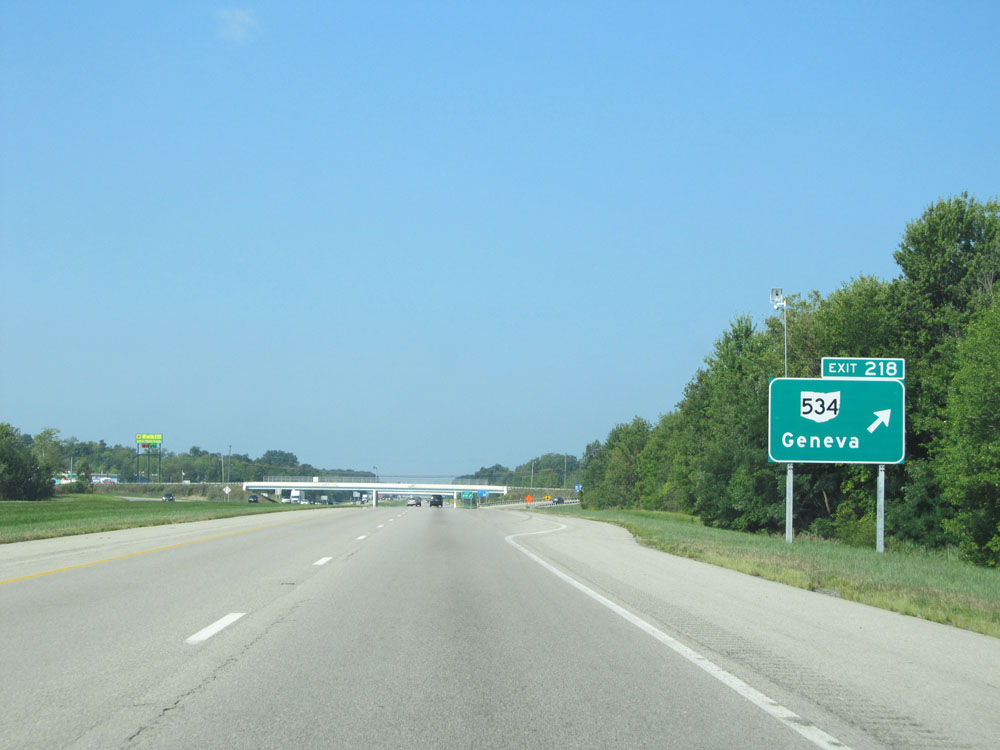 |
Interstate 90 West at Exit 218: OH 534 - Geneva (Photo taken 9/6/15). |
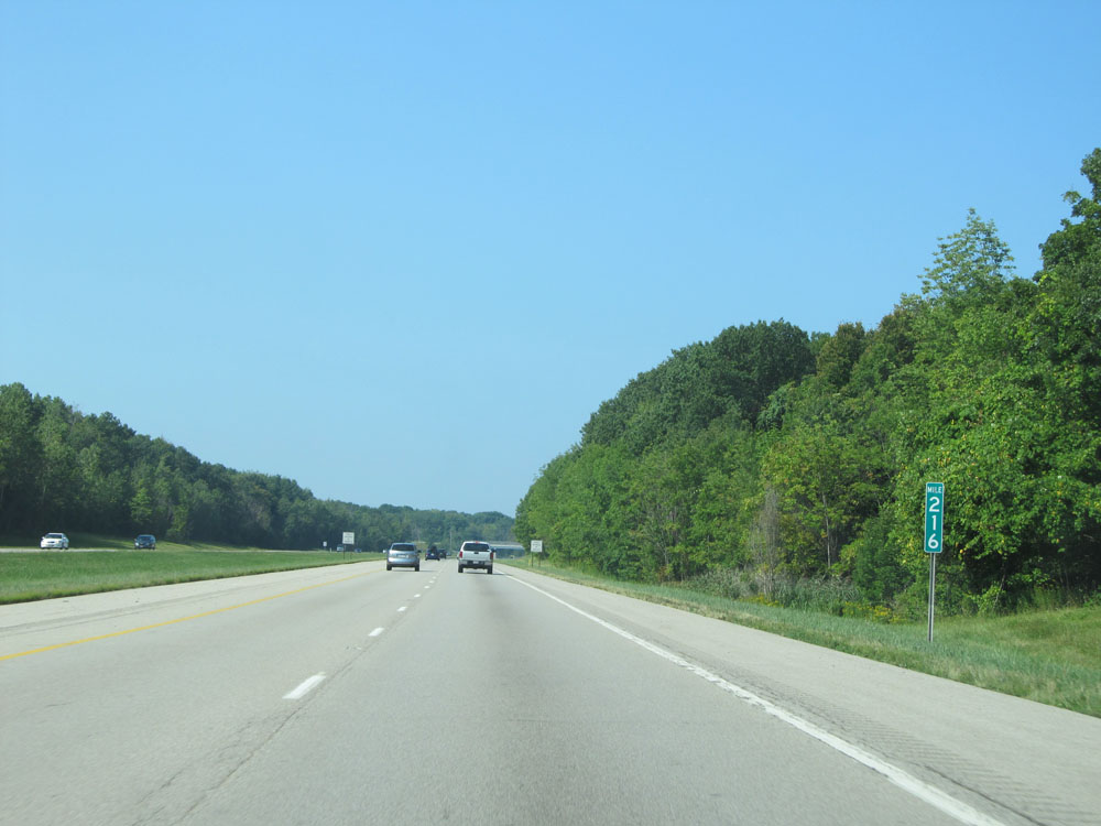 |
Interstate 90 West at mile marker 216. (Photo taken 9/6/15). |
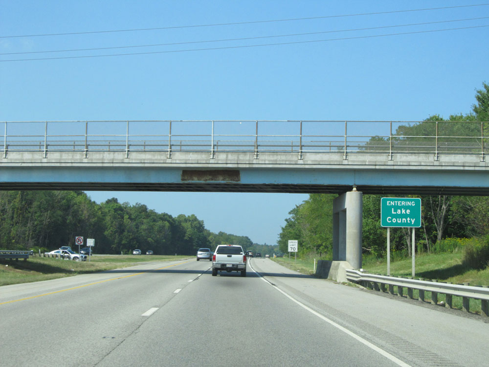 |
Interstate 90 West as it enters Lake County. (Photo taken 9/6/15). |
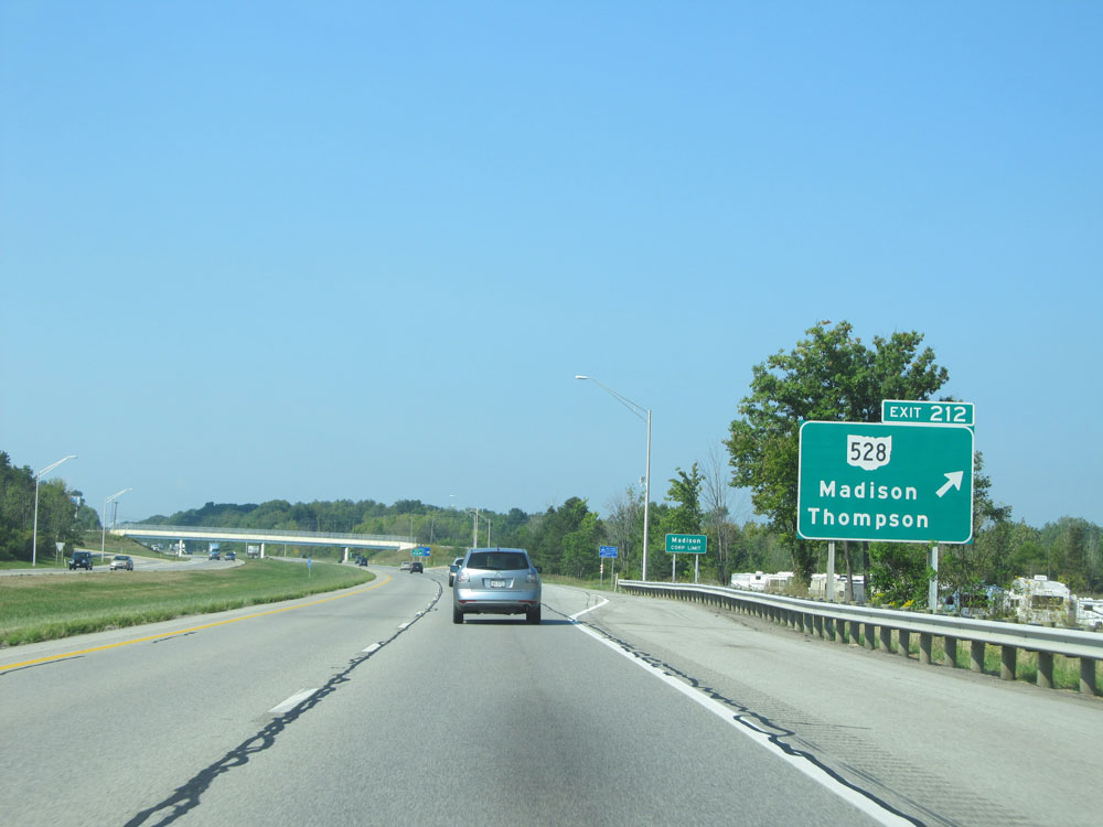 |
Interstate 90 West at Exit 212: OH 528 - Madison / Thompson (Photo taken 9/6/15). |
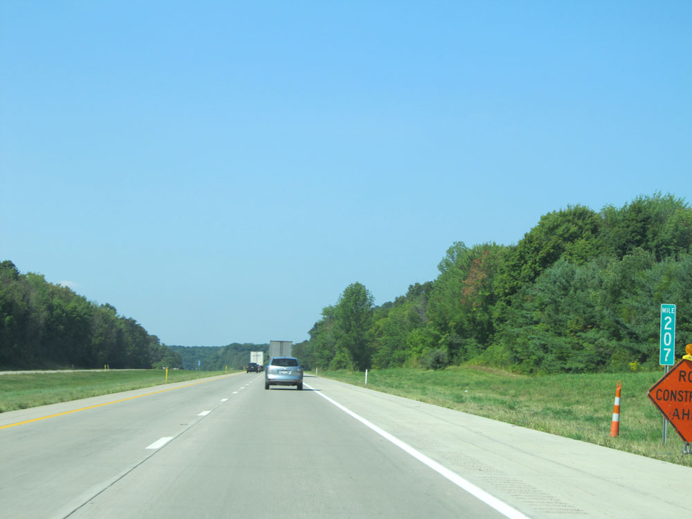 |
Interstate 90 West at mile marker 207. (Photo taken 9/6/15). |
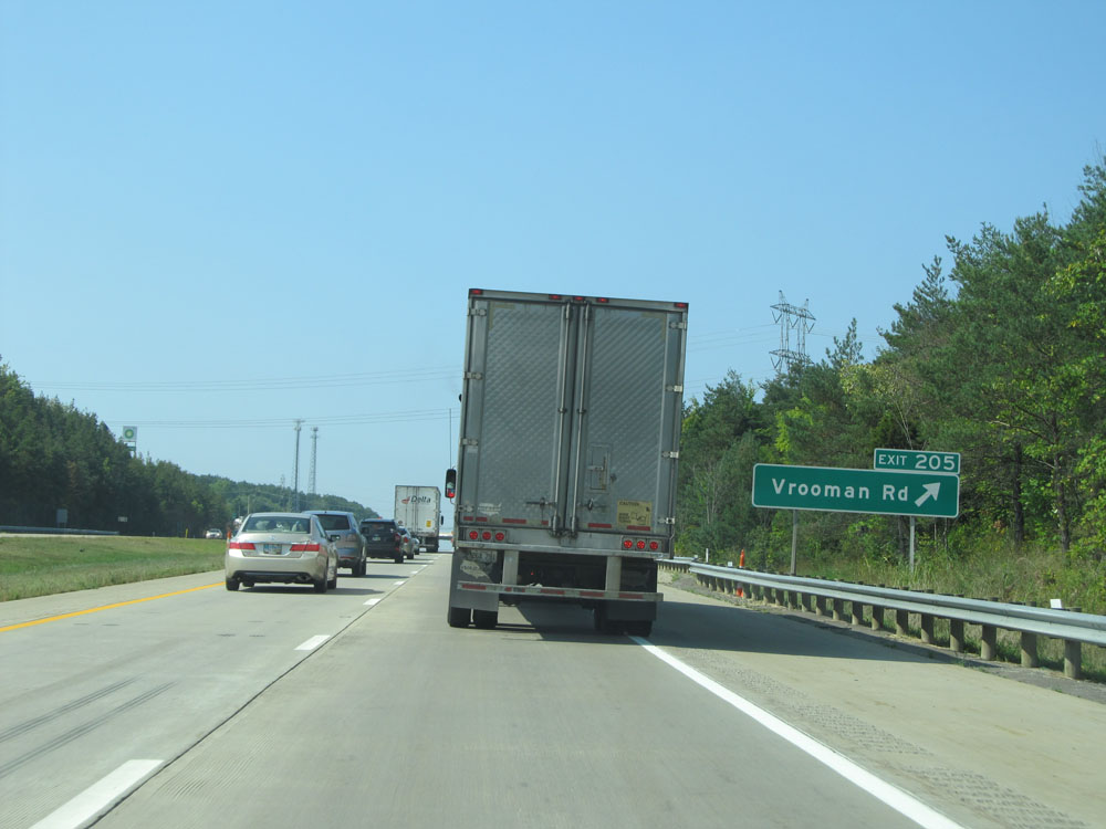 |
Interstate 90 West at Exit 205: Vrooman Rd (Photo taken 9/6/15). |
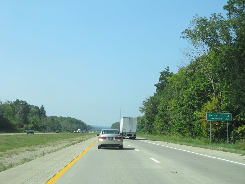 |
Mileage sign just beyond Exit 205. It's 3 miles to the next exit (junction of OH 44) and 32 miles to Cleveland. (Photo taken 9/6/15). |
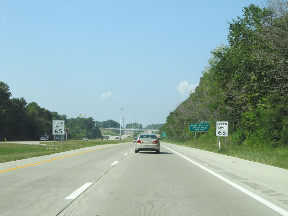 |
Just before Exit 200, the speed limit decreases to 65 mph. (Photo taken 9/6/15). |
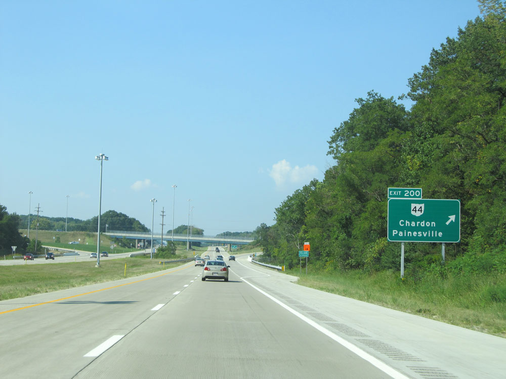 |
Interstate 90 West at Exit 200: OH 44 - Chardon / Painesville (Photo taken 9/6/15). |
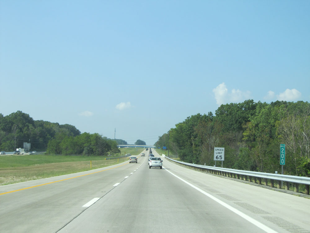 |
Interstate 90 West at mile marker 200. (Photo taken 9/6/15). |
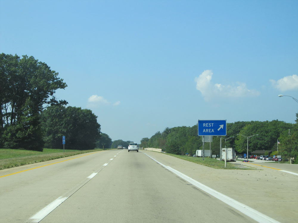 |
Interstate 90 West at the Rest Area located at mile marker 198.8. (Photo taken 9/6/15). |
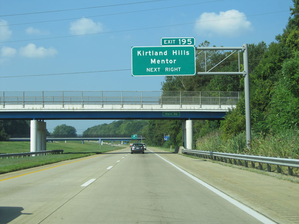 |
Take Exit 195 to Kirtland Hills and Mentor. (Photo taken 9/6/15). |
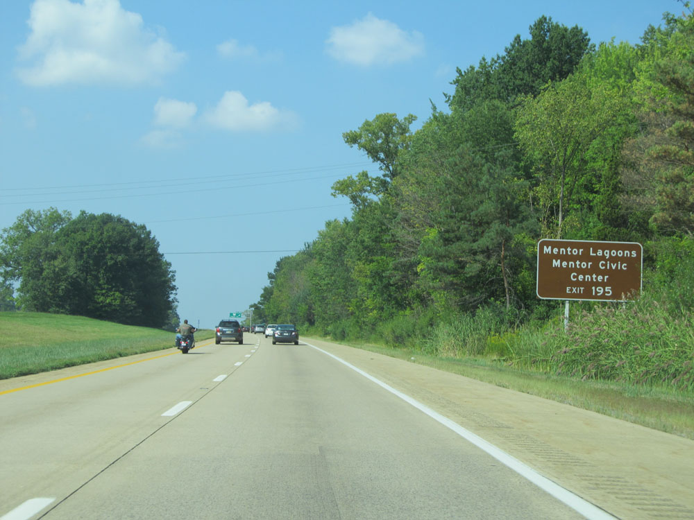 |
Also take Exit 195 to Mentor Lagoons and Mentor Civic Center. (Photo taken 9/6/15). |
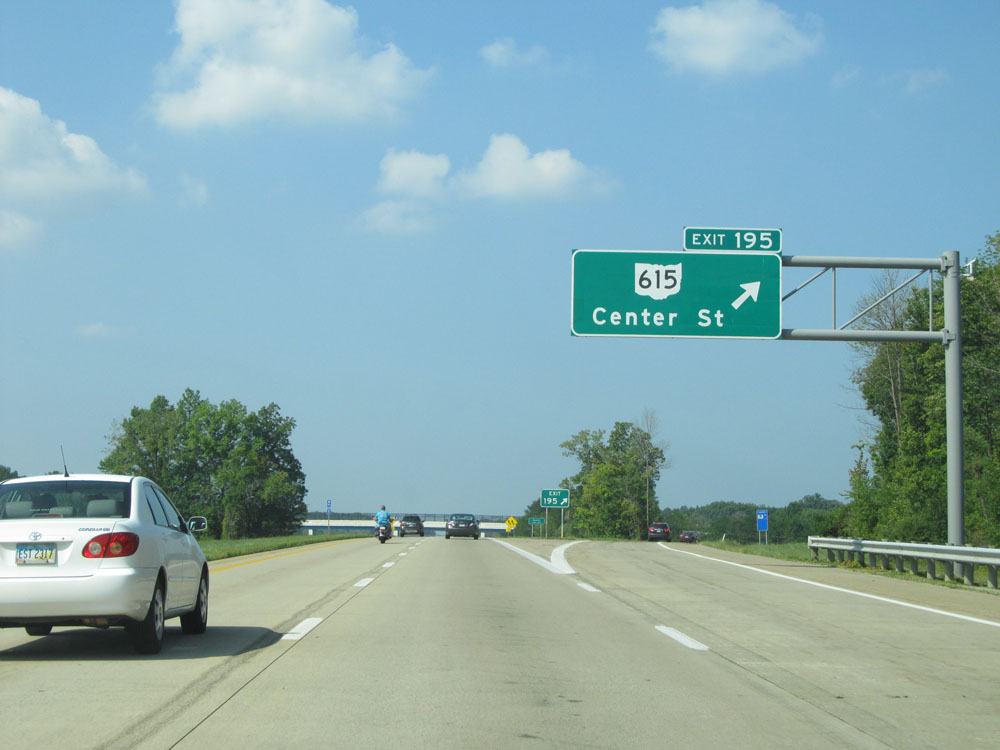 |
Interstate 90 West at Exit 195: OH 615 - Center St (Photo taken 9/6/15). |
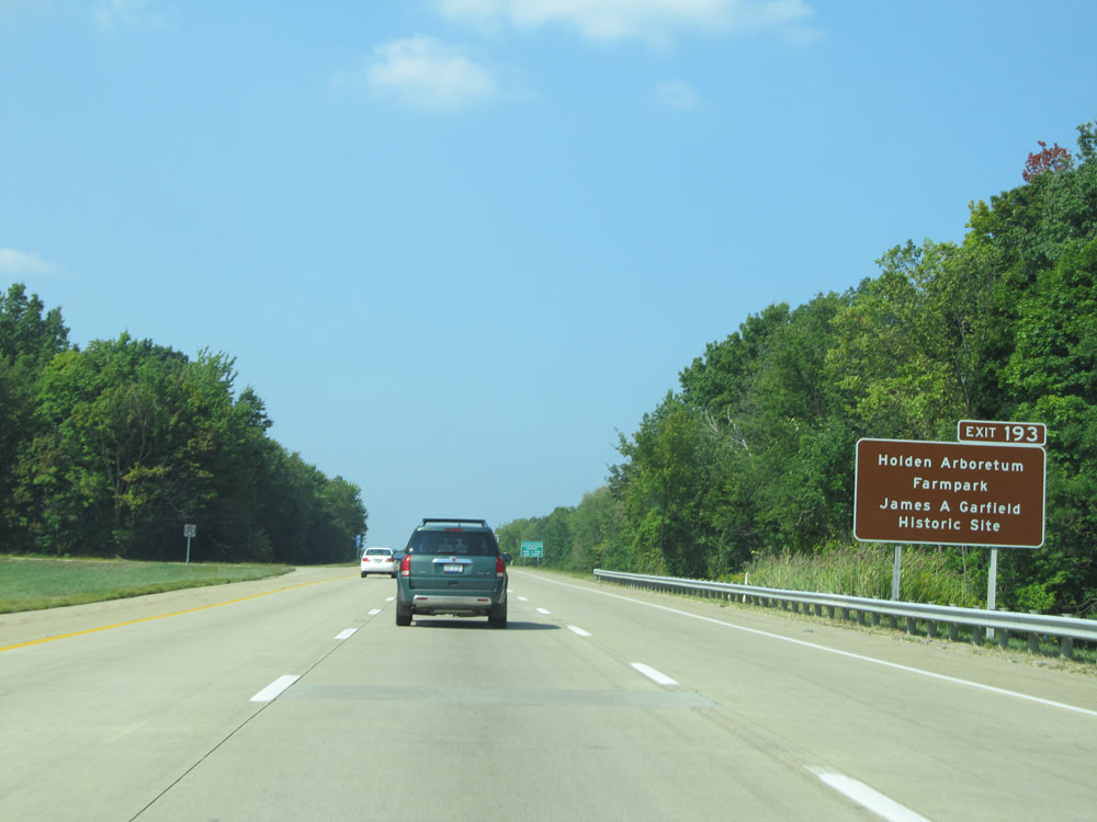 |
Take Exit 193 to Holden Arboretum Farmpark and James A. Garfield Historic Site. (Photo taken 9/6/15). |
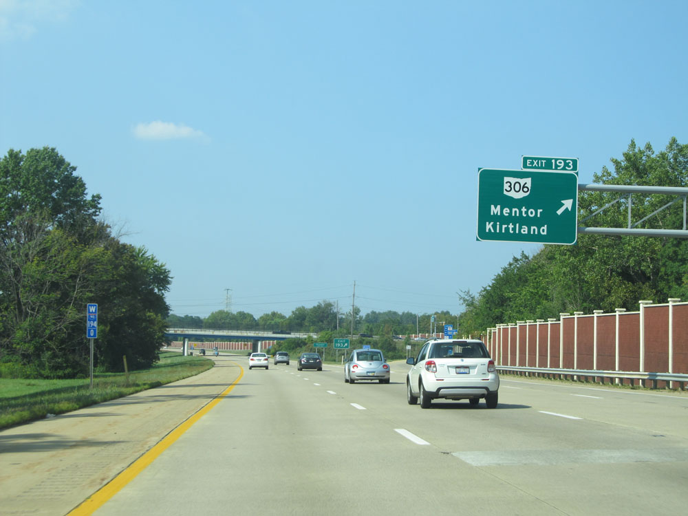 |
Interstate 90 West at Exit 193: OH 306 - Mentor / Kirtland (Photo taken 9/6/15). |
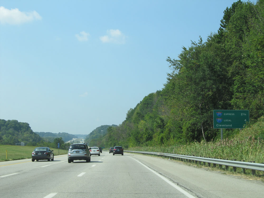 |
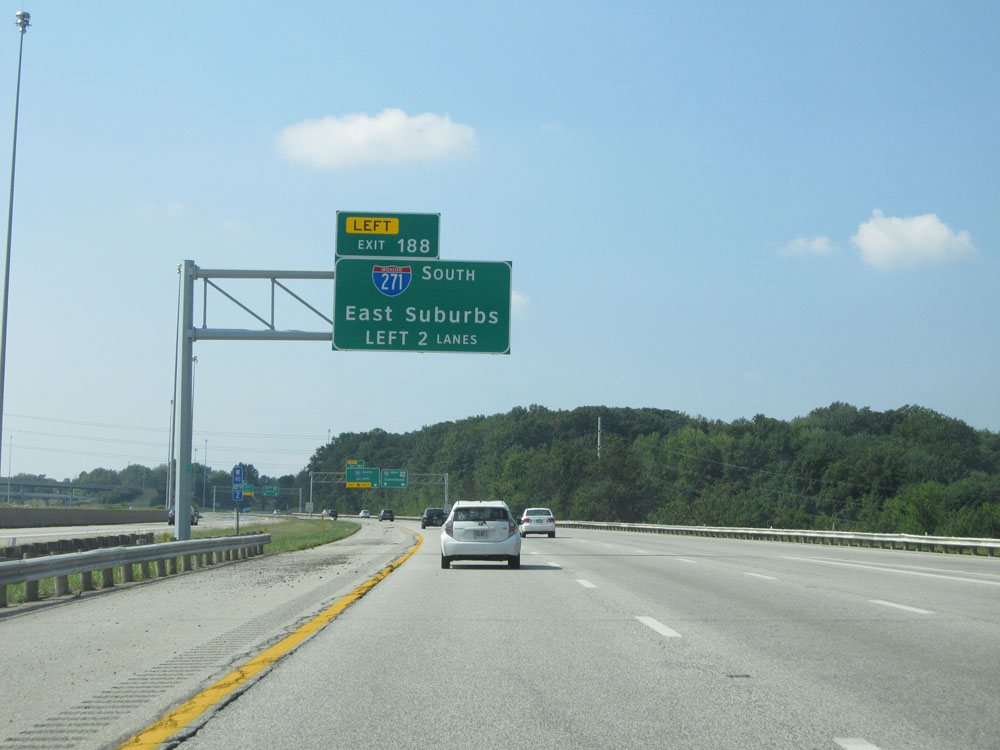
This mileage sign states that it's 2 3/4 miles to the junction of Interstate 271's Express Lanes and 4 miles to Interstate 271's Local Lanes. (Photo taken 9/6/15). |
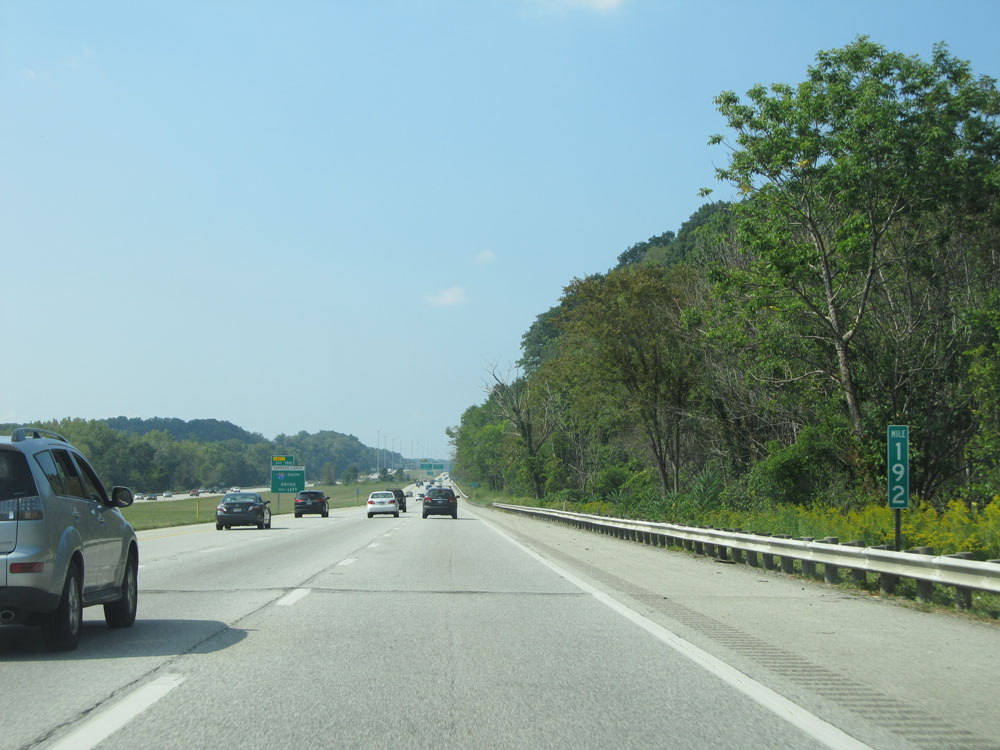 |
Interstate 90 West at mile marker 192. (Photo taken 9/6/15). |
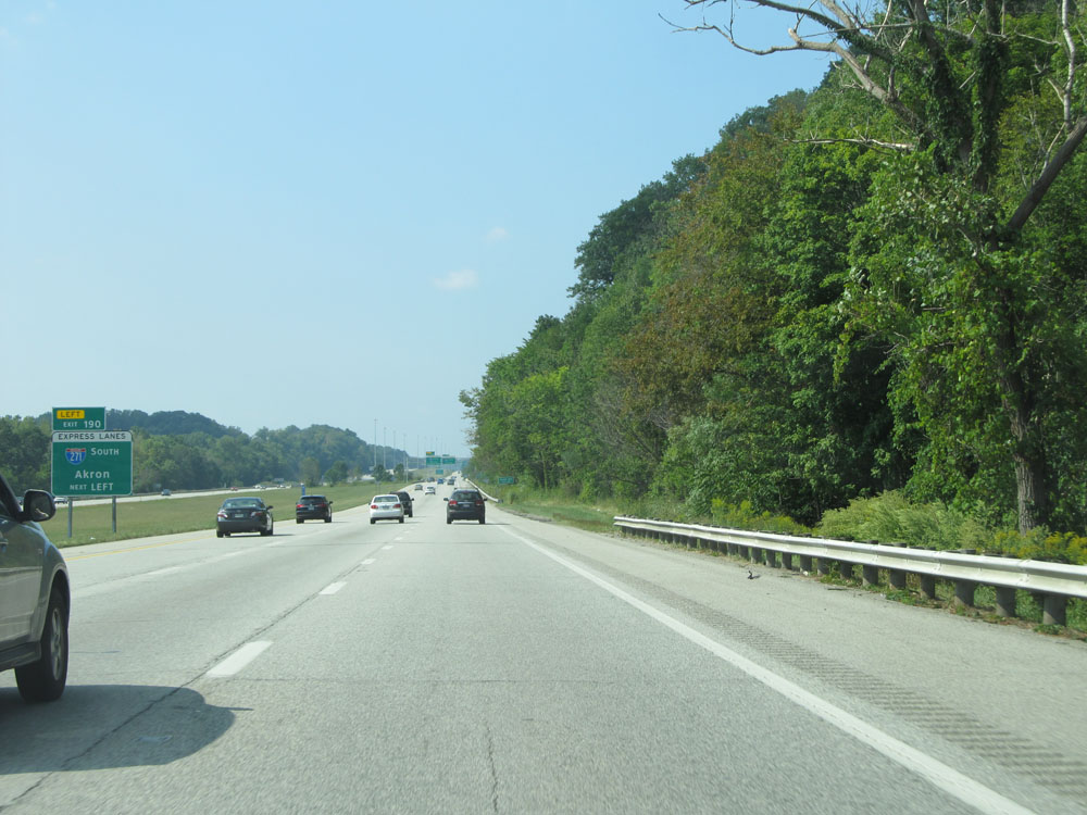 |
Exit 190, which is for Interstate 271's Express Lanes, is a left exit ahead. (Photo taken 9/6/15). |
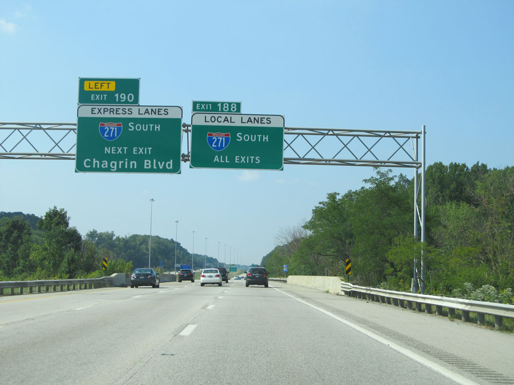 |
If you choose to use Interstate 271's Express Lanes, the first exit on I-271 South that you will have access to is Exit 29 (Chagrin Blvd). If you need to exit before that, you will have to use the local lanes. (Photo taken 9/6/15). |
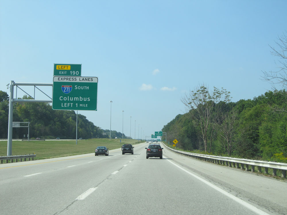 |
Interstate 90 West approaching Exit 190 - 1 mile on the left. (Photo taken 9/6/15). |
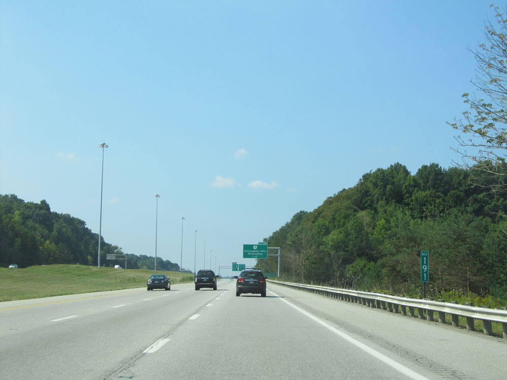 |
Interstate 90 West at mile marker 191. (Photo taken 9/6/15). |
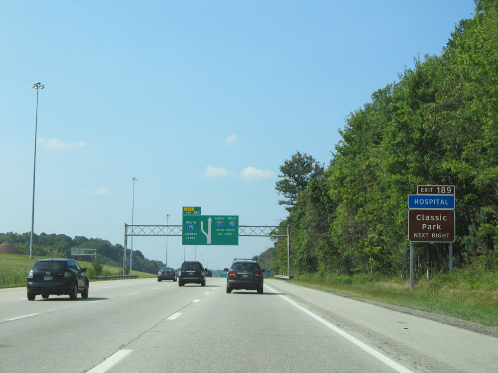 |
Take Exit 189 to Classic Park. (Photo taken 9/6/15). |
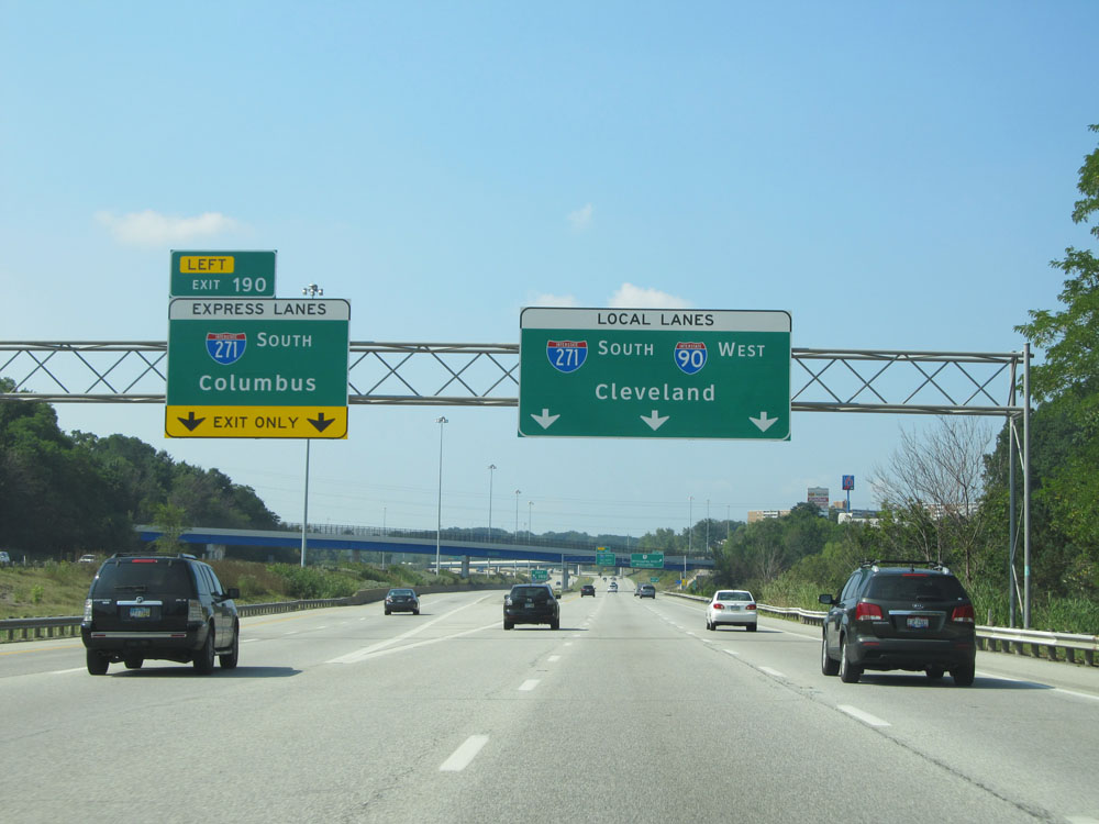 |
Interstate 90 West at Exit 190: Interstate 271 South (Express Lanes) - Columbus (Photo taken 9/6/15). |
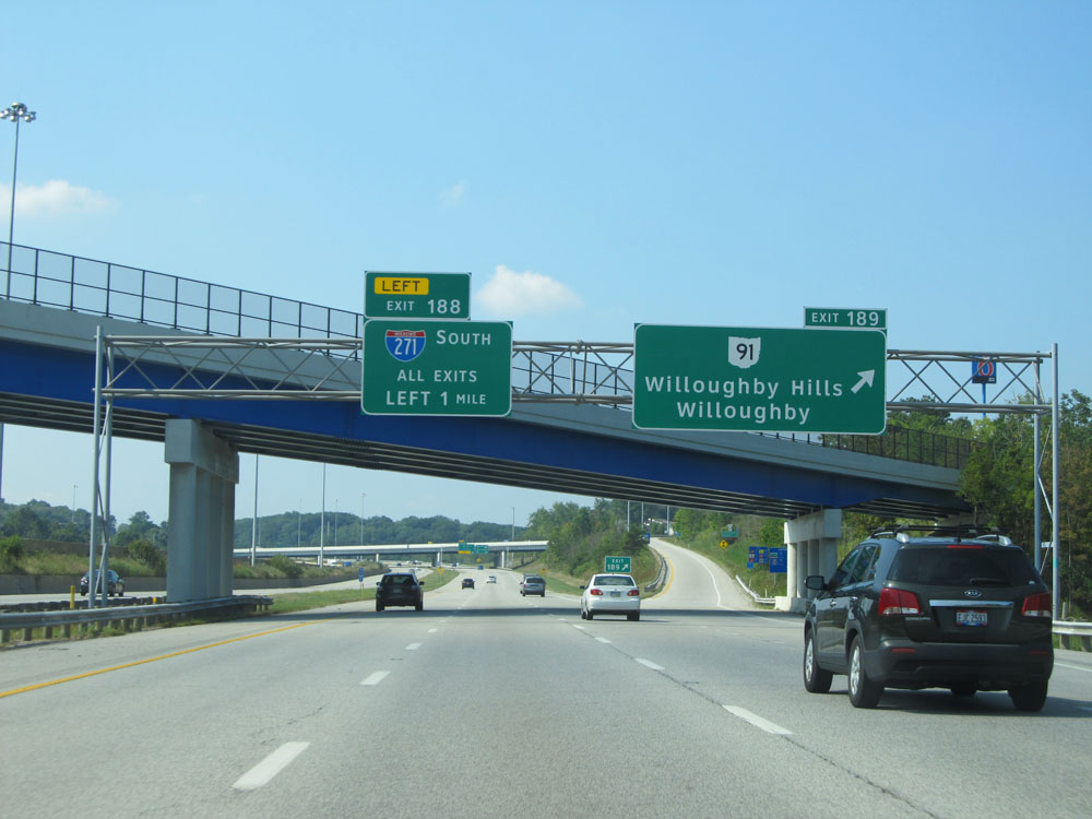 |
Interstate 90 West at Exit 189: OH 91 - Willoughby Hills / Willoughby (Photo taken 9/6/15). |
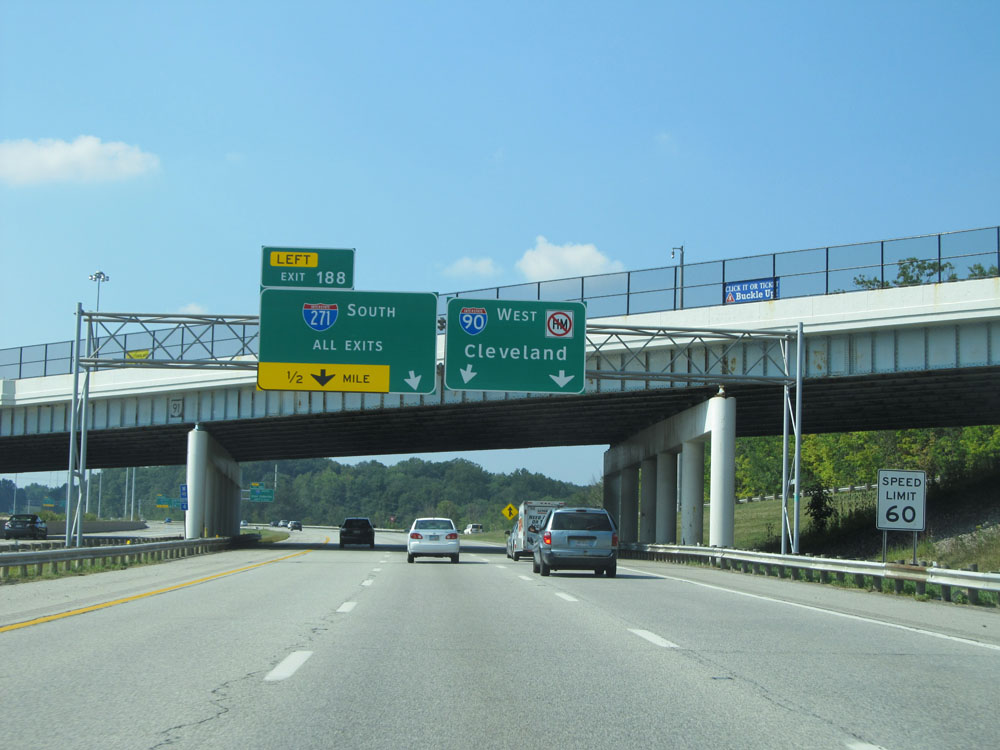 |
Approaching Exit 188, the speed limit decreases to 60 mph. (Photo taken 9/6/15). |
 |
Approaching Exit 188, you will need to be in the two leftmost lanes to access it. (Photo taken 9/6/15). |
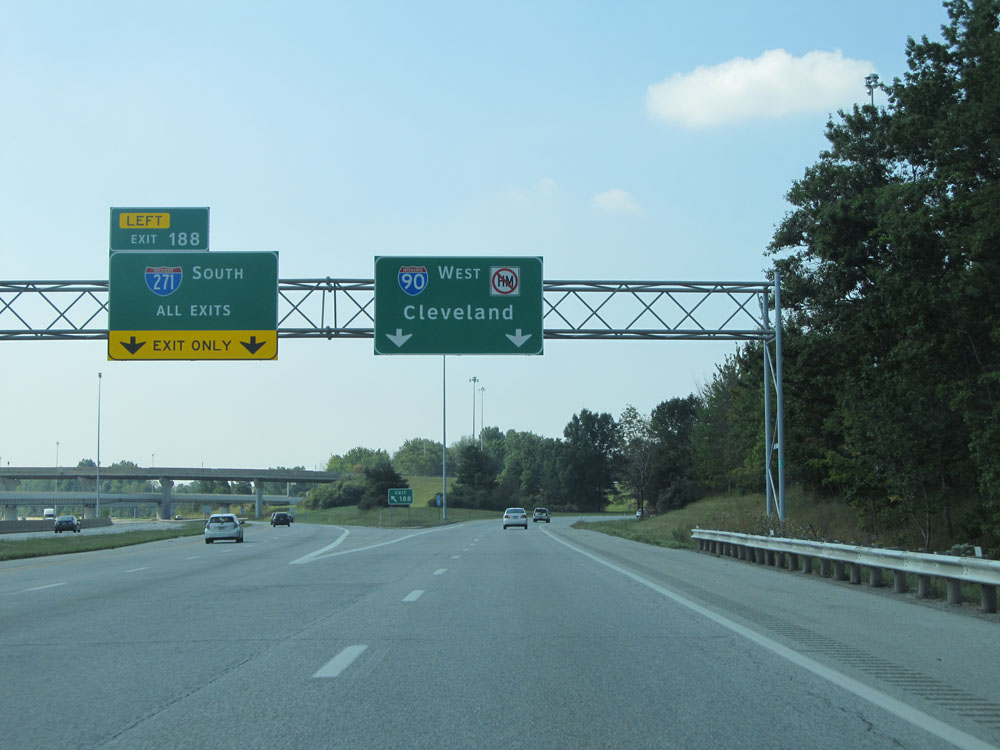 |
Interstate 90 West at Exit 188: Interstate 271 South (Local Lanes) (Photo taken 9/6/15). |
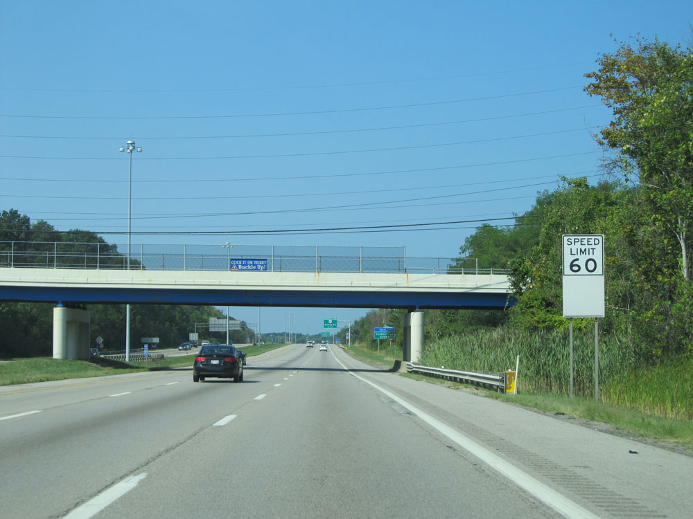 |
Speed limit assurance sign beyond Exit 188. Speed Limit - 60 mph. (Photo taken 9/6/15). |
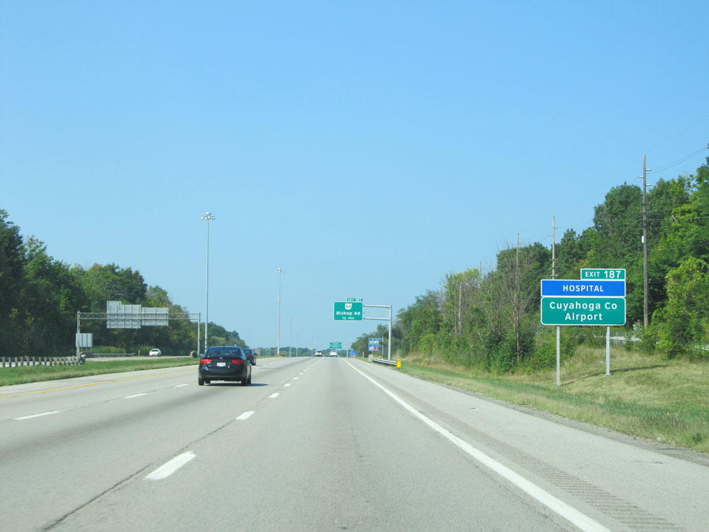 |
Take Exit 187 to Cuyahoga County Airport. (Photo taken 9/6/15). |
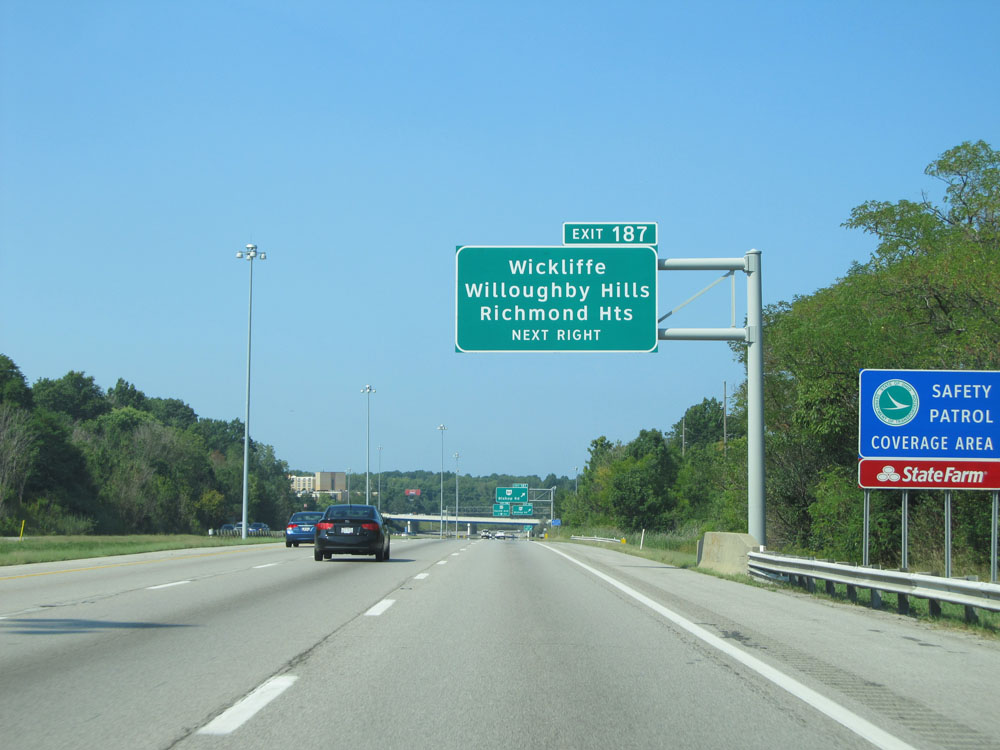 |
Also take Exit 187 to Wickliffe, Willoughby Hills, and Richmond Heights. (Photo taken 9/6/15). |
 |
Interstate 90 West at Exit 187: OH 84 - Bishop Rd (Photo taken 9/6/15). |
 |
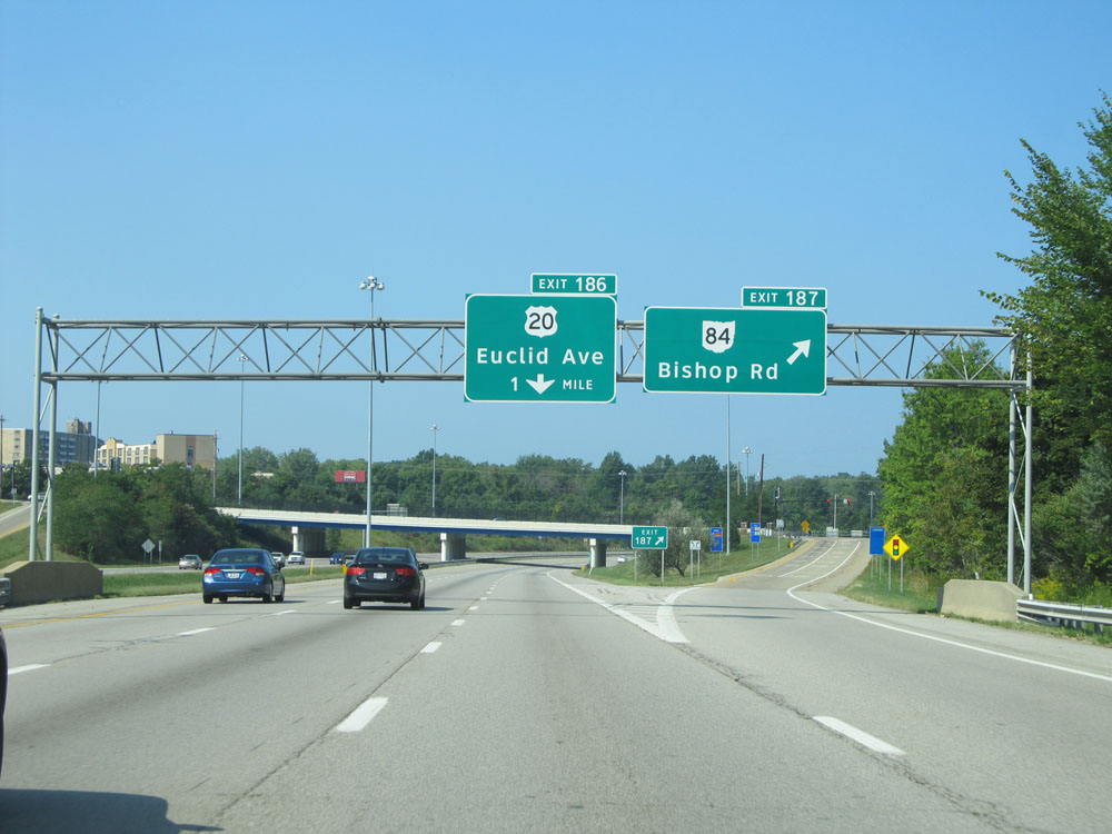
Interstate 90 West at Exit 186: US 20 - Euclid Ave (Photo taken 9/6/15). |
 |
Approaching Exit 185, Interstate 90 West enters Cuyahoga County. (Photo taken 9/6/15). |
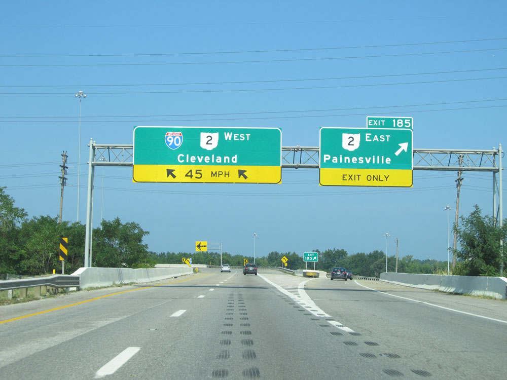 |
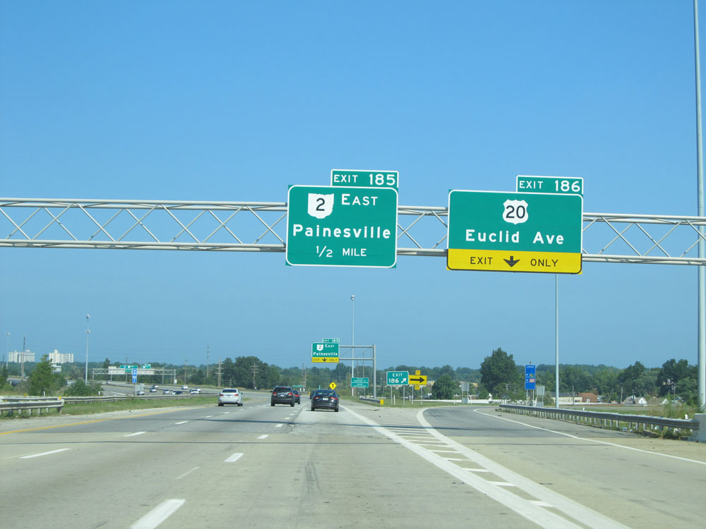
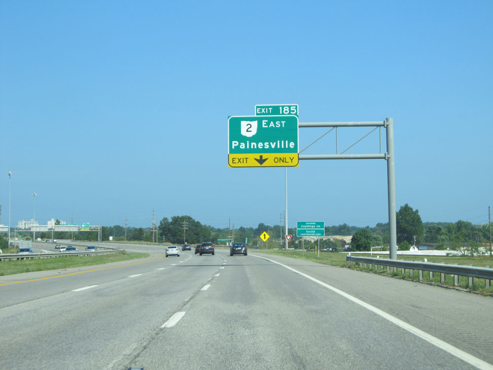
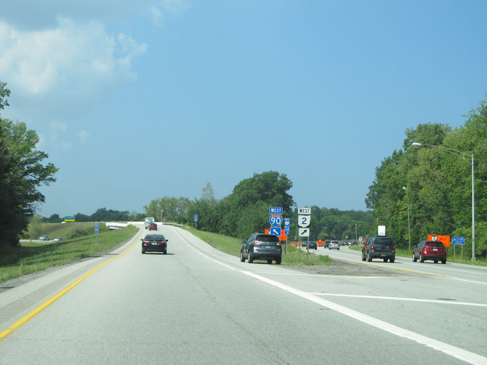
Interstate 90 West at Exit 185: OH 2 East - Painesville (Photo taken 9/6/15). |
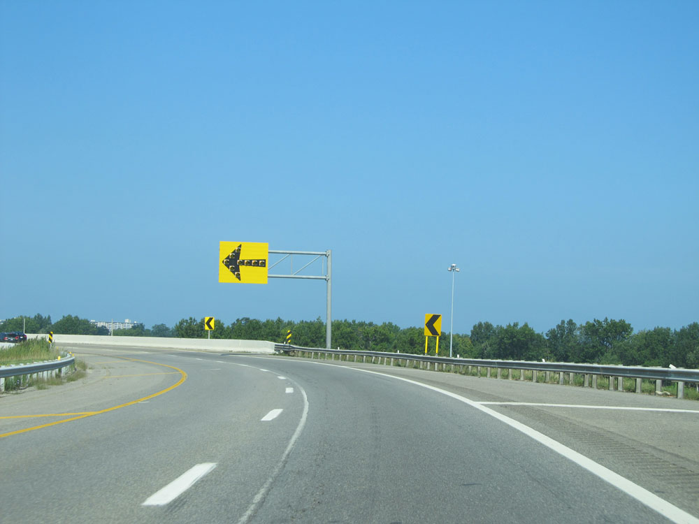 |
Immediately beyond Exit 185, Interstate 90 West traverses a sharp (45 mph) curve to the south. However, this isn't the worst curve on I-90 as you will see in a bit. (Photo taken 9/6/15). |
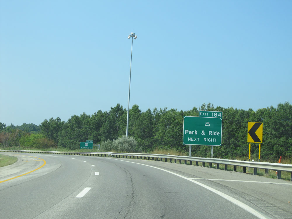 |
Take Exit 184 to the Park & Ride. (Photo taken 9/6/15). |
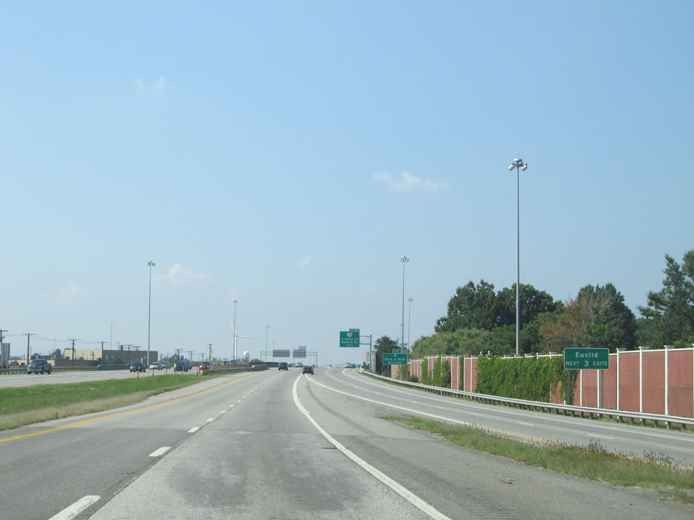 |
Take any of the next 3 exits to Euclid. (Photo taken 9/6/15). |
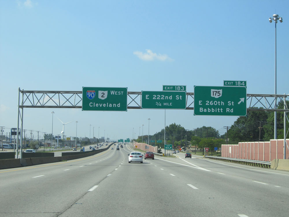 |
Interstate 90 West at Exit 184: OH 175 - E 260th St / Babbitt Rd (Photo taken 9/6/15). |
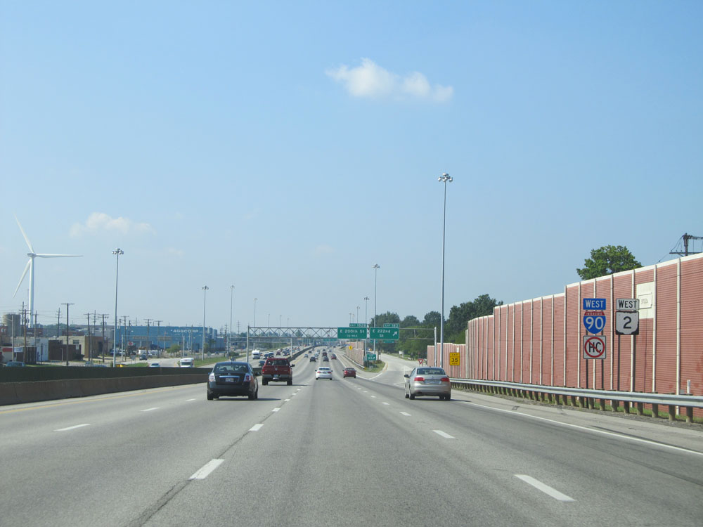 |
Dual Interstate 90 West / OH 2 West assurance markers. (Photo taken 9/6/15). |
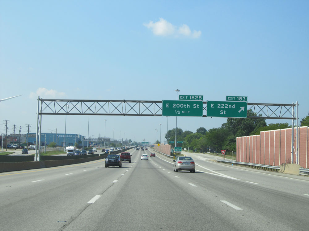 |
Interstate 90 West at Exit 183: E 222nd St (Photo taken 9/6/15). |
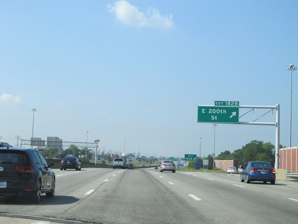 |
Interstate 90 West at Exit 182B: E 200th St (Photo taken 9/6/15). |
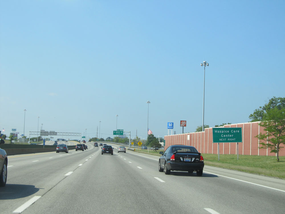 |
Take Exit 182A to Hospice Care Center. (Photo taken 9/6/15). |
 |
Interstate 90 West as it enters the Cleveland corporate limits. (Photo taken 9/6/15). |
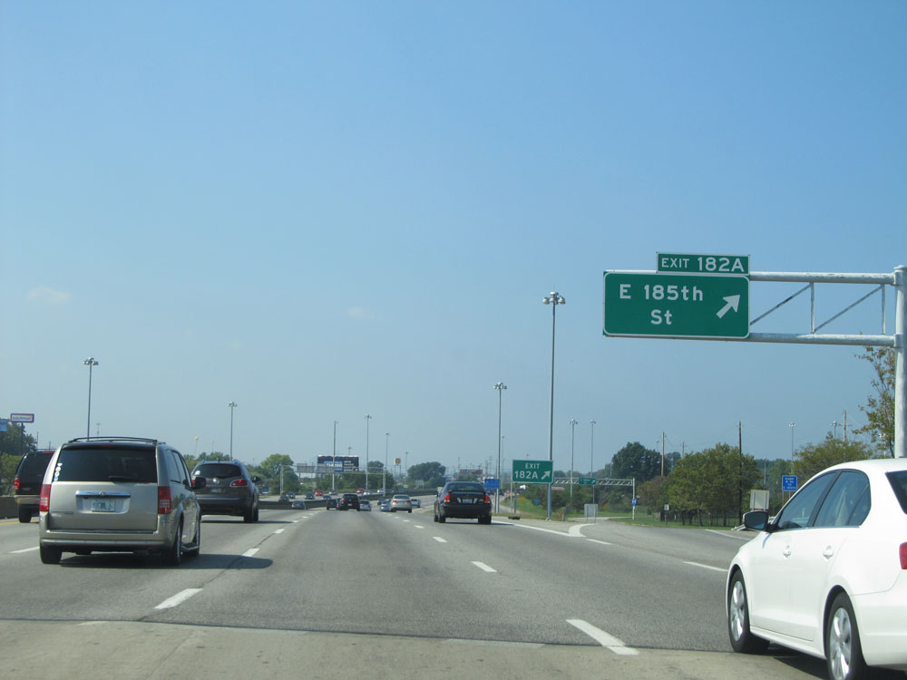 |
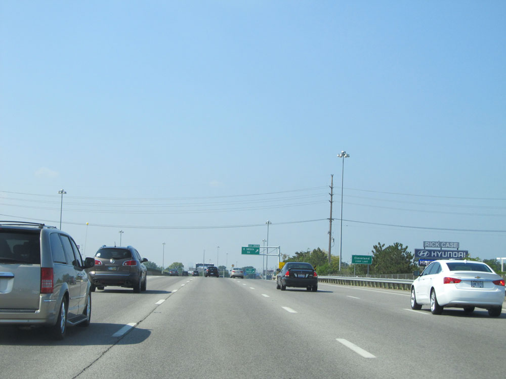
Interstate 90 West at Exit 182A: E 185th St (Photo taken 9/6/15). |
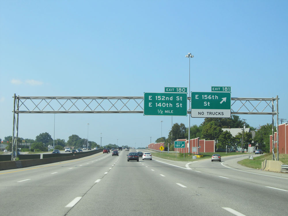 |
Interstate 90 West at Exit 181: E 156th St (Photo taken 9/6/15). |
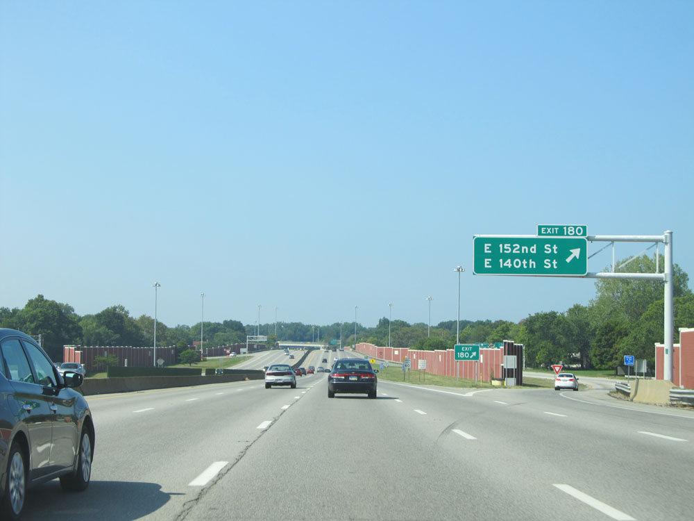 |
Interstate 90 West at Exit 180: E 152nd St / E 140th St (Photo taken 9/6/15). |
 |
More dual Interstate 90 West / OH 2 West assurance shields beyond Exit 180. (Photo taken 9/6/15). |
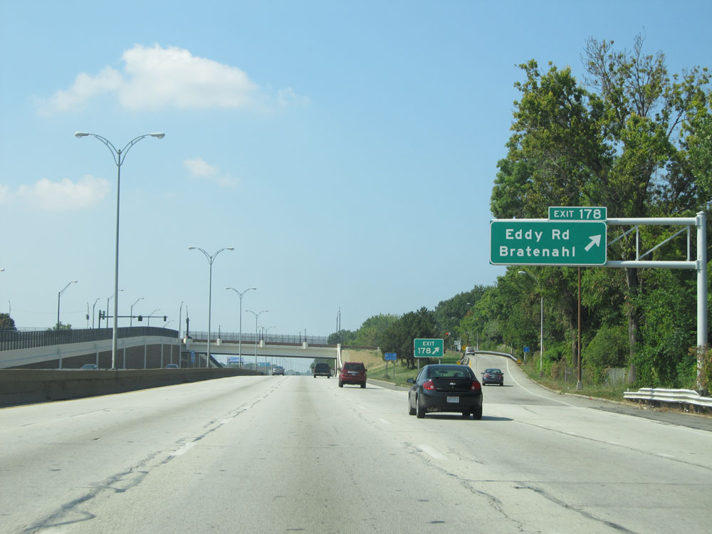 |
Interstate 90 West at Exit 178: Eddy Rd / Bratenahl (Photo taken 9/6/15). |
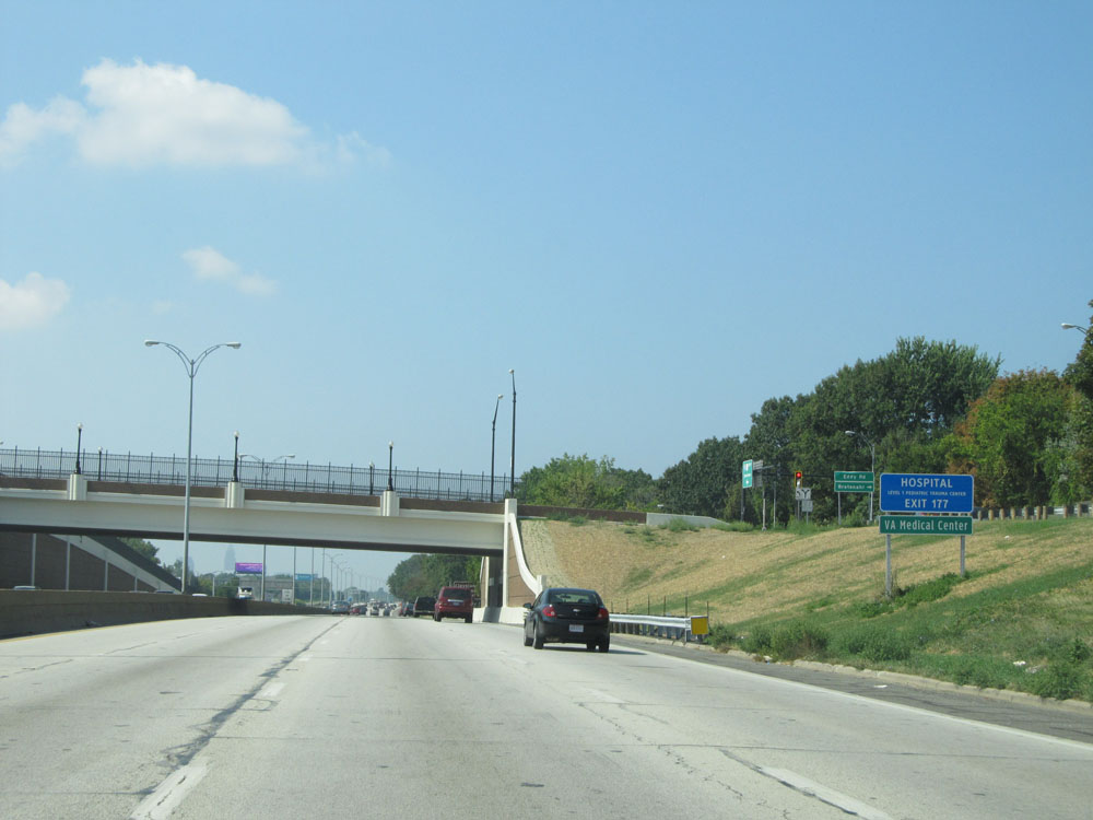 |
Take Exit 177 to the VA Medical Center. (Photo taken 9/6/15). |
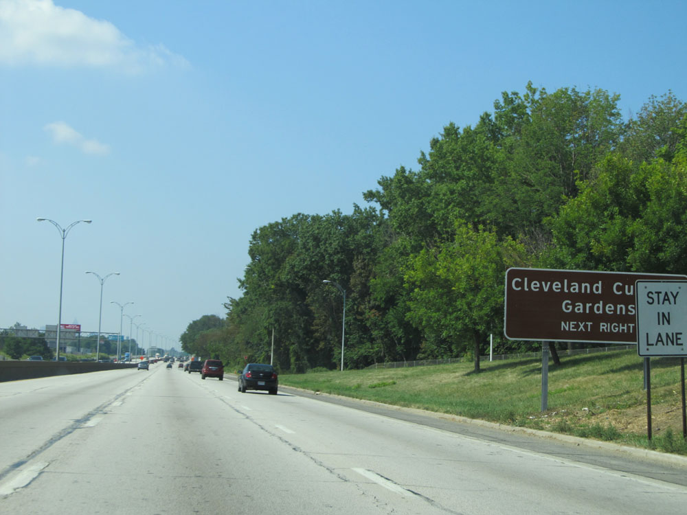 |
Also take Exit 177 to Cleveland Cultural Gardens. (Photo taken 9/6/15). |
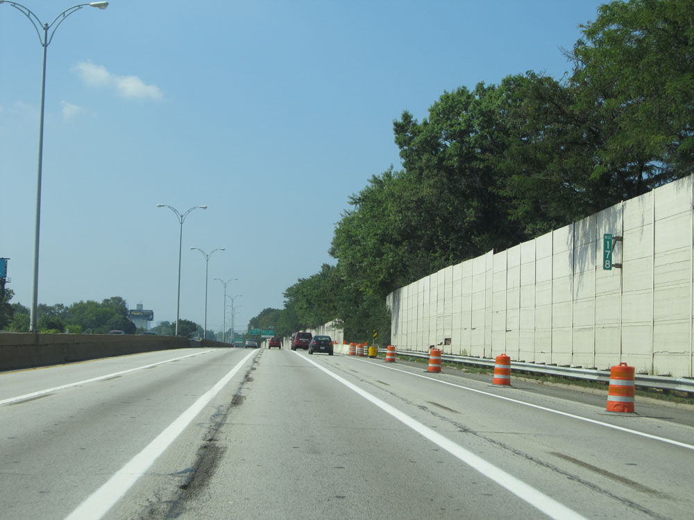 |
Interstate 90 West at mile marker 178. (Photo taken 9/6/15). |
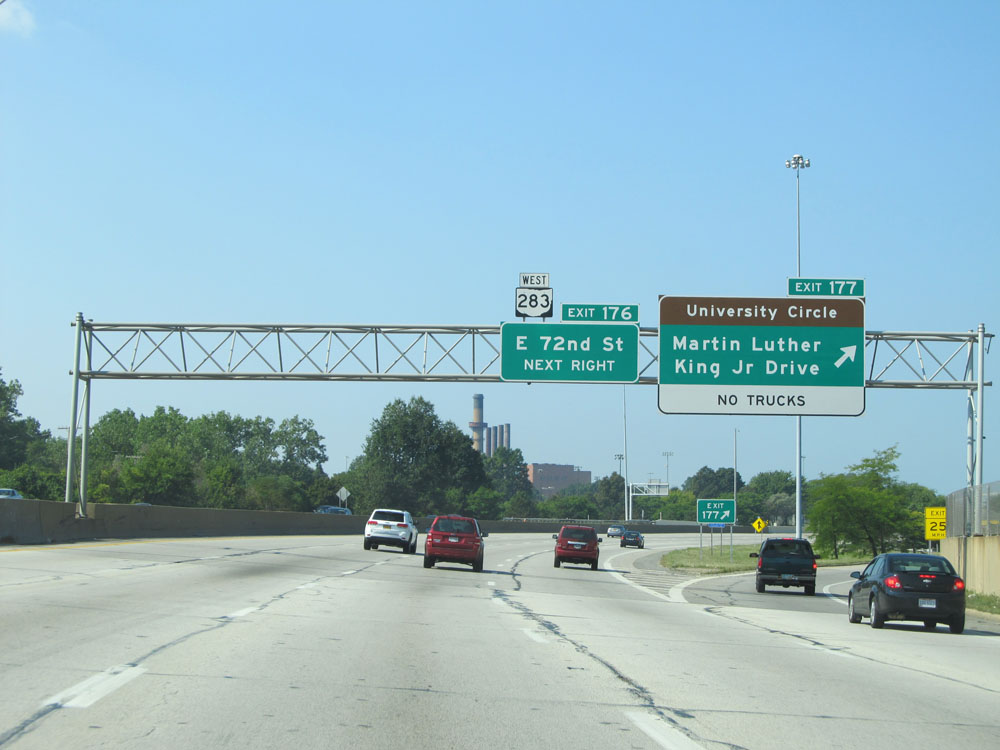 |
Interstate 90 West at Exit 177: Martin Luther King Jr Drive / University Circle (Photo taken 9/6/15). |
 |
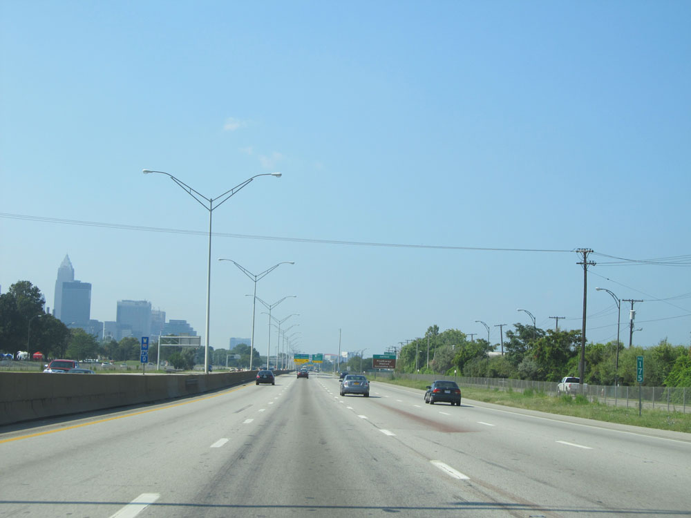
Interstate 90 West at Exit 176: E 72nd St (Photo taken 9/6/15). |
Section 2: Cleveland (Exit 176) to Elyria (Exit 140)
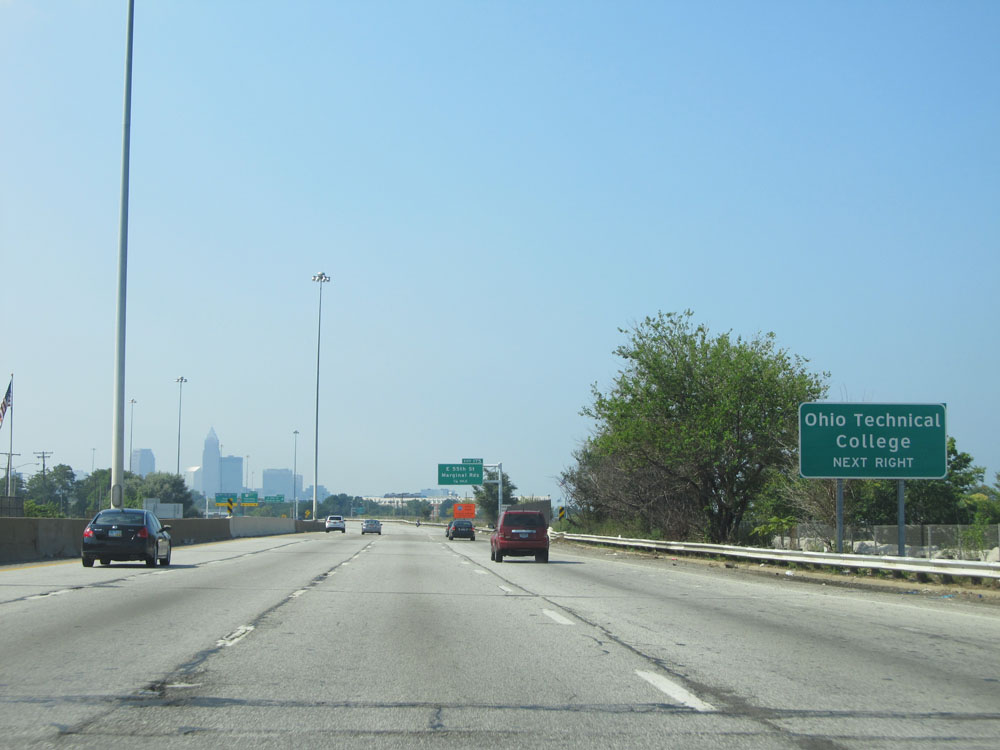 |
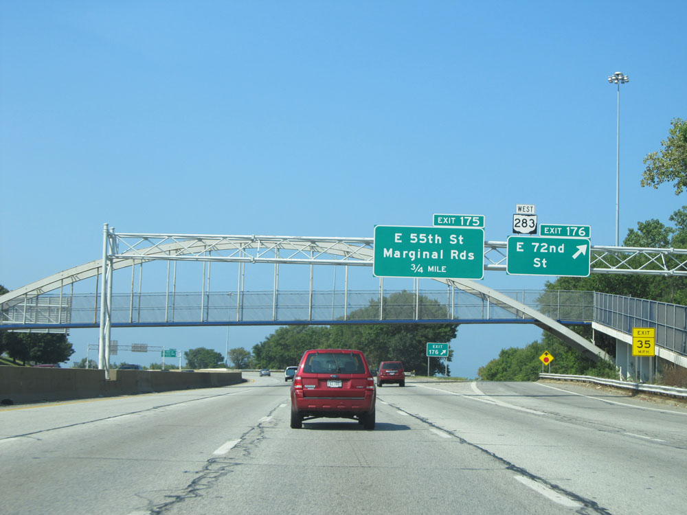
Take Exit 175 to Ohio Technical College. (Photo taken 9/6/15). |
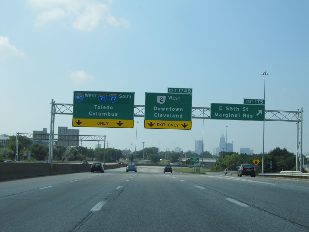 |
Interstate 90 West at Exit 175: E 55th St / Marginal Rds (Photo taken 9/6/15). |
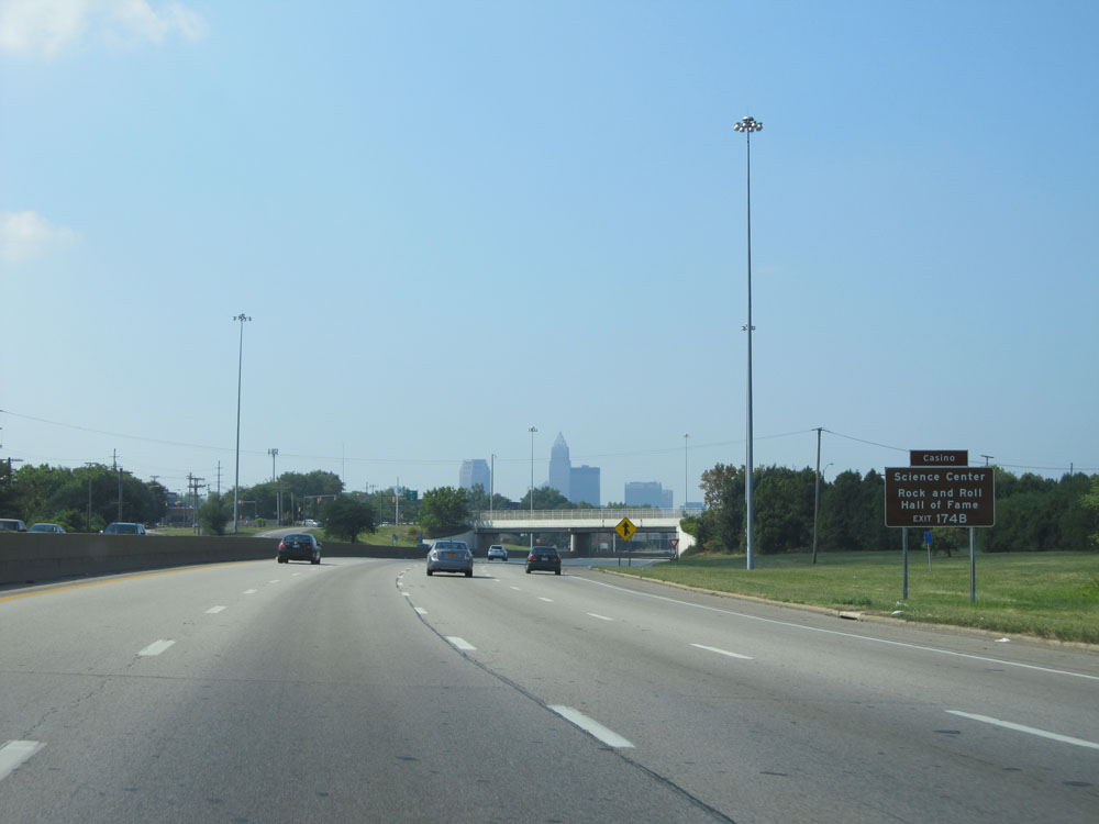 |
Take Exit 174B to the Science Center, Casino, and the Rock & Roll Hall of Fame. (Photo taken 9/6/15). |
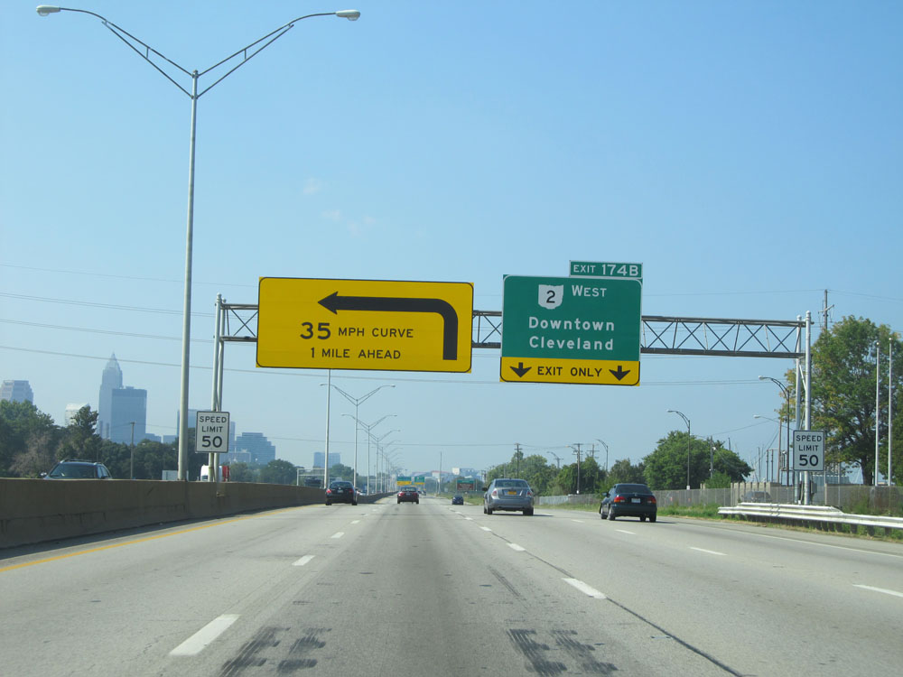 |
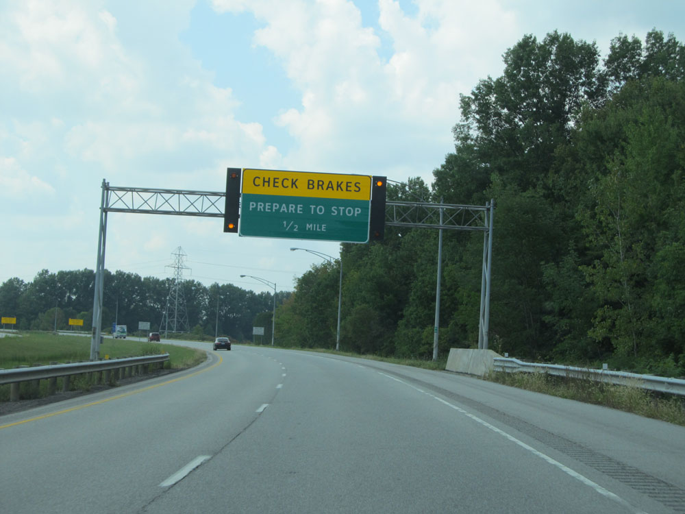
Approaching Exit 174B, the speed limit decreases to 50 mph. One mile ahead on I-90 is this 35 mph curve shown on the overhead warning sign, known as "Dead Man's Curve". (Photo taken 9/6/15). |
 |
Interstate 90 West at mile marker 175. (Photo taken 9/6/15). |
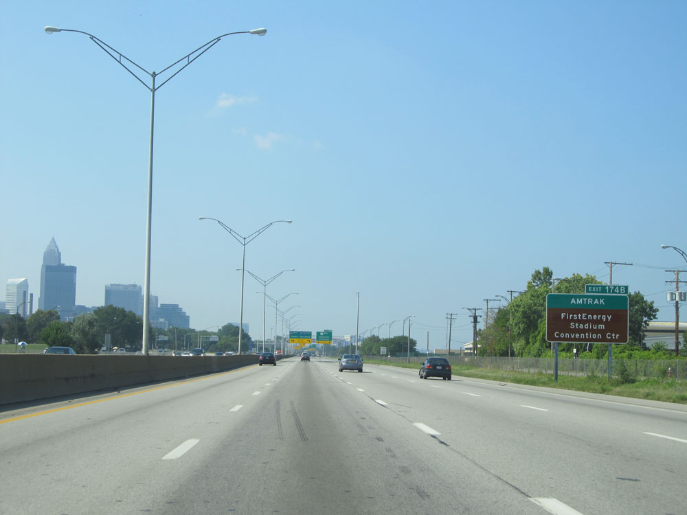 |
Also take Exit 174B to AMTRAK, FirstEnergy Stadium, and Convention Center. (Photo taken 9/6/15). |
 |
1/2 mile from Exit 174B and Dead Man's Curve, we're once again reminded that 35 mph is the recommended speed. Trust me, this curve is no joke. It claims tractor-trailers on a fairly regular basis, despite all the warnings. (Photo taken 9/6/15). |
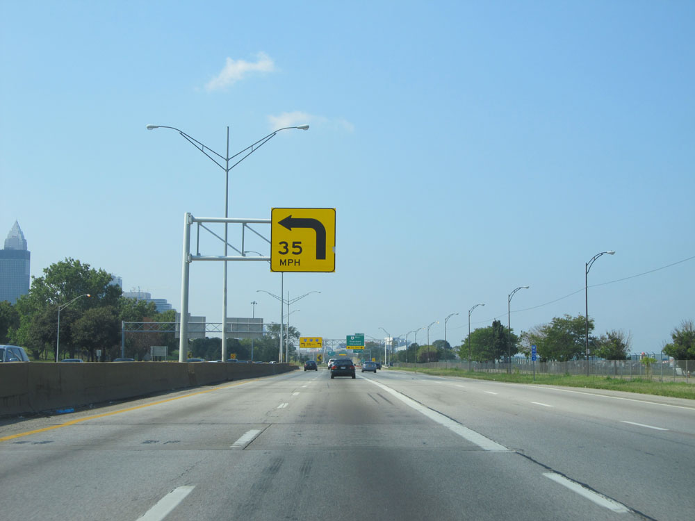 |
Another 35 mph warning sign for Dead Man's Curve. (Photo taken 9/6/15). |
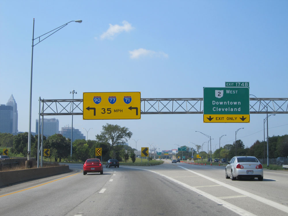 |
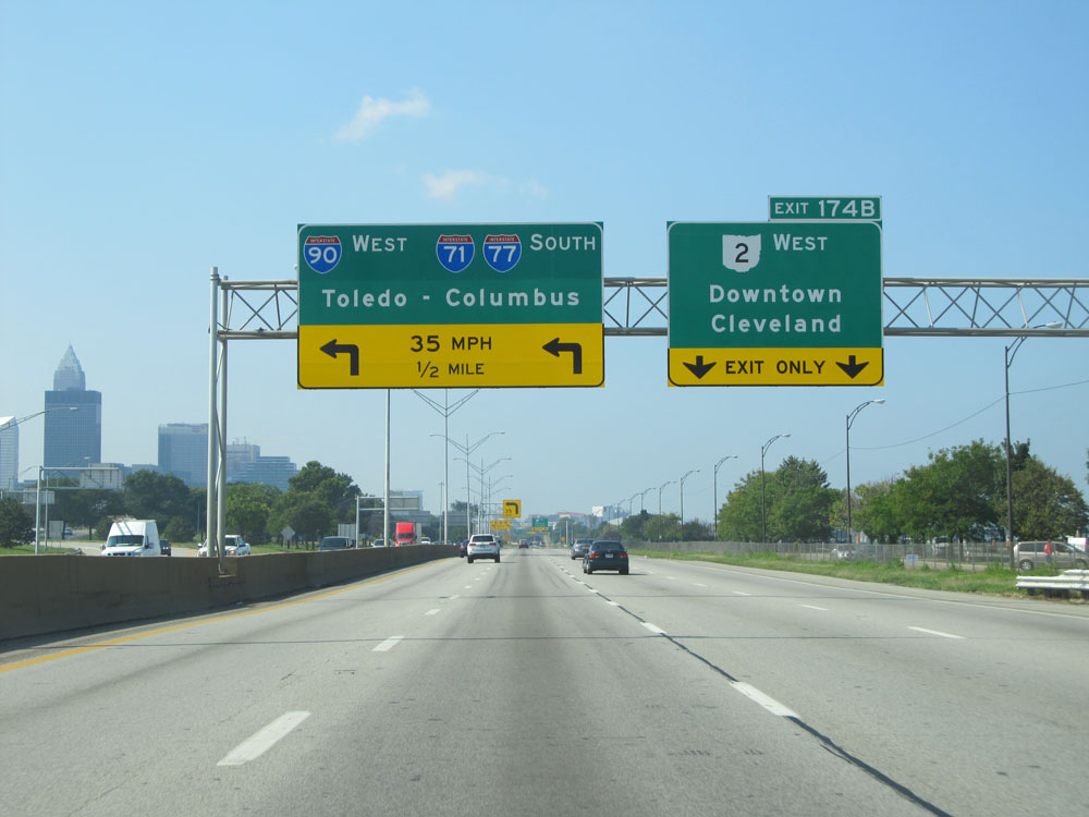
Interstate 90 West at Exit 174B: OH 2 West - Downtown Cleveland. Ahead, you can see just how sharp Dead Man's Curve really is just before we reach it. (Photo taken 9/6/15). |
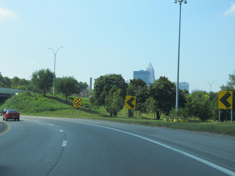 |
Interstate 90 West at Dead Man's Curve. (Photo taken 9/6/15). |
 |
Advance mileage sign for Exit 173C as we near the end of the curve. (Photo taken 9/6/15). |
 |
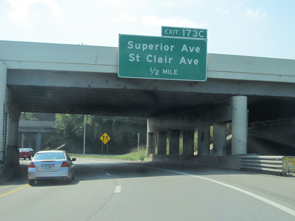
Interstate 90 West at Exit 173C: Superior Ave / St Clair Ave (Photo taken 9/6/15). |
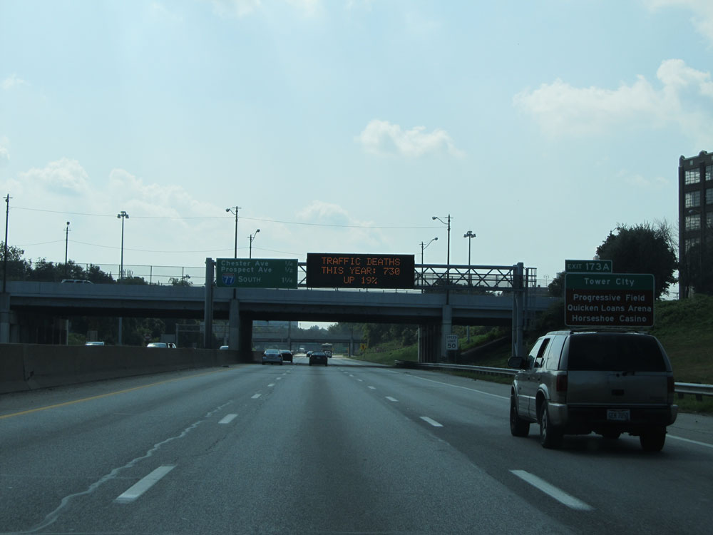 |
Take Exit 173A to Tower City, Progressive Field, Quicken Loans Arena, and Horseshoe Casino. (Photo taken 9/6/15). |
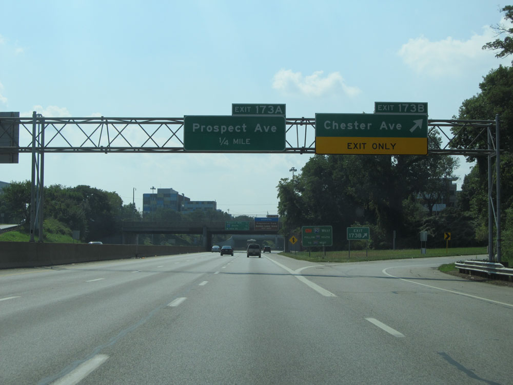 |
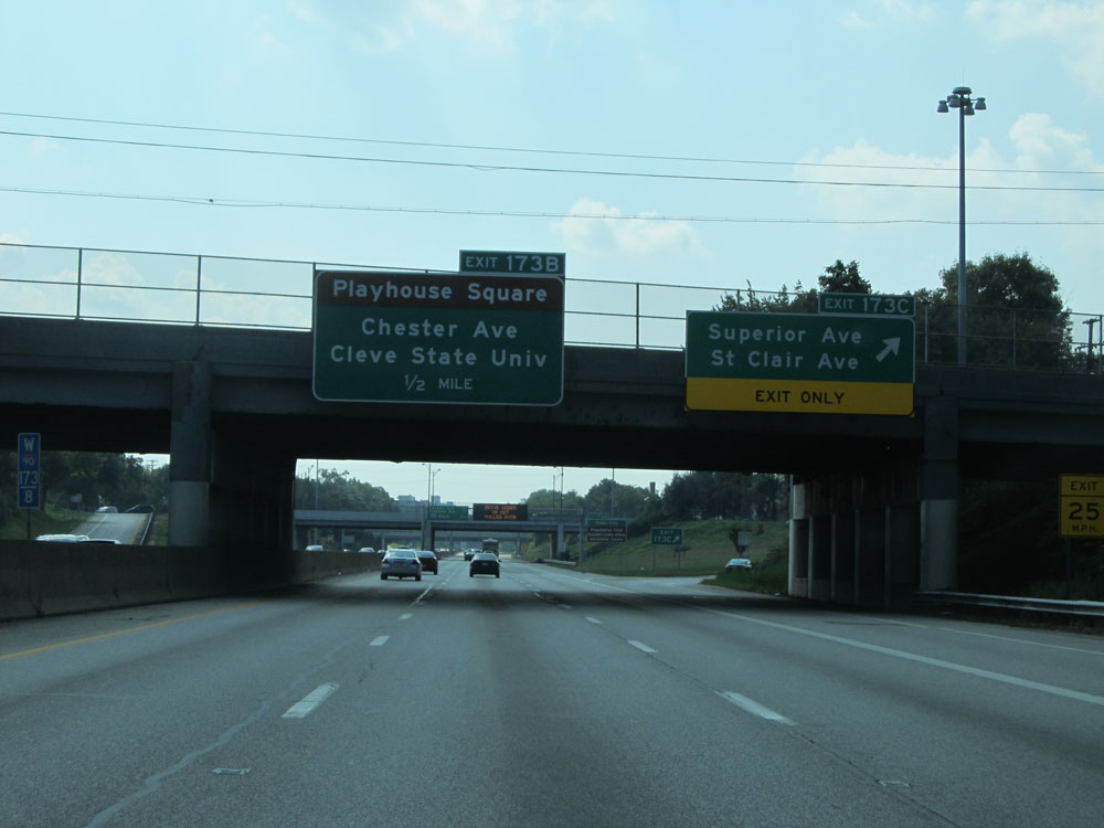
Interstate 90 West at Exit 173B: Chester Ave (Photo taken 9/6/15). |
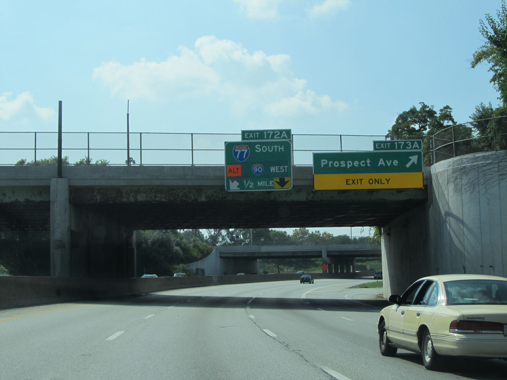 |
Interstate 90 West at Exit 173A: Prospect Ave (Photo taken 9/6/15). |
 |
Interstate 90 West approaching Exit 172A - 1/2 mile. (Photo taken 9/6/15). |
 |
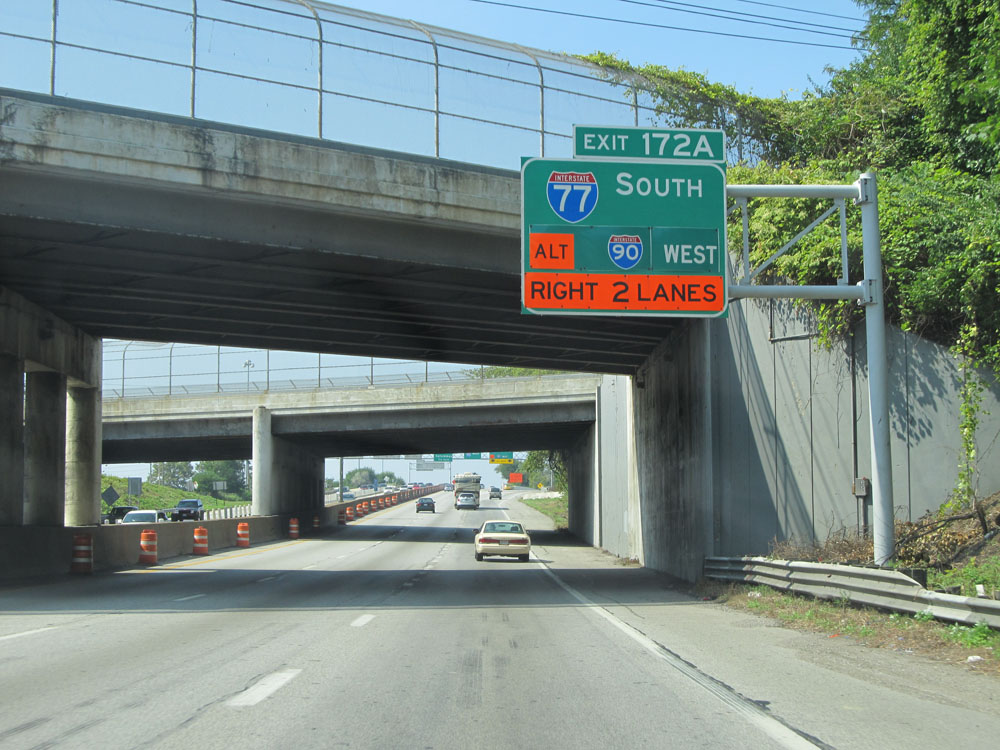
Interstate 90 West at Exit 172A: Interstate 77 South - Akron (Photo taken 9/6/15). |
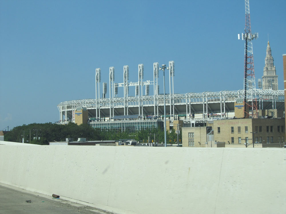 |
Just beyond Exit 172A, we get a nice view of Progressive Field, home of the Cleveland Indians, from Interstate 90. (Photo taken 9/6/15). |
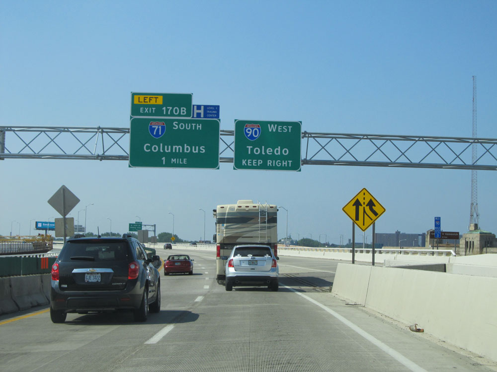 |
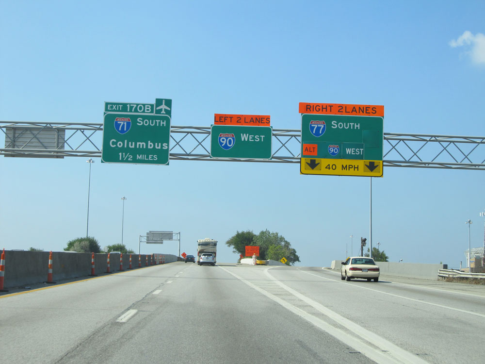
Interstate 90 West approaching Exit 170B - 1 mile on the left. (Photo taken 9/6/15). |
 |
Interstate 90 West at Exit 171: W 14th St / Abbey Ave (Photo taken 9/6/15). |
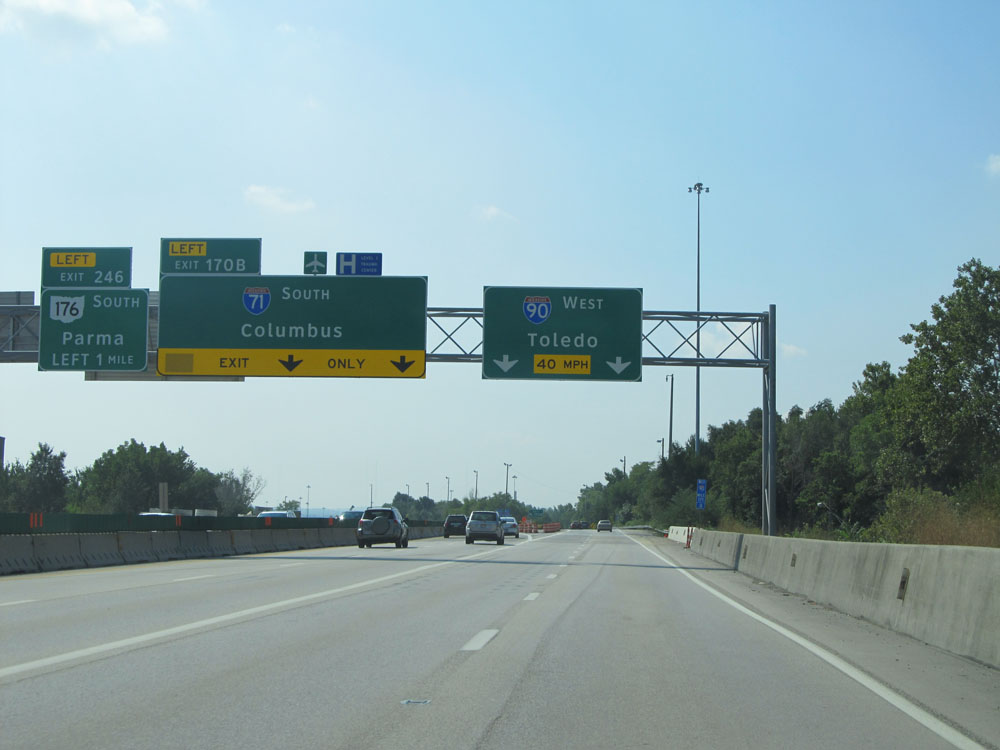 |
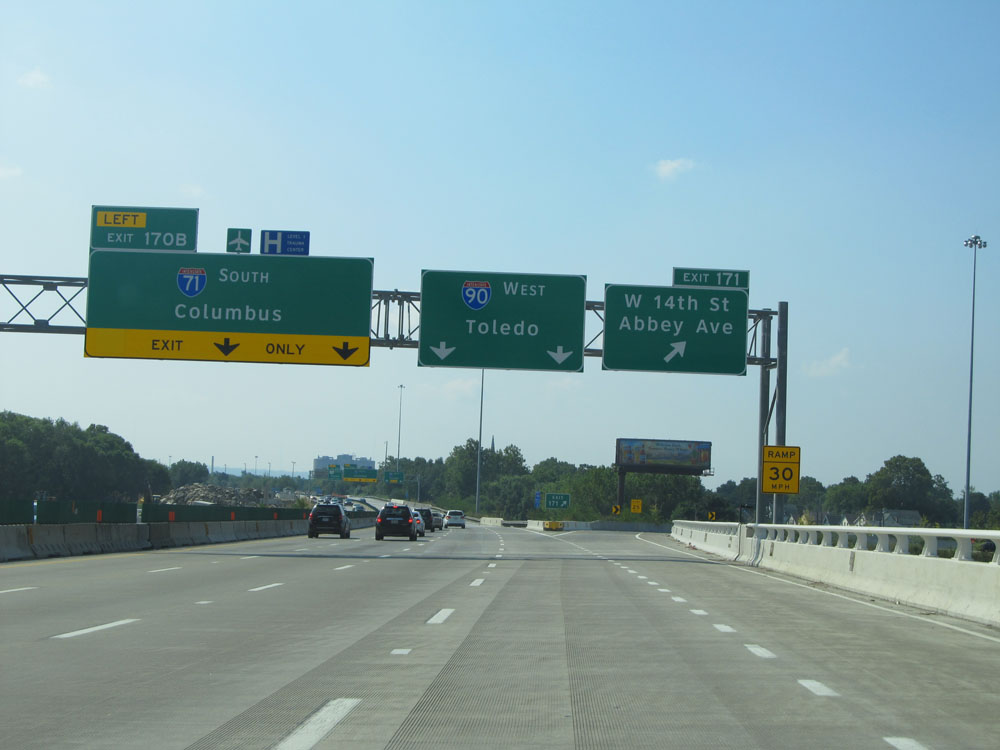
Interstate 90 West at Exit 170B: Interstate 71 South - Columbus (Photo taken 9/6/15). |
 |
A closer view of the ramp for Exit 170B. (Photo taken 9/6/15). |
 |
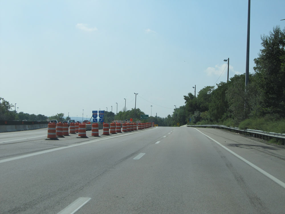
At mile marker 170.6, Interstate 90 West traverses another curve to the west. This one is a bit milder than the previous one, however. (Photo taken 9/6/15). |
 |
Interstate 90 West at mile marker 170. (Photo taken 9/6/15). |
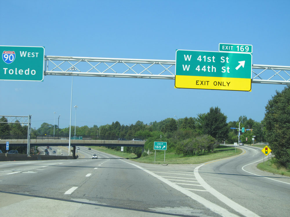 |
Interstate 90 West at Exit 169: W 41st St / W 44th St (Photo taken 9/6/15). |
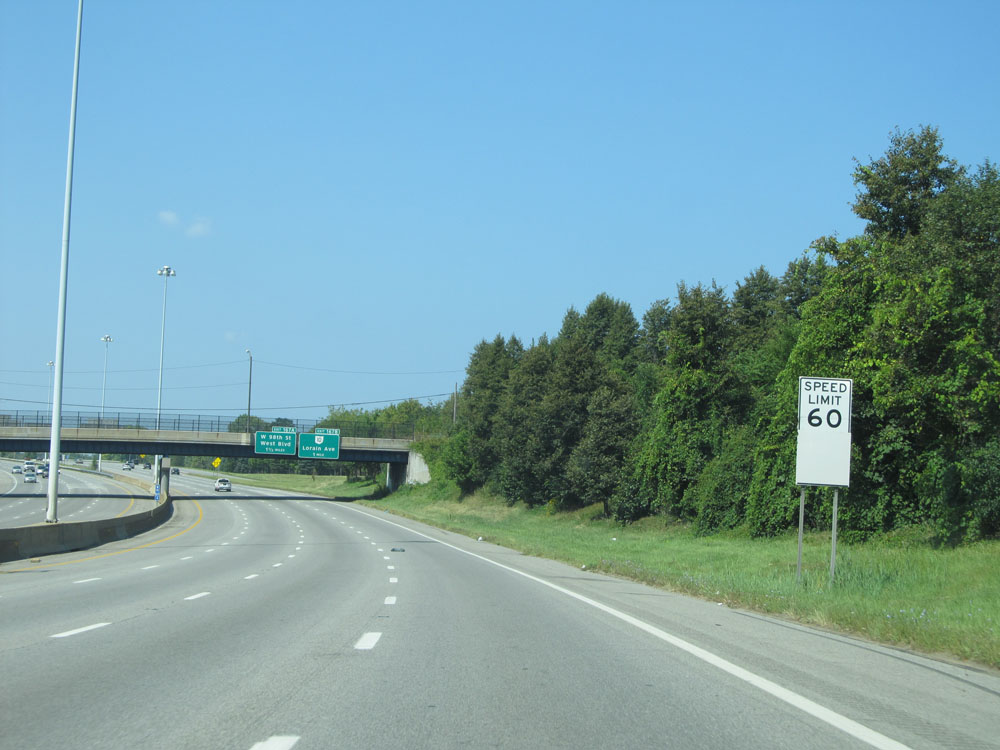 |
West of Exit 169, the speed limit returns to 60 mph. It remains 60 mph until I-90 leaves Cuyahoga County. (Photo taken 9/6/15). |
 |
Interstate 90 West assurance shield. (Photo taken 9/6/15). |
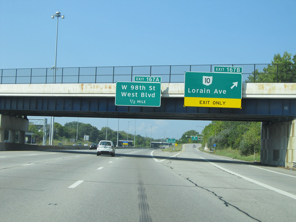 |
Interstate 90 West at Exit 167B: OH 10 - Lorain Ave (Photo taken 9/6/15). |
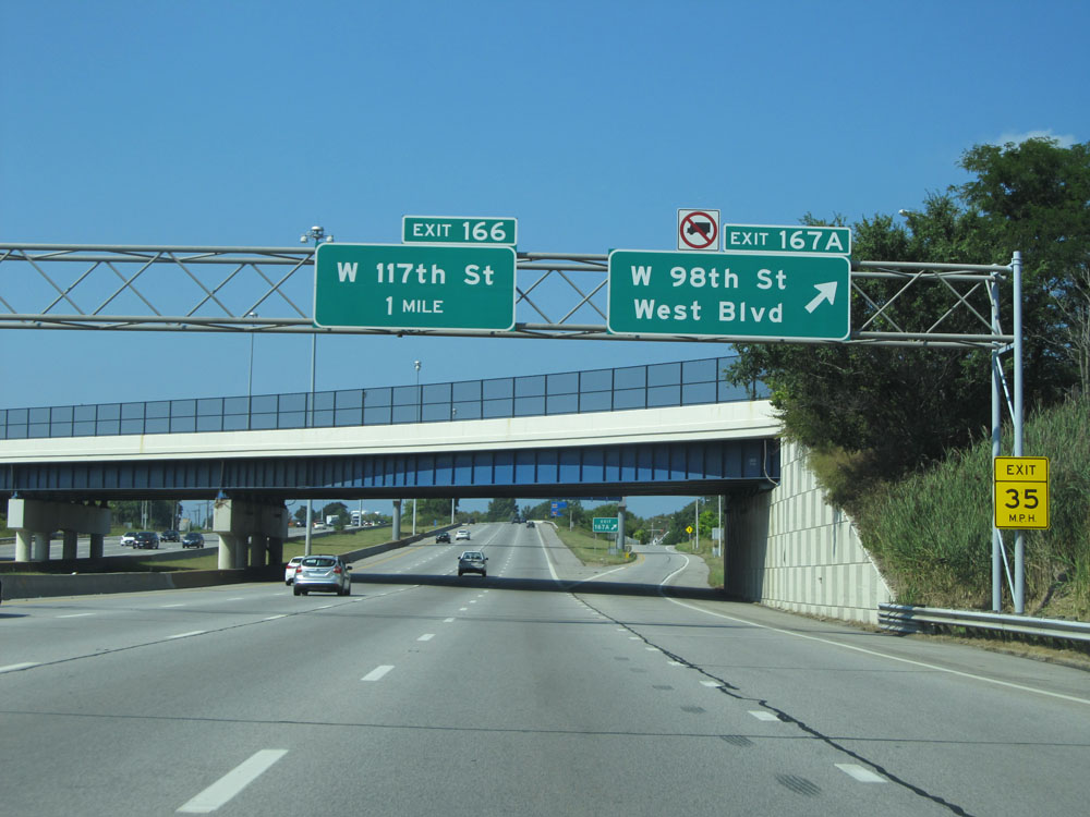 |
Interstate 90 West at Exit 167A: W 98th St / West Blvd (Photo taken 9/6/15). |
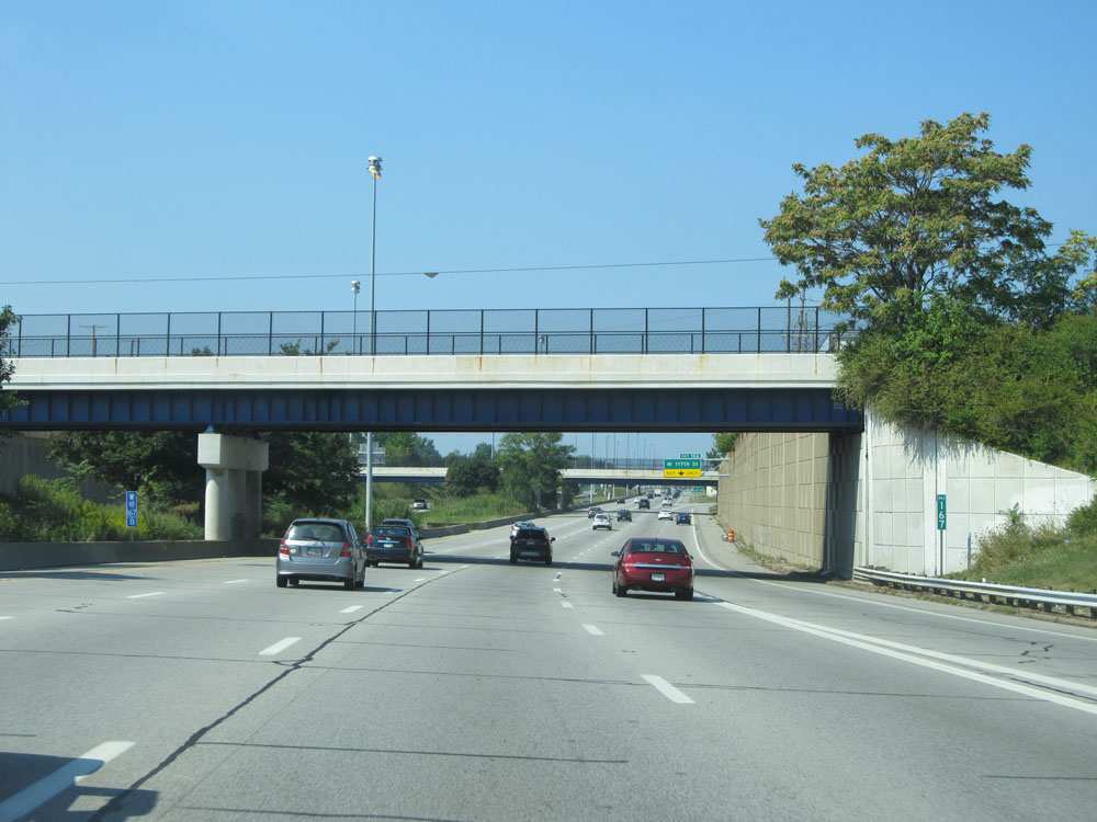 |
Interstate 90 West at mile marker 167. (Photo taken 9/6/15). |
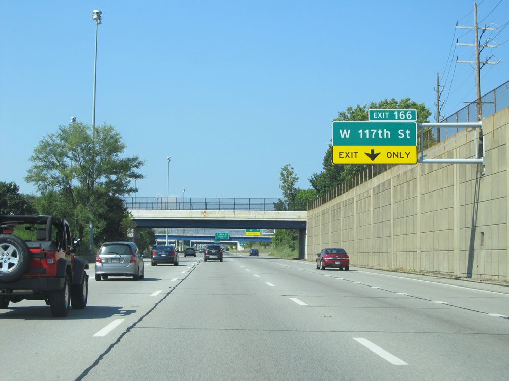 |
Interstate 90 West at Exit 166: W 117th St (Photo taken 9/6/15). |
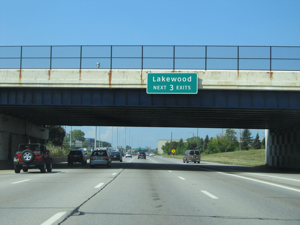 |
Take any of the next 3 exits to Lakewood. (Photo taken 9/6/15). |
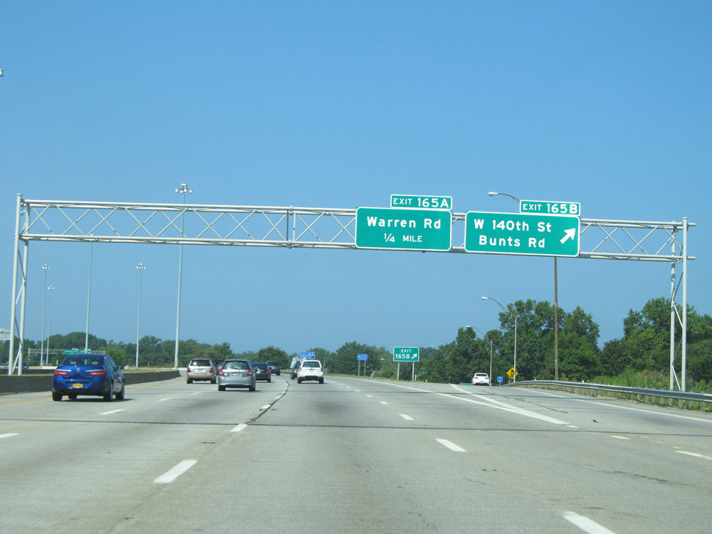 |
Interstate 90 West at Exit 165B: W 140th St / Bunts Rd (Photo taken 9/6/15). |
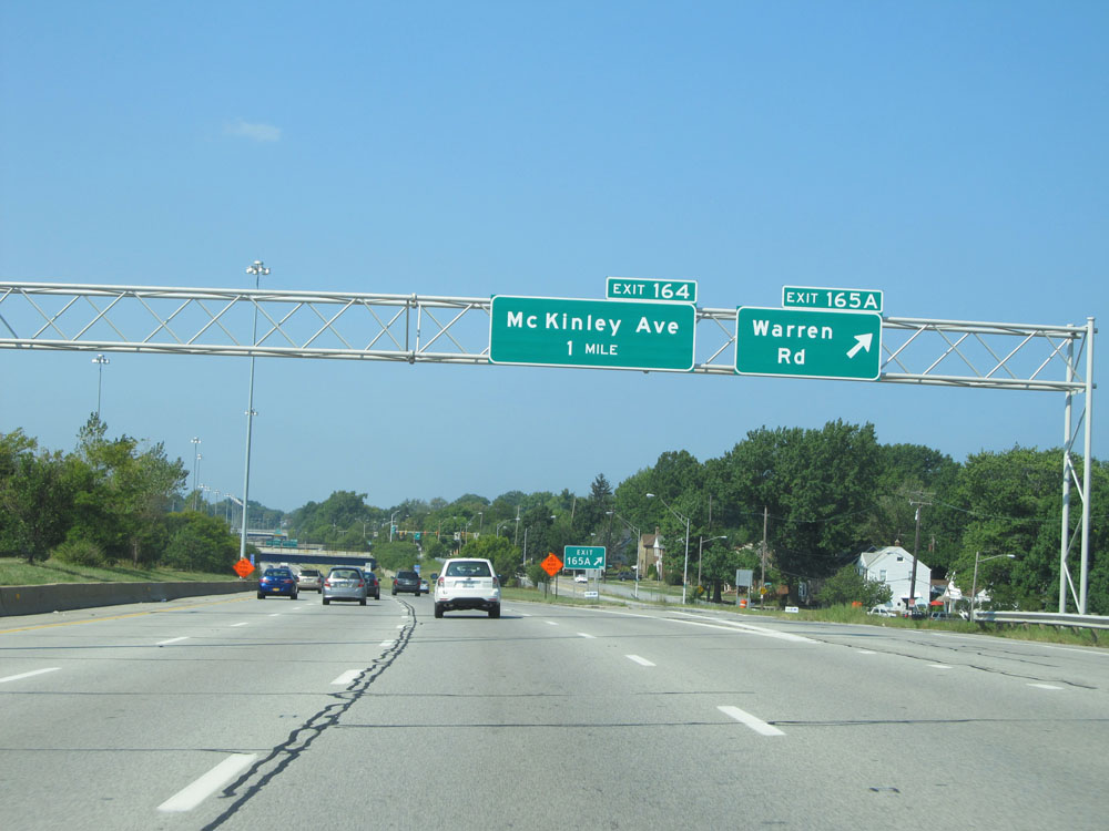 |
Interstate 90 West at Exit 165A: Warren Rd (Photo taken 9/6/15). |
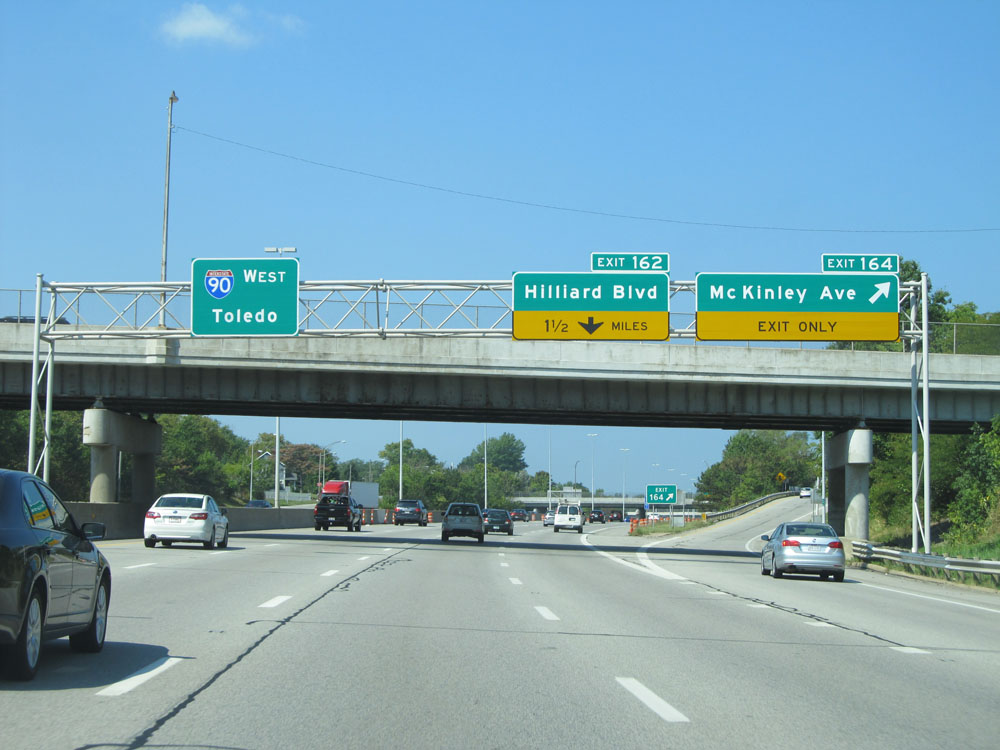 |
Interstate 90 West at Exit 164: McKinley Ave (Photo taken 9/6/15). |
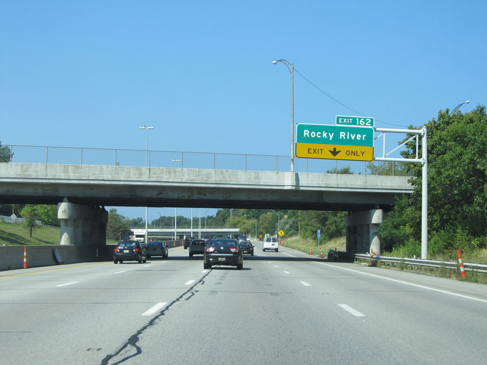 |
Take Exit 162 to Rocky River. (Photo taken 9/6/15). |
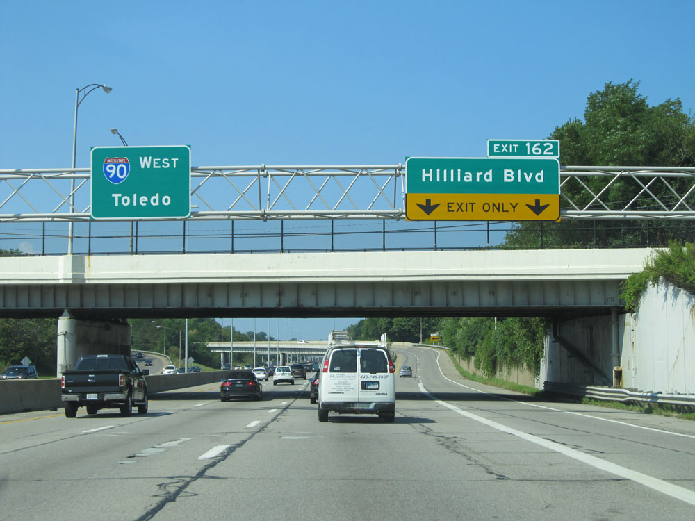 |
Interstate 90 West at Exit 162: Hilliard Blvd (Photo taken 9/6/15). |
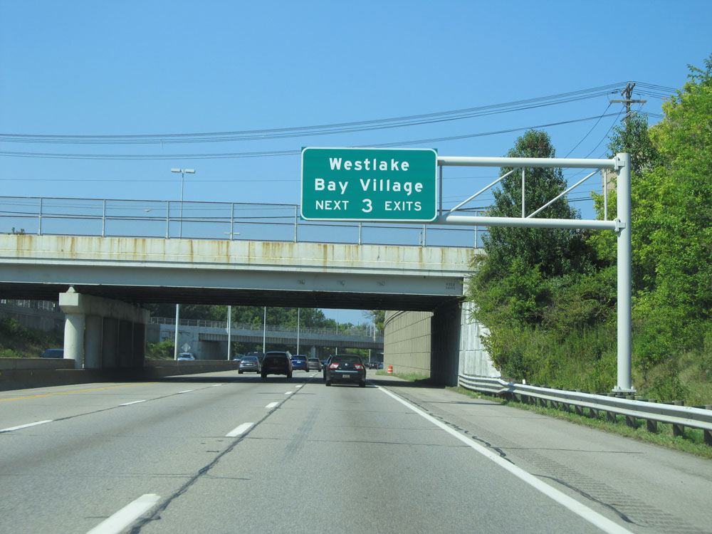 |
Take any of the next 3 exits to Westlake and Bay Village. (Photo taken 9/6/15). |
 |
Interstate 90 West at mile marker 161.4. (Photo taken 9/6/15). |
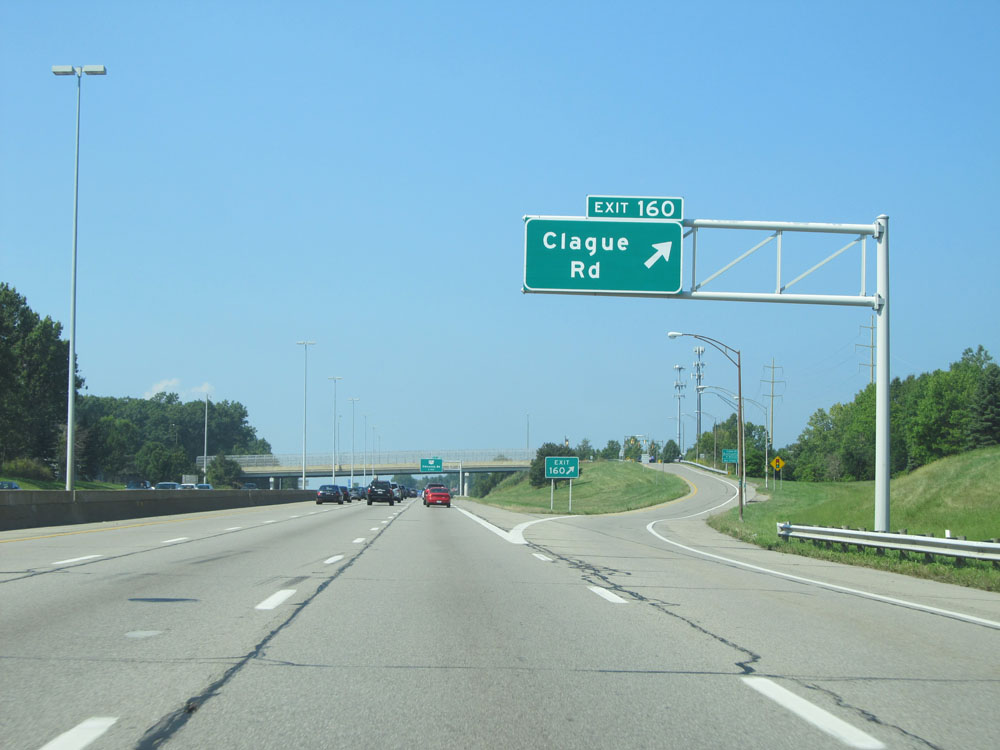 |
Interstate 90 West at Exit 160: Clague Rd (Photo taken 9/6/15). |
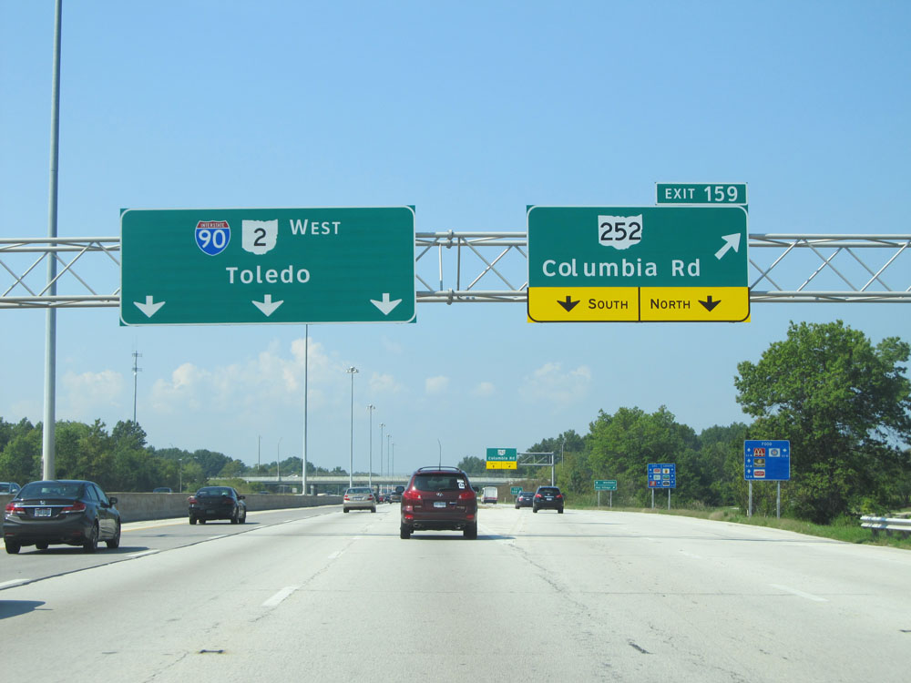 |
Interstate 90 West at Exit 159: OH 252 - Columbia Rd (Photo taken 9/6/15). |
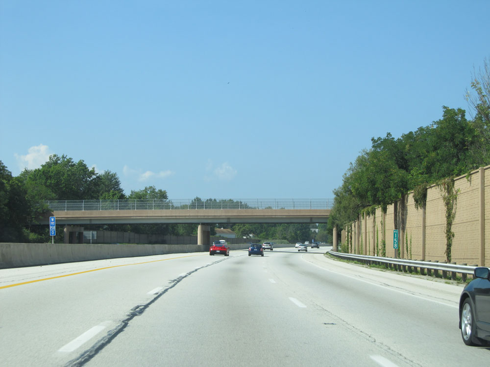 |
Interstate 90 West at mile marker 158. (Photo taken 9/6/15). |
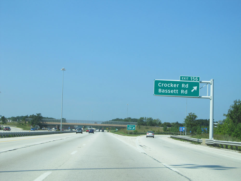 |
Interstate 90 West at Exit 156: Crocker Rd / Bassett Rd (Photo taken 9/6/15). |
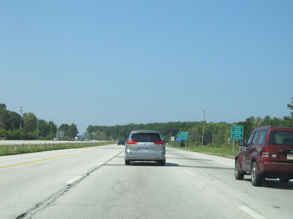 |
Interstate 90 West entering Lorain County. (Photo taken 9/6/15). |
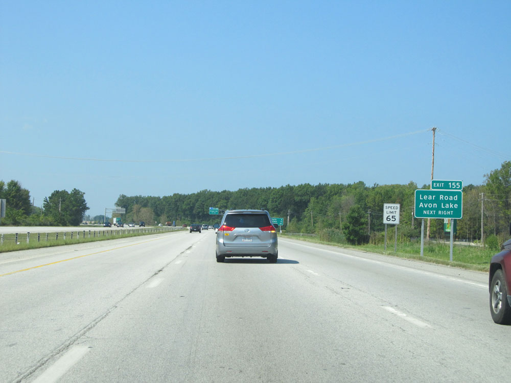 |
Upon entering Lorain County, the speed limit increases to 65 mph. Also, take Exit 155 to Lear Road and Avon Lake. (Photo taken 9/6/15). |
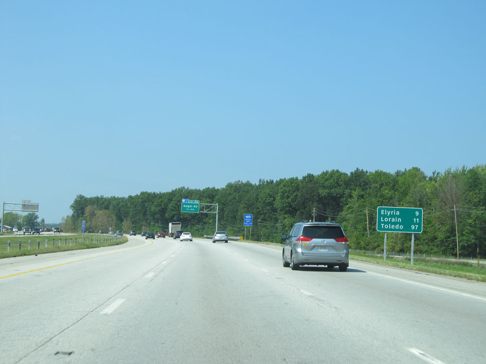 |
Mileage sign approaching Exit 155. It's 9 miles to Elyria, 11 miles to Lorain, and 97 miles to Toledo. (Photo taken 9/6/15). |
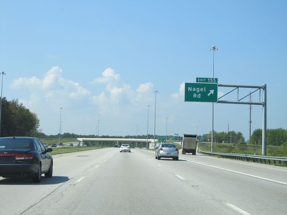 |
Interstate 90 West at Exit 155: Nagel Rd (Photo taken 9/6/15). |
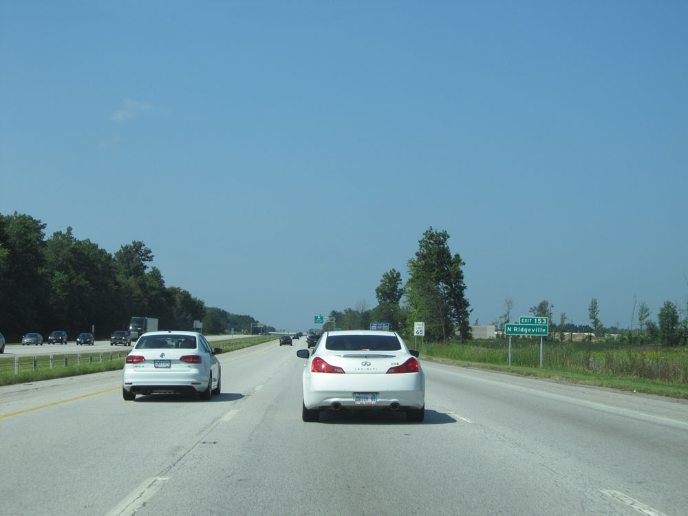 |
Take Exit 153 to North Ridgeville. (Photo taken 9/6/15). |
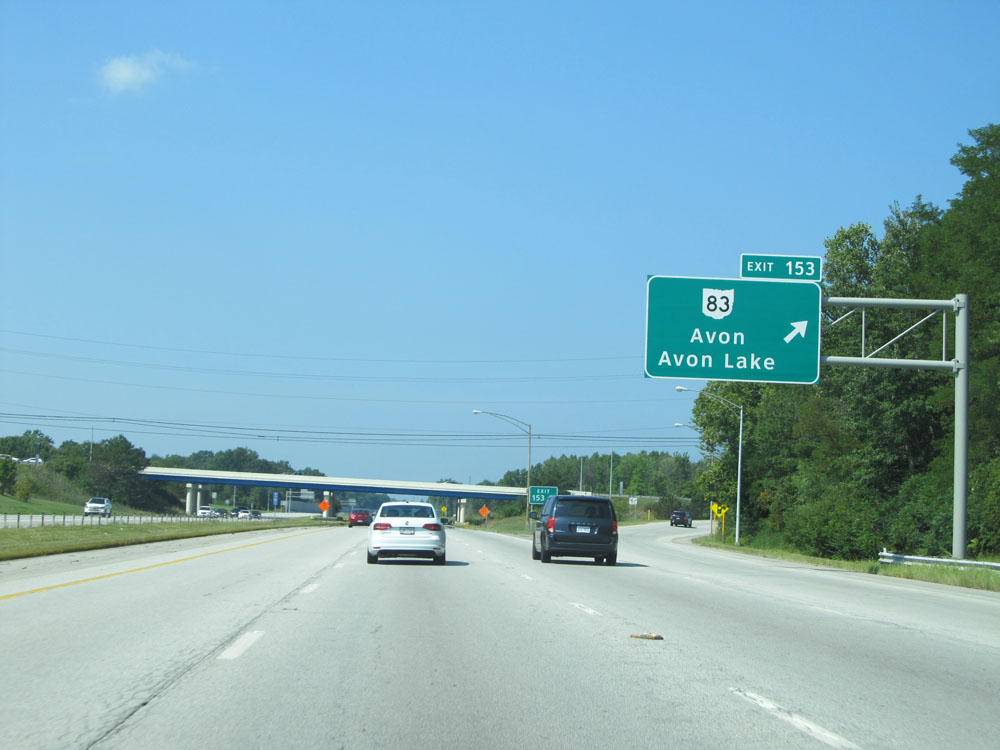 |
Interstate 90 West at Exit 153: OH 83 - Avon / Avon Lake (Photo taken 9/6/15). |
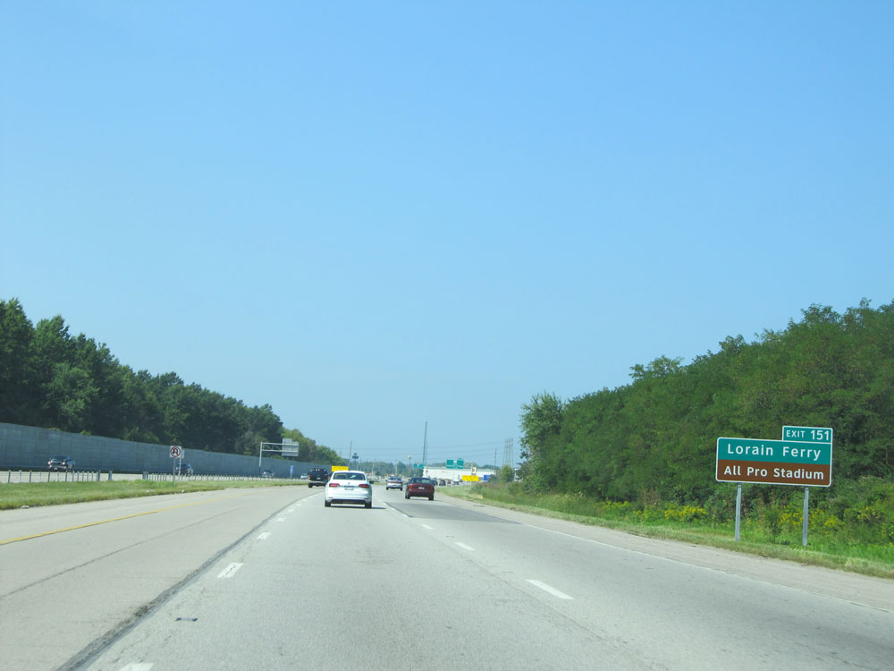 |
Take Exit 151 to Lorain Ferry and All Pro Stadium. (Photo taken 9/6/15). |
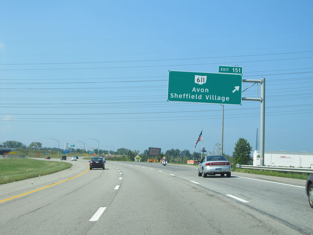 |
Interstate 90 West at Exit 151: OH 611 - Avon / Sheffield Village (Photo taken 9/6/15). |
 |
Mileage sign beyond Exit 151. It's 3 miles to Elyria and 95 miles to Toledo. (Photo taken 9/6/15). |
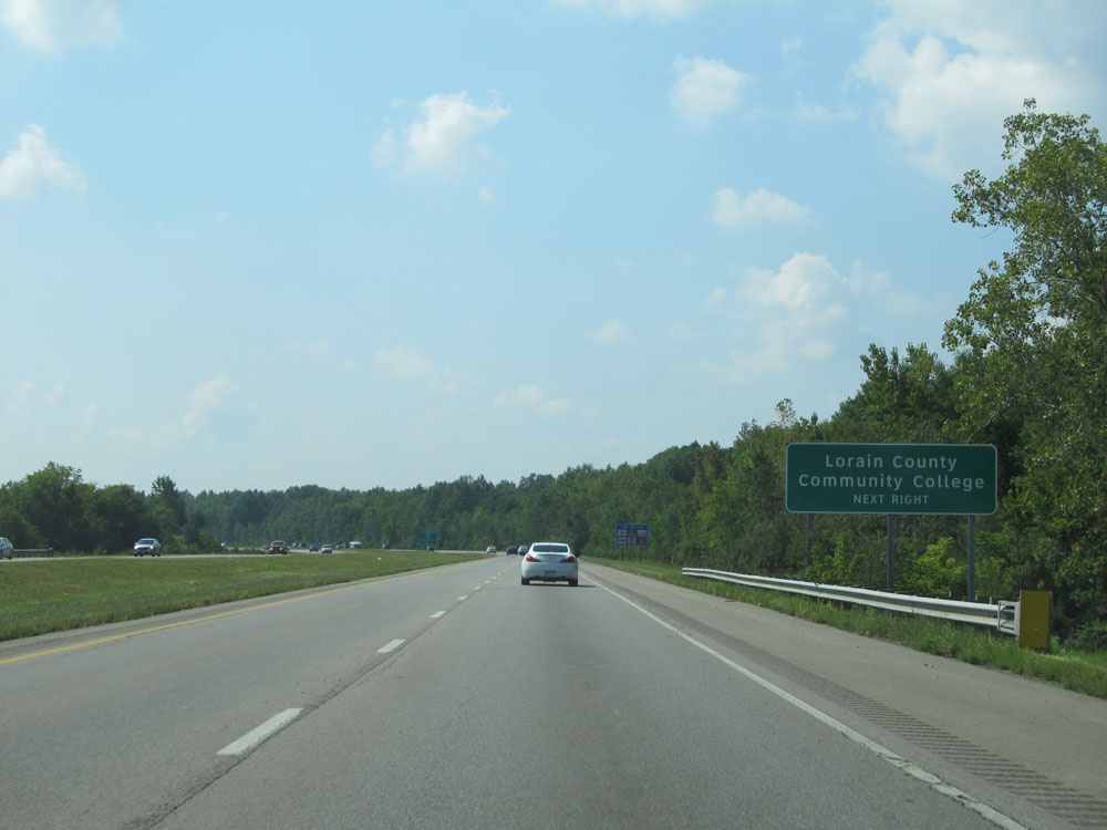 |
Take Exit 148 to Lorain County Community College. (Photo taken 9/6/15). |
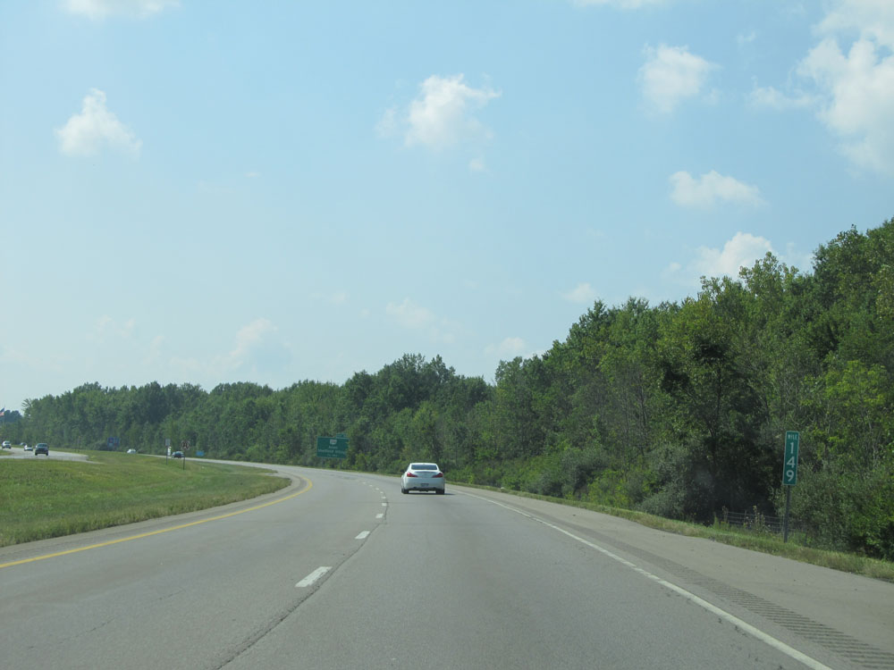 |
Interstate 90 West at mile marker 149. (Photo taken 9/6/15). |
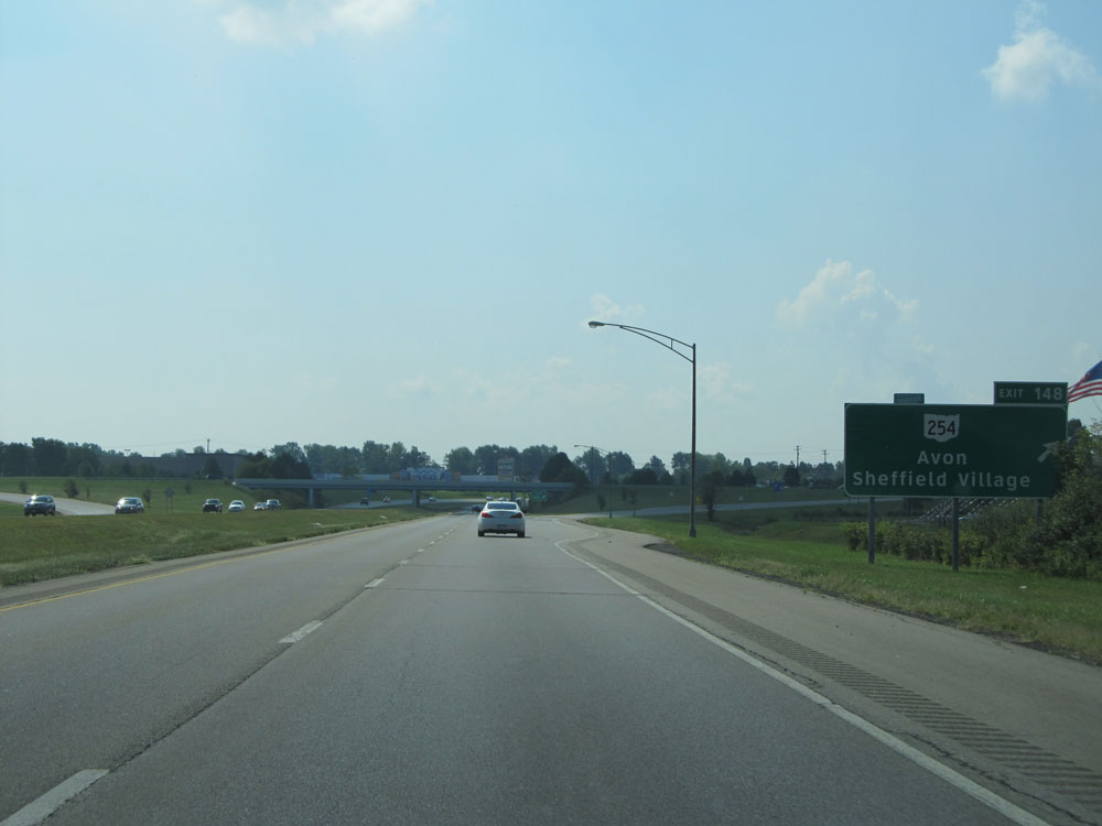 |
Interstate 90 West at Exit 148: OH 254 - Avon / Sheffield Village (Photo taken 9/6/15). |
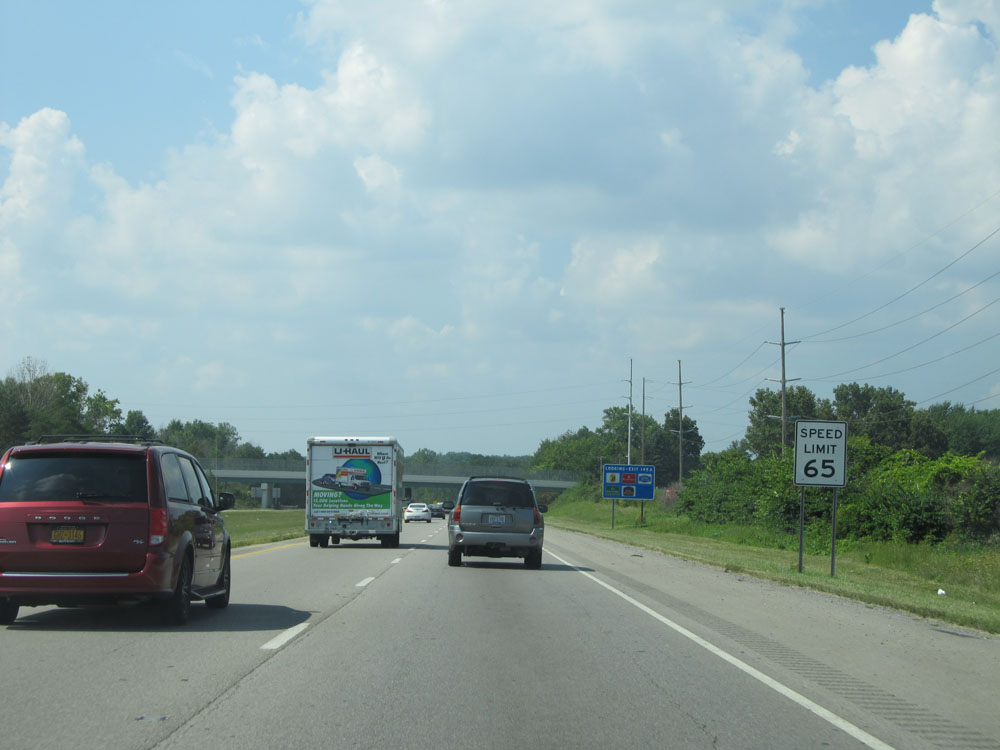 |
Speed limit assurance sign beyond Exit 148. Speed Limit - 65 mph. (Photo taken 9/6/15). |
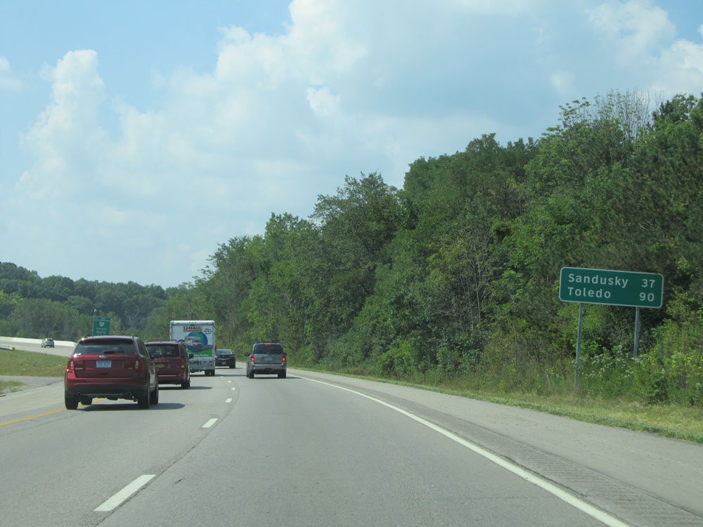 |
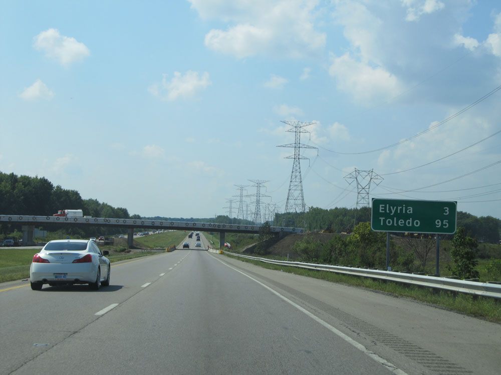
Mileage sign on Interstate 90 West. It's 37 miles to Sandusky and 90 miles to Toledo. (Photo taken 9/6/15). |
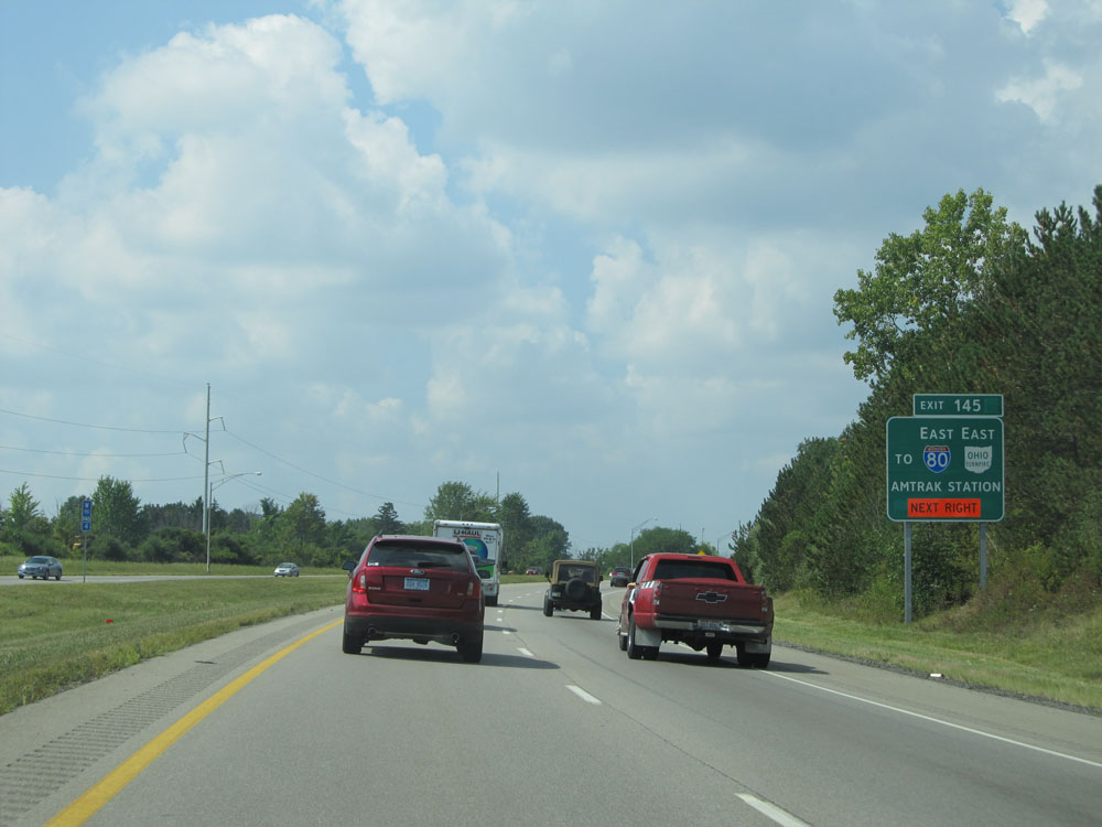 |
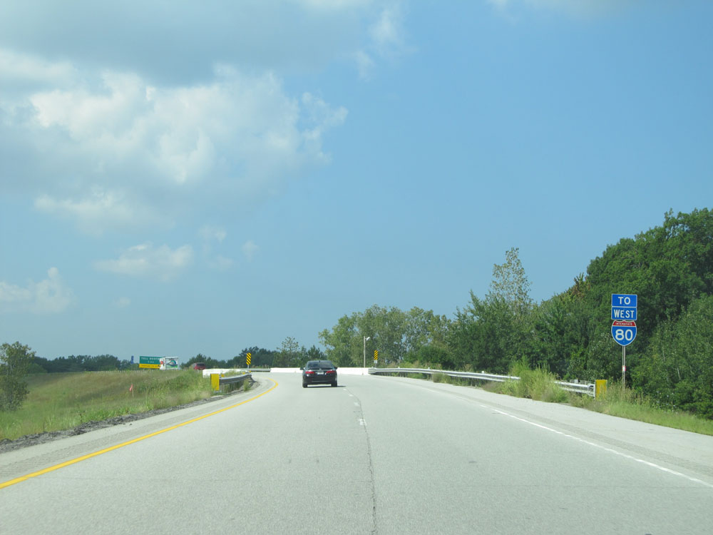
Take Exit 145 to Interstate 80 (Ohio Turnpike) East and AMTRAK Station. (Photo taken 9/6/15). |
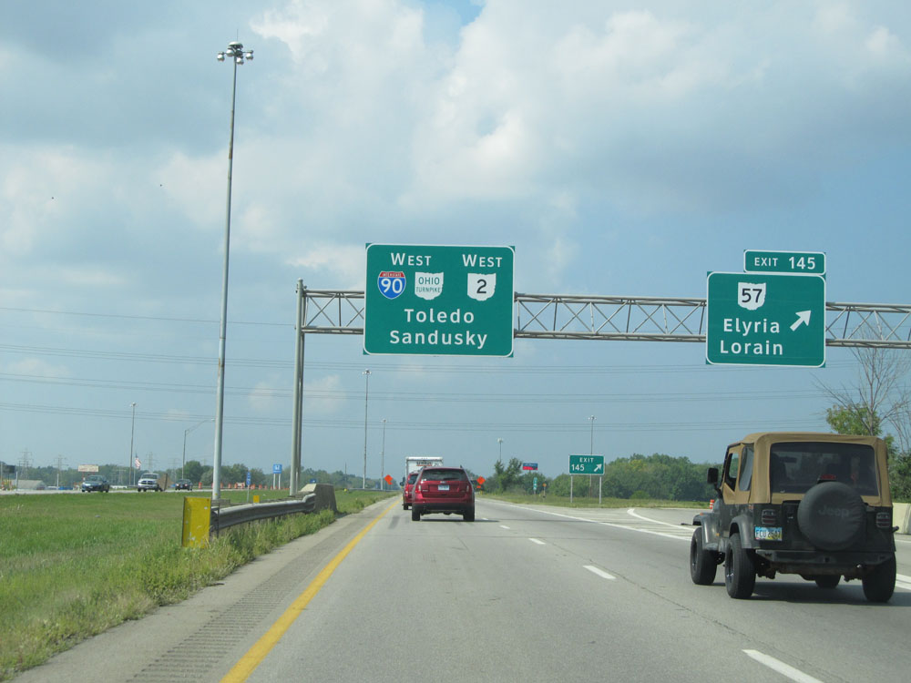 |
Interstate 90 West at Exit 145: OH 57 - Elyria / Lorain (Photo taken 9/6/15). |
 |
Interstate 90 West approaching the junction of Interstate 80 (Ohio Turnpike). The lanes split ahead, and you should keep to the left to reamin on Interstate 90 West via the Ohio Turnpike. (Photo taken 9/6/15). |
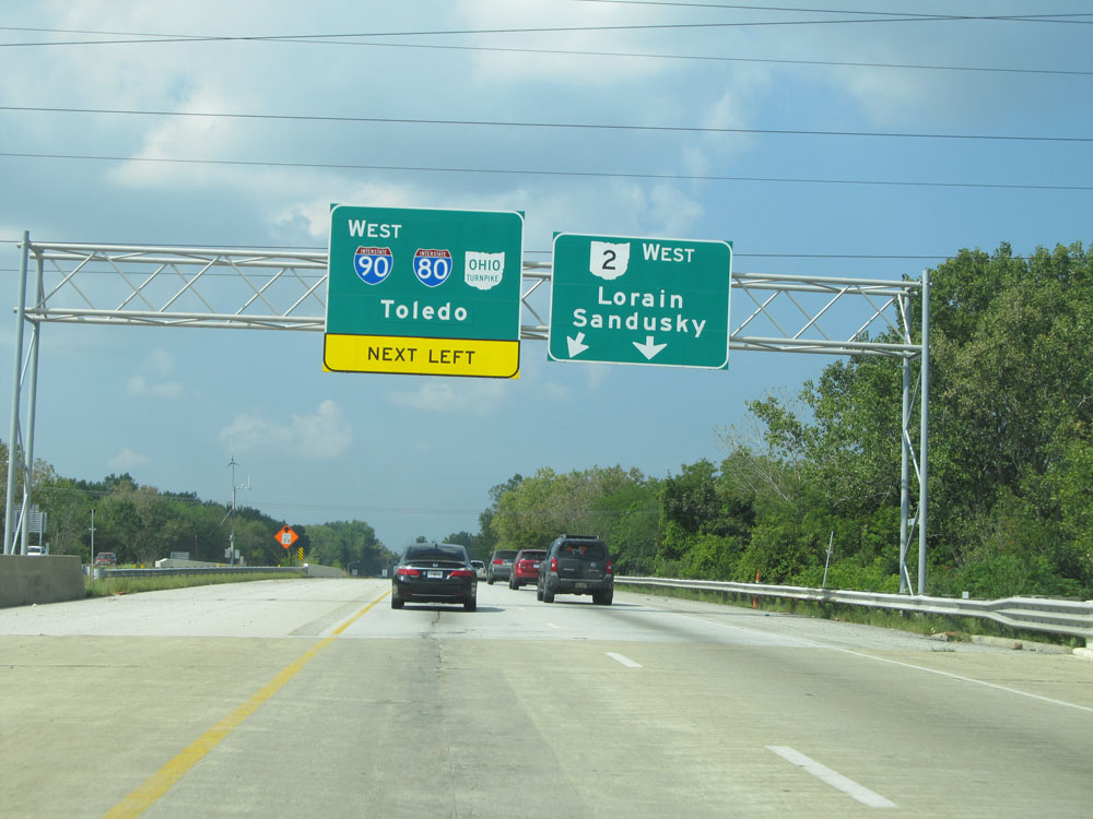 |
Interstate 90 West approaching the split. The ramp to OH 2 West toward Lorain and Sandusky is not assigned an exit number. (Photo taken 9/6/15). |
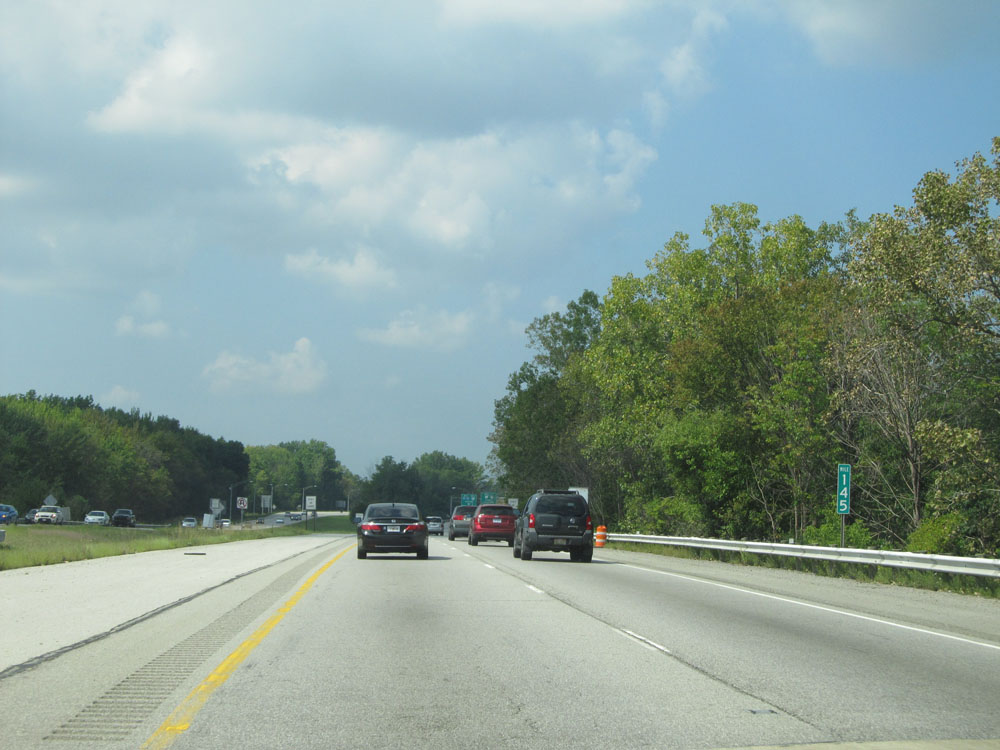 |
Interstate 90 West at mile marker 145. (Photo taken 9/6/15). |
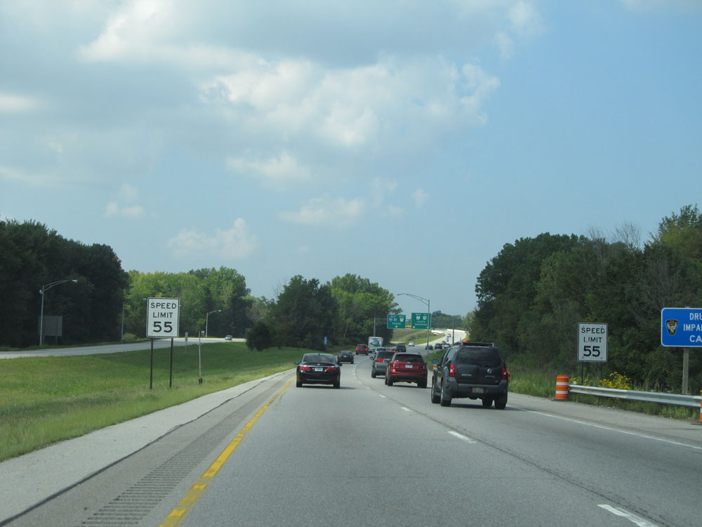 |
Approaching the split of Interstate 90 and OH 2, the speed limit decreases to 55 mph. (Photo taken 9/6/15). |
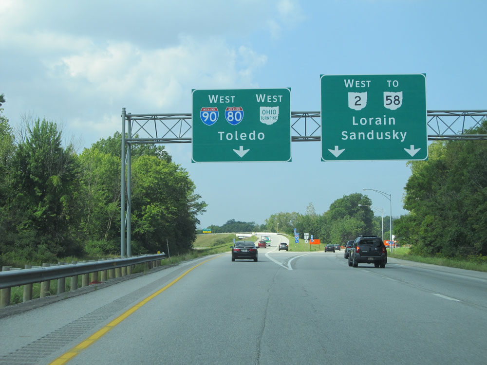 |
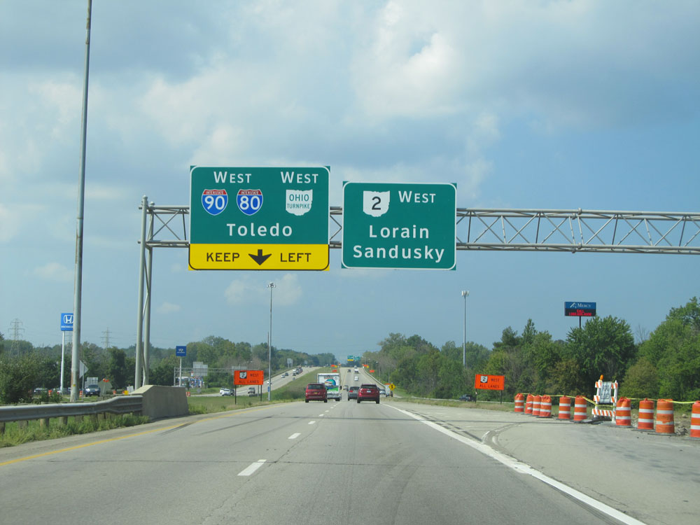
Interstate 90 West at the split of OH 2. Keep to the left here to remain on I-90 West, where it will join up with Interstate 80 West and the Ohio Turnpike. (Photo taken 9/6/15). |
 |
A closer view of the split. (Photo taken 9/6/15). |
 |
Soon after, the ramp to Interstate 80 / Ohio Turnpike divides into 2 lanes. (Photo taken 9/6/15). |
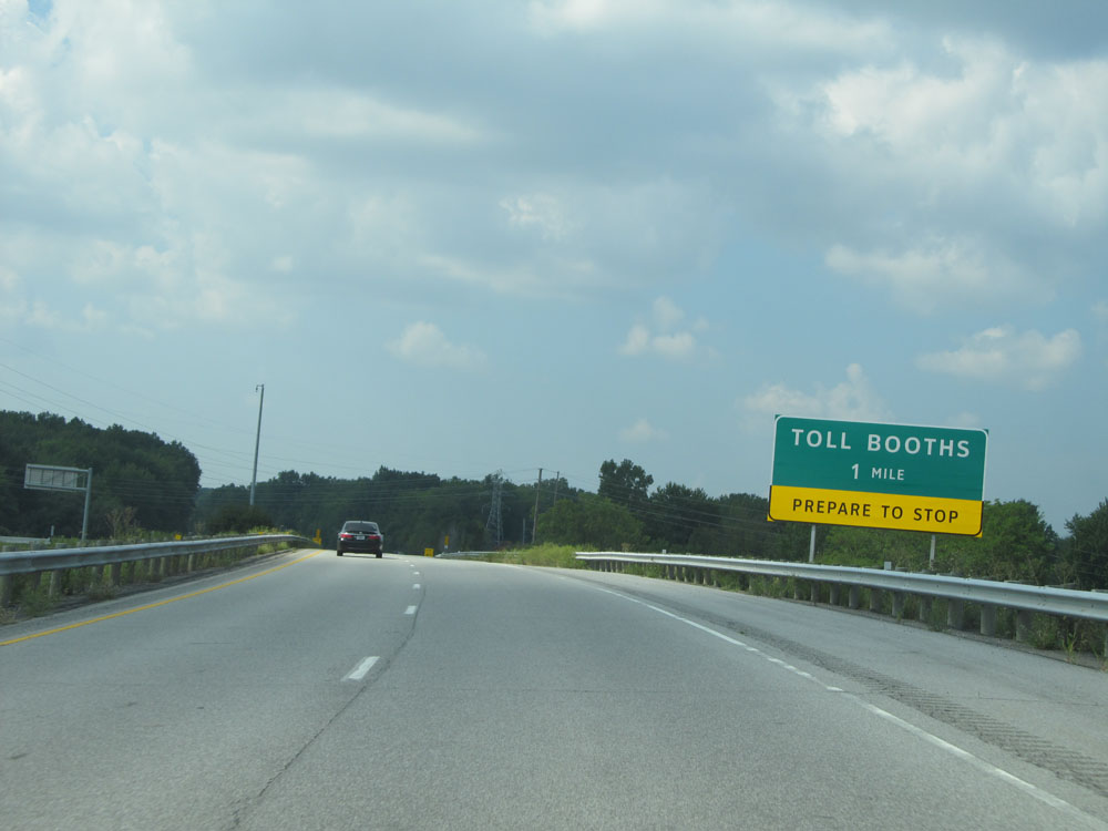 |
The toll plaza for the Ohio Turnpike lies 1 mile ahead. (Photo taken 9/6/15). |
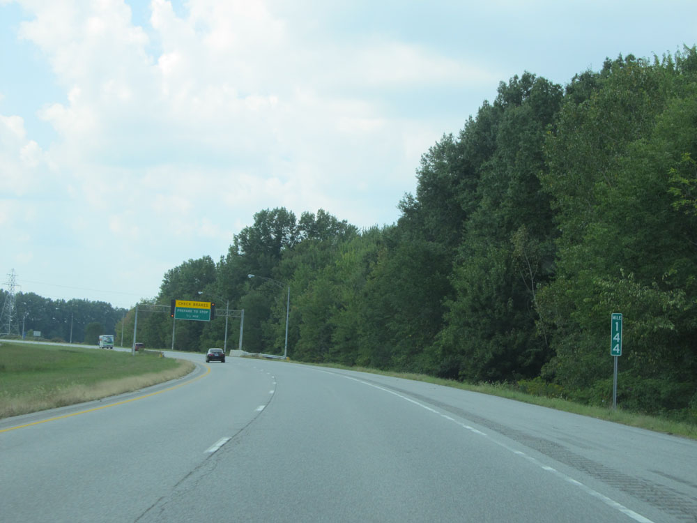 |
Interstate 90 West at mile marker 144, approaching the toll plaza. (Photo taken 9/6/15). |
 |
Interstate 90 West 1/2 mile from the toll plaza for the Ohio Turnpike. (Photo taken 9/6/15). |
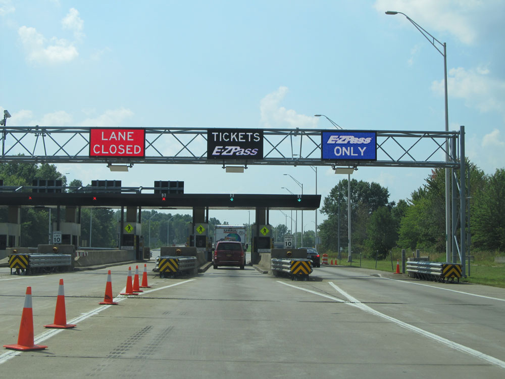 |
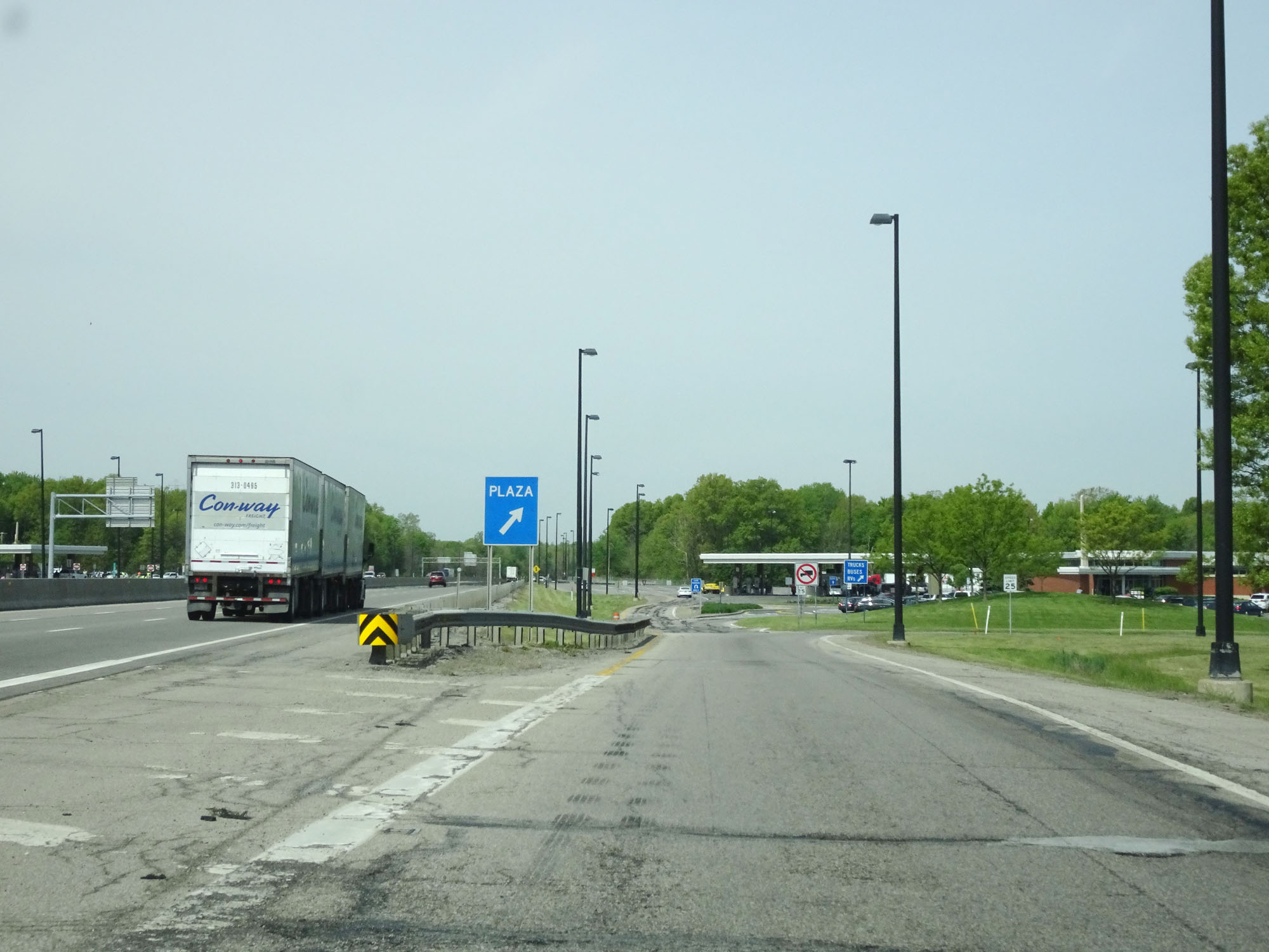
View of the toll plaza. (Photo taken 9/6/15). |
 |
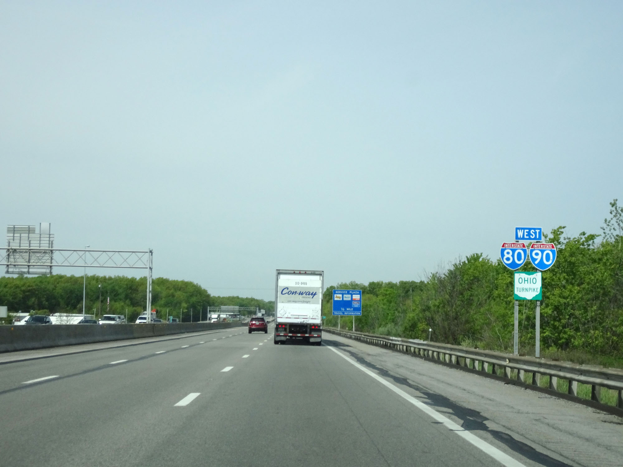
At mile marker 143, Interstate 90 West prepares to join up with Interstate 80 West and the Ohio Turnpike, where they will run concurrently to the Indiana border and beyond. (Photo taken 9/6/15). |
 |
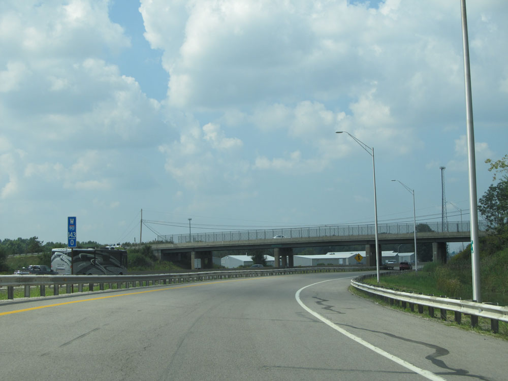
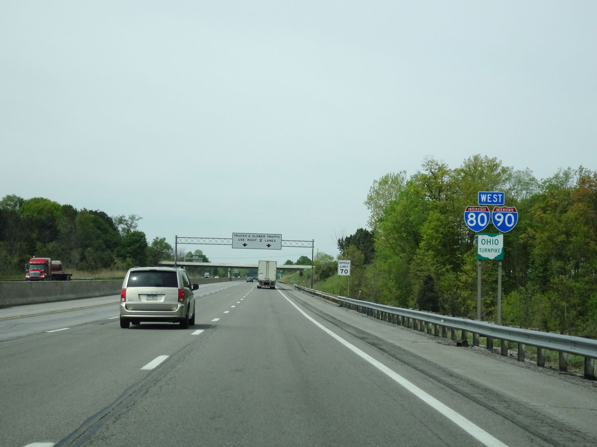
Interstate 80 West (Ohio Turnpike) approaching Exit 140 - 1 mile. At this point, traffic from Interstate 90 Westbound merges onto the turnpike. I-80, I-90 and the Ohio Turnpike run concurrently the rest of the way through Ohio. (Photo taken 5/20/16). |
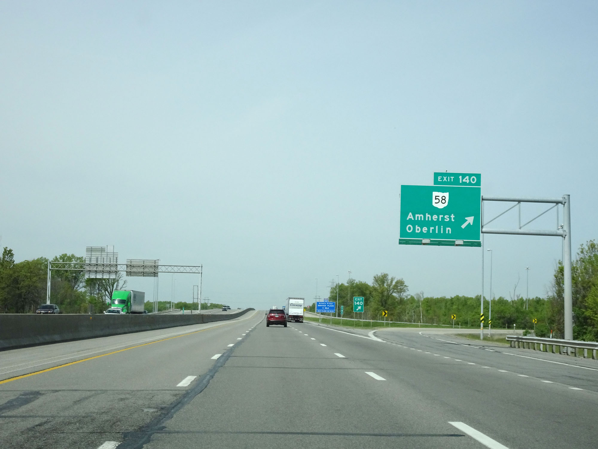 |
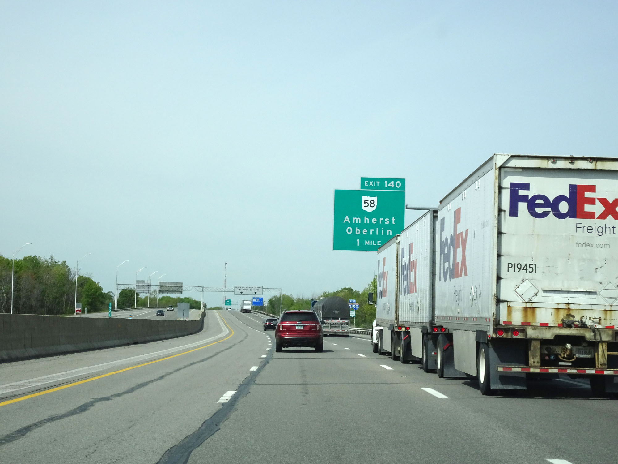
Interstate 80 / Interstate 90 West (Ohio Turnpike) at Exit 140: OH 58 - Amherst / Oberlin (Photo taken 5/20/16). |
Section 3: Elyria (Exit 140) to Maumee (Exit 59)
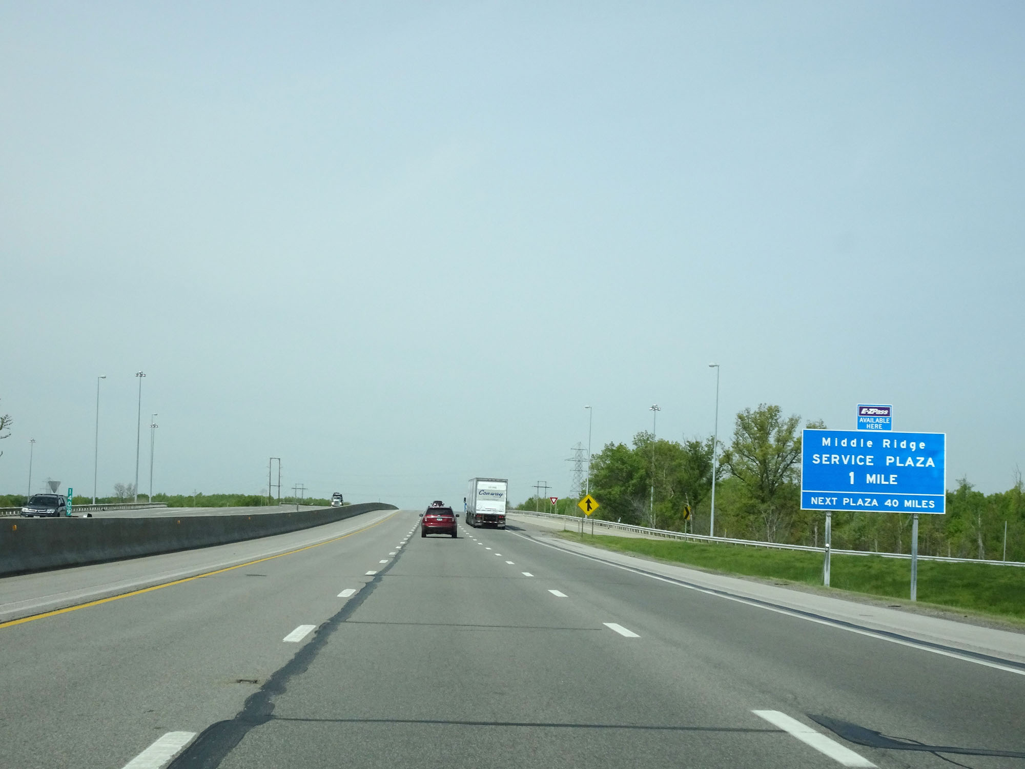 |
Interstate 80 / Interstate 90 West (Ohio Turnpike) approaching the Middle Ridge Service Plaza - 1 mile. (Photo taken 5/20/16). |
 |
Interstate 80 / Interstate 90 / Ohio Turnpike West assurance shields approaching the Middle Ridge Service Plaza. (Photo taken 5/20/16). |
 |
Interstate 80 / Interstate 90 West (Ohio Turnpike) at the Middle Ridge Service Plaza located at mile marker 139.5. (Photo taken 5/20/16). |
 |
Speed limit sign on Interstate 80 / Interstate 90 West (Ohio Turnpike). Speed Limit - 70 mph. (Photo taken 5/20/16). |
 |
Interstate 80 / Interstate 90 West (Ohio Turnpike) approaching Exit 135 - 1 mile. (Photo taken 5/20/16). |
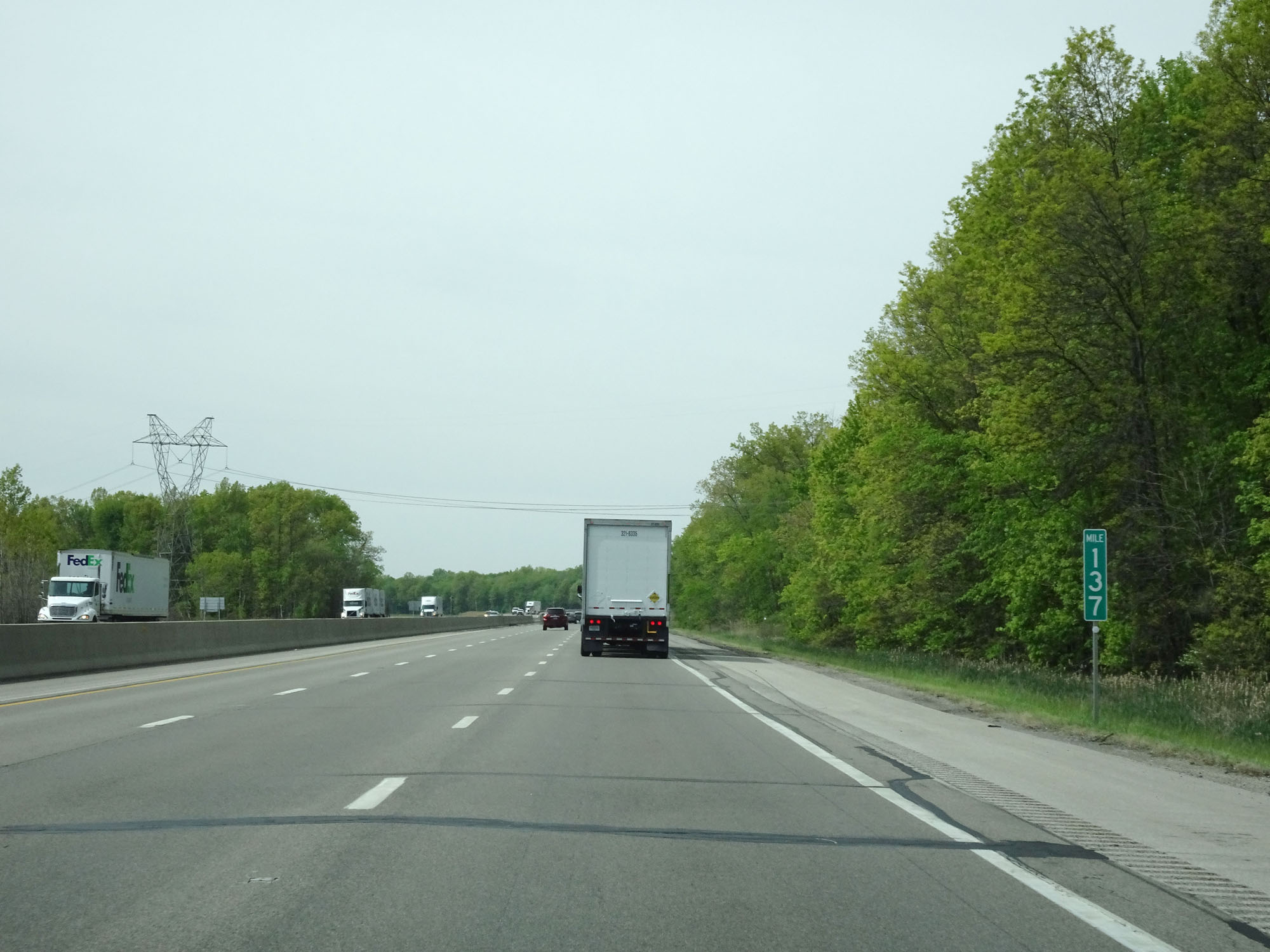 |
Interstate 80 / Interstate 90 West (Ohio Turnpike) at mile marker 137. (Photo taken 5/20/16). |
 |
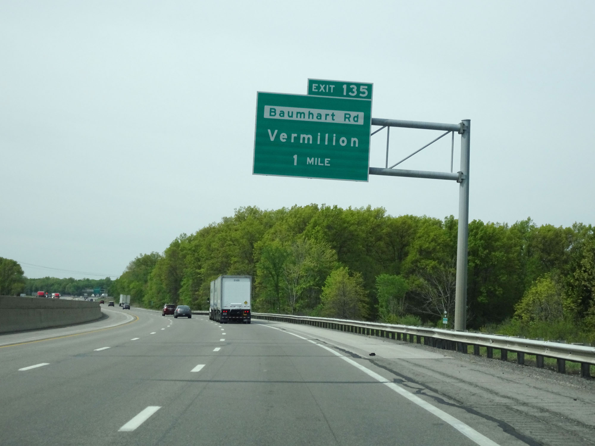
Interstate 80 / Interstate 90 West (Ohio Turnpike) at Exit 135: To OH 2 - Baumhart Rd / Vermilion (Photo taken 5/20/16). |
 |
Interstate 80 / Interstate 90 / Ohio Turnpike West assurance shields west of Exit 135. (Photo taken 5/20/16). |
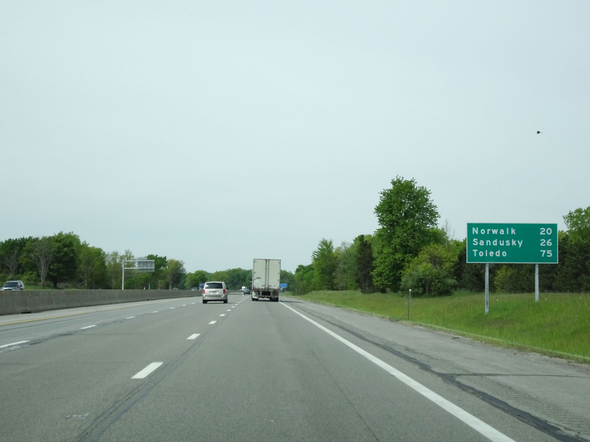 |
Mileage sign west of Exit 135. It's 20 miles to Norwalk, 26 miles to Sandusky, and 75 miles to Toledo. (Photo taken 5/20/16). |
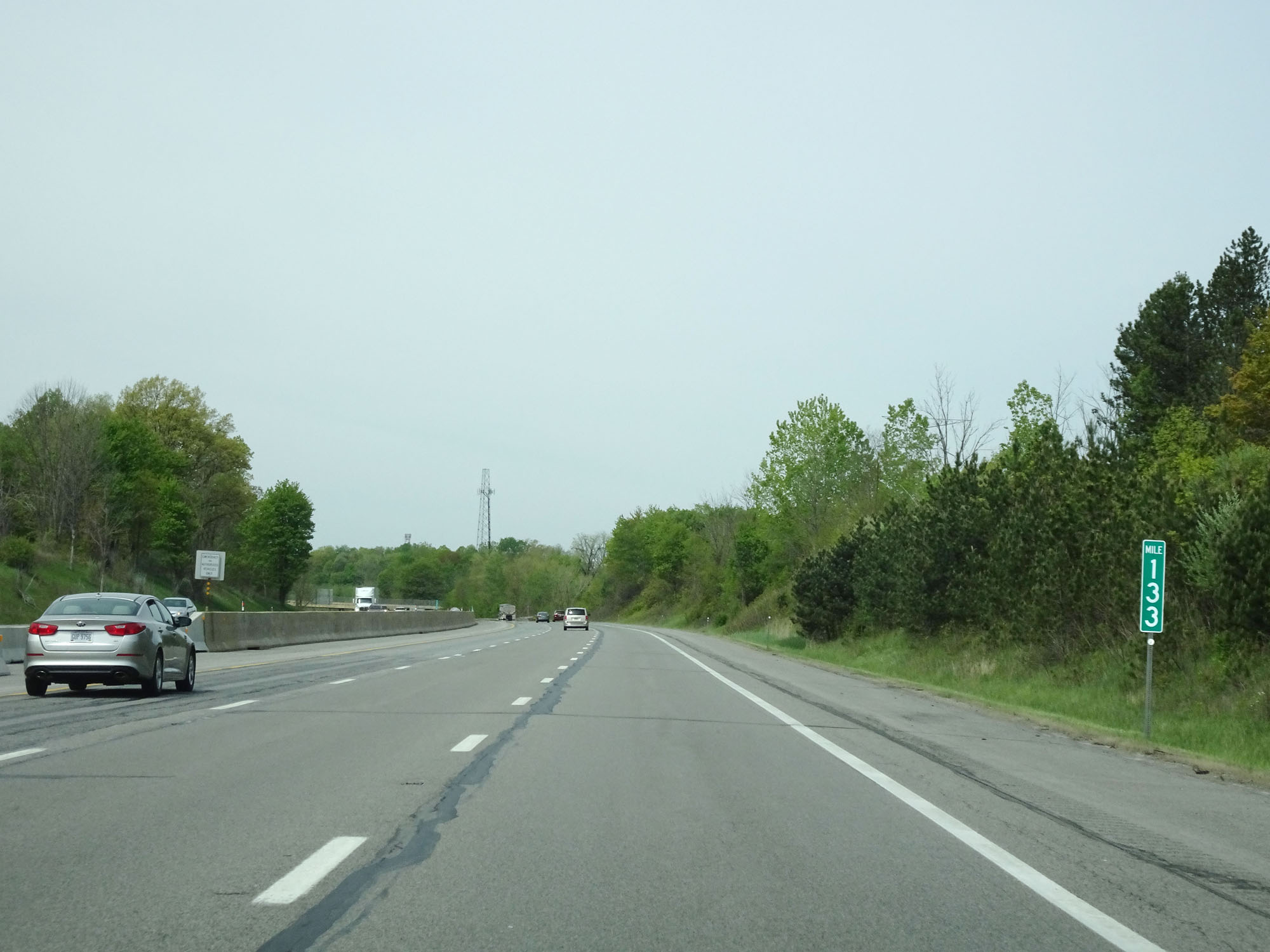 |
Interstate 80 / Interstate 90 West (Ohio Turnpike) at mile marker 133. (Photo taken 5/20/16). |
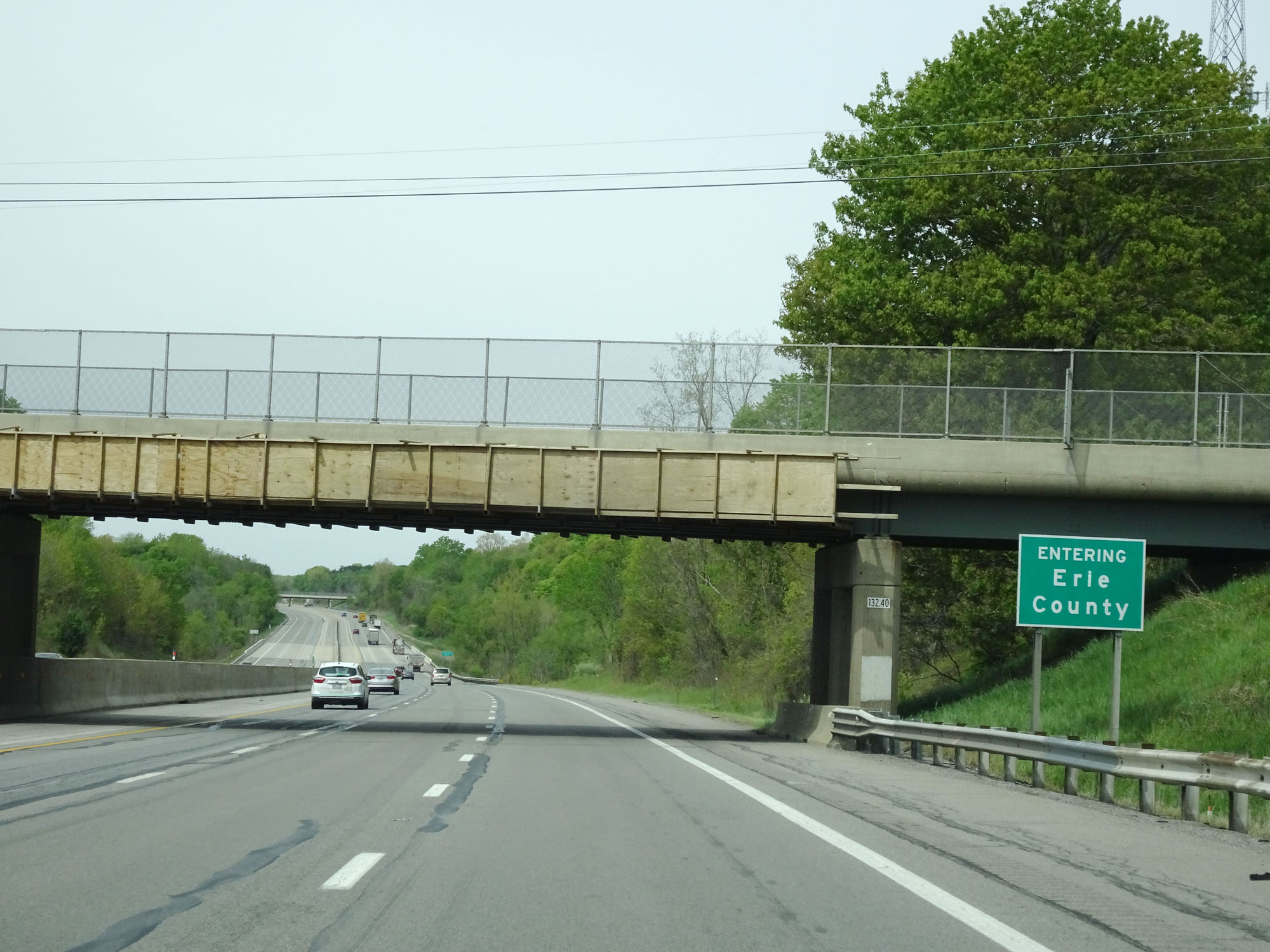 |
Interstate 80 / Interstate 90 West (Ohio Turnpike) entering Erie County. (Photo taken 5/20/16). |
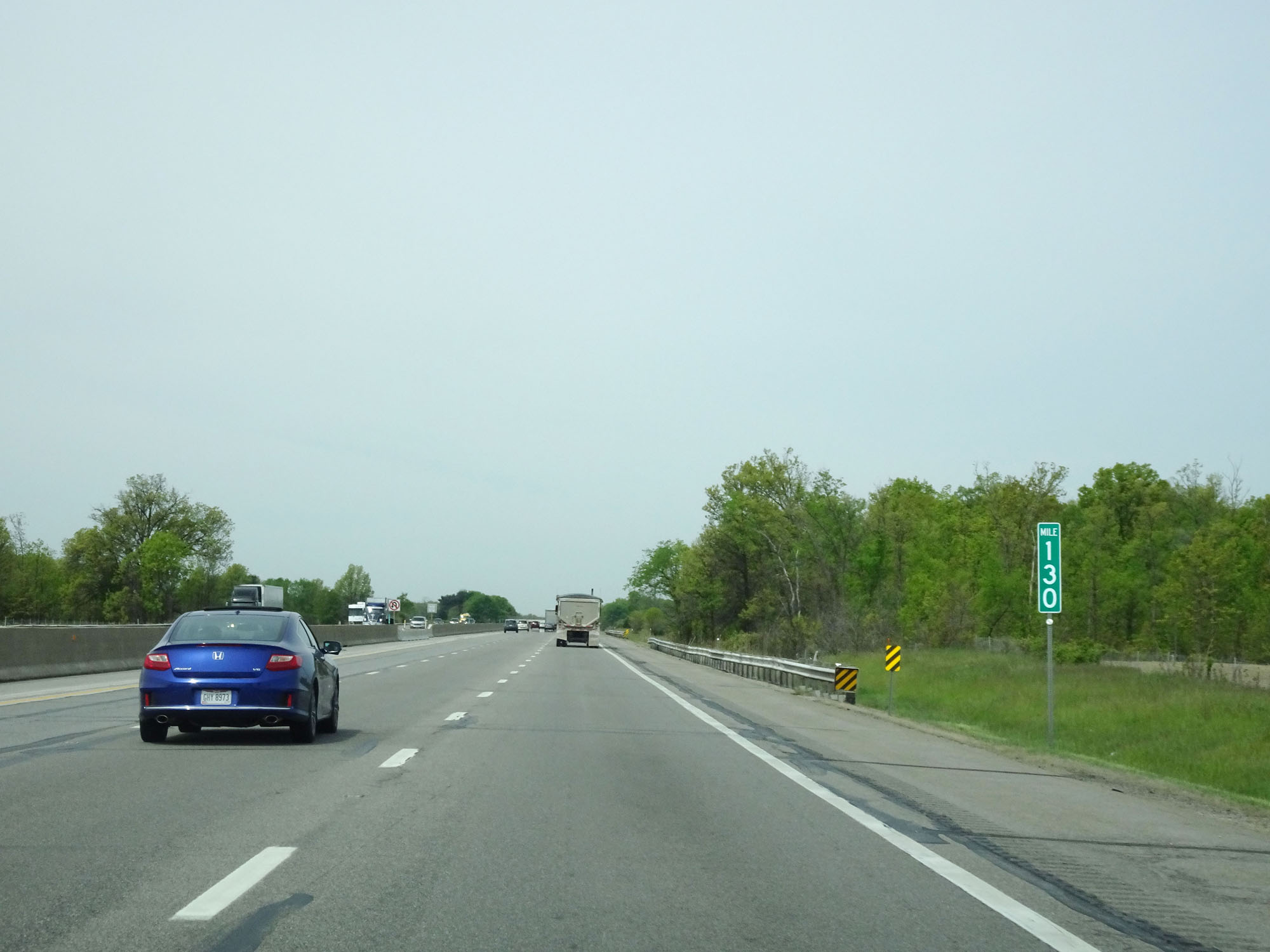 |
Interstate 80 / Interstate 90 West (Ohio Turnpike) at mile marker 130. (Photo taken 5/20/16). |
 |
Interstate 80 / Interstate 90 West (Ohio Turnpike) at mile marker 127. (Photo taken 5/20/16). |
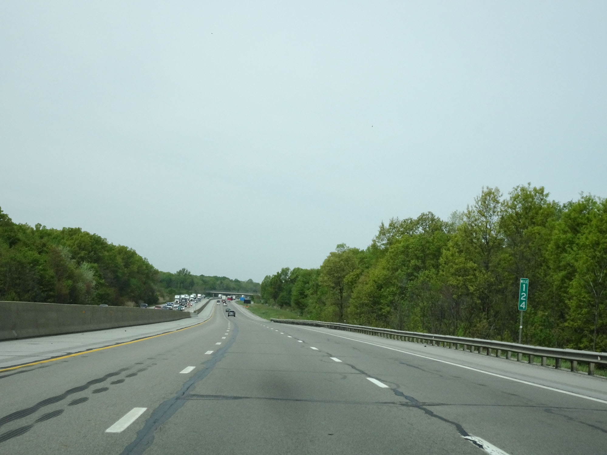 |
Interstate 80 / Interstate 90 West (Ohio Turnpike) at mile marker 124. (Photo taken 5/20/16). |
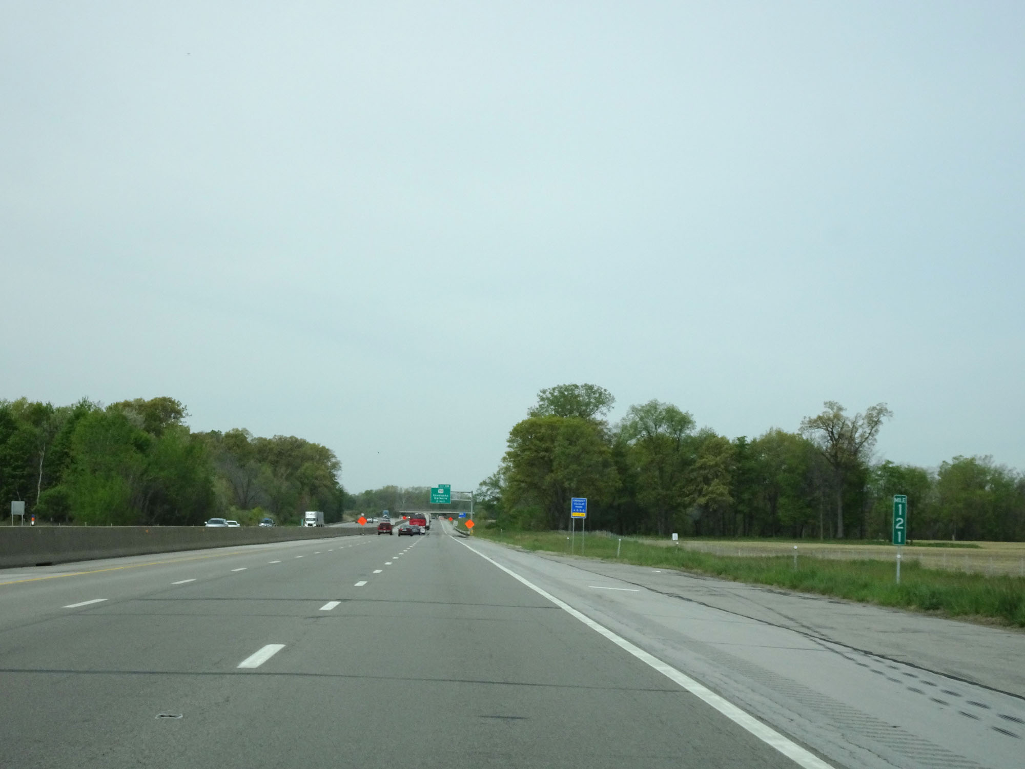 |
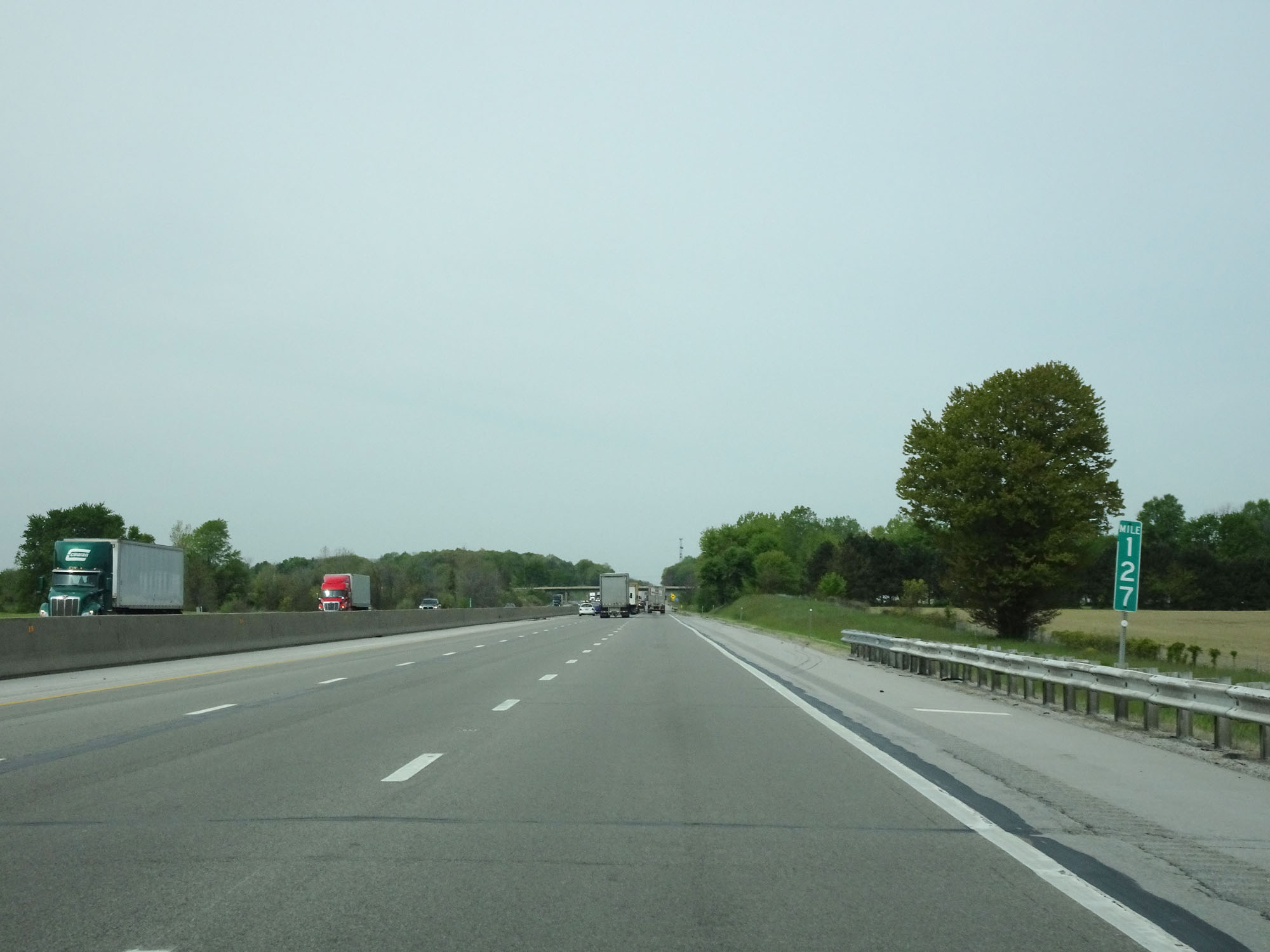
Interstate 80 / Interstate 90 West (Ohio Turnpike) at mile marker 121. (Photo taken 5/20/16). |
 |
Interstate 80 / Interstate 90 West (Ohio Turnpike) approaching Exit 118 - 1 mile. (Photo taken 5/20/16). |
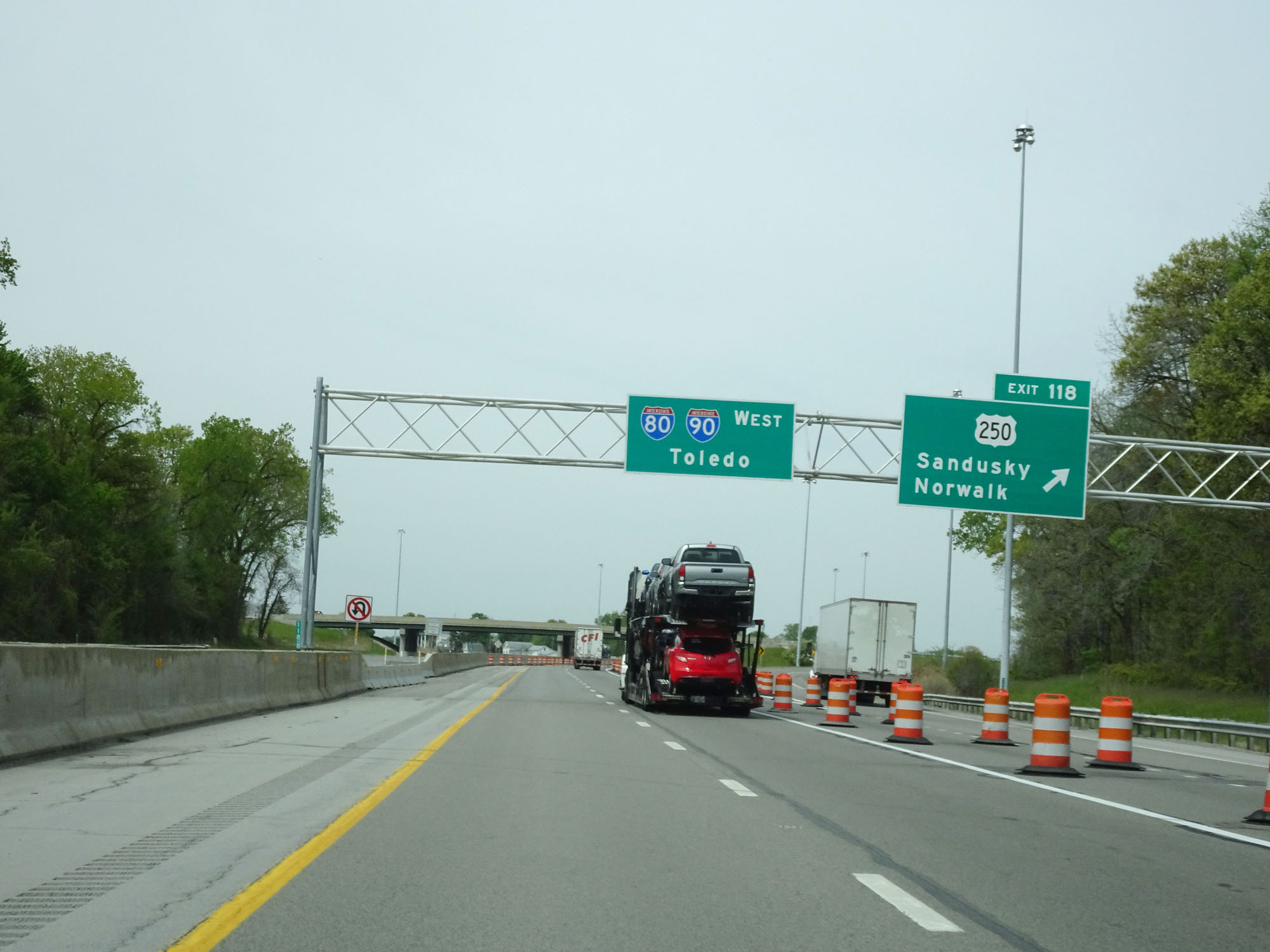 |
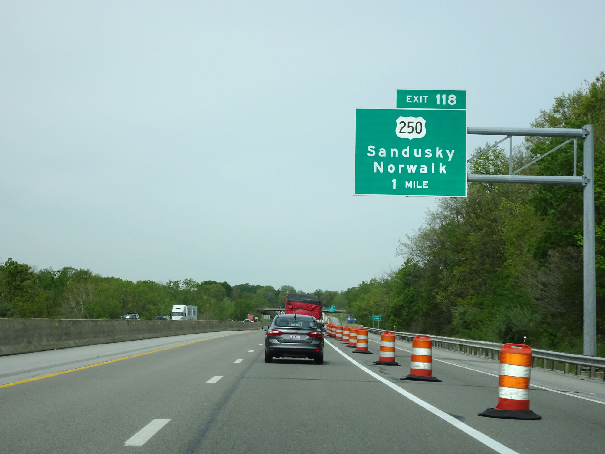
Interstate 80 / Interstate 90 West (Ohio Turnpike) at Exit 118: US 250 - Sandusky / Norwalk (Photo taken 5/20/16). |
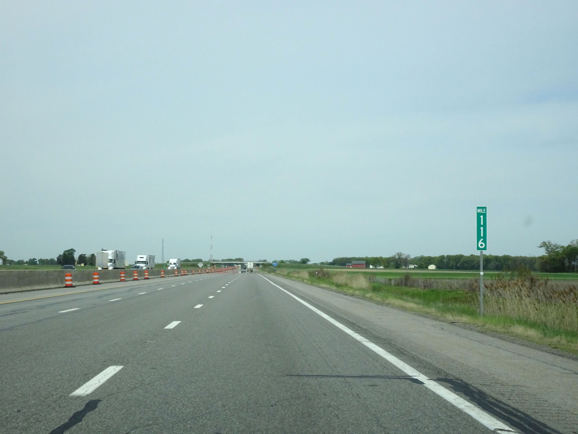 |
Interstate 80 / Interstate 90 West (Ohio Turnpike) at mile marker 116. (Photo taken 5/20/16). |
 |
Interstate 80 / Interstate 90 West (Ohio Turnpike) approaching Exit 110 - 1 mile. (Photo taken 5/20/16). |
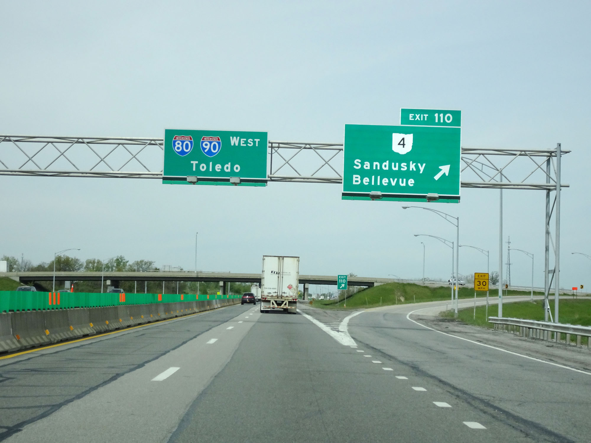 |
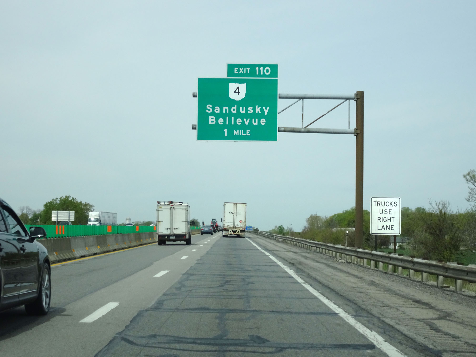
Interstate 80 / Interstate 90 West (Ohio Turnpike) at Exit 110: OH 4 - Sandusky / Bellevue (Photo taken 5/20/16). |
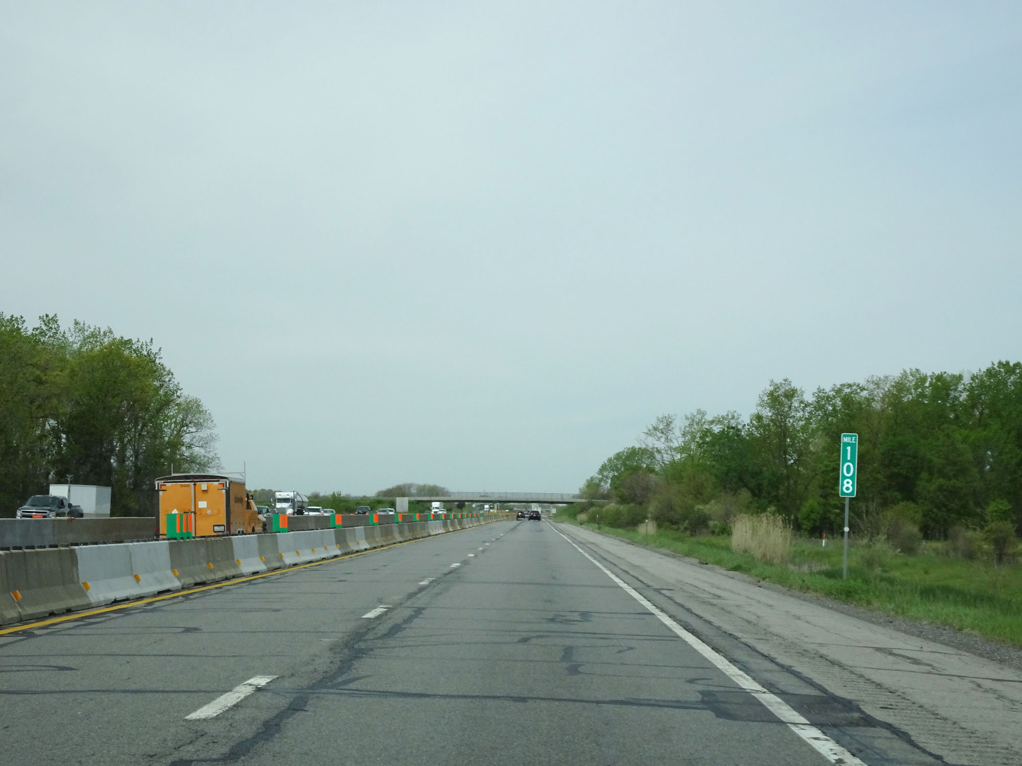 |
Interstate 80 / Interstate 90 West (Ohio Turnpike) at mile marker 108. (Photo taken 5/20/16). |
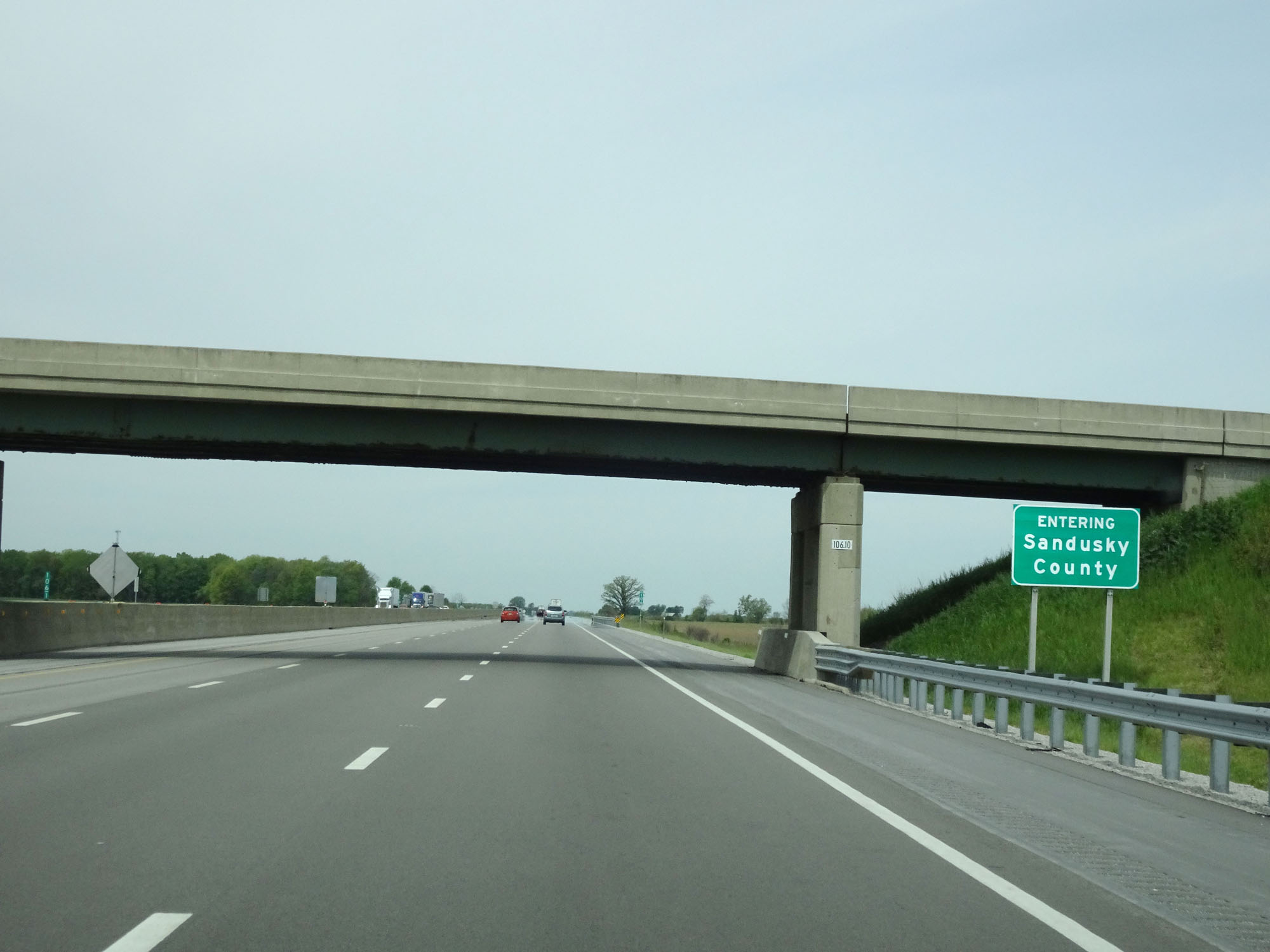 |
Interstate 80 / Interstate 90 West (Ohio Turnpike) entering Sandusky County. (Photo taken 5/20/16). |
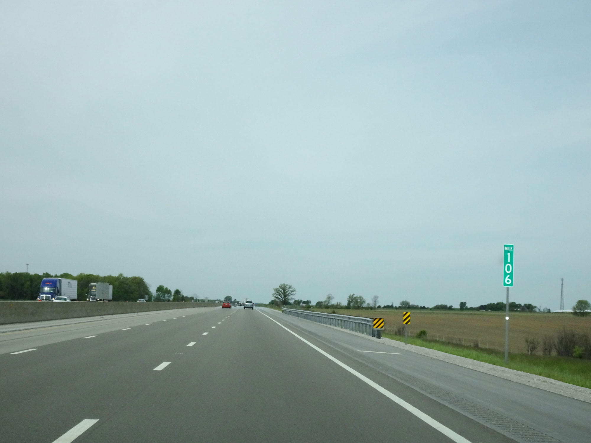 |
Interstate 80 / Interstate 90 West (Ohio Turnpike) at mile marker 106. (Photo taken 5/20/16). |
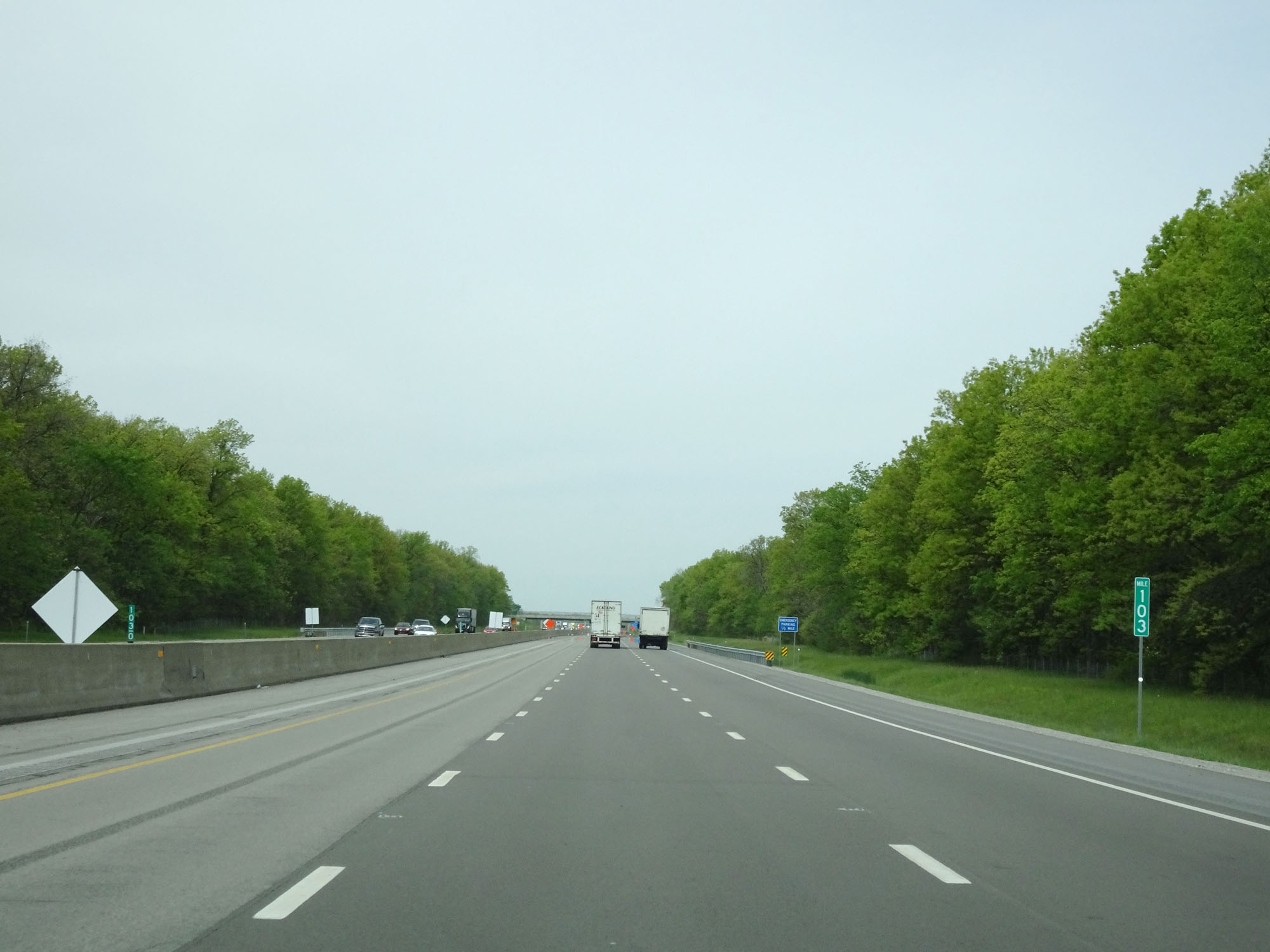 |
Interstate 80 / Interstate 90 West (Ohio Turnpike) at mile marker 103. (Photo taken 5/20/16). |
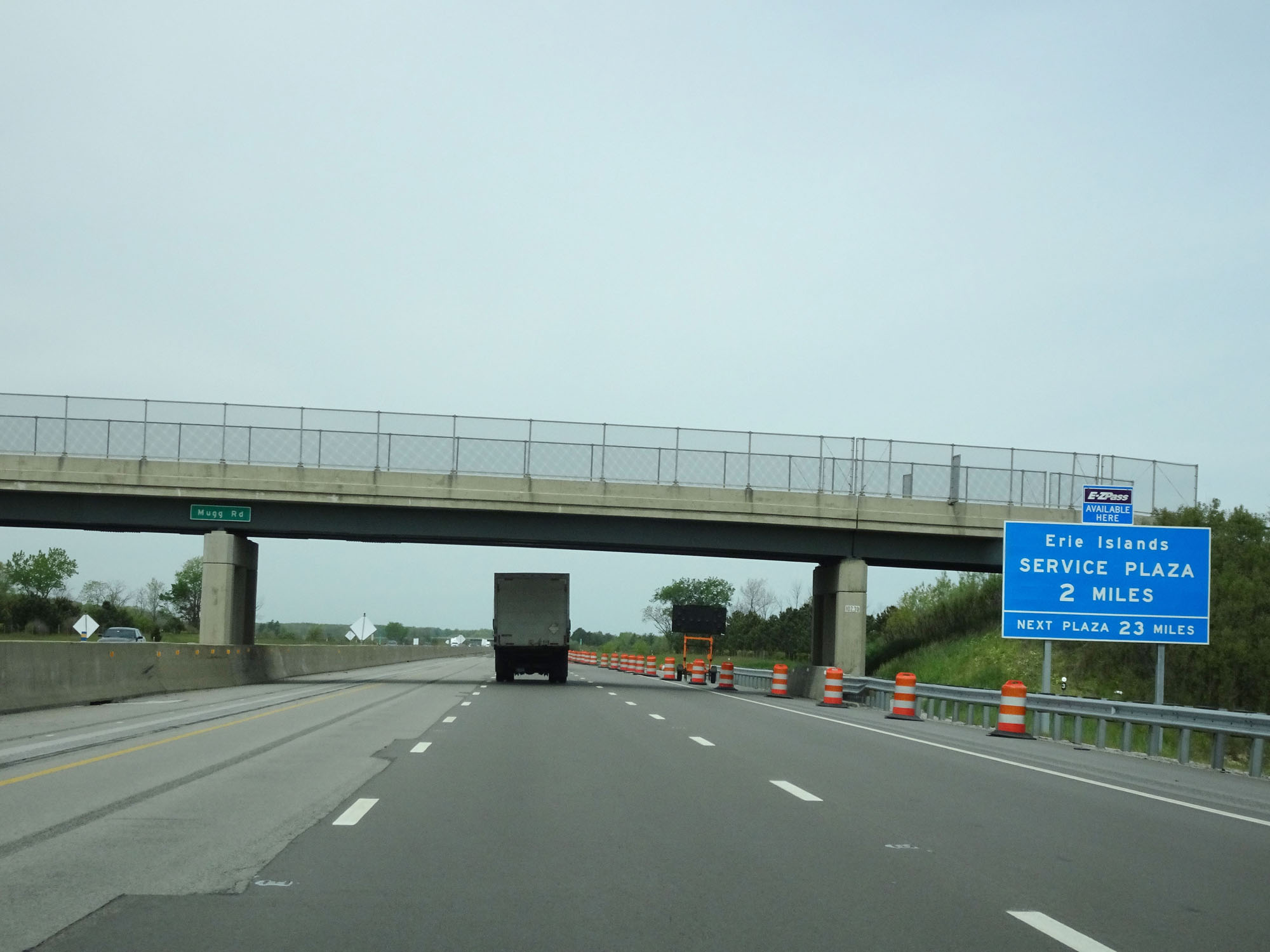 |
Interstate 80 / Interstate 90 West (Ohio Turnpike) approaching the Erie Islands Service Plaza - 2 miles. (Photo taken 5/20/16). |
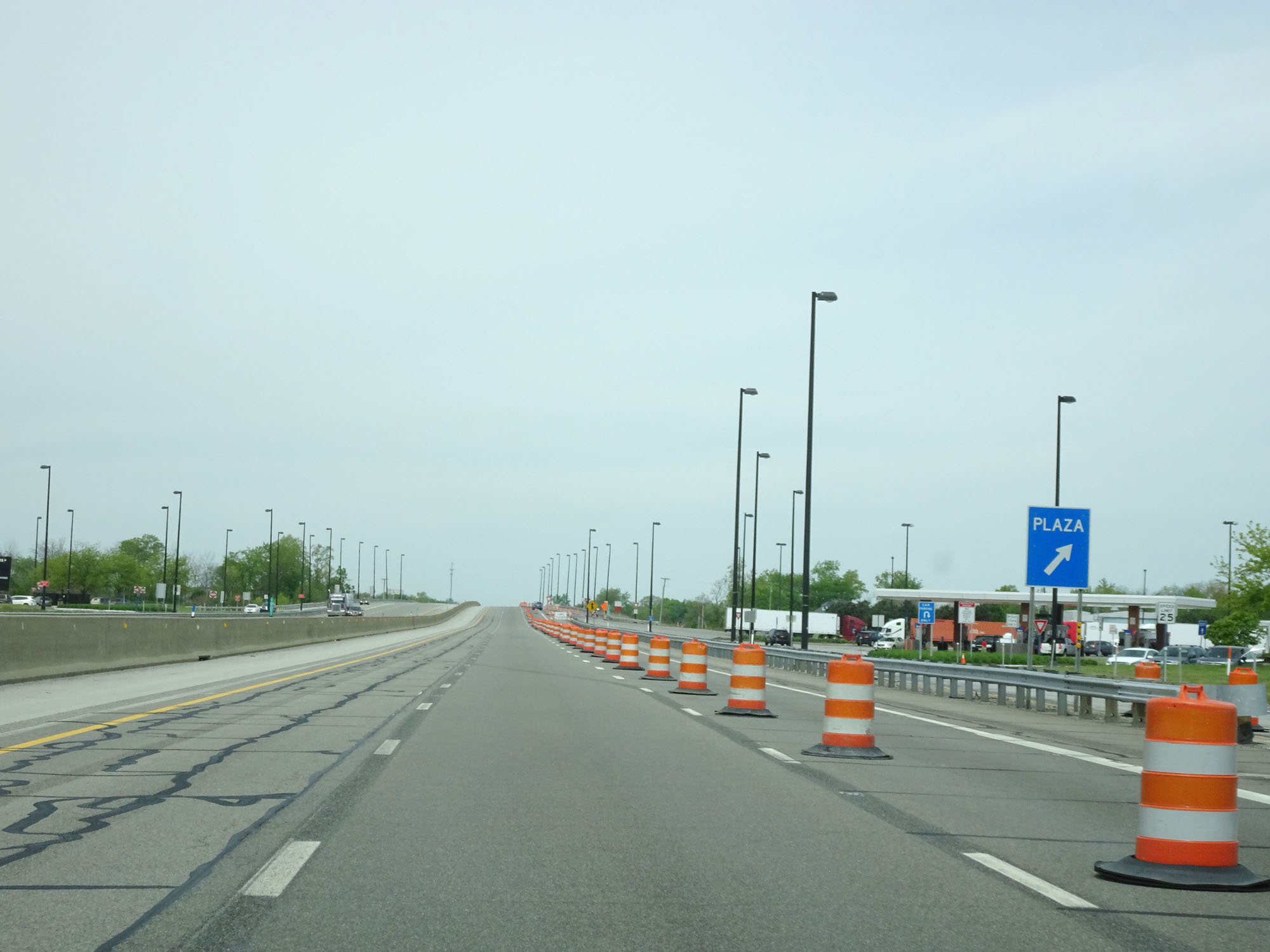 |
Interstate 80 / Interstate 90 West (Ohio Turnpike) at the Erie Islands Service Plaza located at mile marker 100. (Photo taken 5/20/16). |
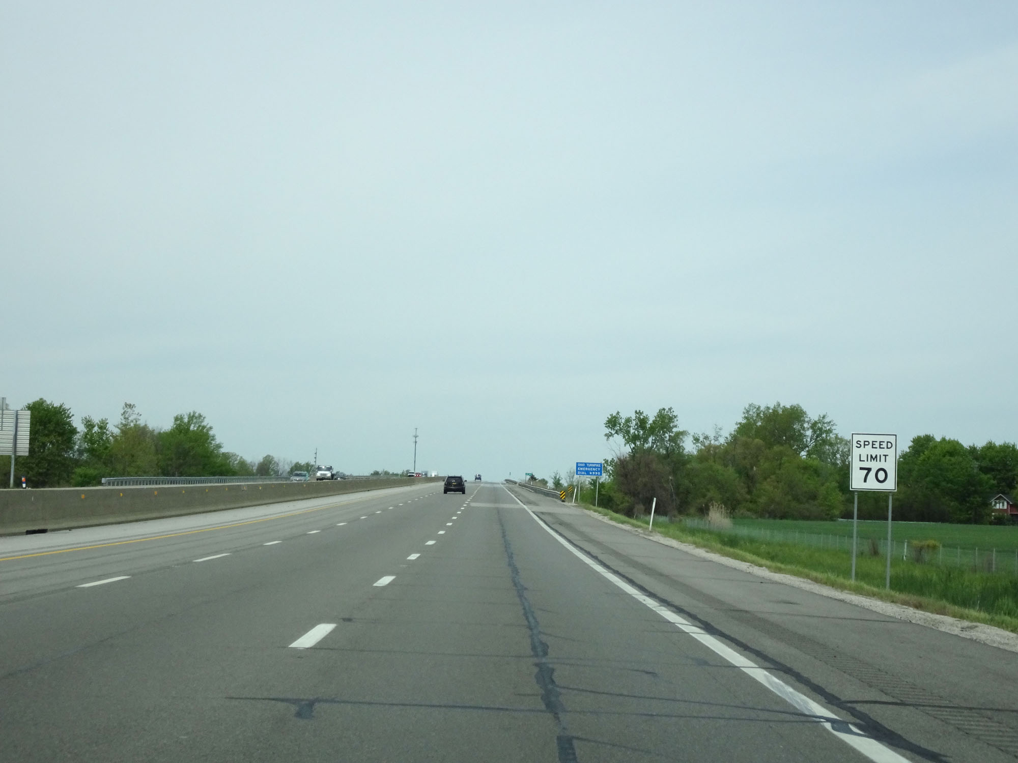 |
Speed limit assurance sign west of mile marker 100. Speed Limit - 70 mph. (Photo taken 5/20/16). |
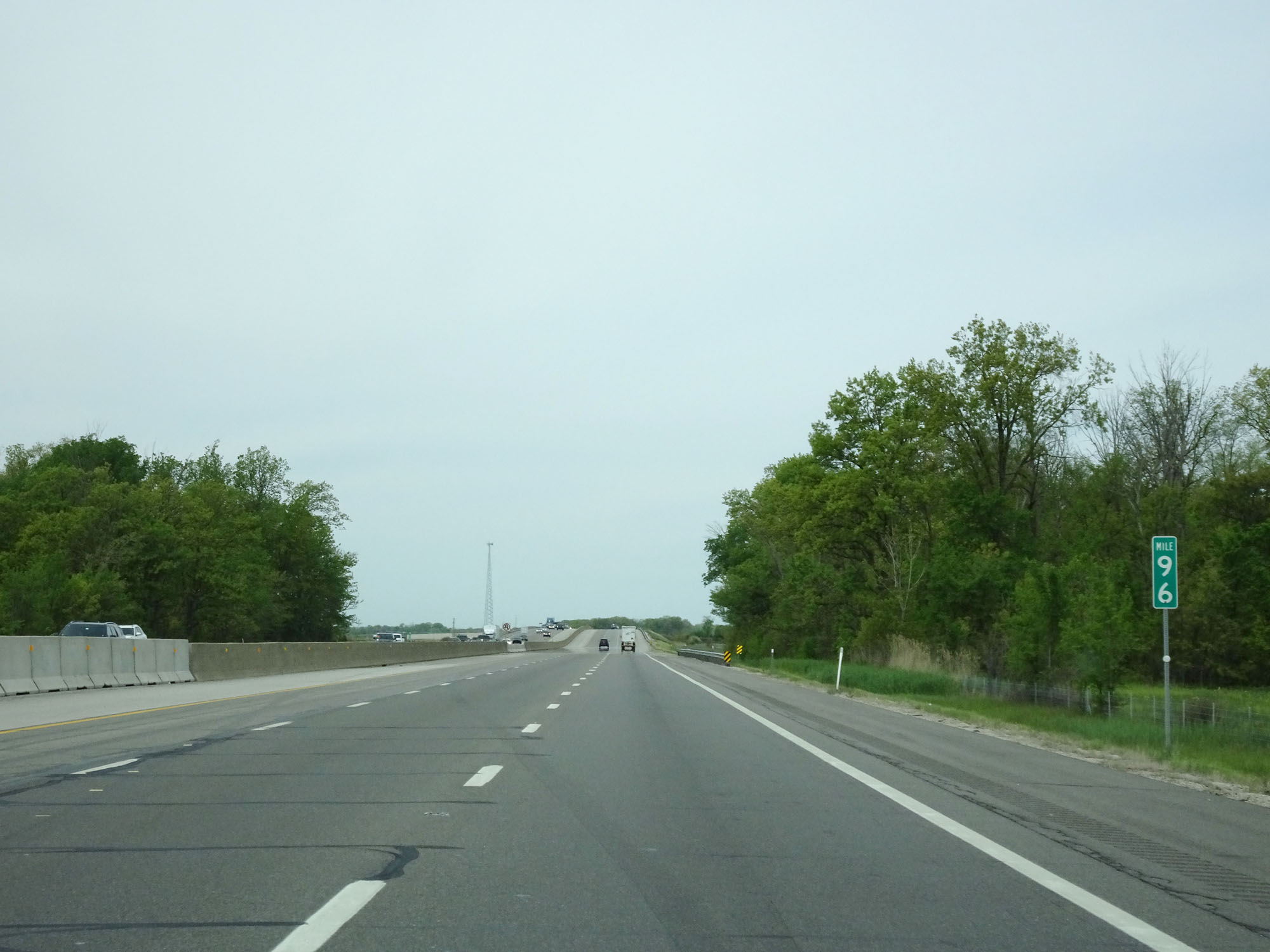 |
Interstate 80 / Interstate 90 West (Ohio Turnpike) at mile marker 96. (Photo taken 5/20/16). |
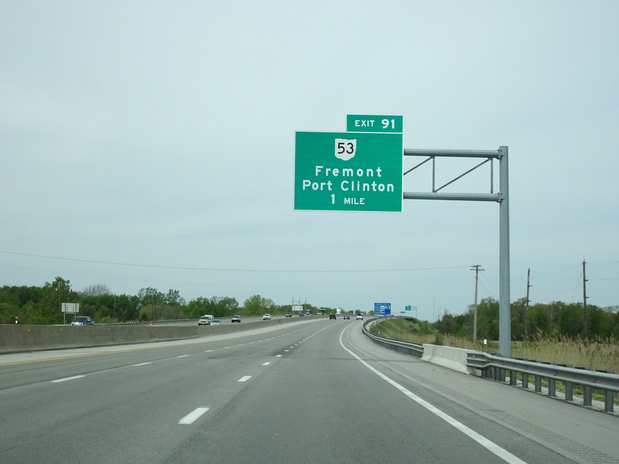 |
Interstate 80 / Interstate 90 West (Ohio Turnpike) approaching Exit 91 - 1 mile. (Photo taken 5/20/16). |
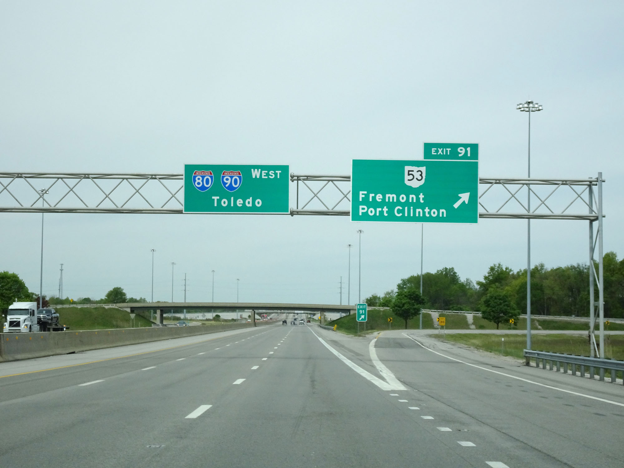 |
Interstate 80 / Interstate 90 West (Ohio Turnpike) at Exit 91: OH 53 - Fremont / Port Clinton (Photo taken 5/20/16). |
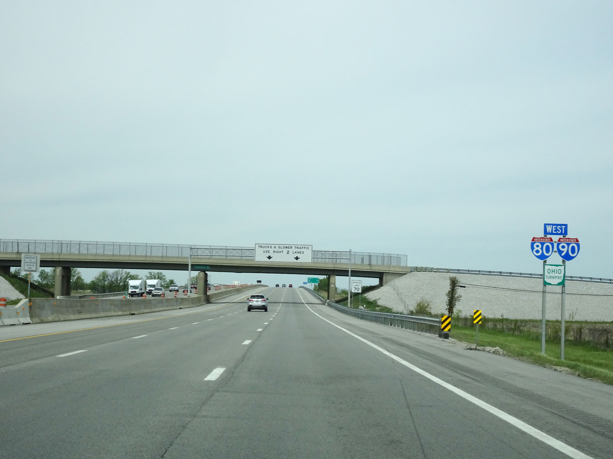 |
Interstate 80 / Interstate 90 / Ohio Turnpike West assurance shields. (Photo taken 5/20/16). |
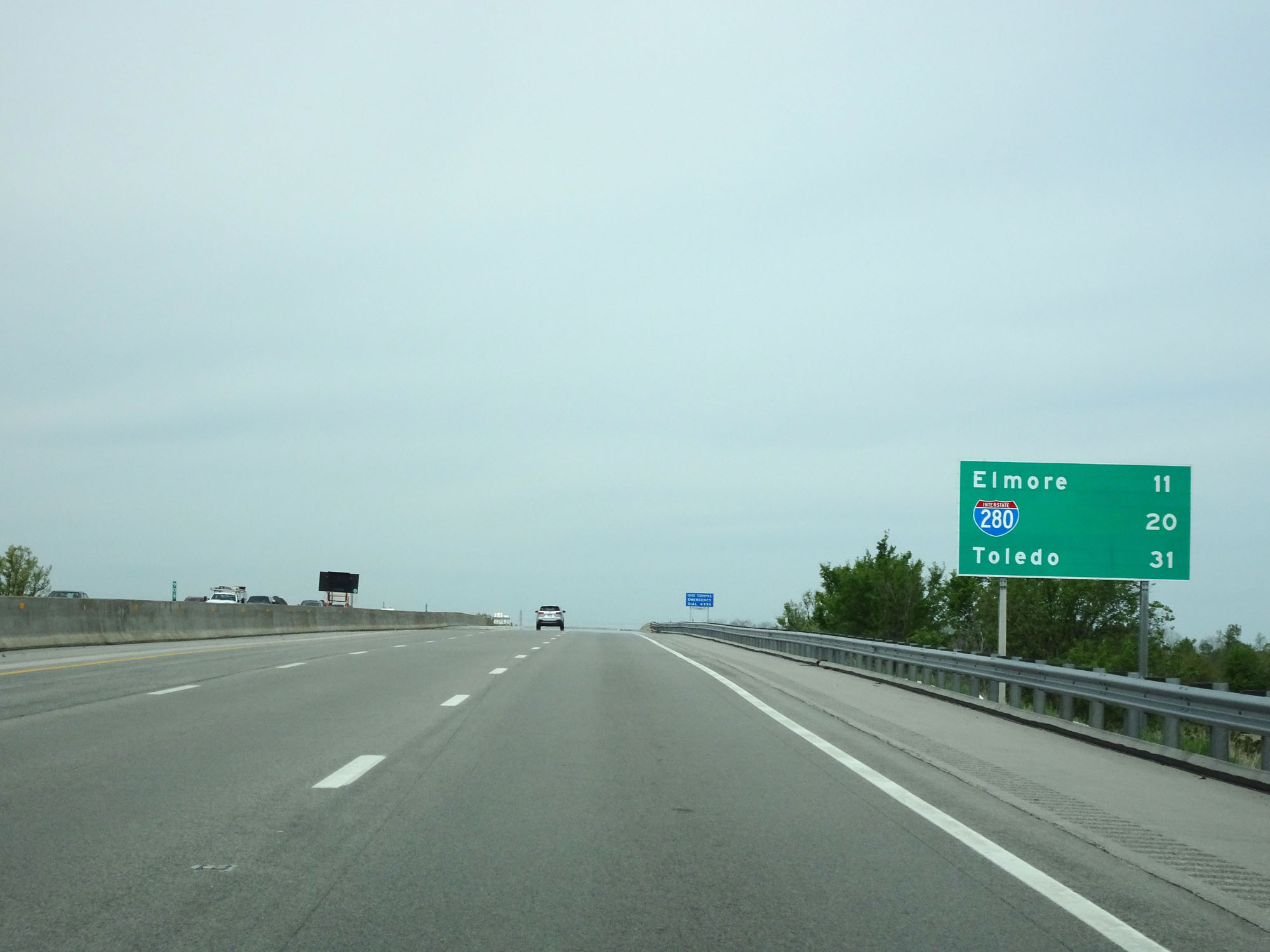 |
Mileage sign west of Exit 91. It's 11 miles to Elmore, 20 miles to the junction of Interstate 280, and 31 miles to Toledo. (Photo taken 5/20/16). |
 |
Interstate 80 / Interstate 90 West (Ohio Turnpike) at mile marker 90. (Photo taken 5/20/16). |
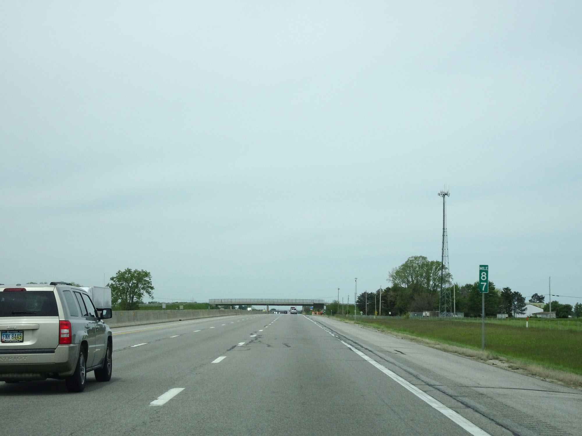 |
Interstate 80 / Interstate 90 West (Ohio Turnpike) at mile marker 87. (Photo taken 5/20/16). |
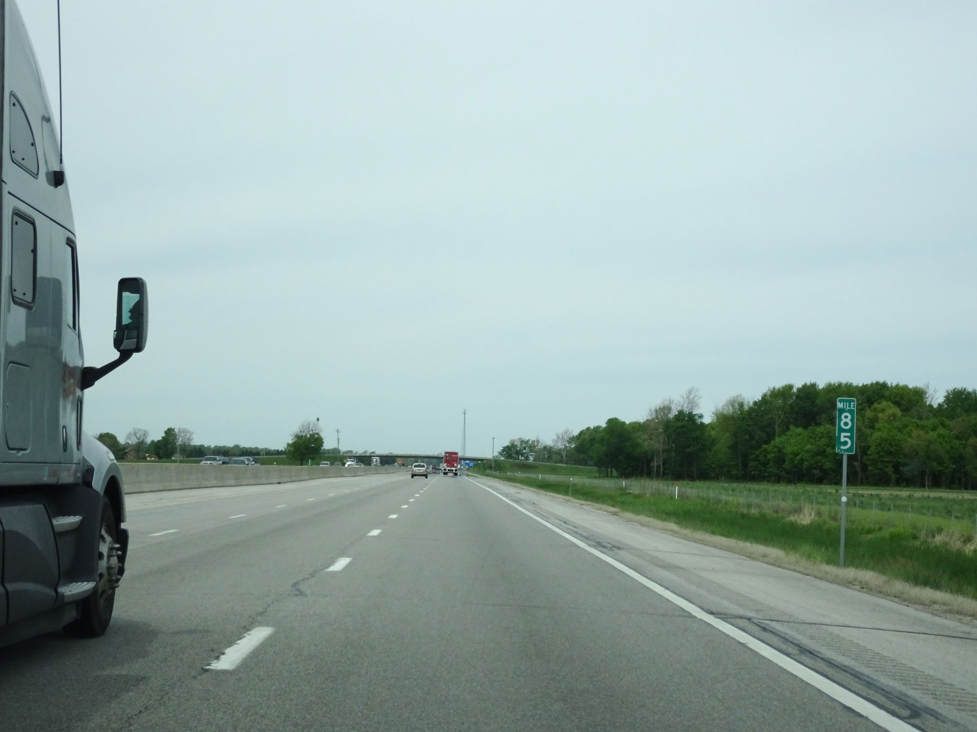 |
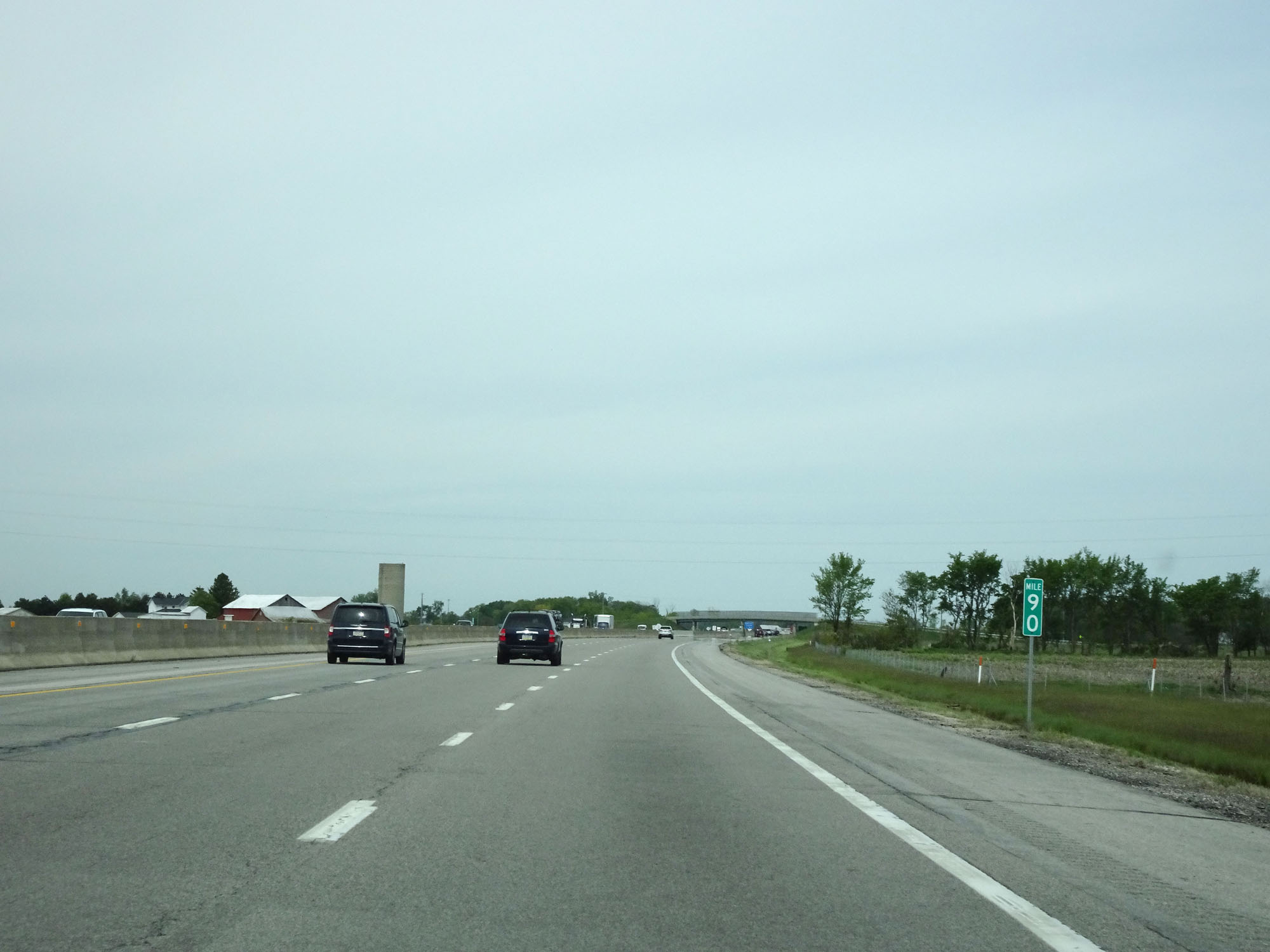
Interstate 80 / Interstate 90 West (Ohio Turnpike) at mile marker 85. (Photo taken 5/20/16). |
 |
Interstate 80 / Interstate 90 West (Ohio Turnpike) approaching Exit 81 - 1 mile. (Photo taken 5/20/16). |
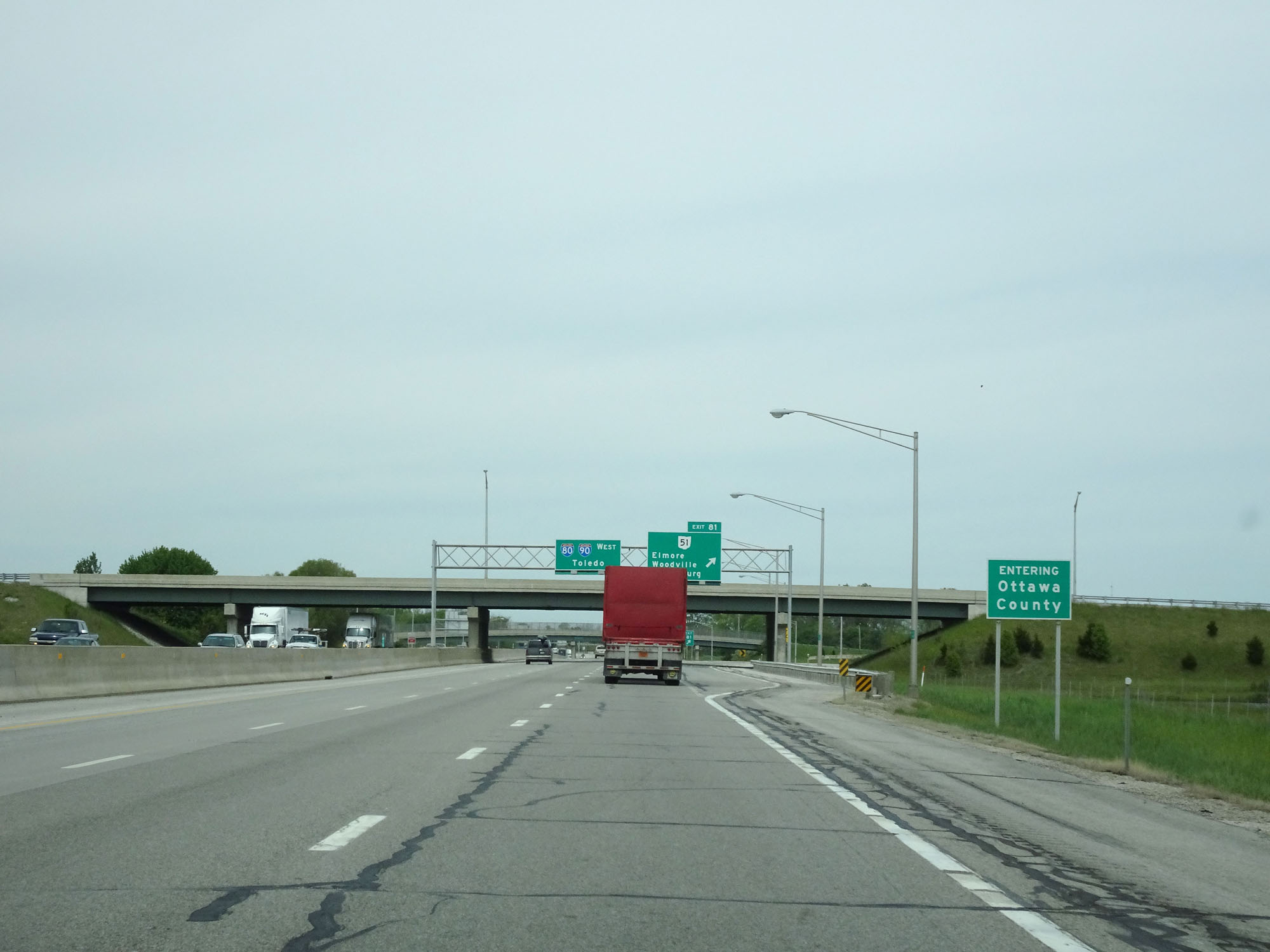 |
Interstate 80 / Interstate 90 West (Ohio Turnpike) entering Ottawa County. (Photo taken 5/20/16). |
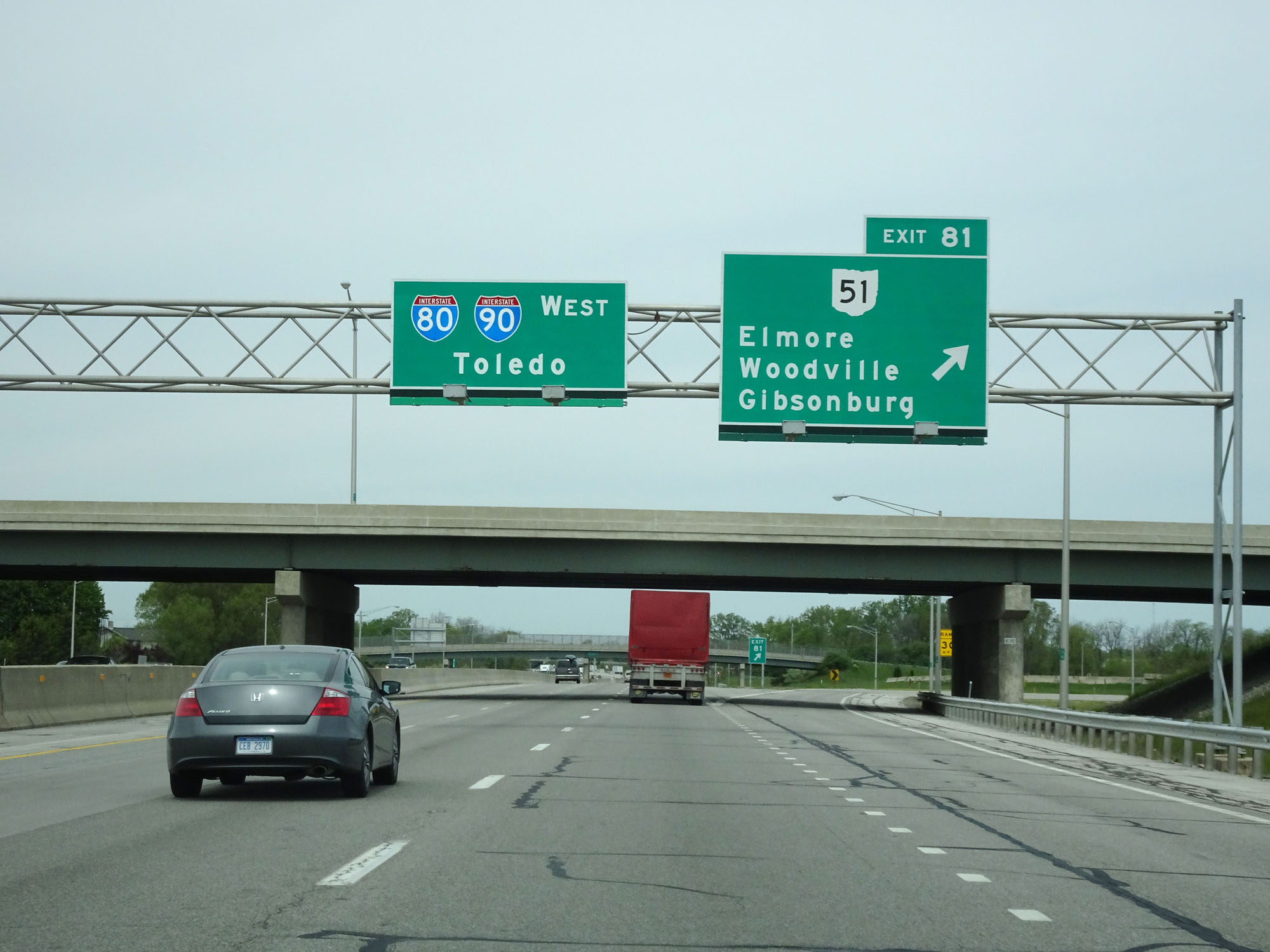 |
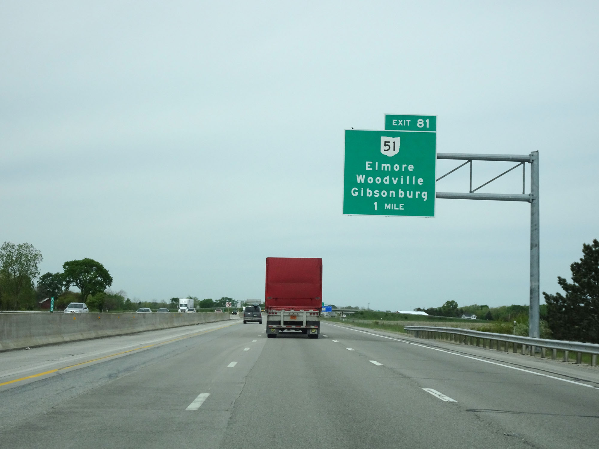
Interstate 80 / Interstate 90 West (Ohio Turnpike) at Exit 81: OH 51 - Elmore / Woodville / Gibsonburg (Photo taken 5/20/16). |
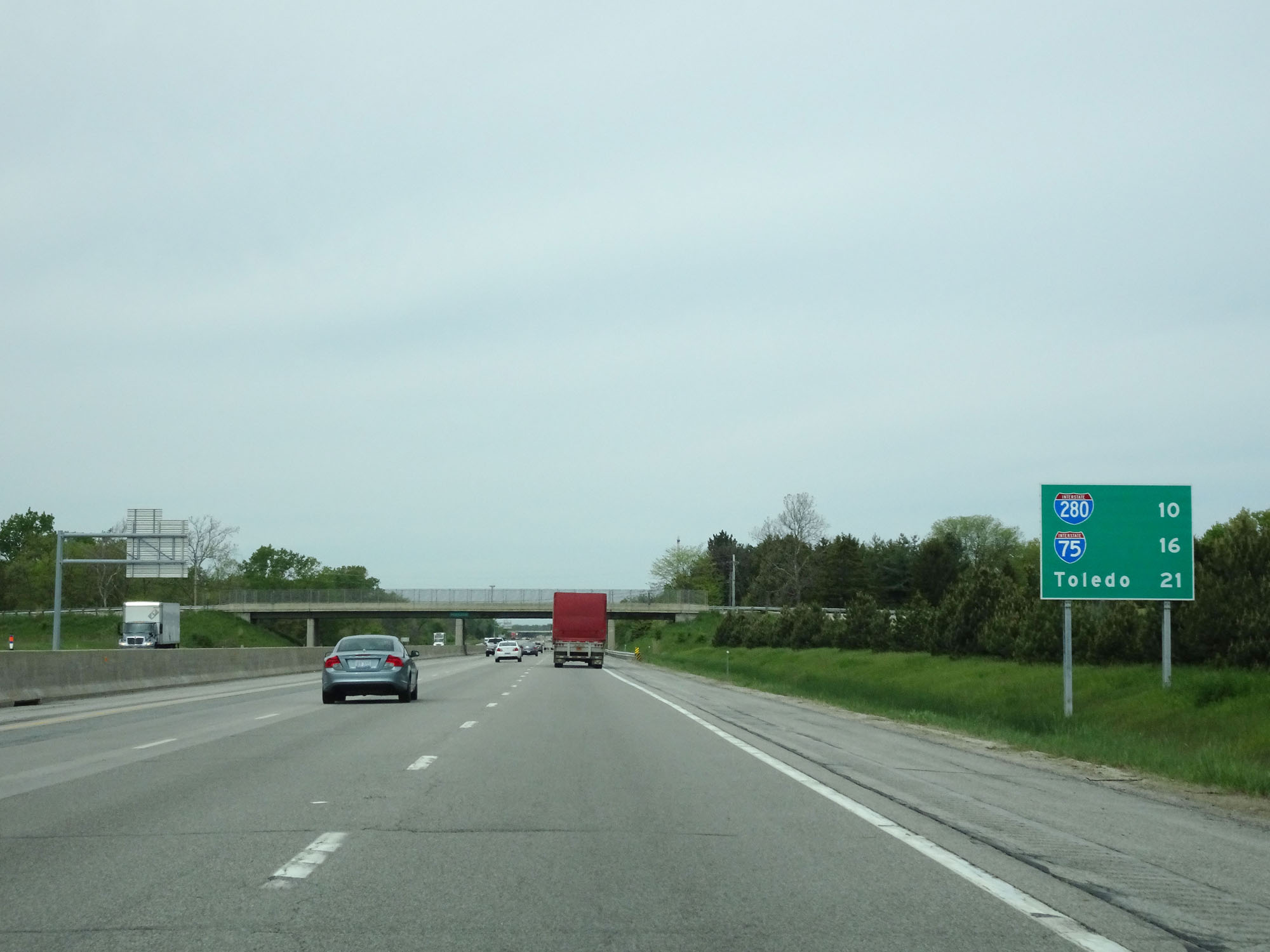 |
Mileage sign west of Exit 81. It's 10 miles to the junction of Interstate 280, 16 miles to the junction of Interstate 75, and 21 miles to Toledo. (Photo taken 5/20/16). |
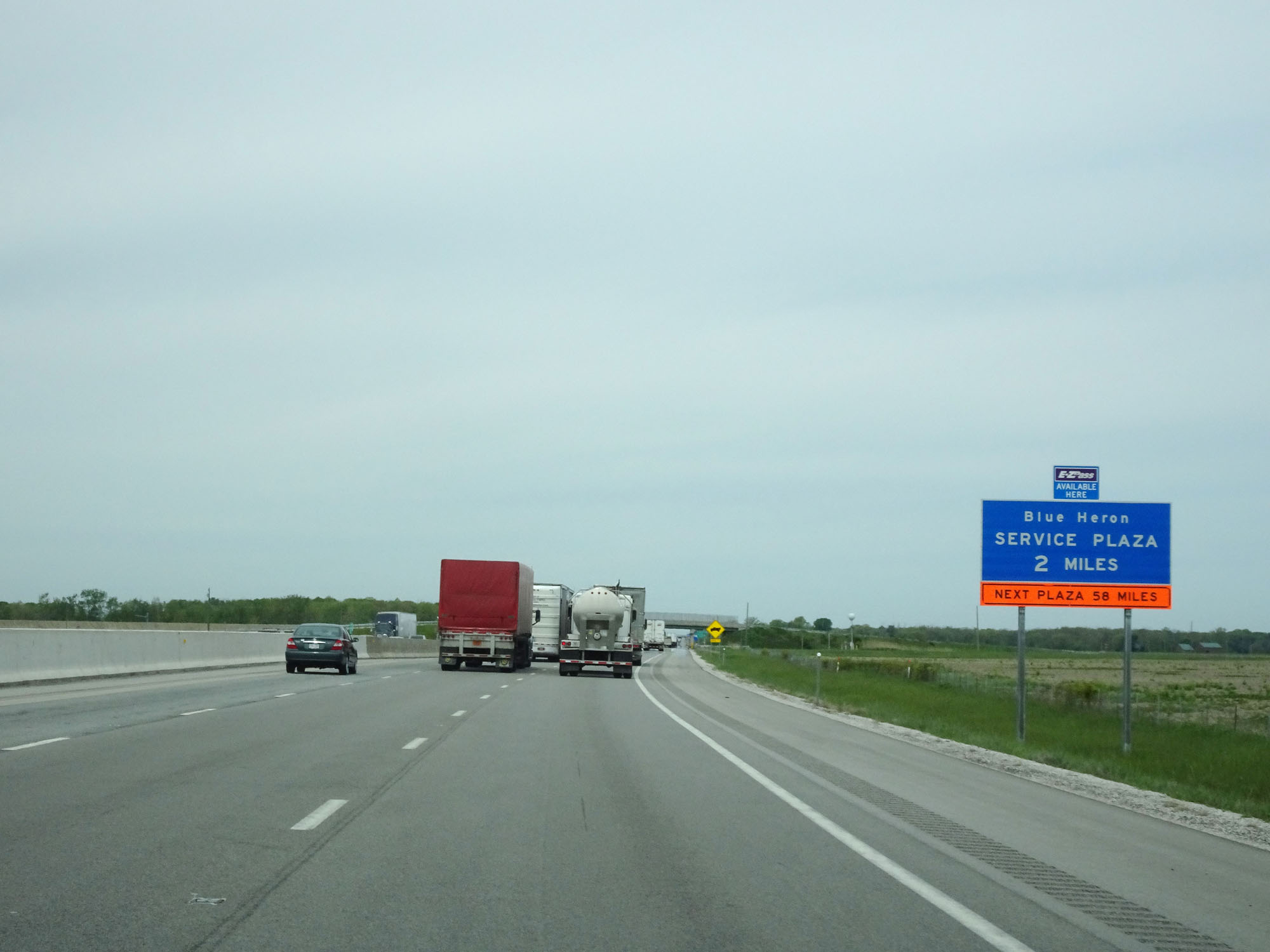 |
Interstate 80 / Interstate 90 West (Ohio Turnpike) approaching the Blue Heron Service Plaza - 2 miles. (Photo taken 5/20/16). |
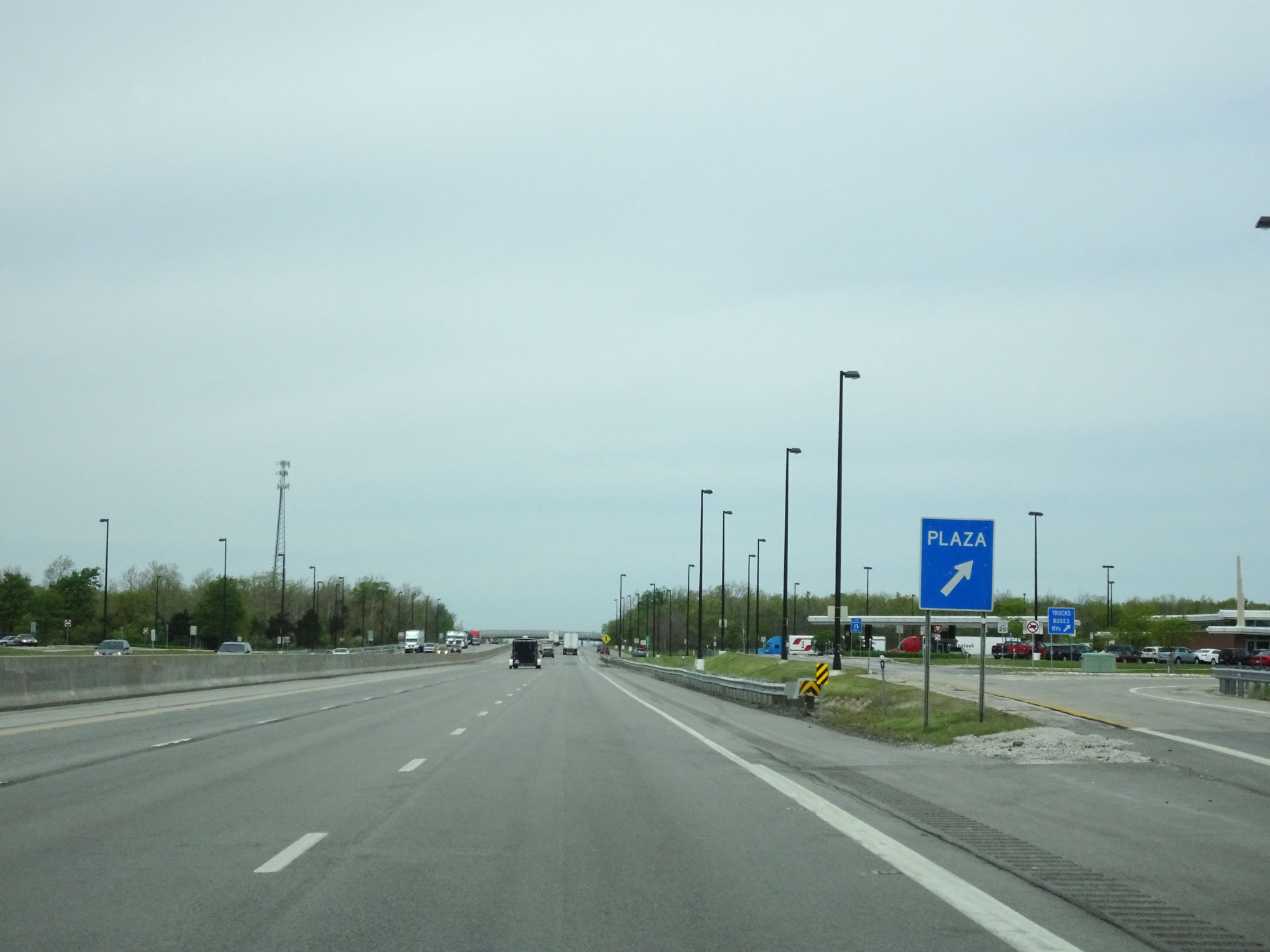 |
Interstate 80 / Interstate 90 West (Ohio Turnpike) at the Blue Heron Service Plaza, located at mile marker 77. (Photo taken 5/20/16). |
 |
Interstate 80 / Interstate 90 West (Ohio Turnpike) as it re-enters Ottawa County. (Photo taken 5/20/16). |
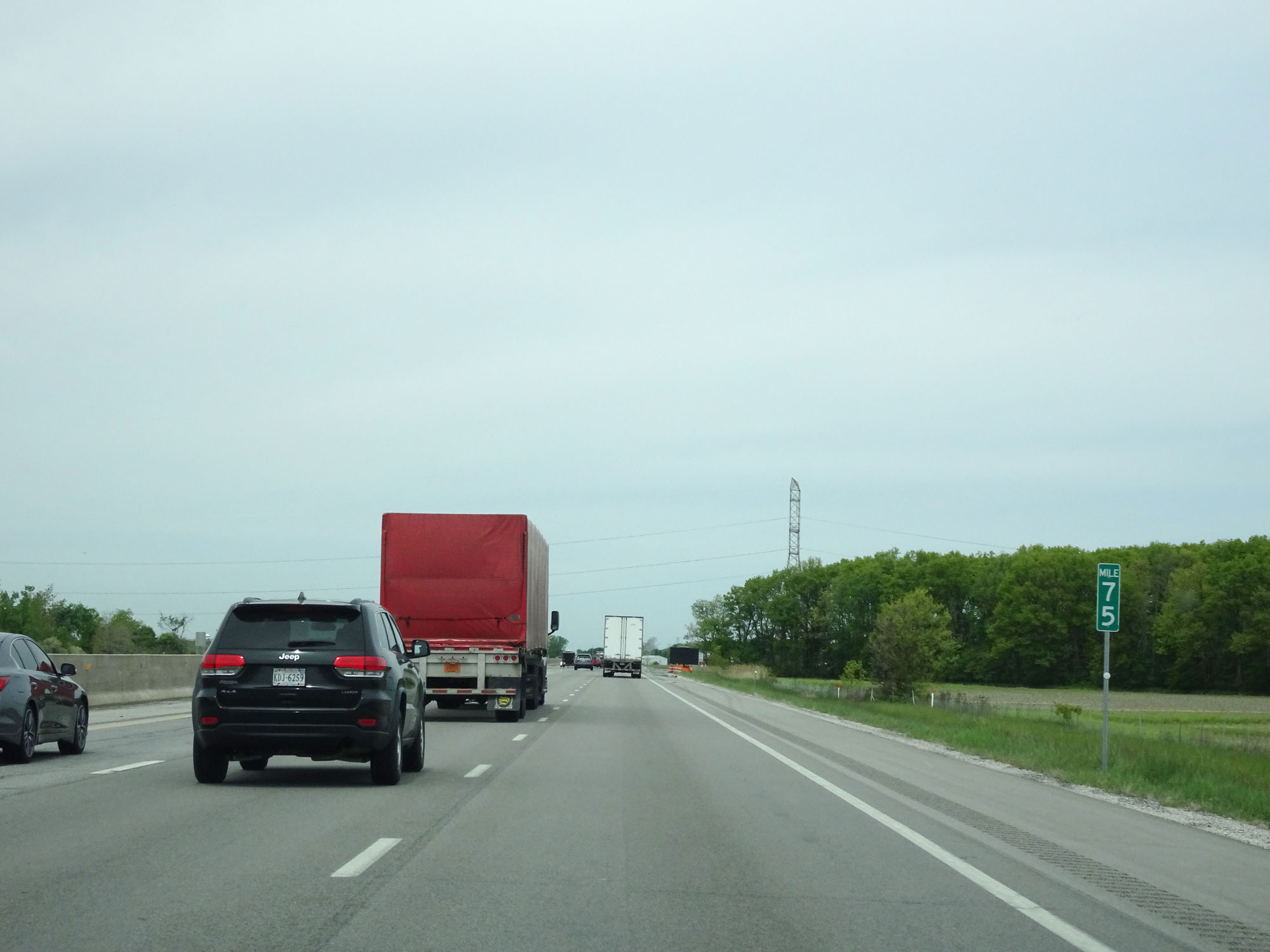 |
Interstate 80 / Interstate 90 West (Ohio Turnpike) at mile marker 75. (Photo taken 5/20/16). |
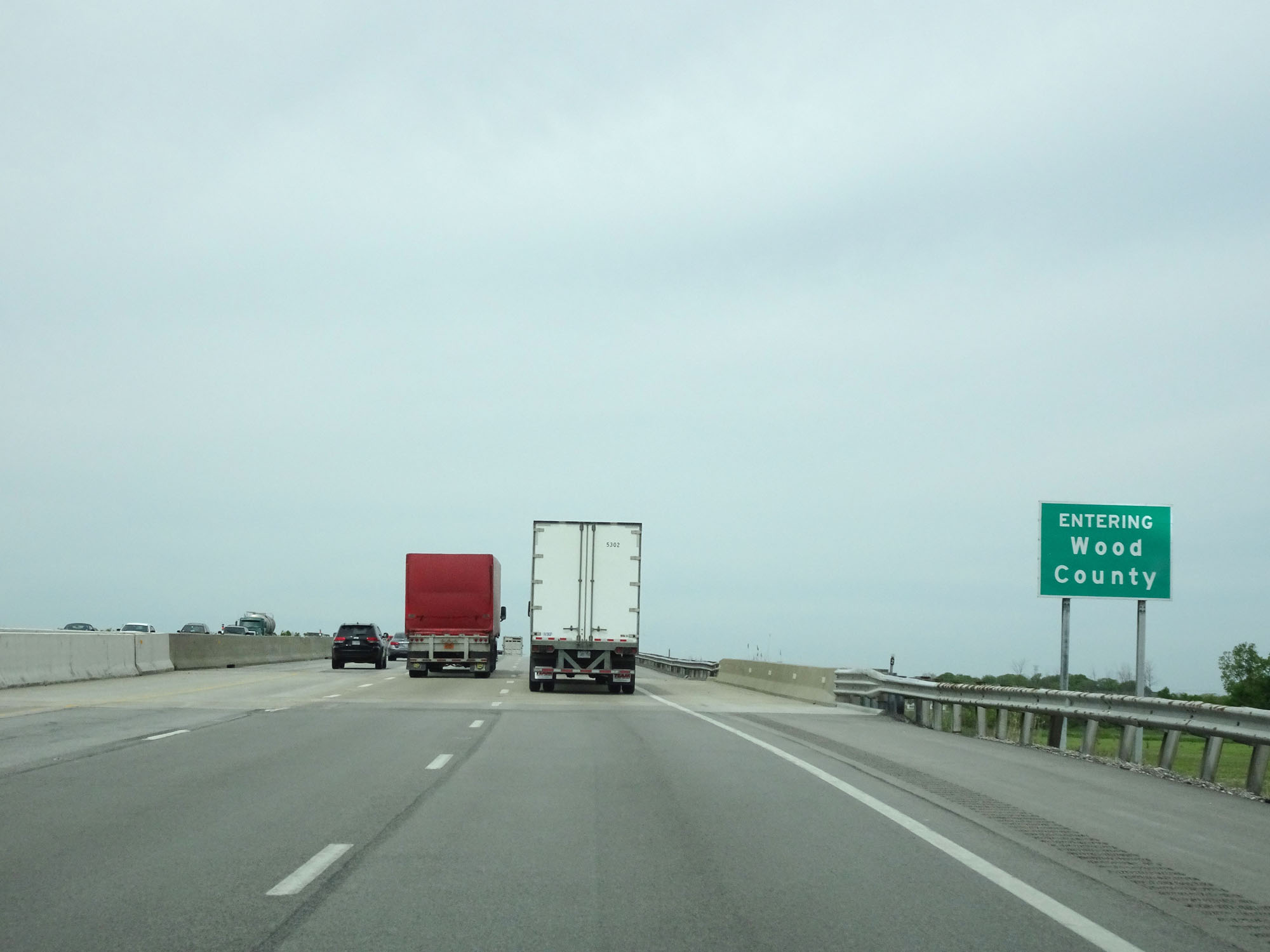 |
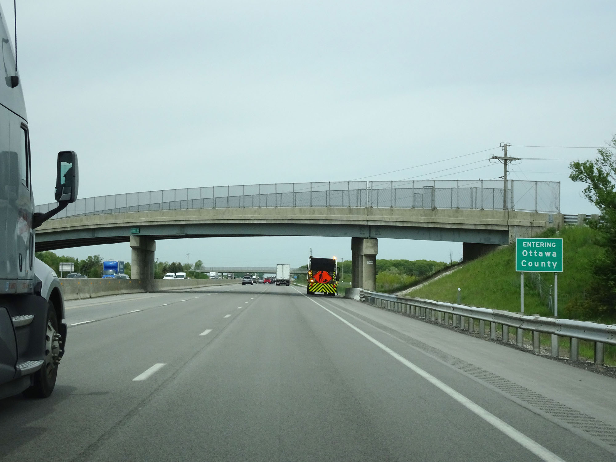
Interstate 80 / Interstate 90 West (Ohio Turnpike) entering Wood County. (Photo taken 5/20/16). |
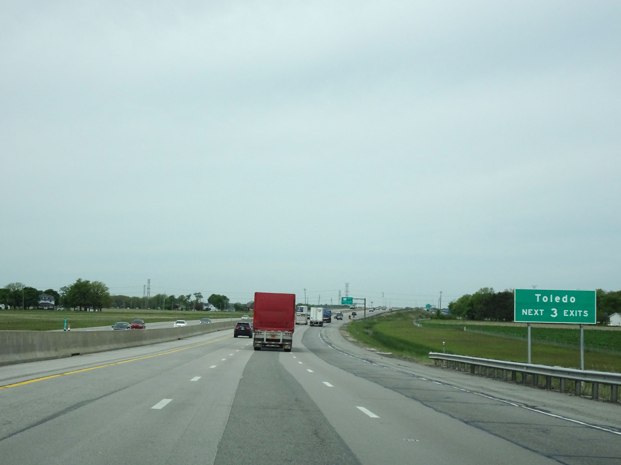 |
Take any of the next 3 exits to Toledo. (Photo taken 5/20/16). |
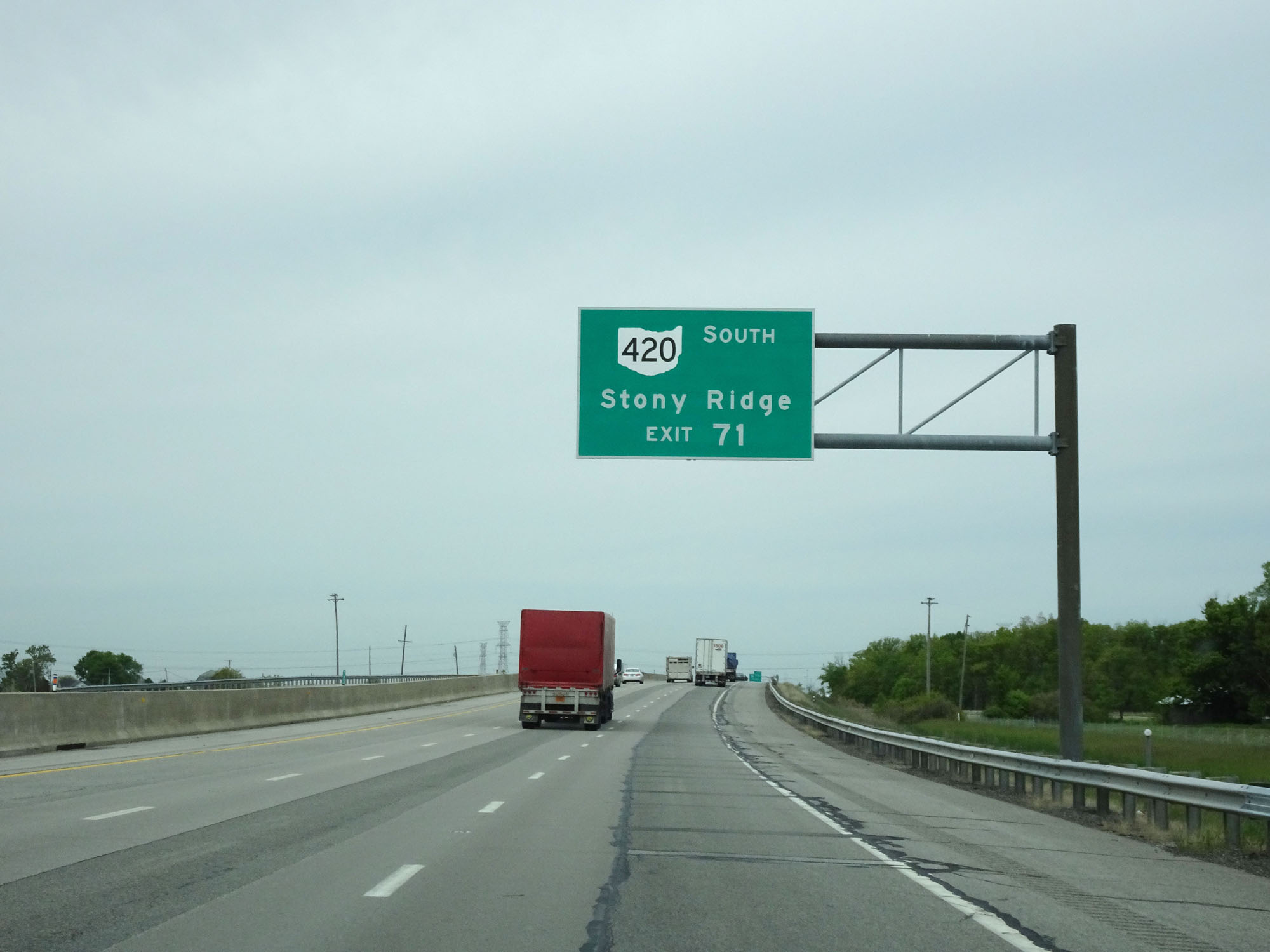 |
Take Exit 71 to OH 420 South toward Stony Ridge. (Photo taken 5/20/16). |
 |
Interstate 80 / Interstate 90 West (Ohio Turnpike) approaching Exit 71 - 1 mile. (Photo taken 5/20/16). |
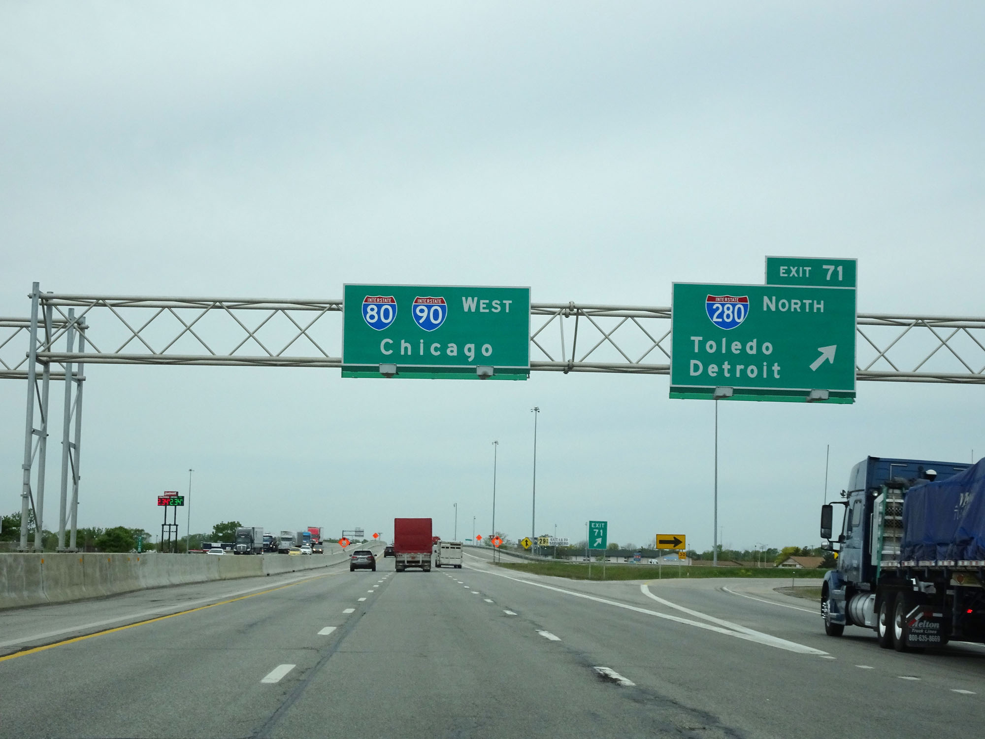 |
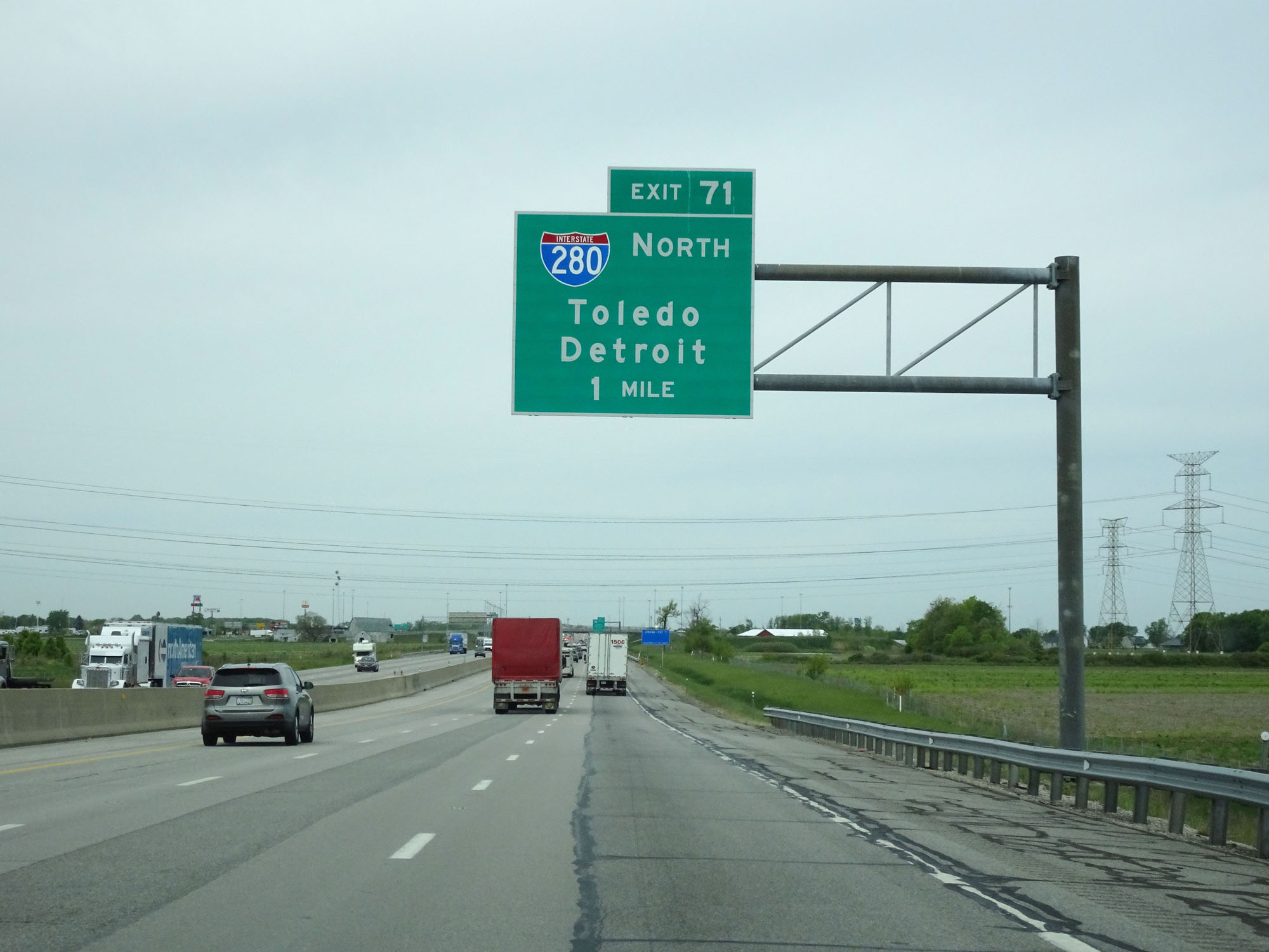
Interstate 80 / Interstate 90 West (Ohio Turnpike) at Exit 71: Interstate 280 North - Toledo / Detroit (Photo taken 5/20/16). |
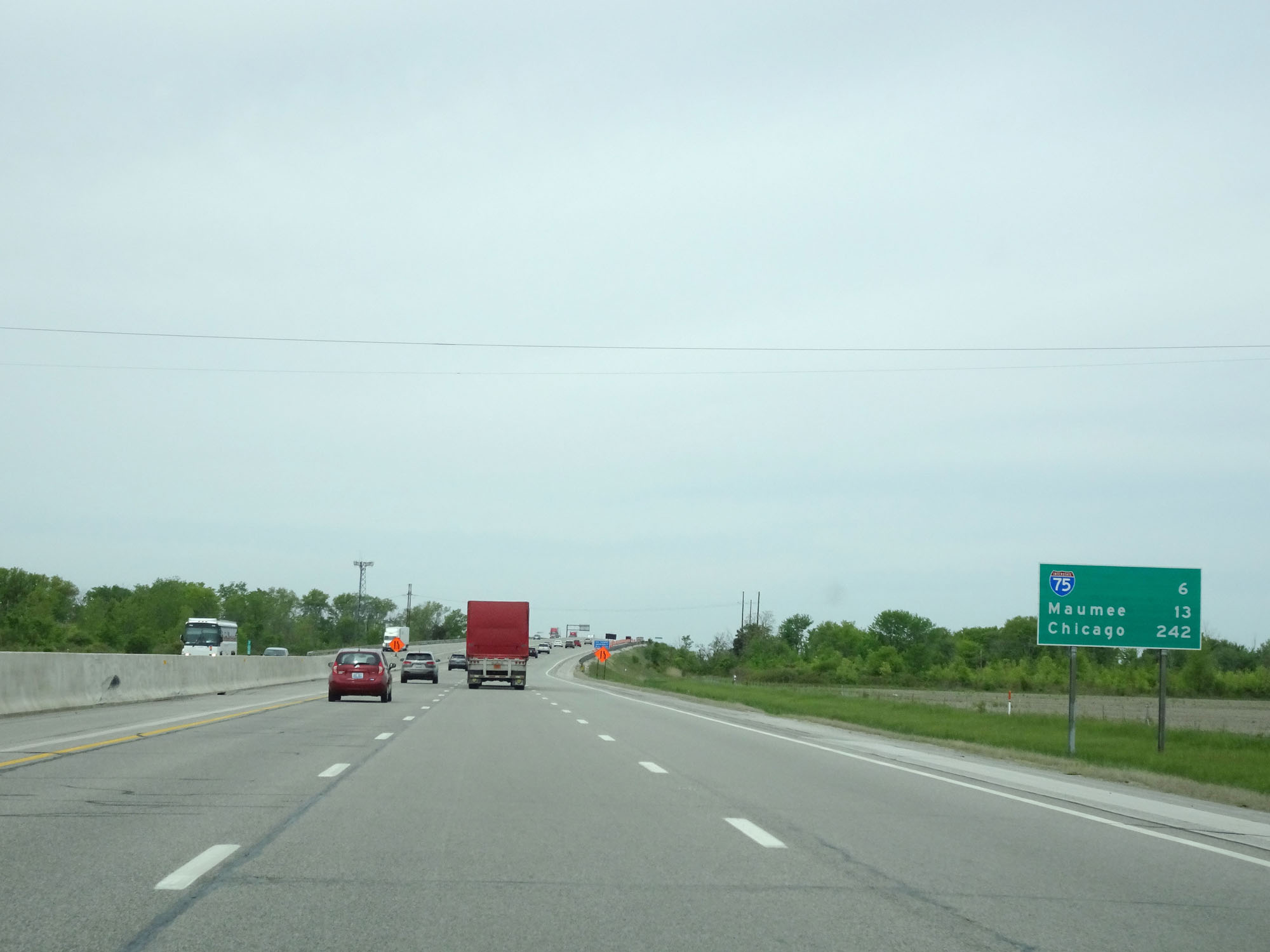 |
Mileage sign west of Exit 71. It's 6 miles to the junction of Interstate 75, 13 miles to Maumee, and 242 miles to Chicago. This is the first mileage sign on Interstate 80 / Interstate 90 West to use Chicago as a destination. (Photo taken 5/20/16). |
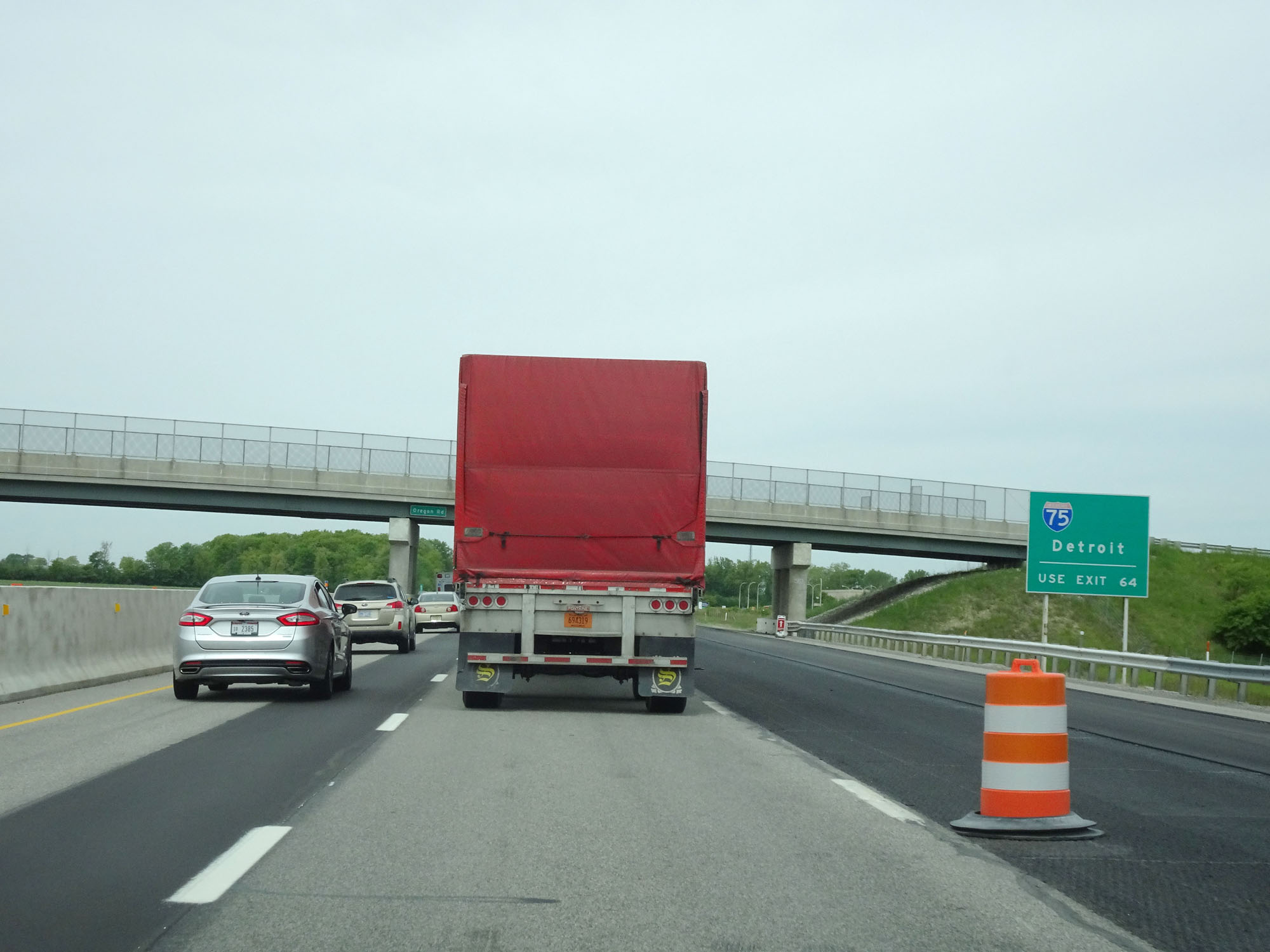 |
Take Exit 64 to Interstate 75 toward Detroit. (Photo taken 5/20/16). |
 |
Interstate 80 / Interstate 90 West (Ohio Turnpike) approaching Exit 64 - 1 mile. (Photo taken 5/20/16). |
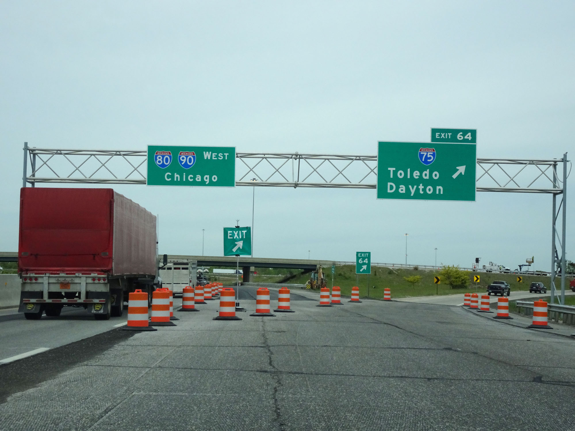 |
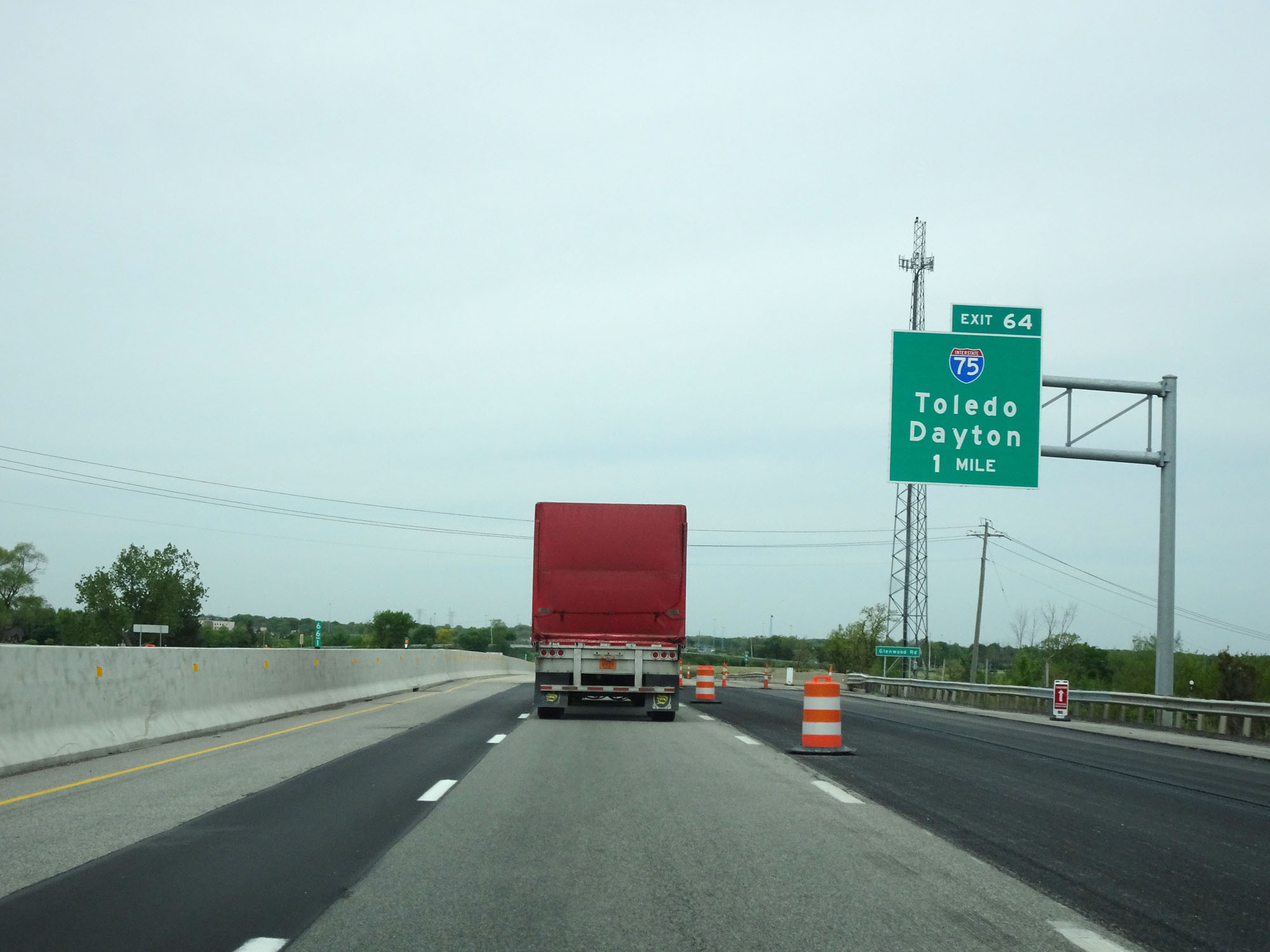
Interstate 80 / Interstate 90 West (Ohio Turnpike) at Exit 64: Interstate 75 - Toledo / Dayton (Photo taken 5/20/16). |
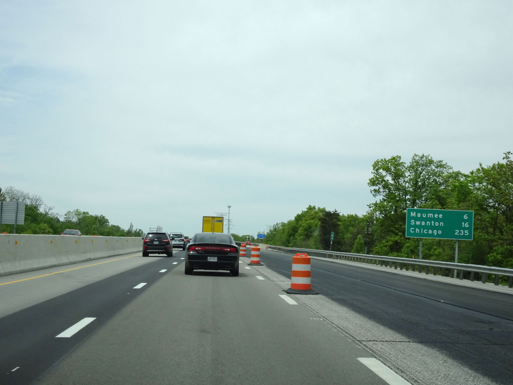 |
Mileage sign at mile marker 64. It's 6 miles to Maumee, 16 miles to Swanton, and 235 miles to Chicago. (Photo taken 5/20/16). |
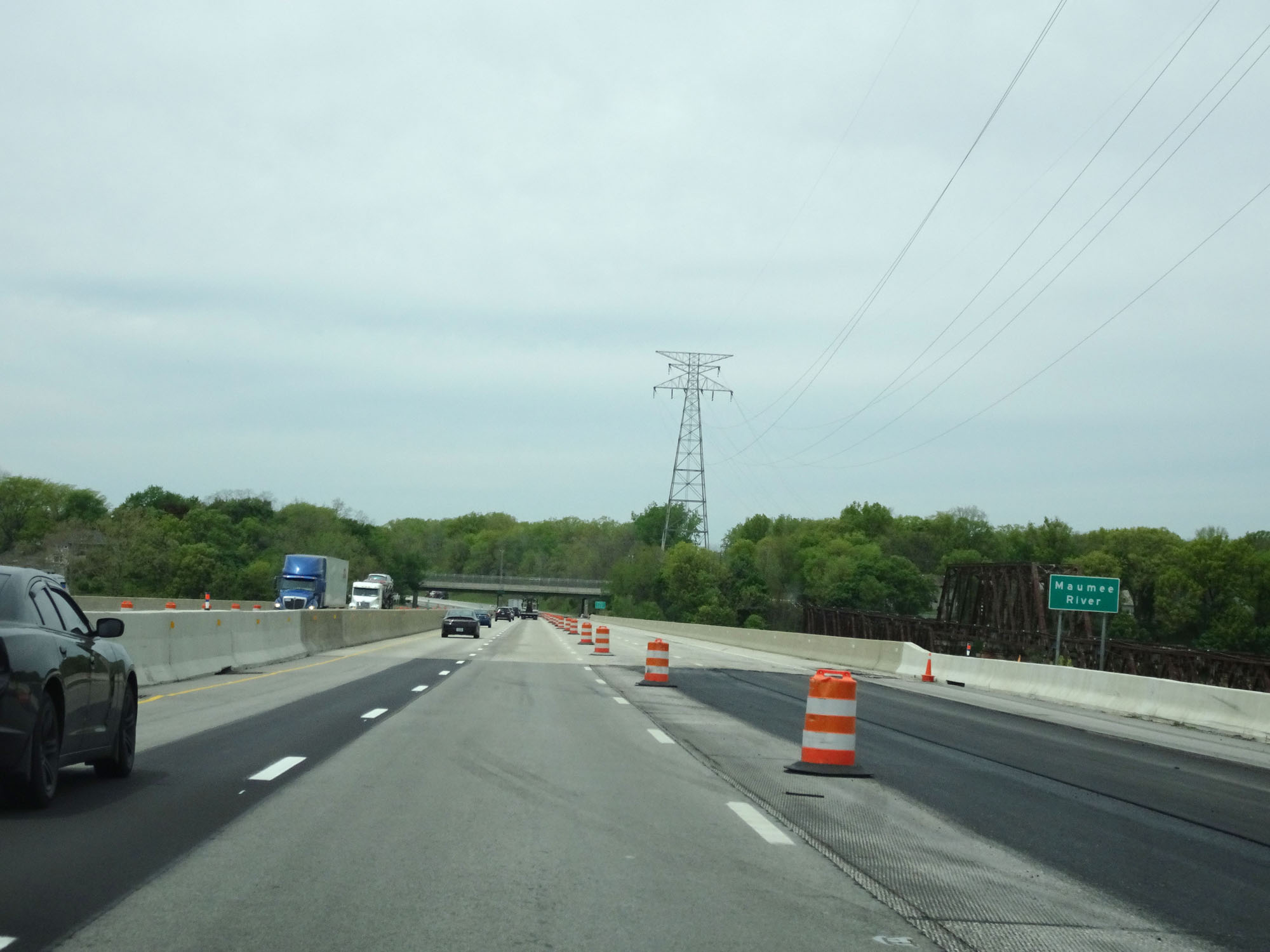 |
Interstate 80 / Interstate 90 West (Ohio Turnpike) as it prepares to cross the Maumee River. (Photo taken 5/20/16). |
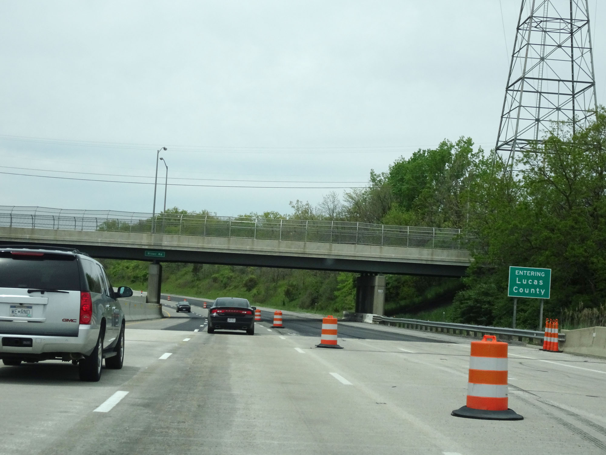 |
Interstate 80 / Interstate 90 West (Ohio Turnpike) as it enters Lucas County after crossing the Maumee River. (Photo taken 5/20/16). |
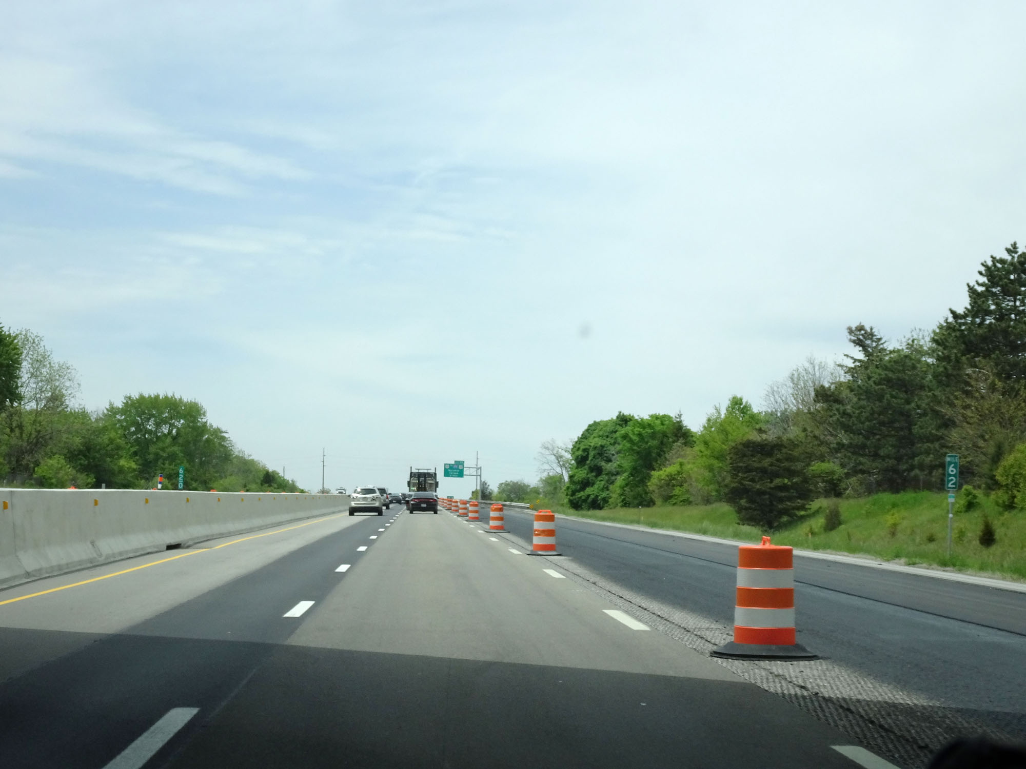 |
Interstate 80 / Interstate 90 West (Ohio Turnpike) at mile marker 62. (Photo taken 5/20/16). |
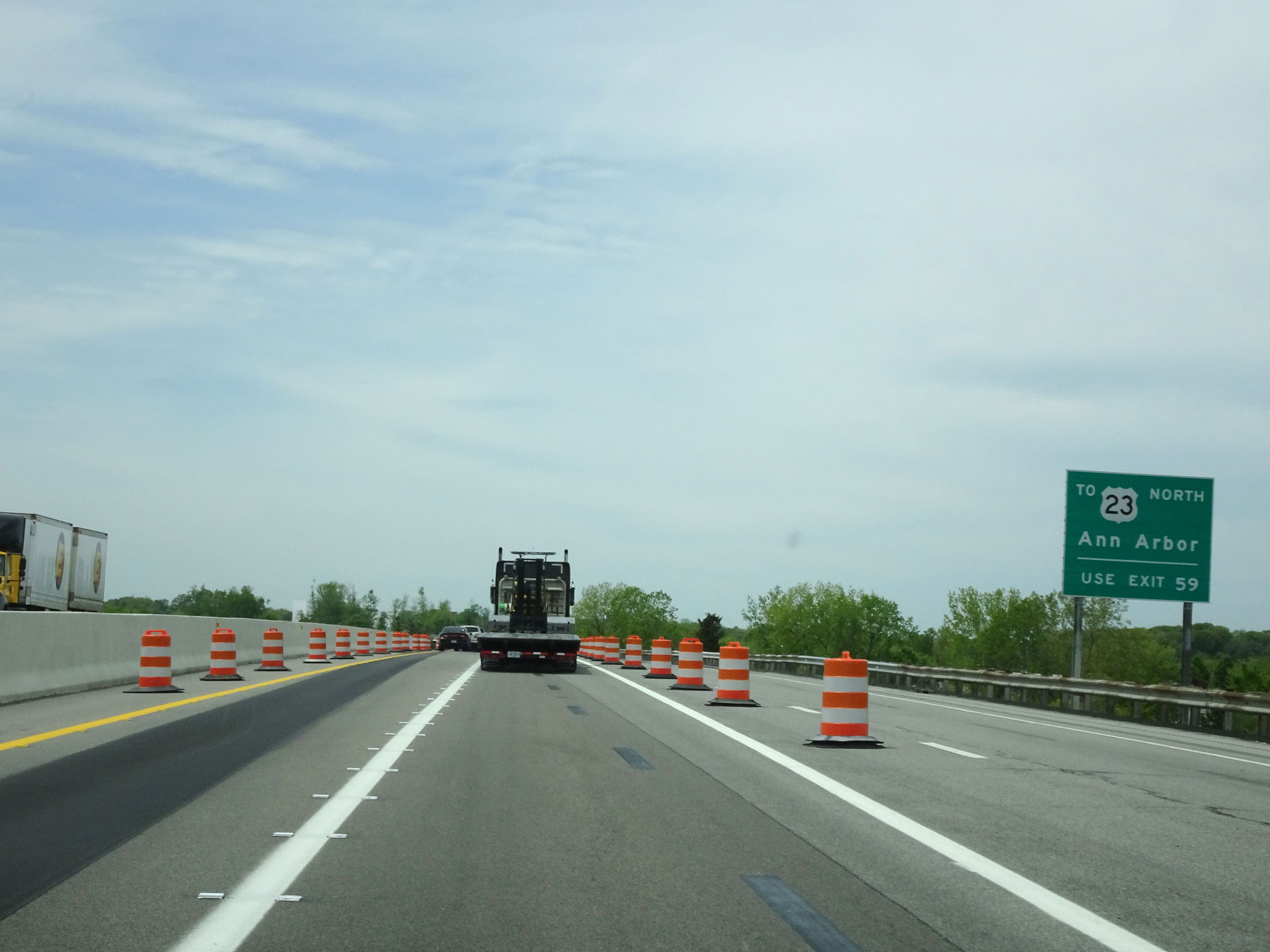 |
Take Exit 59 to US 23 North toward Ann Arbor. (Photo taken 5/20/16). |
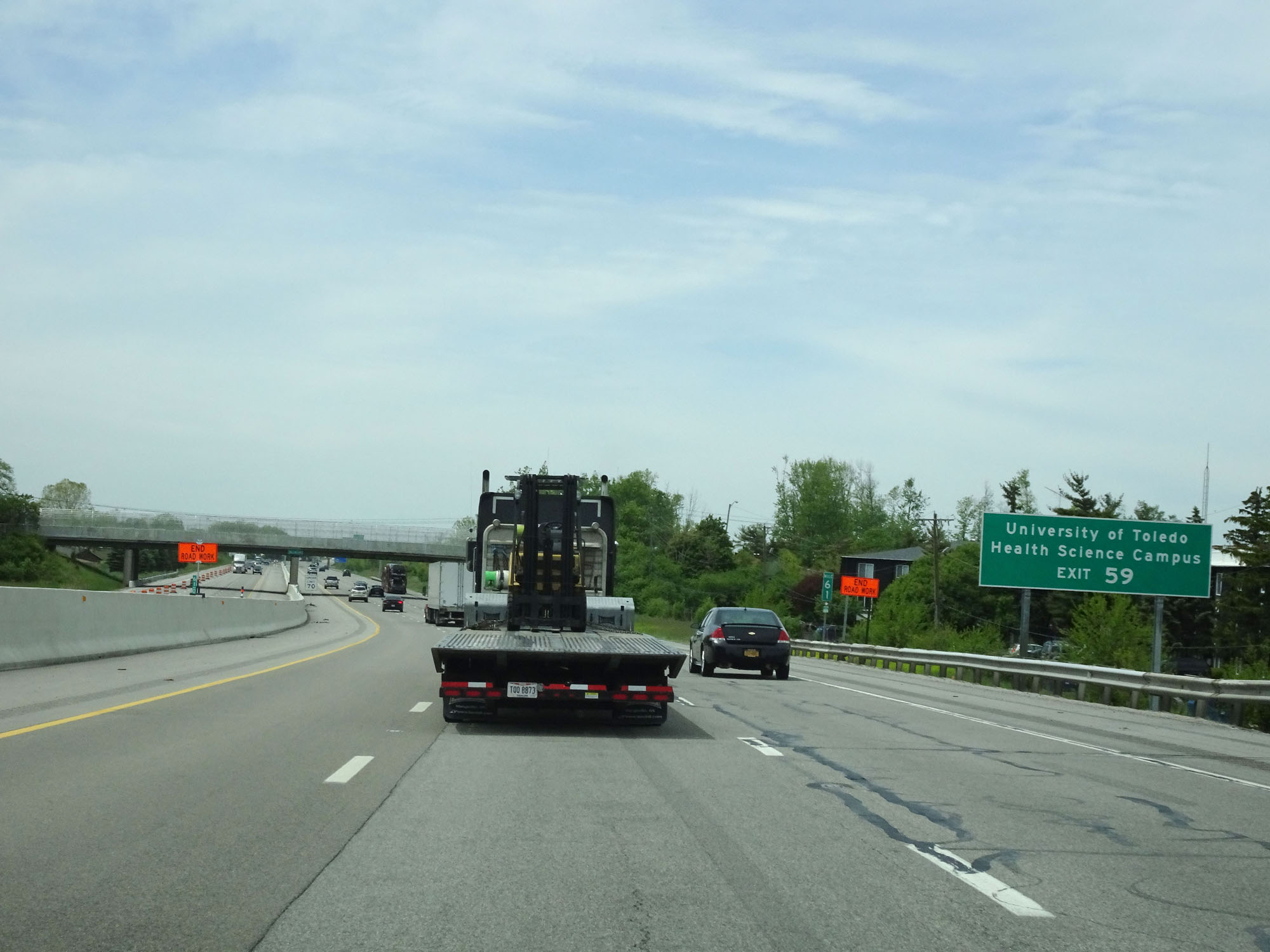 |
Also take Exit 59 to University of Toledo Health Science Campus. (Photo taken 5/20/16). |
 |
Interstate 80 / Interstate 90 West (Ohio Turnpike) approaching Exit 59 - 1 mile. (Photo taken 5/20/16). |
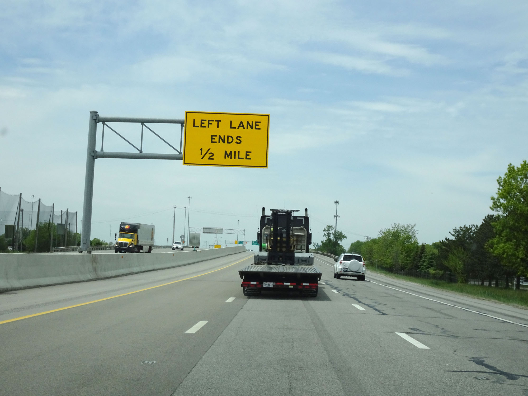 |
1/2 mile ahead, just beyond Exit 59, the left lane comes to an end and Interstate 80 / Interstate 90 West (Ohio Turnpike) is reduced to two lanes in each direction the rest of the way through Ohio. (Photo taken 5/20/16). |
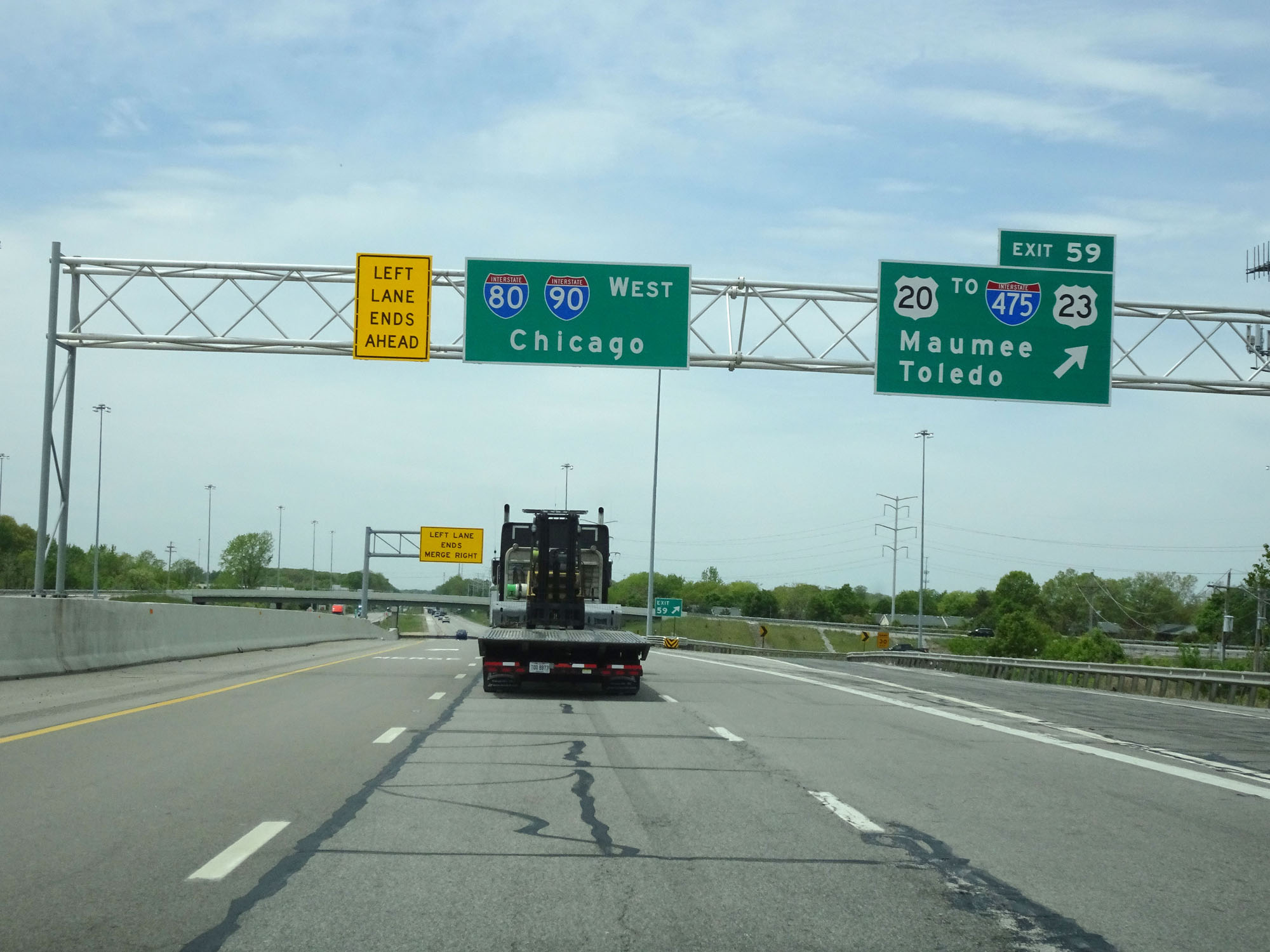 |
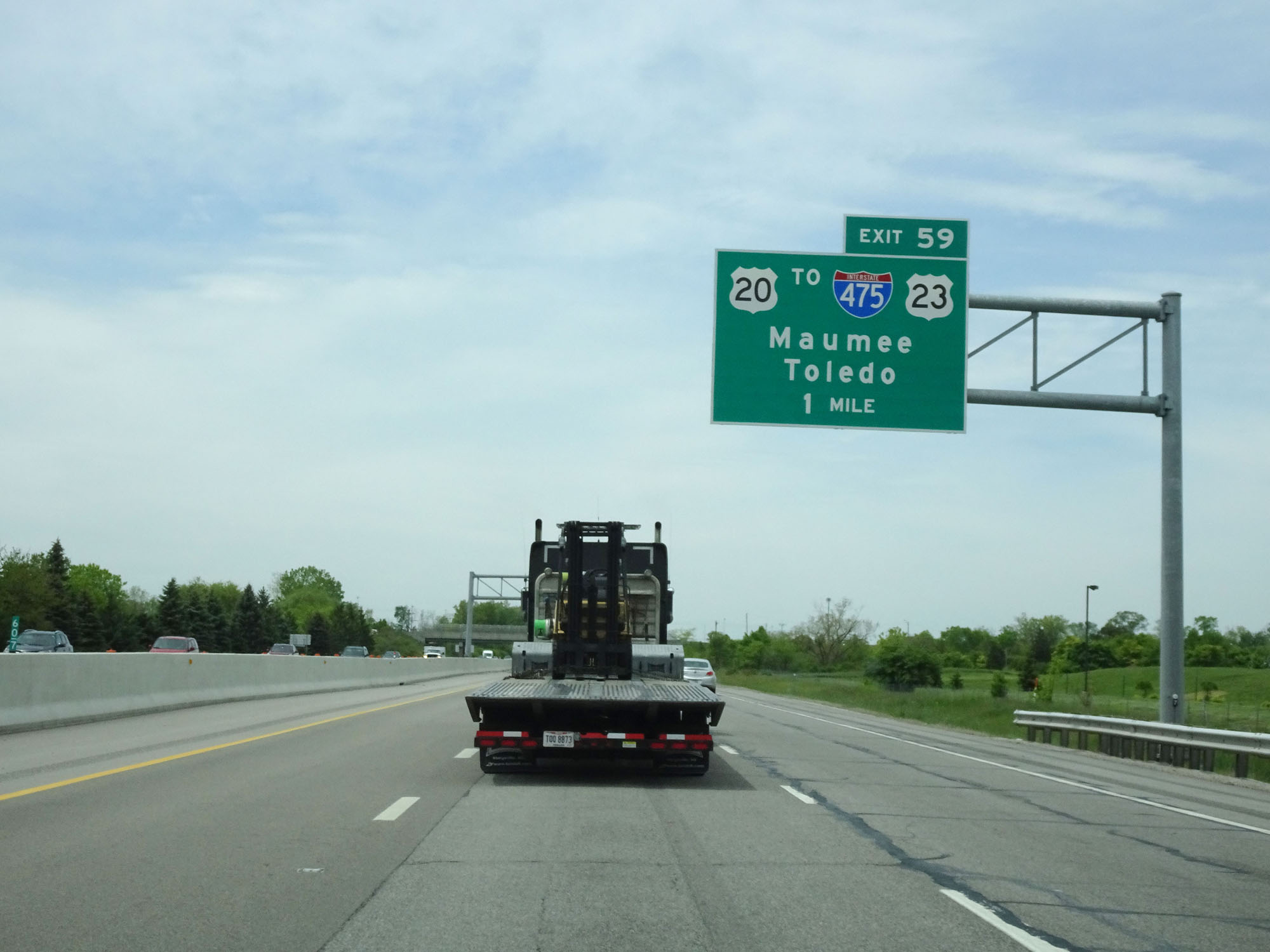
Interstate 80 / Interstate 90 West (Ohio Turnpike) at Exit 59: US 20 / To Interstate 475 / To US 23 - Maumee / Toledo (Photo taken 5/20/16). |
Section 4: Maumee (Exit 59) to Indiana Border
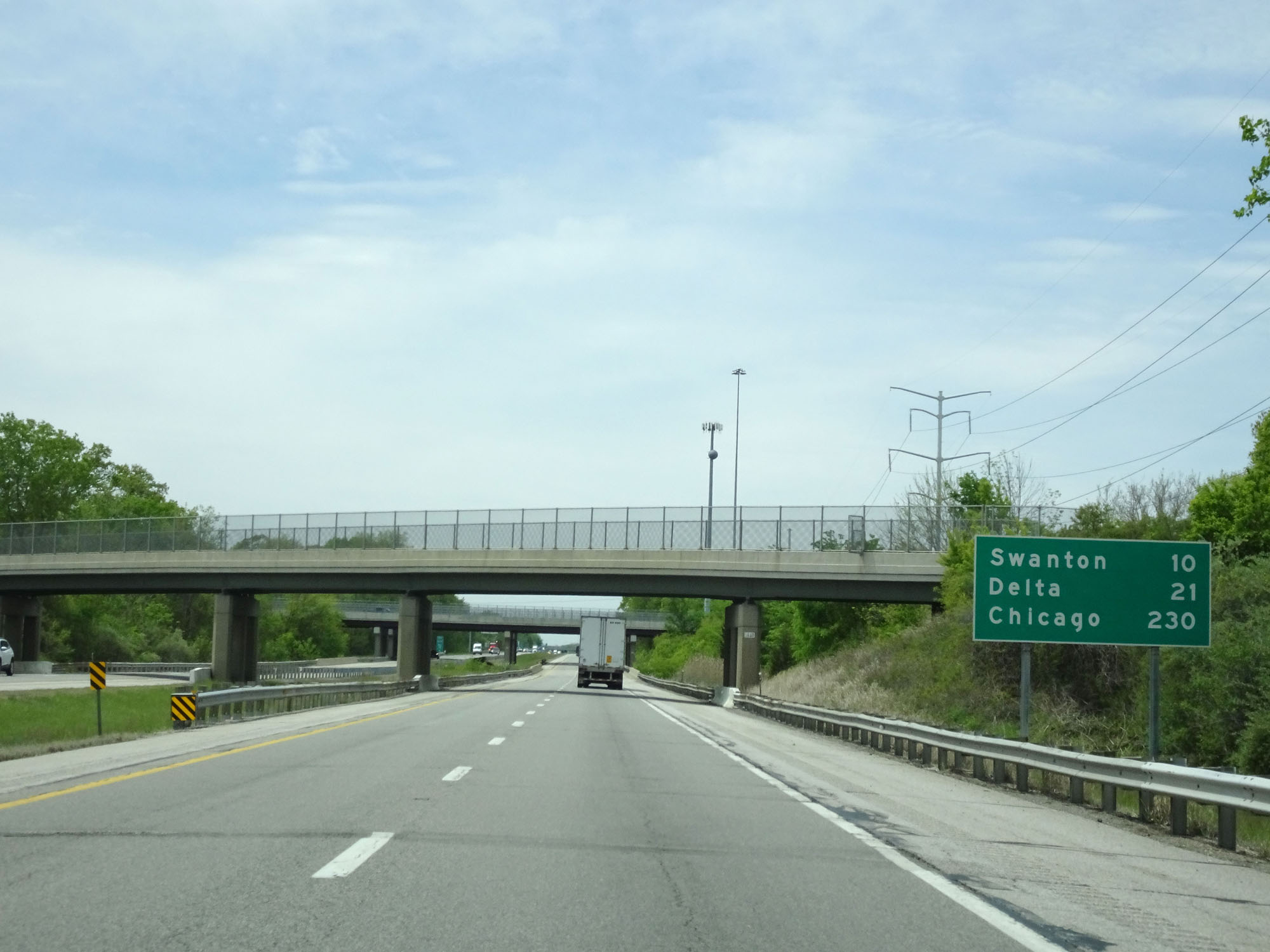 |
Mileage sign west of Exit 59. It's 10 miles to Swanton, 21 miles to Delta, and 230 miles to Chicago. (Photo taken 5/20/16). |
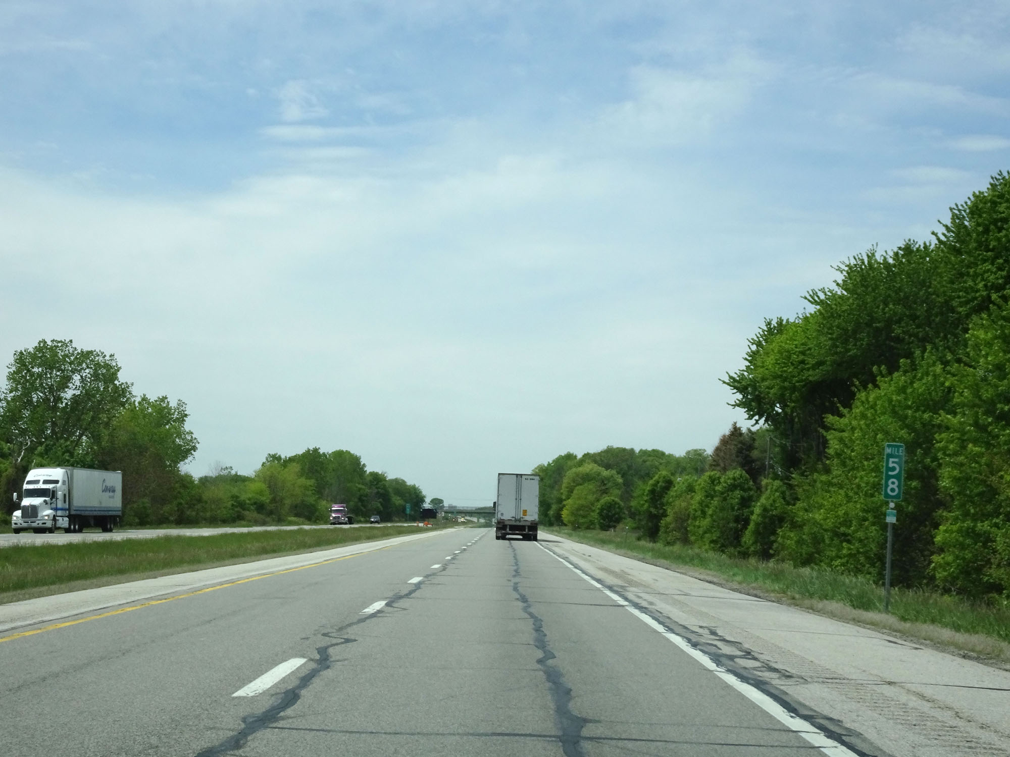 |
Interstate 80 / Interstate 90 West (Ohio Turnpike) at mile marker 58. (Photo taken 5/20/16). |
 |
Interstate 80 / Interstate 90 West (Ohio Turnpike) approaching Exit 52 - 1 mile. (Photo taken 5/20/16). |
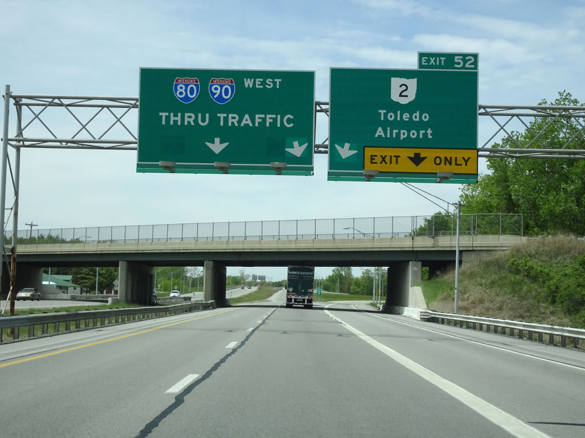 |
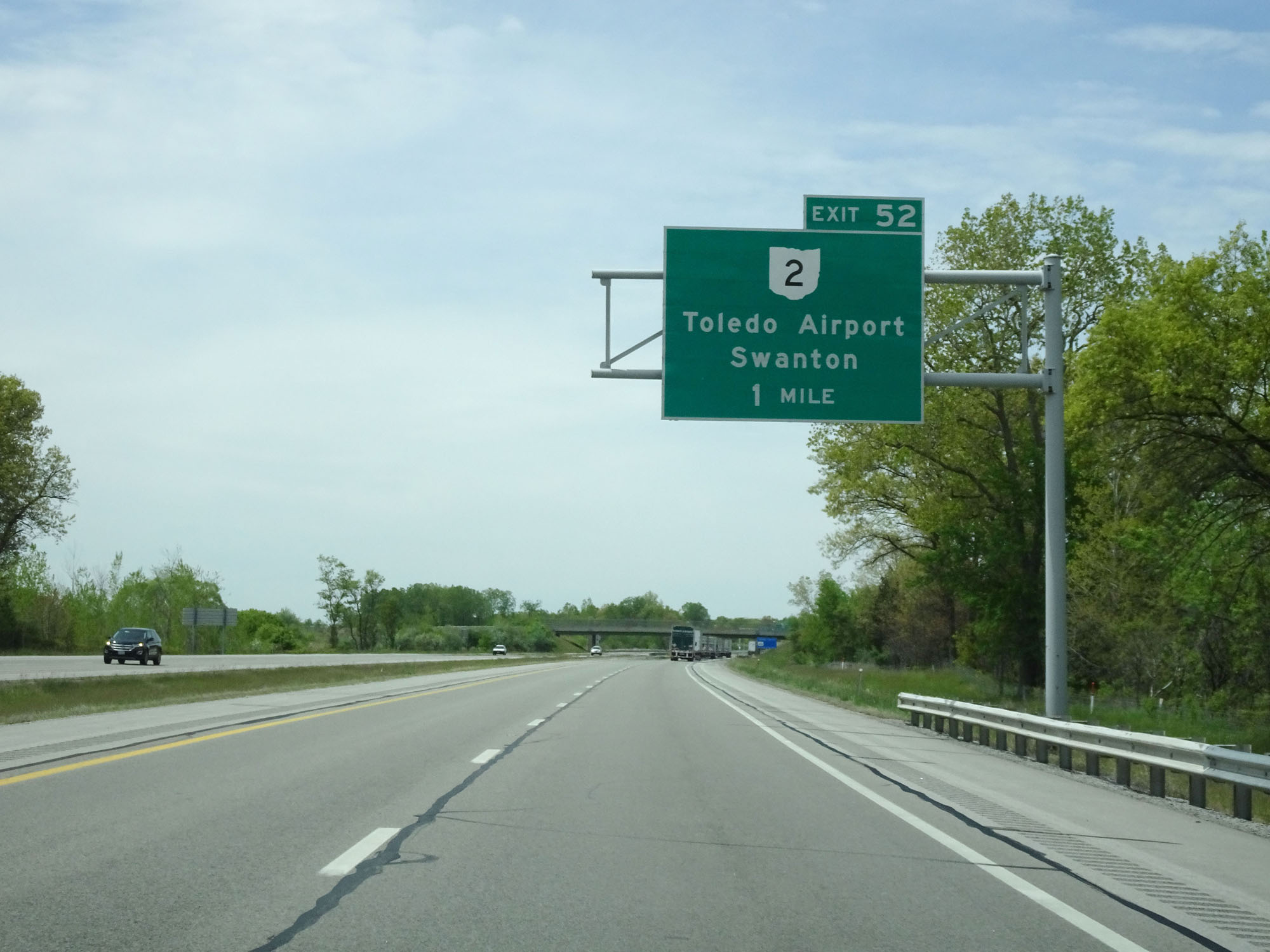
Interstate 80 / Interstate 90 West (Ohio Turnpike) at Exit 52: OH 2 - Toledo Airport / Swanton (Photo taken 5/20/16). |
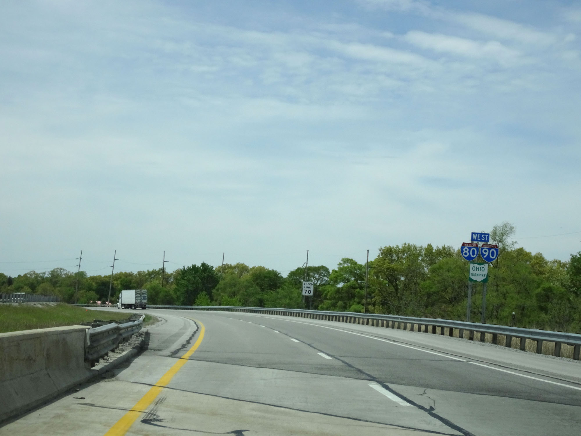 |
Interstate 80 / Interstate 90 / Ohio Turnpike West assurance shields west of Exit 52. (Photo taken 5/20/16). |
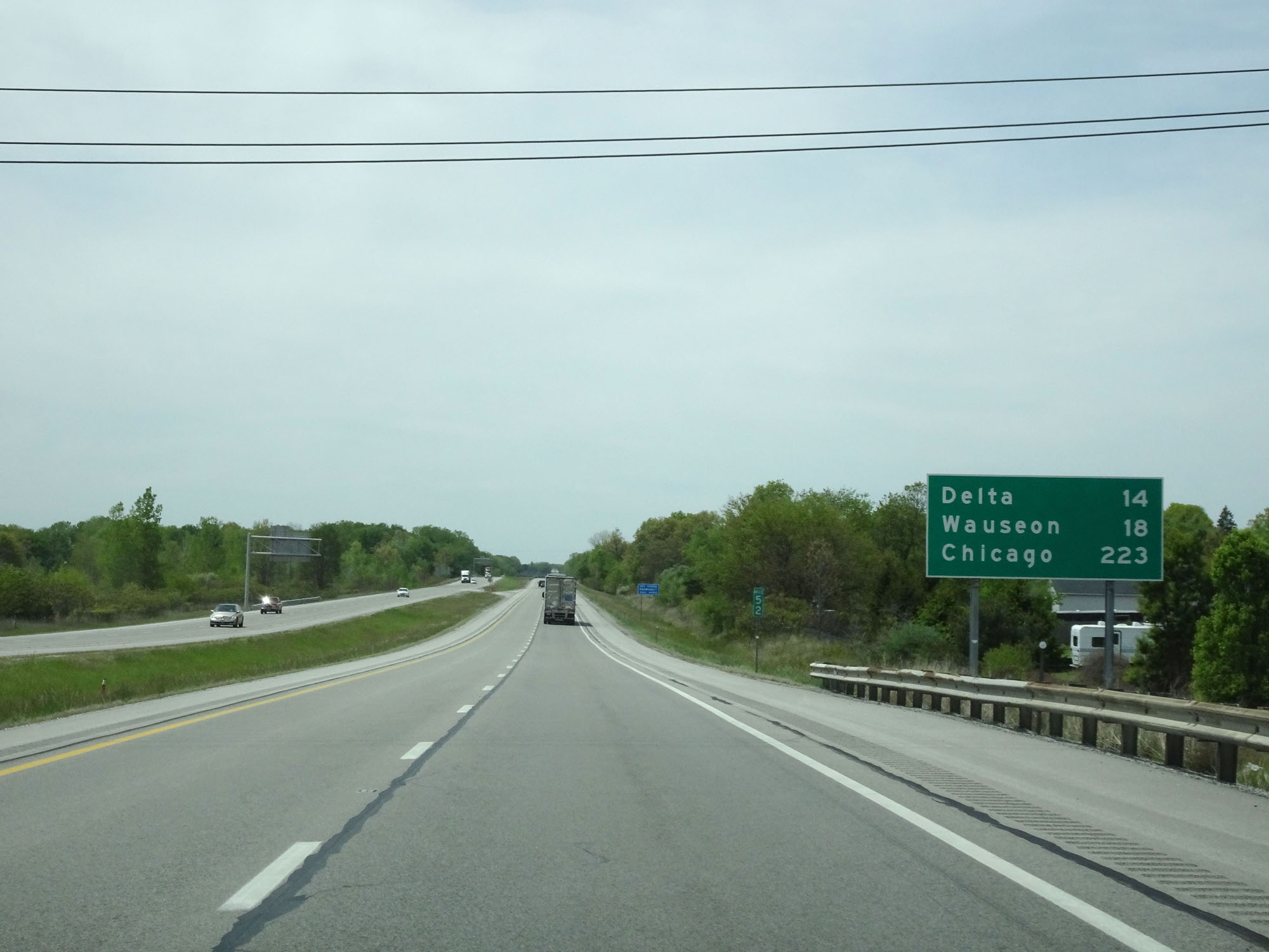 |
Mileage sign at mile marker 52. It's 14 miles to Delta, 18 miles to Wauseon, and 223 miles to Chicago. (Photo taken 5/20/16). |
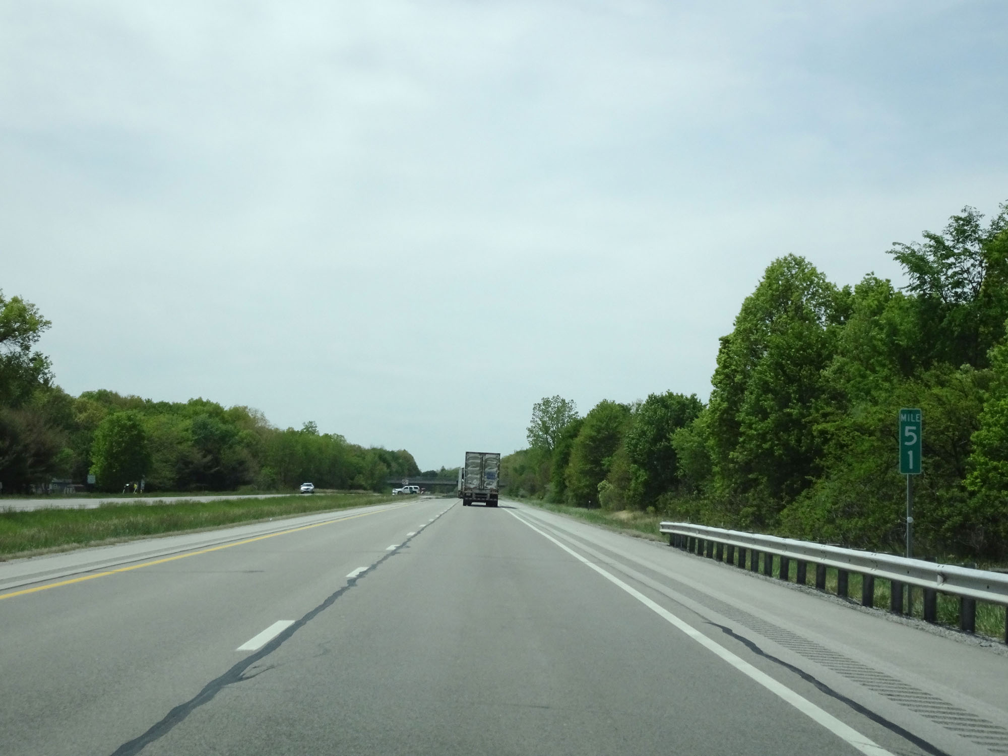 |
Interstate 80 / Interstate 90 West (Ohio Turnpike) at mile marker 51. (Photo taken 5/20/16). |
 |
Interstate 80 / Interstate 90 West (Ohio Turnpike) at mile marker 43. (Photo taken 5/20/16). |
 |
Interstate 80 / Interstate 90 West (Ohio Turnpike) approaching Exit 39 - 1 mile. (Photo taken 5/20/16). |
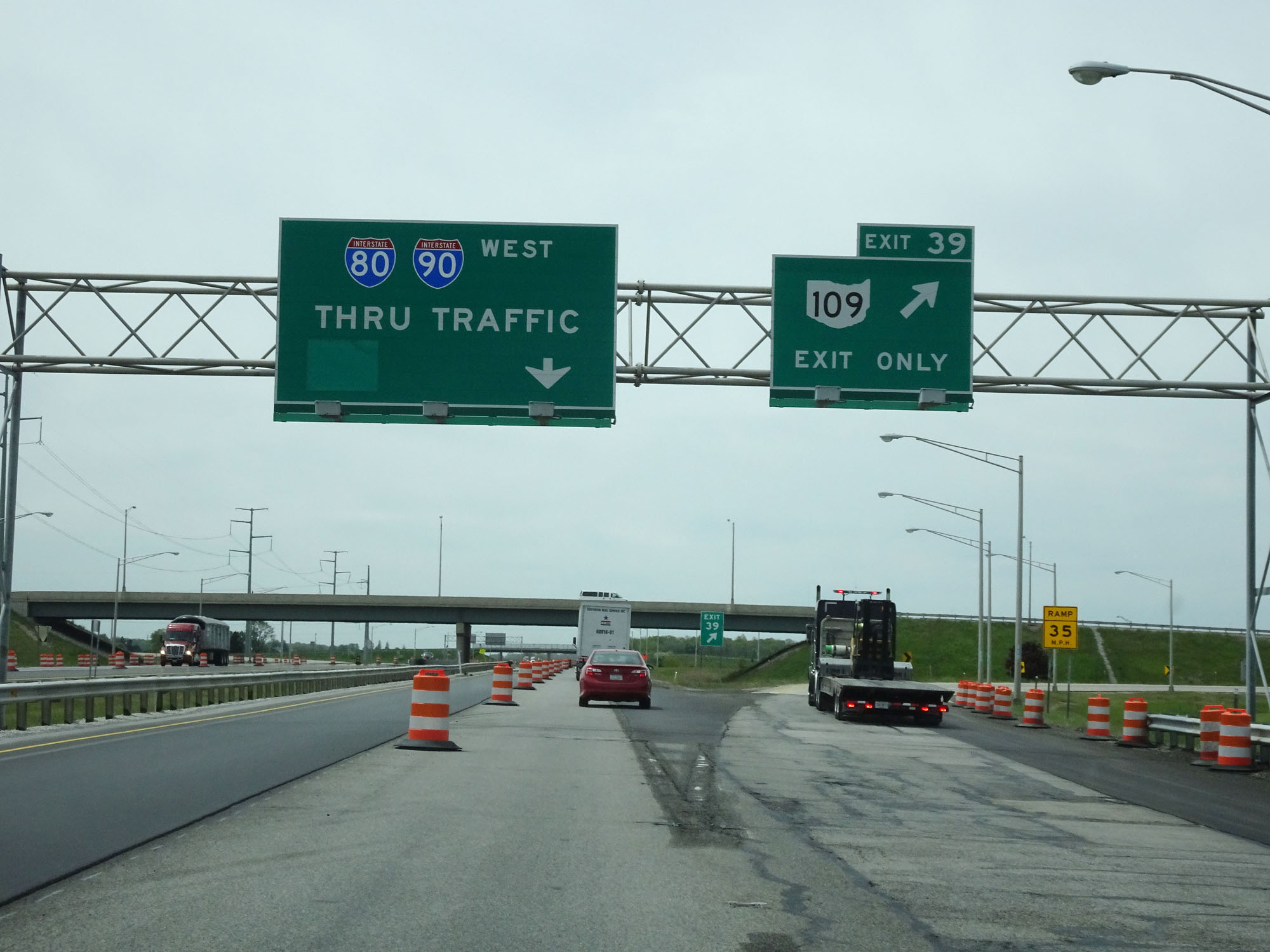 |
Interstate 80 / Interstate 90 West (Ohio Turnpike) at Exit 39: OH 109 - Delta / Lyons (Photo taken 5/20/16). |
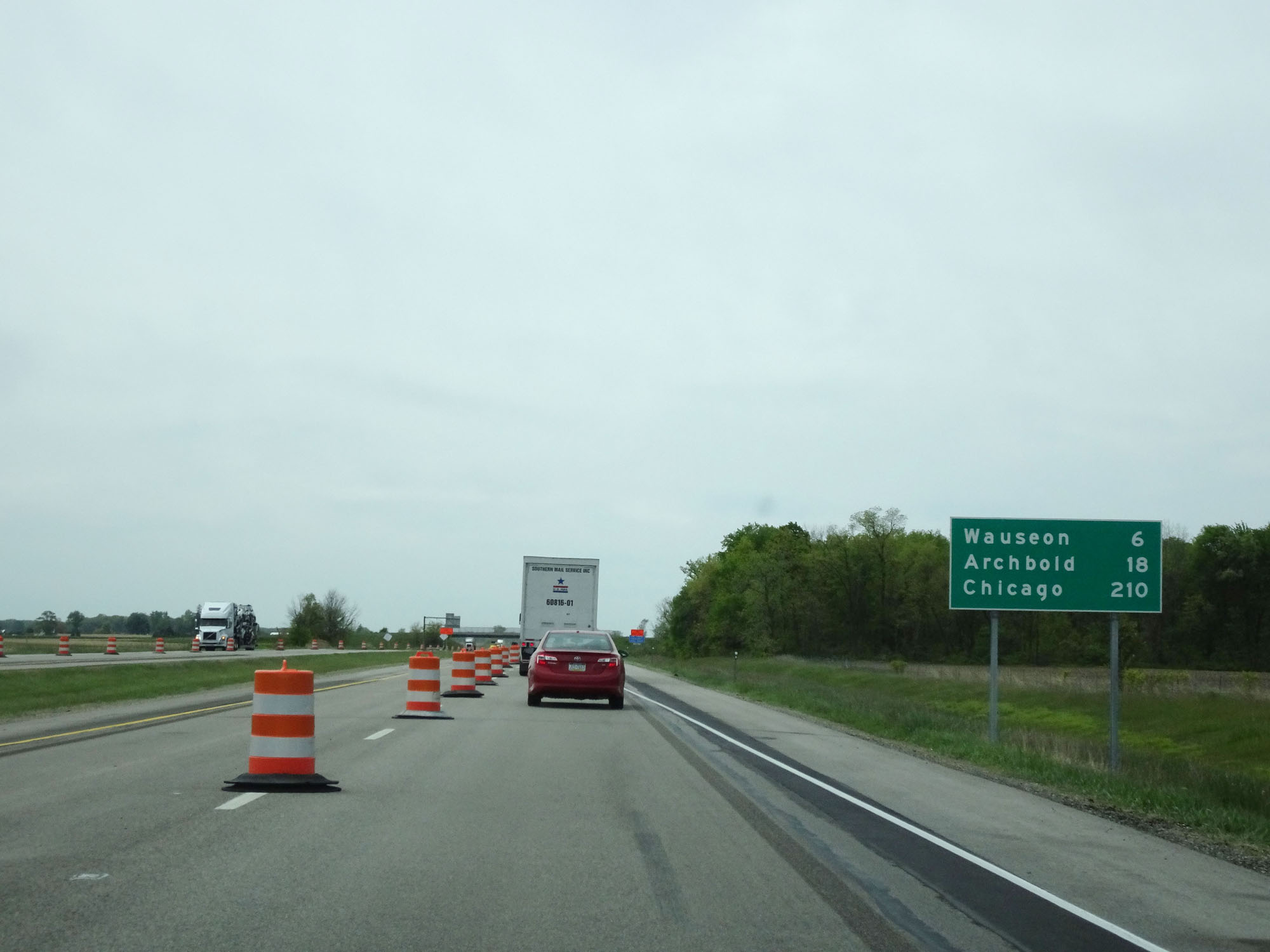 |
Mileage sign west of Exit 39. It's 6 miles to Wauseon, 18 miles to Archbold, and 210 miles to Chicago. (Photo taken 5/20/16). |
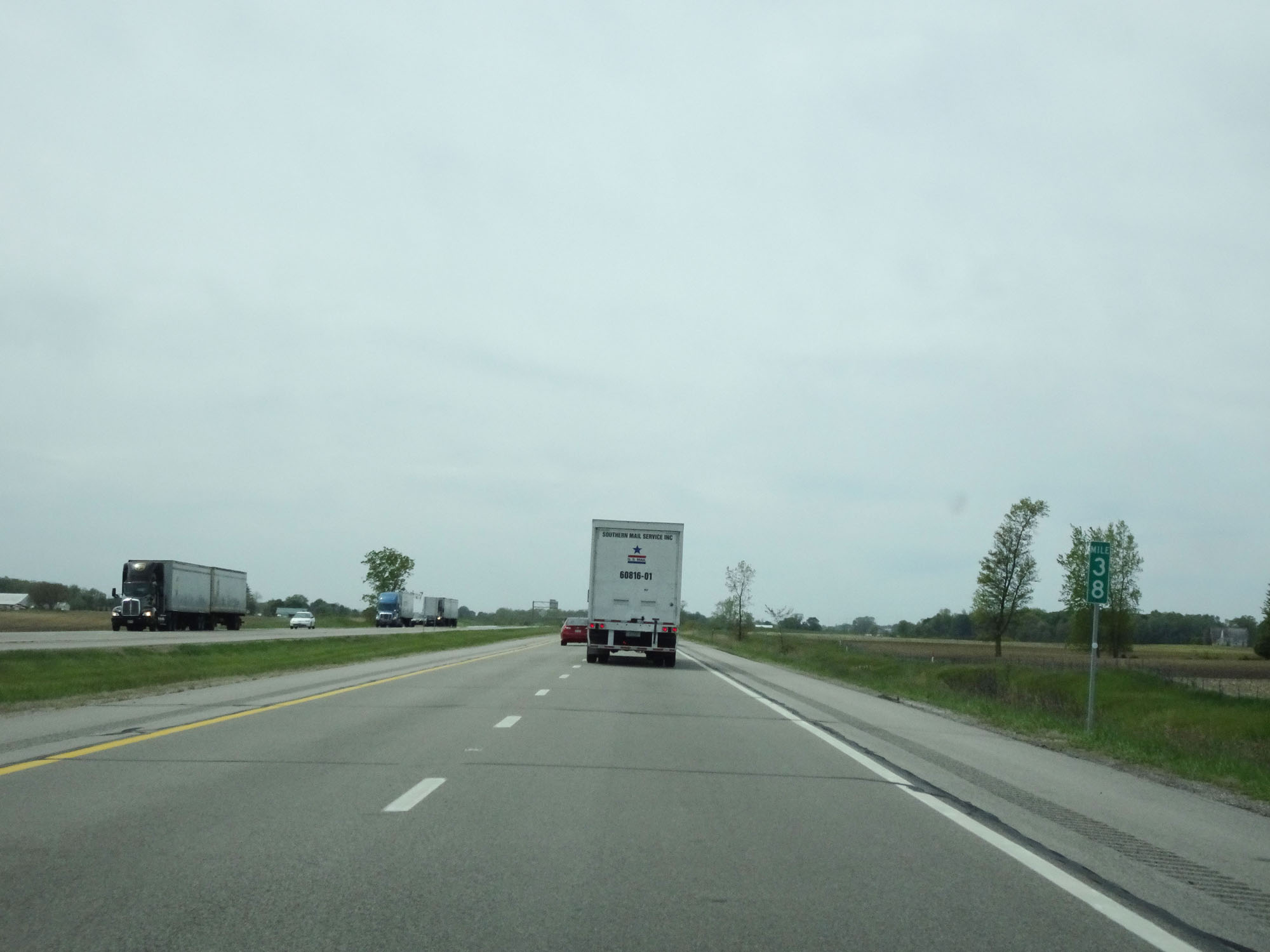 |
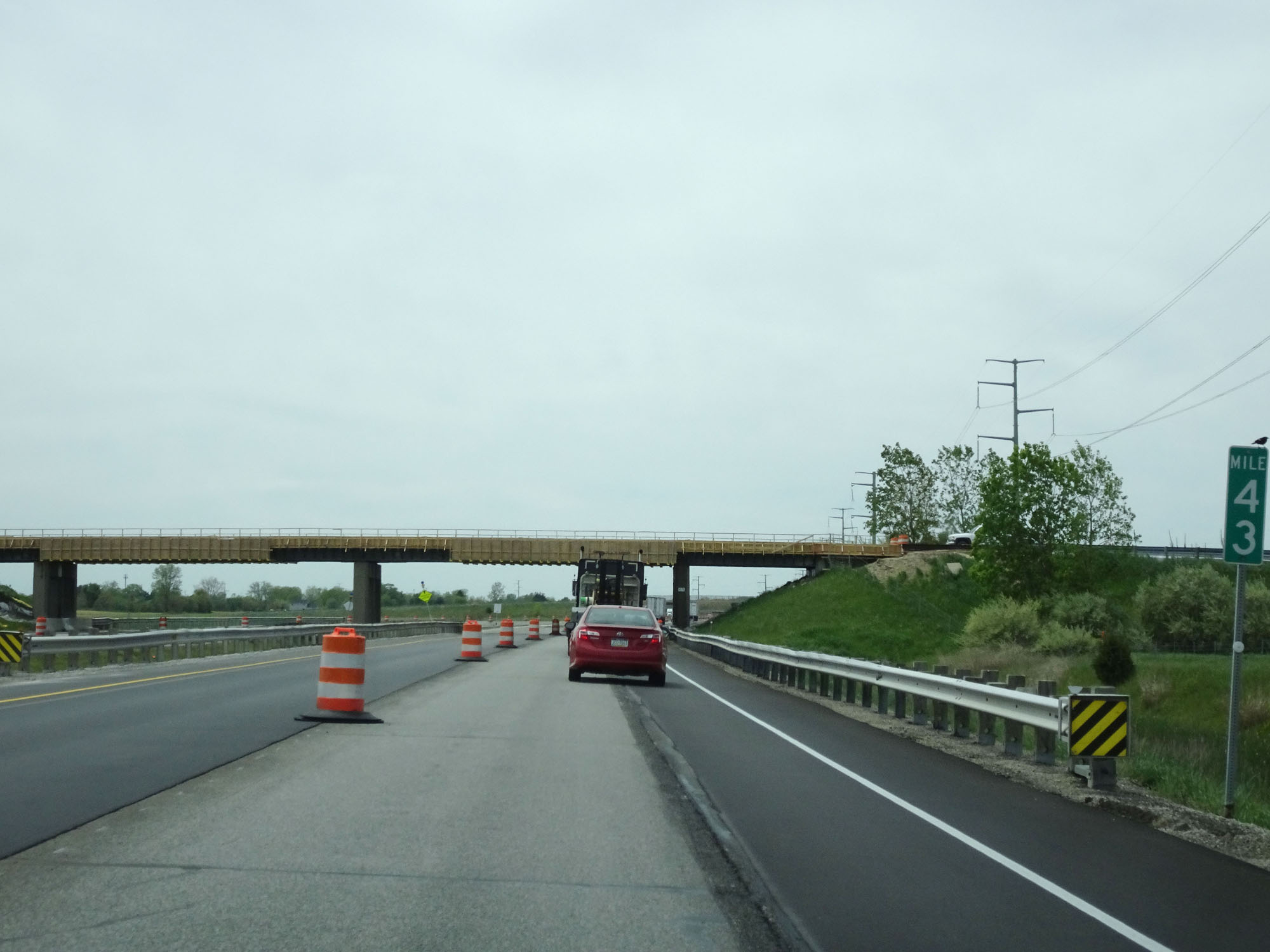
Interstate 80 / Interstate 90 West (Ohio Turnpike) at mile marker 38. (Photo taken 5/20/16). |
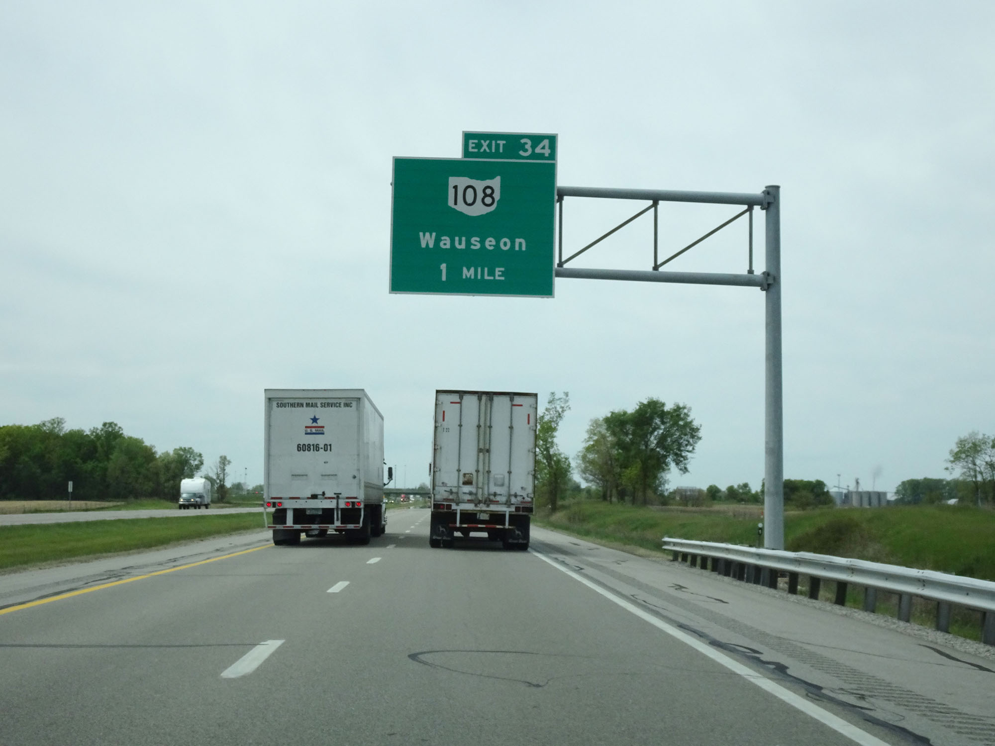 |
Interstate 80 / Interstate 90 West (Ohio Turnpike) approaching Exit 34 - 1 mile. (Photo taken 5/20/16). |
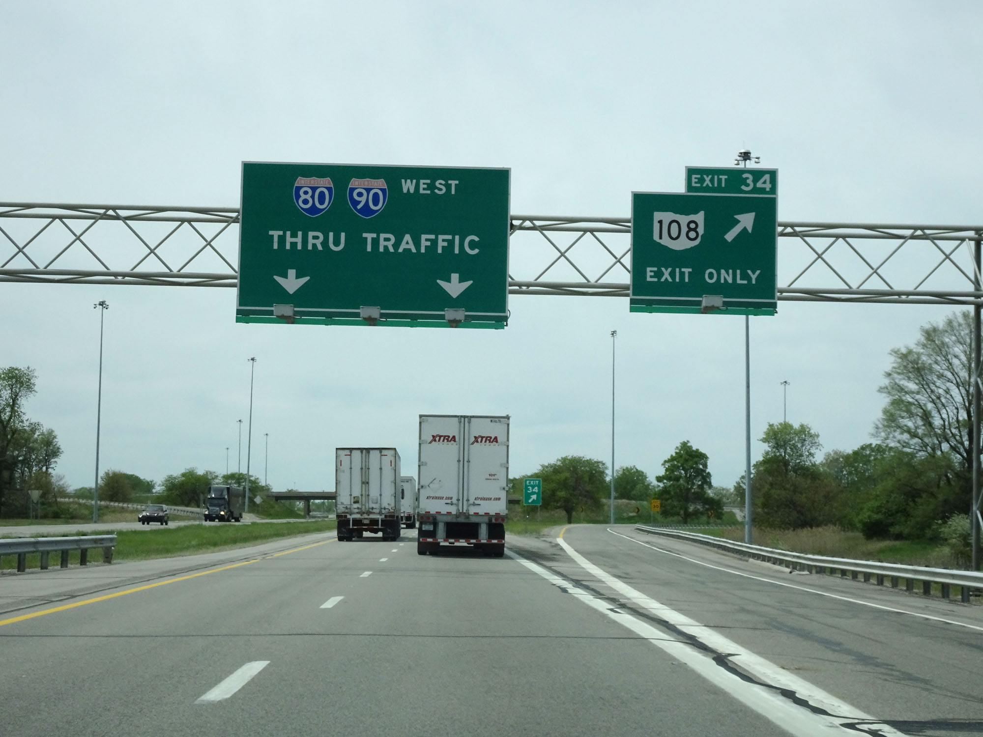 |
Interstate 80 / Interstate 90 West (Ohio Turnpike) at Exit 34: OH 108 - Wauseon (Photo taken 5/20/16). |
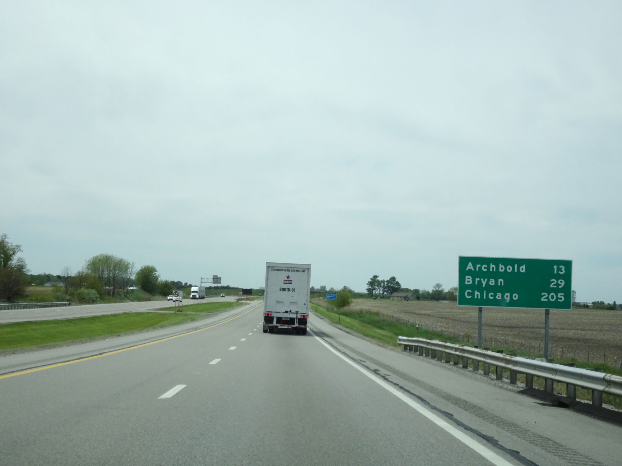 |
Mileage sign west of Exit 34. It's 13 miles to Archbold, 29 miles to Bryan, and 205 miles to Chicago. (Photo taken 5/20/16). |
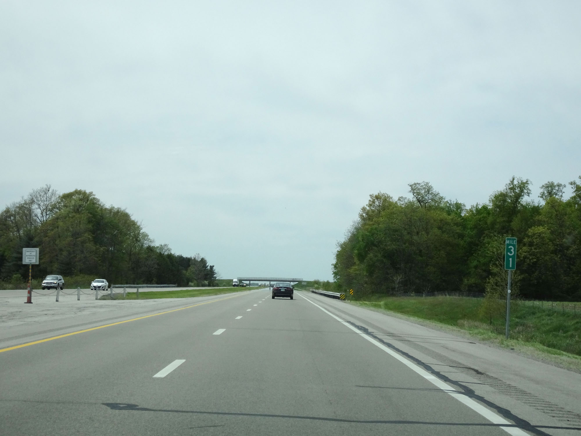 |
Interstate 80 / Interstate 90 West (Ohio Turnpike) at mile marker 31. (Photo taken 5/20/16). |
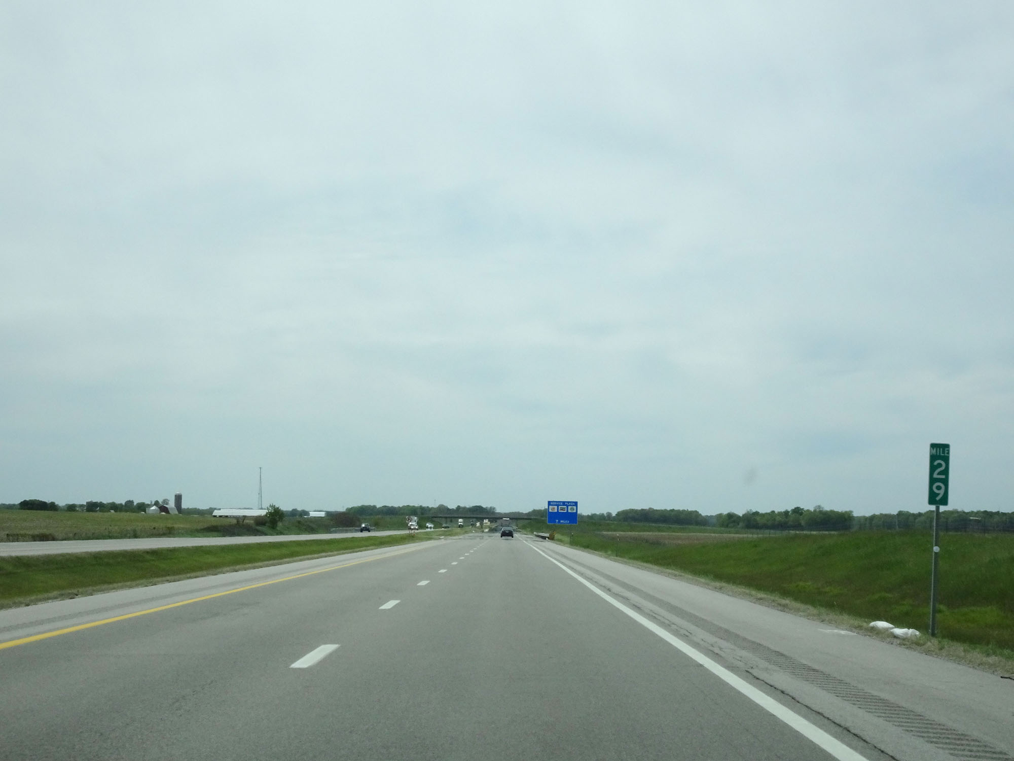 |
Interstate 80 / Interstate 90 West (Ohio Turnpike) at mile marker 29. (Photo taken 5/20/16). |
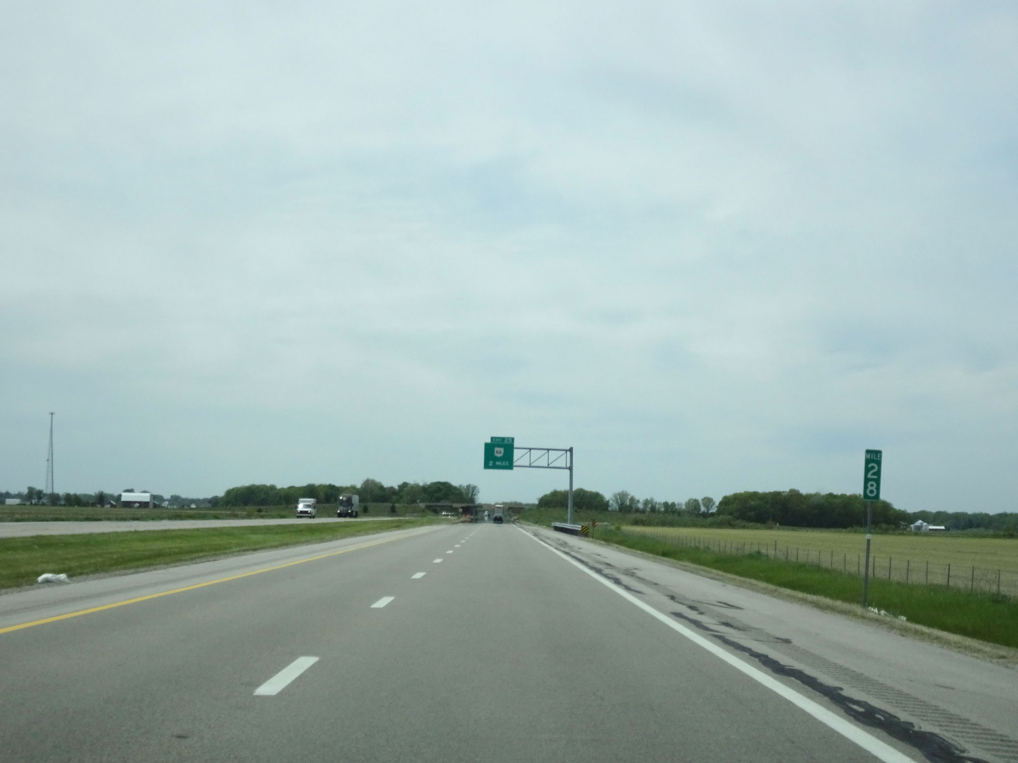 |
Interstate 80 / Interstate 90 West (Ohio Turnpike) at mile marker 28. (Photo taken 5/20/16). |
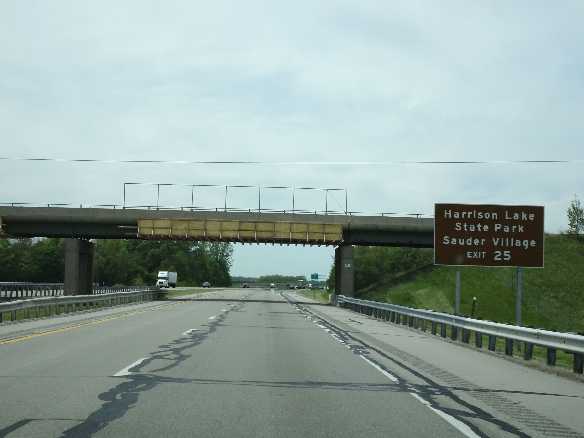 |
Take Exit 25 to Harrison Lake State Park and Sauder Village. (Photo taken 5/20/16). |
 |
Interstate 80 / Interstate 90 West (Ohio Turnpike) approaching Exit 25 - 1 mile. (Photo taken 5/20/16). |
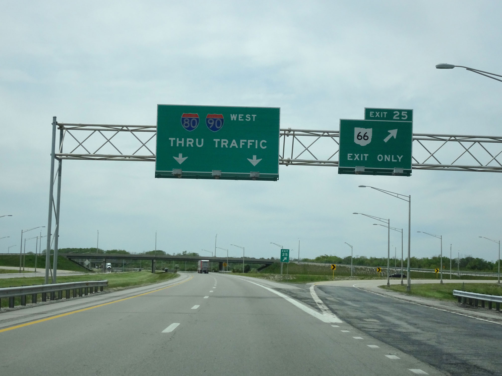 |
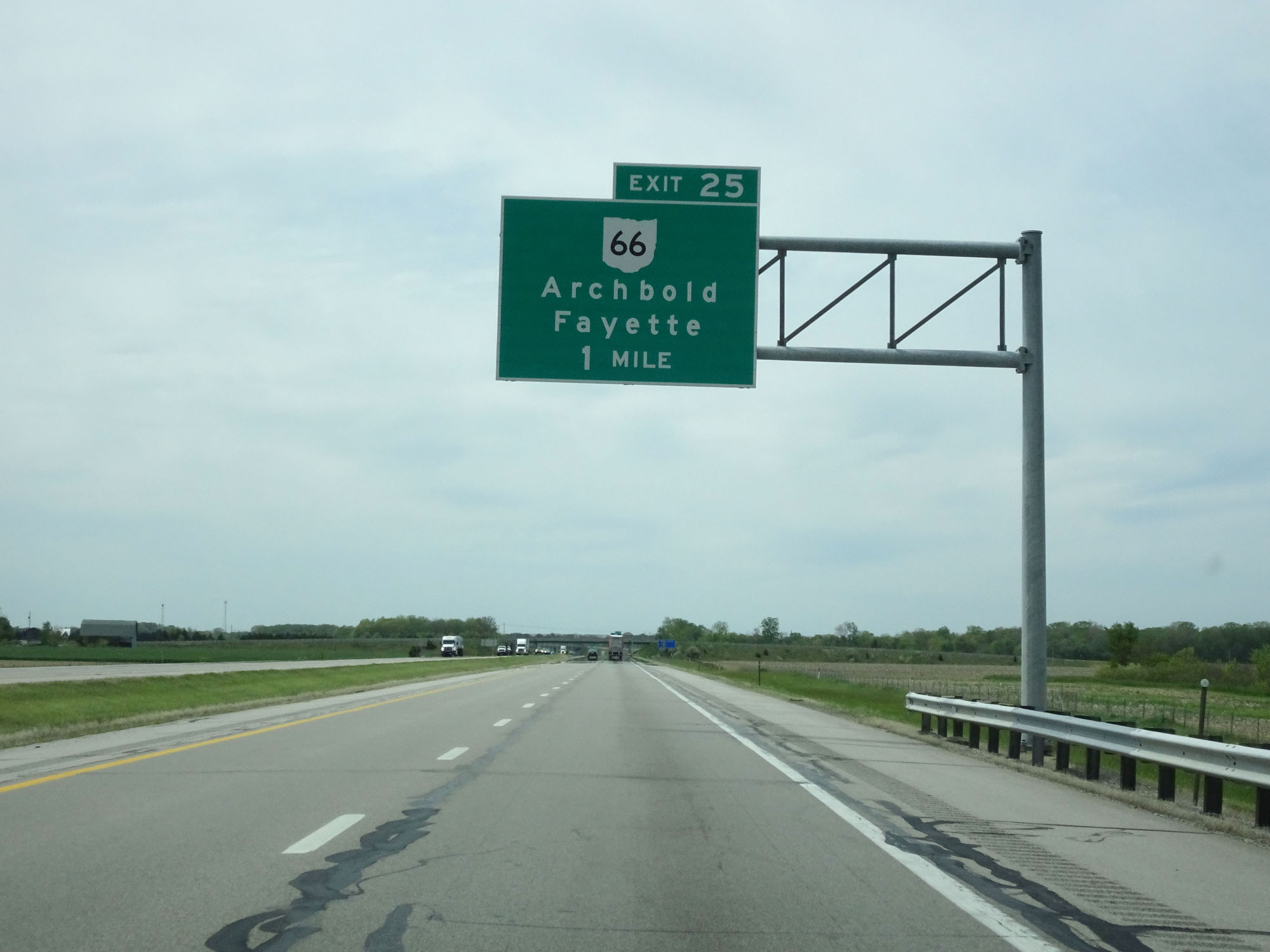
Interstate 80 / Interstate 90 West (Ohio Turnpike) at Exit 25: OH 66 - Archbold / Fayette (Photo taken 5/20/16). |
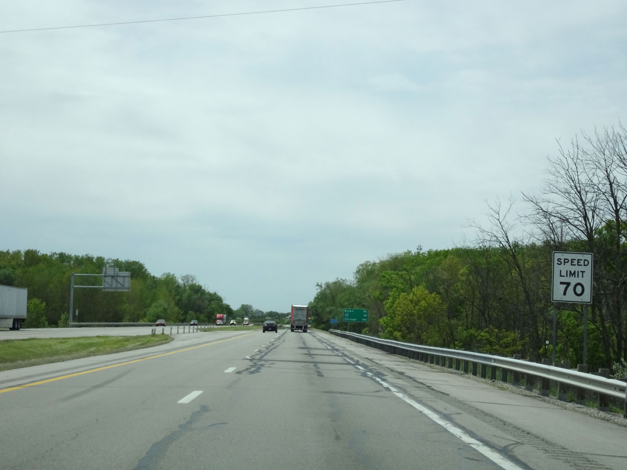 |
Speed limit sign west of Exit 25. Again, Speed Limit - 70 mph. (Photo taken 5/20/16). |
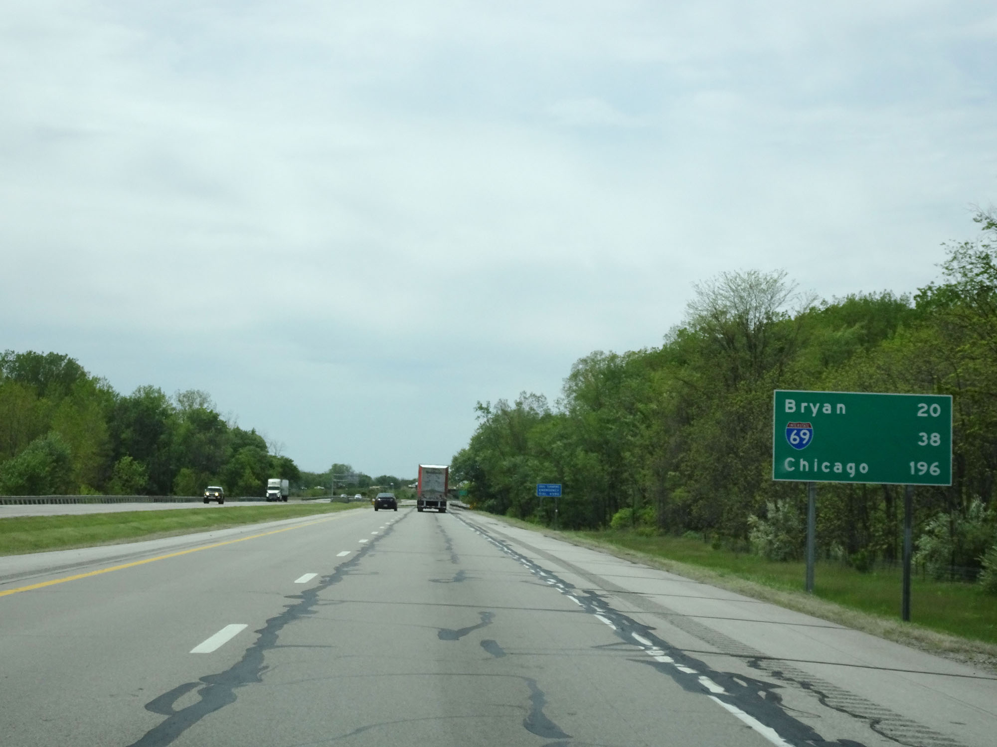 |
Mileage sign near mile marker 25. It's 20 miles to Bryan, 38 miles to the junction of Interstate 69, and 196 miles to Chicago. (Photo taken 5/20/16). |
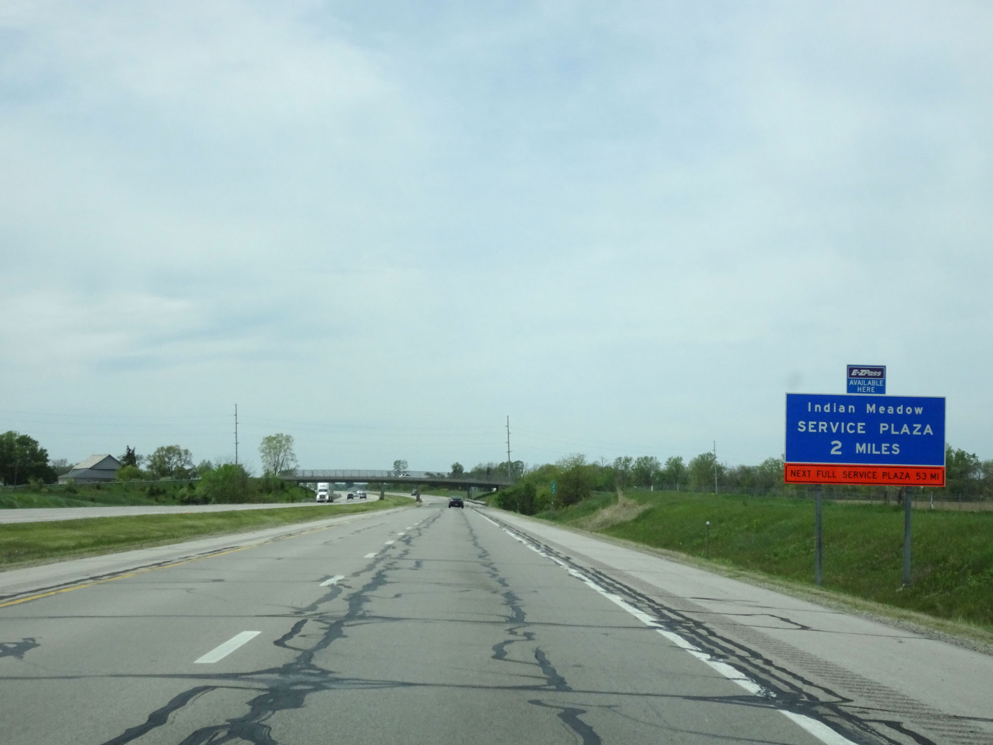 |
Interstate 80 / Interstate 90 West (Ohio Turnpike) approaching the Indian Meadow Service Plaza - 2 miles. (Photo taken 5/20/16). |
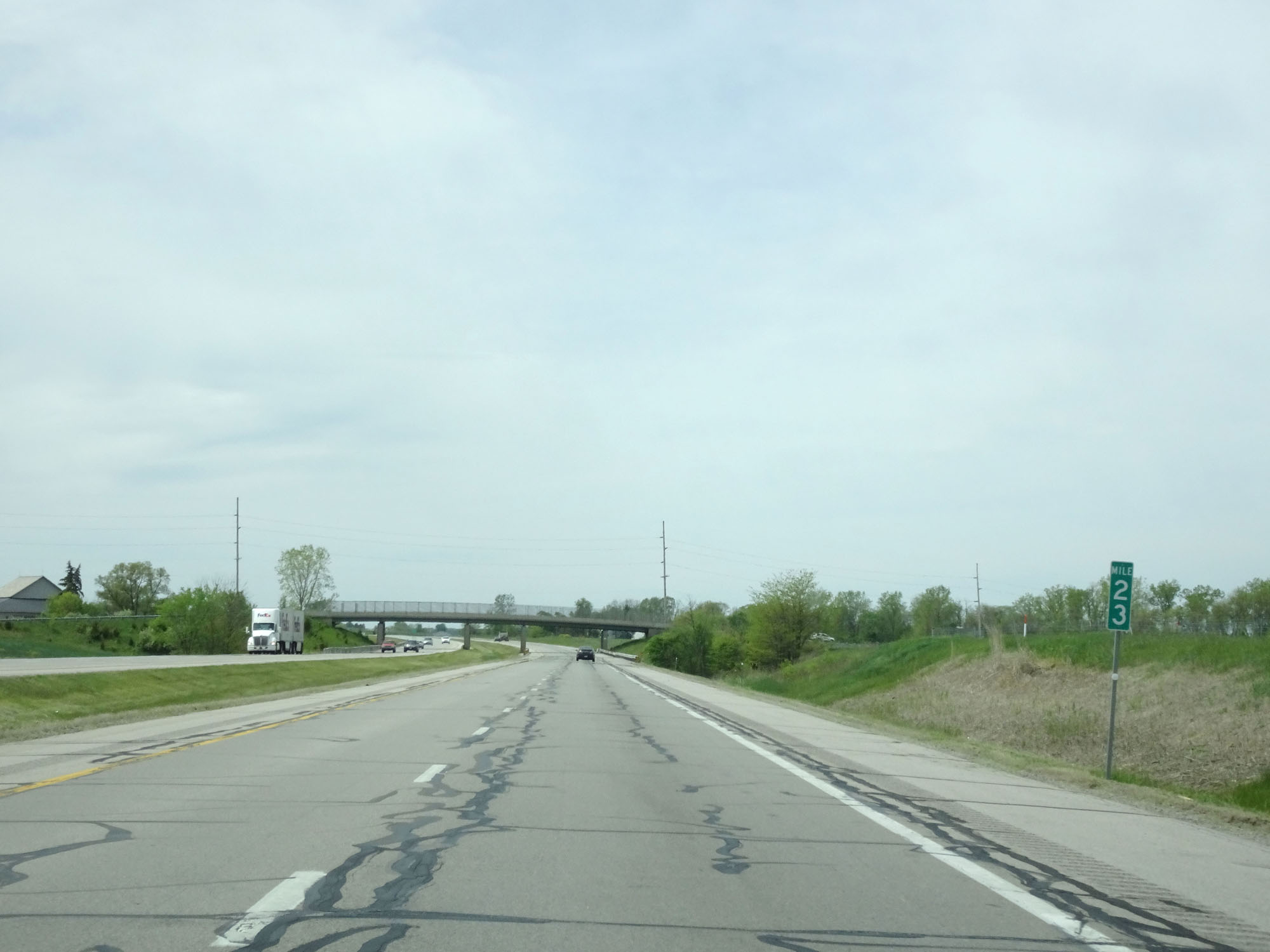 |
Interstate 80 / Interstate 90 West (Ohio Turnpike) at mile marker 23. (Photo taken 5/20/16). |
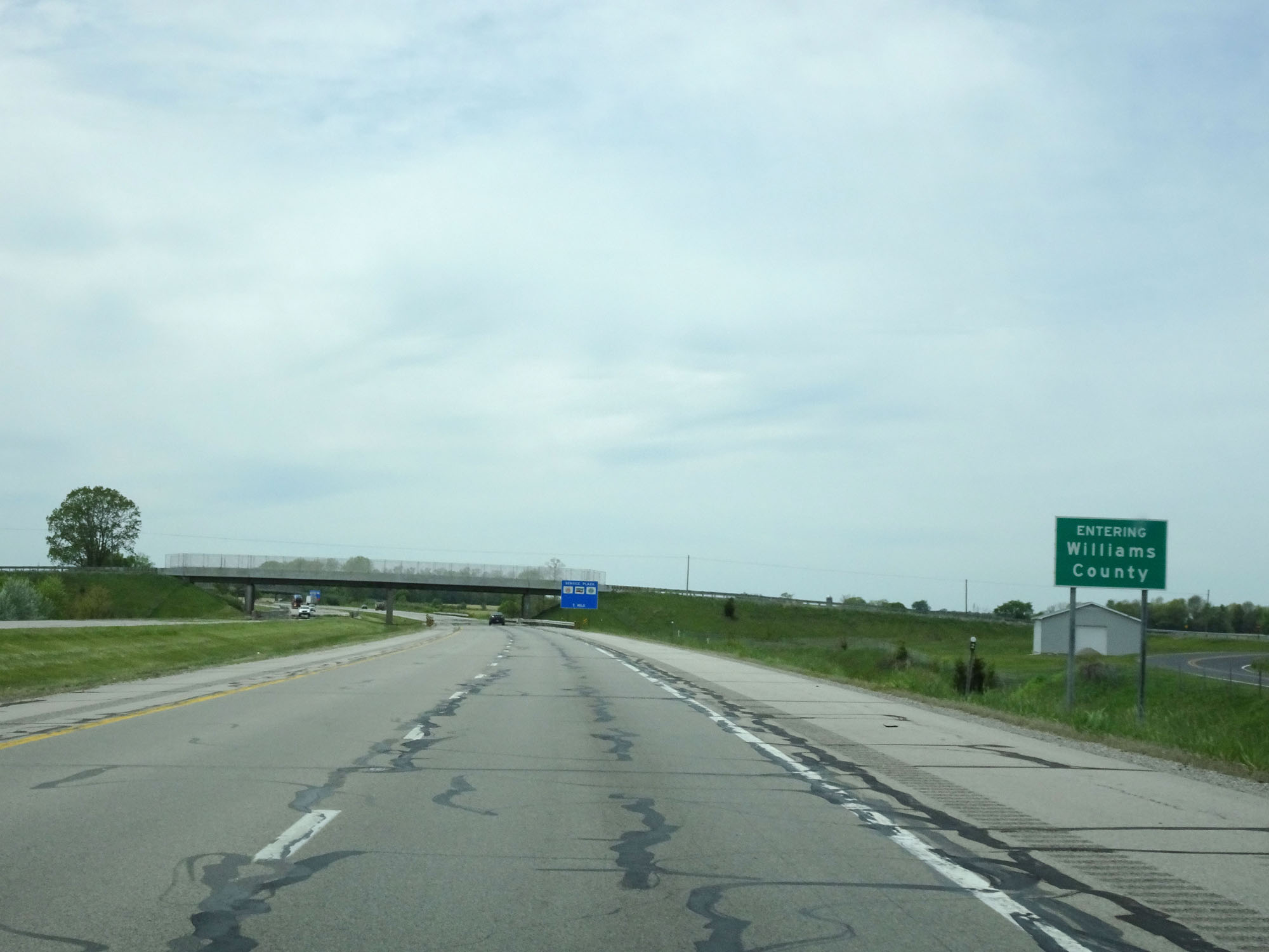 |
Interstate 80 / Interstate 90 West (Ohio Turnpike) entering Williams County. (Photo taken 5/20/16). |
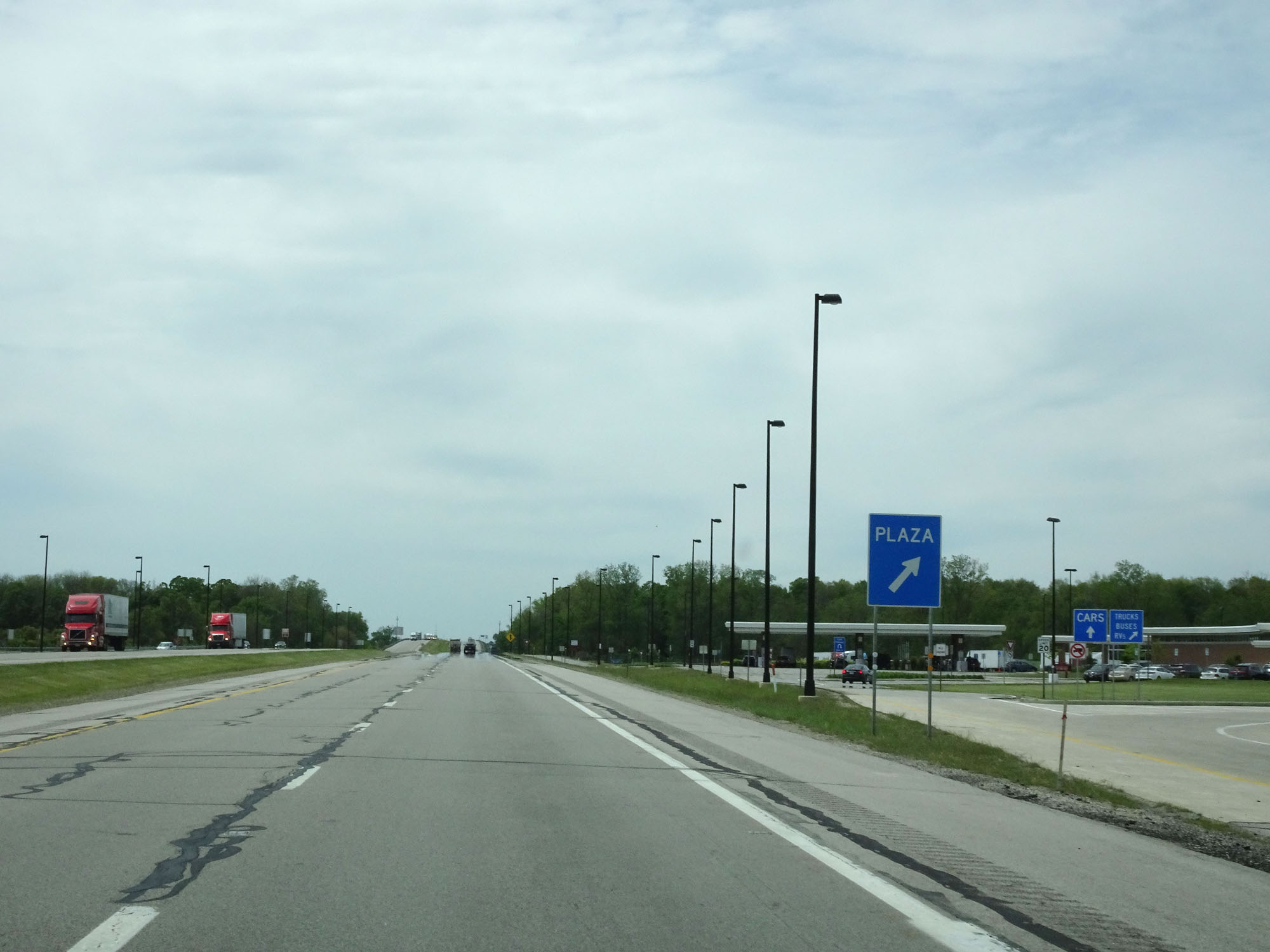 |
Interstate 80 / Interstate 90 West (Ohio Turnpike) at the Indian Meadow Service Plaza, located at mile marker 21. (Photo taken 5/20/16). |
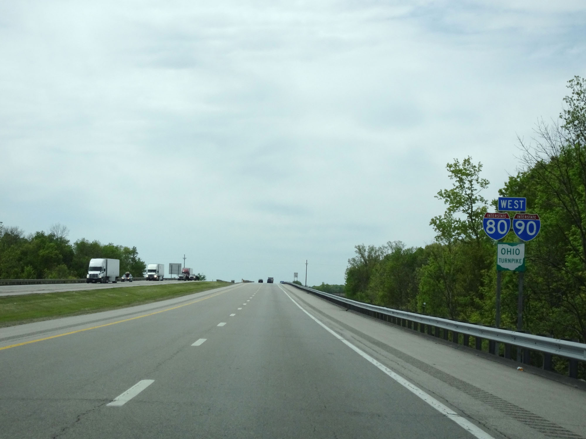 |
Interstate 80 / Interstate 90 / Ohio Turnpike West assurance shields. (Photo taken 5/20/16). |
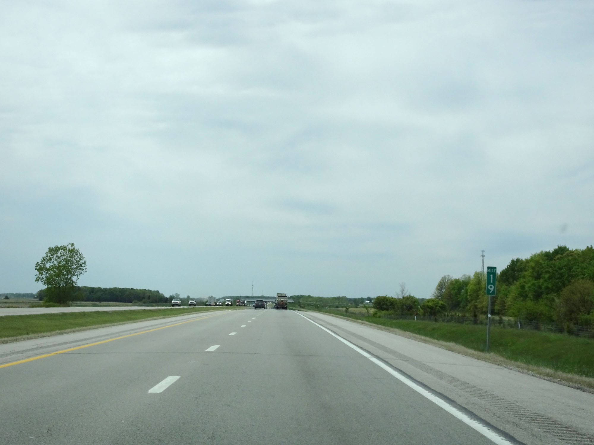 |
Interstate 80 / Interstate 90 West (Ohio Turnpike) at mile marker 19. (Photo taken 5/20/16). |
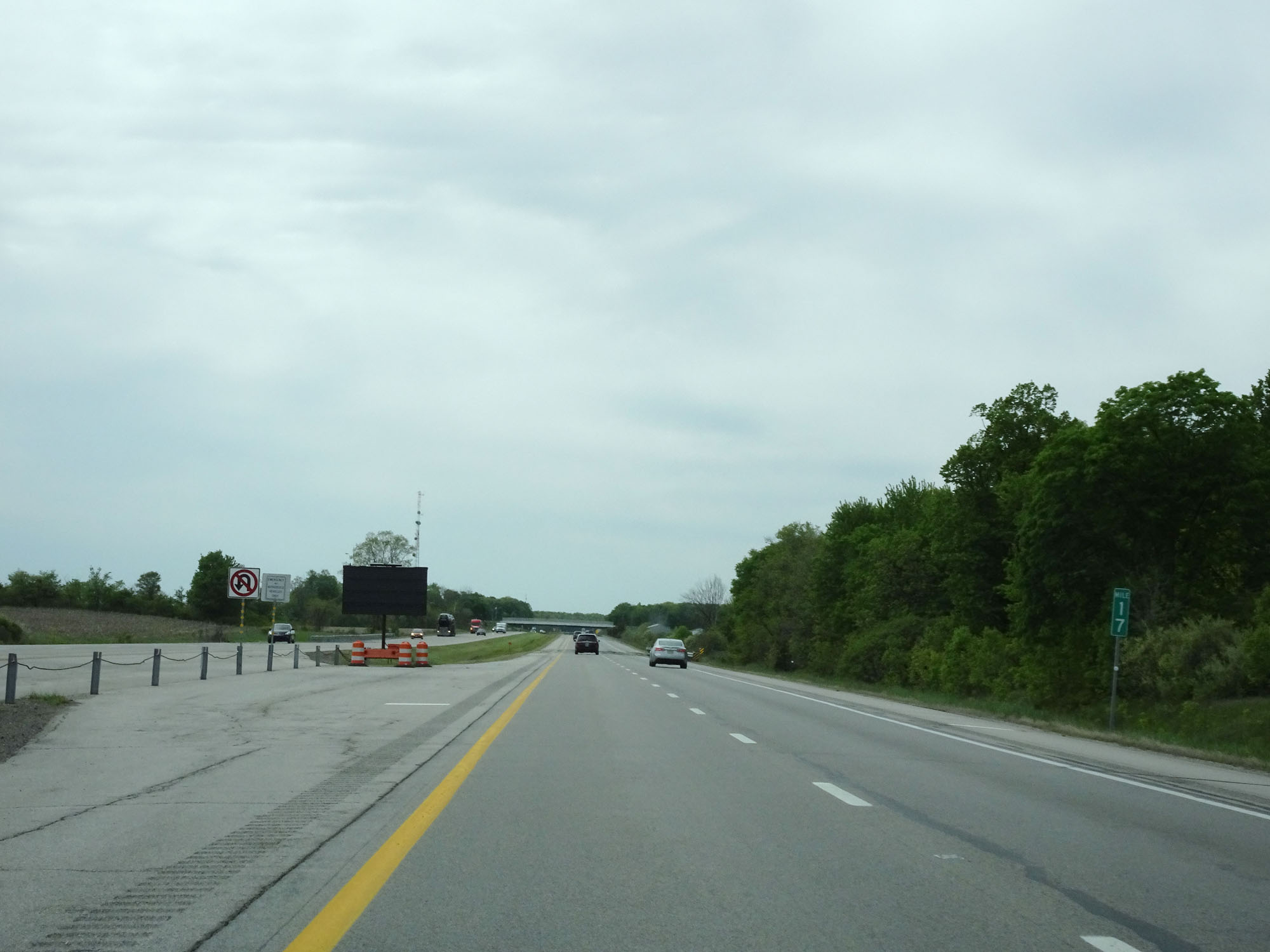 |
Interstate 80 / Interstate 90 West (Ohio Turnpike) at mile marker 17. (Photo taken 5/20/16). |
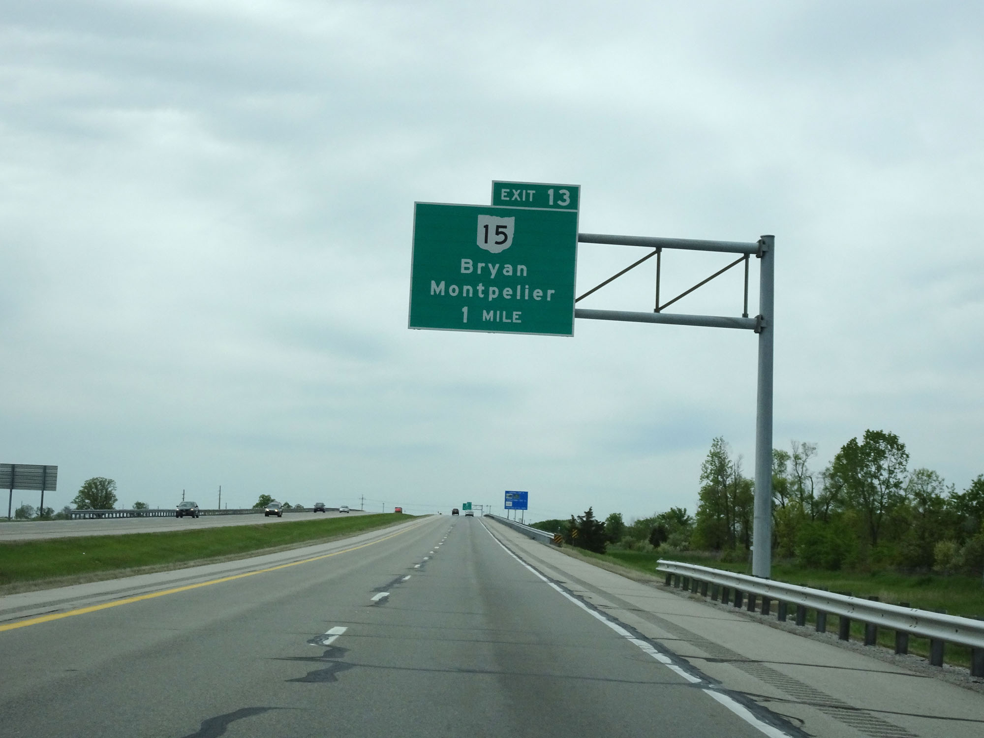 |
Interstate 80 / Interstate 90 West (Ohio Turnpike) approaching Exit 13 - 1 mile. (Photo taken 5/20/16). |
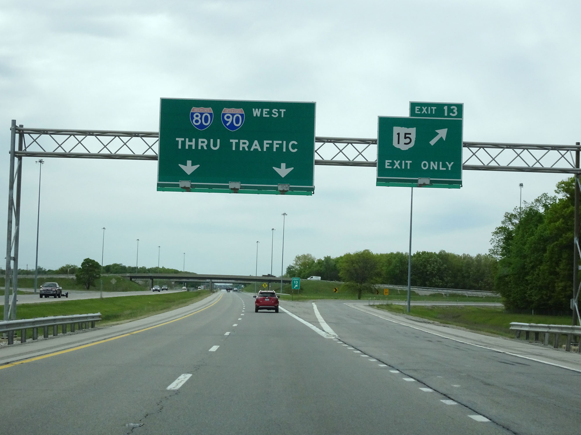 |
Interstate 80 / Interstate 90 West (Ohio Turnpike) at Exit 13: OH 15 - Bryan / Montpelier (Photo taken 5/20/16). |
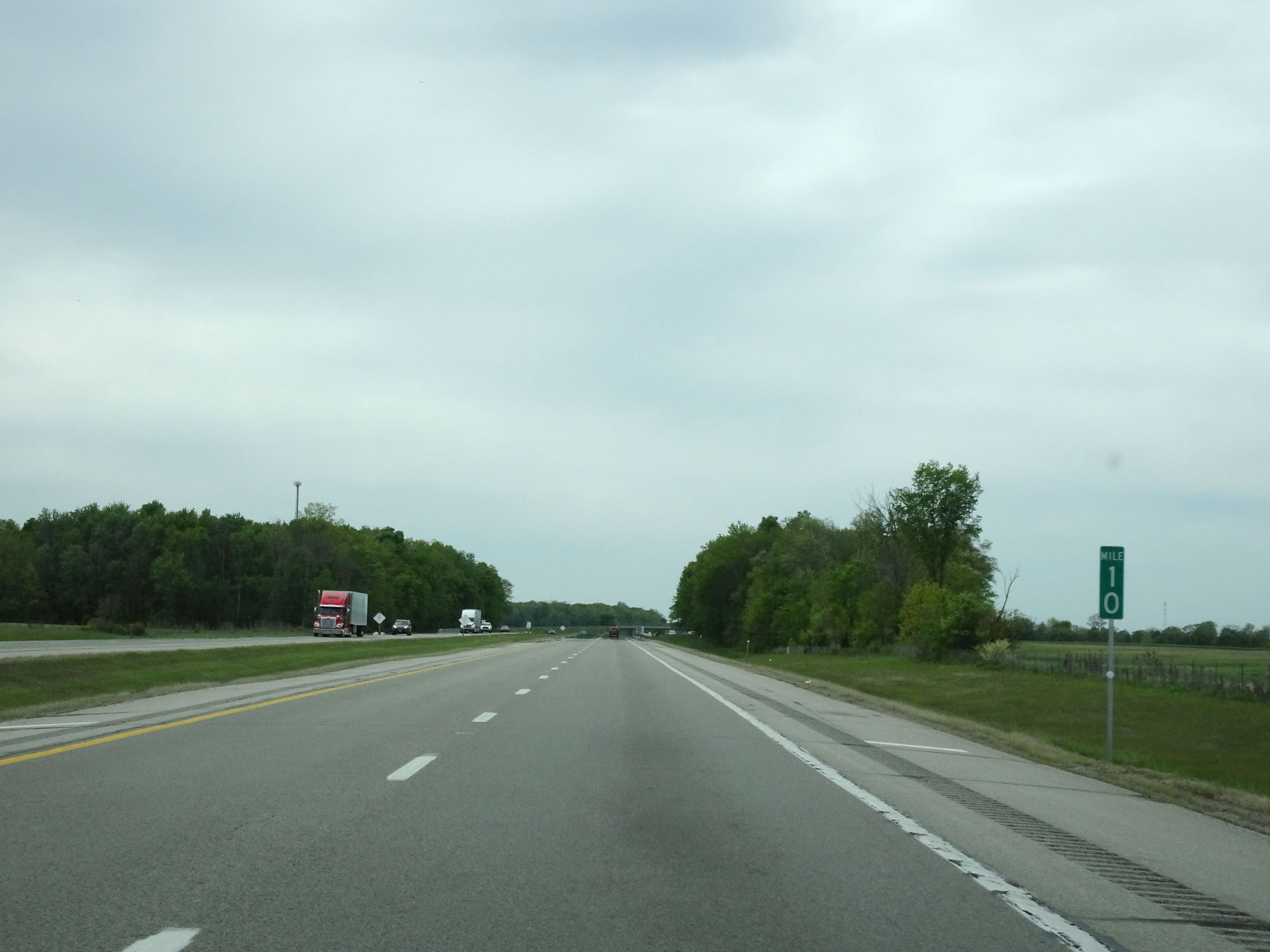 |
Interstate 80 / Interstate 90 West (Ohio Turnpike) at mile marker 10. (Photo taken 5/20/16). |
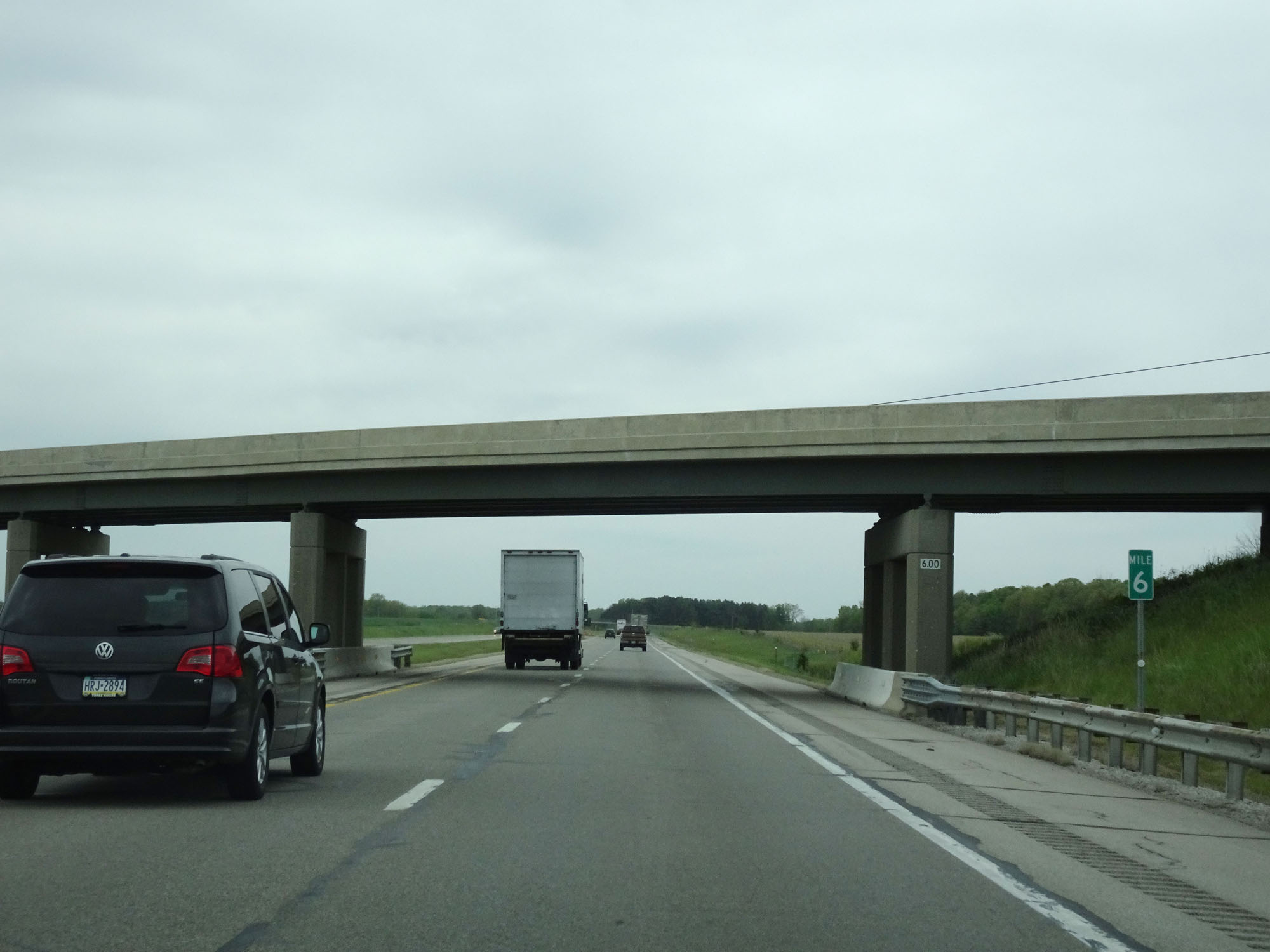 |
Interstate 80 / Interstate 90 West (Ohio Turnpike) at mile marker 6. (Photo taken 5/20/16). |
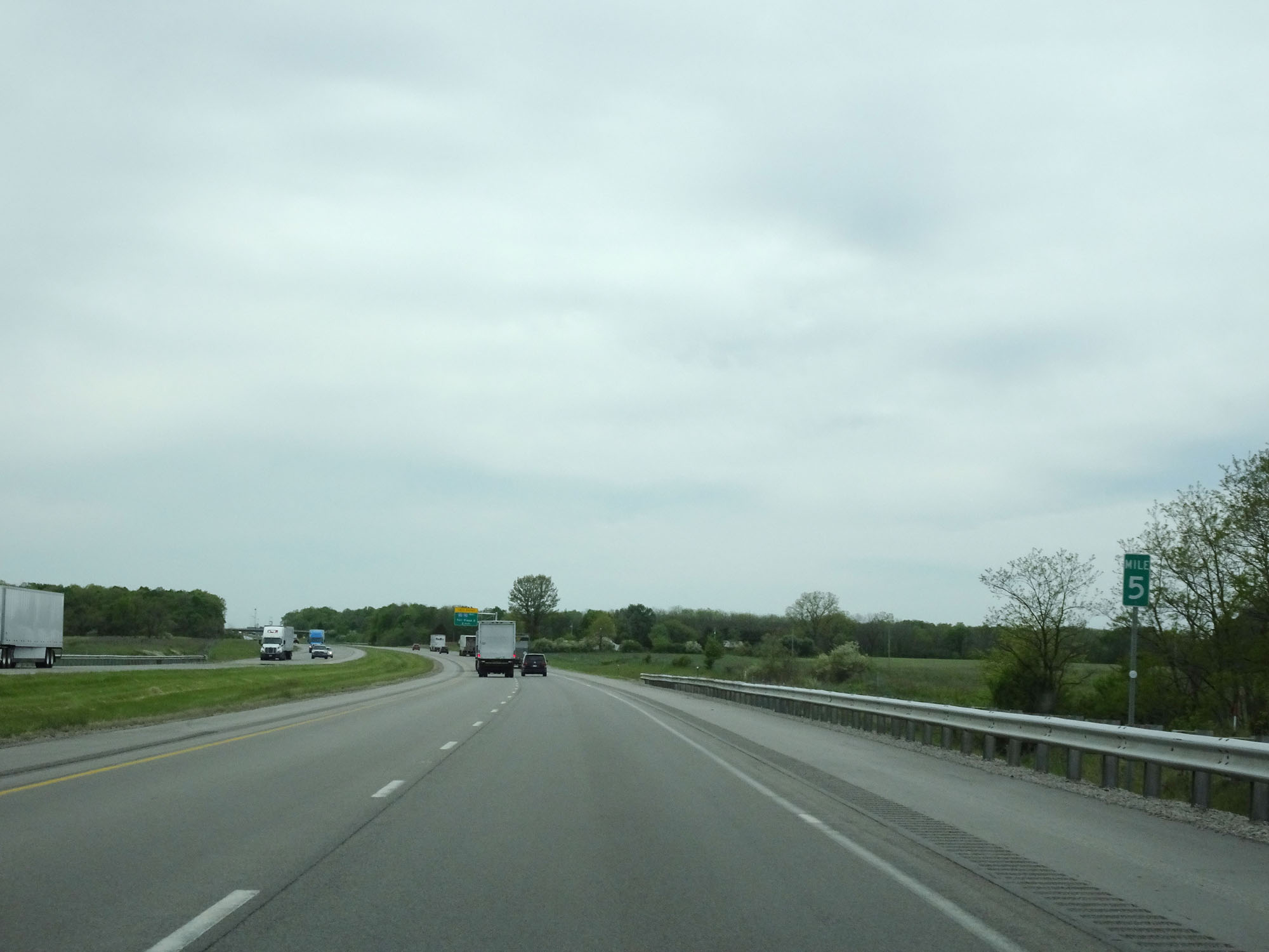 |
Interstate 80 / Interstate 90 West (Ohio Turnpike) at mile marker 5. (Photo taken 5/20/16). |
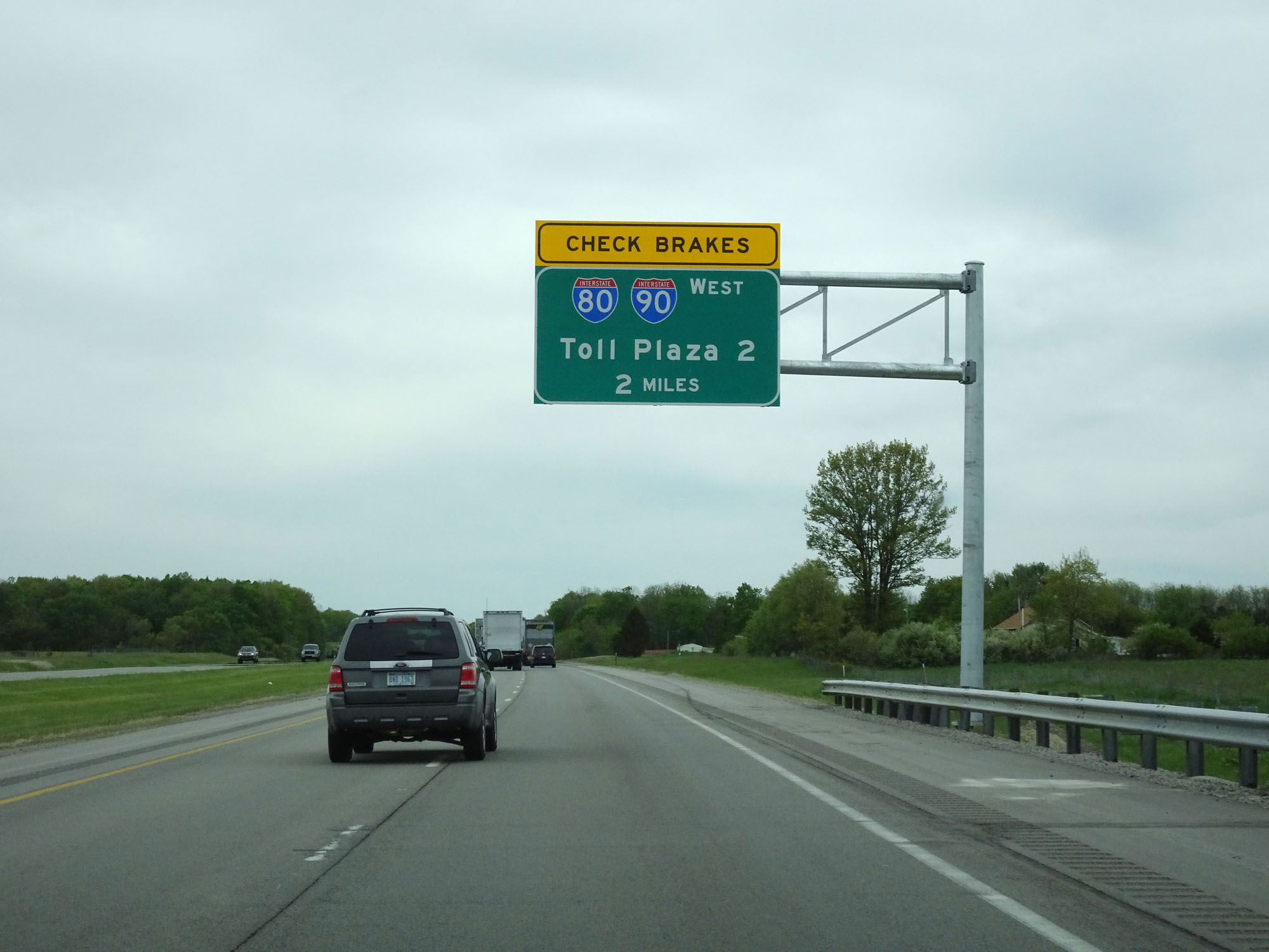 |
Interstate 80 / Interstate 90 West (Ohio Turnpike) approaching the Westgate Toll Plaza - 2 miles. (Photo taken 5/20/16). |
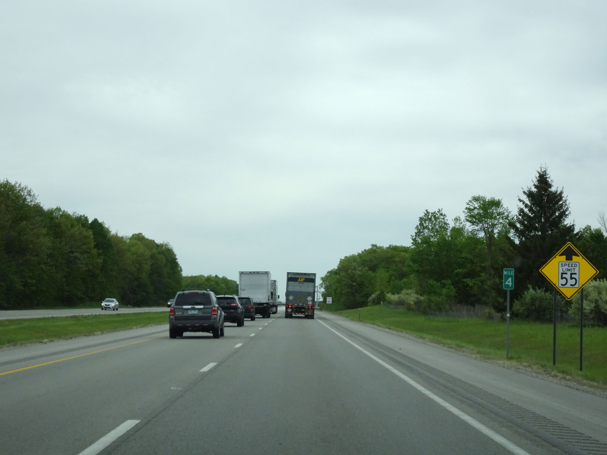 |
Interstate 80 / Interstate 90 West (Ohio Turnpike) at mile marker 4. The speed limit decreases to 55 mph ahead as we approach the Westgate Toll Plaza. (Photo taken 5/20/16). |
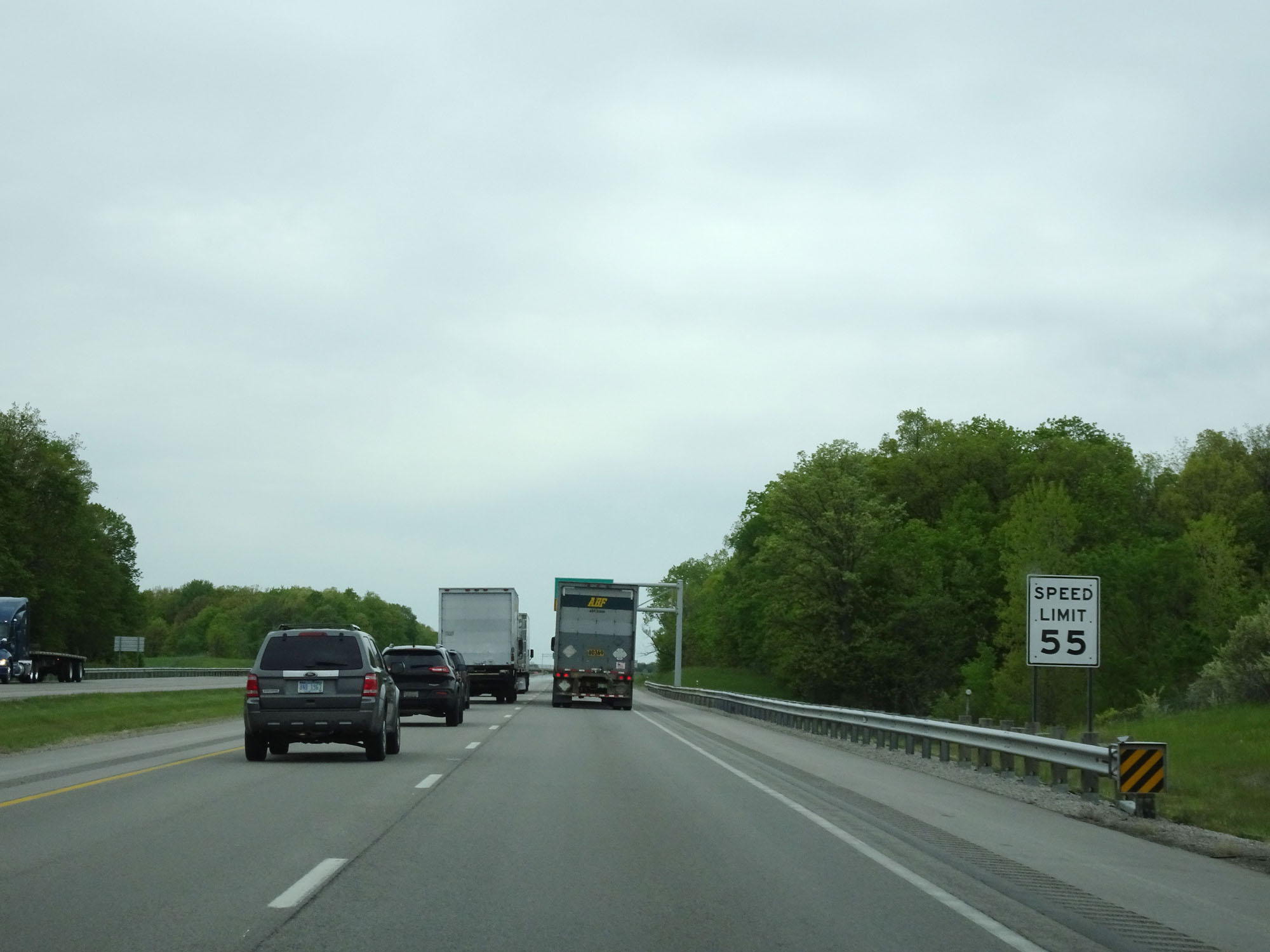 |
As previously mentioned, the speed limit decreases to 55 mph here as we approach the Westgate Toll Plaza. (Photo taken 5/20/16). |
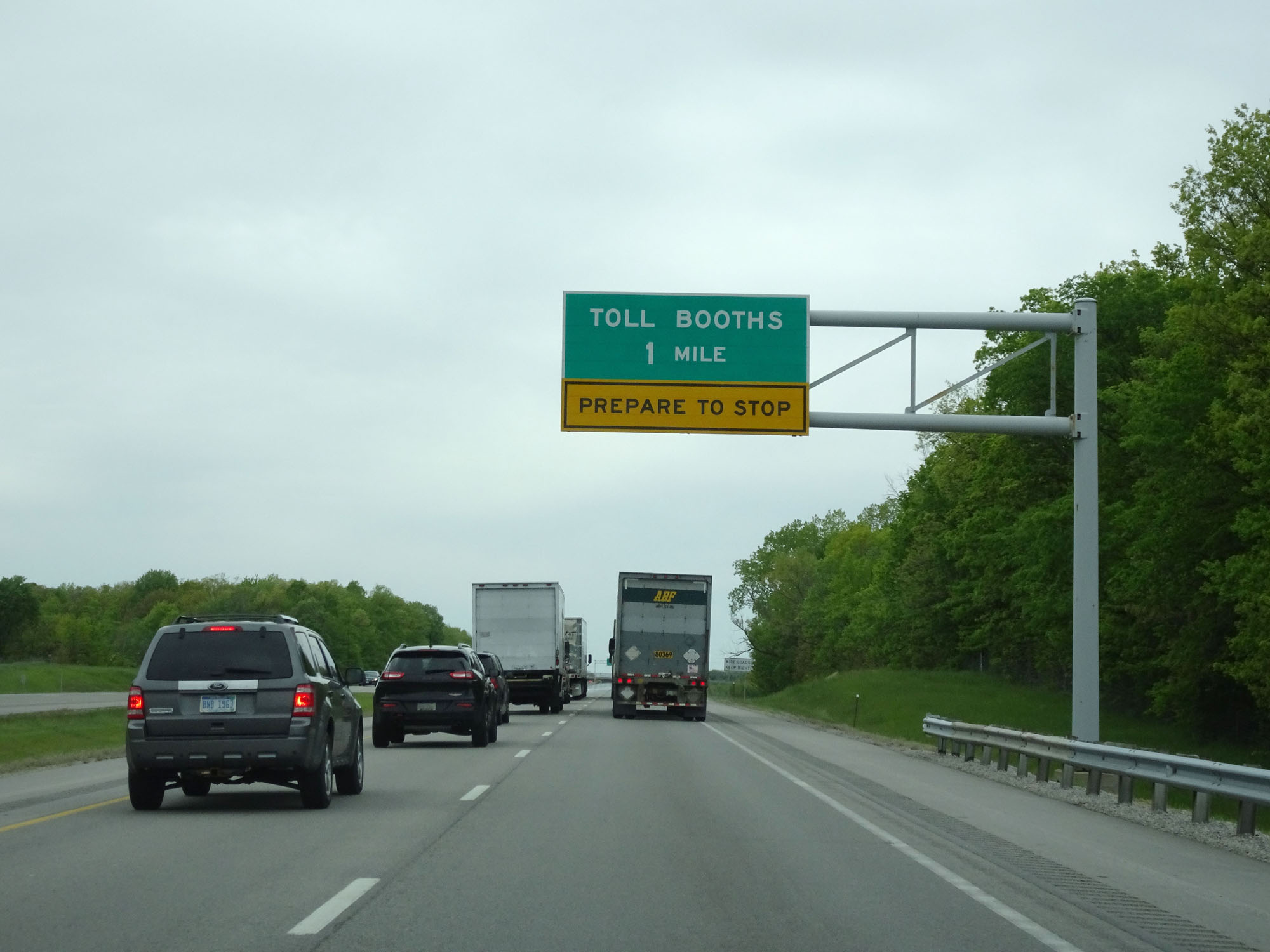 |
Interstate 80 / Interstate 90 West (Ohio Turnpike) approaching the Westgate Toll Plaza - 1 mile. (Photo taken 5/20/16). |
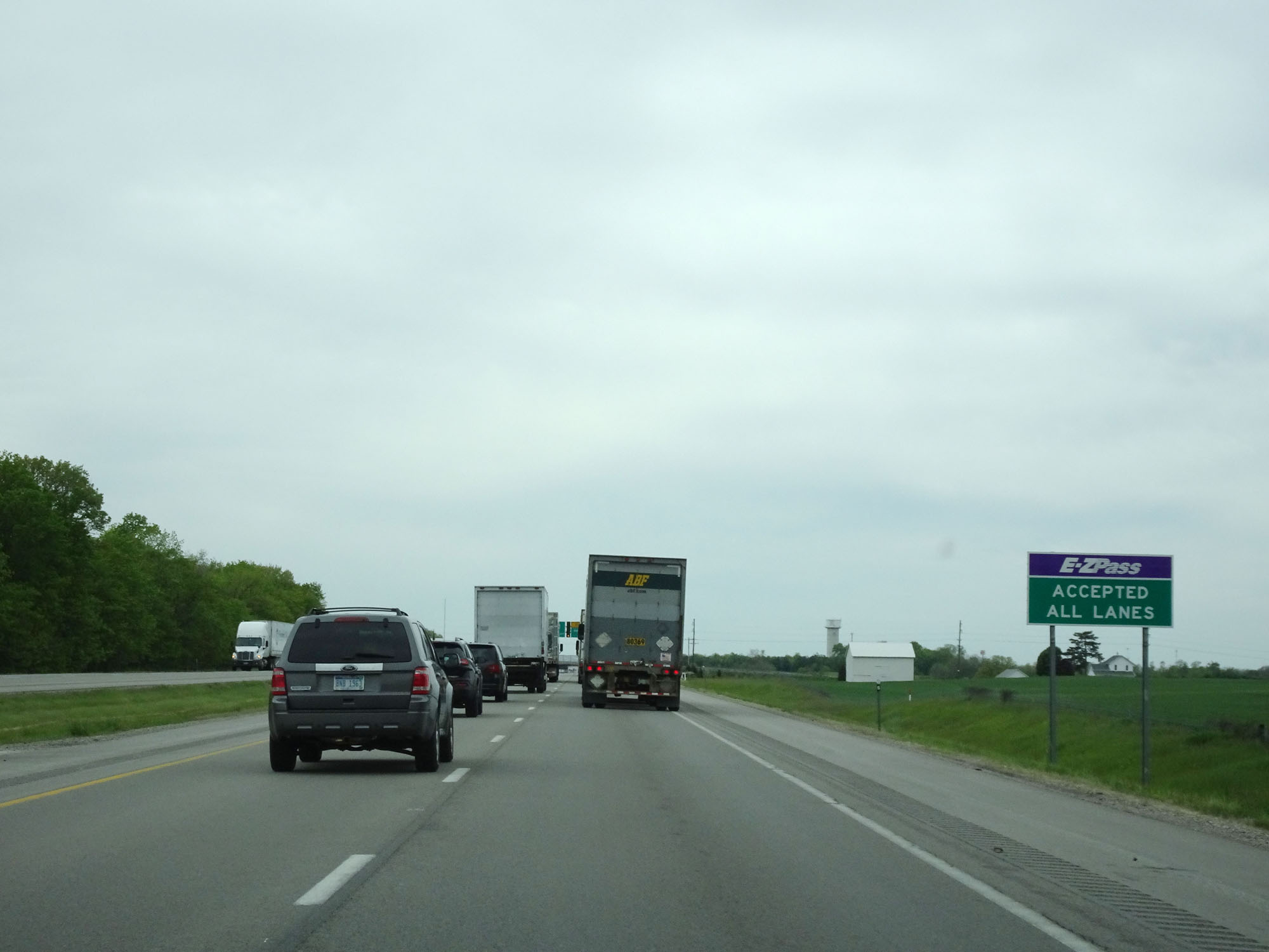 |
This sign reminds motorists than EZ Pass is accepted in all toll lanes. (Photo taken 5/20/16). |
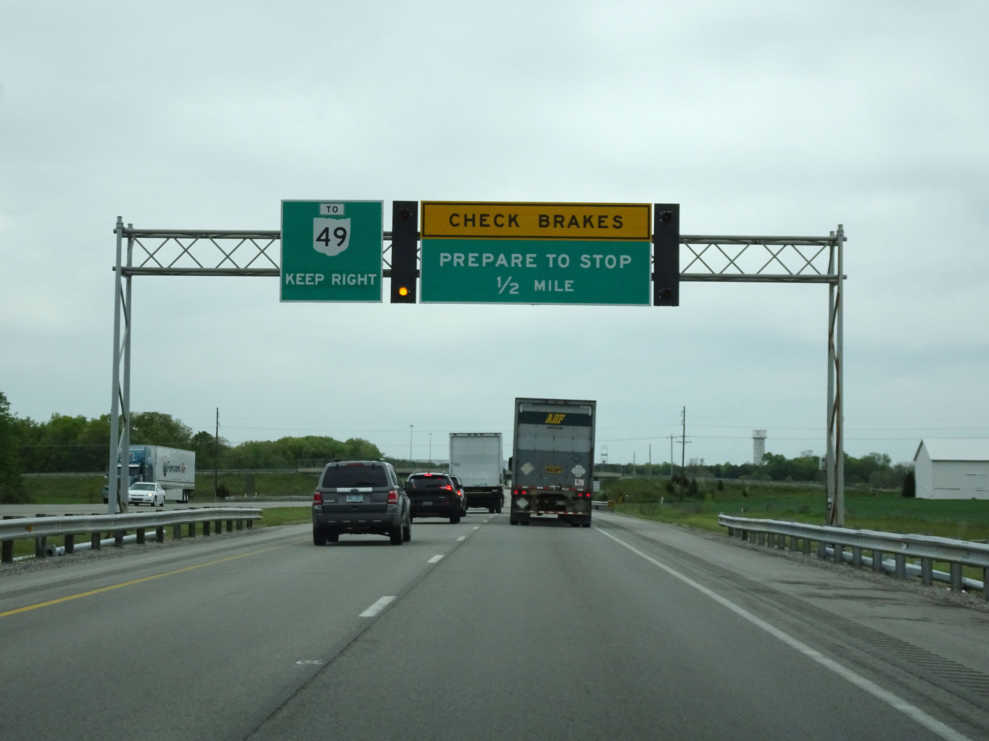 |
The exit for OH 49 is on the right, immediately after the toll plaza. Thus, if you're taking that exit, keep right and use the rightmost toll lanes. (Photo taken 5/20/16). |
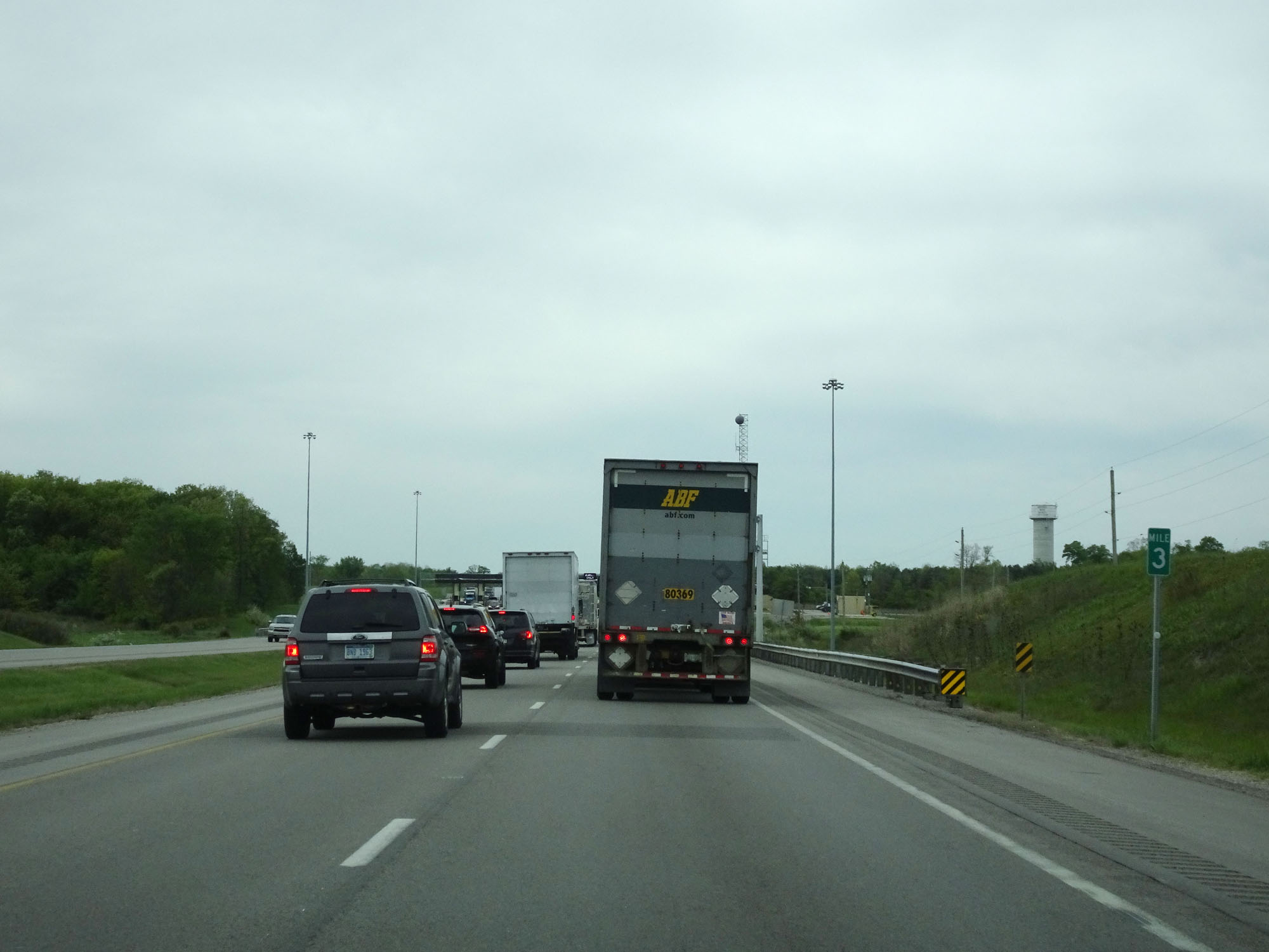 |
Interstate 80 / Interstate 90 West (Ohio Turnpike) at mile marker 3, approaching the Westgate Toll Plaza. (Photo taken 5/20/16). |
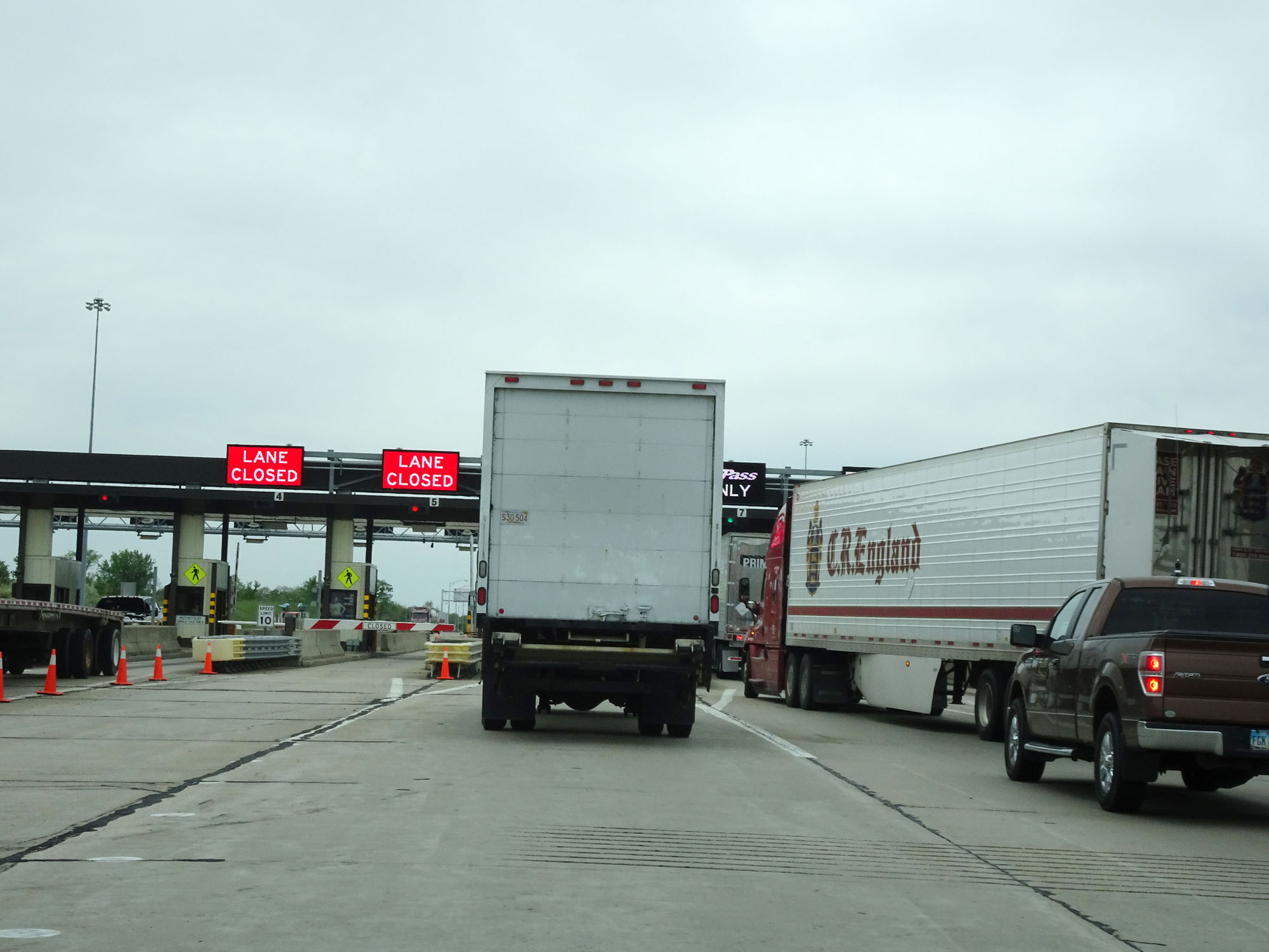 |
An attempted closer view of the Westgate Toll Plaza. (Photo taken 5/20/16). |
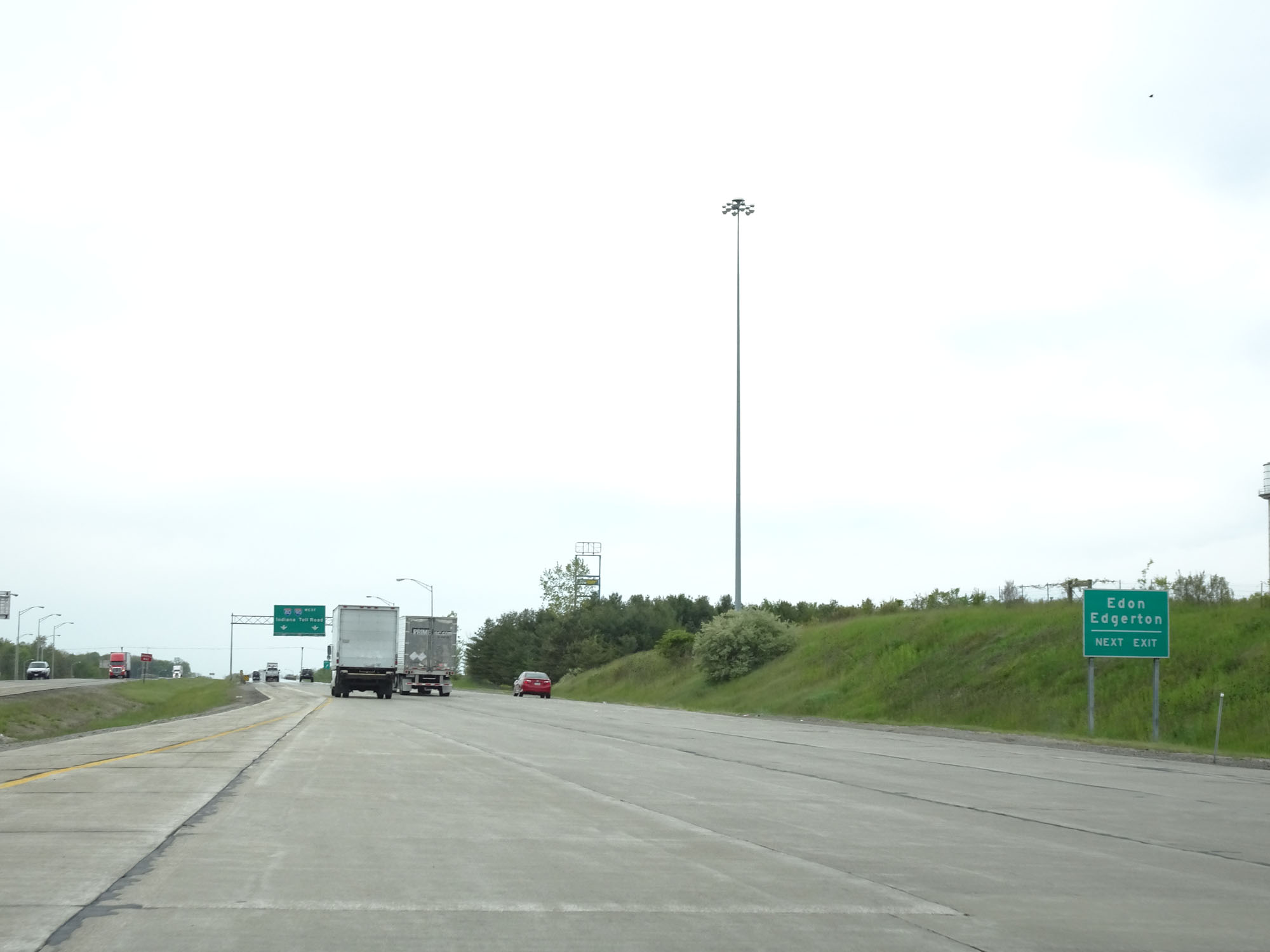 |
Take the next exit (OH 49) to Edon and Edgerton. (Photo taken 5/20/16). |
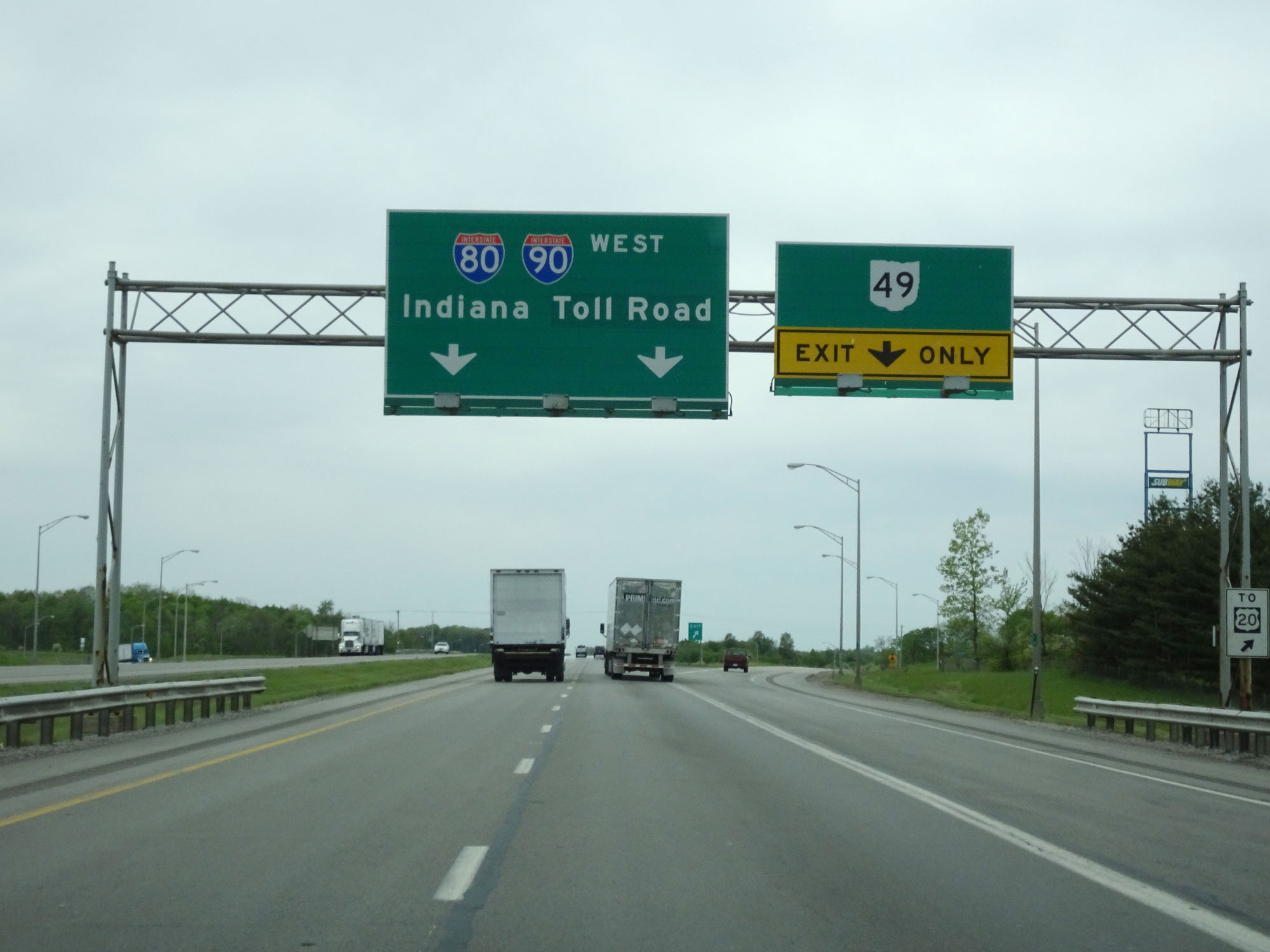 |
Interstate 80 / Interstate 90 West (Ohio Turnpike) at Exit: OH 49 (Photo taken 5/20/16). |
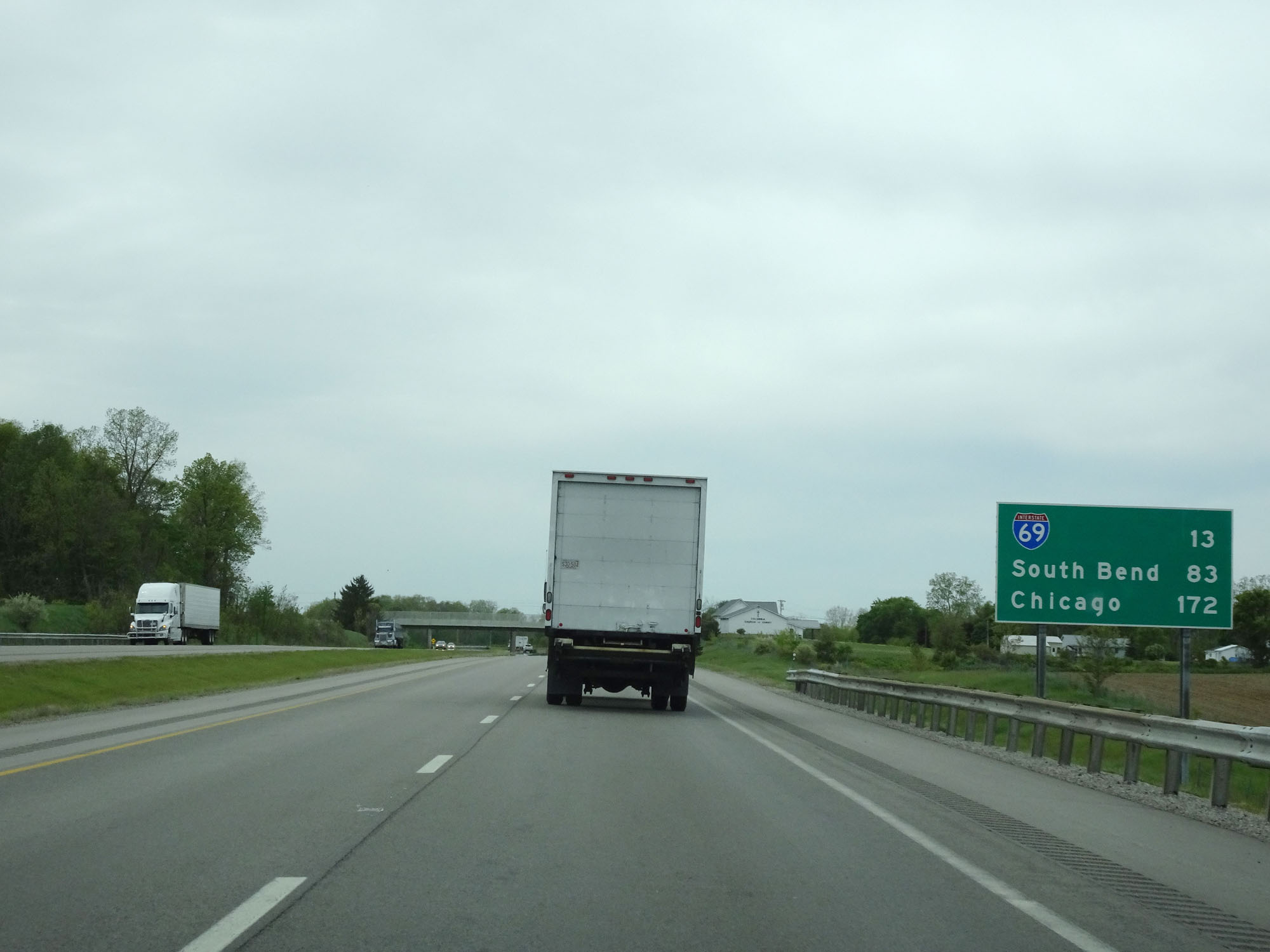 |
Mileage sign approaching the Indiana border and the beginning of the Indiana Toll Road. It's 13 miles to the junction of Interstate 69, 83 miles to South Bend, and 172 miles to Chicago. (Photo taken 5/20/16). |
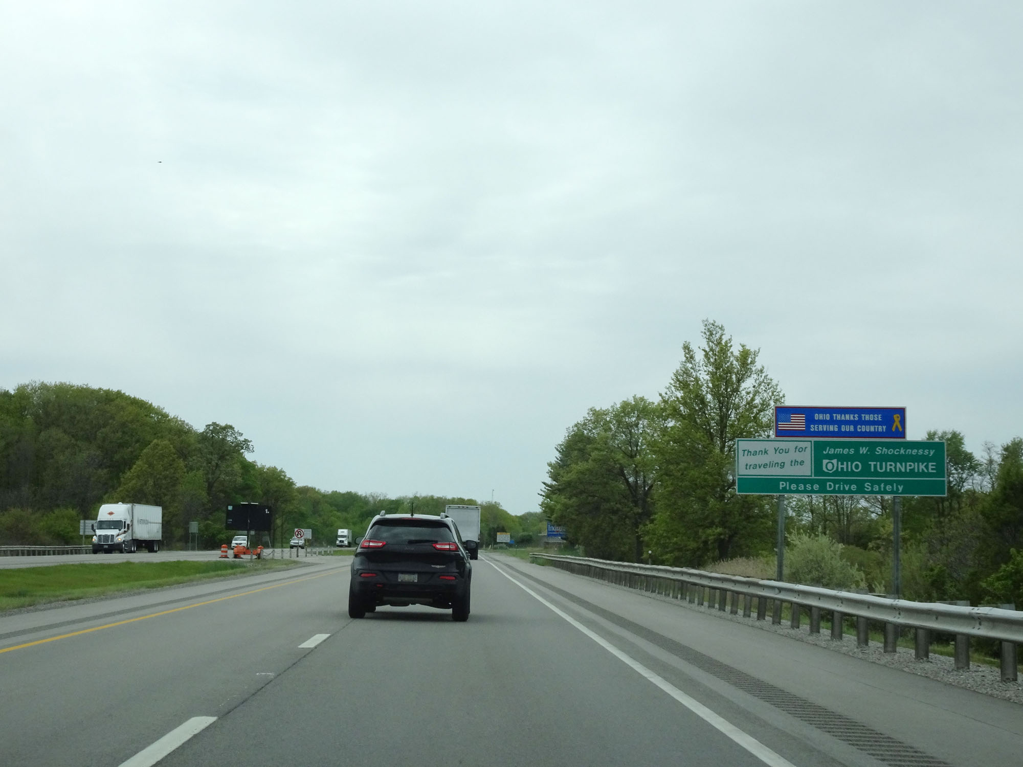 |
Just before the Indiana border and the start of the Indiana Toll Road, this sign thanks you for traveling the James W. Shocknessy Ohio Turnpike. (Photo taken 5/20/16). |