Road Information |
||
 |
||
| Total Mileage in State: | 9 miles | |
| Eastern End: | At I-40, in Asheville | |
| Western End: | At I-40/I-26, in Asheville | |
| Mileage covered in Photos: | 9 miles | |
| Counties covered in Photos: | Buncombe | |
| Major Junctions in Photos: | Future I-26 East/US 19 North/US 23 North/US 70 West, in Asheville I-40 West/I-26 East, in Asheville |
|
| Control Cities in Photos: | Asheville | |
Westbound
 |
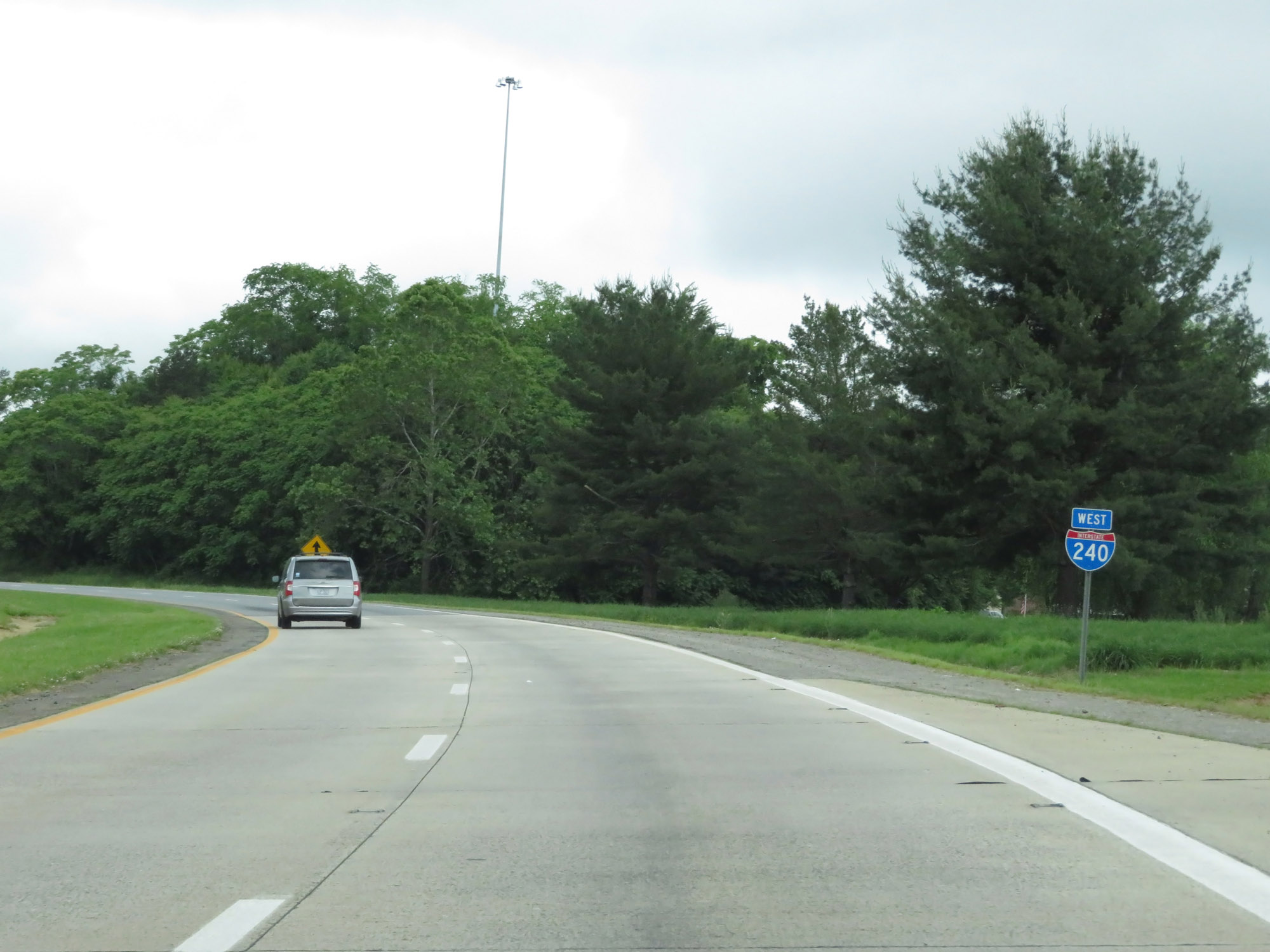
Interstate 240 West begins here, at an interchange with Interstate 40 East to the southeast of downtown Asheville. (Photo taken 5/26/18). |
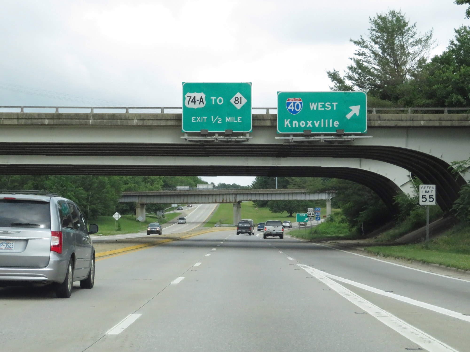 |
Interstate 240 West at Exit: Interstate 40 West - Knoxville (Photo taken 5/26/18). |
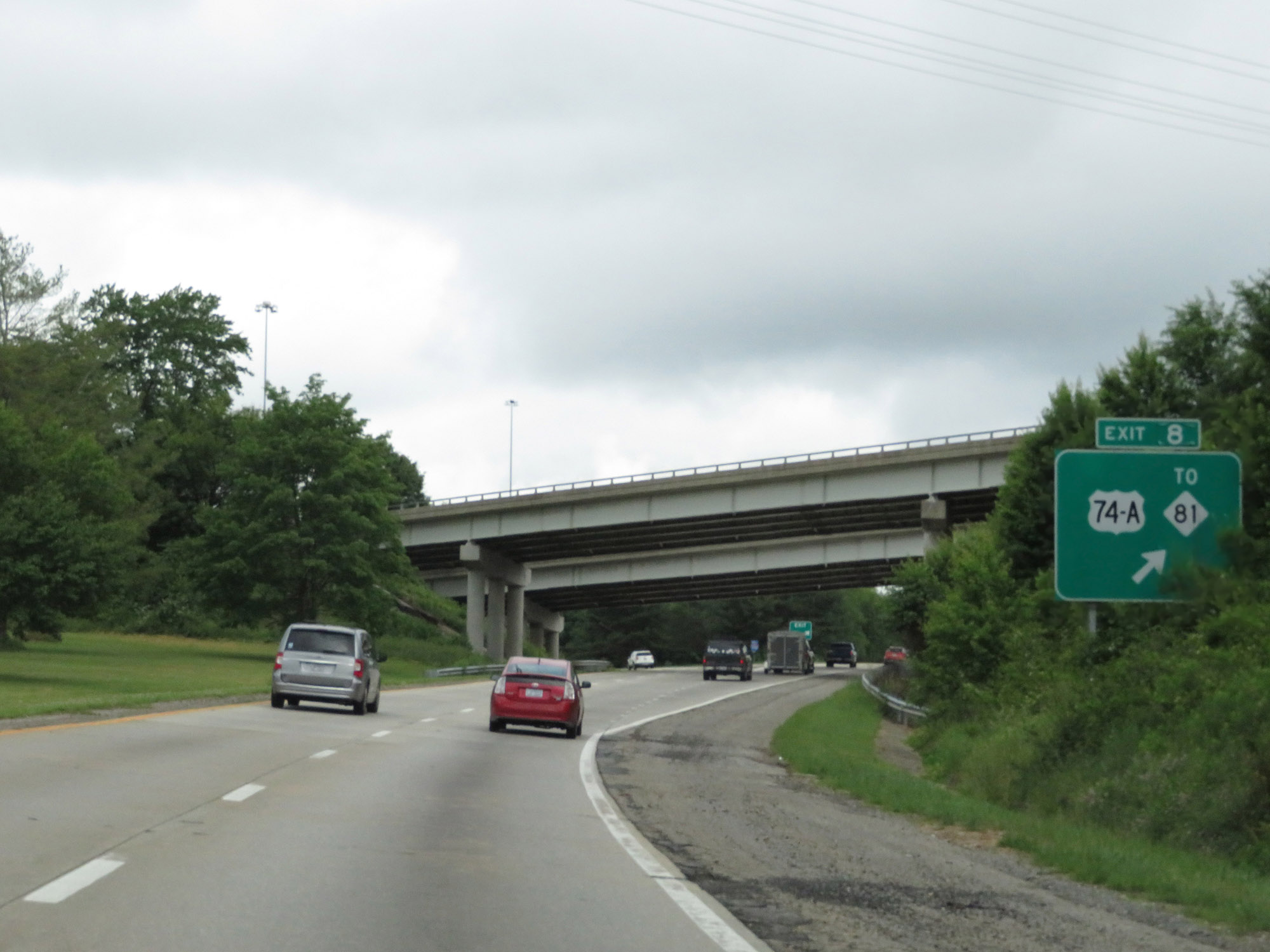 |
Interstate 240 West at Exit 8: US 74A / To NC 81 (Photo taken 5/26/18). |
 |
Interstate 240 West reassurance shield. (Photo taken 5/26/18). |
 |
View on Interstate 240 West as traffic from Interstate 40 Westbound merges in on the left. (Photo taken 5/26/18). |
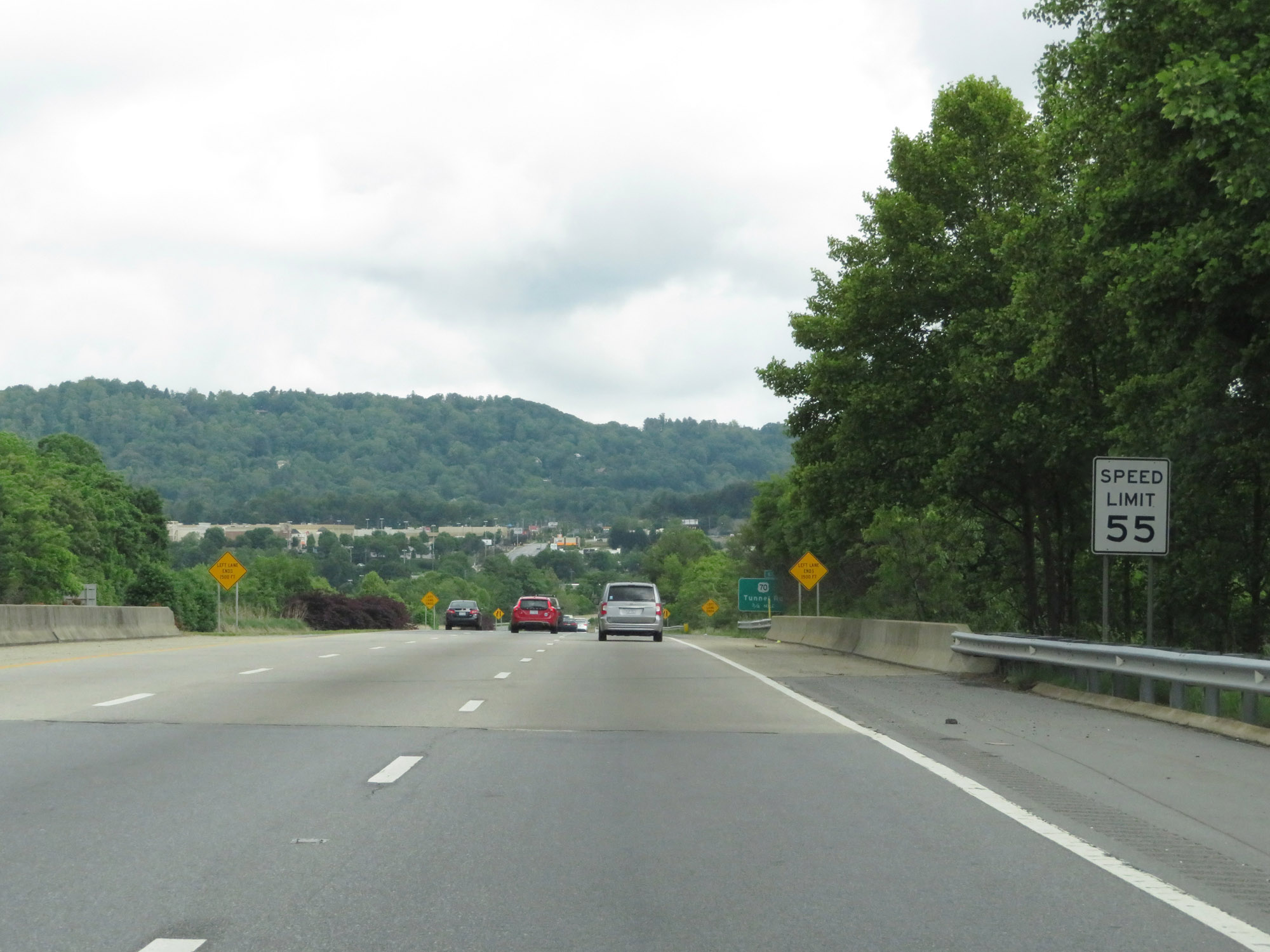 |
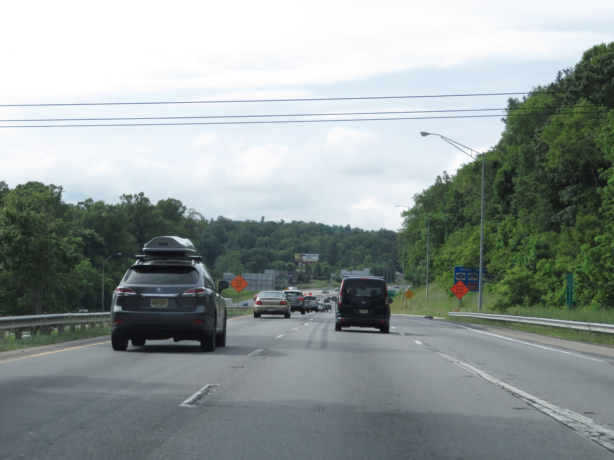
The speed limit on Interstate 240 West starts out at 55 mph. (Photo taken 5/26/18). |
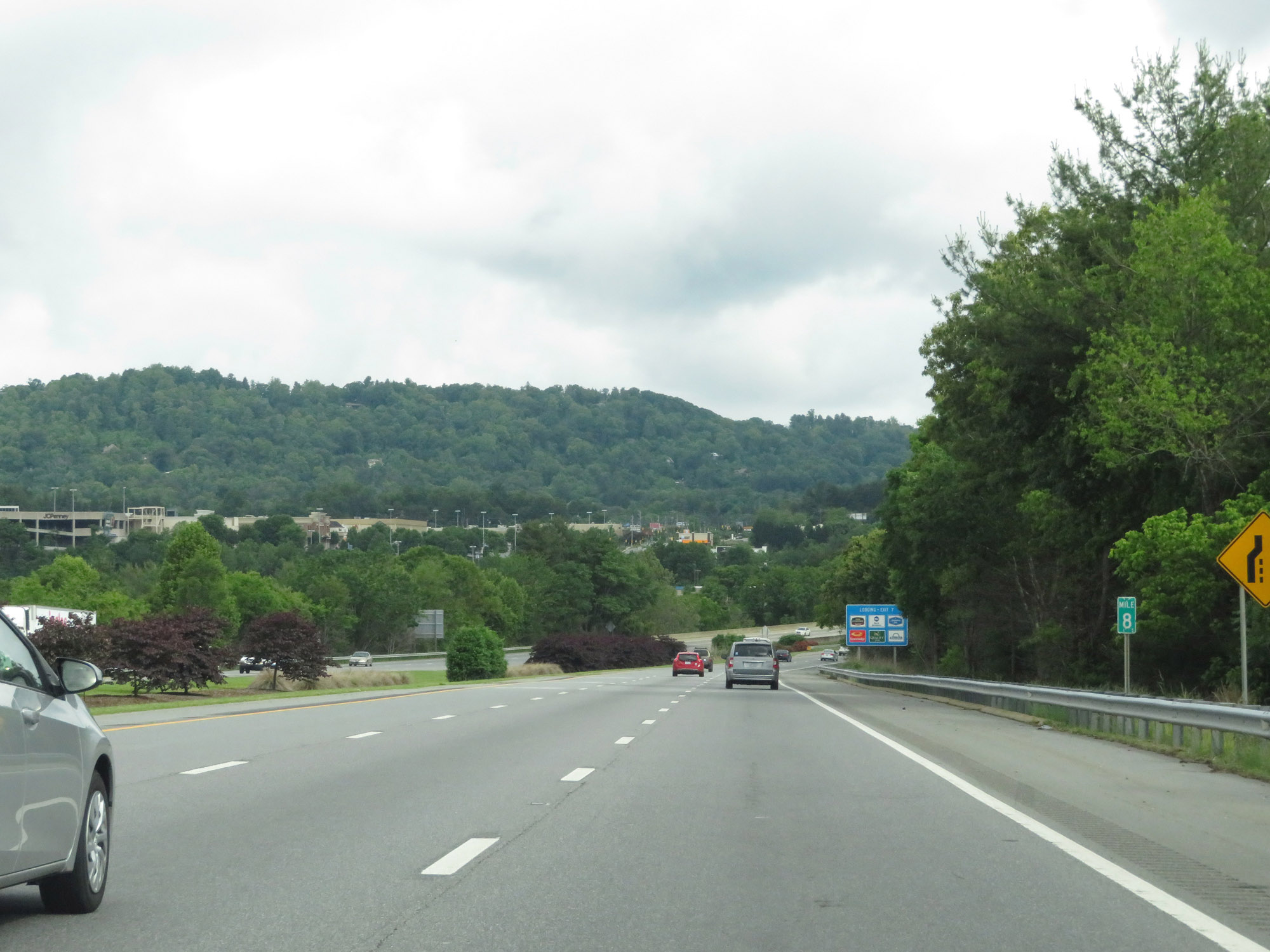 |
Interstate 240 West at mile marker 8, as the leftmost lane prepares to come to an end reducing I-240 West to just 2 lanes into downtown Asheville. (Photo taken 5/26/18). |
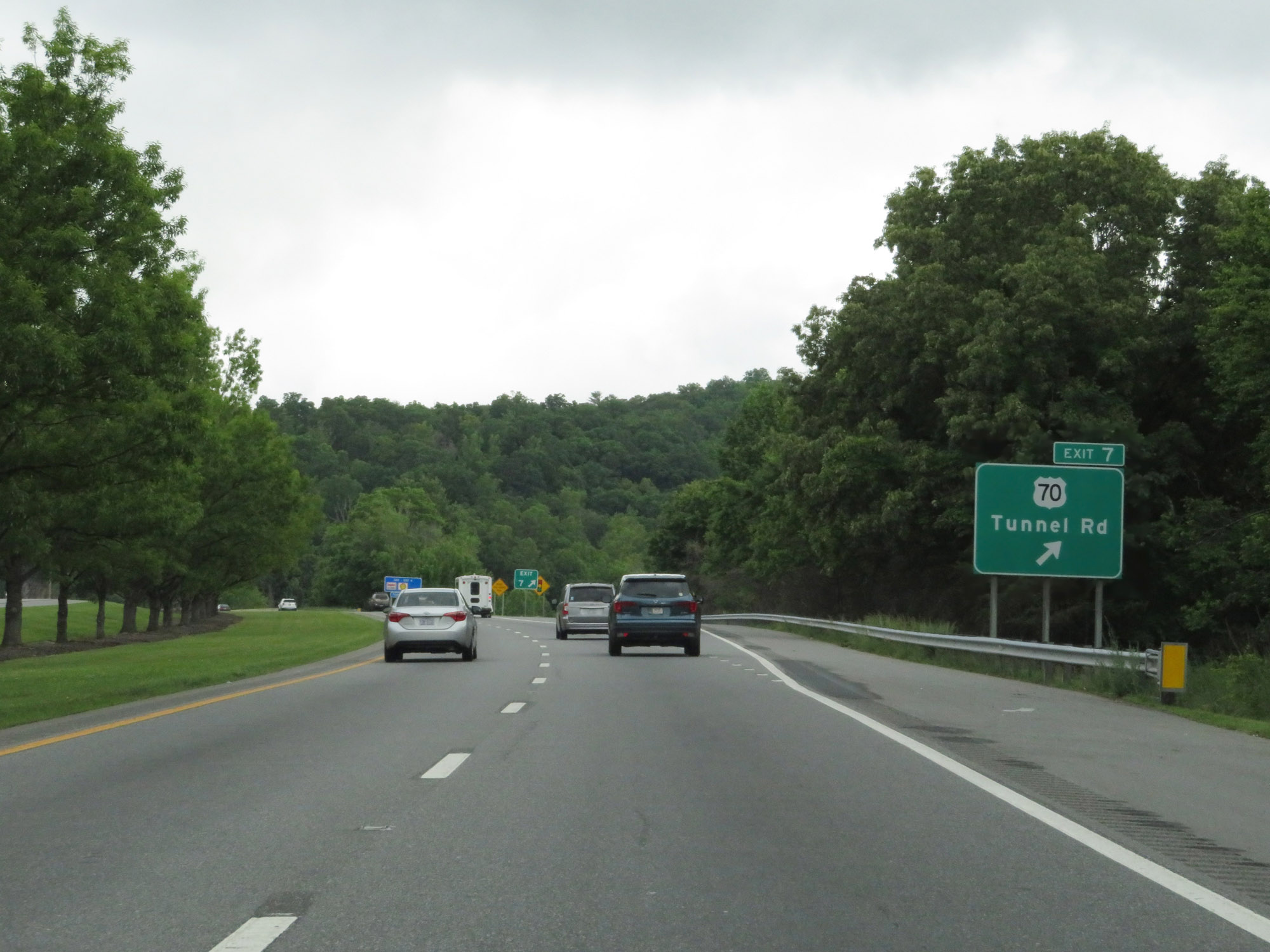 |
Interstate 240 West at Exit 7: US 70 - Tunnel Rd (Photo taken 5/26/18). |
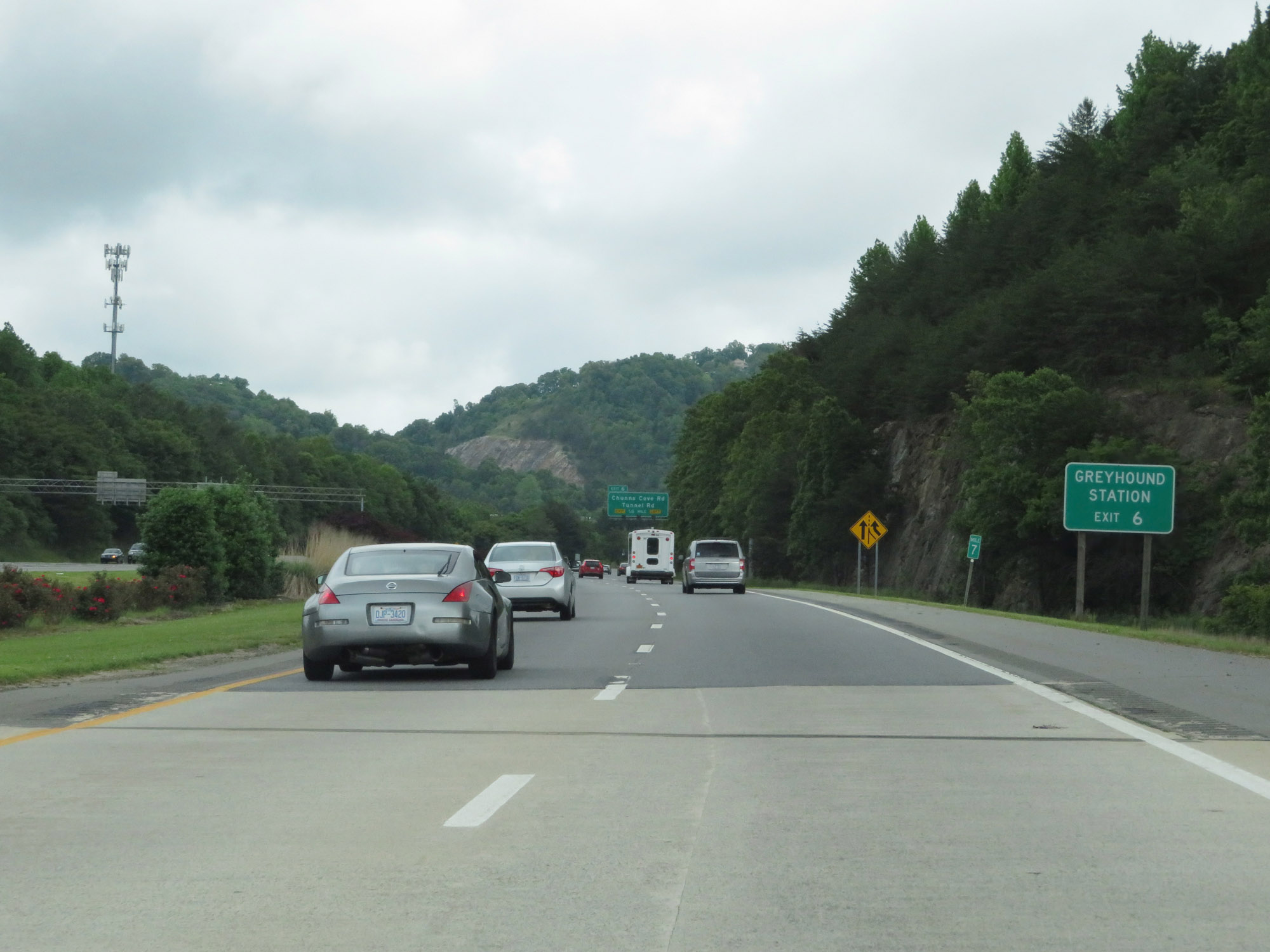 |
Take Exit 6 to the Greyhound Station. (Photo taken 5/26/18). |
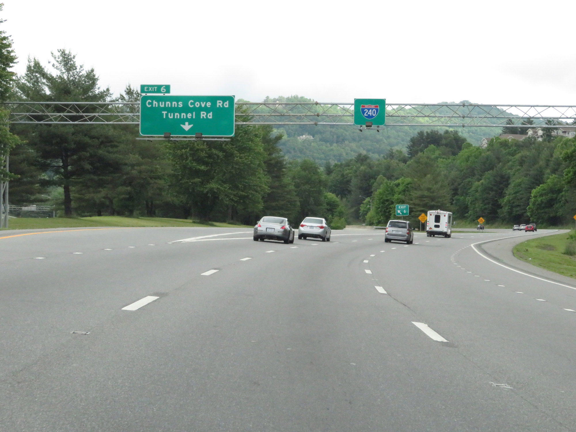 |
Interstate 240 West at Exit 6: Chunns Cove Rd / Tunnel Rd (Photo taken 5/26/18). |
 |
Interstate 240 in North Carolina is also known as Billy Graham Freeway. (Photo taken 5/26/18). |
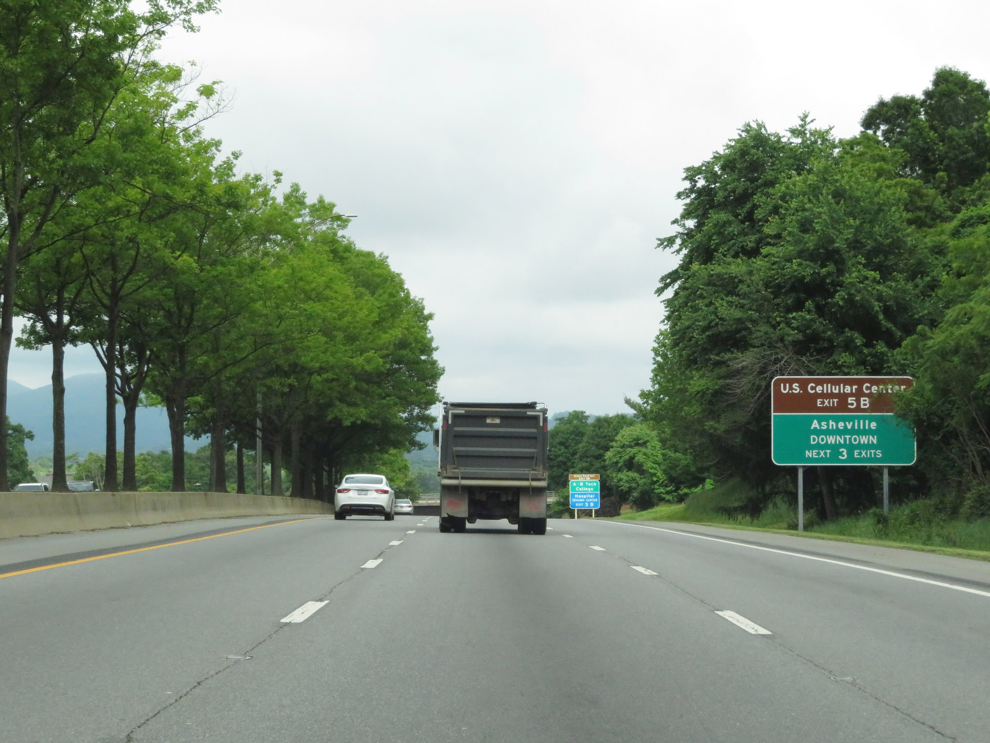 |
Take any of the next 3 exits to downtown Asheville. Use Exit 5B to the U.S. Cellular Center. (Photo taken 5/26/18). |
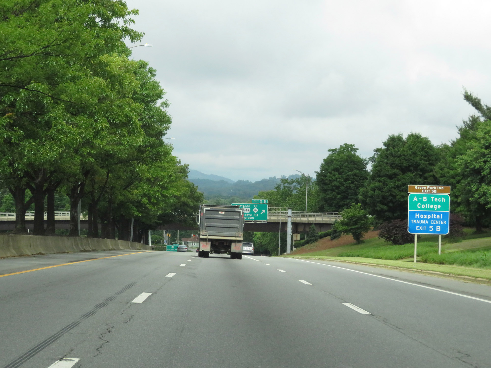 |
Also take Exit 5B to Grove Park Inn and A-B Tech College. (Photo taken 5/26/18). |
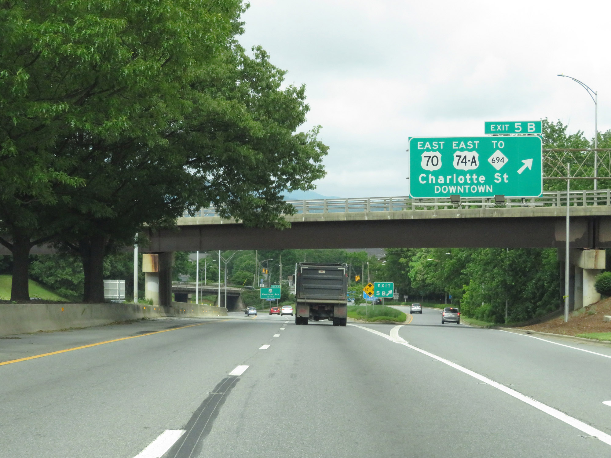 |
Interstate 240 West at Exit 5B: US 70 East / US 74A East / To NC 694 - Charlotte St / Downtown (Photo taken 5/26/18). |
 |
Interstate 240 West approaching Exit 5A - 1/4 mile. (Photo taken 5/26/18). |
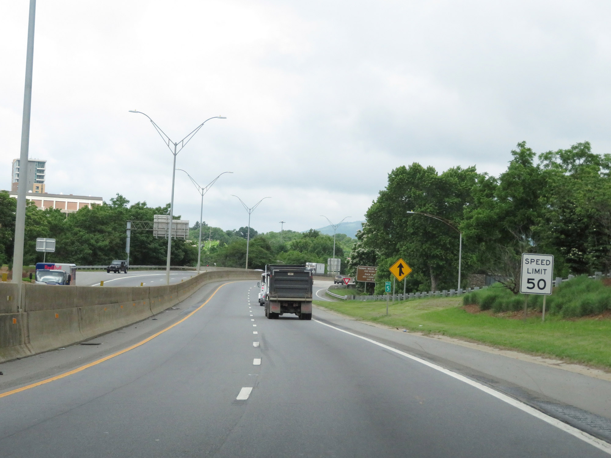 |
At mile marker 5 in downtown Asheville, the speed limit decreases to 50 mph on Interstate 240 West. The exits come pretty quickly through here, so you definitely do need to be paying close attention. (Photo taken 5/26/18). |
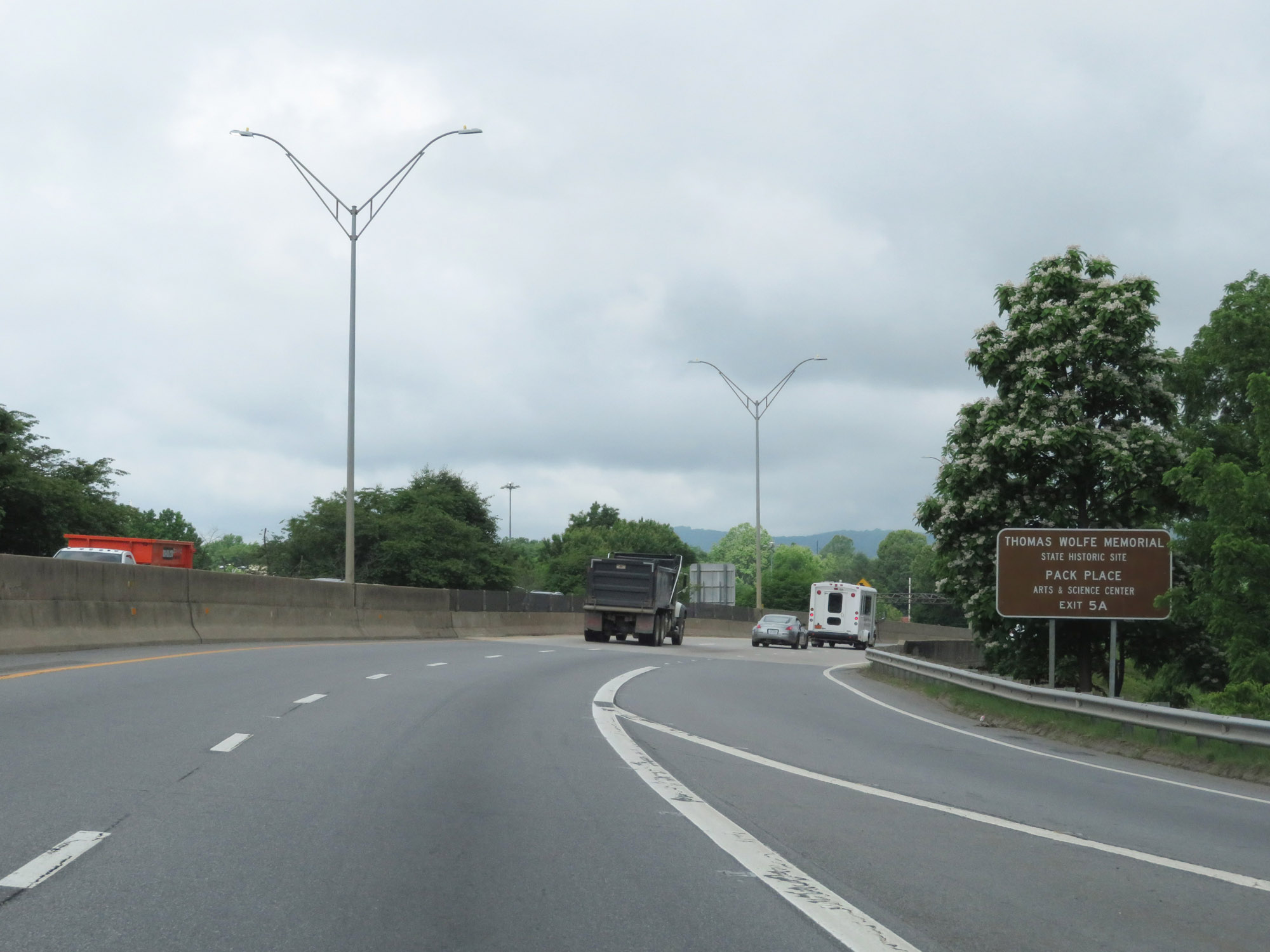 |
Take Exit 5A to Thomas Wolfe Memorial State Historic Site and Pack Place Arts & Science Center. (Photo taken 5/26/18). |
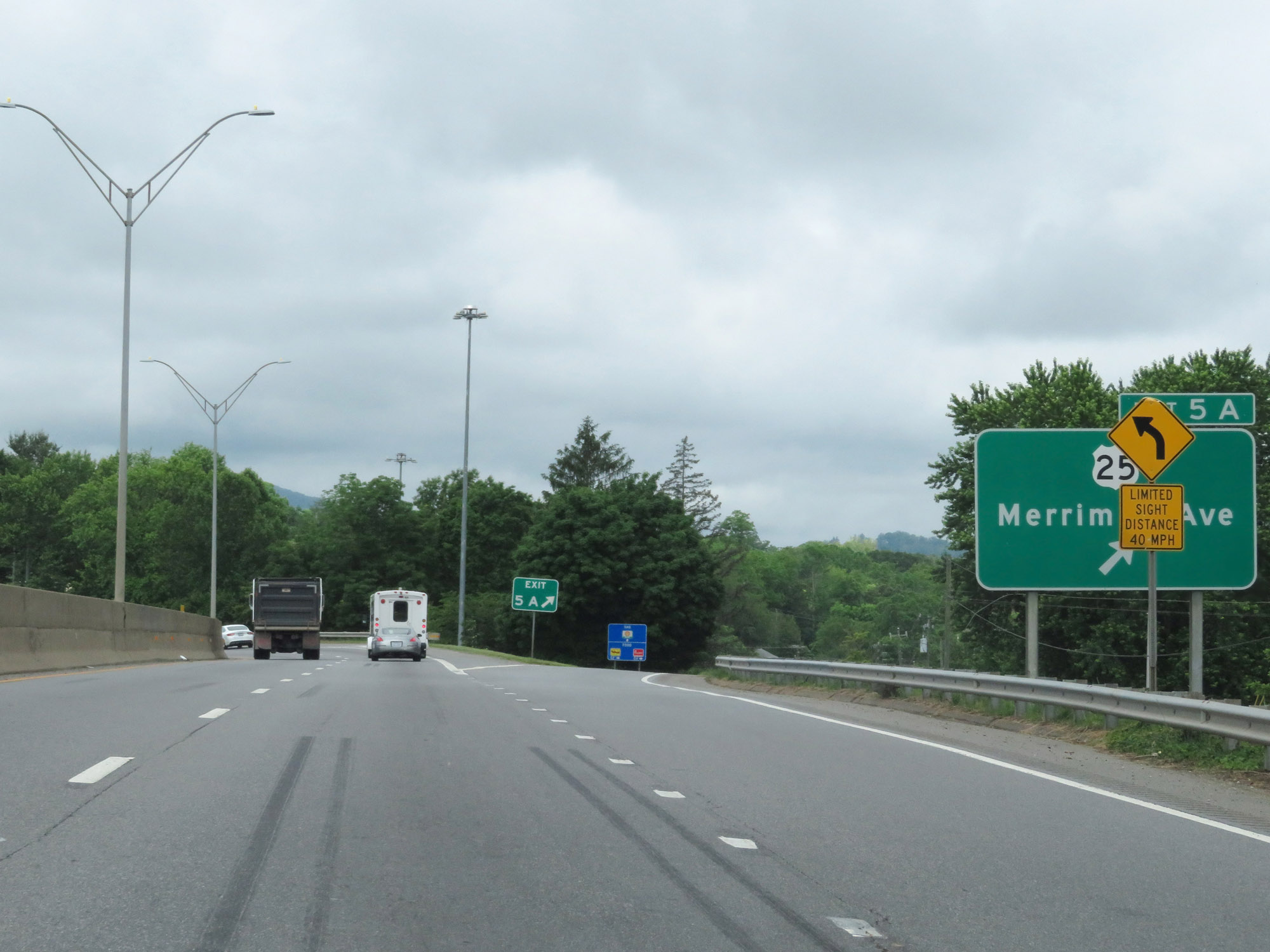 |
Interstate 240 West at Exit 5A: US 25 - Merrimon Ave (Photo taken 5/26/18). |
 |
Interstate 240 West reassurance shield along with US 70 West and US 74A West markers. (Photo taken 5/26/18). |
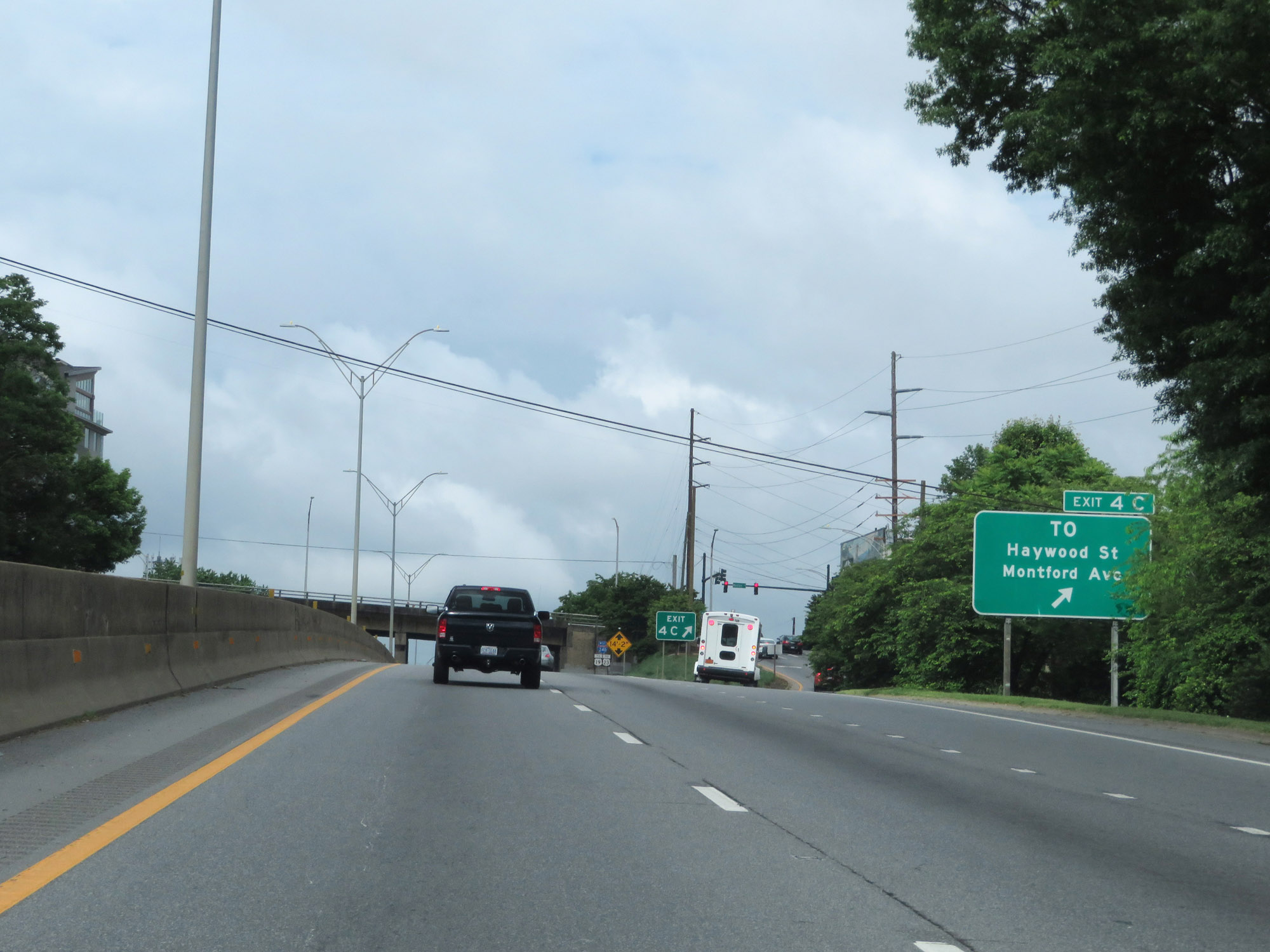 |
Interstate 240 West at Exit 4C: Haywood St / Montford Ave (Photo taken 5/26/18). |
 |
Interstate 240 West at mile marker 4. (Photo taken 5/26/18). |
 |
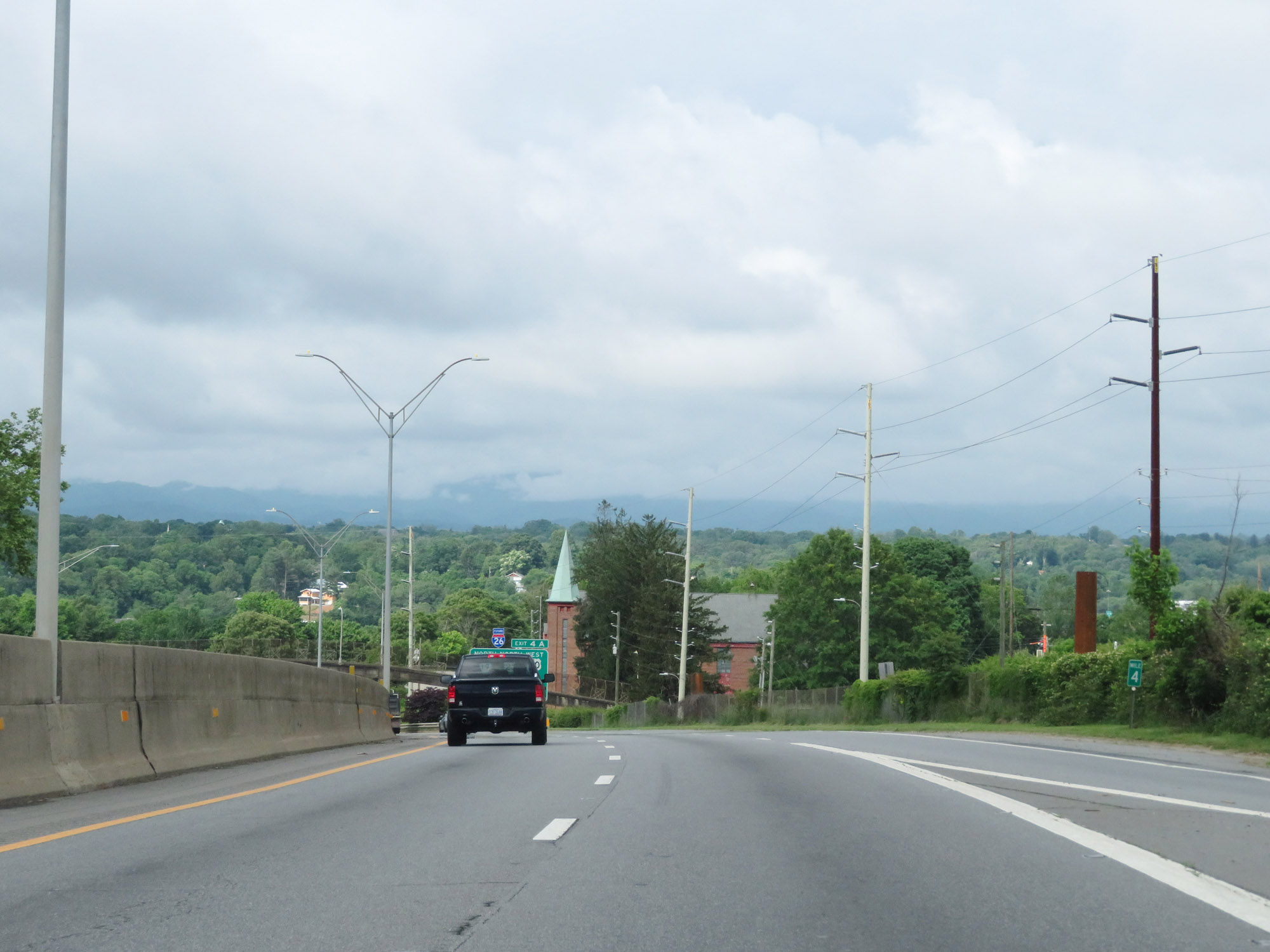
Interstate 240 West approaching Exit 4A - 1/4 mile. (Photo taken 5/26/18). |
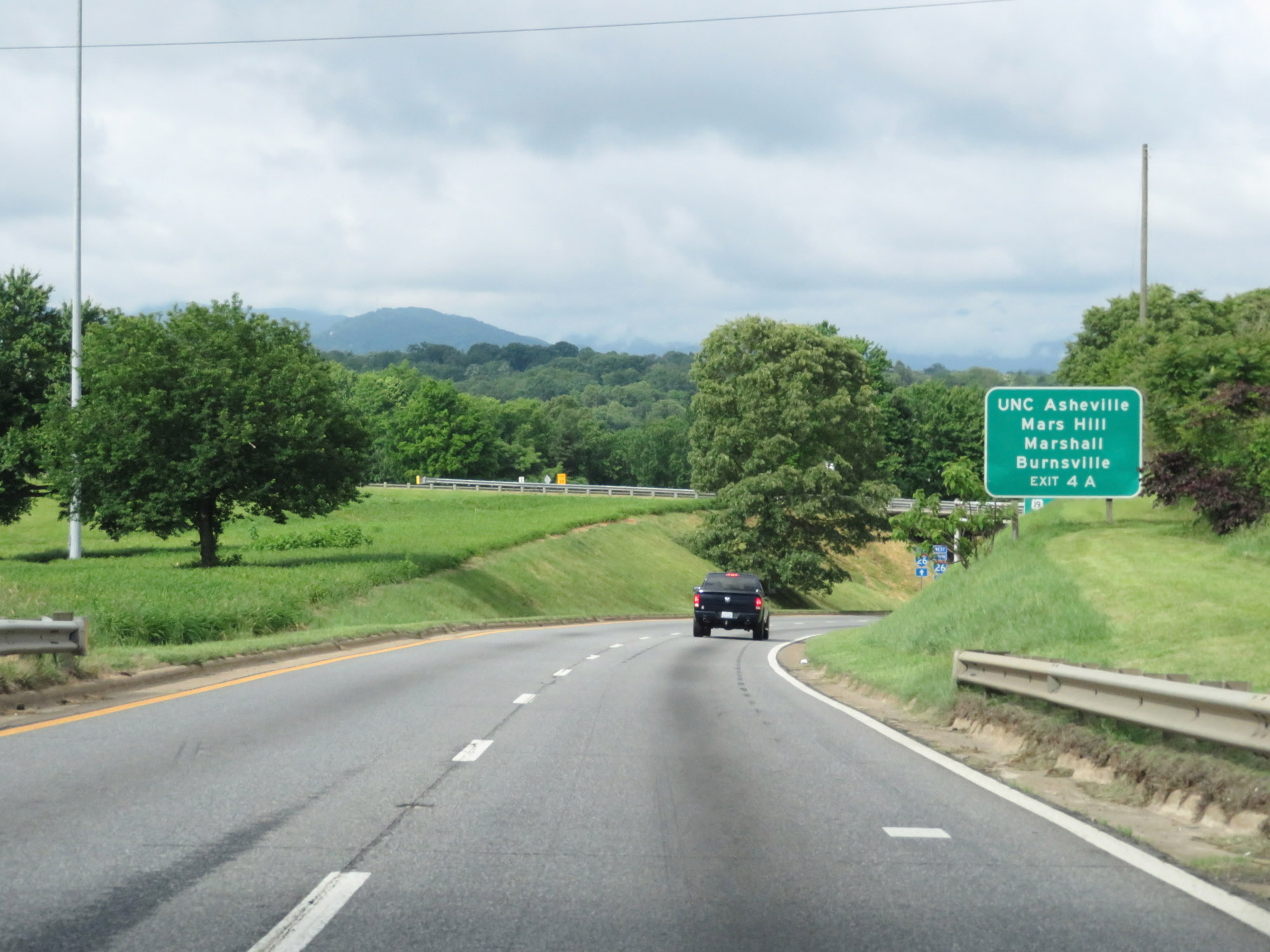 |
Take Exit 4A to UNC Asheville, Mars Hill, Marshall, and Burnsville. (Photo taken 5/26/18). |
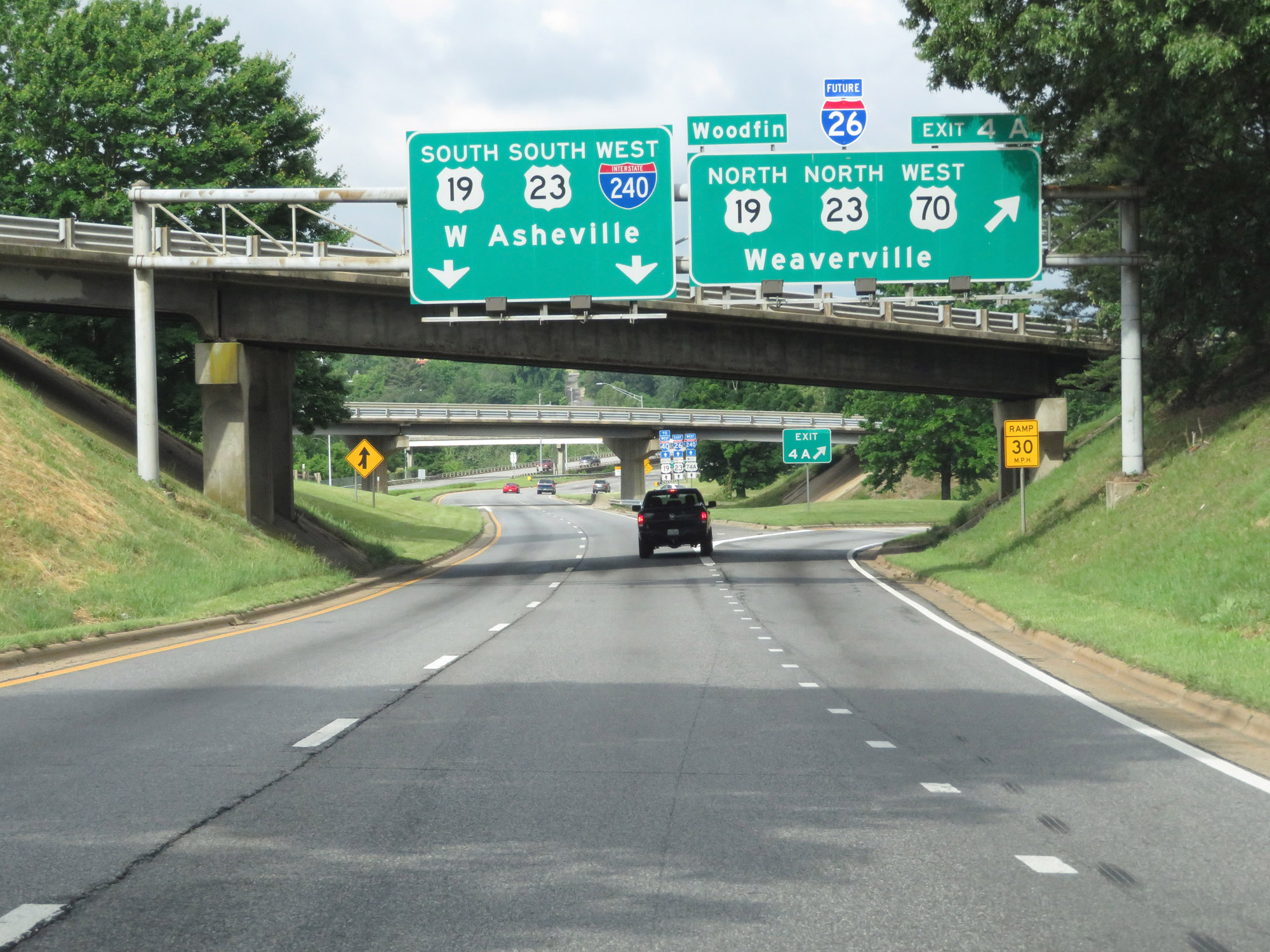 |
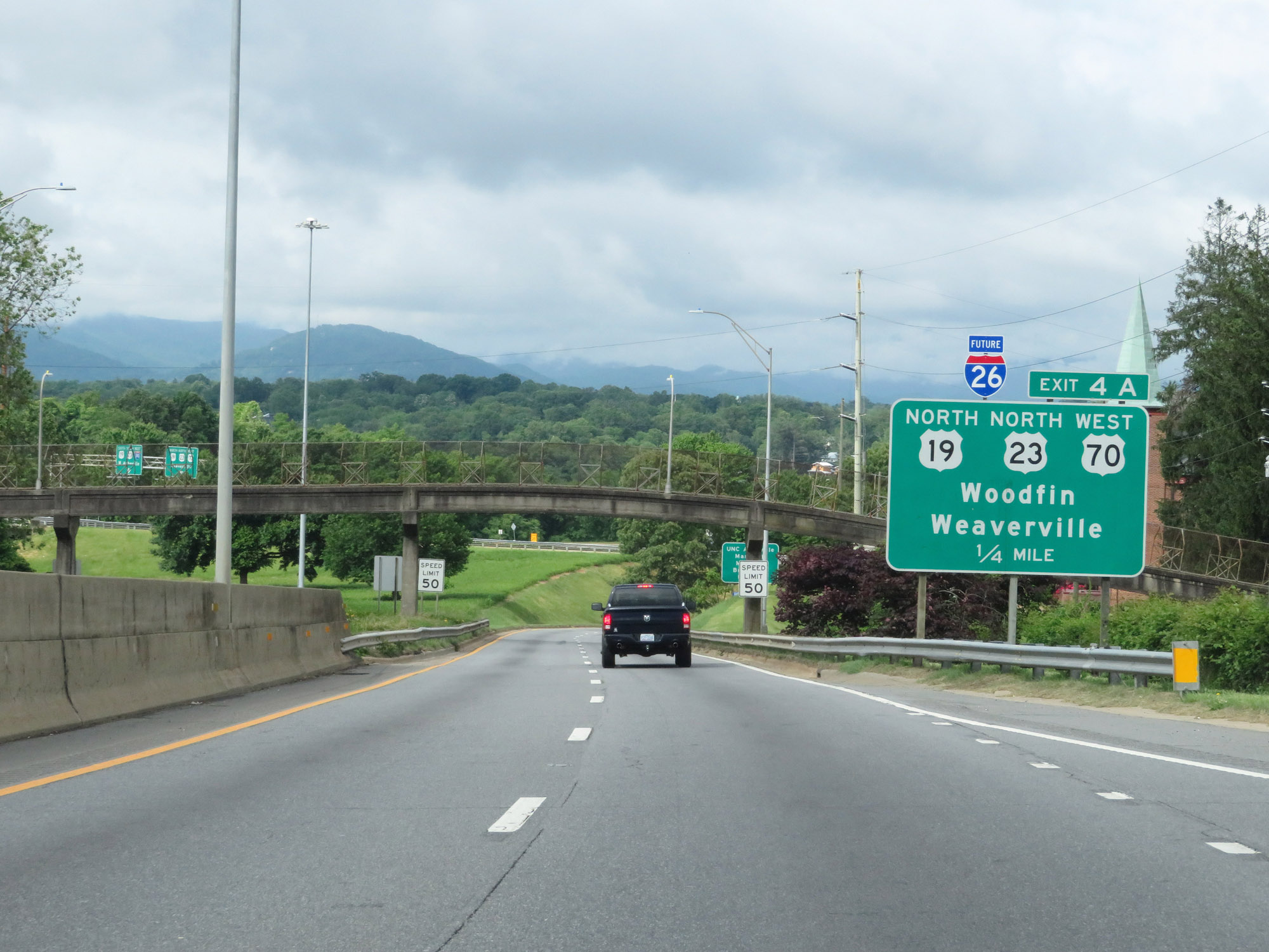
Interstate 240 West at Exit 4A: Future Interstate 26 West / US 19 North / US 23 North / US 70 West - Weaverville (Photo taken 5/26/18). |
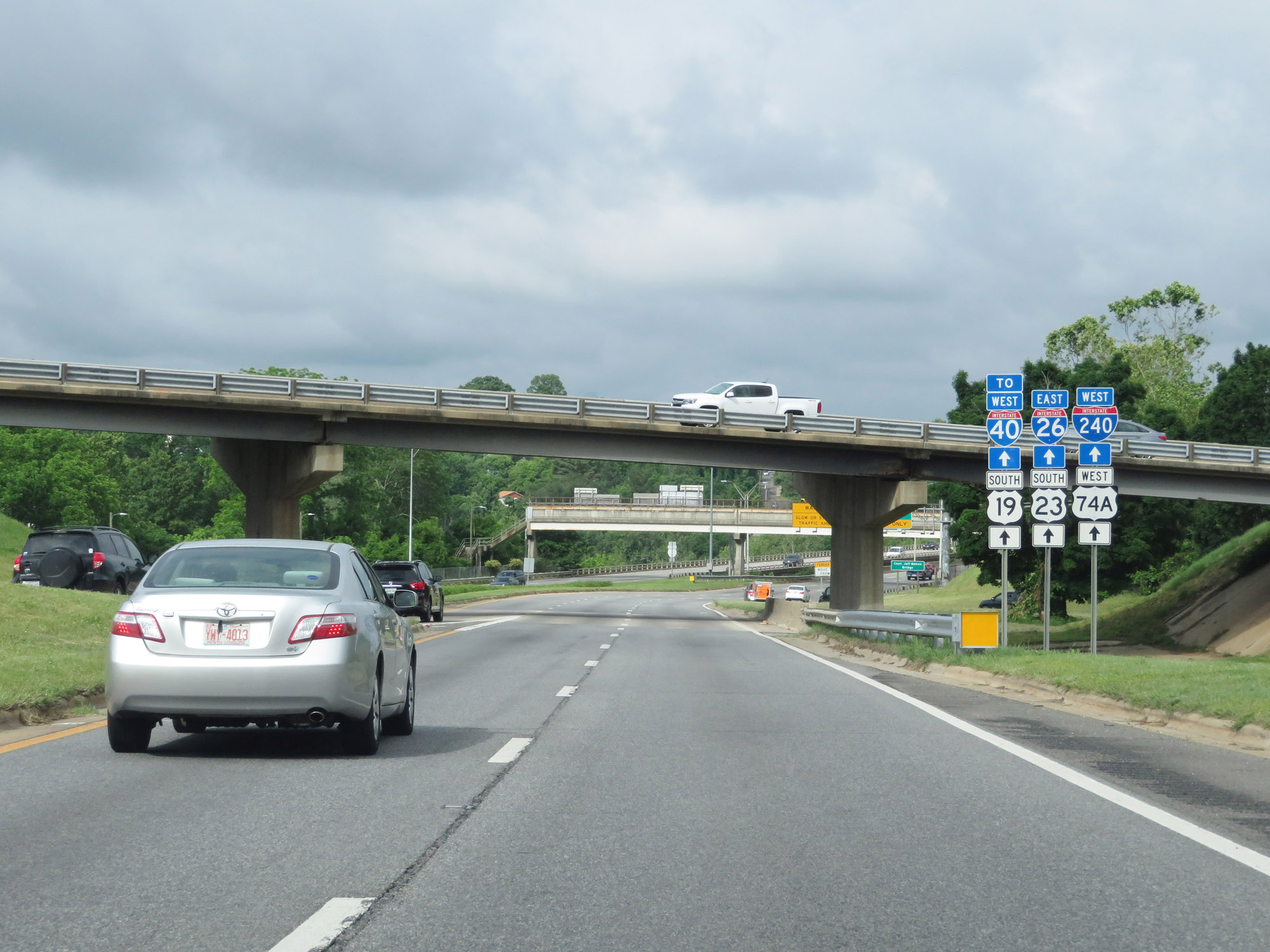 |
Ahead, Interstate 240 West will run concurrently with the current portion of Interstate 26 East the whole way to I-240's western terminus. (Photo taken 5/26/18). |
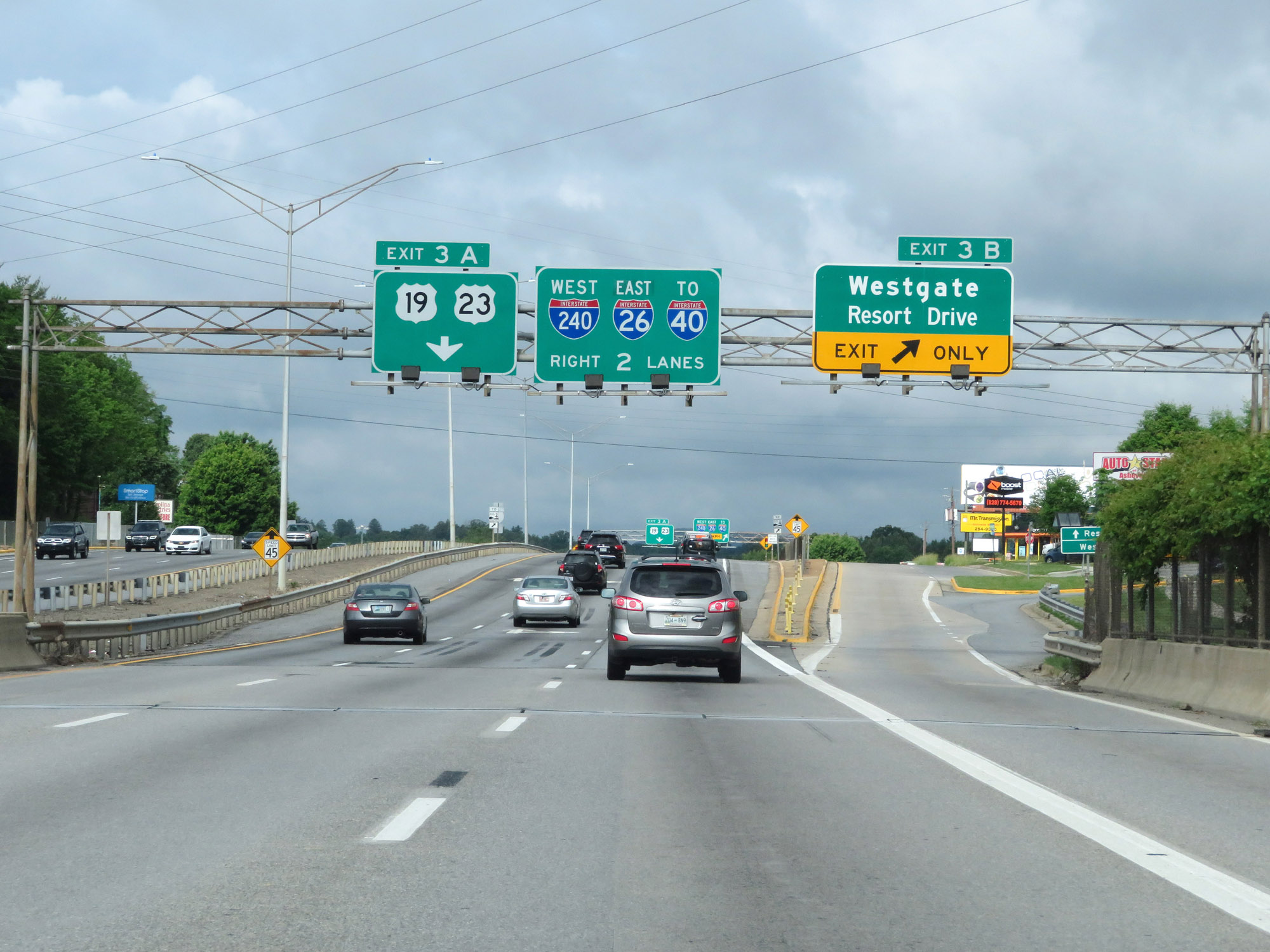 |
Interstate 240 West / Interstate 26 East at Exit 3B: Westgate / Resort Drive (Photo taken 5/26/18). |
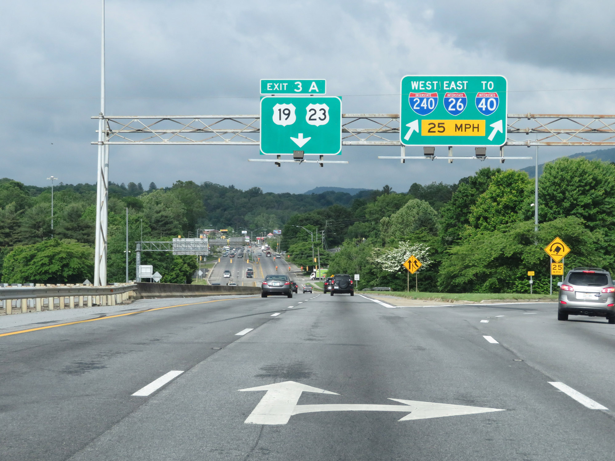 |
Interstate 240 West / Interstate 26 East at Exit 3A: US 19 / US 23 (Photo taken 5/26/18). |
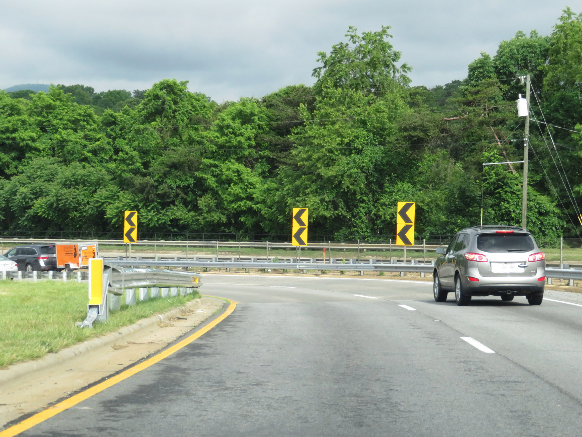 |
View on Interstate 240 West / Interstate 26 East, as they enter a sharp curve which will take them underneath US 19 and US 23. (Photo taken 5/26/18). |
 |
Interstate 240 West / Interstate 26 East as they pass under US 19 / US 23. I-240 West / I-26 East now will head due south toward the interchange with Interstate 40 to the southwest of downtown Asheville. (Photo taken 5/26/18). |
 |
After passing under US 19 / US 23, the speed limit increases slightly to 55 mph once again on Interstate 240 West / Interstate 26 East. (Photo taken 5/26/18). |
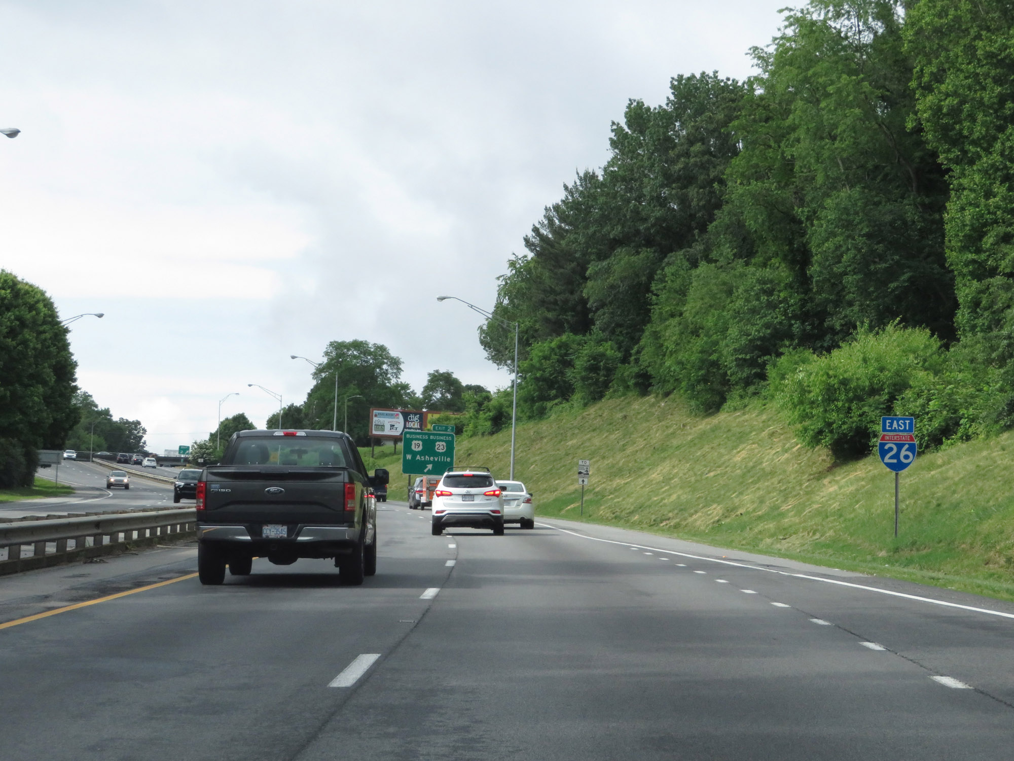 |
Interstate 26 East reassurance shield. I included this photo in this guide because a lot of sources say that this stretch of I-26 is still designated as Future I-26. Clearly it isn't marked with a FUTURE tab, which to me, makes it currently part of Interstate 26. Not a single FUTURE tab is found on any signage for I-26 during the I-240/I-26 concurrency. (Photo taken 5/26/18). |
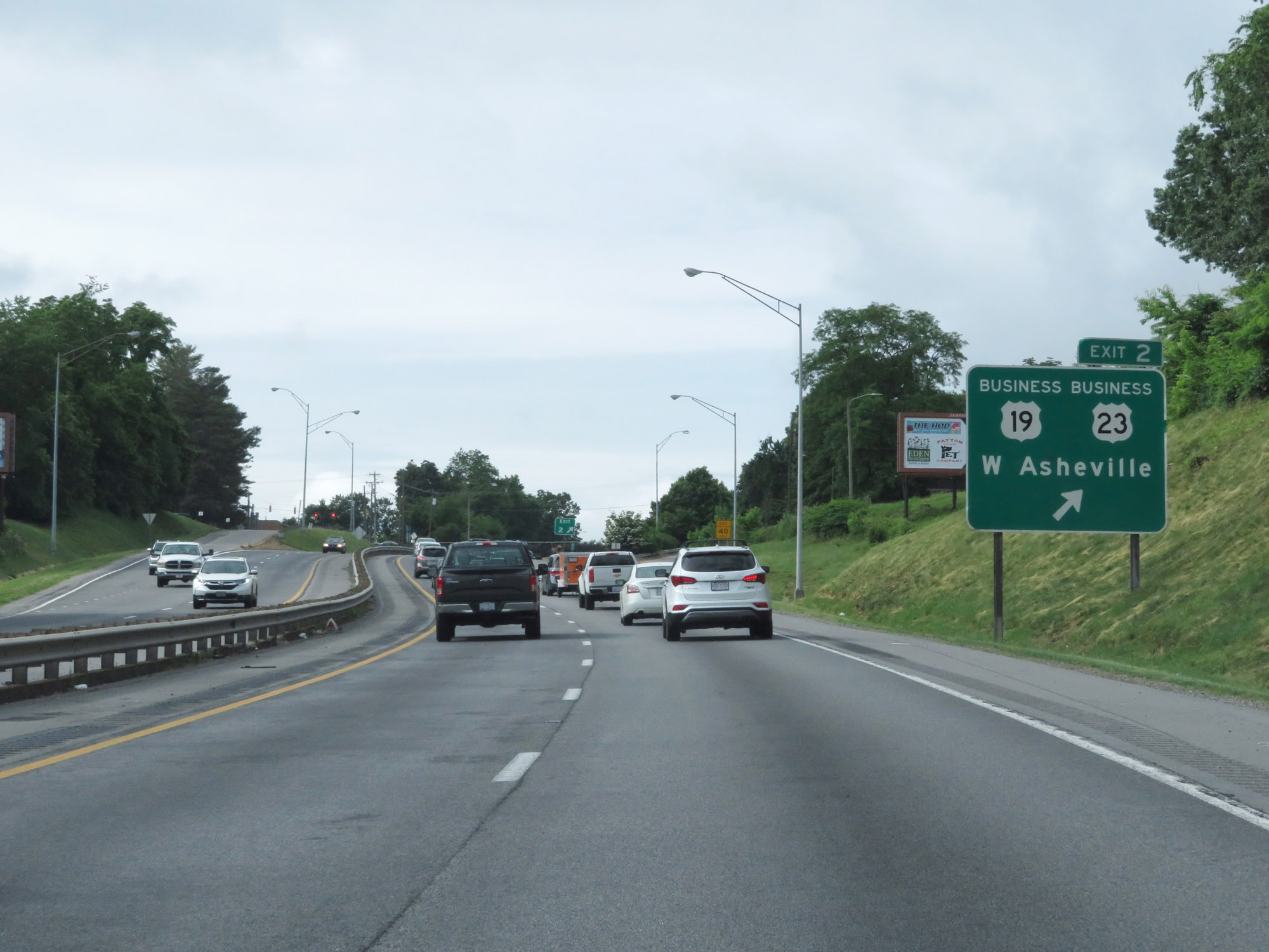 |
Interstate 240 West / Interstate 26 East at Exit 2: US 19 Business / US 23 Business - West Asheville (Photo taken 5/26/18). |
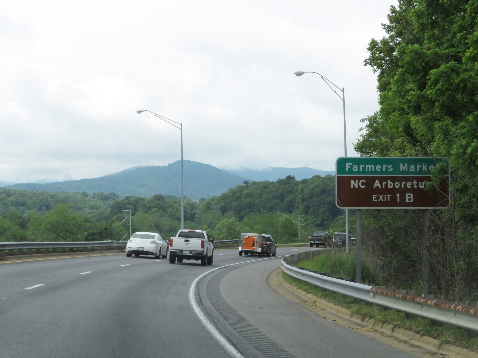 |
Take Exit 1B to the Farmers Market and NC Arboretum. (Photo taken 5/26/18). |
 |
Interstate 240 West / Interstate 26 East at mile marker 1. In case you didn't notice, the mile markers and exit numbers during the I-240/I-26 concurrency reflect the mileage of I-240. (Photo taken 5/26/18). |
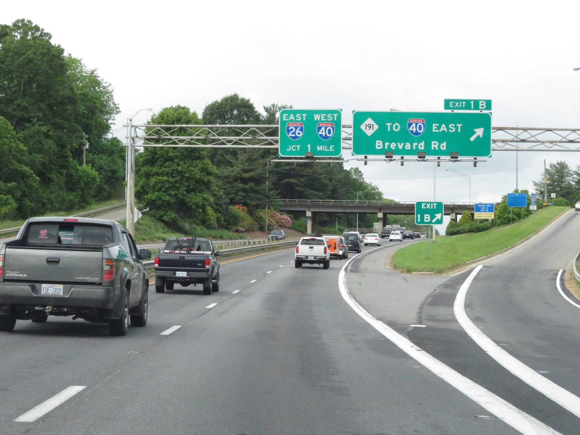 |
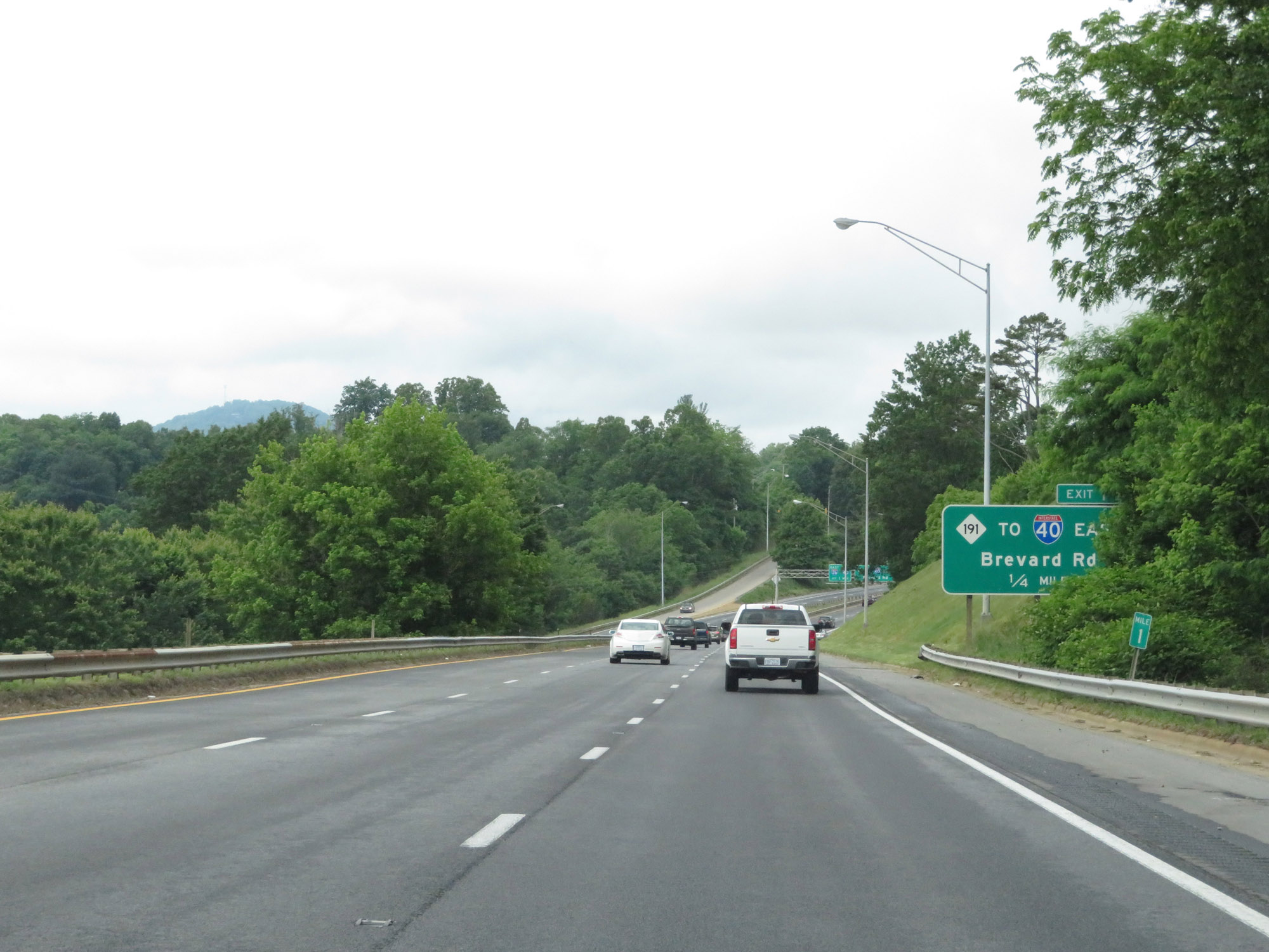
Interstate 240 West / Interstate 26 East at Exit 1B: NC 191 / To Interstate 40 East - Brevard Rd (Photo taken 5/26/18). |
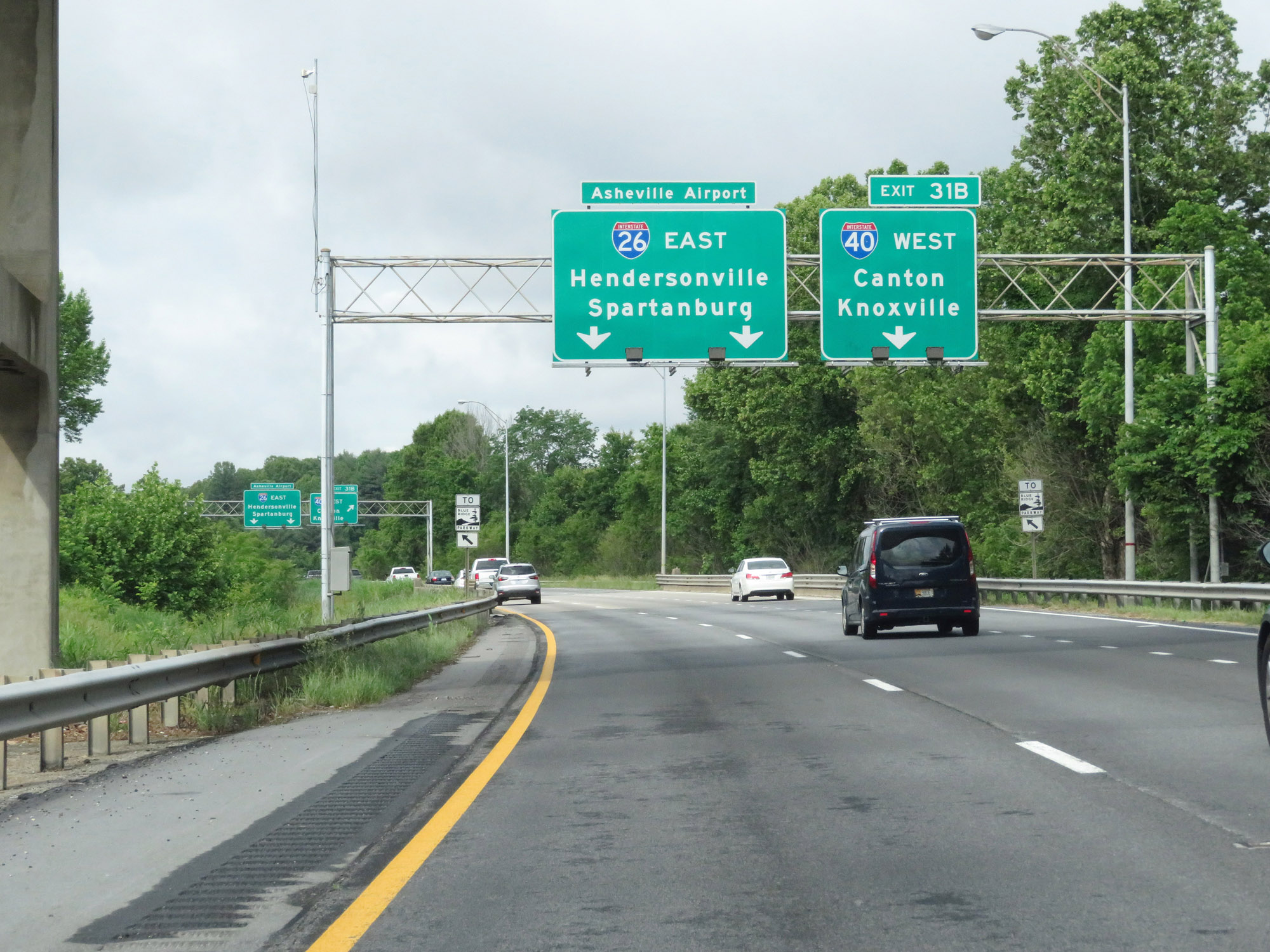 |
Interstate 240 West / Interstate 26 East approaching its interchange with Interstate 40 West, which becomes marked by Interstate 26's mileage as Exit 31B. This interchange will mark the western terminus of I-240. (Photo taken 5/26/18). |
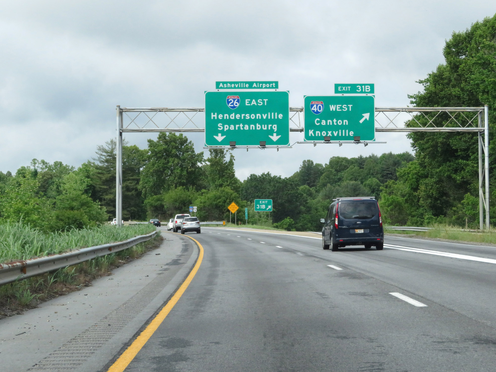 |
Interstate 240 West / Interstate 26 East at Exit 31B: Interstate 40 West - Canton / Knoxville (Photo taken 5/26/18). |
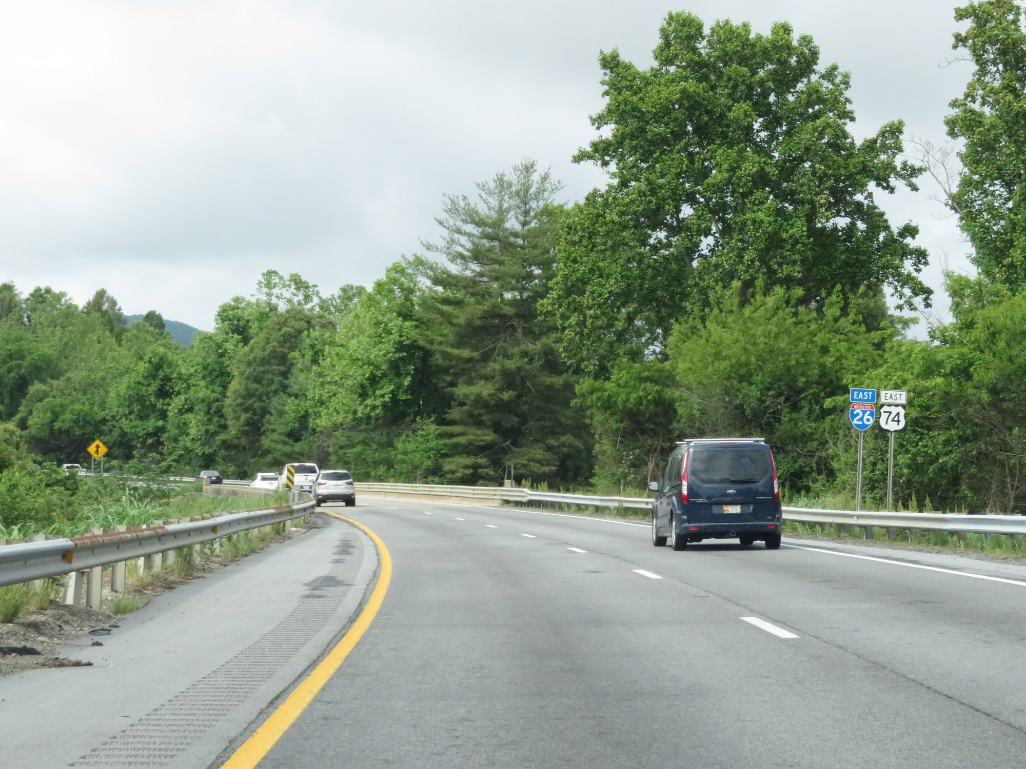 |
As Interstate 240 West comes to an end just beyond the previous exit, Interstate 26 East continues in a southward direction toward Hendersonville. (Photo taken 5/26/18). |
 |
Traffic from Interstate 40 East joins Interstate 26 East at mile marker 31.5. (Photo taken 5/26/18). |