Road Information |
||
 |
||
| Total Mileage in State: | 54 miles | |
| Beginning/End: | At Kansas state line | |
| Mileage covered in Photos: | 54 miles | |
| Counties covered in Photos: | Jackson, Clay, Platte | |
| Major Junctions in Photos: | I-470/I-49, in Kansas City I-70, in Kansas City I-35, in Claycomo I-29, in Kansas City |
|
| Control Cities in Photos: | Kansas City, Randolph, Claycomo, Platte City | |
Outer Loop
 |
Interstate 435 Outer Loop (East) as it enters Missouri from Kansas in the southern stretches of Kansas City. (Photo taken 5/17/18). |
 |
Interstate 435 Outer Loop (East) starts its 54-mile run in the Show Me State within the Kansas City city limits, which stretch out quite far. (Photo taken 5/17/18). |
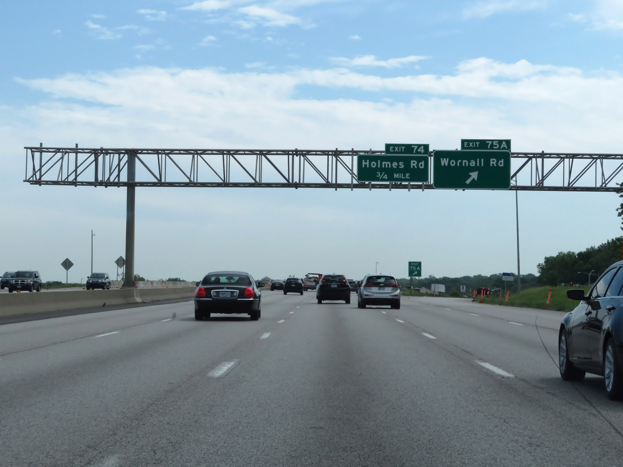 |
Interstate 435 Outer Loop (East) at Exit 75A: Wornall Rd (Photo taken 5/17/18). |
 |
The speed limits on Interstate 435 Outer Loop (East) in Missouri starts out at 65 mph maximum and 40 mph minimum. (Photo taken 5/17/18). |
 |
Interstate 435 Outer Loop (East) at Exit 74: Holmes Road (Photo taken 5/17/18). |
 |
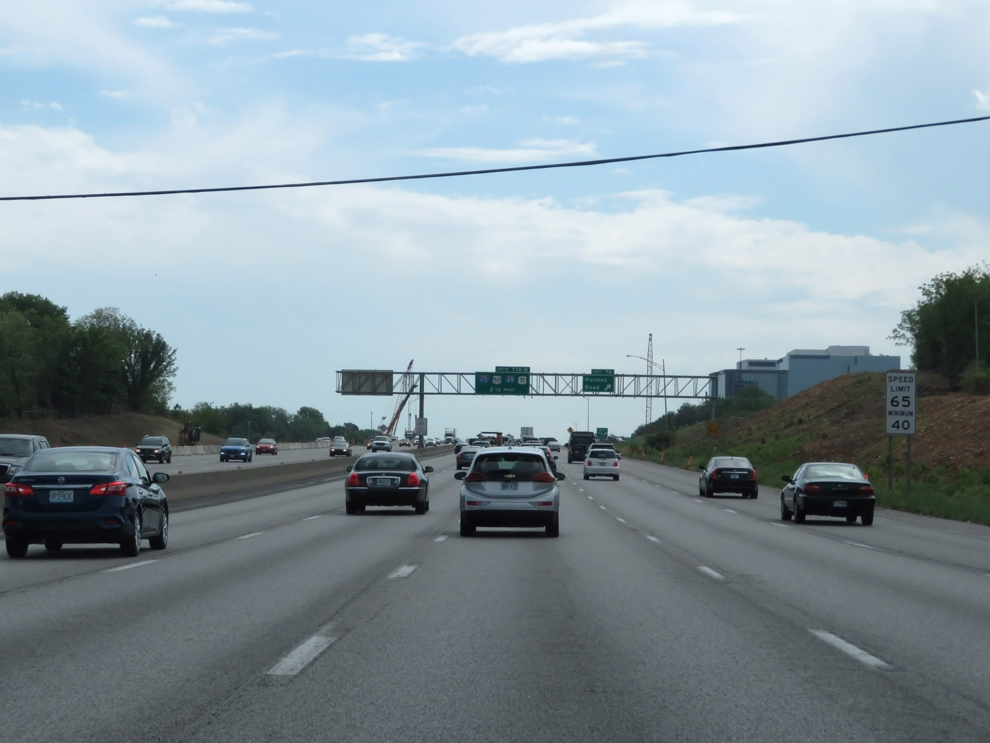
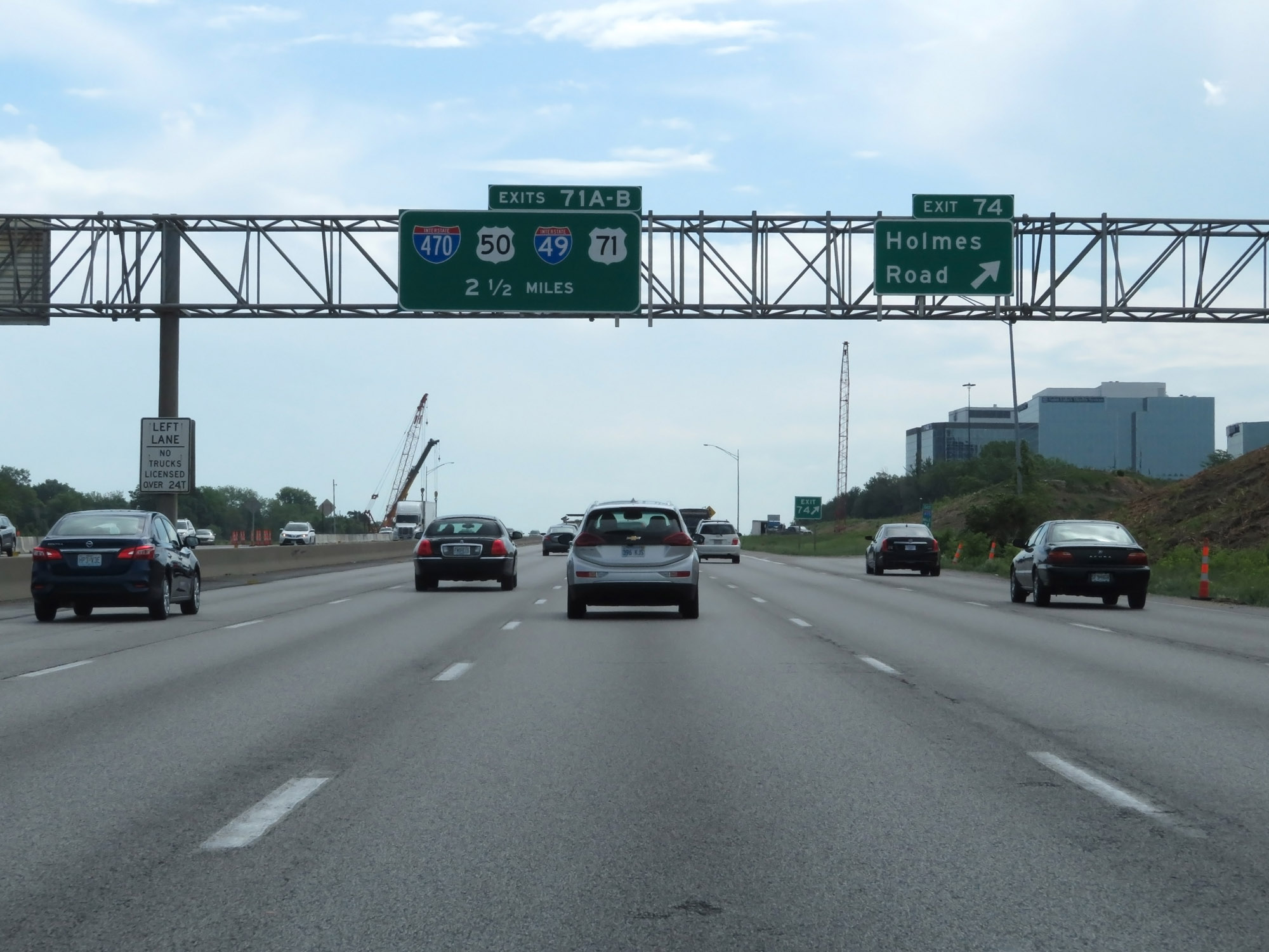
Interstate 435 Outer Loop (East) approaching Exit 71A - 1/2 mile. (Photo taken 5/17/18). |
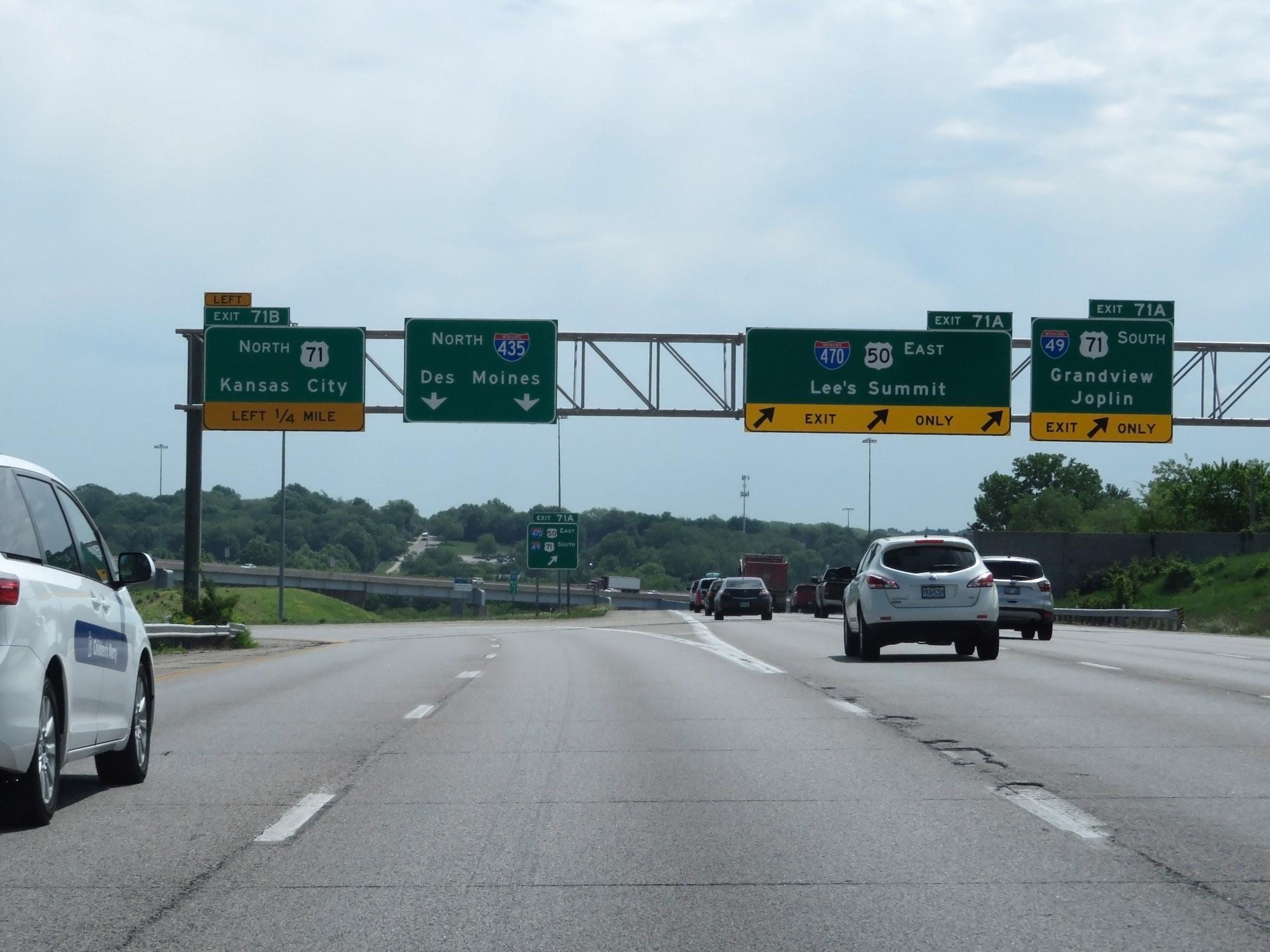 |
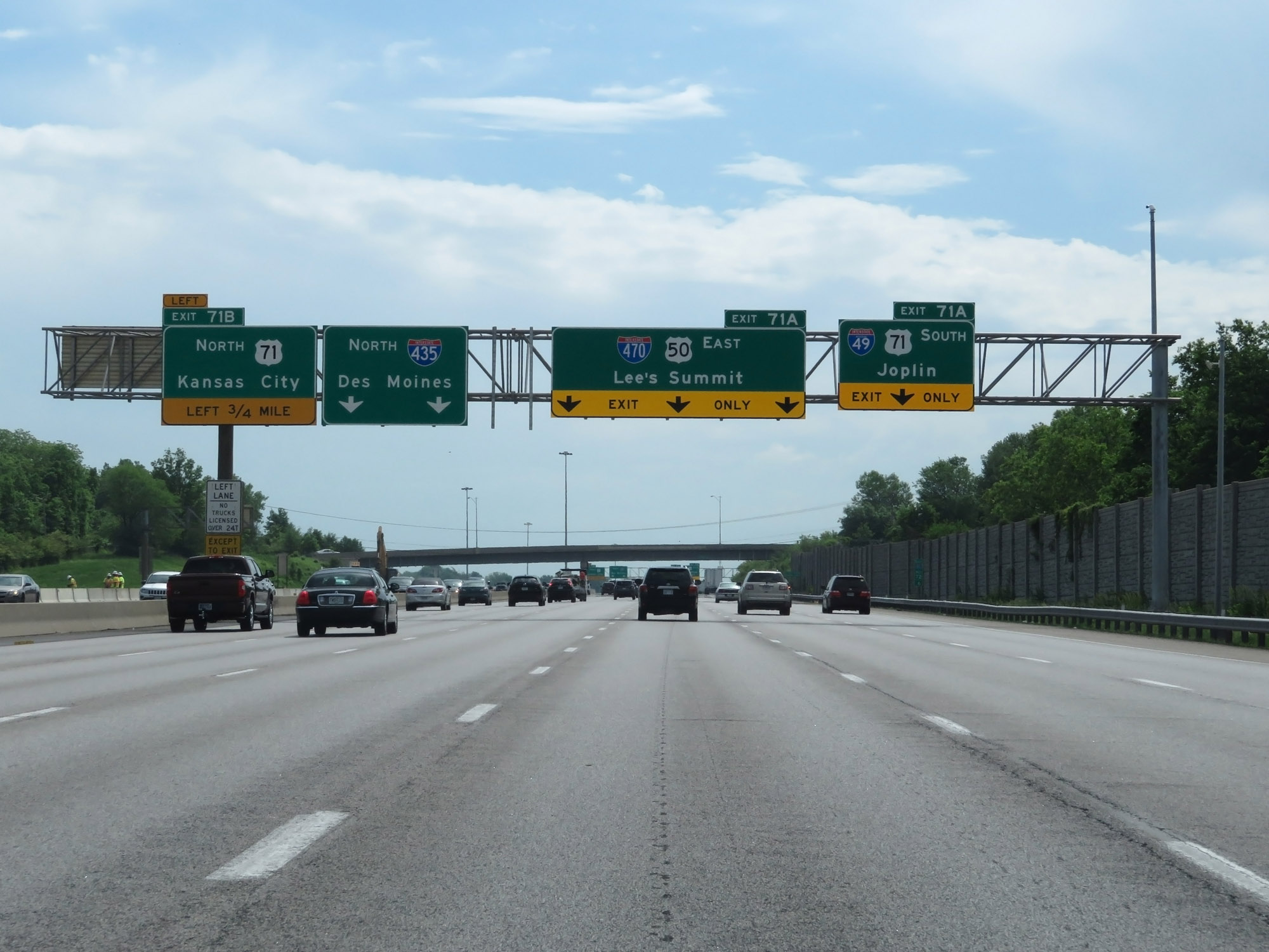
Interstate 435 Outer Loop (East) at Exit 71A: Interstate 470 East / Interstate 49 South / US 50 East / US 71 South - Lee's Summit / Grandview / Joplin (Photo taken 5/17/18). |
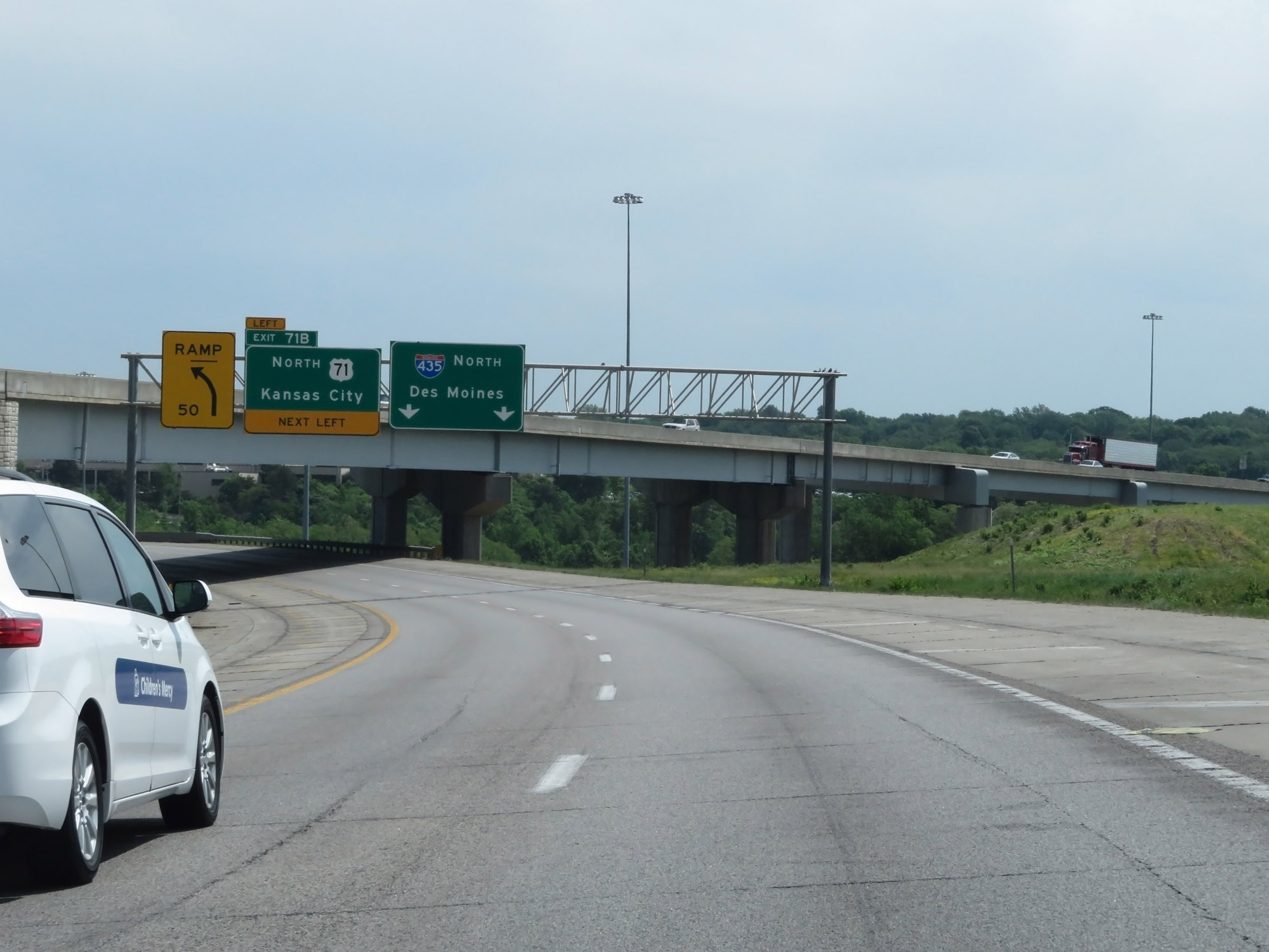 |
Interstate 435 Outer Loop (East) as it begins its curve to the north, at the southeastern corner of the Kansas City city limits. (Photo taken 5/17/18). |
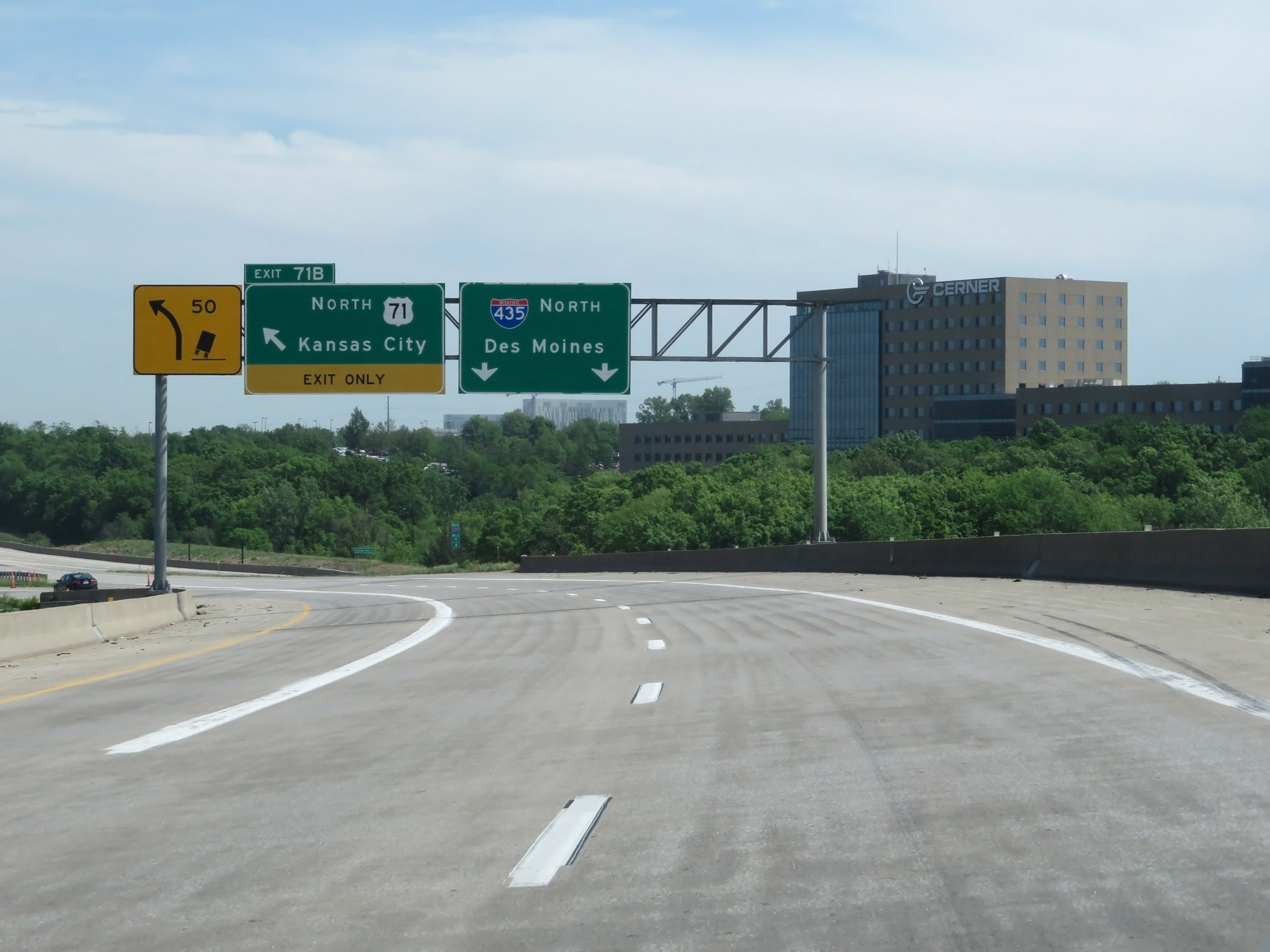 |
Interstate 435 Outer Loop (North) at Exit 71B: US 71 North - Kansas City (Photo taken 5/17/18). |
 |
The speed limits remain 65 mph maximum and 40 mph minimum. (Photo taken 5/17/18). |
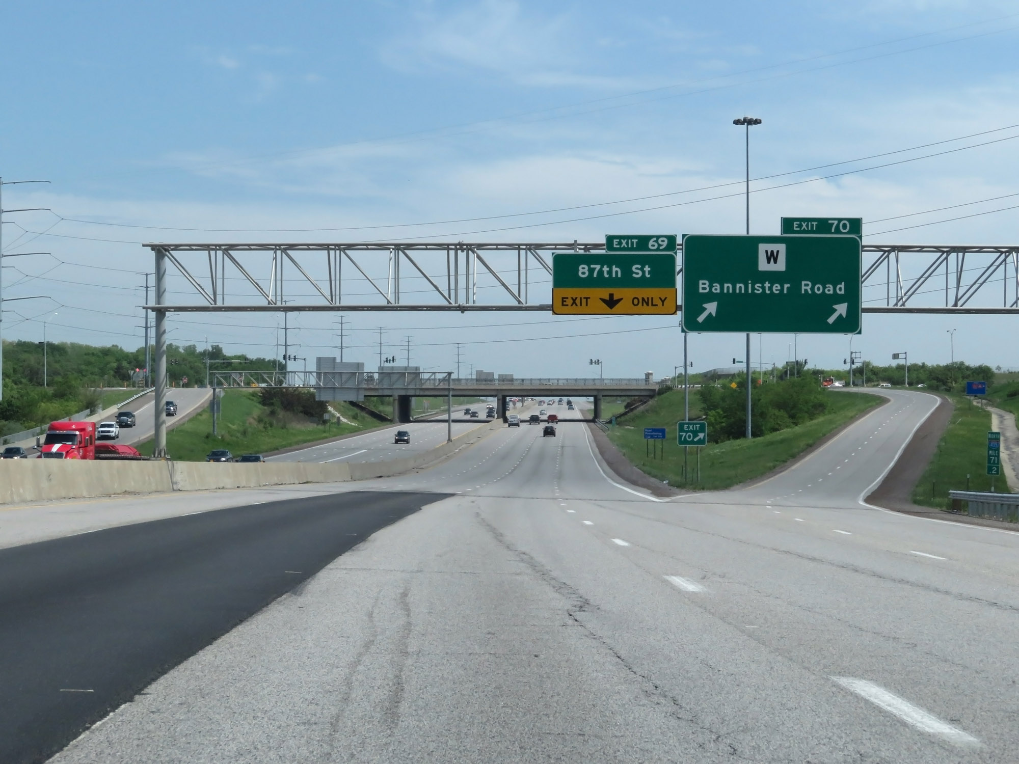 |
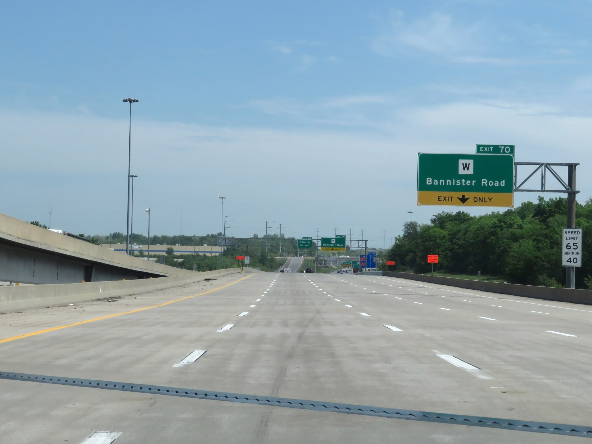
Interstate 435 Outer Loop (North) at Exit 70: Route W - Bannister Road (Photo taken 5/17/18). |
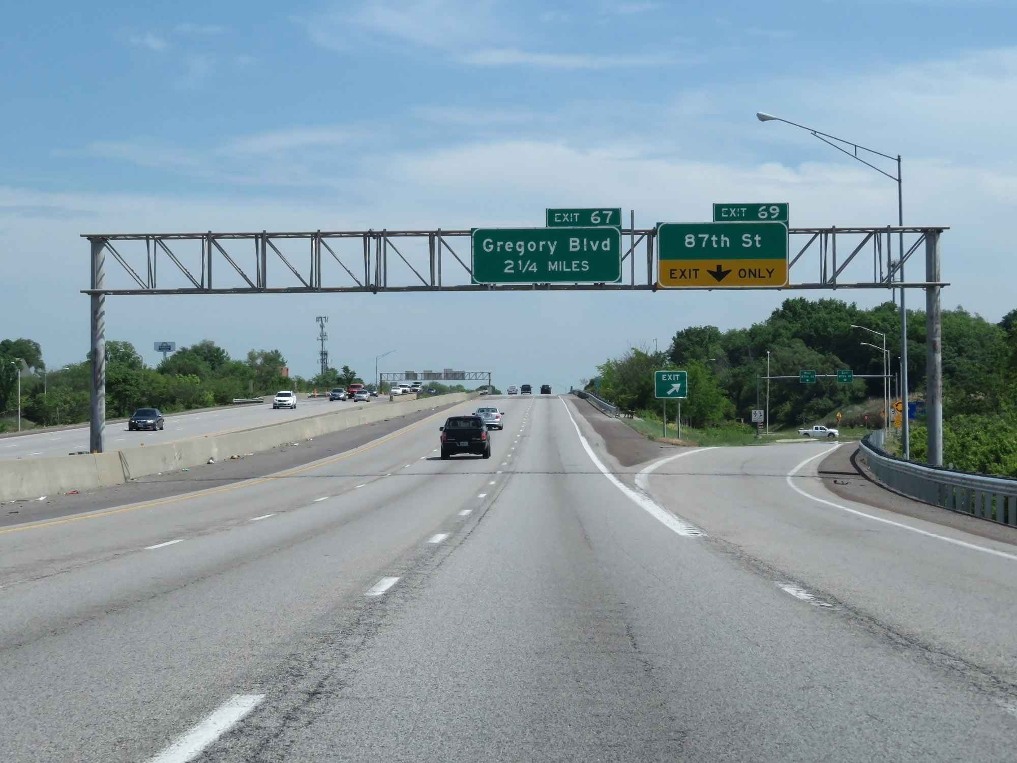 |
Interstate 435 Outer Loop (North) at Exit 69: 87th St (Photo taken 5/17/18). |
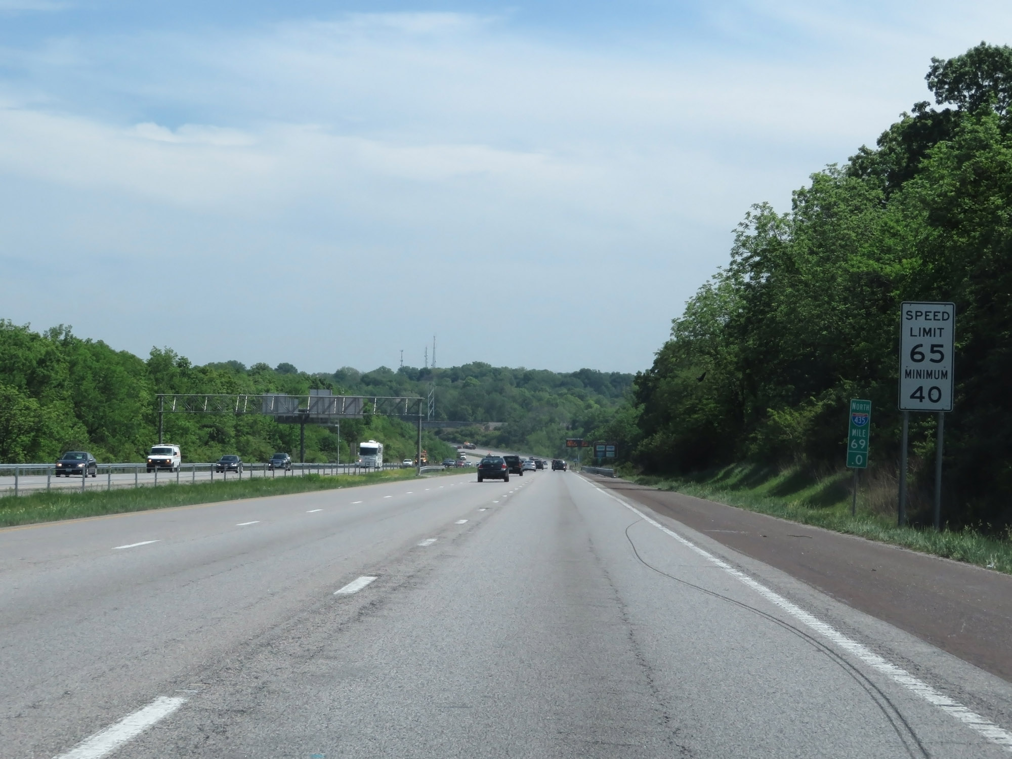 |
Interstate 435 Outer Loop (North) at mile marker 69. (Photo taken 5/17/18). |
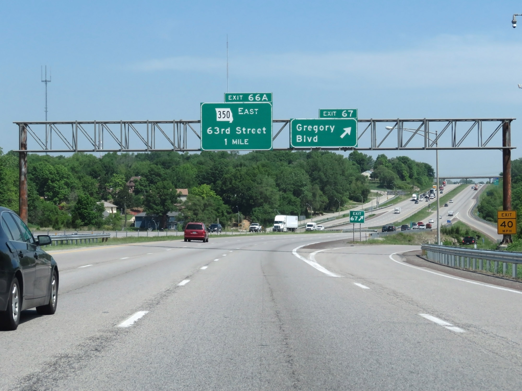 |
Interstate 435 Outer Loop (North) at Exit 67: Gregory Blvd (Photo taken 5/17/18). |
 |
Interstate 435 Outer Loop (North) at Exit 66A: MO 350 East - Raytown / 63rd St (Photo taken 5/17/18). |
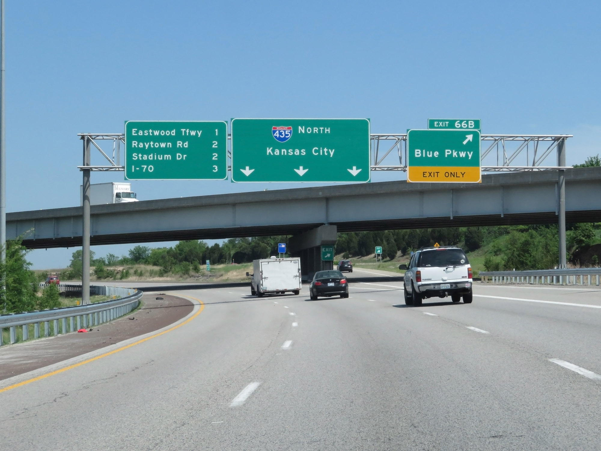 |
Interstate 435 Outer Loop (North) at Exit 66B: Blue Pkwy (Photo taken 5/17/18). |
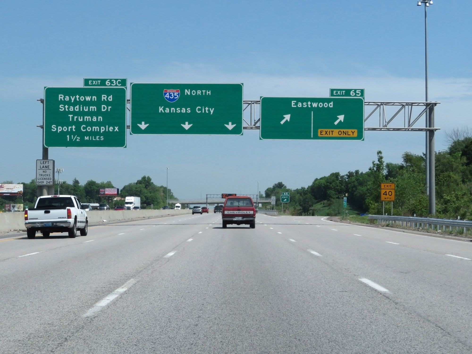 |
Interstate 435 Outer Loop (North) at Exit 65: Eastwood Tfwy (Photo taken 5/17/18). |
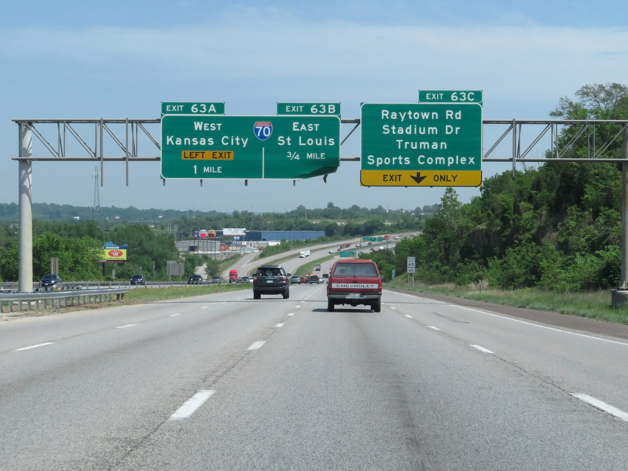 |
Interstate 435 Outer Loop (North) approaching Exits 63B and 63A - 3/4 mile and 1 mile respectively. (Photo taken 5/17/18). |
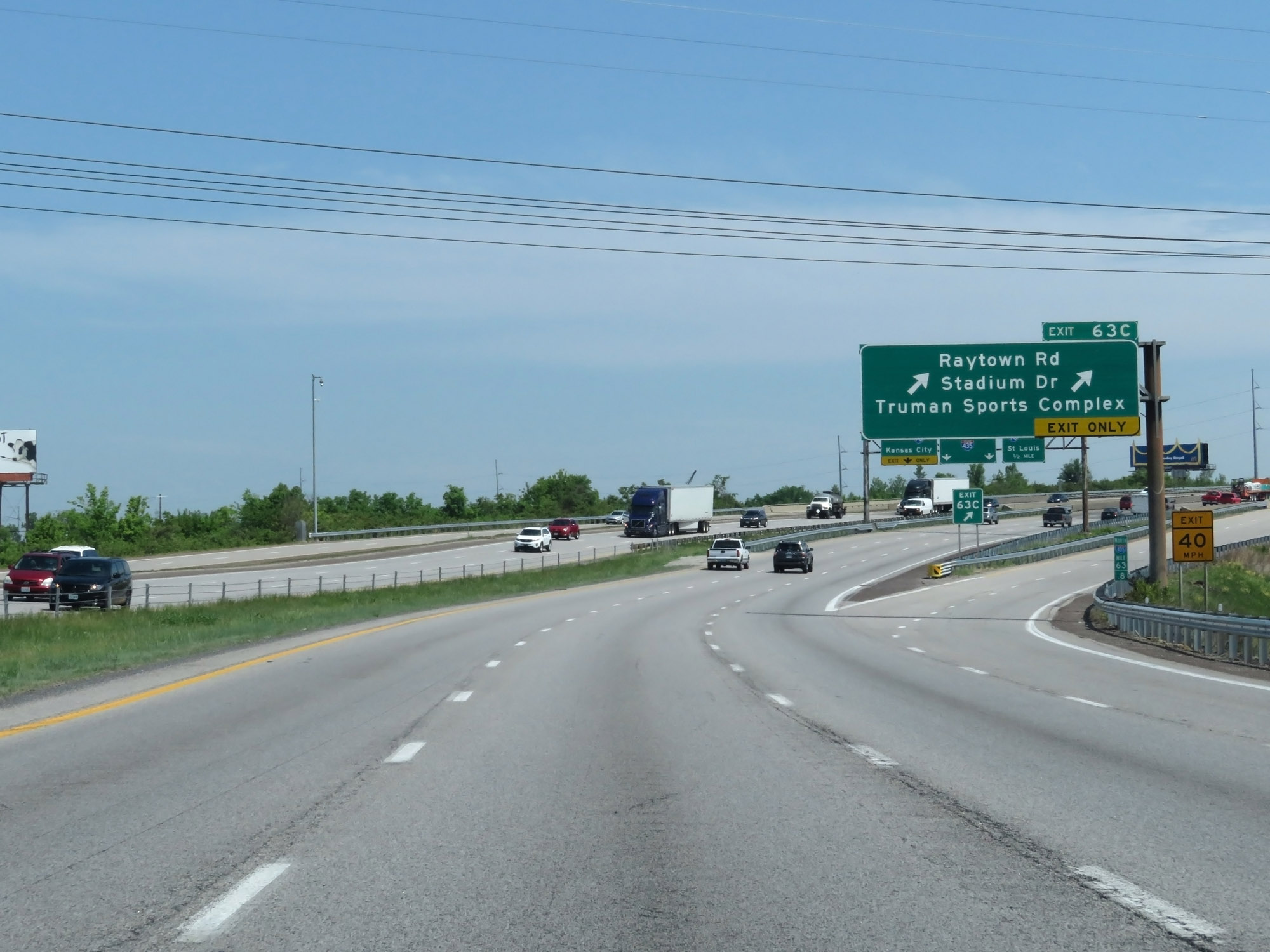 |
Interstate 435 Outer Loop (North) at Exit 63C: Raytown Rd / Stadium Dr / Truman Sports Complex (Photo taken 5/17/18). |
 |
Take Exit 63B (Interstate 70 East) to a Missouri Welcome Center. (Photo taken 5/17/18). |
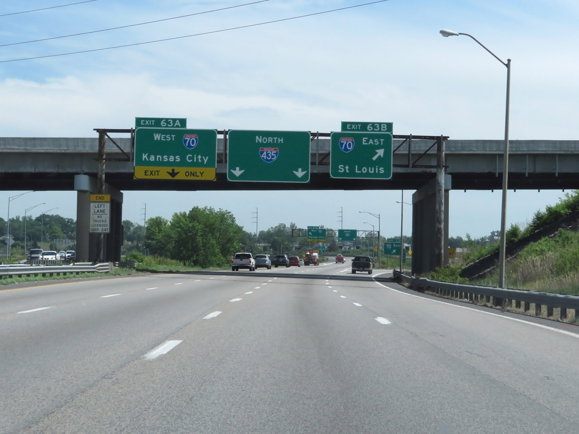 |
Interstate 435 Outer Loop (North) at Exit 63B: Interstate 70 East - St Louis (Photo taken 5/17/18). |
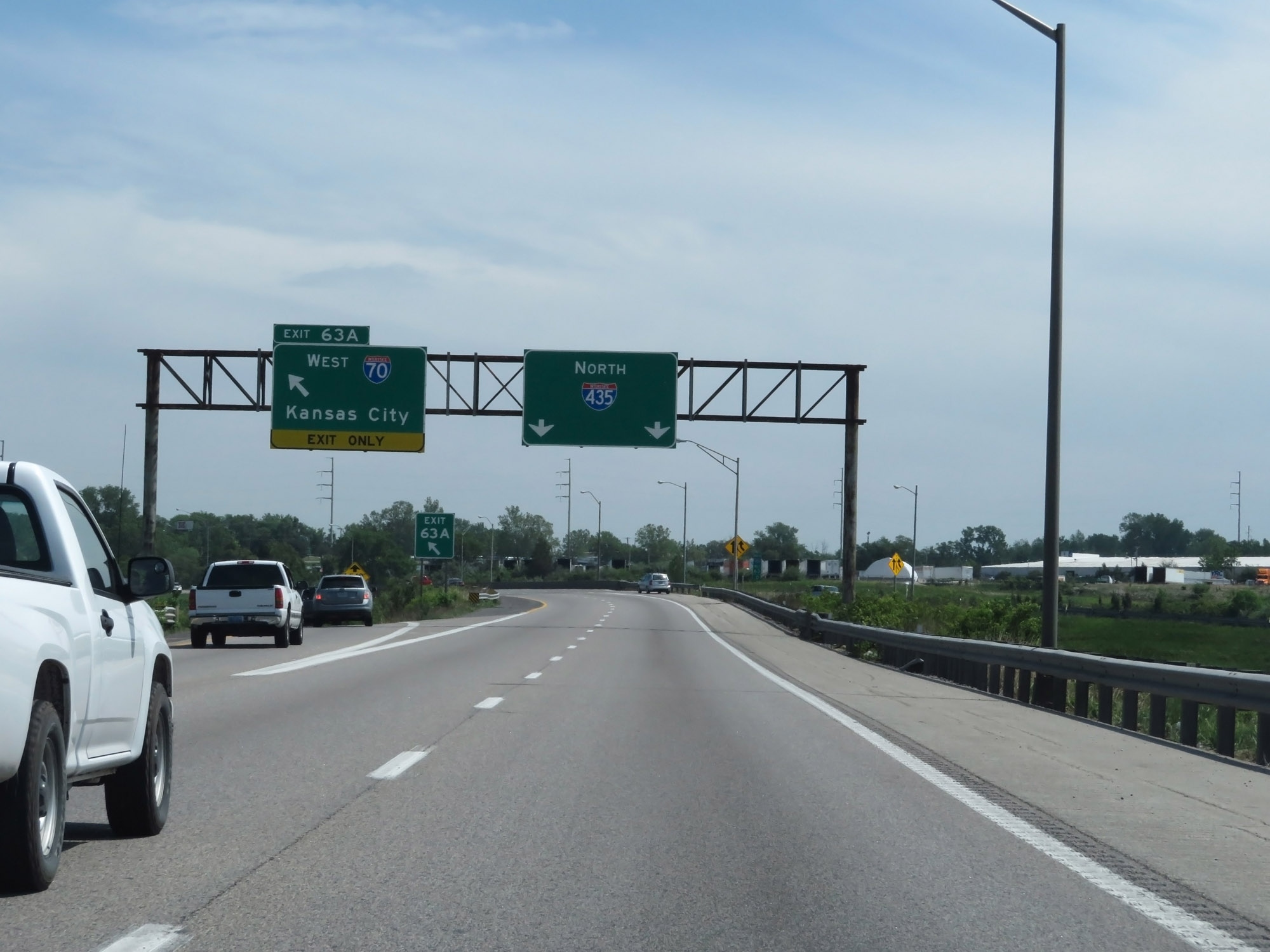 |
Interstate 435 Outer Loop (North) at Exit 63A: Interstate 70 West - Kansas City (Photo taken 5/17/18). |
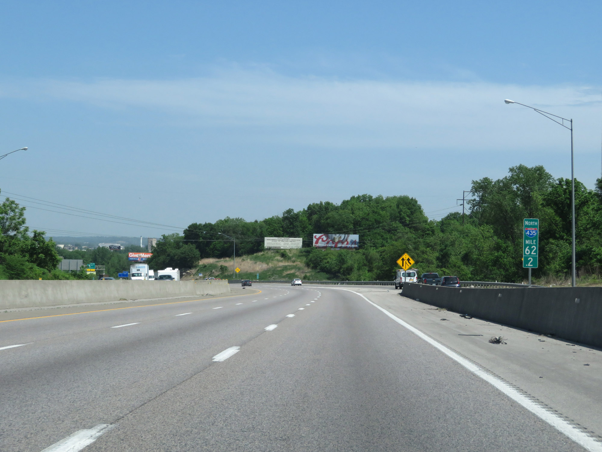 |
Interstate 435 Outer Loop (North) at mile marker 62.2, as traffic from Interstate 70 merges in on the right. (Photo taken 5/17/18). |
 |
Interstate 435 North reassurance shield. (Photo taken 5/17/18). |
 |
The speed limits remain 65 mph maximum and 40 mph minimum. (Photo taken 5/17/18). |
 |
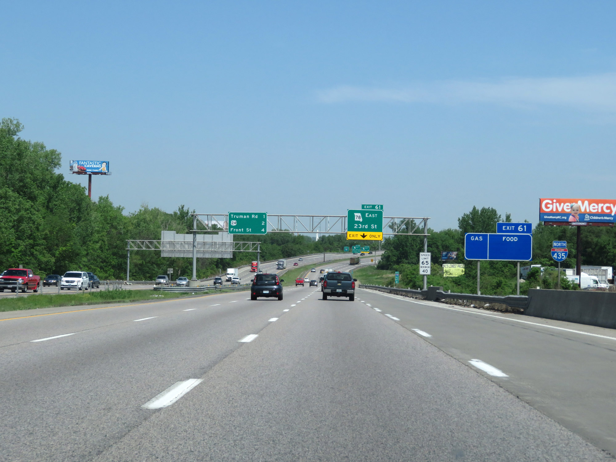
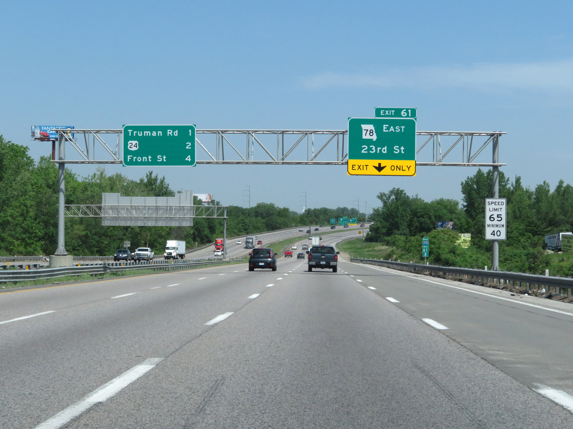
Interstate 435 Outer Loop (North) at Exit 61: MO 78 East - 23rd St (Photo taken 5/17/18). |
 |
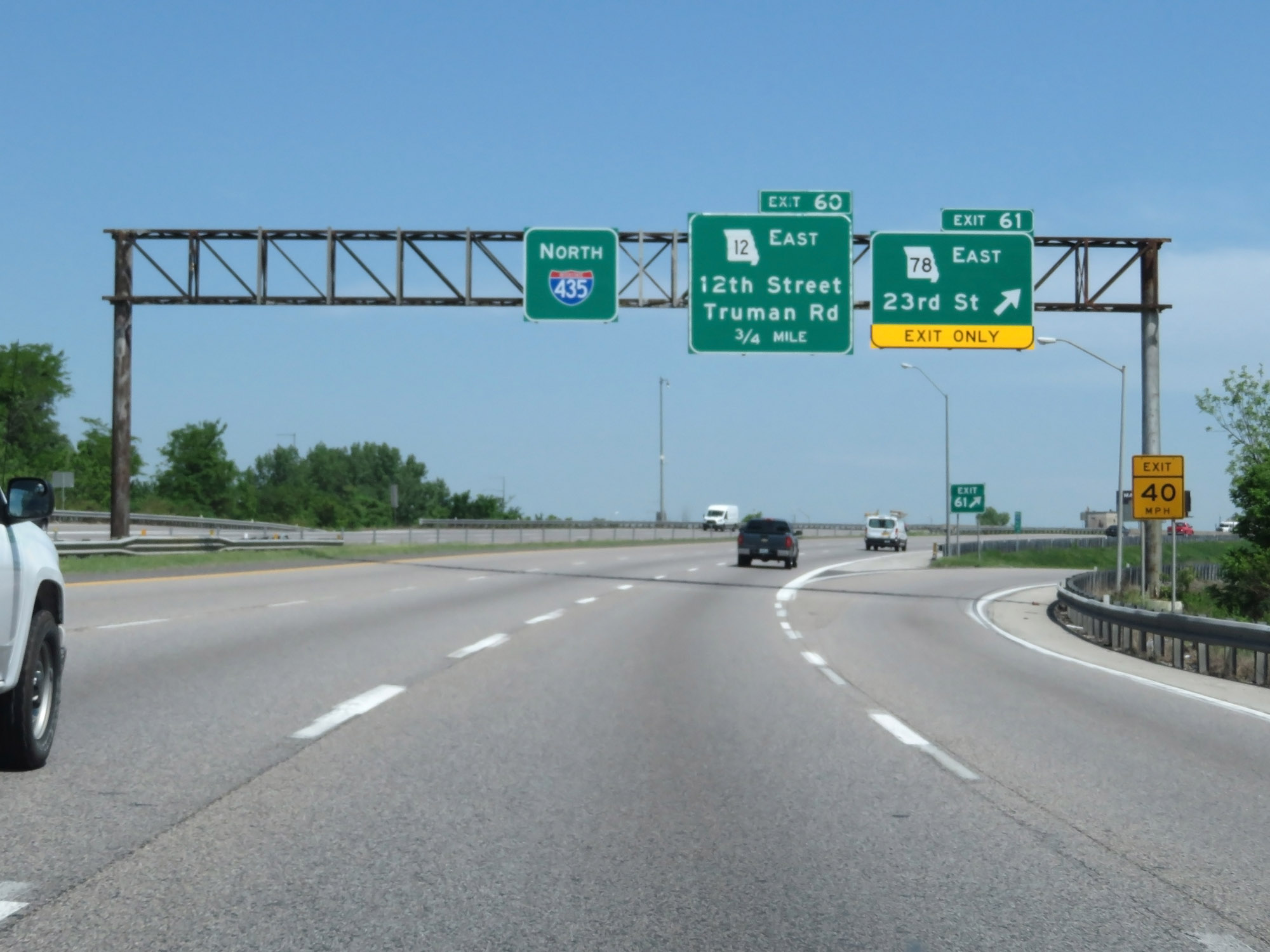
Interstate 435 Outer Loop (North) at Exit 60: MO 12 East - 12th Street / Truman Rd (Photo taken 5/17/18). |
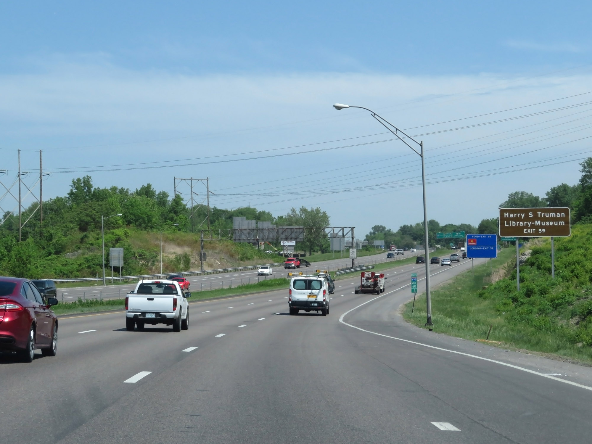 |
Take Exit 59 to Harry S. Truman Library & Museum. (Photo taken 5/17/18). |
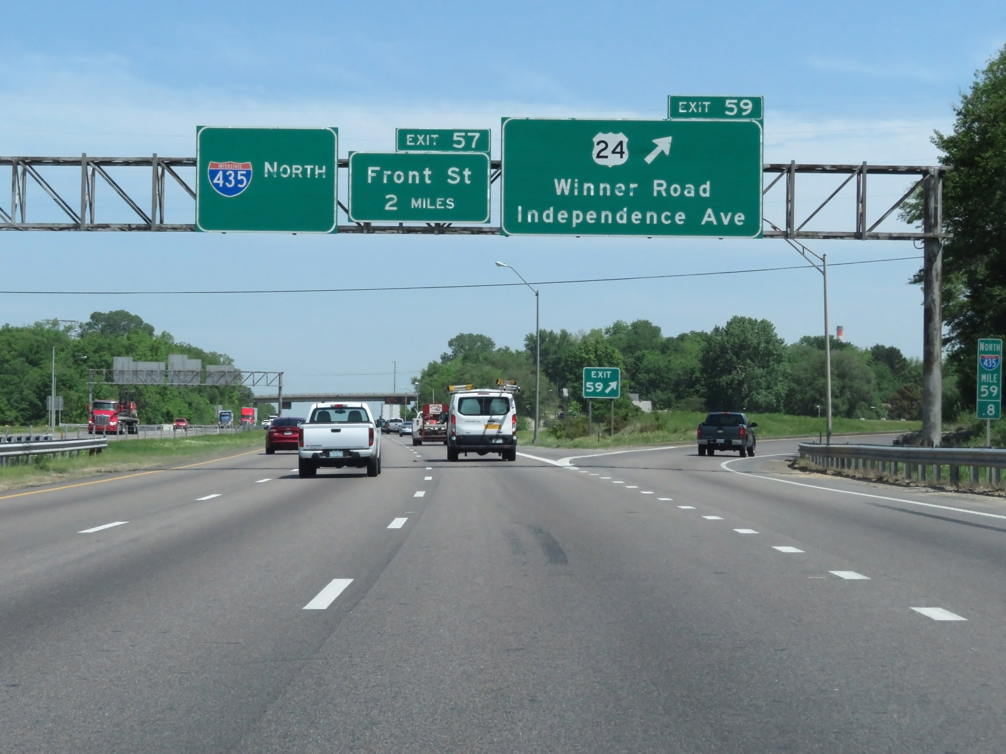 |
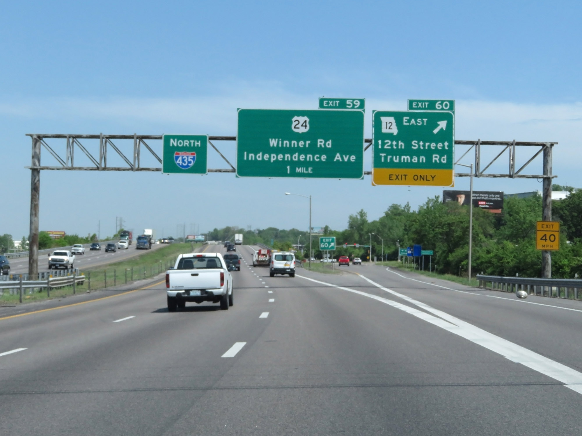
Interstate 435 Outer Loop (North) at Exit 59: US 24 - Winner Road / Independence Ave (Photo taken 5/17/18). |
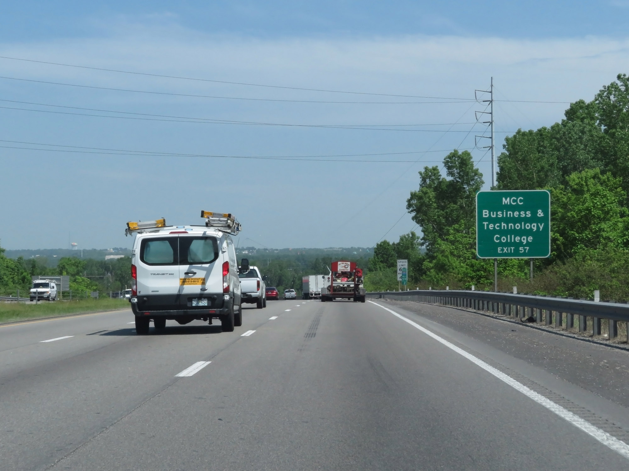 |
Take Exit 57 to MCC Business & Technology College. (Photo taken 5/17/18). |
 |
Interstate 435 Outer Loop (North) at Exit 57: Front St (Photo taken 5/17/18). |
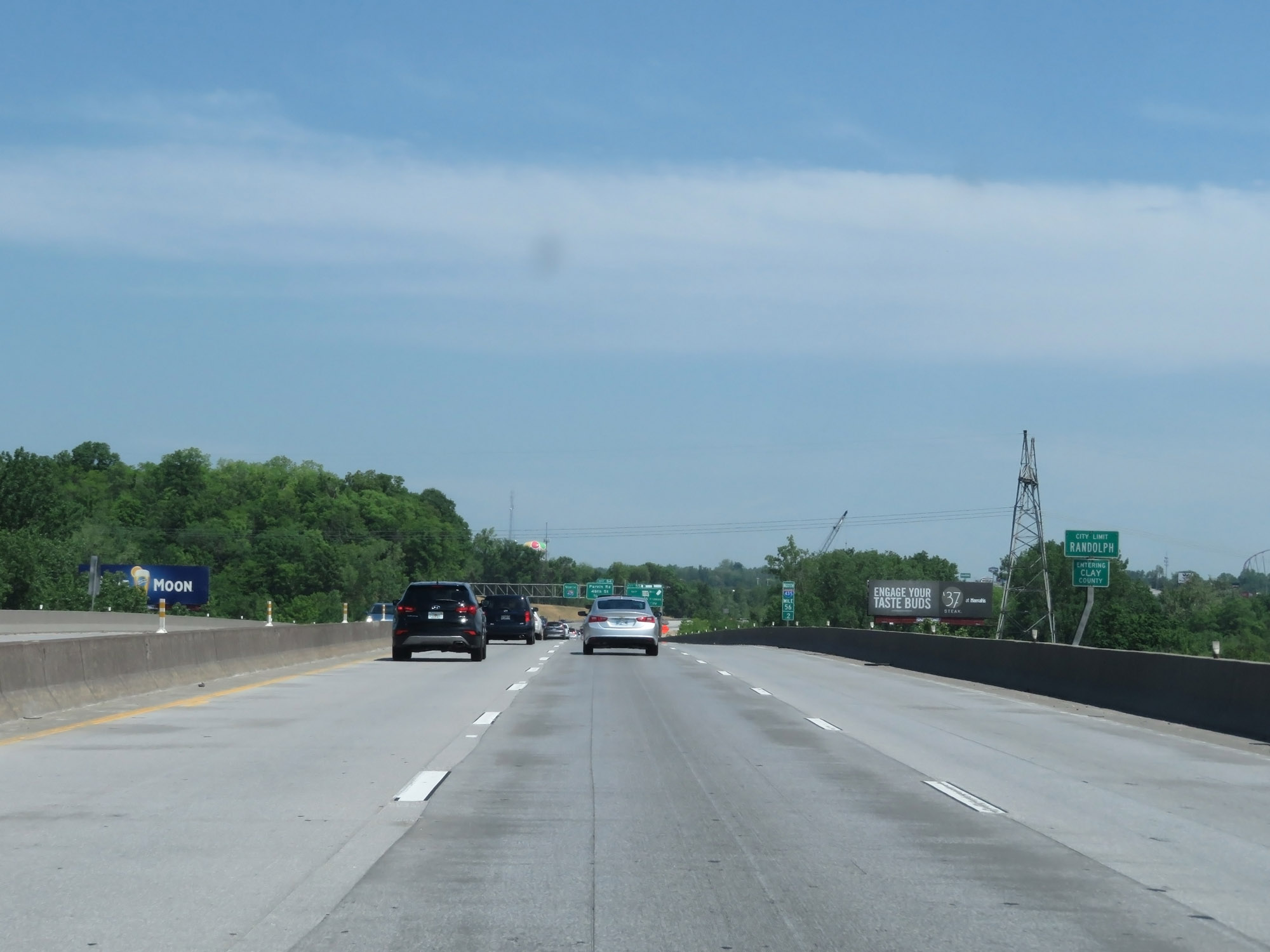 |
At mile marker 56.2, Interstate 435 Outer Loop (North) enters Clay County and the Randolph city limits. (Photo taken 5/17/18). |
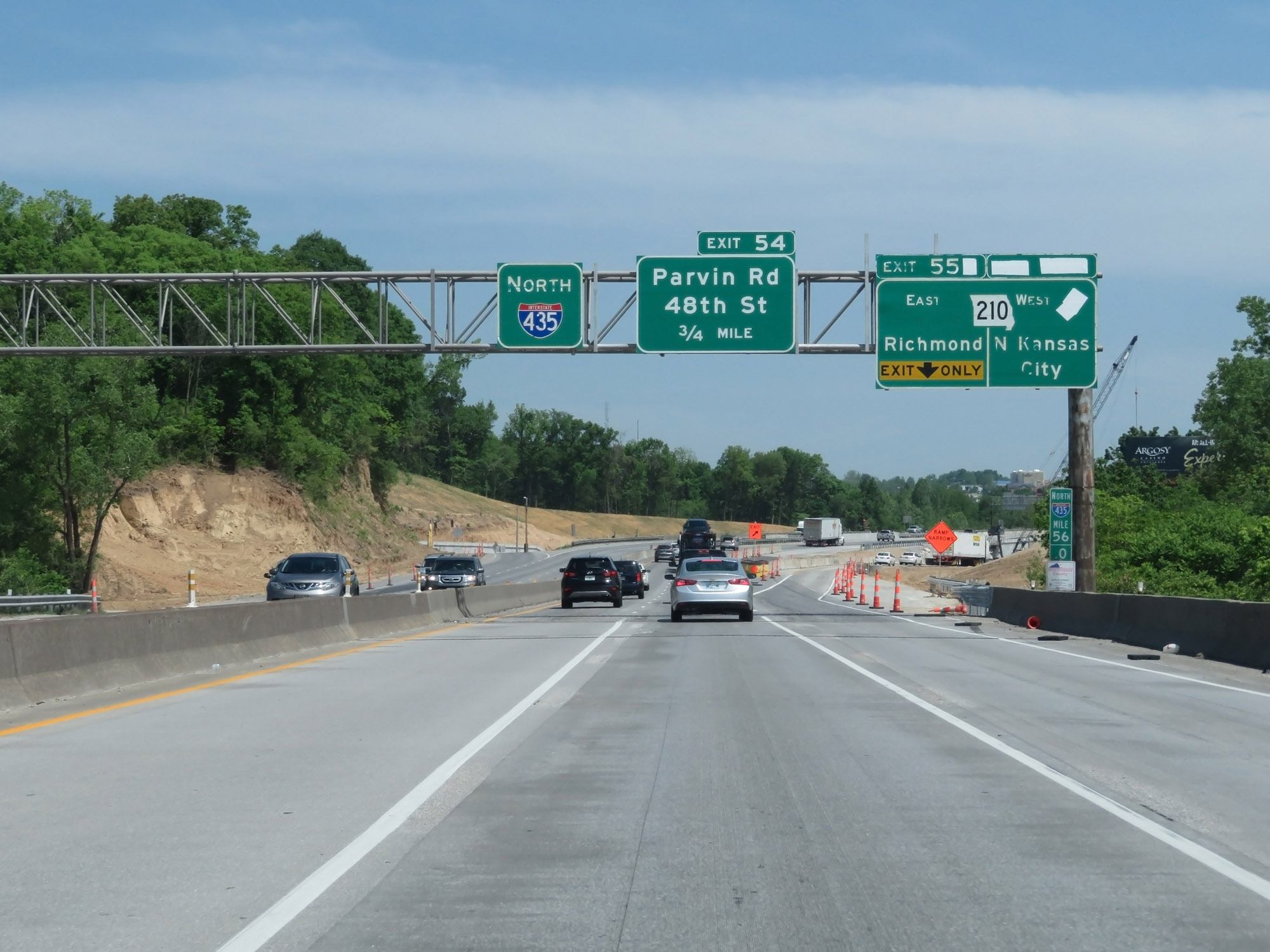 |
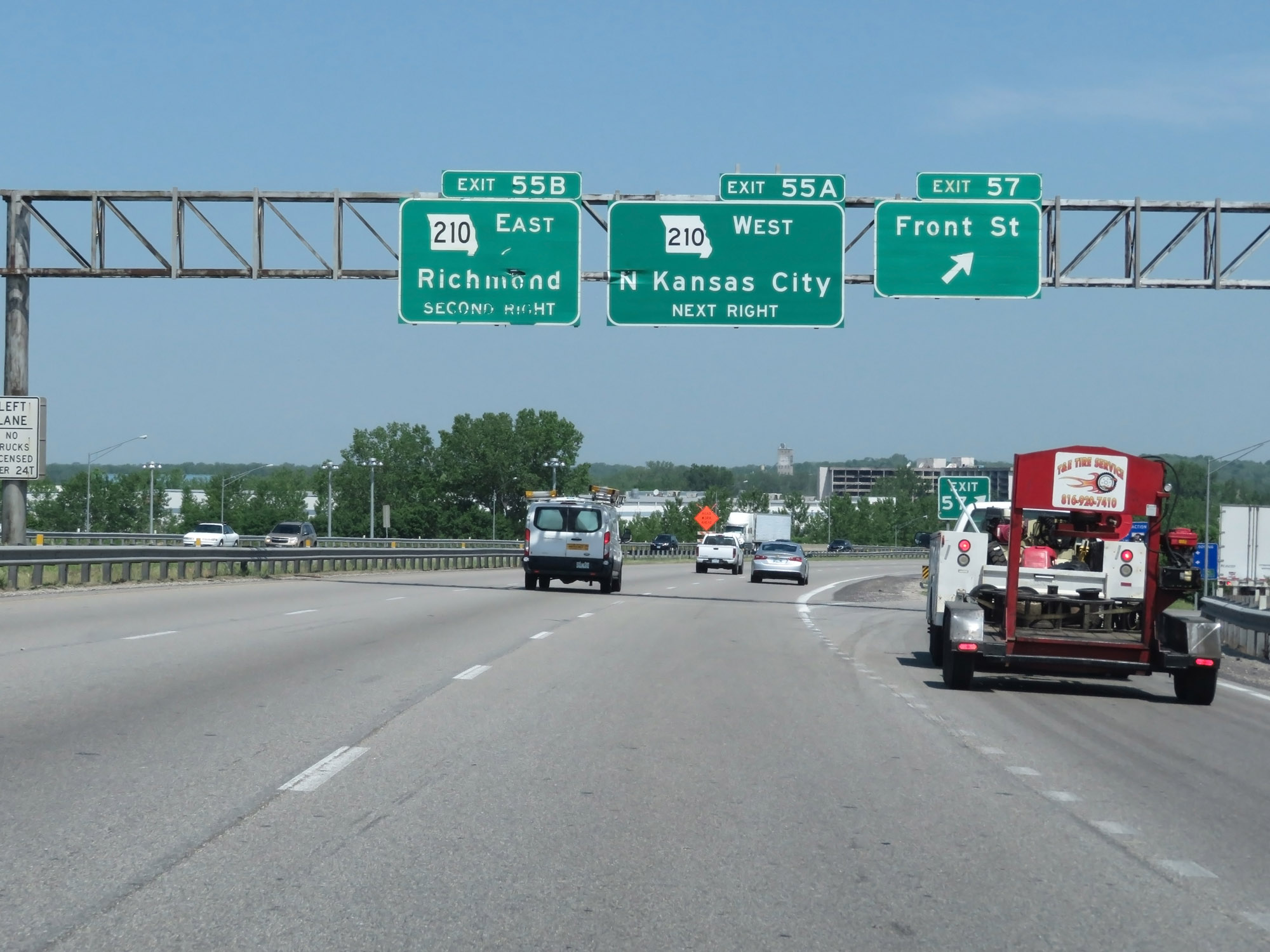
Interstate 435 Outer Loop (North) at Exits 56A-B: MO 210 - N Kansas City / Richmond (Photo taken 5/17/18). |
 |
North of Exits 56A-B, Interstate 435 Outer Loop (North) reenters the Kansas City city limits in Clay County. (Photo taken 5/17/18). |
 |
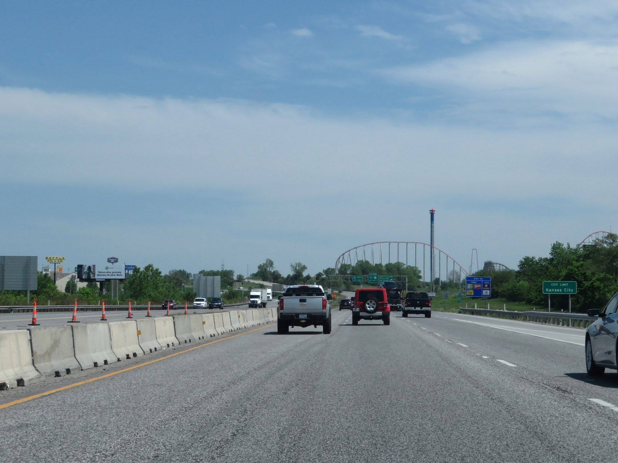
Interstate 435 Outer Loop (North) at Exit 54: Parvin Rd / 48th St (Photo taken 5/17/18). |
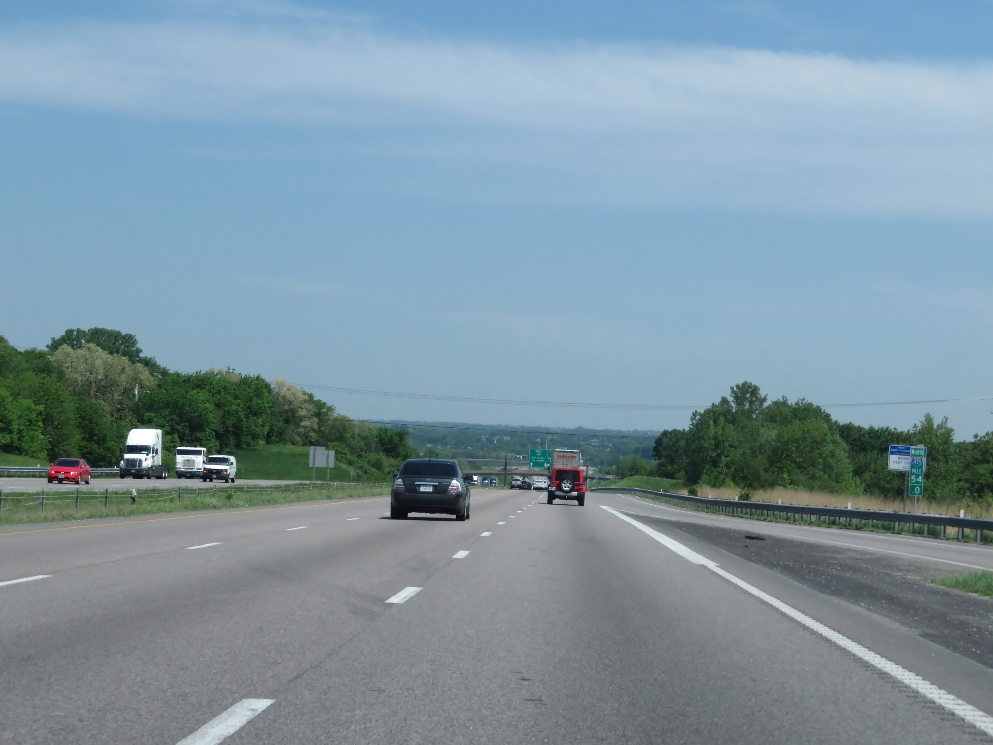 |
Interstate 435 Outer Loop (North) at mile marker 54. (Photo taken 5/17/18). |
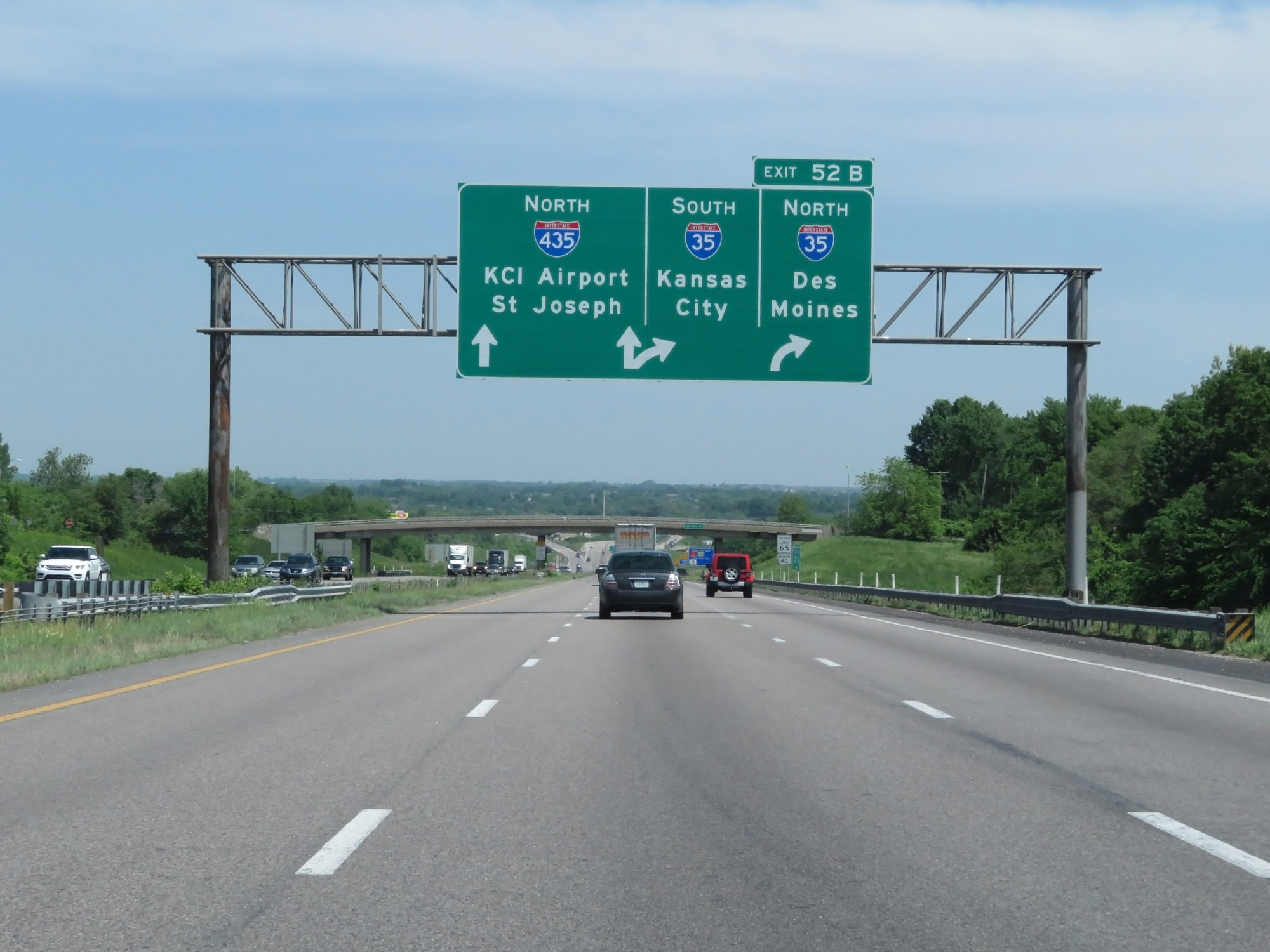 |
Interstate 435 Outer Loop (North) approaching Exit 52B - 1/2 mile. (Photo taken 5/17/18). |
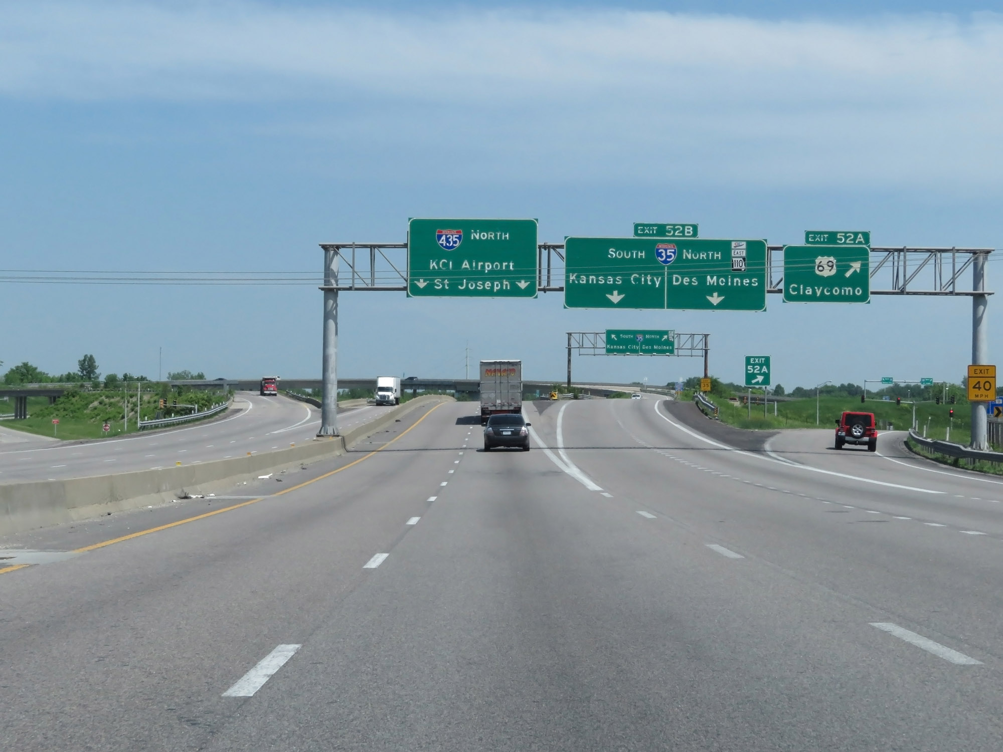 |
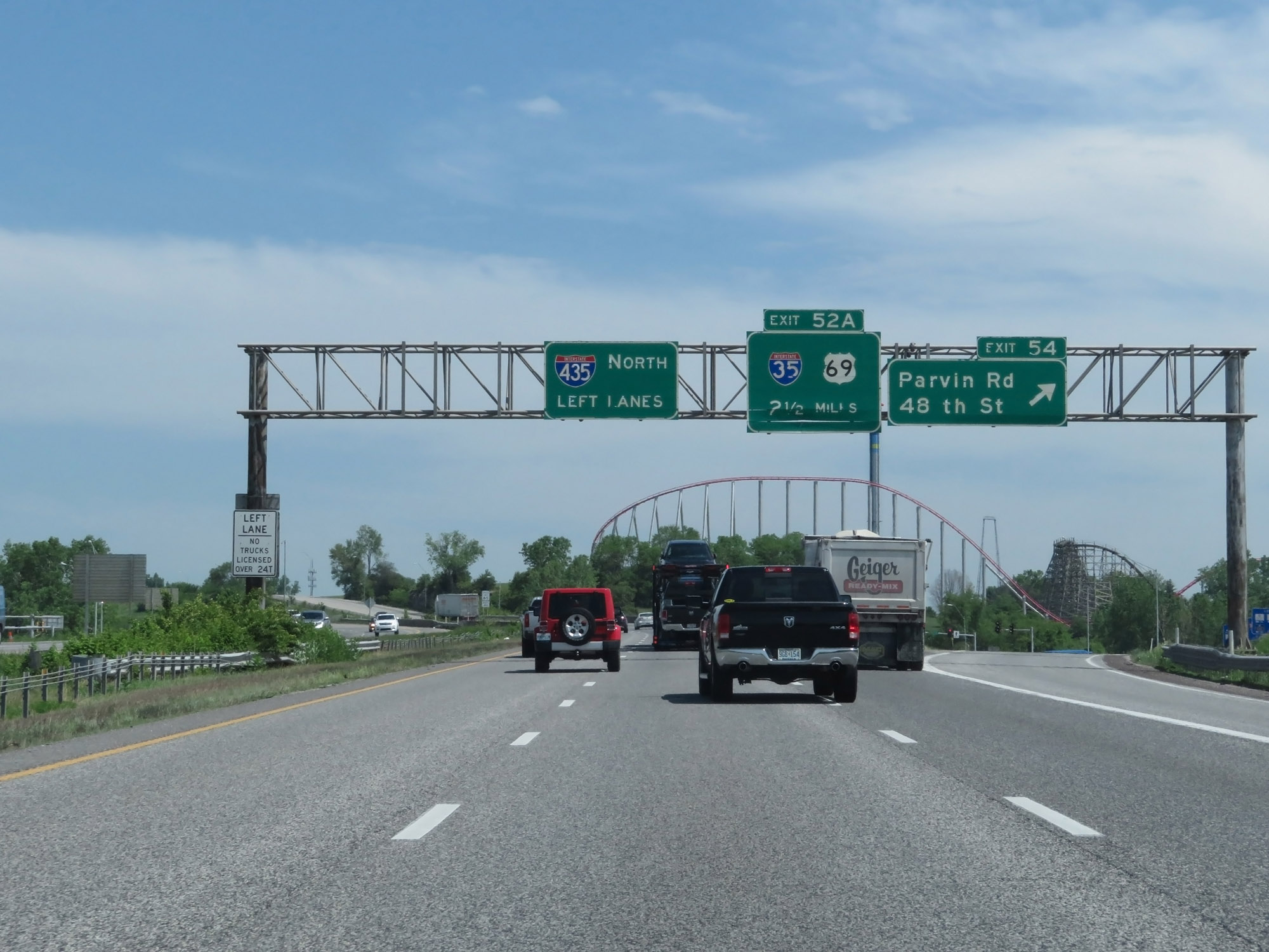
Interstate 435 Outer Loop (North) at Exit 52A: US 69 - Claycomo; Exit 52B: Interstate 35 - Des Moines / Kansas City (Photo taken 5/17/18). |
 |
Interstate 435 Outer Loop (North) at mile marker 52. (Photo taken 5/17/18). |
 |
Interstate 435 North reassurance shield. (Photo taken 5/17/18). |
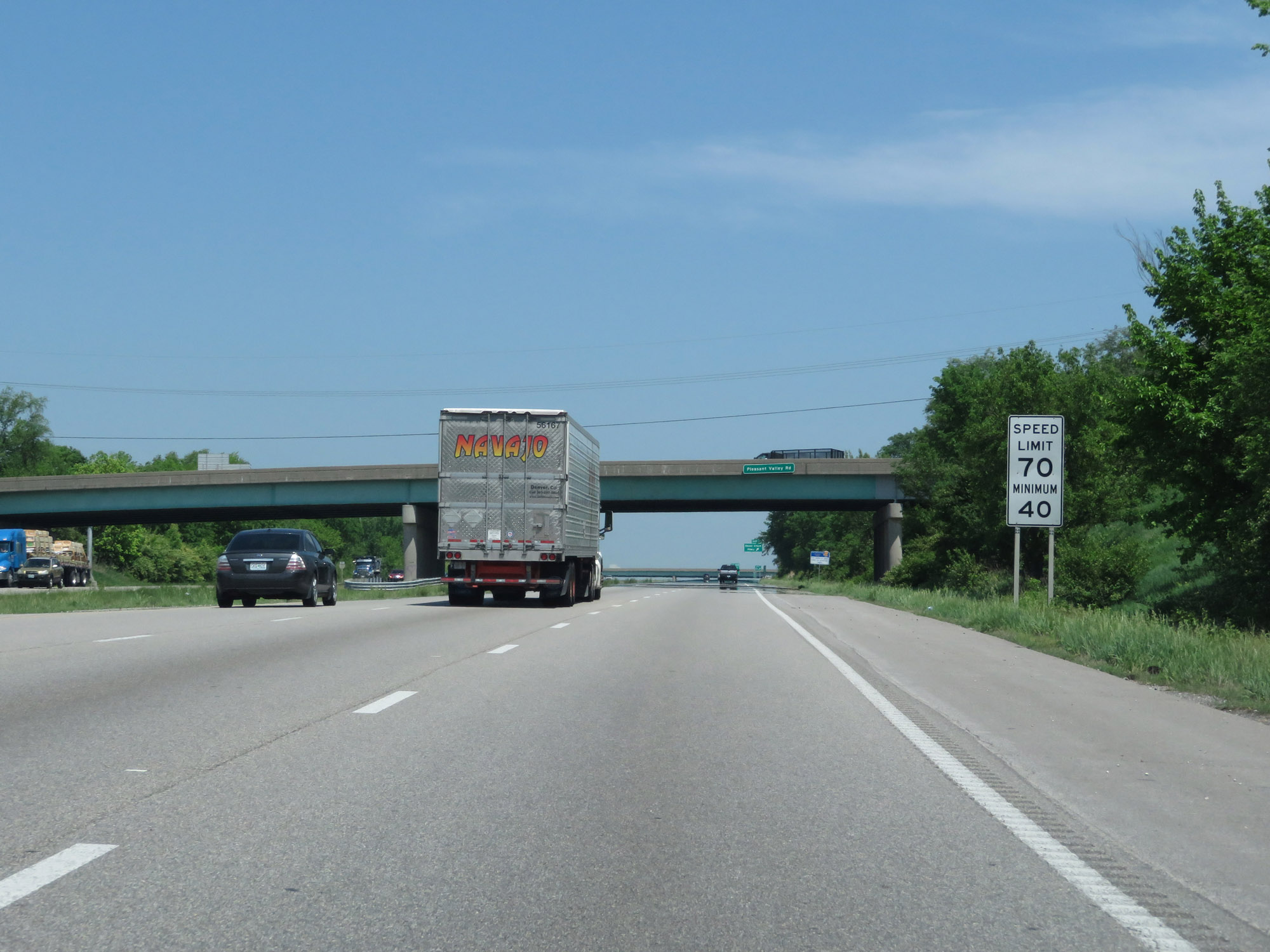 |
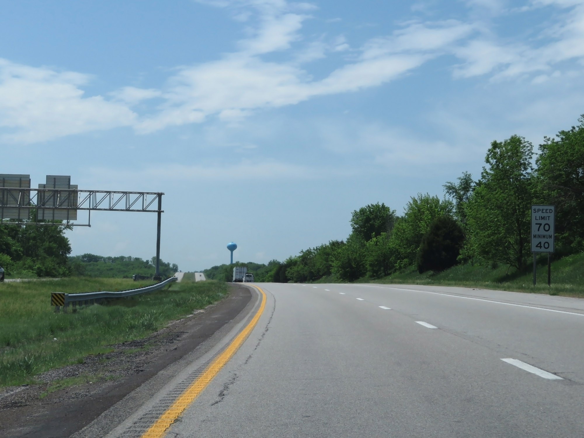
Approaching Exit 51, the maximum speed limit increases to 70 mph. The minimum speed limit remains the state-standard 40 mph. (Photo taken 5/17/18). |
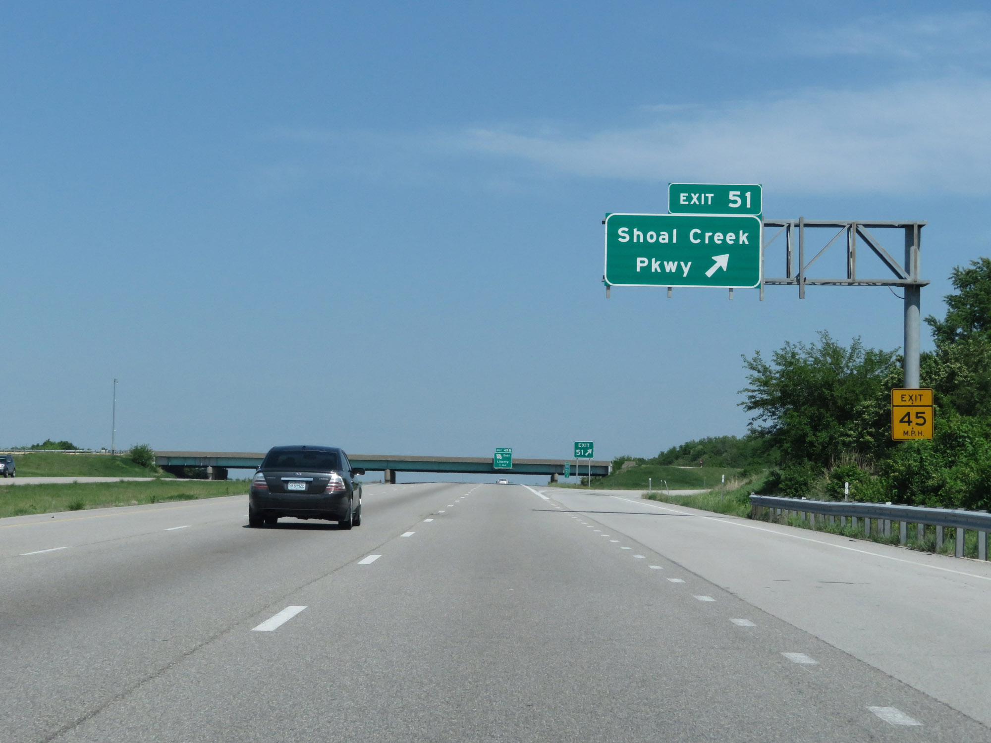 |
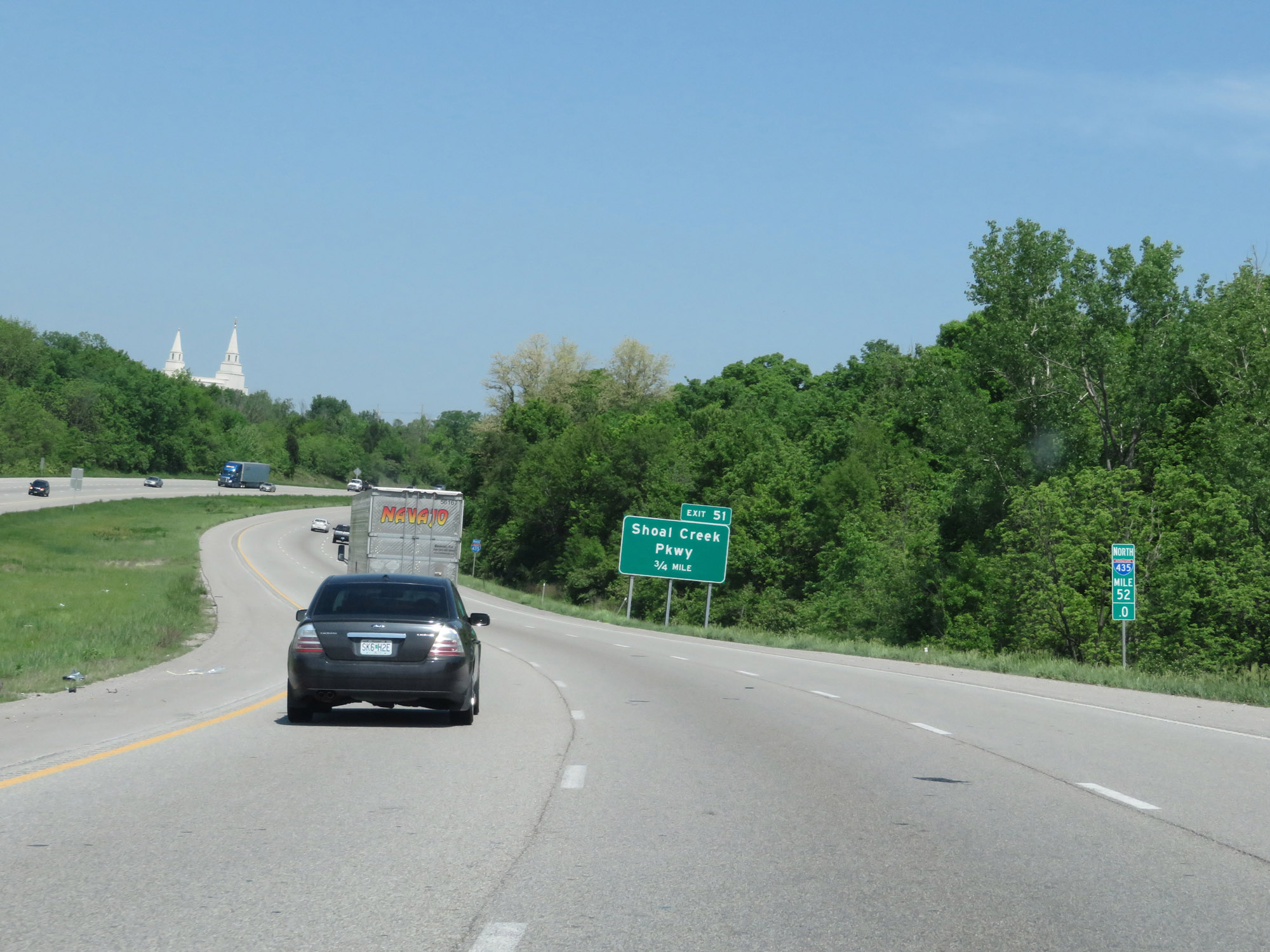
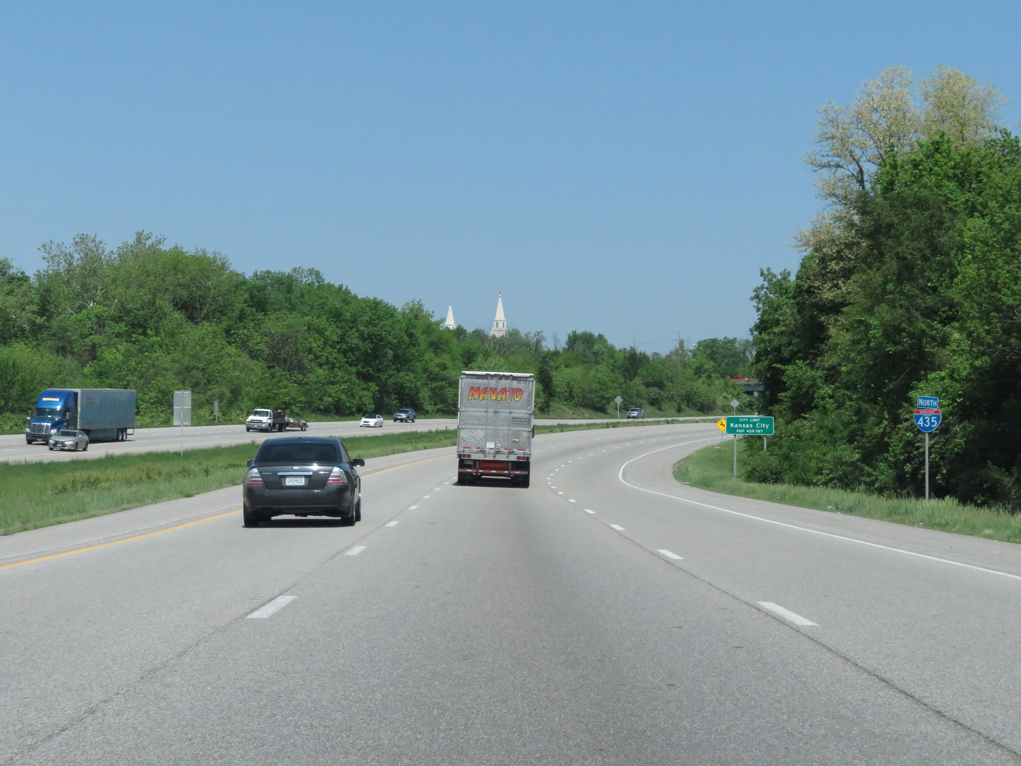
Interstate 435 Outer Loop (North) at Exit 51: Shoal Creek Pkwy (Photo taken 5/17/18). |
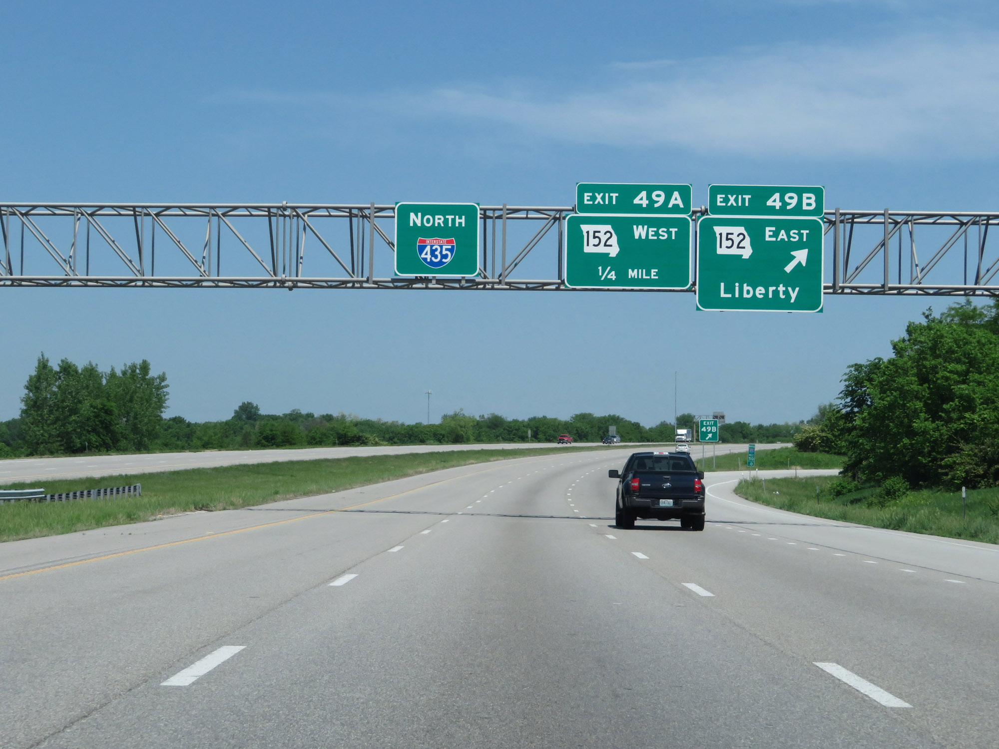 |
Interstate 435 Outer Loop (North) at Exit 49B: MO 152 East - Liberty (Photo taken 5/17/18). |
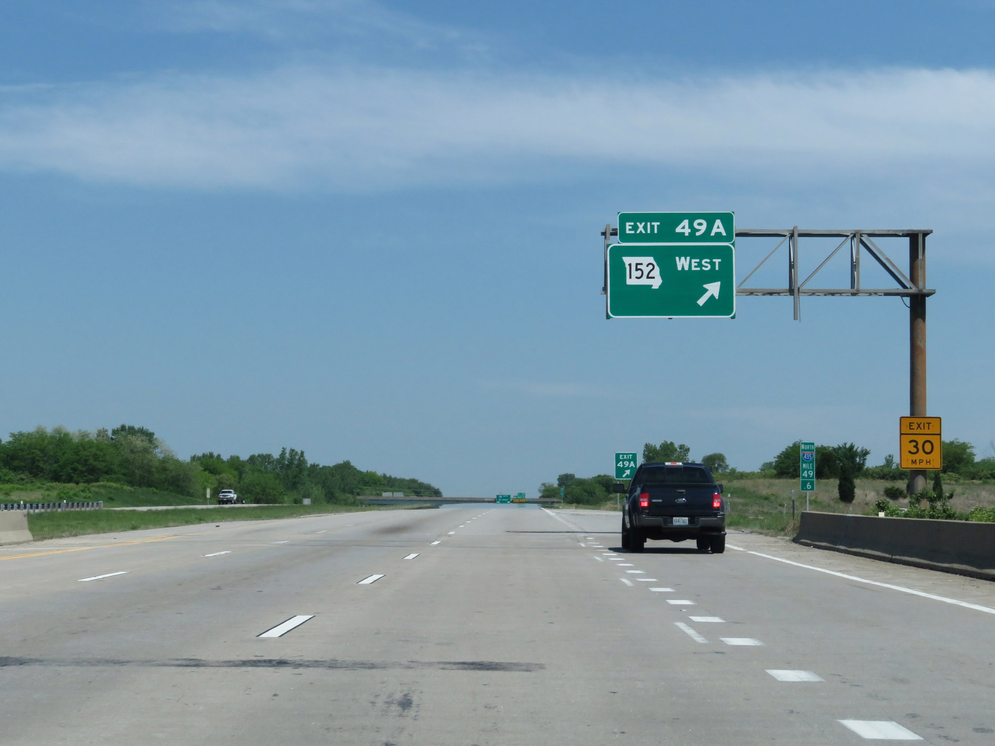 |
Interstate 435 Outer Loop (North) at Exit 49A: MO 152 West (Photo taken 5/17/18). |
 |
Interstate 435 Outer Loop (North) at Exit 47: NE 96th St (Photo taken 5/17/18). |
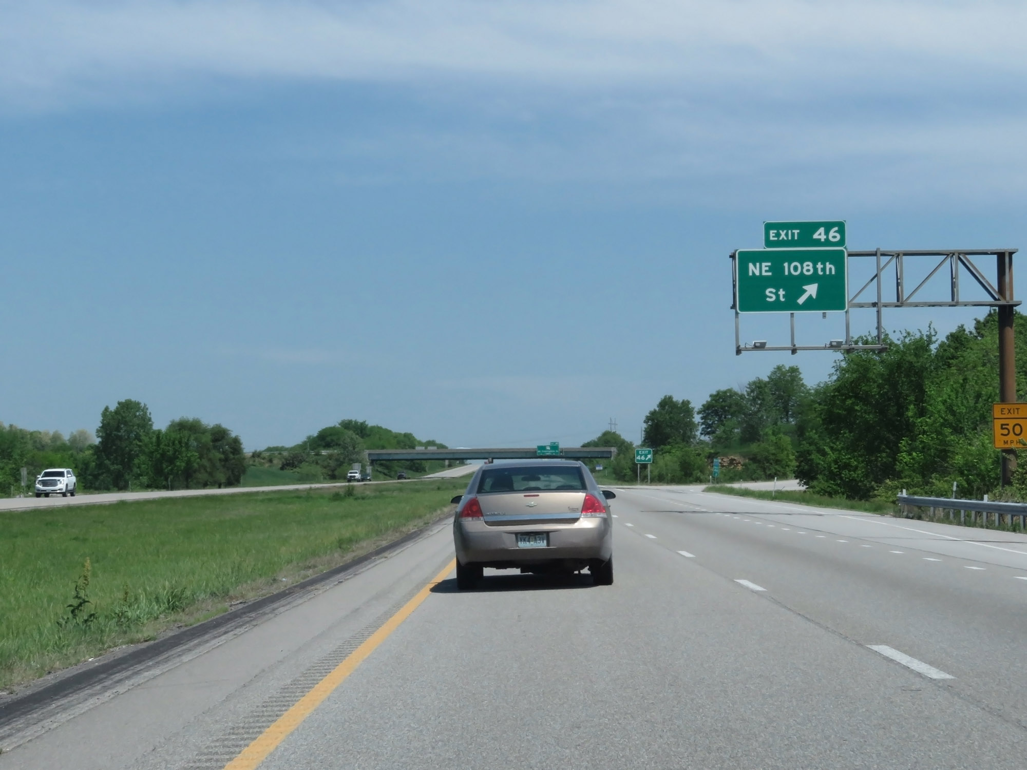 |
Interstate 435 Outer Loop (North) at Exit 46: NE 108th St (Photo taken 5/17/18). |
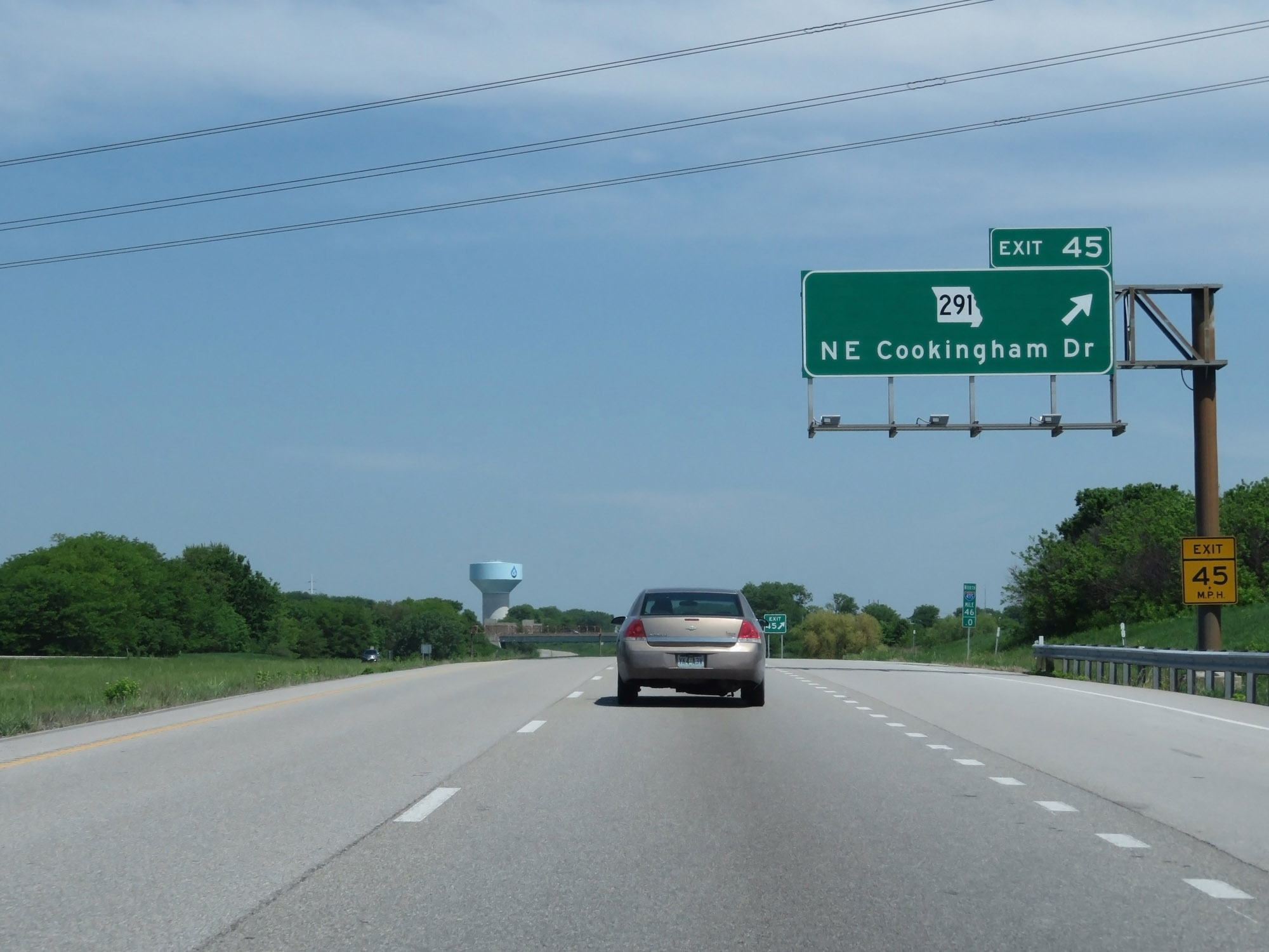 |
Interstate 435 Outer Loop (North) at Exit 45: MO 291 - NE Cookingham Dr (Photo taken 5/17/18). |
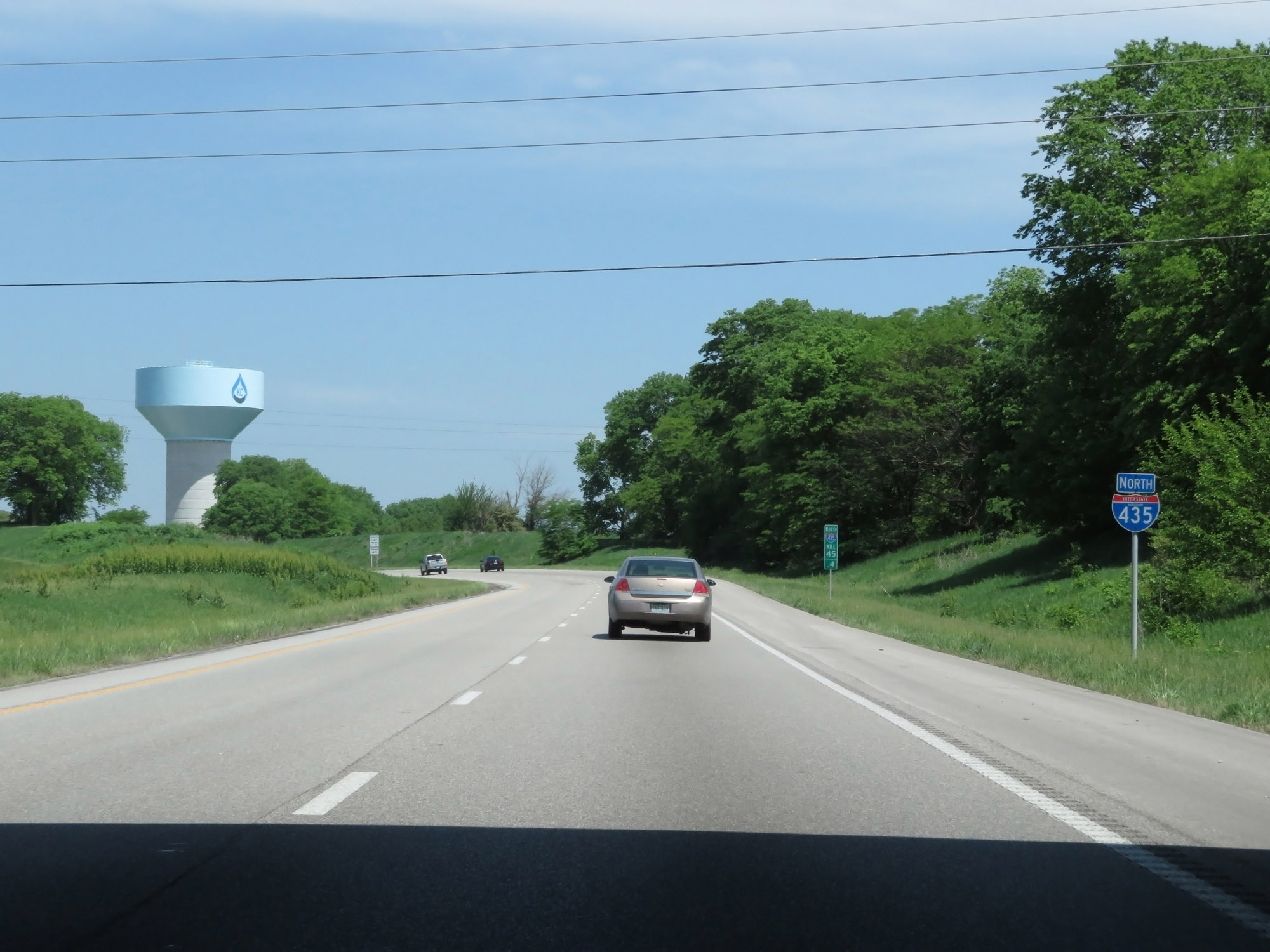 |
Interstate 435 North reassurance shield at mile marker 45.4, just before it curves to the west in the northeastern reaches of the Kansas City city limits. (Photo taken 5/17/18). |
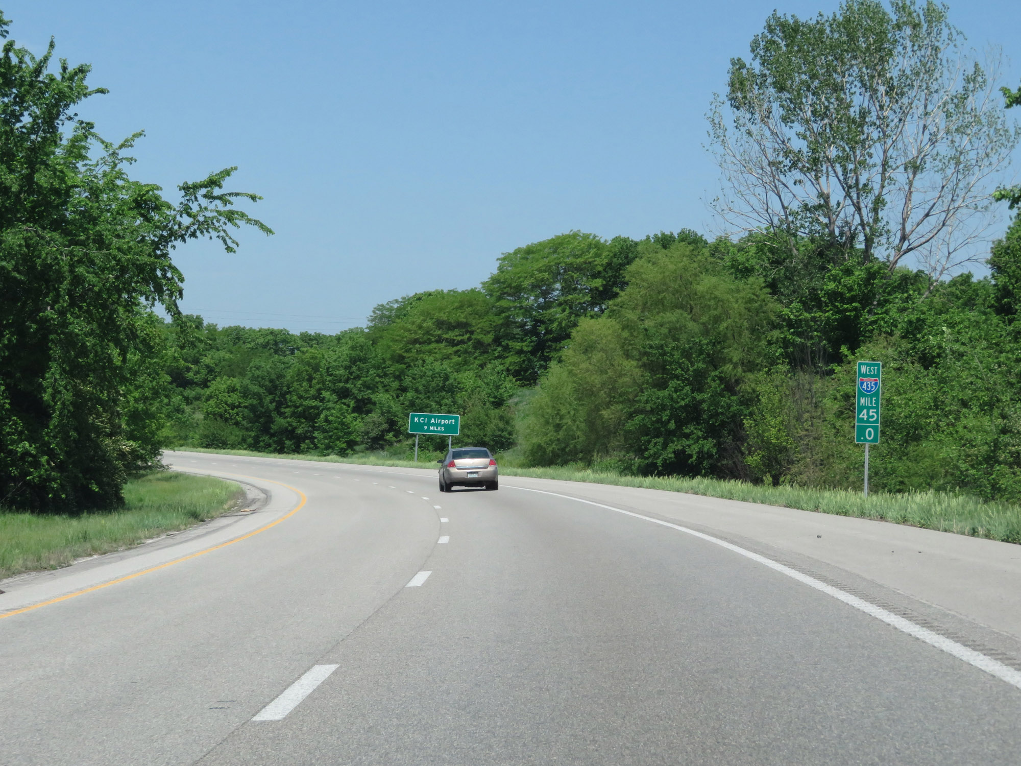 |
Interstate 435 Outer Loop (North) begins its curve to the west at mile marker 45, seen here. (Photo taken 5/17/18). |
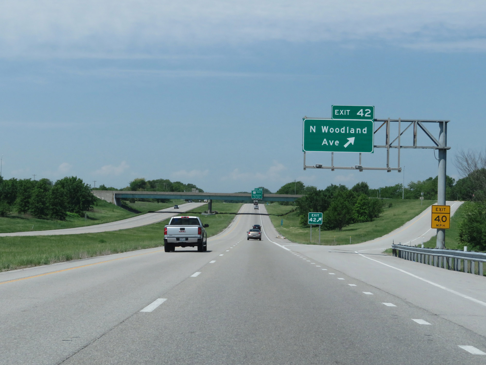 |
Interstate 435 Outer Loop (West) at Exit 42: N Woodland Ave (Photo taken 5/17/18). |
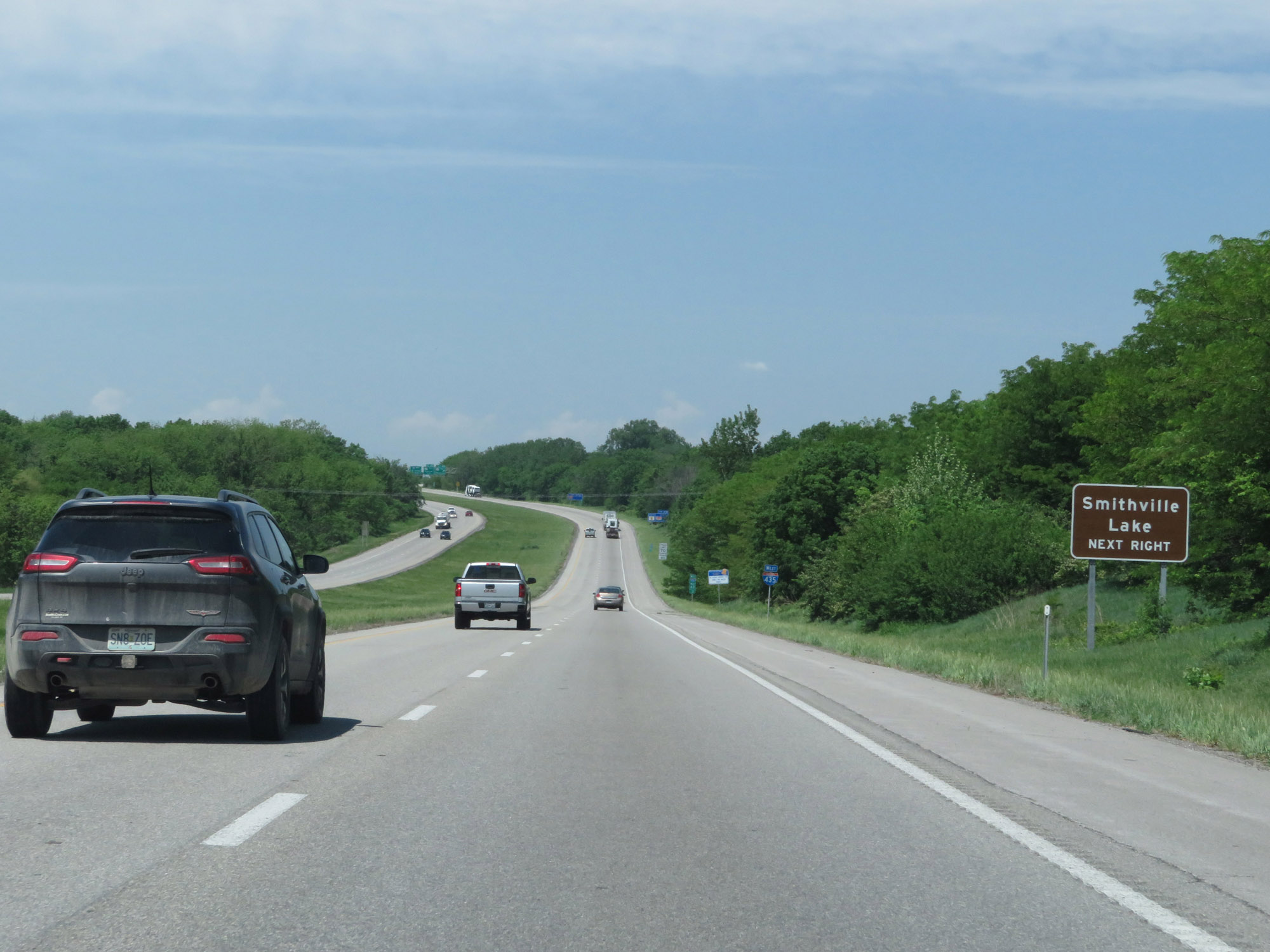 |
Take Exit 41B to Smithville Lake. (Photo taken 5/17/18). |
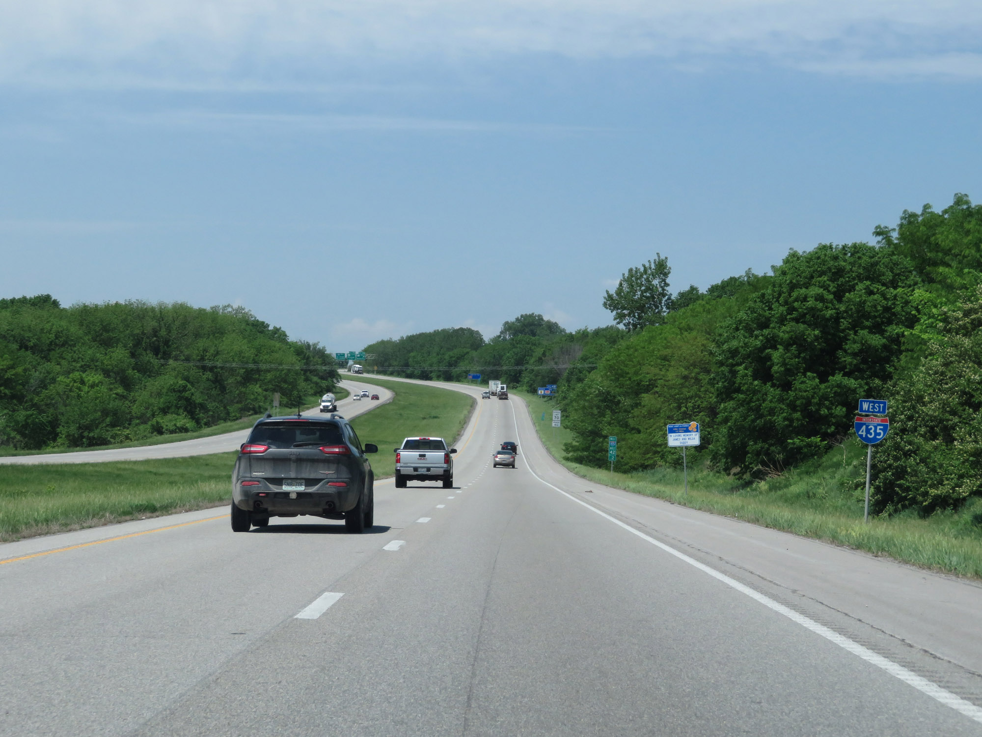 |
State-named Interstate 435 West reassurance shield. (Photo taken 5/17/18). |
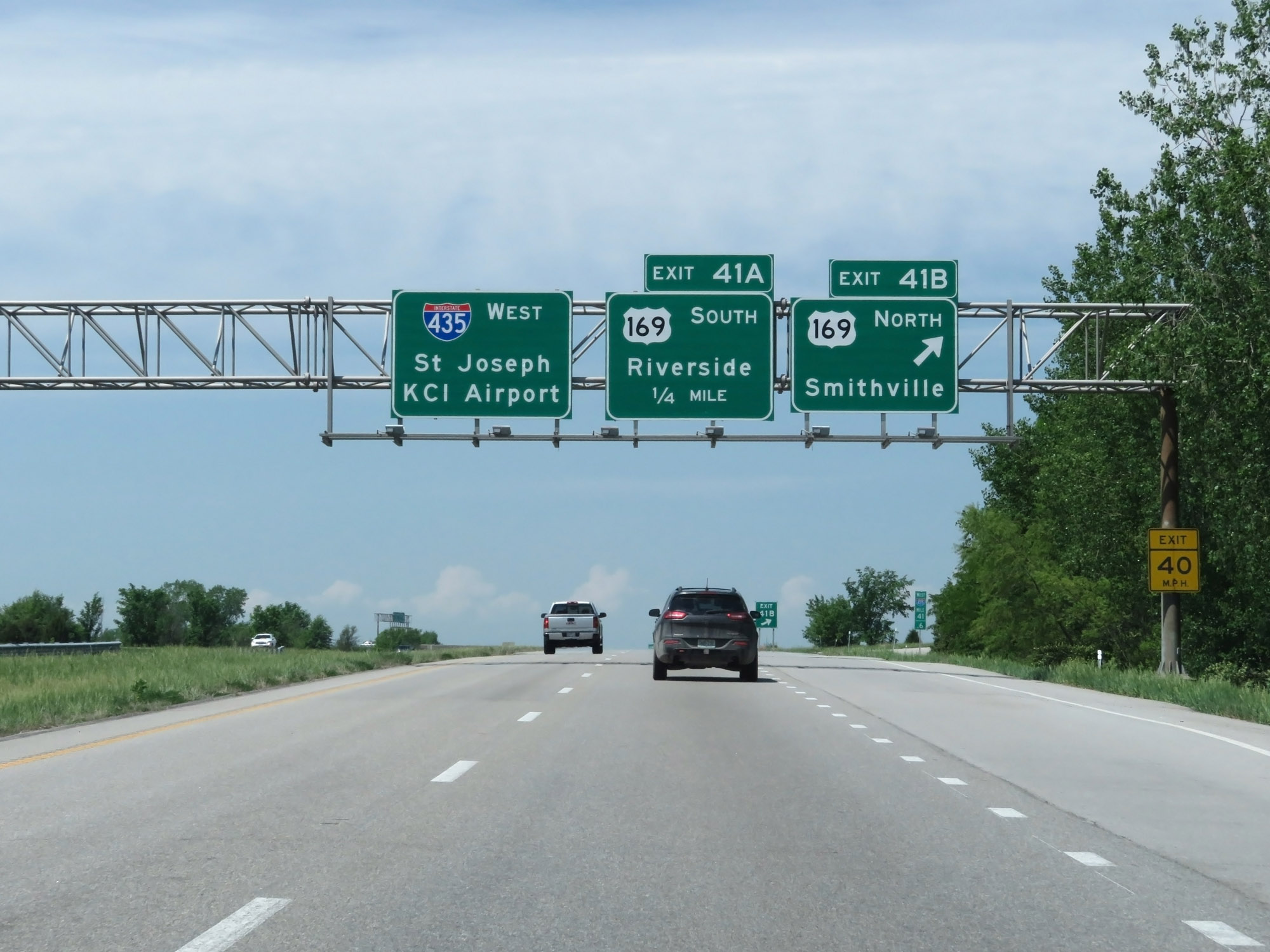 |
Interstate 435 Outer Loop (West) at Exit 41B: US 169 North - Smithville (Photo taken 5/17/18). |
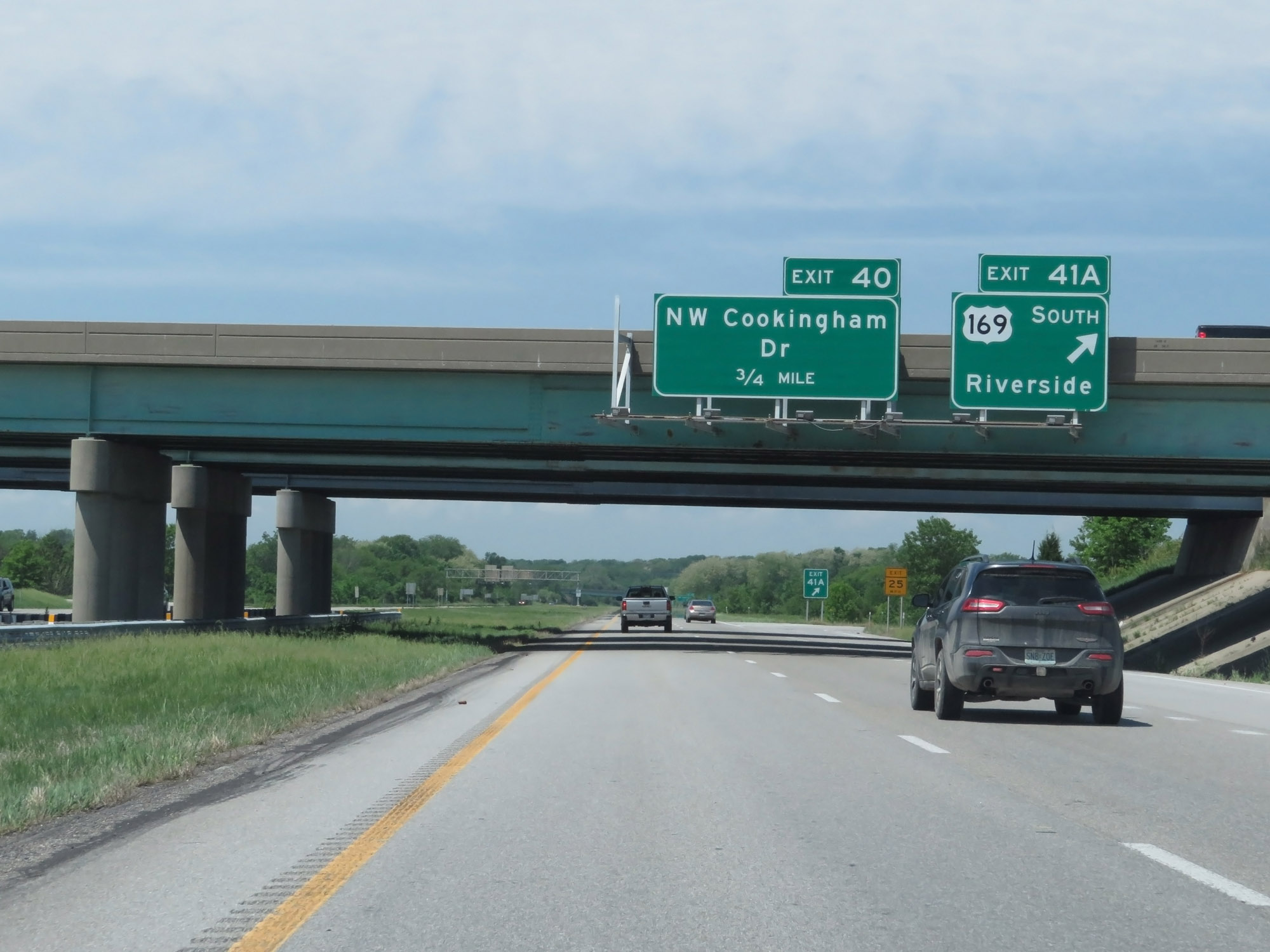 |
Interstate 435 Outer Loop (West) at Exit 41A: US 169 South - Riverside (Photo taken 5/17/18). |
 |
Interstate 435 Outer Loop (West) at Exit 40: NW Cookingham Dr (Photo taken 5/17/18). |
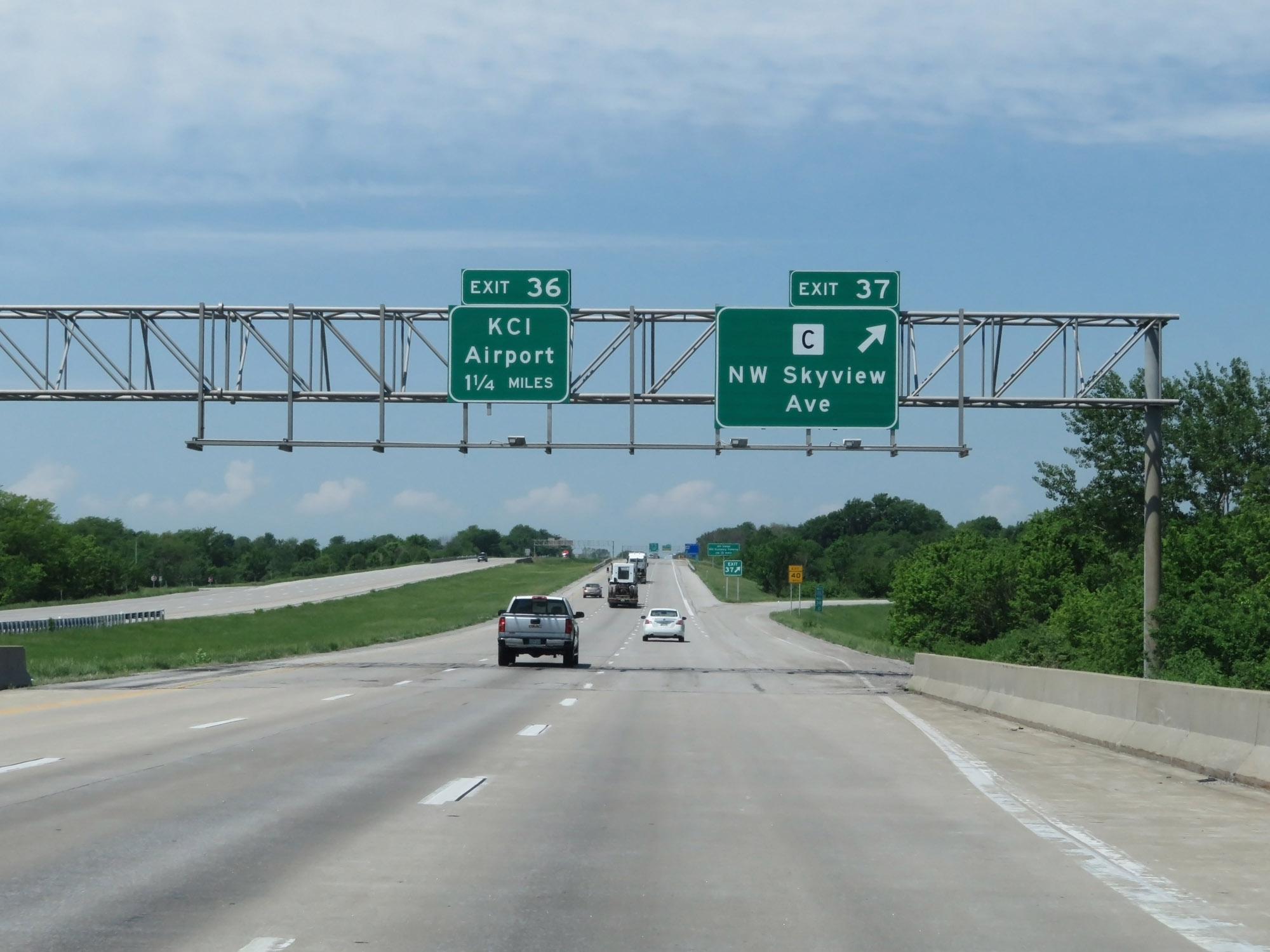 |
Interstate 435 Outer Loop (West) at Exit 37: Route C - NW Skyview Ave (Photo taken 5/17/18). |
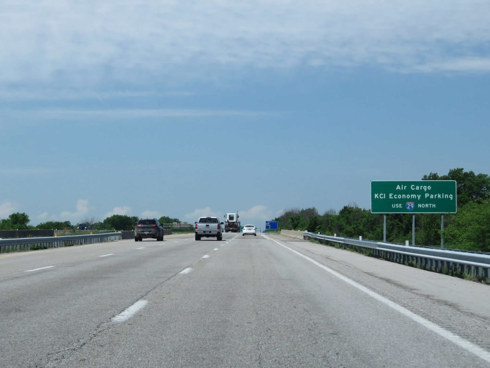 |
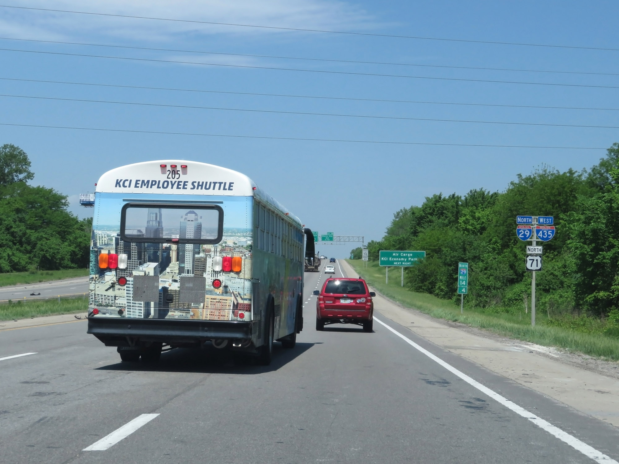
Follow Interstate 29 North to KCI Airport's Air Cargo area and Economy Parking. (Photo taken 5/17/18). |
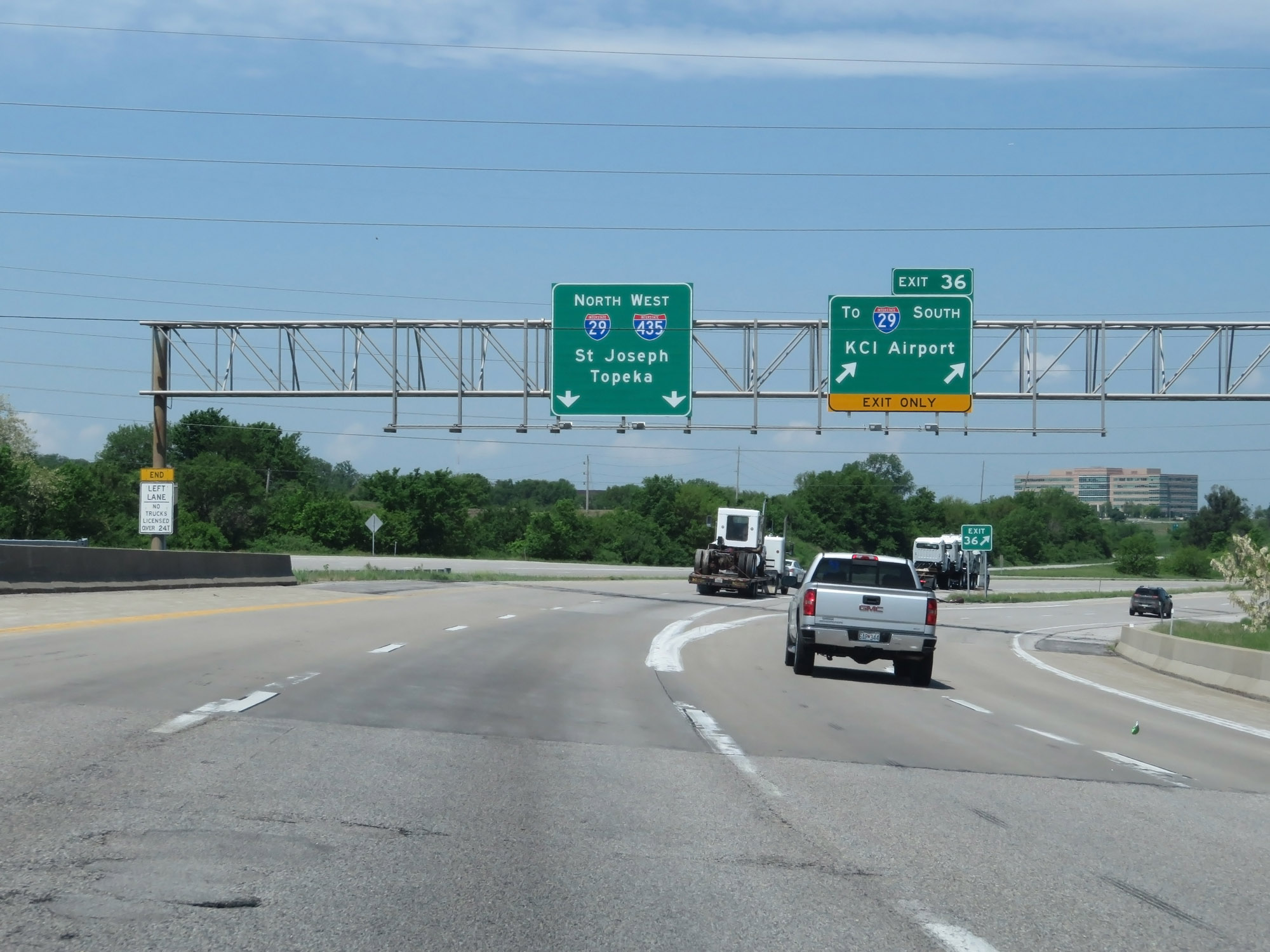 |
Interstate 435 Outer Loop (West) at Exit 36: To Interstate 29 South - KCI Airport (Photo taken 5/17/18). |
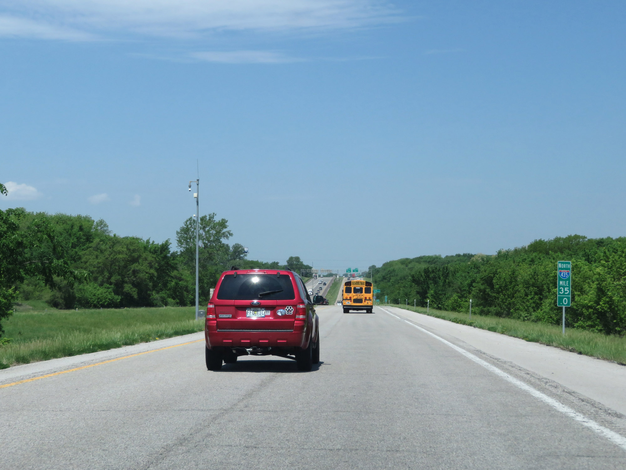 |
At mile marker 35, Interstate 435 Outer Loop (West) is briefly reduced to one lane as it prepares to merge into the northbound lanes of Interstate 29. I-435 and I-29 will run concurrently for a brief distance. (Photo taken 5/17/18). |
 |
State-named Interstate 435 West / Interstate 29 North reassurance shields at mile marker 14.4. During this concurrency, the mileage and exit numbers are based on those of Interstate 29. (Photo taken 5/17/18). |
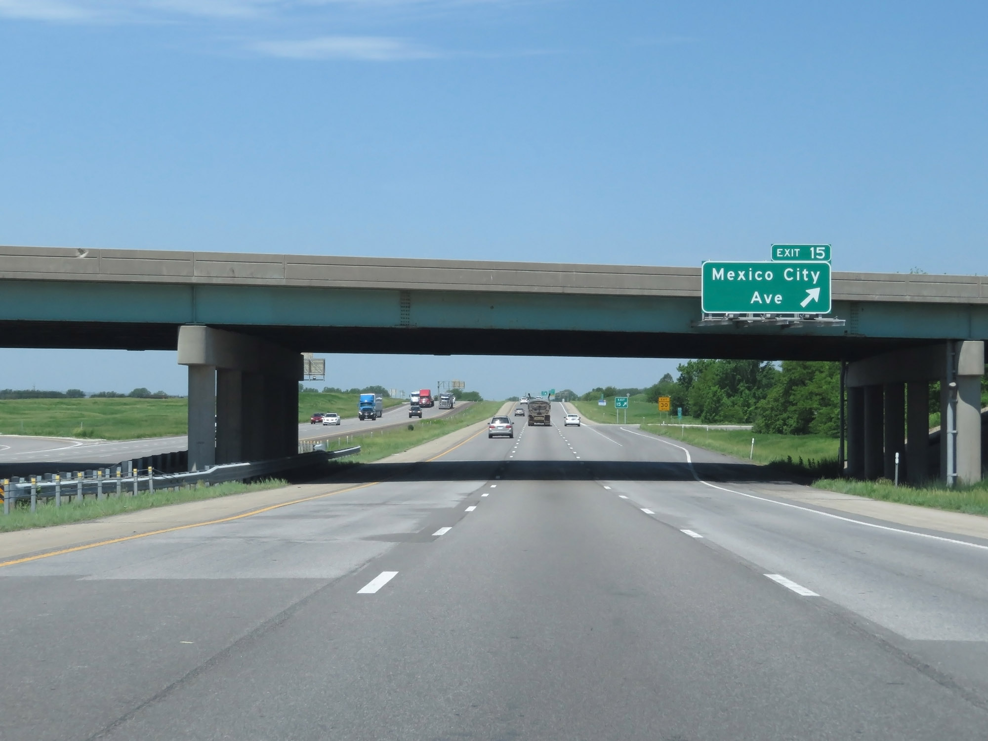 |
Interstate 435 Outer Loop (West) / Interstate 29 North at Exit 15: Mexico City Ave (Photo taken 5/17/18). |
 |
Interstate 435 Outer Loop (West) / Interstate 29 North approaching Exit 17 - 1 mile. (Photo taken 5/17/18). |
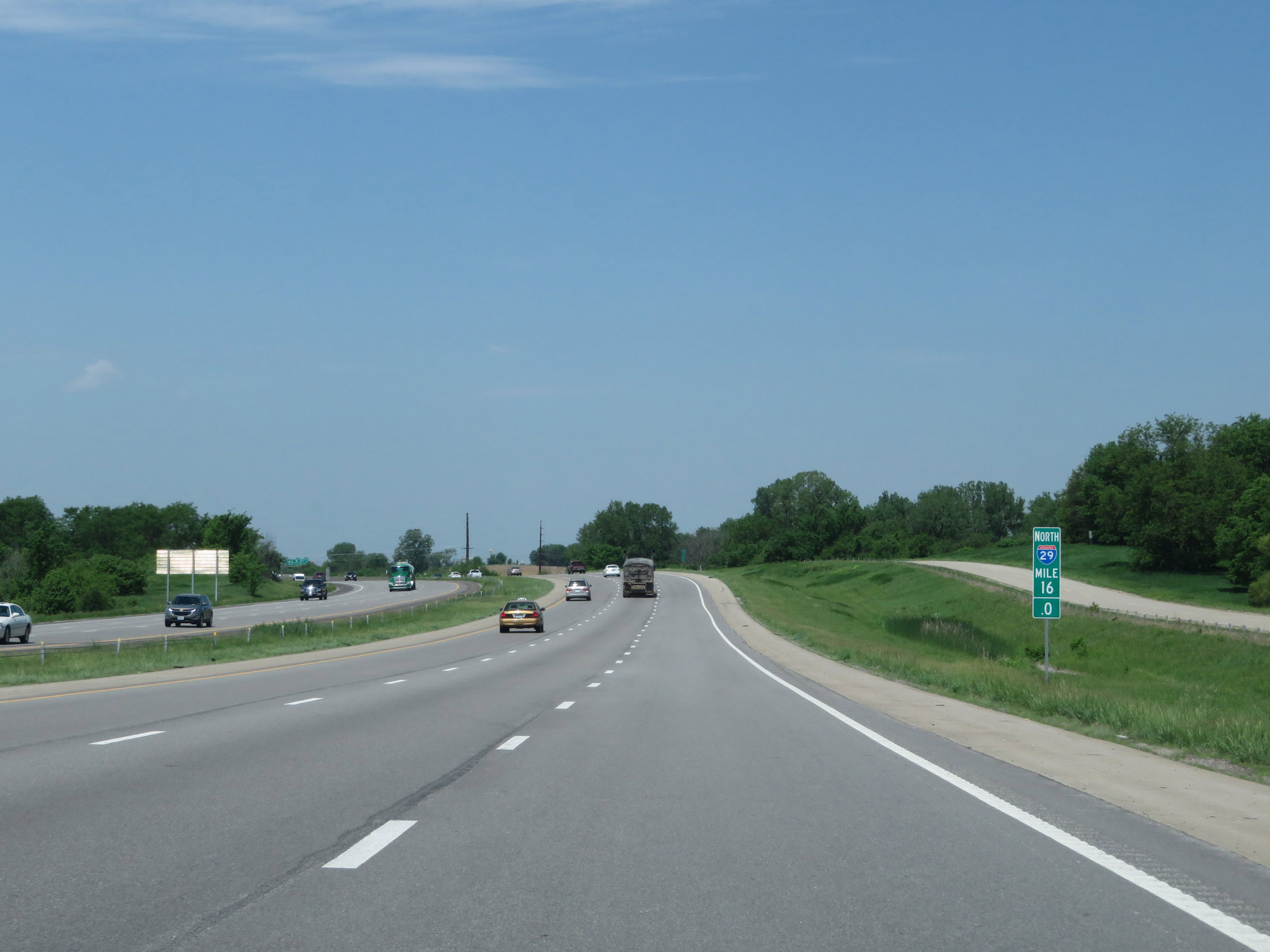 |
Interstate 435 Outer Loop (West) / Interstate 29 North at mile marker 16. (Photo taken 5/17/18). |
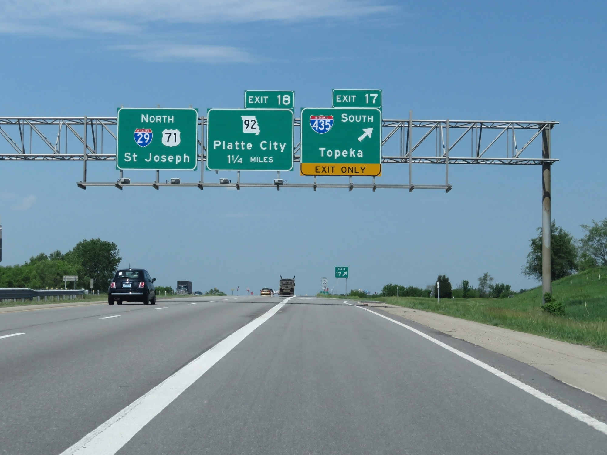 |
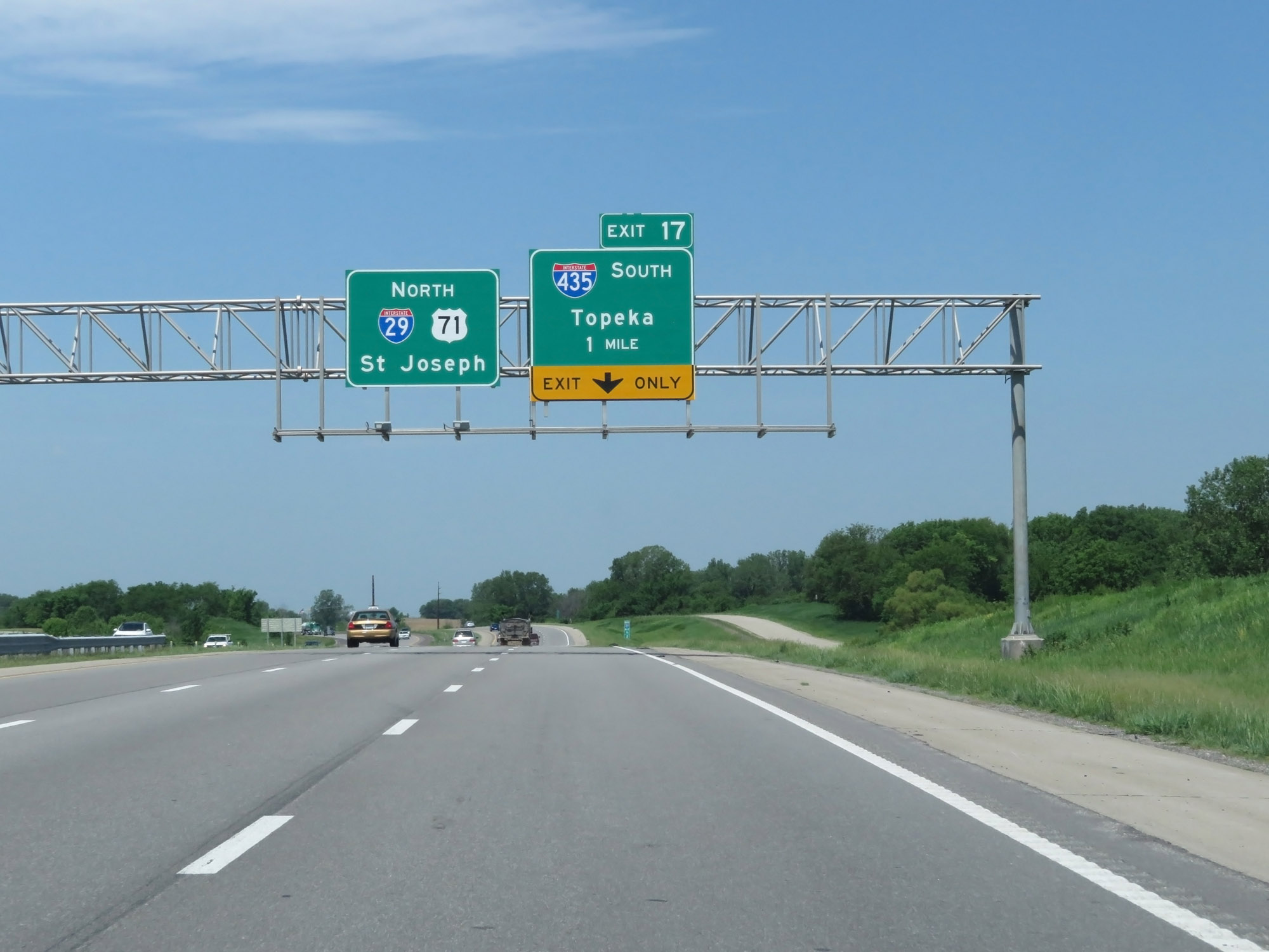
Interstate 435 Outer Loop (West) / Interstate 29 North at Exit 17: Interstate 435 South - Topeka (Photo taken 5/17/18). |
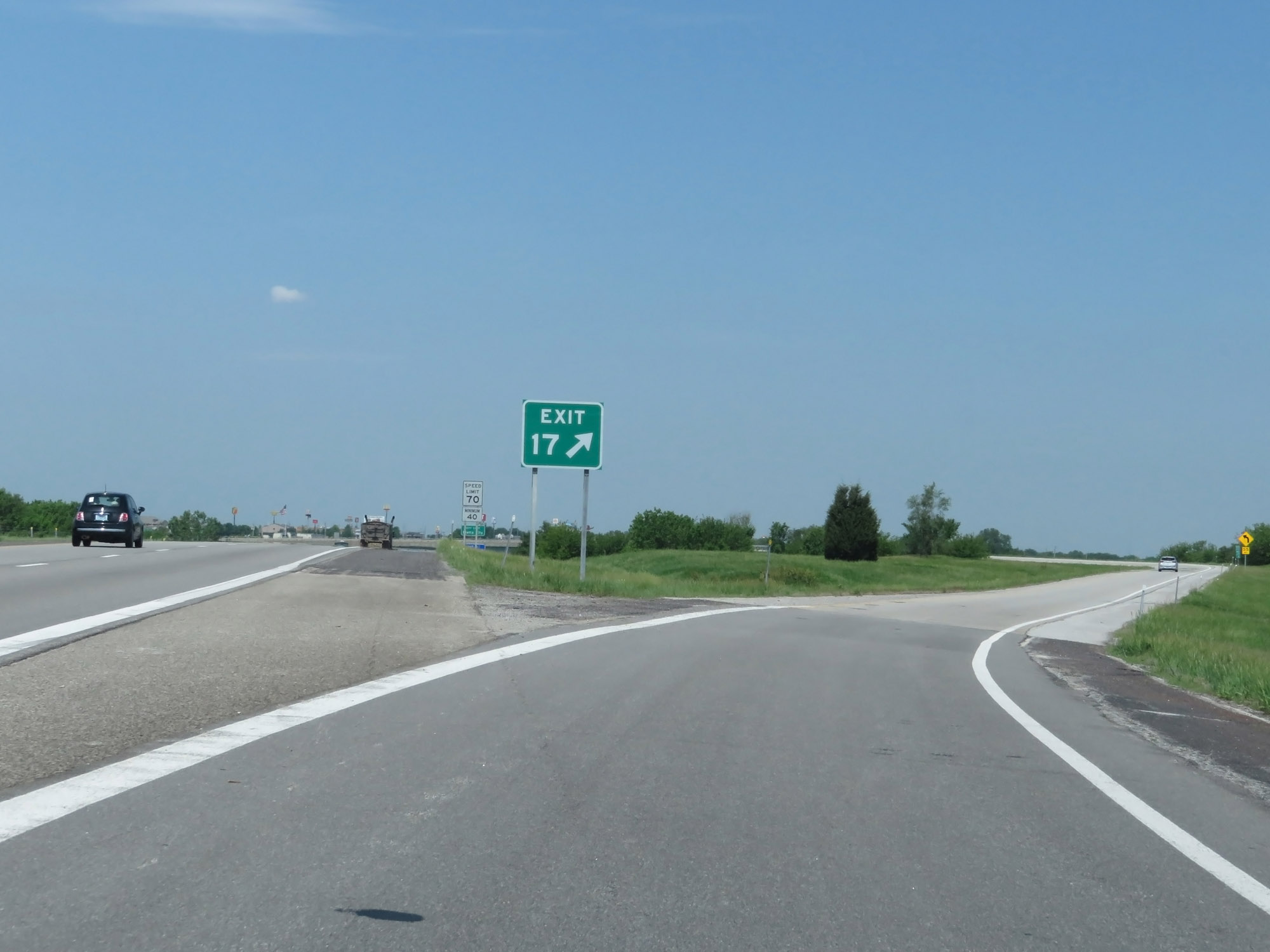 |
View of the ramp for Exit 17, which you must take to remain on Interstate 435 Outer Loop (West). (Photo taken 5/17/18). |
 |
Interstate 435 Outer Loop (South) at mile marker 31.8, still on the ramp from Exit 17 off Interstate 29. (Photo taken 5/17/18). |
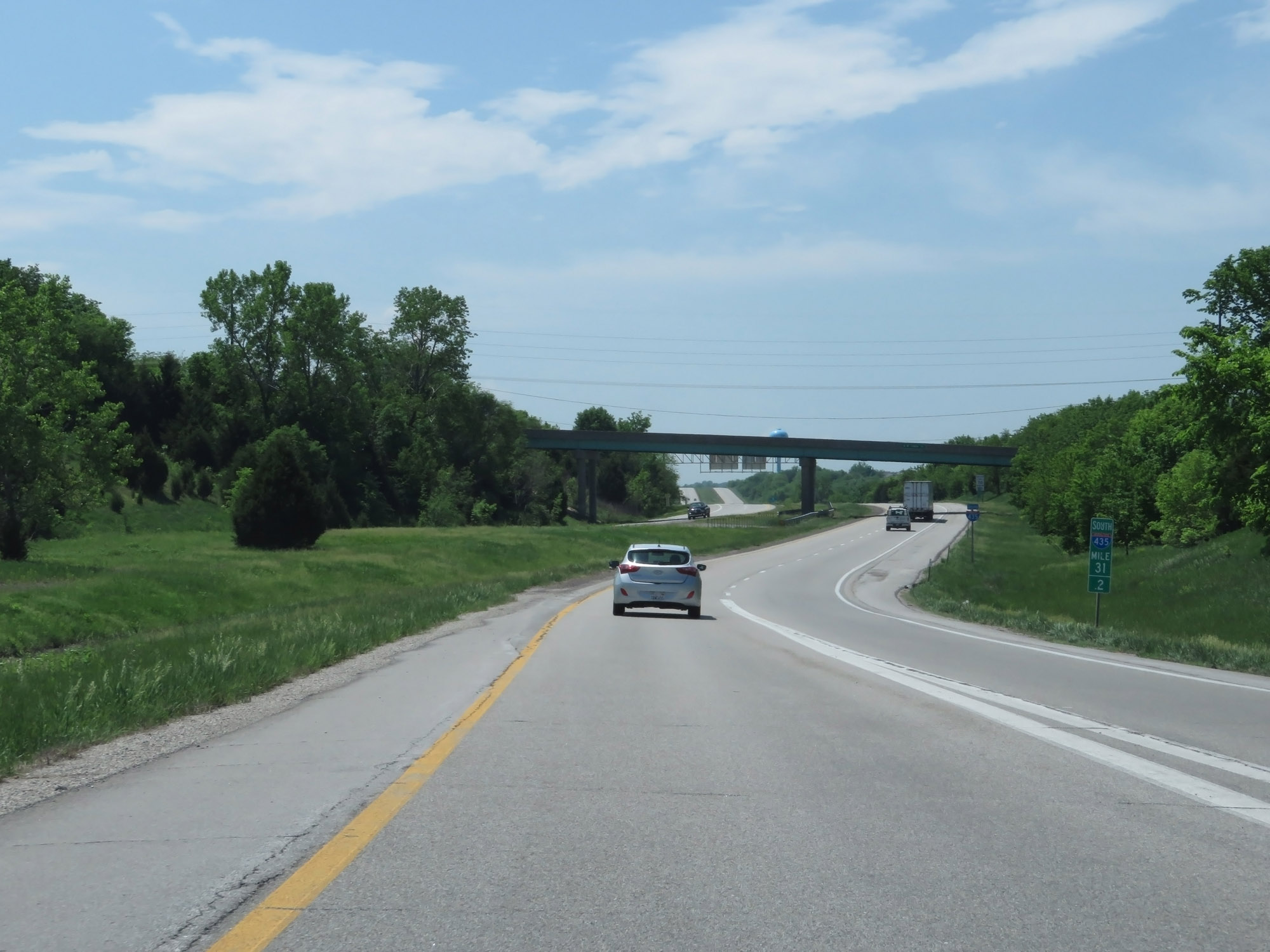 |
Interstate 435 Outer Loop (South) at mile marker 31.2, as the ramp from Interstate 29 South joins on the right to become two lanes once again. (Photo taken 5/17/18). |
 |
State-named Interstate 435 South reassurance shield. (Photo taken 5/17/18). |
 |
The speed limits remain 70 mph maximum and 40 mph minimum. (Photo taken 5/17/18). |
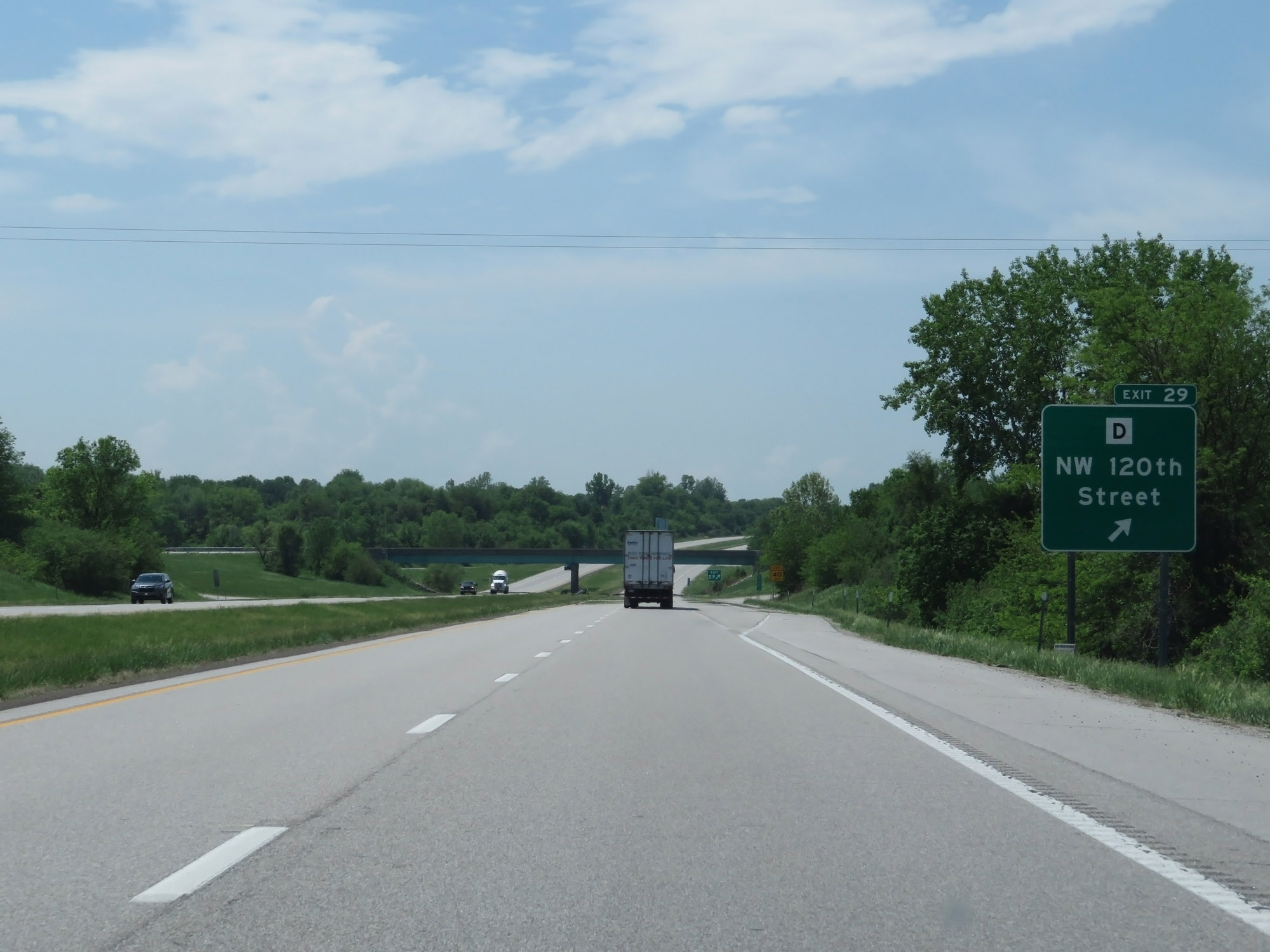 |
Interstate 435 Outer Loop (South) at Exit 29: Route D - NW 120th Street (Photo taken 5/17/18). |
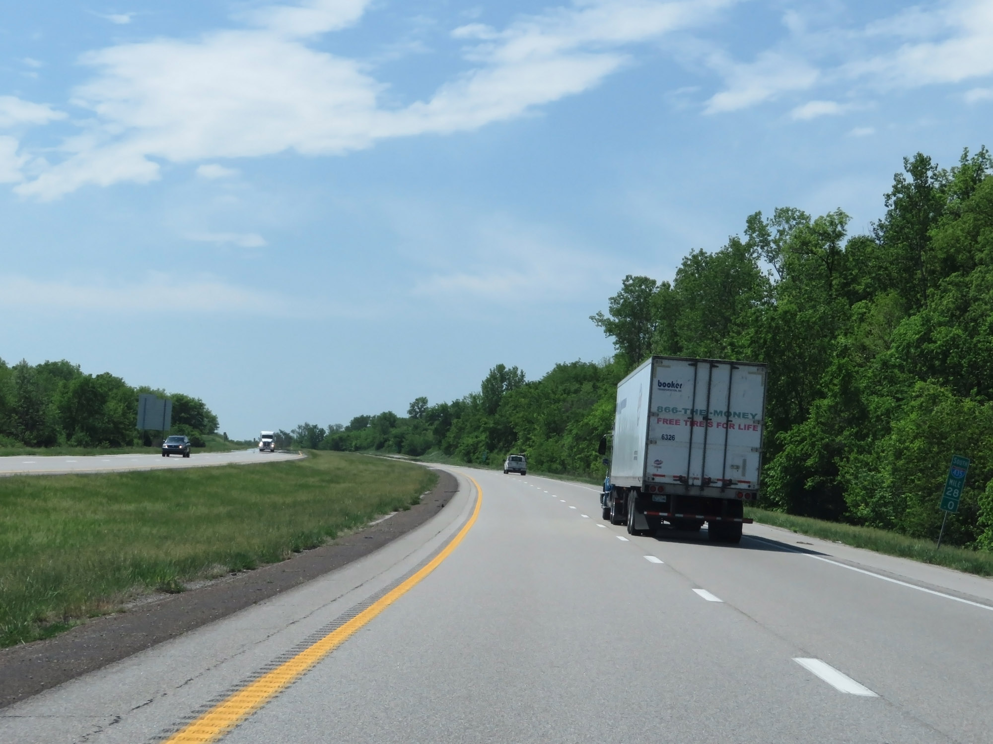 |
Interstate 435 Outer Loop (South) at mile marker 28. (Photo taken 5/17/18). |
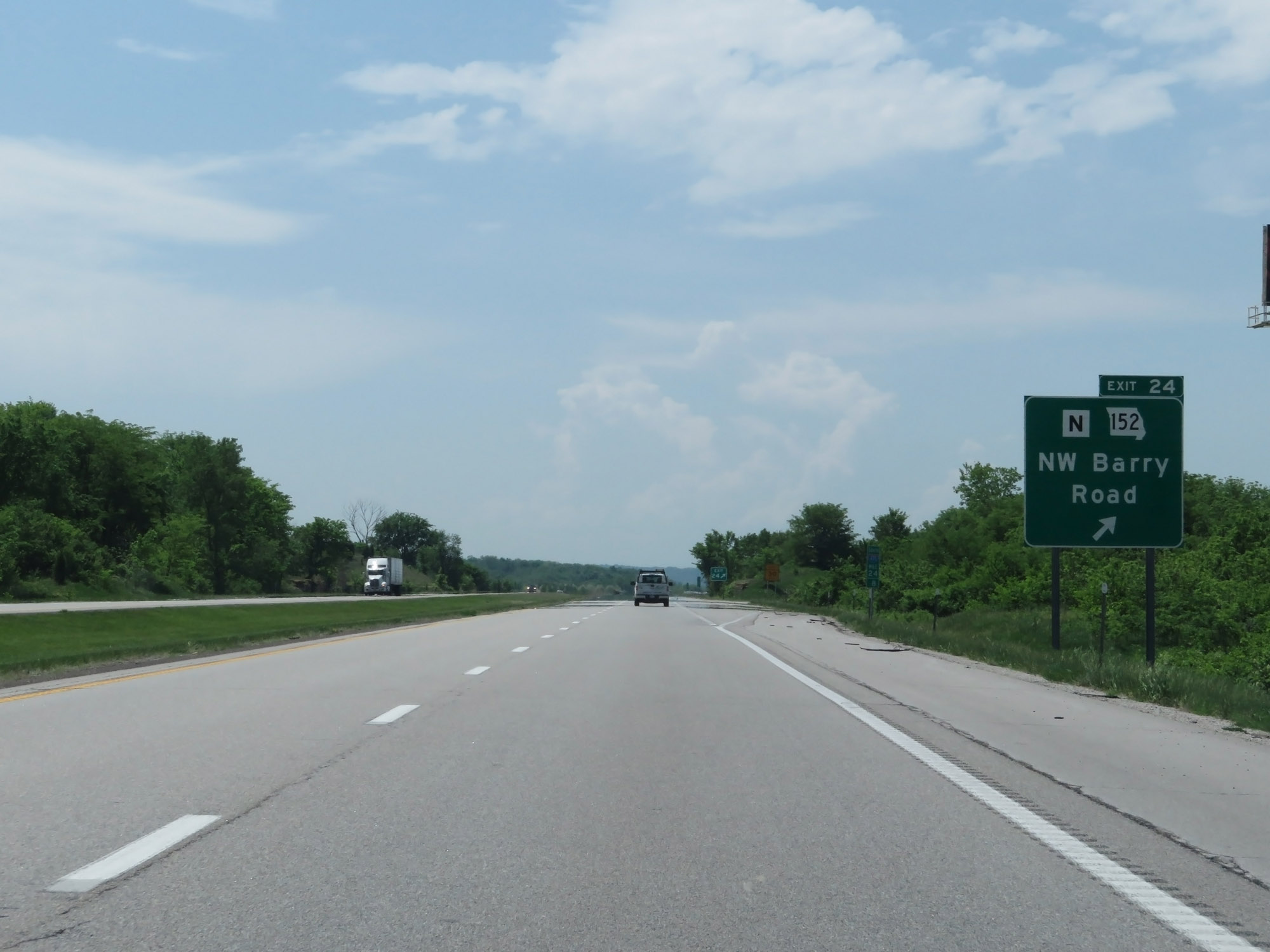 |
Interstate 435 Outer Loop (South) at Exit 24: Route N / MO 152 - NW Barry Road (Photo taken 5/17/18). |
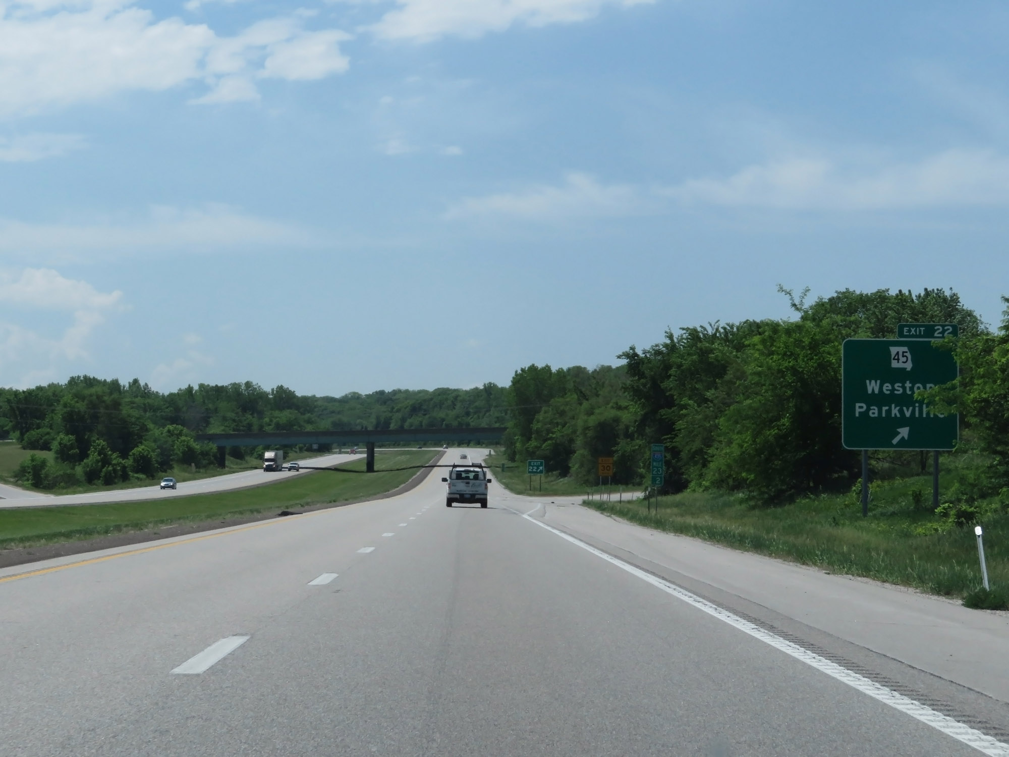 |
Interstate 435 Outer Loop (South) at Exit 22: MO 45 - Weston / Parkville (Photo taken 5/17/18). |
 |
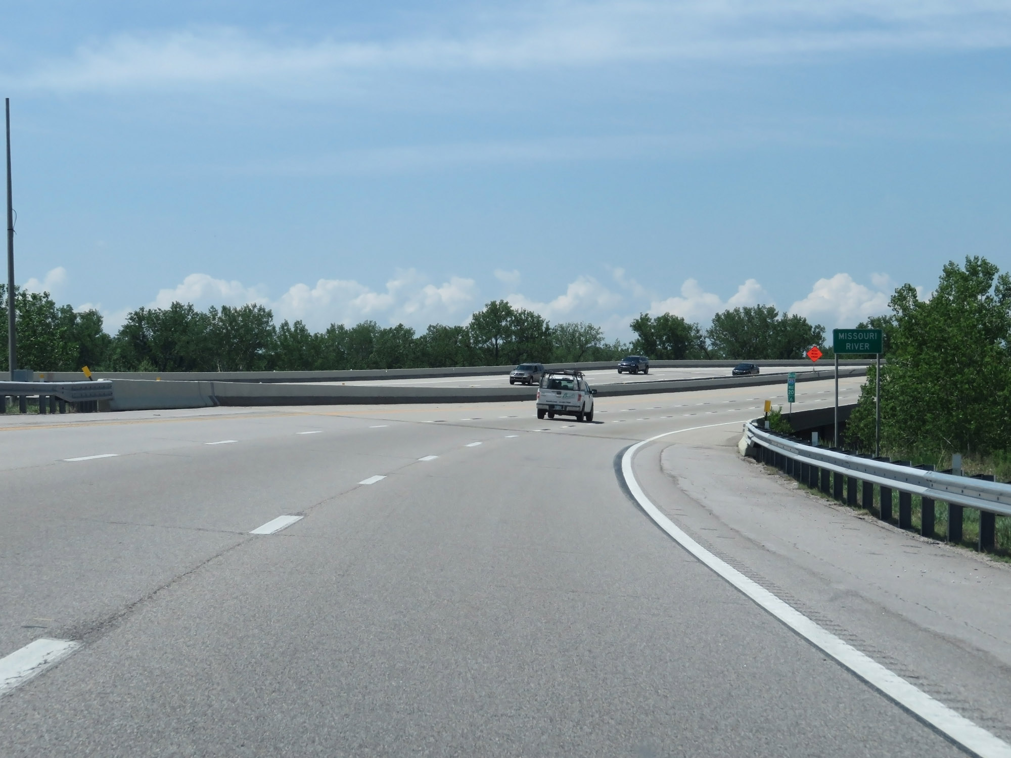
Interstate 435 Outer Loop (South) at mile marker 20.8, as it prepares to cross the Missouri River into Kansas. (Photo taken 5/17/18). |
 |
Interstate 435 Outer Loop (South) as it starts across the Missouri River. (Photo taken 5/17/18). |
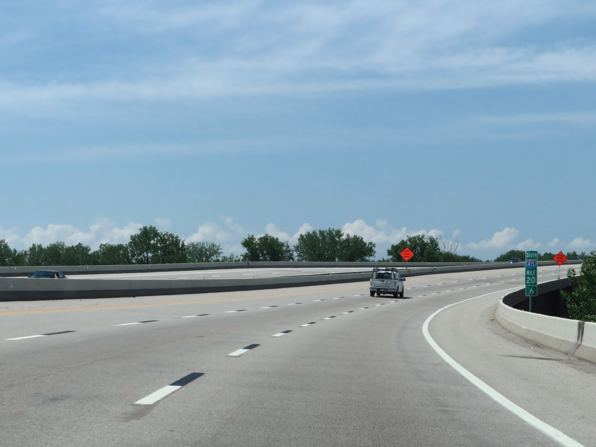 |
Crossing the Missouri River at mile marker 20.6, Interstate 435 Outer Loop (South) prepares to enter Kansas. (Photo taken 5/17/18). |