Road Information |
||
 |
||
| Total Mileage in State: | 43 miles | |
| Western End: | At I-94/I-694, in Maple Grove | |
| Southern End: | At I-94/I-694, in Woodbury | |
| Mileage covered in Photos: | 43 miles | |
| Counties covered in Photos: | Washington, Ramsey, Washington, Dakota, Hennepin | |
| Major Junctions in Photos: | US 10/US 61, in Newport US 52, in Inver Grove Heights I-35E, in Mendota Heights I-35W, in Bloomington US 169, in Bloomington I-394/US 12, in Minnetonka I-94/I-694, in Maple Grove |
|
| Control Cities in Photos: | Woodbury, South St. Paul, Eagan, Bloomington, Eden Prairie, Minnetonka, Maple Grove | |
Inner Loop
- Section 1: Interstate 94/Interstate 694 to Bloomington (Exit 2B)
- Section 2: Bloomington (Exit 2B) to Interstate 94/Interstate 694
Section 1: Interstate 94/Interstate 694 to Bloomington (Exit 2B)
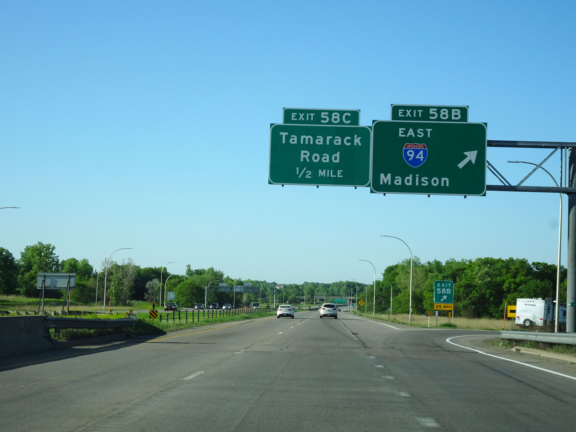 |
Interstate 494 Inner Loop (South) at Exit 58B: Interstate 94 East - Madison (Photo taken 5/22/16). |
 |
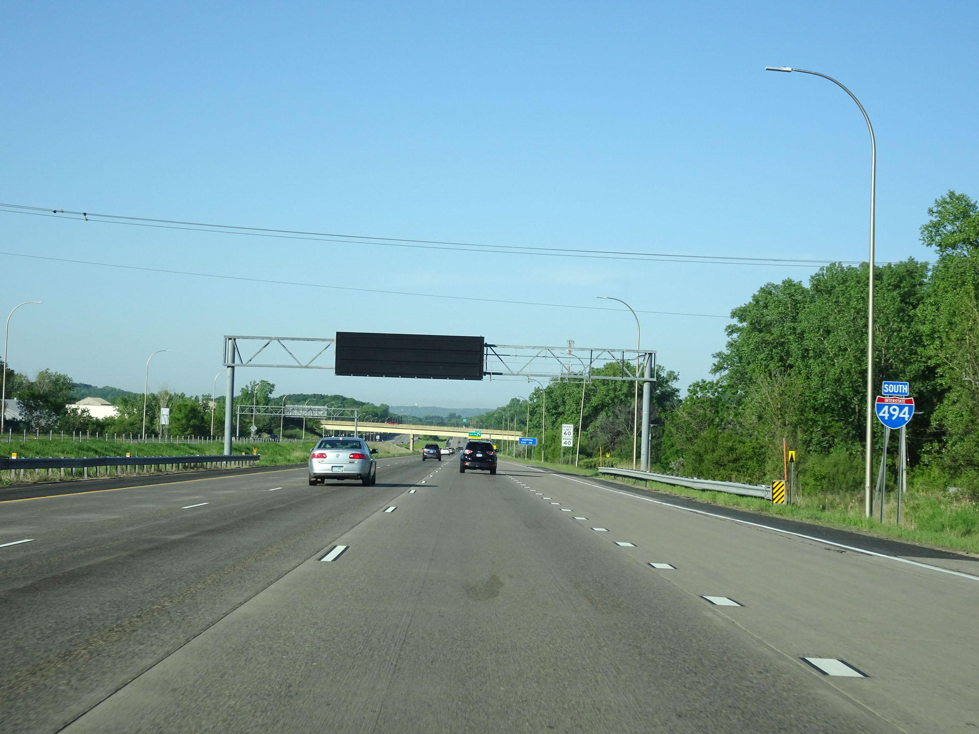
Interstate 494 South assurance shield just south of its interchange with Interstate 94 and Interstate 694 in Woodbury, on the east side of the Twin Cities. (Photo taken 5/22/16). |
 |
Interstate 494 Inner Loop (South) at Exit 58C: Tamarack Rd (Photo taken 5/22/16). |
 |
Mileage sign listing the distances to the next three interchanges on Interstate 494 Inner Loop. As you will see later, I-494 and I-694 share a combined mileage to form a loop around the Twin Cities. Therefore, I-494's mileage starts out high and resets to zero at the Minnesota River, which we will see in a bit. (Photo taken 5/22/16). |
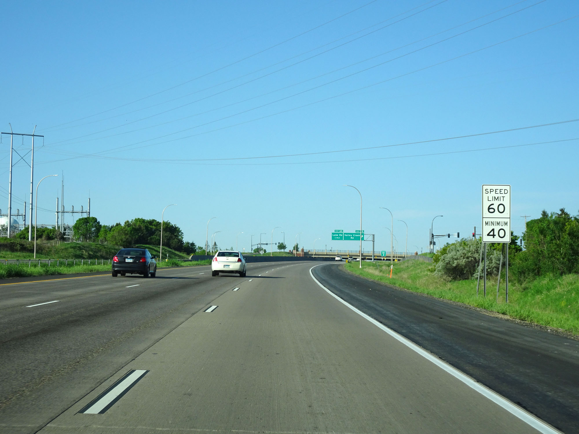 |
Speed limit signs on Interstate 494 Inner Loop (South). The speed limit on both I-494 and I-694 around the Twin Cities is 60 mph for all traffic, with a minimum speed limit of 40 mph. (Photo taken 5/22/16). |
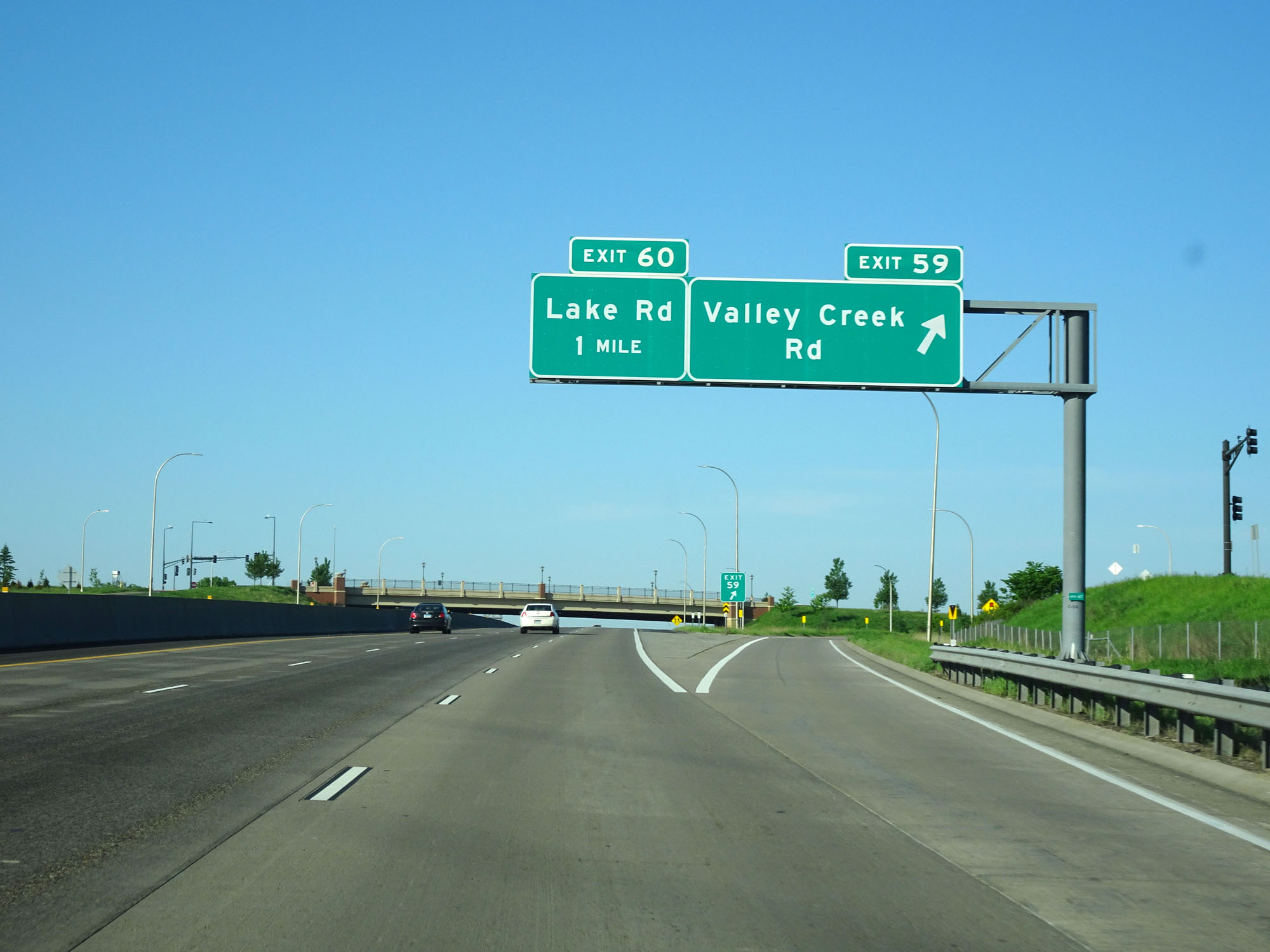 |
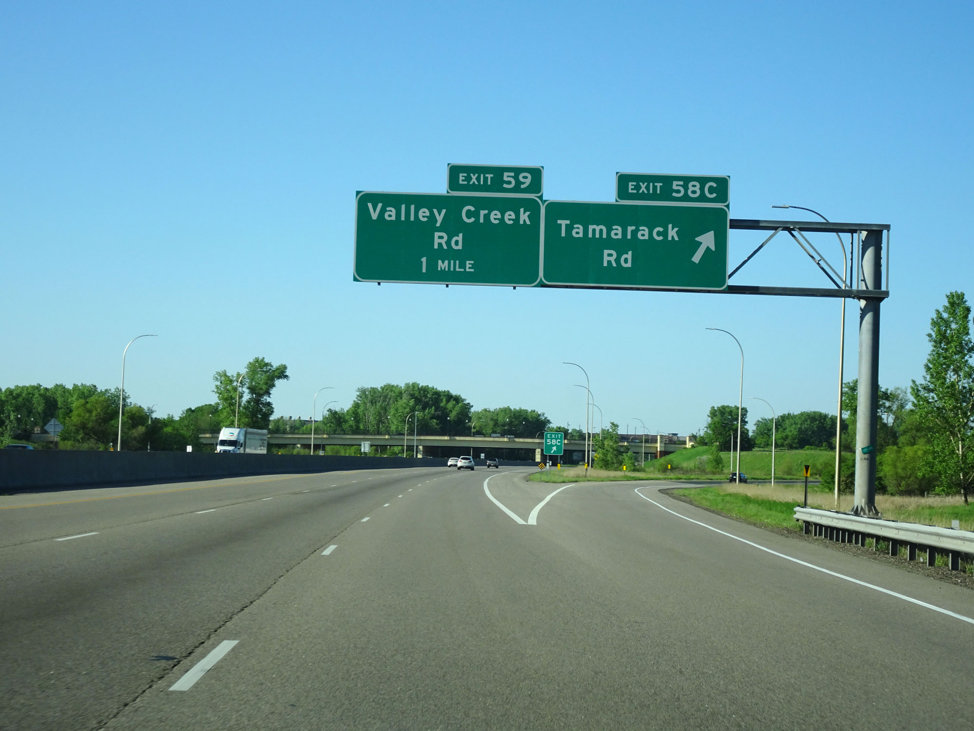
Interstate 494 Inner Loop (South) at Exit 59: Valley Creek Rd (Photo taken 5/22/16). |
 |
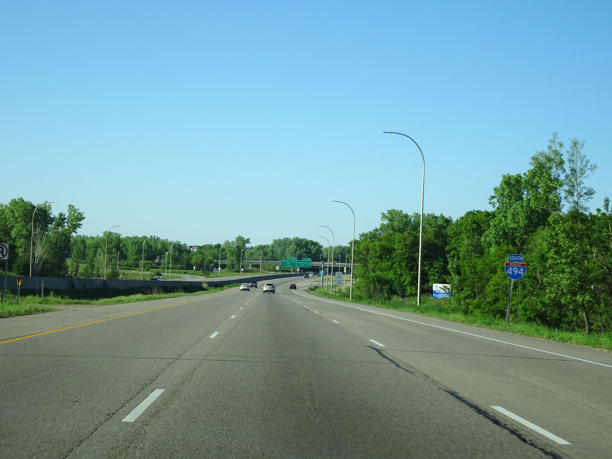
Another Interstate 494 South assurance shield just south of Exit 59. (Photo taken 5/22/16). |
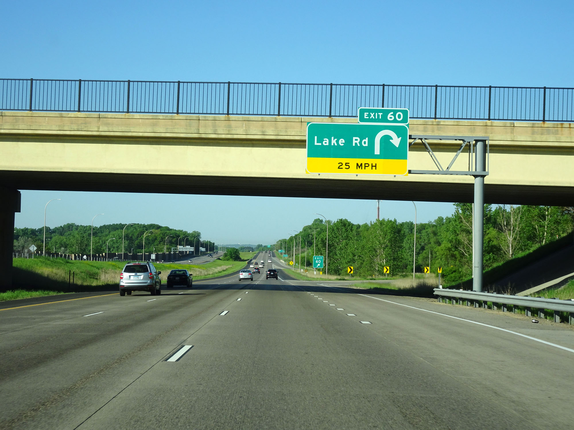 |
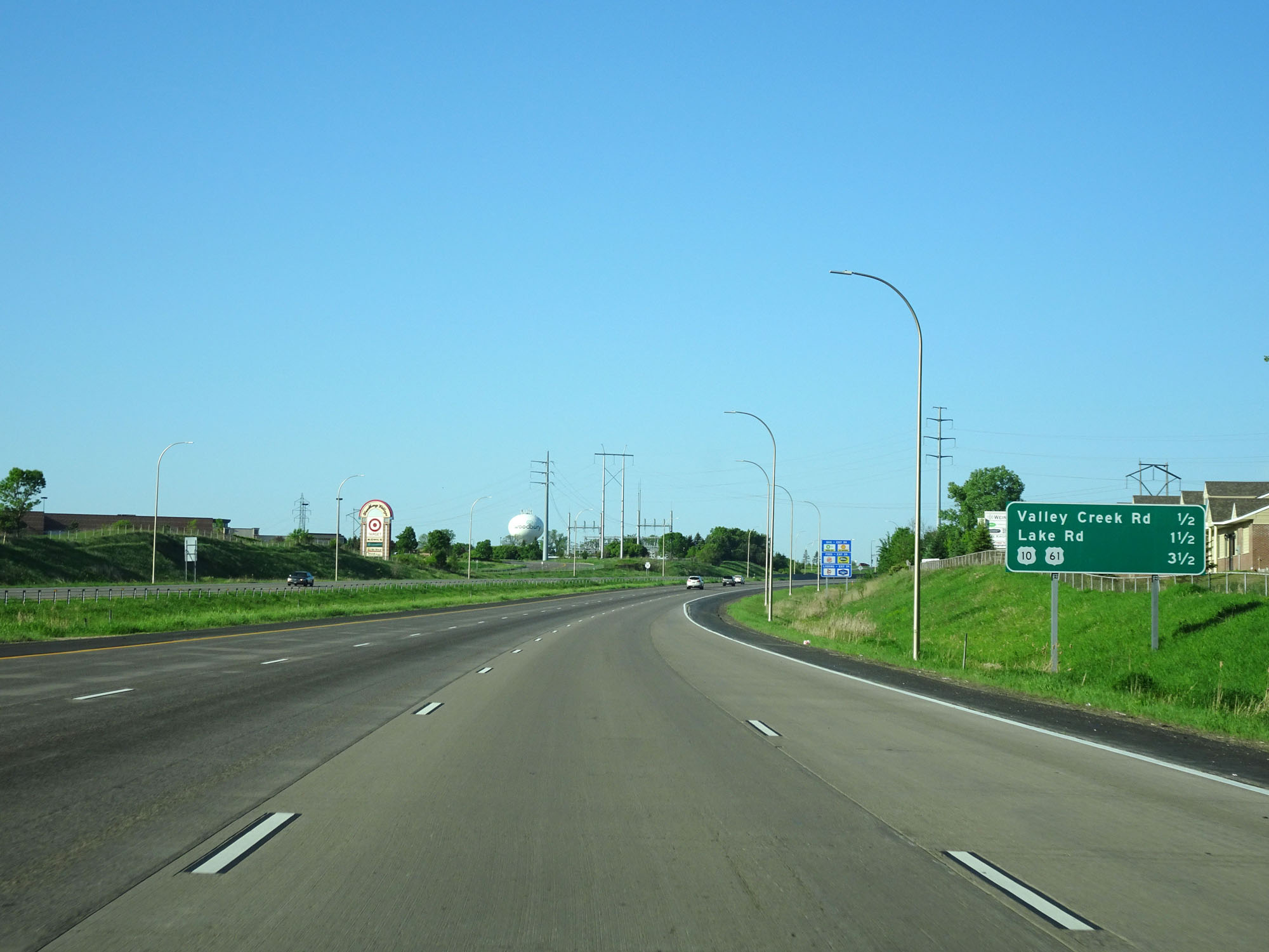
Interstate 494 Inner Loop (South) at Exit 60: Lake Rd (Photo taken 5/22/16). |
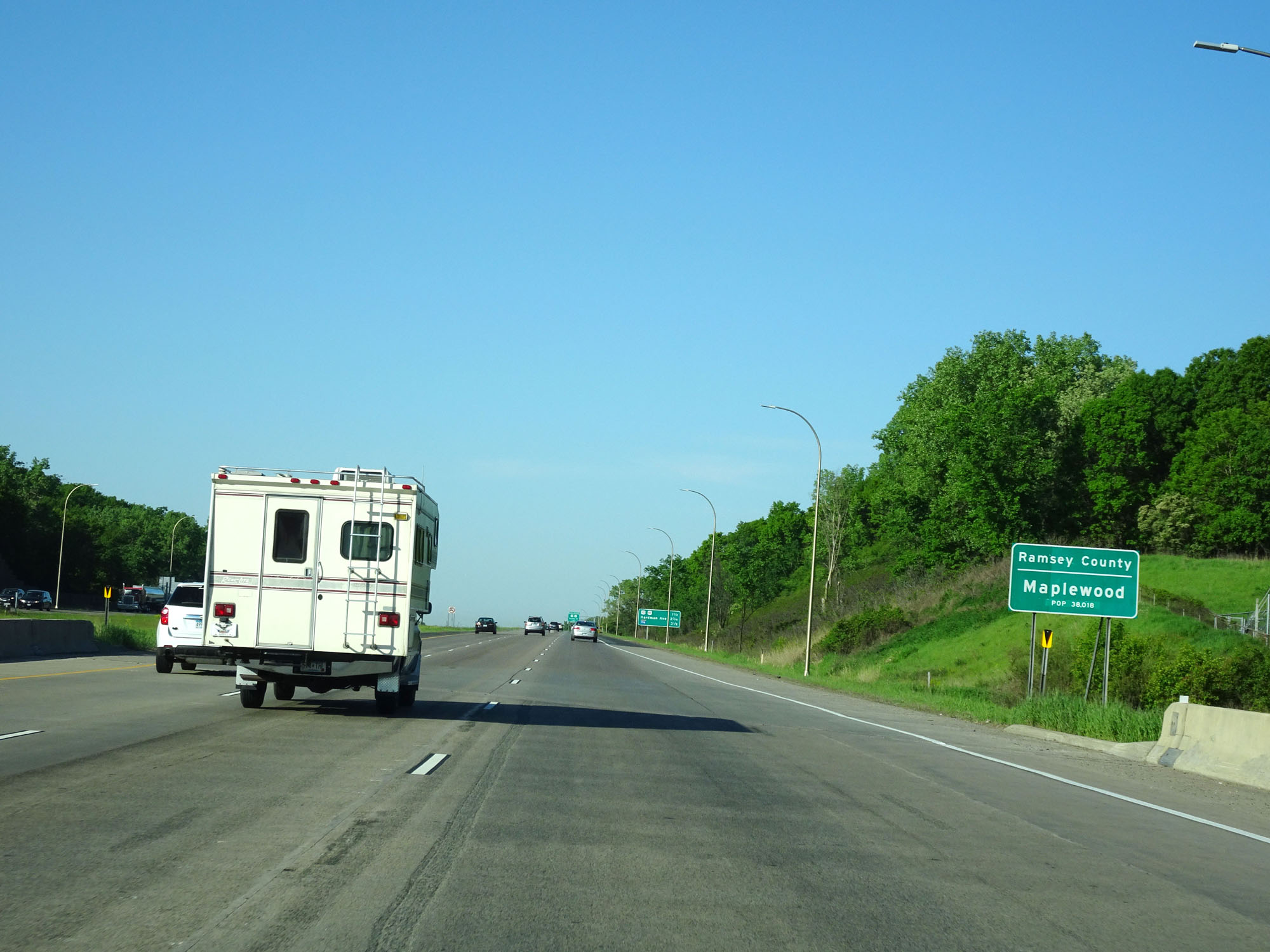 |
Interstate 494 Inner Loop (South) as it briefly dips into Ramsey County and enters the Maplewood city limits. (Photo taken 5/22/16). |
 |
Another mileage sign on Interstate 494 Inner Loop (South) listing the distances to the three upcoming exits. (Photo taken 5/22/16). |
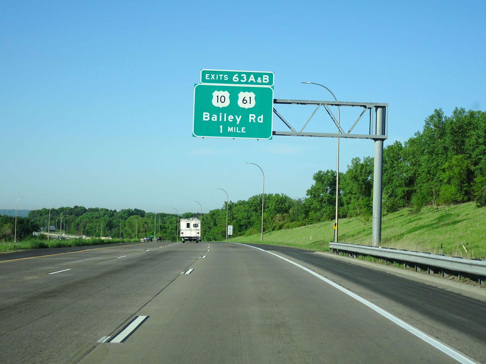 |
Interstate 494 Inner Loop (South) approaching Exits 63A-B - 1 mile. (Photo taken 5/22/16). |
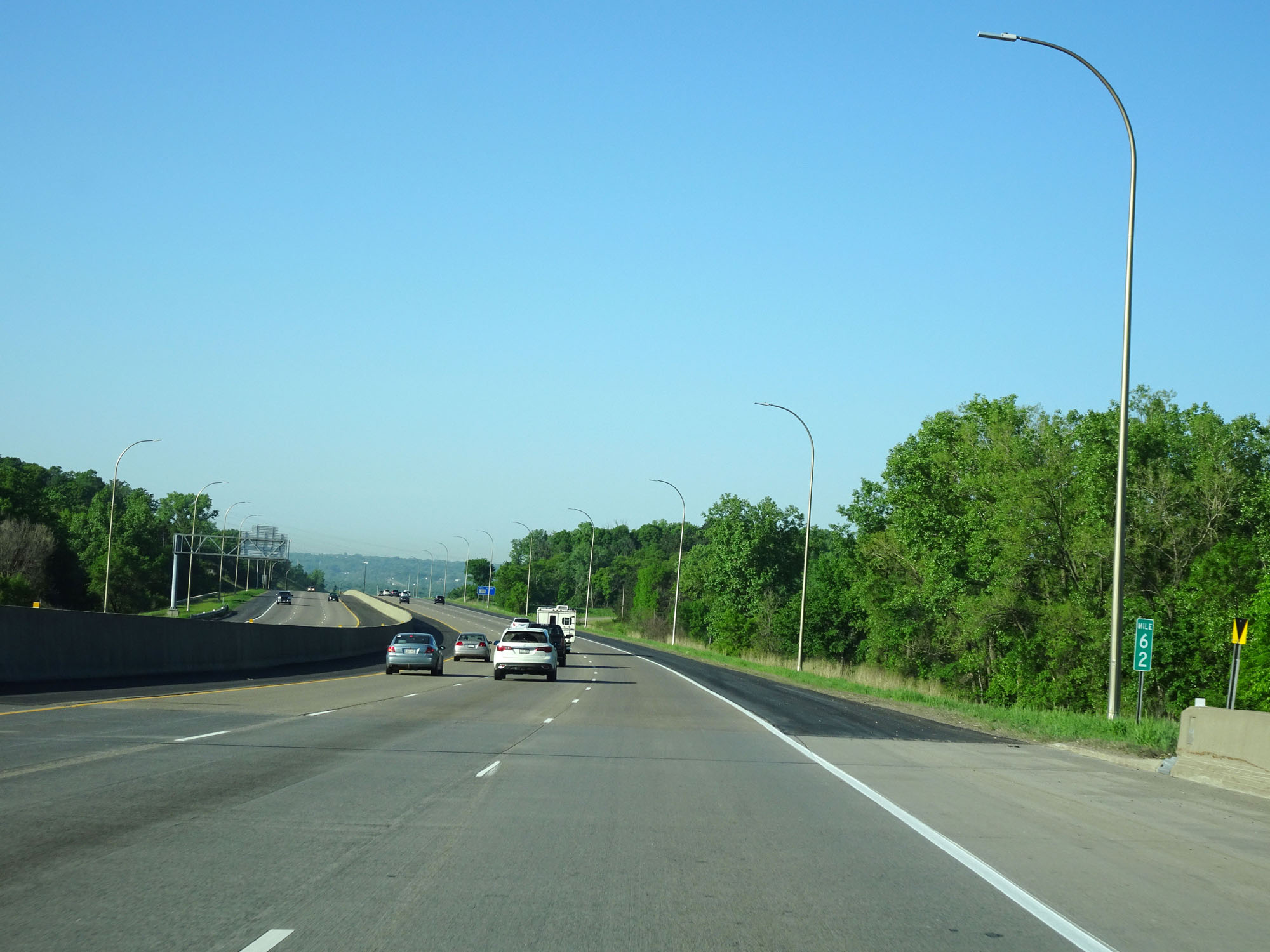 |
Interstate 494 Inner Loop (South) at mile marker 62. (Photo taken 5/22/16). |
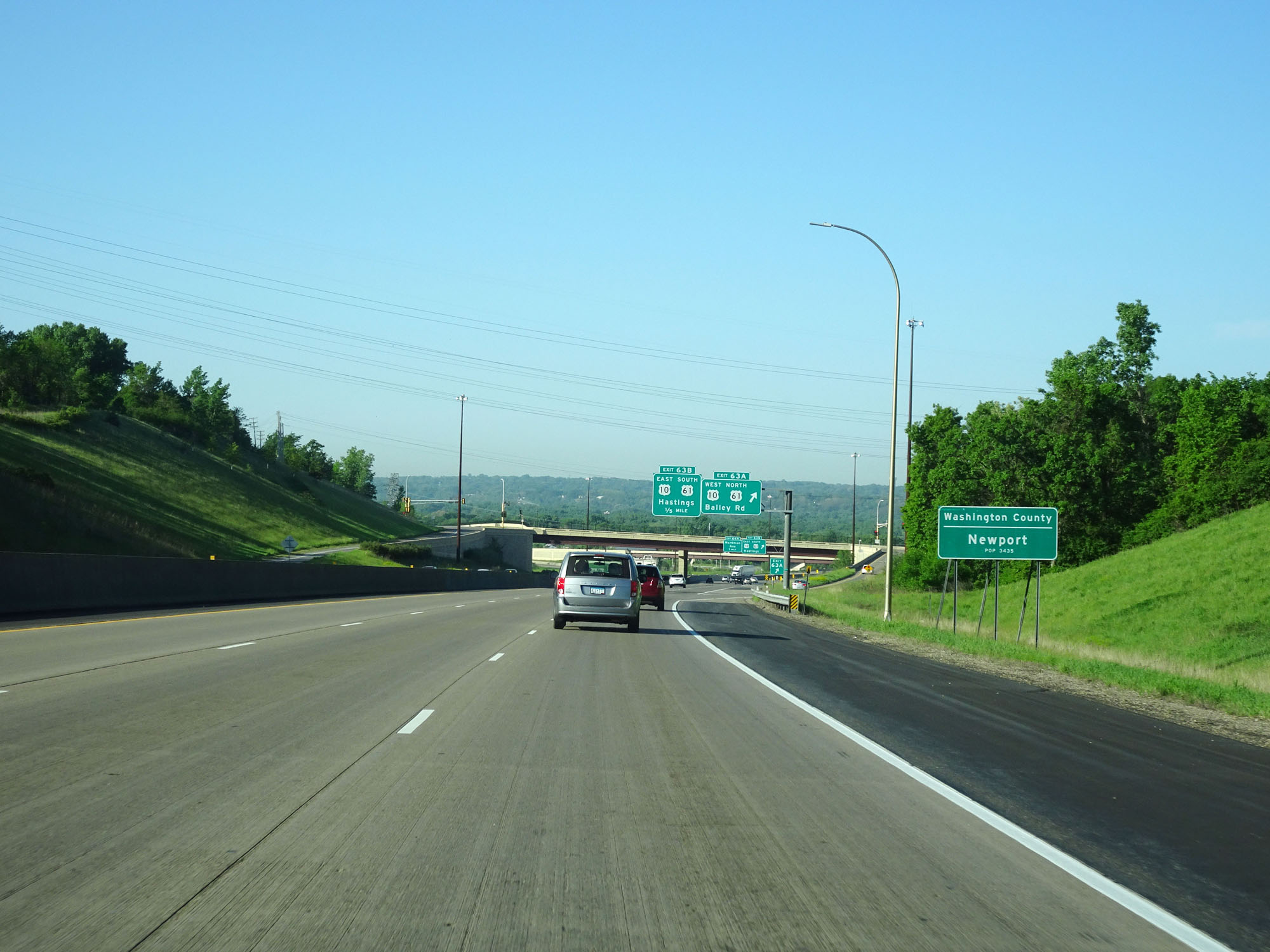 |
Interstate 494 Inner Loop (South) as it re-enters Washington County and enters the Newport city limits. (Photo taken 5/22/16). |
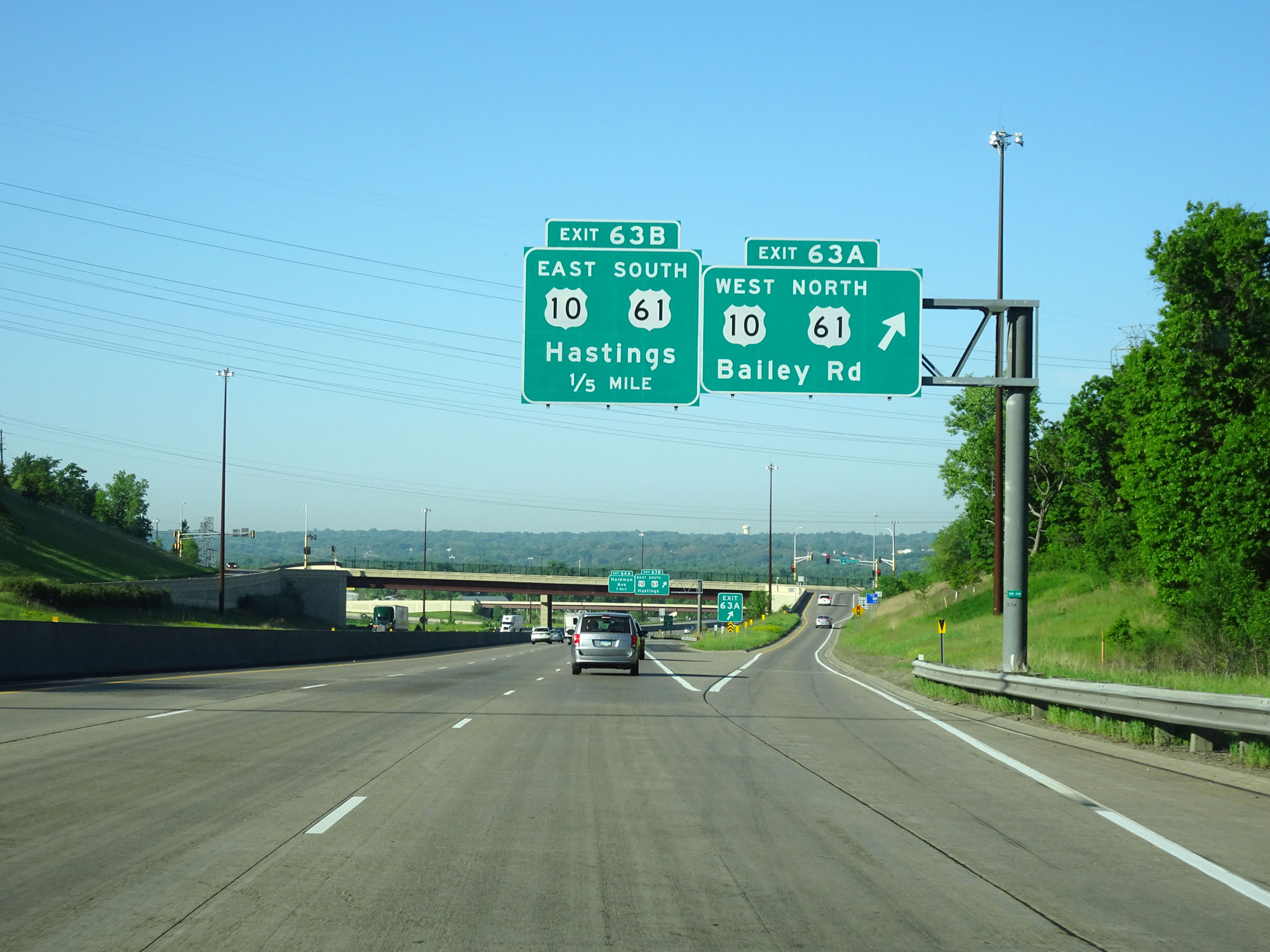 |
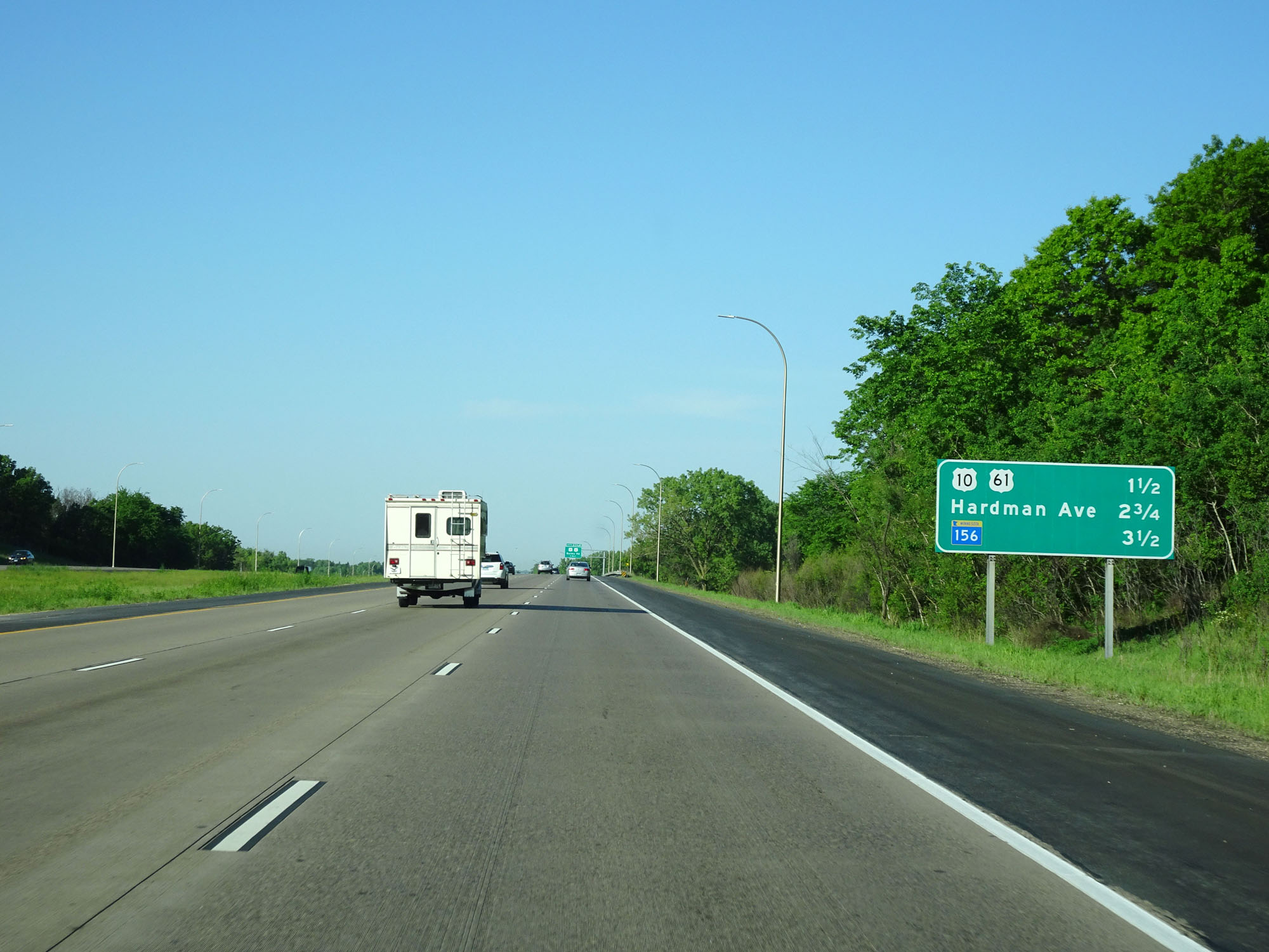
Interstate 494 Inner Loop (South) at Exit 63A: US 10 West / US 61 North - Bailey Rd (Photo taken 5/22/16). |
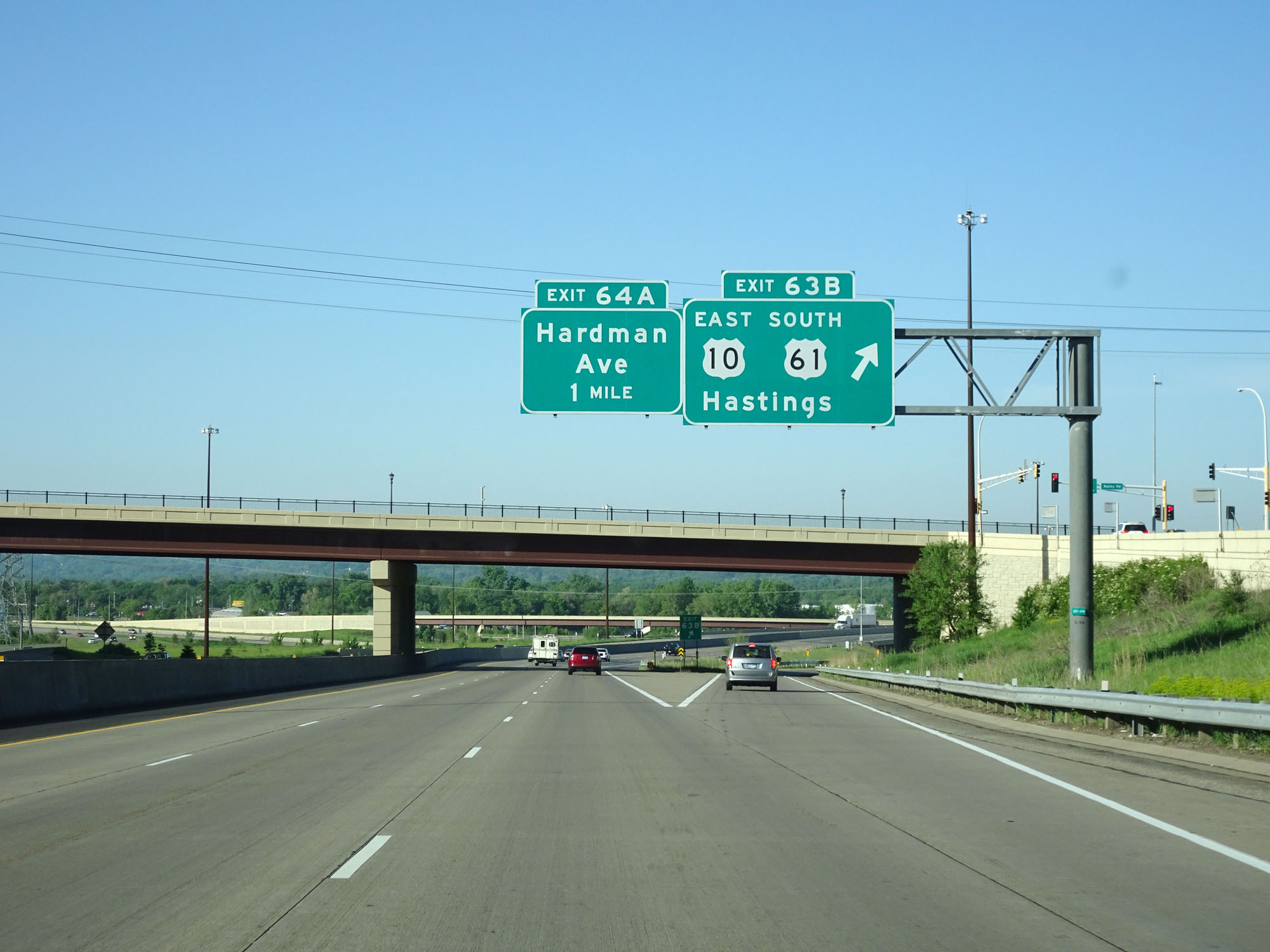 |
Interstate 494 Inner Loop (South) at Exit 63B: US 10 East / US 61 South - Hastings (Photo taken 5/22/16). |
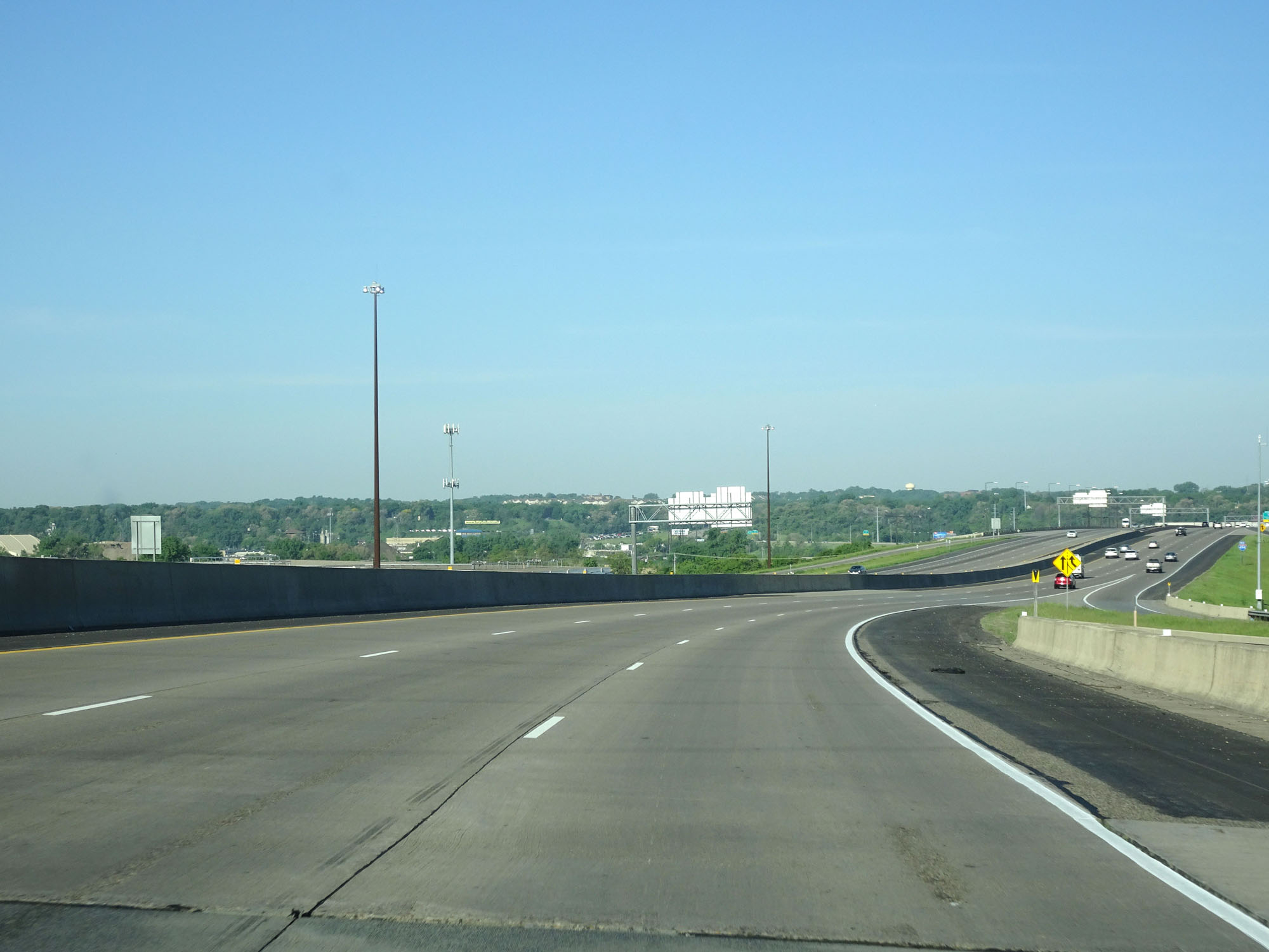 |
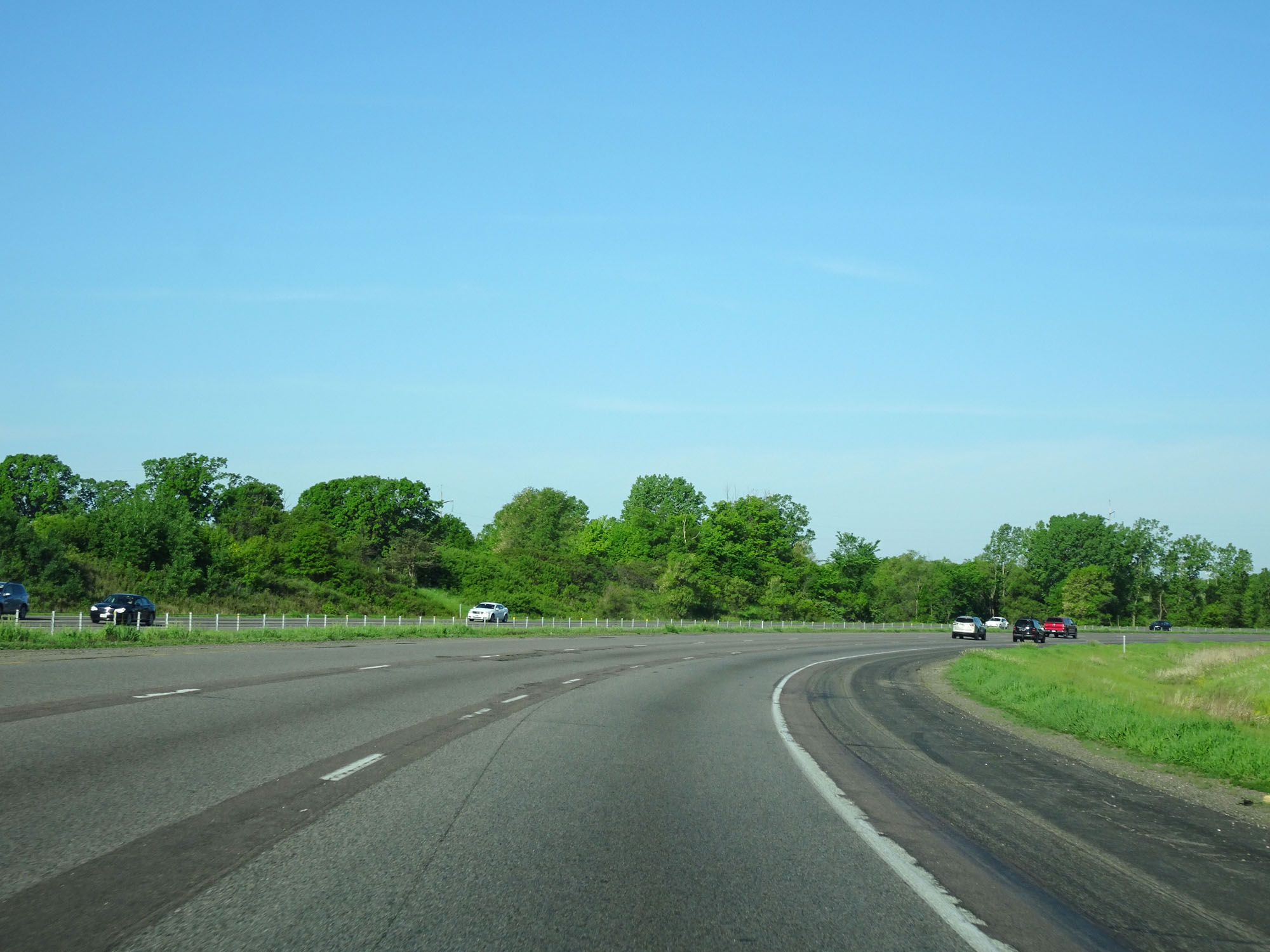
Interstate 494 Inner Loop (South) as it begins to curve to the west. (Photo taken 5/22/16). |
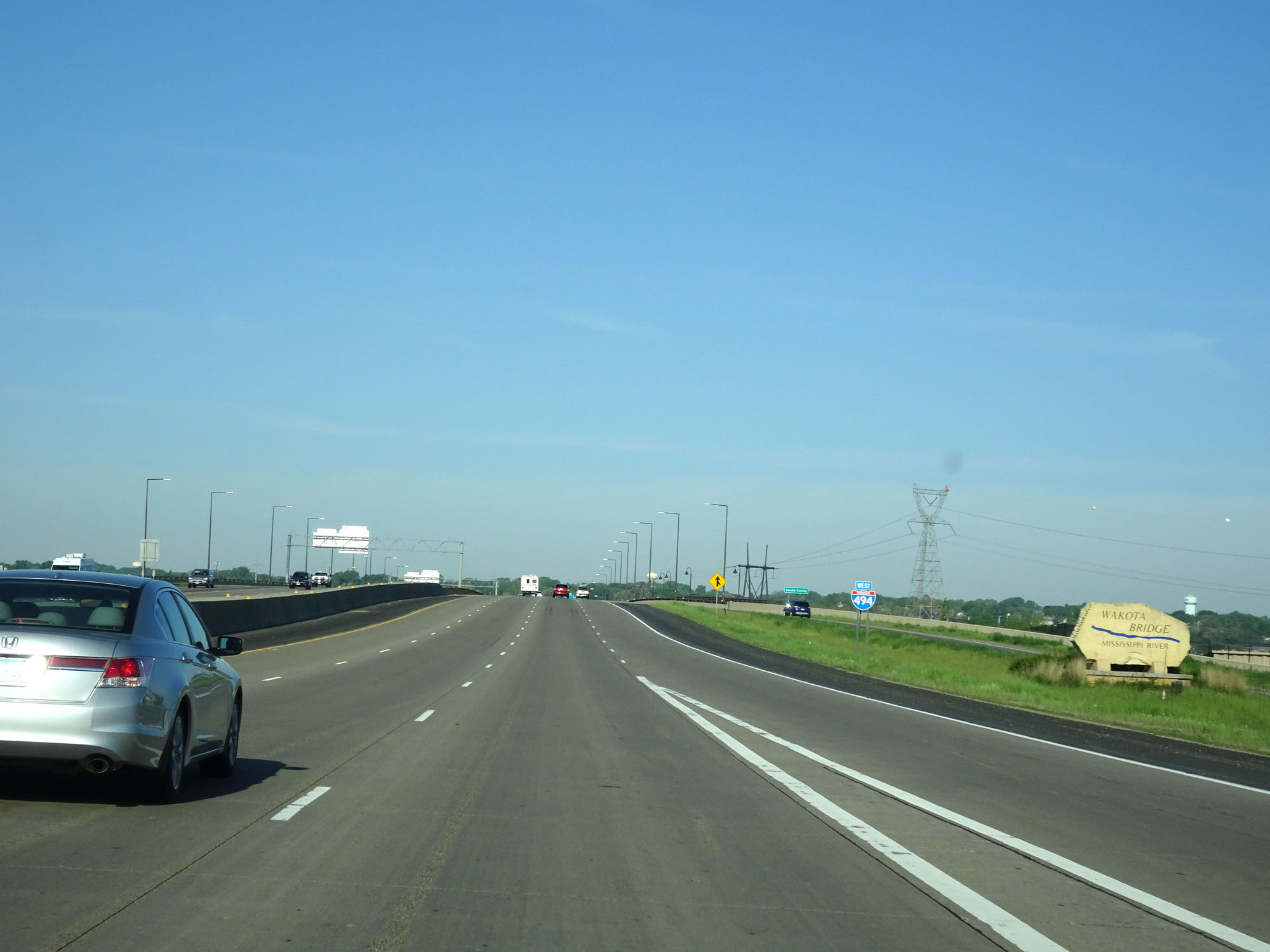 |
Interstate 494 West assurance shield as it prepares to cross the Wakota Bridge over the Mississippi River, noted by the sign seen here. (Photo taken 5/22/16). |
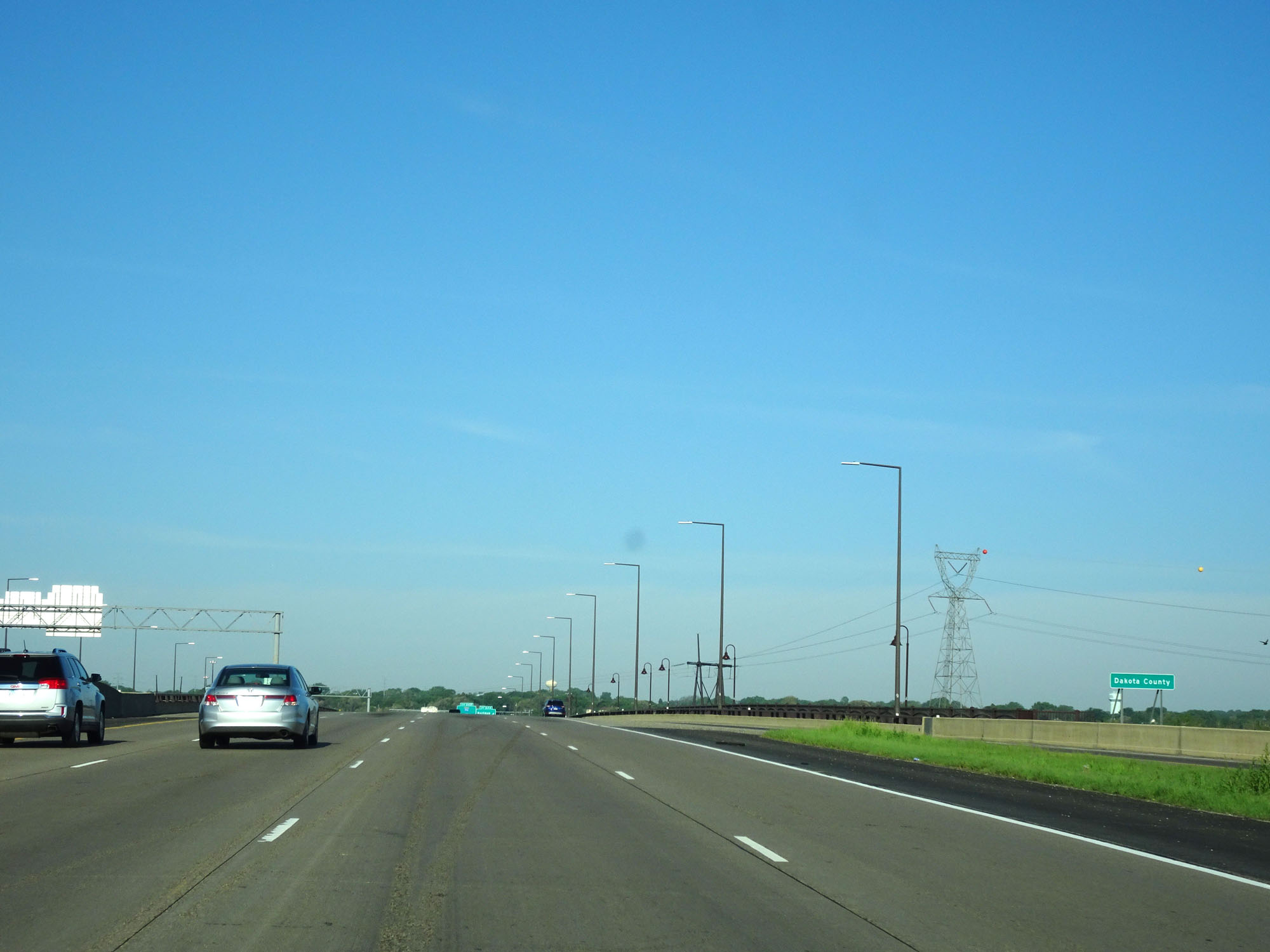 |
Upon crossing the Mississippi River via the Wakota Bridge, Interstate 494 West enters Dakota County. (Photo taken 5/22/16). |
 |
Interstate 494 Inner Loop (West) at Exit 64A: Hardman Ave (Photo taken 5/22/16). |
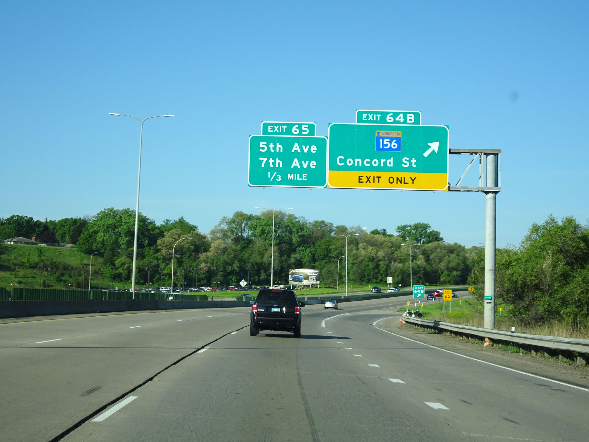 |
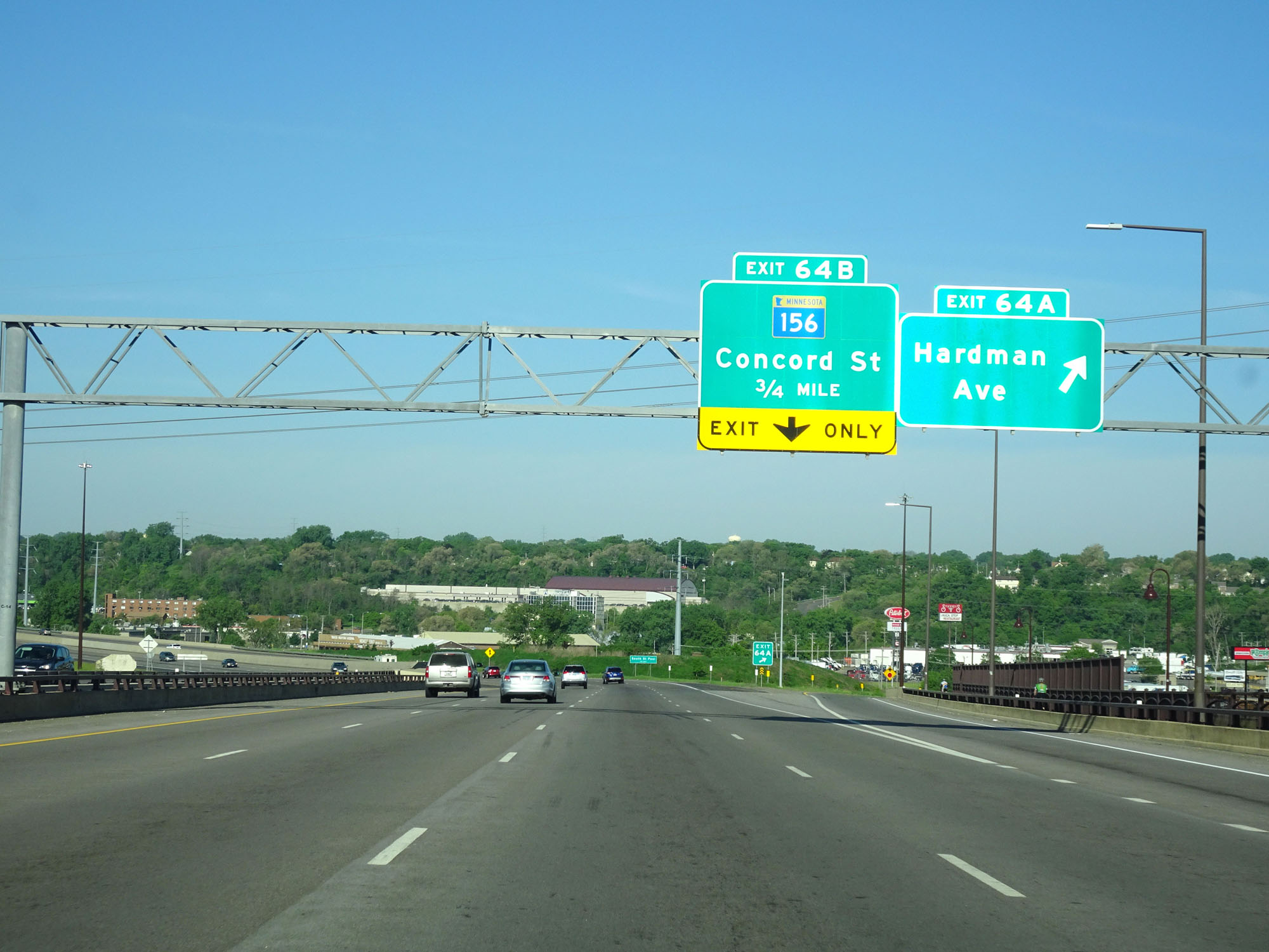
Interstate 494 Inner Loop (West) at Exit 64B: MN 156 - Concord St (Photo taken 5/22/16). |
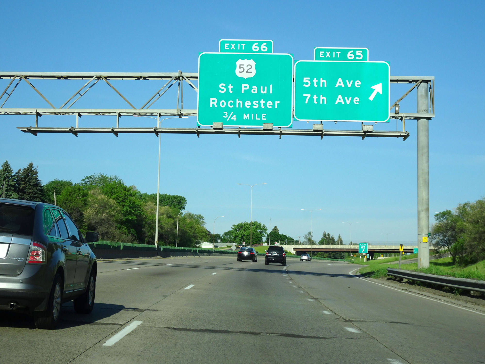 |
Interstate 494 Inner Loop (West) at Exit 65: 5th Ave / 7th Ave (Photo taken 5/22/16). |
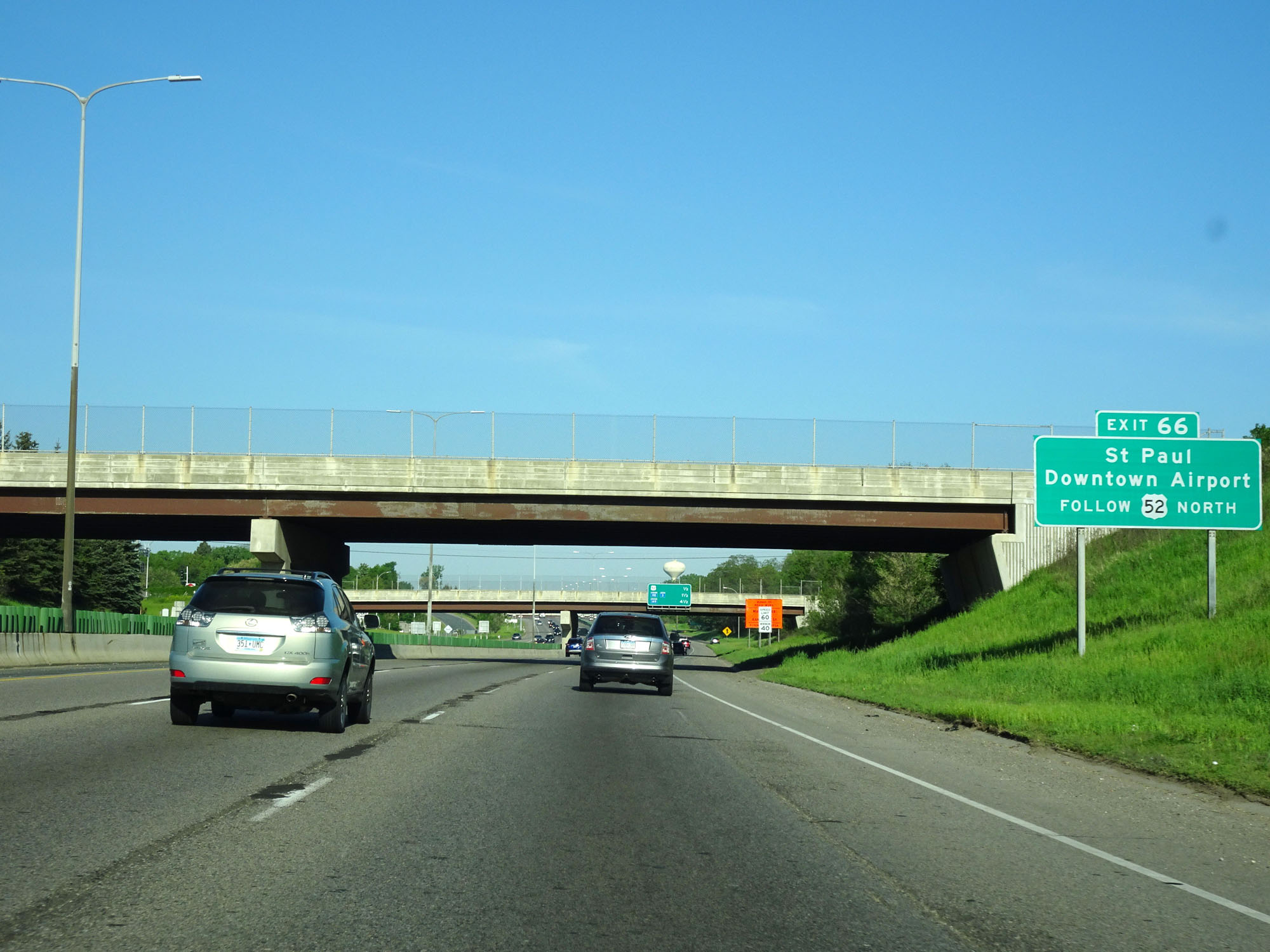 |
Take Exit 66 to St. Paul Downtown Airport via US 52 North. (Photo taken 5/22/16). |
 |
Another overhead mileage sign listing the distances to the three upcoming interchanges. (Photo taken 5/22/16). |
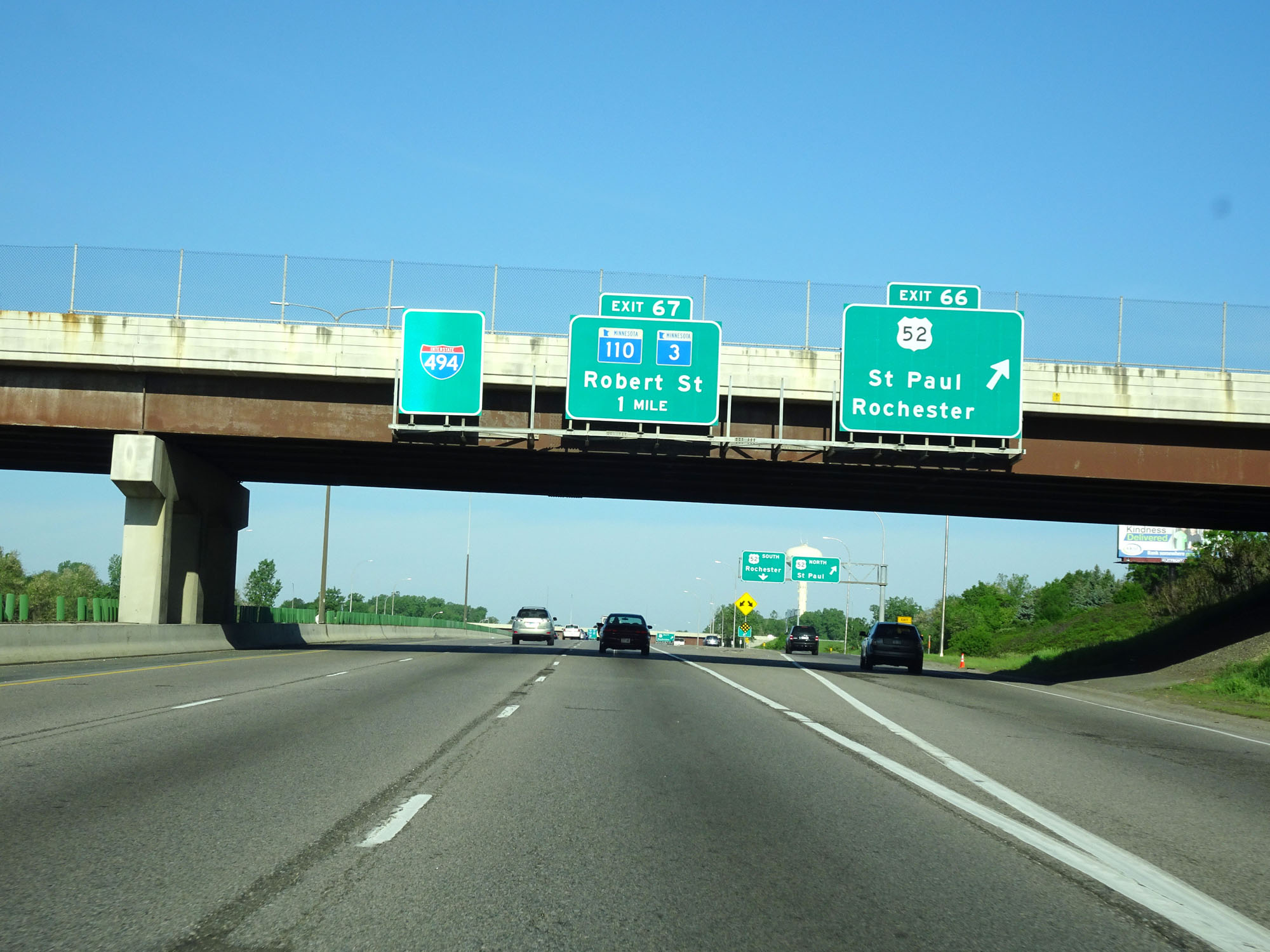 |
Interstate 494 Inner Loop (West) at Exit 66: US 52 - St Paul / Rochester (Photo taken 5/22/16). |
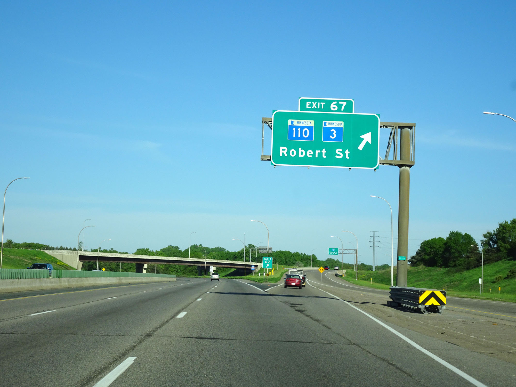 |
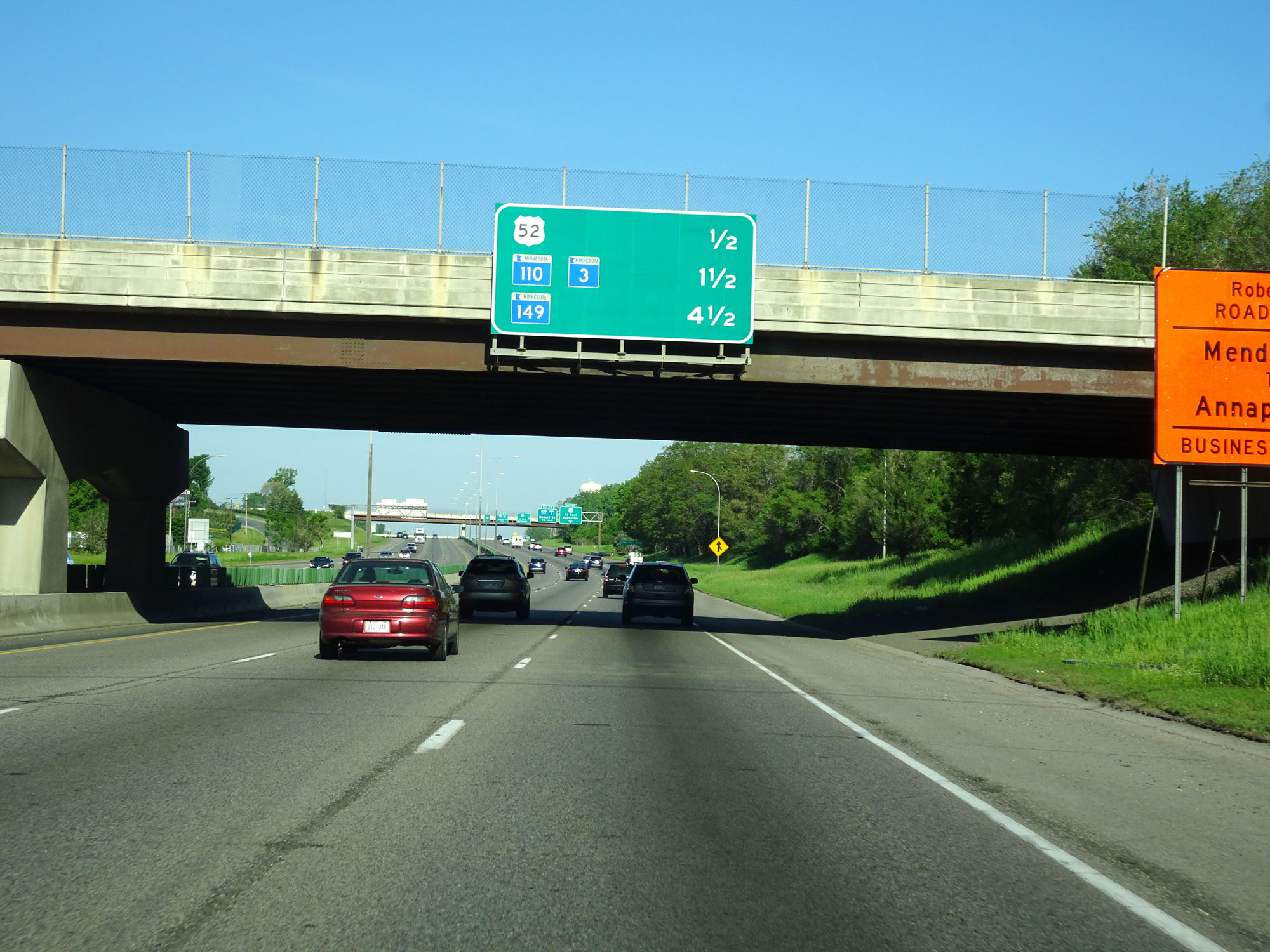
Interstate 494 Inner Loop (West) at Exit 67: MN 110 / MN 3 - Robert St (Photo taken 5/22/16). |
 |
Interstate 494 West assurance shield beyond Exit 67. (Photo taken 5/22/16). |
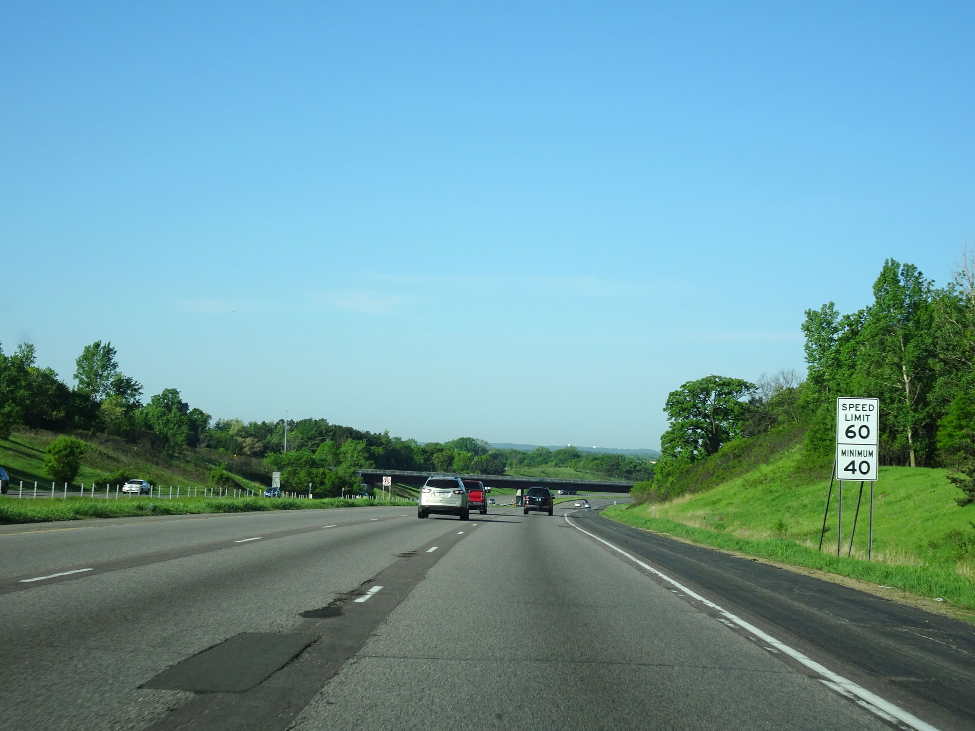 |
Speed limit signs west of Exit 67. Again, the speed limit on Interstate 494 AND Interstate 694 around the Twin Cities is 60 mph with a minimum speed limit of 40 mph. (Photo taken 5/22/16). |
 |
Interstate 494 Inner Loop (West) as it curves further to the west in preparation to cross the Minnesota River. (Photo taken 5/22/16). |
 |
Interstate 494 Inner Loop (West) entering the Mendota Heights city limits. (Photo taken 5/22/16). |
 |
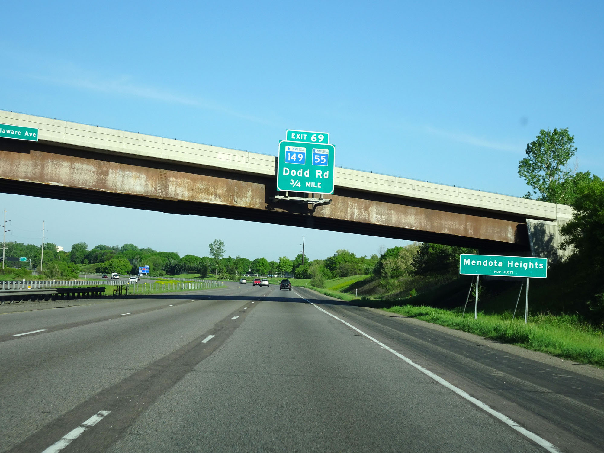
Interstate 494 Inner Loop (West) at Exit 69: MN 149 / MN 55 - Dodd Rd (Photo taken 5/22/16). |
 |
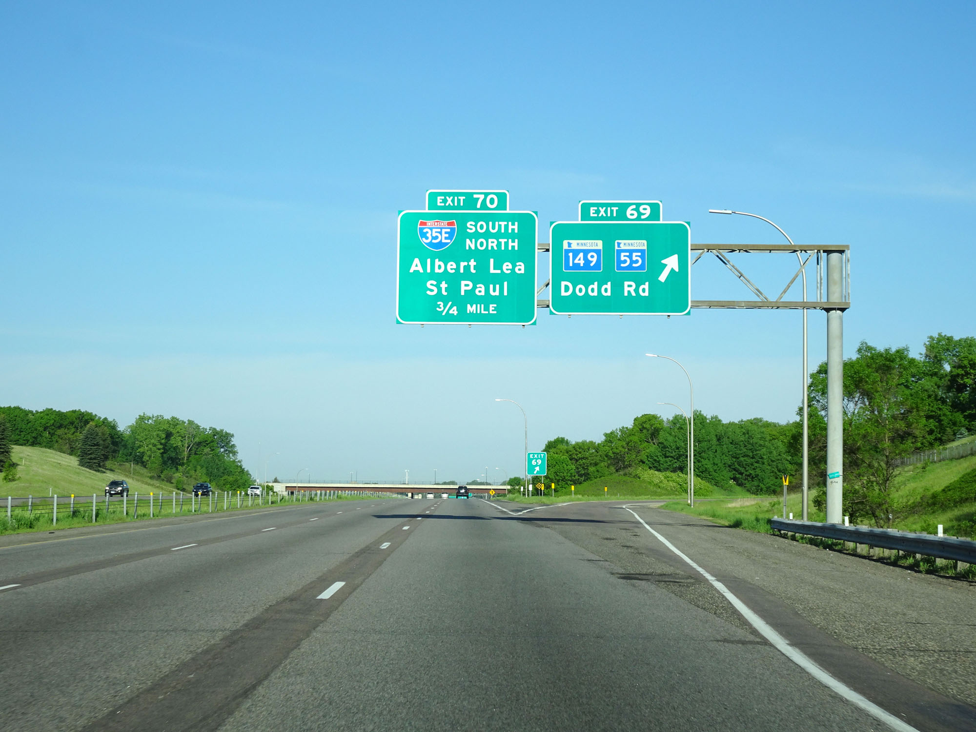
Interstate 494 Inner Loop (West) approaching Exit 70 - 1/4 mile. (Photo taken 5/22/16). |
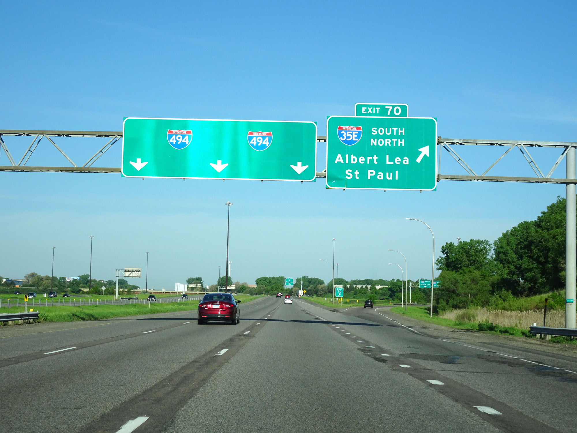 |
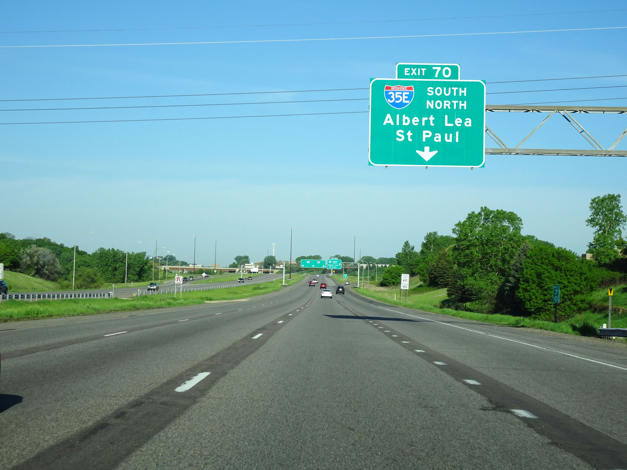
Interstate 494 Inner Loop (West) at Exit 70: Interstate 35E - Albert Lea / St Paul (Photo taken 5/22/16). |
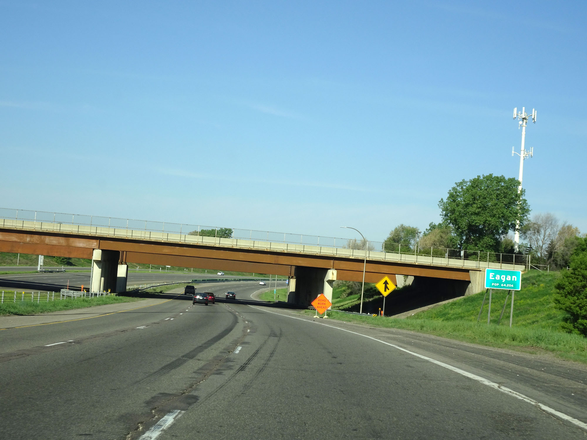 |
Interstate 494 Inner Loop (West) entering the Eagan city limits. (Photo taken 5/22/16). |
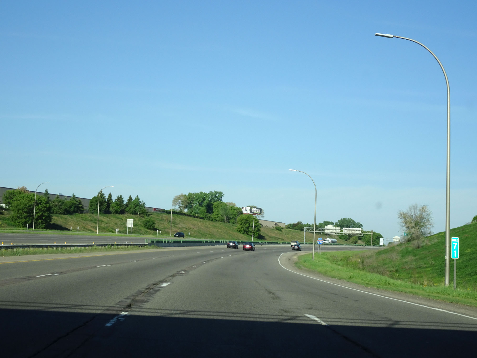 |
Interstate 494 Inner Loop (West) at mile marker 71. (Photo taken 5/22/16). |
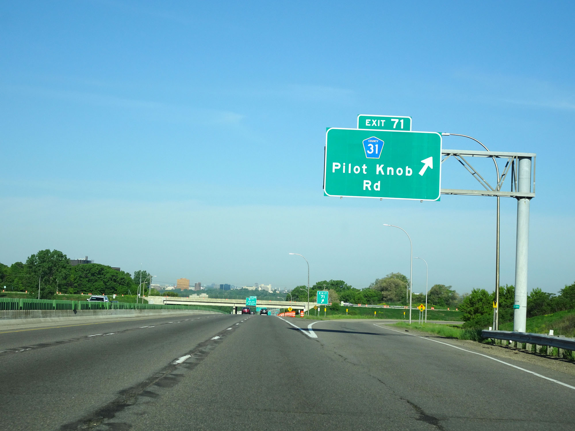 |
Interstate 494 Inner Loop (West) at Exit 71: CR 31 - Pilot Knob Rd (Photo taken 5/22/16). |
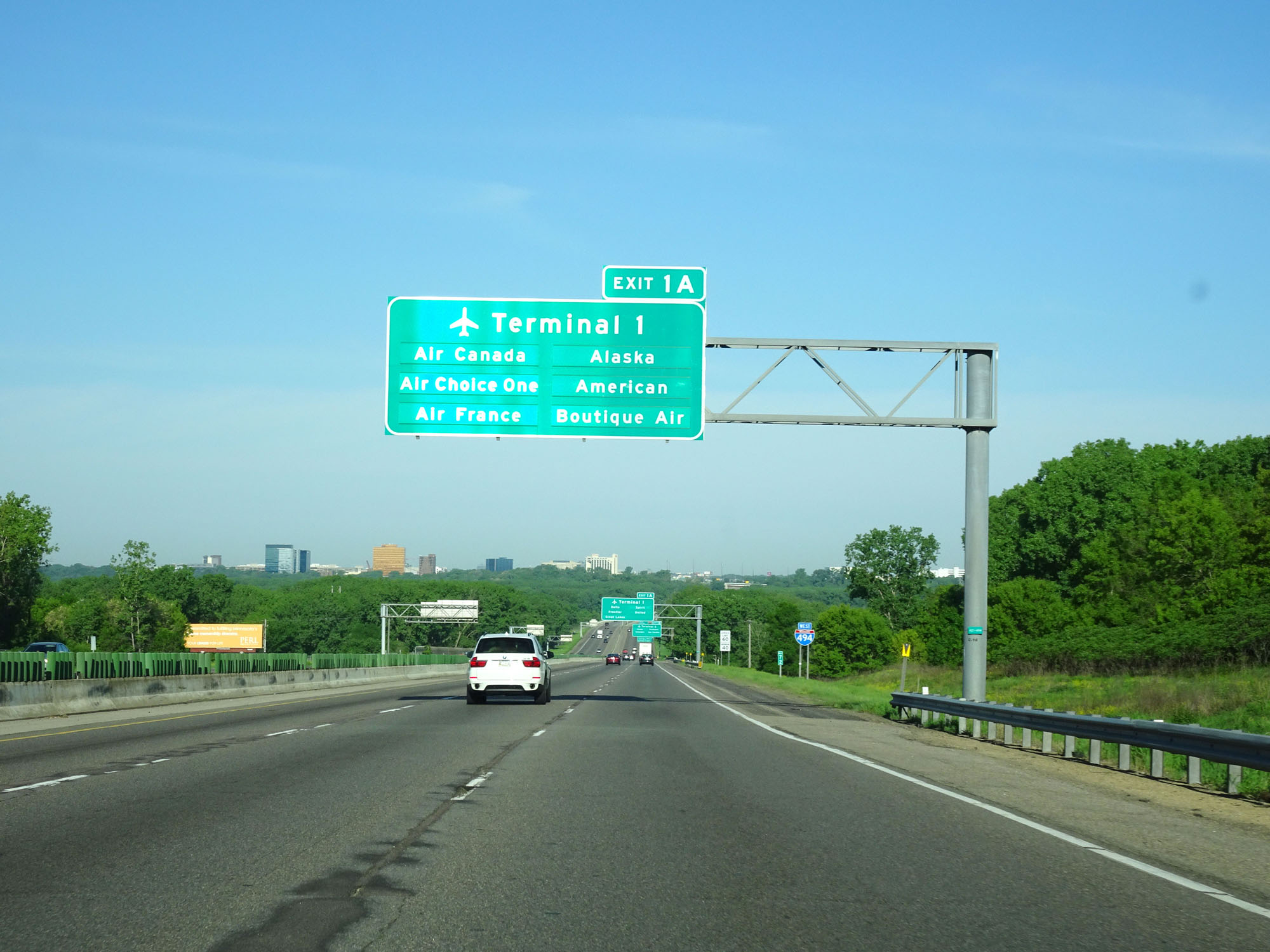 |
Ahead, after crossing the Minnesota River, the mileage on Interstate 494 Inner Loop resets to 0. Thus, the first exits beyond the river are Exits 1A-B. This sign shows which airlines are accessible at the airport's Terminal 1 via Exit 1A. (Photo taken 5/22/16). |
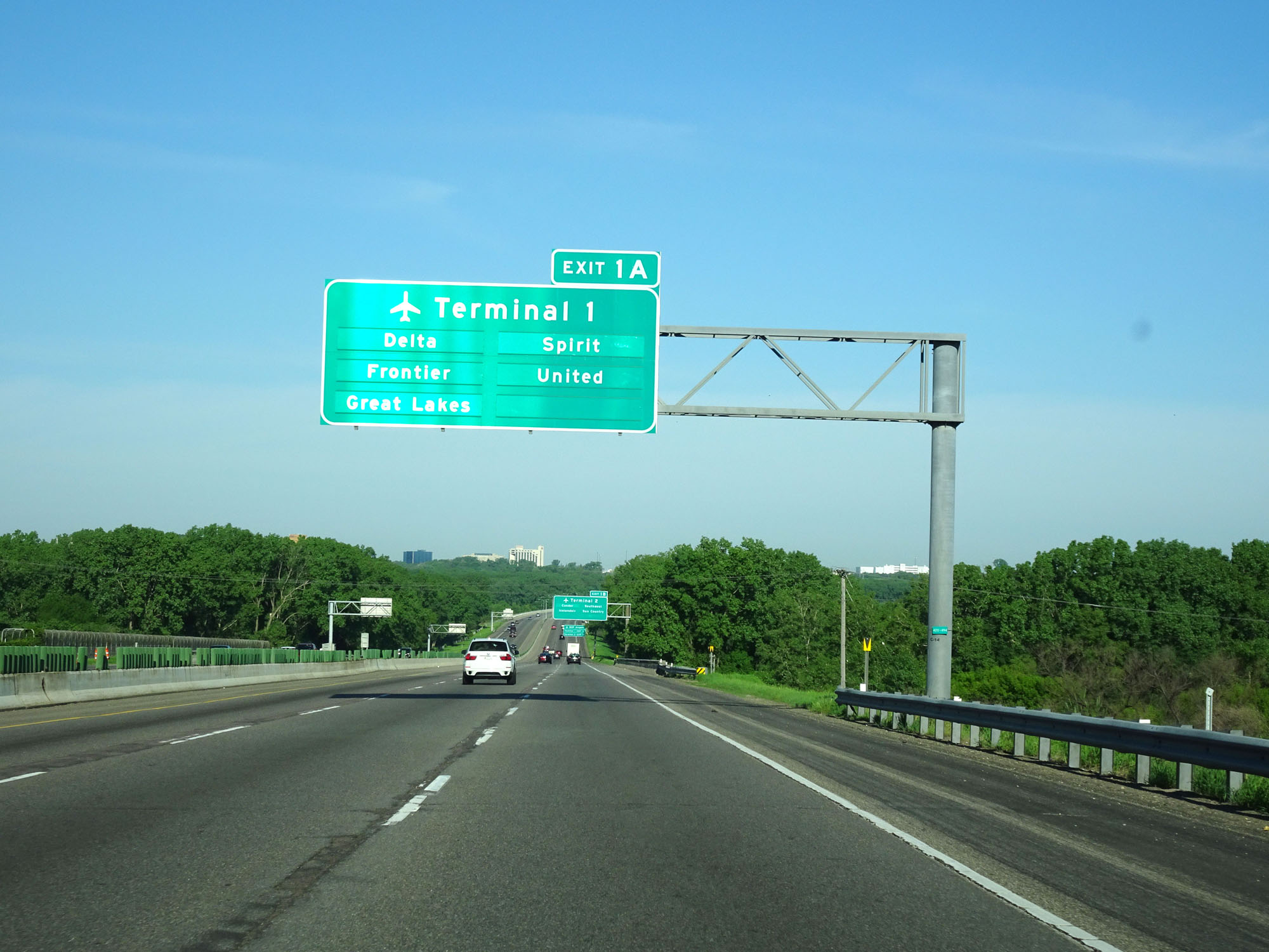 |
Another overhead sign showing more airlines accessible at Terminal 1 via Exit 1A. (Photo taken 5/22/16). |
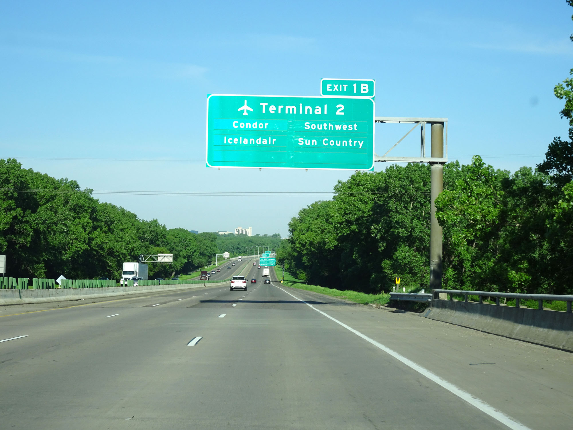 |
This third sign for the airport shows the airlines accessible at Terminal 2 via Exit 1B. (Photo taken 5/22/16). |
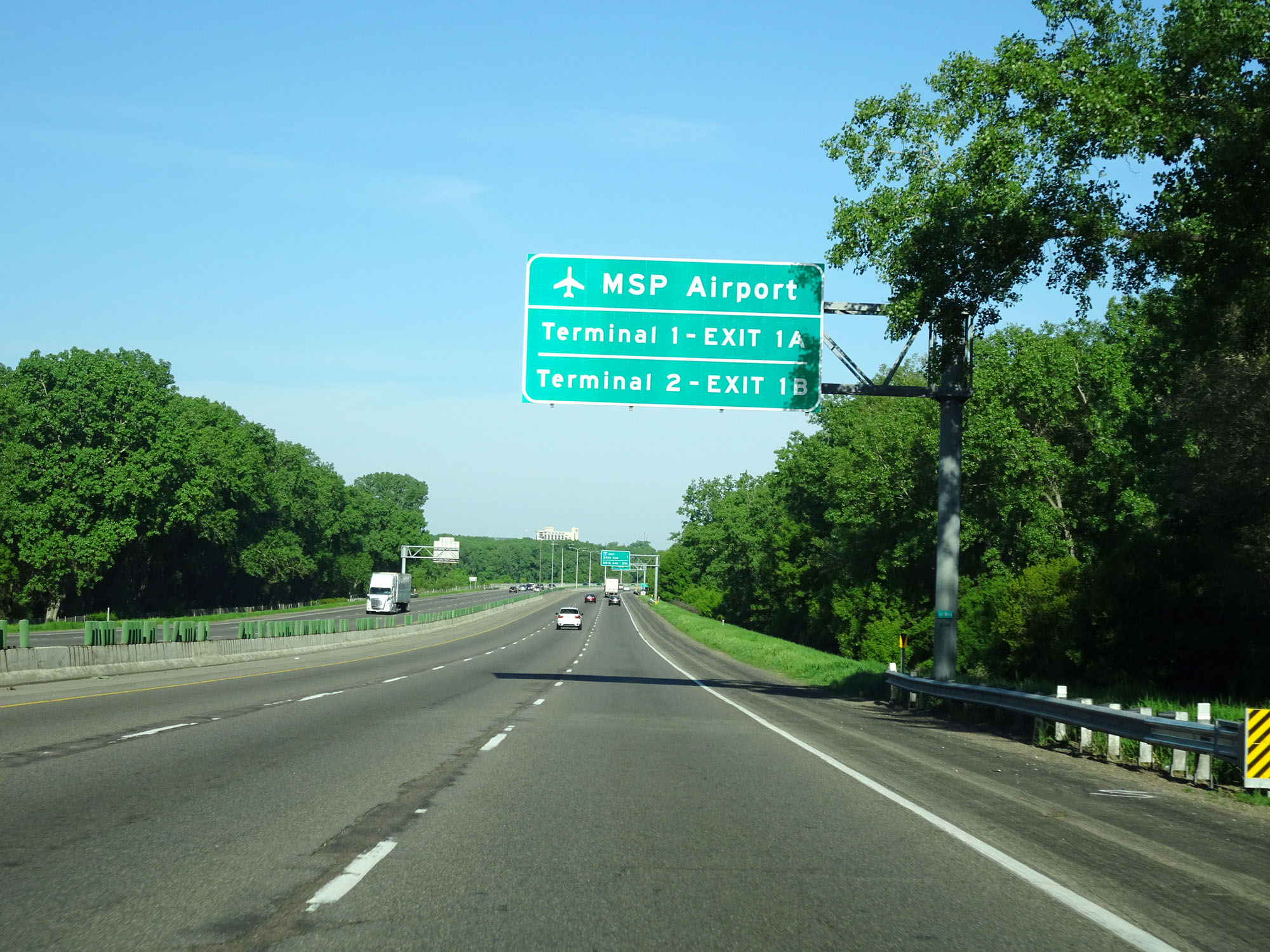 |
As implied by the previous three signs, take Exit 1A to MSP Airport's Terminal 1 and Exit 1B to MSP Airport's Terminal 2. (Photo taken 5/22/16). |
 |
Interstate 494 Inner Loop (West) as it crosses the Minnesota River and into Hennepin County. At this point, I-494's mileage resets to 0. (Photo taken 5/22/16). |
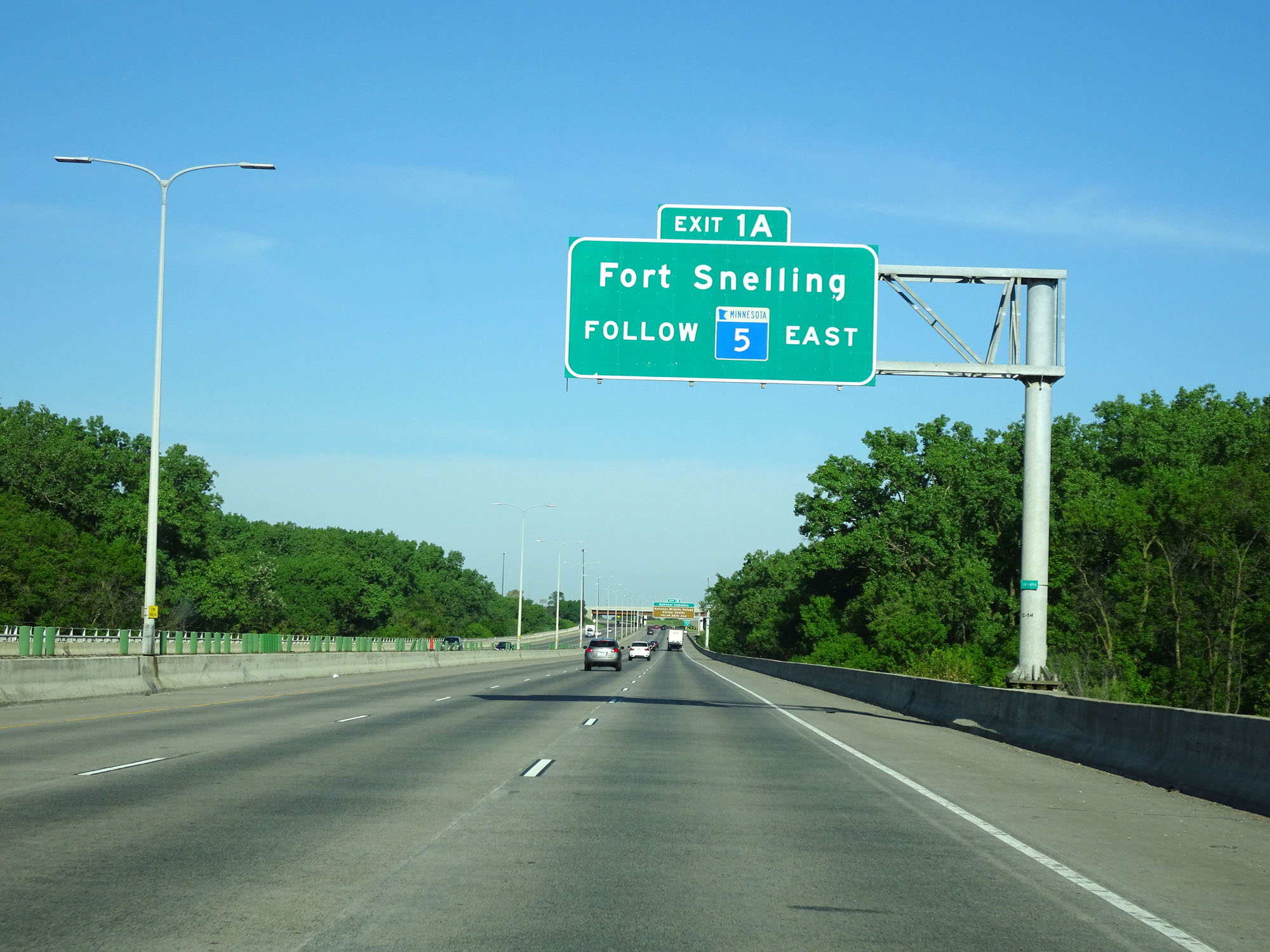 |
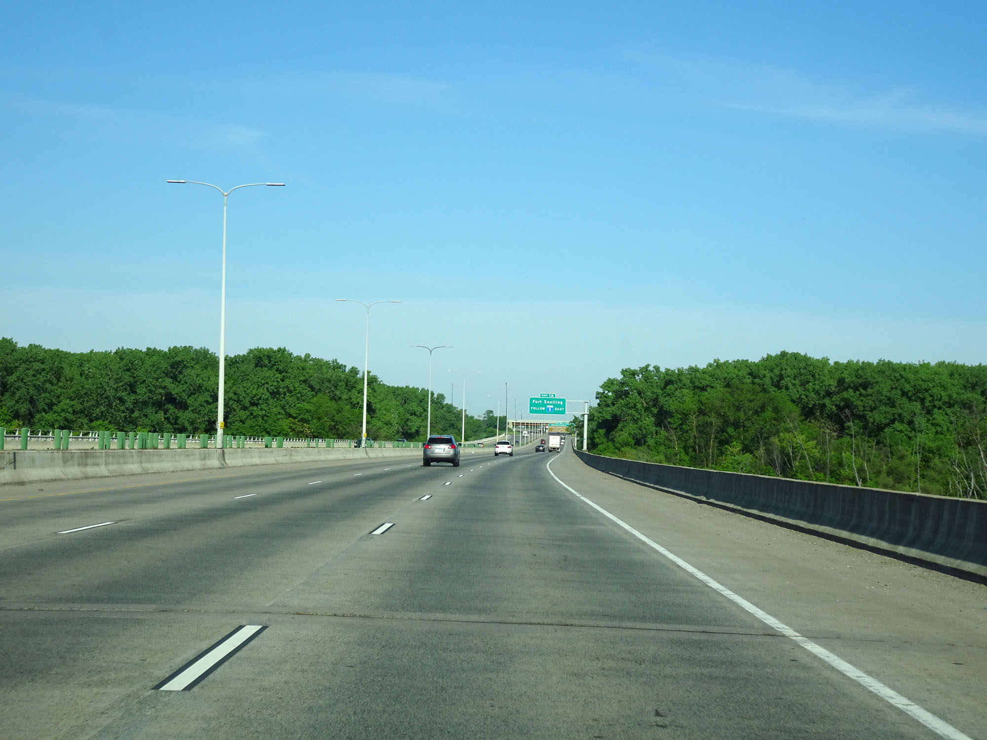
Take Exit 1A to Fort Snelling via MN 5 East. (Photo taken 5/22/16). |
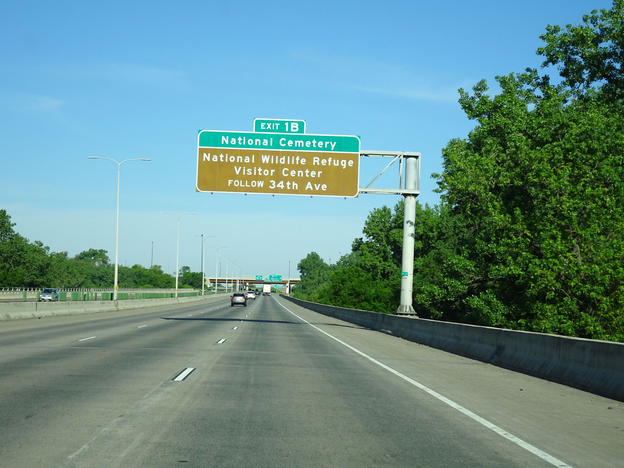 |
Take Exit 1B to National Cemetery and the National Wildlife Refuge Visitor Center via 34th Ave. (Photo taken 5/22/16). |
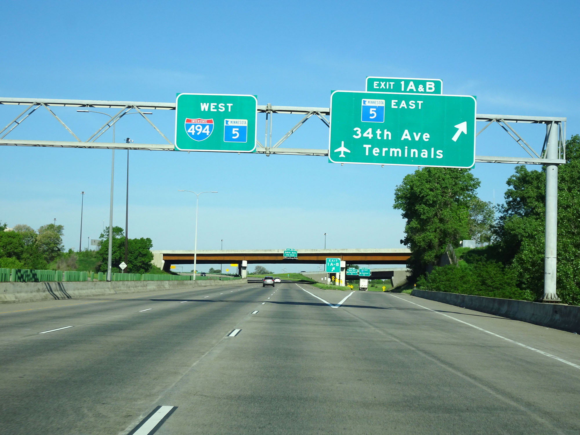 |
Interstate 494 Inner Loop (West) at Exits 1A-B: MN 5 East - 34th Ave / MSP Airport Terminals (Photo taken 5/22/16). |
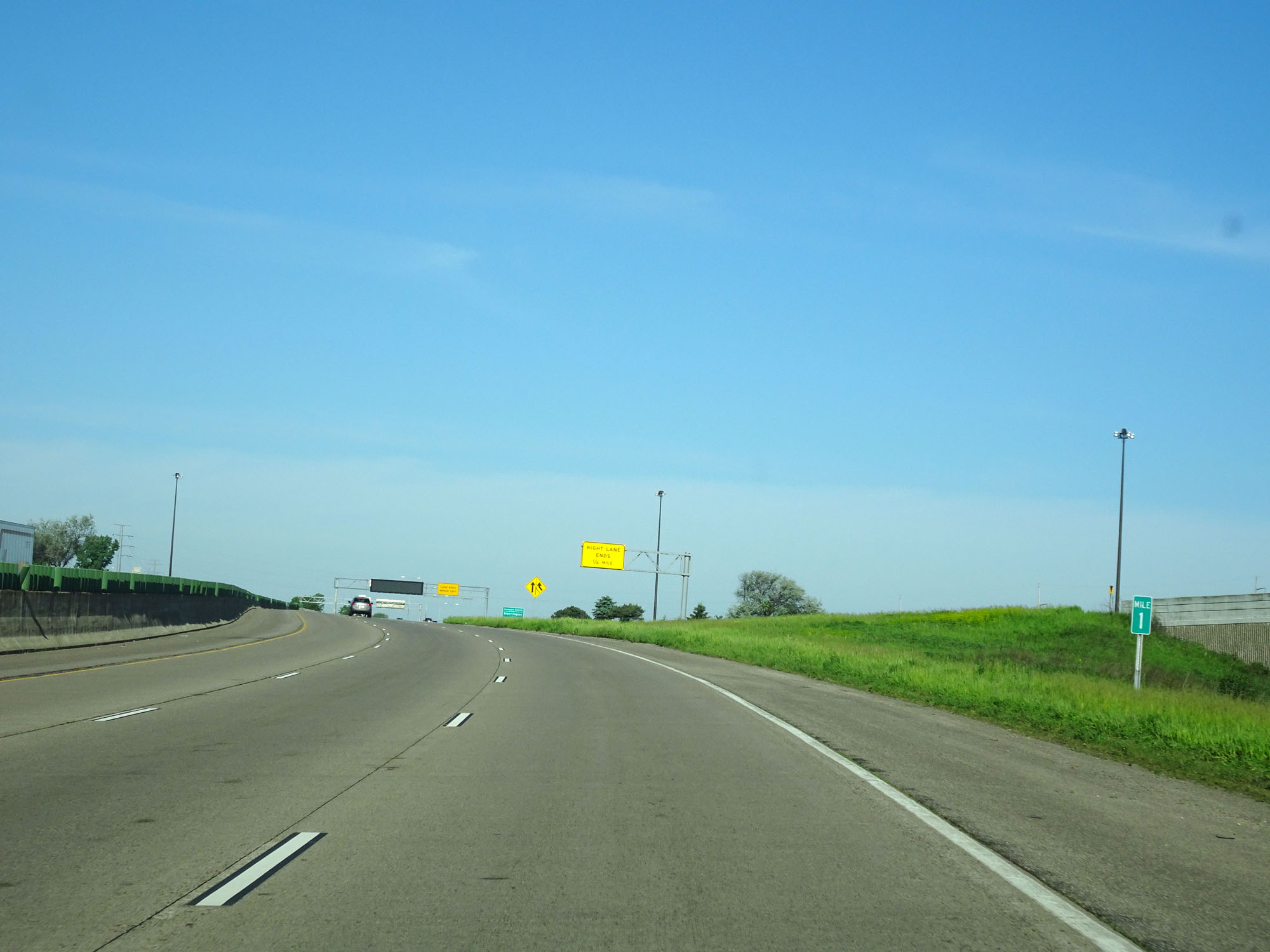 |
Interstate 494 Inner Loop (West) at mile marker 1. (Photo taken 5/22/16). |
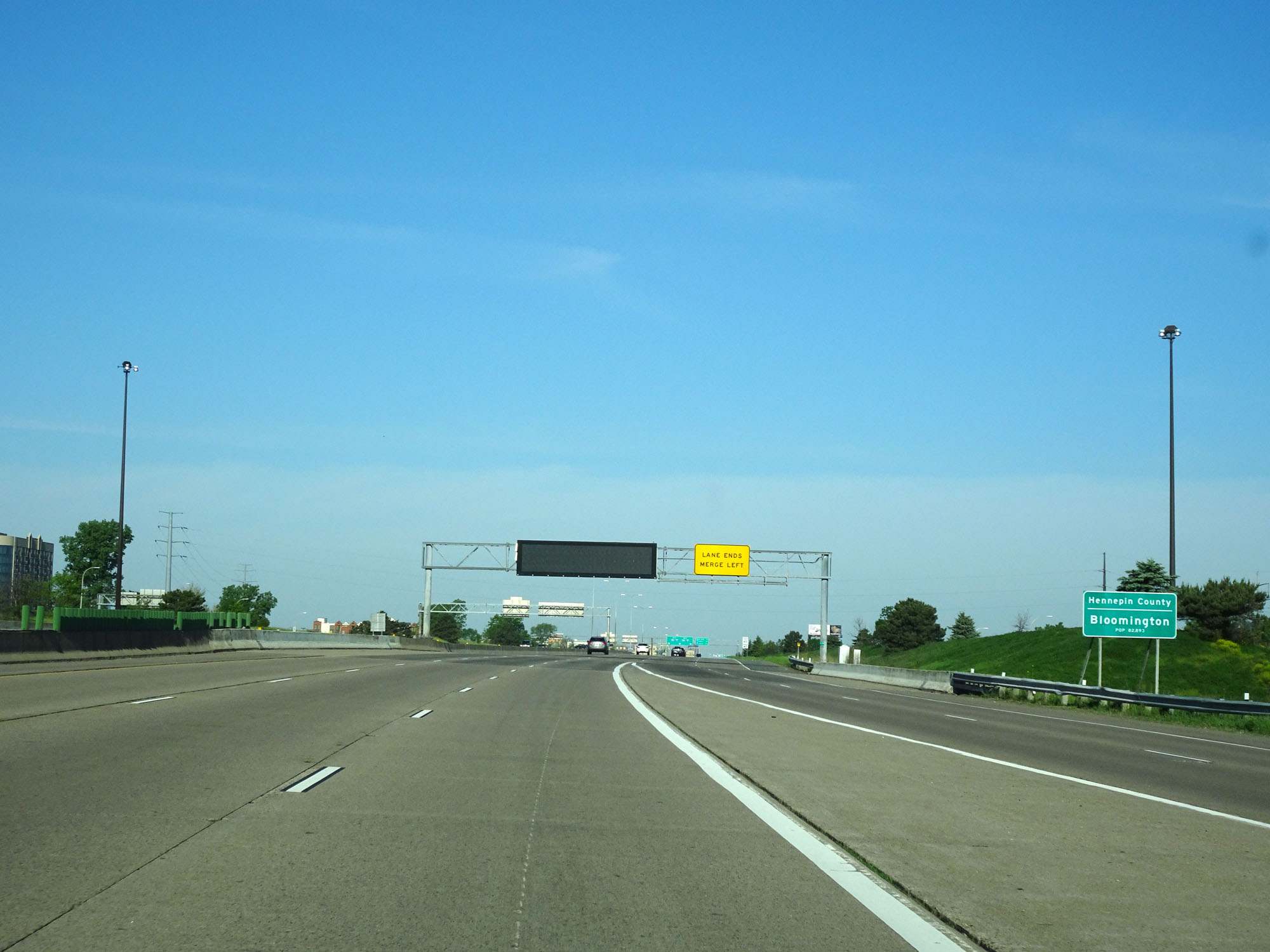 |
Interstate 494 Inner Loop (West) entering Hennepin County and the Bloomington city limits. (Photo taken 5/22/16). |
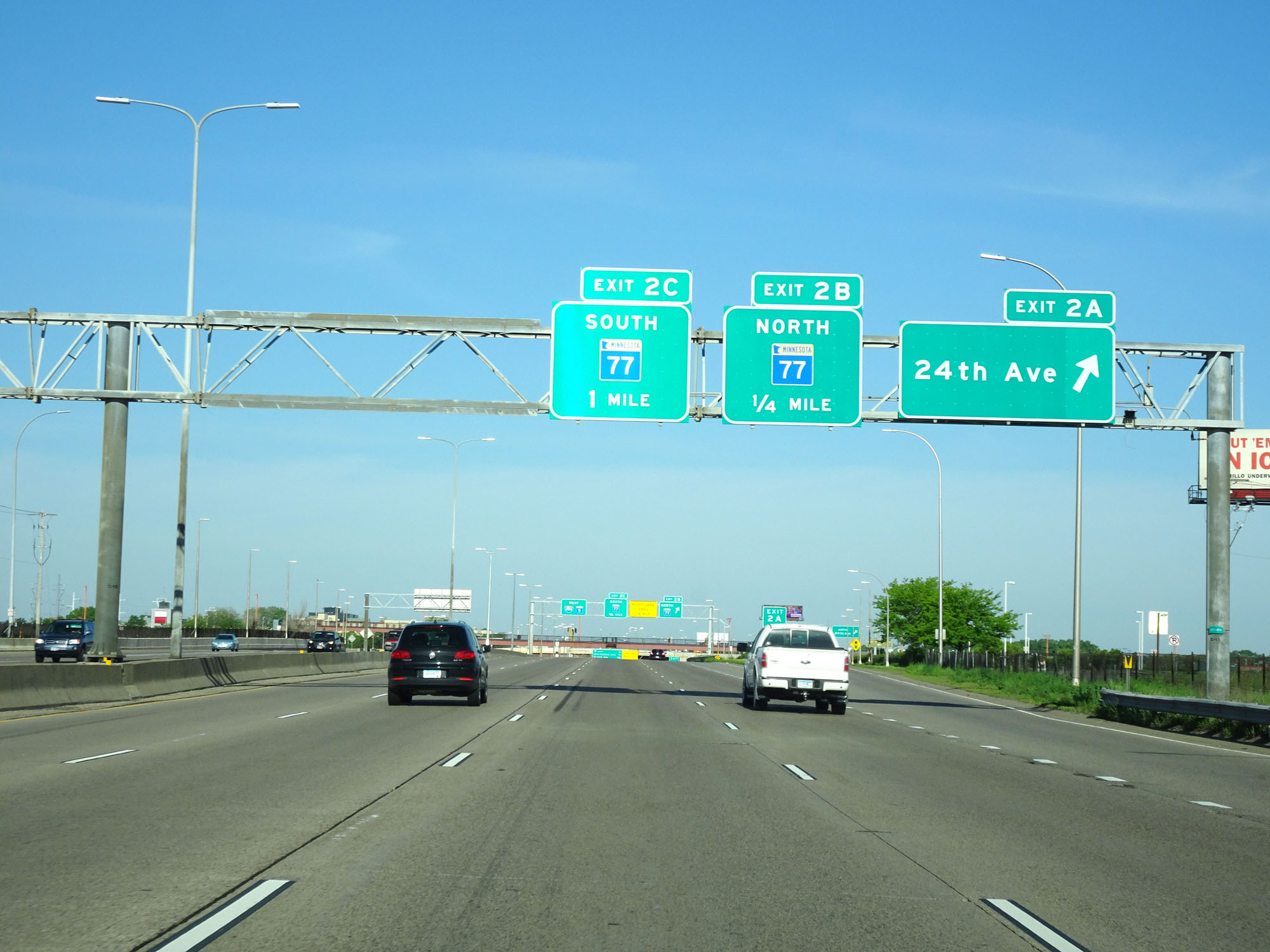 |
Interstate 494 Inner Loop (West) at Exit 2A: 24th Ave (Photo taken 5/22/16). |
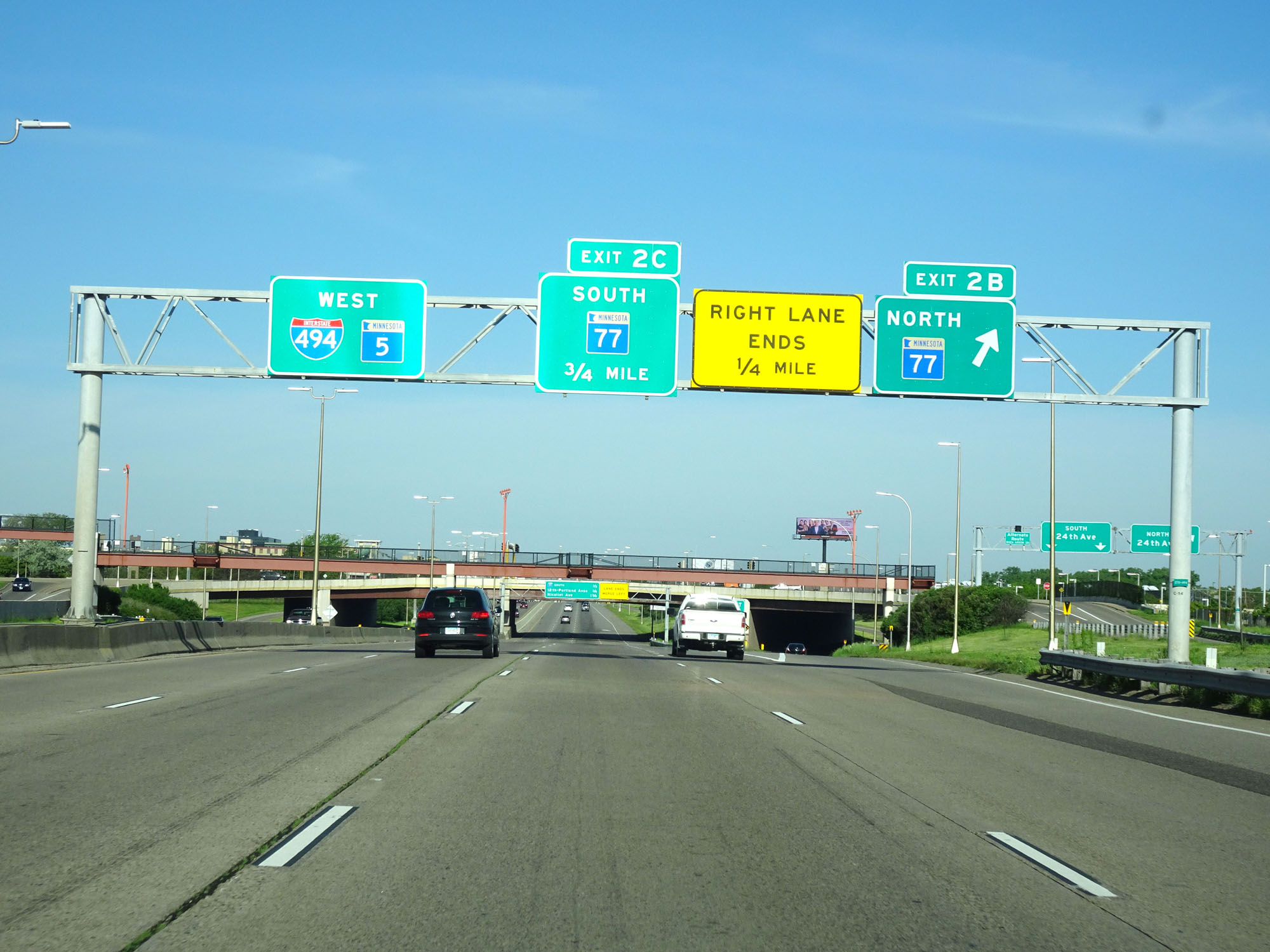 |
Interstate 494 Inner Loop (West) at Exit 2B: MN 77 North (Photo taken 5/22/16). |
Section 2: Bloomington (Exit 2B) to Interstate 94/Interstate 694
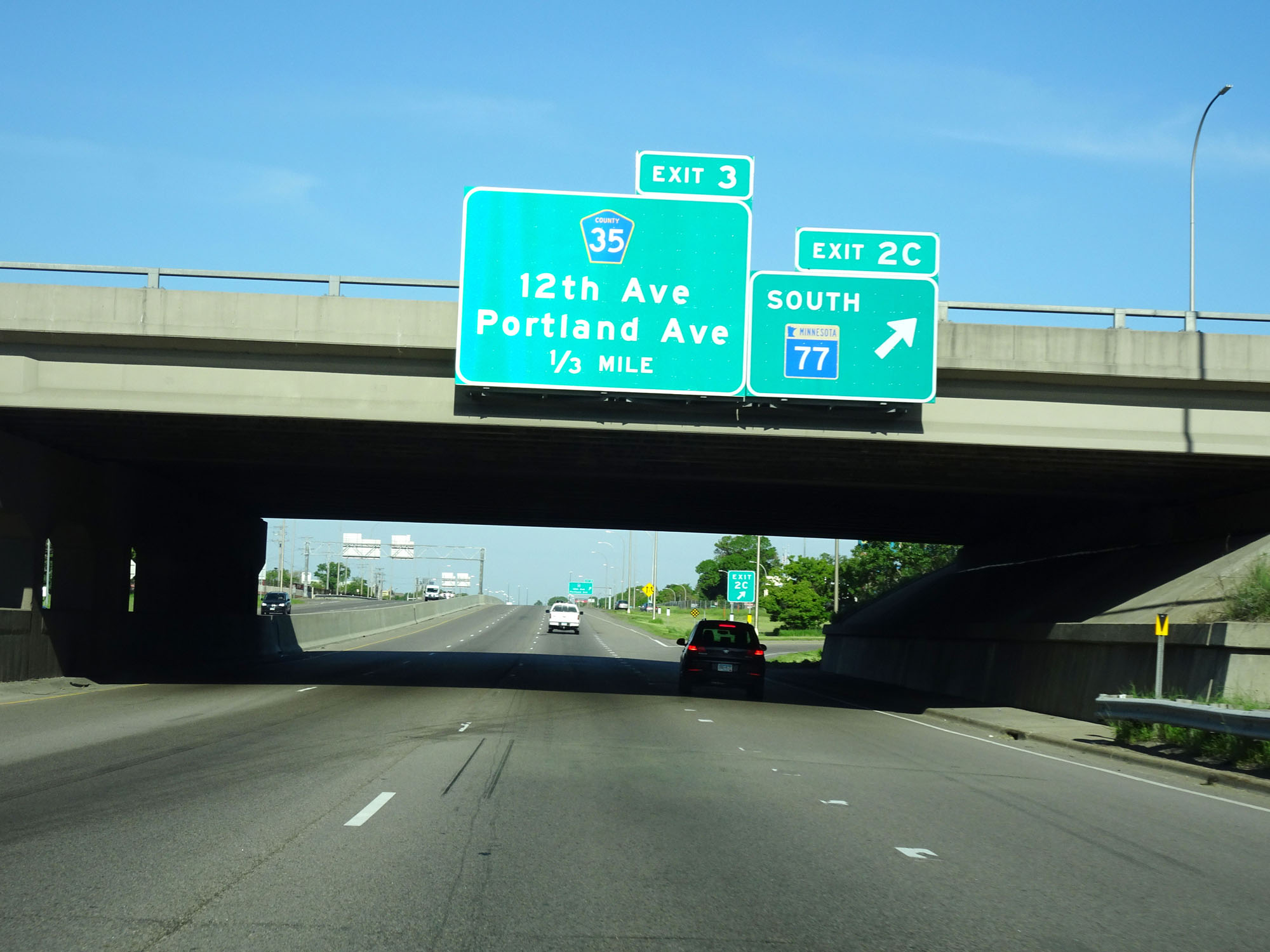 |
Interstate 494 Inner Loop (West) at Exit 2C: MN 77 South (Photo taken 5/22/16). |
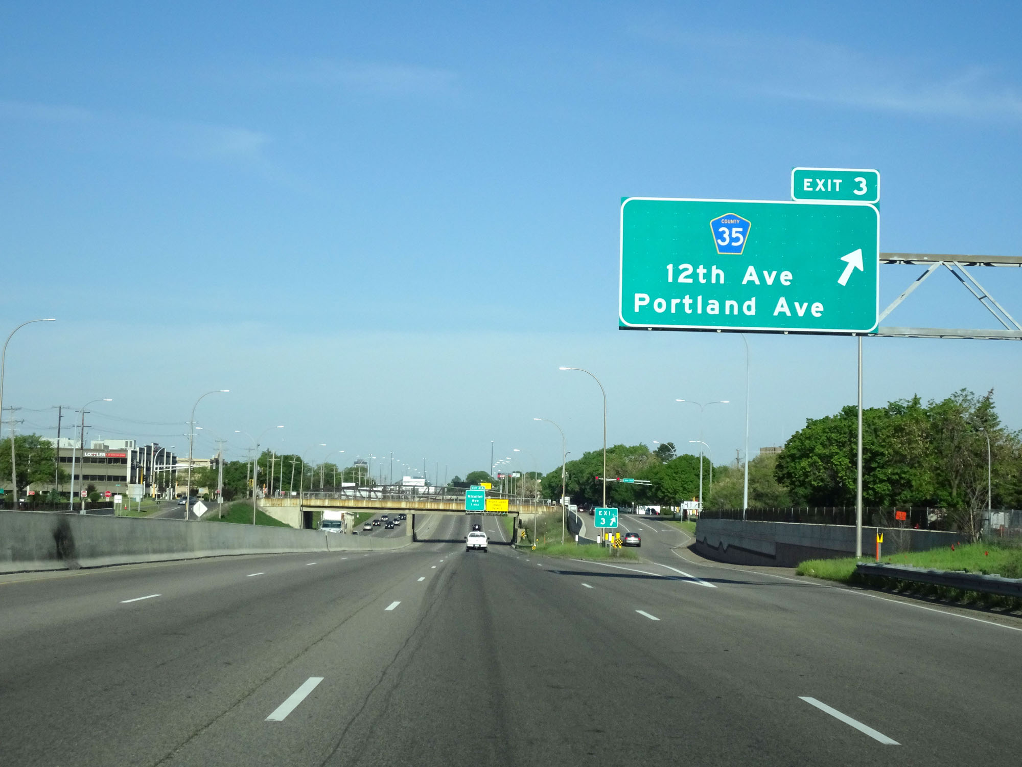 |
Interstate 494 Inner Loop (West) at Exit 3: CR 35 - 12th Ave / Portland Ave (Photo taken 5/22/16). |
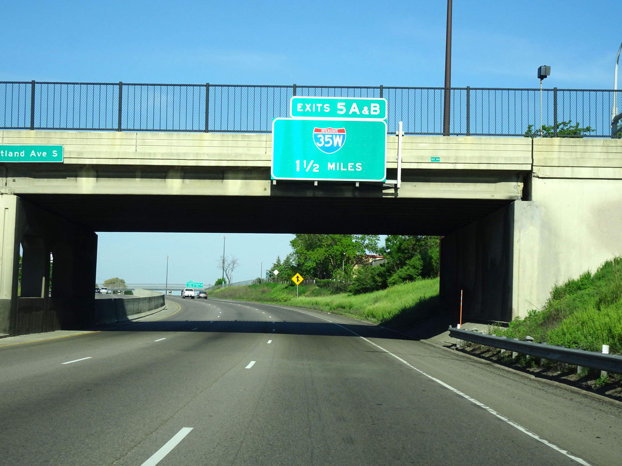 |
Interstate 494 Inner Loop (West) approaching Exits 5A-B - 1 1/2 miles. (Photo taken 5/22/16). |
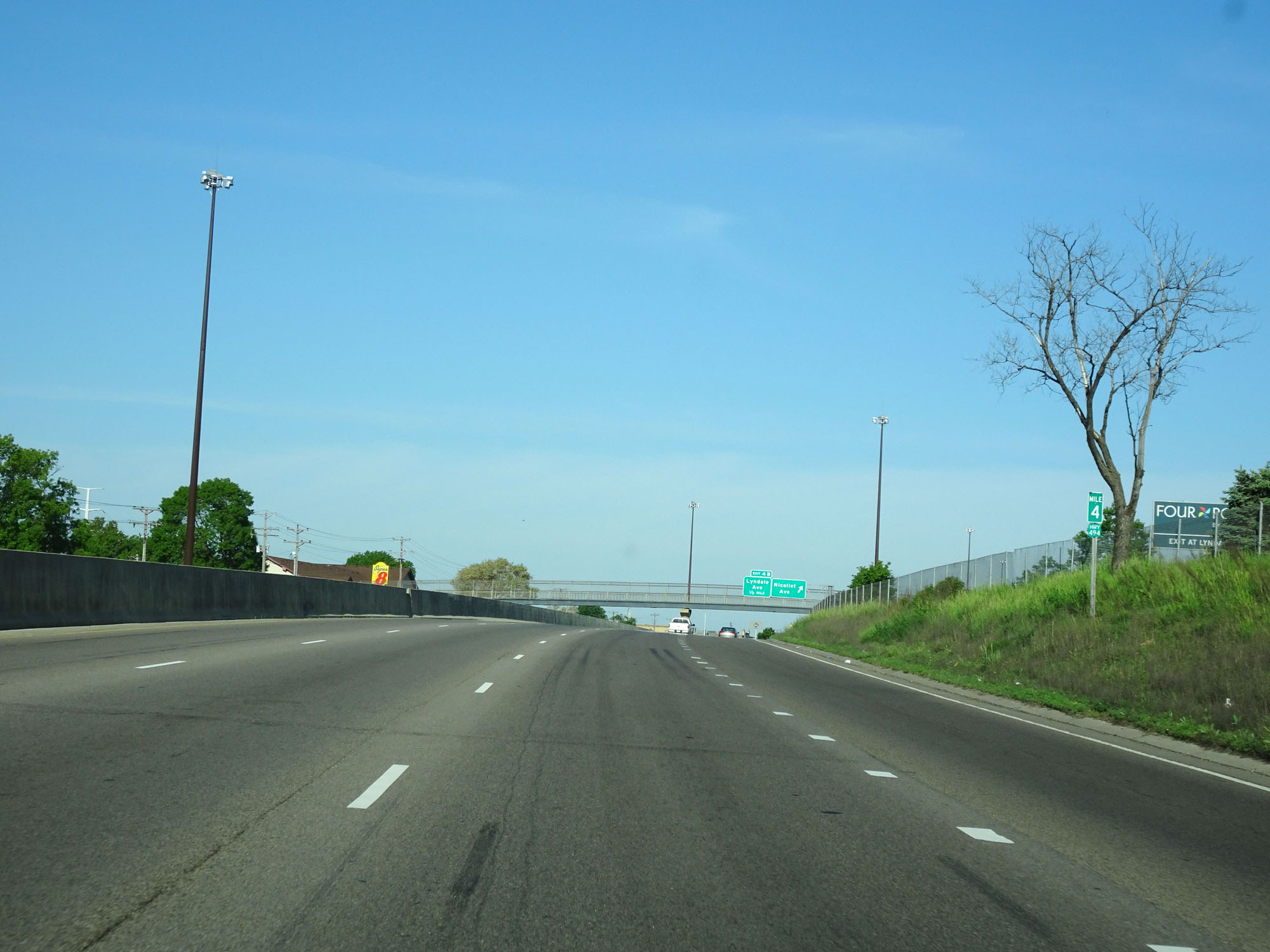 |
Interstate 494 Inner Loop (West) at mile marker 4. (Photo taken 5/22/16). |
 |
Interstate 494 Inner Loop (West) at Exit 4A: Nicollet Ave (Photo taken 5/22/16). |
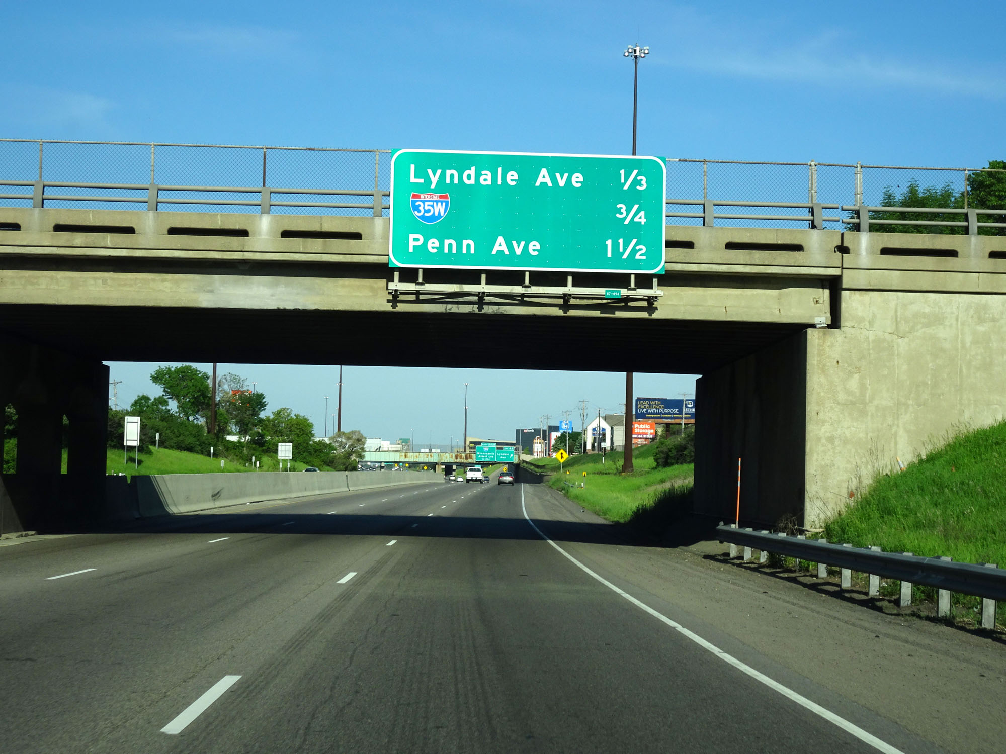 |
Overhead mileage sign listing the distances to the three upcoming interchanges. (Photo taken 5/22/16). |
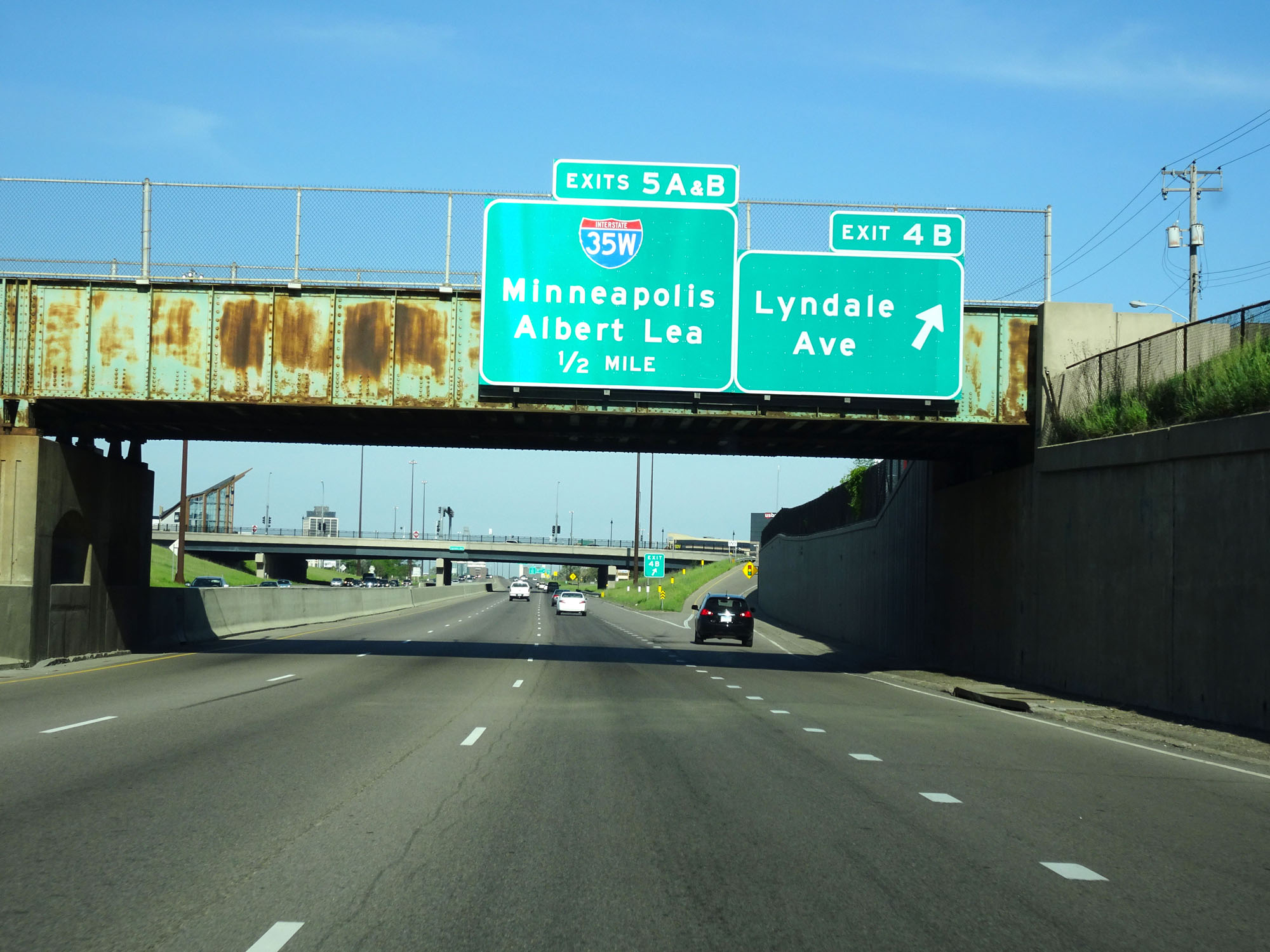 |
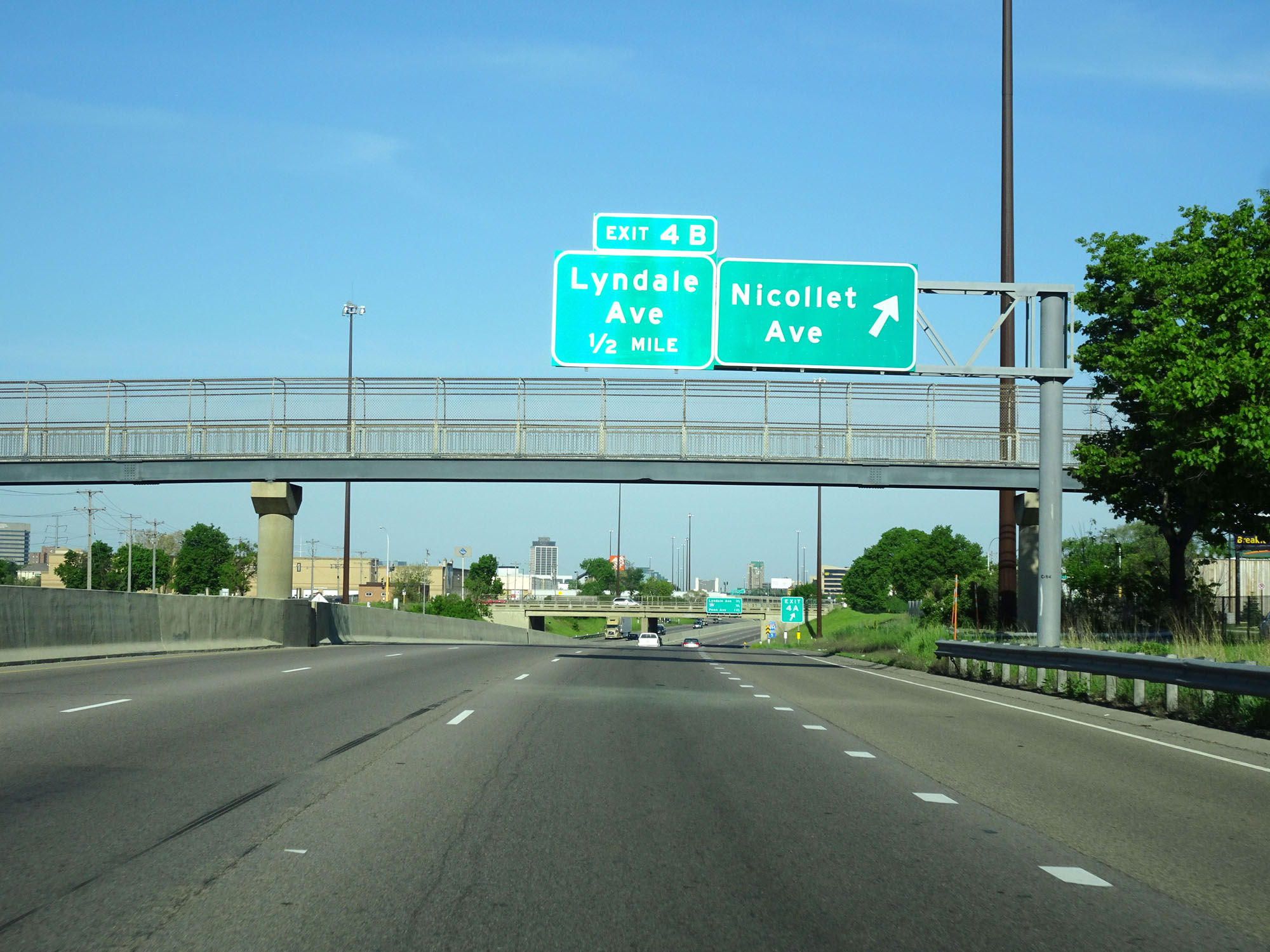
Interstate 494 Inner Loop (West) at Exit 4B: Lyndale Ave (Photo taken 5/22/16). |
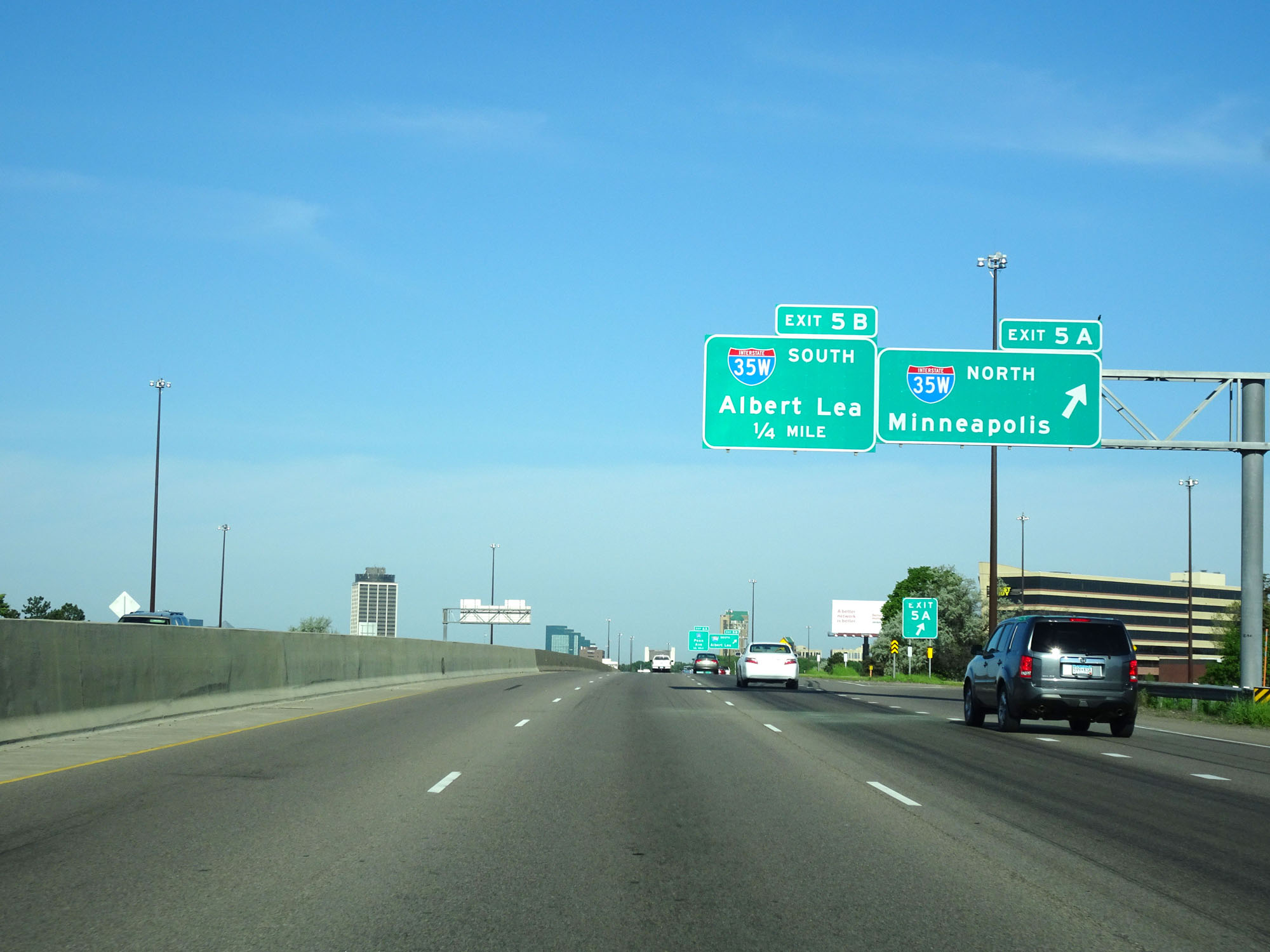 |
Interstate 494 Inner Loop at Exit 5A: Interstate 35W North - Minneapolis (Photo taken 5/22/16). |
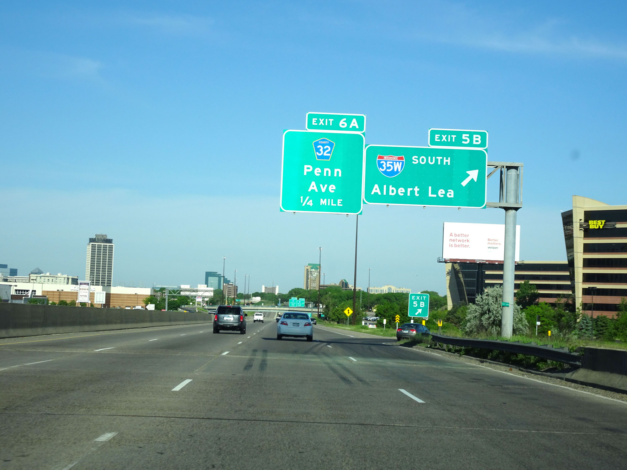 |
Interstate 494 Inner Loop (West) at Exit 5B: Interstate 35W South - Albert Lea (Photo taken 5/22/16). |
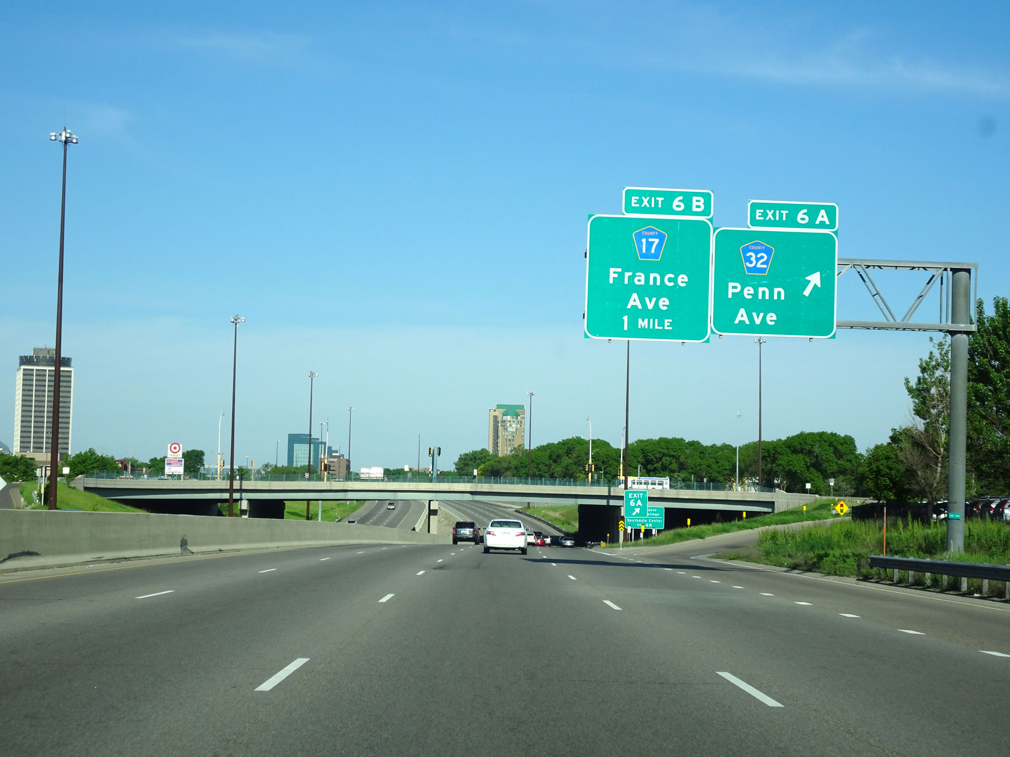 |
Interstate 494 Inner Loop (West) at Exit 6A: CR 32 - Penn Ave (Photo taken 5/22/16). |
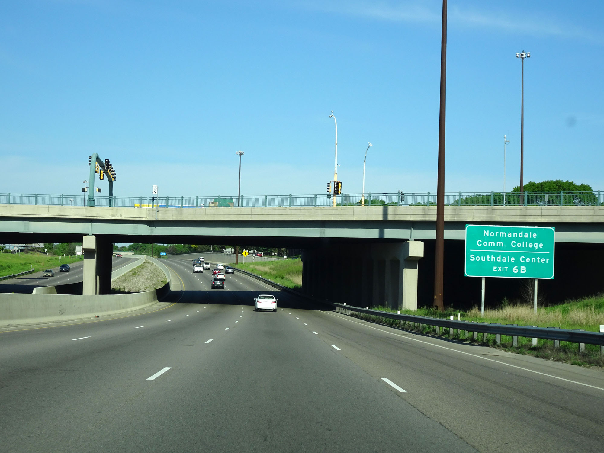 |
Take Exit 6B to Normandale Community College and Southdale Center. (Photo taken 5/22/16). |
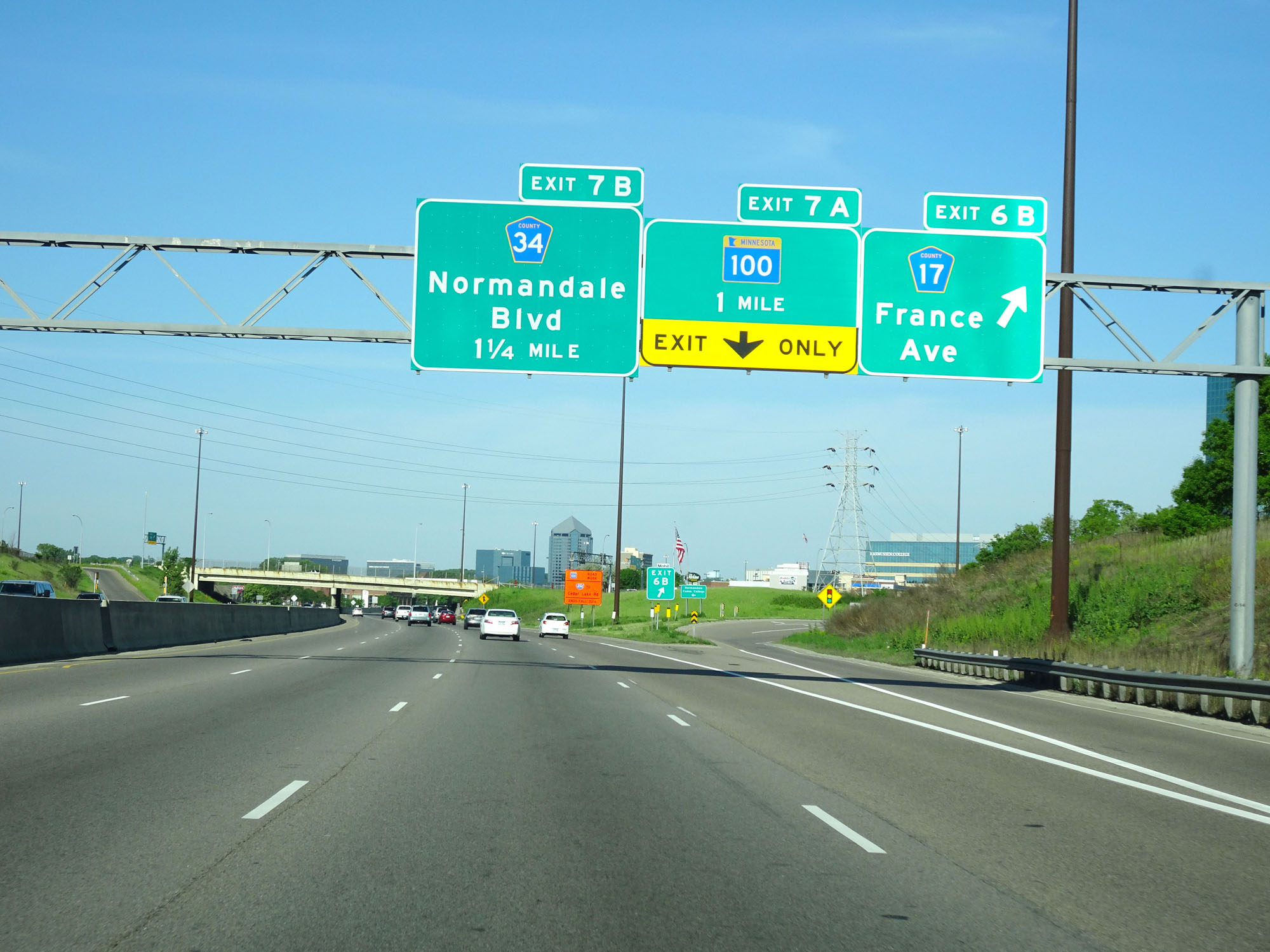 |
Interstate 494 Inner Loop (West) at Exit 6B: CR 17 - France Ave (Photo taken 5/22/16). |
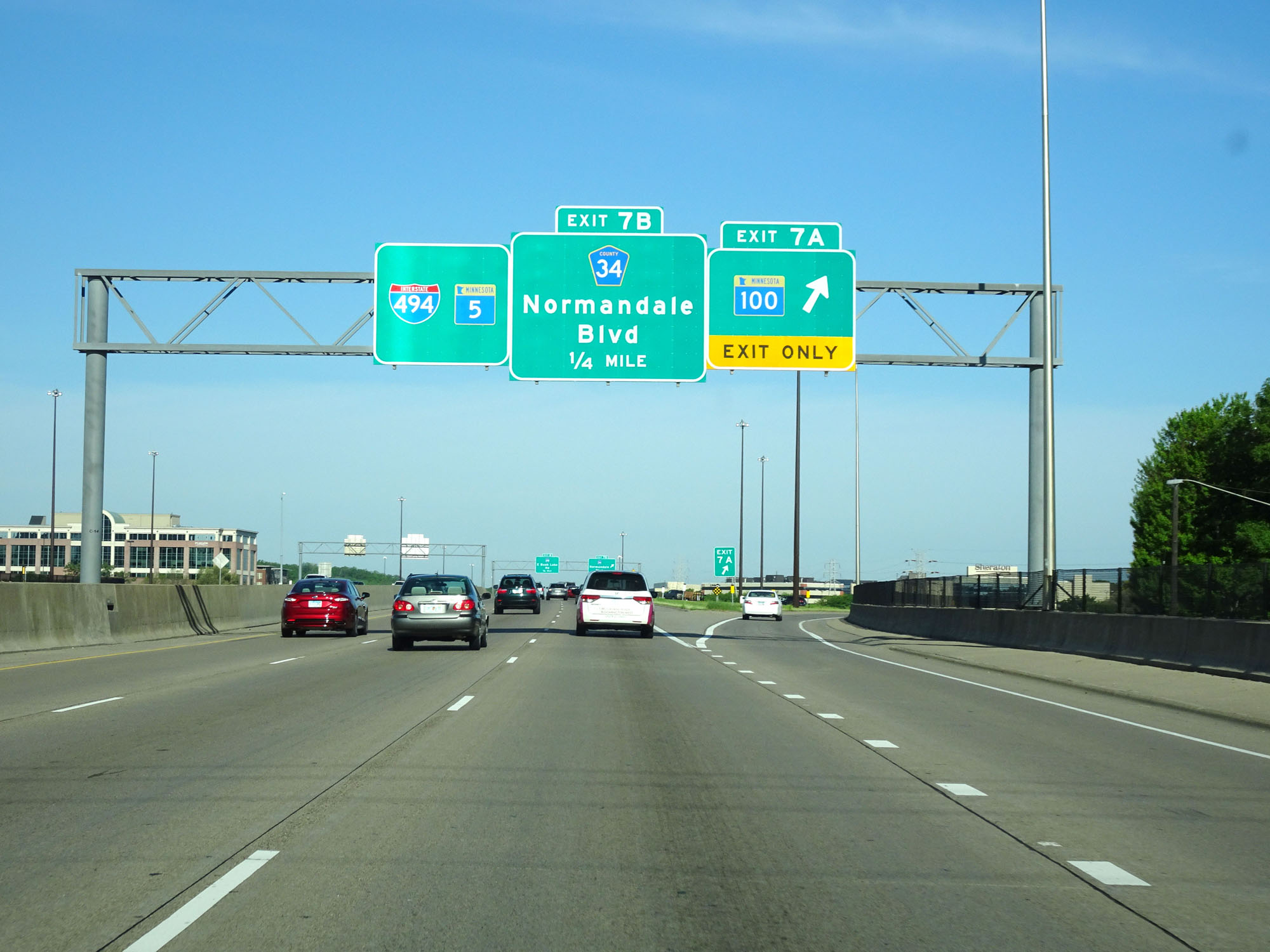 |
Interstate 494 Inner Loop (West) at Exit 7A: MN 100 (Photo taken 5/22/16). |
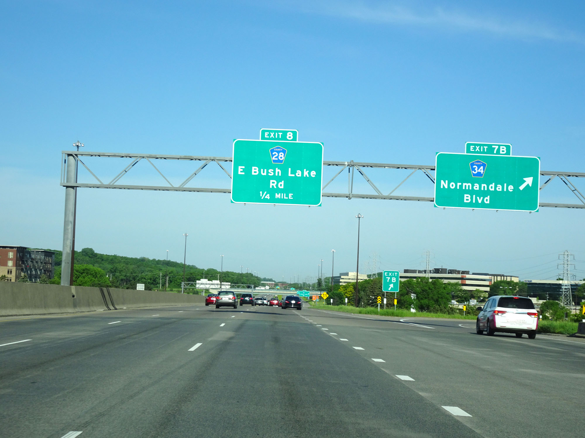 |
Interstate 494 Inner Loop at Exit 7B: CR 34 - Normandale Blvd (Photo taken 5/22/16). |
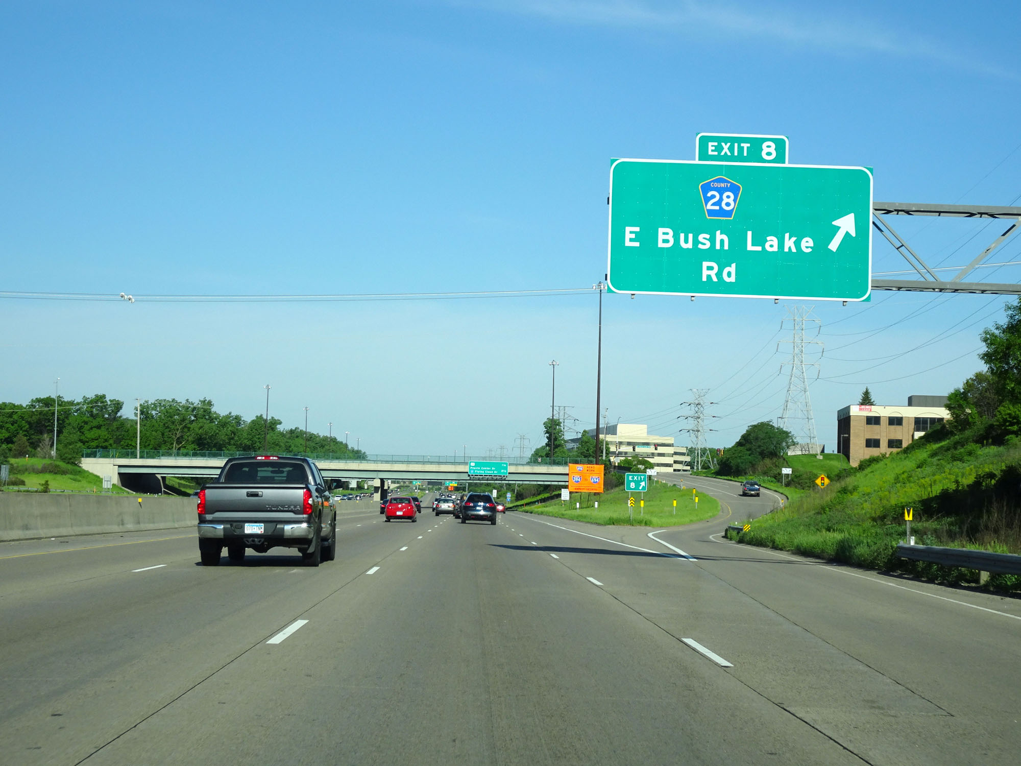 |
Interstate 494 Inner Loop (West) at Exit 8: CR 28 - E Bush Lake Rd (Photo taken 5/22/16). |
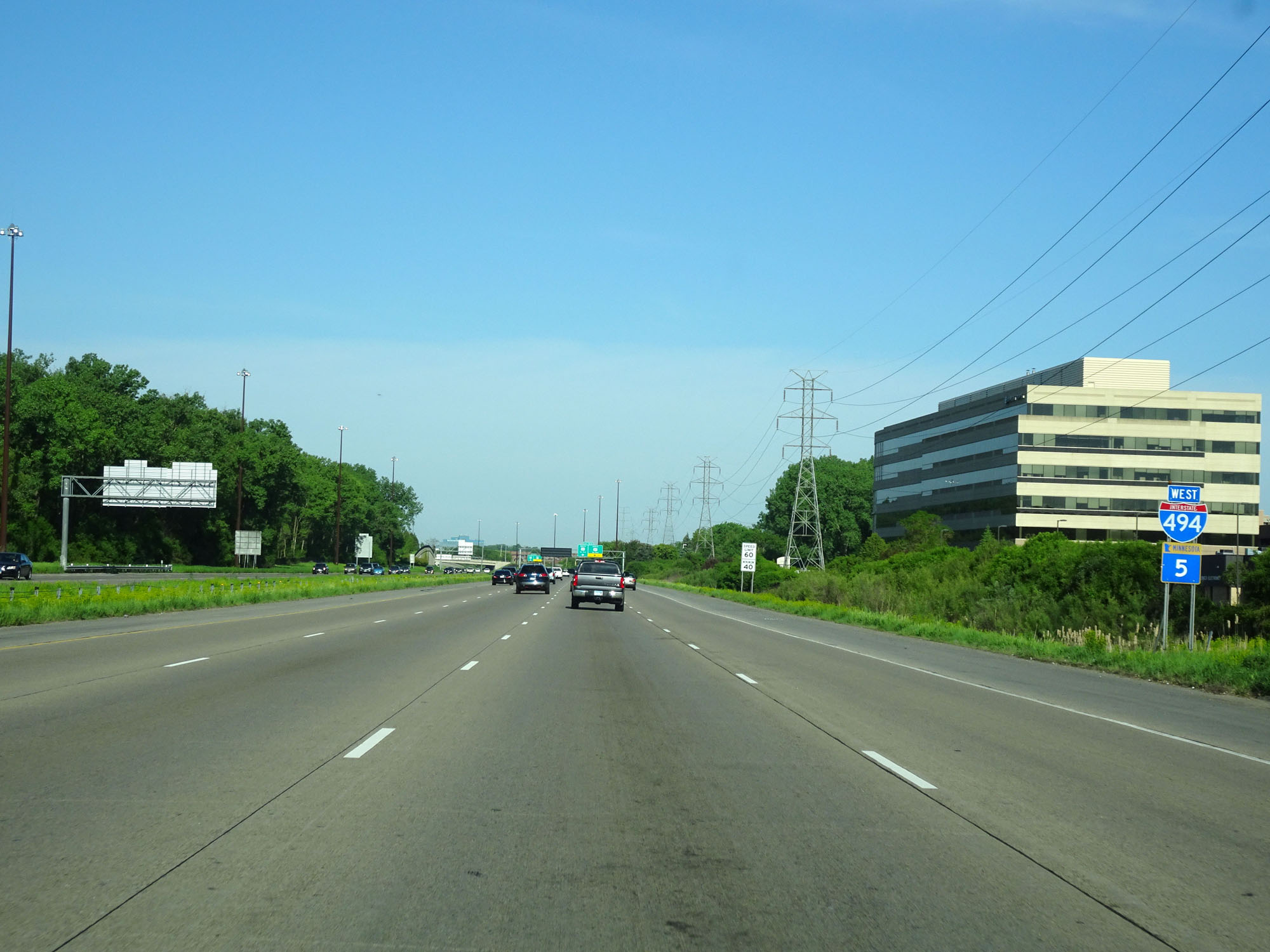 |
Interstate 494 West / MN 5 West assurance shields. (Photo taken 5/22/16). |
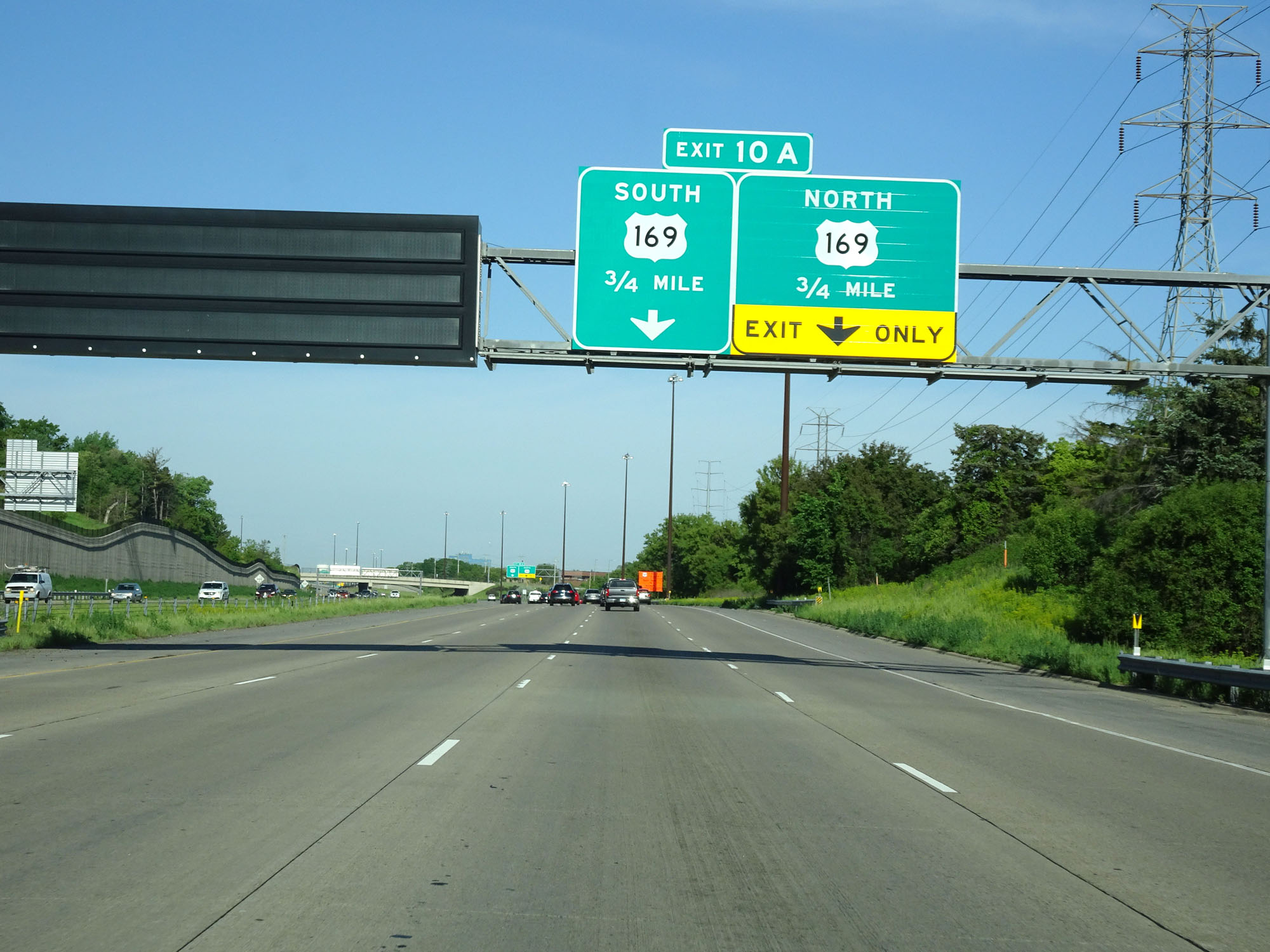 |
Interstate 494 Inner Loop (West) approaching Exit 10A - 3/4 mile. (Photo taken 5/22/16). |
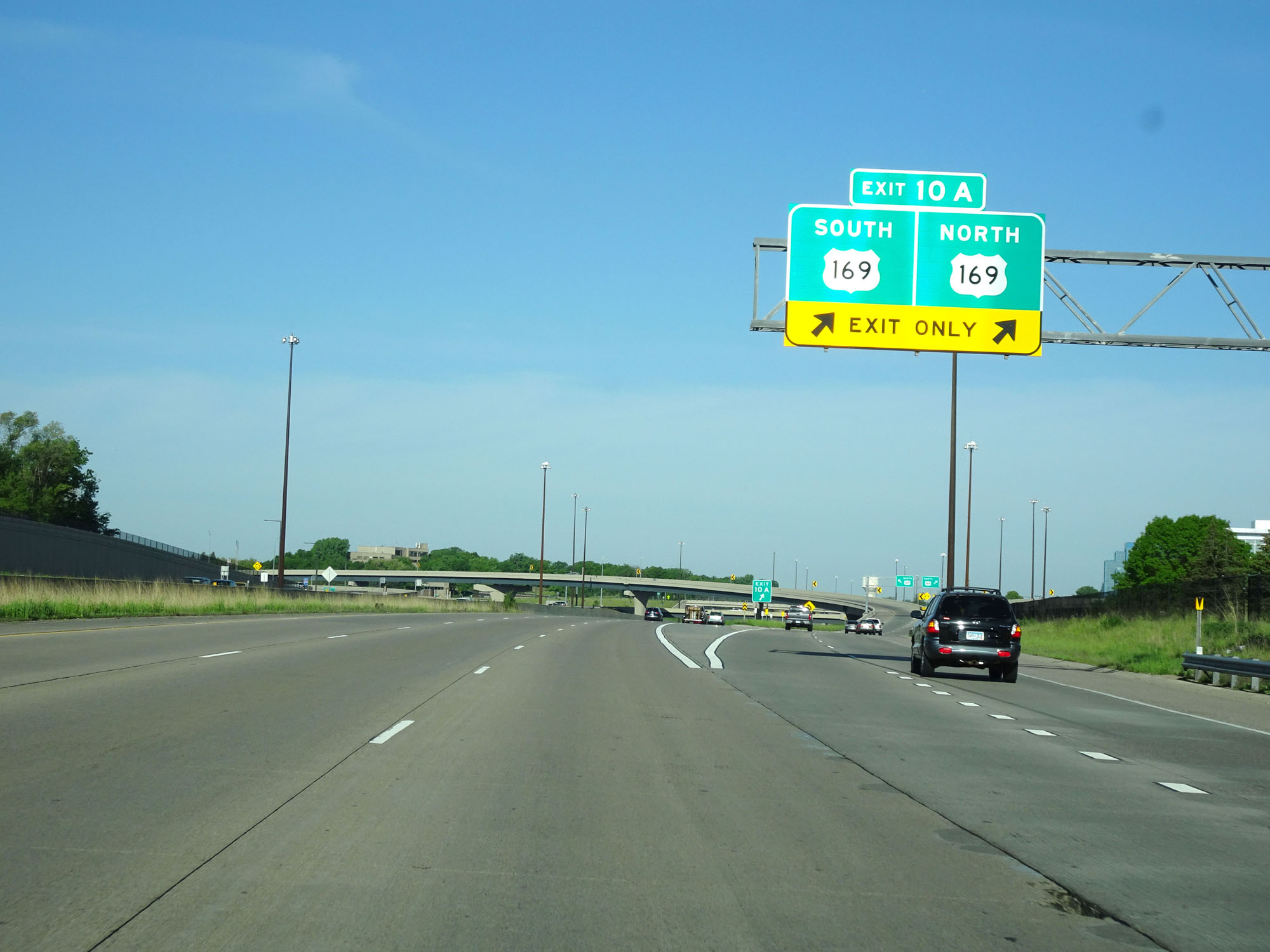 |
Interstate 494 Inner Loop (West) at Exit 10A: US 169 (Photo taken 5/22/16). |
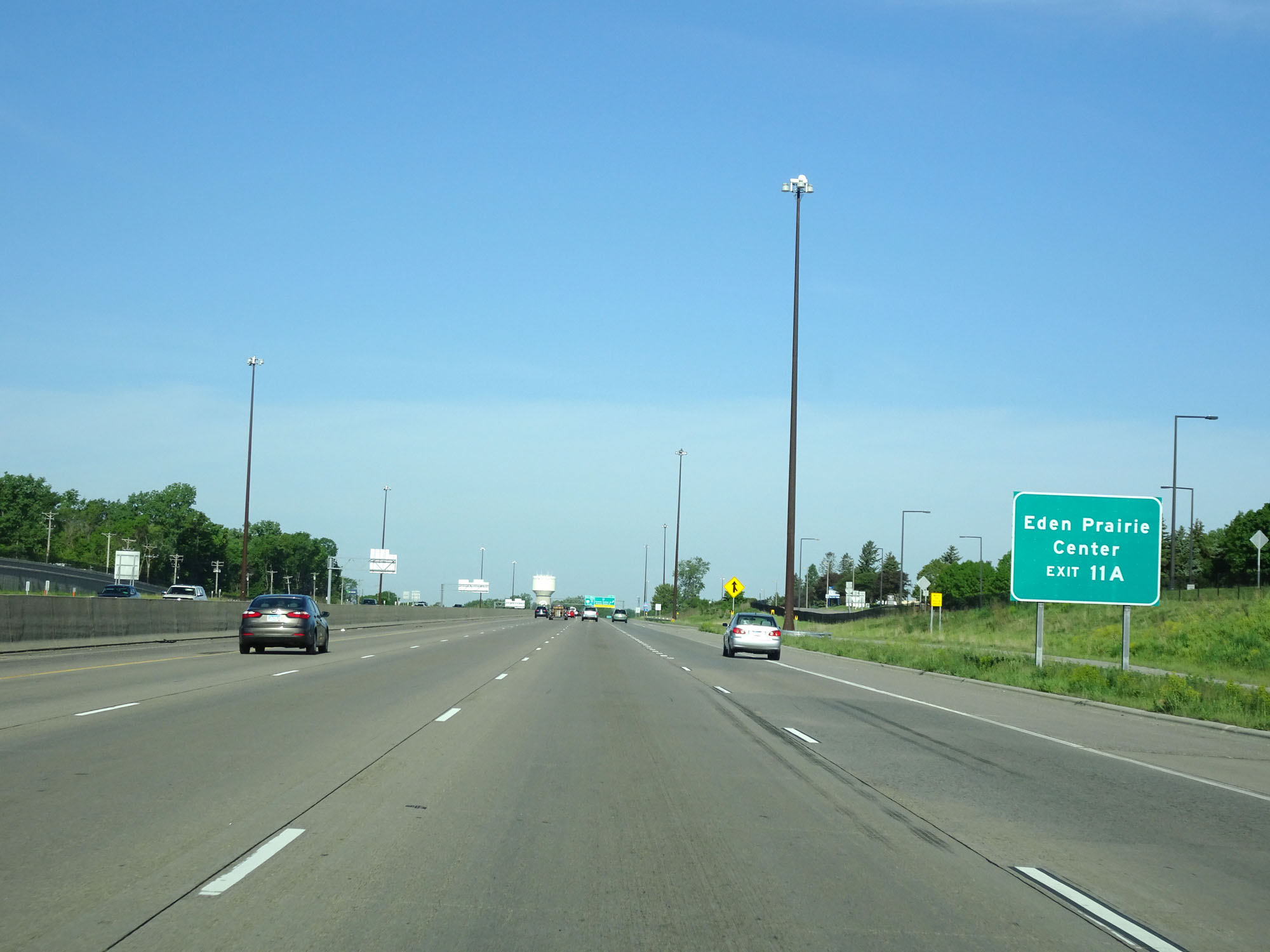 |
Take Exit 11A to Eden Prairie Center. (Photo taken 5/22/16). |
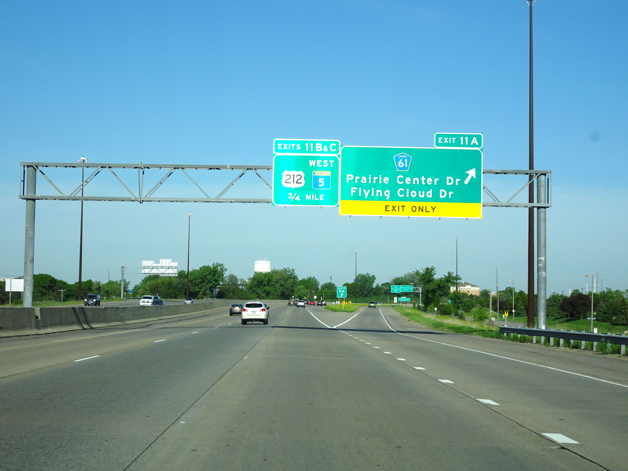 |
Interstate 494 Inner Loop (West) at Exit 11A: CR 61 - Prairie Center Dr / Flying Cloud Dr (Photo taken 5/22/16). |
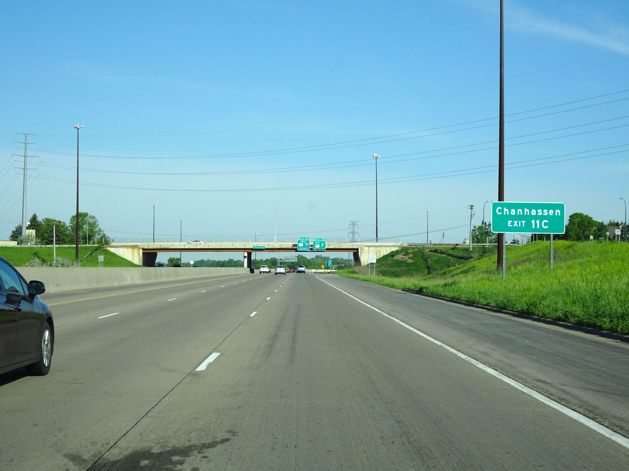 |
Take Exit 11C to Chanhassen. (Photo taken 5/22/16). |
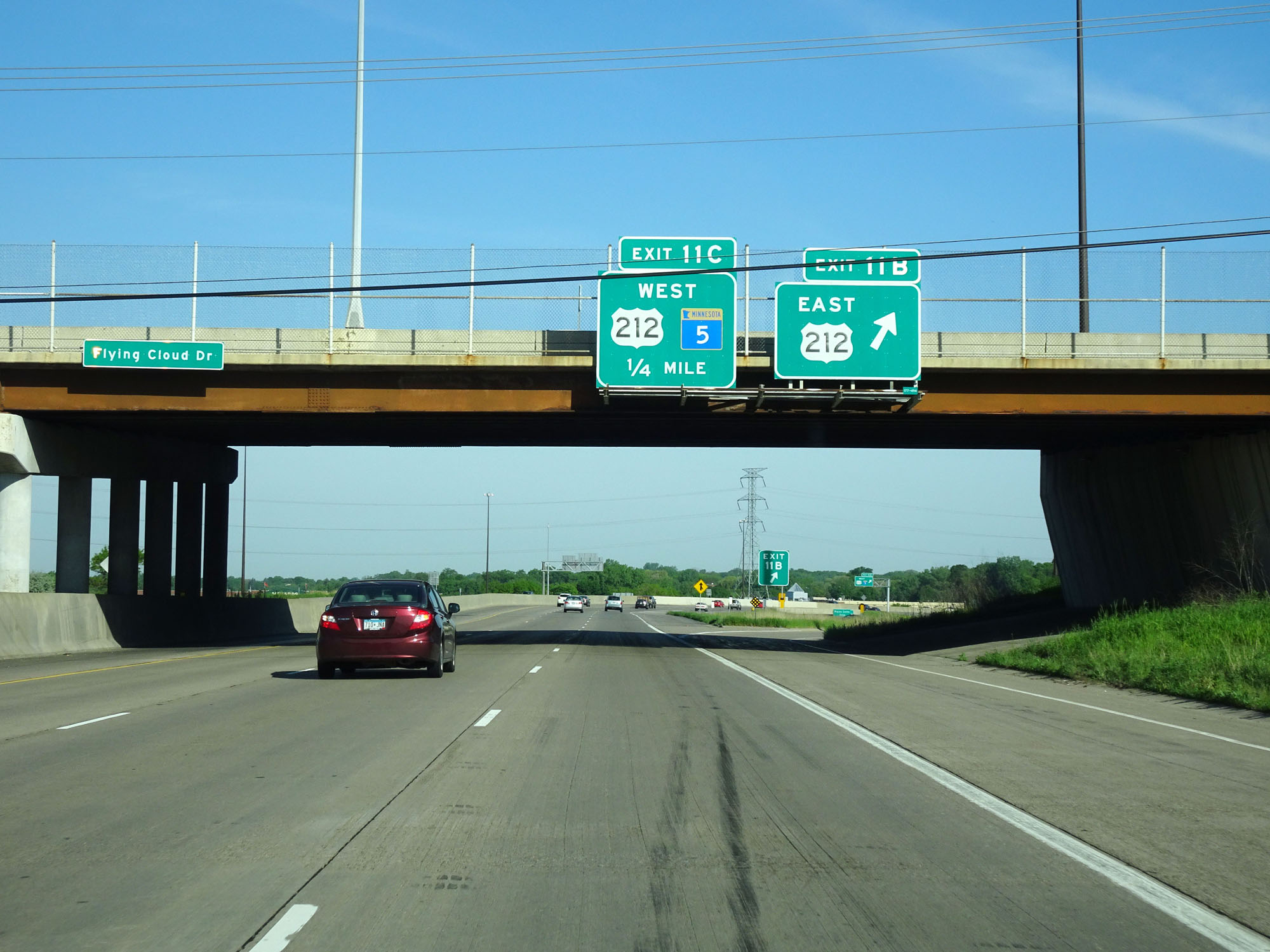 |
Interstate 494 Inner Loop (West) at Exit 11B: US 212 East (Photo taken 5/22/16). |
 |
Interstate 494 Inner Loop (West) as it begins to curve to the north, at the southwestern corner of the Minneapolis area. (Photo taken 5/22/16). |
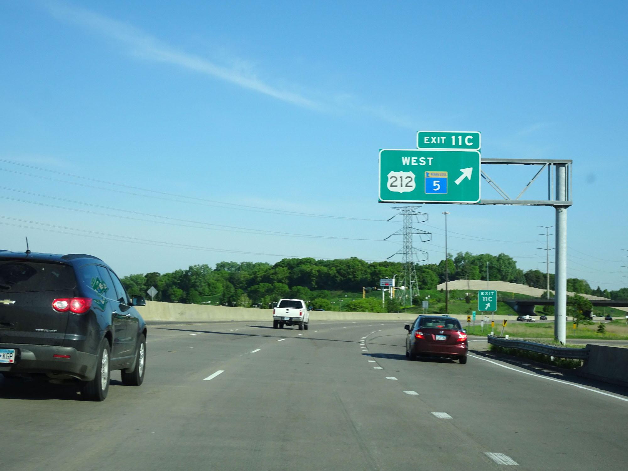 |
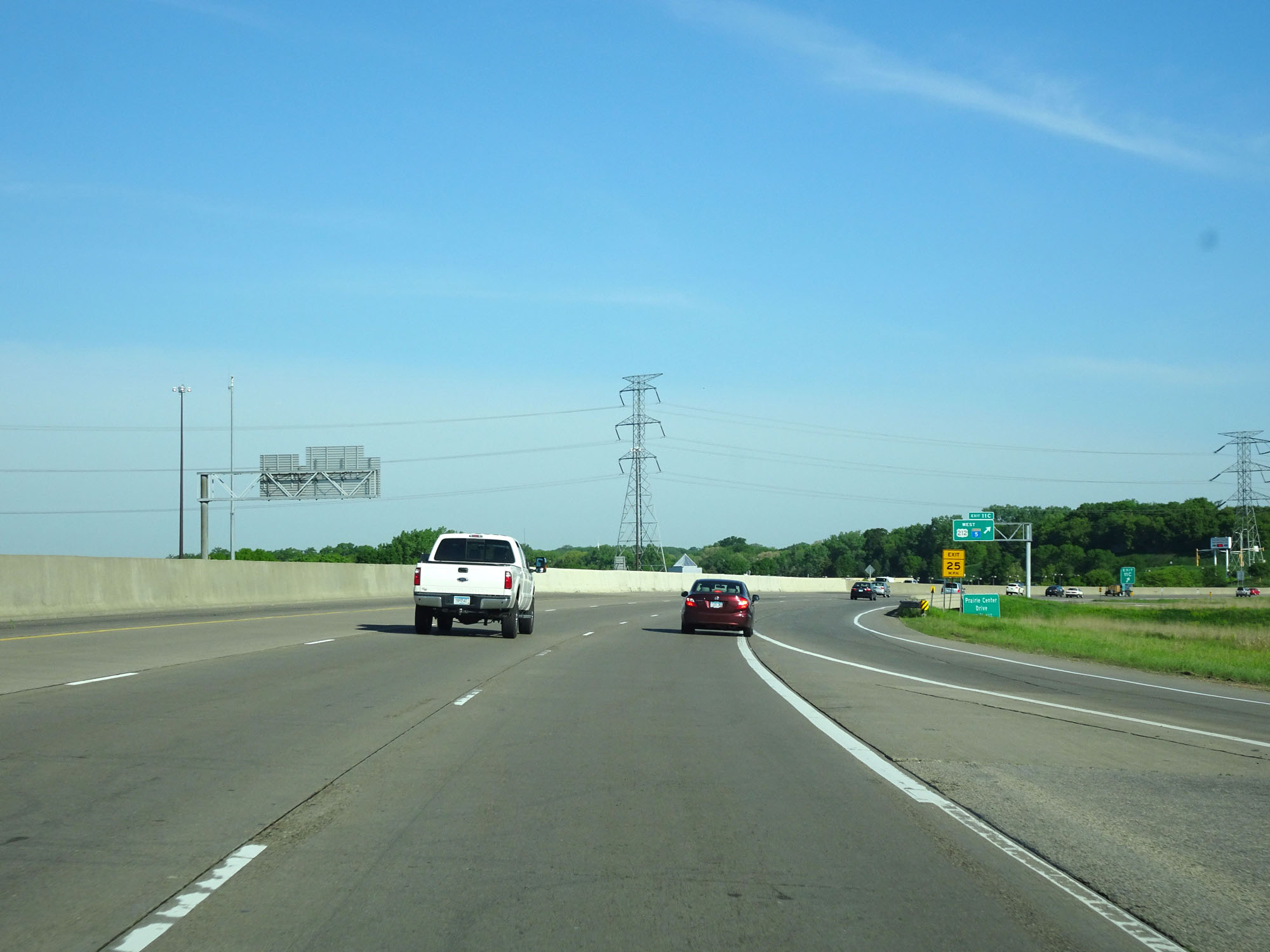
Interstate 494 Inner Loop (West) at Exit 11C: US 212 West / MN 5 West (Photo taken 5/22/16). |
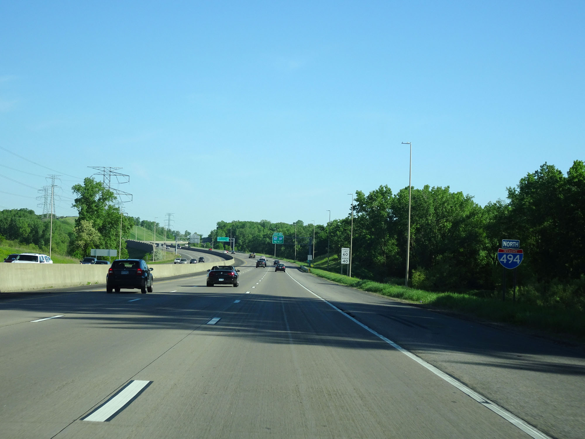 |
Interstate 494 North assurance shield just beyond Exit 11C. (Photo taken 5/22/16). |
 |
More speed limit signs on Interstate 494 Inner Loop (North). Same as before, the speed limit remains 60 mph with a minimum speed limit of 40 mph. (Photo taken 5/22/16). |
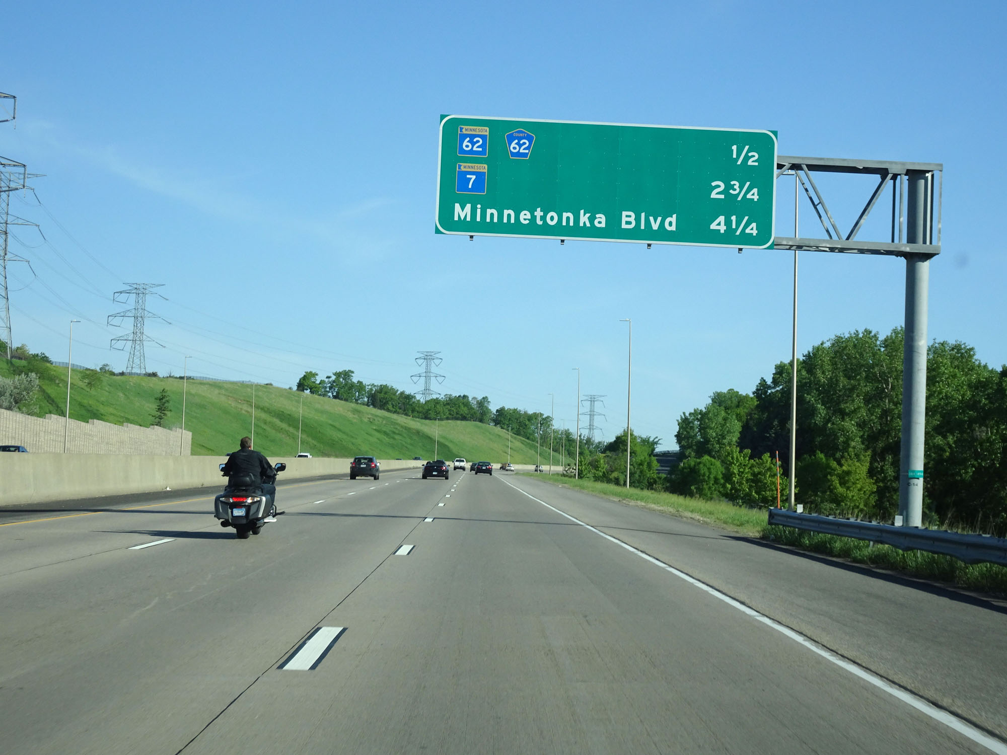 |
Overhead mileage sign listing the distances to the next three interchanges. (Photo taken 5/22/16). |
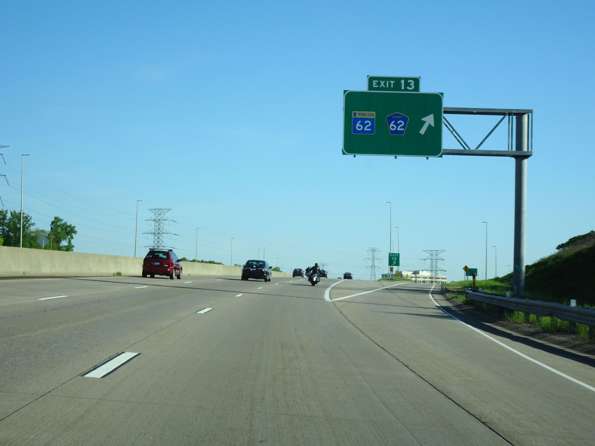 |
Interstate 494 Inner Loop (North) at Exit 13: MN 62 / CR 62 (Photo taken 5/22/16). |
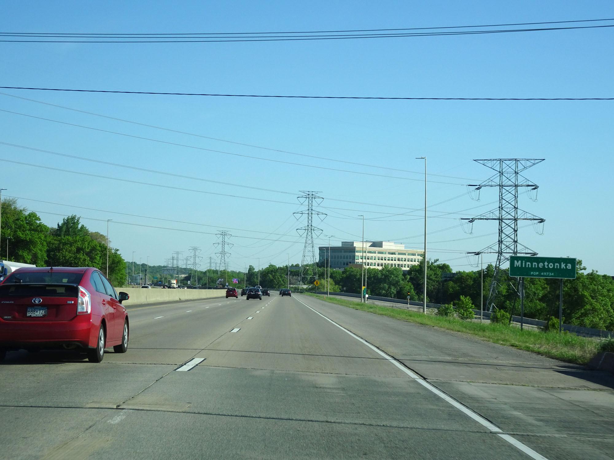 |
Interstate 494 Inner Loop (North) entering the Minnetonka city limits at mile marker 14. (Photo taken 5/22/16). |
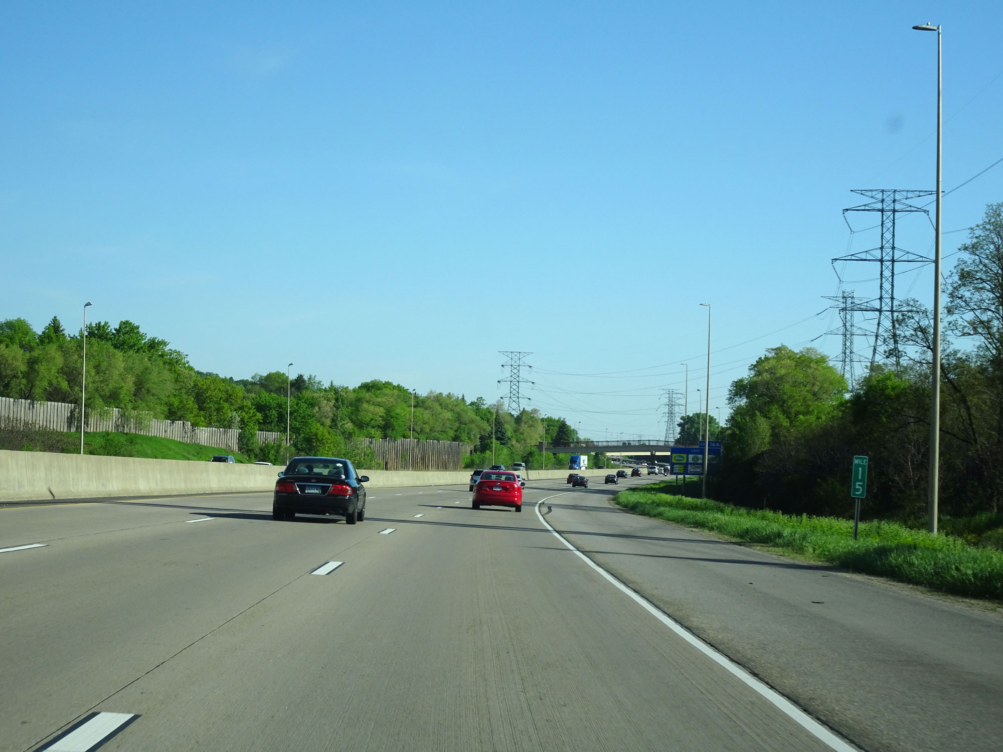 |
Interstate 494 Inner Loop (North) at mile marker 15. (Photo taken 5/22/16). |
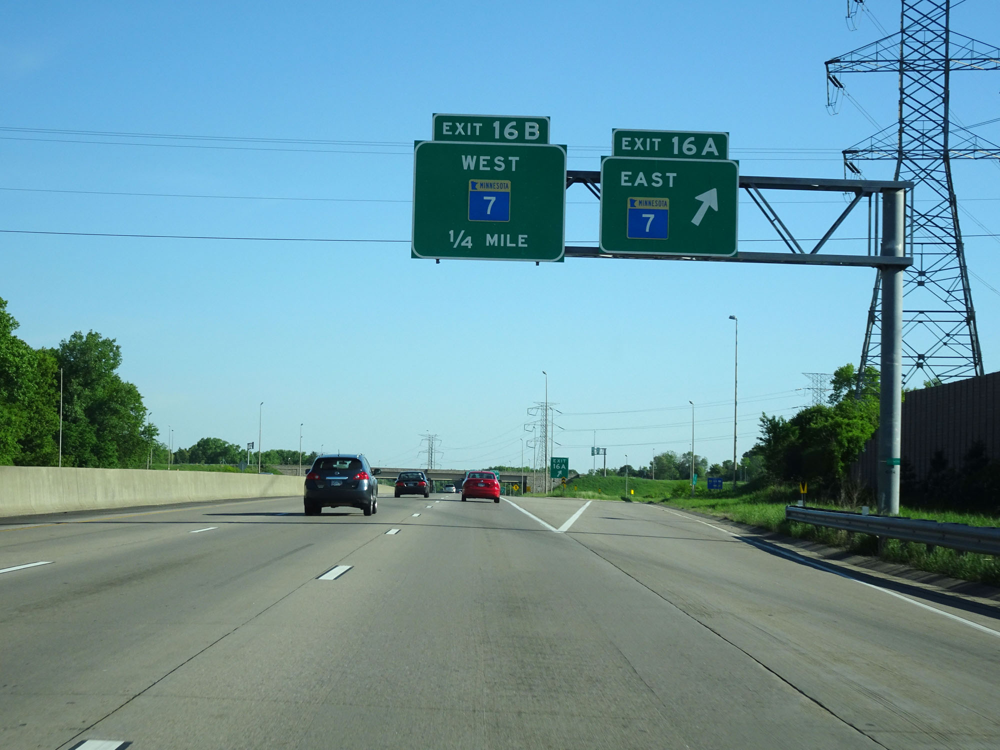 |
Interstate 494 Inner Loop (North) at Exit 16A: MN 7 East (Photo taken 5/22/16). |
 |
Interstate 494 Inner Loop (North) at Exit 16B: MN 7 West (Photo taken 5/22/16). |
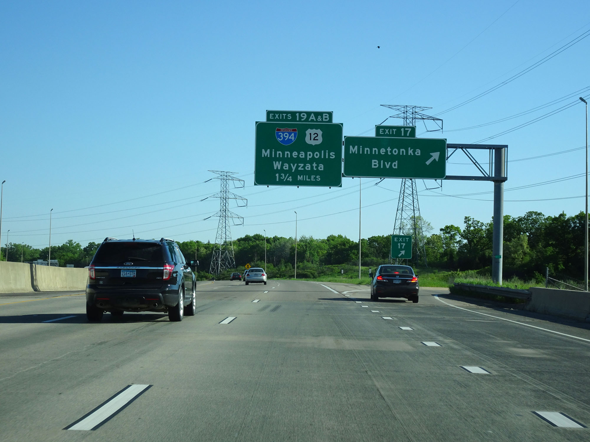 |
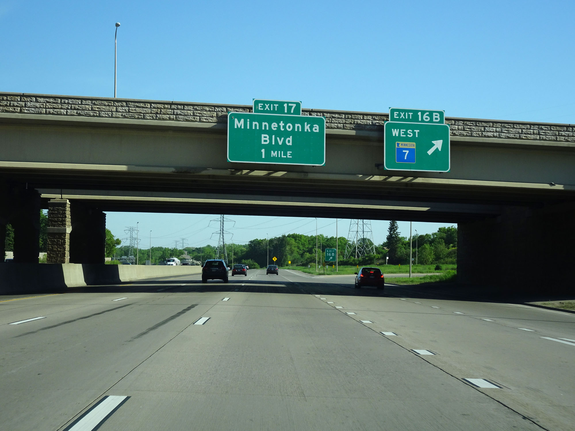
Interstate 494 Inner Loop (North) at Exit 17: Minnetonka Blvd (Photo taken 5/22/16). |
 |
Interstate 494 Inner Loop (North) at mile marker 18. (Photo taken 5/22/16). |
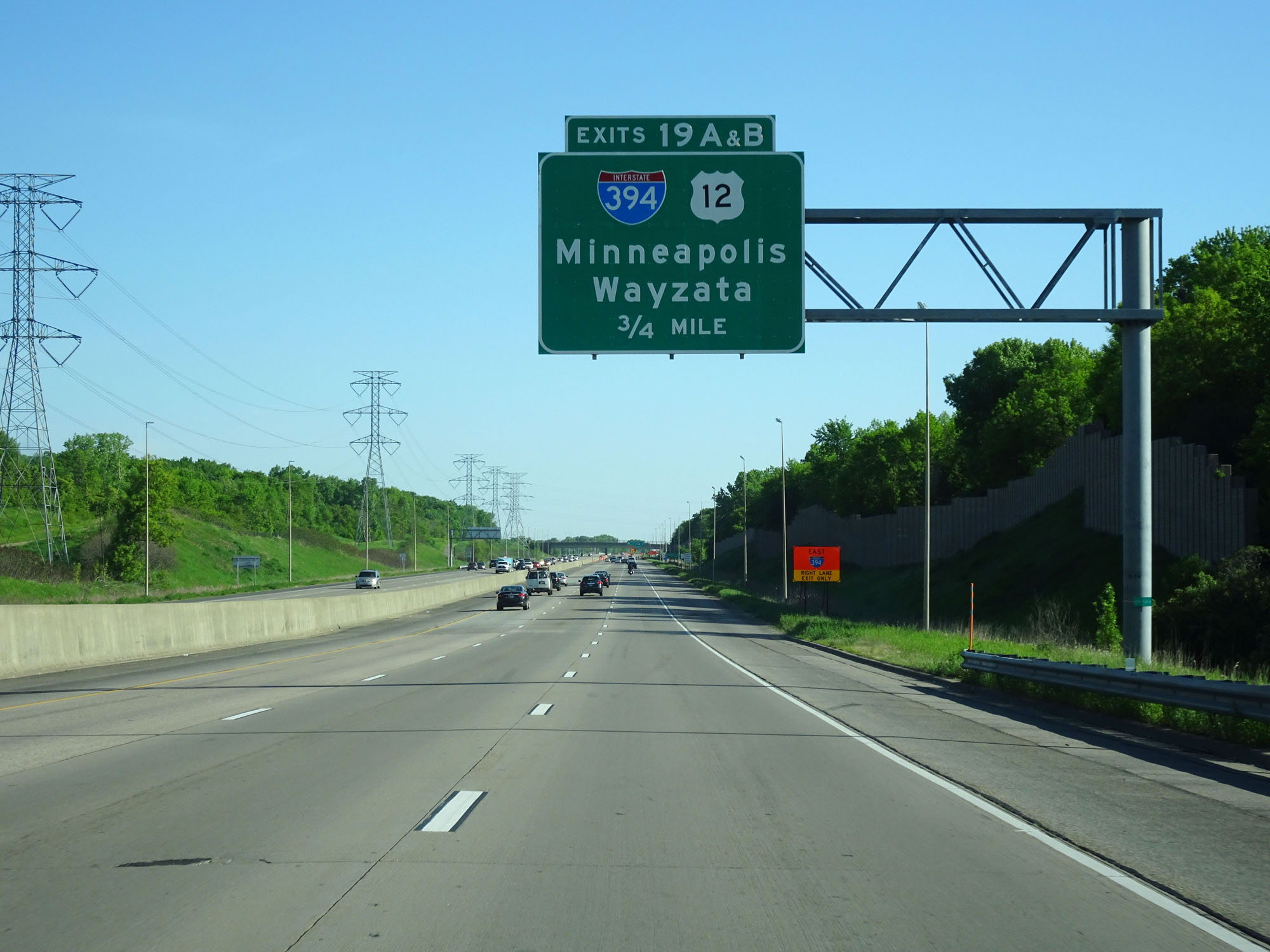 |
Interstate 494 Inner Loop (North) approaching Exits 19A-B - 3/4 mile. (Photo taken 5/22/16). |
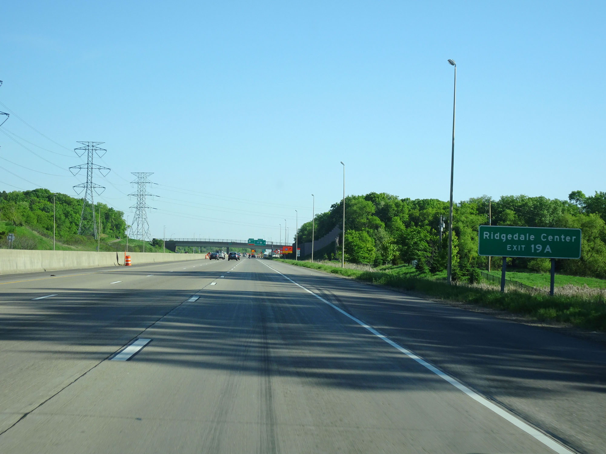 |
Take Exit 19A to Ridgedale Center. (Photo taken 5/22/16). |
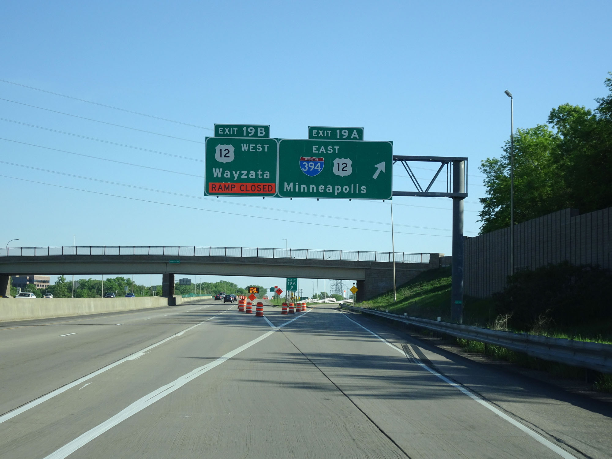 |
Interstate 494 Inner Loop (North) at Exit 19A: Interstate 394 East / US 12 East - Minneapolis (Photo taken 5/22/16). |
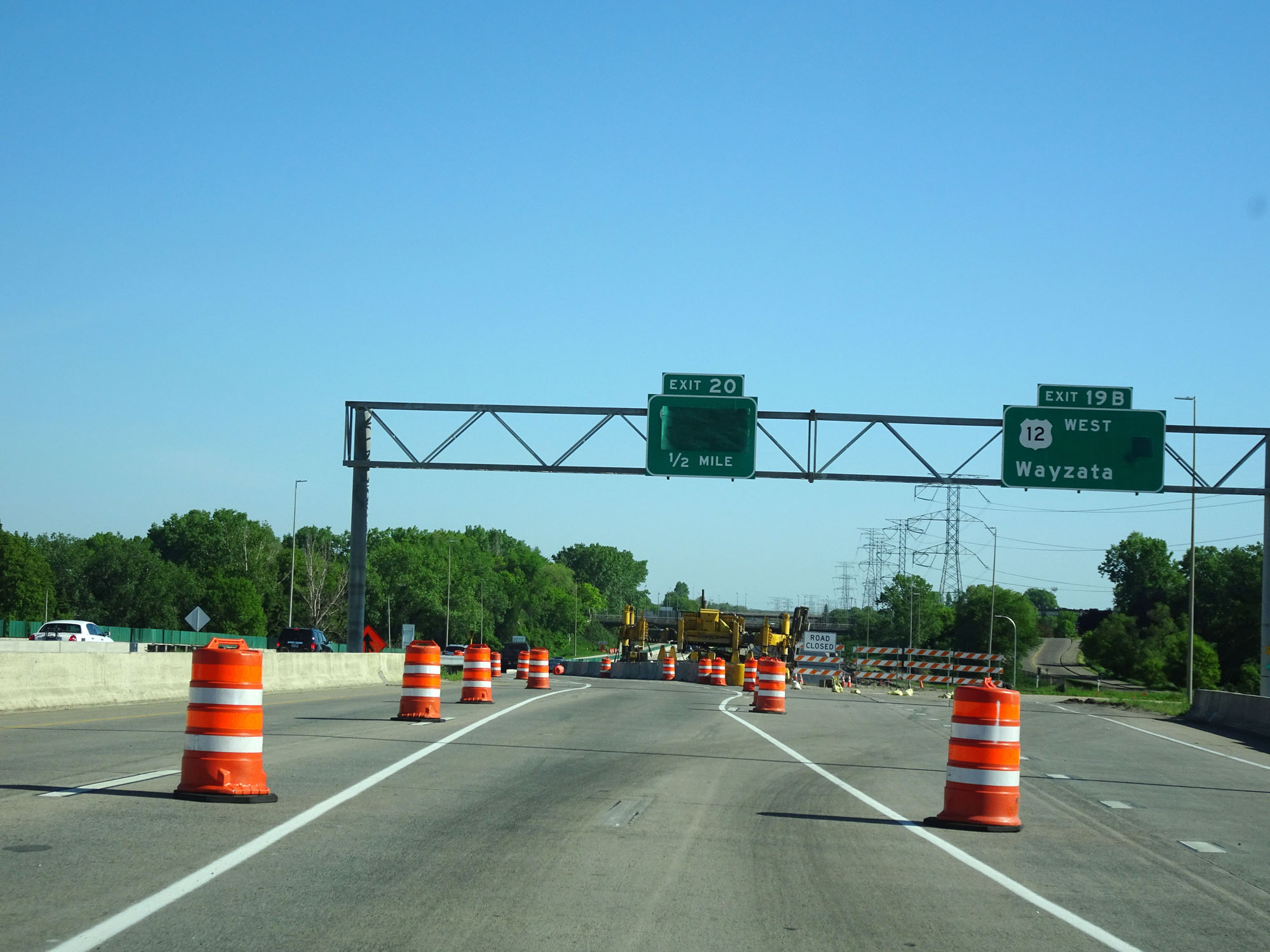 |
Interstate 494 Inner Loop (North) at Exit 19B: US 12 West - Wayzata (Photo taken 5/22/16). |
 |
Interstate 494 Inner Loop (North) at Exit 21: CR 6 (Photo taken 5/22/16). |
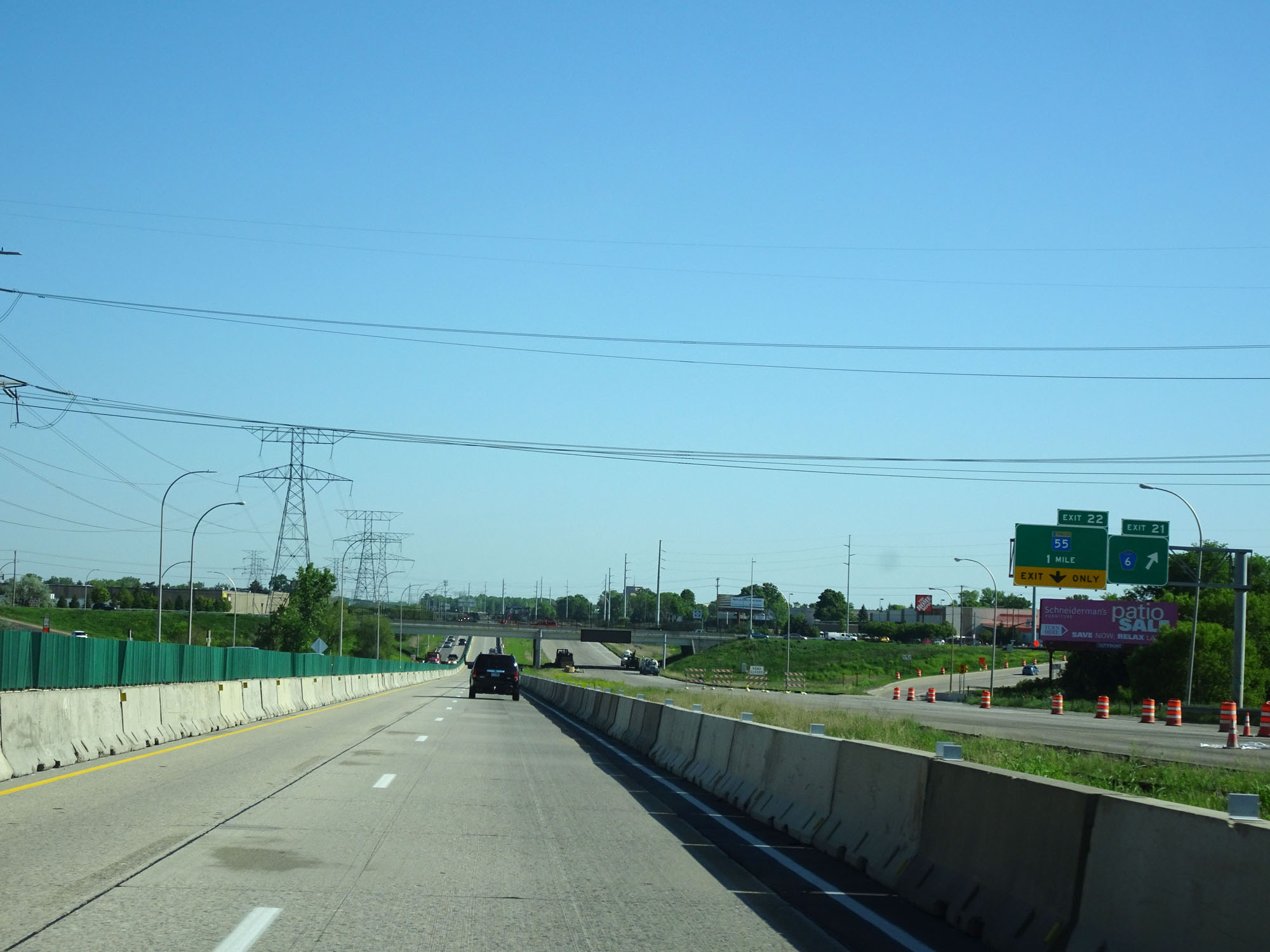
 |
Interstate 494 Inner Loop (North) at Exit 22: MN 55 (Photo taken 5/22/16). |
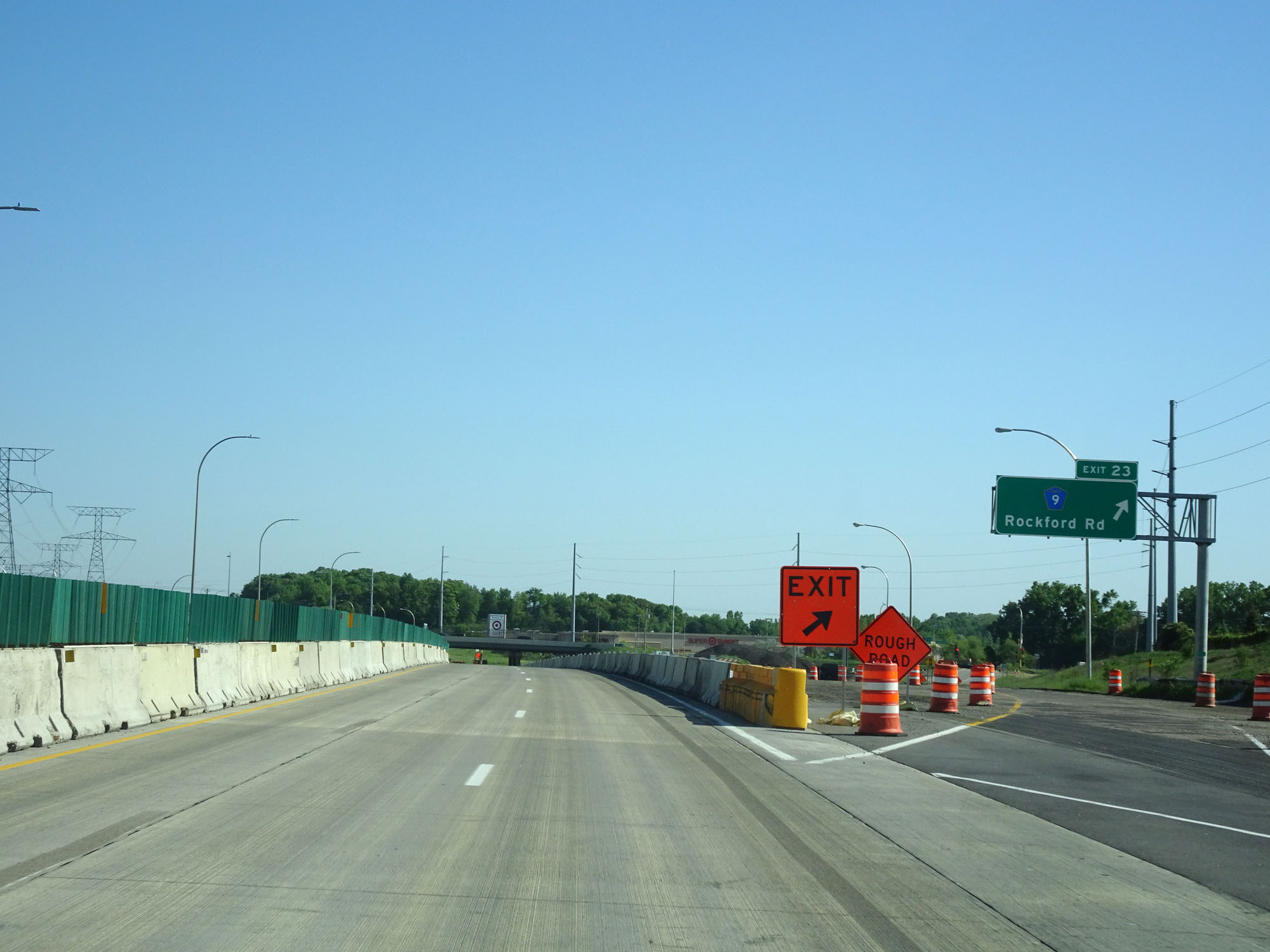 |
Interstate 494 Inner Loop (North) at Exit 23: CR 9 - Rockford Rd (Photo taken 5/22/16). |
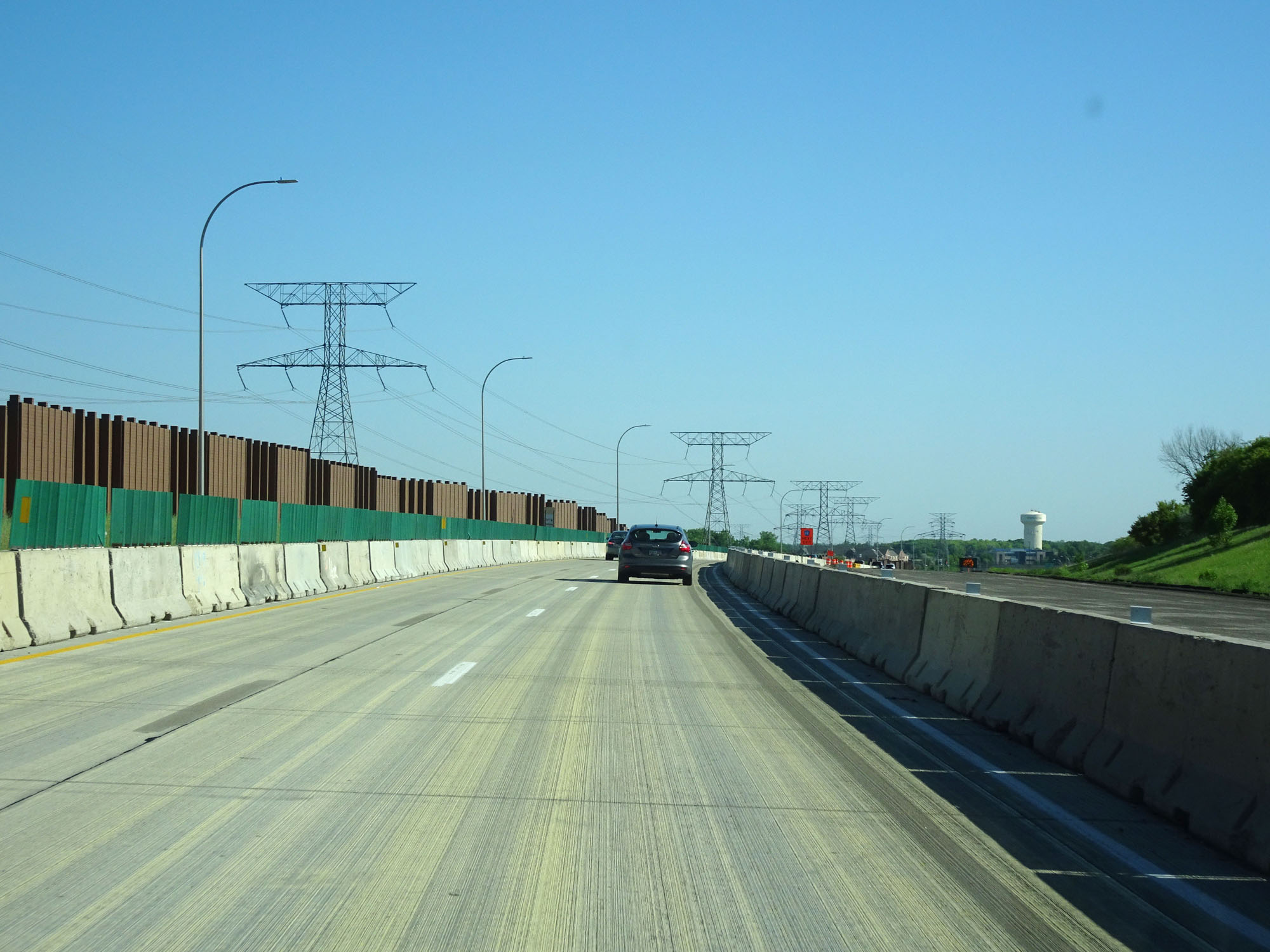 |
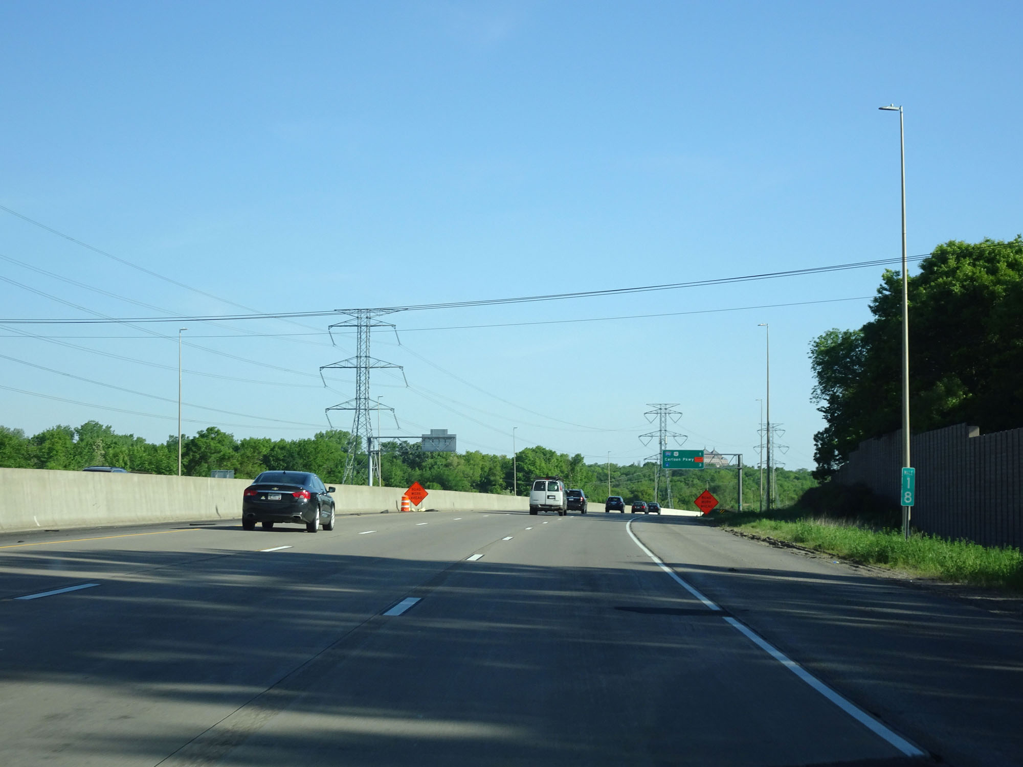
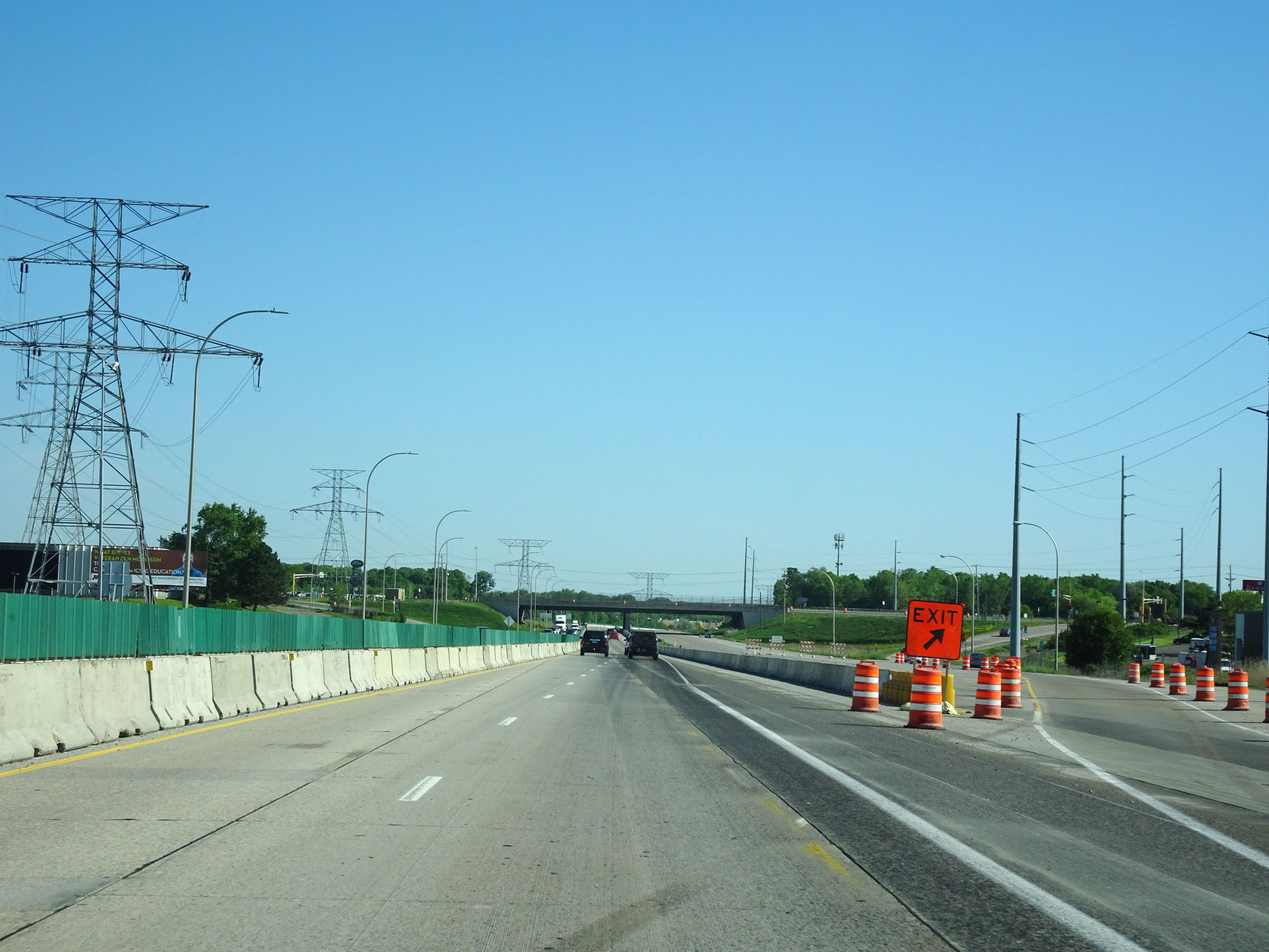
View on Interstate 494 Inner Loop (North). This construction on the west and northwest side of Minneapolis looks like it will be around for a bit. (Photo taken 5/22/16). |
 |
Interstate 494 Inner Loop (North) at Exit 26: CR 10 - Bass Lake Rd (Photo taken 5/22/16). |
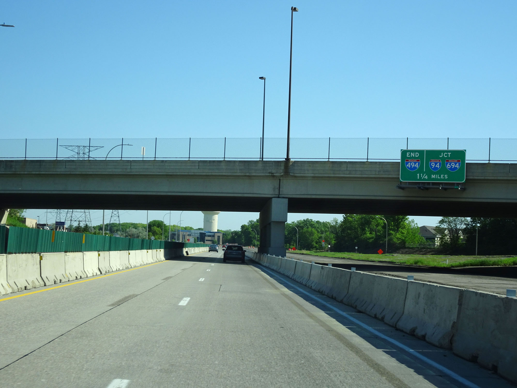 |
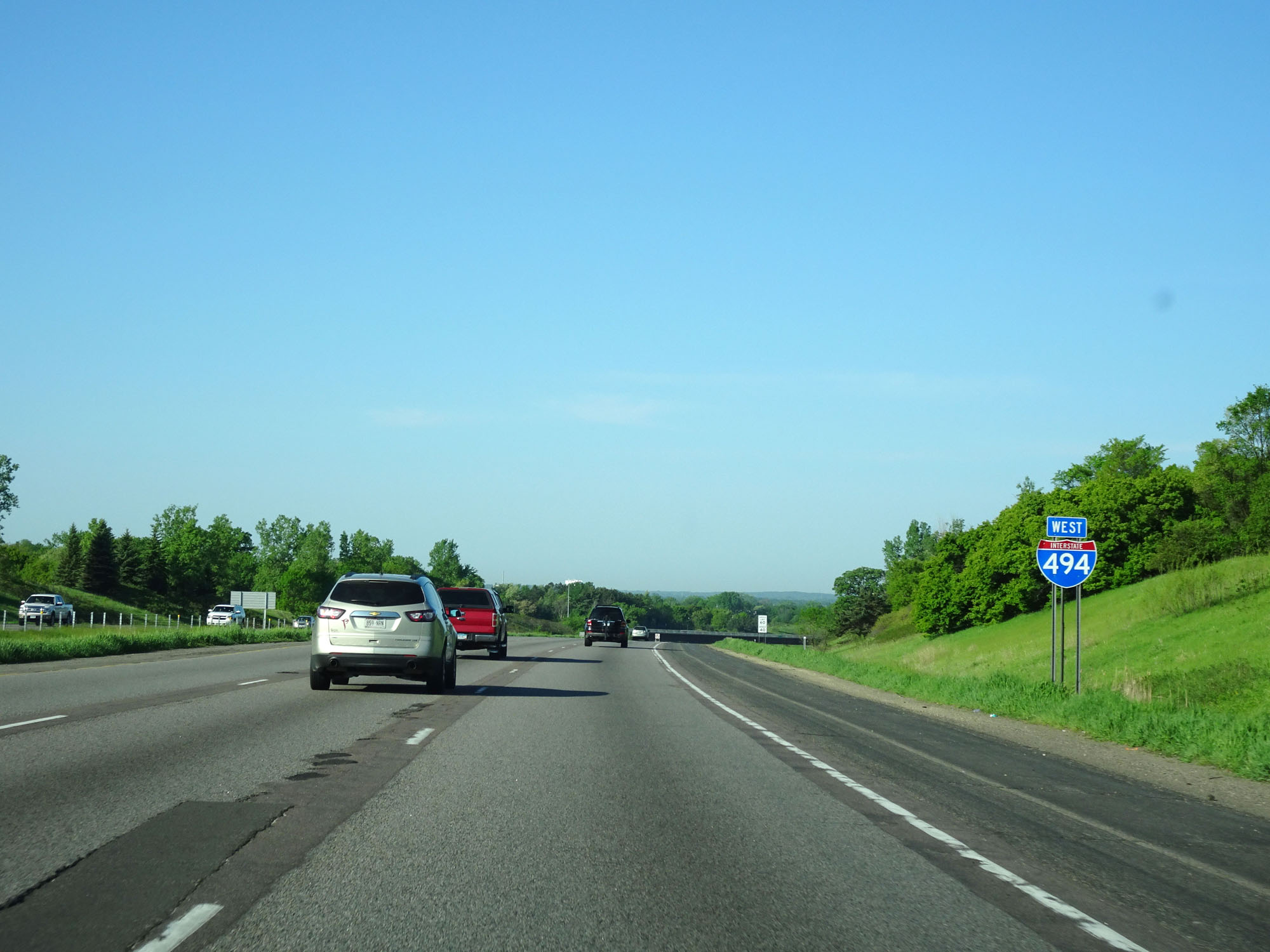
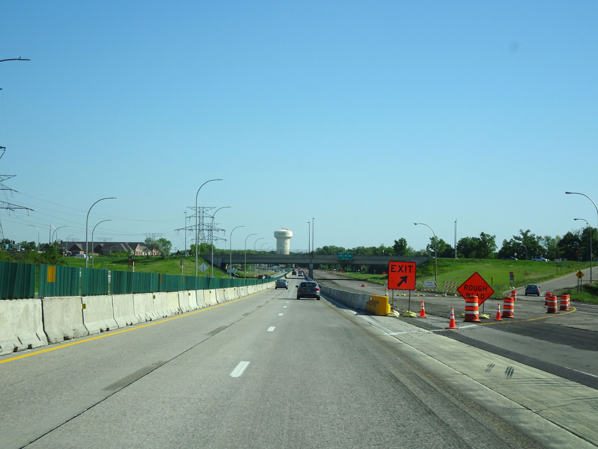
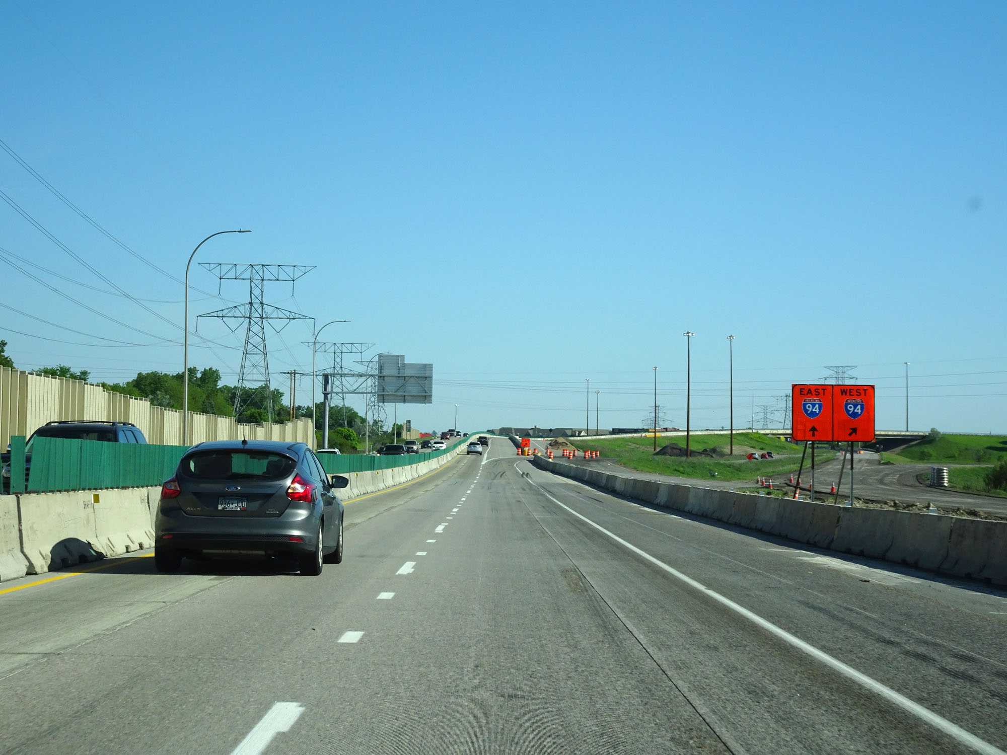
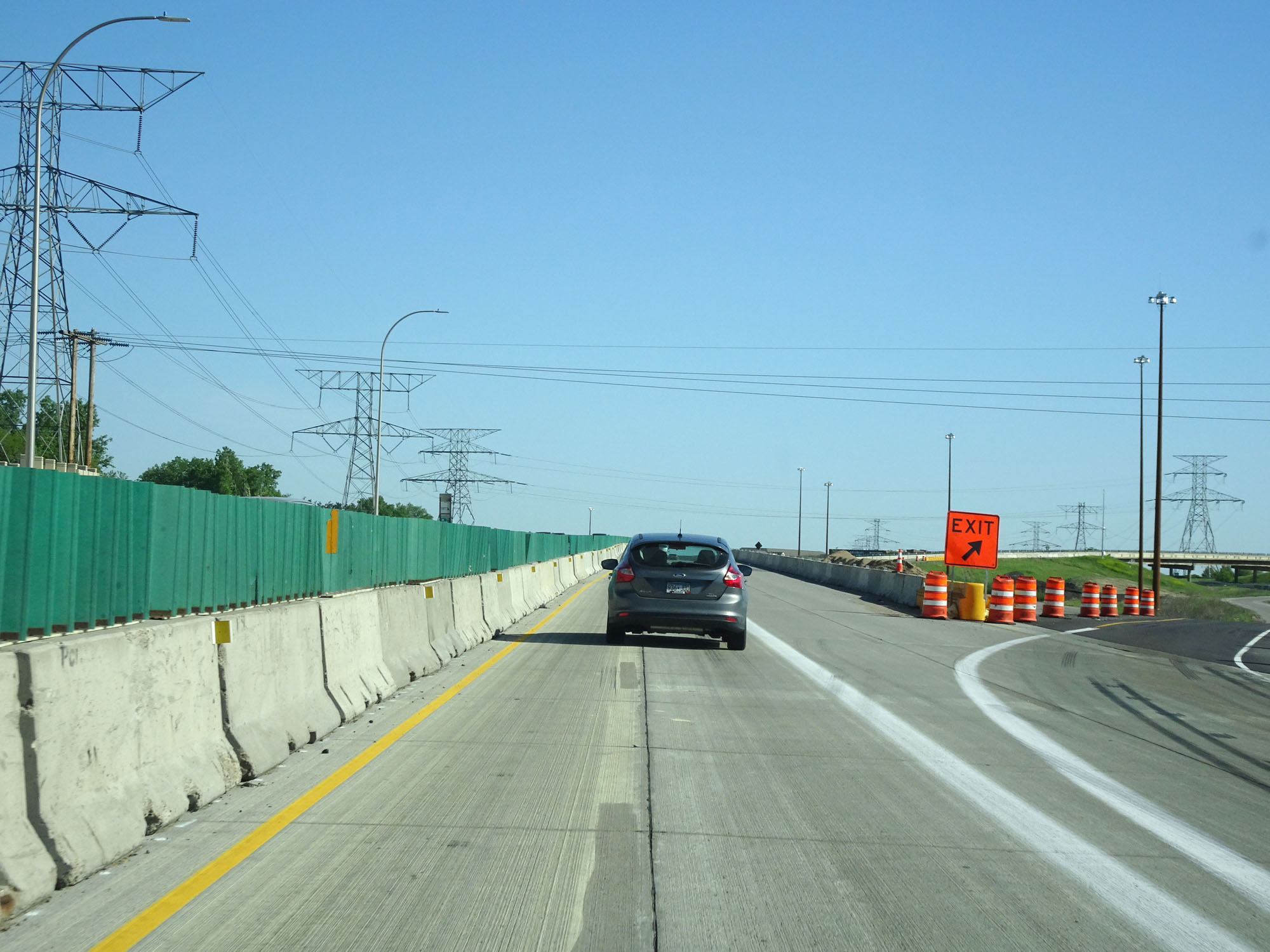
Interstate 494 Inner Loop (North) approaching its western terminus at the junction of Interstate 94 / Interstate 694 - 1 1/4 miles. (Photo taken 5/22/16). |
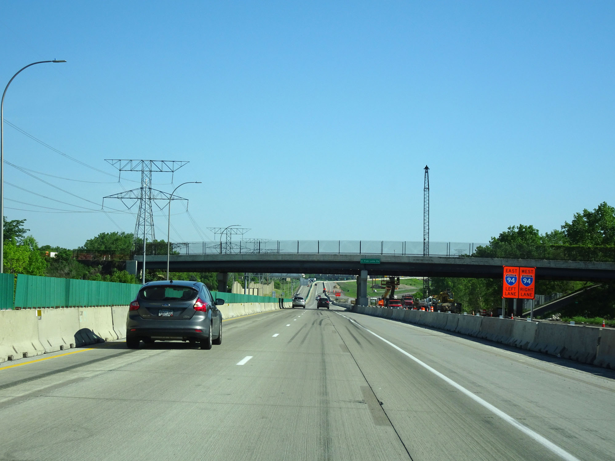 |
With the construction restricting Interstate 494 to two lanes, use the right lane for Interstate 94 West and use the left lane for Interstate 94 East / Interstate 694 Inner Loop (East). (Photo taken 5/22/16). |
 |
Interstate 494 Inner Loop (North) at Exit 27: Interstate 94 / Interstate 694 East - St Cloud. I-494 ends just ahead and continues straight into Interstate 694 Inner Loop (East) to continue the loop around the Twin Cities. (Photo taken 5/22/16). |
 |
Interstate 494 Inner Loop (North) at its western terminus, providing a closer view of the ramp for Exit 27. (Photo taken 5/22/16). |