Road Information |
||
 |
||
| Total Mileage in State: | 46 miles | |
| Northern End: | At New Hampshire state line | |
| Southern End: | At I-95, in Canton | |
| Mileage covered in Photos: | 46 miles | |
| Counties covered in Photos: | Essex, Middlesex, Suffolk, Norfolk | |
| Major Junctions in Photos: | I-495, in Andover I-95, in Reading I-90 (Mass Pike), in Boston I-95, in Canton |
|
| Control Cities in Photos: | Methuen, Medford, Boston, Braintree, Canton | |
Southbound
- Section 1: New Hampshire Border to Boston (Exit 26)
- Section 2: Boston (Exit 26) to Interstate 95
Section 1: New Hampshire Border to Boston (Exit 26)
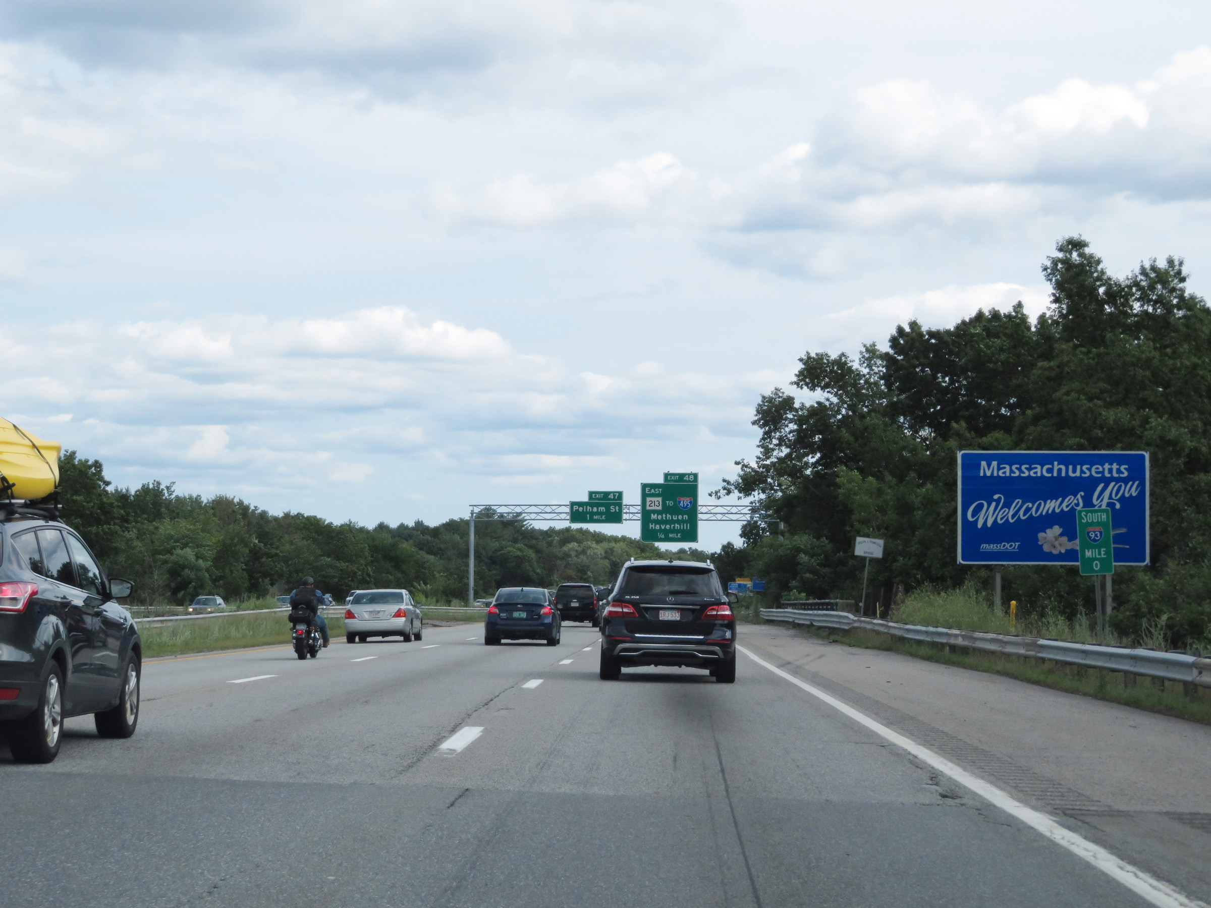 |
Welcome sign as Interstate 93 South enters Massachusetts from New Hampshire. (Photo taken 8/6/17). |
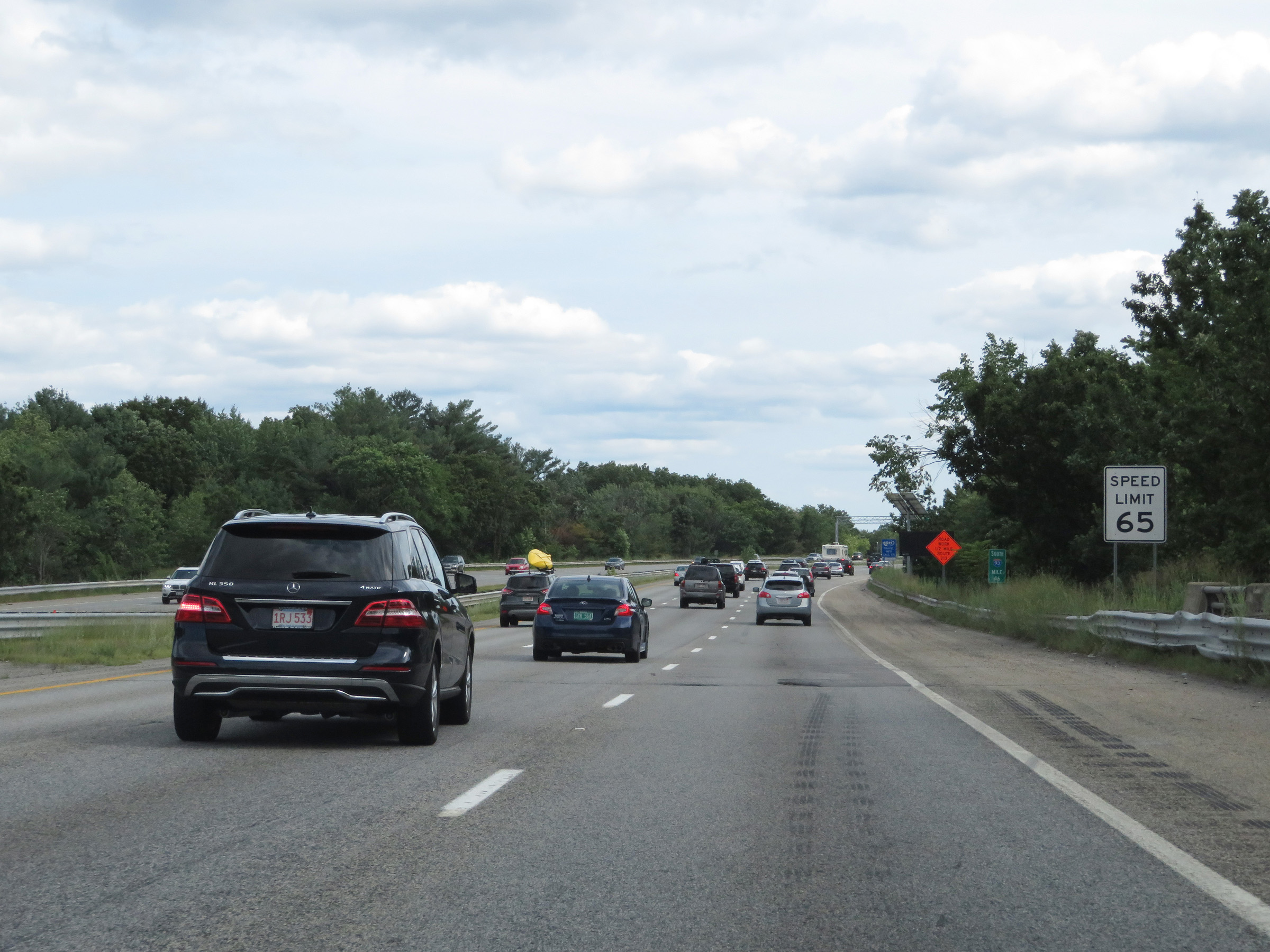 |
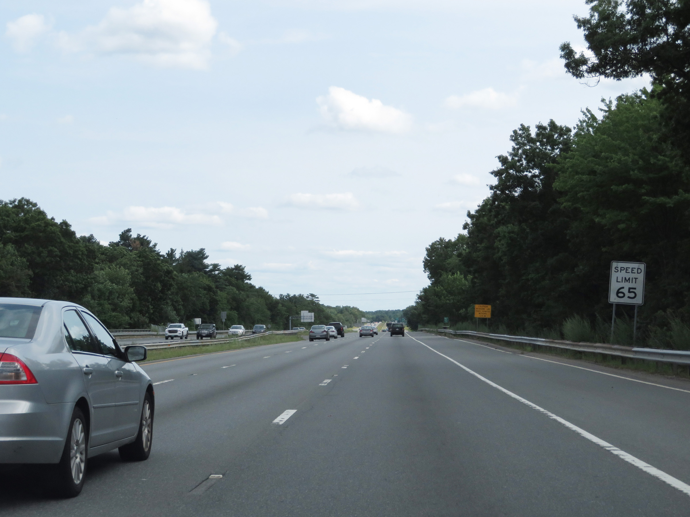
The speed limit on Interstate 93 South starts out at 65 mph. This is the standard speed limit on many rural Interstate highways in Massachusetts. (Photo taken 8/6/17). |
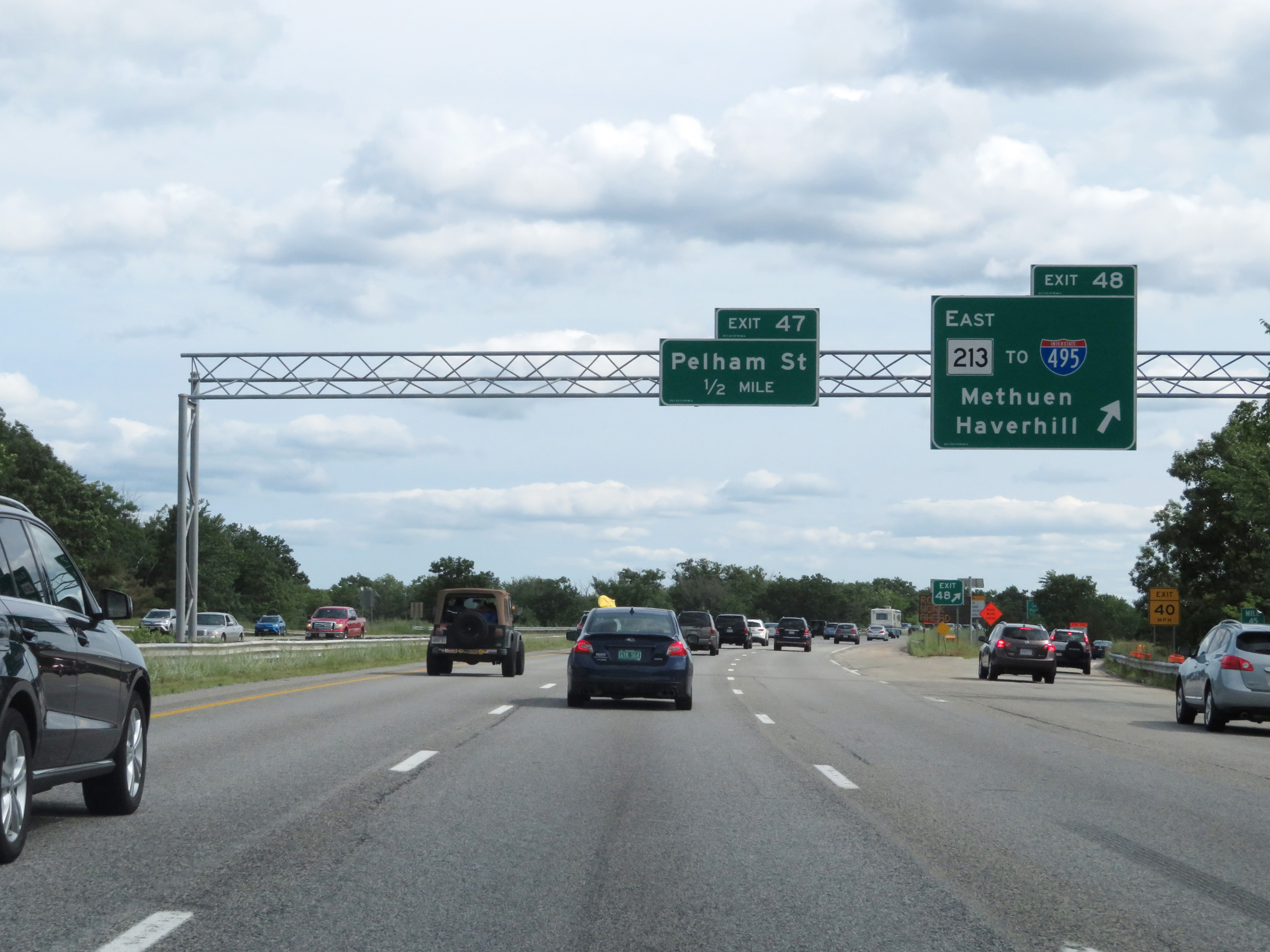 |
Interstate 93 South at Exit 48: MA 213 East / To Interstate 495 - Methuen / Haverhill (Photo taken 8/6/17). |
 |
Interstate 93 South at Exit 47: Pelham St (Photo taken 8/6/17). |
 |
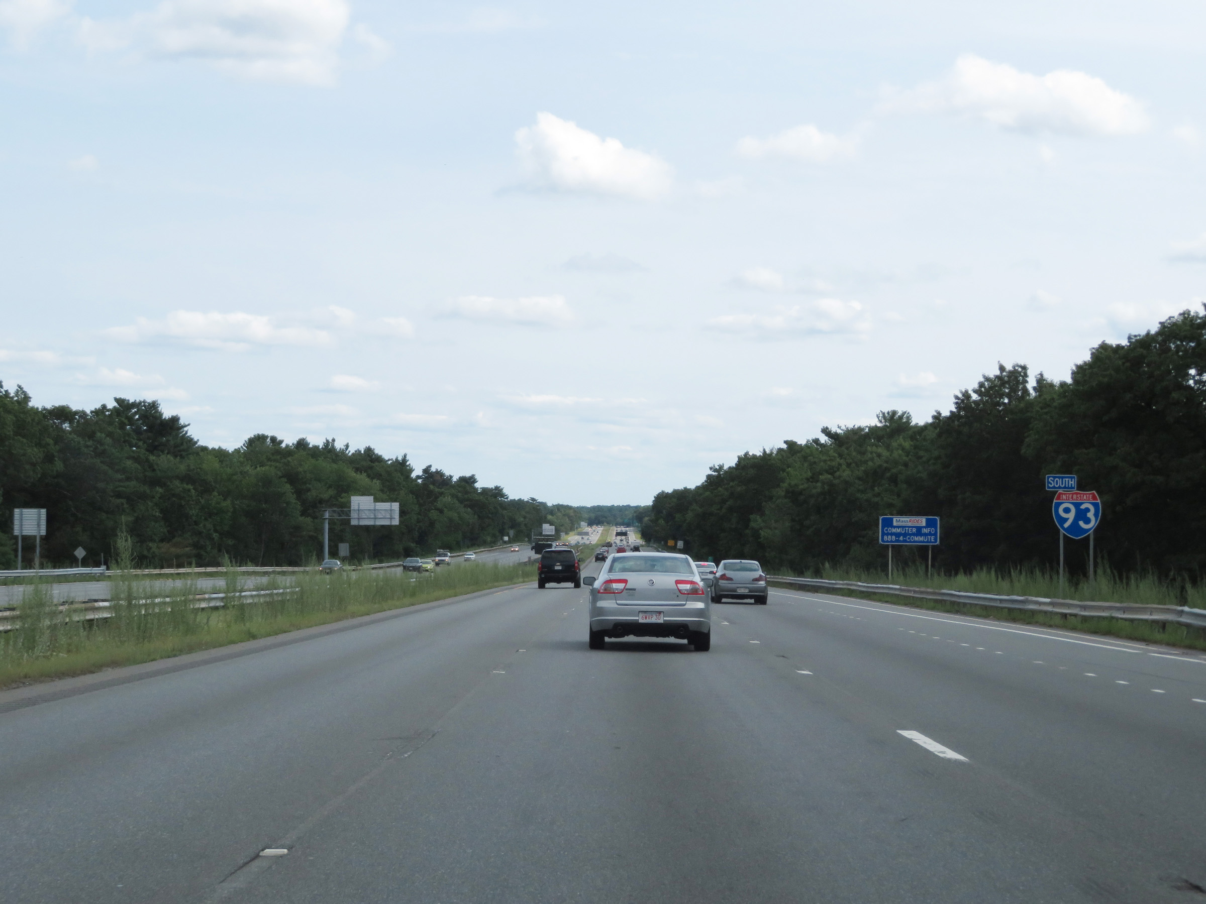
Interstate 93 South reassurance shield. (Photo taken 8/6/17). |
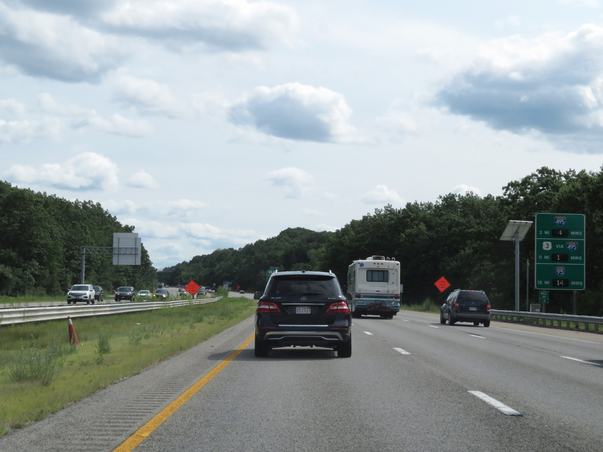 |
Mileage sign on Interstate 93 South listing the distances to the junctions of Interstates 495 and 95, along with dynamically displaying the current estimated travel times to each interchange. (Photo taken 8/6/17). |
 |
Interstate 93 South at Exit 46: MA 110 / MA 113 - Lawrence / Dracut (Photo taken 8/6/17). |
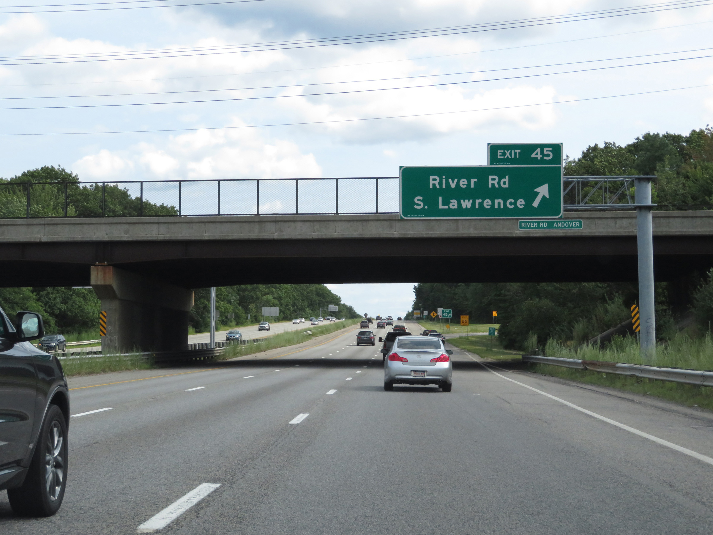 |
Interstate 93 South at Exit 45: River Rd / South Lawrence (Photo taken 8/6/17). |
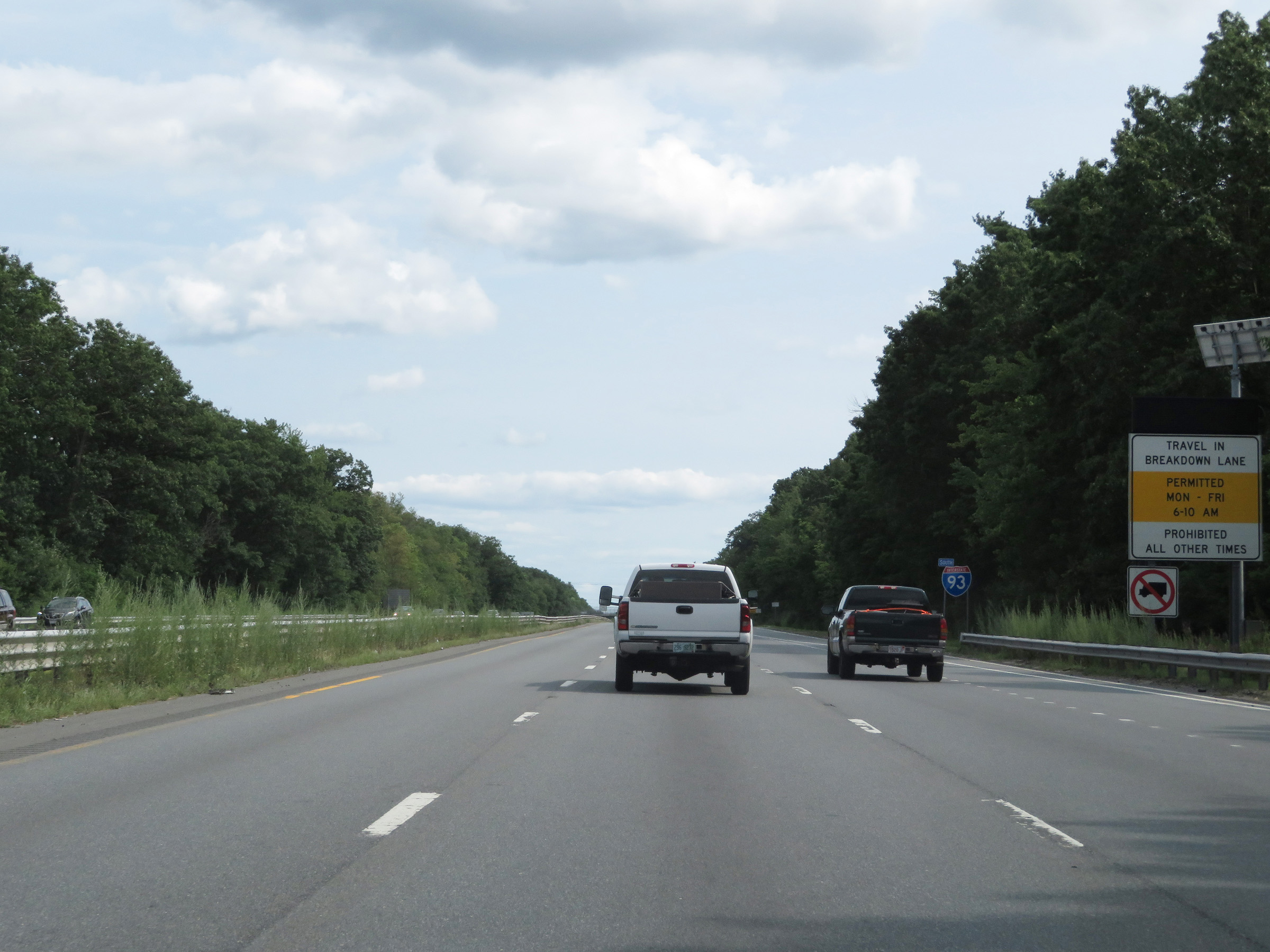 |
On this stretch of Interstate 93 South, travel in the breakdown lane (right shoulder) is permitted Monday thru Friday from 6-10 AM. All other times, driving on the shoulder is prohibited. Trucks are always prohibited from driving in the breakdown lane. (Photo taken 8/6/17). |
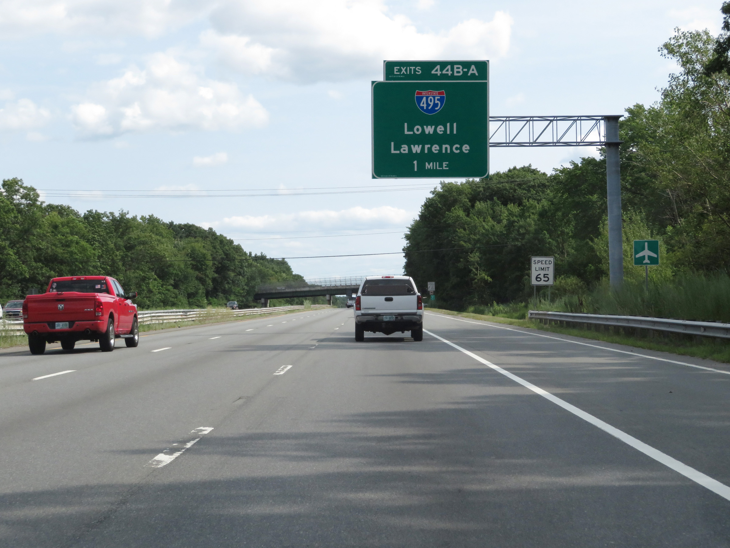 |
Interstate 93 South approaching Exits 44B-A - 1 mile. (Photo taken 8/6/17). |
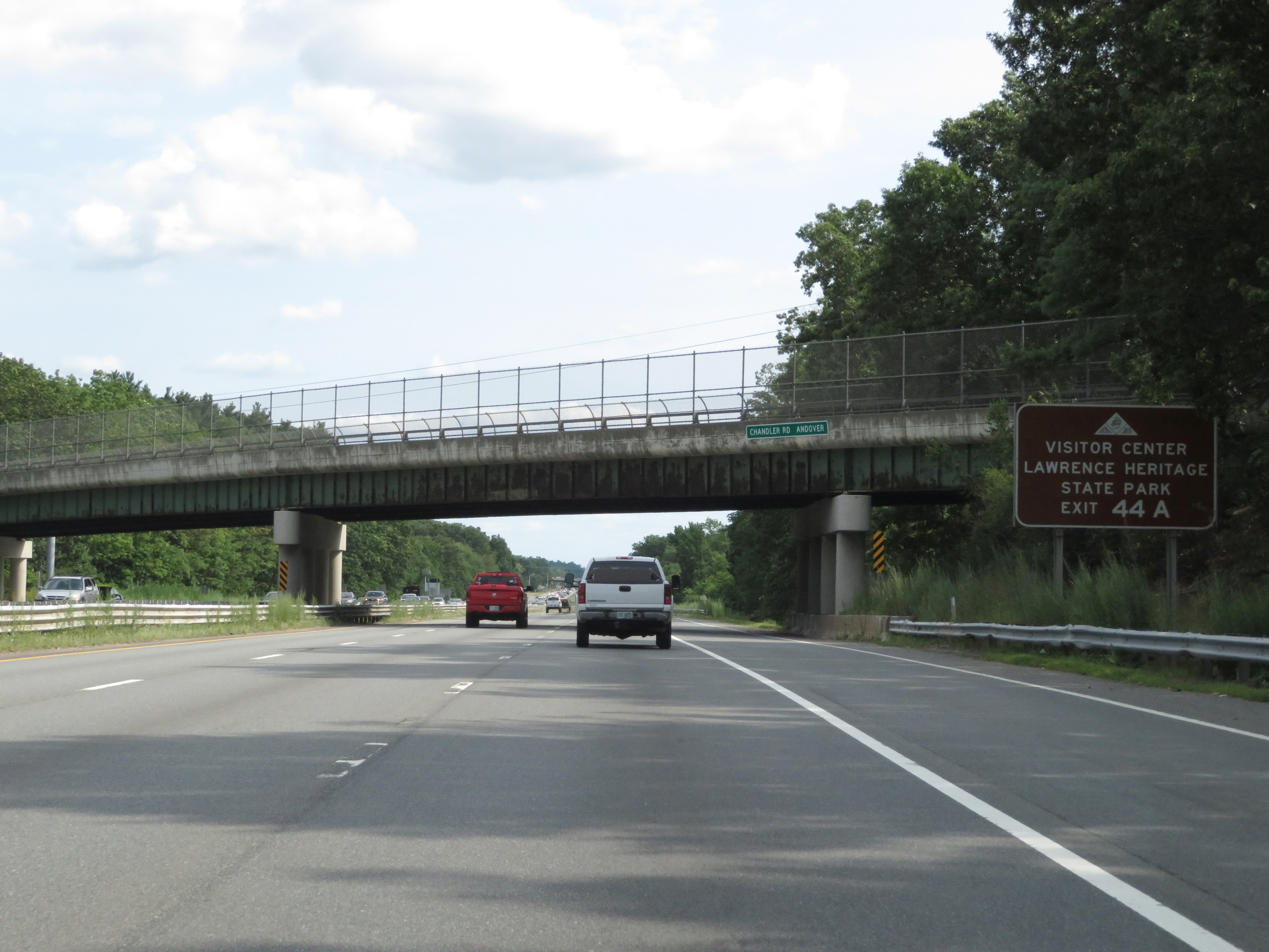 |
Take Exit 44A (Interstate 495 North) to Lawrence Heritage State Park and its Visitor Center. (Photo taken 8/6/17). |
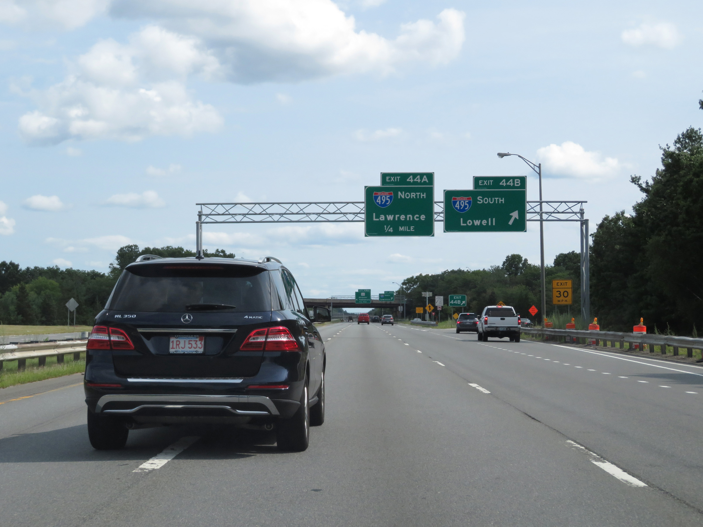 |
Interstate 93 South at Exit 44B: Interstate 495 South - Lowell (Photo taken 8/6/17). |
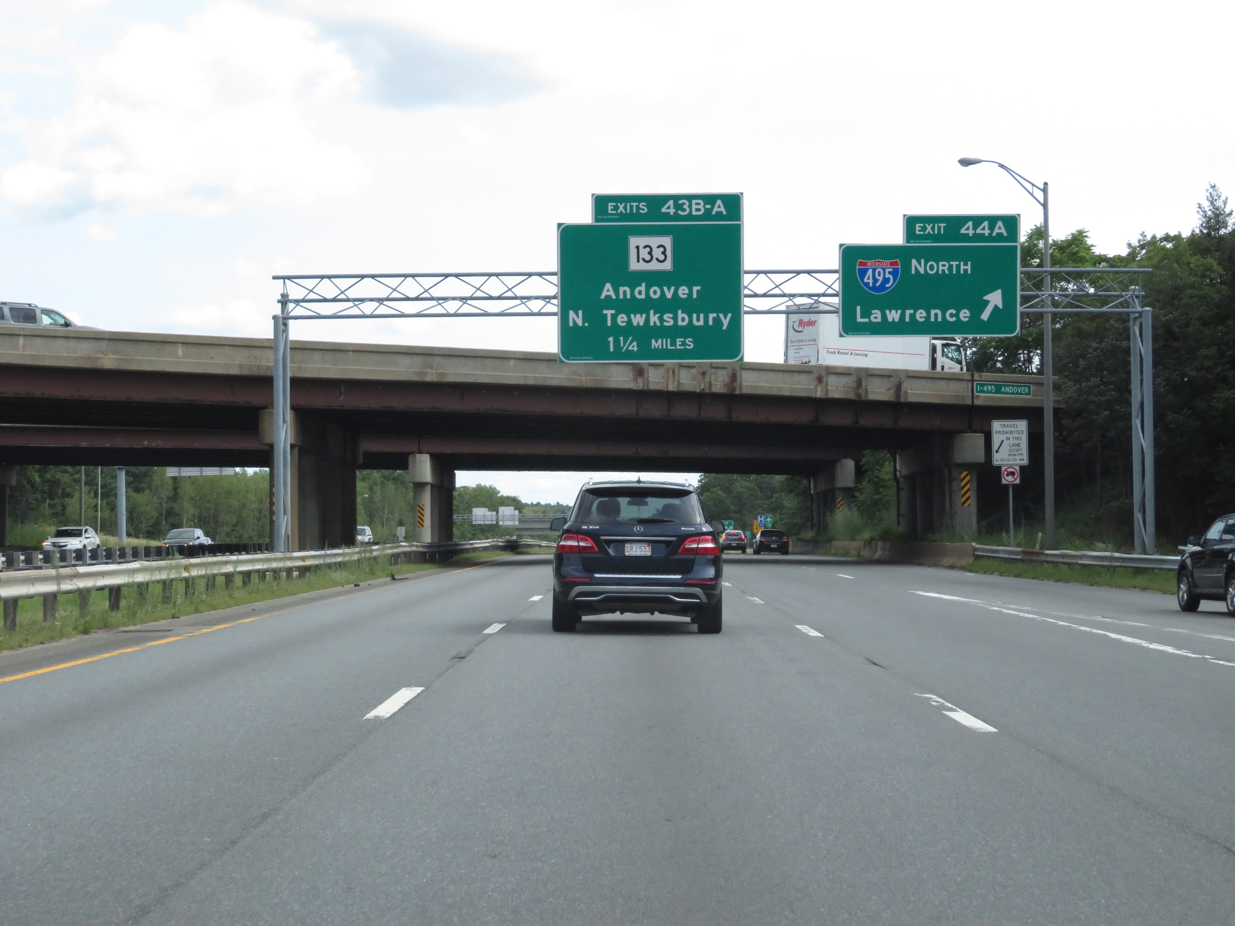 |
Interstate 93 South at Exit 44A: Interstate 495 North - Lawrence (Photo taken 8/6/17). |
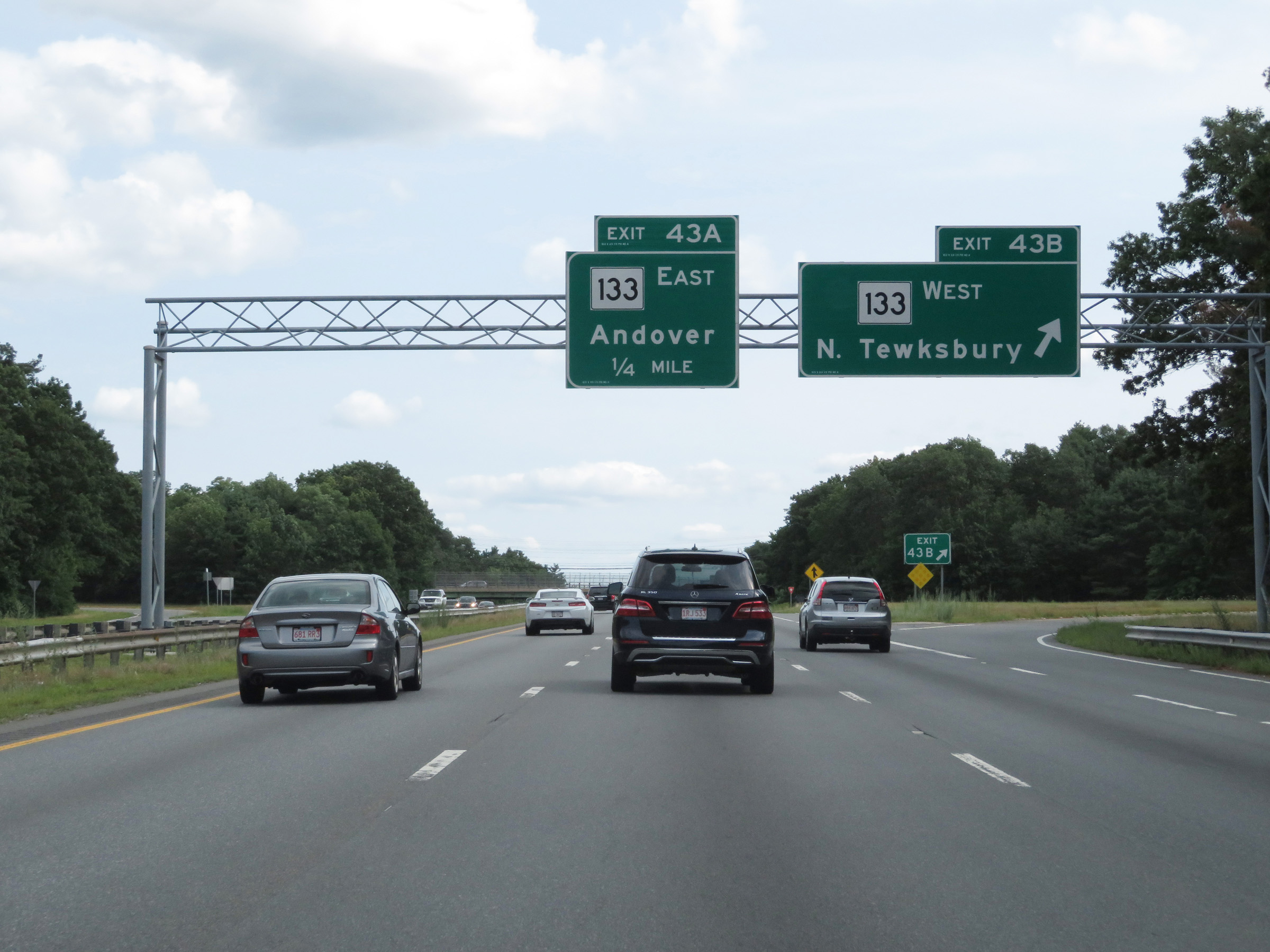 |
Interstate 93 South at Exit 43B: MA 133 West - North Tewksbury (Photo taken 8/6/17). |
 |
Interstate 93 South at Exit 43A: MA 133 East - Andover (Photo taken 8/6/17). |
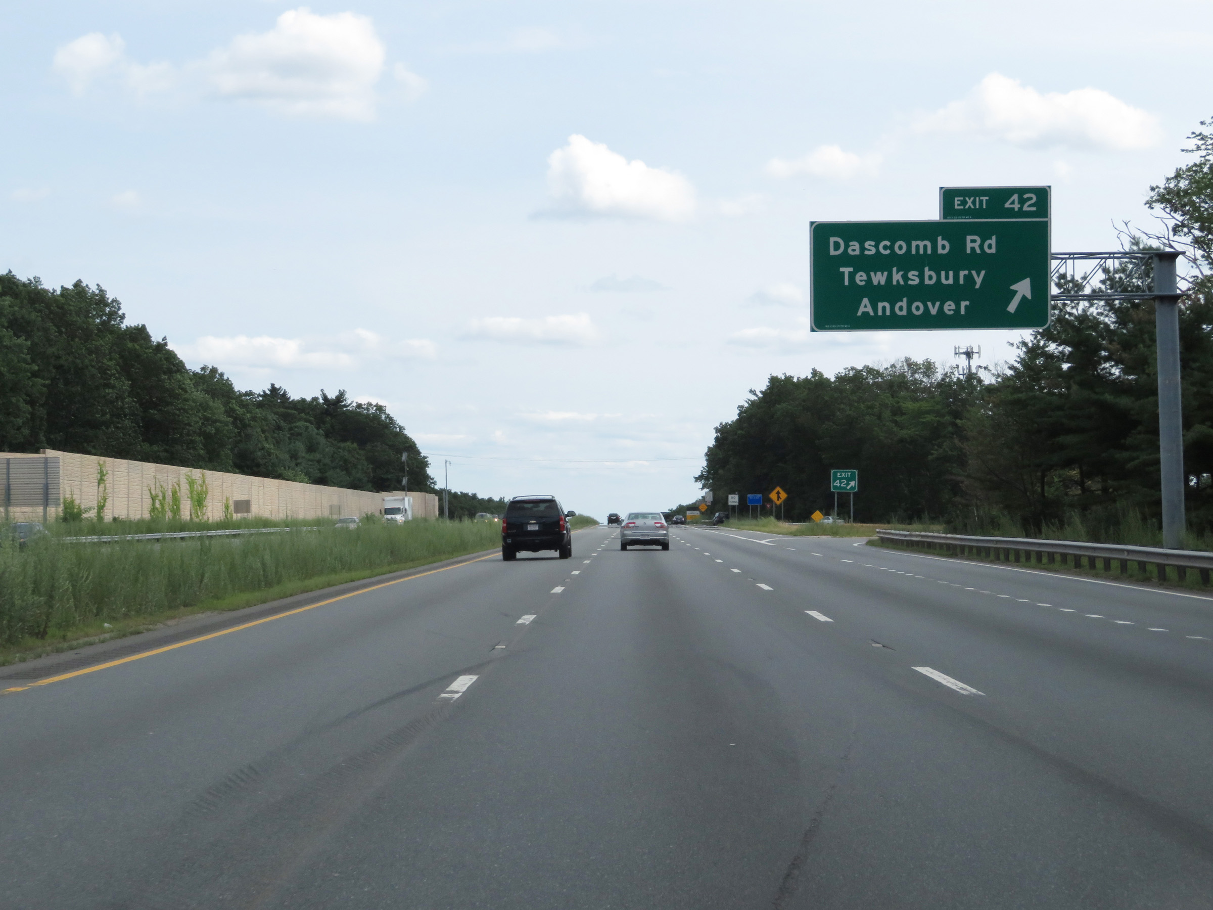 |
Interstate 93 South at Exit 42: Dascomb Rd / Tewksbury / Andover (Photo taken 8/6/17). |
 |
Another Interstate 93 South reassurance shield. (Photo taken 8/6/17). |
 |
The speed limit remains 65 mph. (Photo taken 8/6/17). |
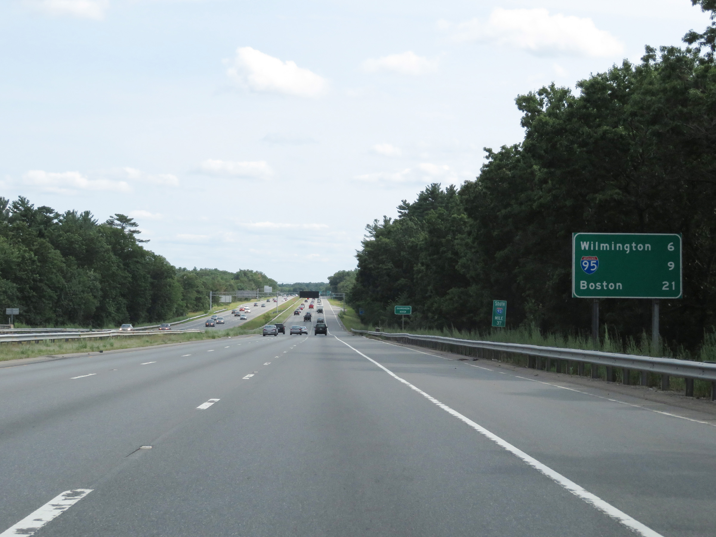 |
Mileage sign at mile marker 37. It's 6 miles to Wilmington, 9 miles to the junction of Interstate 95, and 21 miles to Boston. (Photo taken 8/6/17). |
 |
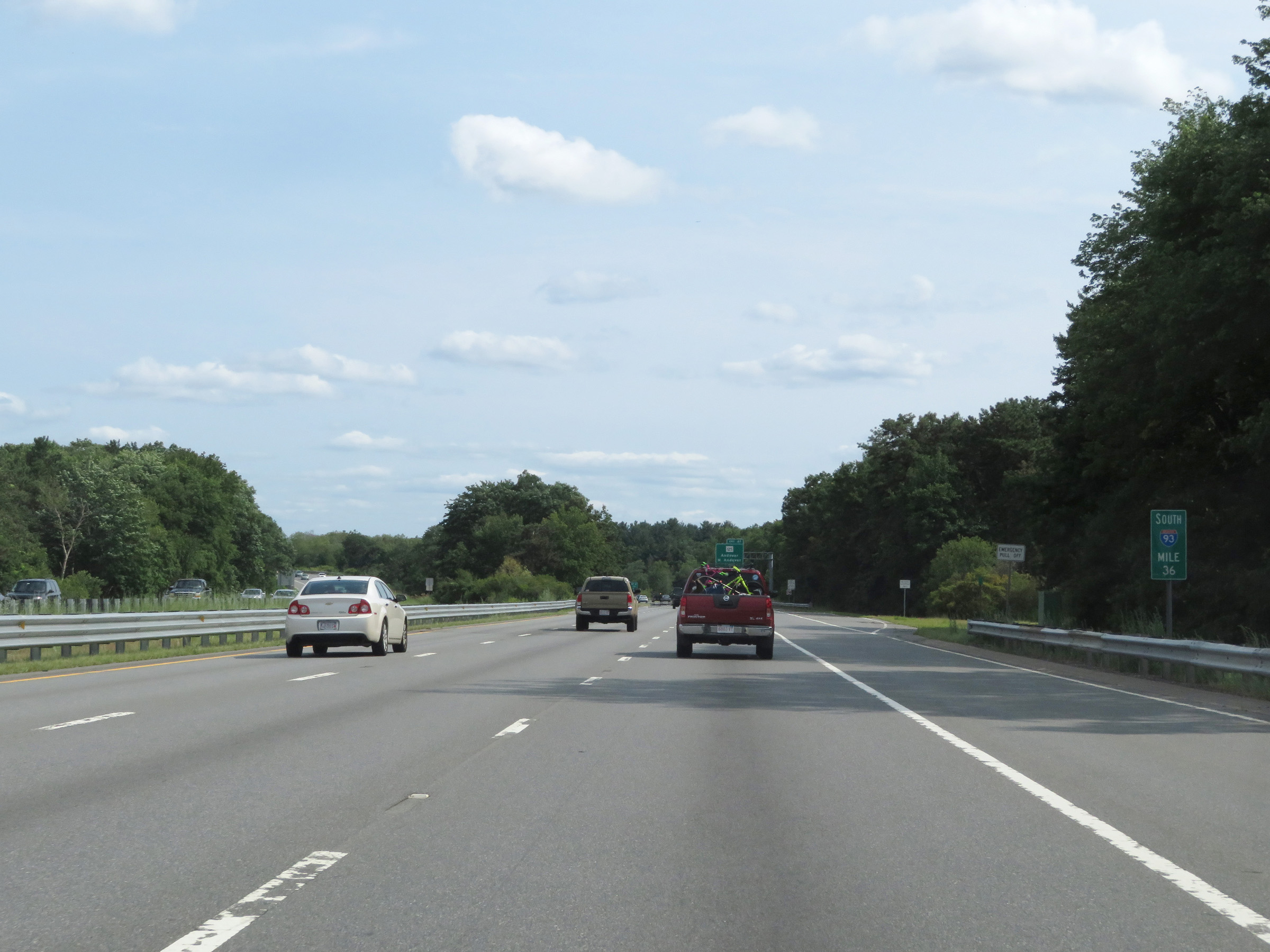
Interstate 93 South as it enters Middlesex County at mile marker 36.2. (Photo taken 8/6/17). |
 |
View on Interstate 93 South at mile marker 36. (Photo taken 8/6/17). |
 |
Interstate 93 South at Exit 41: MA 125 - Andover / North Andover (Photo taken 8/6/17). |
 |
Interstate 93 South at Exit 40: MA 62 - North Reading / Wilmington (Photo taken 8/6/17). |
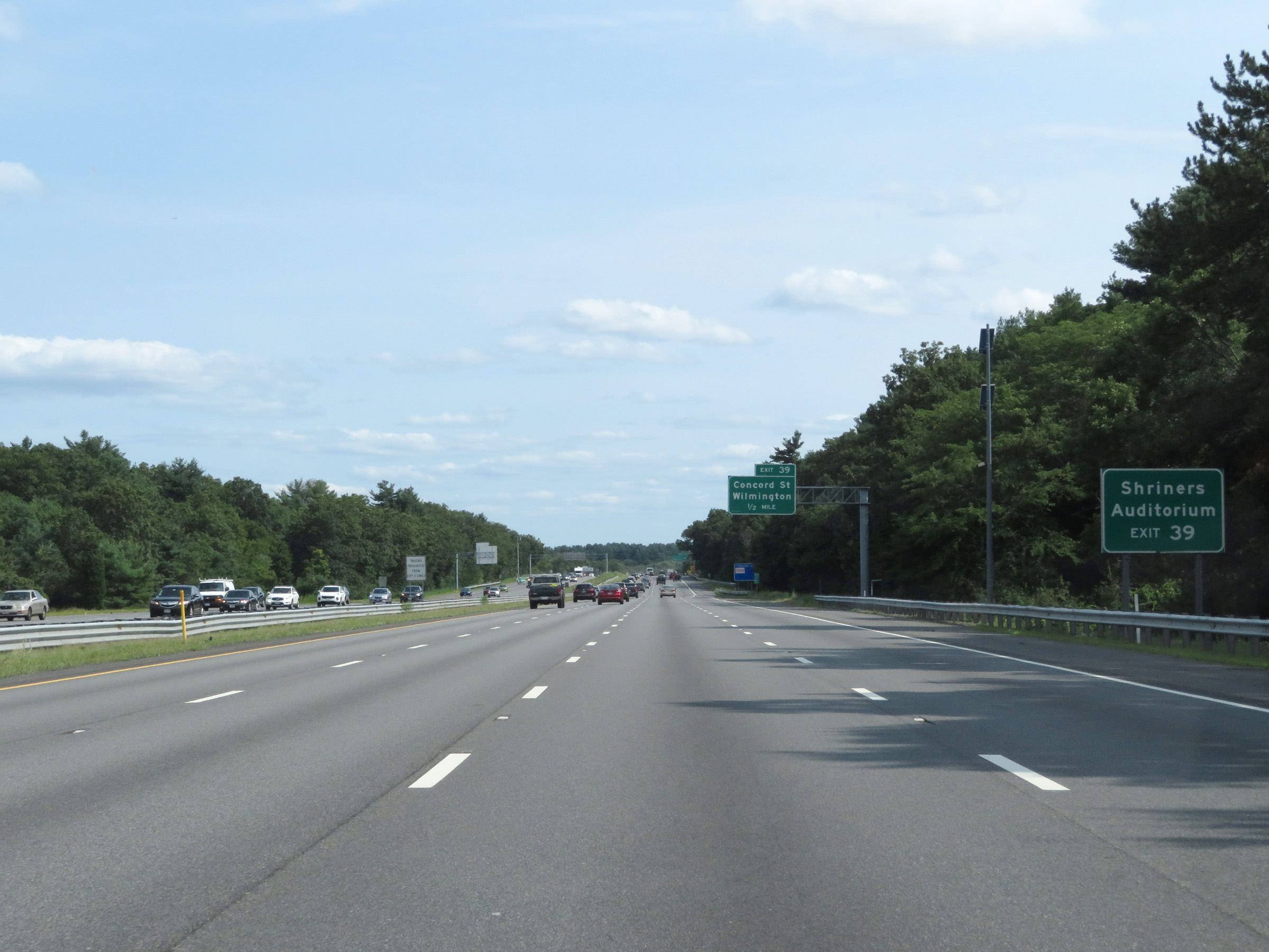 |
Take Exit 39 to Shriners Auditorium. (Photo taken 8/6/17). |
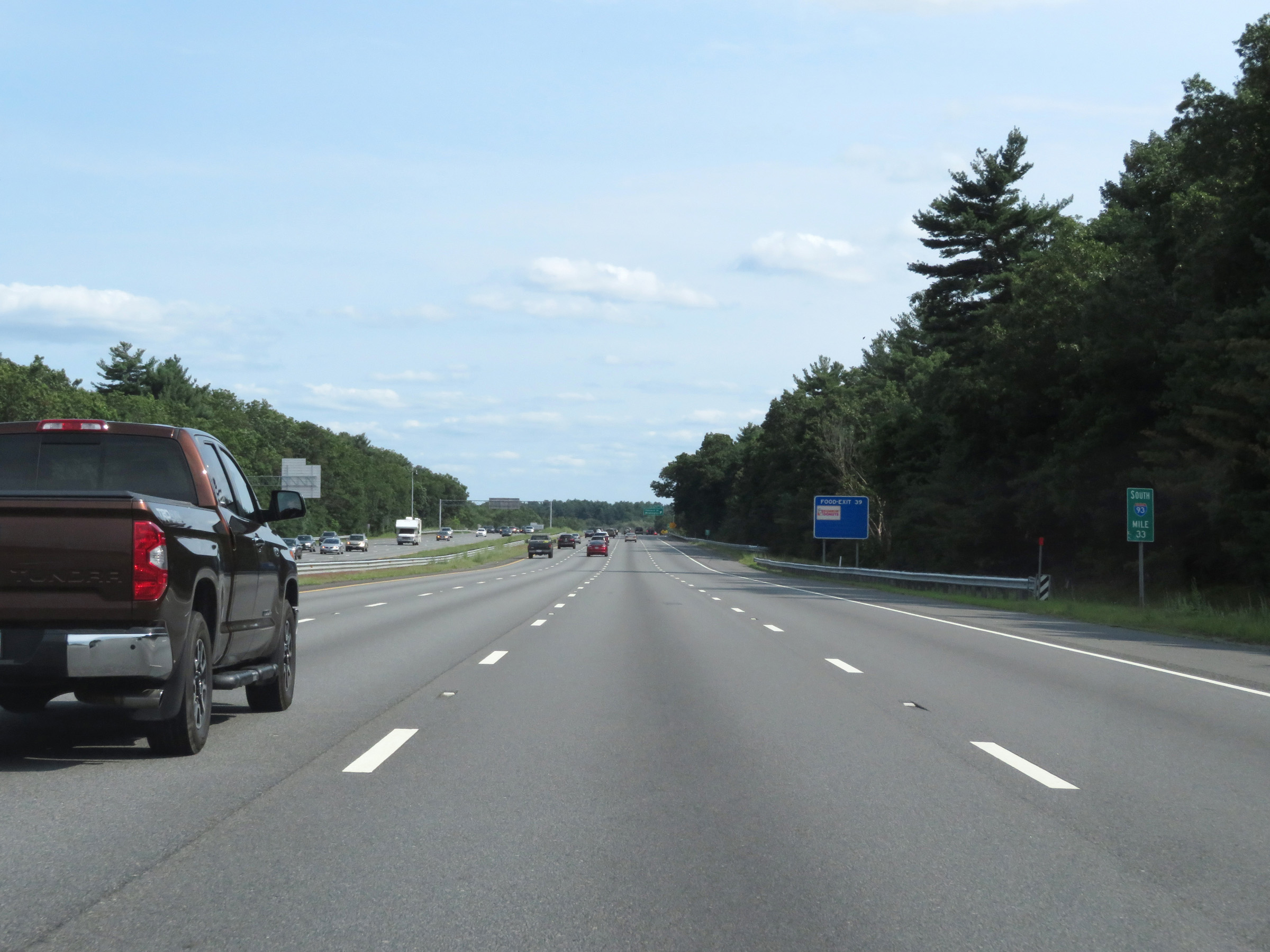 |
View on Interstate 93 South at mile marker 33. (Photo taken 8/6/17). |
 |
Interstate 93 South at Exit 39: Concord St / Wilmington (Photo taken 8/6/17). |
 |
Interstate 93 South at Exit 38: MA 129 - Reading / Wilmington (Photo taken 8/6/17). |
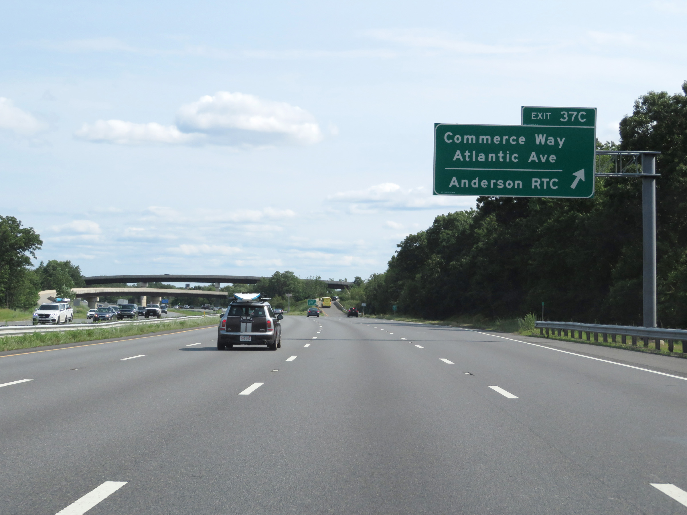 |
Interstate 93 South at Exit 37C: Commerce Way / Atlantic Ave / Anderson RTC (Photo taken 8/6/17). |
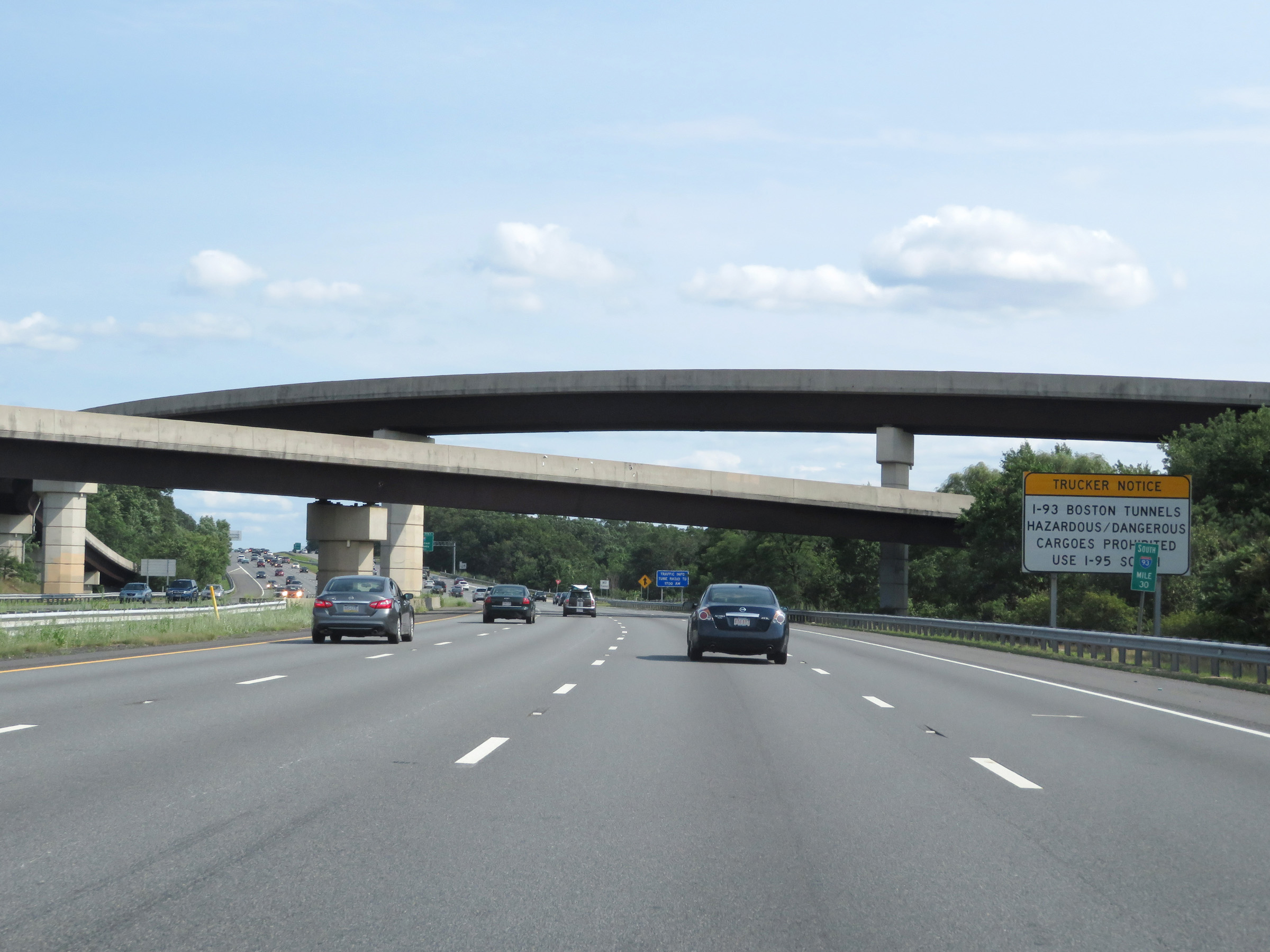 |
View on Interstate 93 South at mile marker 30. As this sign warns, all thru hazardous materials are prohibitied on I-93 through the Thomas P. O'Neill Jr. Tunnel in downtown Boston. Trucks hauling hazardous materials should use Interstate 95 South instead. (Photo taken 8/6/17). |
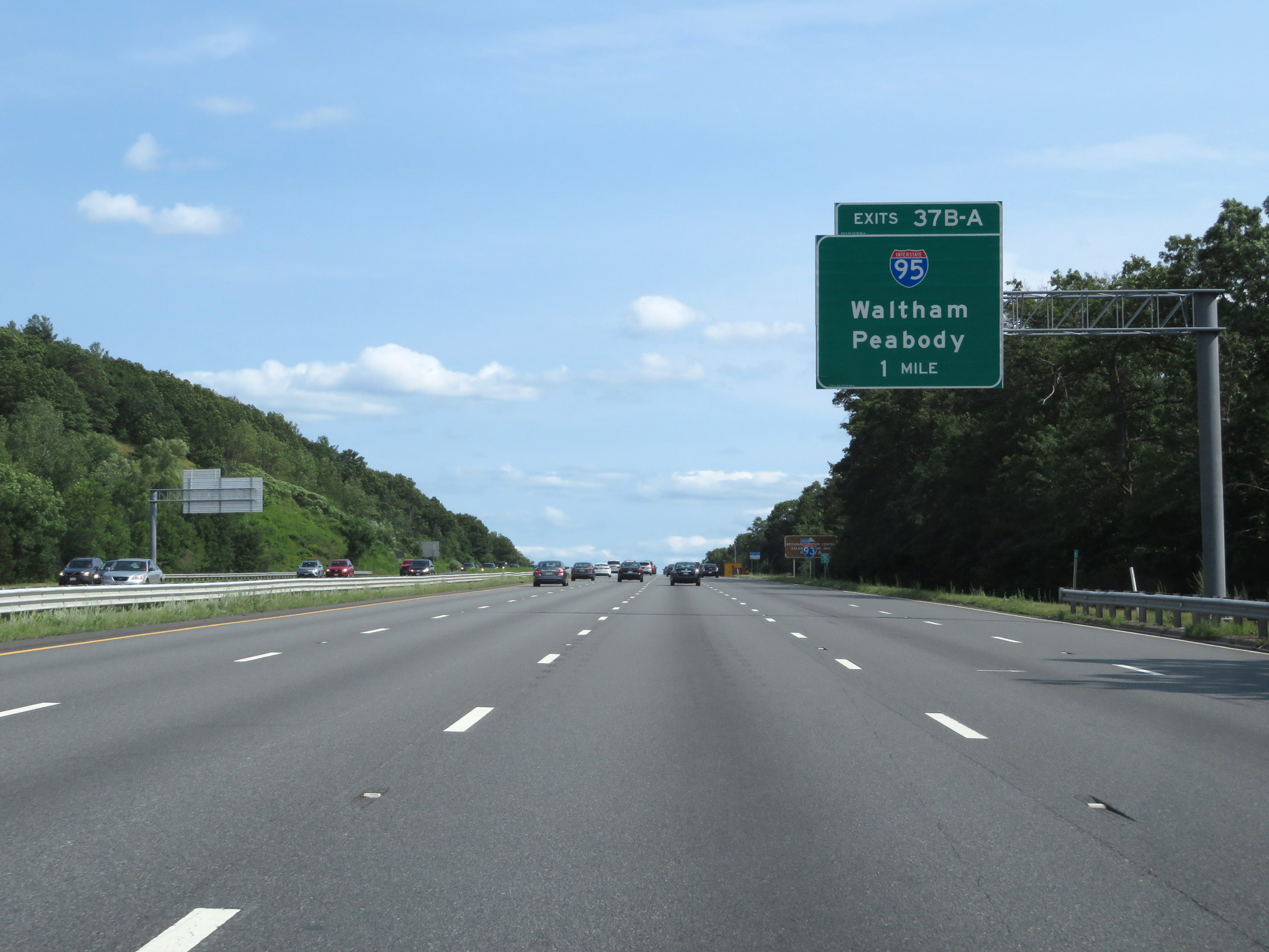 |
Interstate 93 South approaching Exits 37B-A - 1 mile. (Photo taken 8/6/17). |
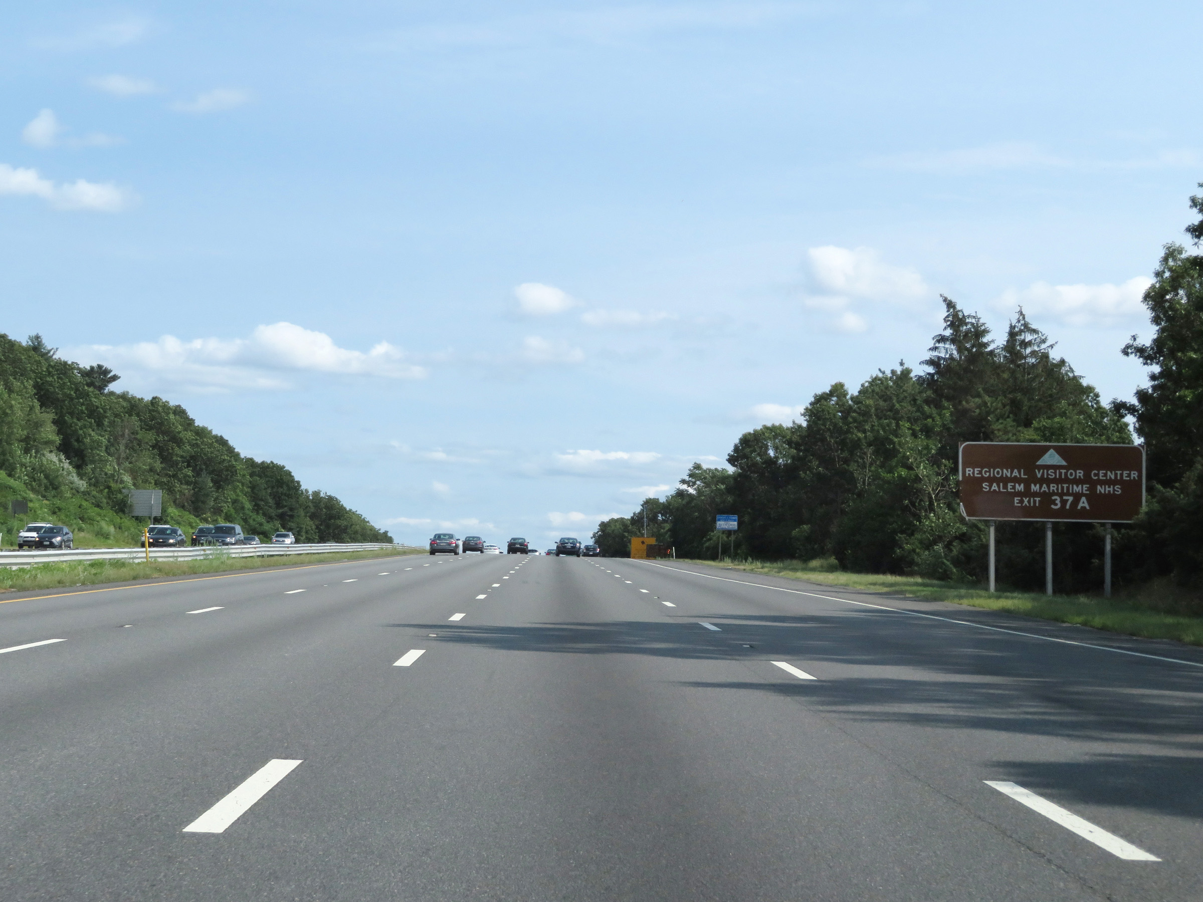 |
Take Exit 37A (Interstate 95 North) to the Regional Visitor Center and Salem Maritime NHS. (Photo taken 8/6/17). |
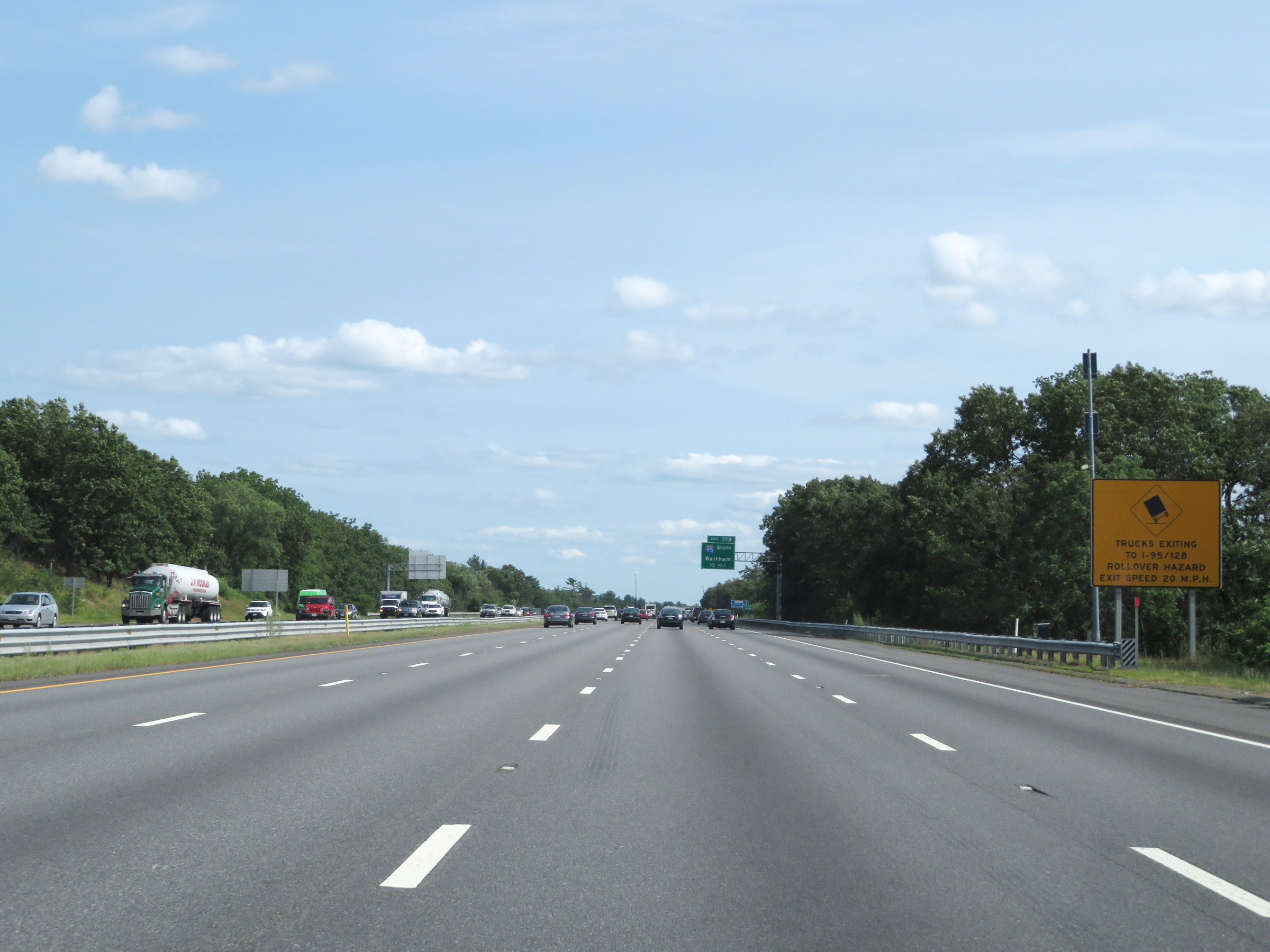 |
As this sign warns, the ramps to Interstate 95 from Interstate 93 South are very sharp and present a rollover hazard for trucks. The advised speed on these ramps is 20 mph. (Photo taken 8/6/17). |
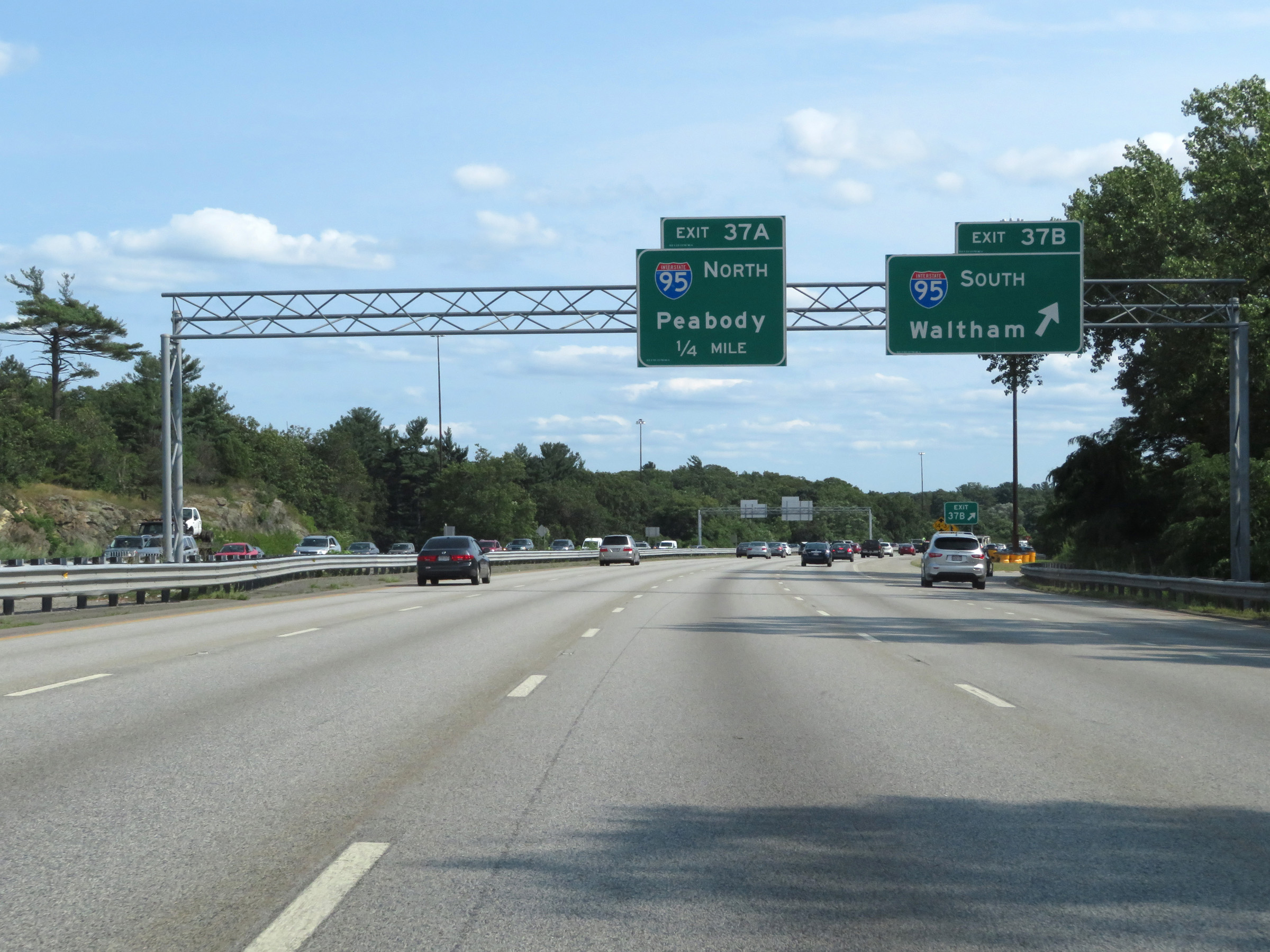 |
Interstate 93 South at Exit 37B: Interstate 95 South - Waltham (Photo taken 8/6/17). |
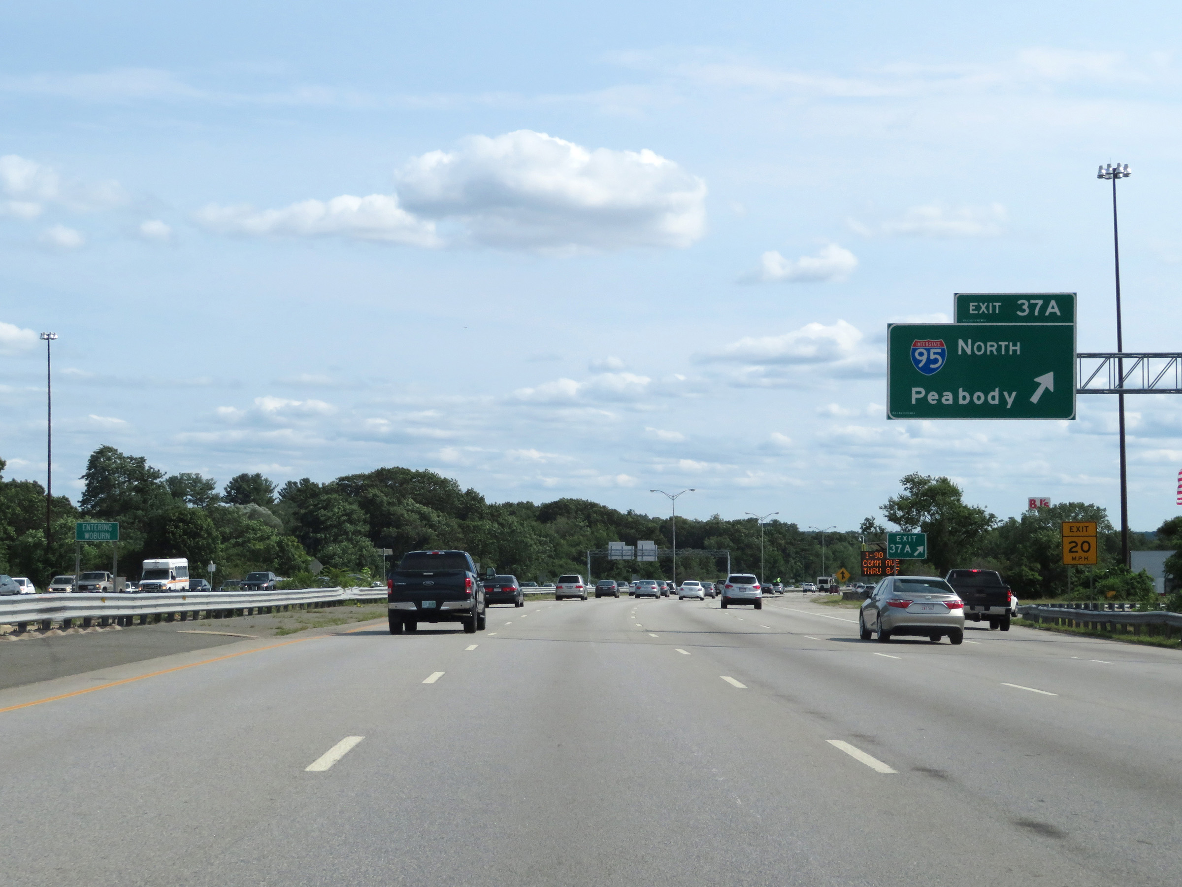 |
Interstate 93 South at Exit 37A: Interstate 95 North - Peabody (Photo taken 8/6/17). |
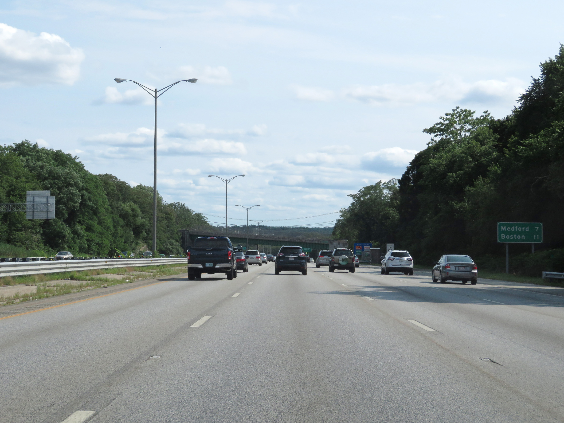 |
Another mileage sign on Interstate 93 South. It's 7 miles to Medford and 11 miles to Boston. (Photo taken 8/6/17). |
 |
Interstate 93 South at Exit 36: Montvale Ave / Stoneham / Woburn (Photo taken 8/6/17). |
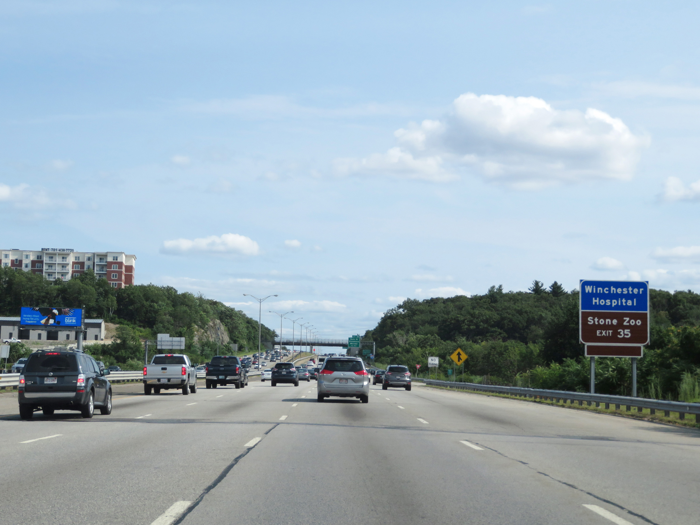 |
Take Exit 35 to Stone Zoo and Winchester Hospital. (Photo taken 8/6/17). |
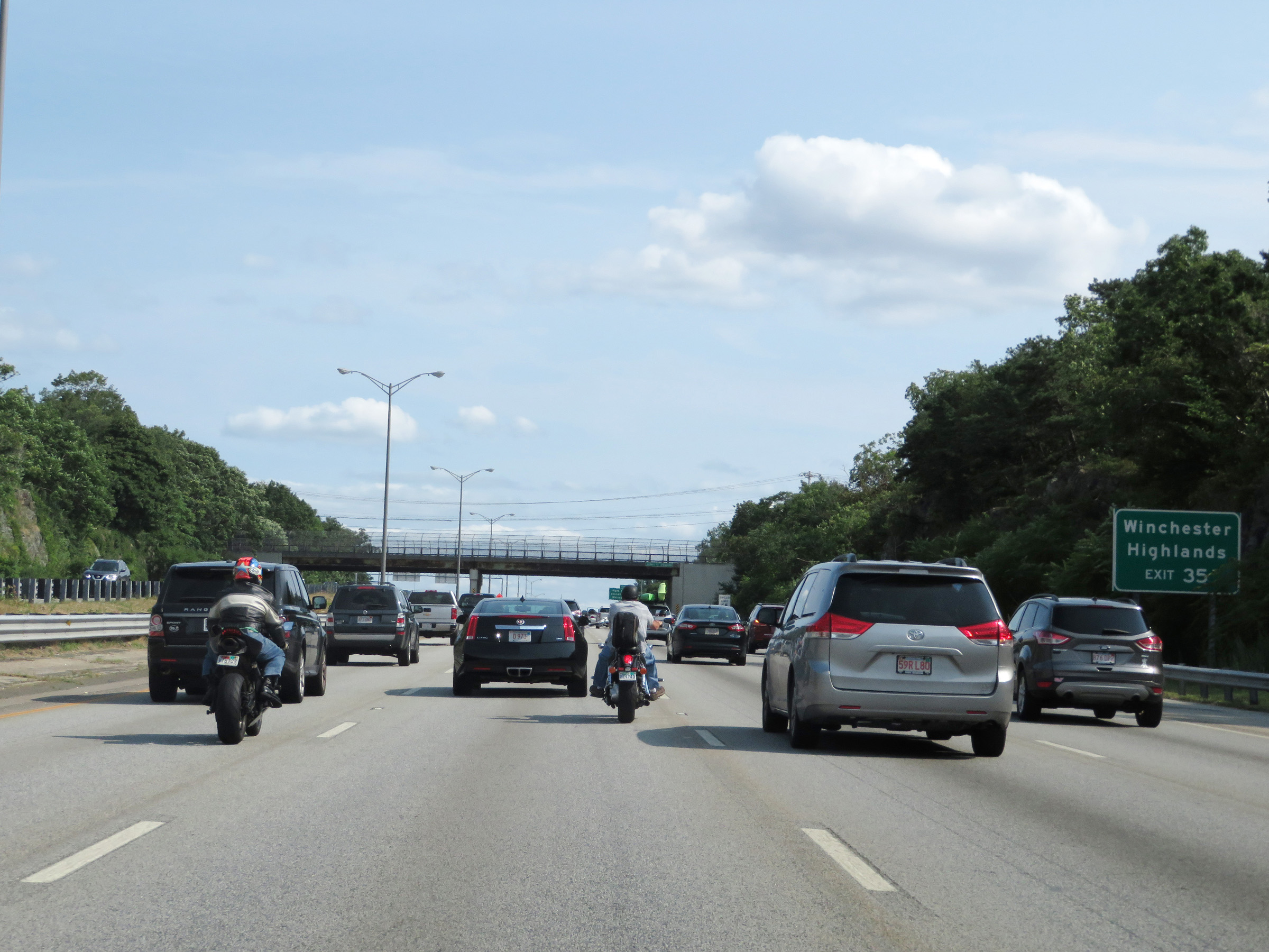 |
Also take Exit 35 to Winchester Highlands. (Photo taken 8/6/17). |
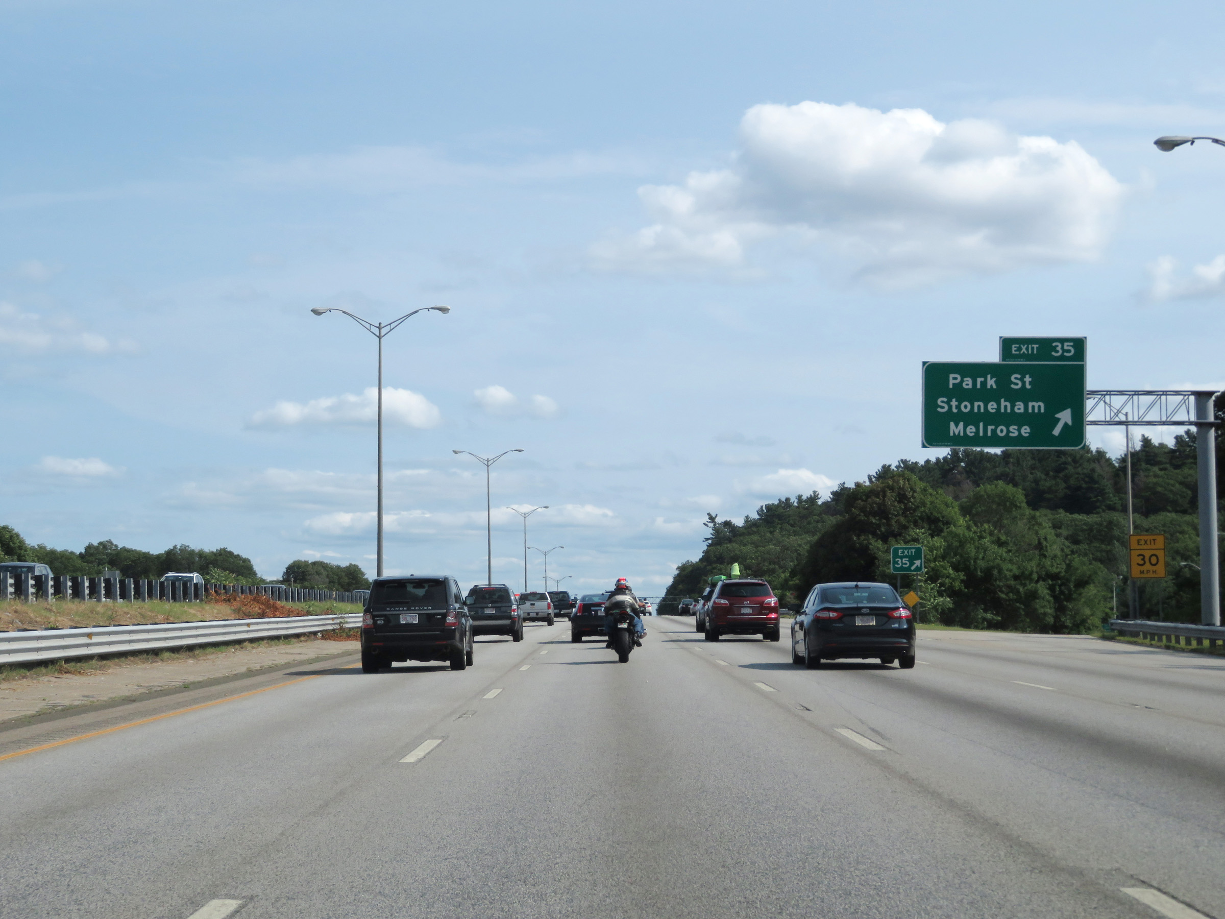 |
Interstate 93 South at Exit 35: Park St / Stoneham / Melrose (Photo taken 8/6/17). |
 |
Another mileage sign which dynamically shows the current estimated travel time to the destinations listed on it. (Photo taken 8/6/17). |
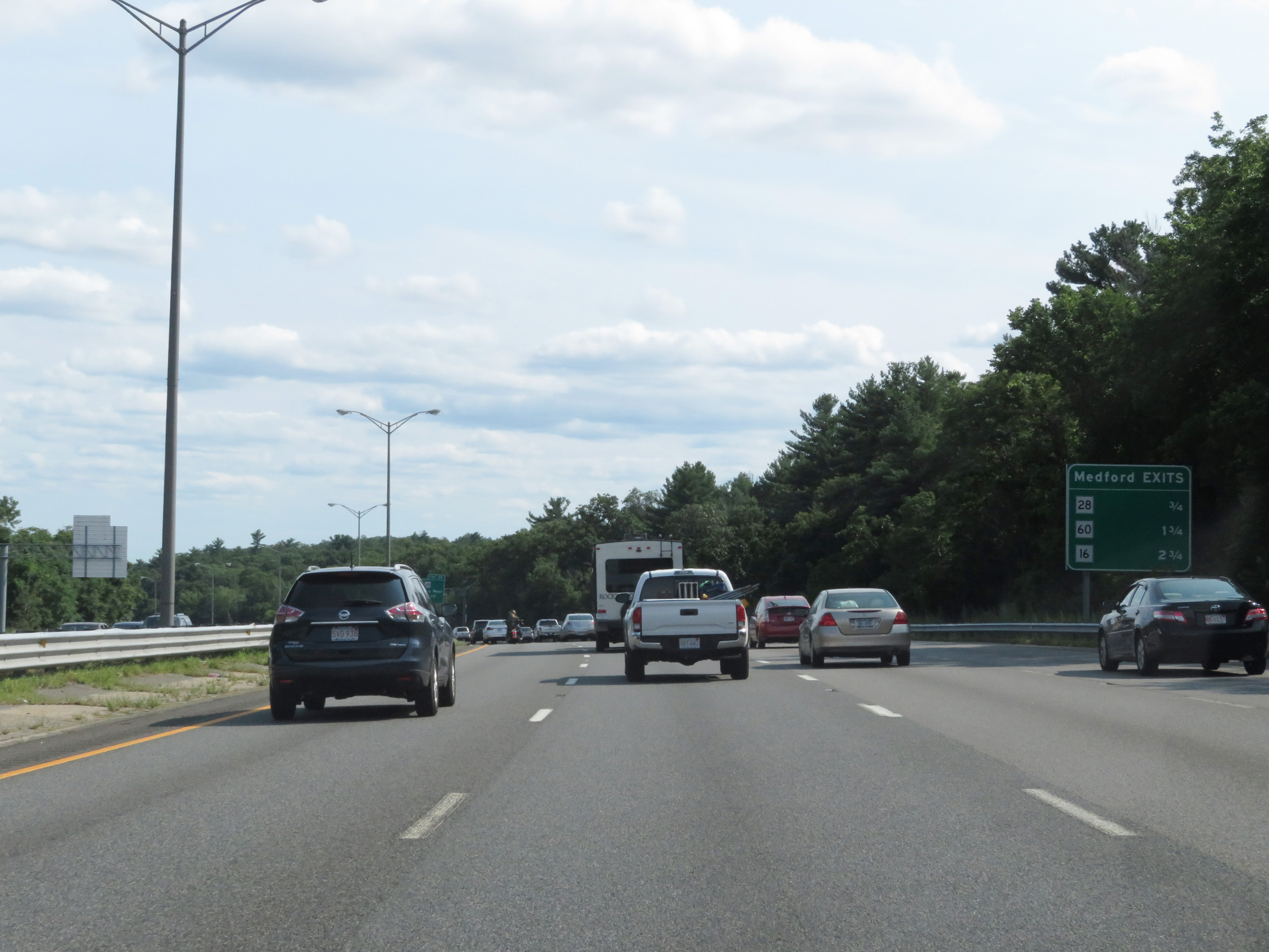 |
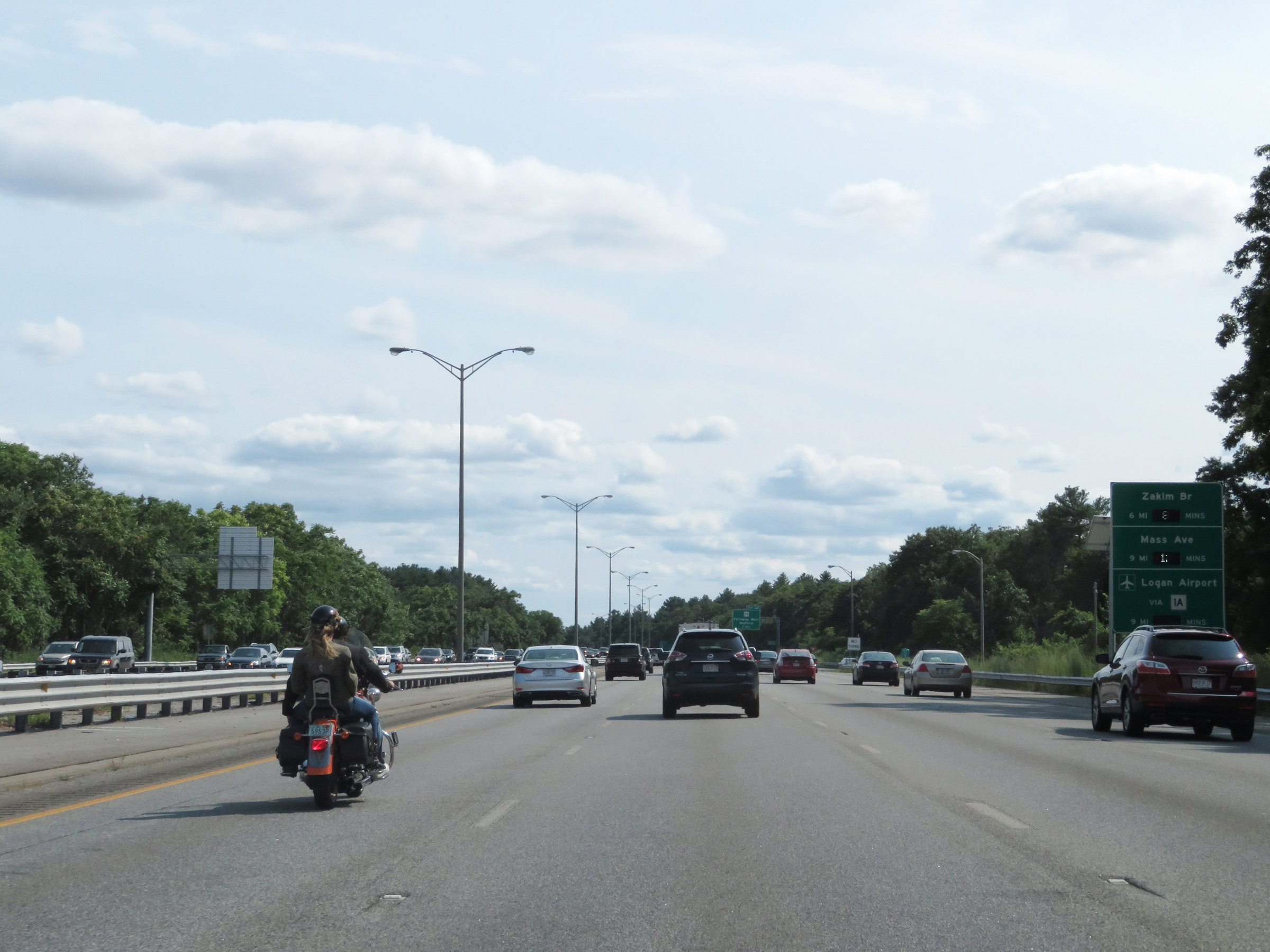
This sign displays the distances to the three upcoming exits to Medford on Interstate 93 South. (Photo taken 8/6/17). |
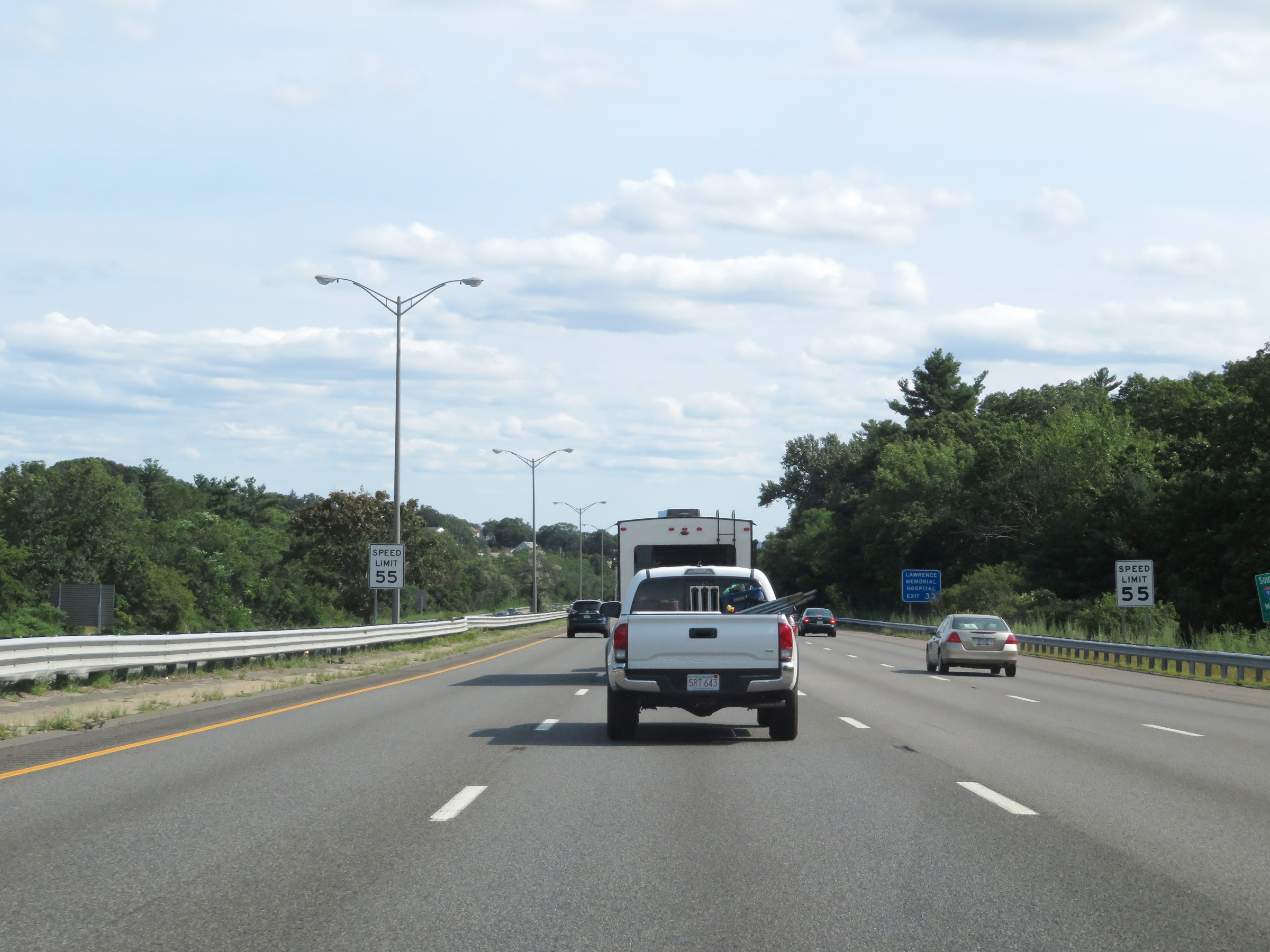 |
Approaching Exit 33, the speed limit decreases to 55 mph on Interstate 93 South. (Photo taken 8/6/17). |
 |
Interstate 93 South at Exit 33: MA 28 - Fellsway West / Winchester (Photo taken 8/6/17). |
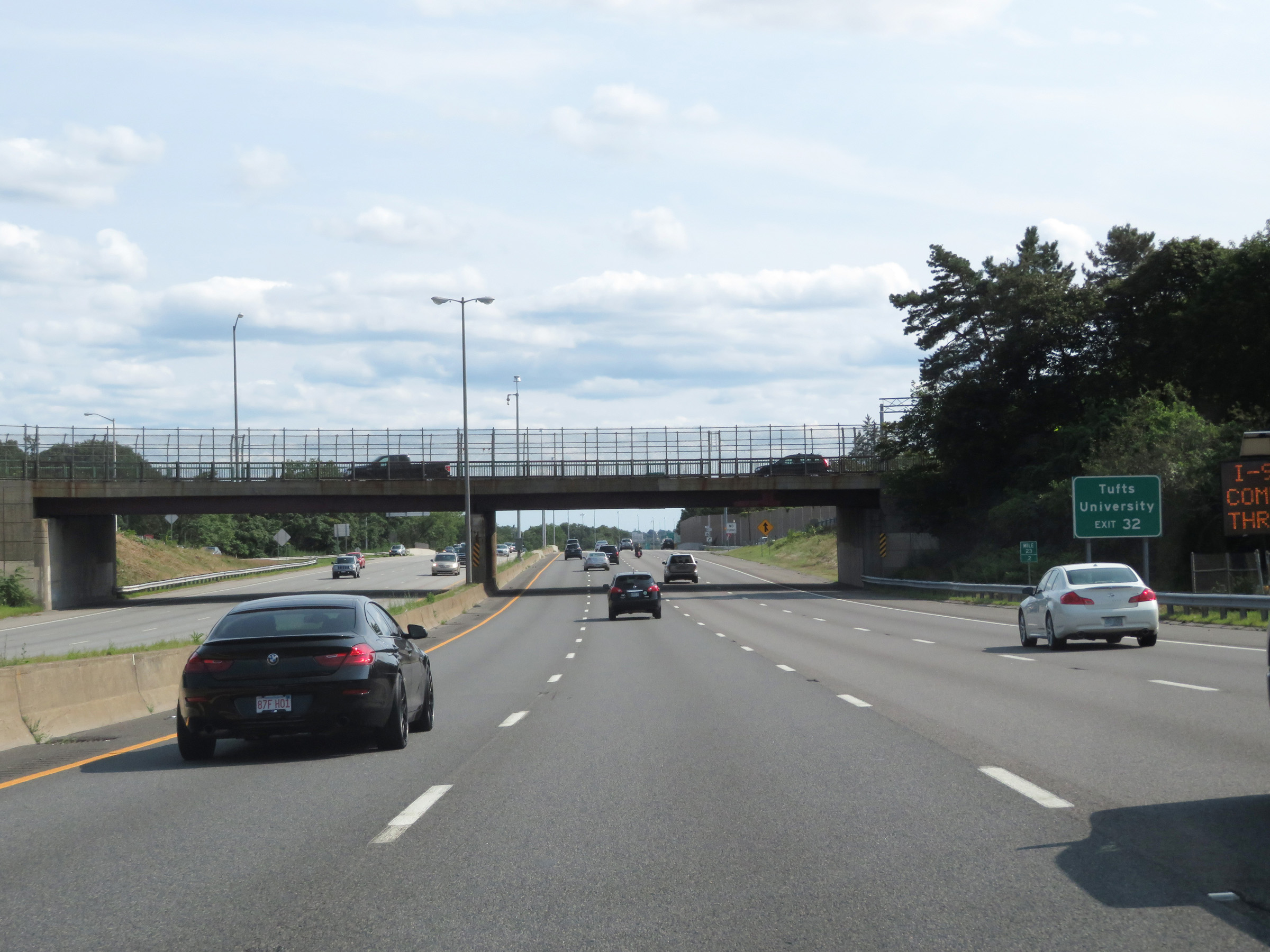 |
Take Exit 32 to Tufts University. (Photo taken 8/6/17). |
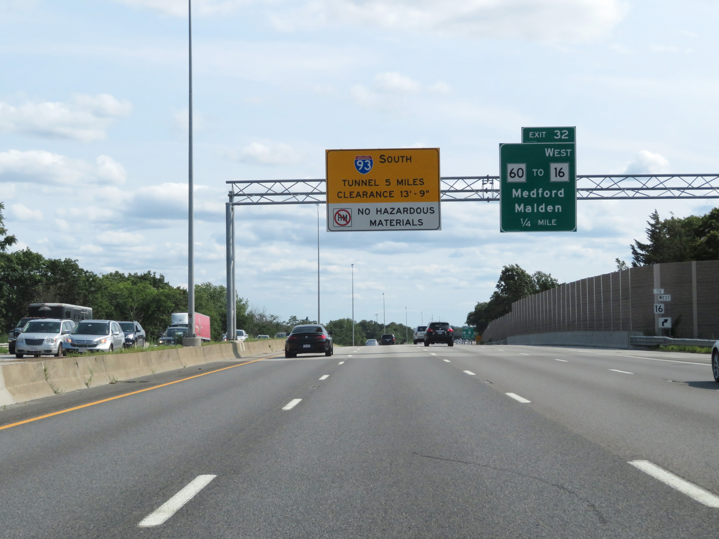 |
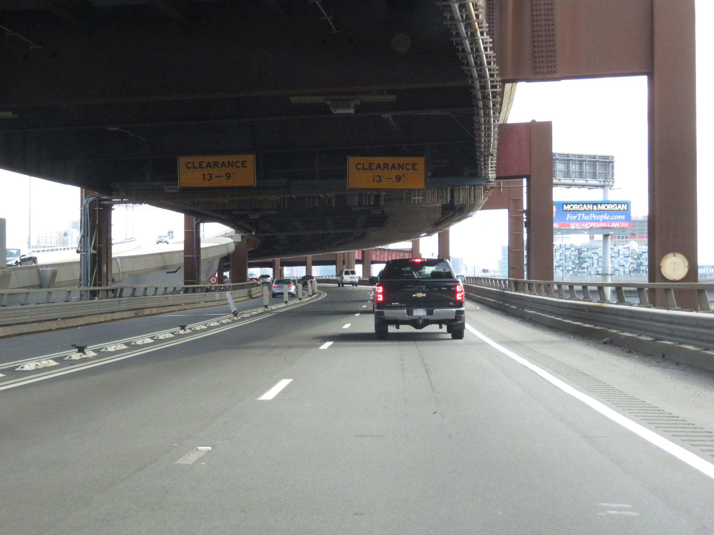
The Thomas P. O'Neill Jr. Tunnel exists 5 miles ahead in downtown Boston on Interstate 93 South. The vertical clearance in the tunnel is 13'-9", and this overhead sign reminds truck drivers that all hazardous materials are prohibited through the tunnel. (Photo taken 8/6/17). |
 |
Interstate 93 South at Exit 32: MA 60 / To MA 16 West - Medford / Malden (Photo taken 8/6/17). |
 |
Interstate 93 South at Exit 31: MA 16 East - Everett / Revere (Photo taken 8/6/17). |
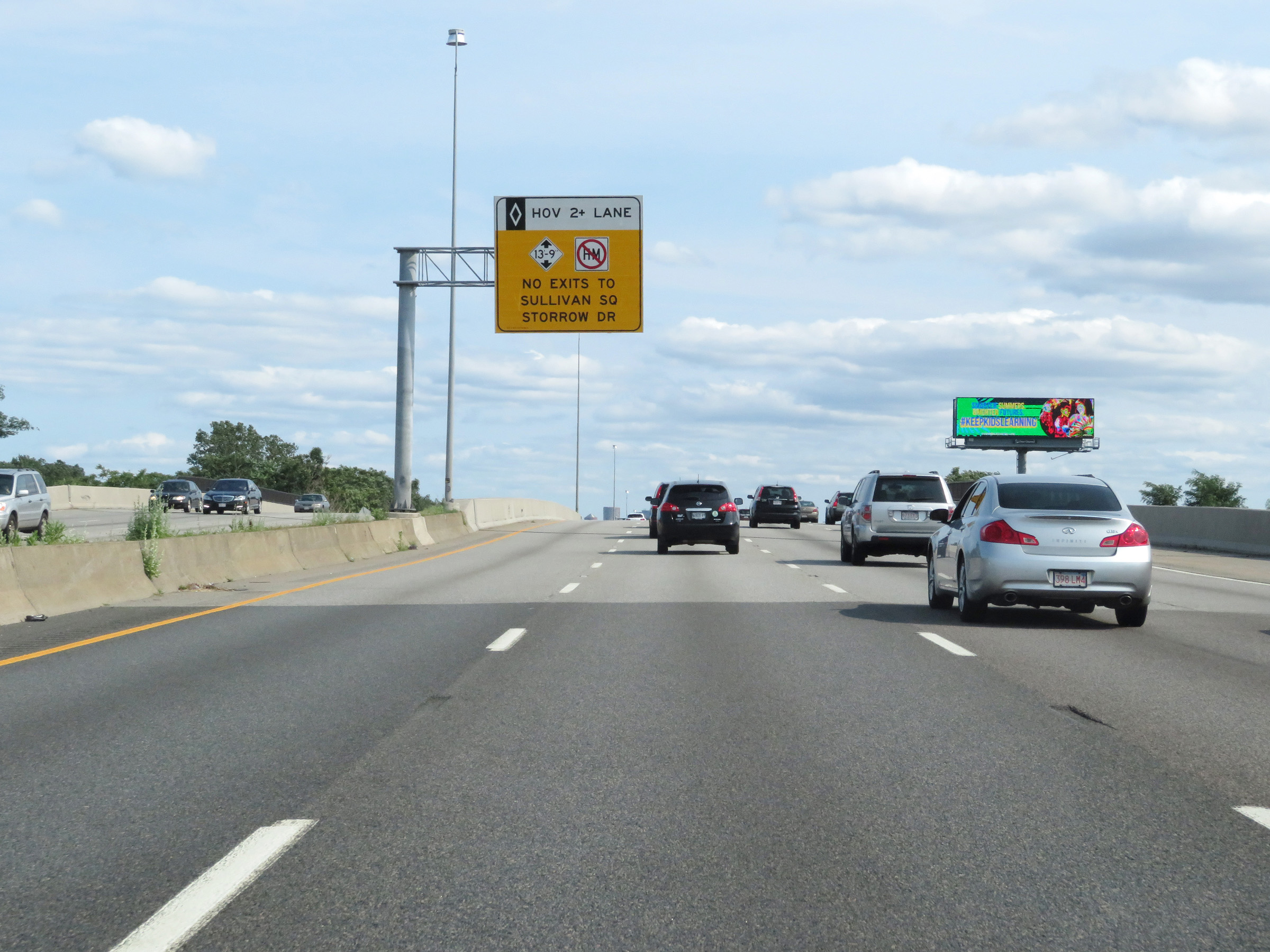 |
Ahead, there will be an entrance on the left to a HOV lane on Interstate 93 South. This overhead sign warns that in the HOV lane, the maximum vertical clearance is 13'-9", hazardous materials are prohibited, and the HOV lane does not provide access to Sullivan Square (Exit 20). (Photo taken 8/6/17). |
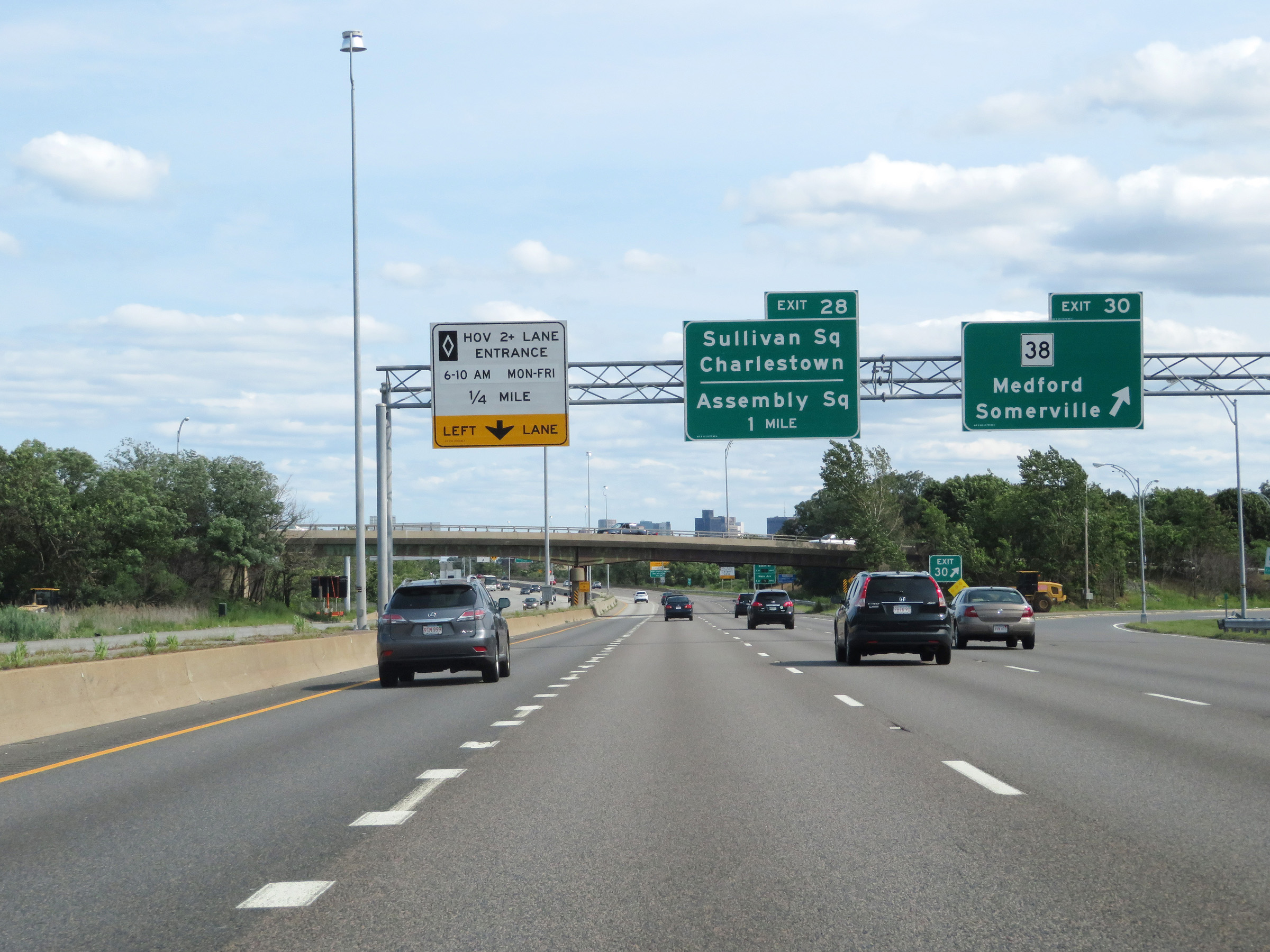 |
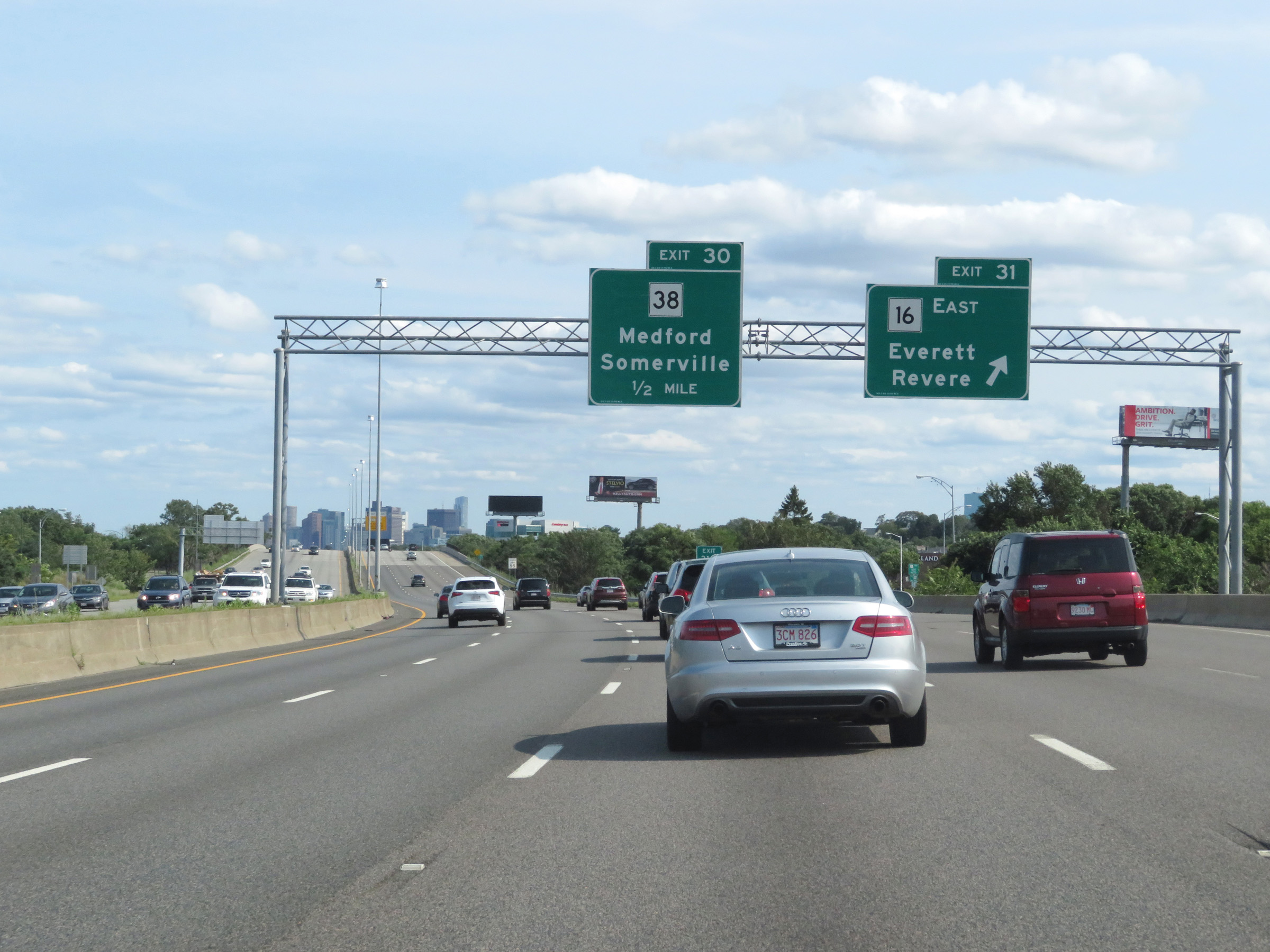
Interstate 93 South at Exit 30: MA 38 - Medford / Somerville (Photo taken 8/6/17). |
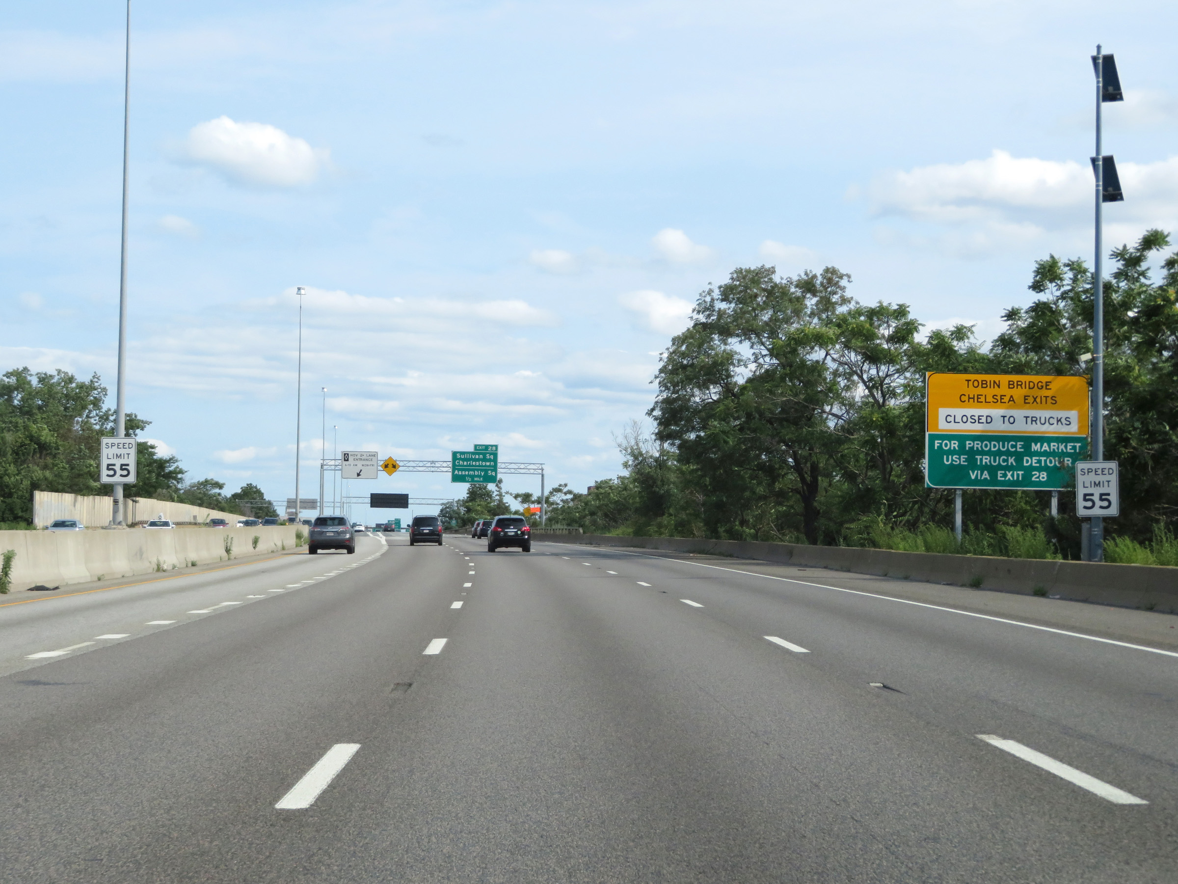 |
The speed limit remains 55 mph on Interstate 93 South. Also, this sign warns that the Tobin Bridge on US 1 and the exits to Chelsea are closed to trucks. All trucks to the Produce Market should follow the truck detour via Exit 28. (Photo taken 8/6/17). |
 |
HOV lane entrance on the left on Interstate 93 South. Monday thru Friday from 6-10 AM, the HOV lane is restricted to vehicles with 2 more more people. (Photo taken 8/6/17). |
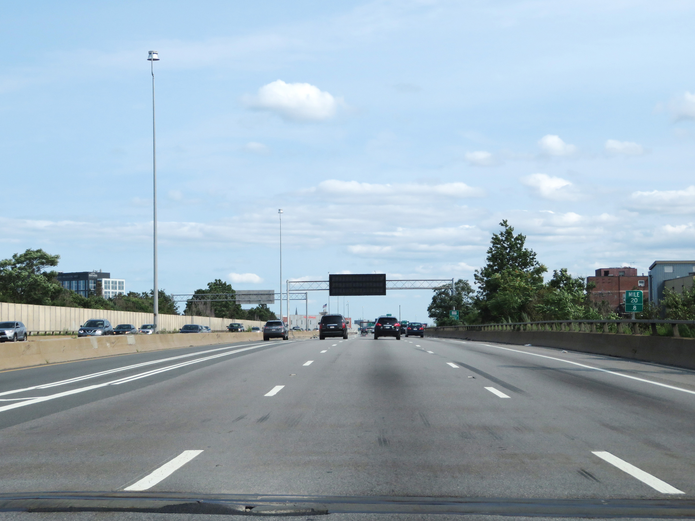 |
View on Interstate 93 South at mile marker 20.8. (Photo taken 8/6/17). |
 |
Interstate 93 South at Exit 28: Sullivan Square / Charlestown / Assembly Square (Photo taken 8/6/17). |
 |
View on Interstate 93 South at mile marker 20.2. (Photo taken 8/6/17). |
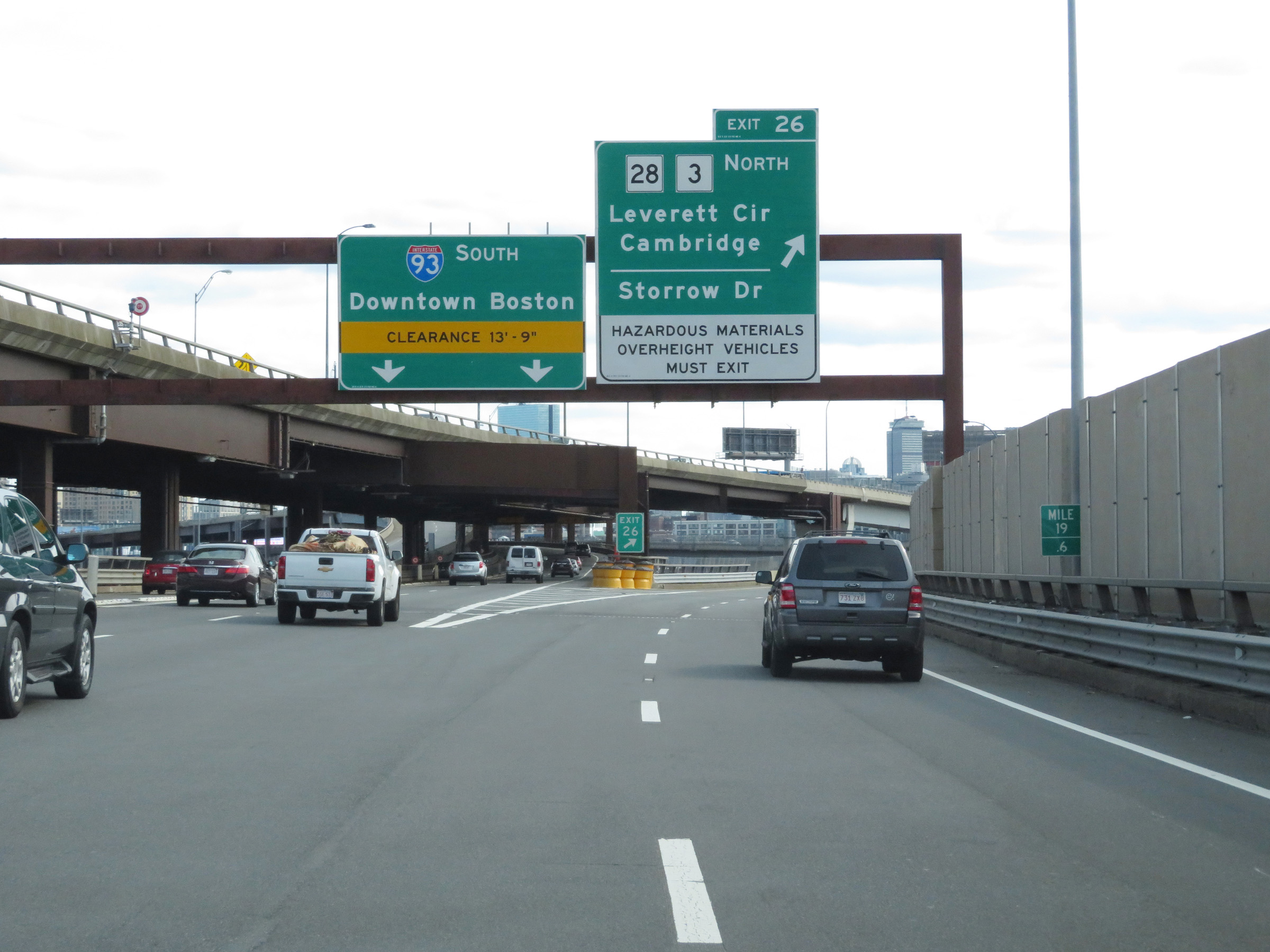 |
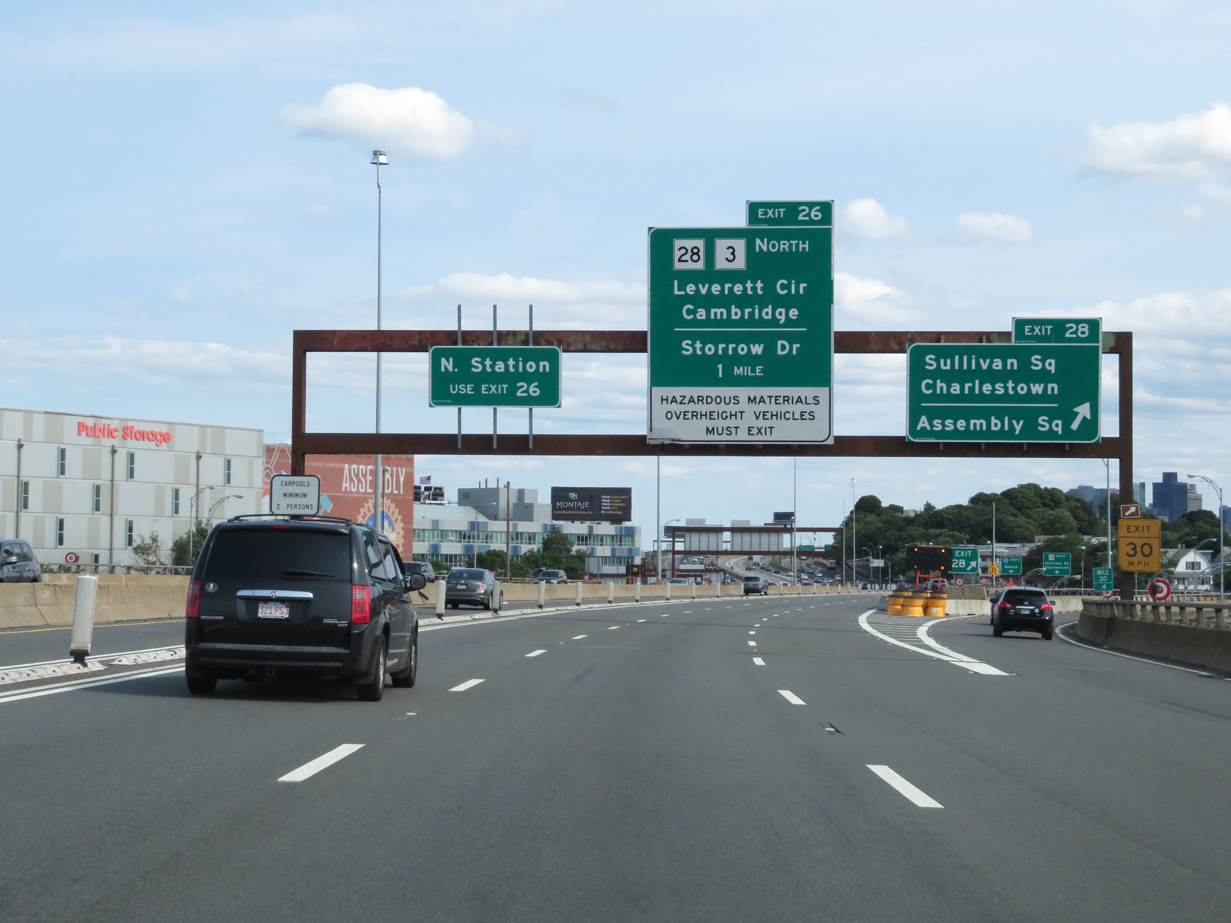
Interstate 93 South at Exit 26: MA 28 / MA 3 North - Leverett Circle / Cambridge / Storrow Dr (Photo taken 8/6/17). |
Section 2: Boston (Exit 26) to Interstate 95
 |
South of Exit 26, Interstate 93 becomes double-decked as it approaches the Leonard P. Zakim Bunker Hill Memorial Bridge. The southbound lanes of I-93 take the lower deck. (Photo taken 8/6/17). |
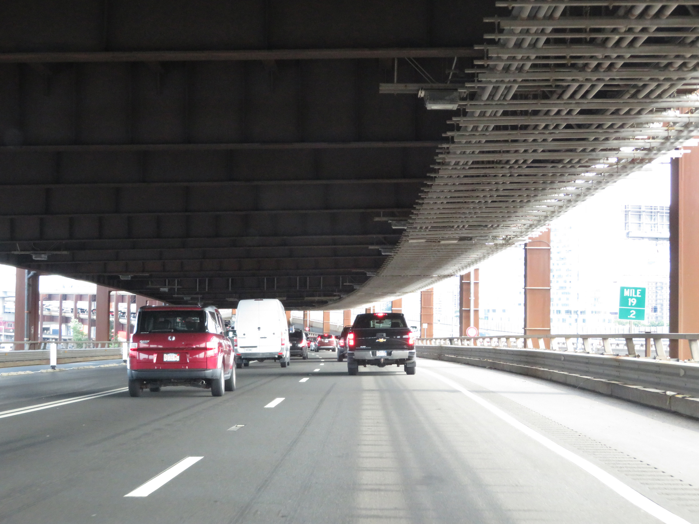 |
A better view of the double-decked configuration of Interstate 93 at mile marker 19.2, in its southbound lanes. (Photo taken 8/6/17). |
 |
Advance signage for Exits 24B-A, which are 1 mile ahead inside the Thomas P. O'Neill Jr. Tunnel. (Photo taken 8/6/17). |
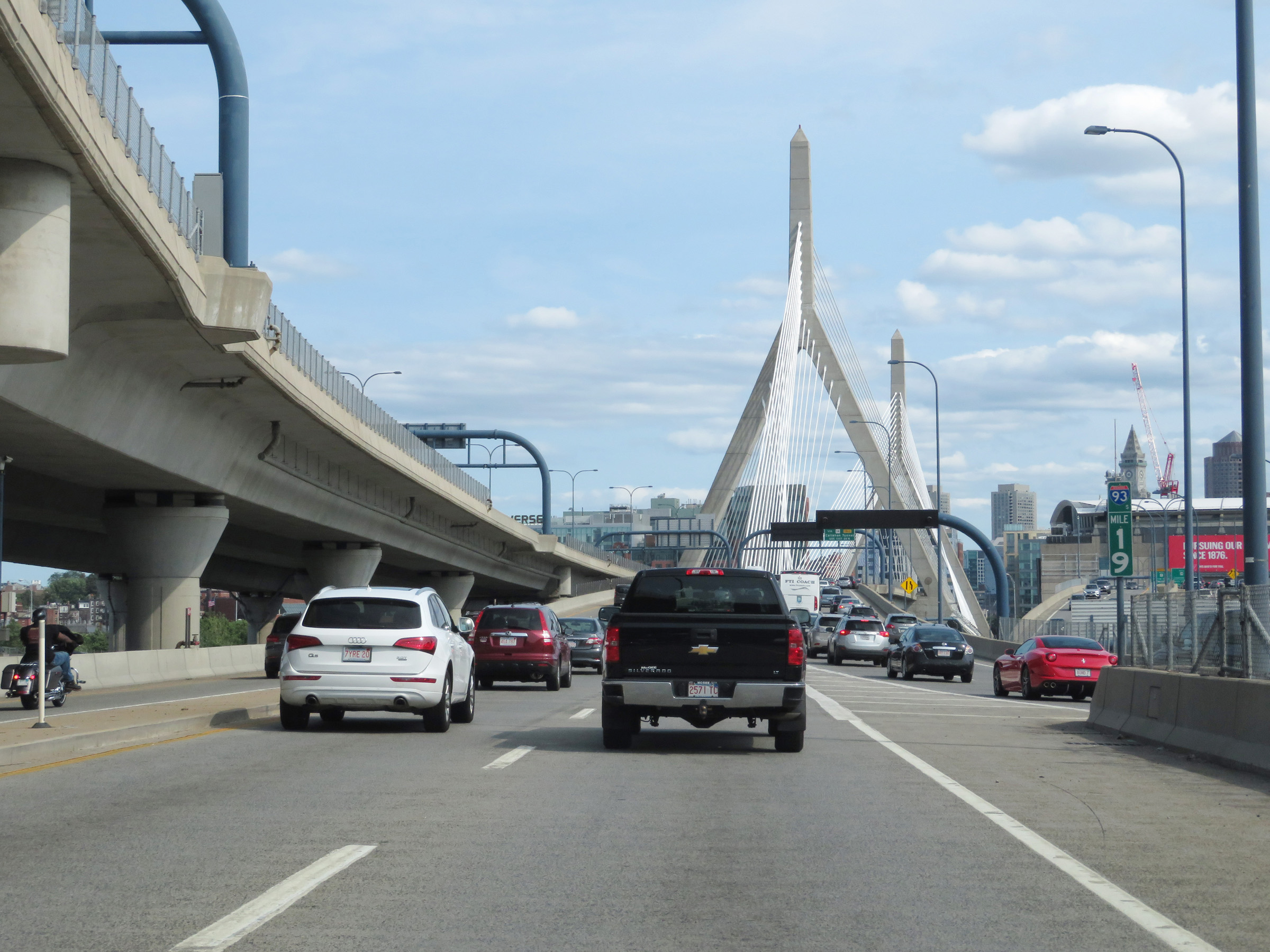 |
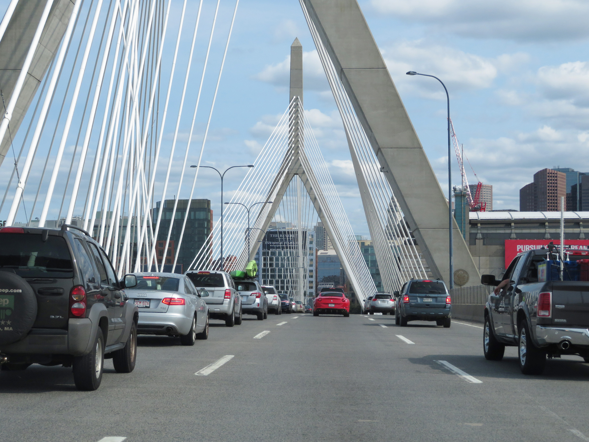
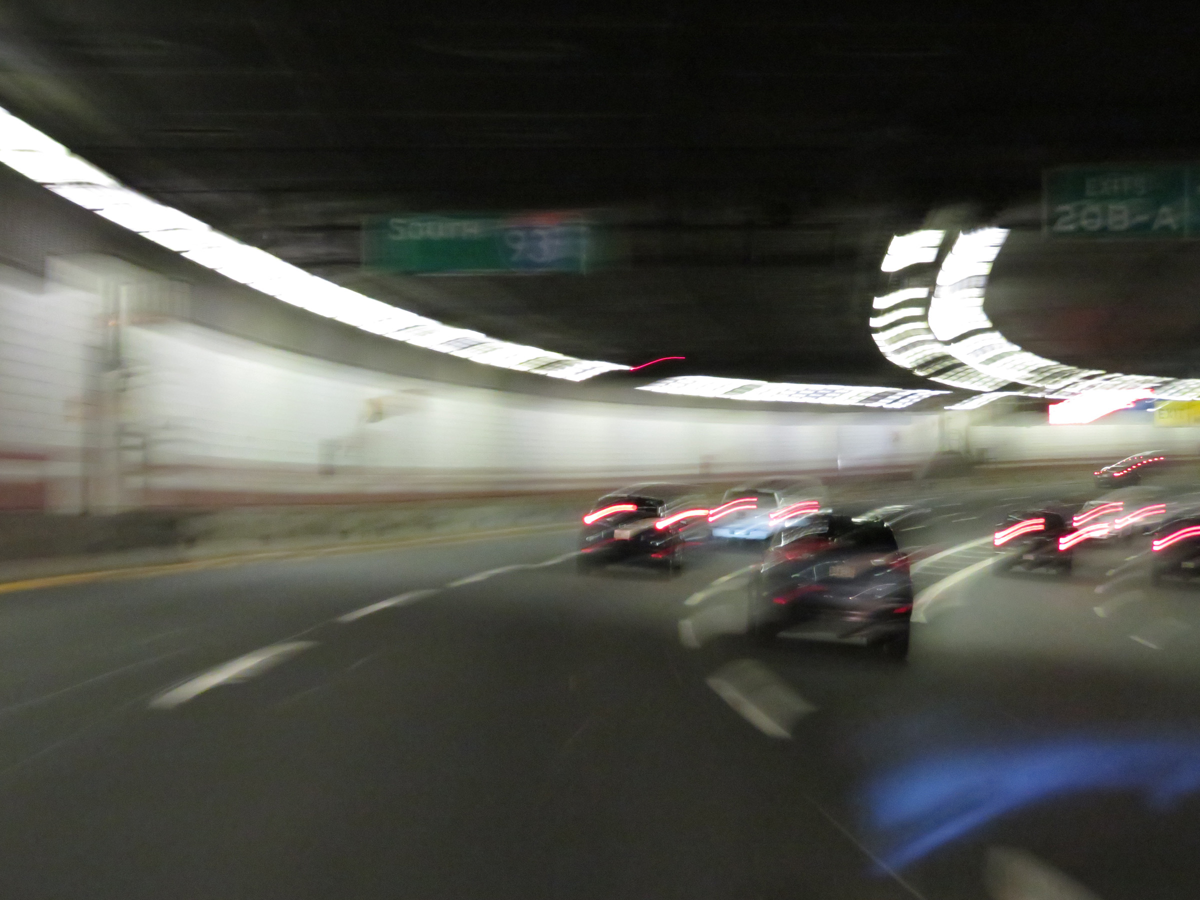
At mile marker 19, the double-decker configuration comes to an end as the Leonard P. Zakim Bunker Hill Memorial Bridge comes into view on Interstate 93 South in downtown Boston. (Photo taken 8/6/17). |
 |
Starting across the Leonard P. Zakim Bunker Hill Memorial Bridge over the Charles River, this overhead sign directs traffic to Logan Airport via MA 1A (which is tolled) and the Callahan Tunnel by way of Exit 24B. Be advised that the maximum vertical clearance along this route is 13'-4". (Photo taken 8/6/17). |
 |
View on Interstate 93 South in downtown Boston as it crosses the Charles River on the Leonard P. Zakim Bunker Hill Memorial Bridge. (Photo taken 8/6/17). |
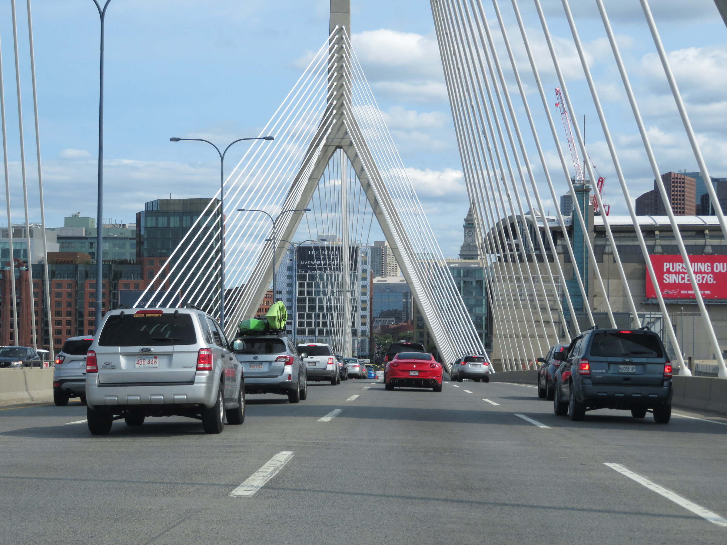 |
Another view on the Leonard P. Zakim Bunker Hill Memorial Bridge in downtown Boston on Interstate 93 South. Just after crossing the bridge, I-93 South will enter the Thomas P. O'Neill Jr. Tunnel. (Photo taken 8/6/17). |
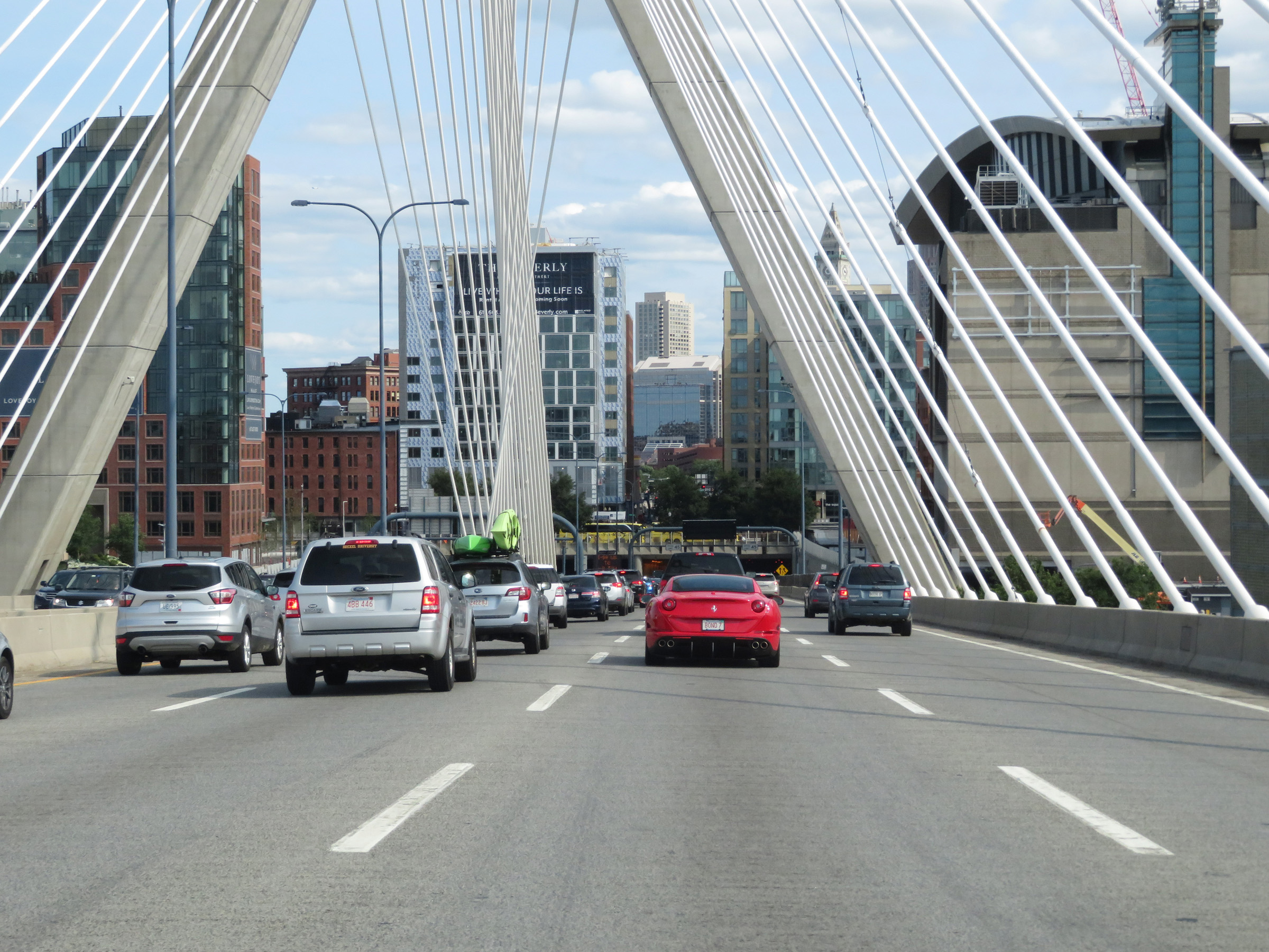 |
As Interstate 93 South descends the peak of the Leonard P. Zakim Bunker Hill Memorial Bridge, the Thomas P. O'Neill Jr. Tunnel begins to come into view. (Photo taken 8/6/17). |
 |
Interstate 93 South as it nears the south side of the Leonard P. Zakim Bunker Hill Memorial Bridge in downtown Boston. (Photo taken 8/6/17). |
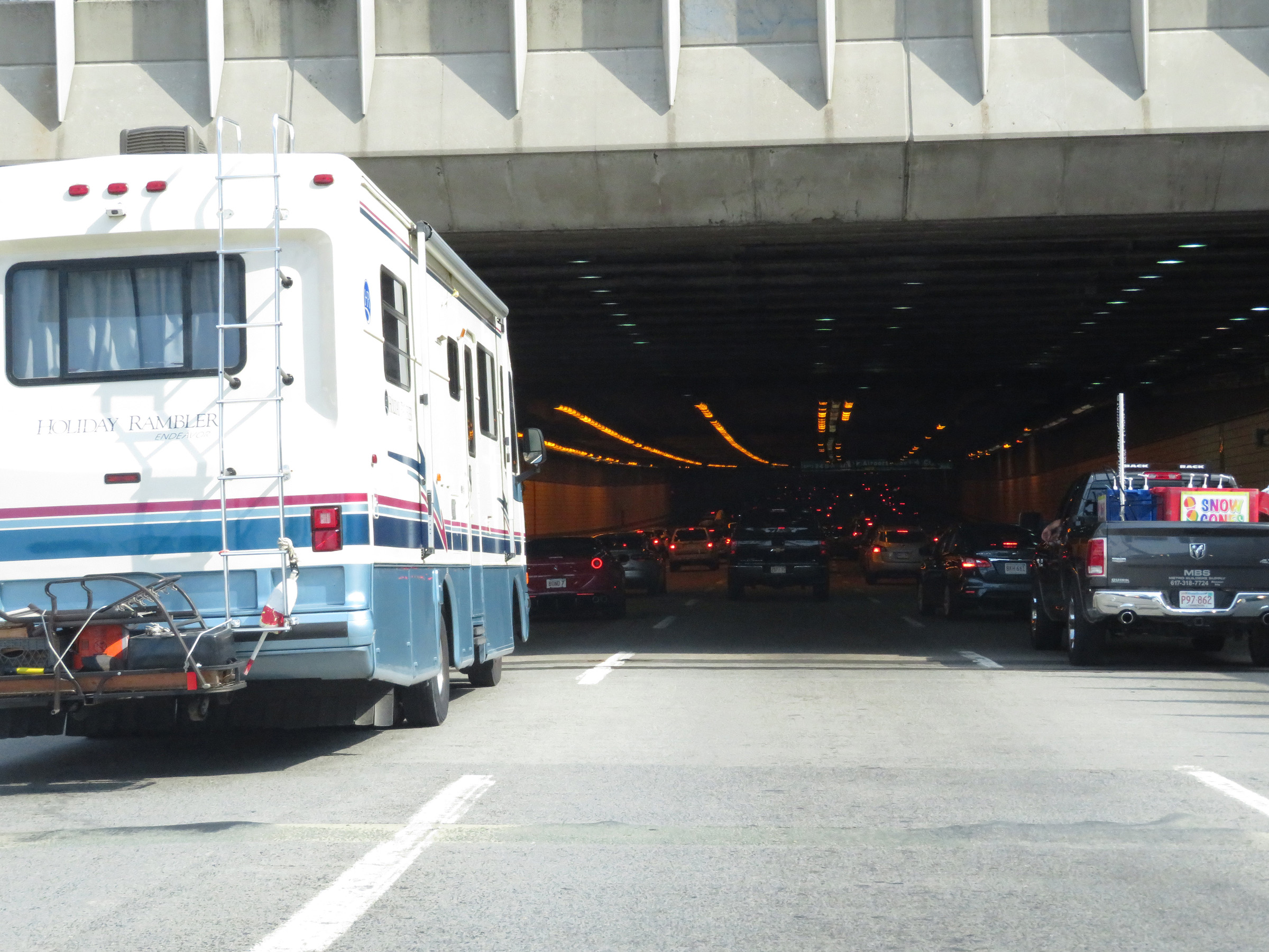 |
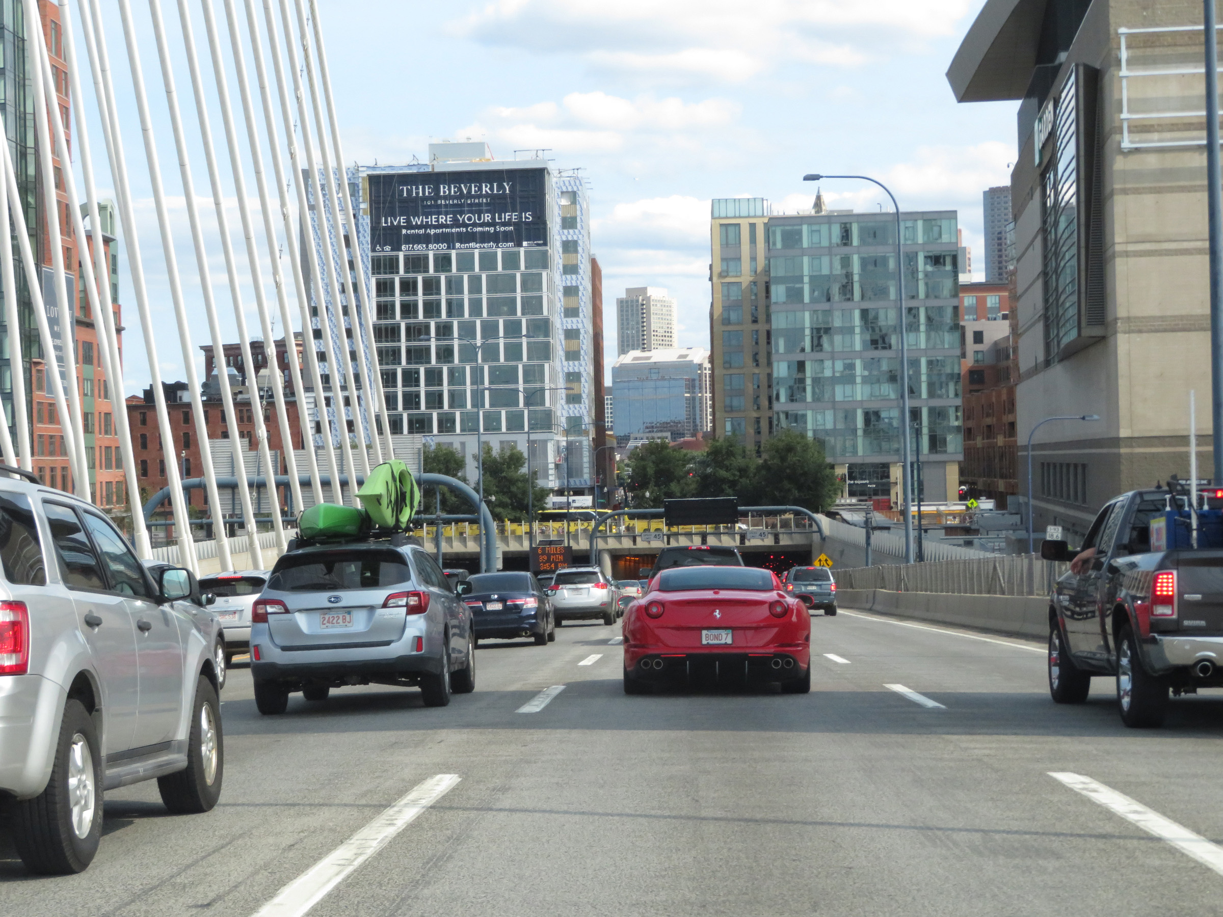
Very shortly after reaching the south side of the bridge, Interstate 93 South prepares to enter the Thomas P. O'Neill Jr. Tunnel. (Photo taken 8/6/17). |
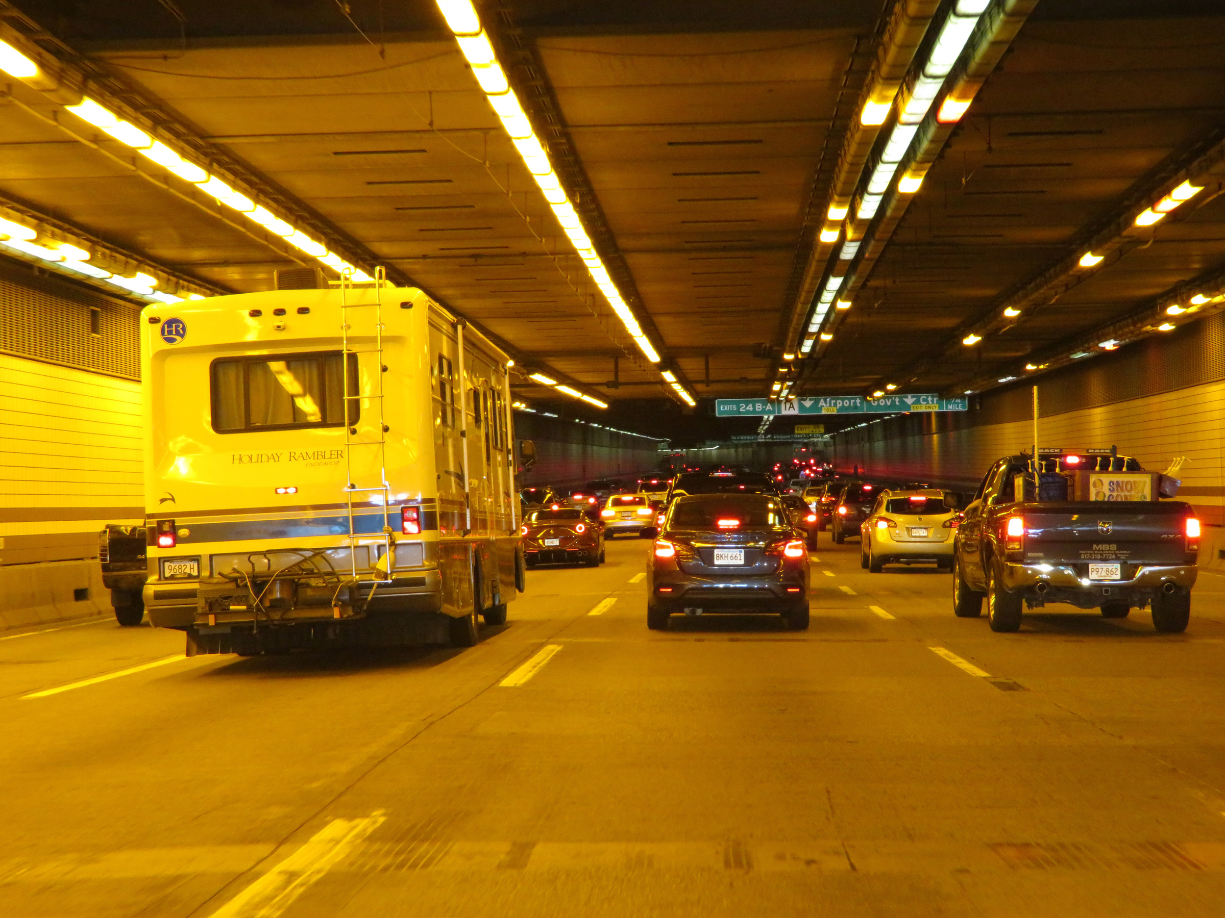 |
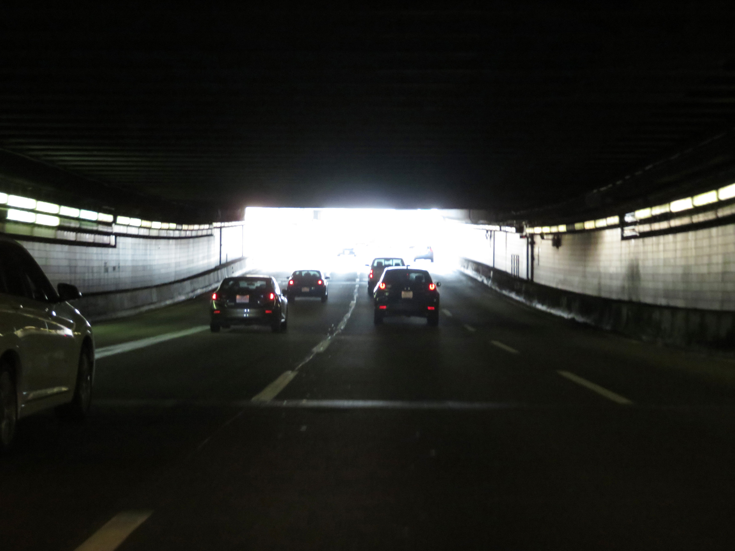
View on Interstate 93 South inside the Thomas P. O'Neill Jr. Tunnel. (Photo taken 8/6/17). |
 |
Interstate 93 South approaching Exits 24B-A - 1/4 mile. (Photo taken 8/6/17). |
 |
Interstate 93 South at Exit 24B: MA 1A North - Airport; Exit 24A: Government Center (Photo taken 8/6/17). |
 |
Interstate 93 South approaching Exit 23 - 1/4 mile. (Photo taken 8/6/17). |
 |
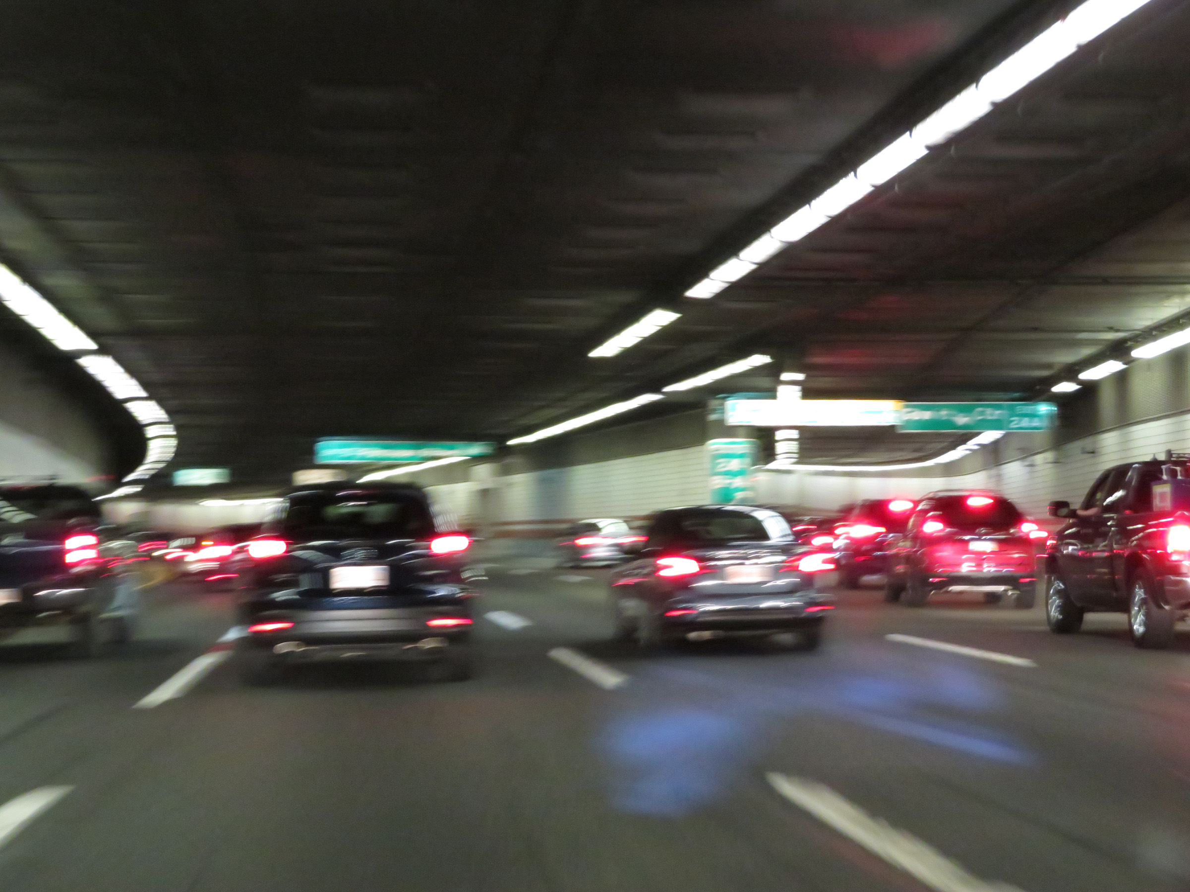
Another view on Interstate 93 South inside the Thomas P. O'Neill Jr. Tunnel in downtown Boston. (Photo taken 8/6/17). |
 |
Interstate 93 South approaching Exits 20B-A - 1/2 mile. (Photo taken 8/6/17). |
 |
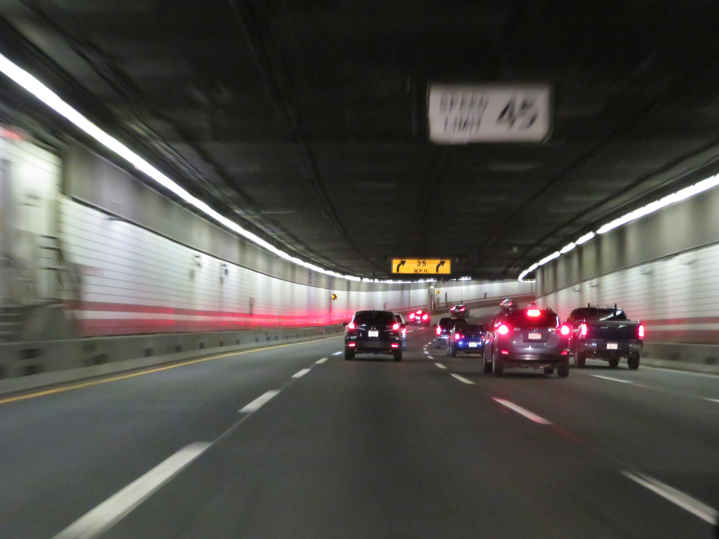
View on Interstate 93 South from inside the Thomas P. O'Neill Jr. Tunnel, approaching Exit 23. (Photo taken 8/6/17). |
 |
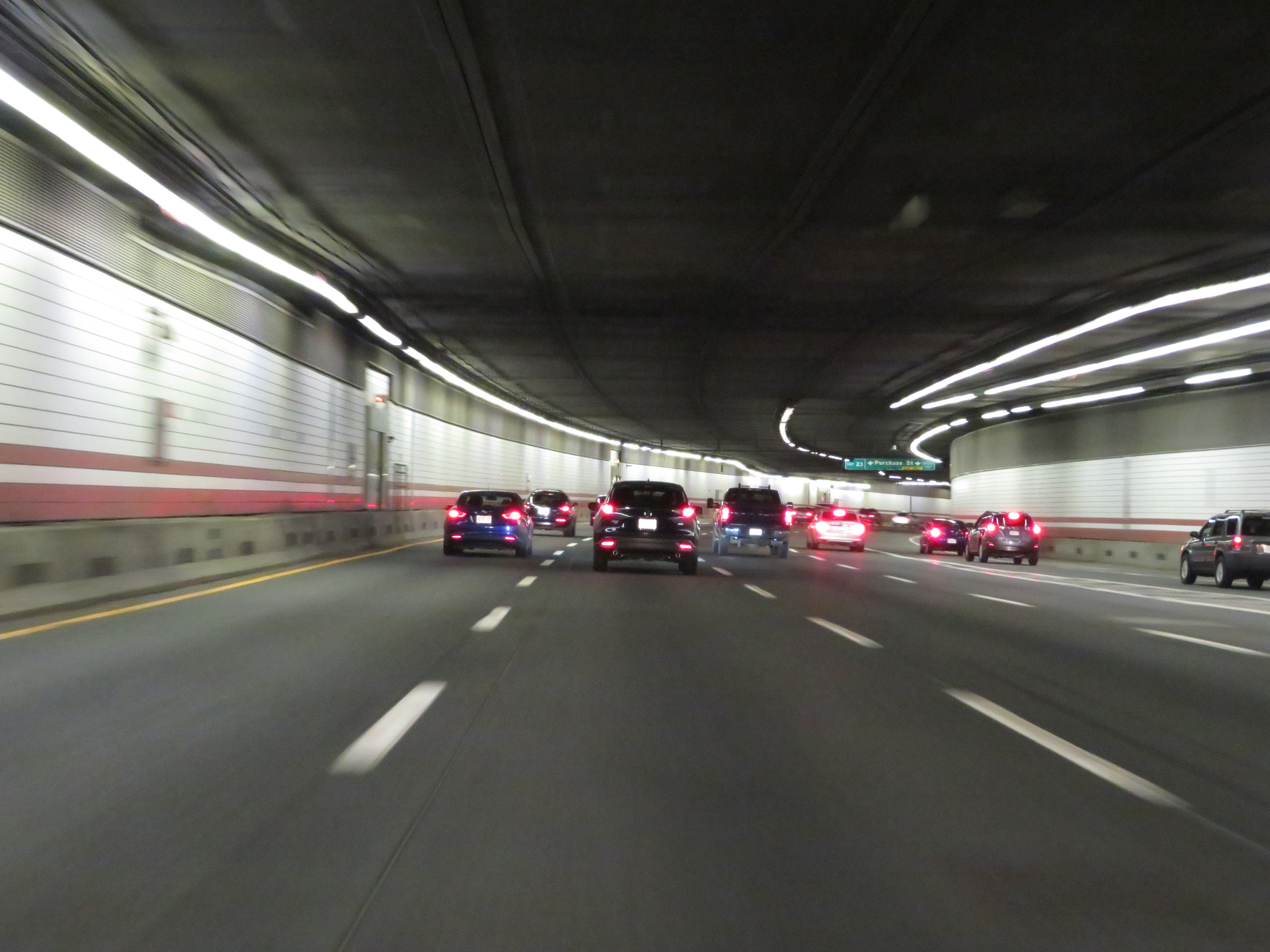
Interstate 93 South at Exit 23: Purchase St (Photo taken 8/6/17). |
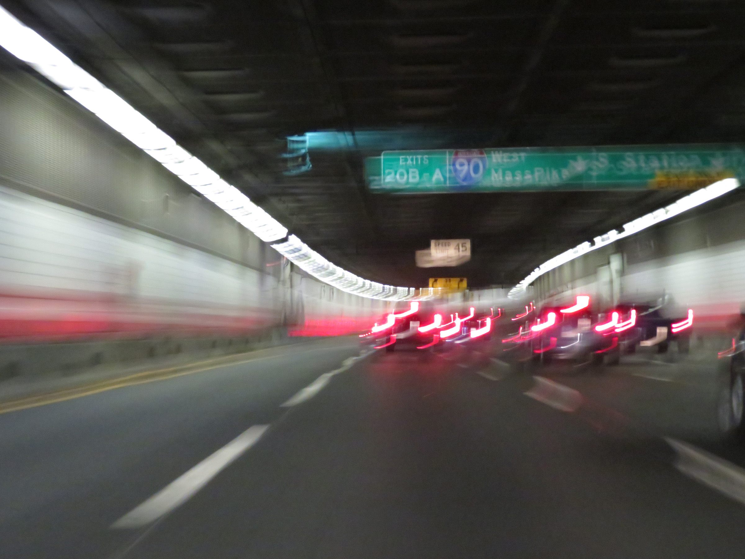 |
Interstate 93 South approaching Exits 20B-A. (Photo taken 8/6/17). |
 |
The speed limit on Interstate 93 South through the Thomas P. O'Neill Jr. Tunnel is 45 mph. (Photo taken 8/6/17). |
 |
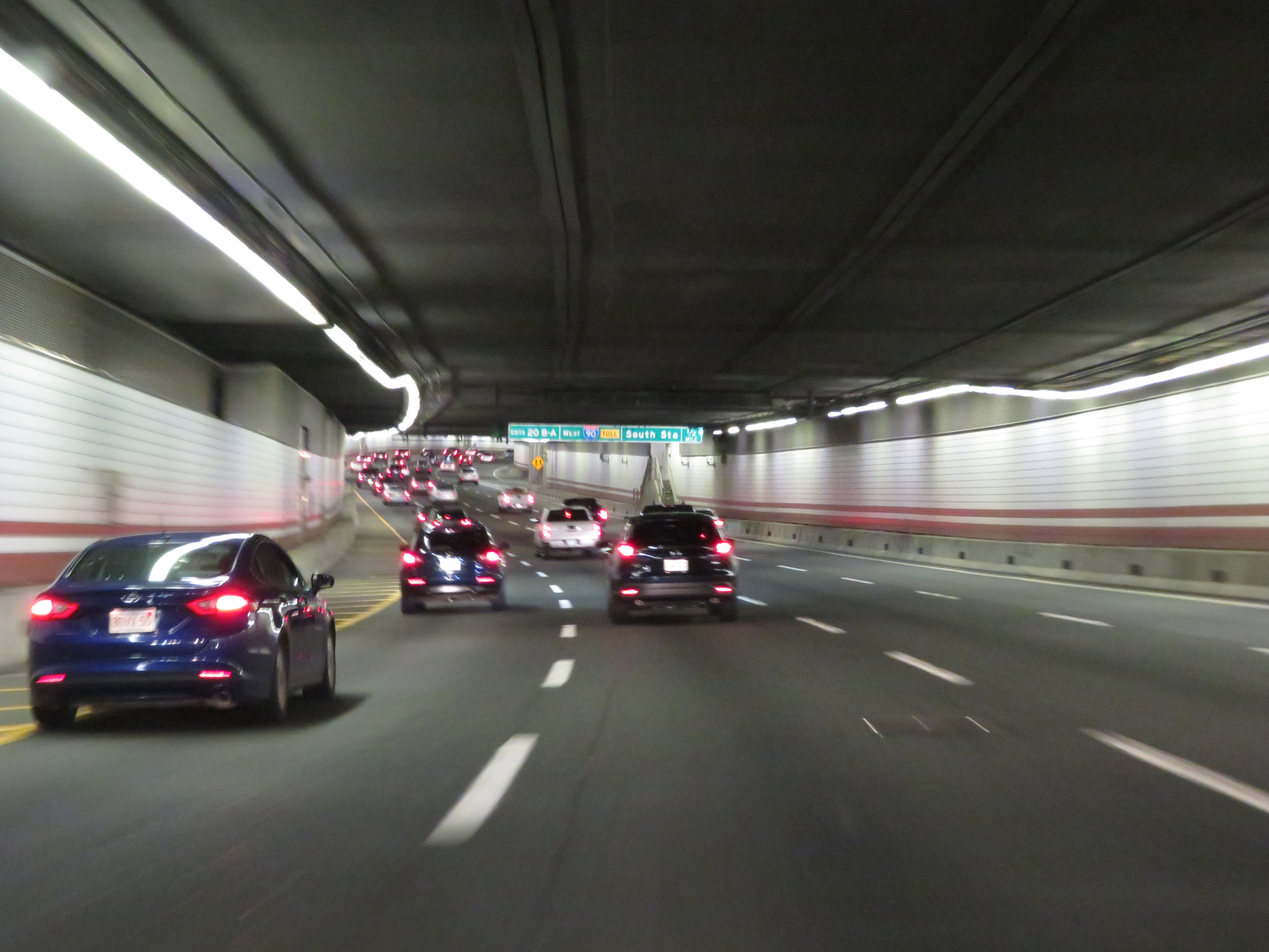
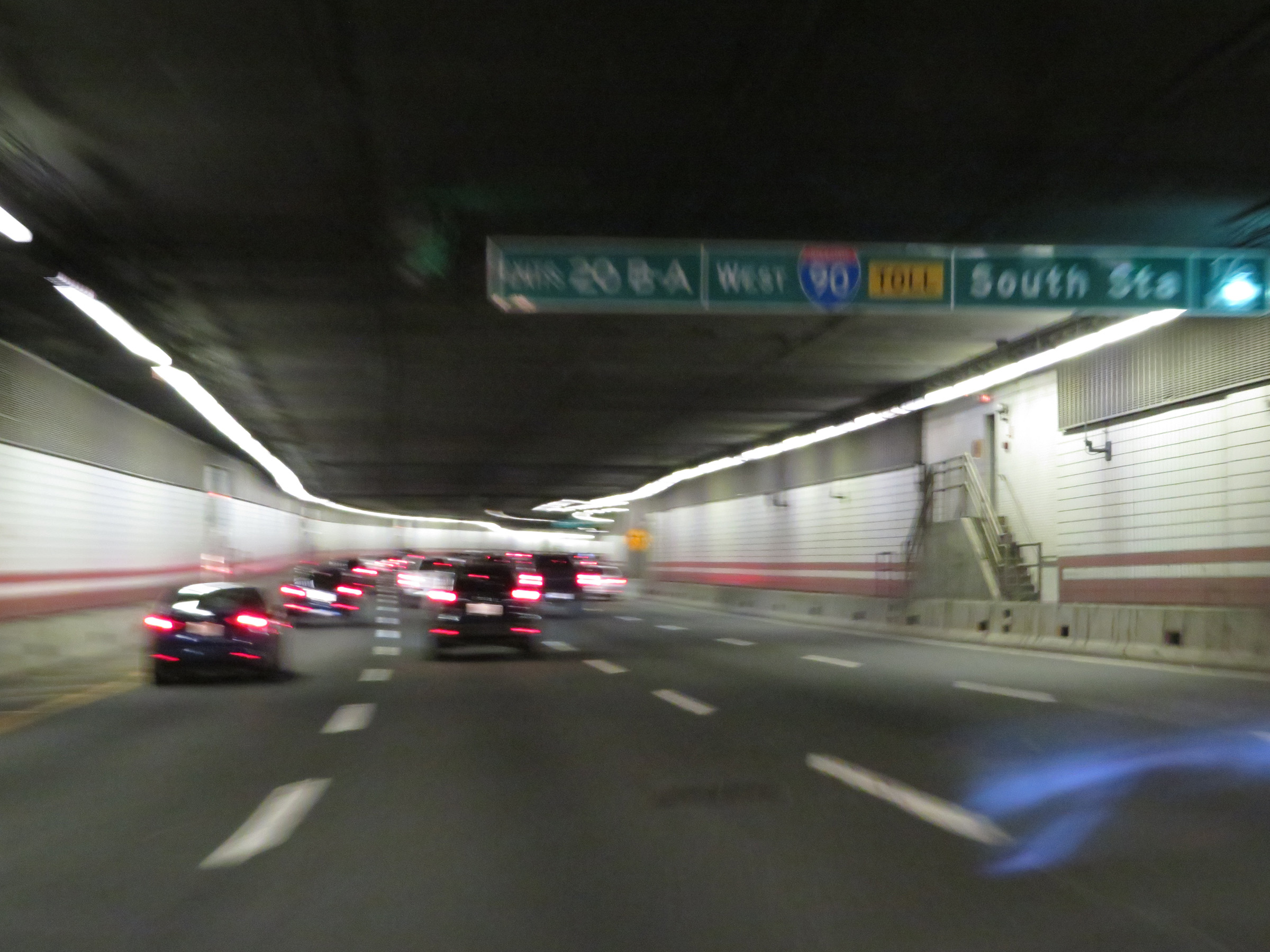
Interstate 93 South at Exit 20B: Interstate 90 West - Mass Pike; Exit 20A: South Station (Photo taken 8/6/17). |
 |
Advance signage for Exit 18, which will be the first exit on Interstate 93 South upon exiting the Thomas P. O'Neill Jr. Tunnel - 1 1/4 miles. (Photo taken 8/6/17). |
 |
Interstate 93 South as the south end of the Thomas P. O'Neill Jr. Tunnel comes into view ahead. (Photo taken 8/6/17). |
 |
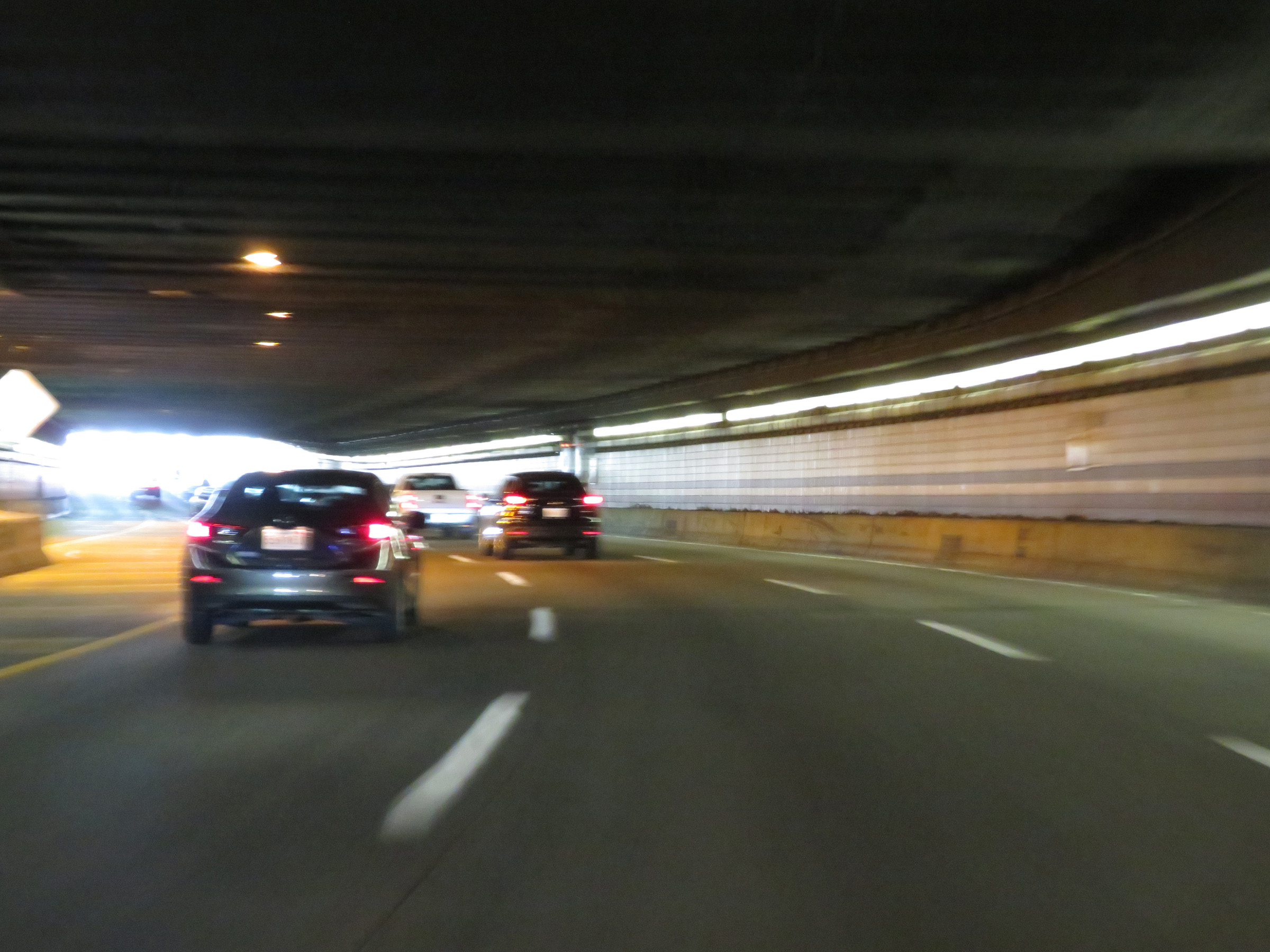
View on Interstate 93 South as it prepares to exit the Thomas P. O'Neill Jr. Tunnel. (Photo taken 8/6/17). |
 |
Interstate 93 South approaching Exit 18 - 1/2 mile. The right lane will become an Exit Only lane for Exit 18. (Photo taken 8/6/17). |
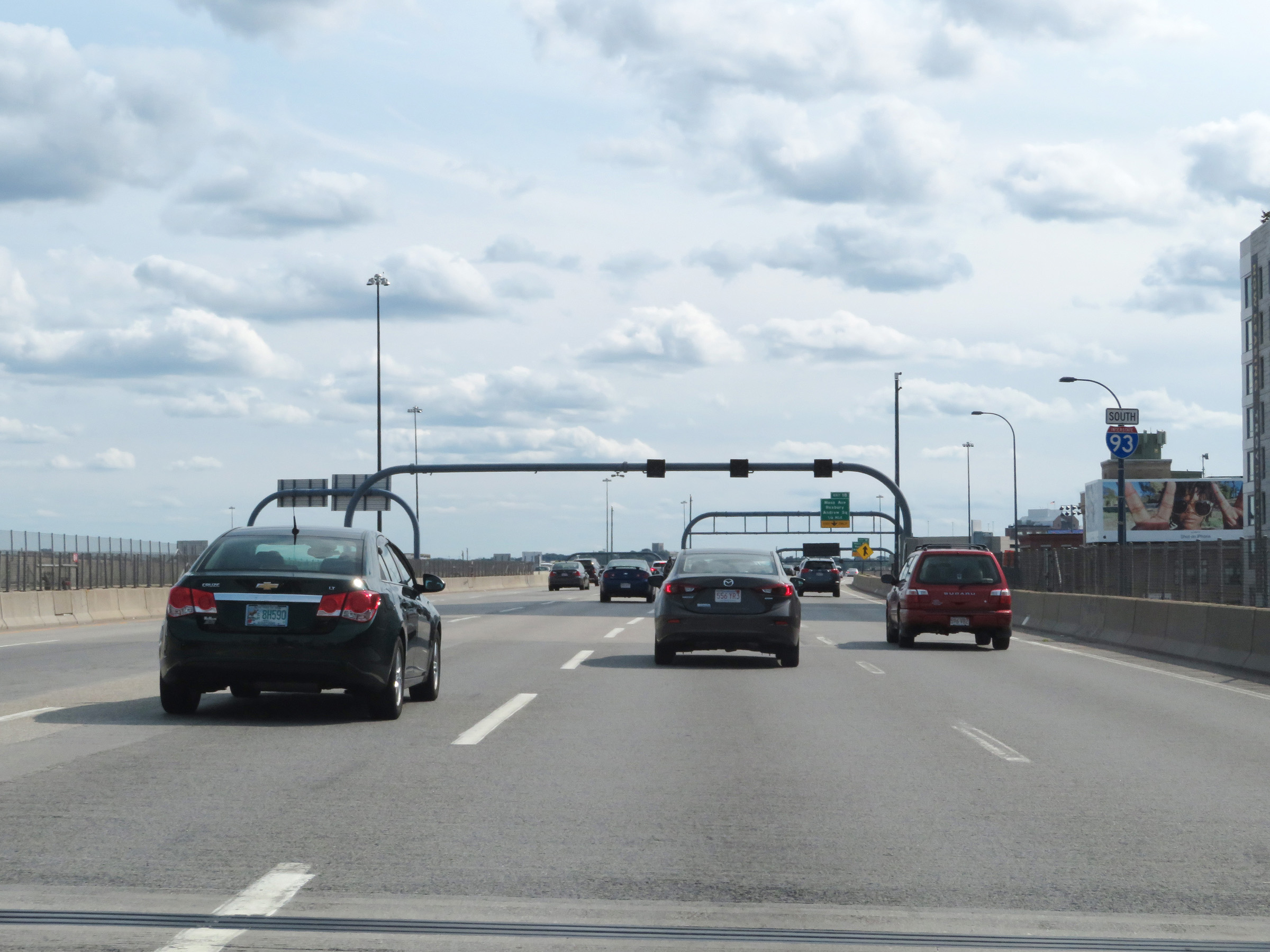 |
Interstate 93 South reassurance shield in downtown Boston. (Photo taken 8/6/17). |
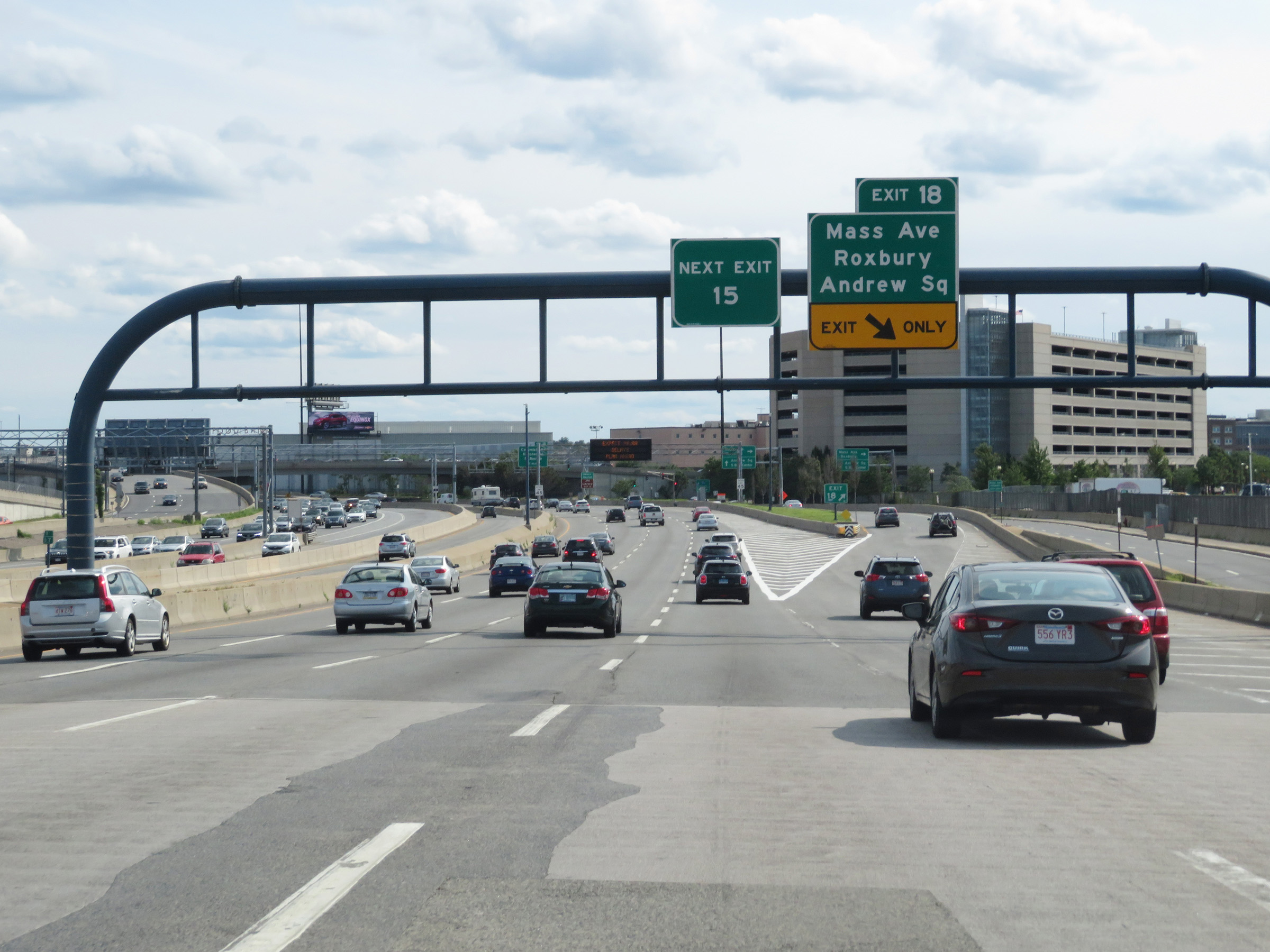 |
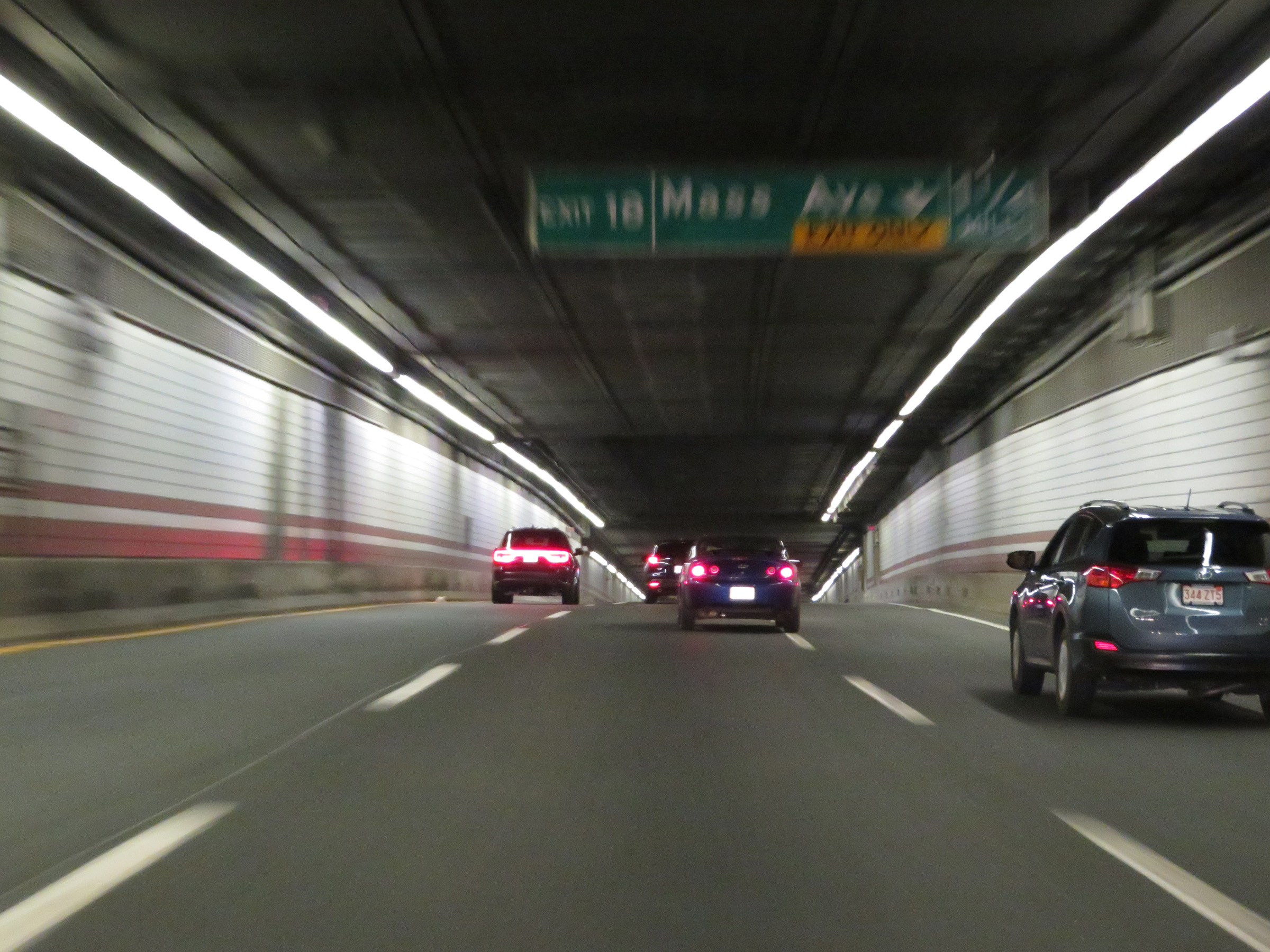
Interstate 93 South at Exit 18: Massachusetts Ave / Roxbury / Andrew Square. The sign on the left warns that the next southbound exit will be Exit 15. However, in 2020, MassDOT renumbered the exits on most of its Interstates, changing to the standard mileage-based exit numbering system. (Photo taken 8/6/17). |
 |
The speed limit remains 45 mph on Interstate 93 South. (Photo taken 8/6/17). |
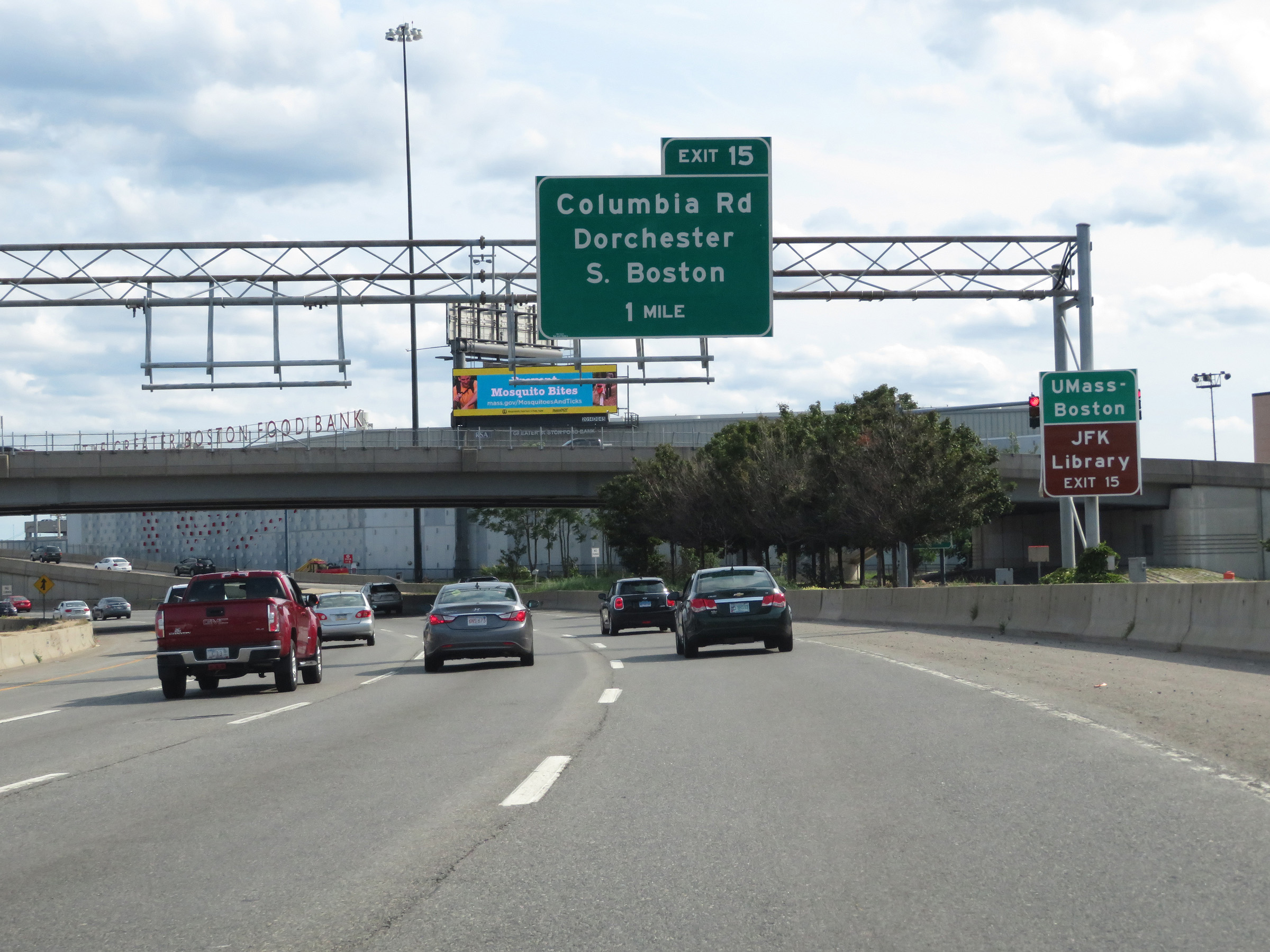 |
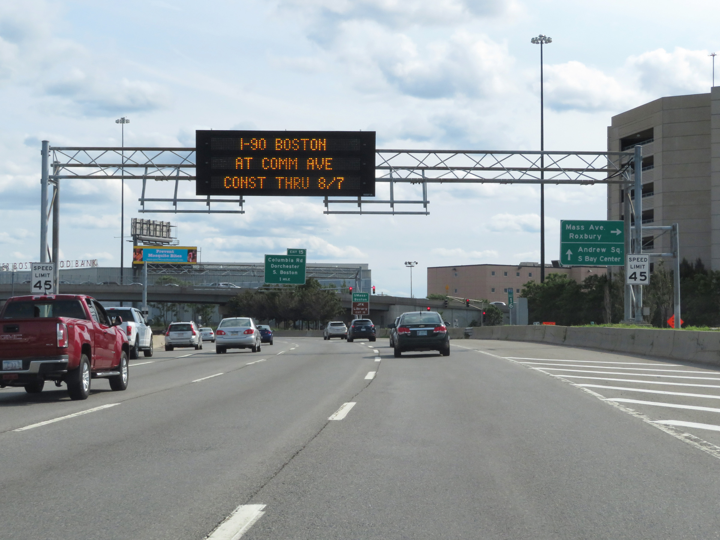
Take Exit 15 to UMass - Boston and the JFK Library. (Photo taken 8/6/17). |
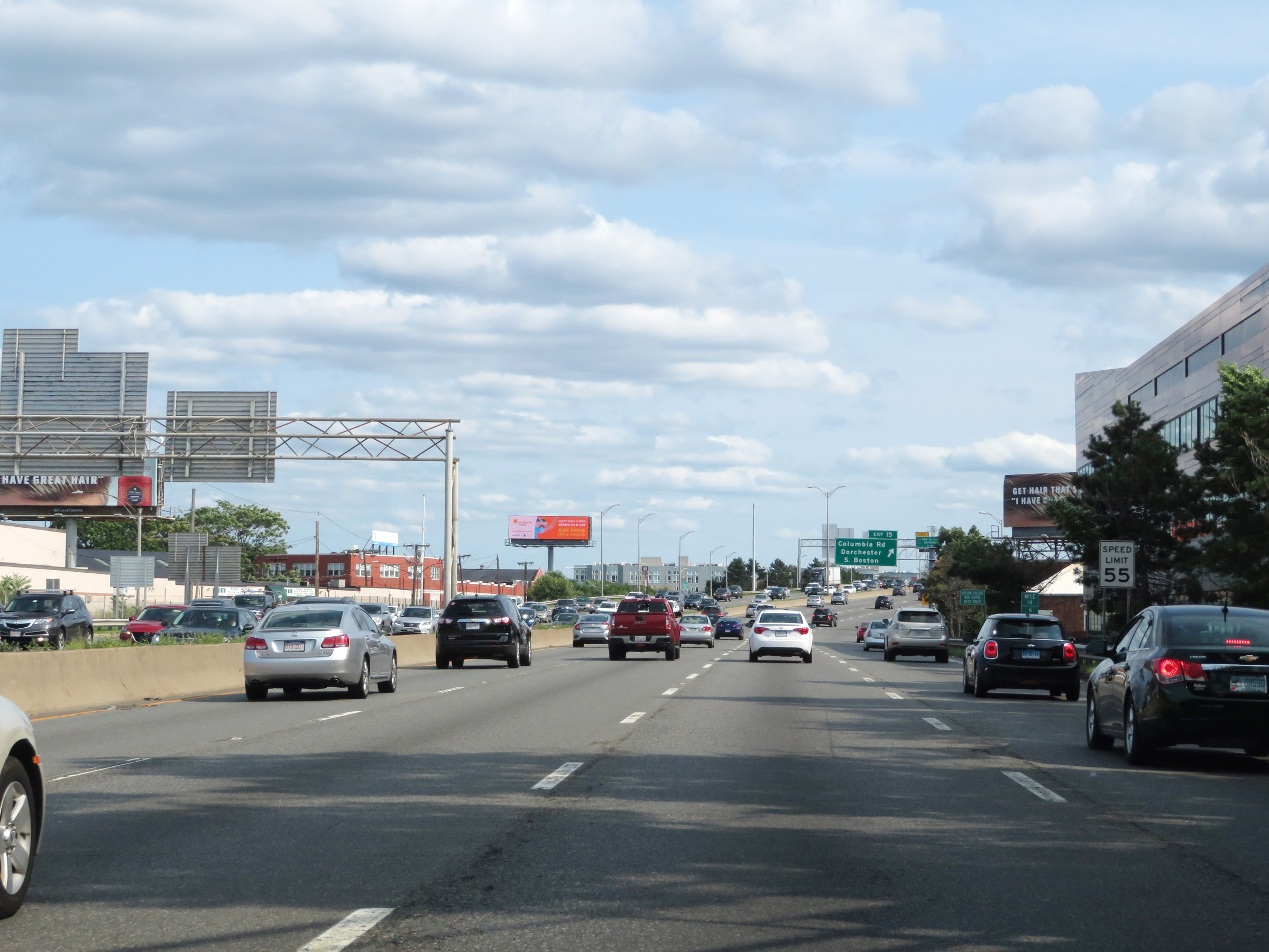 |
Approaching Exit 15, the speed limit increases to 55 mph once again. (Photo taken 8/6/17). |
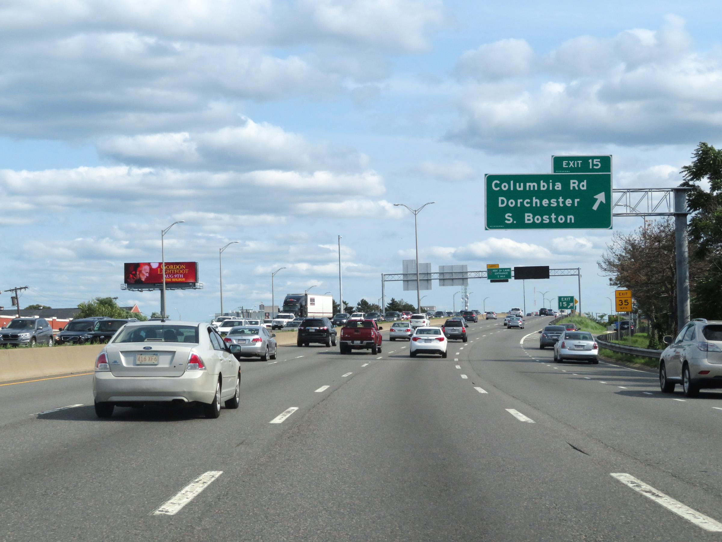 |
Interstate 93 South at Exit 15: Columbia Rd / Dorchester / South Boston (Photo taken 8/6/17). |
 |
View on Interstate 93 South at mile marker 14.4. (Photo taken 8/6/17). |
 |
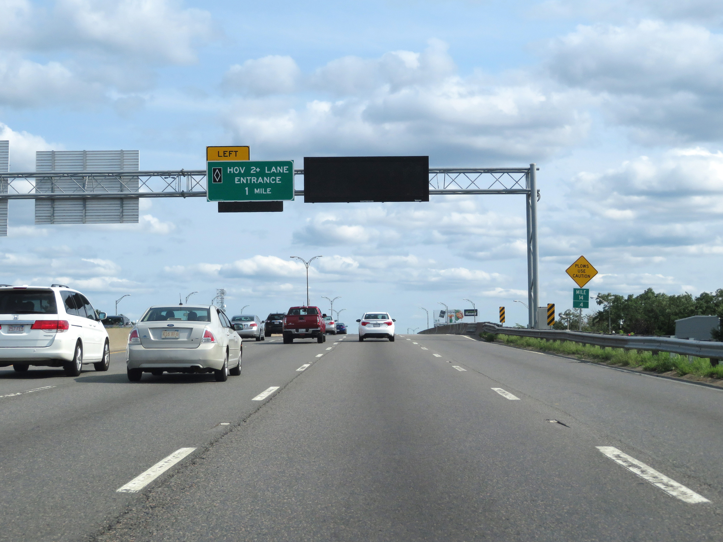
With another HOV lane beginning ahead on Interstate 93 South, this sign displays the rules governing the use of the HOV lane. (Photo taken 8/6/17). |
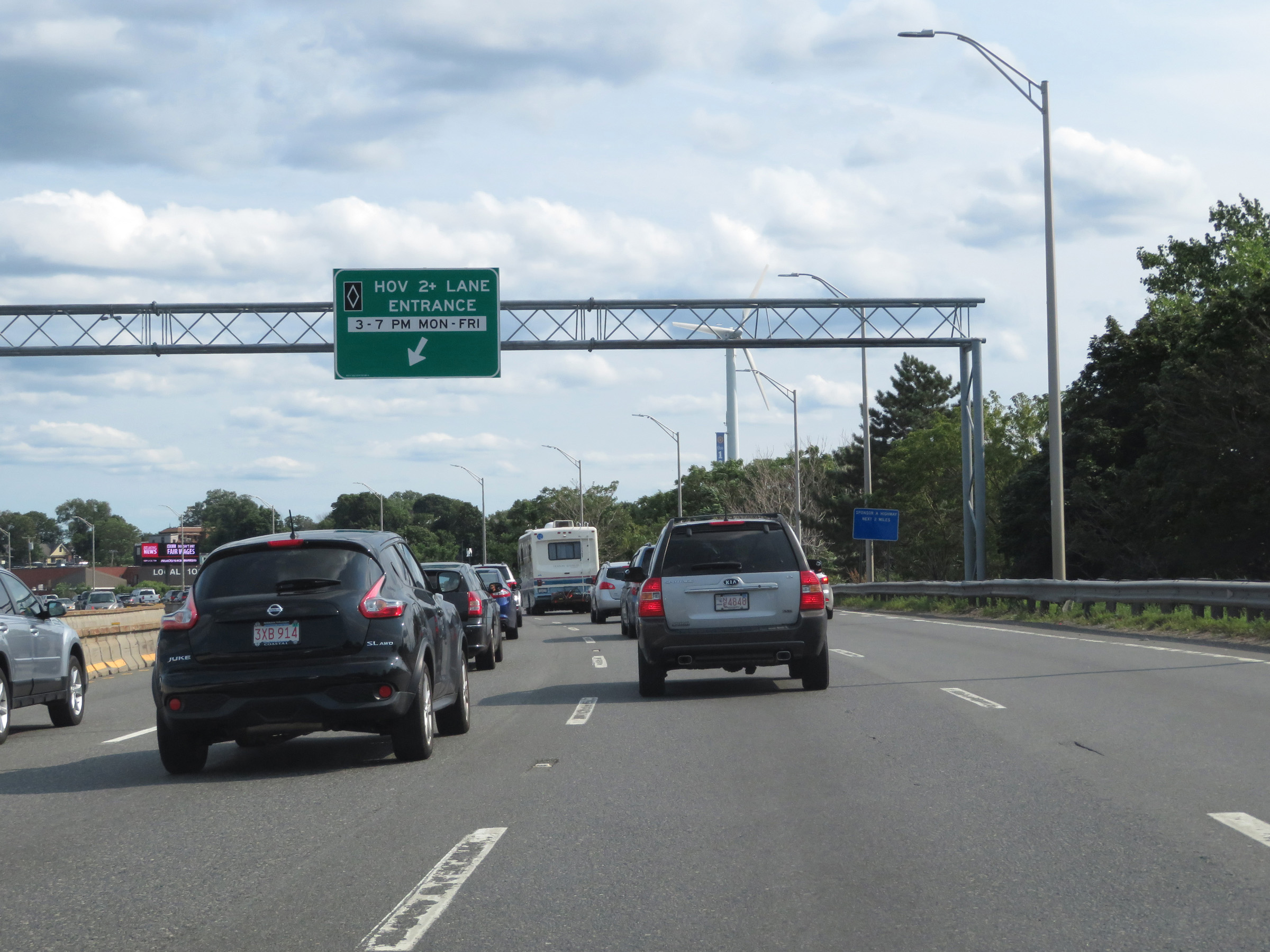 |
HOV lane entrance on the left on Interstate 93 South. (Photo taken 8/6/17). |
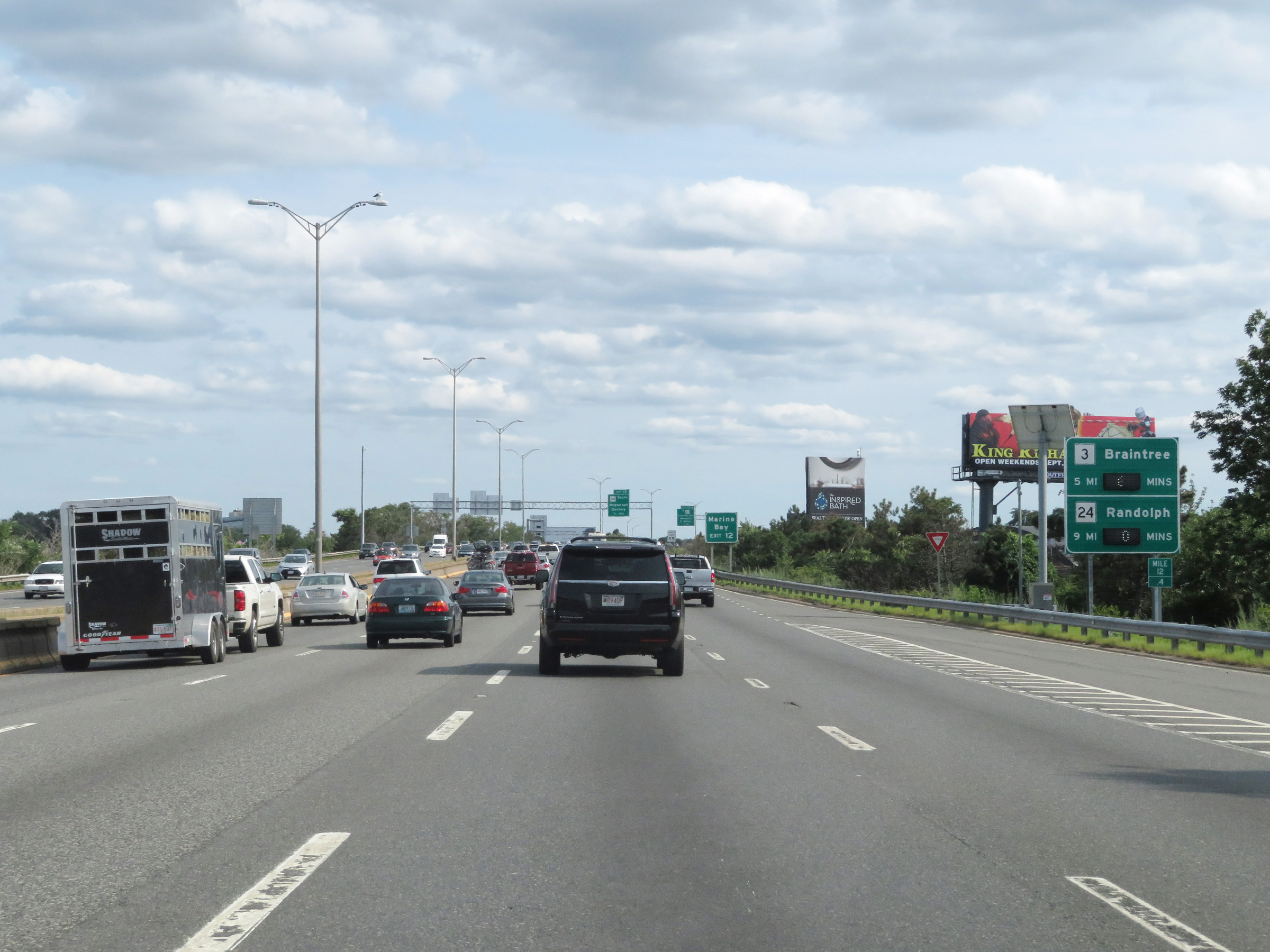 |
Another mileage sign on Interstate 93 South at mile marker 12.4 which dynamically displays the current estimated travel times to the junctions of MA 3 and MA 24. (Photo taken 8/6/17). |
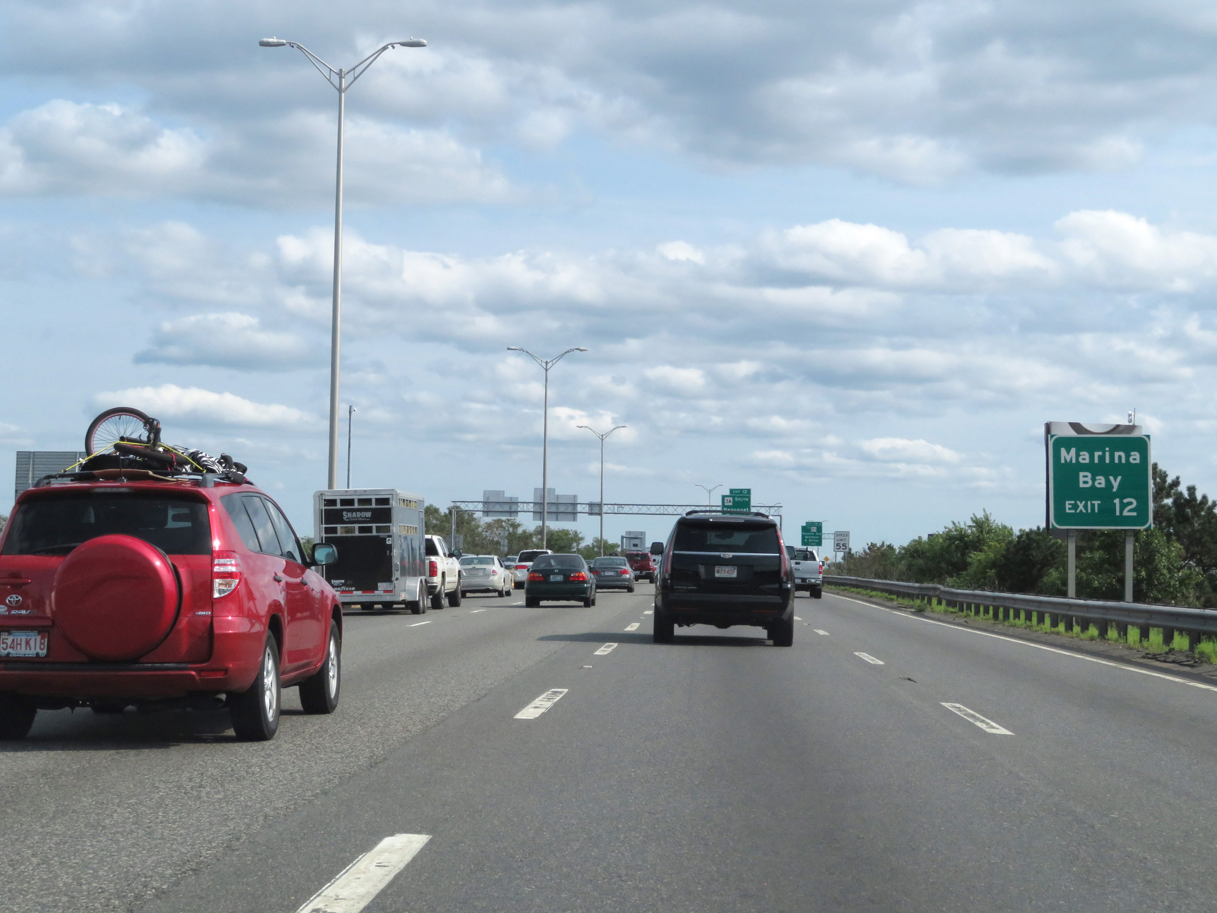 |
Take Exit 12 to Marina Bay. (Photo taken 8/6/17). |
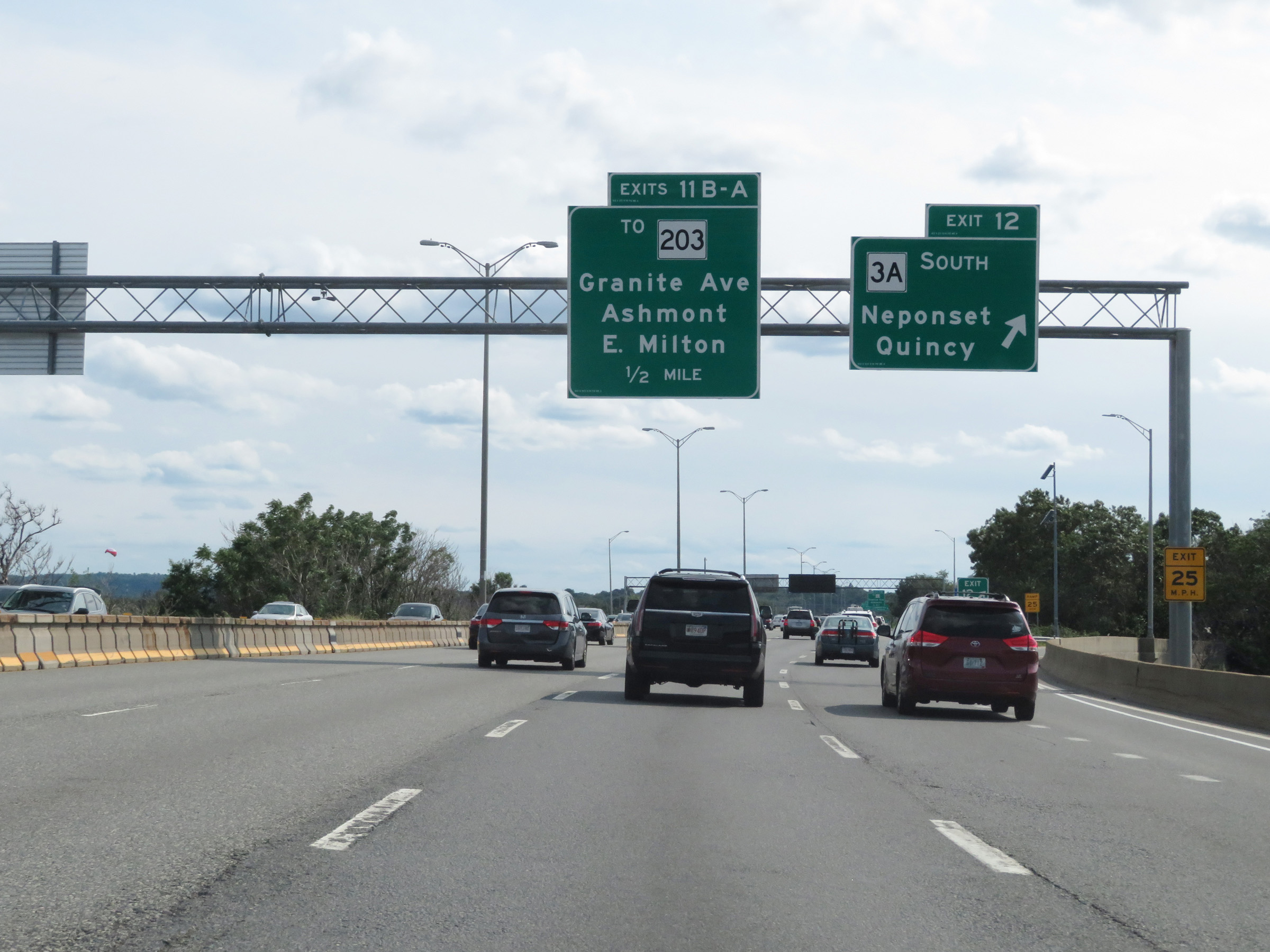 |
Interstate 93 South at Exit 12: MA 3A South - Neponset / Quincy (Photo taken 8/6/17). |
 |
Interstate 93 South at Exit 11B: To MA 203 - Granite Ave / Ashmont (Photo taken 8/6/17). |
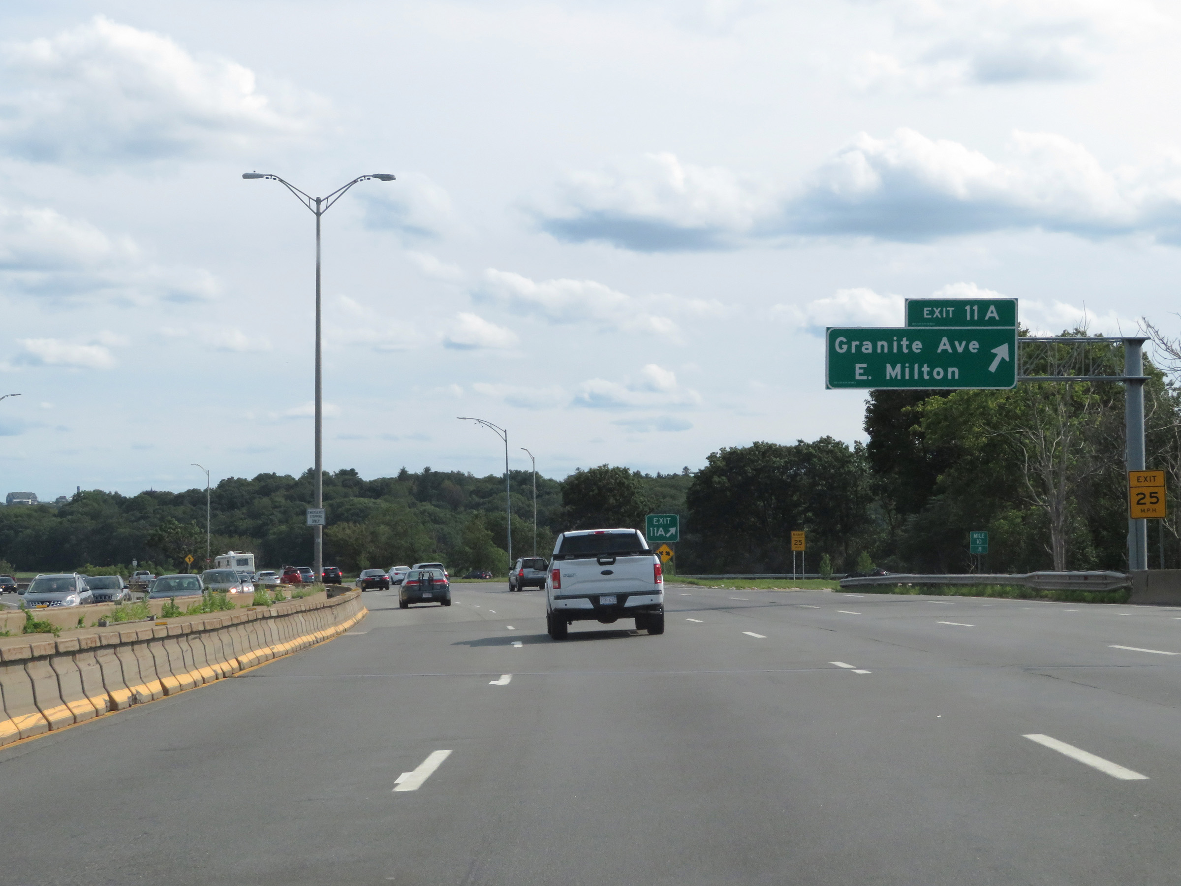 |
Interstate 93 South at Exit 11A: Granite Ave / East Milton (Photo taken 8/6/17). |
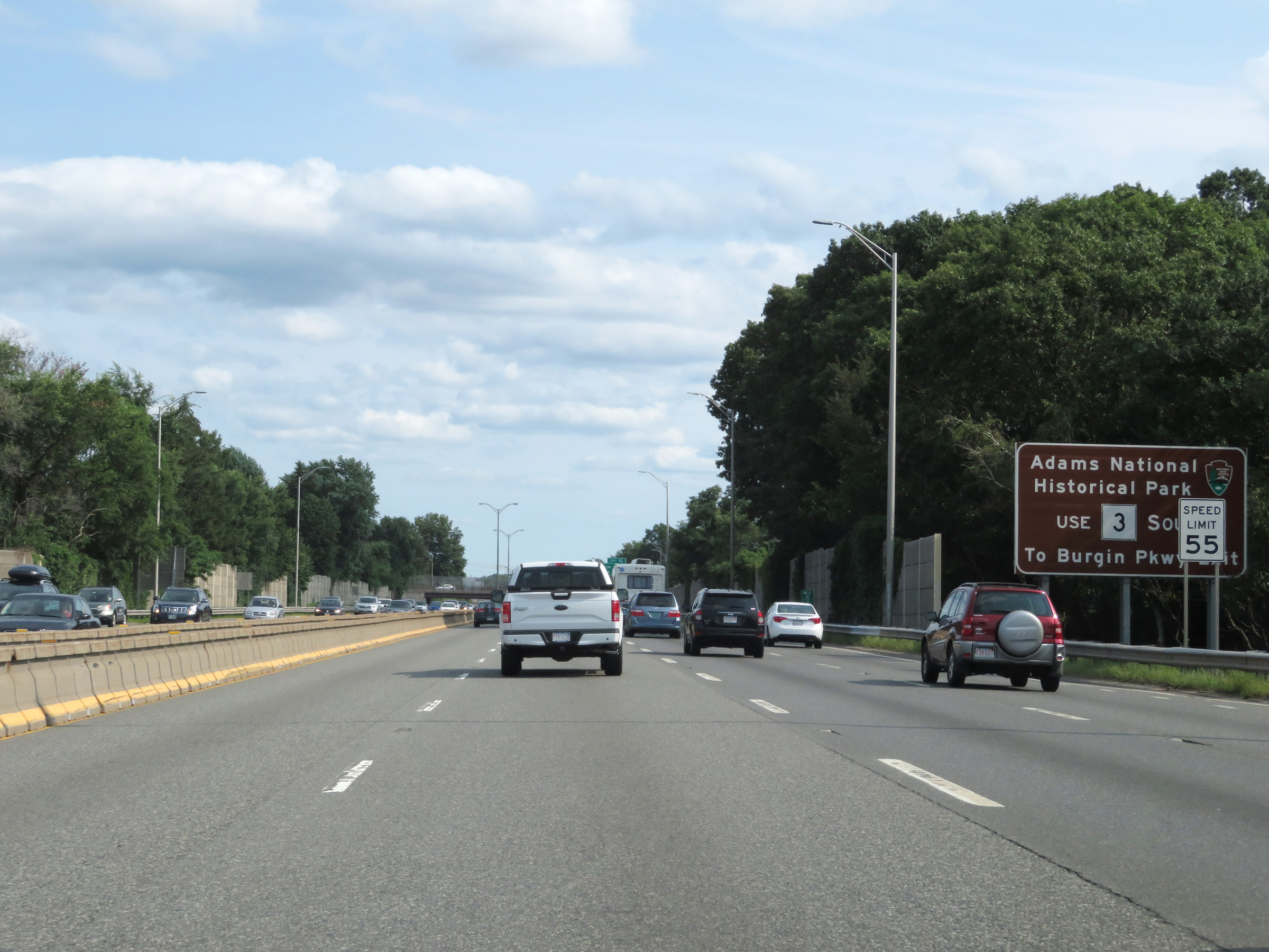 |
Take Exit 7 and follow MA 3 South to the Burgin Pkwy Exit to get to Adams National Historical Park. (Photo taken 8/6/17). |
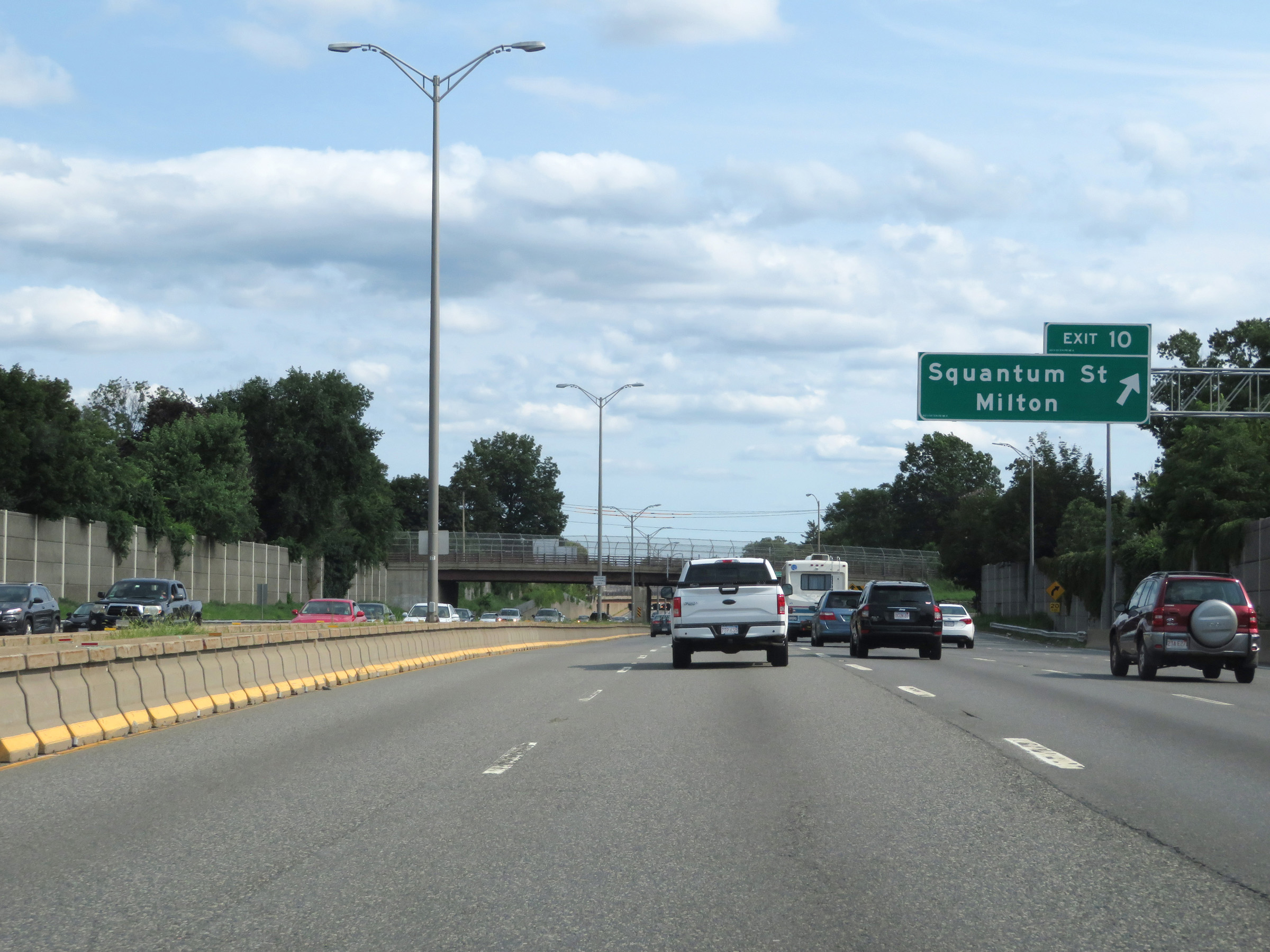 |
Interstate 93 South at Exit 10: Squantum St / Milton (Photo taken 8/6/17). |
 |
Interstate 93 South at Exit 9: Bryant Ave / West Quincy (Photo taken 8/6/17). |
 |
Interstate 93 South reassurance shield. (Photo taken 8/6/17). |
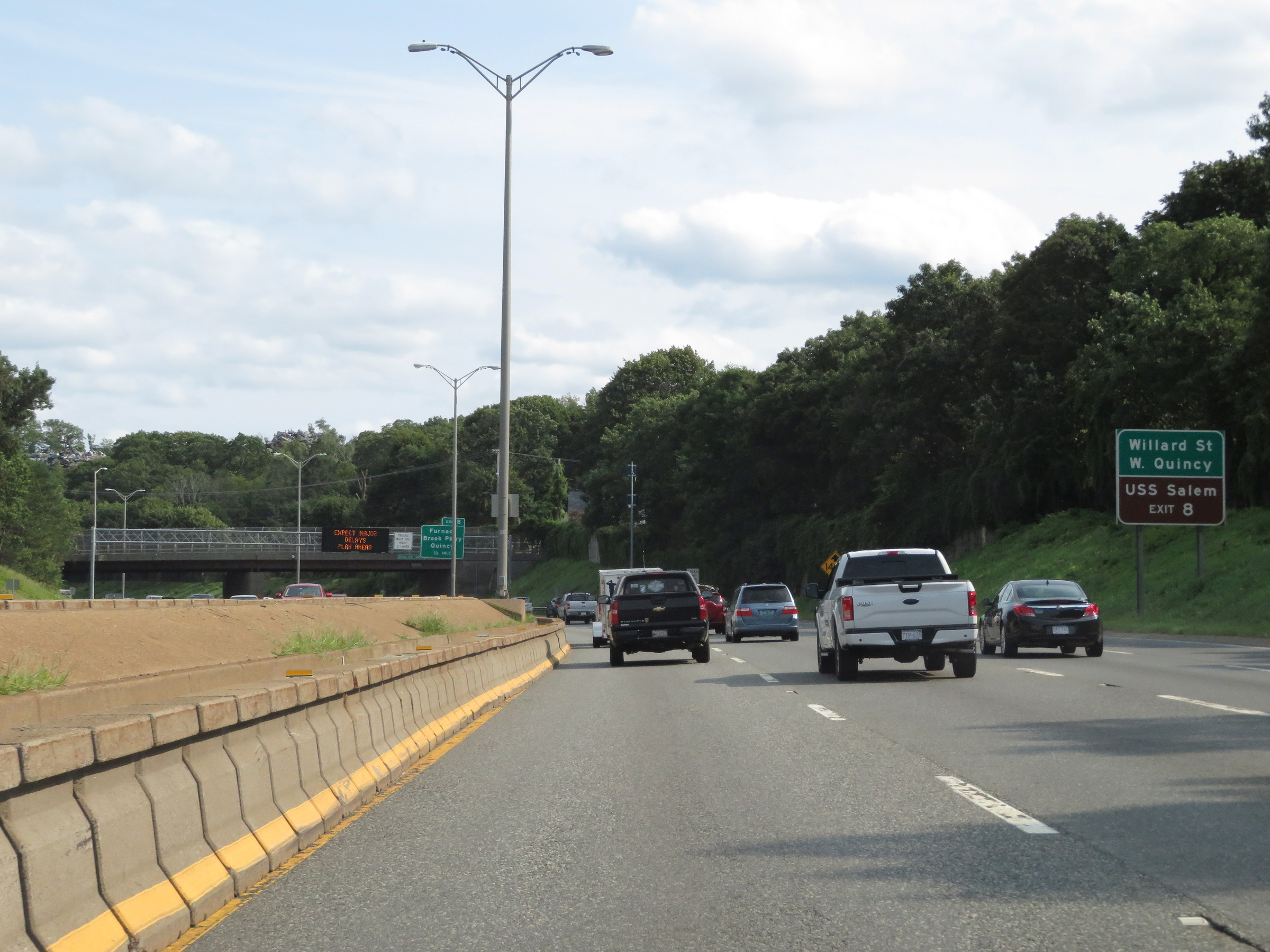 |
Take Exit 8 to WIllard St, West Quincy, and the USS Salem. (Photo taken 8/6/17). |
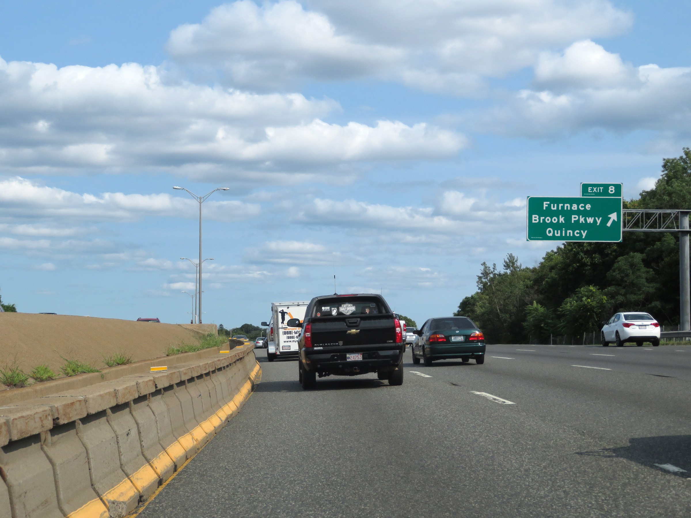 |
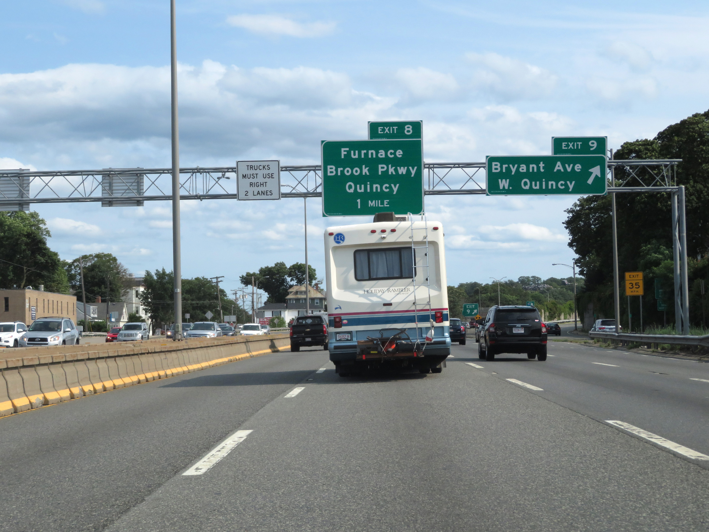
Interstate 93 South at Exit 8: Furnace Brook Pkwy / Quincy (Photo taken 8/6/17). |
 |
Interstate 93 South approaching Exit 7 - 1 mile on the left. (Photo taken 8/6/17). |
 |
Take Exit 7 and follow MA 3 South to Braintree. (Photo taken 8/6/17). |
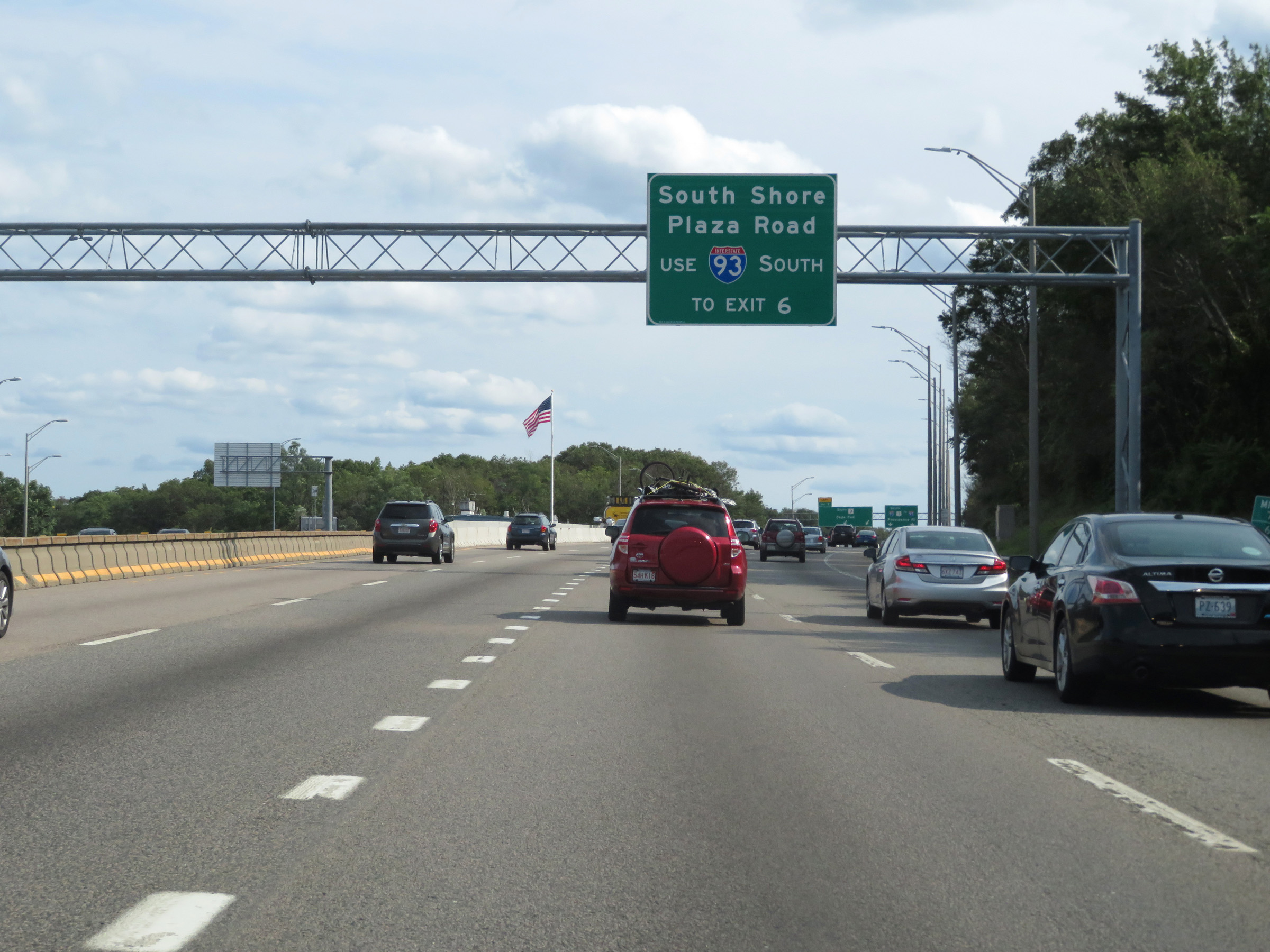 |
Traffic to South Shore Plaza Road should remain on Interstate 93 South and use Exit 6. (Photo taken 8/6/17). |
 |
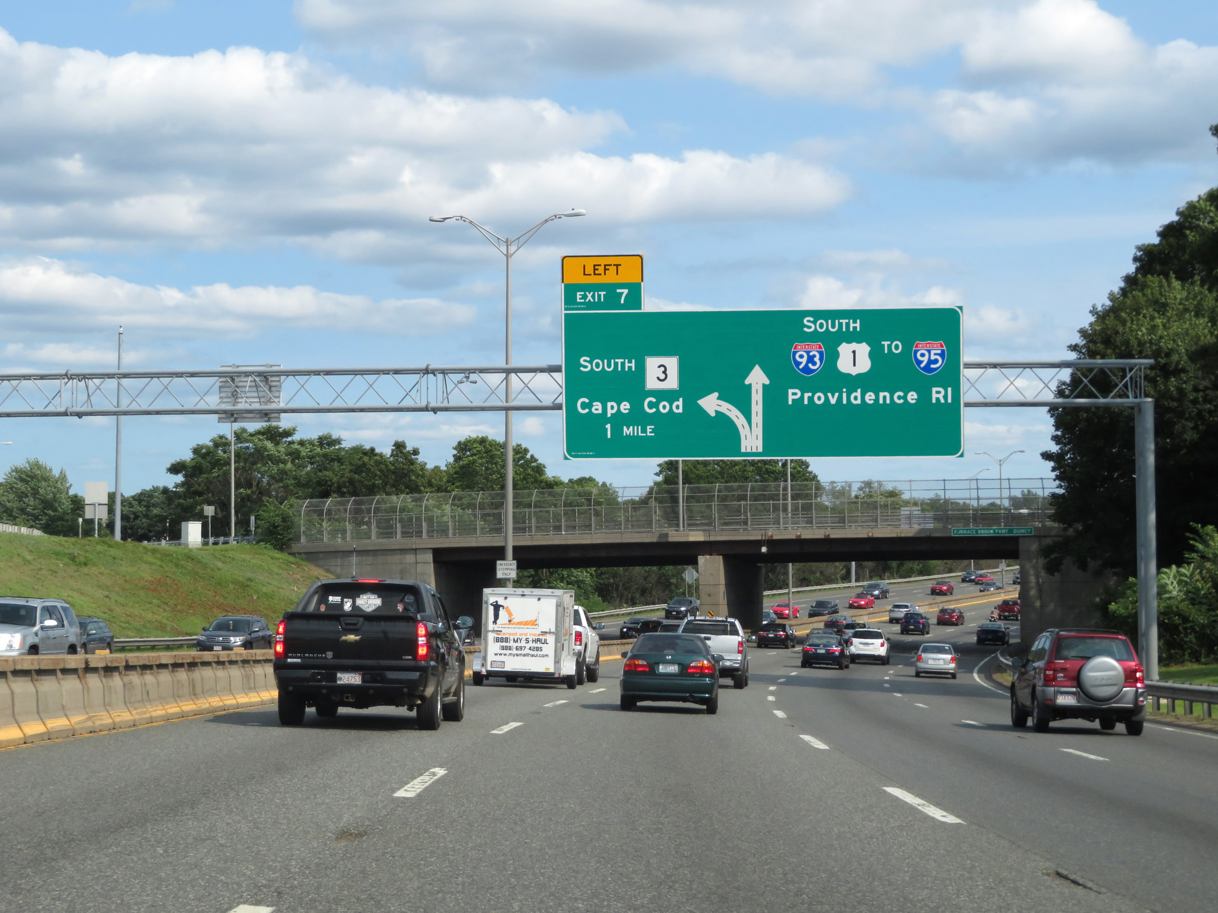
Interstate 93 South at Exit 7: MA 3 South - Cape Cod (Photo taken 8/6/17). |
 |
View on Interstate 93 South at mile marker 6.8. (Photo taken 8/6/17). |
 |
Interstate 93 South at Exit 6: MA 37 - Braintree / Holbrook (Photo taken 8/6/17). |
 |
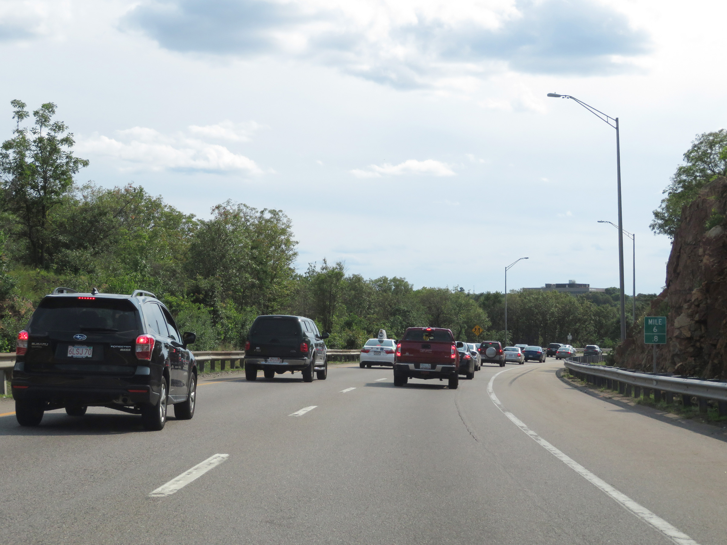
Mile marker 5.8 on Interstate 93 South in Norfolk County. (Photo taken 8/6/17). |
 |
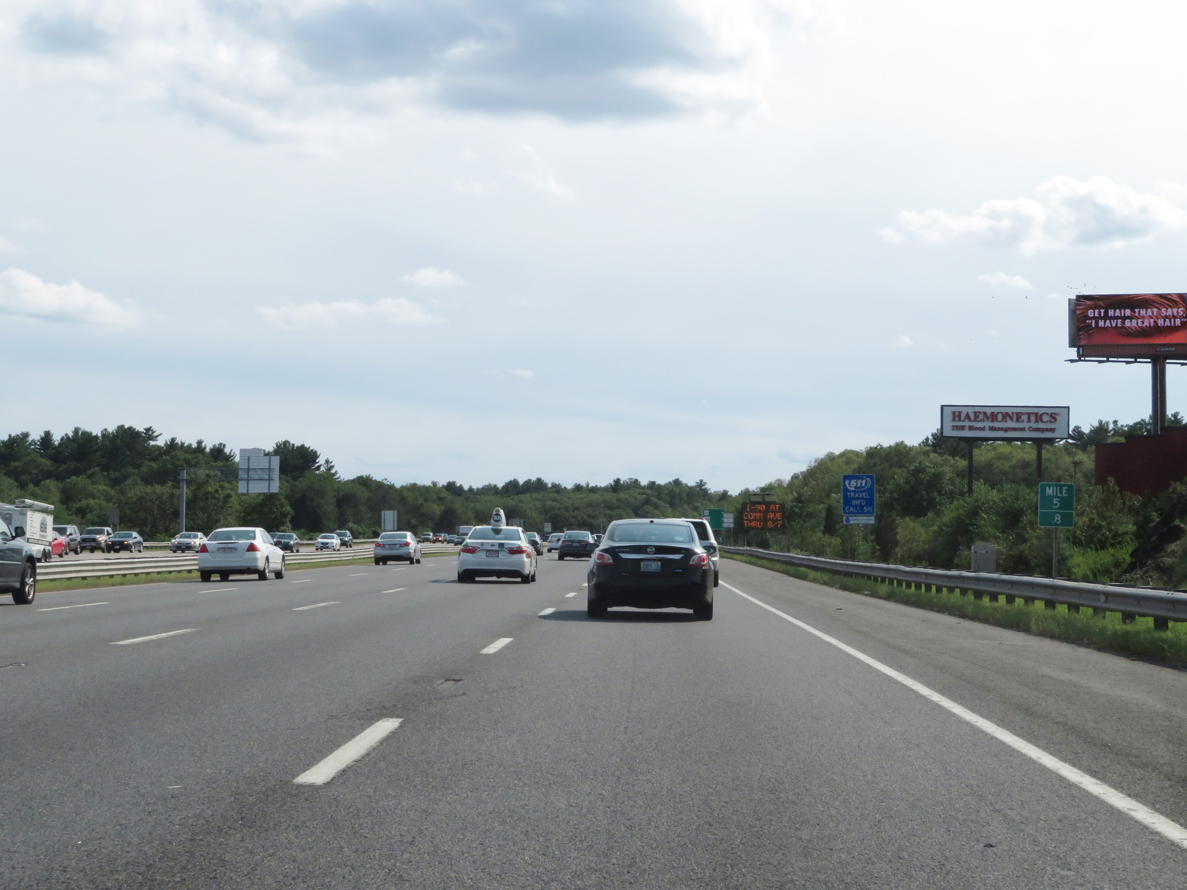
View on Interstate 93 South at mile marker 5. (Photo taken 8/6/17). |
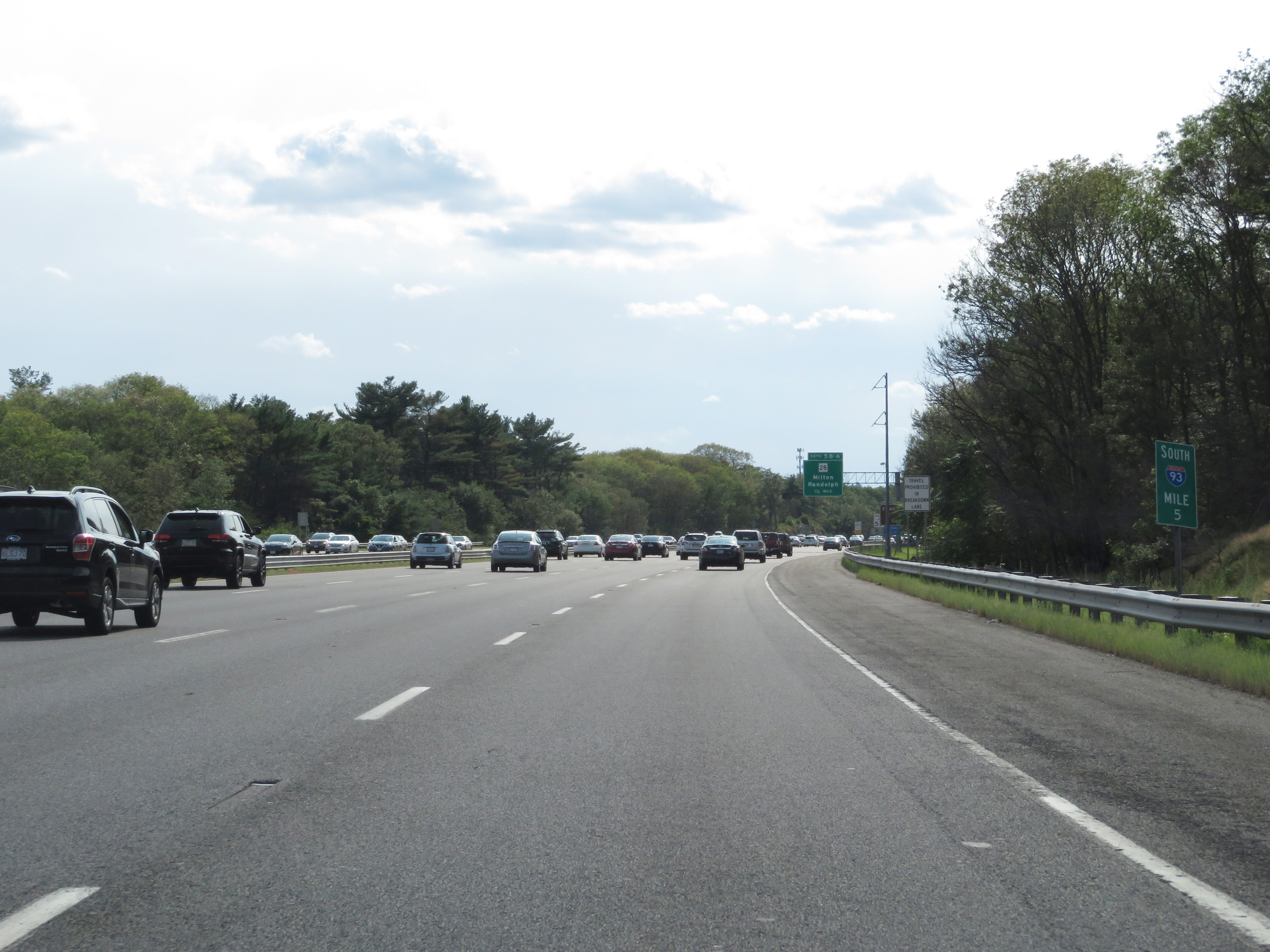
 |
Take Exit 5B to Franklin Park Zoo. (Photo taken 8/6/17). |
 |
Traffic to Brockton and New Bedford should follow MA 24 South via Exit 4. (Photo taken 8/6/17). |
 |
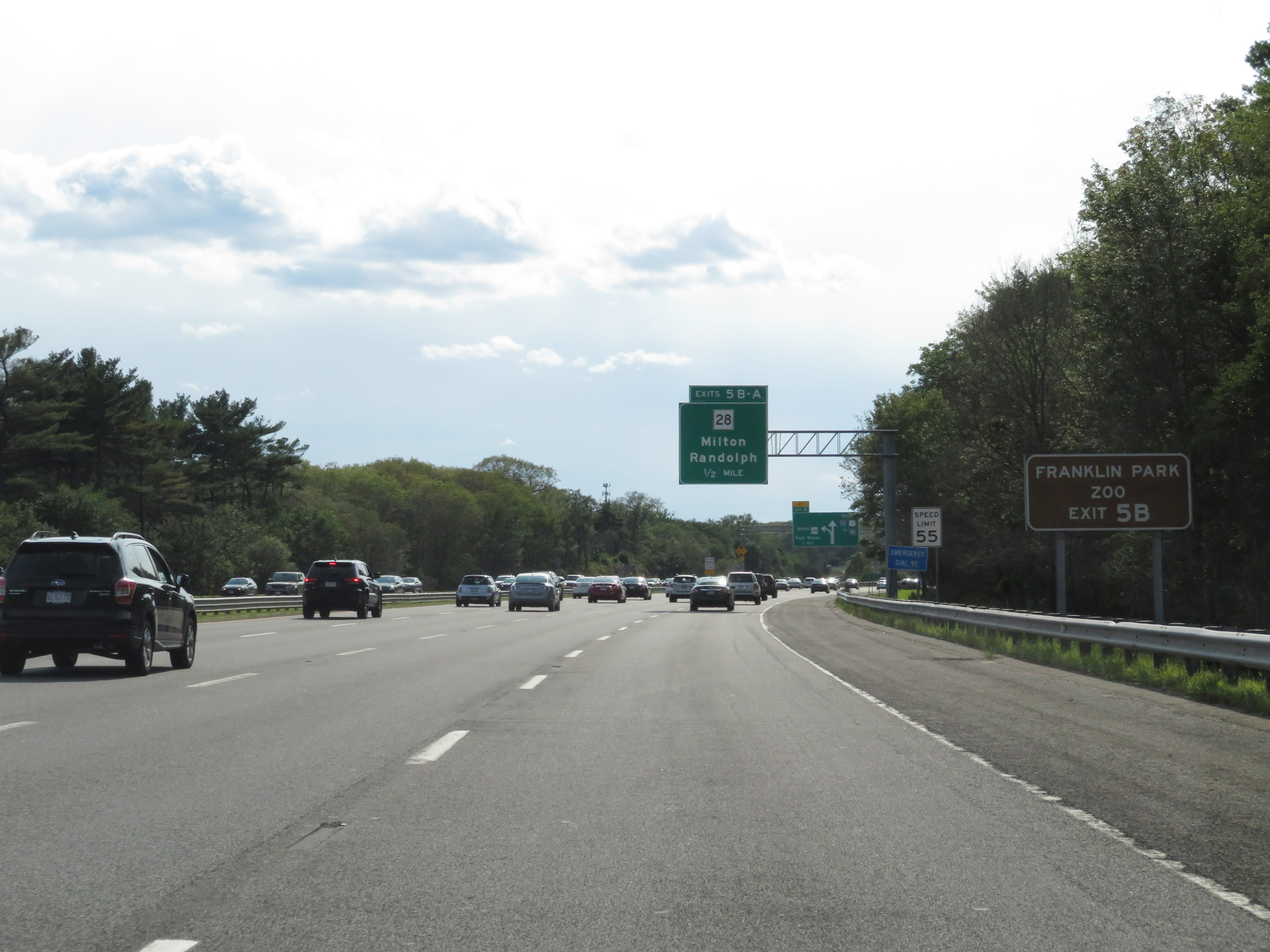
Interstate 93 South at Exit 5B: MA 28 North - Milton (Photo taken 8/6/17). |
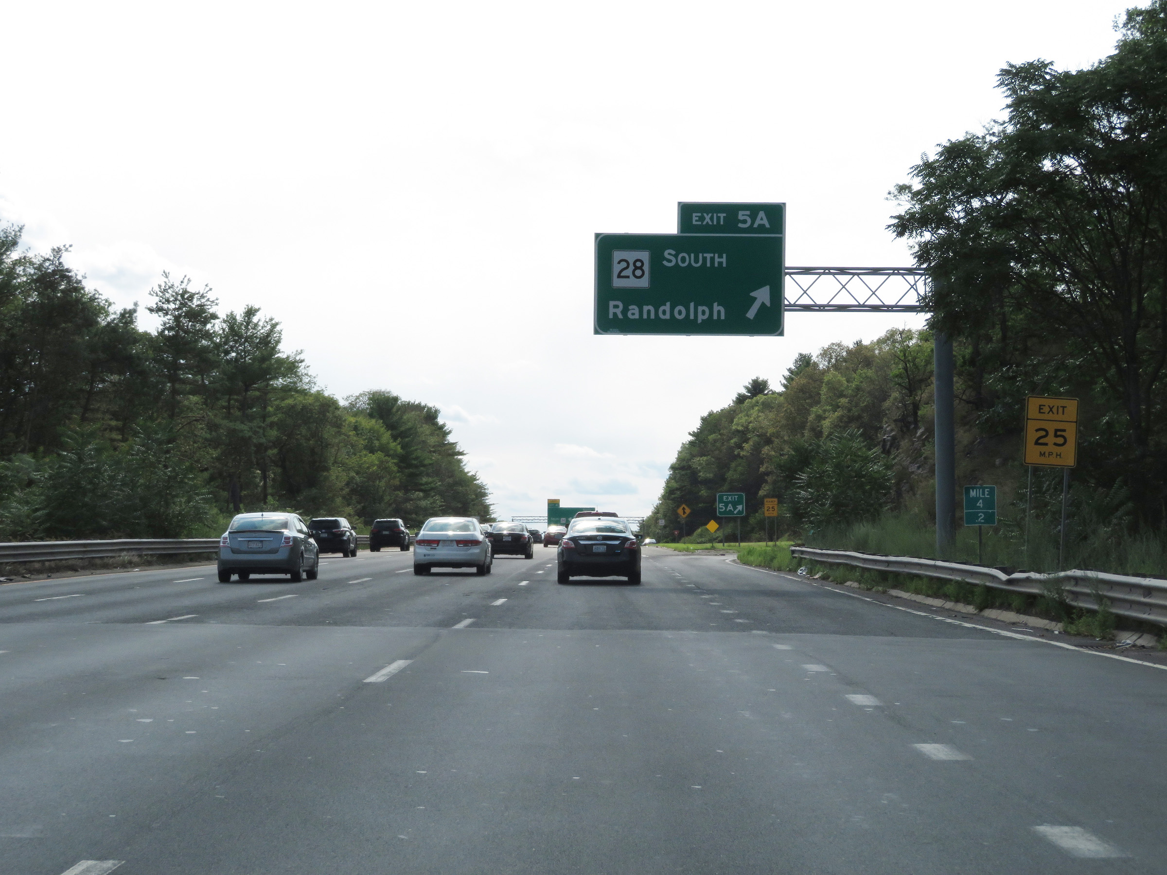 |
Interstate 93 South at Exit 5A: MA 28 South - Randolph (Photo taken 8/6/17). |
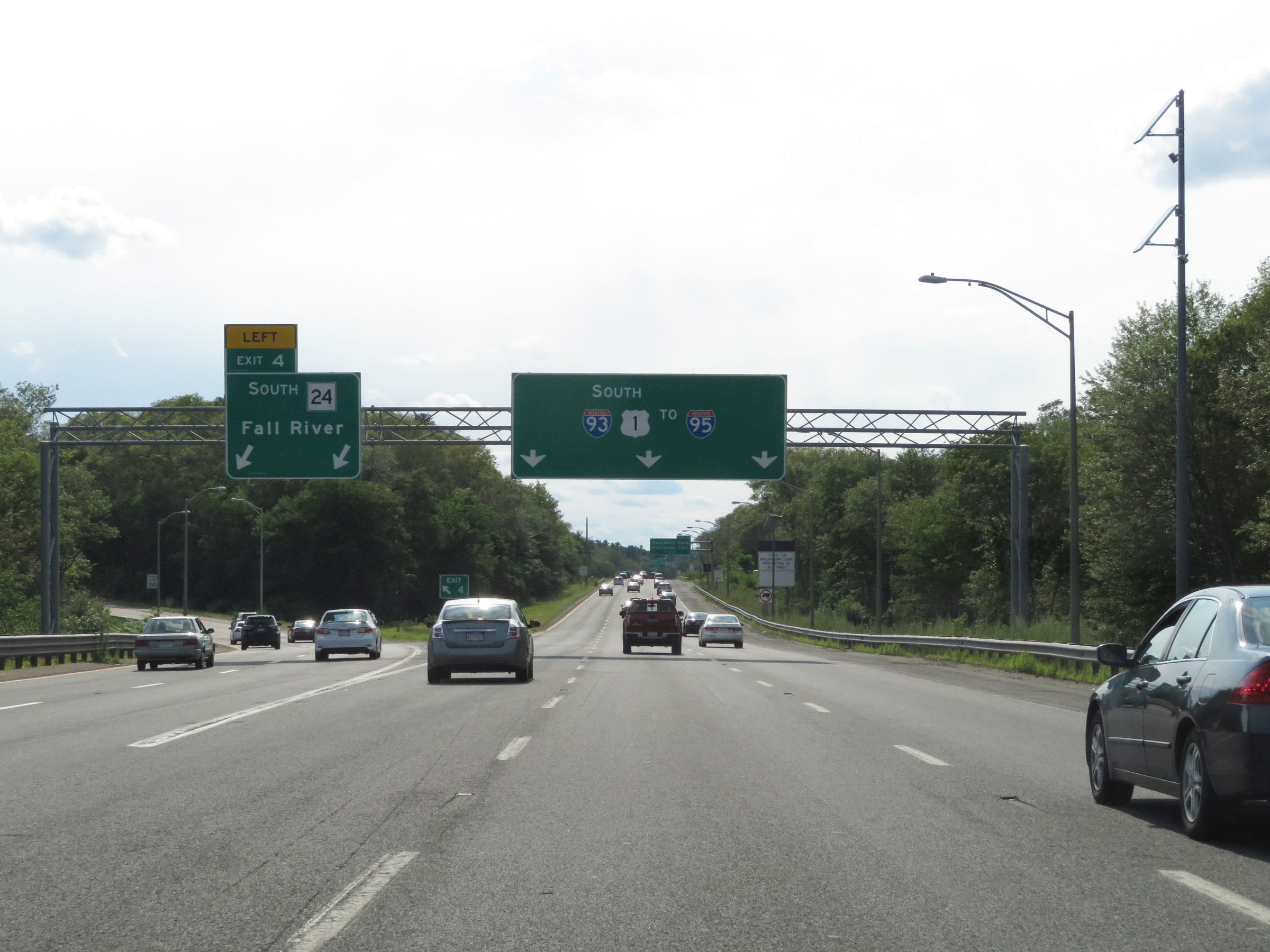 |
Interstate 93 South at Exit 4: MA 24 South - Fall River (Photo taken 8/6/17). |
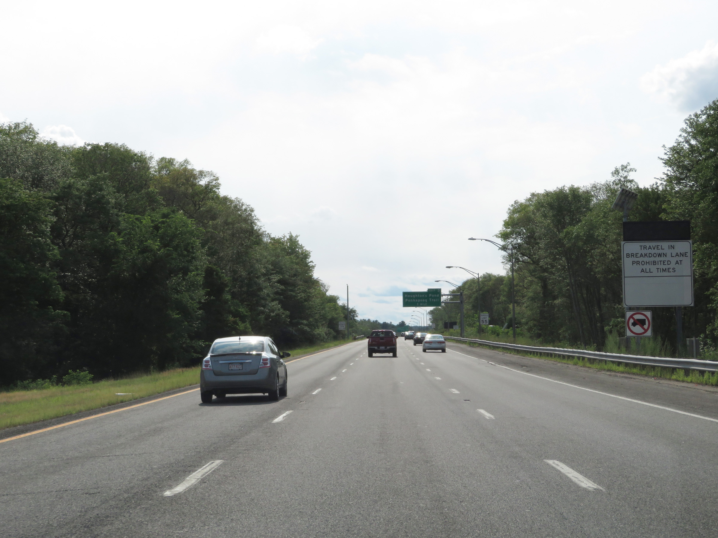 |
As this sign reads, travel in the breakdown lane (right shoulder) is prohibited at all times. (Photo taken 8/6/17). |
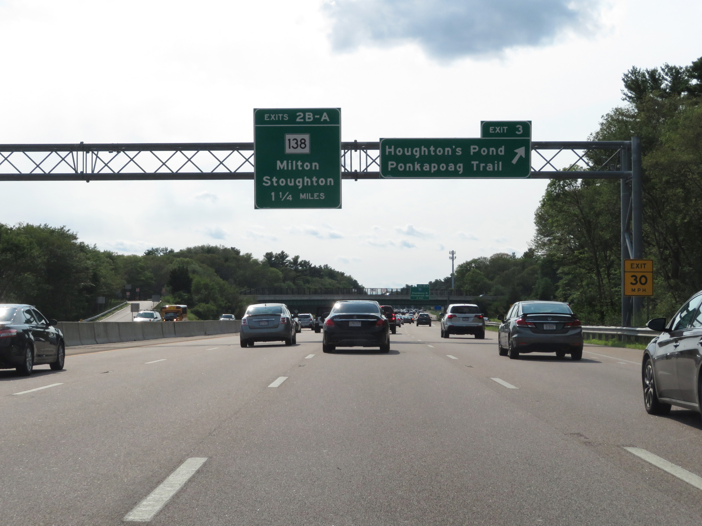 |
Interstate 93 South at Exit 3: Houghton's Pond / Ponkapoag Trail (Photo taken 8/6/17). |
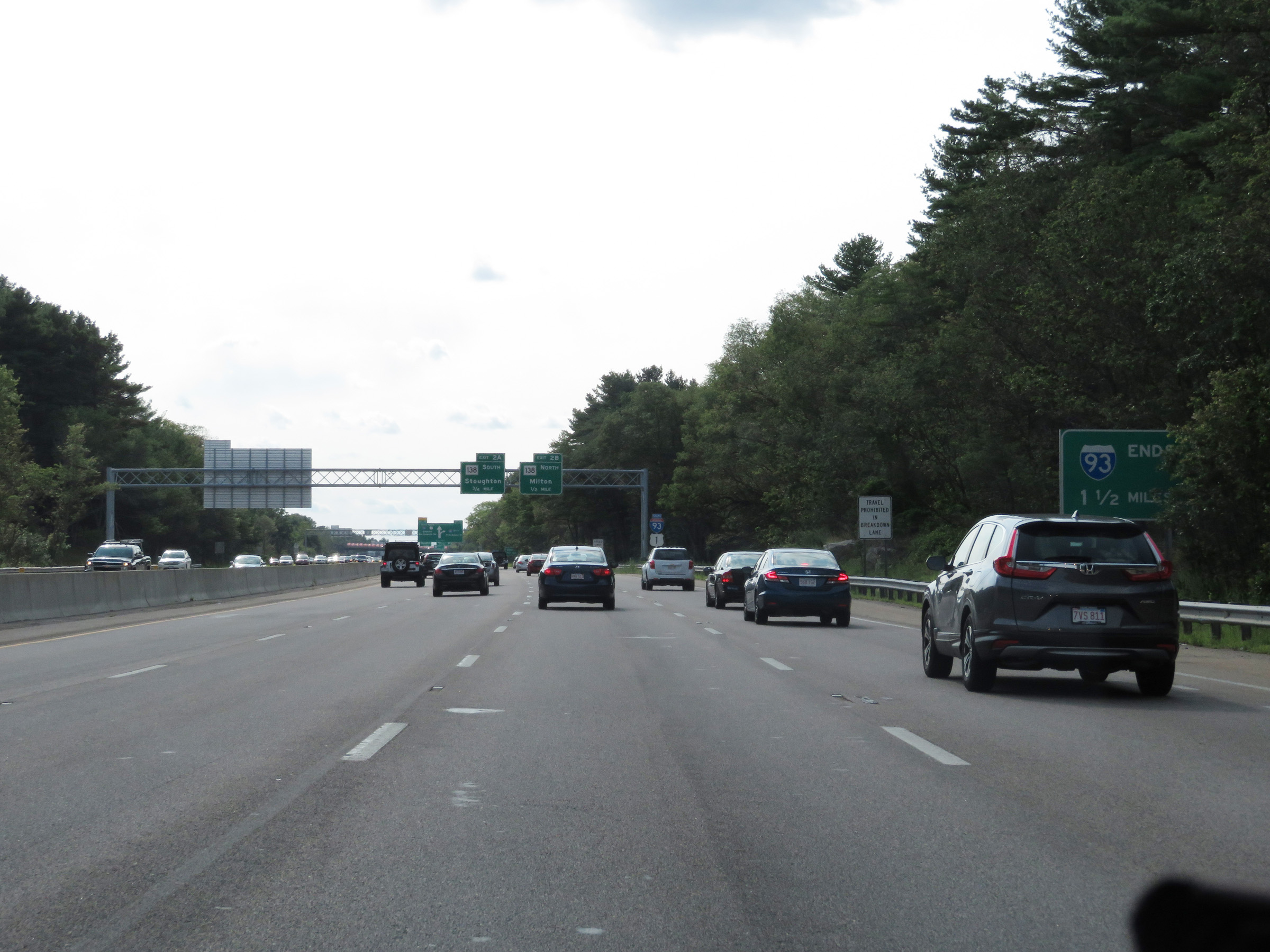 |
Interstate 93 South will end 1 1/2 miles ahead at the junction of Interstate 95. (Photo taken 8/6/17). |
 |
One final Interstate 93 South reassurance shield approaching Exit 2B. (Photo taken 8/6/17). |
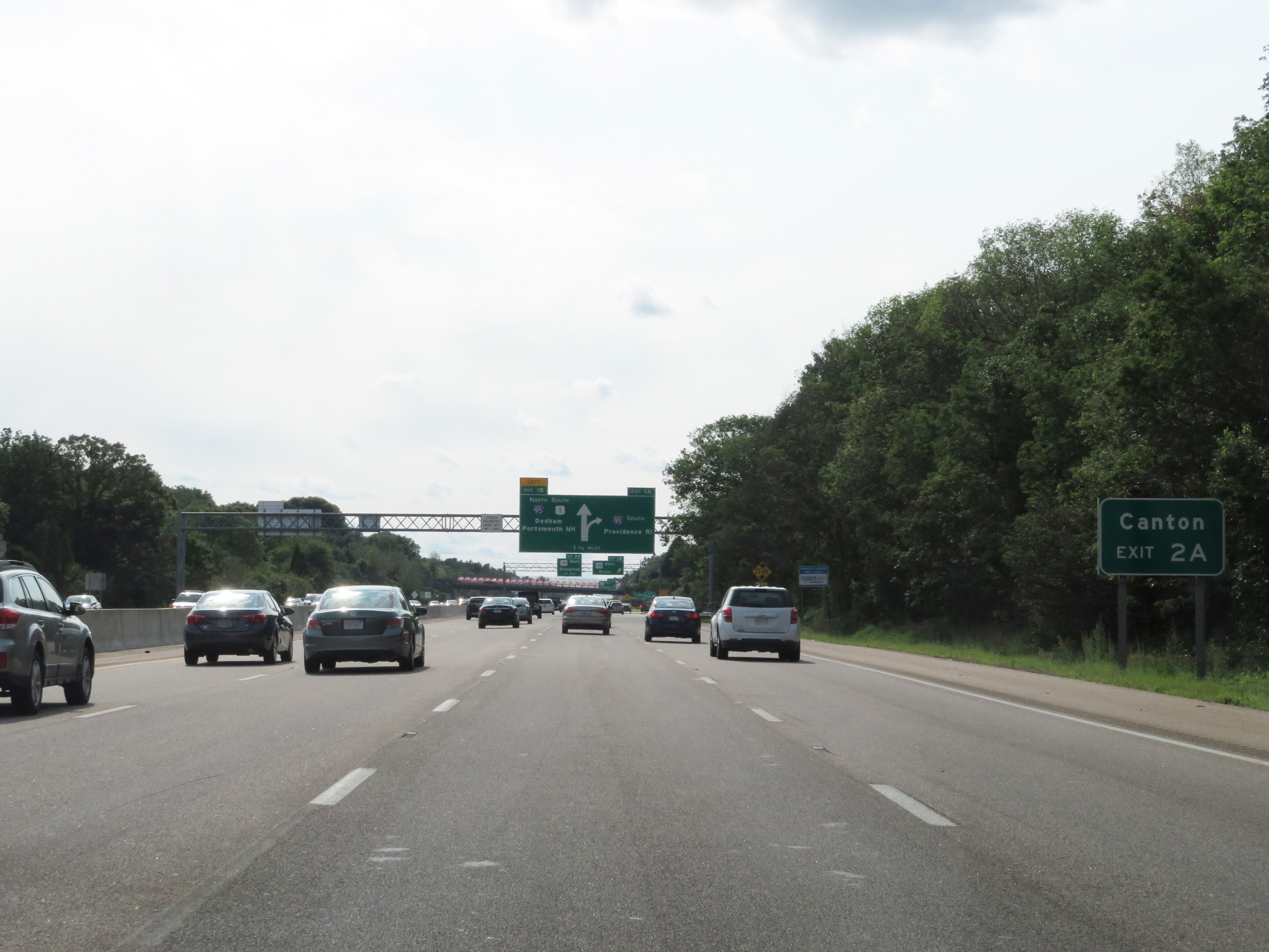 |
Take Exit 2A to Canton. (Photo taken 8/6/17). |
 |
Interstate 93 South approaching Exits 1B-A - 1 mile. This interchange will mark the southern terminus of I-93. (Photo taken 8/6/17). |
 |
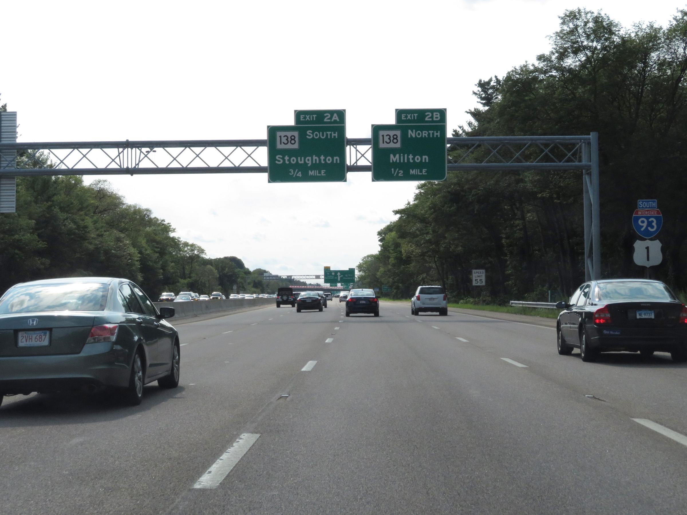
Interstate 93 South at Exit 2B: MA 138 North - Milton (Photo taken 8/6/17). |
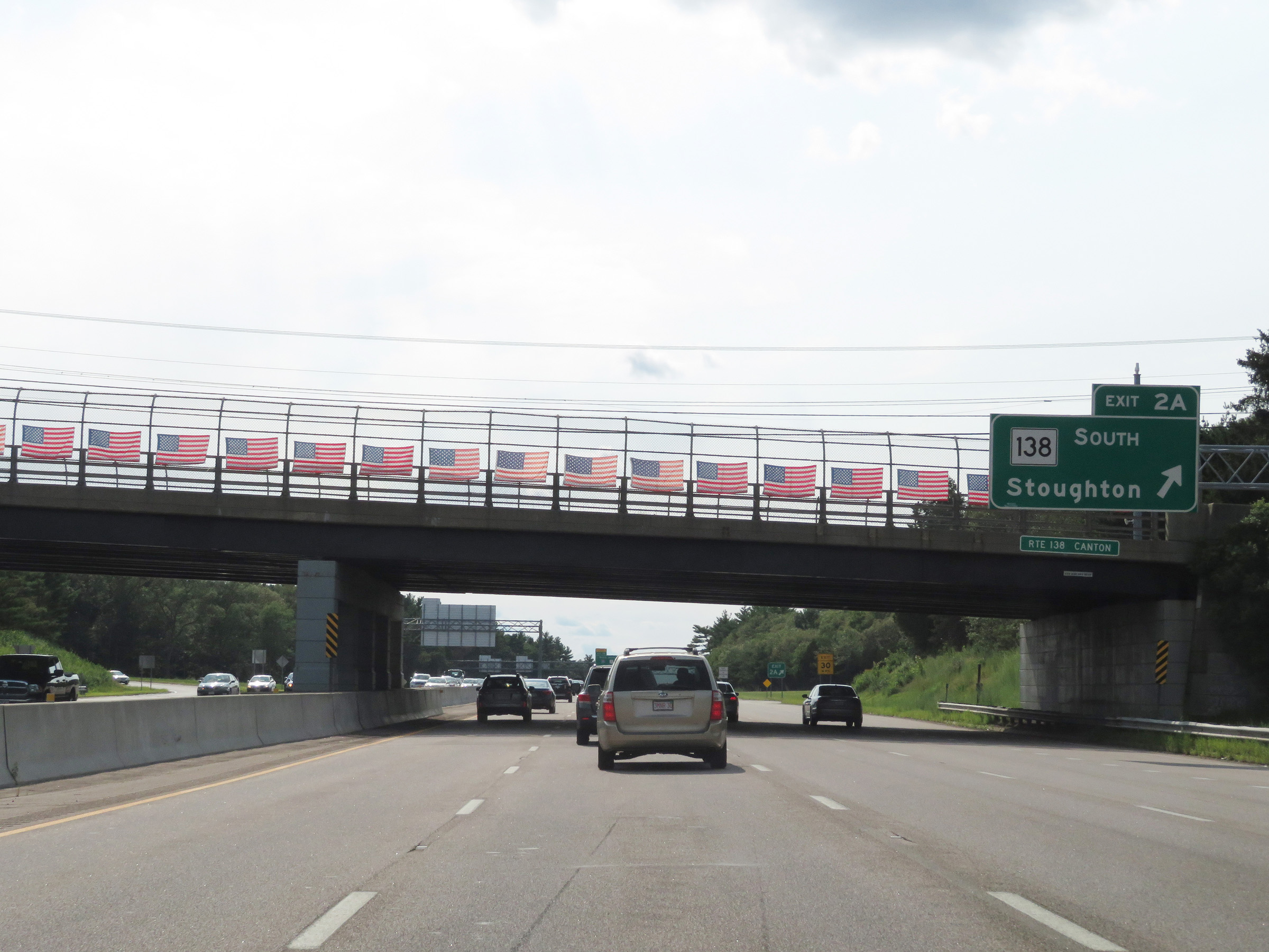 |
Interstate 93 South at Exit 2A: MA 138 South - Stoughton (Photo taken 8/6/17). |
 |
View on Interstate 93 South as it curves to the west to meet Interstate 95 1/2 mile ahead. (Photo taken 8/6/17). |
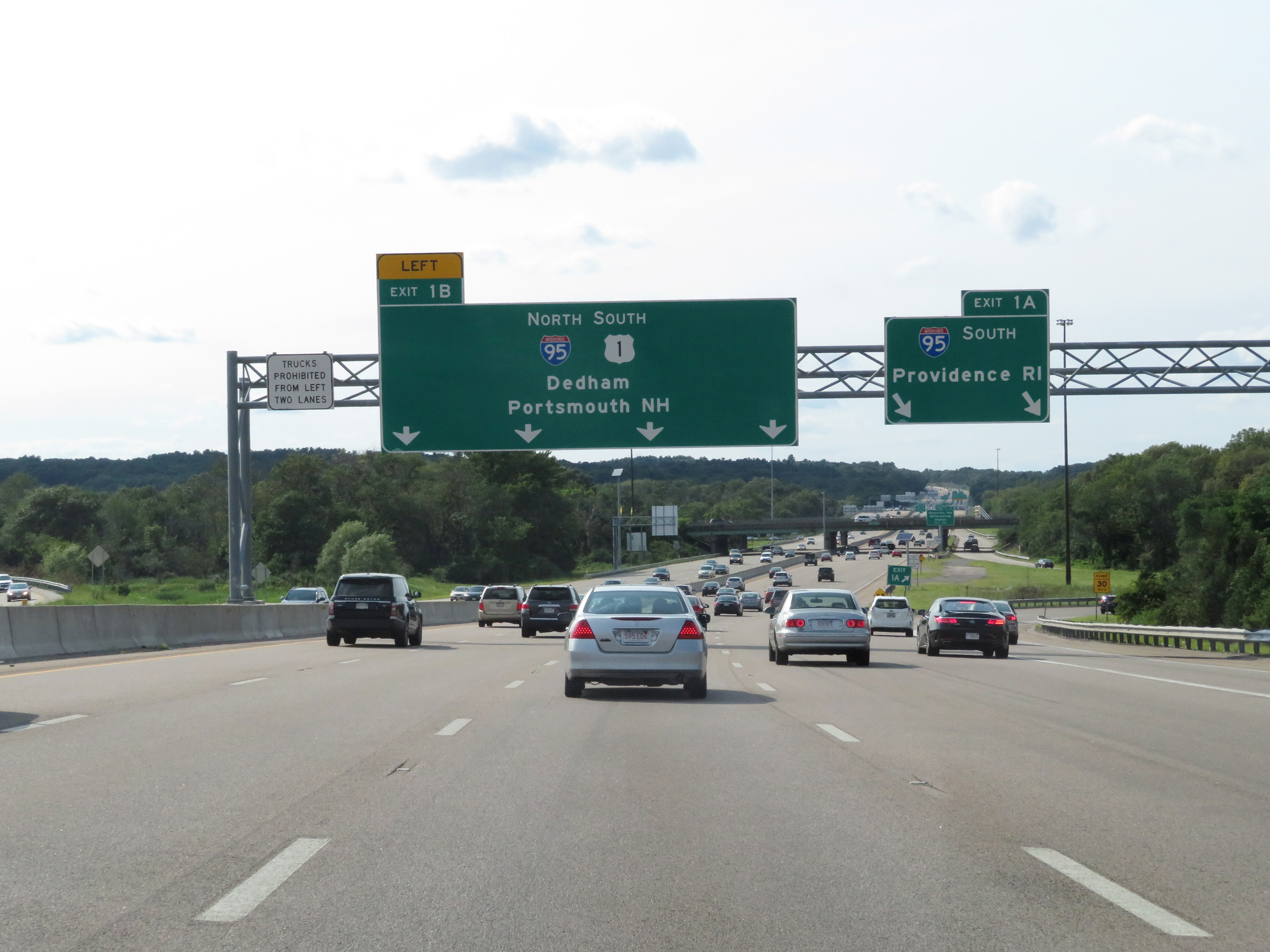 |
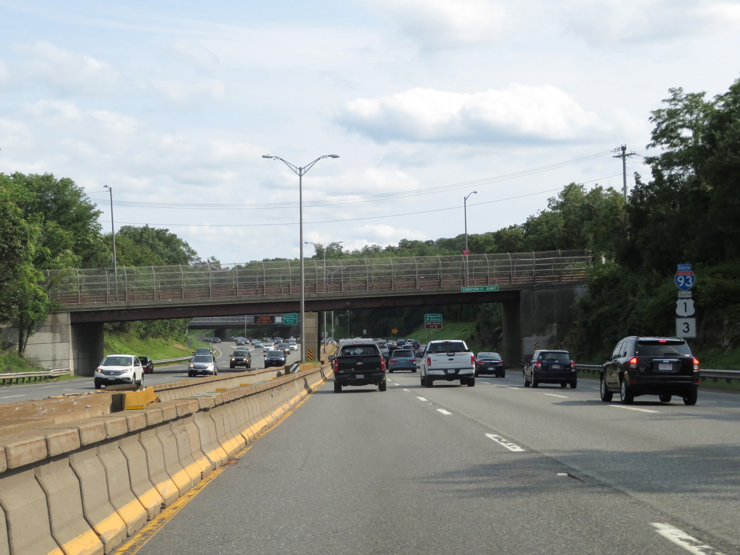
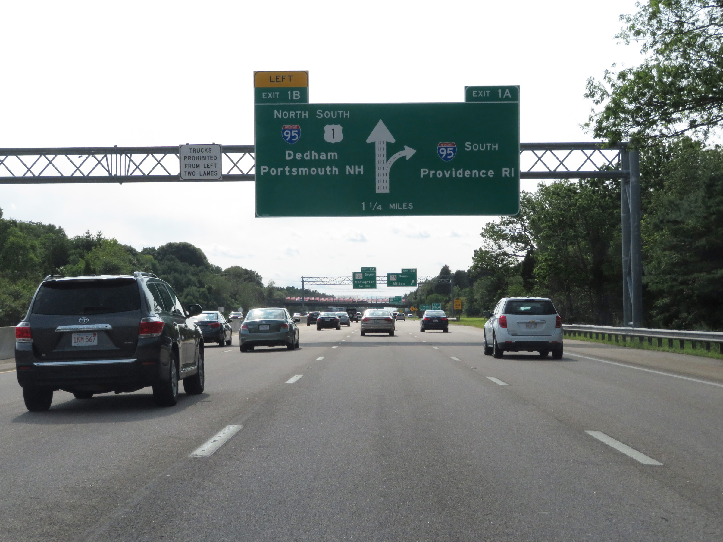
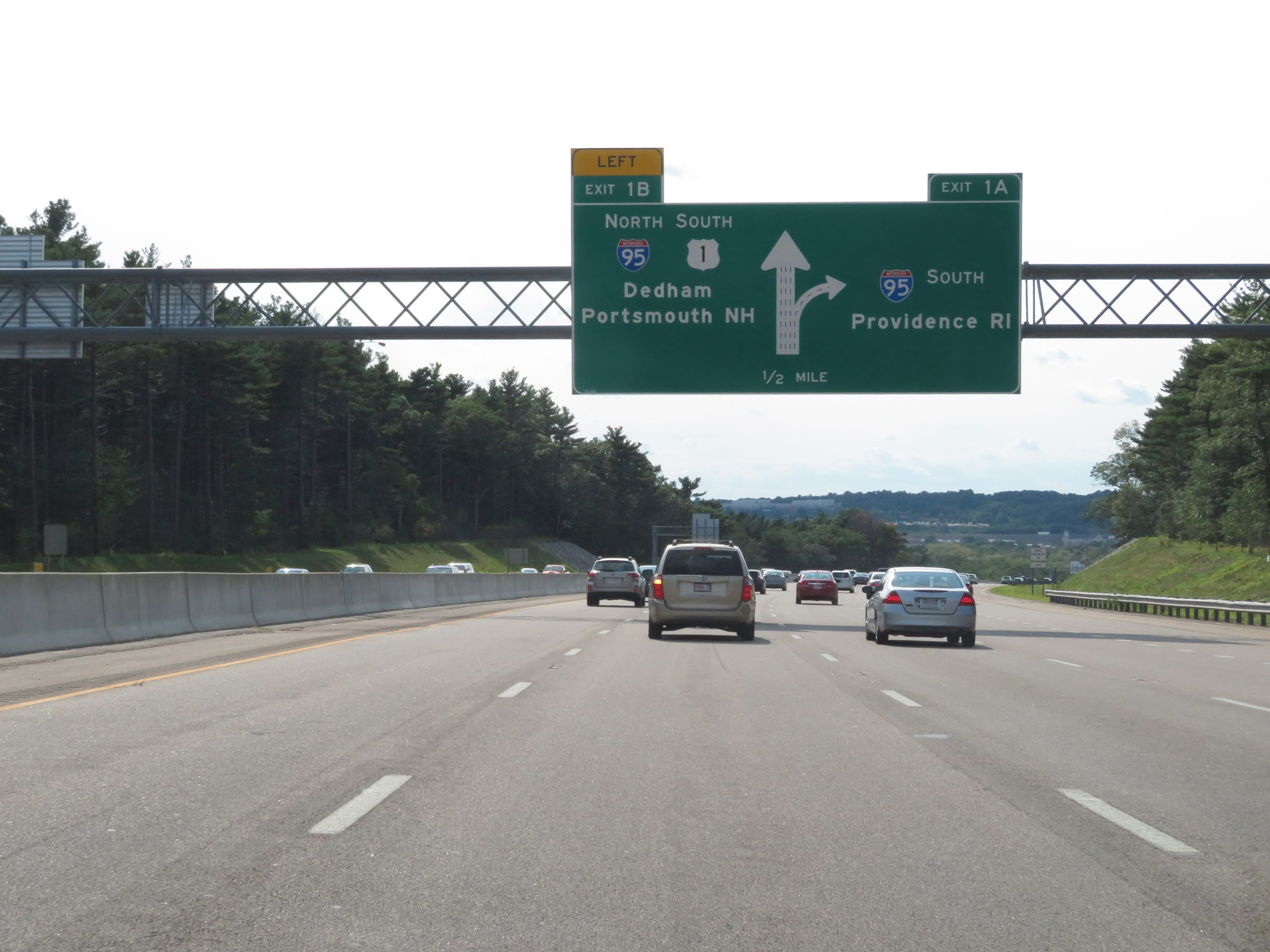
Interstate 93 South at Exit 1A: Interstate 95 South - Providence, RI; Exit 1B: Interstate 95 North / US 1 South - Dedham / Portsmouth, NH (Photo taken 8/6/17). |
 |
Interstate 93 reaches its southern terminus here, at Interstate 95 in Canton. It's four thru lanes continue as the northbound lanes of Interstate 95. (Photo taken 8/6/17). |
 |
Here, traffic from Interstate 95 North merges into the four thru lanes of Interstate 93 South from the right, and all 6 lanes continue as Interstate 95 North / US 1 South. (Photo taken 8/6/17). |