Road Information |
||
 |
||
| Total Mileage in State: | 138 miles | |
| Eastern End: | At MA 1A, in Boston | |
| Western End: | At New York state line | |
| Mileage covered in Photos: | 93 miles | |
| Counties covered in Photos: | Hampden, Worcester, Middlesex, Suffolk | |
| Major Junctions in Photos: | I-291, in Chicopee I-84, in Sturbridge I-290/I-395, in Auburn I-495, in Hopkinton I-95, in Weston I-93, in Boston |
|
| Control Cities in Photos: | West Springfield, Chicopee, Auburn, Framingham, Weston, Boston | |
Eastbound
- Section 1: West Springfield (Exit 4) to Framingham (Exit 13)
- Section 2: Framingham (Exit 13) to Boston
Section 1: West Springfield (Exit 4) to Framingham (Exit 13)
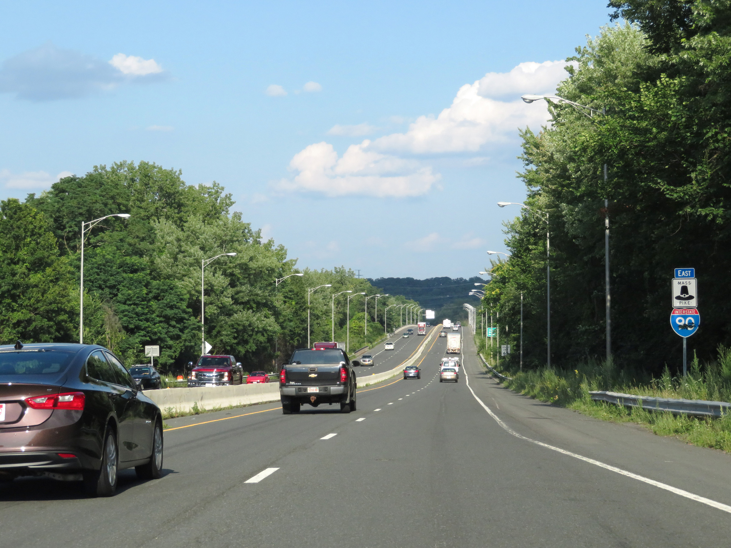 |
Interstate 90 East / Mass Pike reassurance markers. (Photo taken 8/9/17). |
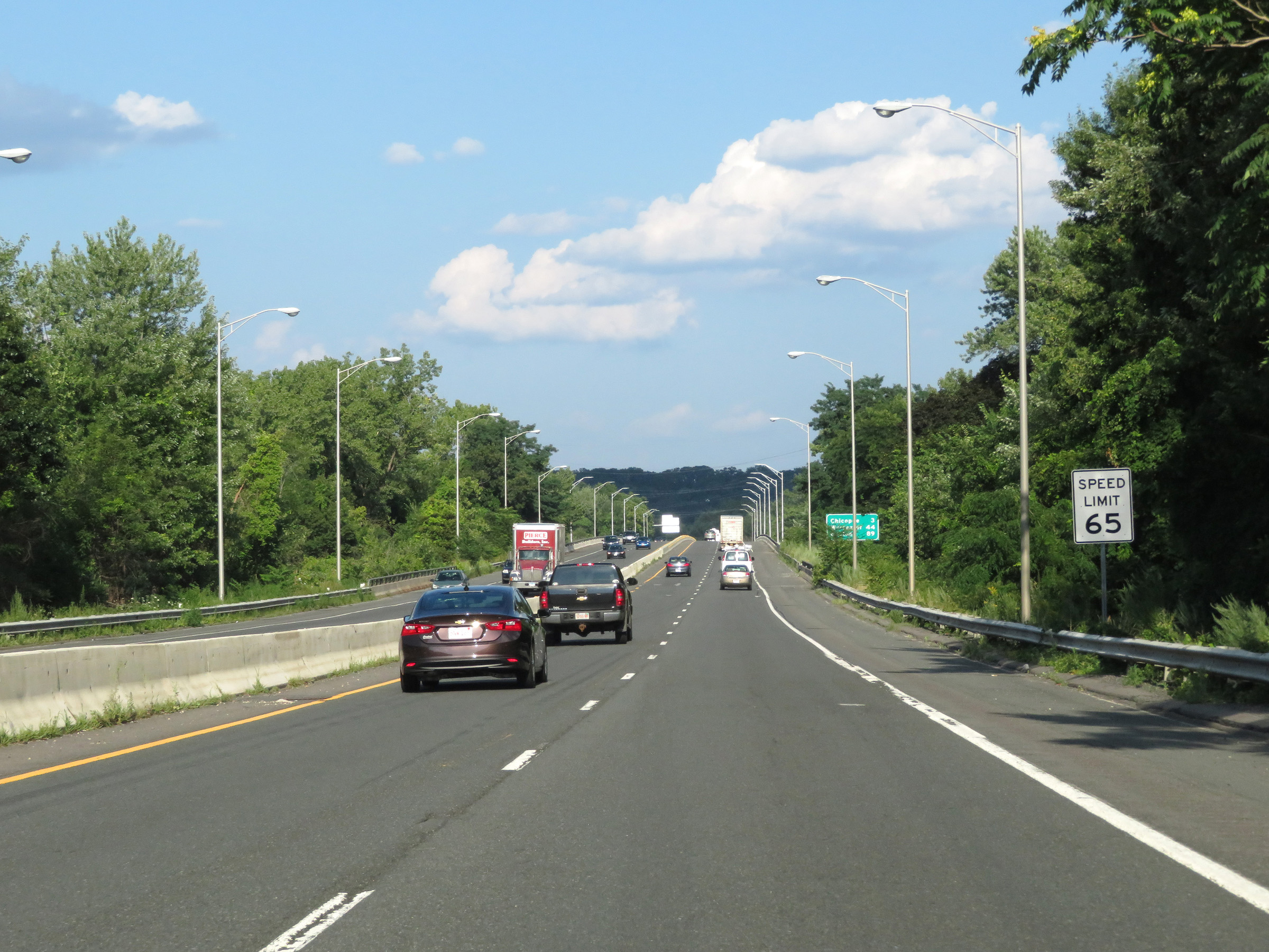 |
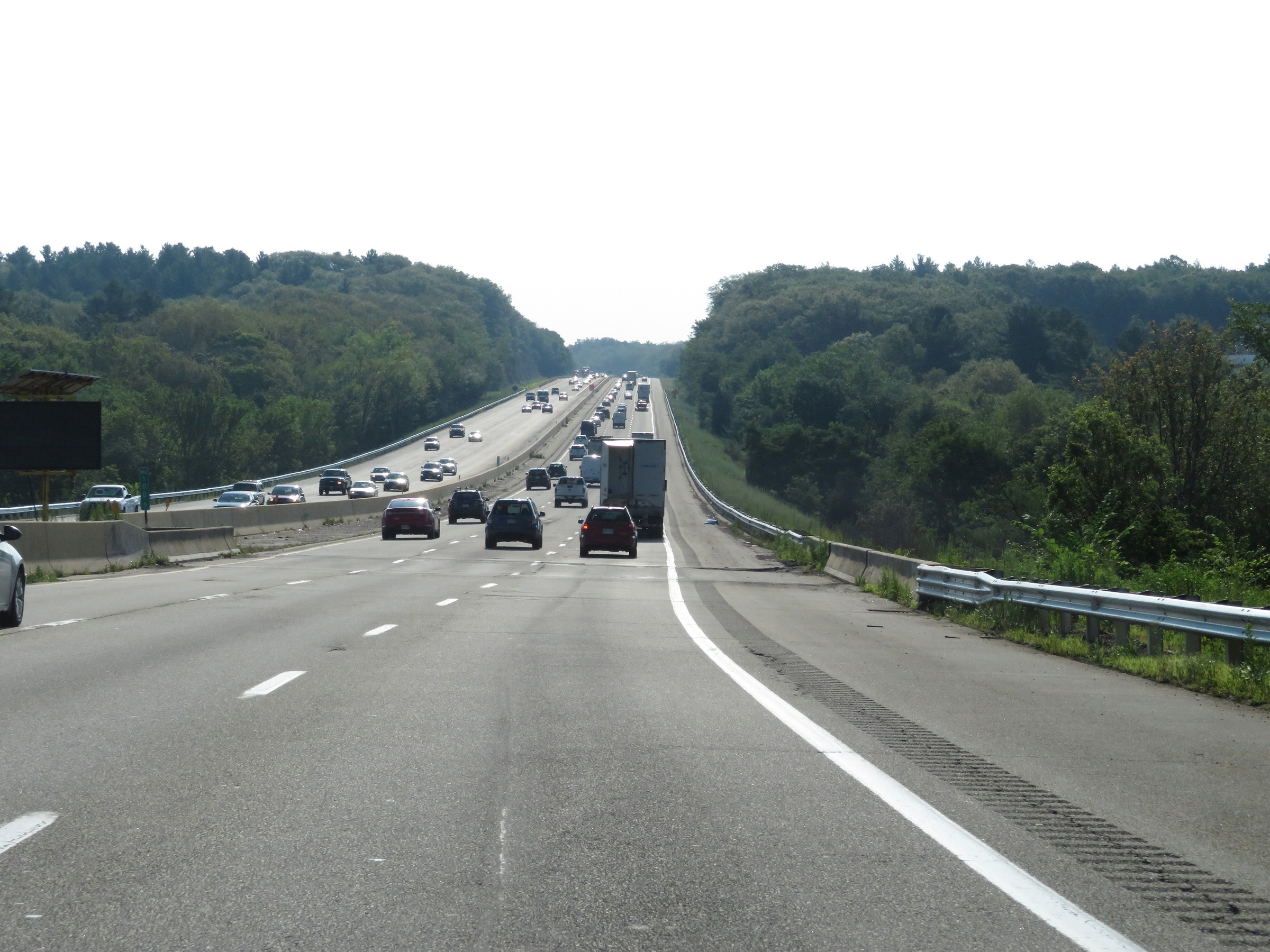
The speed limit remains 65 mph on Interstate 90 East (Mass Pike). (Photo taken 8/9/17). |
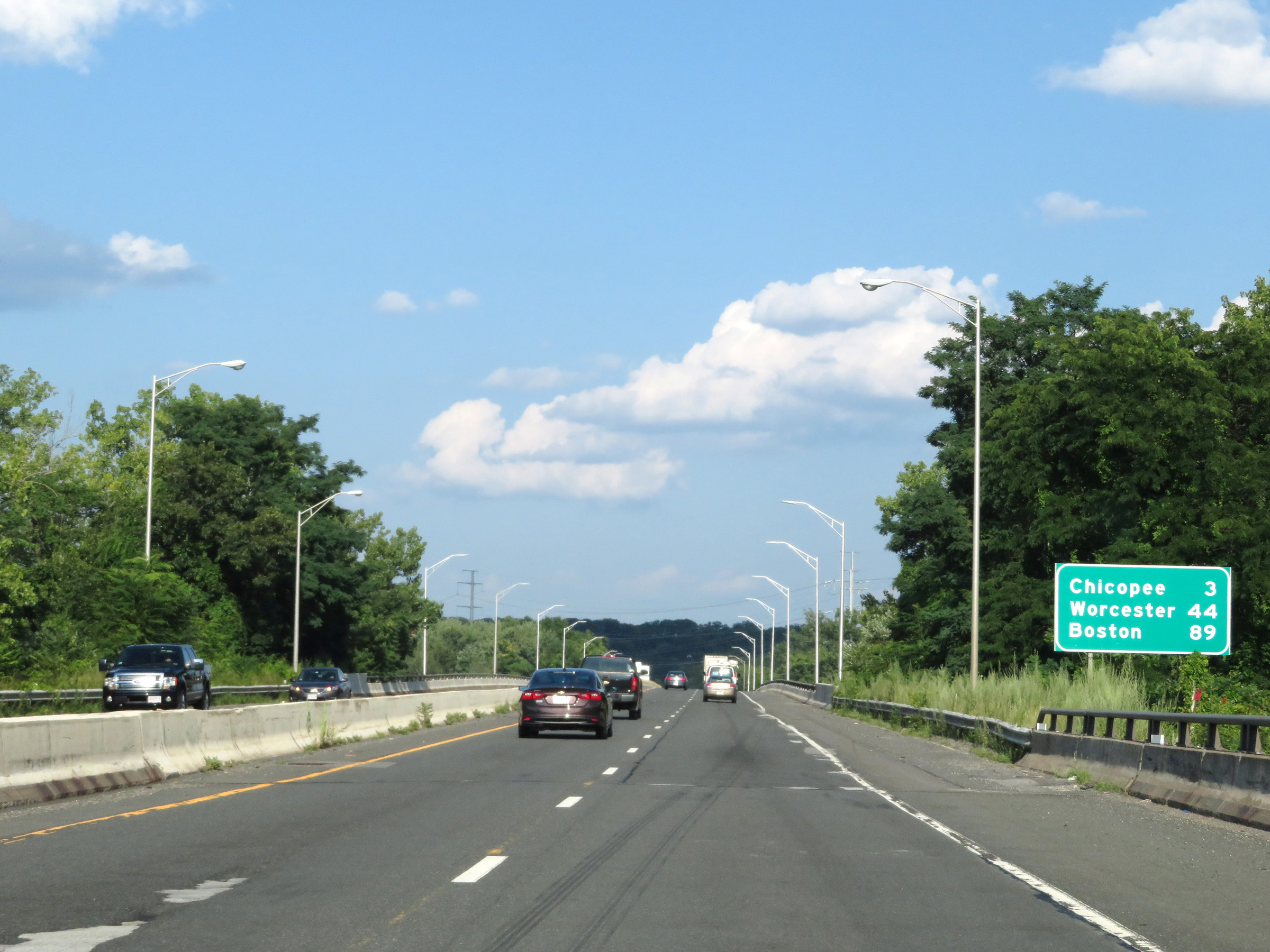 |
Mileage sign on Interstate 90 East (Mass Pike). It's 3 miles to Chicopee, 44 miles to Worcester, and 89 miles to Boston. (Photo taken 8/9/17). |
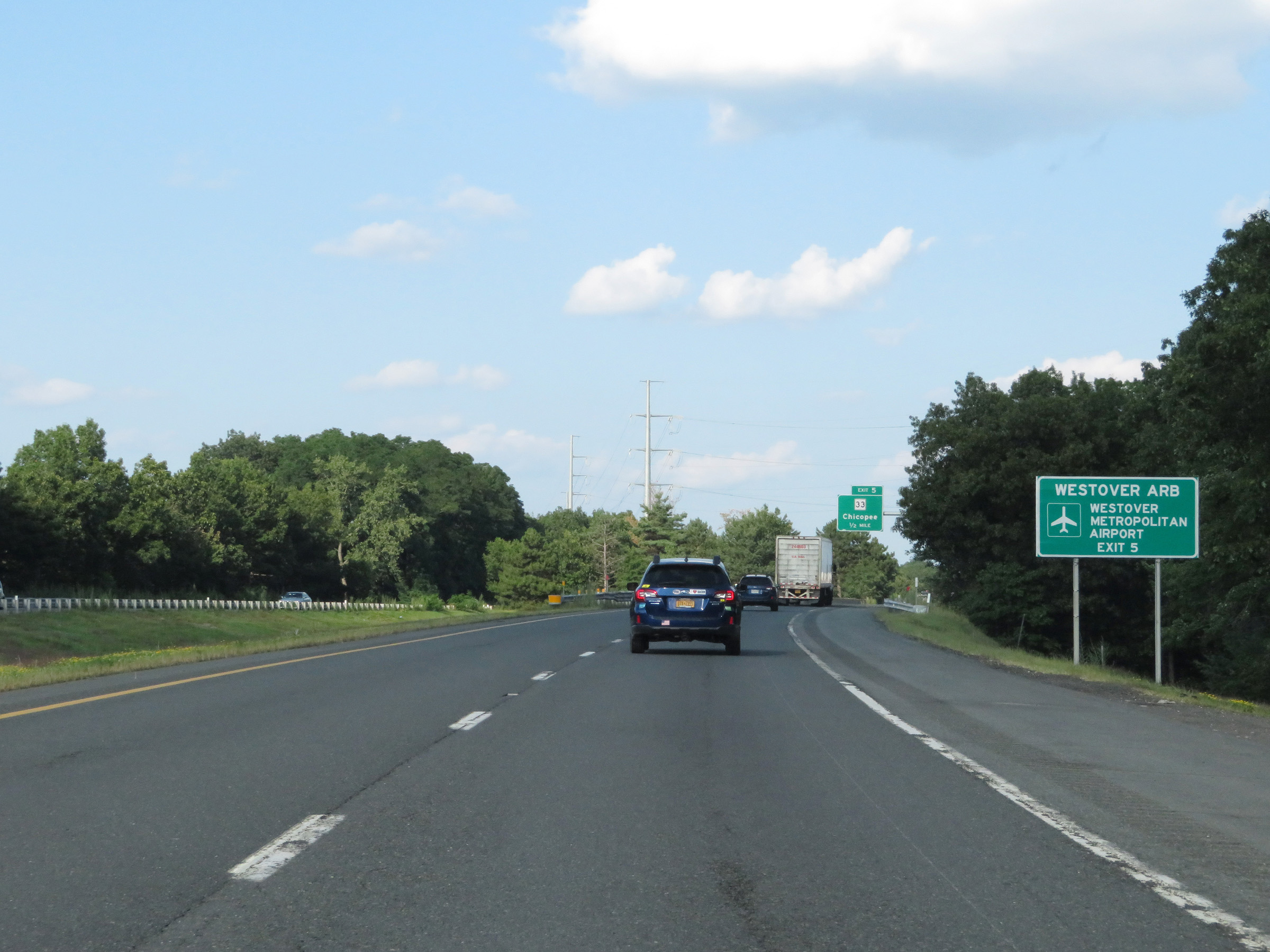 |
Take Exit 5 to Westover ARB and Westover Metropolitan Airport. (Photo taken 8/9/17). |
 |
Interstate 90 East (Mass Pike) at Exit 5: MA 33 - Chicopee (Photo taken 8/9/17). |
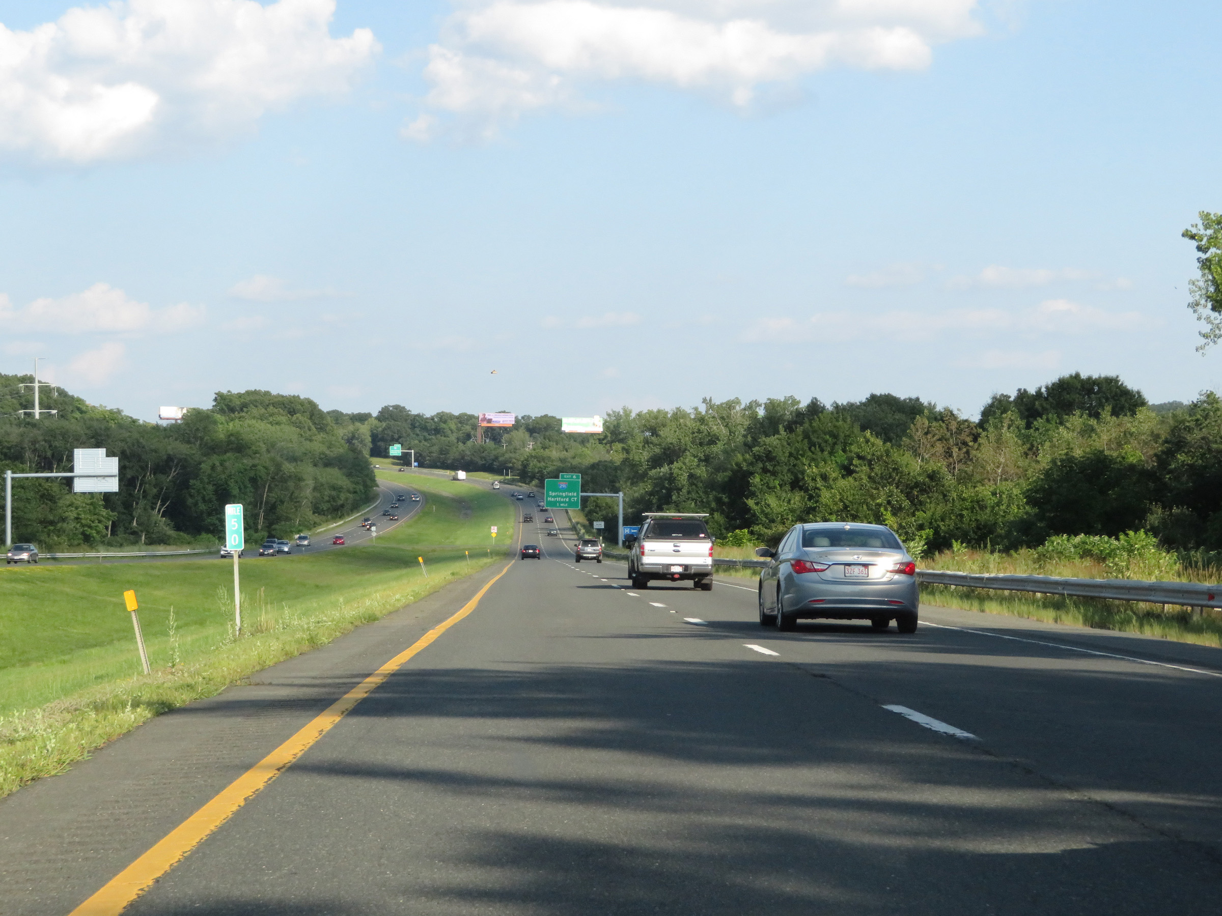 |
View on Interstate 90 East (Mass Pike) at mile marker 50. (Photo taken 8/9/17). |
 |
Interstate 90 East (Mass Pike) approaching Exit 6 - 1/2 mile. (Photo taken 8/9/17). |
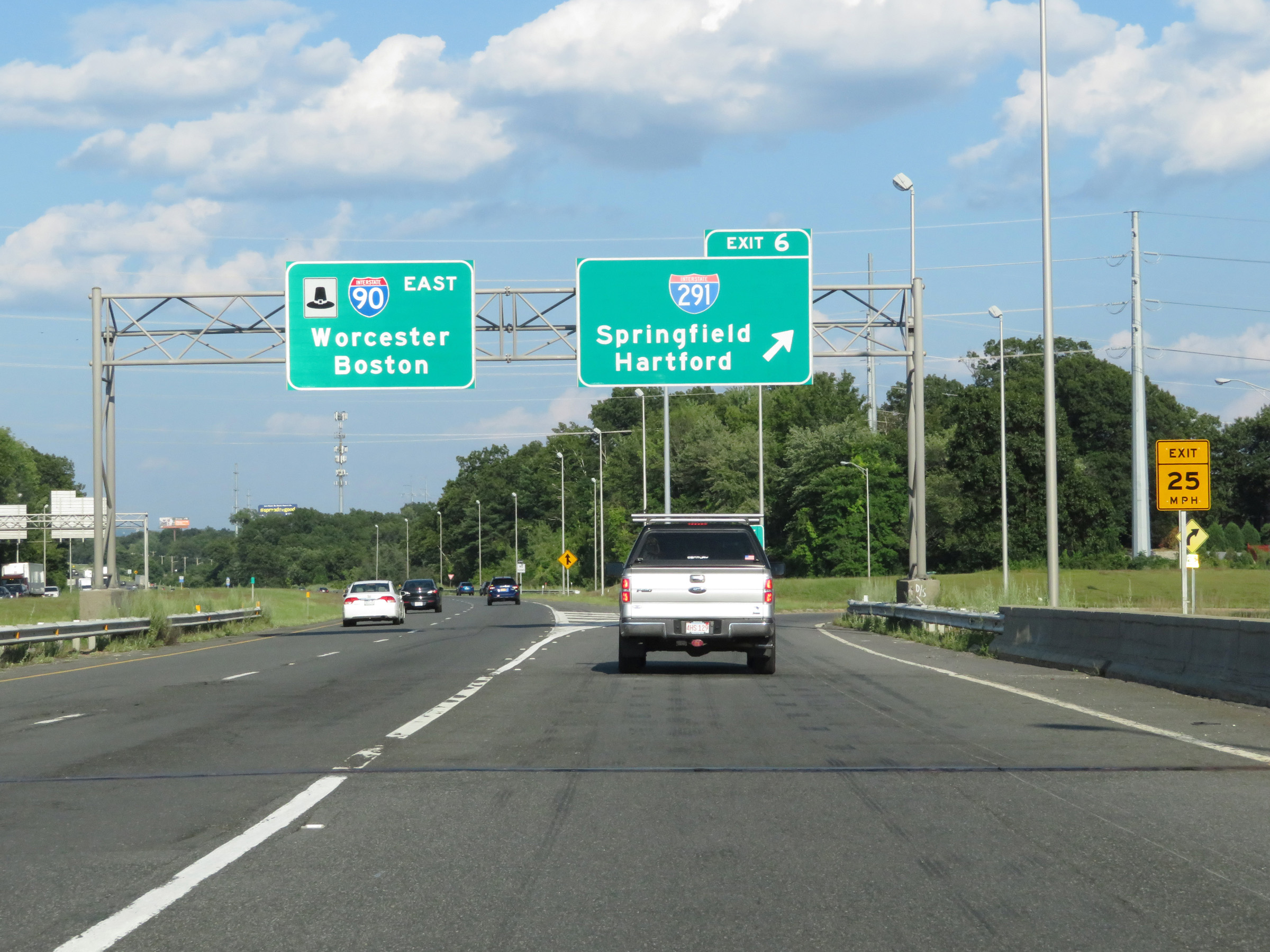 |
Interstate 90 East (Mass Pike) at Exit 6: Interstate 291 - Springfield / Hartford (Photo taken 8/9/17). |
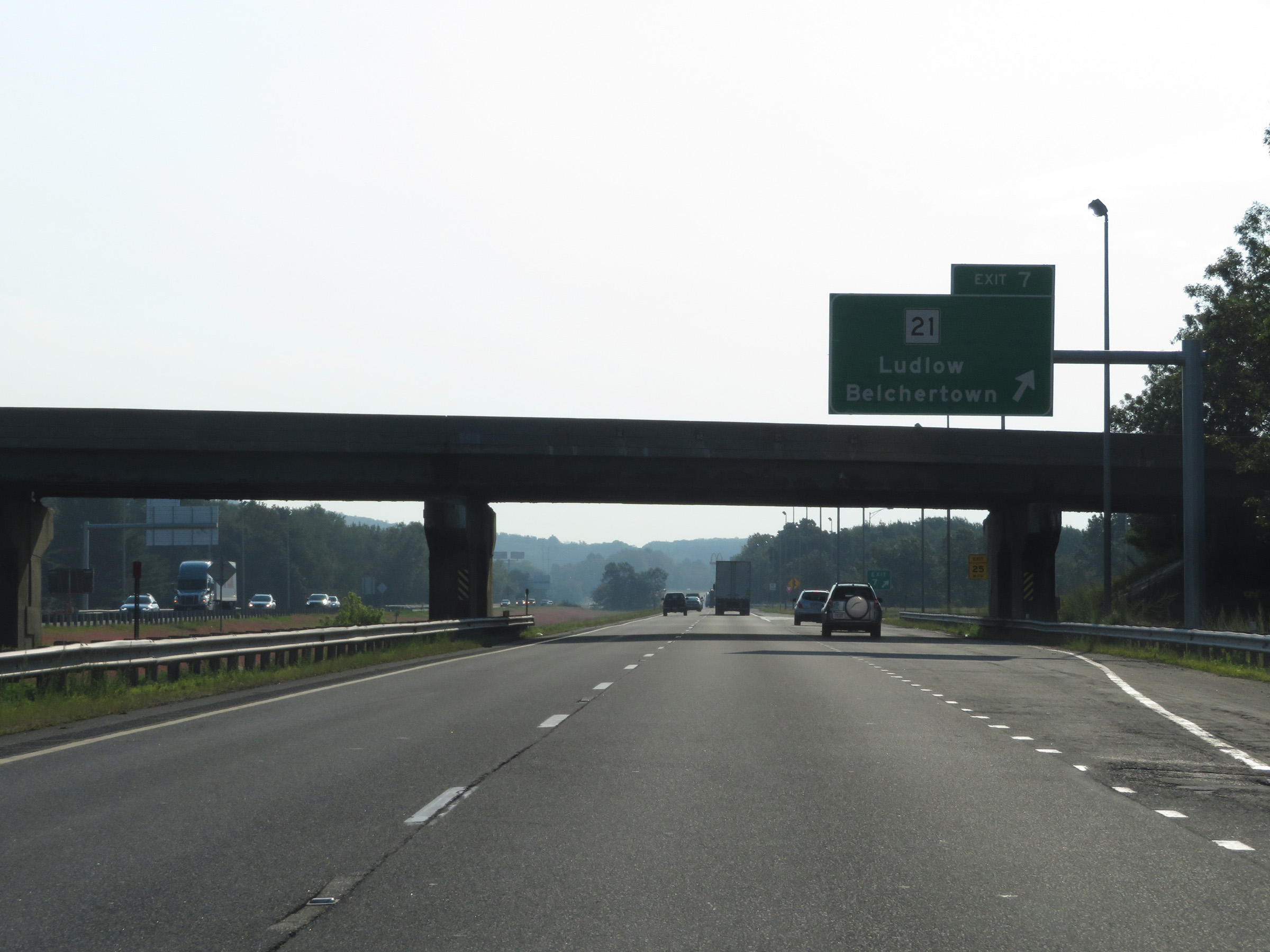 |
Interstate 90 East (Mass Pike) at Exit 7: MA 21 - Ludlow / Belchertown (Photo taken 8/10/17). |
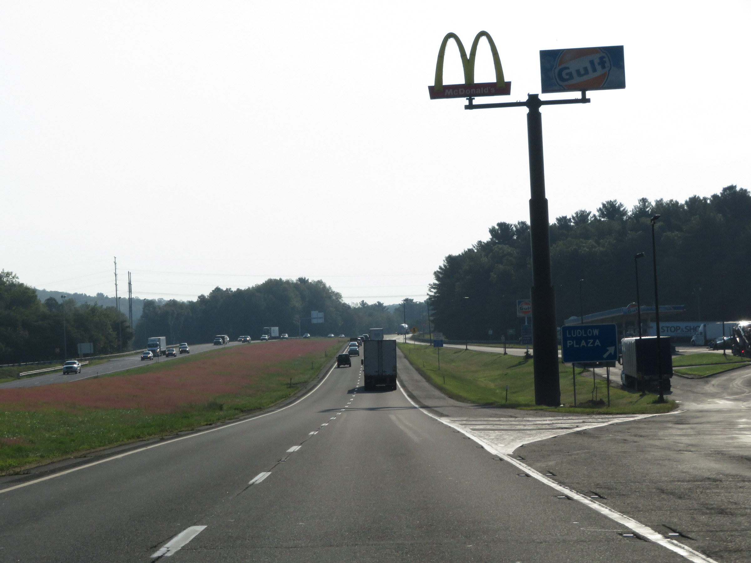 |
Interstate 90 East (Mass Pike) at the Ludlow Service Plaza. (Photo taken 8/10/17). |
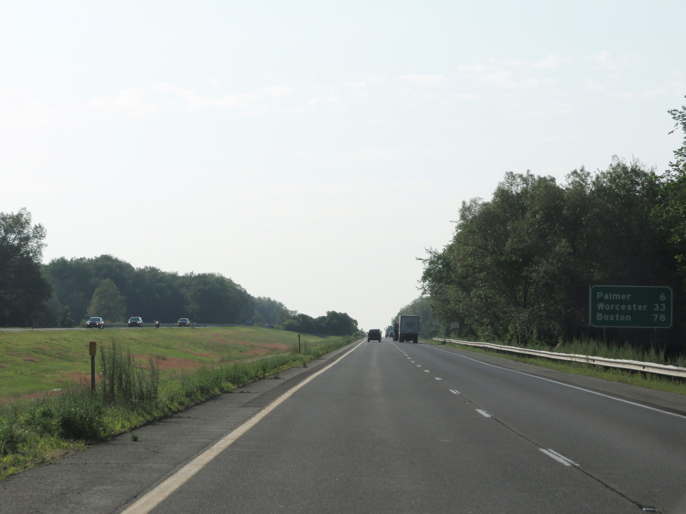 |
Another mileage sign on Interstate 90 East (Mass Pike). It's 6 miles to Palmer, 33 miles to Worcester, and 78 miles to Boston. (Photo taken 8/10/17). |
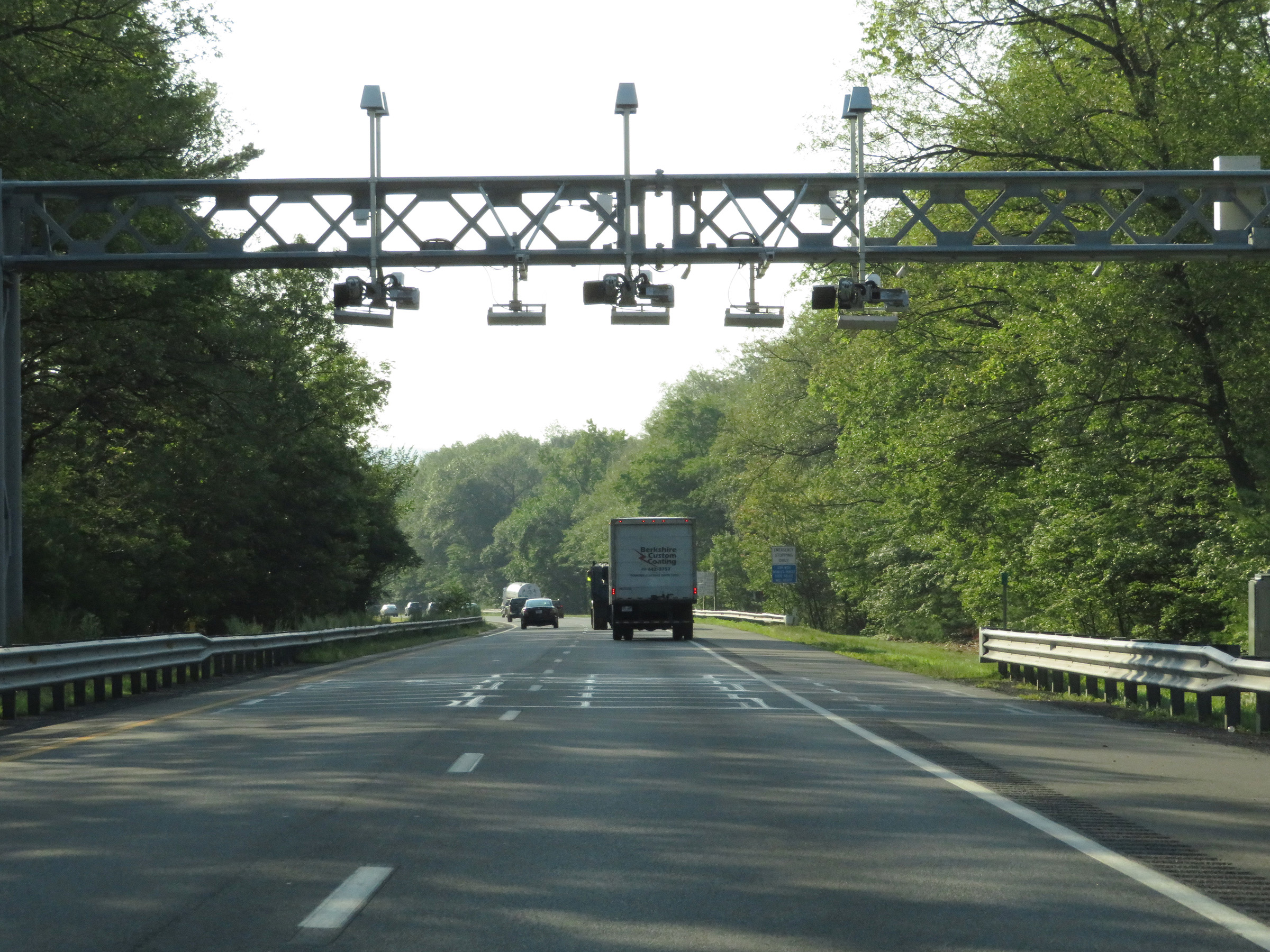 |
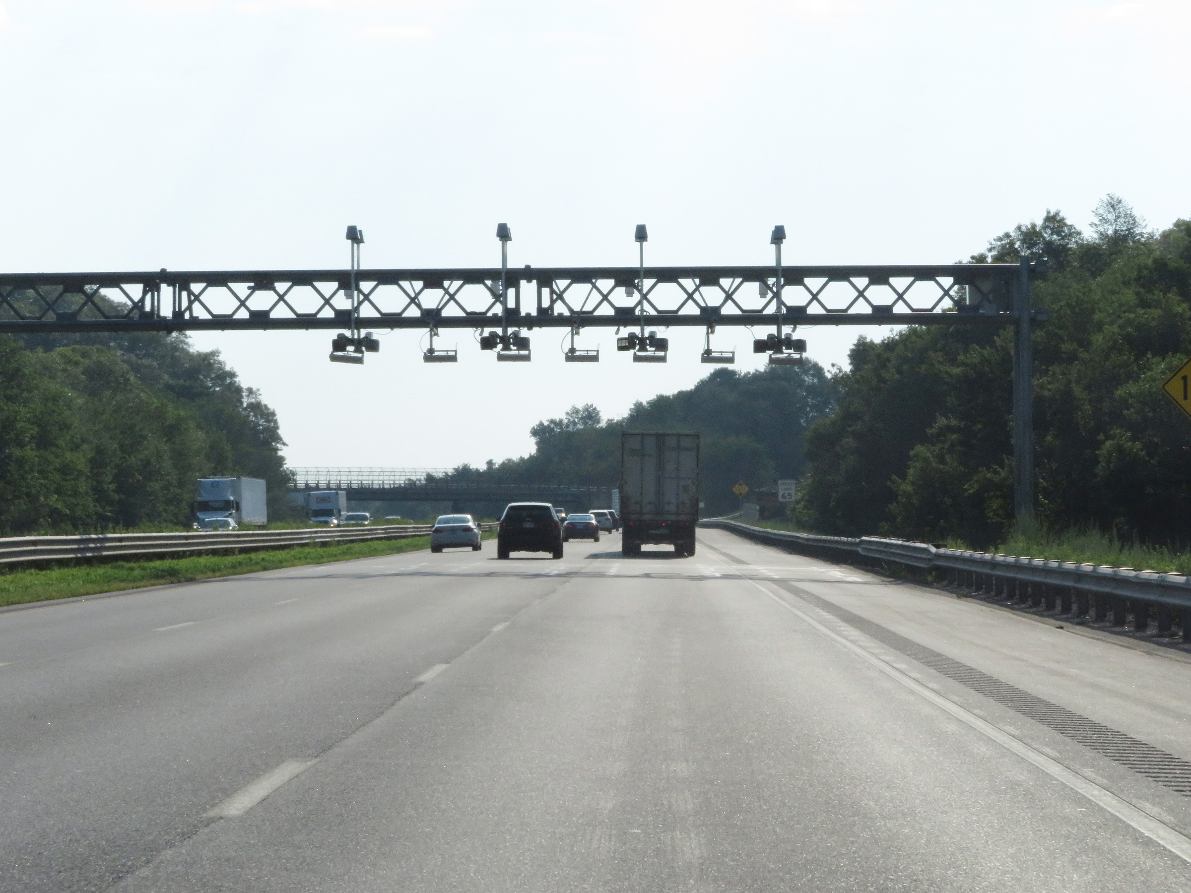
Electronic toll gantry on Interstate 90 East (Mass Pike) in Ludlow. (Photo taken 8/10/17). |
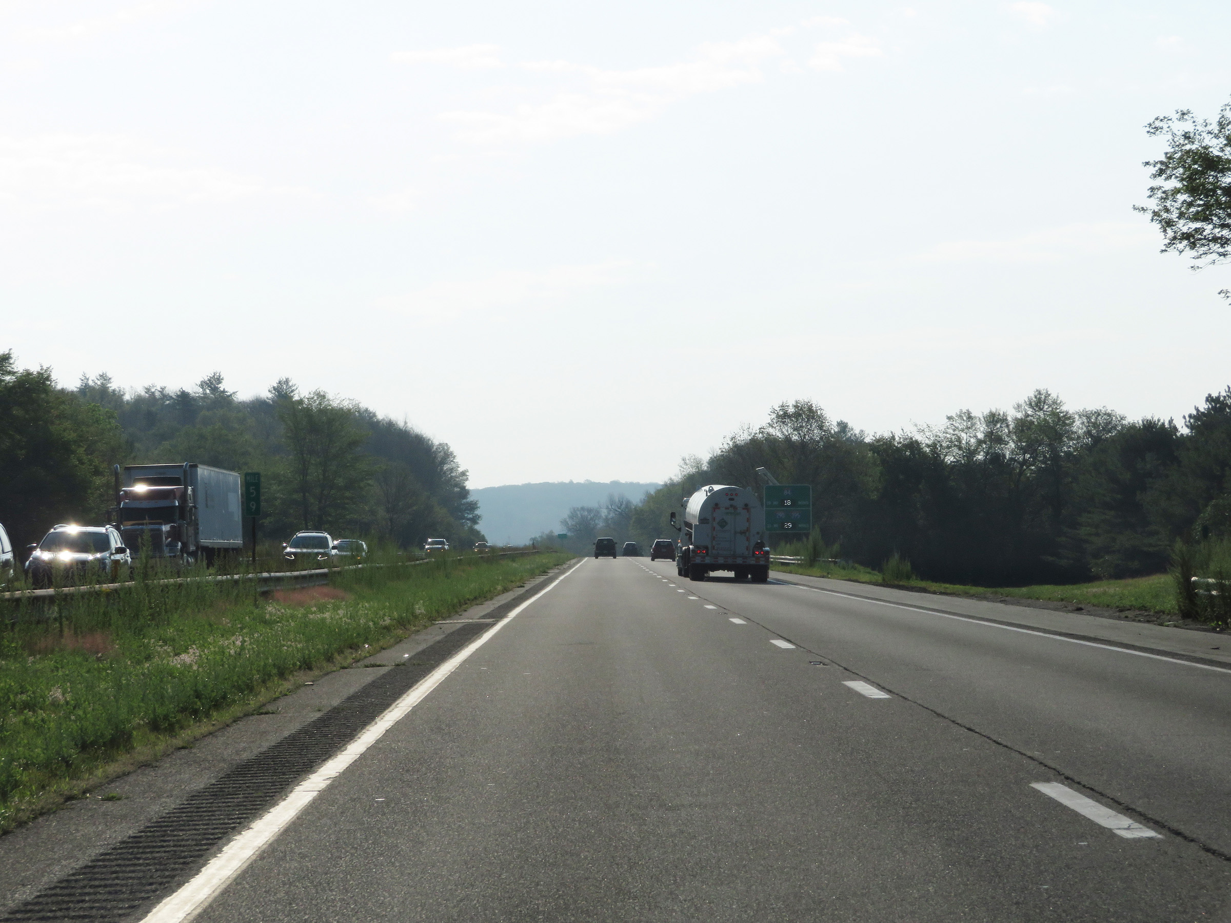 |
View on Interstate 90 East (Mass Pike) at mile marker 59. (Photo taken 8/10/17). |
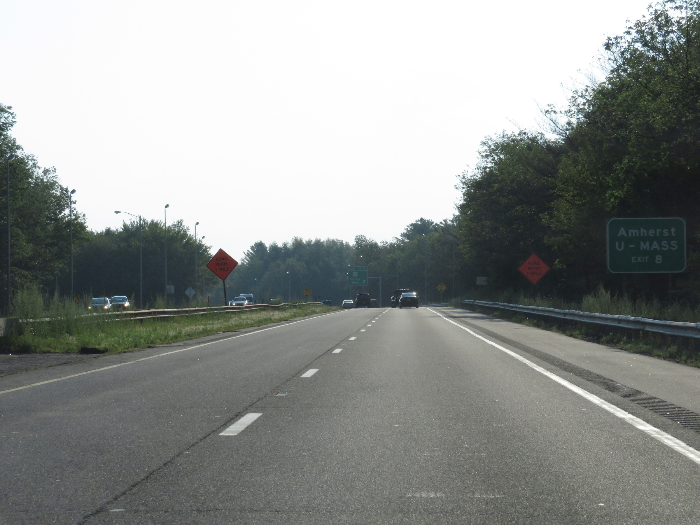 |
Take Exit 8 to Amherst and UMASS. (Photo taken 8/10/17). |
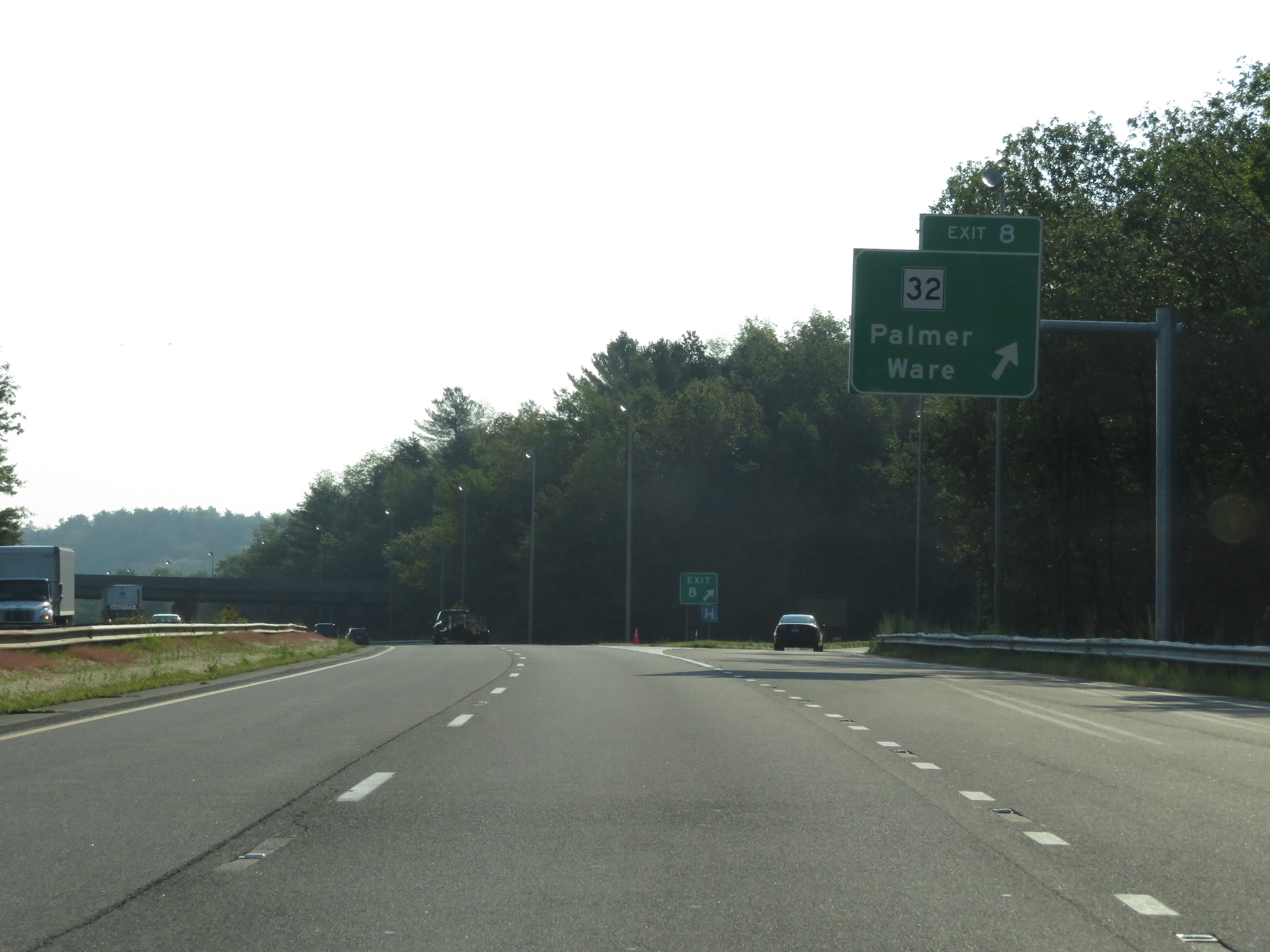 |
Interstate 90 East (Mass Pike) at Exit 8: MA 32 - Palmer / Ware (Photo taken 8/10/17). |
 |
Interstate 90 East (Mass Pike) at mile marker 66. (Photo taken 8/10/17). |
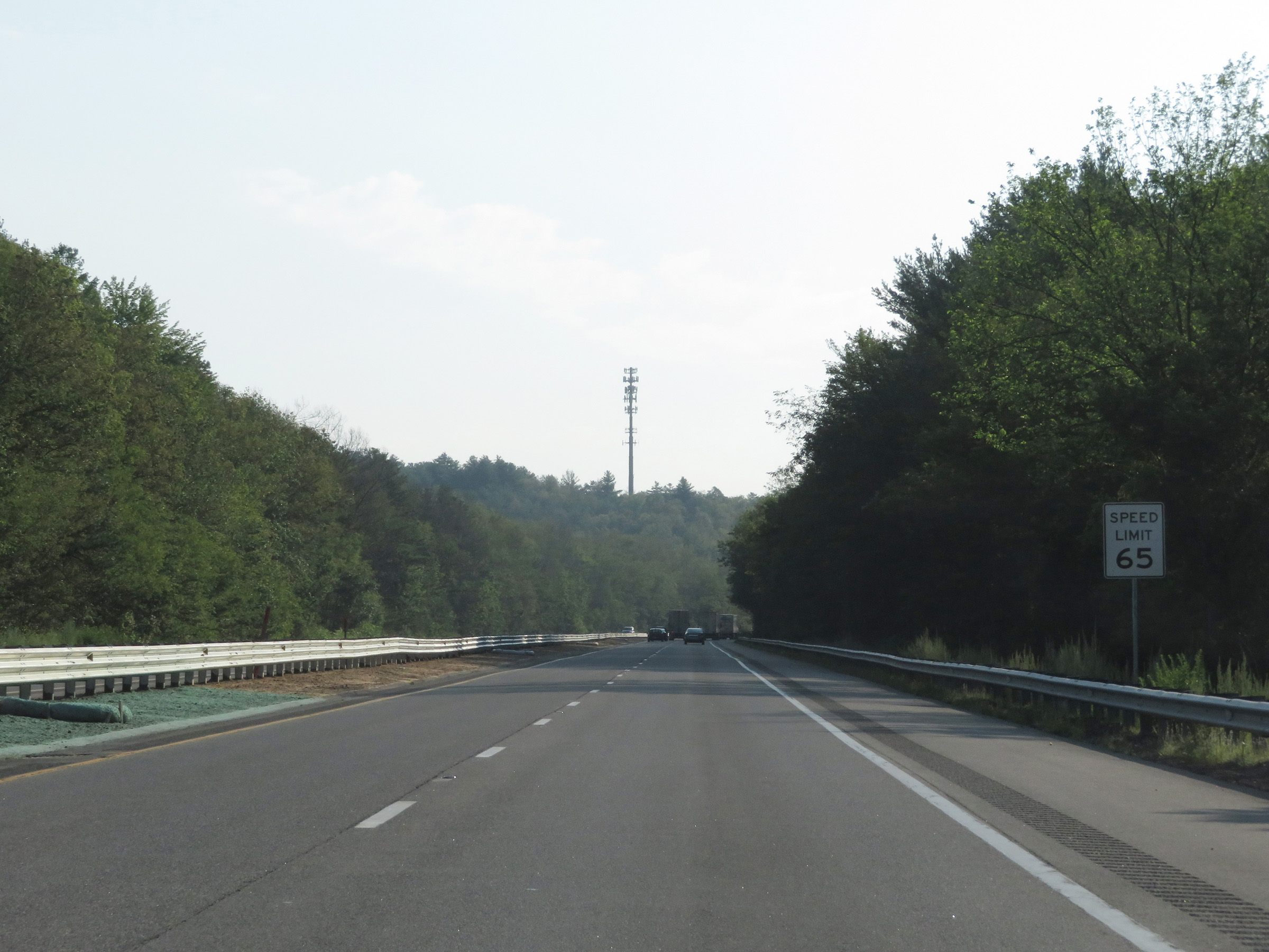 |
The speed limit remains 65 mph. This is the standard speed limit on most rural Interstate highways in Massachusetts. (Photo taken 8/10/17). |
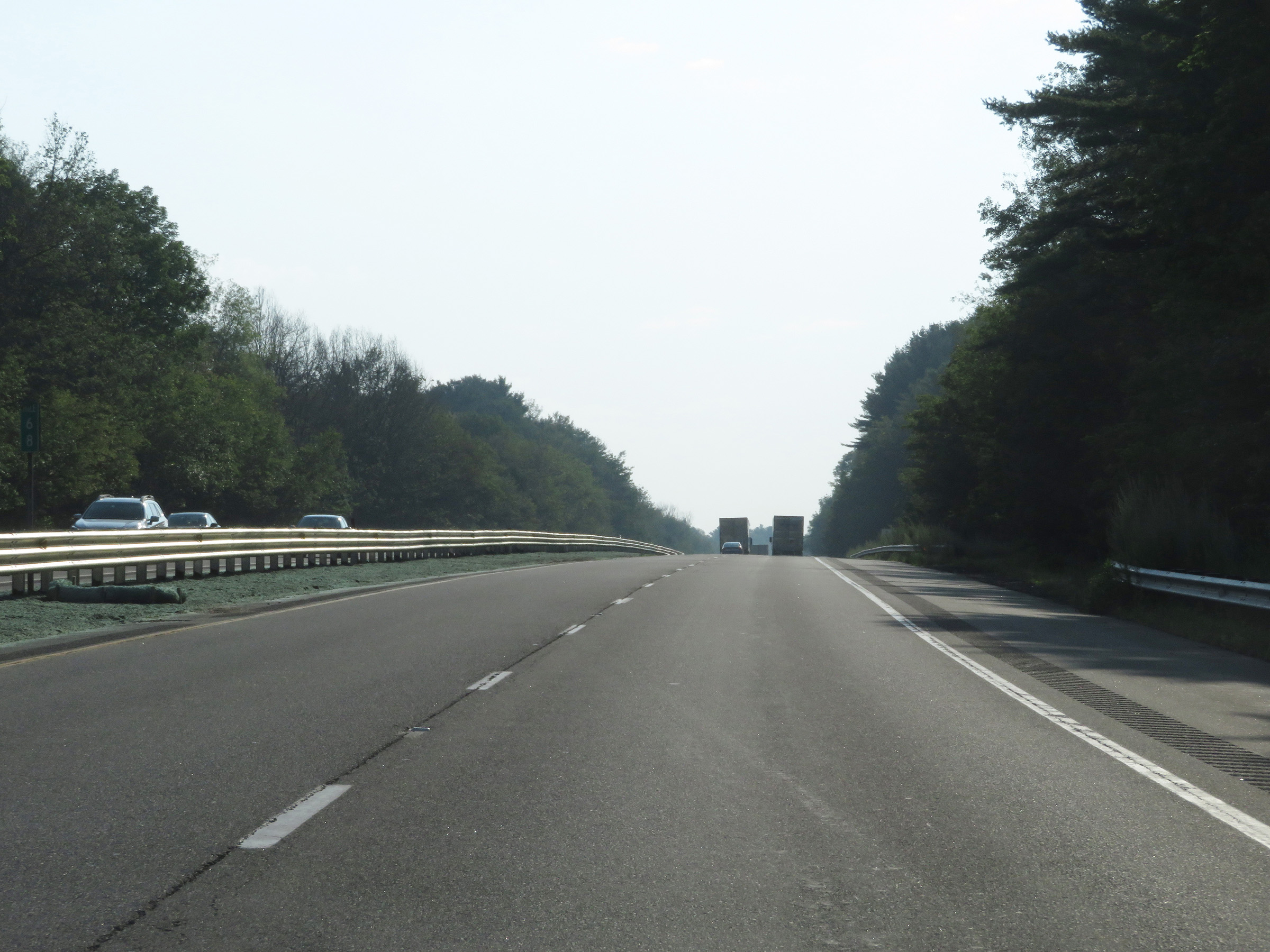 |
View on Interstate 90 East (Mass Pike) at mile marker 68. (Photo taken 8/10/17). |
 |
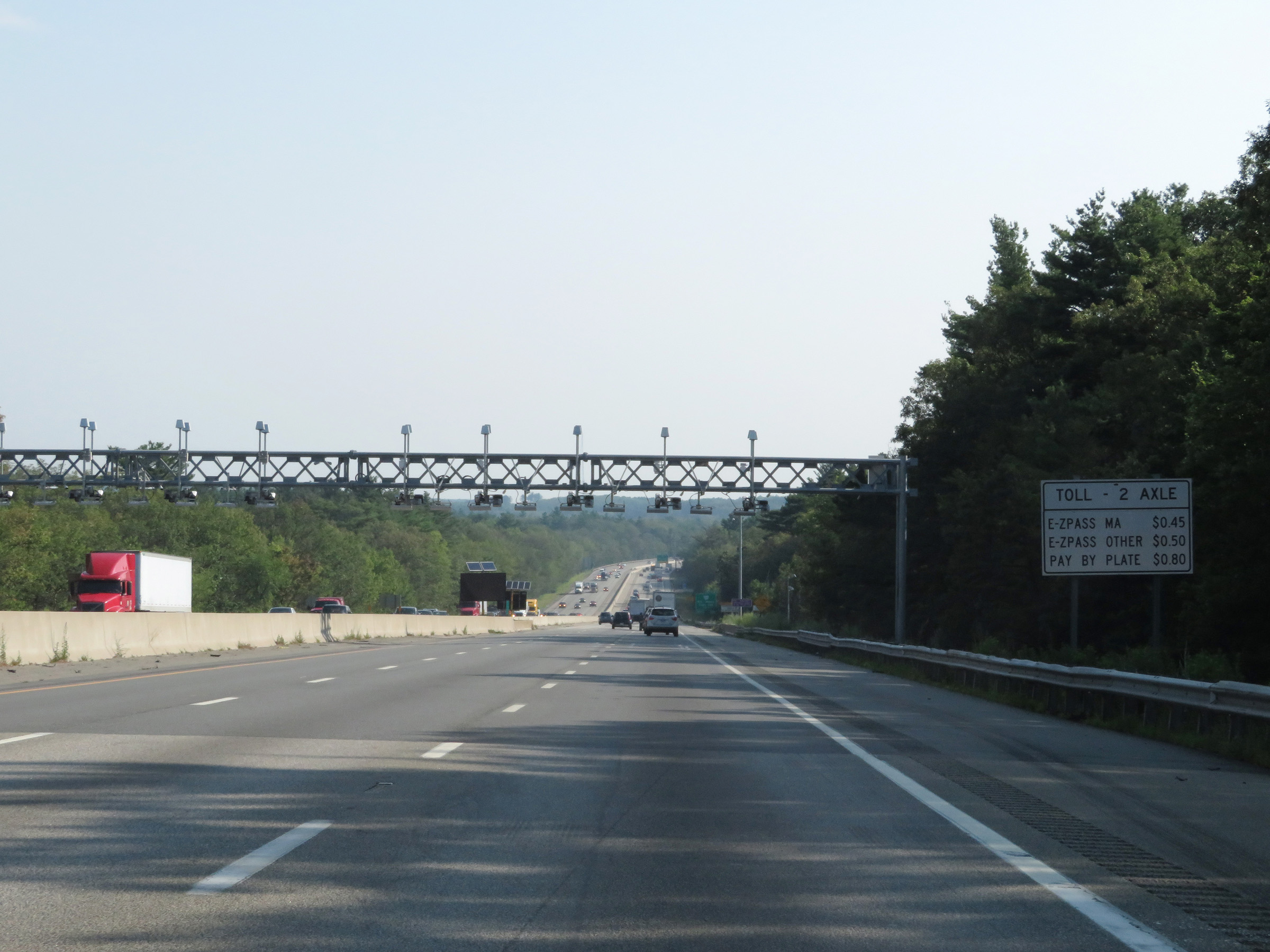
Toll gantry in Warren, with signage listing the toll rates for 2 axle vehicles for Massachusetts EZ Pass, other states' EZ Passes, and Pay by Plate. (Photo taken 8/10/17). |
 |
View on Interstate 90 East (Mass Pike) at mile marker 74. (Photo taken 8/10/17). |
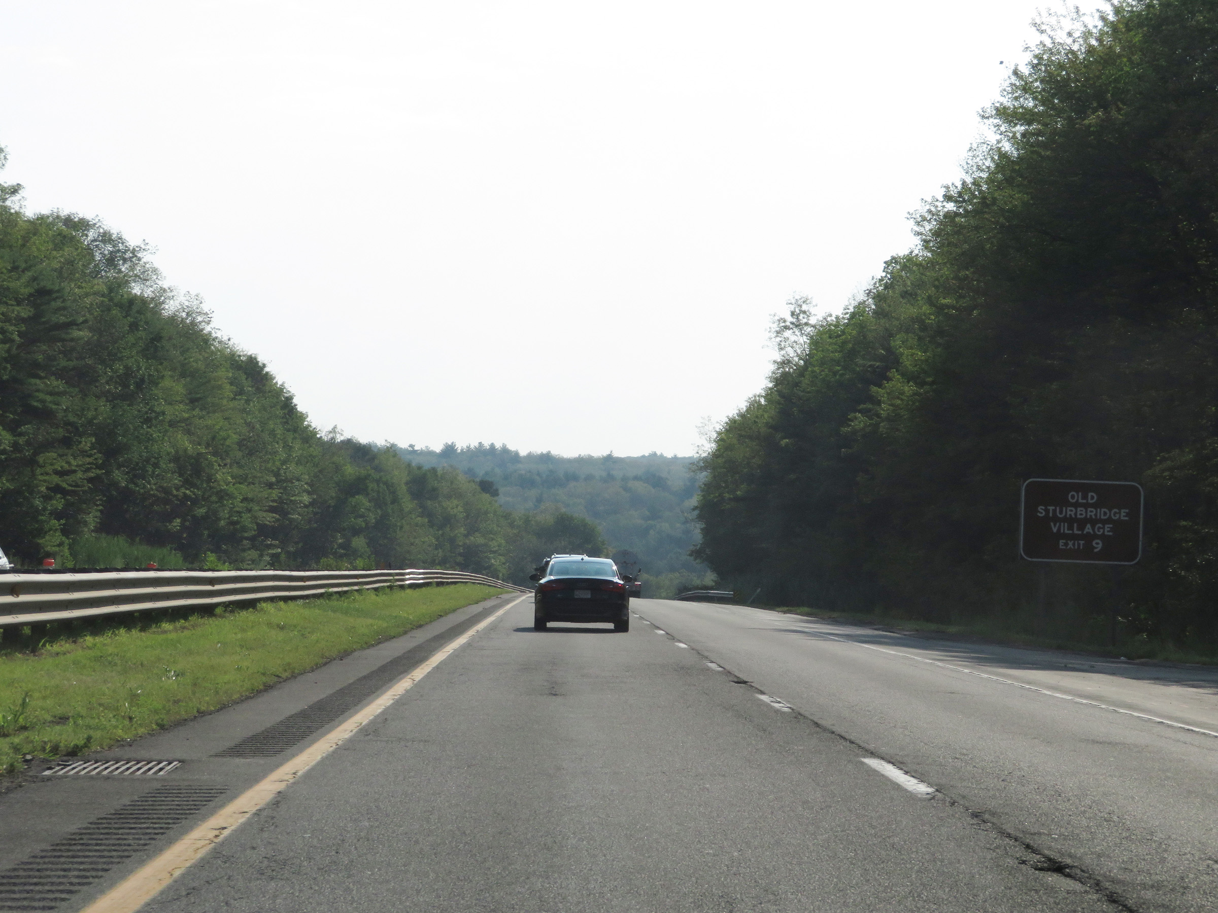 |
Take Exit 9 to Old Sturbridge Village. (Photo taken 8/10/17). |
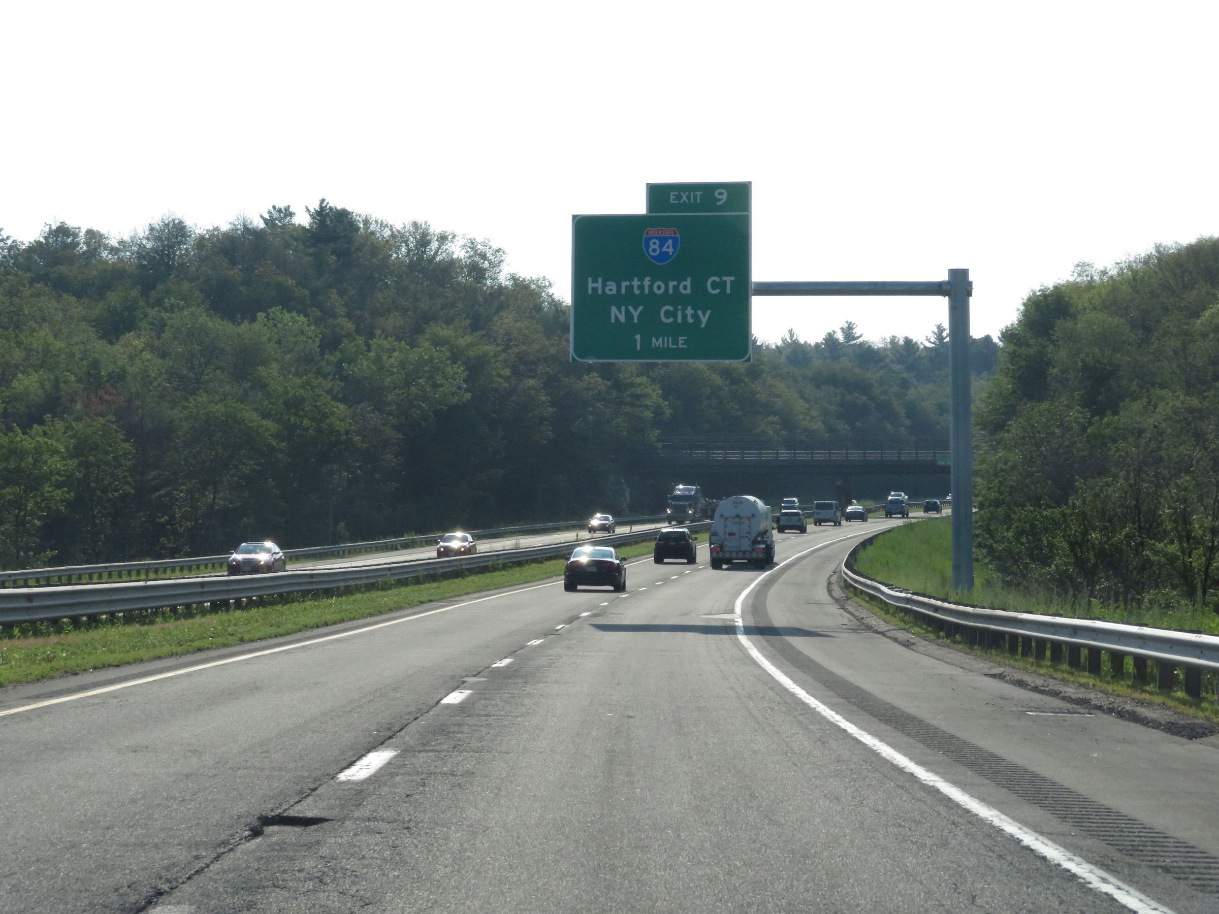 |
Interstate 90 East (Mass Pike) approaching Exit 9 - 1 mile. (Photo taken 8/10/17). |
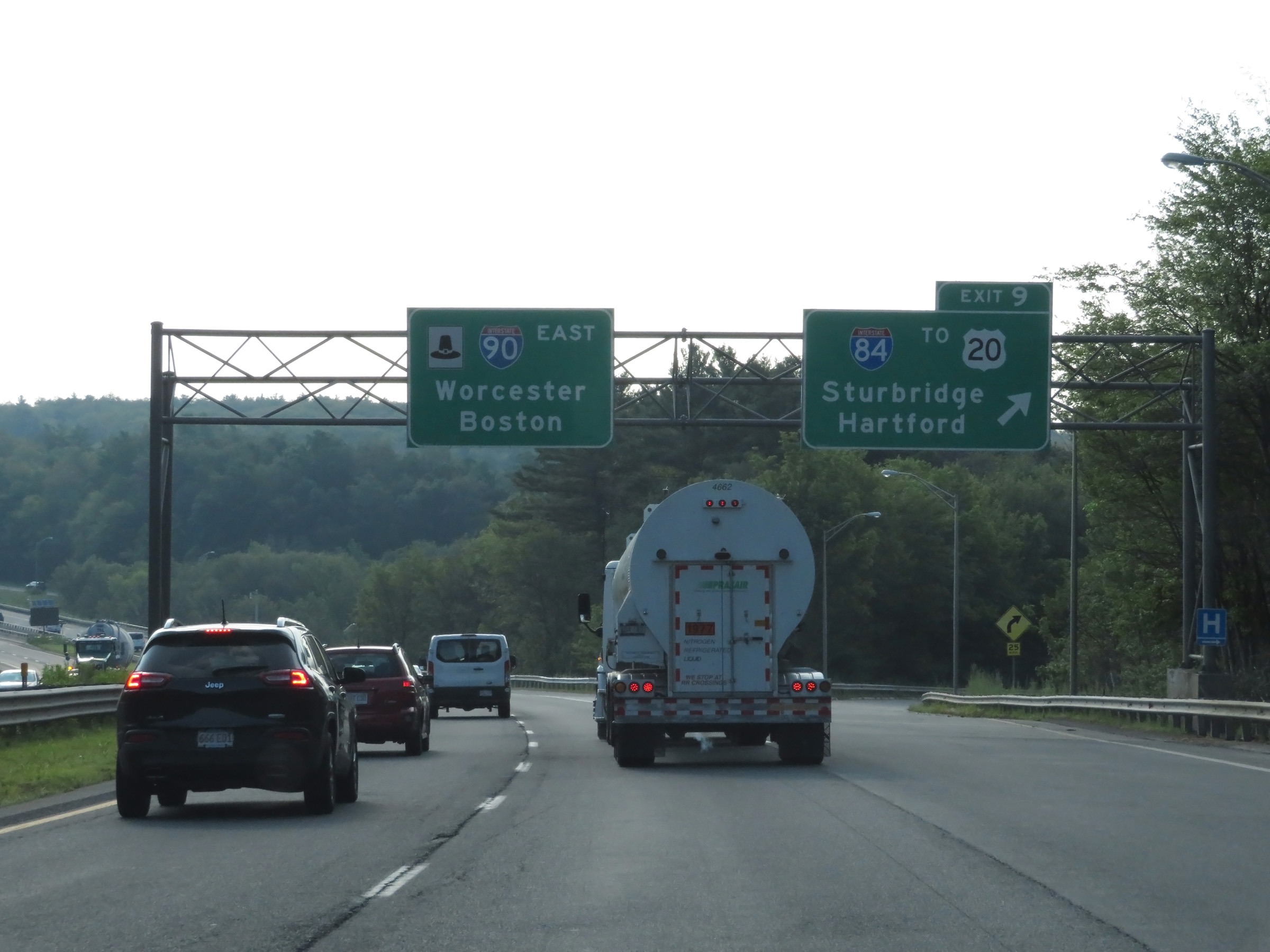 |
Interstate 90 East (Mass Pike) at Exit 9: Interstate 84 / To US 20 - Sturbridge / Hartford (Photo taken 8/10/17). |
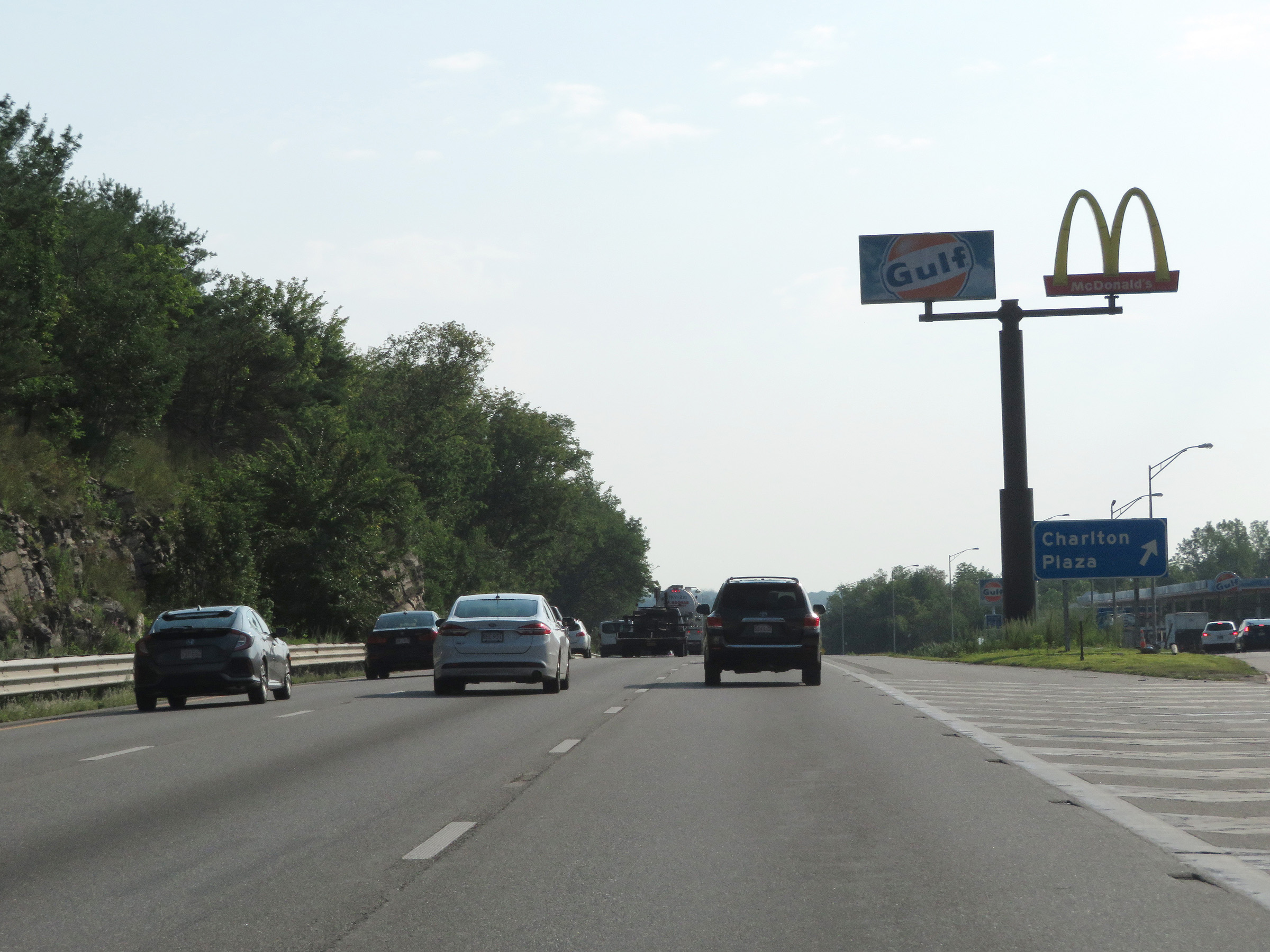 |
Interstate 90 East (Mass Pike) at the Charlton Service Plaza. (Photo taken 8/10/17). |
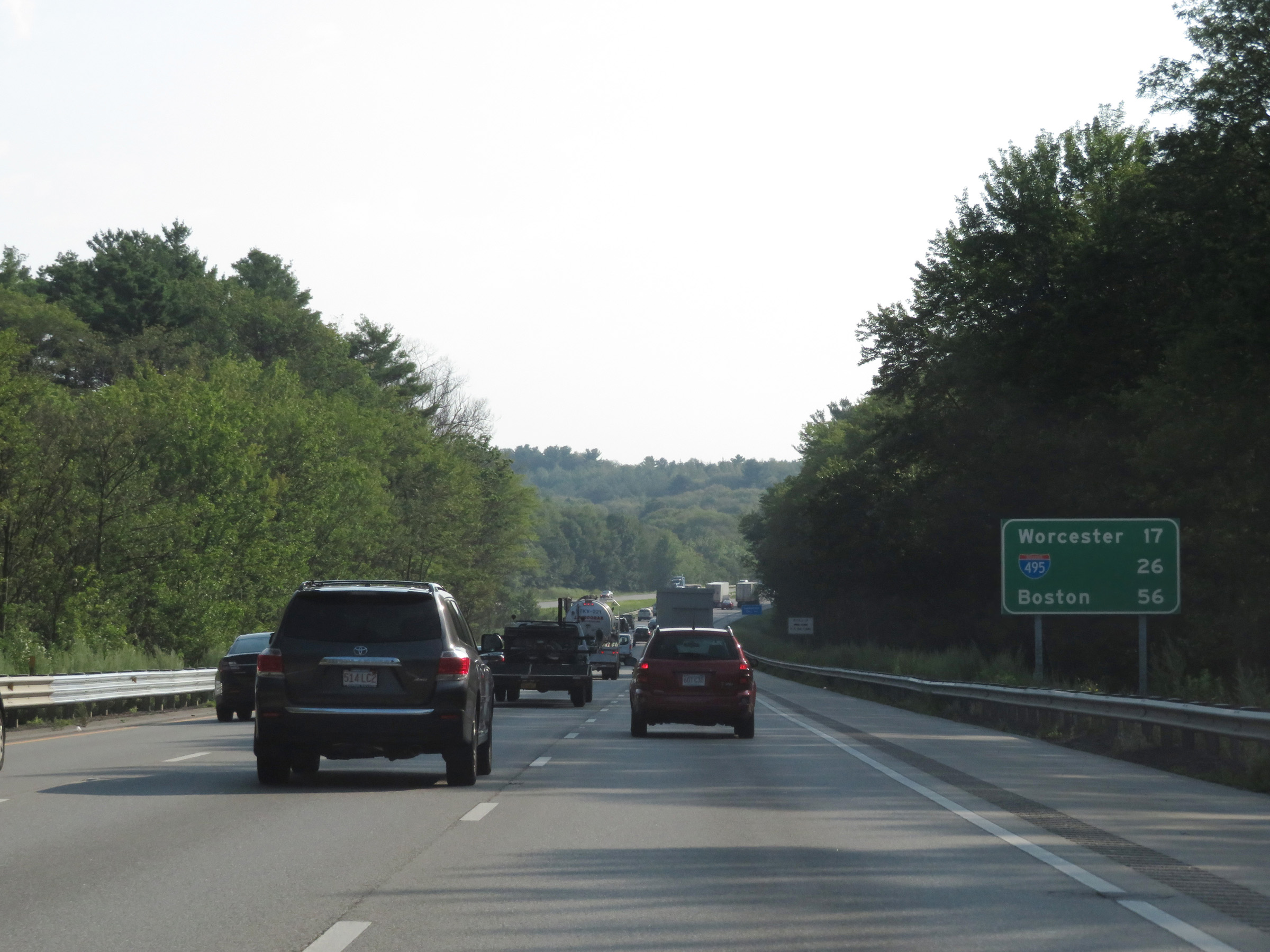 |
Mileage sign on Interstate 90 East (Mass Pike). It's 17 miles to Worcester, 26 miles to the junction of Interstate 495, and 56 miles to Boston. (Photo taken 8/10/17). |
 |
Toll gantry on Interstate 90 East (Mass Pike) in Charlton. (Photo taken 8/10/17). |
 |
View on Interstate 90 East (Mass Pike) in Worcester County. (Photo taken 8/10/17). |
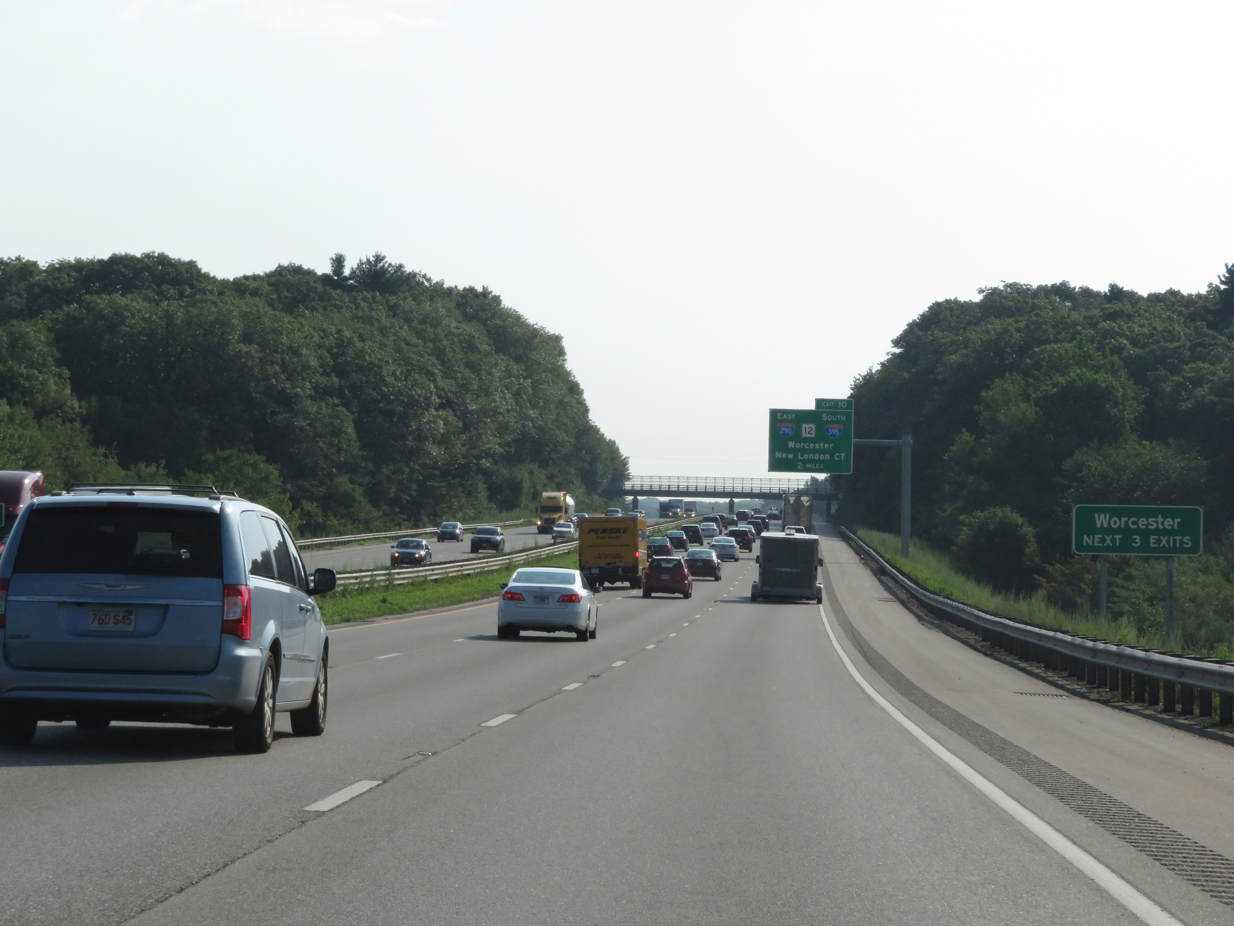 |
Take any of the next 3 exits to Worcester. (Photo taken 8/10/17). |
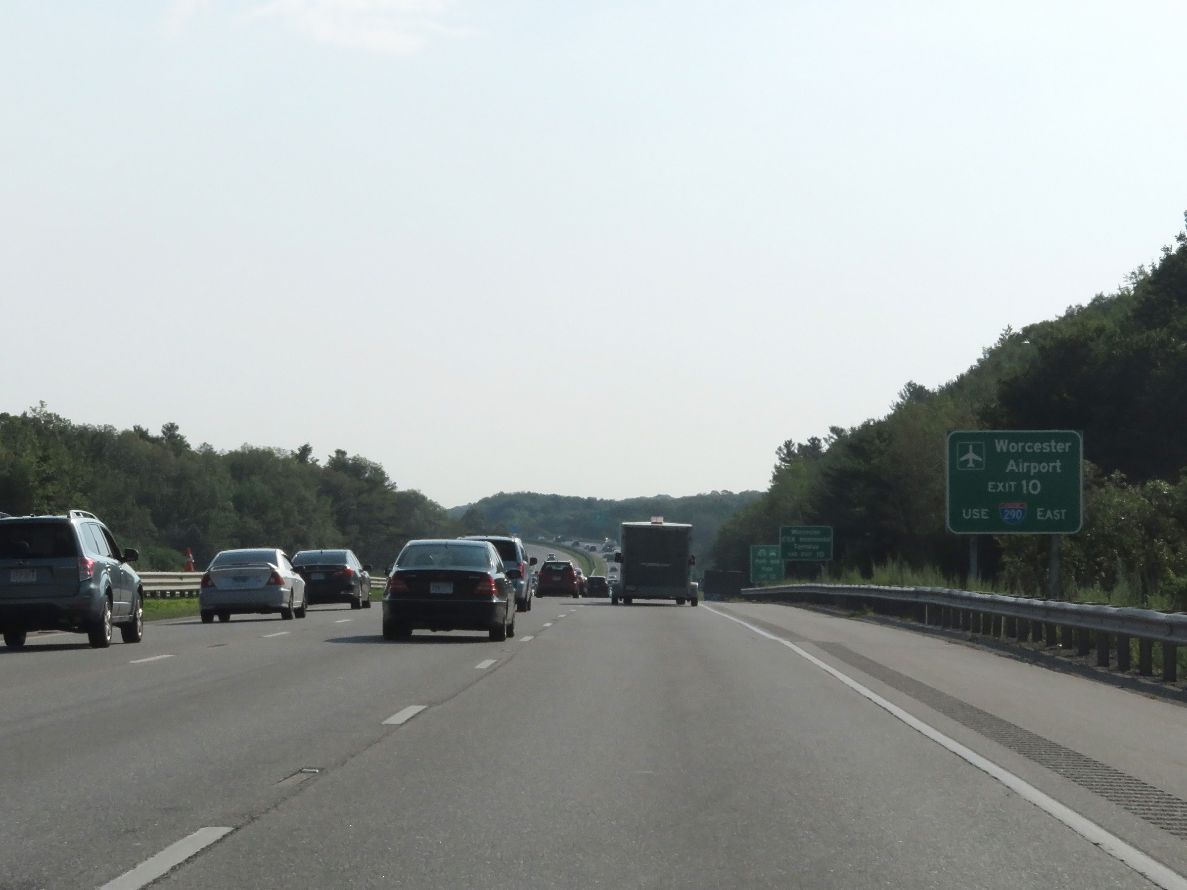 |
Take Exit 10 to Worcester Airport via Interstate 290 East. (Photo taken 8/10/17). |
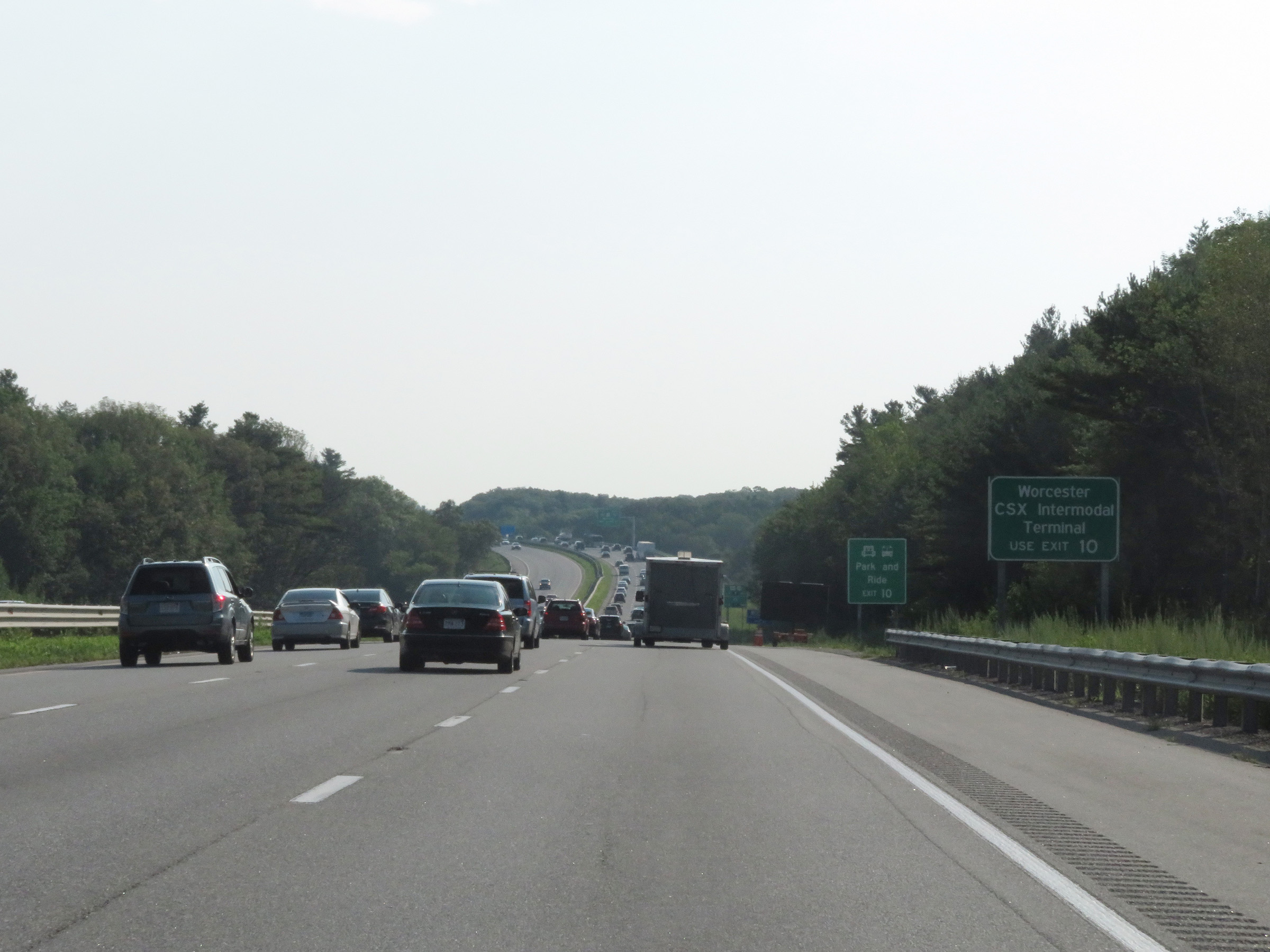 |
Also take Exit 10 to the Worcester CSX Intermodal Terminal. (Photo taken 8/10/17). |
 |
Interstate 90 East (Mass Pike) approaching Exit 10 - 1 mile. (Photo taken 8/10/17). |
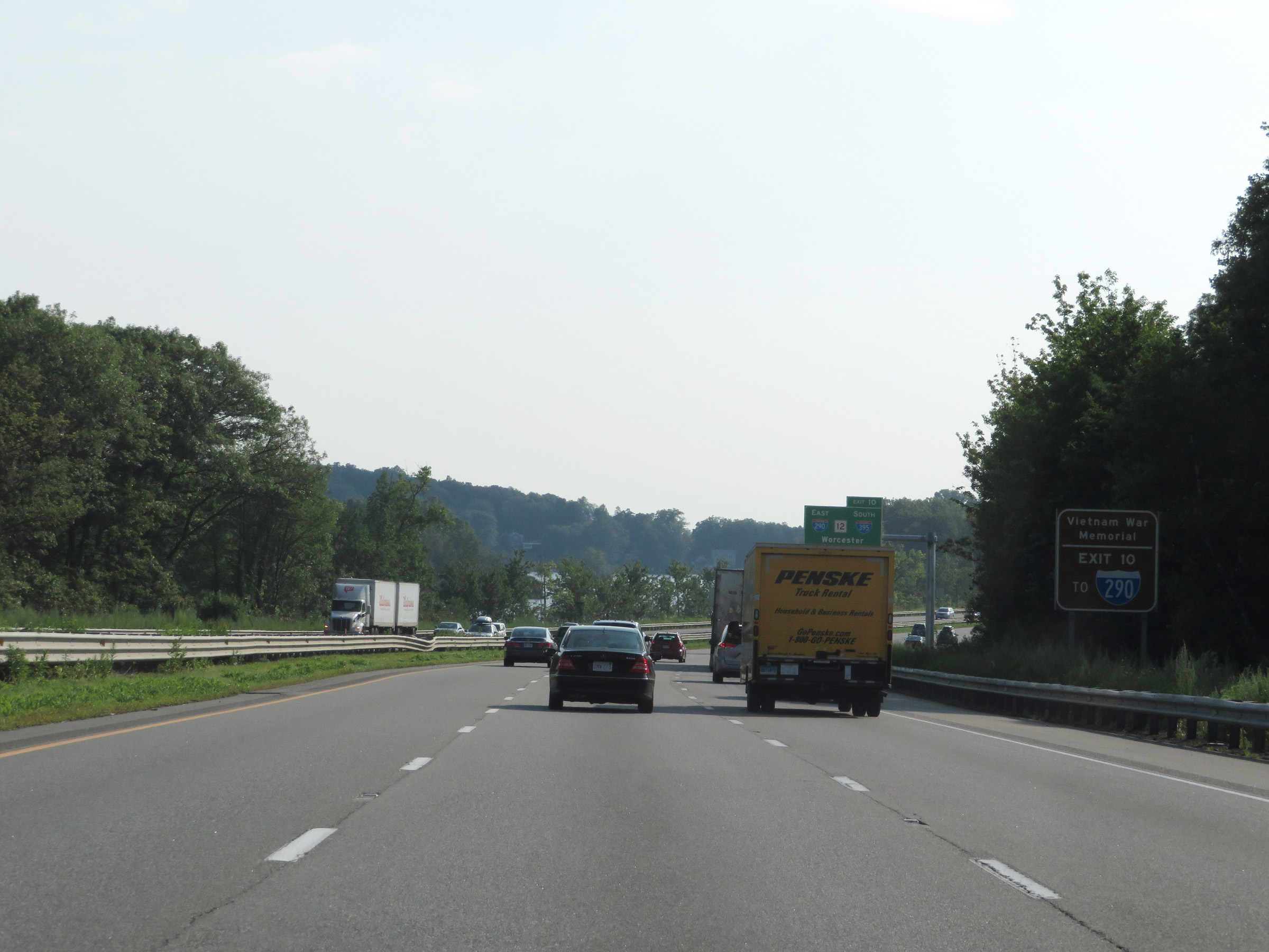 |
Take Exit 10 to the Vietnam War Memorial as well. (Photo taken 8/10/17). |
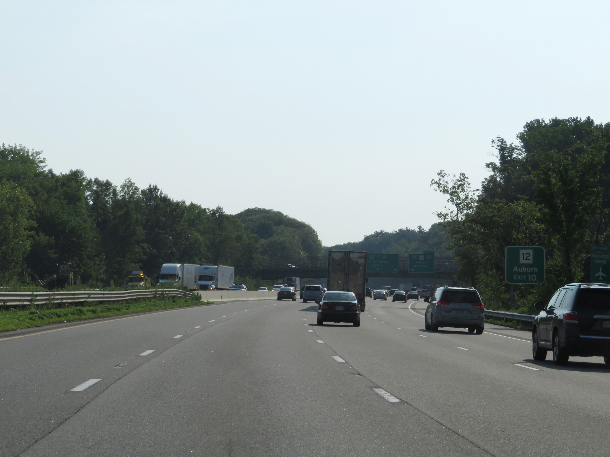 |
MA 12 to Auburn can also be accessed via Exit 10 ahead. (Photo taken 8/10/17). |
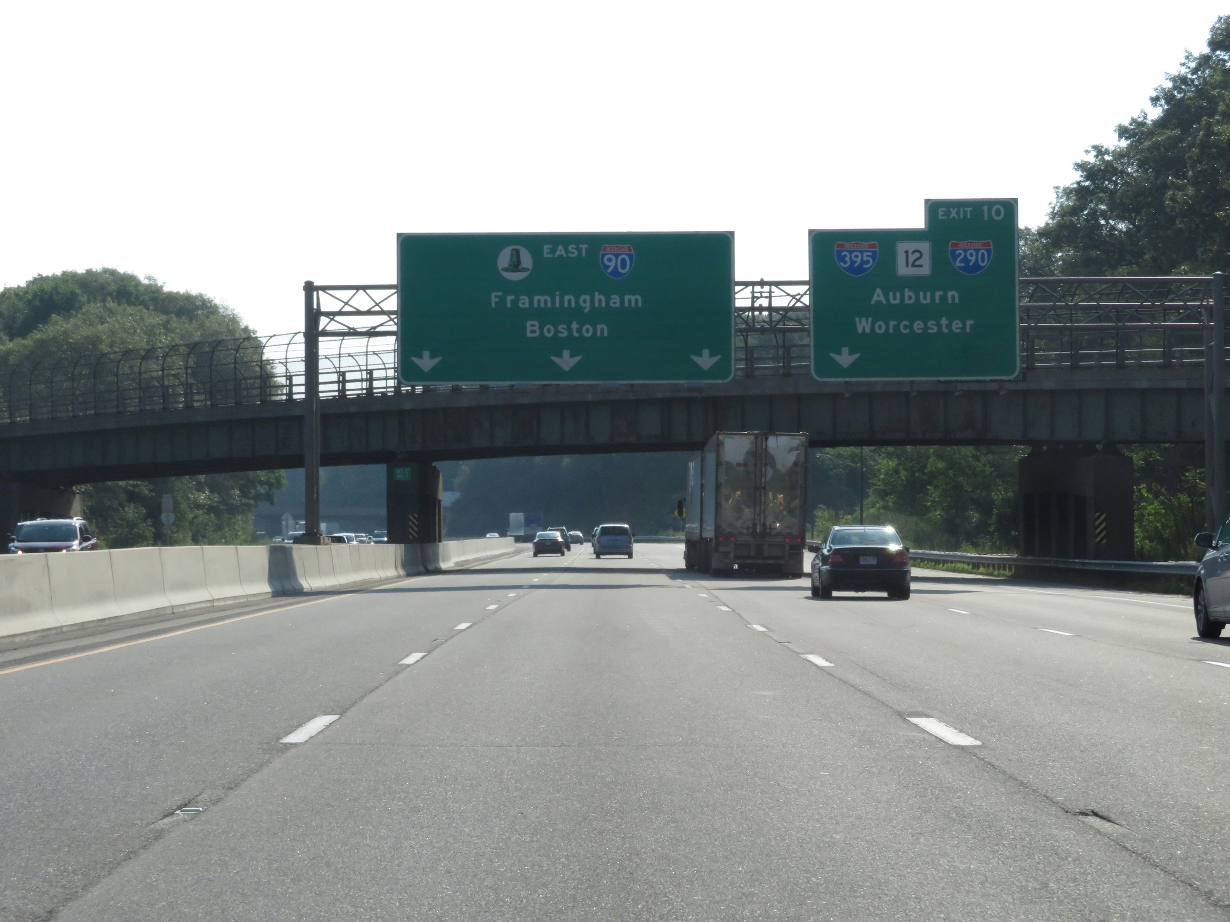 |
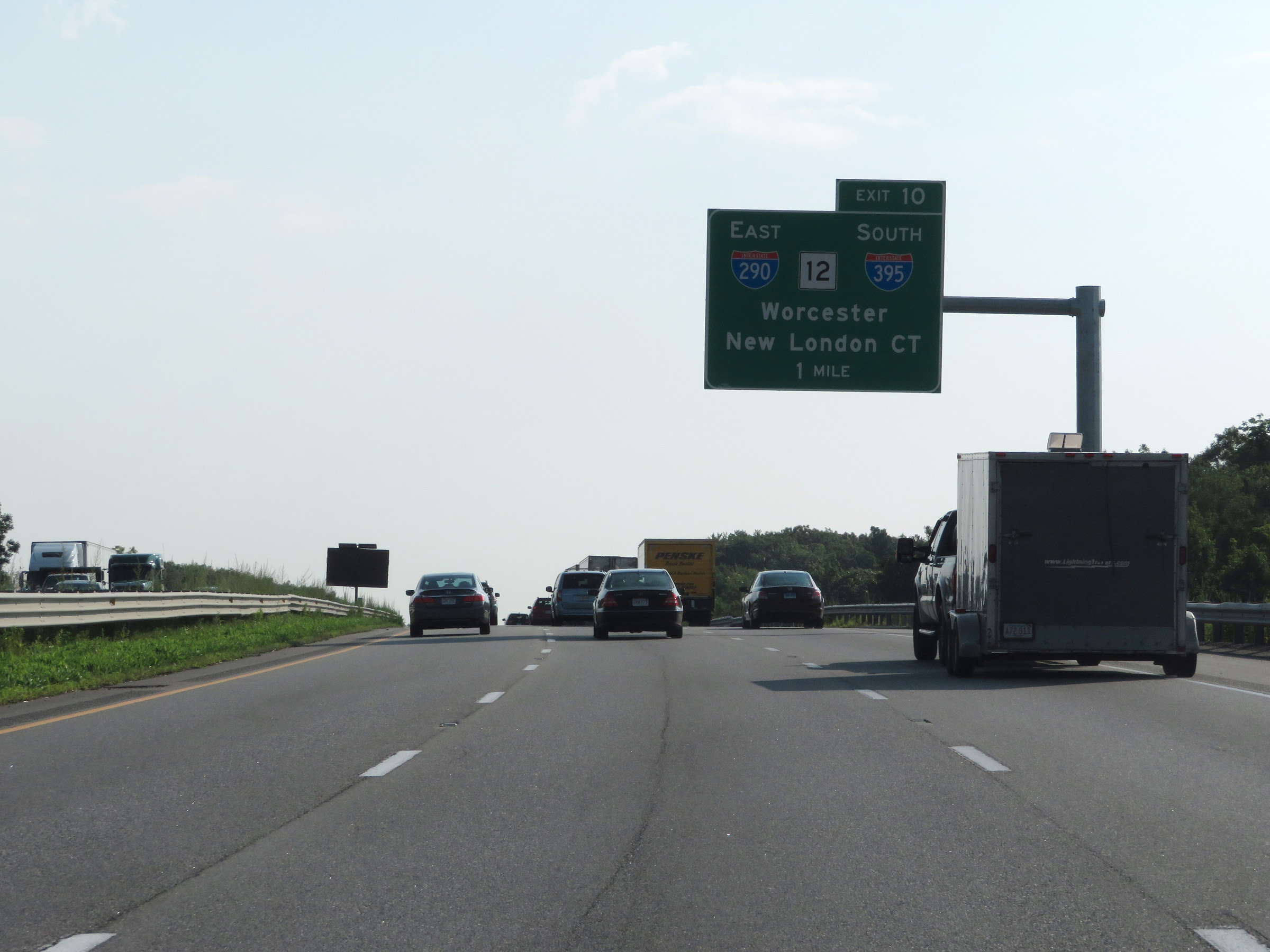
Interstate 90 East (Mass Pike) at Exit 10: Interstate 395 / Interstate 290 / MA 12 - Auburn / Worcester (Photo taken 8/10/17). |
 |
View on Interstate 90 East (Mass Pike) at mile marker 90. (Photo taken 8/10/17). |
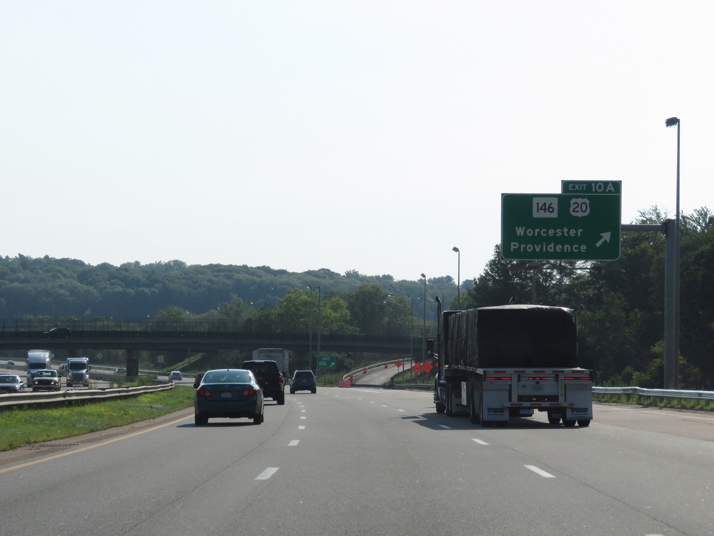 |
Interstate 90 East (Mass Pike) at Exit 10A: MA 146 / US 20 - Worcester / Providence (Photo taken 8/10/17). |
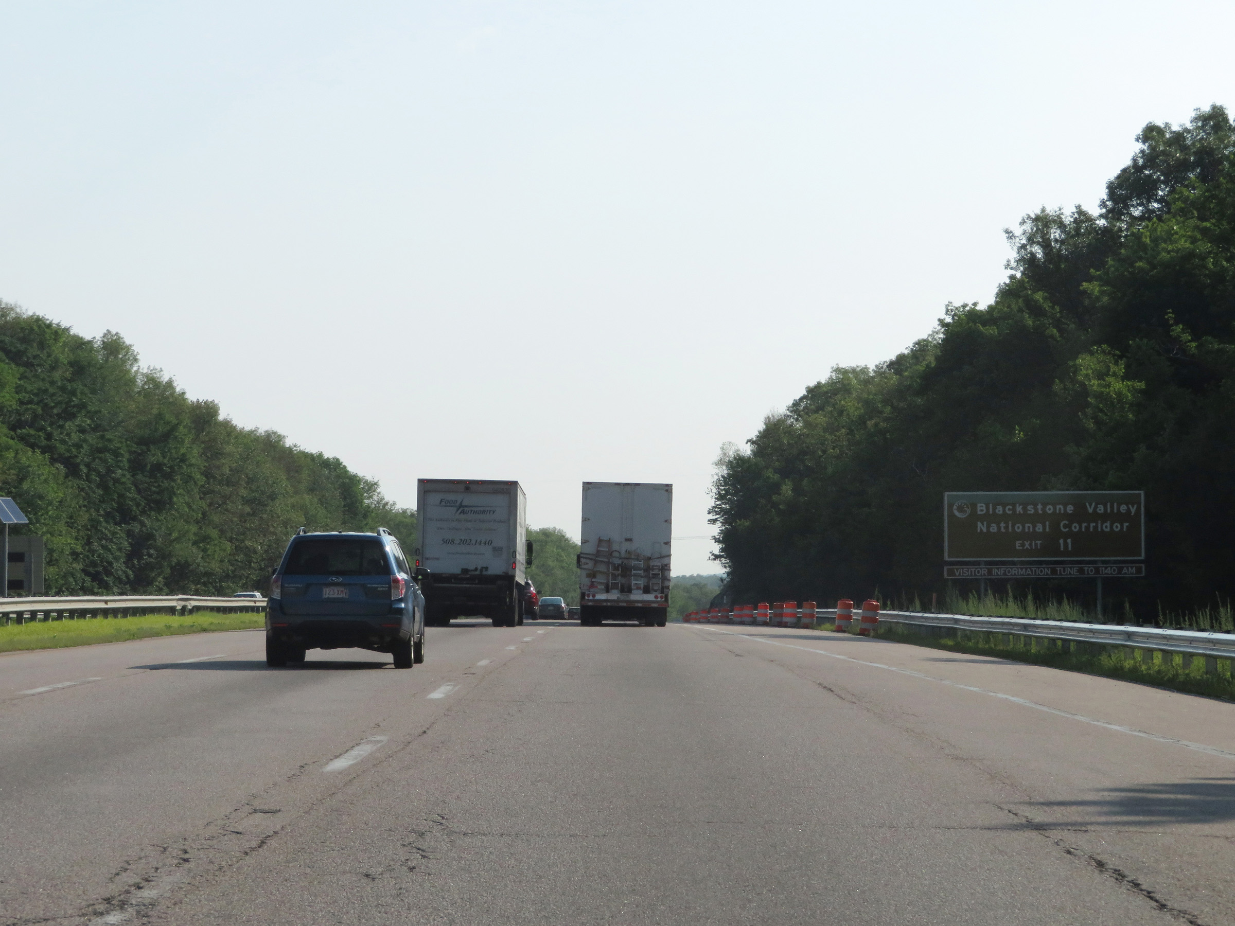 |
Take Exit 11 to Blackstone Valley National Corridor. (Photo taken 8/10/17). |
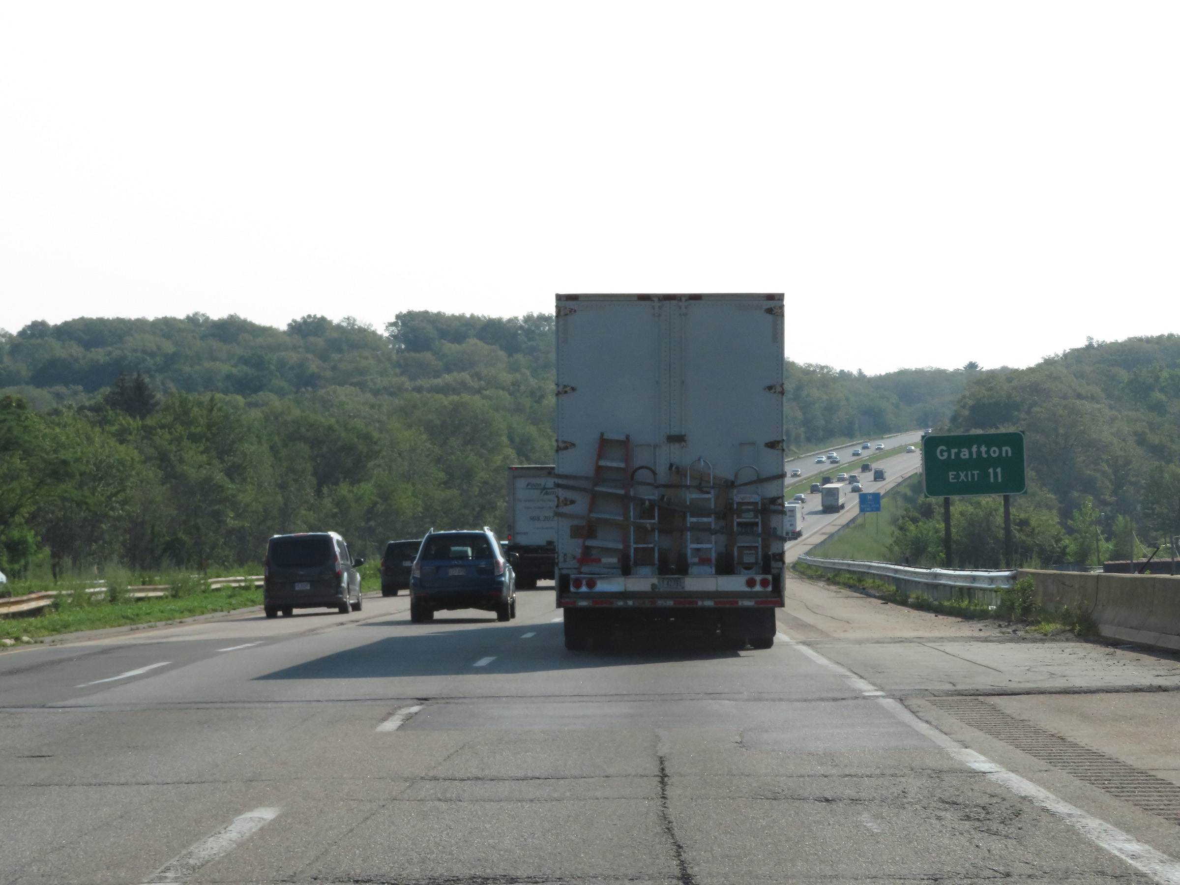 |
Also take Exit 11 to Grafton. (Photo taken 8/10/17). |
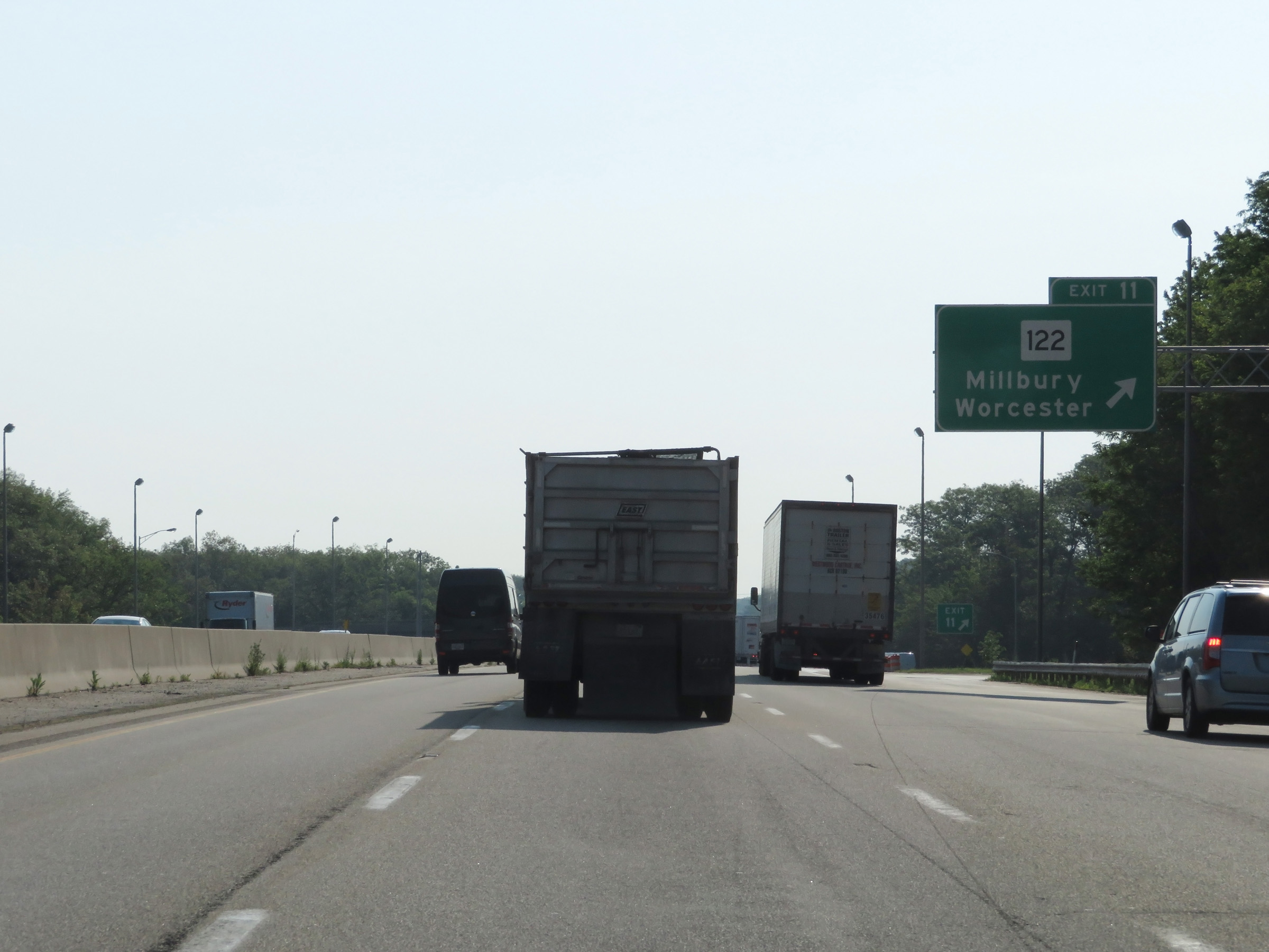 |
Interstate 90 East (Mass Pike) at Exit 11: MA 122 - Millbury / Worcester (Photo taken 8/10/17). |
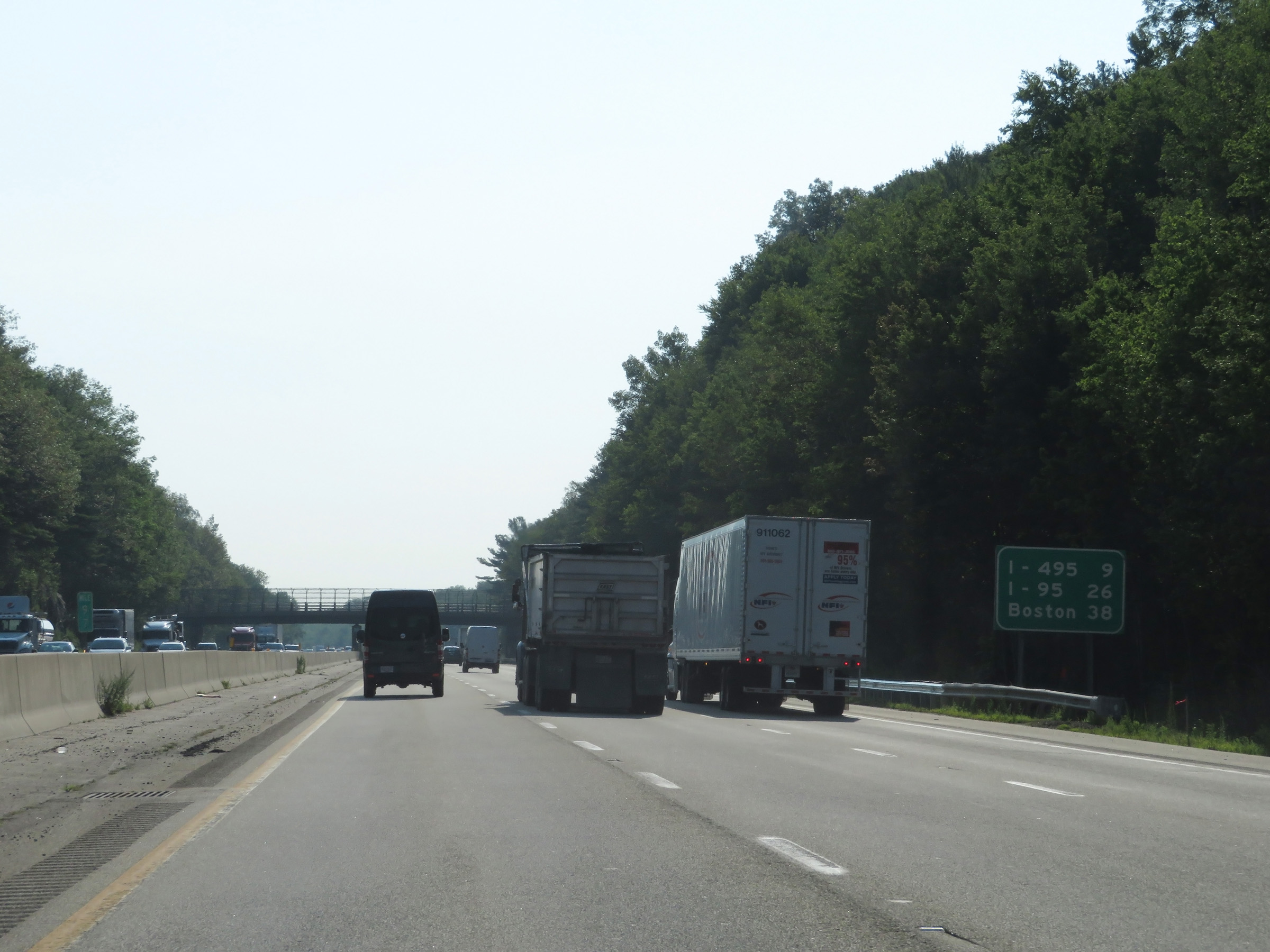 |
Mileage sign on Interstate 90 East (Mass Pike). It's 9 miles to the junction of Interstate 495, 26 miles to the junction of Interstate 95, and 38 miles to Boston. (Photo taken 8/10/17). |
 |
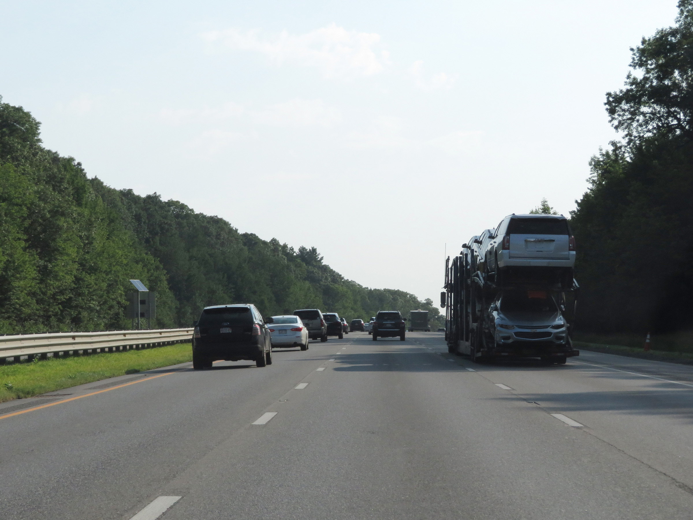
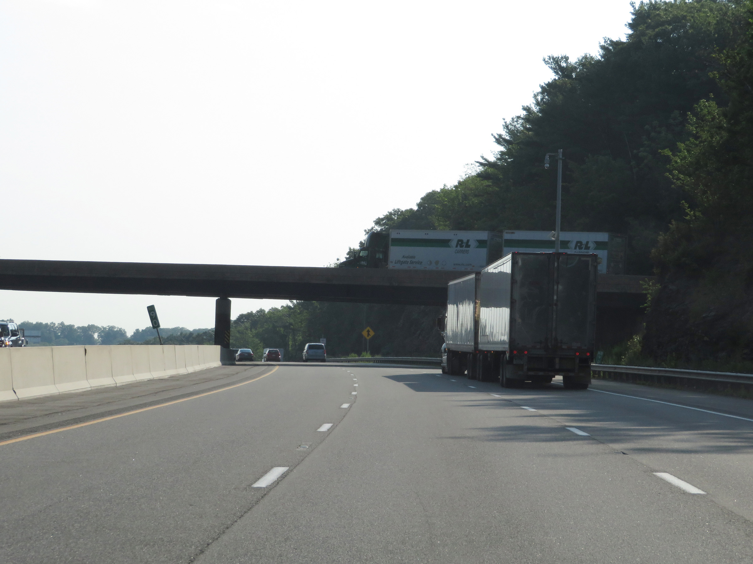
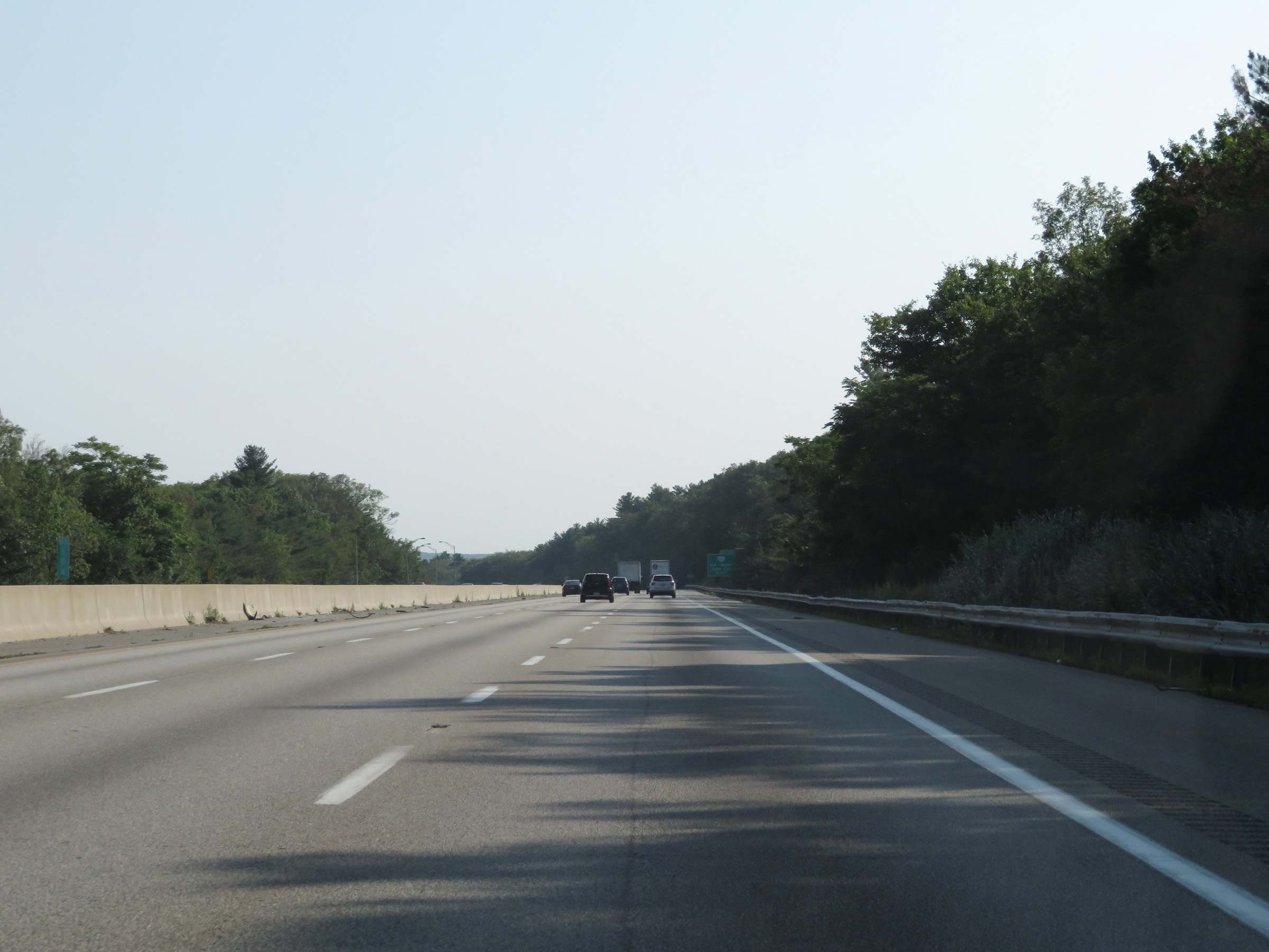
View on Interstate 90 East (Mass Pike) in Worcester County. (Photo taken 8/10/17). |
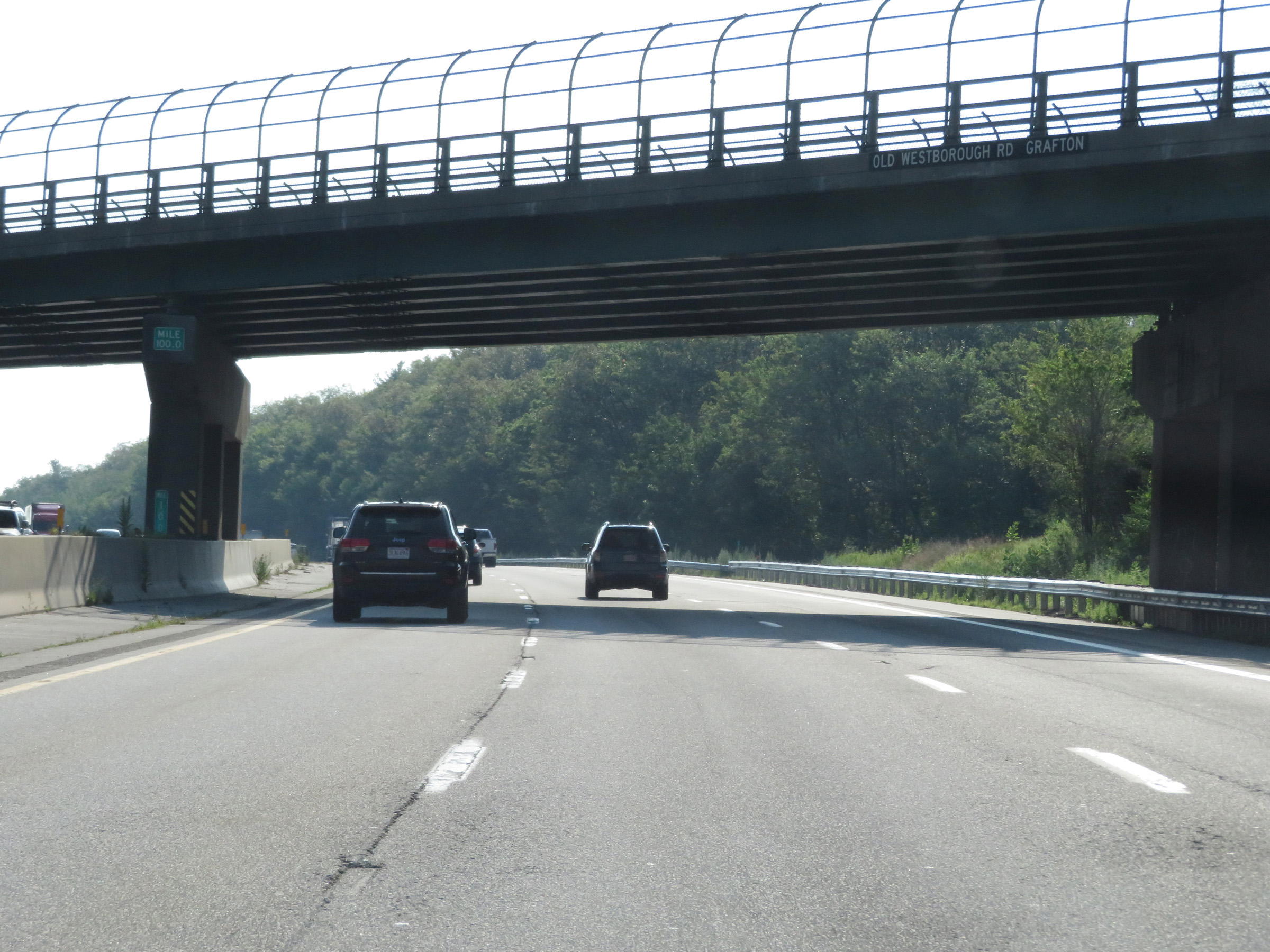 |
Interstate 90 East (Mass Pike) at mile marker 100. (Photo taken 8/10/17). |
 |
View on Interstate 90 East (Mass Pike) at mile marker 100.9. (Photo taken 8/10/17). |
 |
Interstate 90 East (Mass Pike) at mile marker 104. (Photo taken 8/10/17). |
 |
Electronic toll gantry in Hopkinton along with a sign displaying the toll rates which apply to it. (Photo taken 8/10/17). |
 |
Interstate 90 East (Mass Pike) approaching Exit 11A - 1 mile. (Photo taken 8/10/17). |
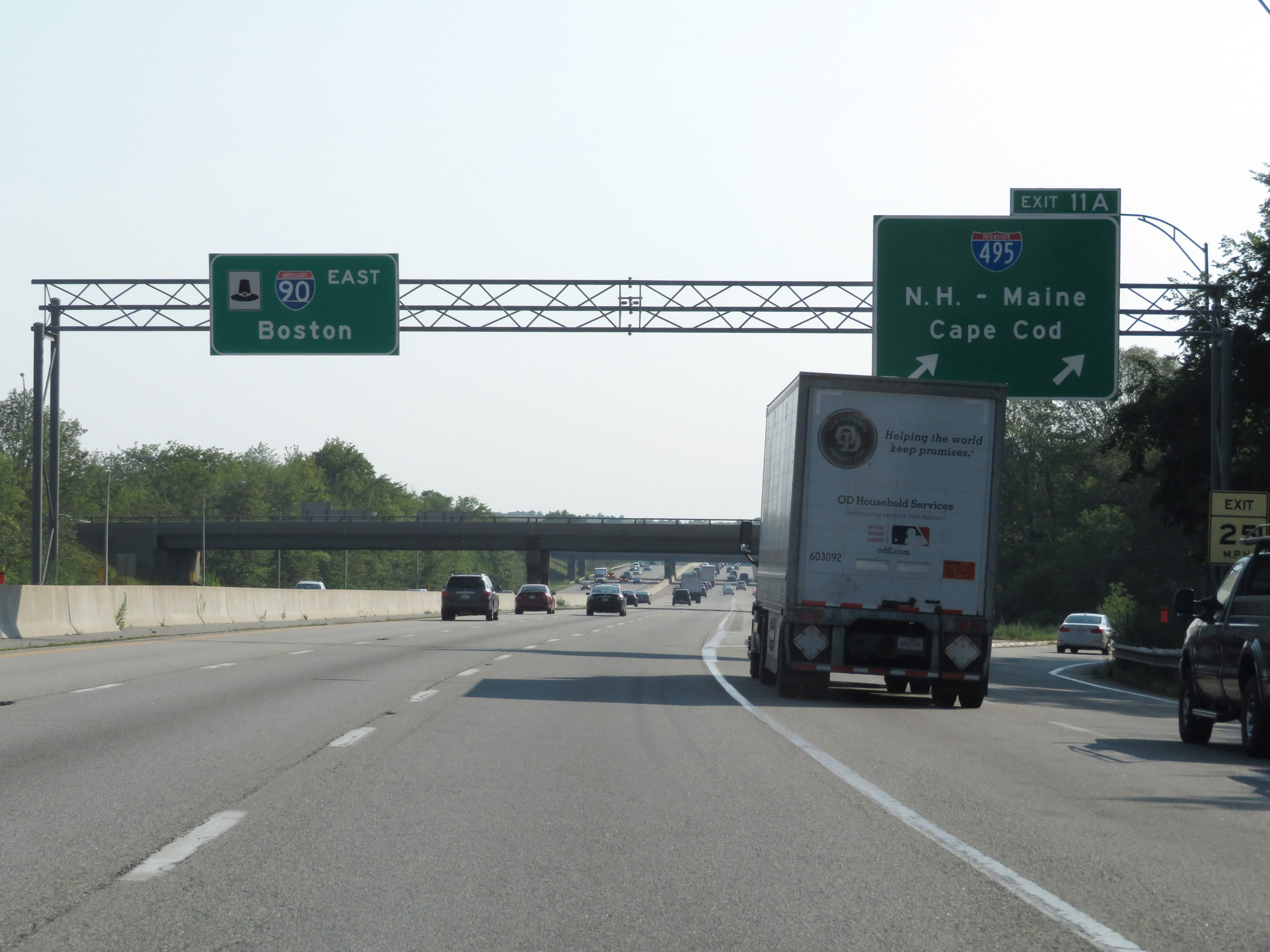 |
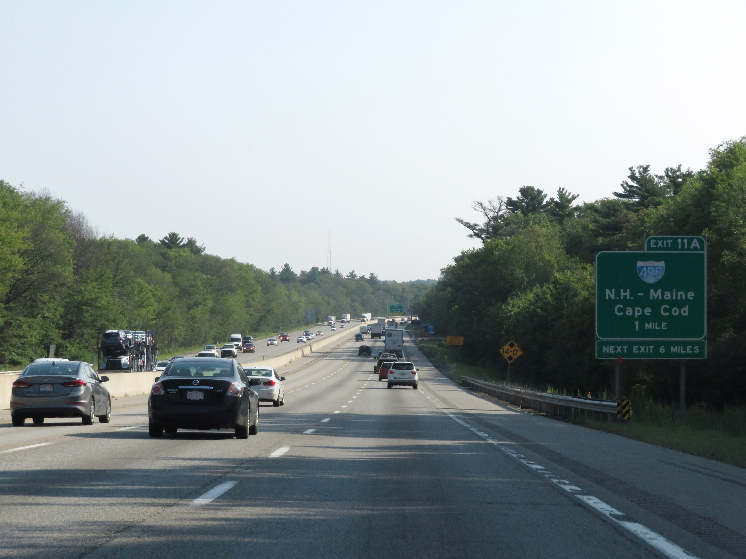
Interstate 90 East (Mass Pike) at Exit 11A: Interstate 495 - New Hampshire-Maine / Cape Cod (Photo taken 8/10/17). |
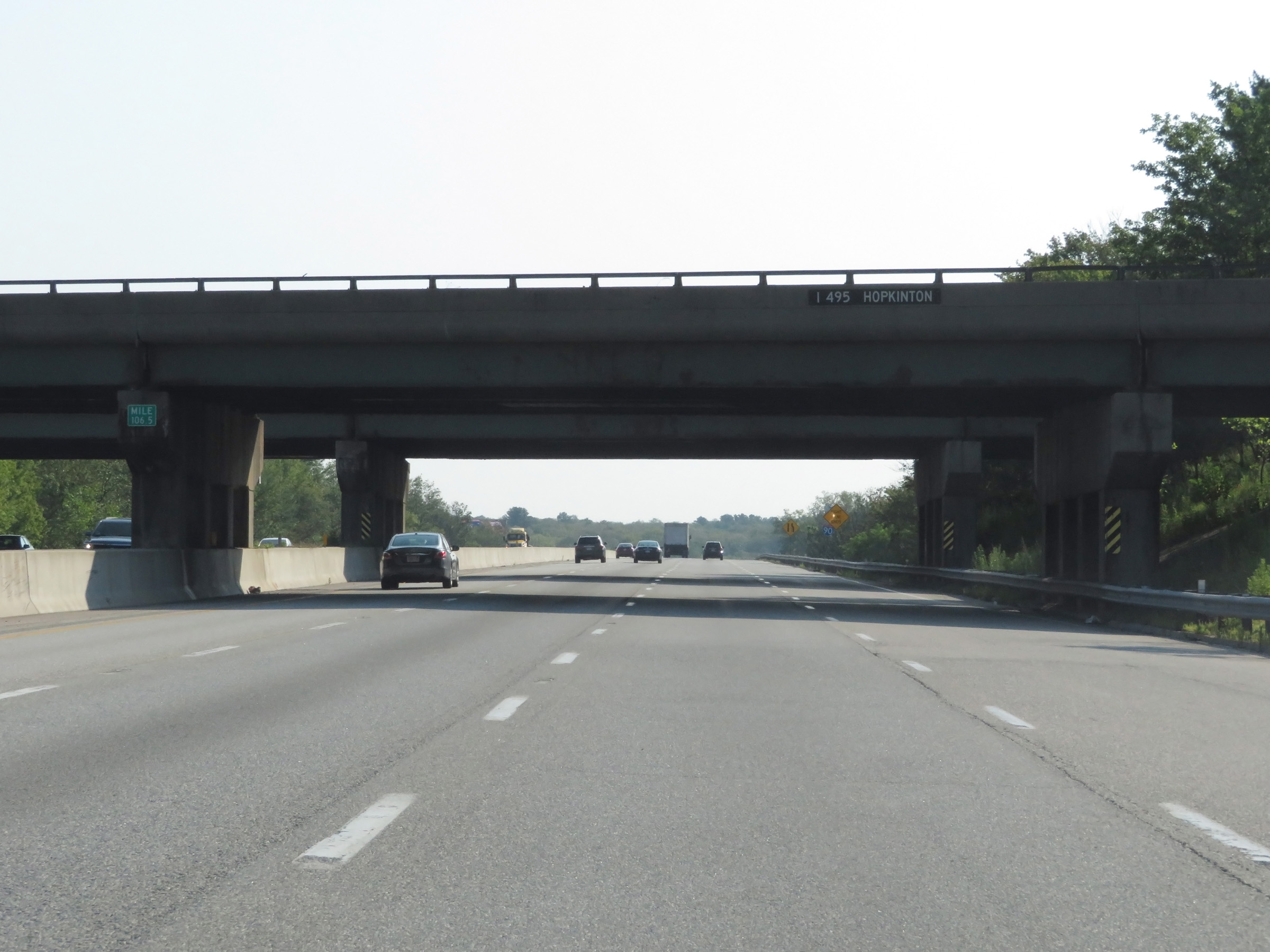 |
View on Interstate 90 East (Mass Pike) at mile marker 106.5 as it passes under Interstate 495 in Hopkinton. (Photo taken 8/10/17). |
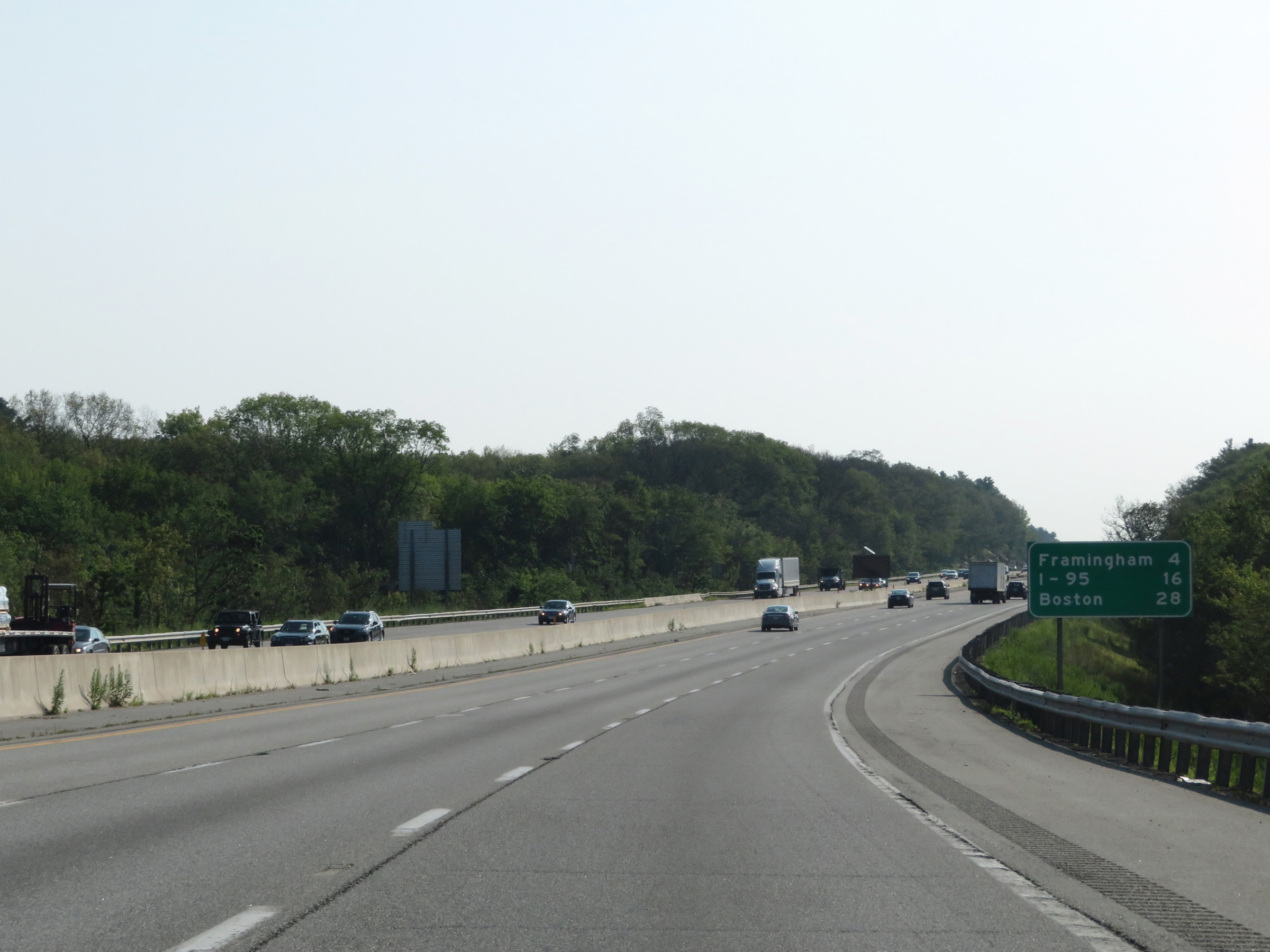 |
Another mileage sign on Interstate 90 East (Mass Pike). It's 4 miles to Framingham, 16 miles to the junction of Interstate 95, and 28 miles to Boston. (Photo taken 8/10/17). |
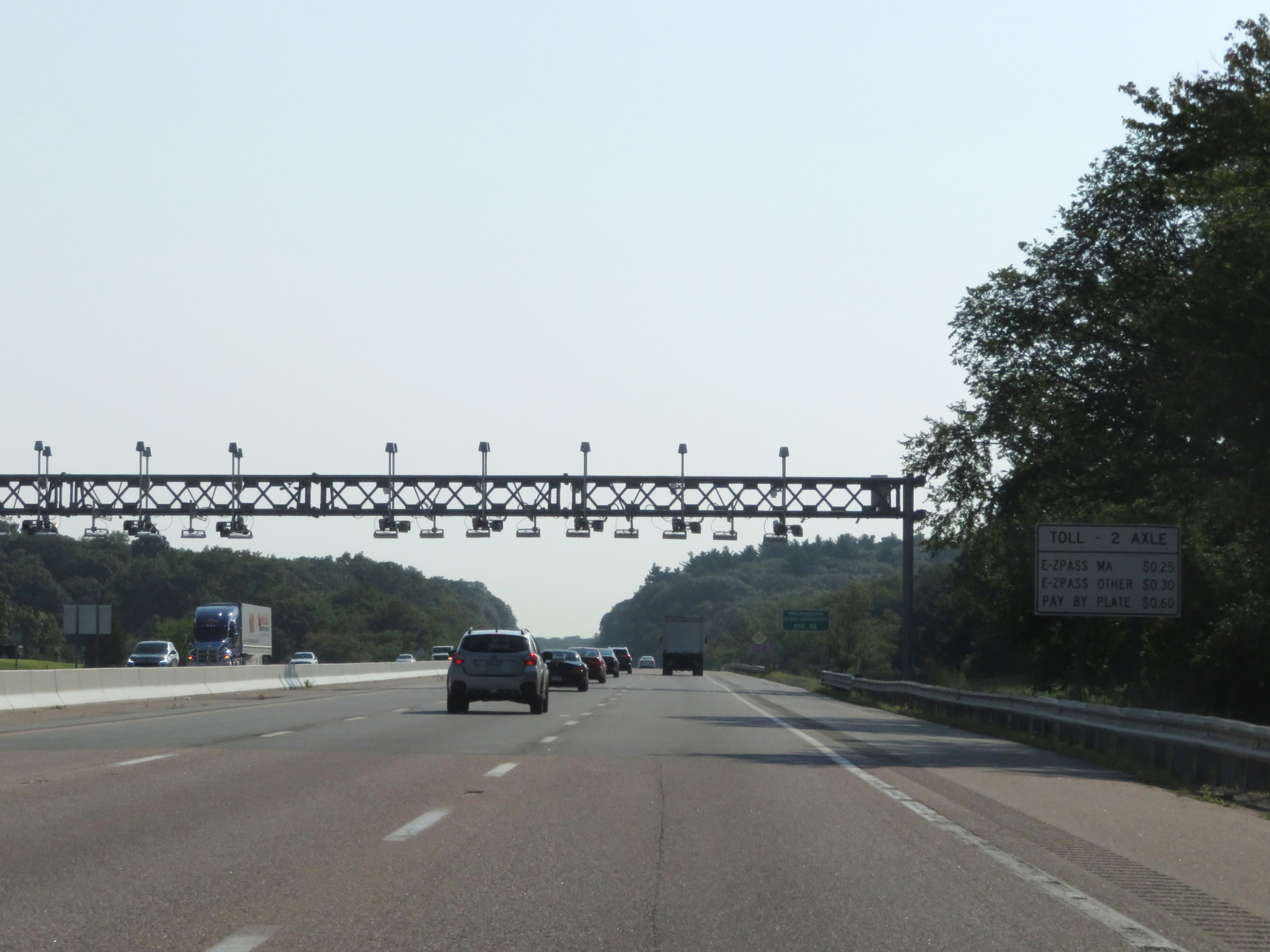 |
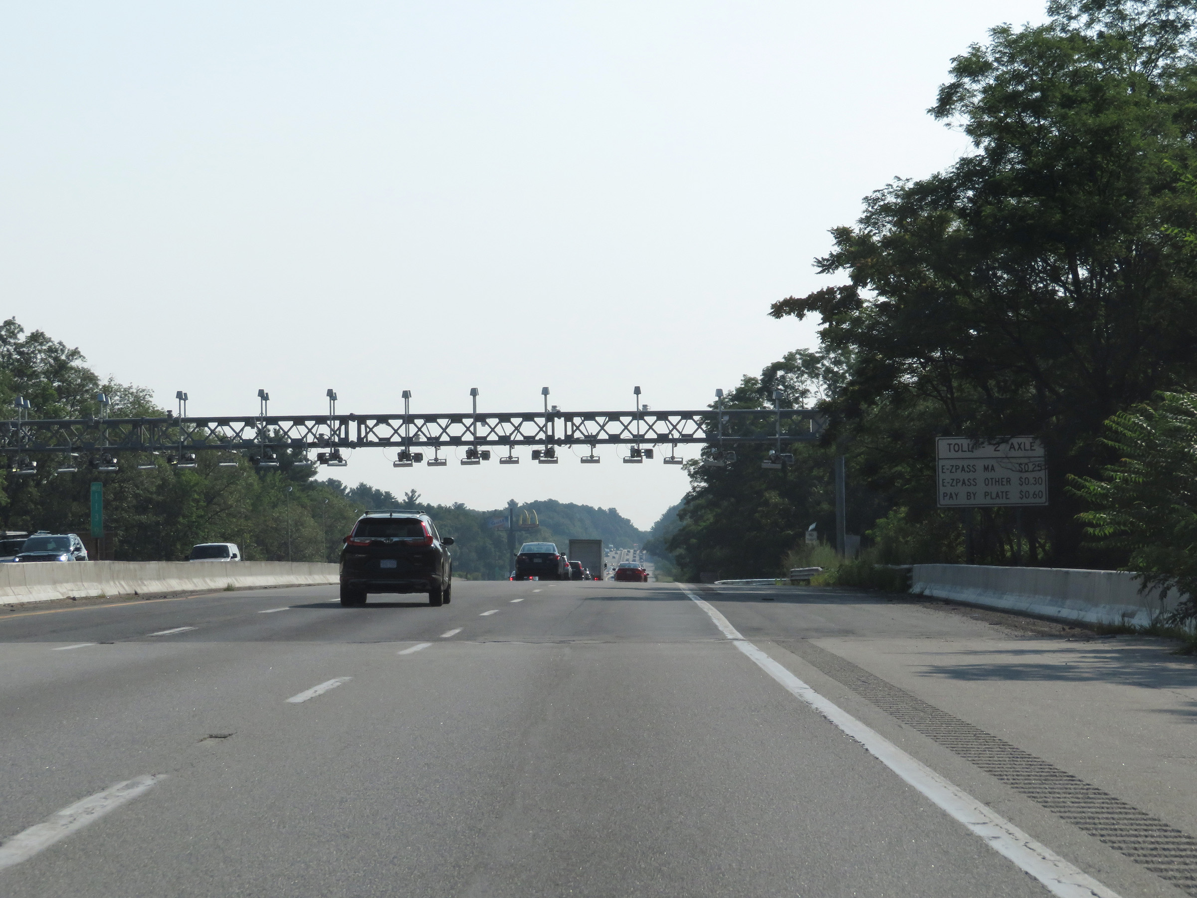
Toll gantry in Southborough with its accompanying signage displaying the toll rates charged by it. (Photo taken 8/10/17). |
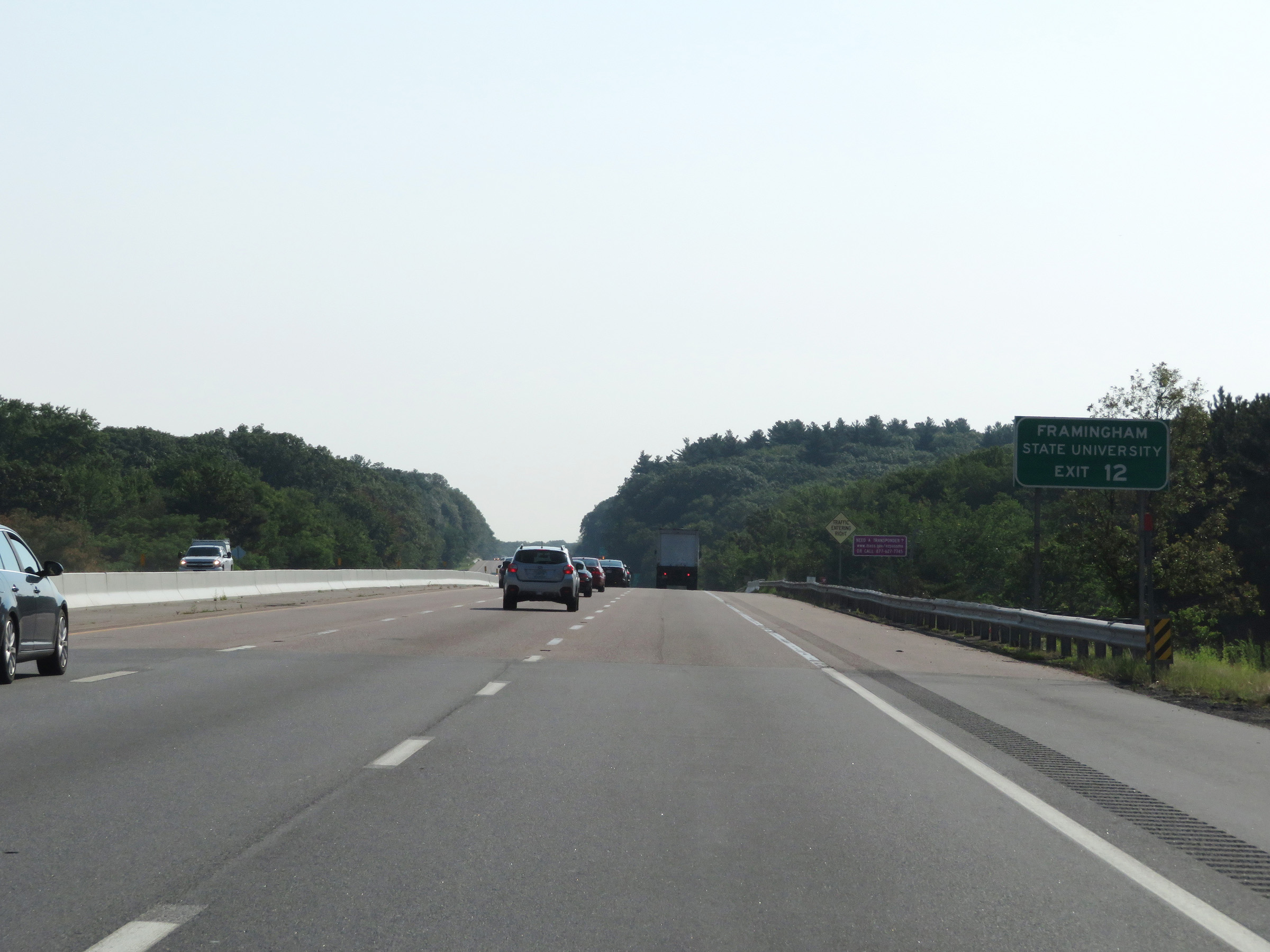 |
Take Exit 12 to Framingham State University. (Photo taken 8/10/17). |
 |
Interstate 90 East (Mass Pike) at Exit 12: MA 9 - Framingham (Photo taken 8/10/17). |
 |
Toll gantry in Framingham on Interstate 90 East (Mass Pike), along with signage showing the rates charged at it. (Photo taken 8/10/17). |
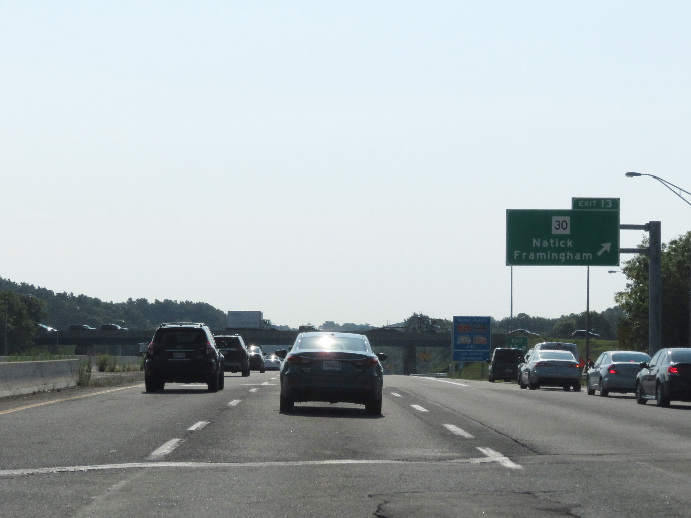 |
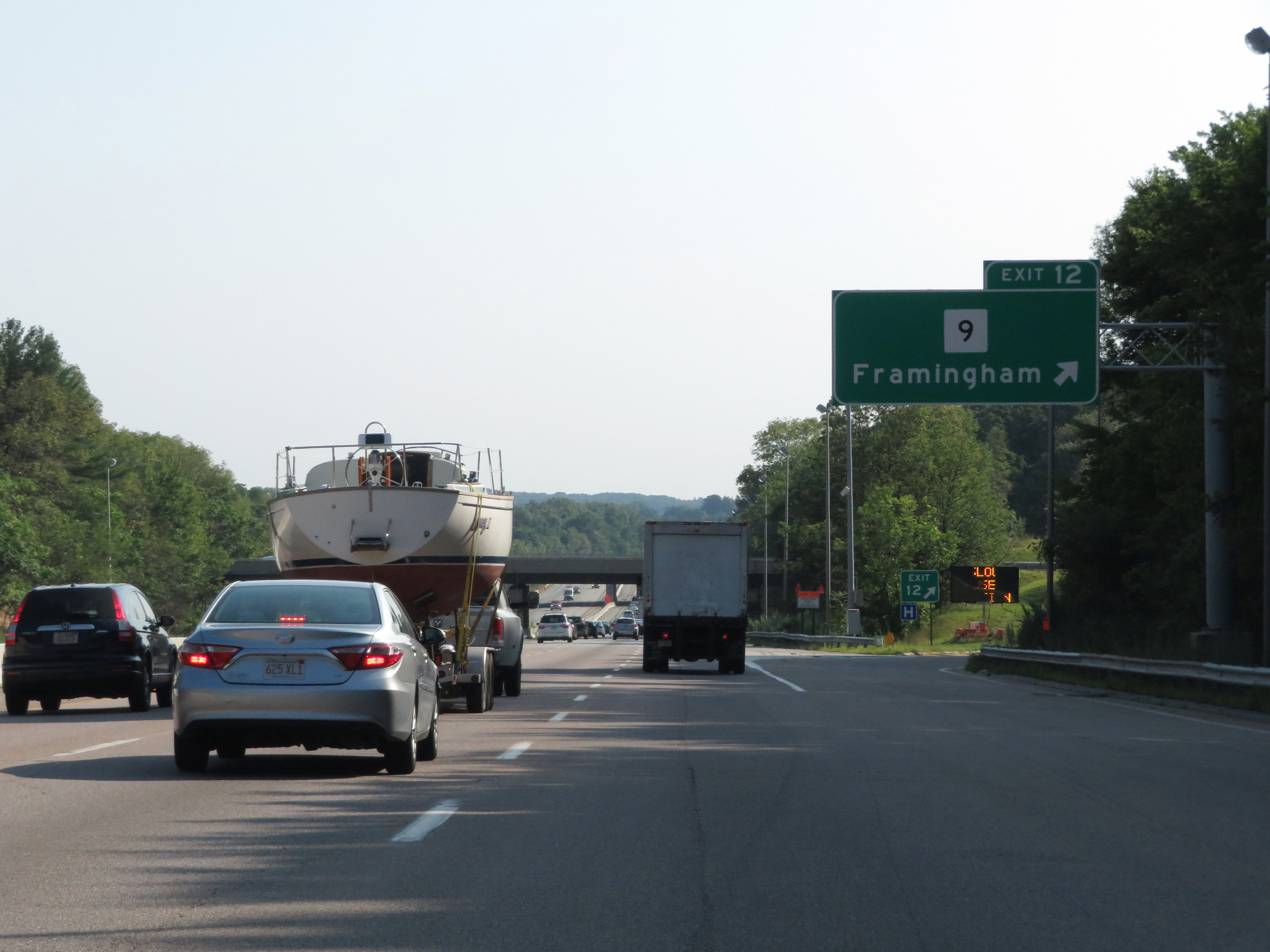
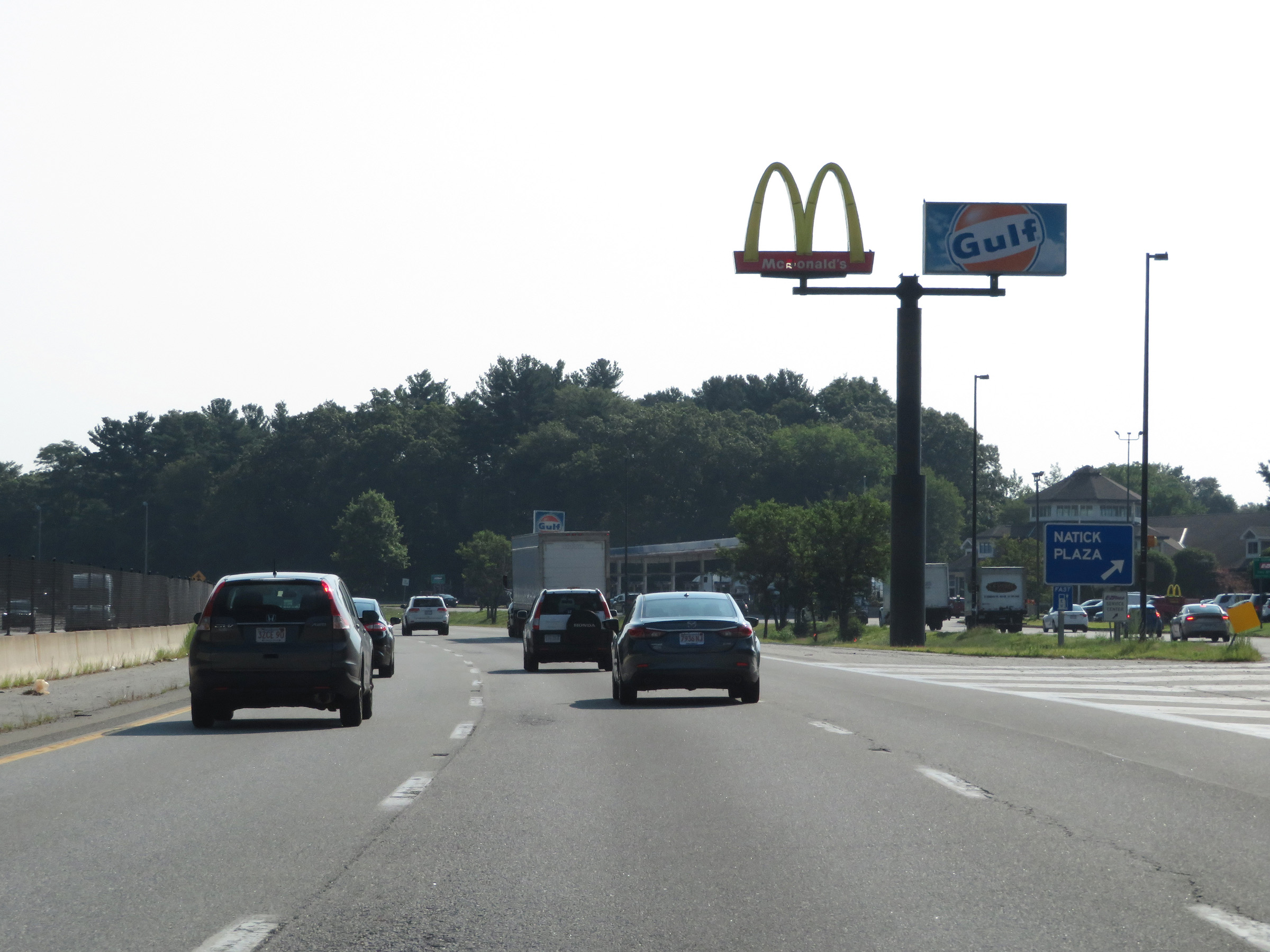
Interstate 90 East (Mass Pike) at Exit 13: MA 30 - Natick / Framingham (Photo taken 8/10/17). |
Section 2: Framingham (Exit 13) to Boston
 |
Interstate 90 East (Mass Pike) at the Natick Service Plaza. (Photo taken 8/10/17). |
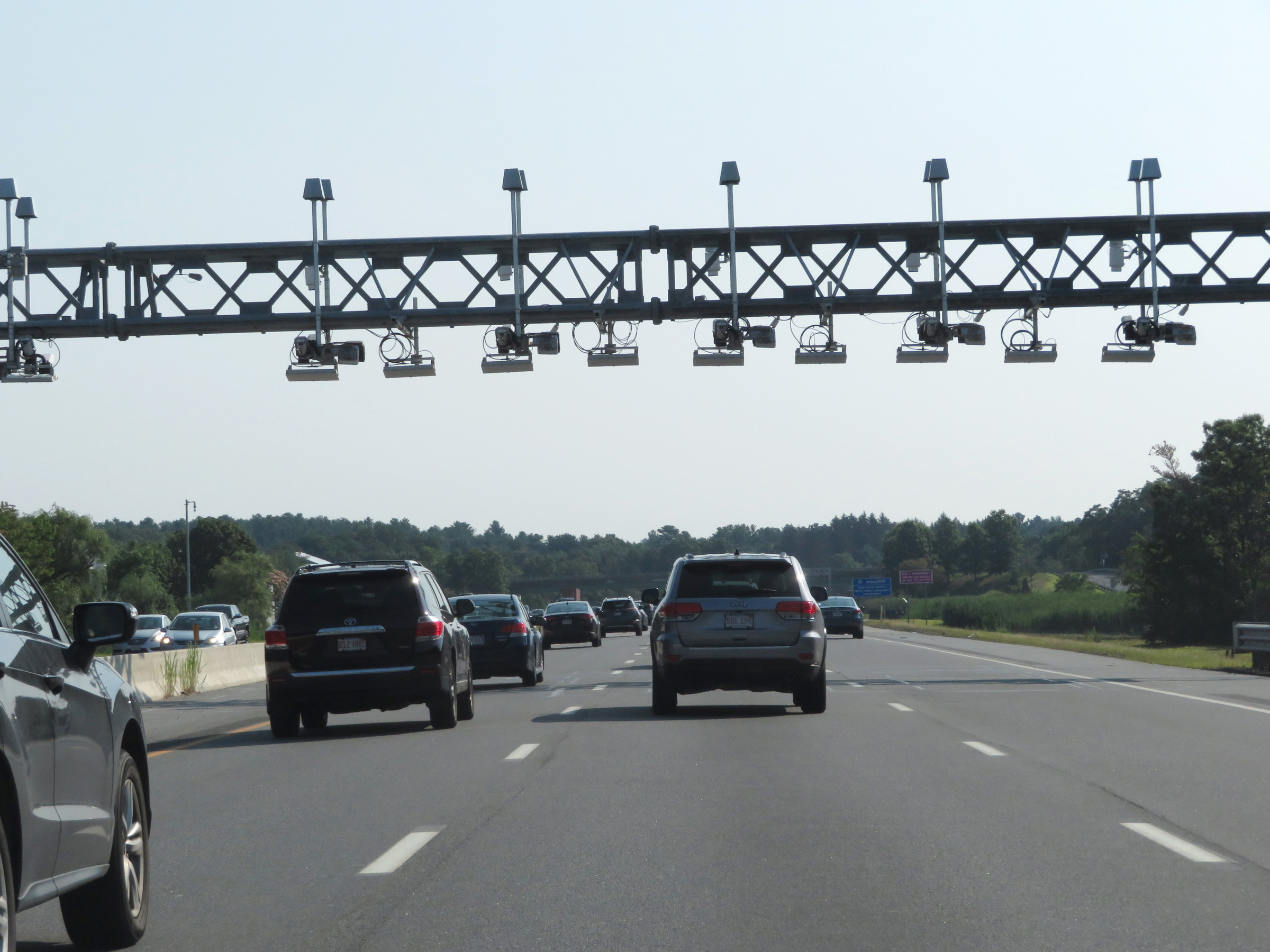 |
Another toll gantry on Interstate 90 East (Mass Pike) as it approaches Weston. (Photo taken 8/10/17). |
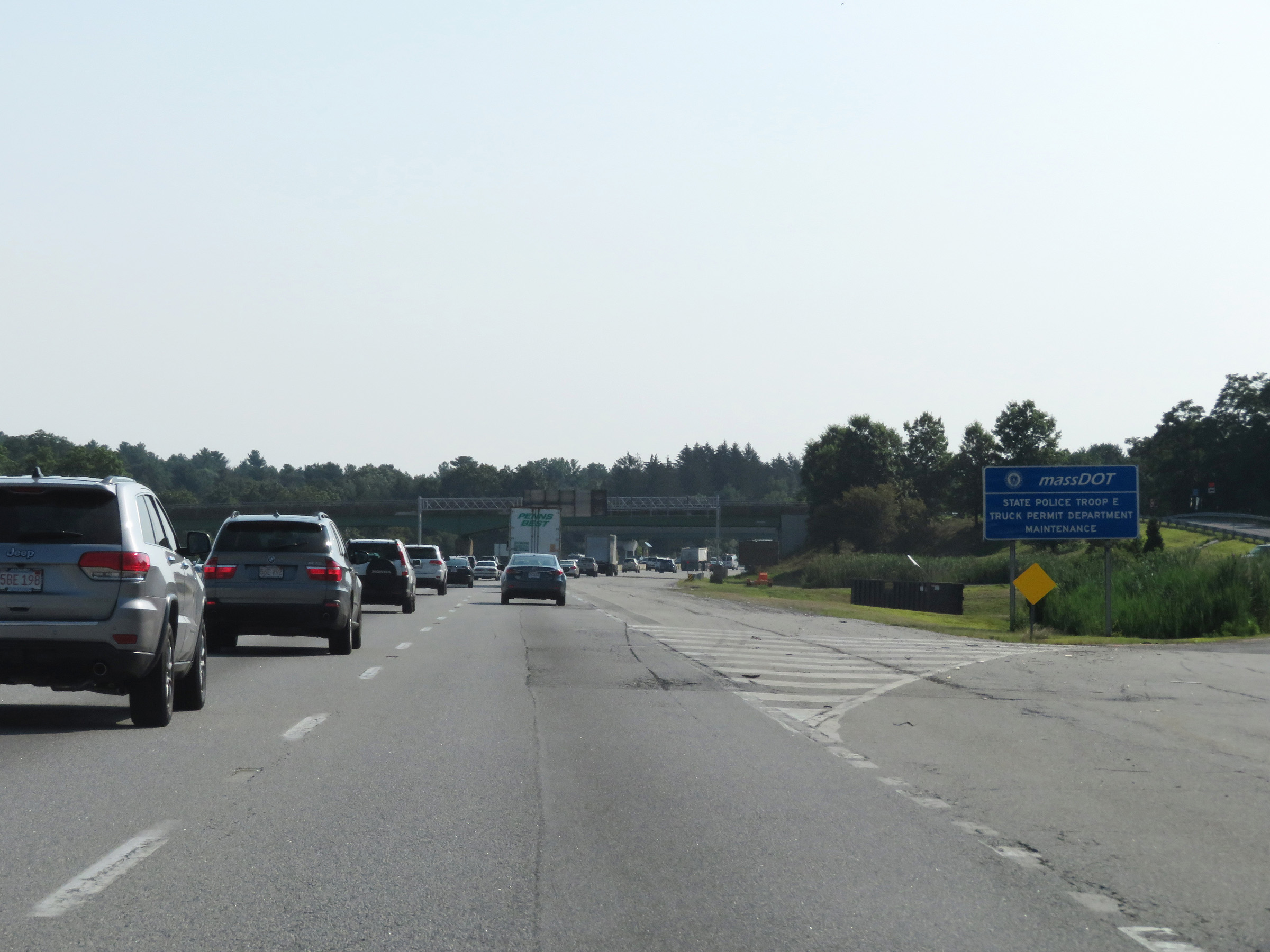 |
The eastbound lanes of Interstate 90 (Mass Pike) provide access to the Troop E State Police barracks in Weston via this ramp. (Photo taken 8/10/17). |
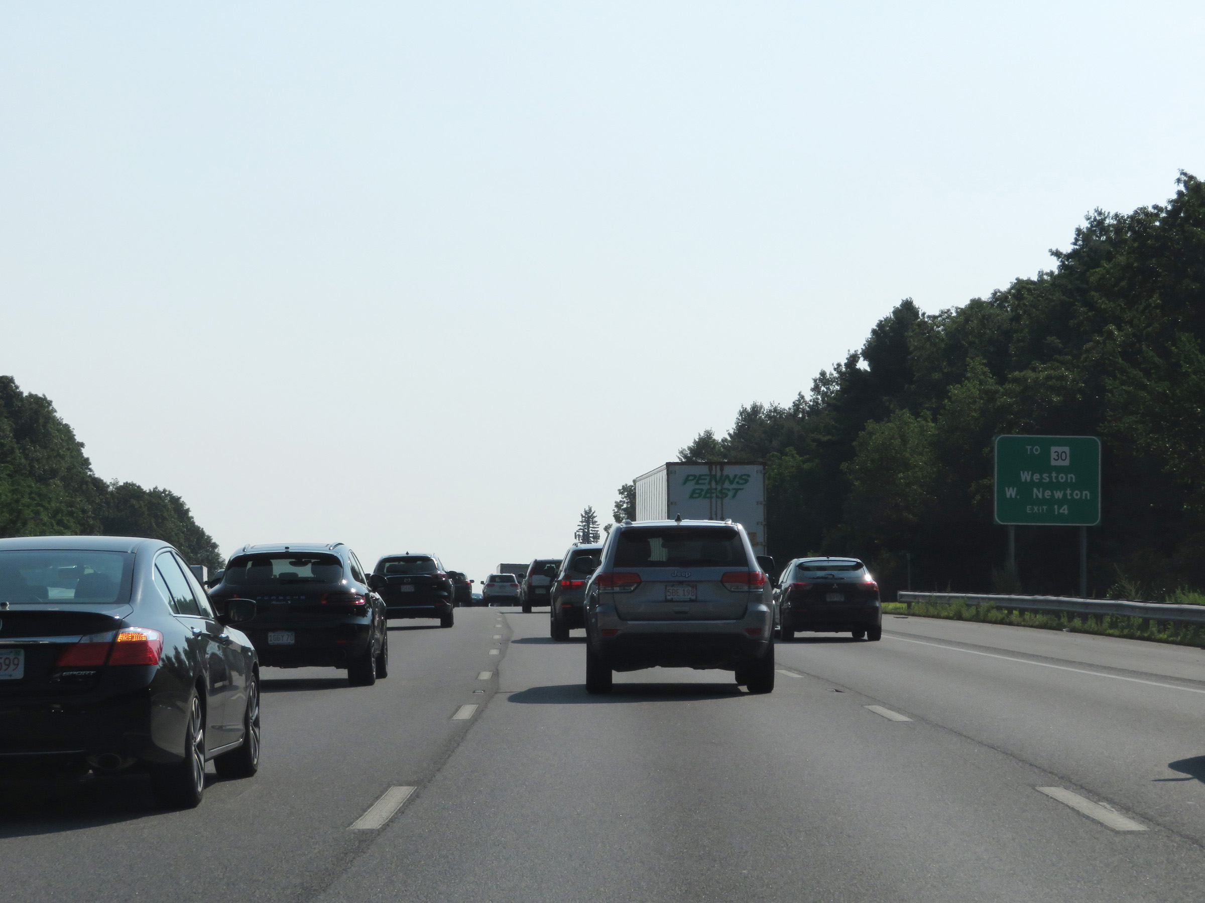 |
Take Exit 14 to MA 30 toward Weston and West Newton. (Photo taken 8/10/17). |
 |
Interstate 90 East (Mass Pike) approaching Exit 14 - 1 mile. (Photo taken 8/10/17). |
 |
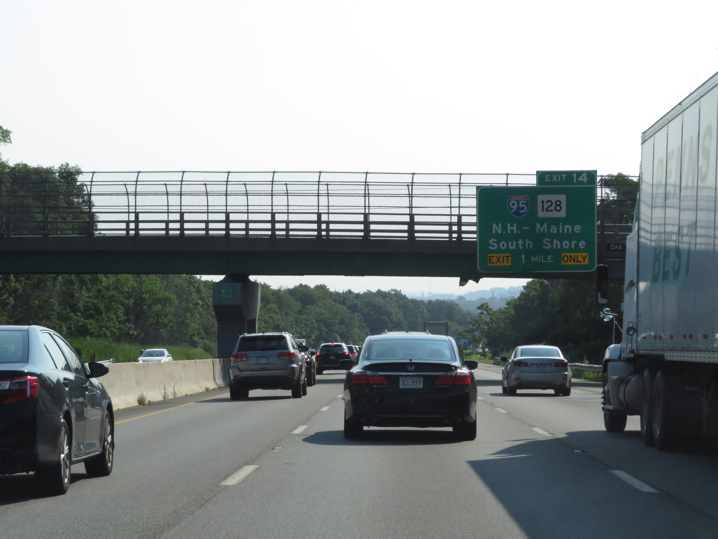
Interstate 90 East (Mass Pike) at Exit 14: Interstate 95 / MA 128 - New Hampshire-Maine / South Shore (Photo taken 8/10/17). |
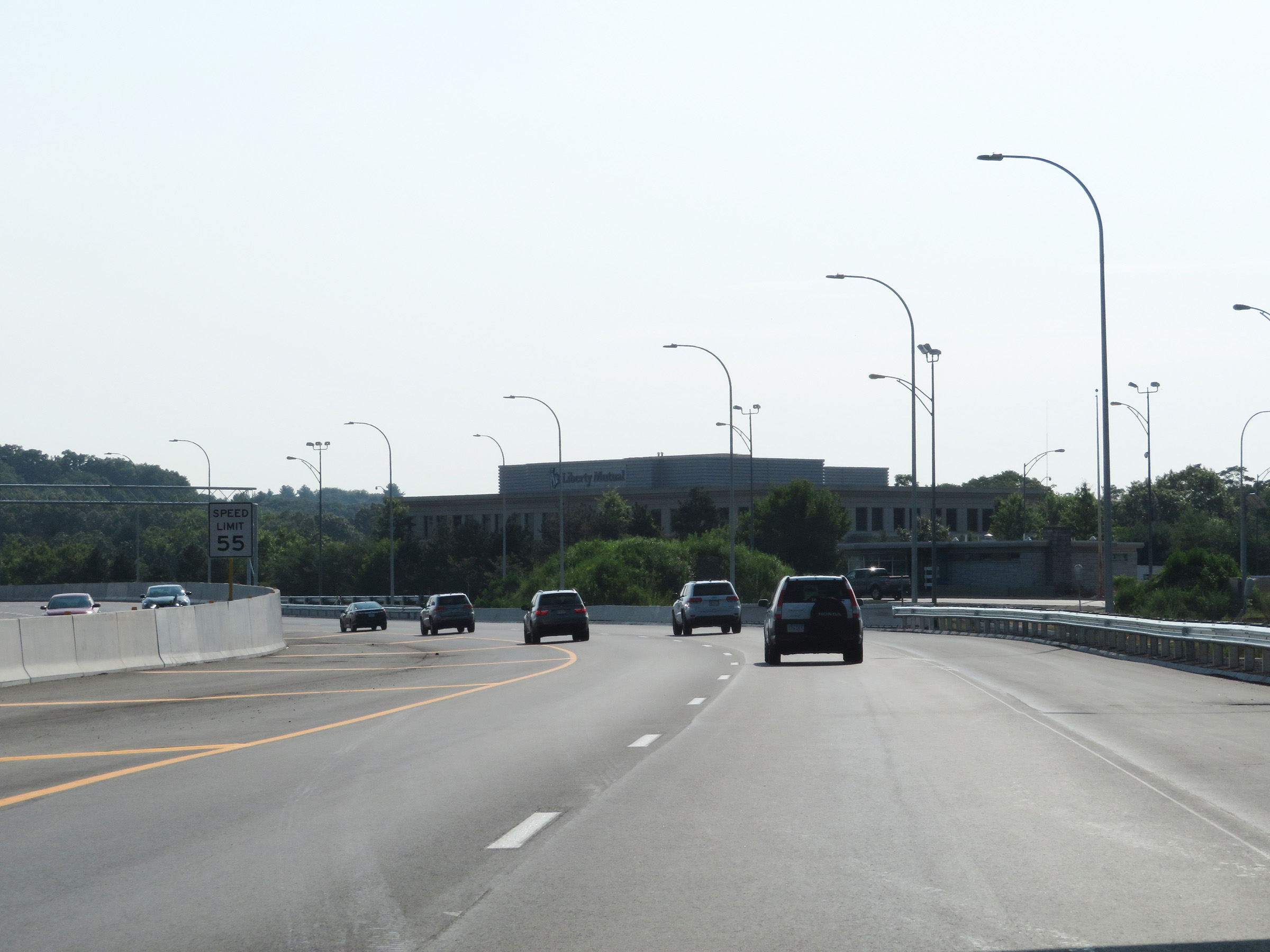 |
East of Exit 14, the speed limit decreases to 55 mph on Interstate 90 East (Mass Pike). (Photo taken 8/10/17). |
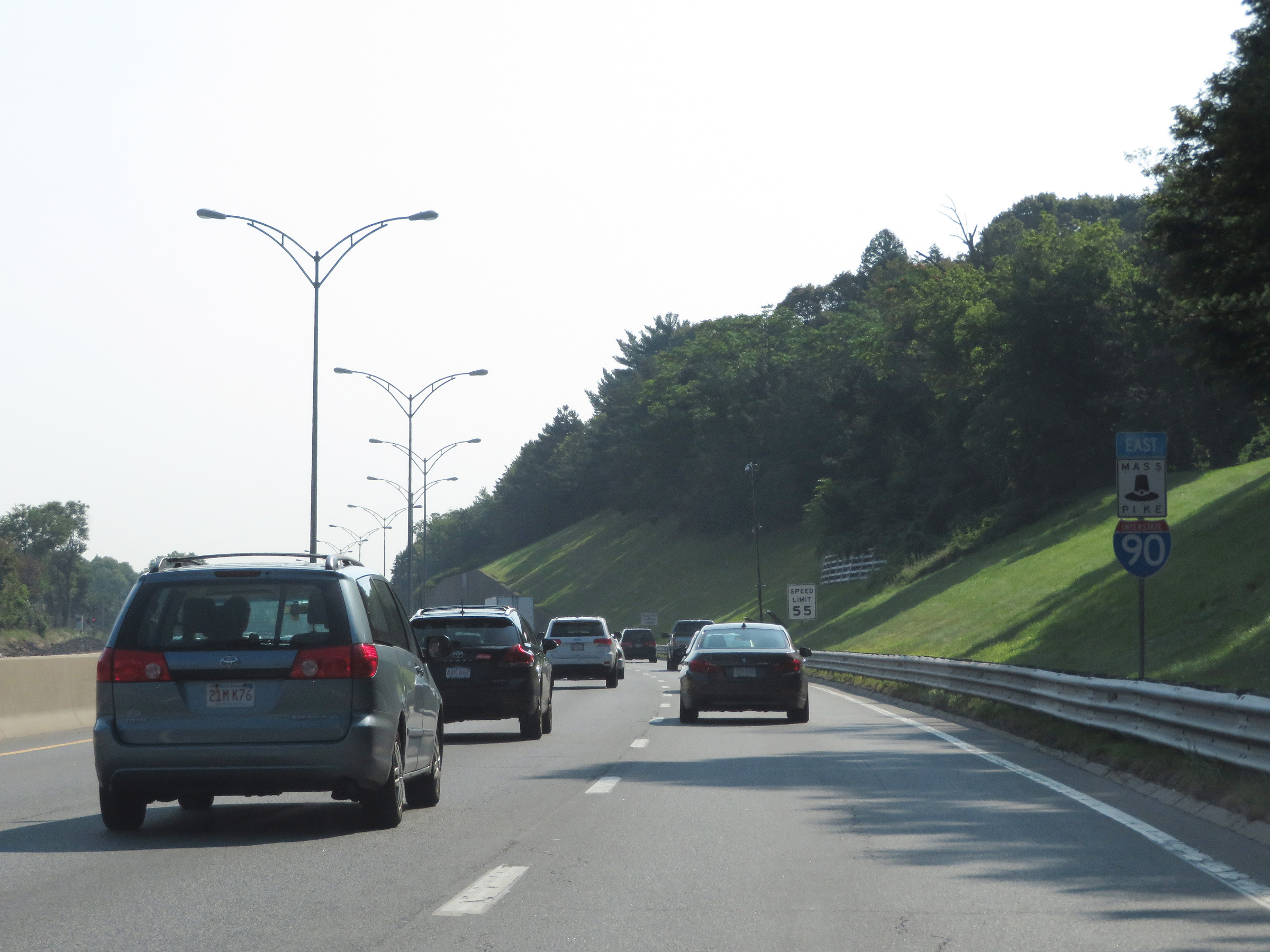 |
Interstate 90 / Mass Pike East reassurance markers. (Photo taken 8/10/17). |
 |
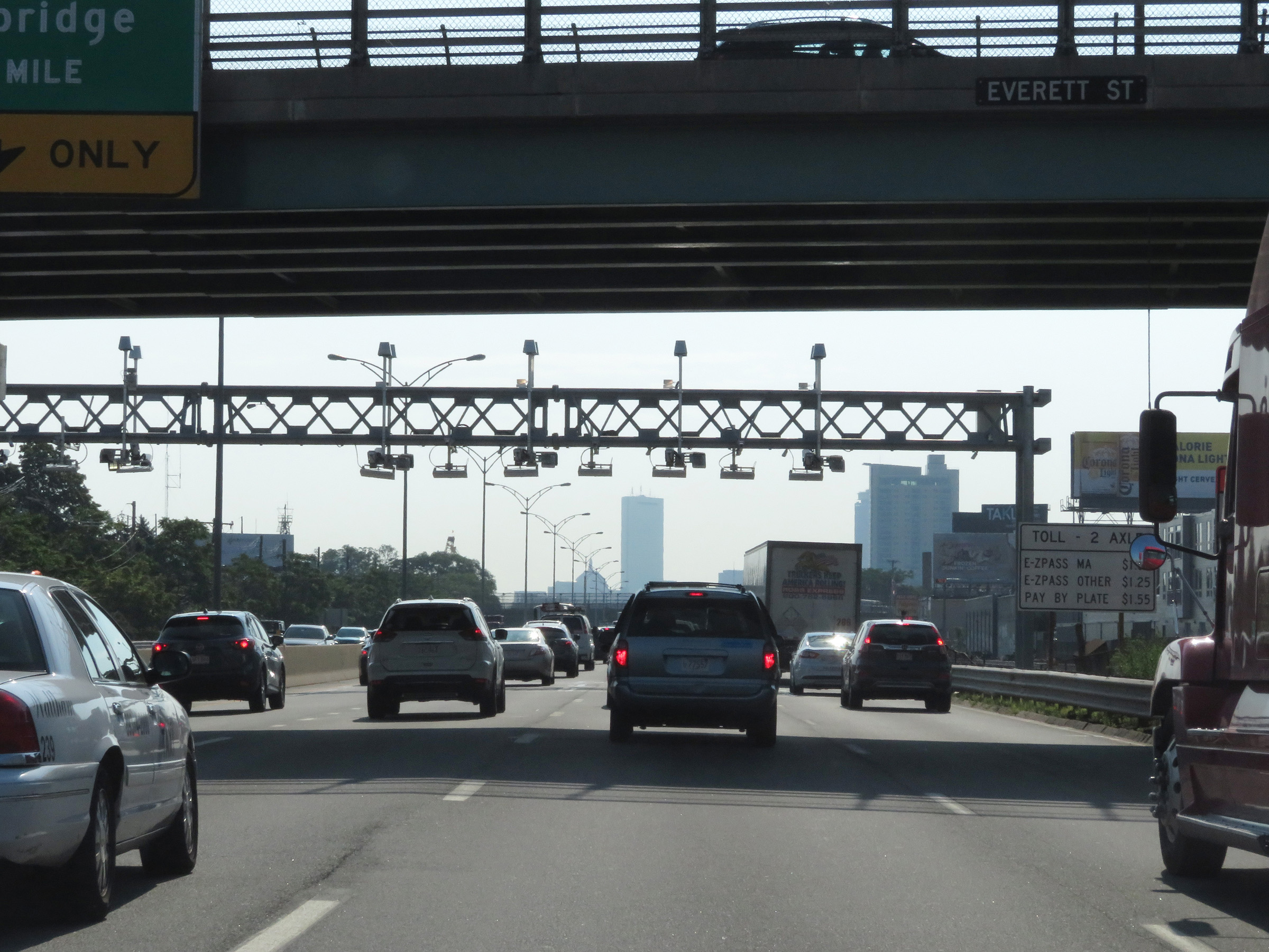
Interstate 90 East (Mass Pike) at the toll gantry in Newton. (Photo taken 8/10/17). |
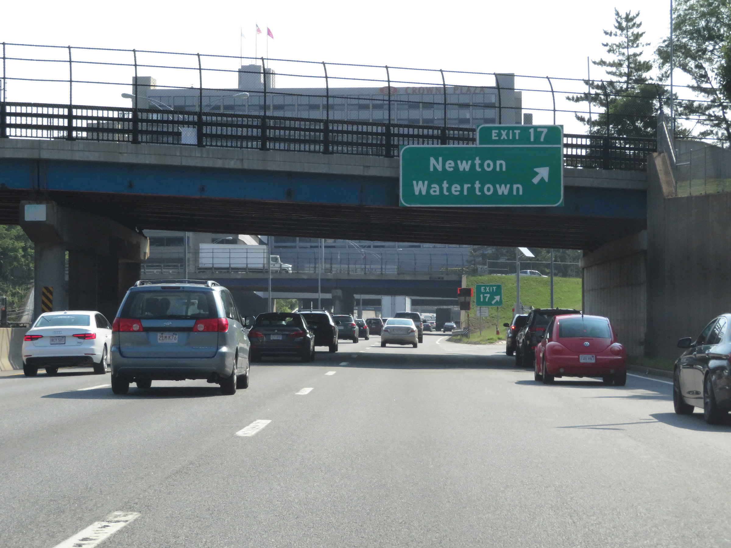 |
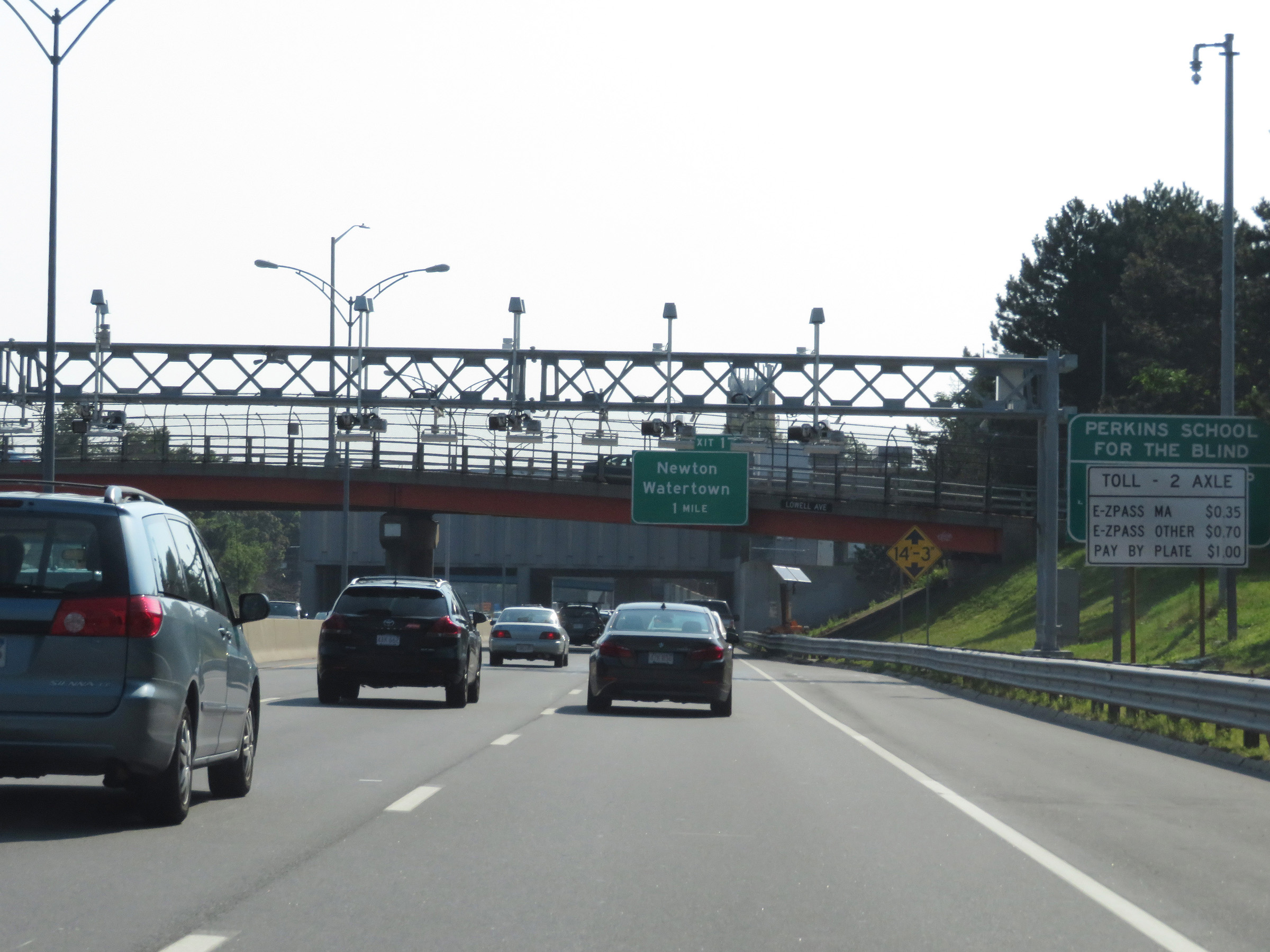
Interstate 90 East (Mass Pike) at Exit 17: Newton / Watertown (Photo taken 8/10/17). |
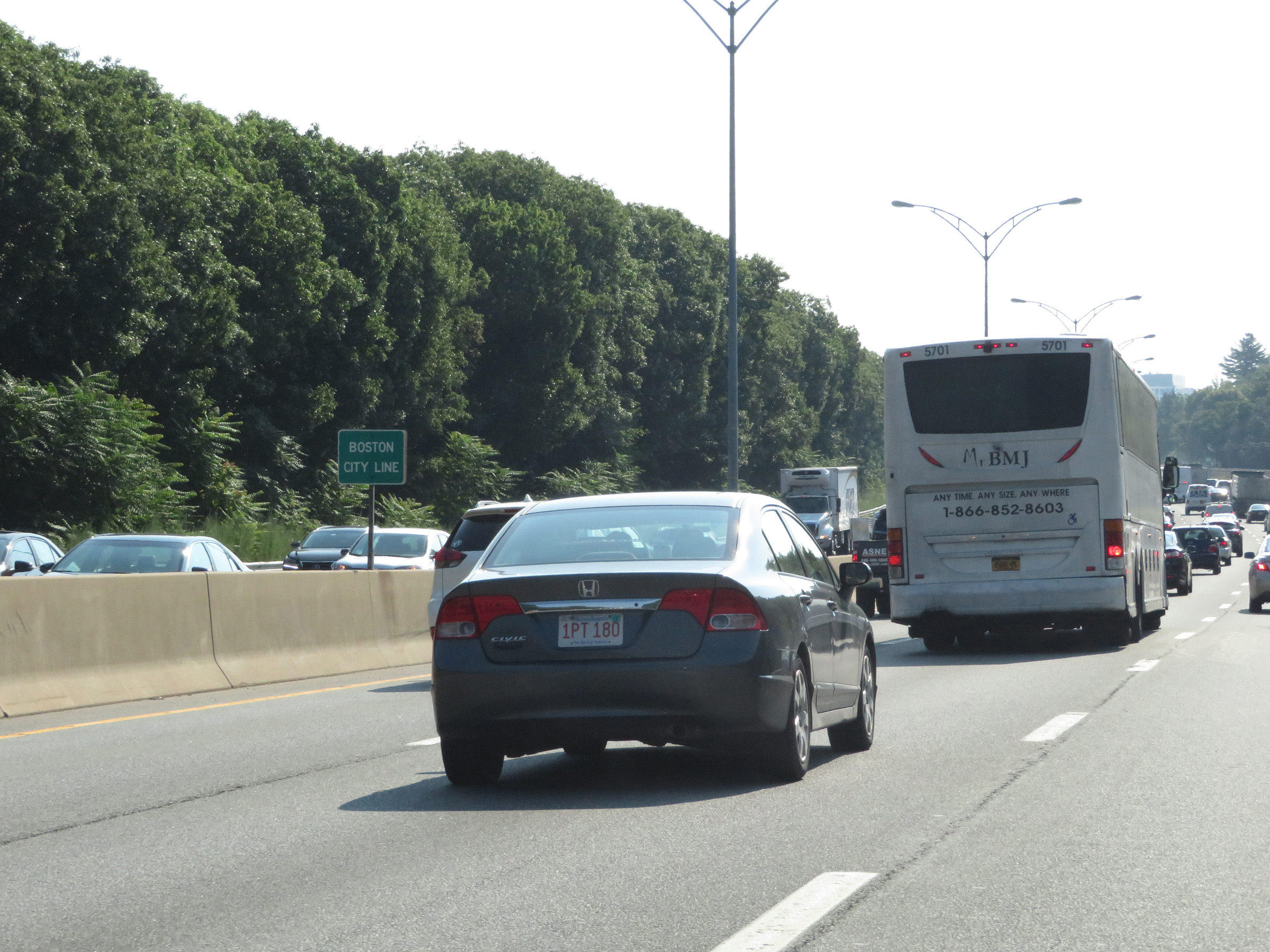 |
Interstate 90 East (Mass Pike) as it enters the Boston city limits. (Photo taken 8/10/17). |
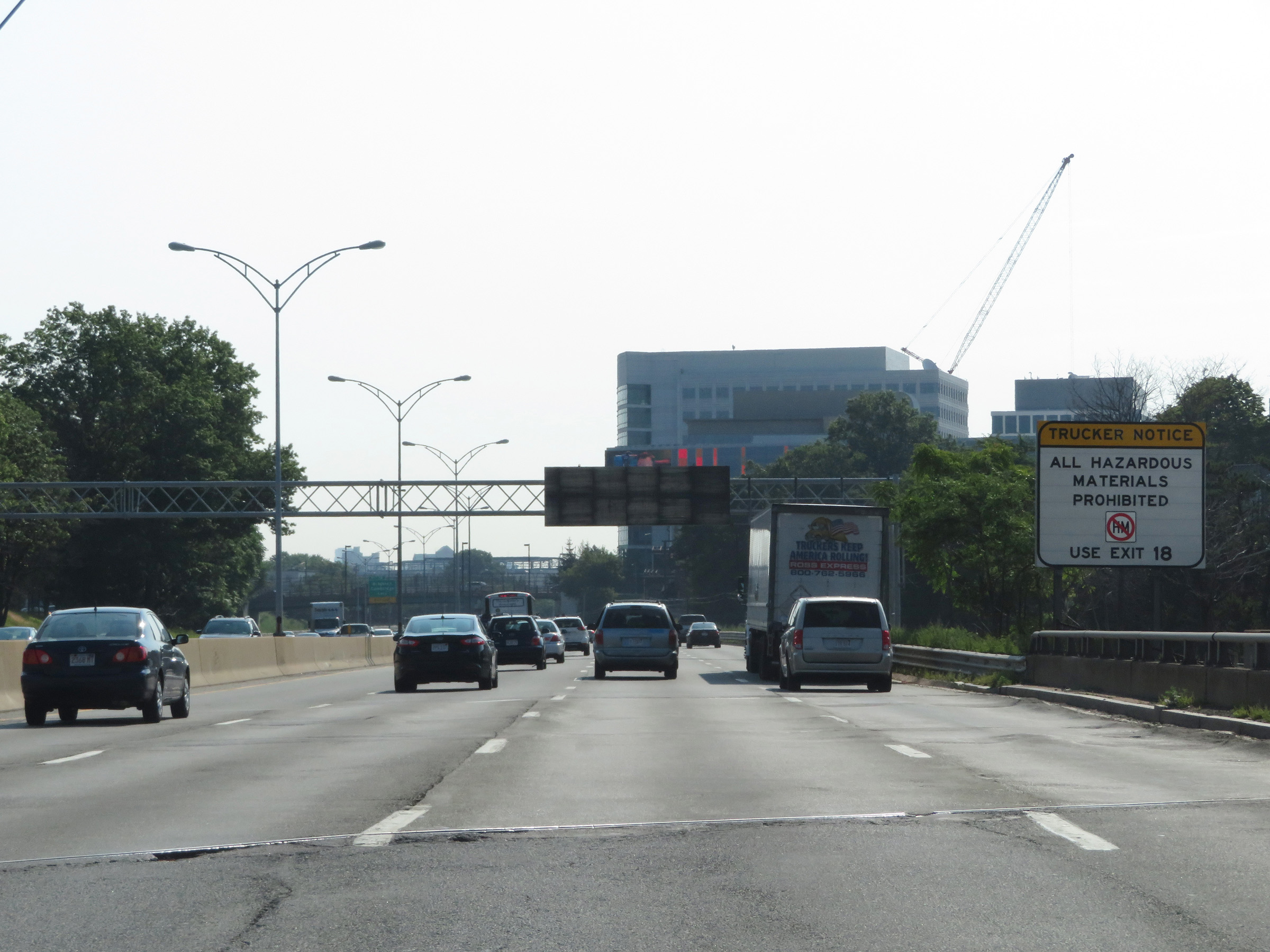 |
Due to the upcoming tunnels on Interstate 90 East (Mass Pike) in downtown Boston, trucks hauling hazardous materials, regardless of class or amount, must use Exit 18. (Photo taken 8/10/17). |
 |
Take Exit 18 to Fenway Park. (Photo taken 8/10/17). |
 |
Toll gantry with toll rate signage on Interstate 90 East (Mass Pike) in Boston. (Photo taken 8/10/17). |
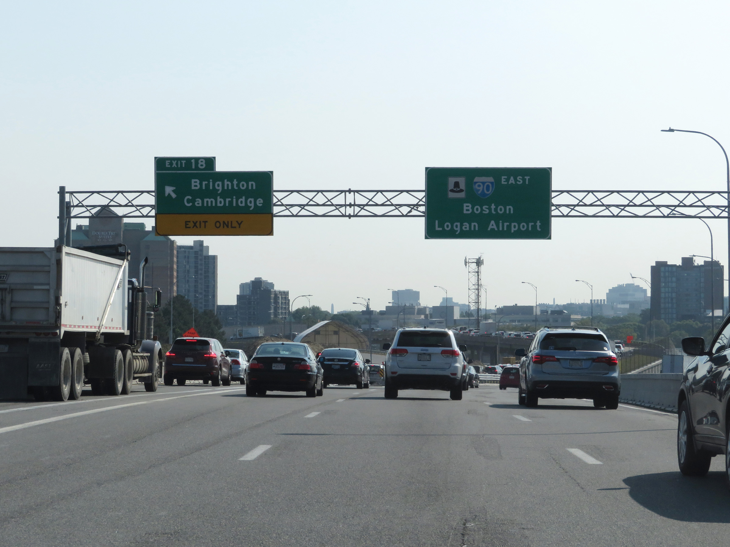 |
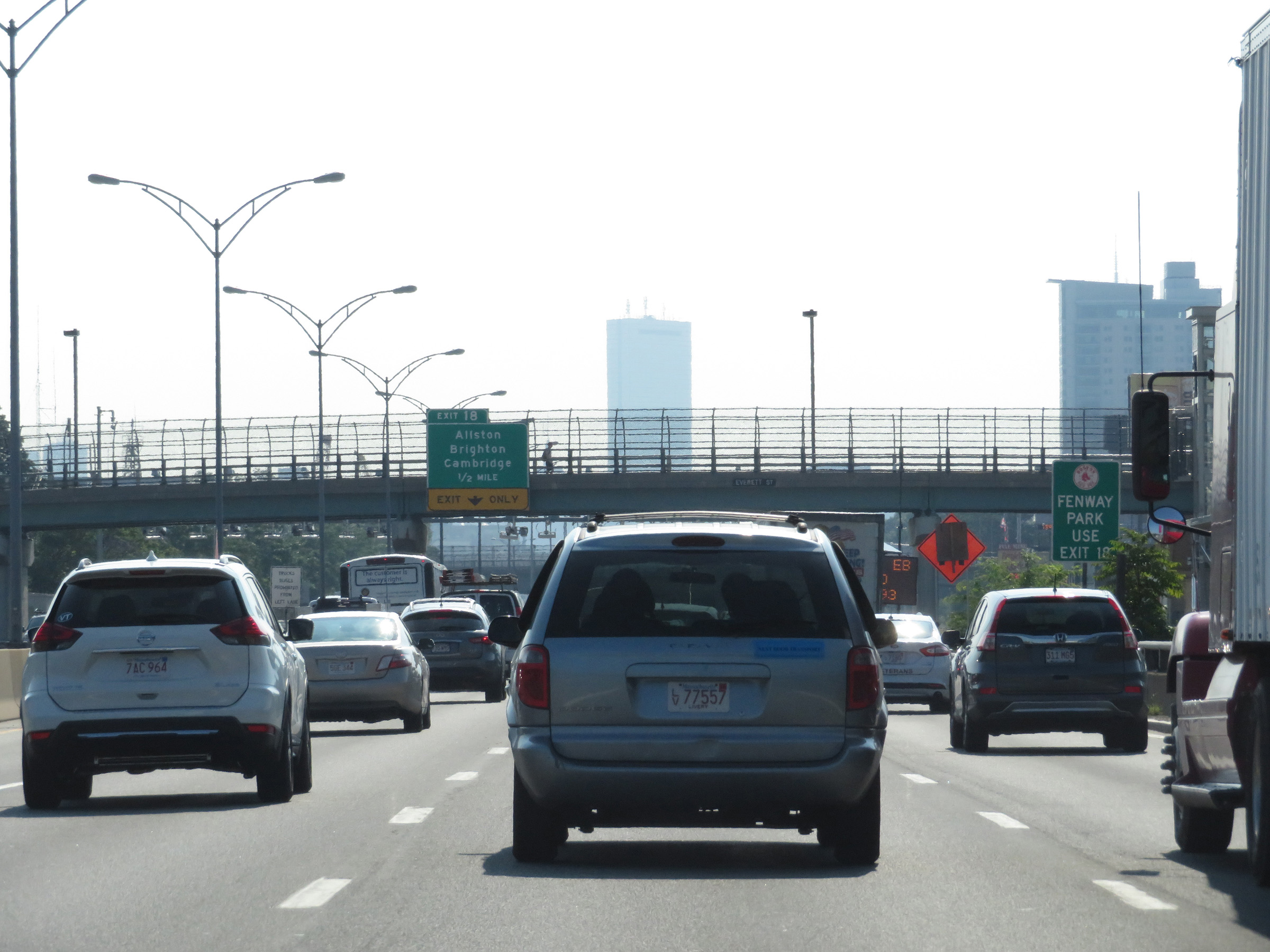
Interstate 90 East (Mass Pike) at Exit 18: Brighton / Cambridge (Photo taken 8/10/17). |
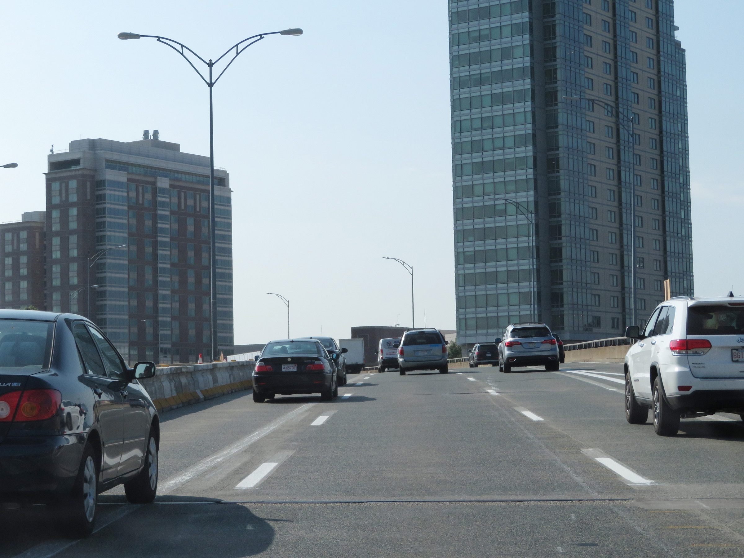 |
View on Interstate 90 East (Mass Pike) in downtown Boston. (Photo taken 8/10/17). |
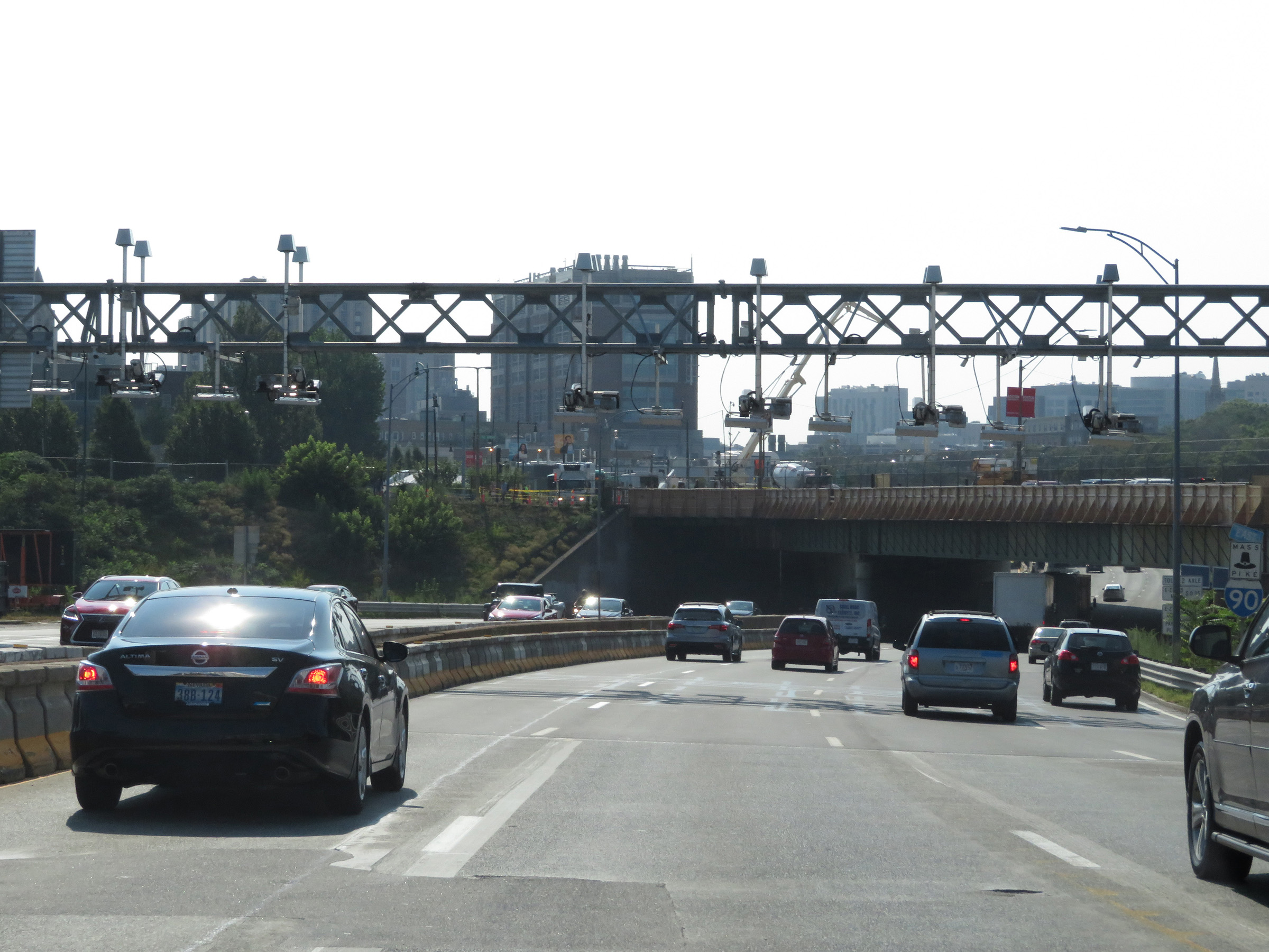 |
Another electronic toll gantry on Interstate 90 East (Mass Pike) in Boston. (Photo taken 8/10/17). |
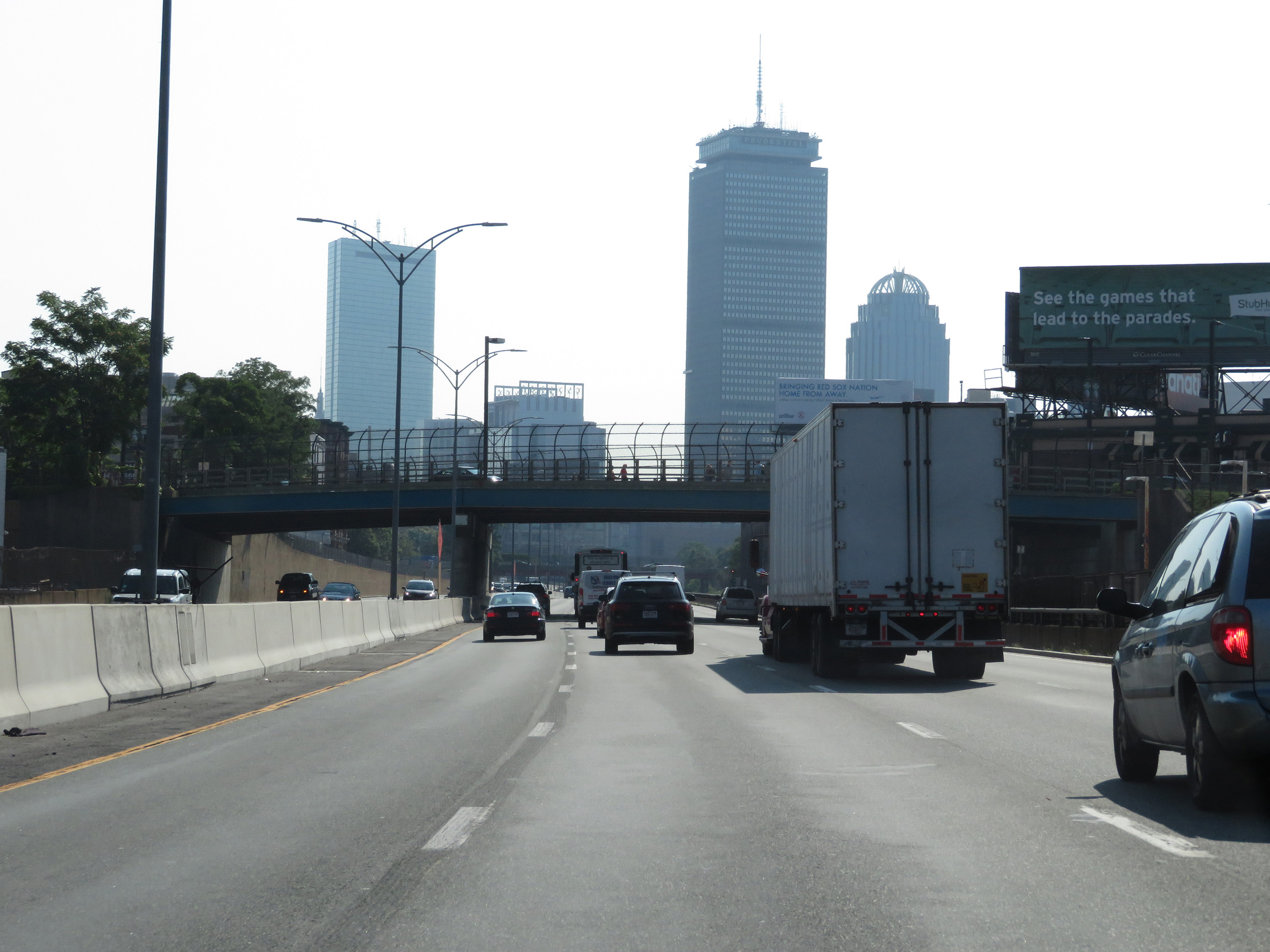 |
View on Interstate 90 East (Mass Pike) in Boston. (Photo taken 8/10/17). |
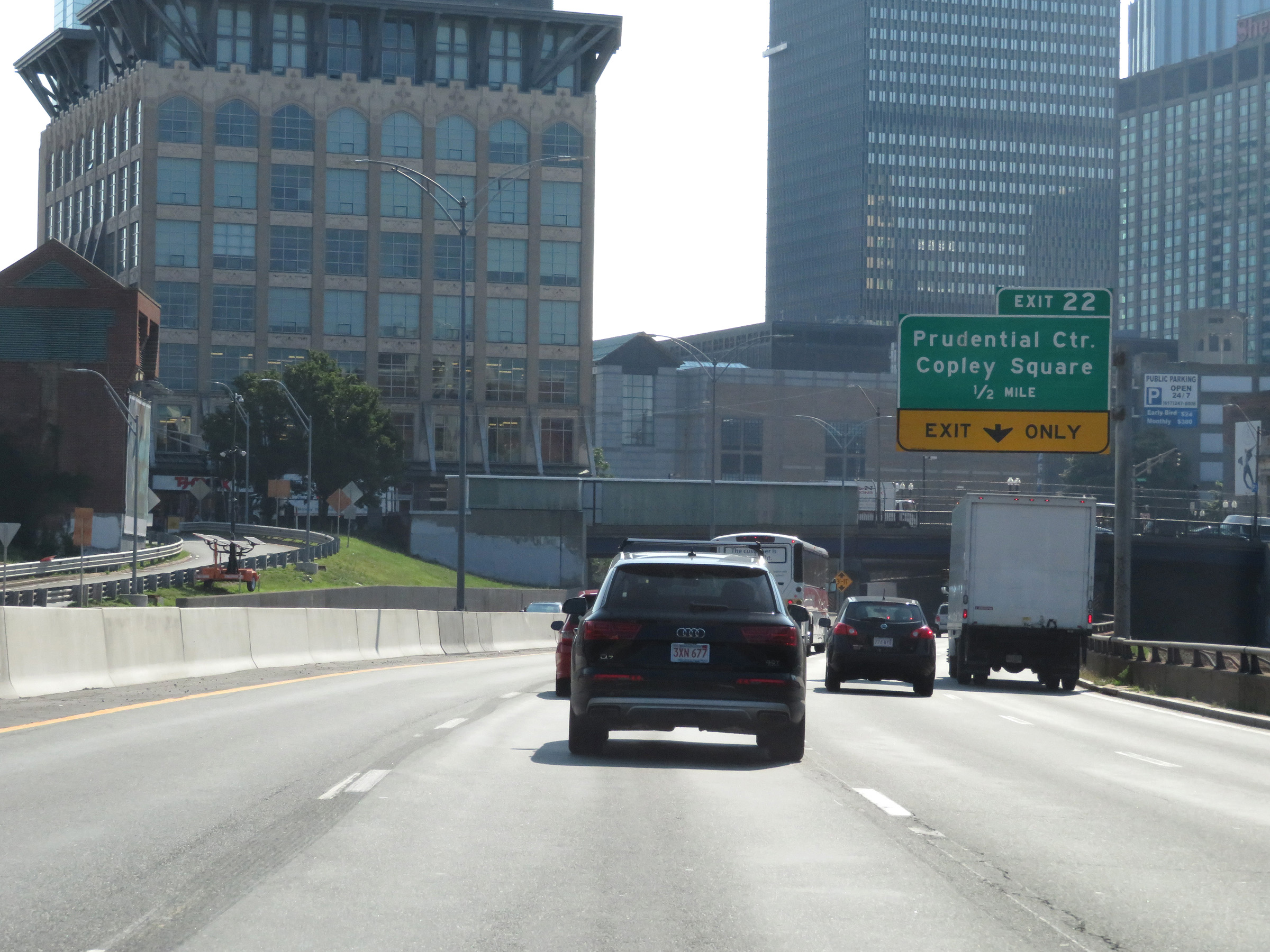 |
Advance signage for Exit 22 - 1/2 mile ahead. This exit is located inside the Prudential Tunnel, which Interstate 90 East (Mass Pike) will enter just ahead. (Photo taken 8/10/17). |
 |
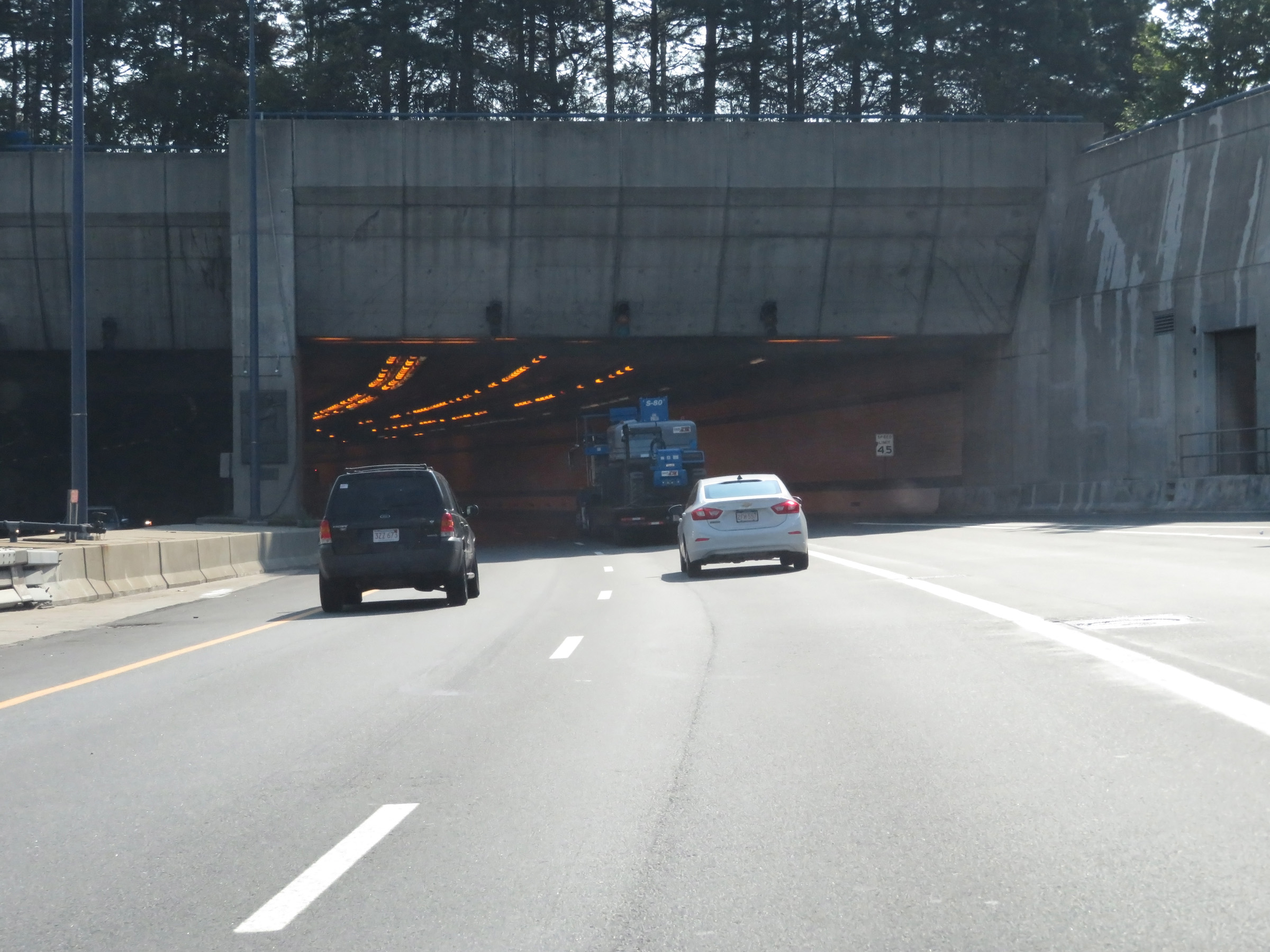
Interstate 90 East (Mass Pike) as it prepares to enter the Prudential Tunnel, which runs under the Prudential Tower complex in downtown Boston. (Photo taken 8/10/17). |
 |
Interstate 90 East (Mass Pike) at Exit 22: Prudential Center / Copley Square (Photo taken 8/10/17). |
 |
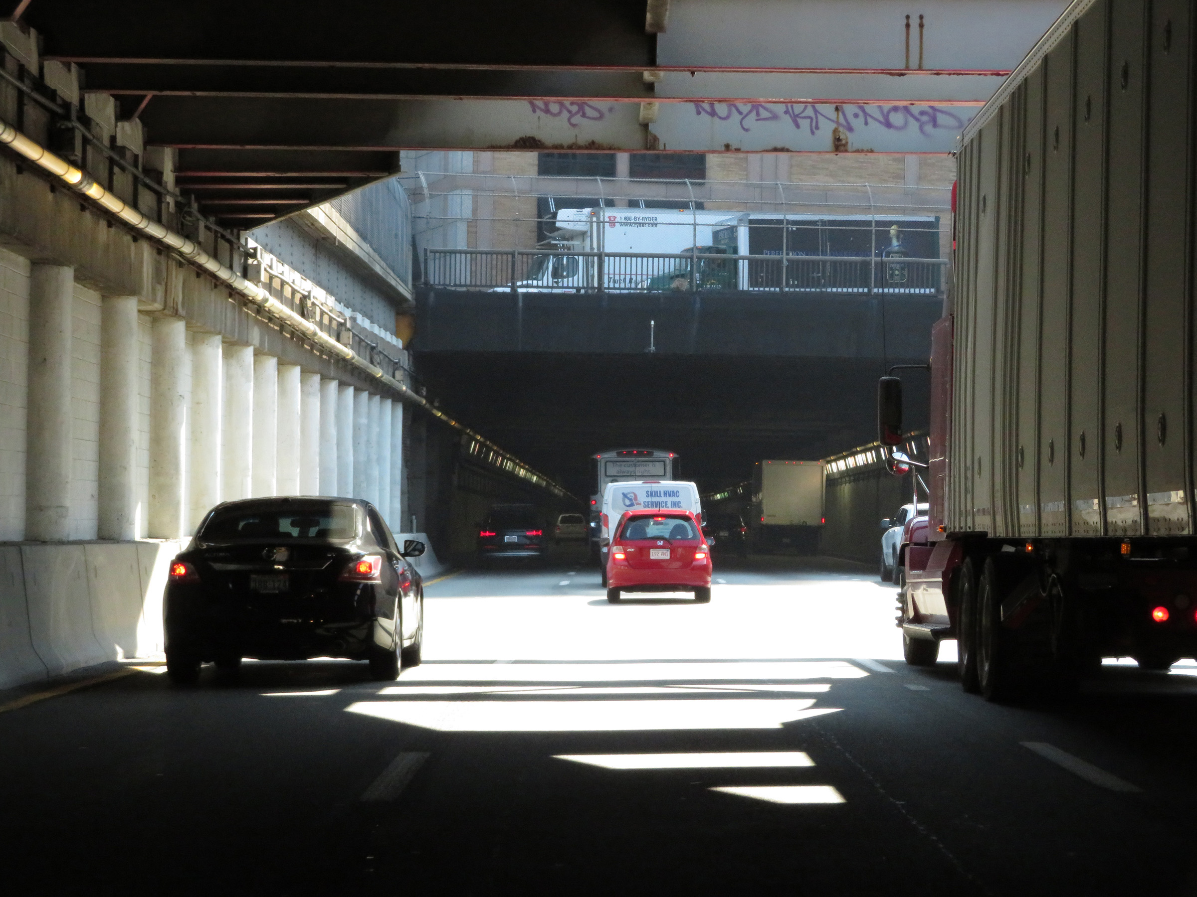
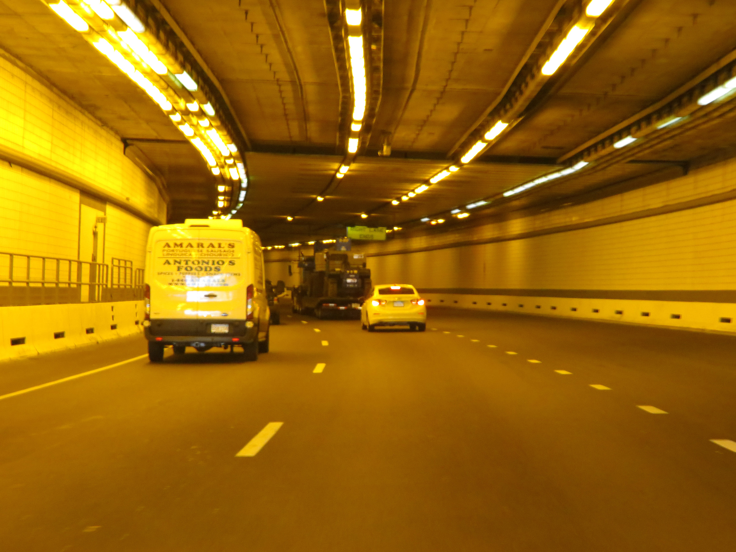
View on Interstate 90 East (Mass Pike) inside the Prudential Tunnel in downtown Boston. (Photo taken 8/10/17). |
 |
Interstate 90 East (Mass Pike) as it prepares to emerge from the Prudential Tunnel. (Photo taken 8/10/17). |
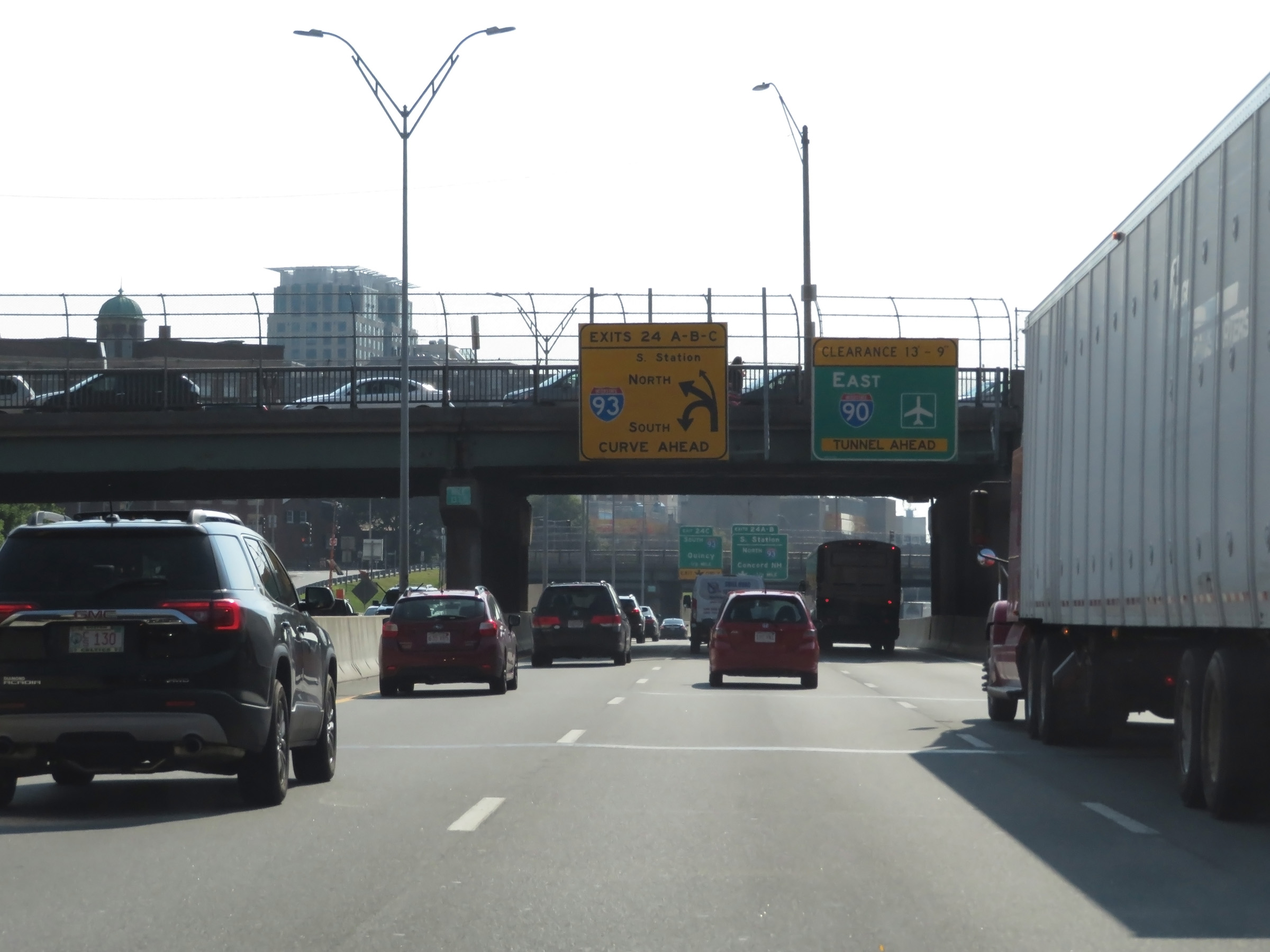 |
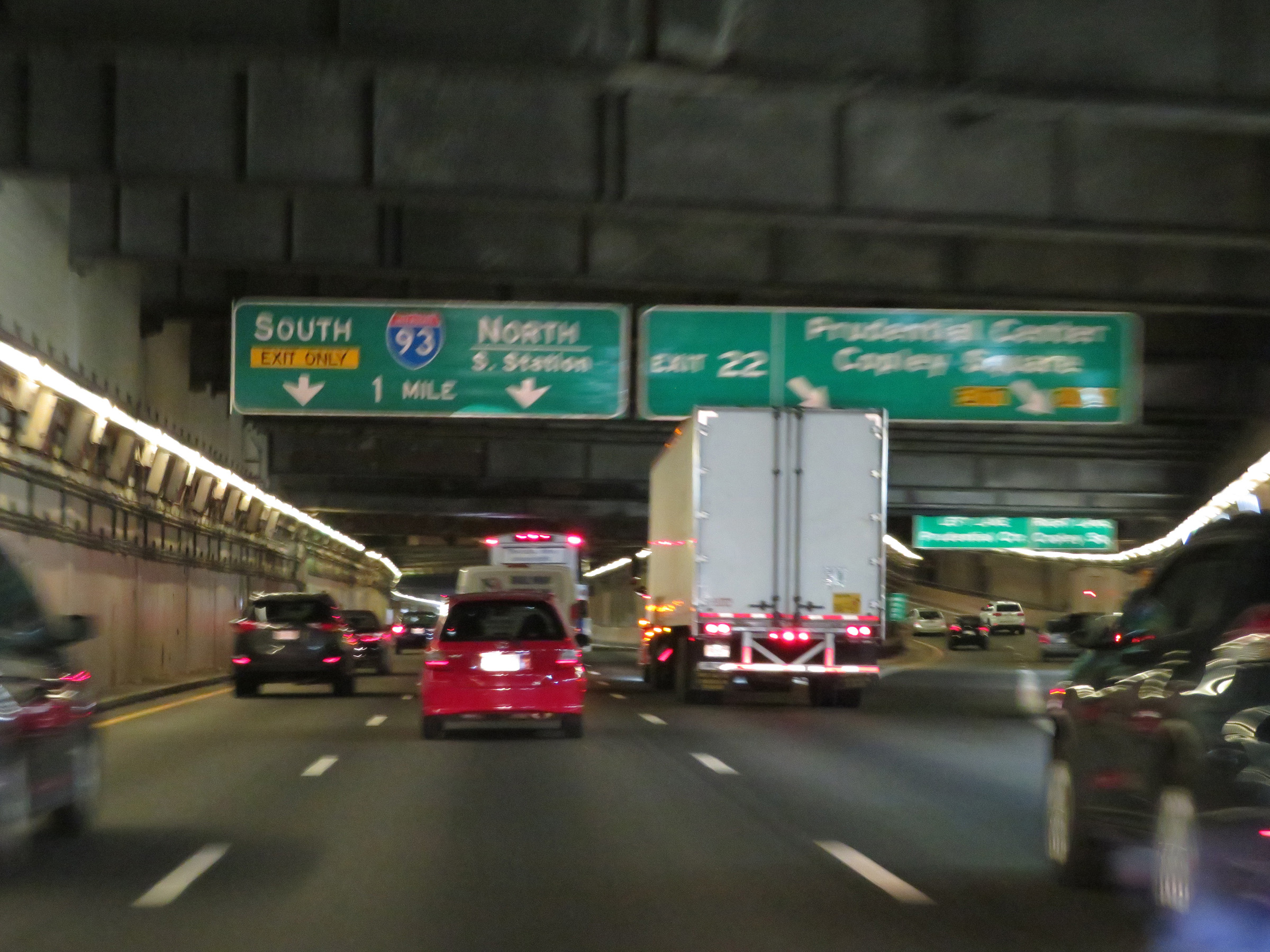
This overhead signage shows the rather complex design of the interchange for Exits 24A-B-C, which is on the left ahead. The overhead clearance of the next tunnel, which is the Fort Point Tunnel, is 13' 9". (Photo taken 8/10/17). |
 |
Interstate 90 East (Mass Pike) approaching Exits 24A-B-C - 1/2 mile. (Photo taken 8/10/17). |
 |
Like the Prudential Tunnel, hazardous materials are also prohibited inside the upcoming Fort Point and Ted Williams Tunnels. Overheight vehicles (over 13' 9") and all trucks hauling hazardous materials must use Exit 24A. (Photo taken 8/10/17). |
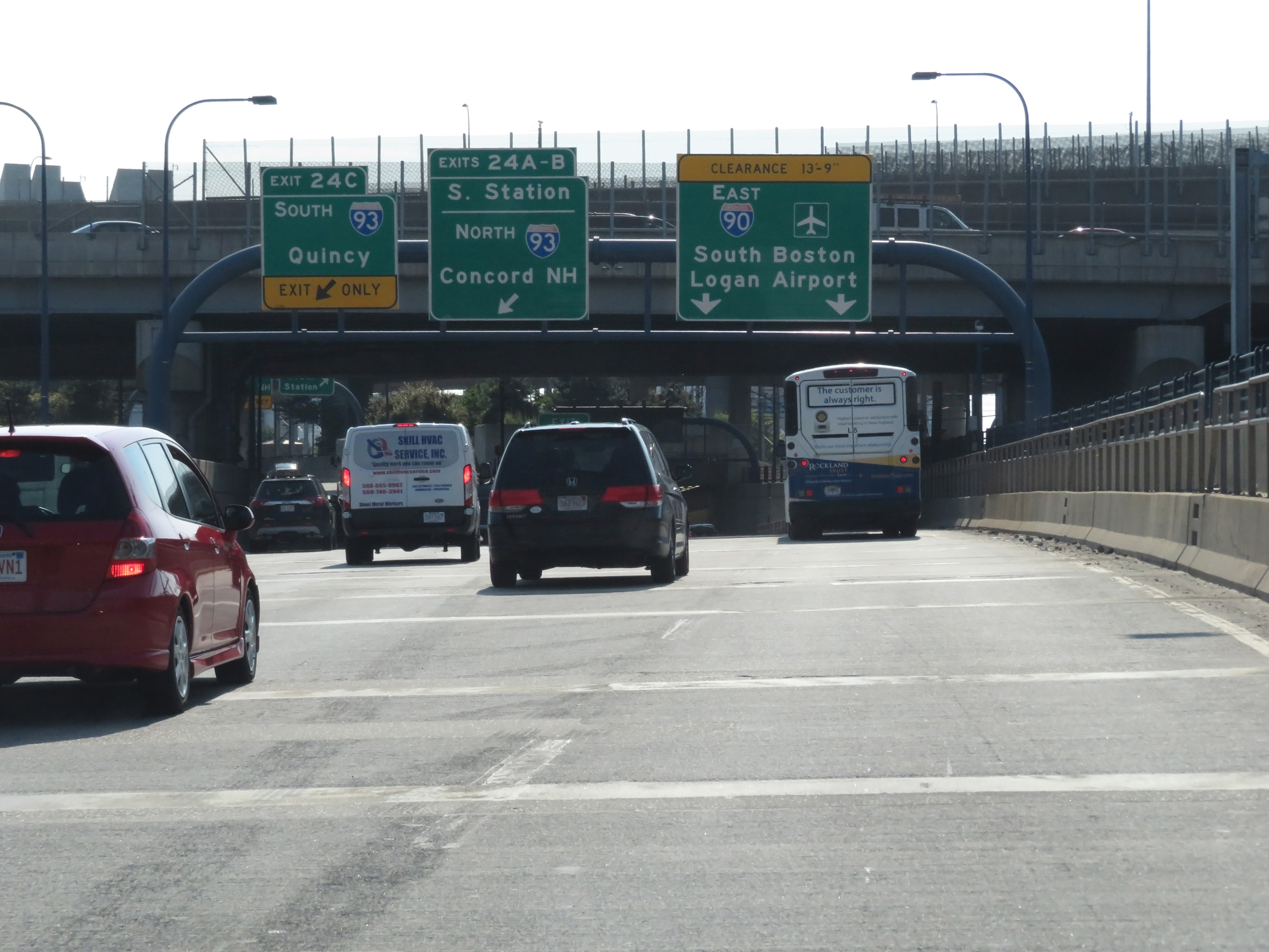 |
Interstate 90 East (Mass Pike) at Exit 24A: South Station; Exit 24B: Interstate 93 North - Concord, NH; Exit 24C: Interstate 93 South - Quincy (Photo taken 8/10/17). |
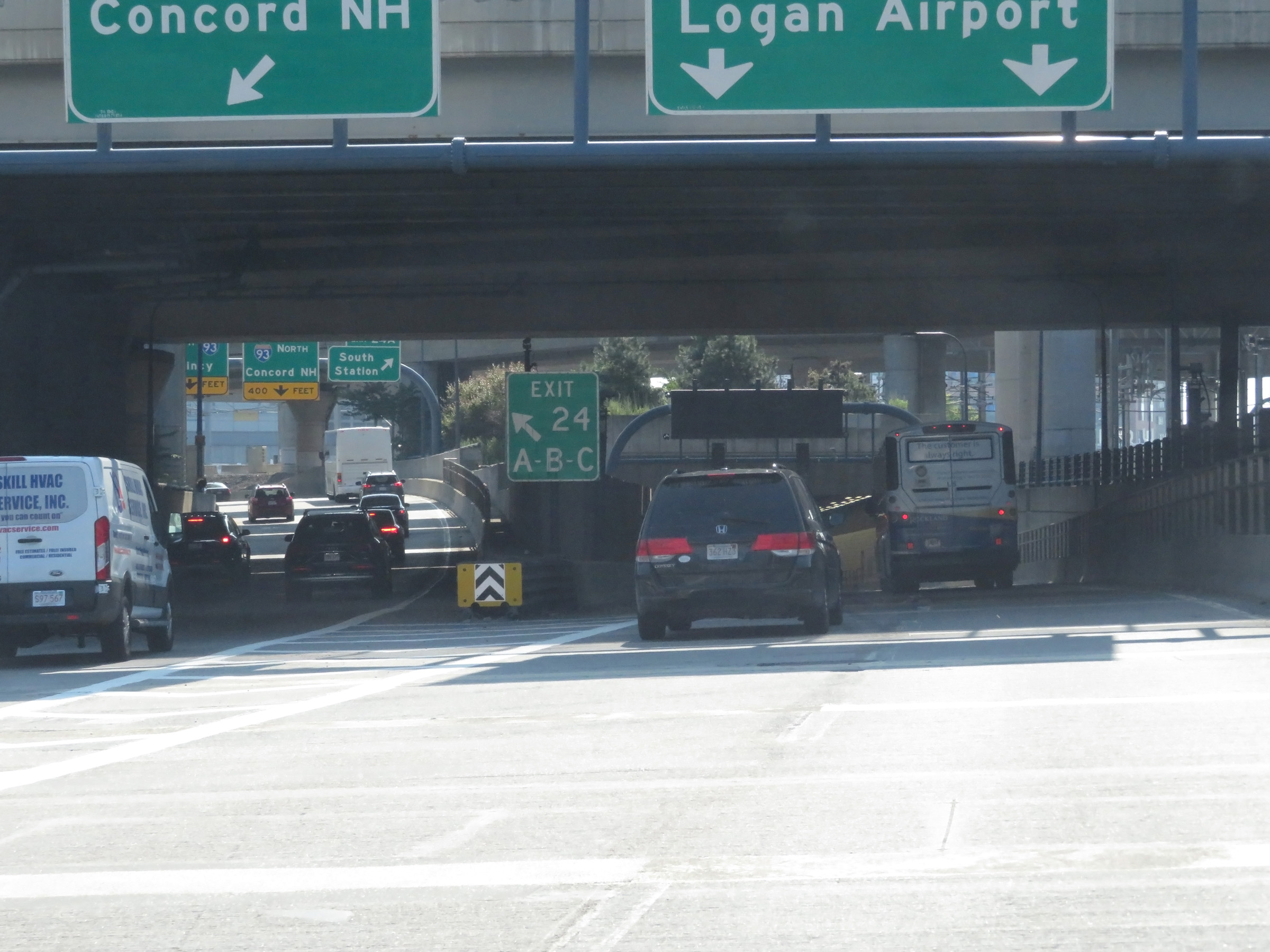 |
A closer view of the ramp to Exits 24A-B-C, on the left. (Photo taken 8/10/17). |
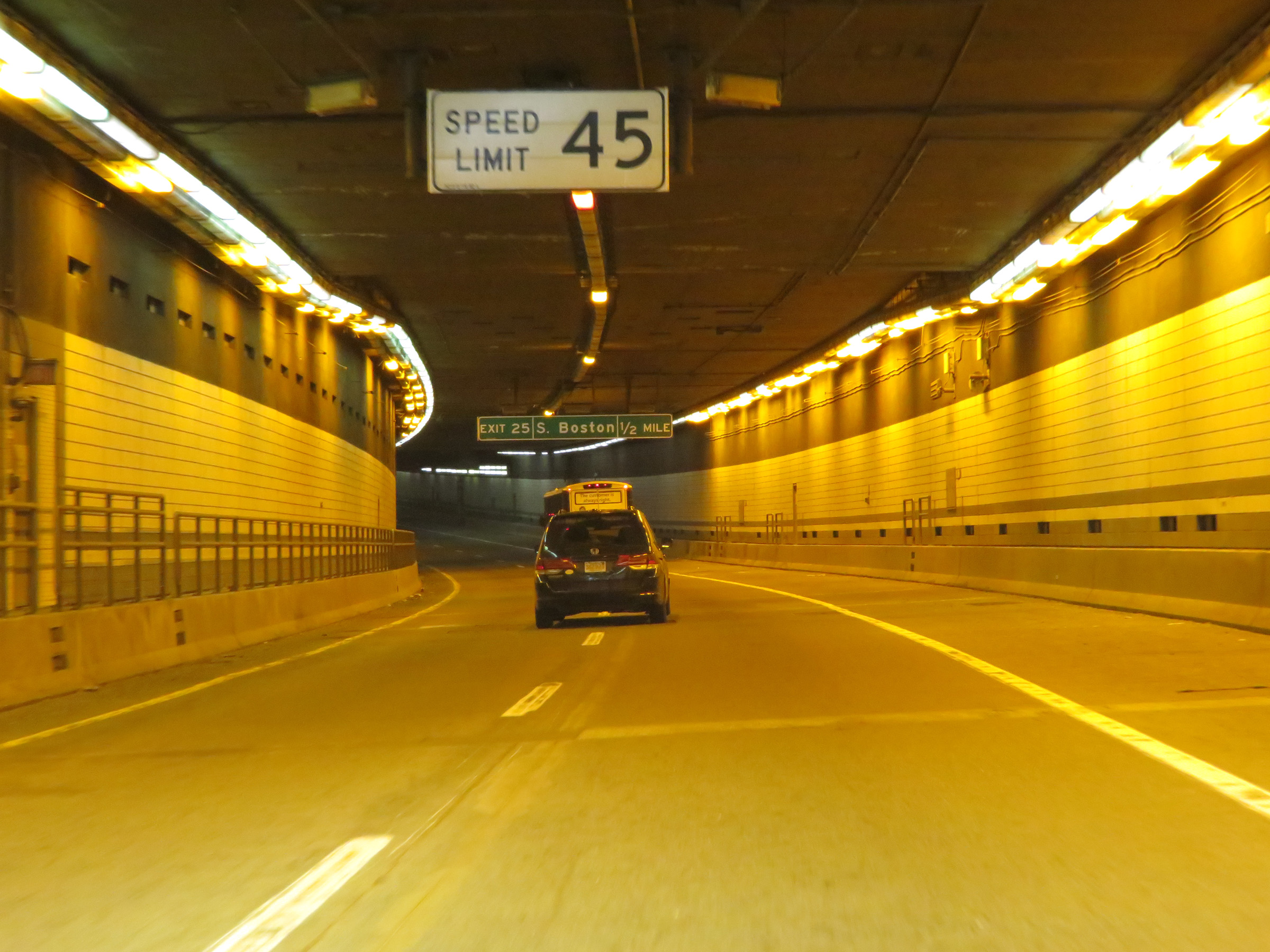 |
As Interstate 90 East (Mass Pike) enters the Fort Point Tunnel under Fort Point Channel, the speed limit decreases to 45 mph. (Photo taken 8/10/17). |
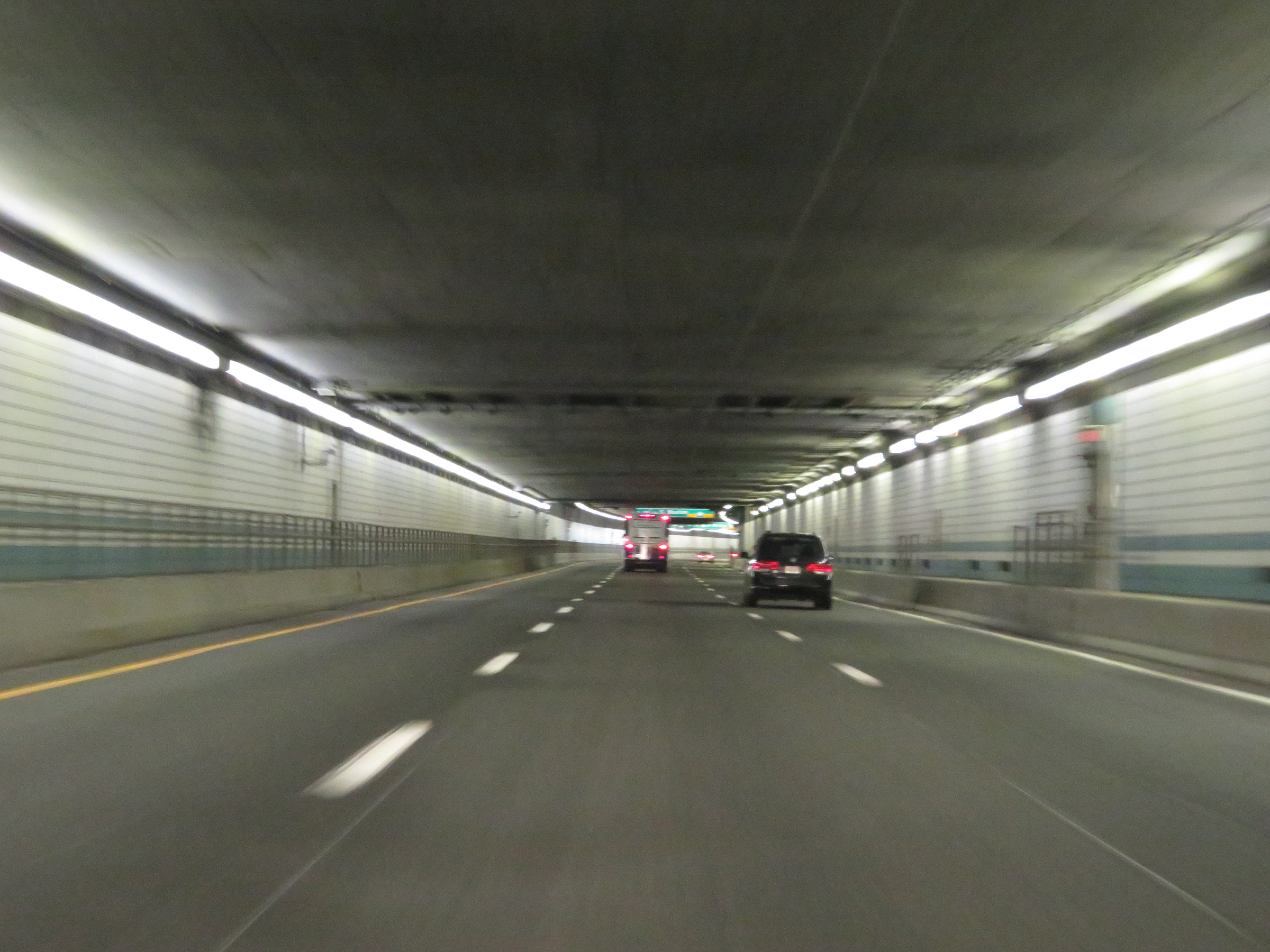 |
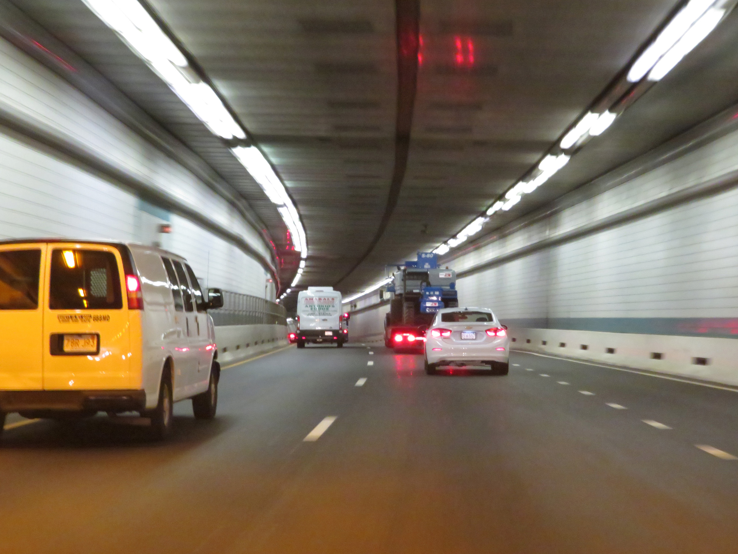
View on Interstate 90 East (Mass Pike) inside the Fort Point Tunnel. (Photo taken 8/10/17). |
 |
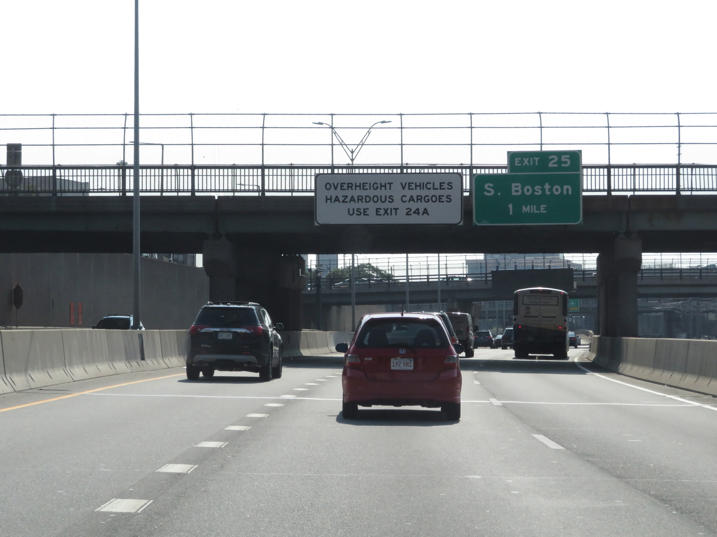
Interstate 90 East (Mass Pike) at Exit 25: South Boston (Photo taken 8/10/17). |
 |
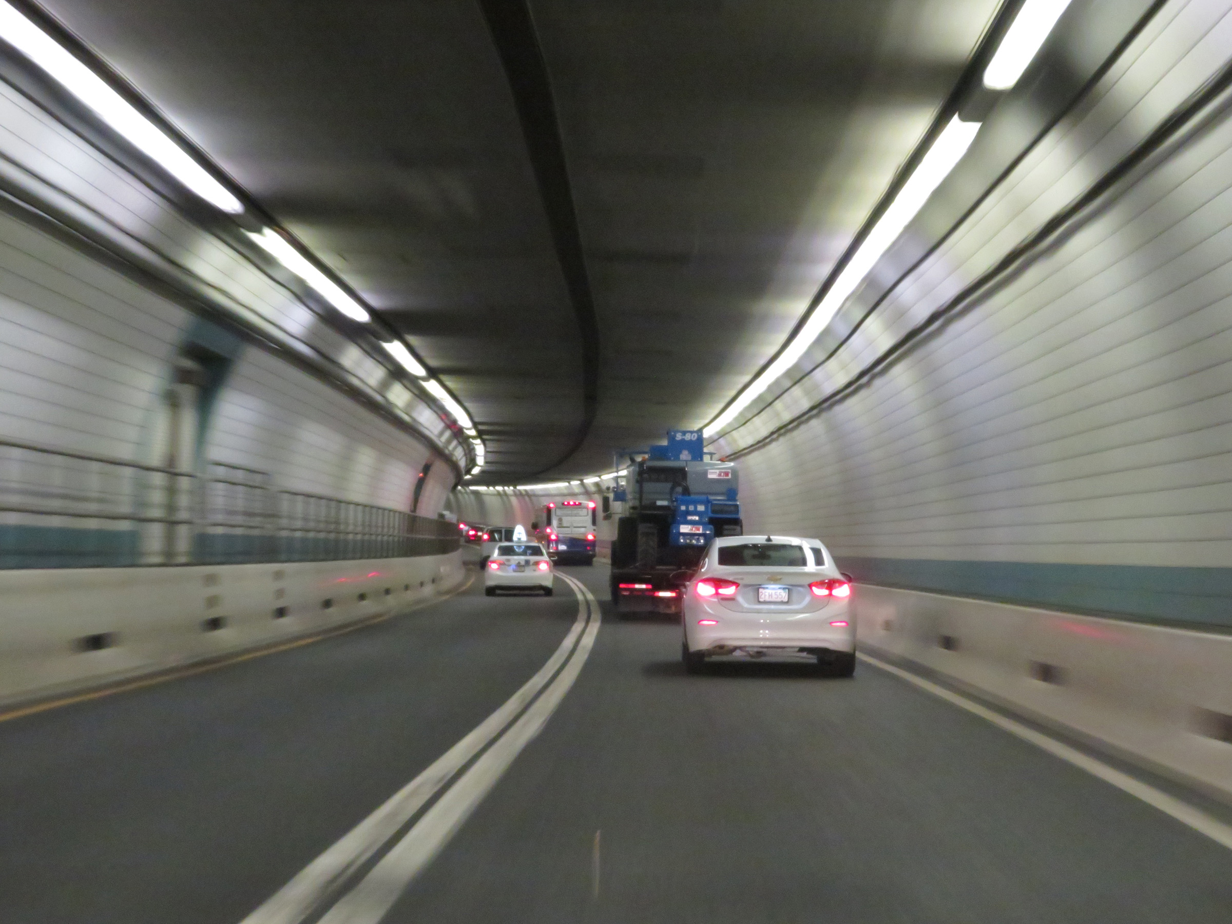
Another view on Interstate 90 East (Mass Pike) from inside the Fort Point Tunnel. (Photo taken 8/10/17). |
 |
Interstate 90 East (Mass Pike) leaving the Fort Point Tunnel in downtown Boston. (Photo taken 8/10/17). |
 |
View on Interstate 90 East (Mass Pike) in downtown Boston, in between the Fort Point Tunnel and Ted Williams Tunnel. (Photo taken 8/10/17). |
 |
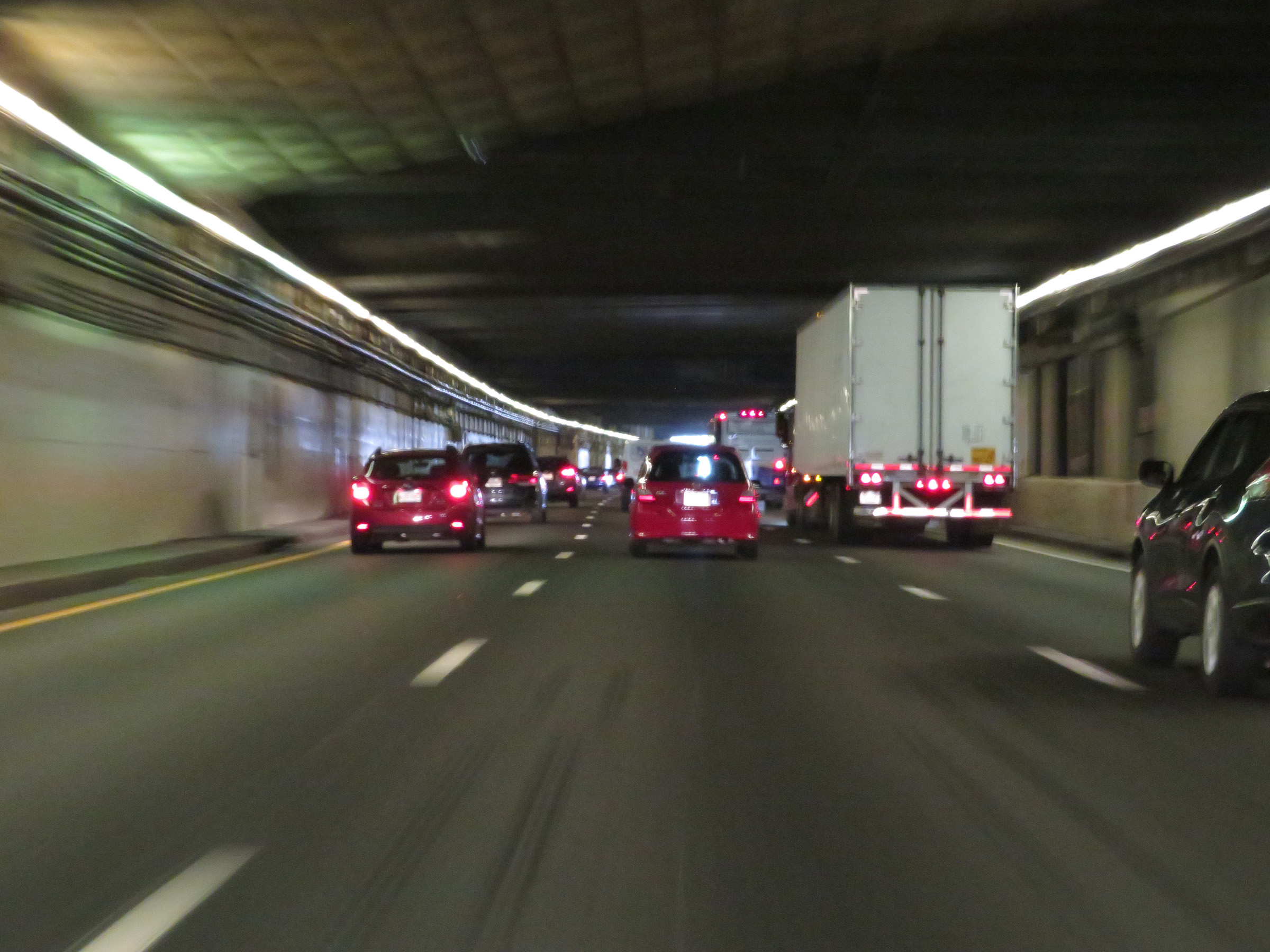
View on Interstate 90 East (Mass Pike) as it enters the Ted Williams Tunnel under Boston Harbor. The speed limit remains 45 mph. (Photo taken 8/10/17). |
 |
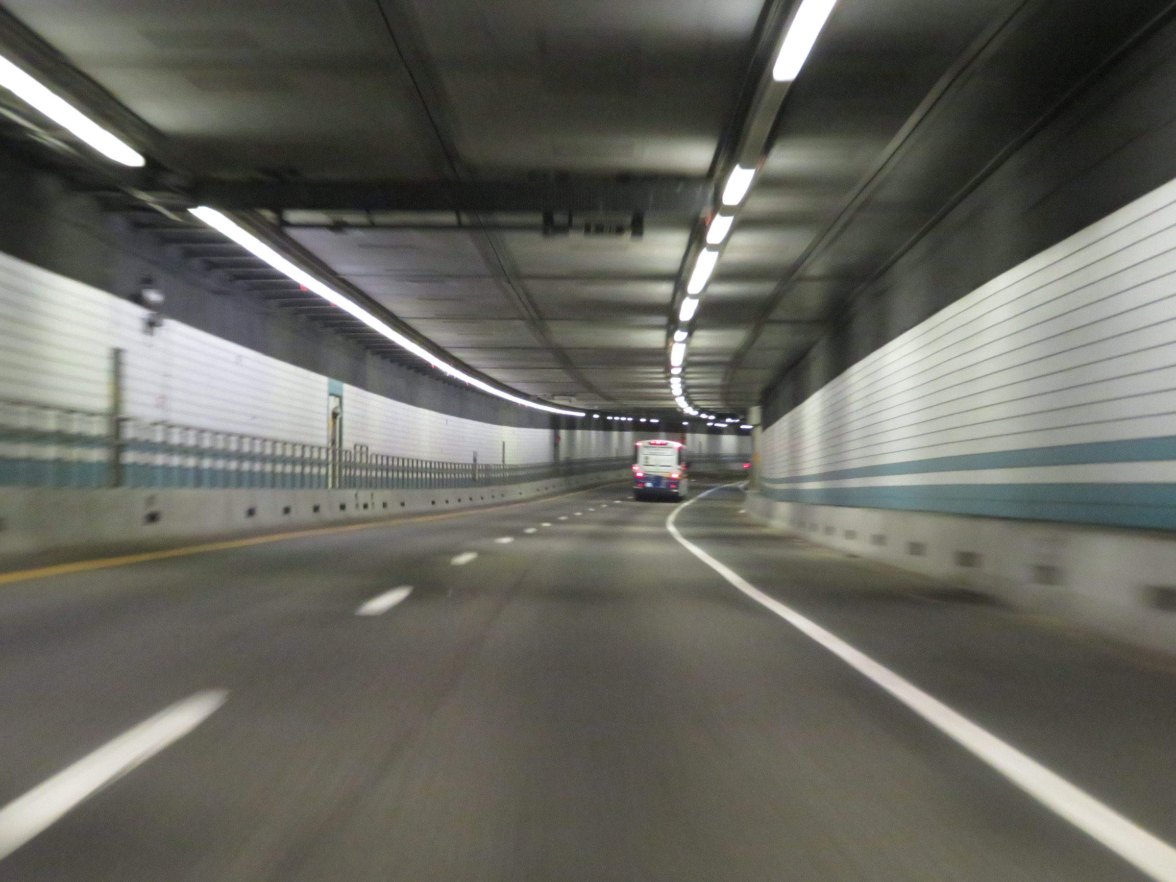
View on Interstate 90 East (Mass Pike) inside the Ted Williams Tunnel. (Photo taken 8/10/17). |
 |
Interstate 90 East (Mass Pike) inside the Ted Williams Tunnel under Boston Harbor. (Photo taken 8/10/17). |
 |
Another view on Interstate 90 East (Mass Pike) from inside the Ted Williams Tunnel. (Photo taken 8/10/17). |
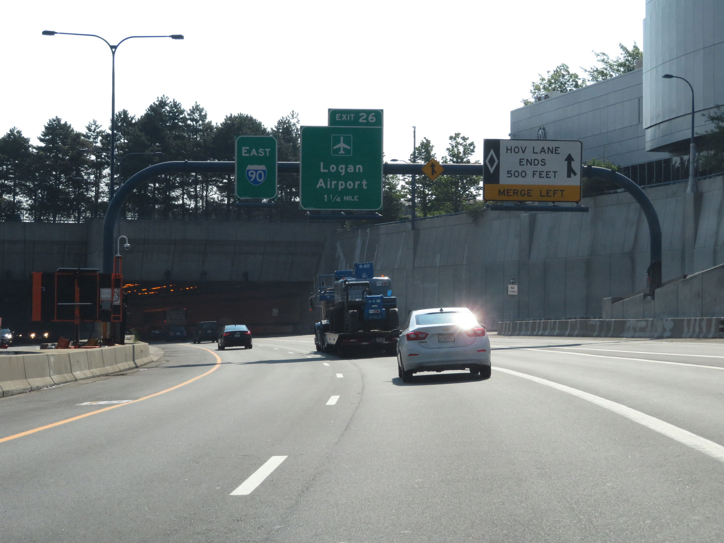
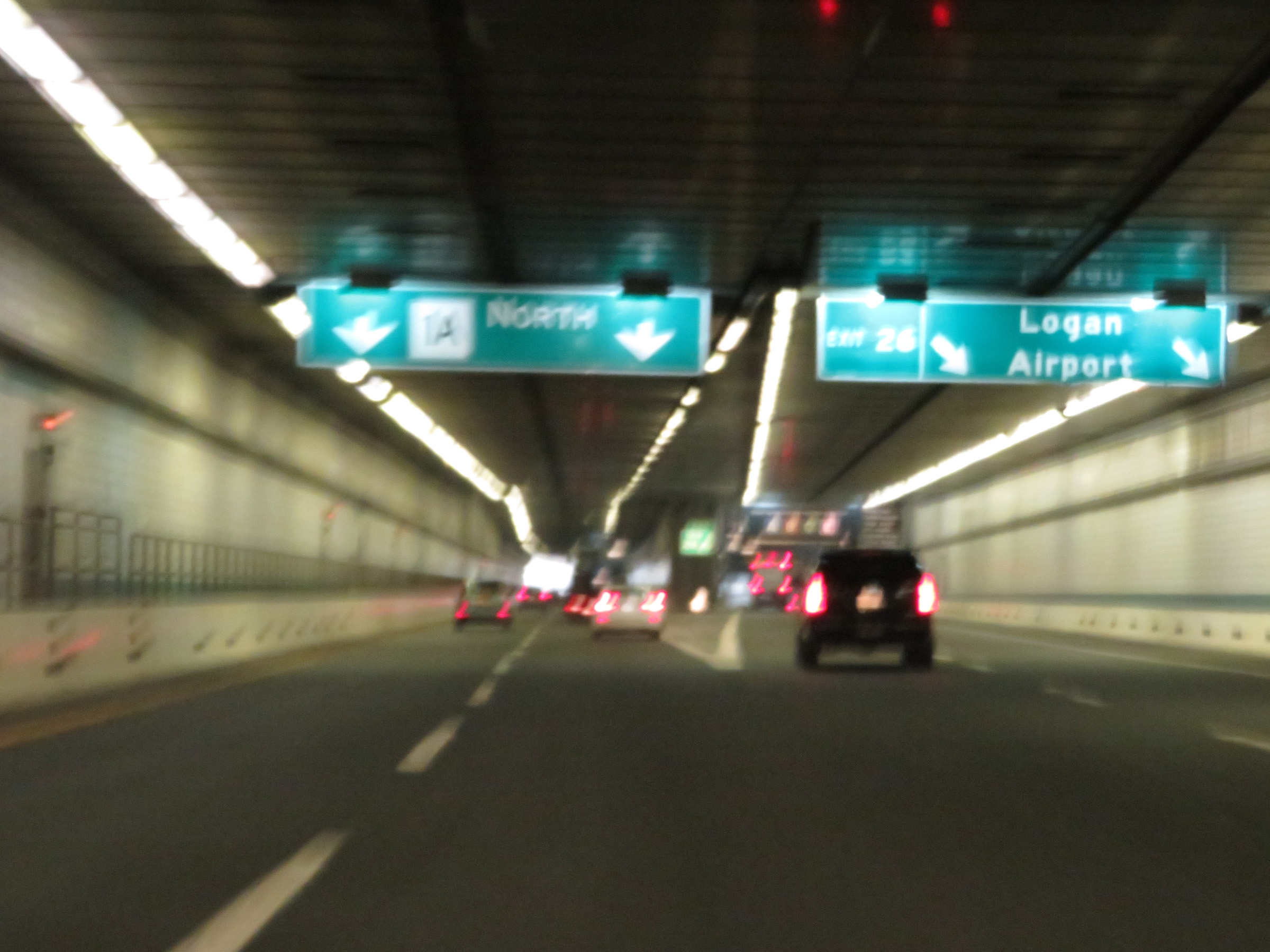 |
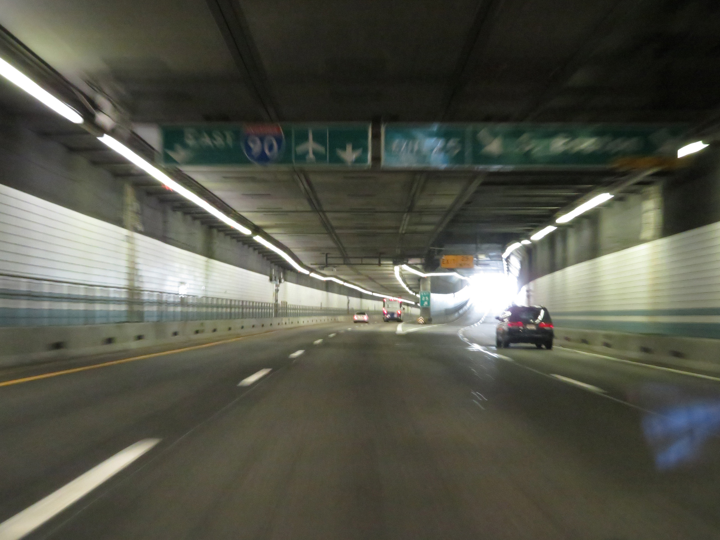
Interstate 90 East (Mass Pike) at Exit 26: Logan Airport (Photo taken 8/10/17). |
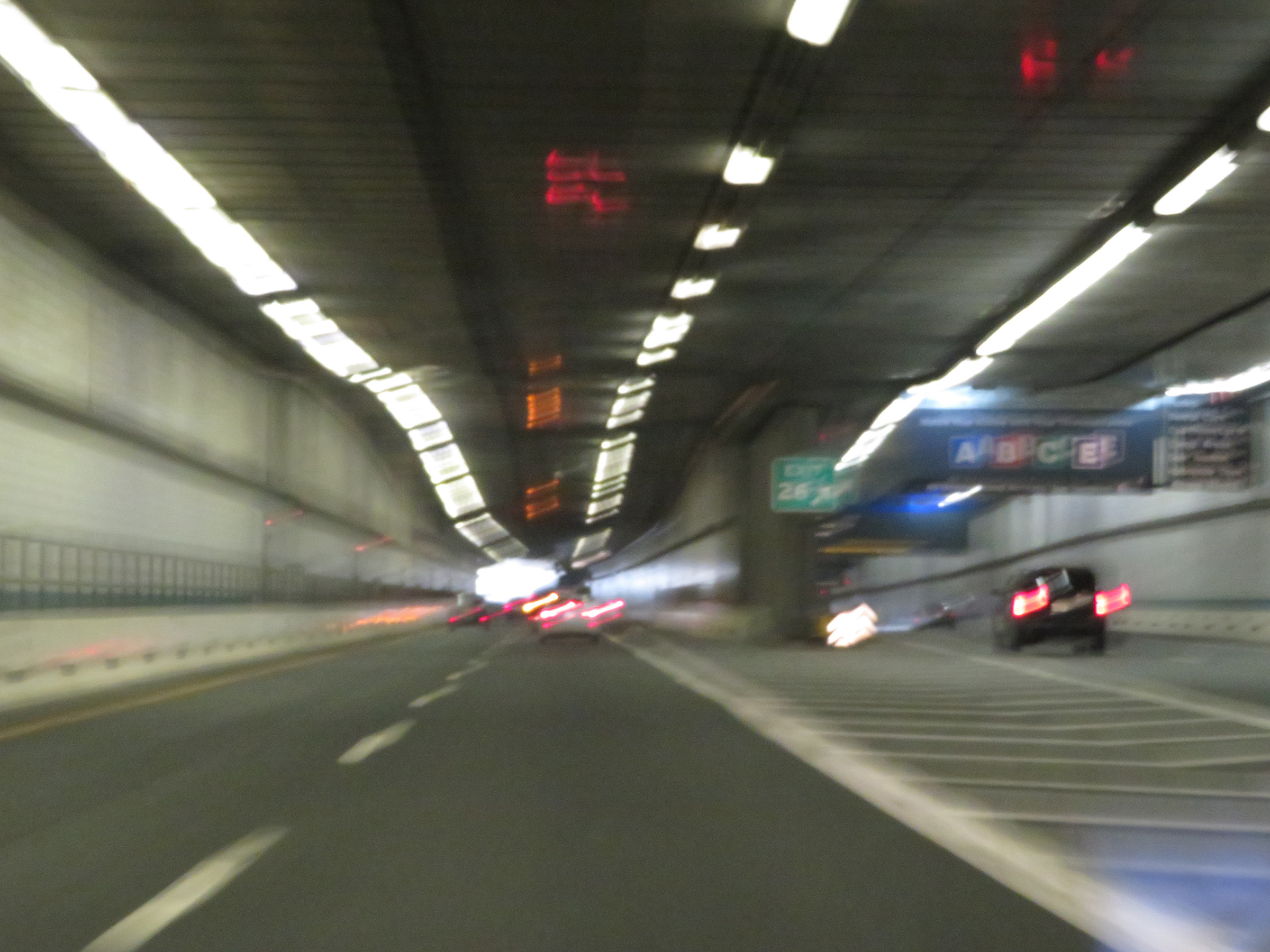 |
A closer view of the ramp for Exit 26, which provides access to Logan Airport. (Photo taken 8/10/17). |
 |
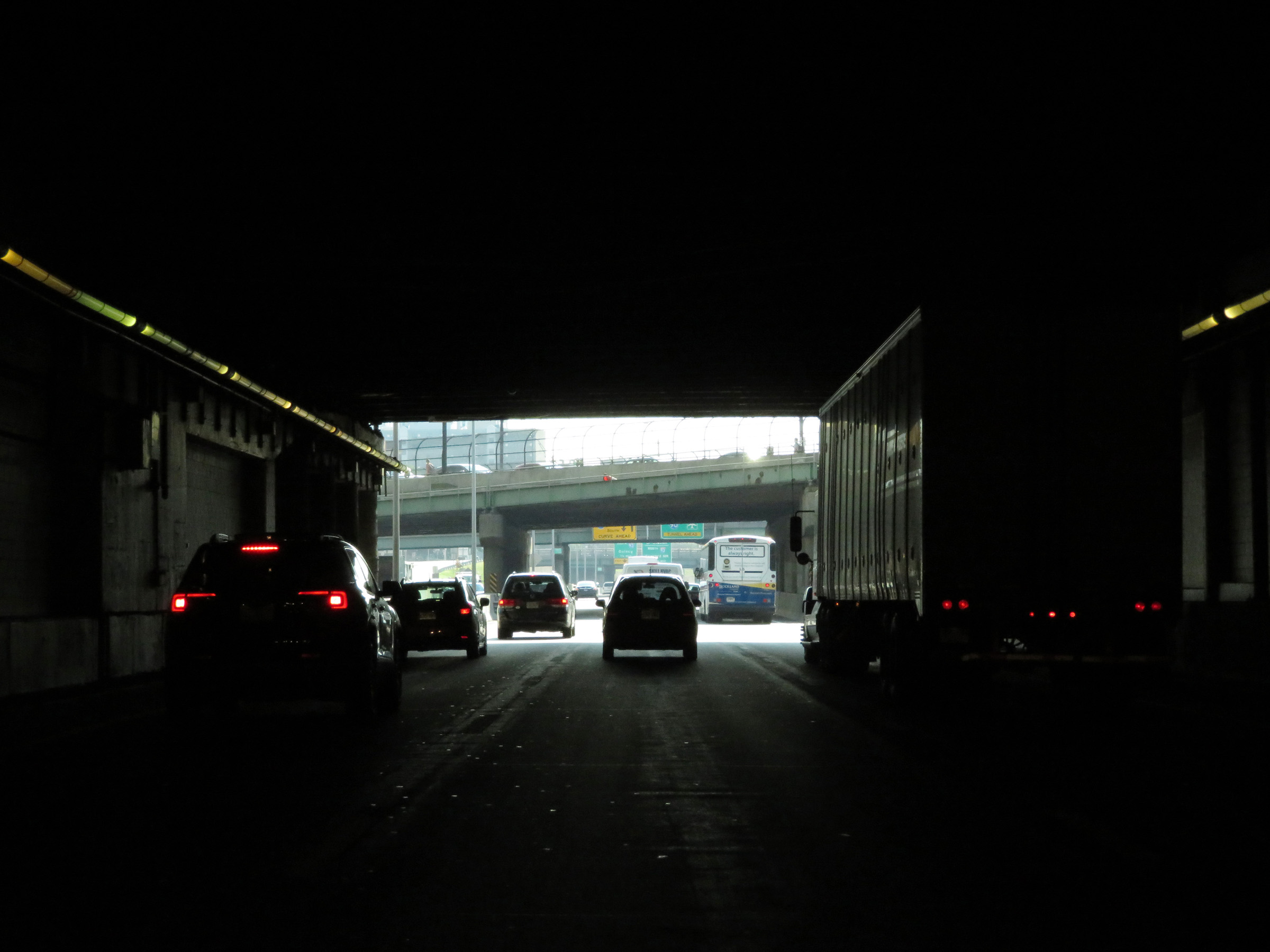
View on Interstate 90 East (Mass Pike) inside the Ted Williams Tunnel as it prepares to reach its eastern end. (Photo taken 8/10/17). |
 |
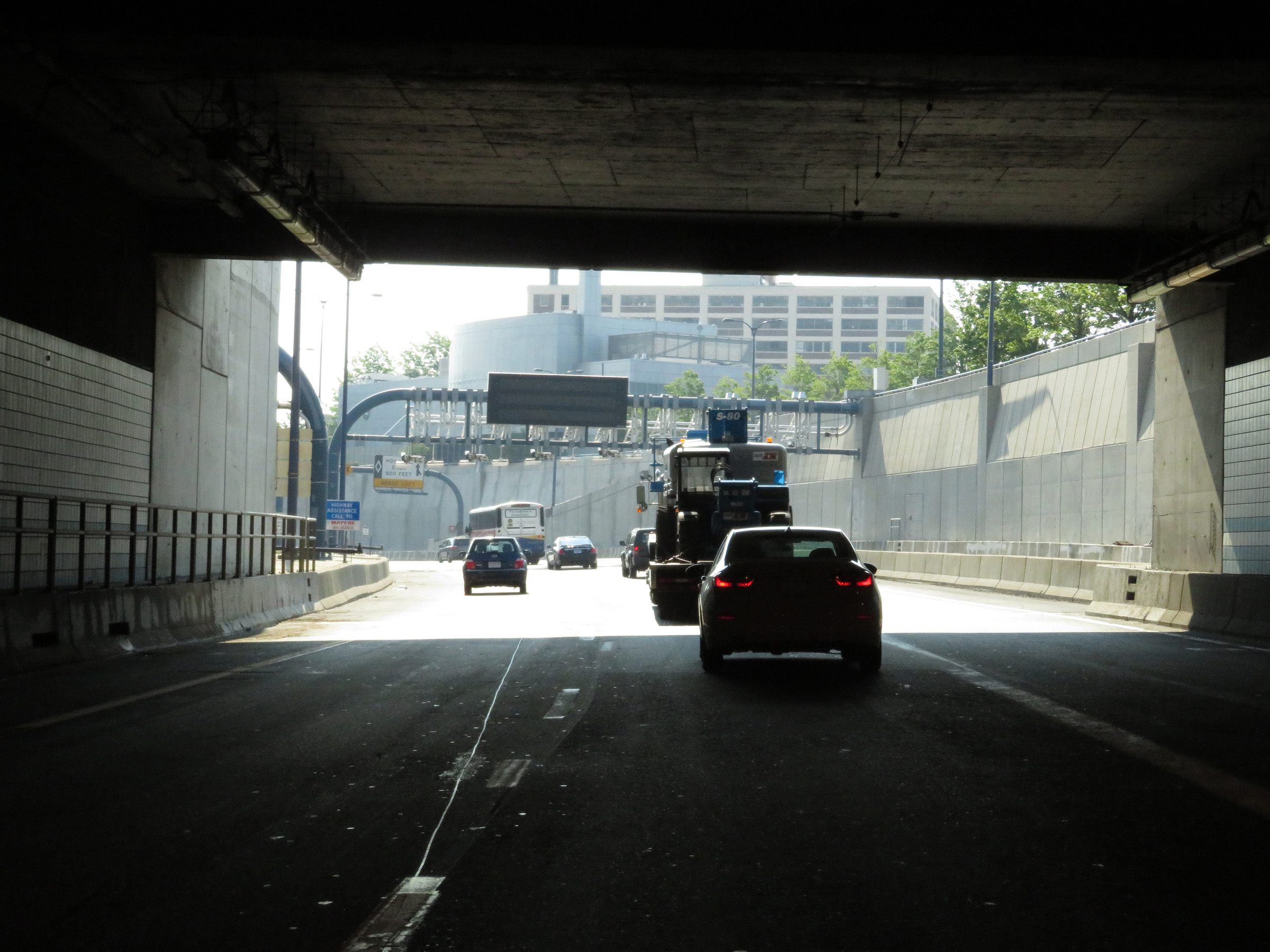
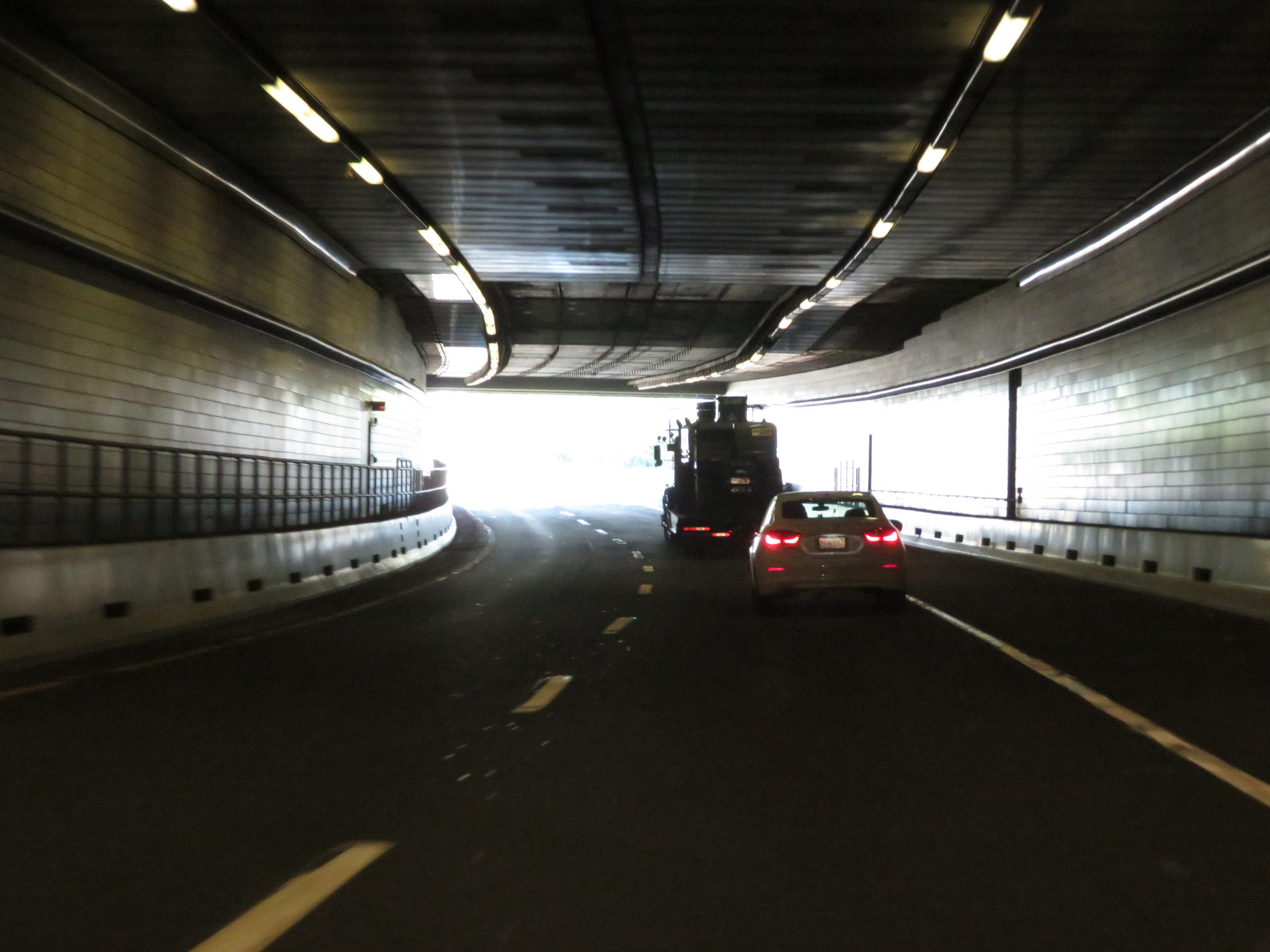
Interstate 90 East (Mass Pike) as it emerges from the Ted Williams Tunnel. (Photo taken 8/10/17). |
 |
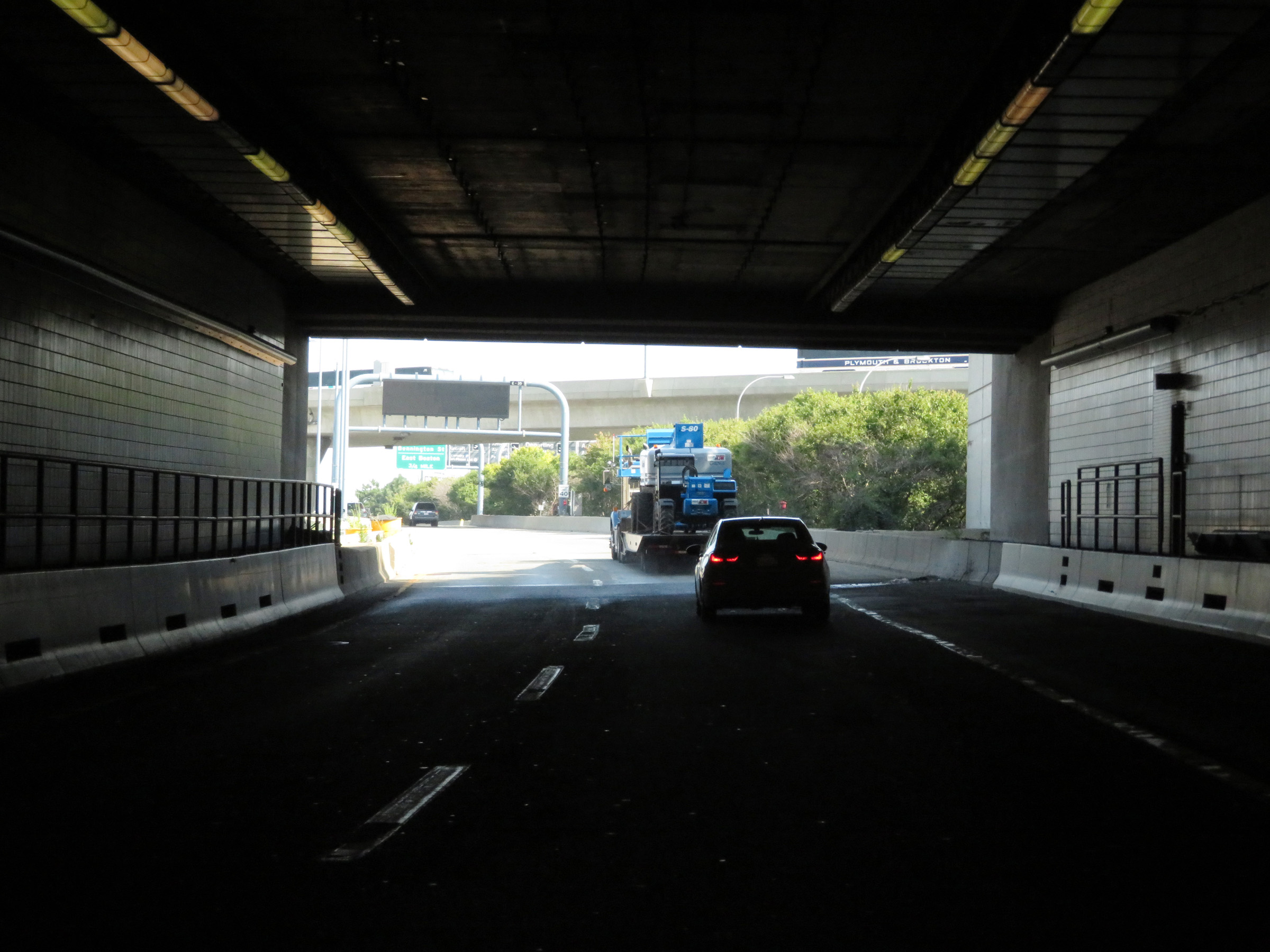
After emerging from the Ted Williams Tunnel, the speed limit on Interstate 90 East (Mass Pike) decreases to 40 mph as I-90 approaches its eastern terminus at the junction of MA 1A. (Photo taken 8/10/17). |
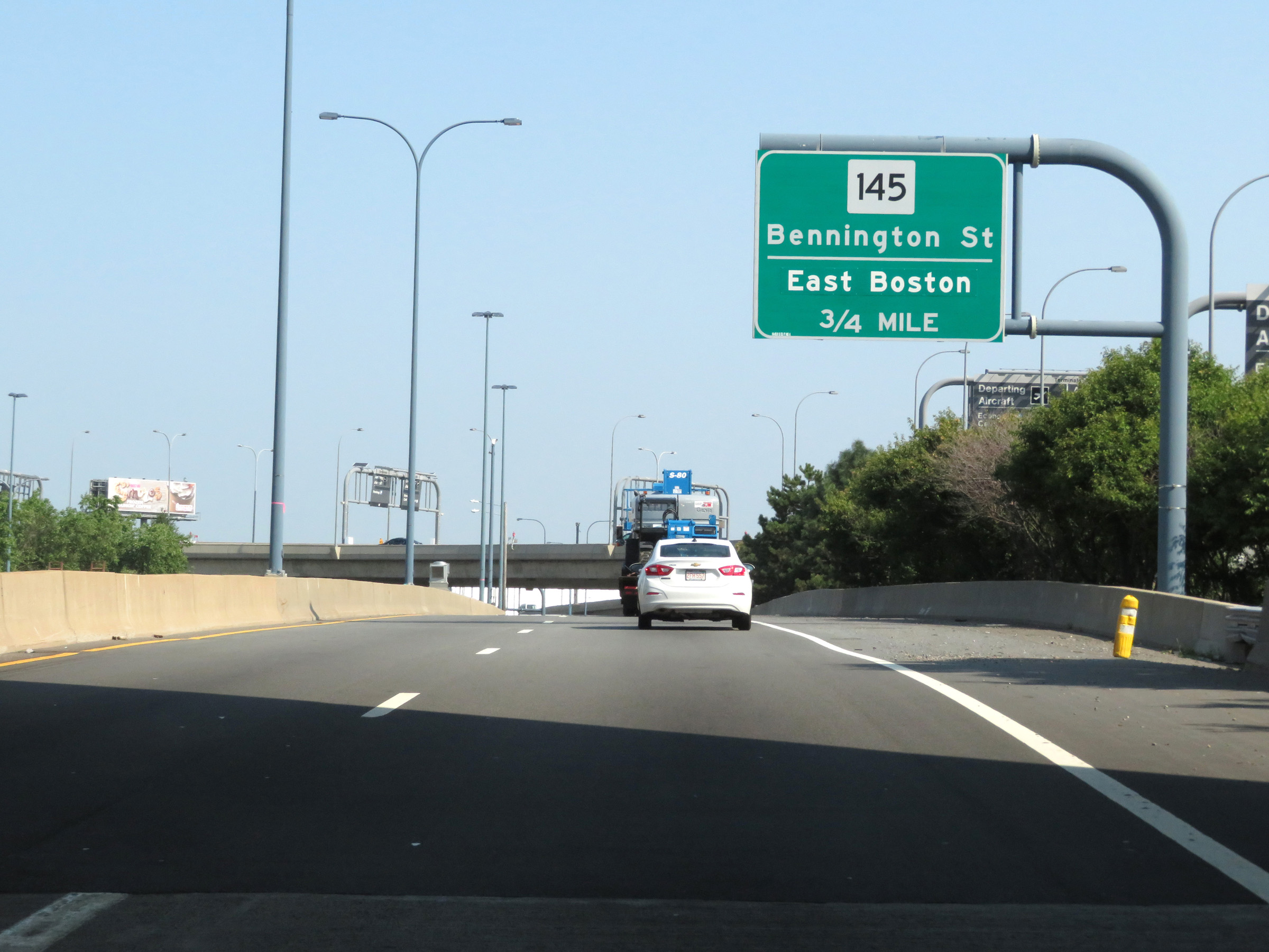 |
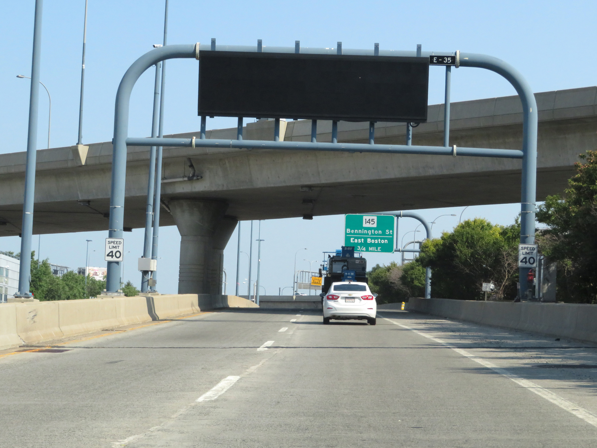
Advance signage for the first exit on MA 1A North from Interstate 90 East (Mass Pike), as I-90 nears its eastern terminus. (Photo taken 8/10/17). |
 |
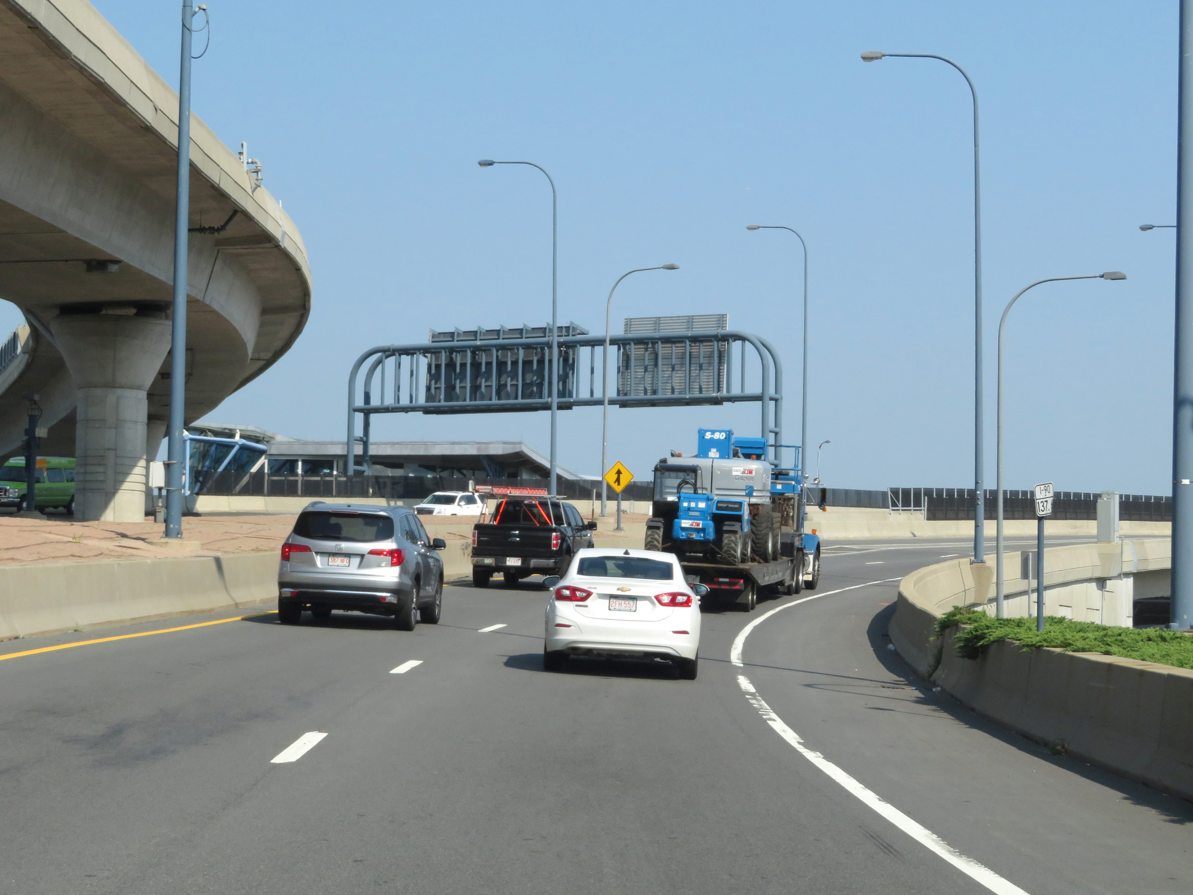
At mile marker 137.3, we see MA 1A pass over Interstate 90 East (Mass Pike) ahead before I-90 traffic will merge into it at the eastern terminus of I-90, just ahead. (Photo taken 8/10/17). |
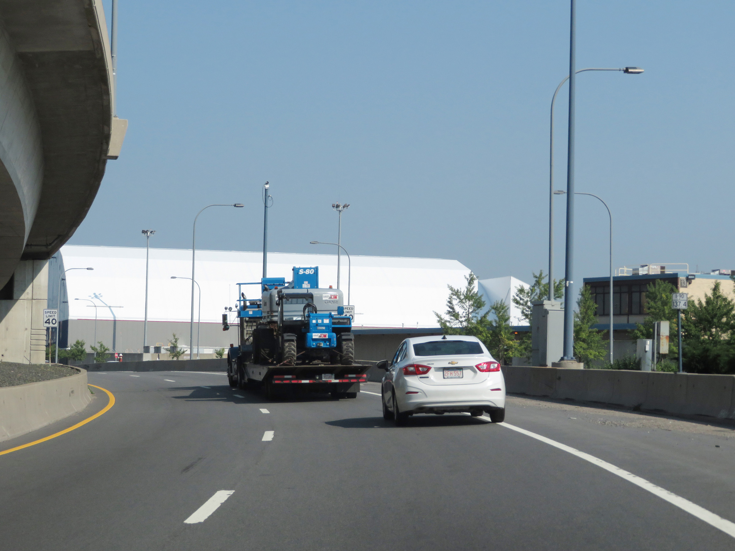 |
View on Interstate 90 East (Mass Pike) at mile marker 137.4. (Photo taken 8/10/17). |
 |
Interstate 90 East as it nears its national eastern terminus at the junction of MA 1A in Boston. (Photo taken 8/10/17). |
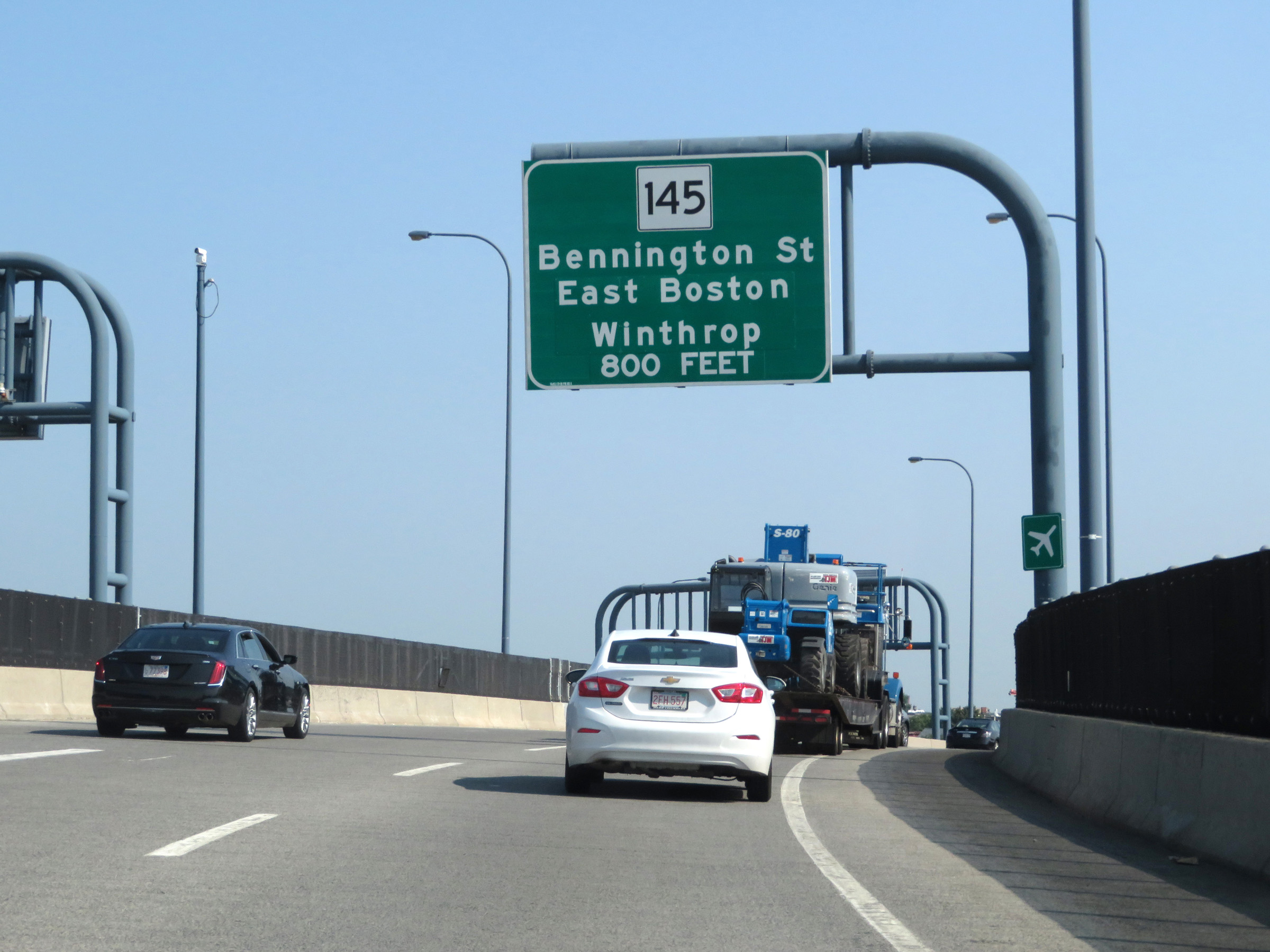 |
Advance signage for the first exit on MA 1A North after the eastern terminus of Interstate 90, which occurs just ahead. (Photo taken 8/10/17). |
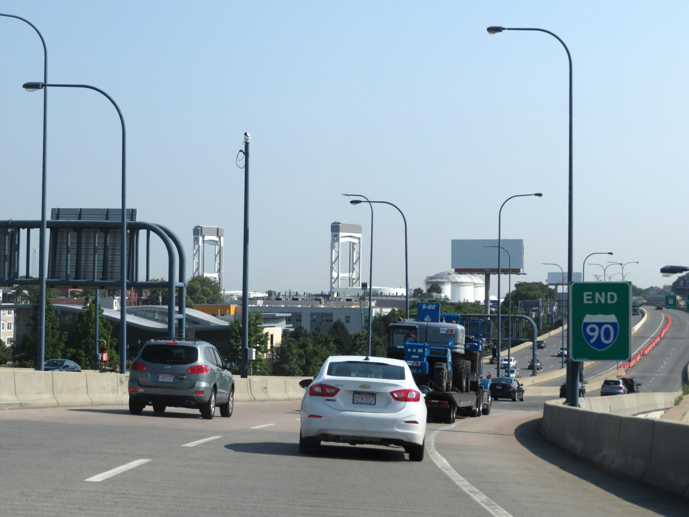 |
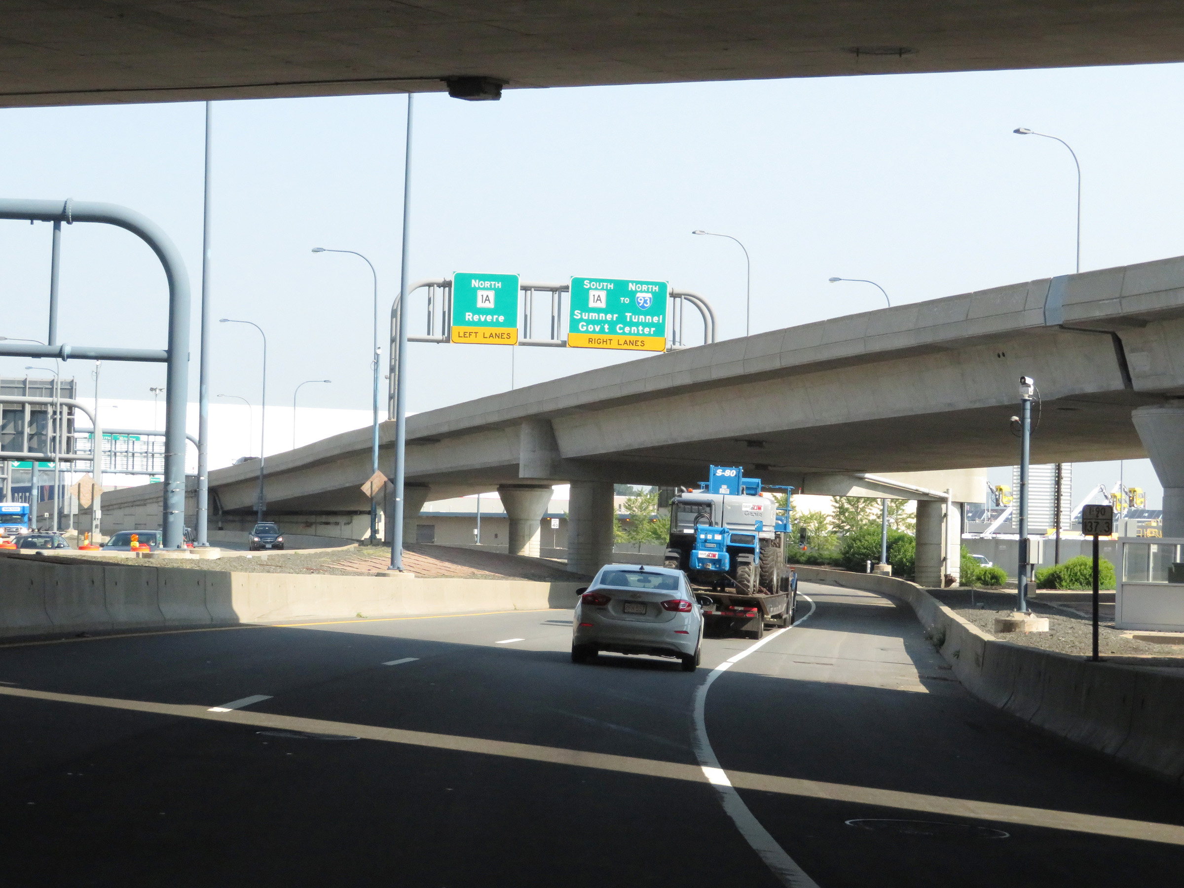
Interstate 90 END signage as it reaches its national eastern terminus at MA 1A North in Boston. (Photo taken 8/10/17). |
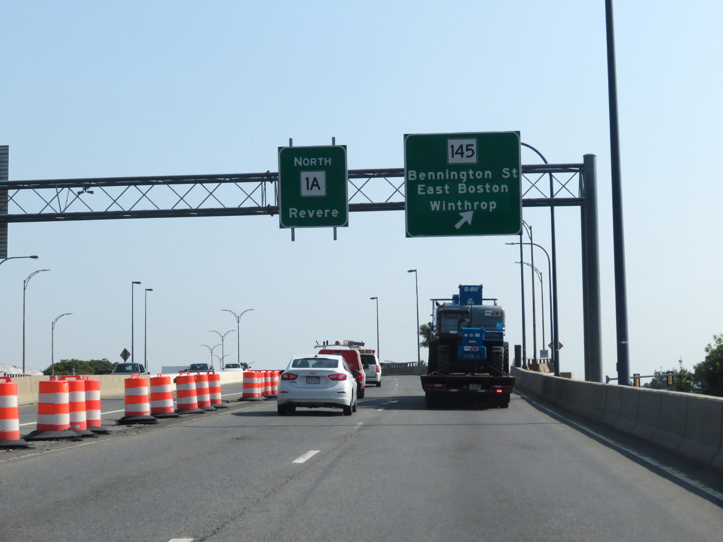 |
View on MA 1A North, as it continues toward Revere just beyond the eastern terminus of Interstate 90. (Photo taken 8/10/17). |