Road Information |
||
 |
||
| Total Mileage in State: | 93 miles | |
| Eastern End: | At Park & Ride, in Baltimore | |
| Western End: | At Pennsylvania state line | |
| Mileage covered in Photos: | 93 miles | |
| Counties covered in Photos: | Washington, Frederick, Carroll, Howard, Baltimore | |
| Major Junctions in Photos: | I-68, near Hancock I-81, in Hagerstown I-270, in Frederick US 29, near Ellicott City I-695, in Woodlawn |
|
| Control Cities in Photos: | Hancock, Hagerstown, Frederick, Ellicott City, Baltimore | |
Eastbound
- Section 1: Pennsylvania Border to Frederick (Exit 52B)
- Section 2: Frederick (Exit 52B) to Baltimore
Section 1: Pennsylvania Border to Frederick (Exit 52B)
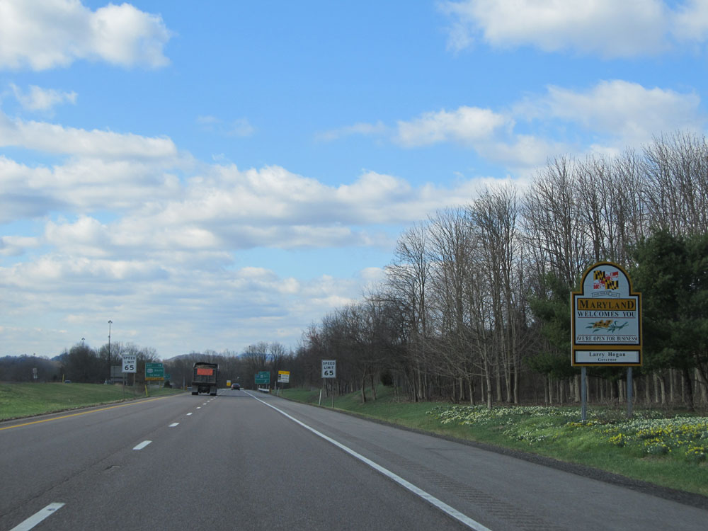 |
Maryland welcome sign as Interstate 70 East enters the Old Line State from Pennsylvania. (Photo taken 4/11/15). |
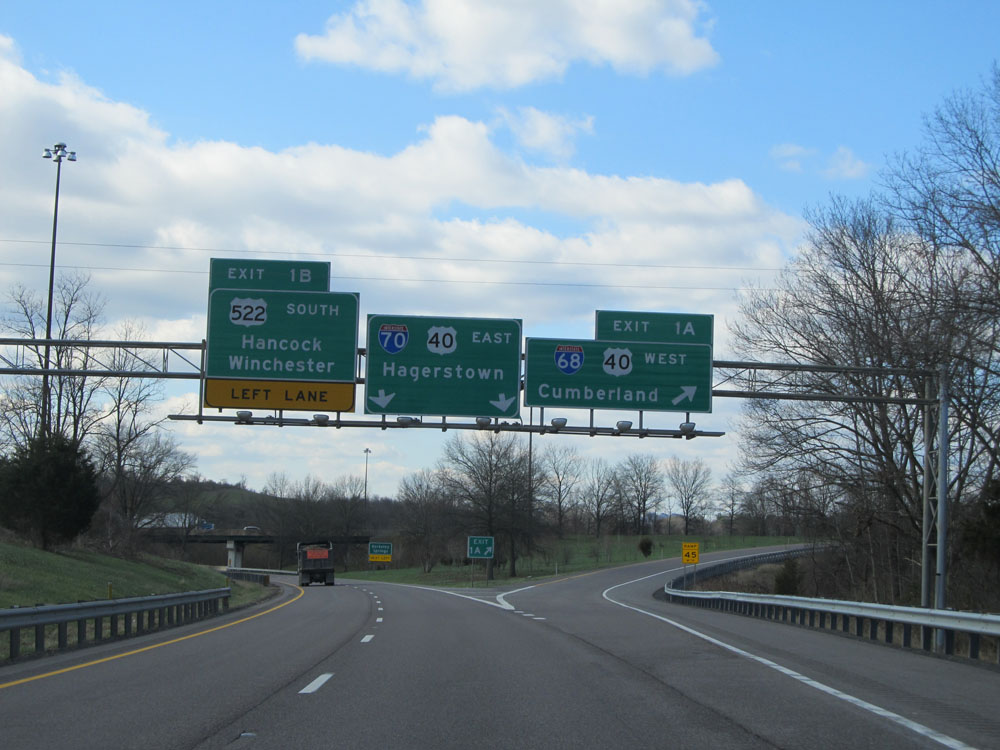 |
Interstate 70 East at Exit 1A: Interstate 68 West / US 40 West - Cumberland (Photo taken 4/11/15). |
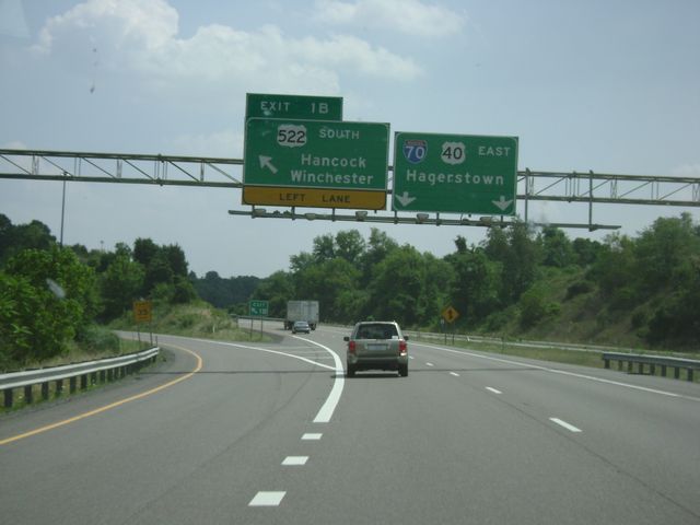 |
Interstate 70 East at Exit 1B: US 522 South - Hancock / Winchester (Photo taken 8/6/10). |
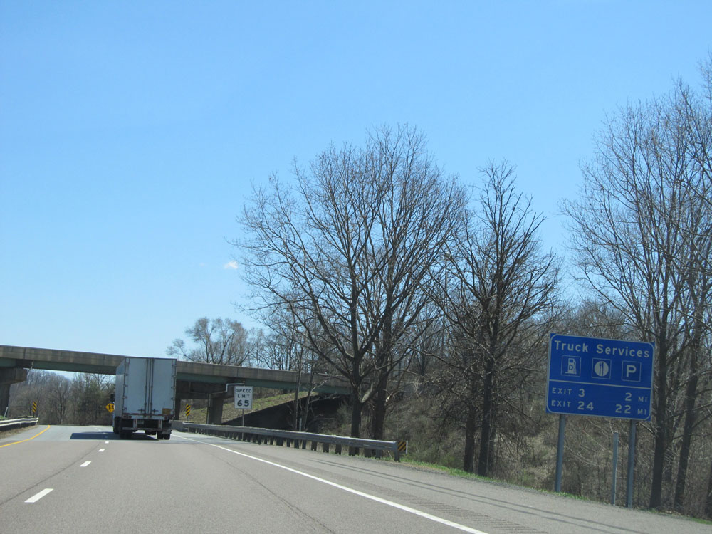 |
Truck services, including fuel, food, and parking, exist at Exits 3 and 24. (Photo taken 4/11/15). |
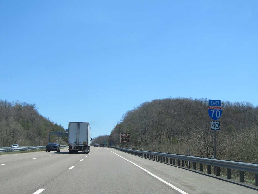 |
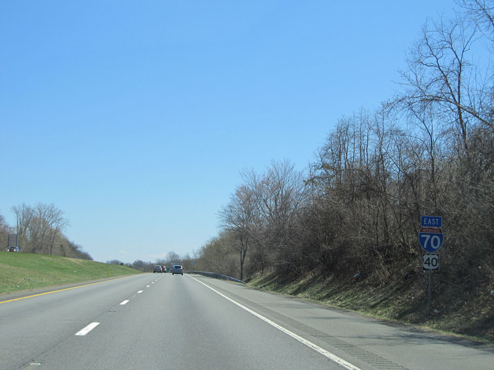
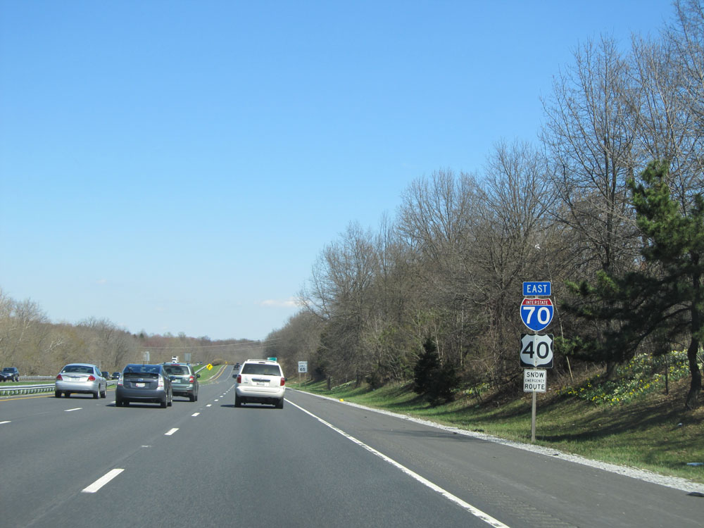
Interstate 70 East / US 40 East dual assurance shields near mile marker 1. (Photo taken 4/11/15). |
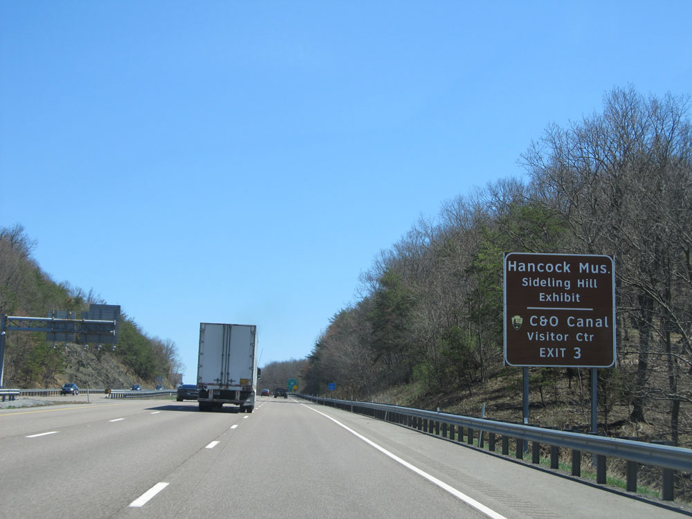 |
Take Exit 3 to Hancock Museum / Sideling Hill Exhibit and C&O Canal Visitor Center. (Photo taken 4/11/15). |
 |
Speed limit sign near mile marker 2. The speed limit on most rural Interstates in Maryland is 65 mph. (Photo taken 4/11/15). |
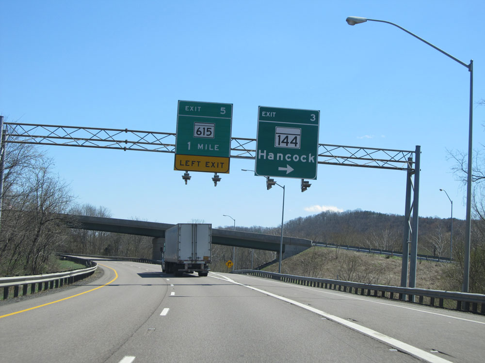 |
Interstate 70 East at Exit 3: MD 144 - Hancock (Photo taken 4/11/15). |
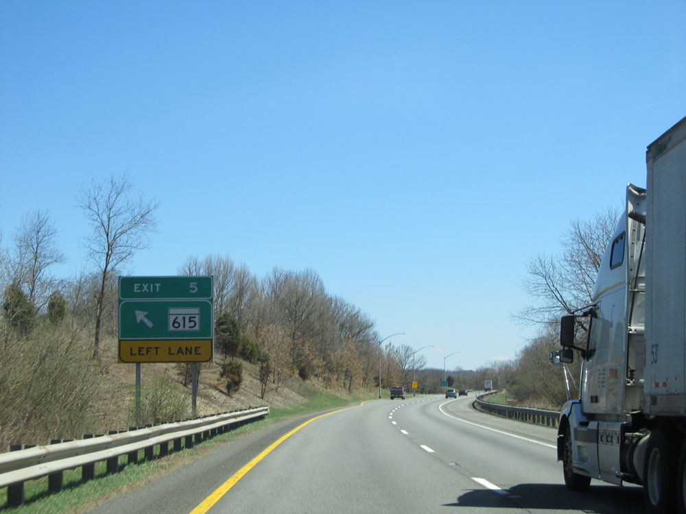 |
Interstate 70 East at Exit 5: MD 615 (Photo taken 4/11/15). |
 |
Another Interstate 70 East assurance shield near mile marker 5. (Photo taken 4/11/15). |
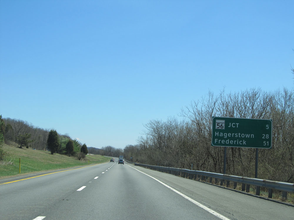 |
Mileage sign near mile marker 5. It's 5 miles to the junction of MD 56, 28 miles to Hagerstown, and 51 miles to Frederick. (Photo taken 4/11/15). |
 |
Interstate 70 East at mile marker 8. (Photo taken 4/11/15). |
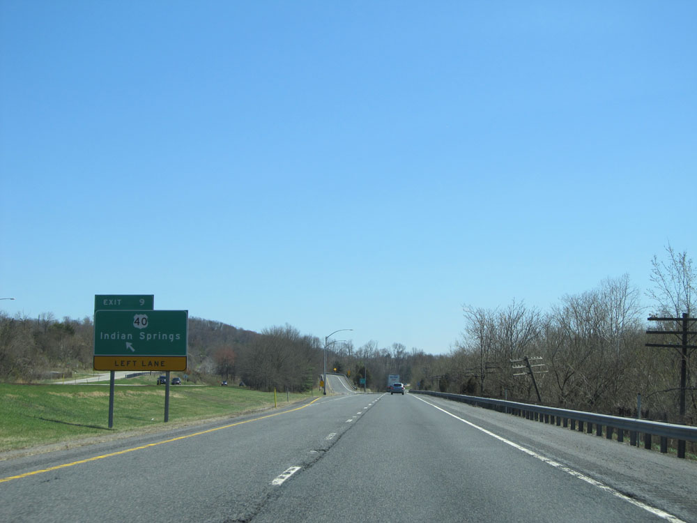 |
Interstate 70 East at Exit 9: US 40 - Indian Springs (Photo taken 4/11/15). |
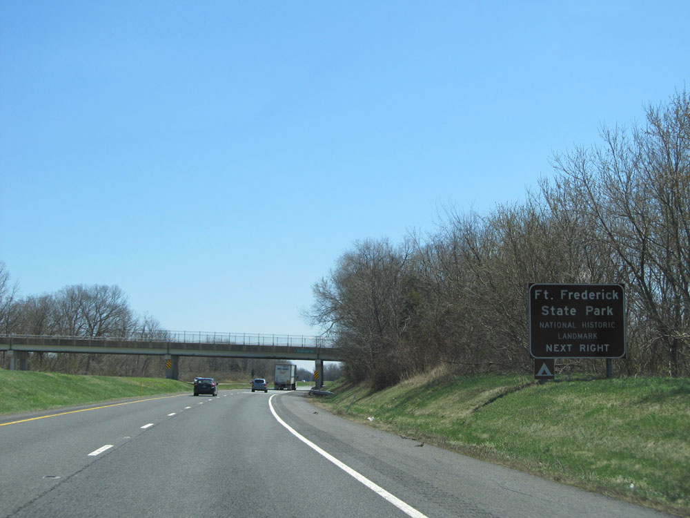 |
Take Exit 12 to Ft. Frederick State Park. (Photo taken 4/11/15). |
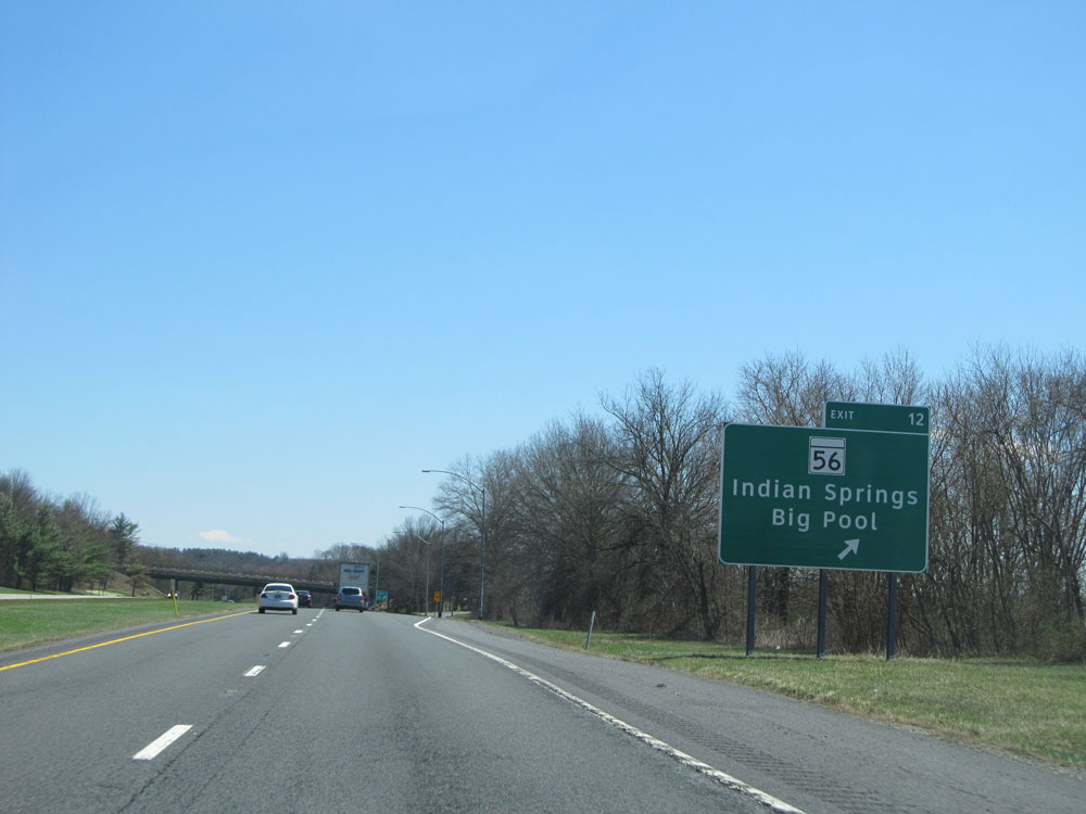 |
Interstate 70 East at Exit 12: MD 56 - Indian Springs / Big Pool (Photo taken 4/11/15). |
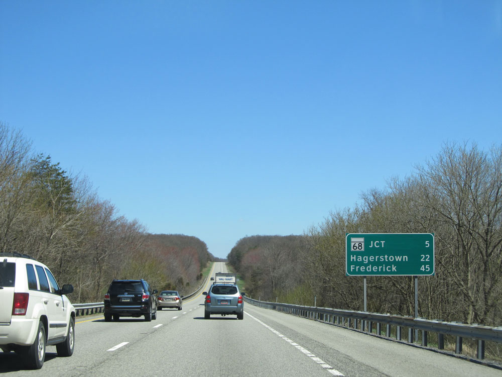 |
Mileage sign near mile marker 12. It's 5 miles to the junction of MD 68, 22 miles to Hagerstown, and 45 miles to Frederick. (Photo taken 4/11/15). |
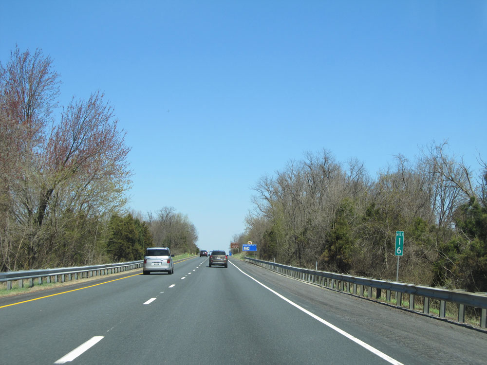 |
Interstate 70 East: Road view from mile marker 16. (Photo taken 4/11/15). |
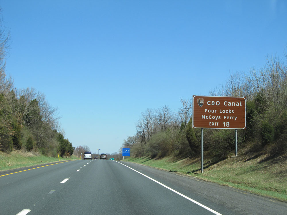 |
Take Exit 18 to C&O Canal / Four Locks / McCoys Ferry. (Photo taken 4/11/15). |
 |
This sign is a reminder that there are truck services off Exit 24, 8 miles ahead. (Photo taken 4/11/15). |
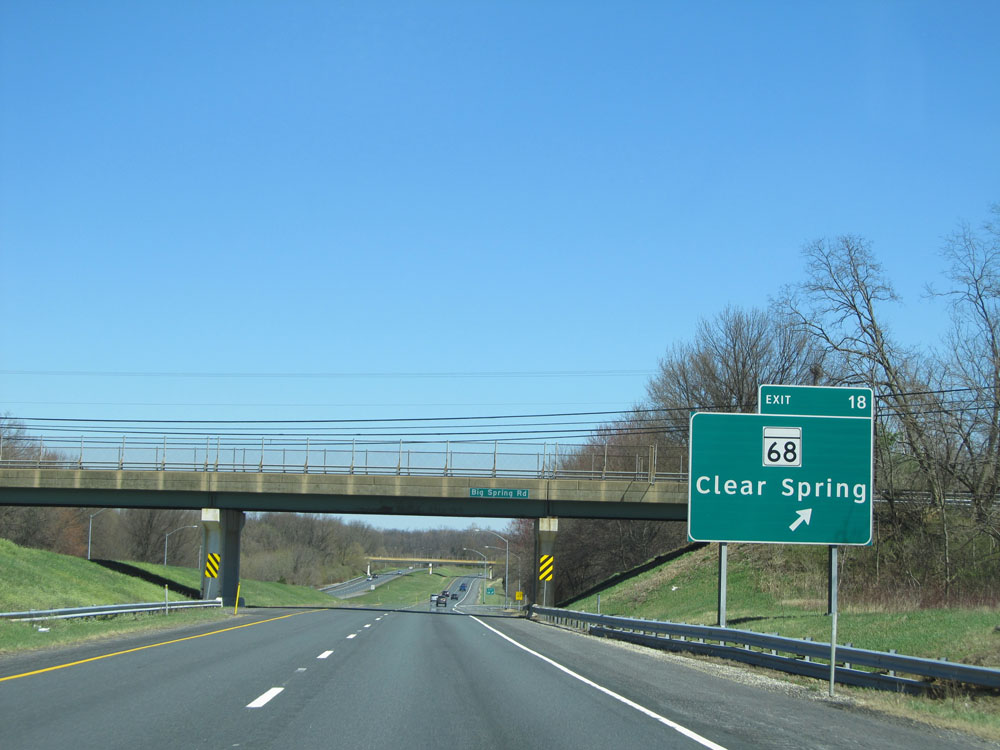 |
Interstate 70 East at Exit 18: MD 68 - Clear Spring (Photo taken 4/11/15). |
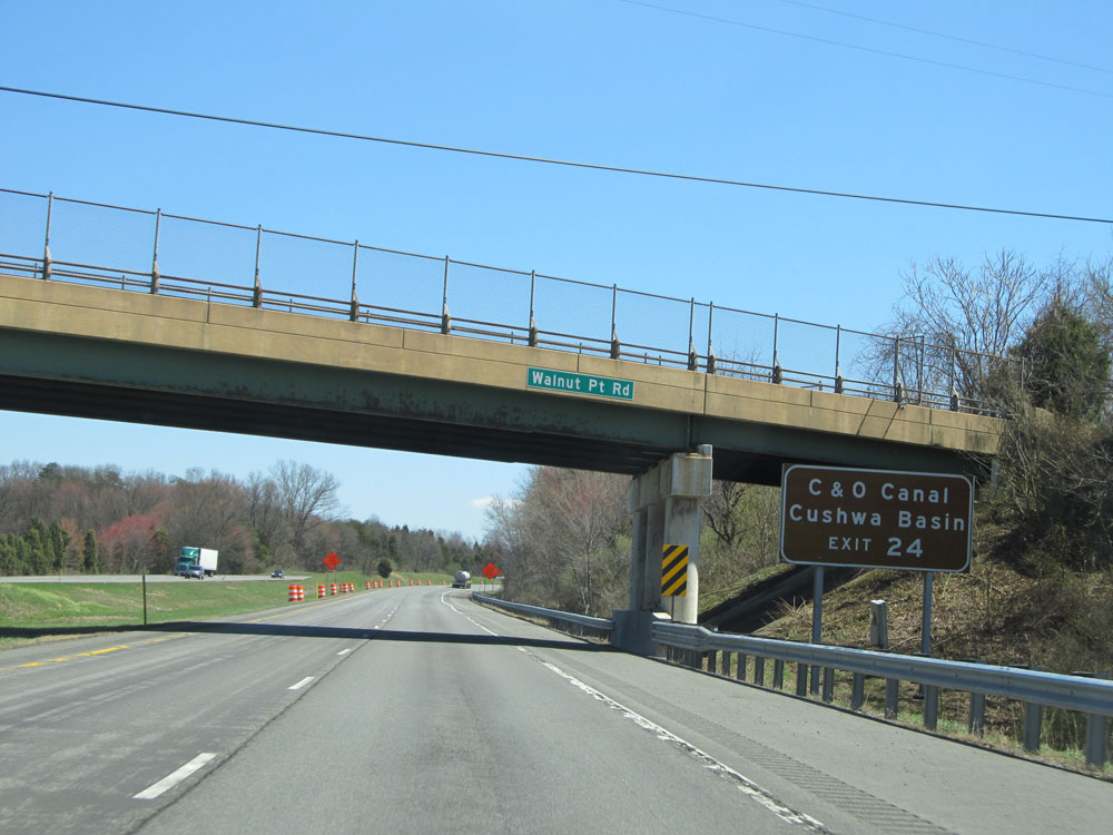 |
Take Exit 24 to C&O Canal - Cushwa Basin. (Photo taken 4/11/15). |
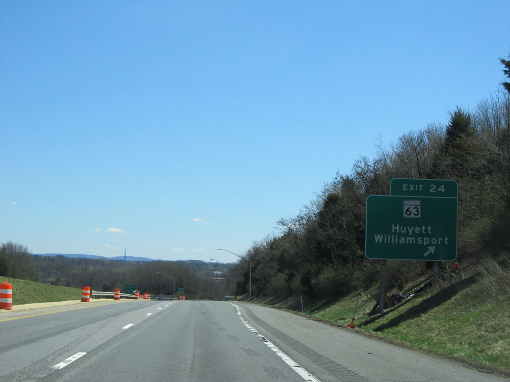 |
Interstate 70 East at Exit 24: MD 63 - Huyett / Williamsport (Photo taken 4/11/15). |
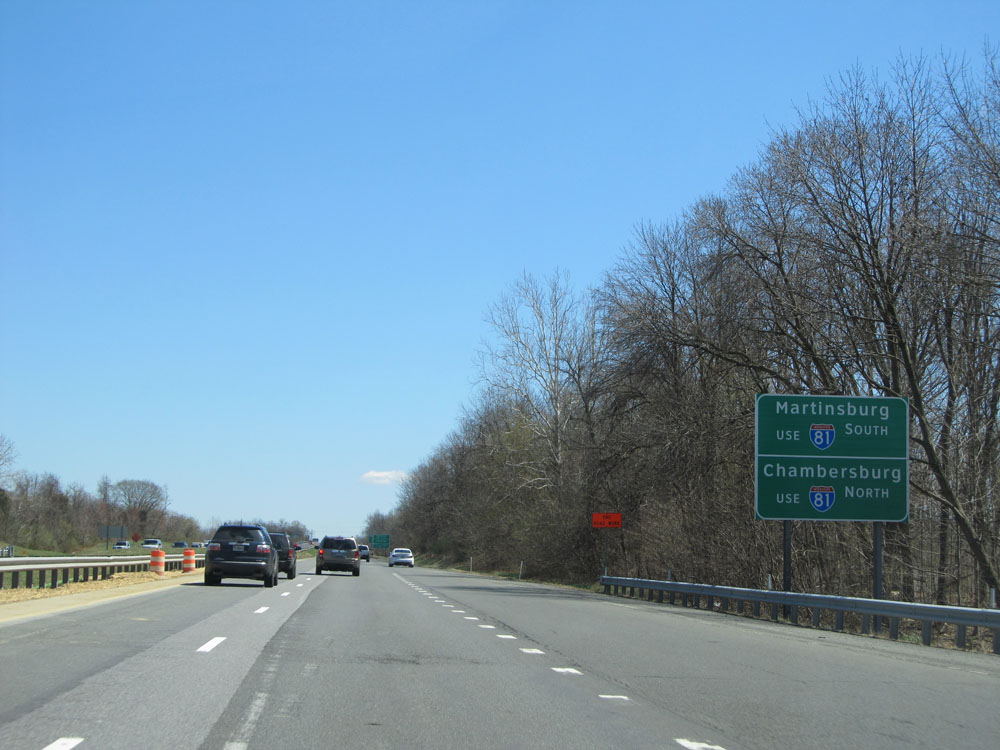 |
Take Interstate 81 South to Martinsburg, and Interstate 81 North to Chambersburg. (Photo taken 4/11/15). |
 |
Take any of the next 4 exits to Hagerstown. Use Interstate 81 North to Hagerstown Regional Airport. (Photo taken 4/11/15). |
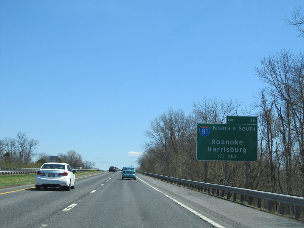 |
Interstate 70 East approaching Exit 26 - 1/2 mile. (Photo taken 4/11/15). |
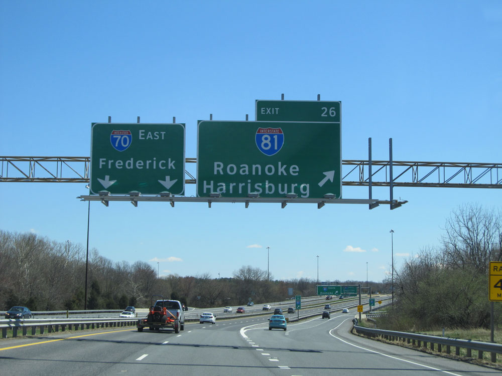 |
Interstate 70 East at Exit 26: Interstate 81 - Roanoke / Harrisburg. (Photo taken 4/11/15). |
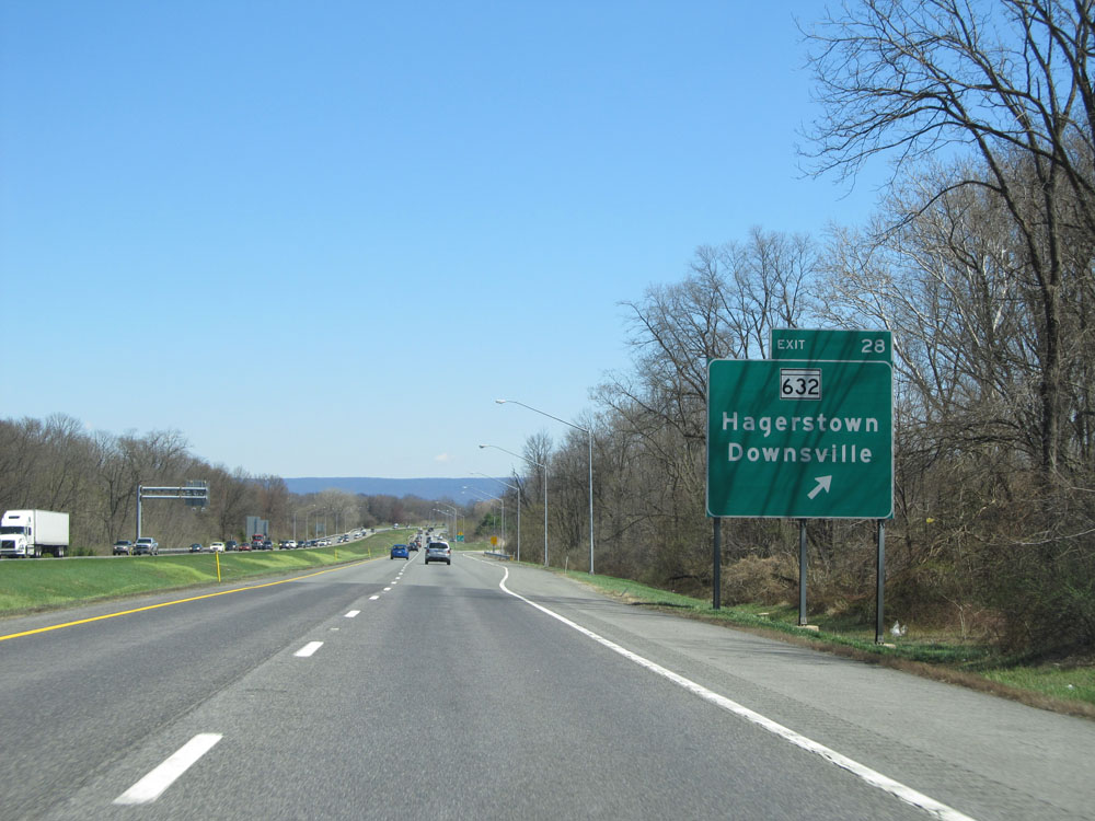 |
Interstate 70 East at Exit 28: MD 632 - Hagerstown / Downsville (Photo taken 4/11/15). |
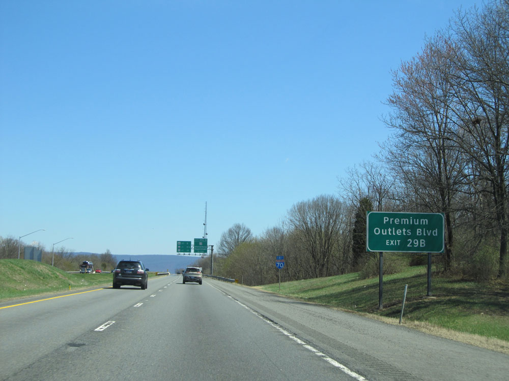 |
Take Exit 29B to Premium Outlets Blvd. (Photo taken 4/11/15). |
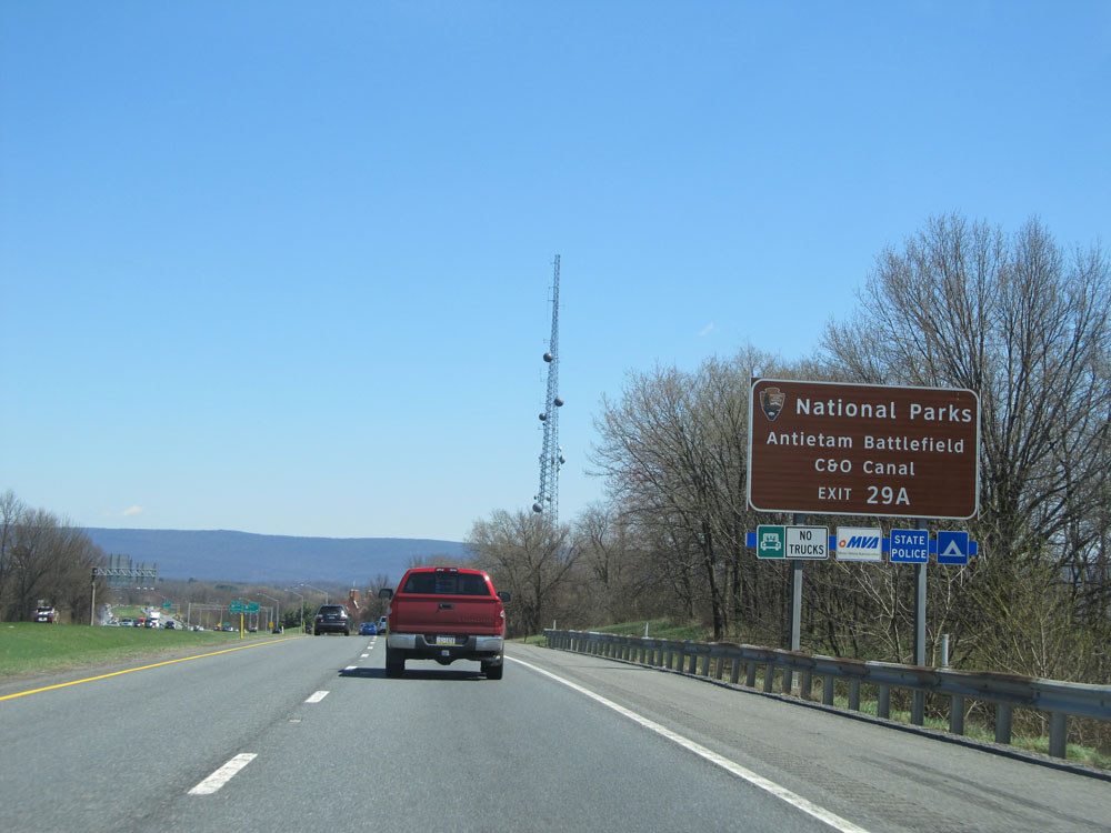 |
Take Exit 29A to Antietam Battlefield and C&O Canal National Historical Parks. (Photo taken 4/11/15). |
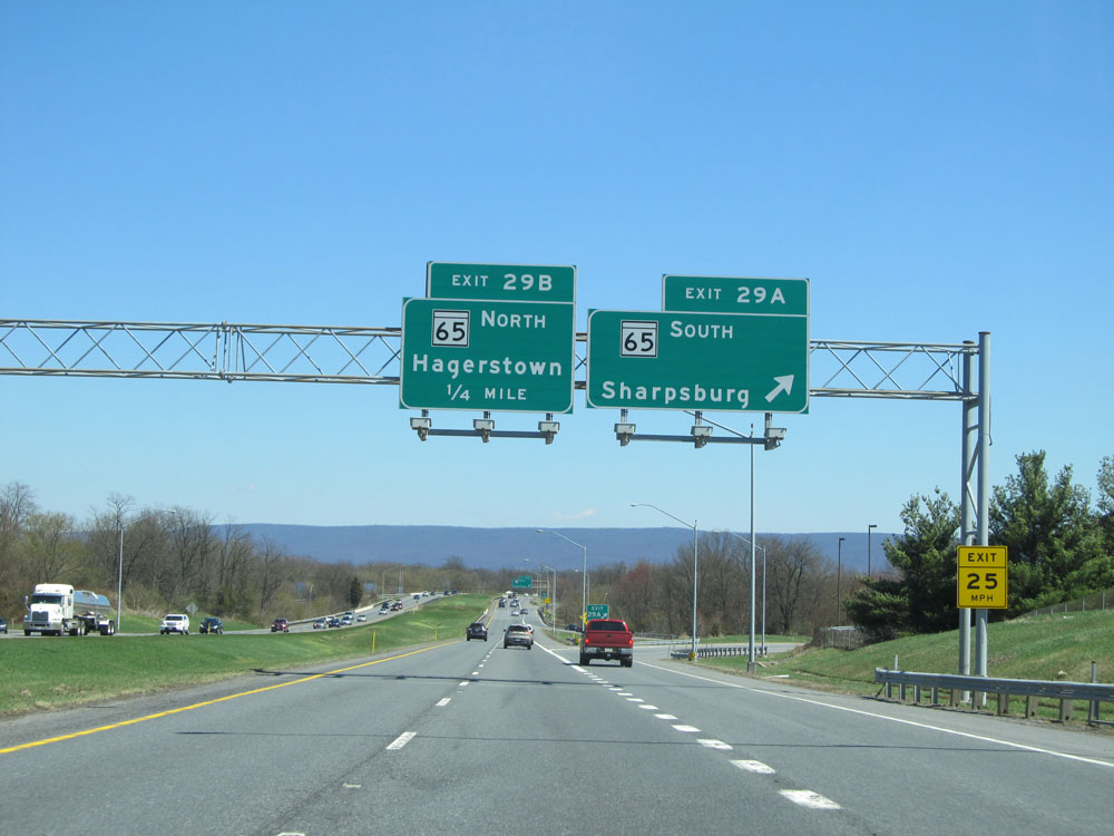 |
Interstate 70 East at Exit 29A: MD 65 South - Sharpsburg (Photo taken 4/11/15). |
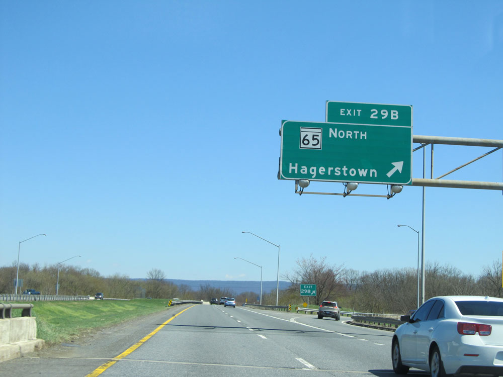 |
Interstate 70 East at Exit 29B: MD 65 North - Hagerstown (Photo taken 4/11/15). |
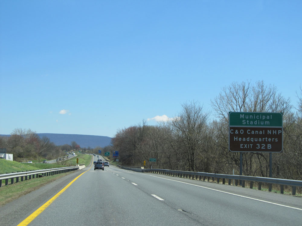 |
Take Exit 32B to Municipal Stadium and C&O Canal National Historical Park Headquarters. (Photo taken 4/11/15). |
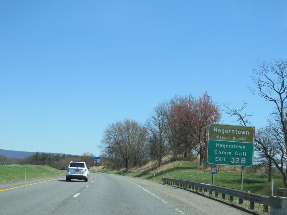 |
Also take Exit 32B to Hagerstown Historic District and Hagerstown Community College. (Photo taken 4/11/15). |
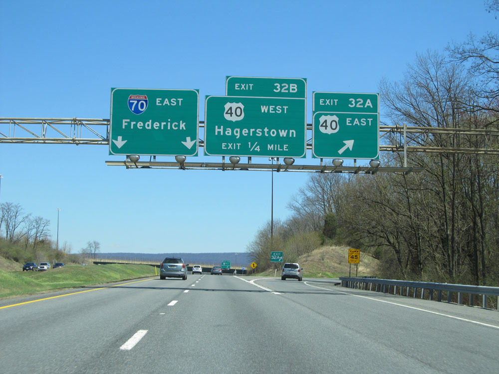 |
Interstate 70 East at Exit 32A: US 40 East (Photo taken 4/11/15). |
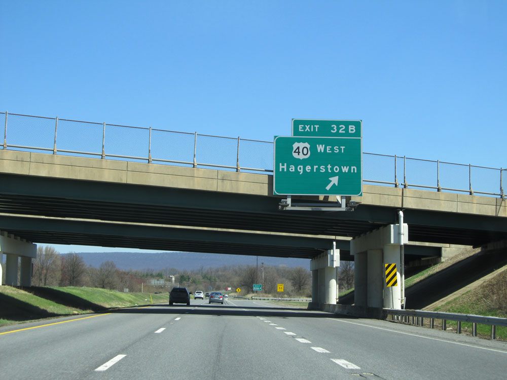 |
Interstate 70 East at Exit 32B: US 40 West - Hagerstown (Photo taken 4/11/15). |
 |
Mileage sign as Interstate 70 leaves the Hagerstown area to the east. Frederick - 22 miles, Washington DC - 67 miles, and Baltimore - 71 miles. (Photo taken 4/11/15). |
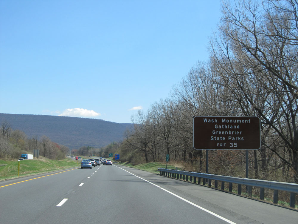 |
Take Exit 35 to Washington Monument, Gathland, and Greenbrier State Parks. (Photo taken 4/11/15). |
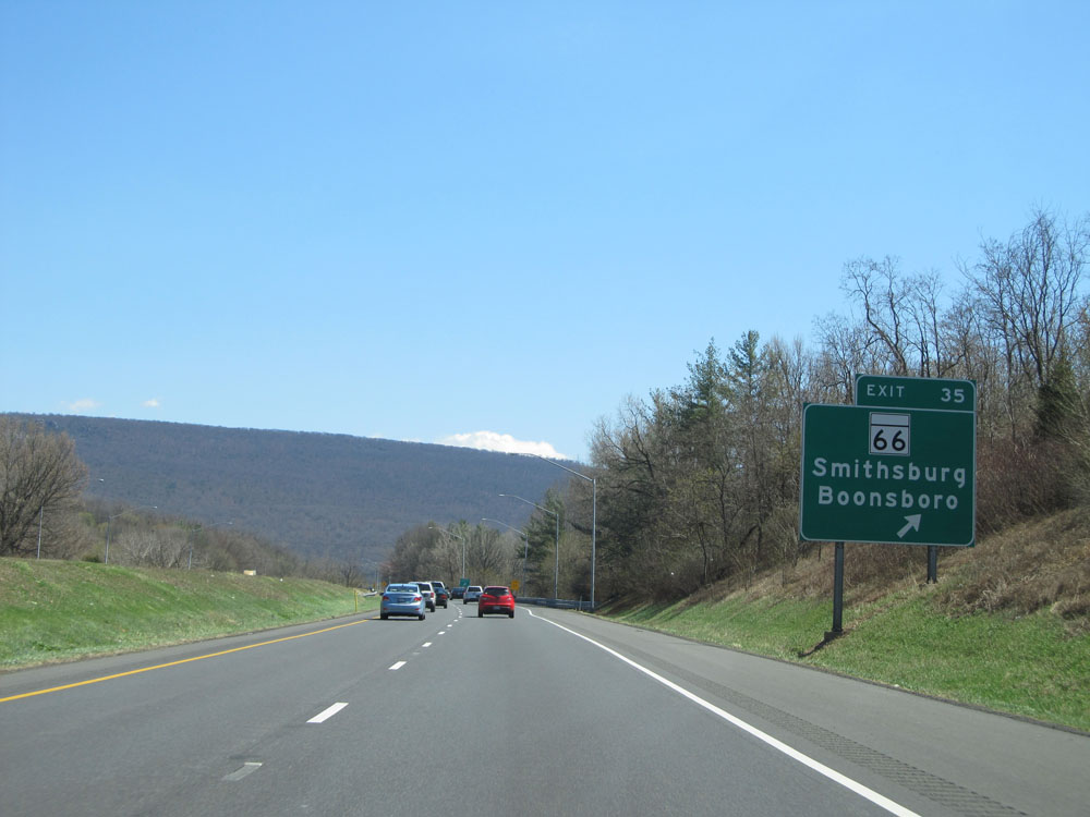 |
Interstate 70 East at Exit 35: MD 66 - Smithsburg / Boonsboro (Photo taken 4/11/15). |
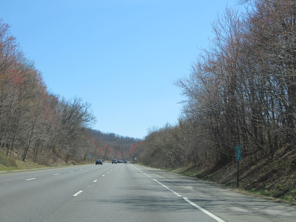 |
Interstate 70 East at mile marker 37. (Photo taken 4/11/15). |
 |
Interstate 70 East entering Frederick County. (Photo taken 4/11/15). |
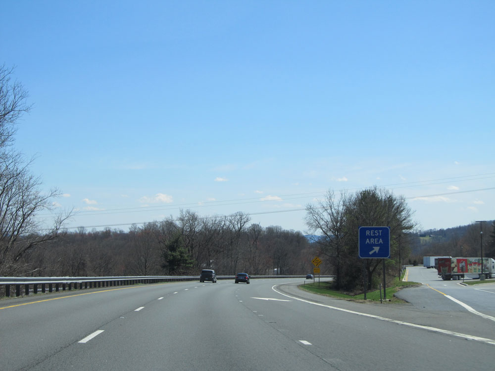 |
Interstate 70 East at the Rest Area located near mile marker 39. (Photo taken 4/11/15). |
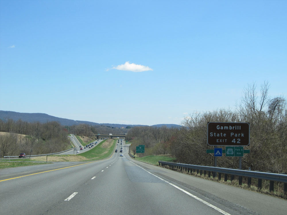 |
Take Exit 42 to Gambrill State Park. (Photo taken 4/11/15). |
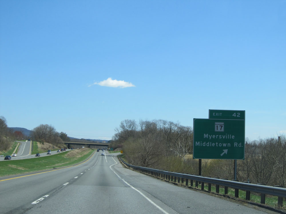 |
Interstate 70 East at Exit 42: MD 17 - Myersville / Middletown Rd (Photo taken 4/11/15). |
 |
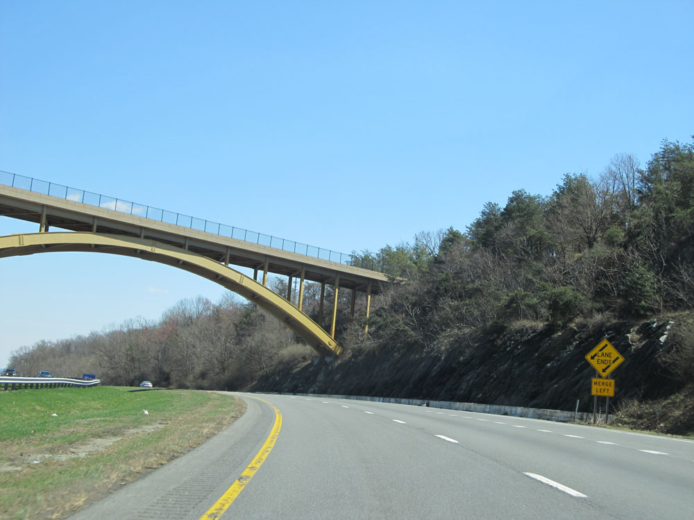
Interstate 70 East at mile marker 45. (Photo taken 4/11/15). |
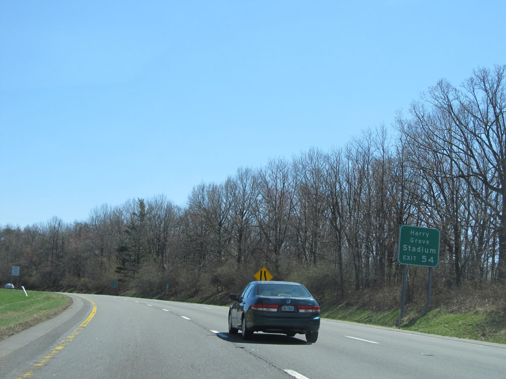 |
Take Exit 54 to Harry Grove Stadium. (Photo taken 4/11/15). |
 |
Interstate 70 East as it reaches the summit of Braddock Mountain at and elevation of 985 feet. Meh. (Photo taken 4/11/15). |
 |
View on Interstate 70 East. (Photo taken 4/11/15). |
 |
Interstate 70 East at Exit 48: US 40 East - Frederick (Photo taken 4/11/15). |
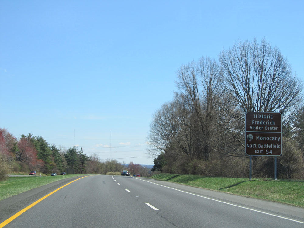 |
Take Exit 54 to Historic Frederick Visitor Center and Monocacy National Battlefield. (Photo taken 4/11/15). |
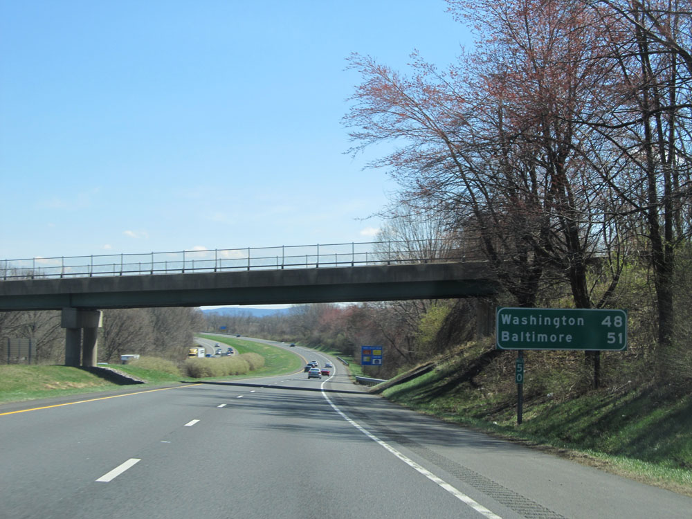 |
Mileage sign at mile marker 50. It's 48 miles to Washington DC and 51 miles to Baltimore. (Photo taken 4/11/15). |
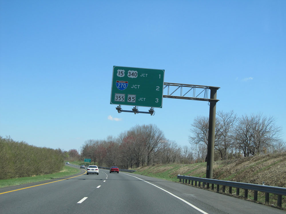 |
This overhead sign lists the distances to the three upcoming exits. (Photo taken 4/11/15). |
 |
Take Exit 52A to Harpers Ferry and Leesburg. (Photo taken 4/11/15). |
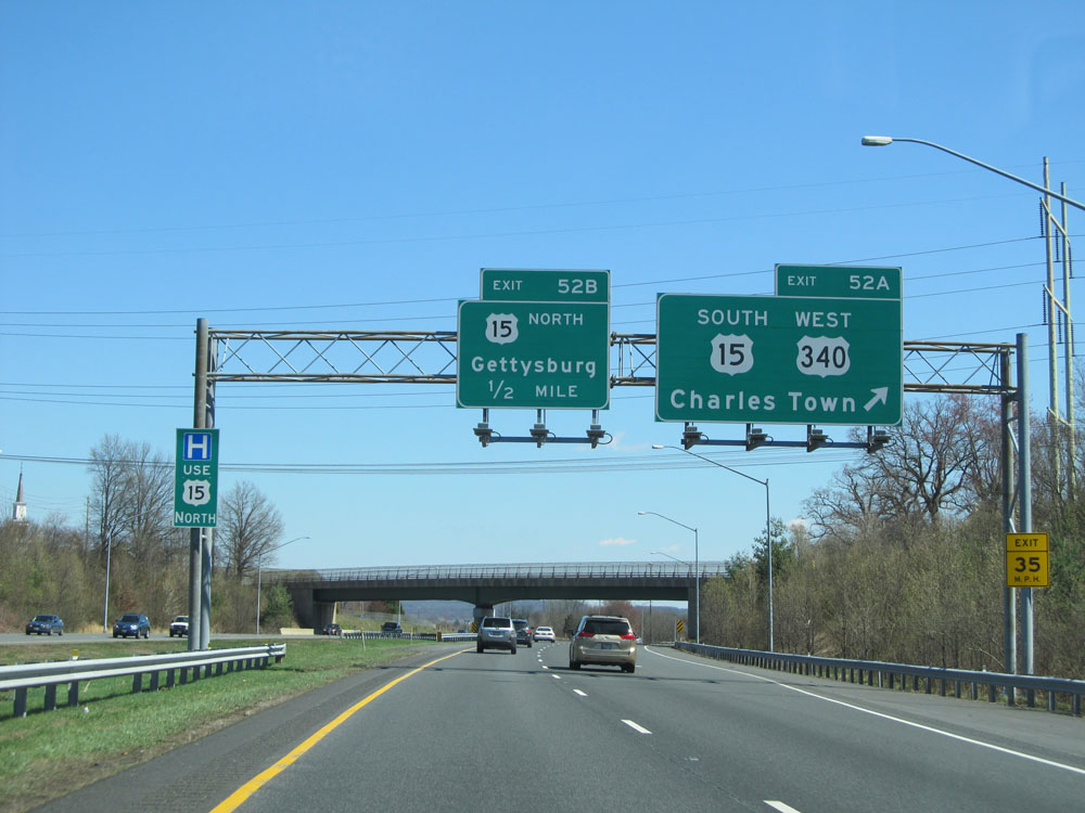 |
Interstate 70 East at Exit 52A: US 15 South / US 340 West - Charles Town (Photo taken 4/11/15). |
 |
Interstate 70 East at Exit 52B: US 15 North - Gettysburg (Photo taken 4/11/15). |
Section 2: Frederick (Exit 52B) to Baltimore
 |
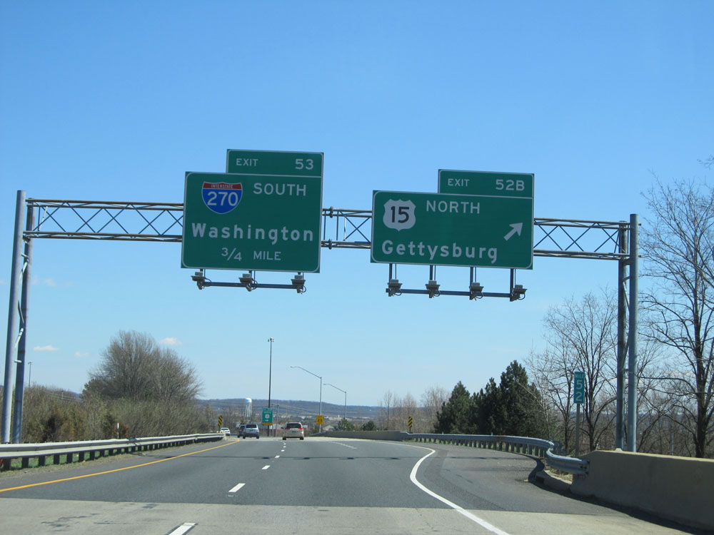
Interstate 70 East approaching Exit 53 - 1/4 mile. (Photo taken 4/11/15). |
 |
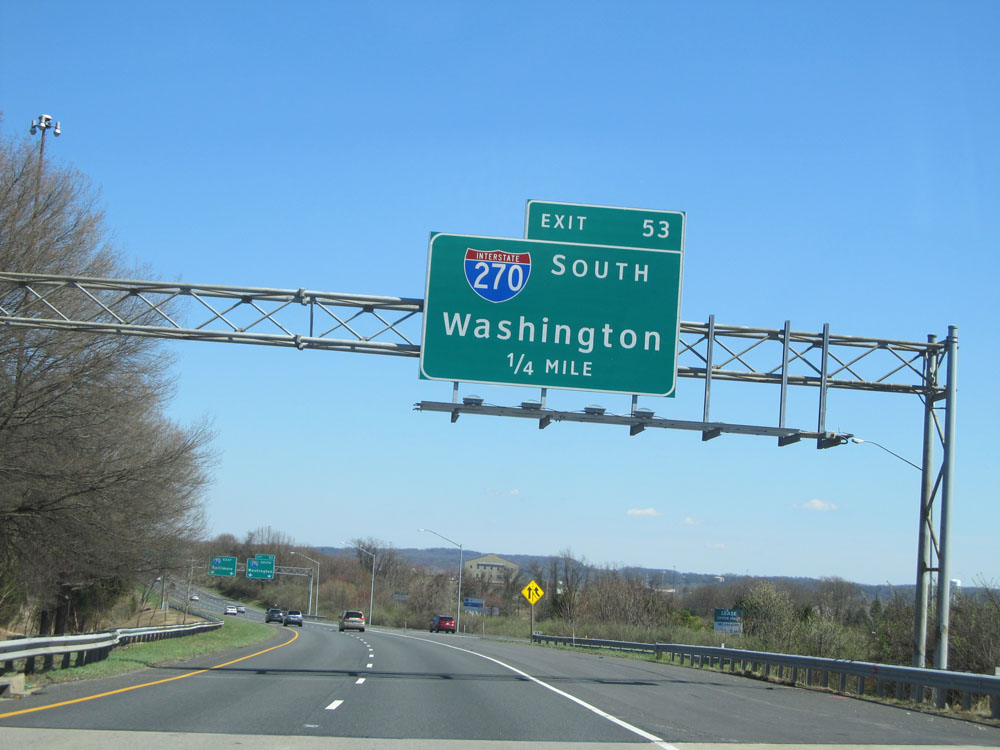
Interstate 70 East at Exit 53: Interstate 270 South - Washington (Photo taken 4/11/15). |
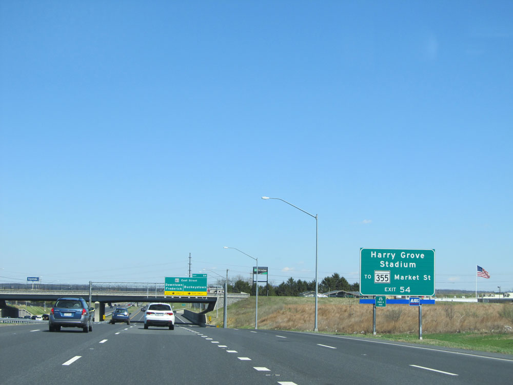 |
Take Exit 54 to Harry Grove Stadium and to MD 355 - Market St. (Photo taken 4/11/15). |
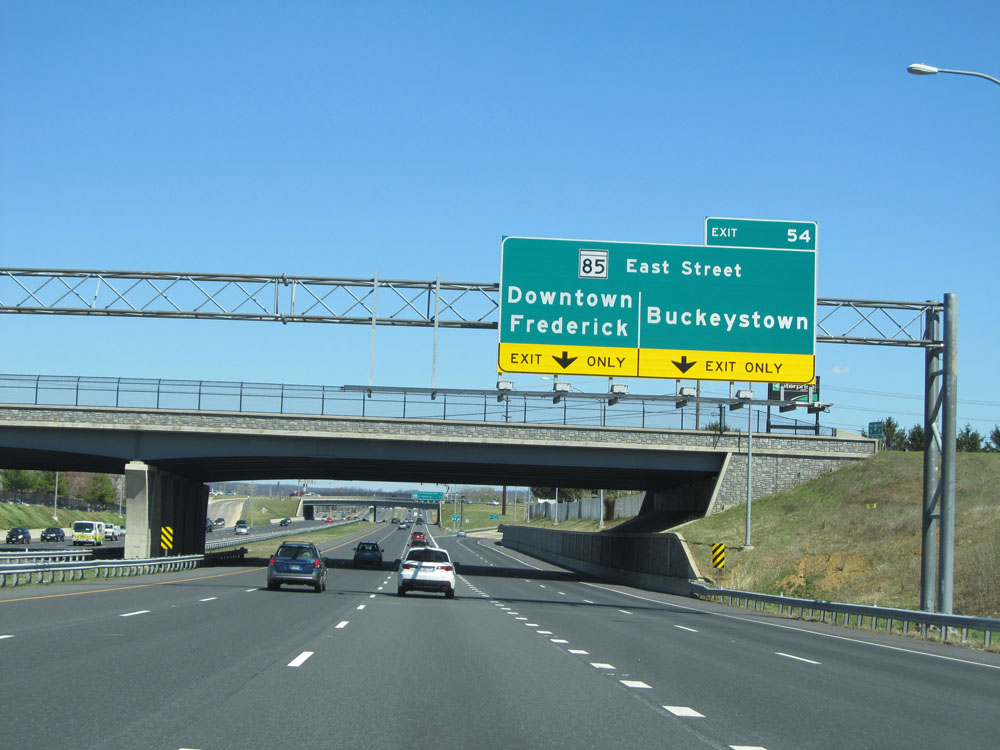 |
Interstate 70 East at Exit 54: MD 85 (East Street) - Downtown Frederick / Buckeystown (Photo taken 4/11/15). |
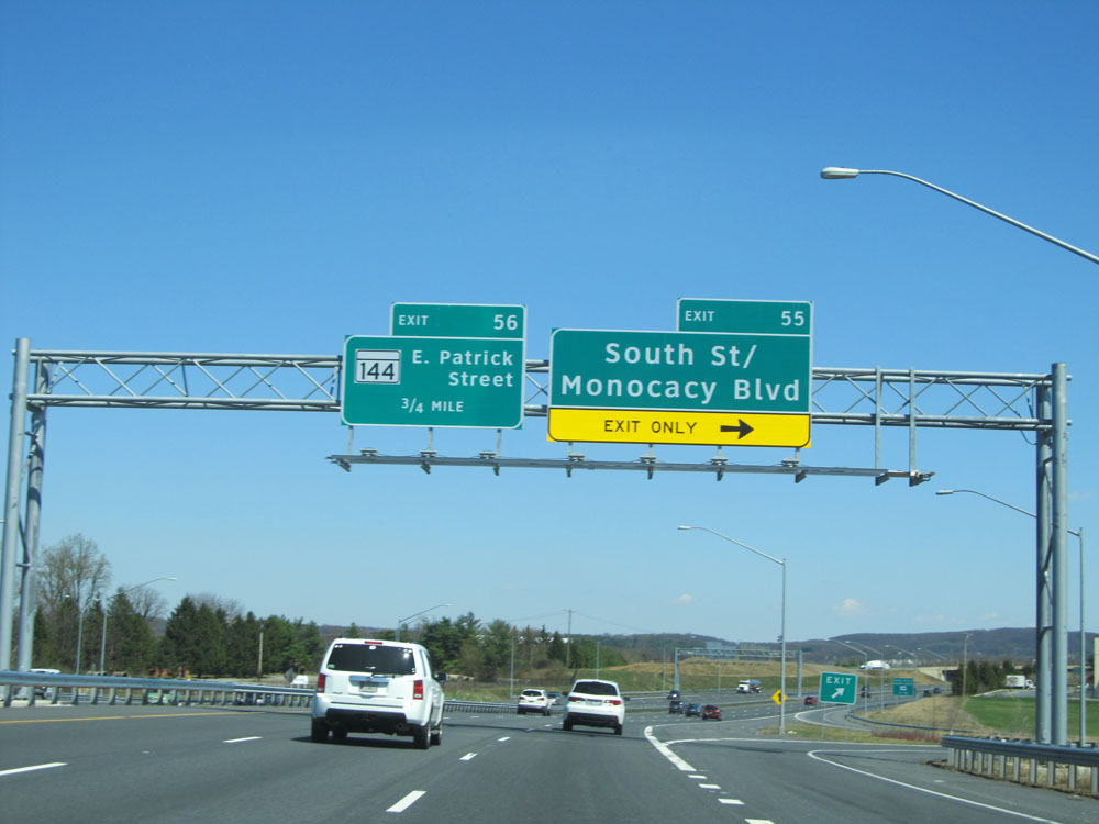 |
Interstate 70 East at Exit 55: South St / Monocacy Blvd (Photo taken 4/11/15). |
 |
Take Exit 56 to the Fairgrounds, Frederick Airport, and Park & Ride. (Photo taken 4/11/15). |
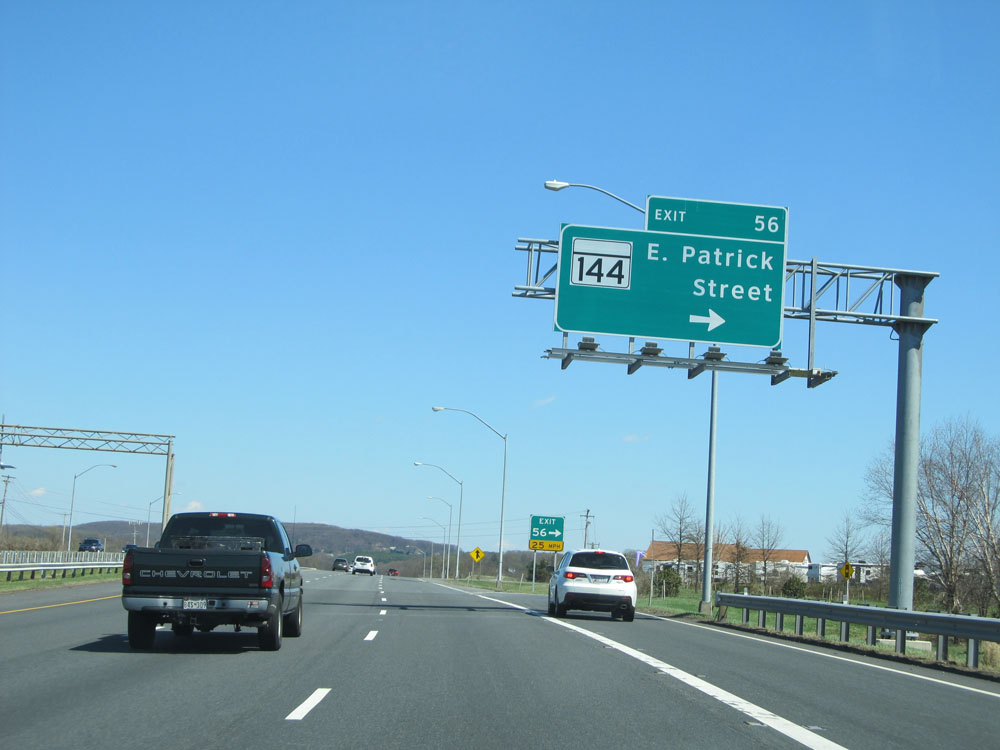 |
Interstate 70 East at Exit 56: MD 144 - E Patrick Street (Photo taken 4/11/15). |
 |
Interstate 70 East: Road view from mile marker 59. I-70 East maintains 3 lanes in each direction from this point to Interstate 695 near Baltimore. (Photo taken 4/11/15). |
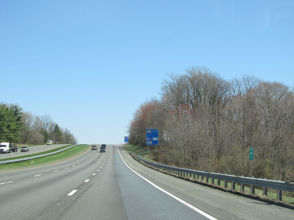 |
Interstate 70 East at mile marker 61. (Photo taken 4/11/15). |
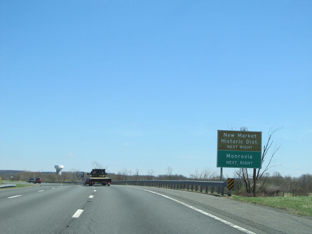 |
Take Exit 62 to New Market Historic District and Monrovia. (Photo taken 4/11/15). |
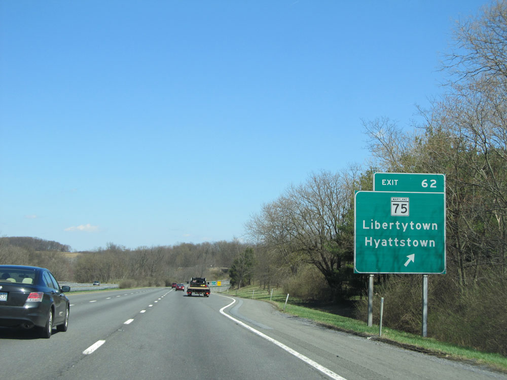 |
Interstate 70 East at Exit 62: MD 75 - Libertytown / Hyattstown (Photo taken 4/11/15). |
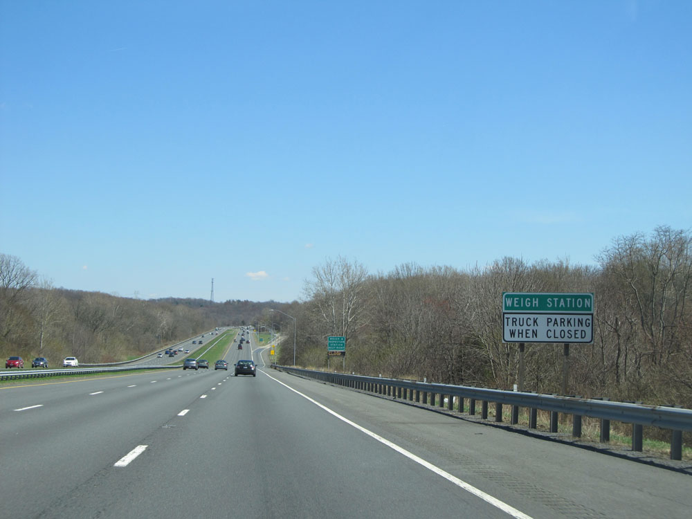 |
Trucks may park at the Weigh Station ahead when it is closed. (Photo taken 4/11/15). |
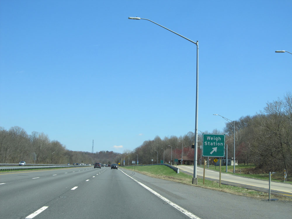 |
Interstate 70 East at the Weigh Station located at mile marker 64. (Photo taken 4/11/15). |
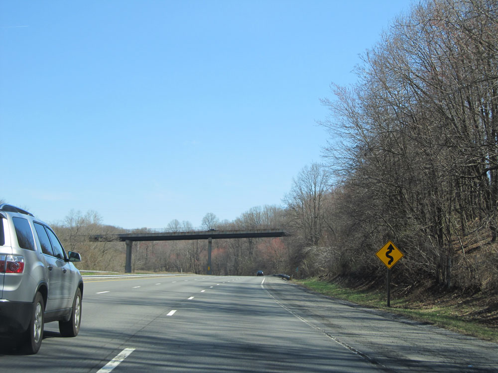 |
This warning sign alerts motorists that Interstate 70 traverses some winding curves ahead. Don't worry; they're very mild. (Photo taken 4/11/15). |
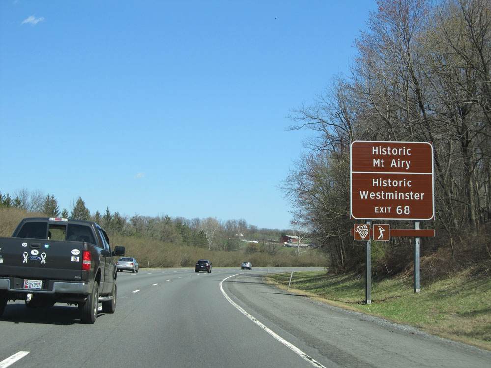 |
Take Exit 68 to Historic Mt Airy and Historic Westminster. (Photo taken 4/11/15). |
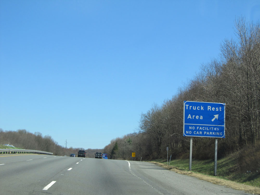 |
Interstate 70 East at the Truck Rest Area located near mile marker 67. (Photo taken 4/11/15). |
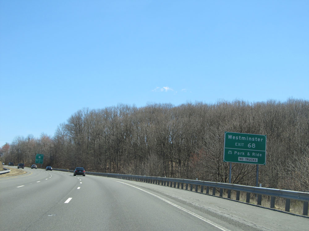 |
Take Exit 68 to Westminster and Park & Ride. (Photo taken 4/11/15). |
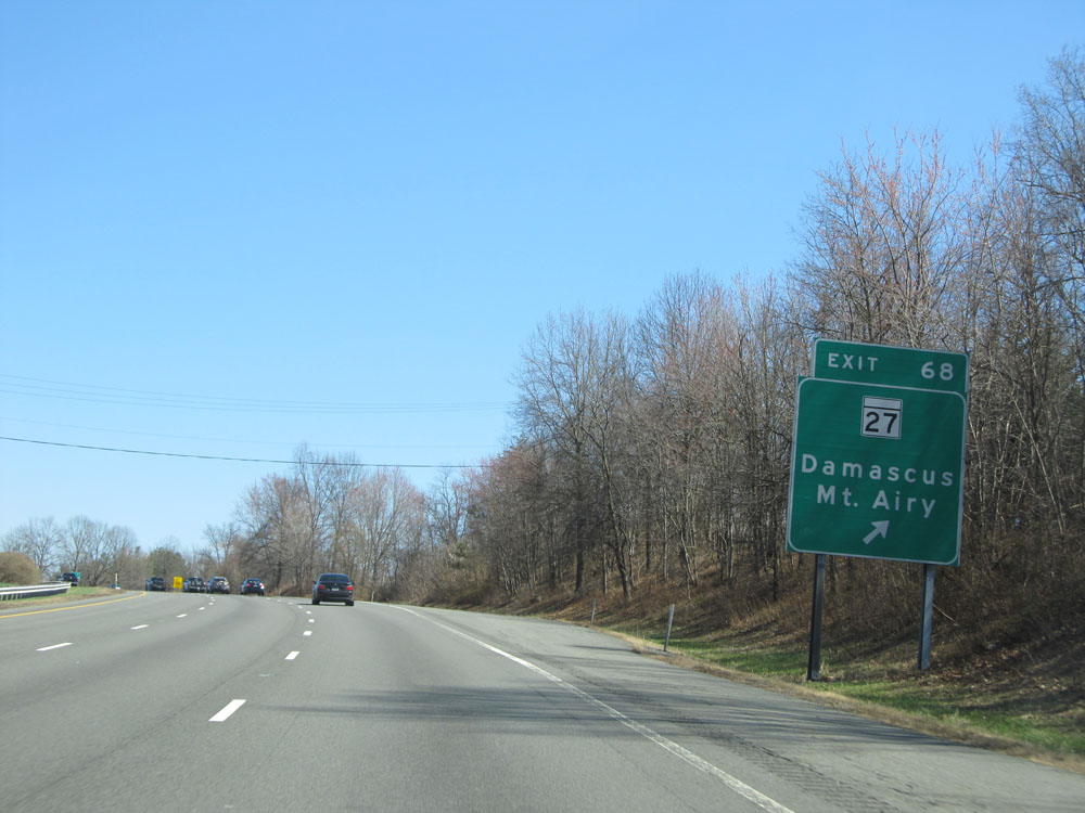 |
Interstate 70 East at Exit 68: MD 27 - Damascus / Mt. Airy (Photo taken 4/11/15). |
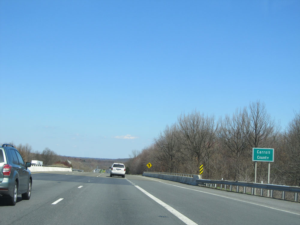 |
Interstate 70 East entering Carroll County. (Photo taken 4/11/15). |
 |
Interstate 70 East / US 40 East dual assurance shields. (Photo taken 4/11/15). |
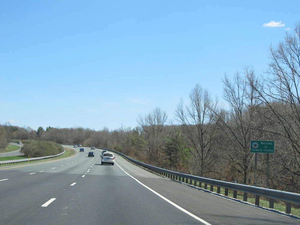 |
Interstate 70 East entering Howard County. (Photo taken 4/11/15). |
 |
Interstate 70 East at Exit 73: MD 94 - Woodbine / Lisbon (Photo taken 4/11/15). |
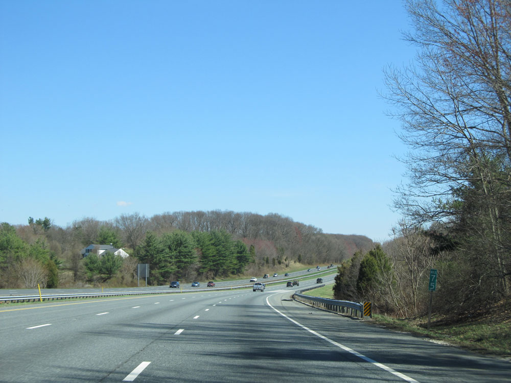 |
Interstate 70 East at mile marker 75. (Photo taken 4/11/15). |
 |
Interstate 70 East approaching Exit 76 - 1 mile. (Photo taken 4/11/15). |
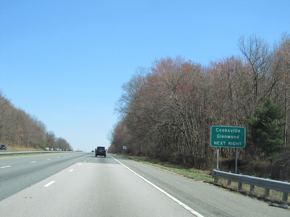 |
Take Exit 76 to Cooksville and Glenwood. (Photo taken 4/11/15). |
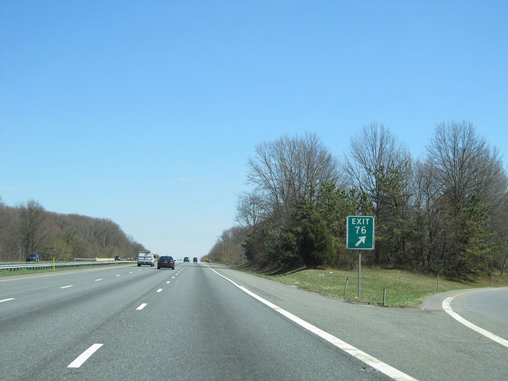 |
Interstate 70 East at Exit 76: MD 97 - Westminster / Olney (Photo taken 4/11/15). |
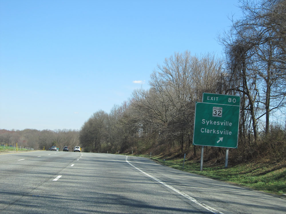 |
Interstate 70 East at Exit 80: MD 32 - Sykesville / Clarksville (Photo taken 4/11/15). |
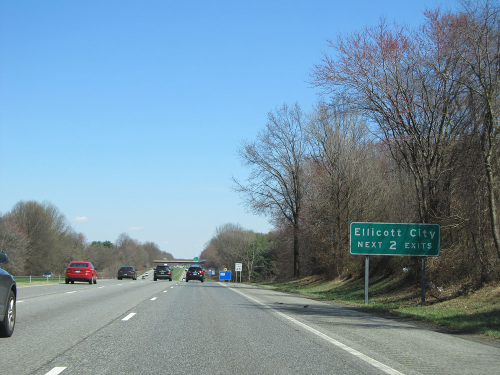 |
Take either of the next 2 exits to Ellicott City. (Photo taken 4/11/15). |
 |
Take Exit 82 to Patapsco Valley State Park and McKeldin Area. (Photo taken 4/11/15). |
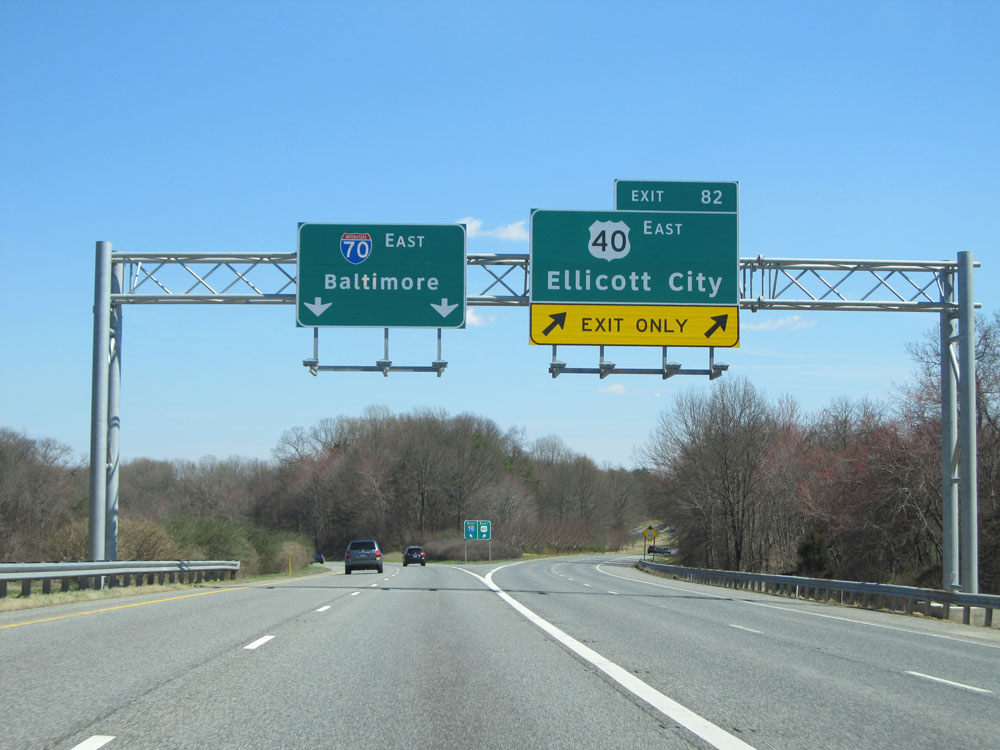 |
Interstate 70 East at Exit 82: US 40 East - Ellicott City (Photo taken 4/11/15). |
 |
Mileage sign near mile marker 82. It's 3 miles to the junction of US 29, 8 miles to the junction of Interstate 695 (Baltimore Beltway), and 15 miles to Baltimore. (Photo taken 4/11/15). |
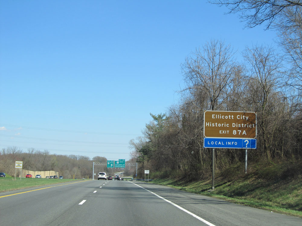 |
Take Exit 87A to Ellicott City Historic District. (Photo taken 4/11/15). |
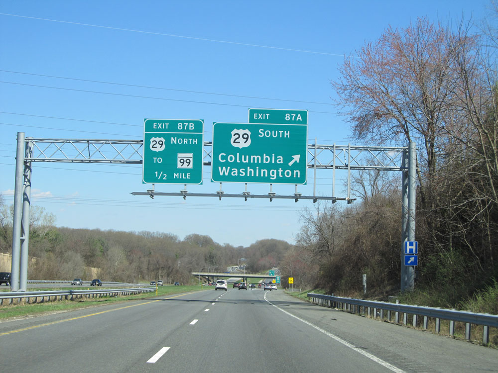 |
Interstate 70 East at Exit 87A: US 29 South - Columbia / Washington (Photo taken 4/11/15). |
 |
Interstate 70 East at Exit 87B: US 29 North / To MD 99 (Photo taken 4/11/15). |
 |
Traffic headed to Camden Yards, home of the Baltimore Orioles, should follow Interstate 695 South to US 40 East. (Photo taken 4/11/15). |
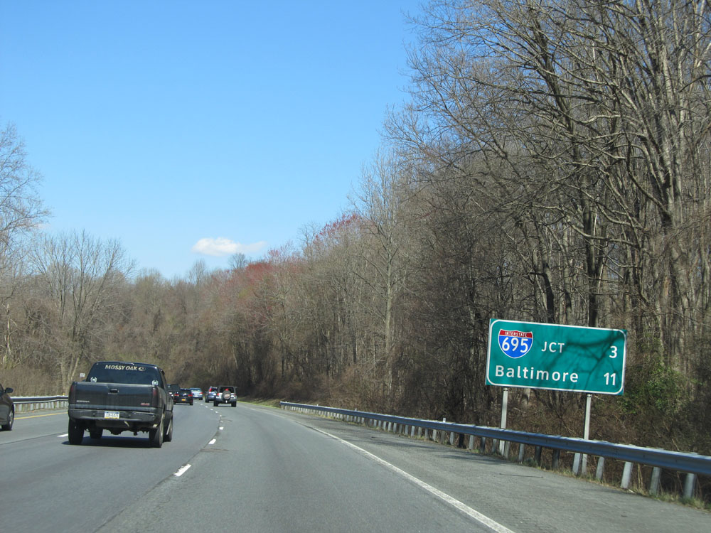 |
We're now just 3 miles from the junction of Interstate 695 (Baltimore Beltway) and 11 miles from Baltimore itself. (Photo taken 4/11/15). |
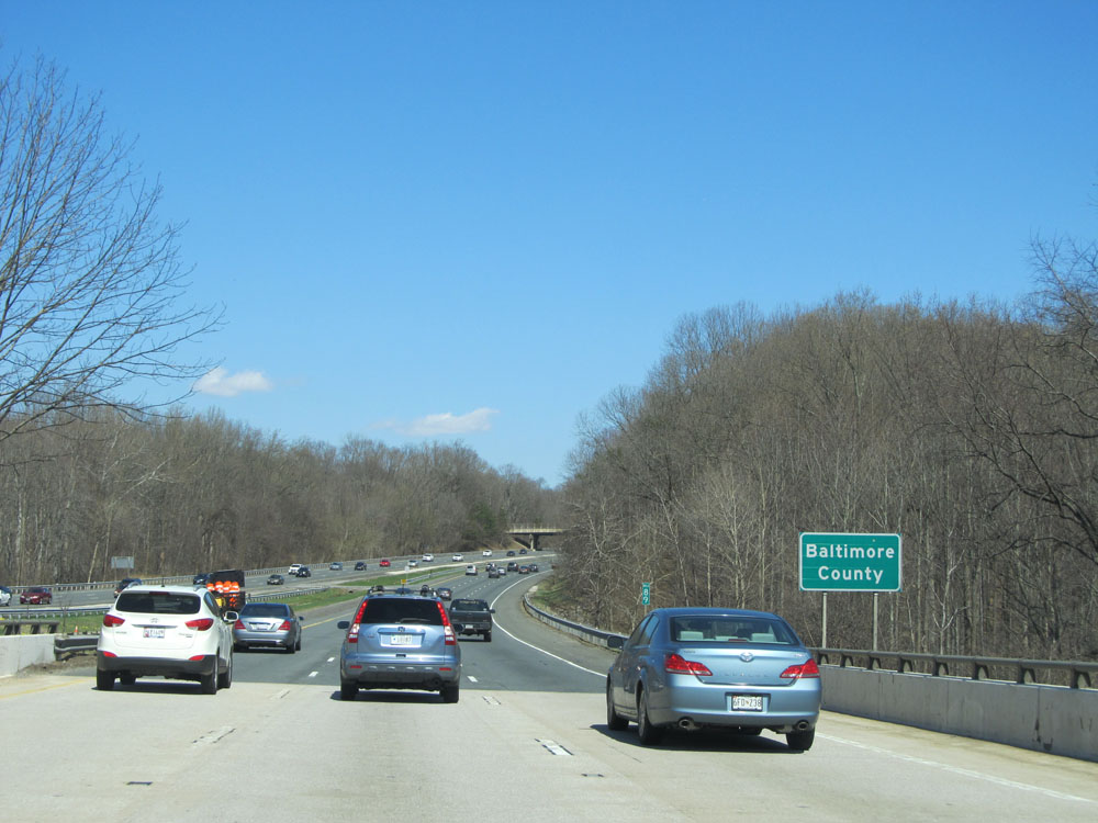 |
Interstate 70 East entering Baltimore County at mile marker 89. (Photo taken 4/11/15). |
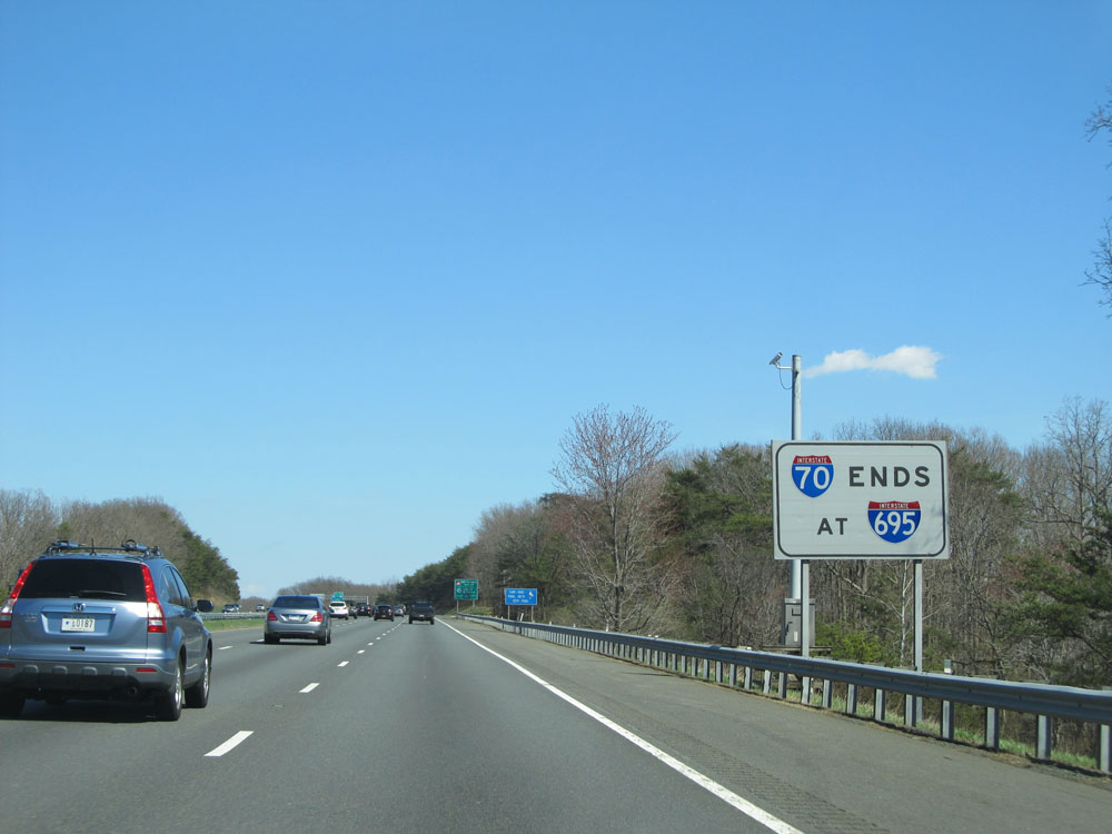 |
This sign warns that Interstate 70 ends at Interstate 695. There is some debate over this, however. Many believe that I-70 ends beyond I-695 at the Park & Ride (myself included). (Photo taken 4/11/15). |
 |
Follow Interstate 695 South to BWI Marshall Airport and Port of Baltimore. (Photo taken 4/11/15). |
 |
Interstate 70 East approaching Exits 91B-A - 1 mile. (Photo taken 4/11/15). |
 |
Interstate 70 East at Exit 91A: Interstate 695 South / To Interstate 95 South - Baltimore / Glen Burnie; Exit 91B: Interstate 695 North / To Interstate 95 North - New York / Towson. I-70 ends not even a mile ahead at the Park & Ride station. (Photo taken 4/11/15). |
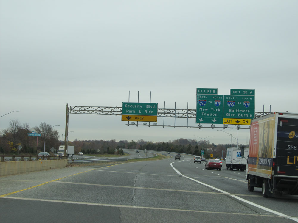 |
A little further ahead we get a closer view of the ramps for Exits 91A-B and this overhead sign directing traffic to Security Blvd and the Park & Ride. Keep to the left here toward Security Blvd to access the remaining mile or so of Interstate 70. (Photo taken 11/9/15). |
 |
Interstate 70 East at mile marker 92. (Photo taken 11/9/15). |
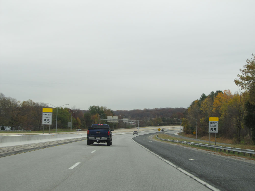 |
Just beyond mile marker 92, the speed limit decreases to 55 mph as we begin the approach to the Park & Ride and the eastern terminus of Interstate 70. (Photo taken 11/9/15). |
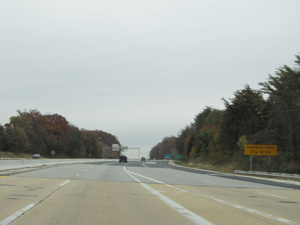 |
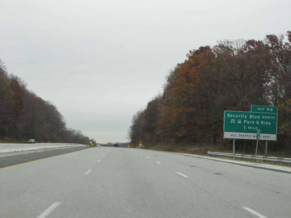
This sign warns that the freeway ends 1 1/4 miles ahead at Security Blvd (Exit 94) and the Park & Ride. (Photo taken 11/9/15). |
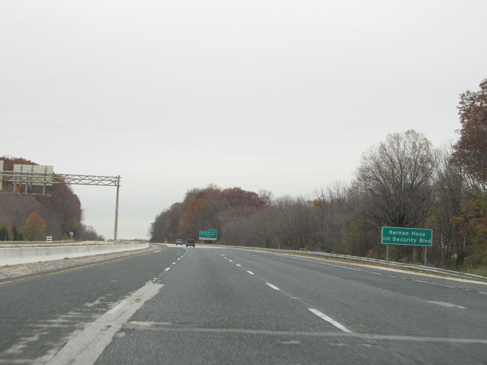 |
Take Exit 94 (Security Blvd) to Kernan Hospital. (Photo taken 11/9/15). |
 |
Interstate 70 East at mile marker 93, 1 mile from I-70's eastern terminus. (Photo taken 11/9/15). |
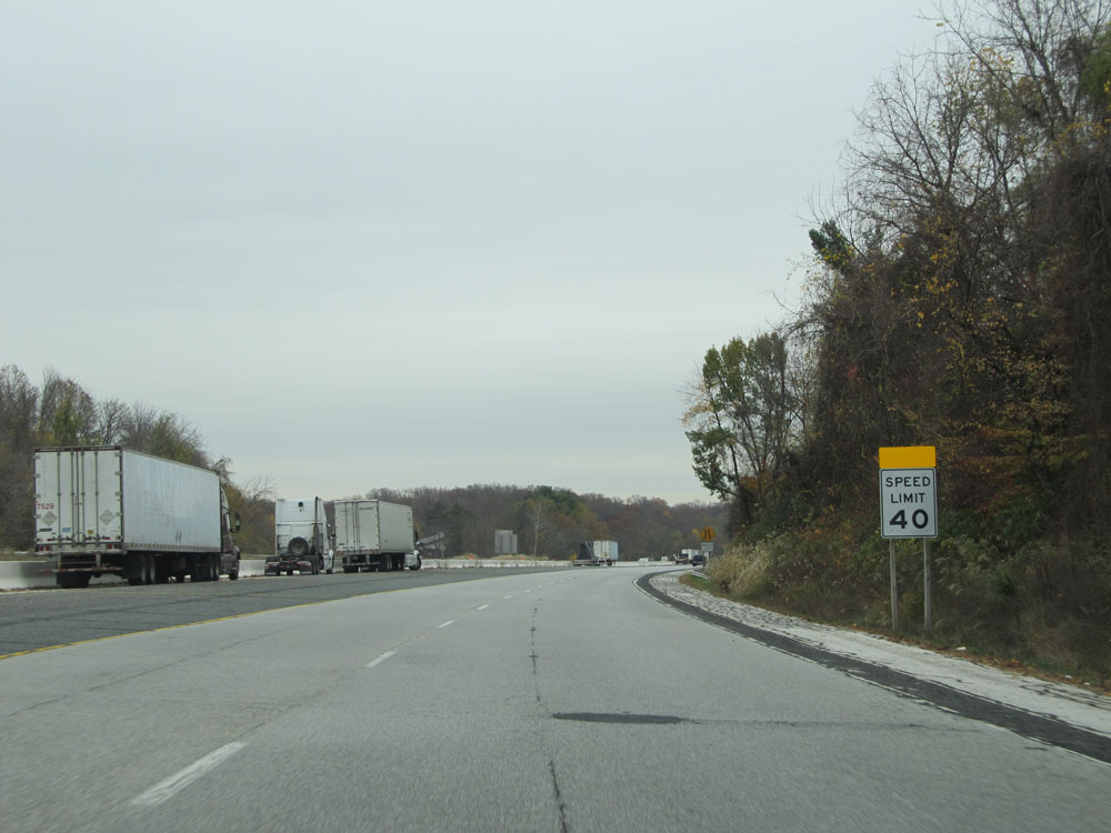 |
The speed limit decreases to 40 mph just beyond mile marker 93 as we approach the eastern terminus. (Photo taken 11/9/15). |
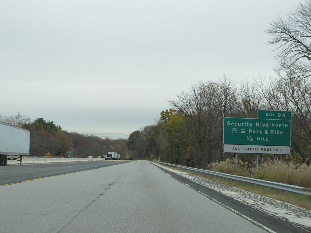 |
Interstate 70 East approaching Exit 94 - 1/2 mile. I-70 is reduced to one lane here approaching the eastern terminus. (Photo taken 11/9/15). |
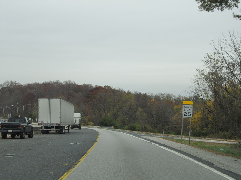 |
Entering the Park & Ride, the speed limit decreases to 25 mph. (Photo taken 11/9/15). |
 |
Interstate 70 East at Exit 94: Security Blvd. The Park & Ride is straight ahead, and this is the eastern terminus of Interstate 70. (Photo taken 11/9/15). |