Road Information |
||
 |
||
| Total Mileage in State: | 244 miles | |
| Eastern End: | At Pennsylvania state line | |
| Western End: | At Indiana state line | |
| Mileage covered in Photos: | 244 miles | |
| Counties covered in Photos: | Williams, Fulton, Lucas, Wood, Ottawa, Sandusky, Ottawa, Sandusky, Erie, Lorain, Cuyahoga, Lake, Ashtabula | |
| Major Junctions in Photos: | I-75, in Rossford I-280, in Perrysburg I-71, in Cleveland I-77, in Cleveland I-271, in Willoughby Hills |
|
| Control Cities in Photos: | Montpelier, Maumee, Perrysburg, Fremont, Elyria, Avon, Cleveland, Ashtabula | |
Eastbound
- Section 1: Indiana Border to Maumee (Exit 64)
- Section 2: Maumee (Exit 64) to Elyria (Exit 142)
- Section 3: Elyria (Exit 142) to Cleveland (Exit 175)
- Section 4: Cleveland (Exit 175) to Pennsylvania Border
Section 1: Indiana Border to Maumee (Exit 64)
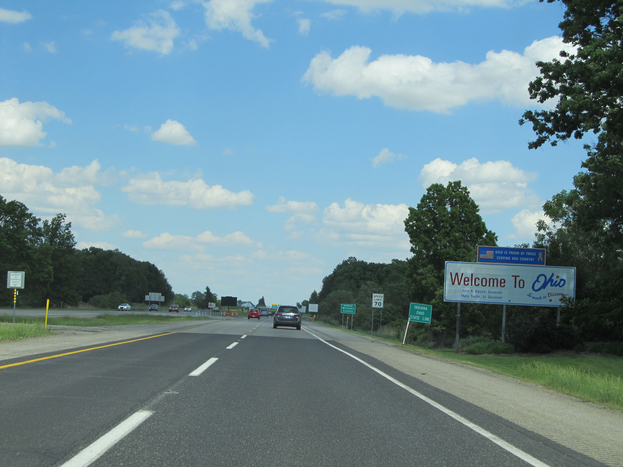 |
Ohio welcome sign as Interstate 80 / Interstate 90 East enter the Buckeye State from Indiana. (Photo taken 5/30/16). |
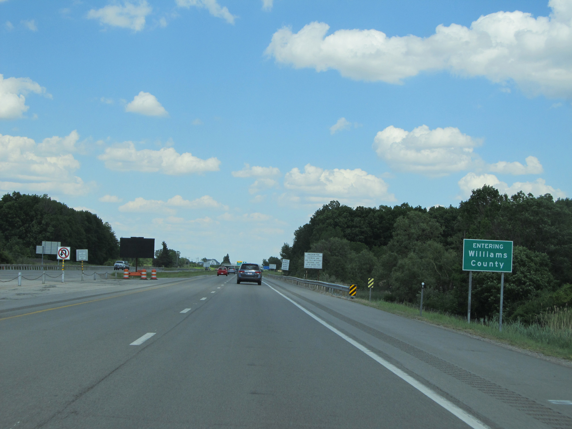 |
Interstate 80 / Interstate 90 East in Ohio start out in Williams County. (Photo taken 5/30/16). |
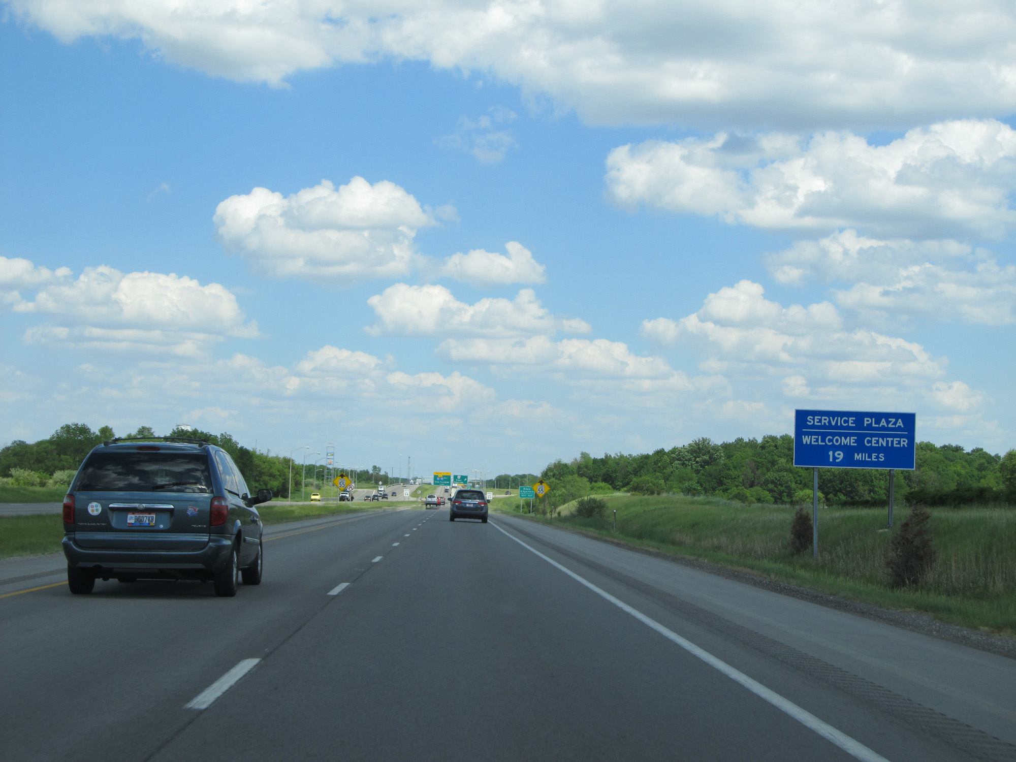 |
The first service plaza heading eastbound on the Ohio Turnpike (which begins just ahead) is 19 miles ahead. A Welcome Center is also located at the plaza. (Photo taken 5/30/16). |
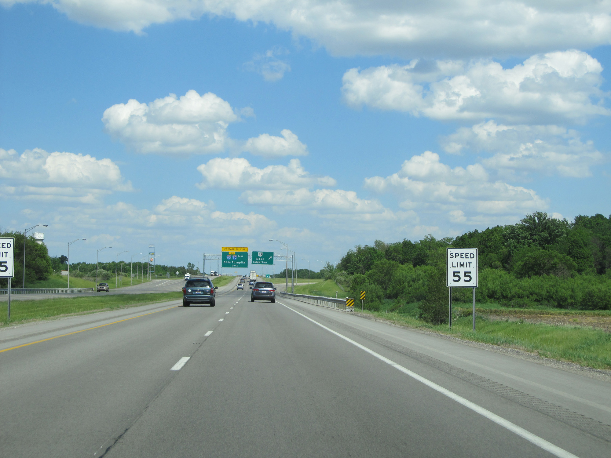 |
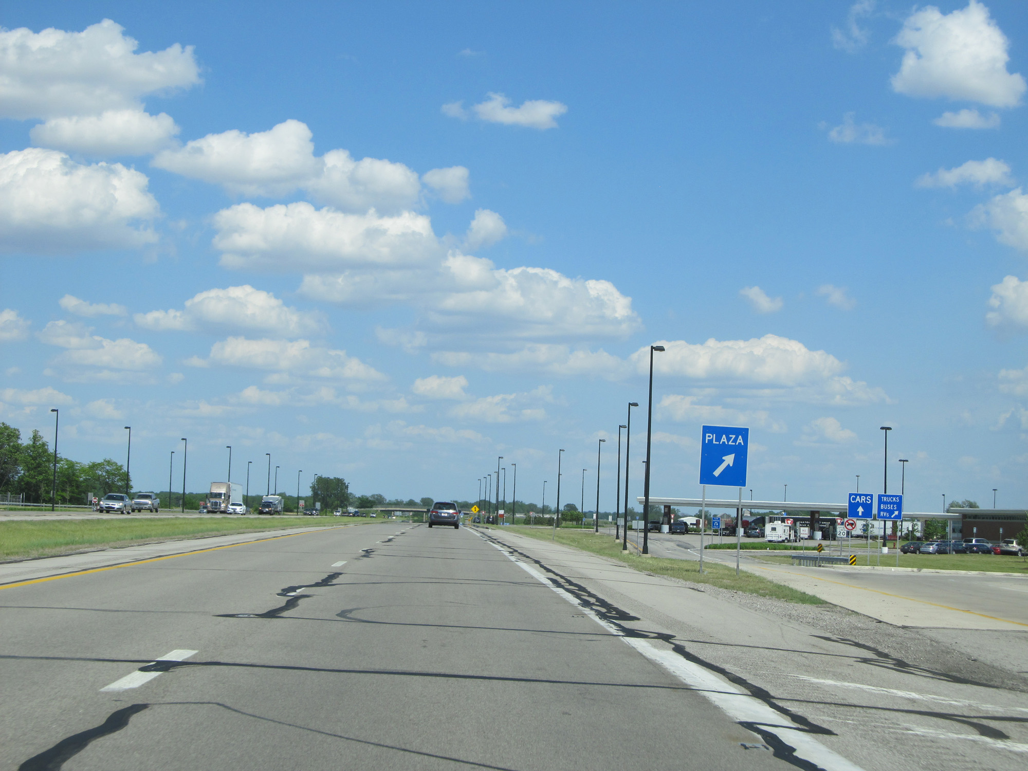
Approaching the Westgate toll plaza for the entry to the Ohio Turnpike, the speed limit decreases from 70 mph to 55 mph here. (Photo taken 5/30/16). |
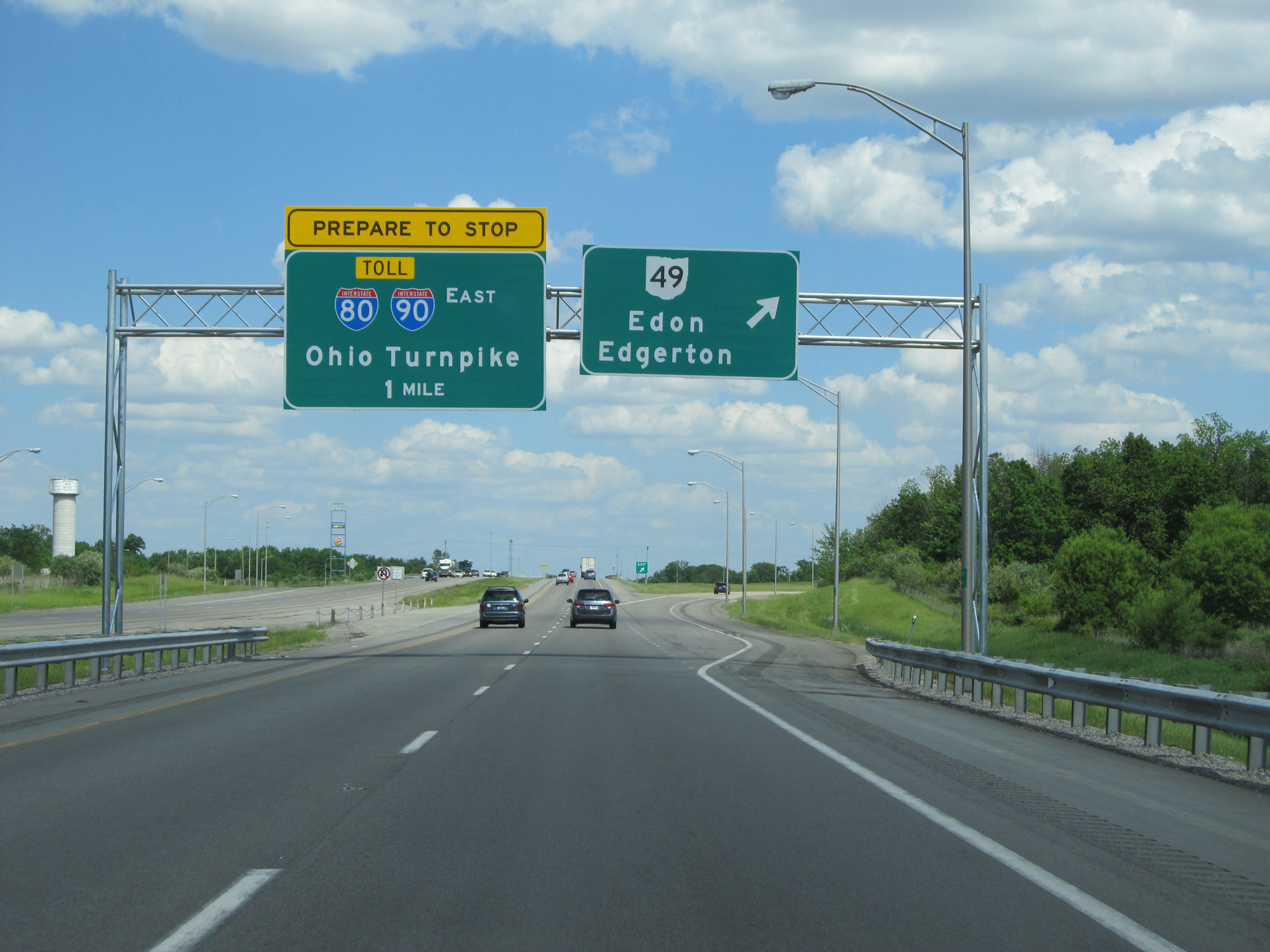 |
Interstate 80 / Interstate 90 East at Exit: OH 49 - Edon / Edgerton (Photo taken 5/30/16). |
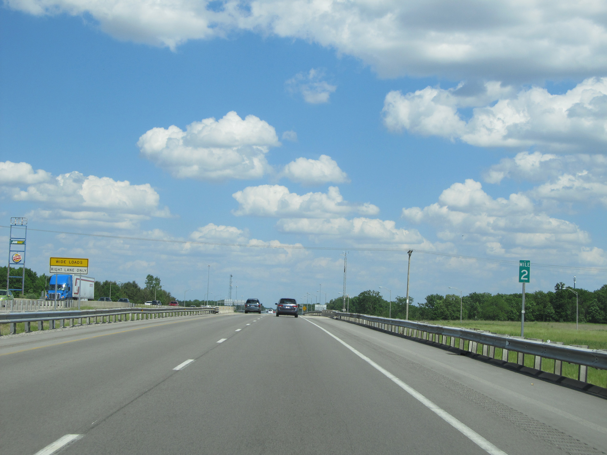 |
Interstate 80 / Interstate 90 East at mile marker 2. (Photo taken 5/30/16). |
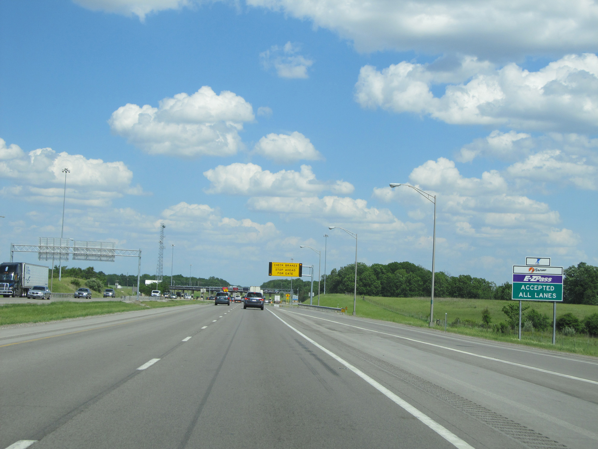 |
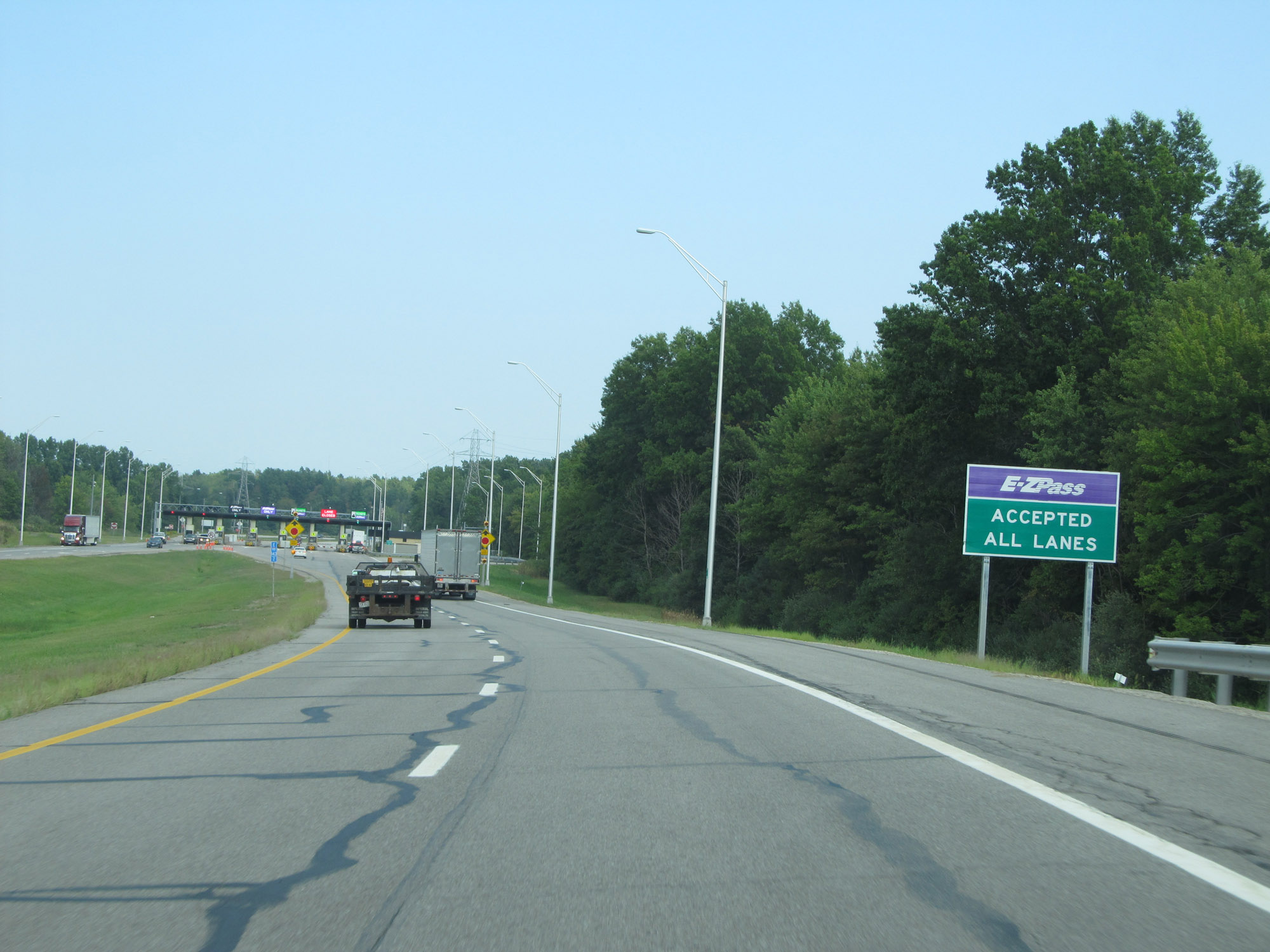
EZ Pass is accepted at all toll lanes. (Photo taken 5/30/16). |
 |
Interstate 80 / Interstate 90 East approaching the Westgate toll plaza and the entrance to the Ohio Turnpike. (Photo taken 5/30/16). |
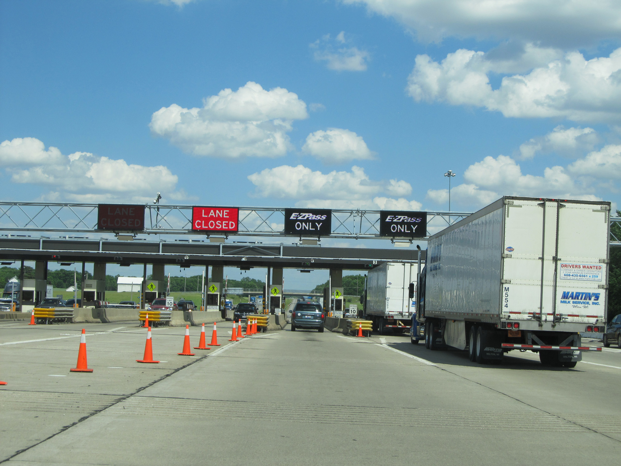 |
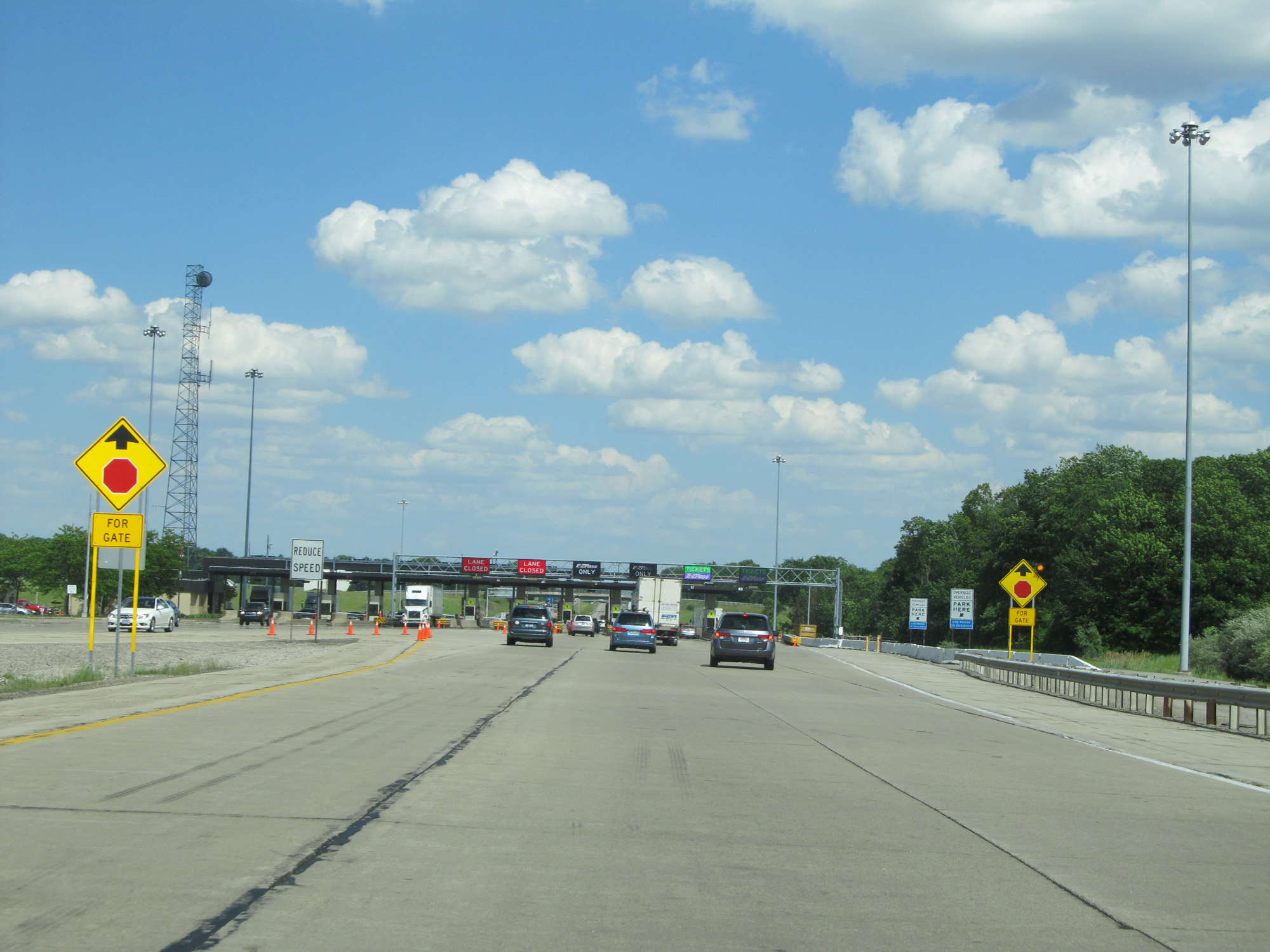
A closer view of the toll plaza. (Photo taken 5/30/16). |
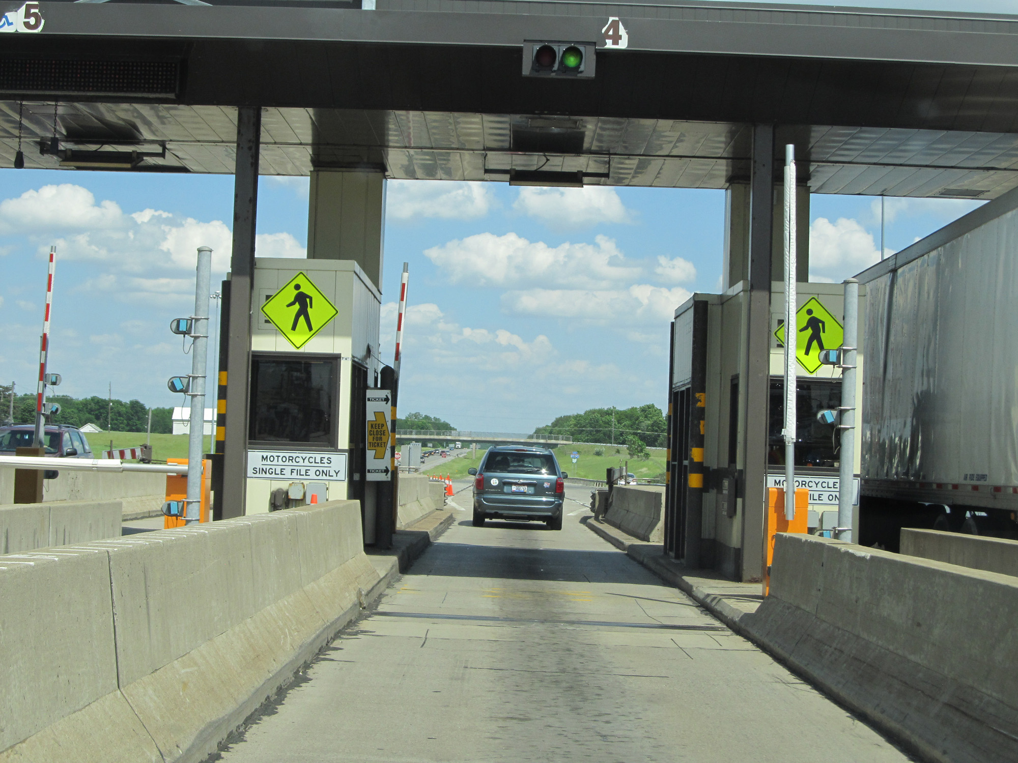 |
View at the Westgate toll plaza. (Photo taken 5/30/16). |
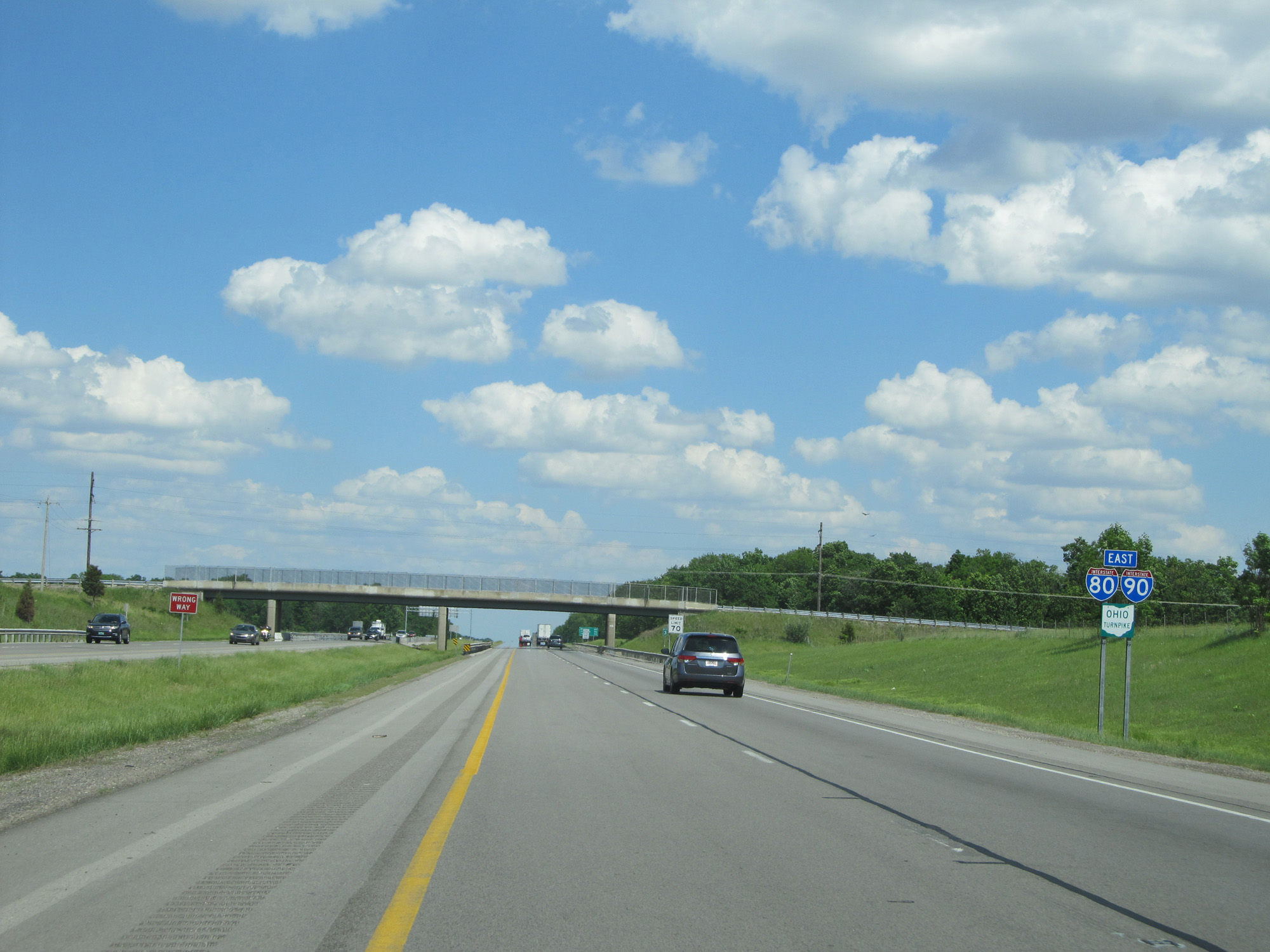 |
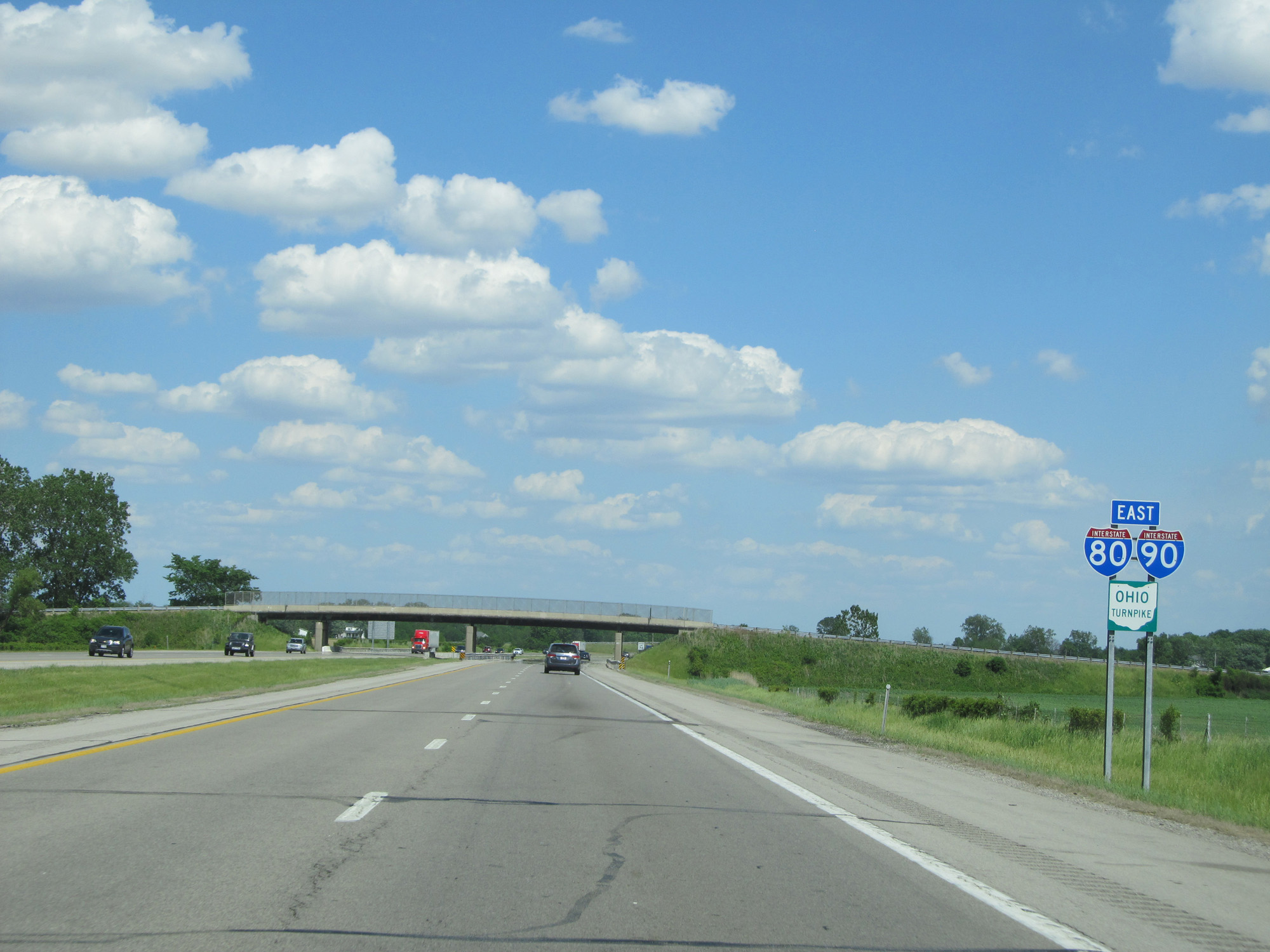
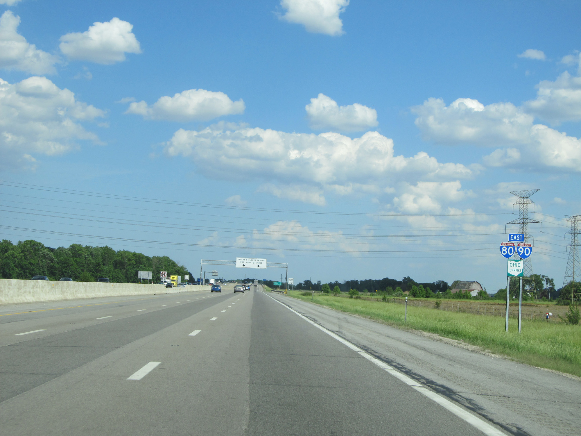
Interstate 80 / Interstate 90 East (Ohio Turnpike) reassurance shields. (Photo taken 5/30/16). |
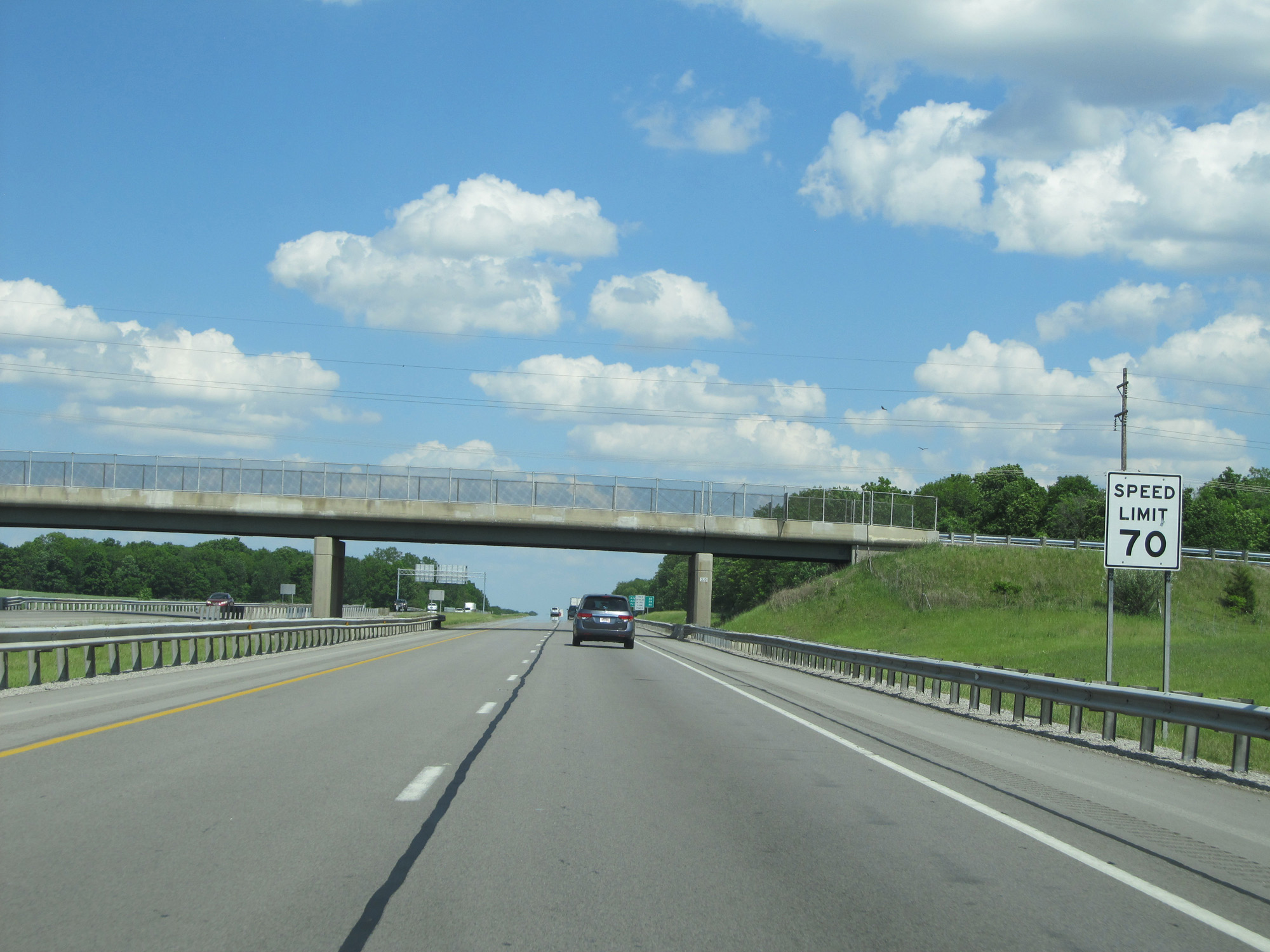 |
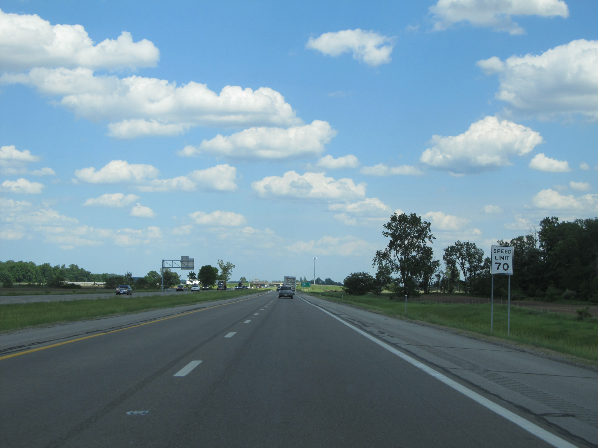
The speed limit of 70 mph resumes. 70 mph is the standard speed limit on most rural Interstate highways in Ohio. (Photo taken 5/30/16). |
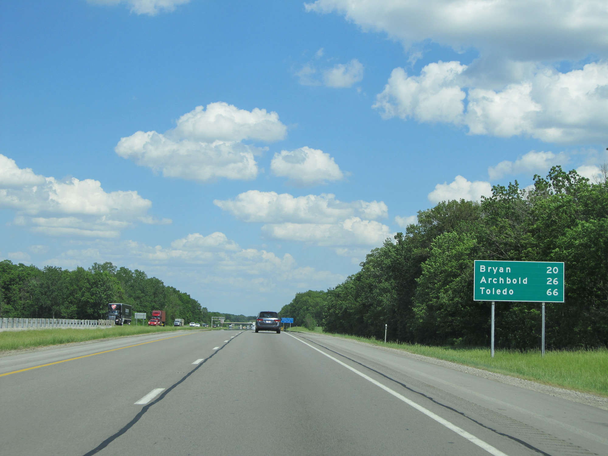 |
Mileage sign on Interstate 80 / Interstate 90 East (Ohio Turnpike). It's 20 miles to Bryan, 26 miles to Archbold, and 66 miles to Toledo. (Photo taken 5/30/16). |
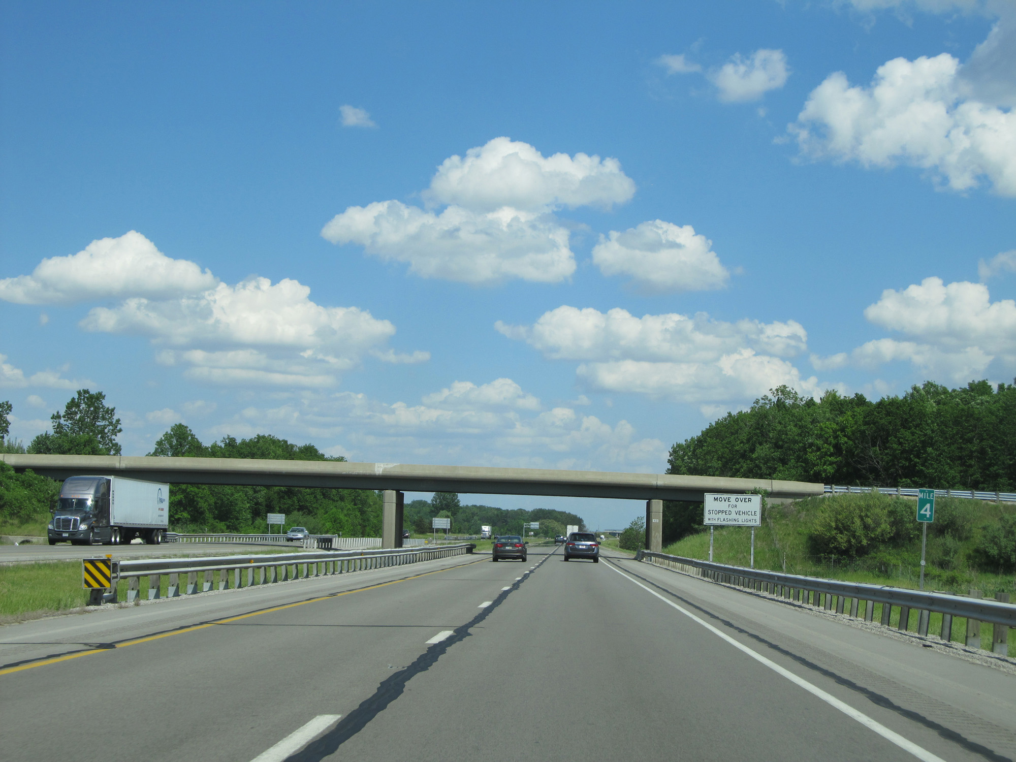 |
Interstate 80 / Interstate 90 East (Ohio Turnpike) at mile marker 4. (Photo taken 5/30/16). |
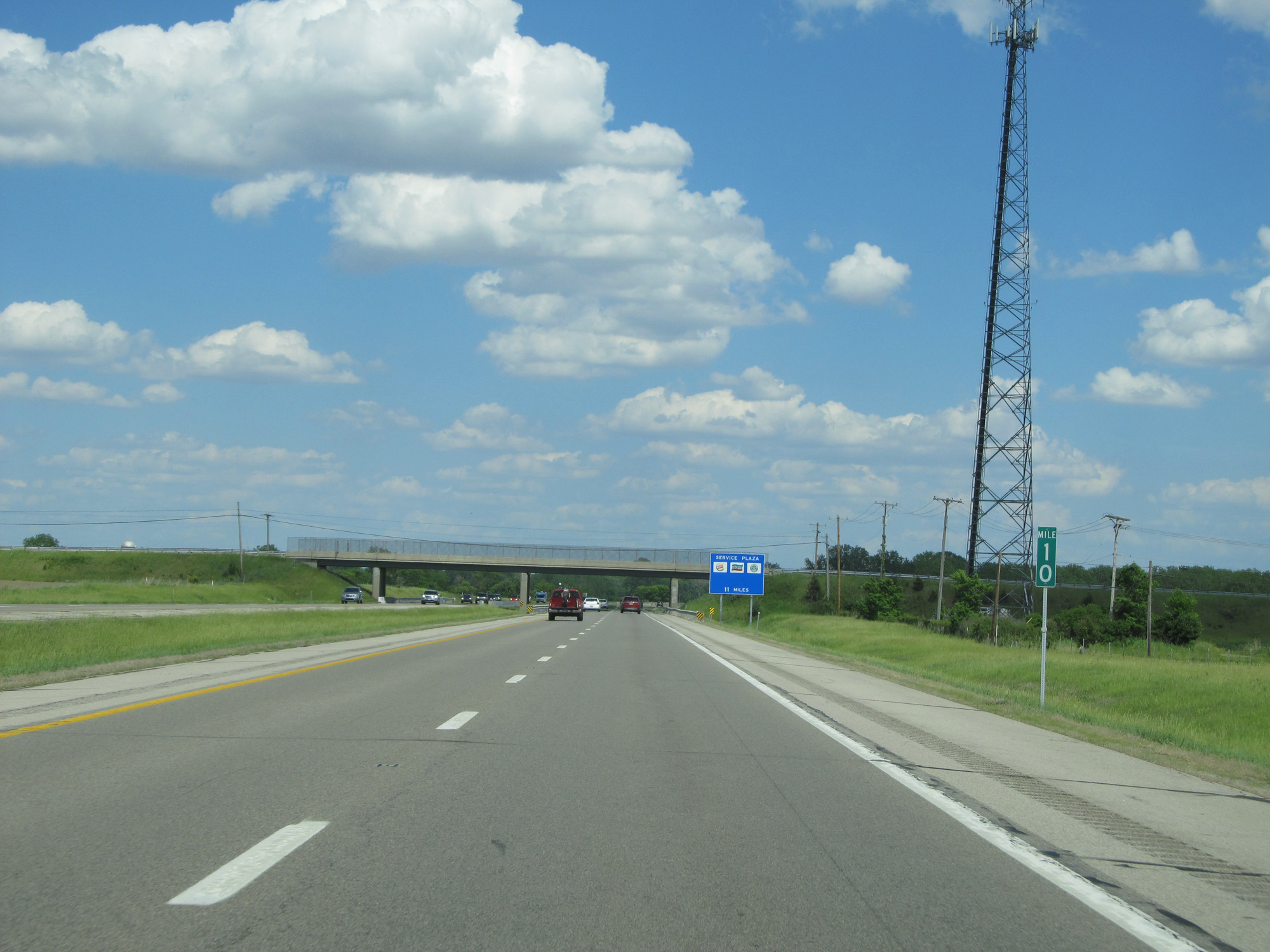 |
Interstate 80 / Interstate 90 East (Ohio Turnpike) at mile marker 10. (Photo taken 5/30/16). |
 |
Interstate 80 / Interstate 90 East (Ohio Turnpike) approaching Exit 13 - 1 mile. (Photo taken 5/30/16). |
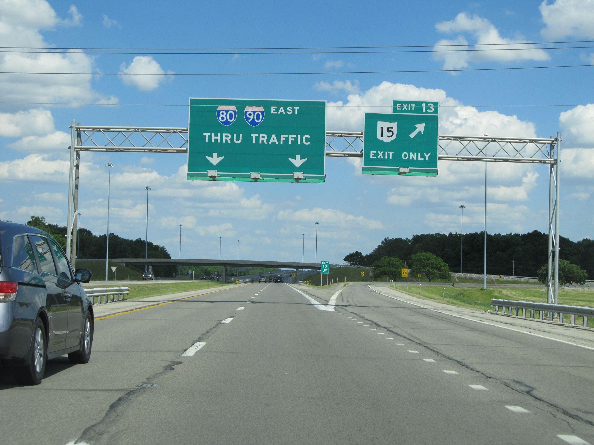 |
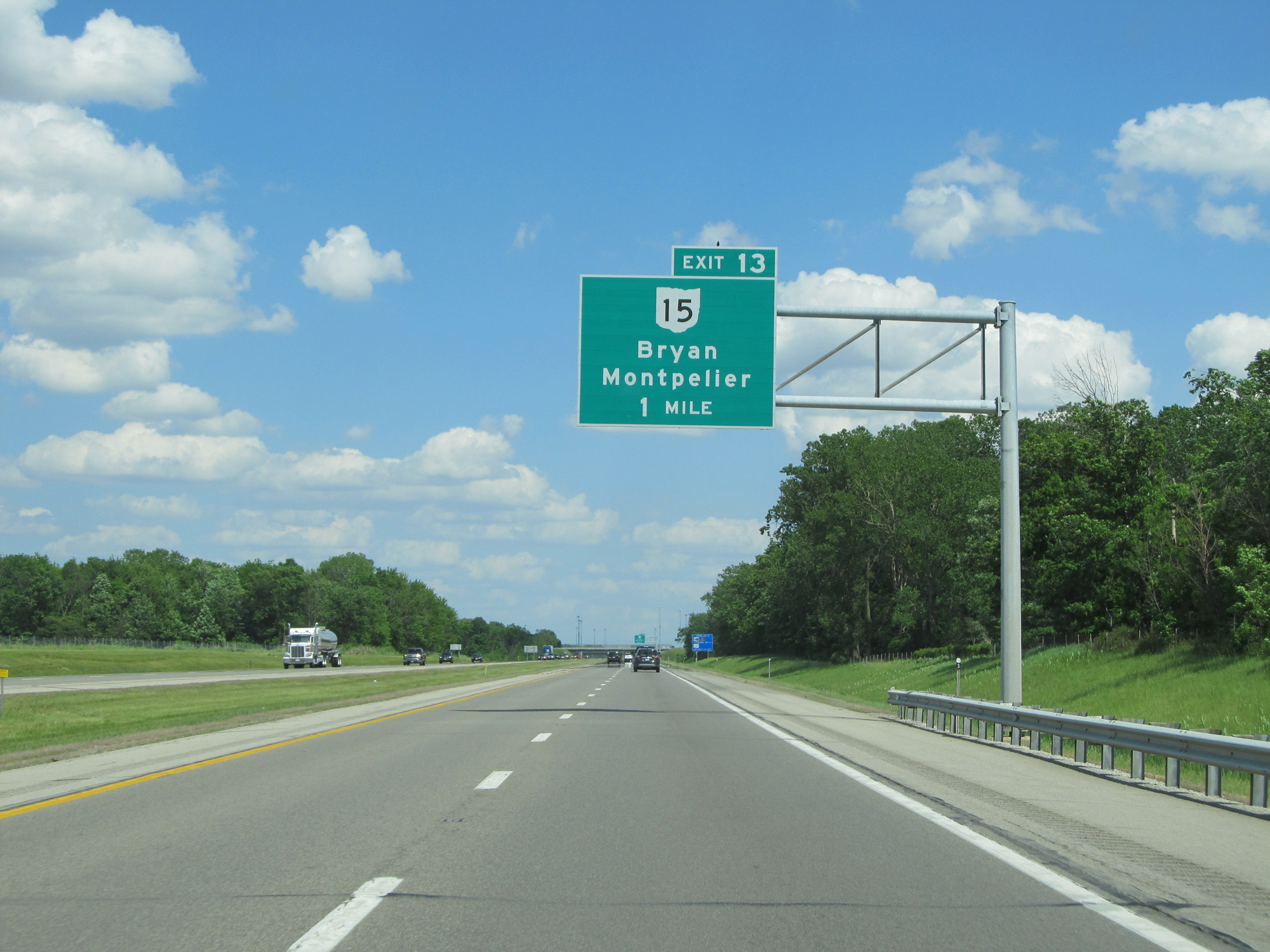
Interstate 80 / Interstate 90 East (Ohio Turnpike) at Exit 13: OH 15 - Bryan / Montpelier (Photo taken 5/30/16). |
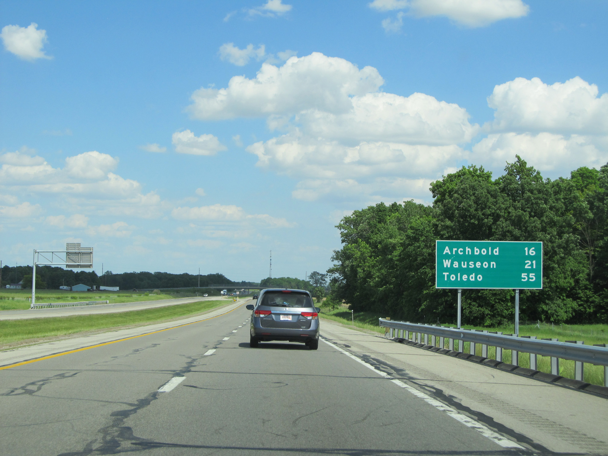 |
Mileage sign on Interstate 80 / Interstate 90 East (Ohio Turnpike). It's 16 miles to Archbold, 21 miles to Wauseon, and 55 miles to Toledo. (Photo taken 5/30/16). |
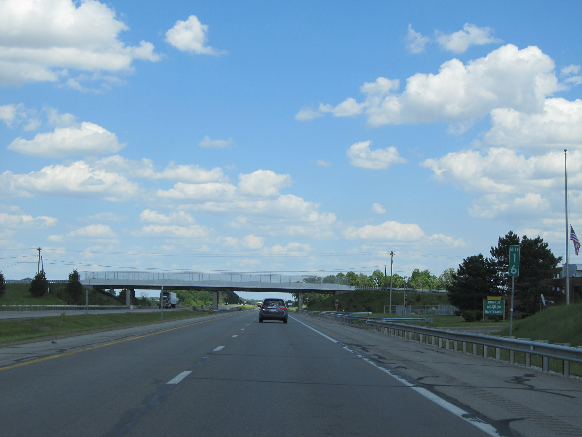 |
Interstate 80 / Interstate 90 East (Ohio Turnpike) at mile marker 16. (Photo taken 5/30/16). |
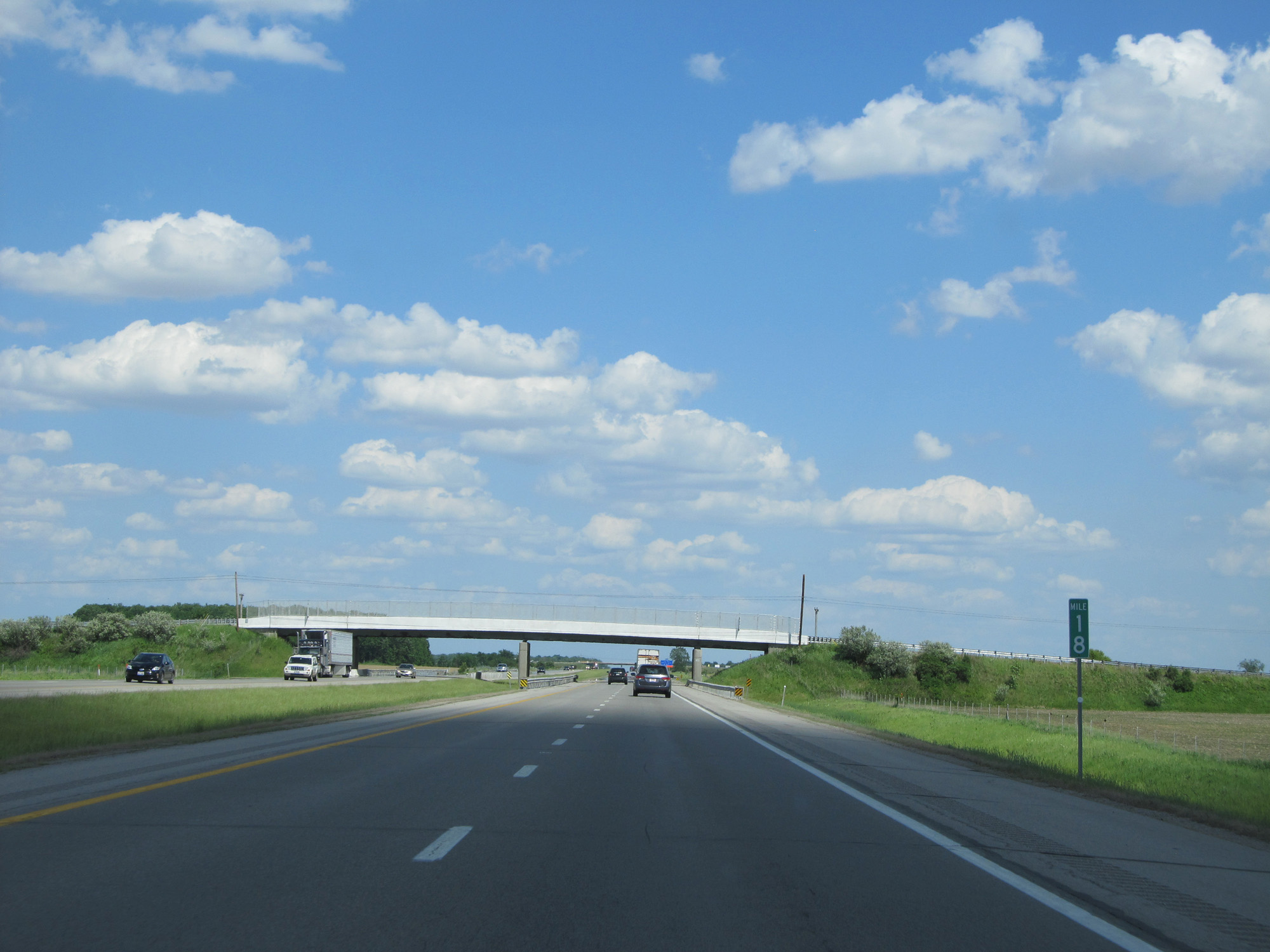 |
Interstate 80 / Interstate 90 East (Ohio Turnpike) at mile marker 18. (Photo taken 5/30/16). |
 |
The Tiffin River Service Plaza is 2 miles ahead. (Photo taken 5/30/16). |
 |
Interstate 80 / Interstate 90 East (Ohio Turnpike) at the Tiffin River Service Plaza. (Photo taken 5/30/16). |
 |
Interstate 80 / Interstate 90 East (Ohio Turnpike) reassurance shields. (Photo taken 5/30/16). |
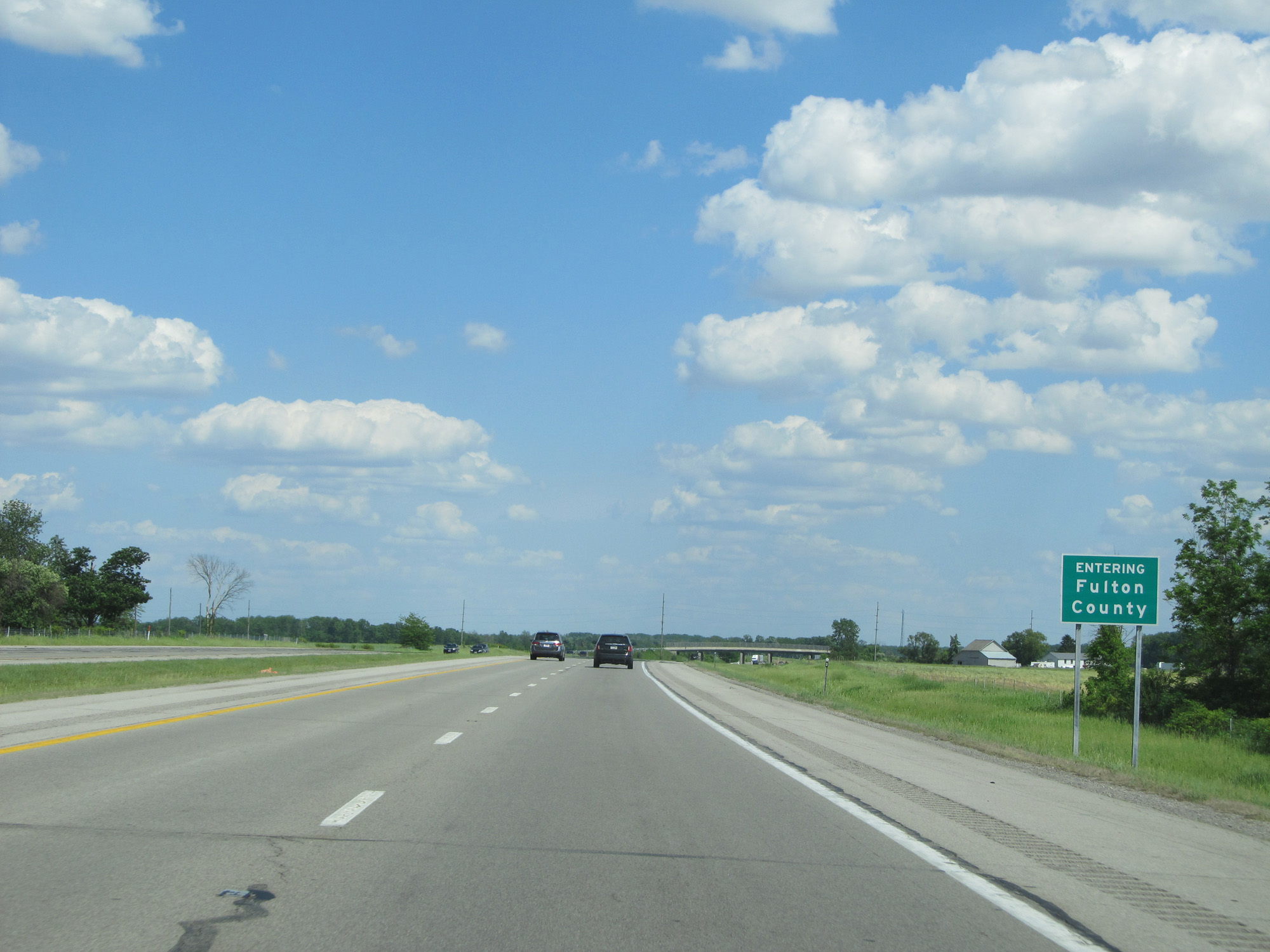 |
Interstate 80 / Interstate 90 East (Ohio Turnpike) entering Fulton County. (Photo taken 5/30/16). |
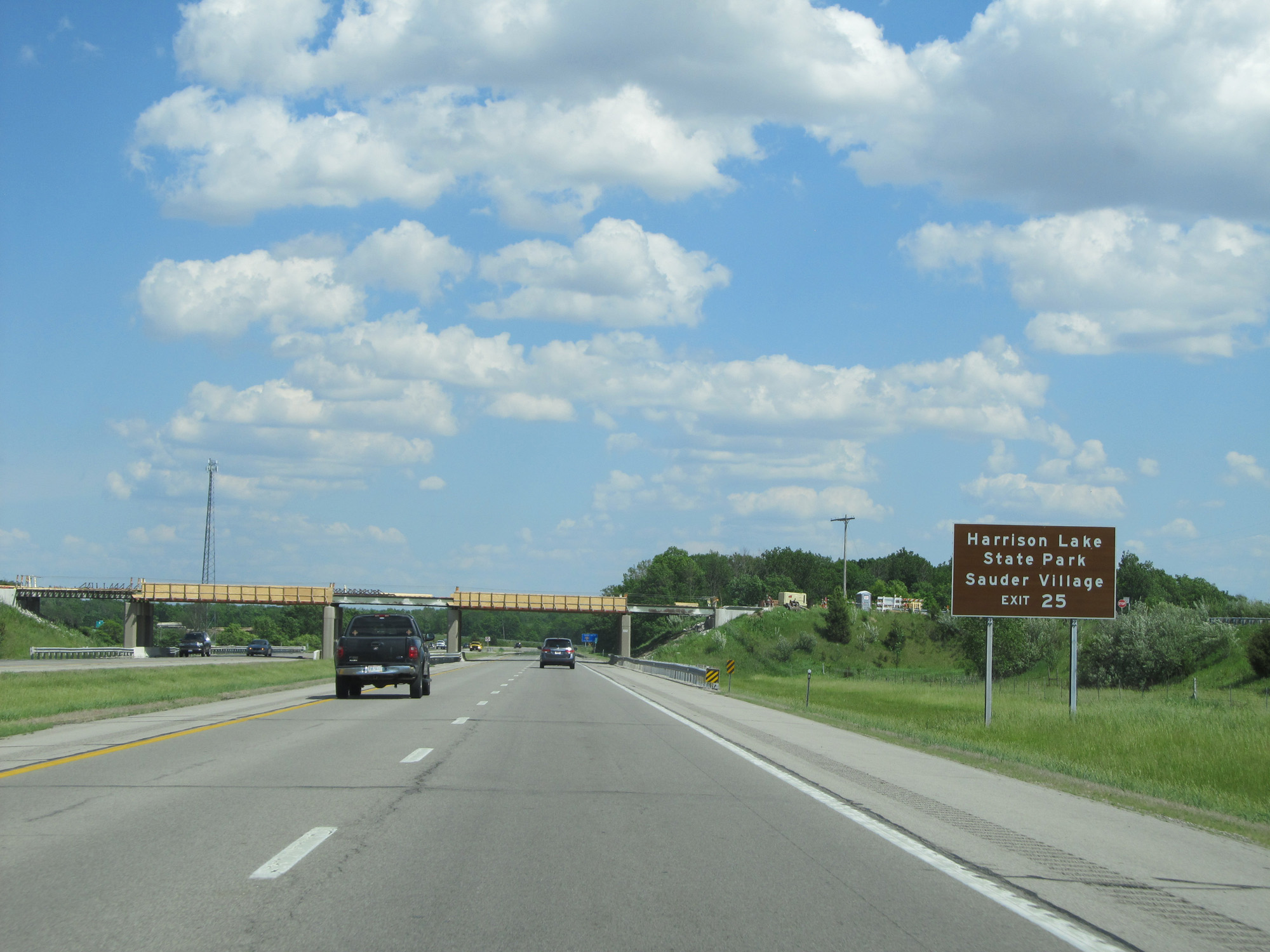 |
Take Exit 25 to Harrison Lake State Park and Sauder Village. (Photo taken 5/30/16). |
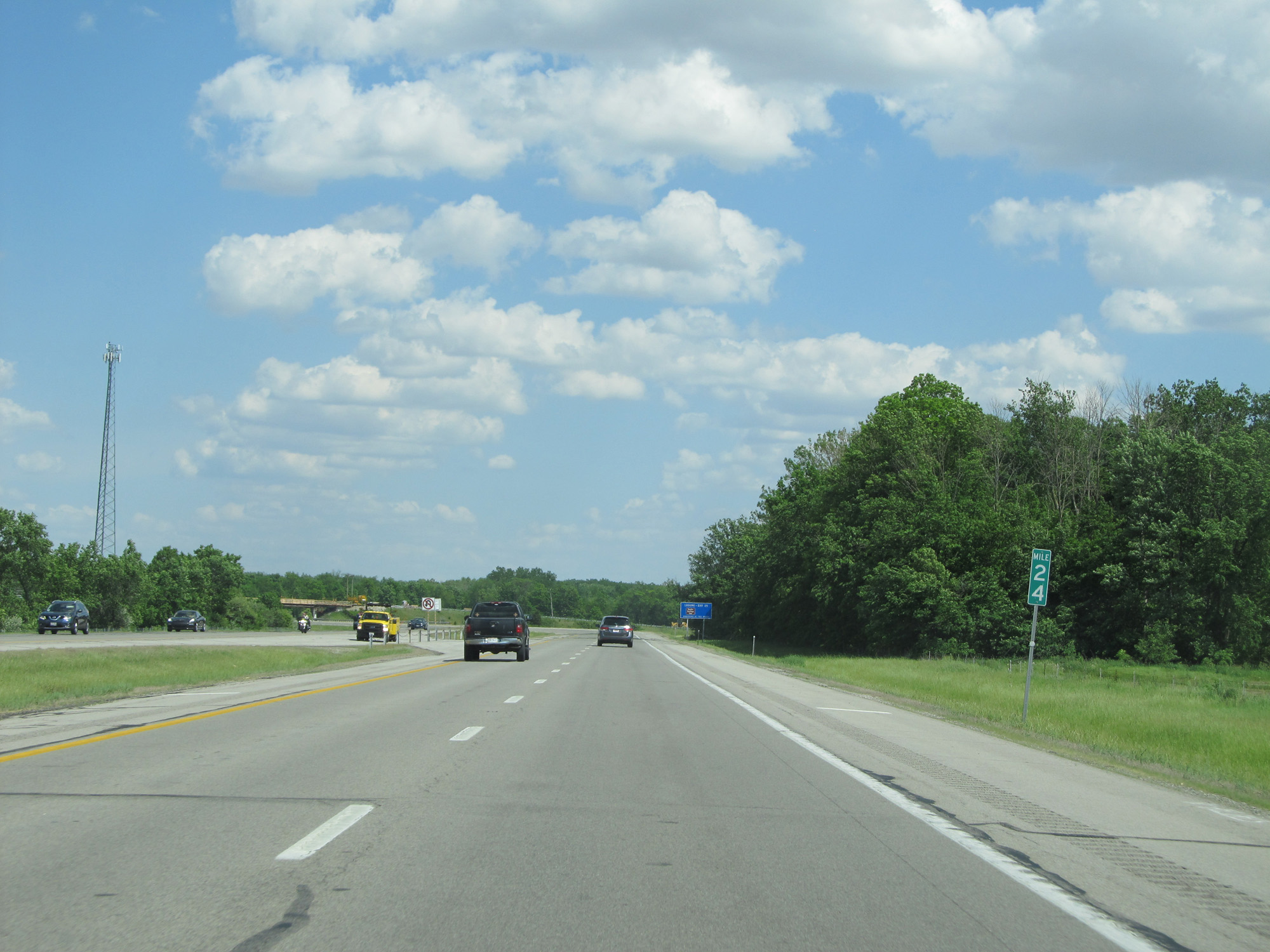 |
Interstate 80 / Interstate 90 East (Ohio Turnpike) at mile marker 24. (Photo taken 5/30/16). |
 |
Interstate 80 / Interstate 90 East (Ohio Turnpike) approaching Exit 25 - 1 mile. (Photo taken 5/30/16). |
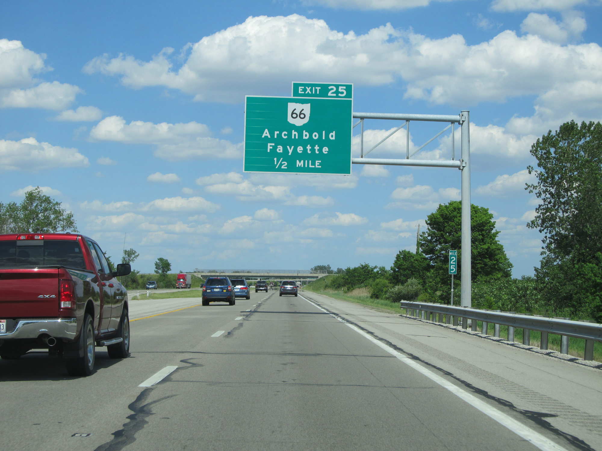 |
Interstate 80 / Interstate 90 East (Ohio Turnpike) approaching Exit 25 - 1/2 mile. (Photo taken 5/30/16). |
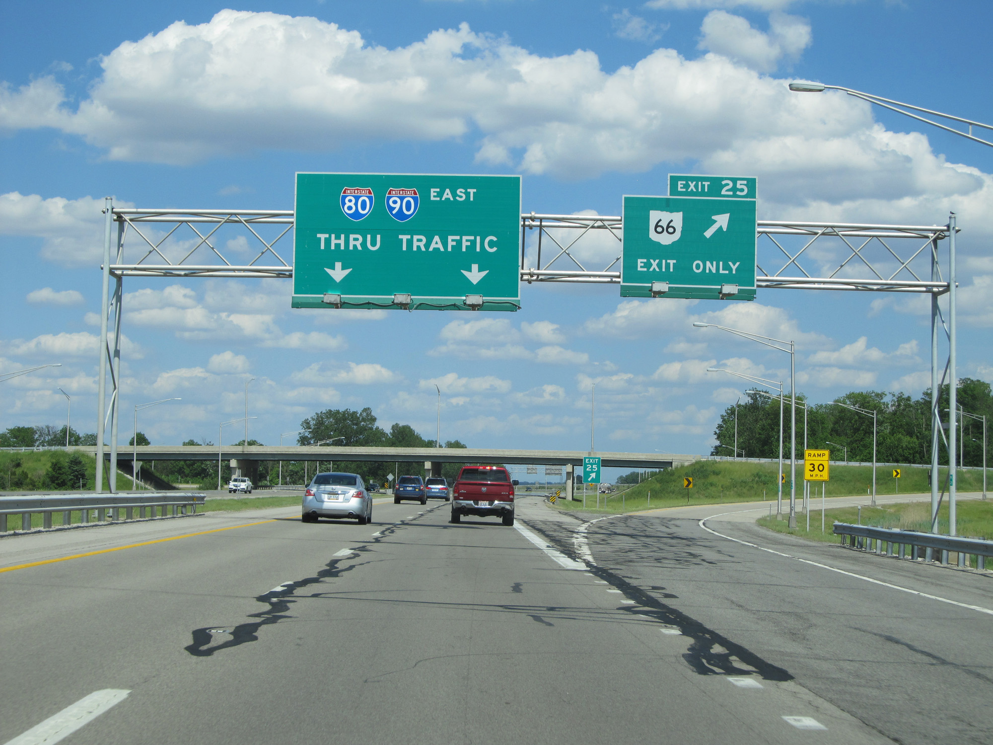 |
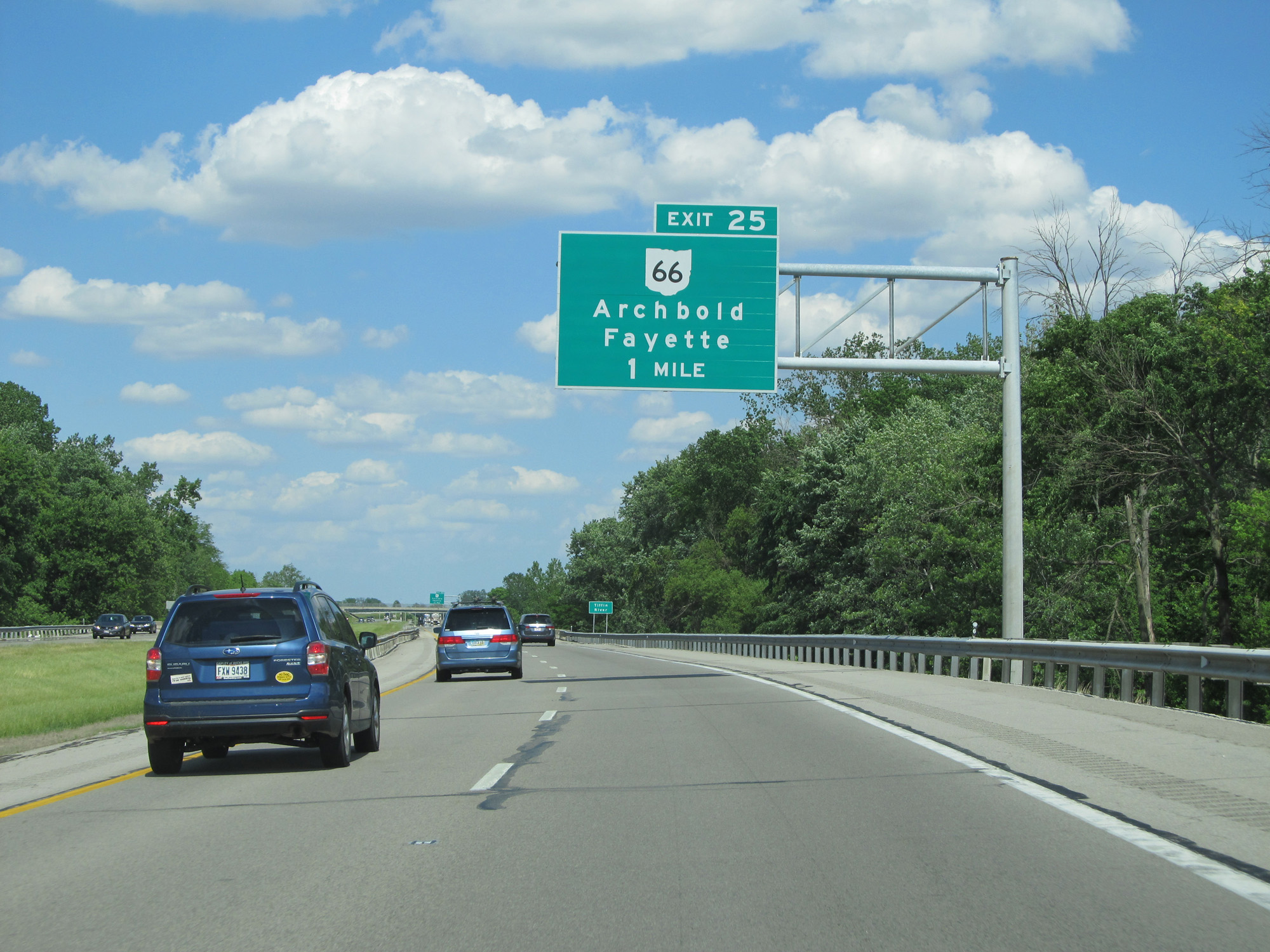
Interstate 80 / Interstate 90 East (Ohio Turnpike) at Exit 25: OH 66 - Archbold / Fayette (Photo taken 5/30/16). |
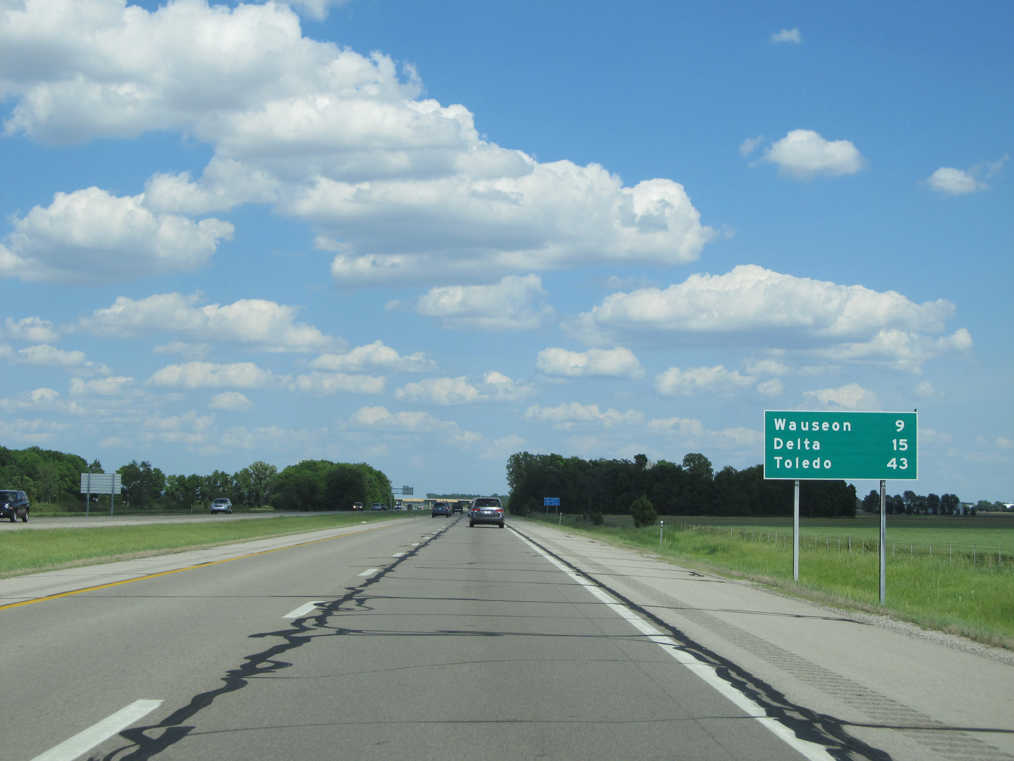 |
Mileage sign on Interstate 80 / Interstate 90 East (Ohio Turnpike). It's 9 miles to Wauseon, 15 miles to Delta, and 43 miles to Toledo. (Photo taken 5/30/16). |
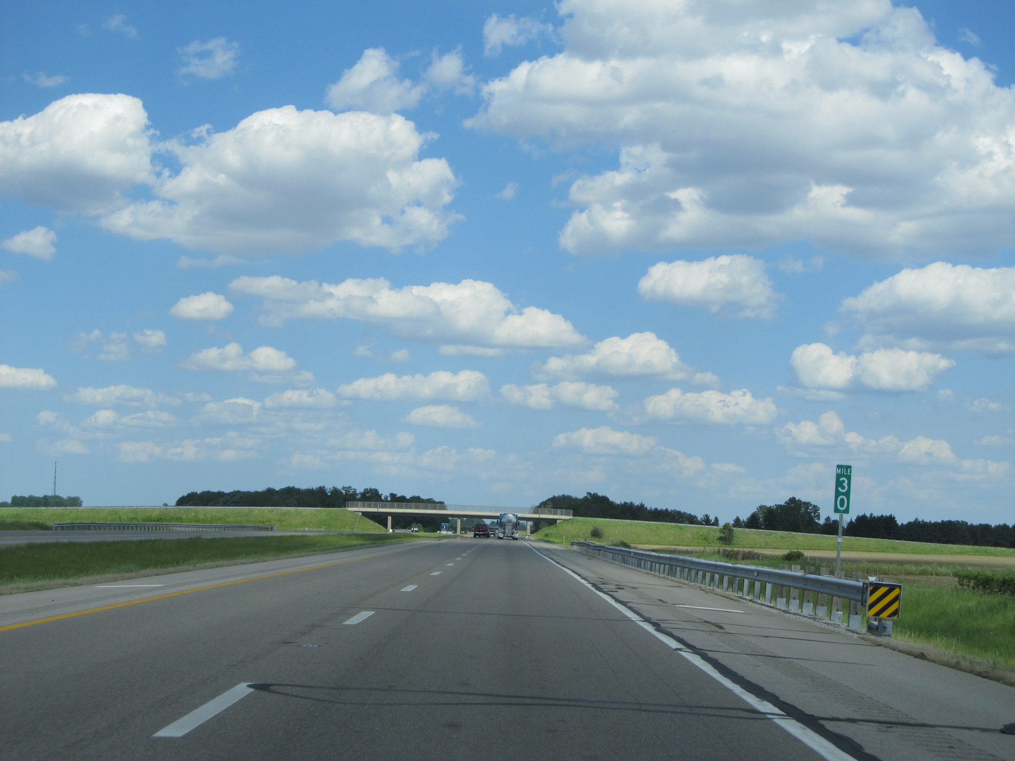 |
Interstate 80 / Interstate 90 East (Ohio Turnpike) at mile marker 30. (Photo taken 5/30/16). |
 |
Interstate 80 / Interstate 90 East (Ohio Turnpike) approaching Exit 34 - 1 mile. (Photo taken 5/30/16). |
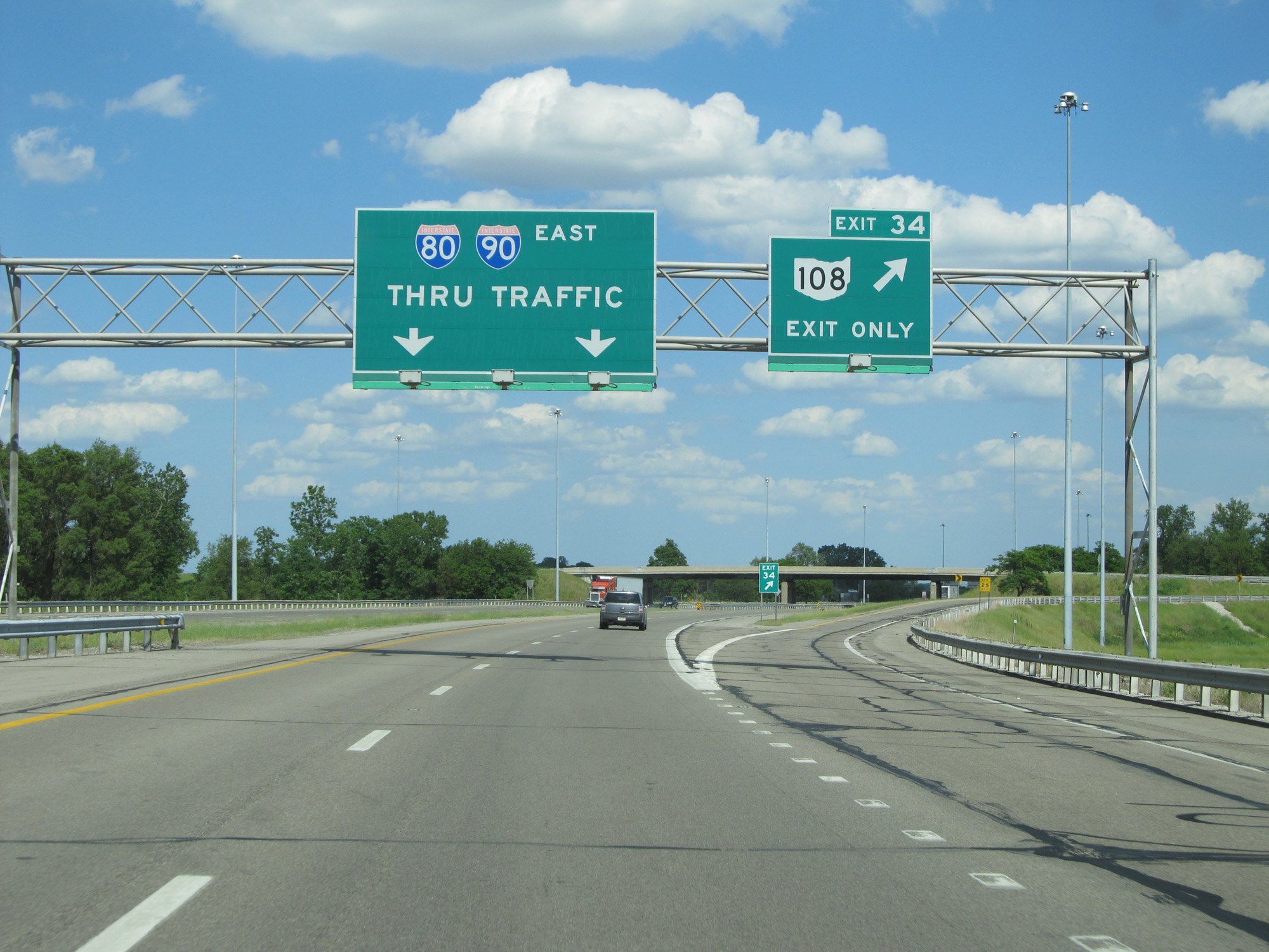 |
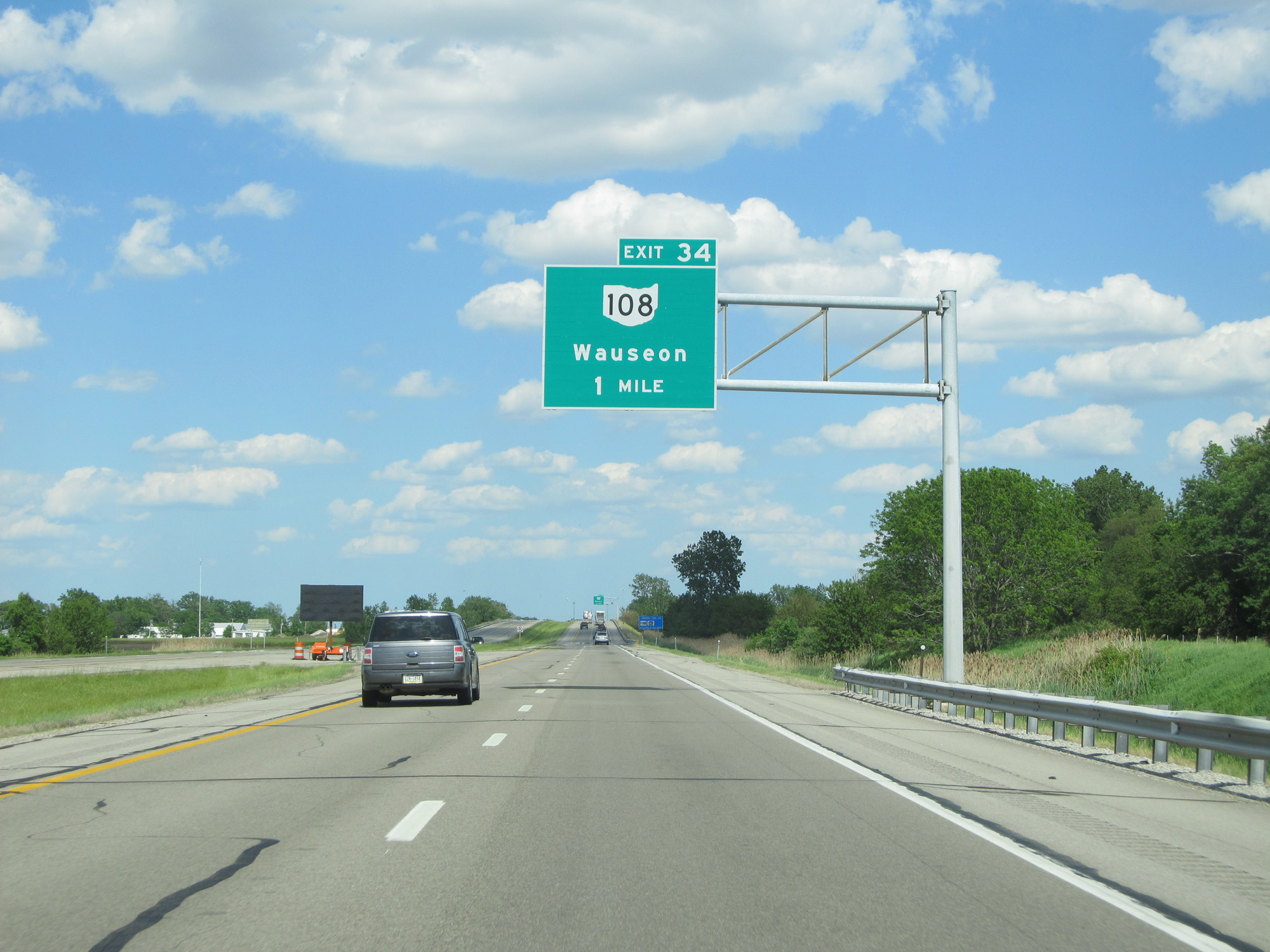
Interstate 80 / Interstate 90 East (Ohio Turnpike) at Exit 34: OH 108 - Wauseon (Photo taken 5/30/16). |
 |
The speed limit remains 70 mph for all traffic. (Photo taken 5/30/16). |
 |
Interstate 80 / Interstate 90 East (Ohio Turnpike) approaching Exit 39 - 1 mile. (Photo taken 5/30/16). |
 |
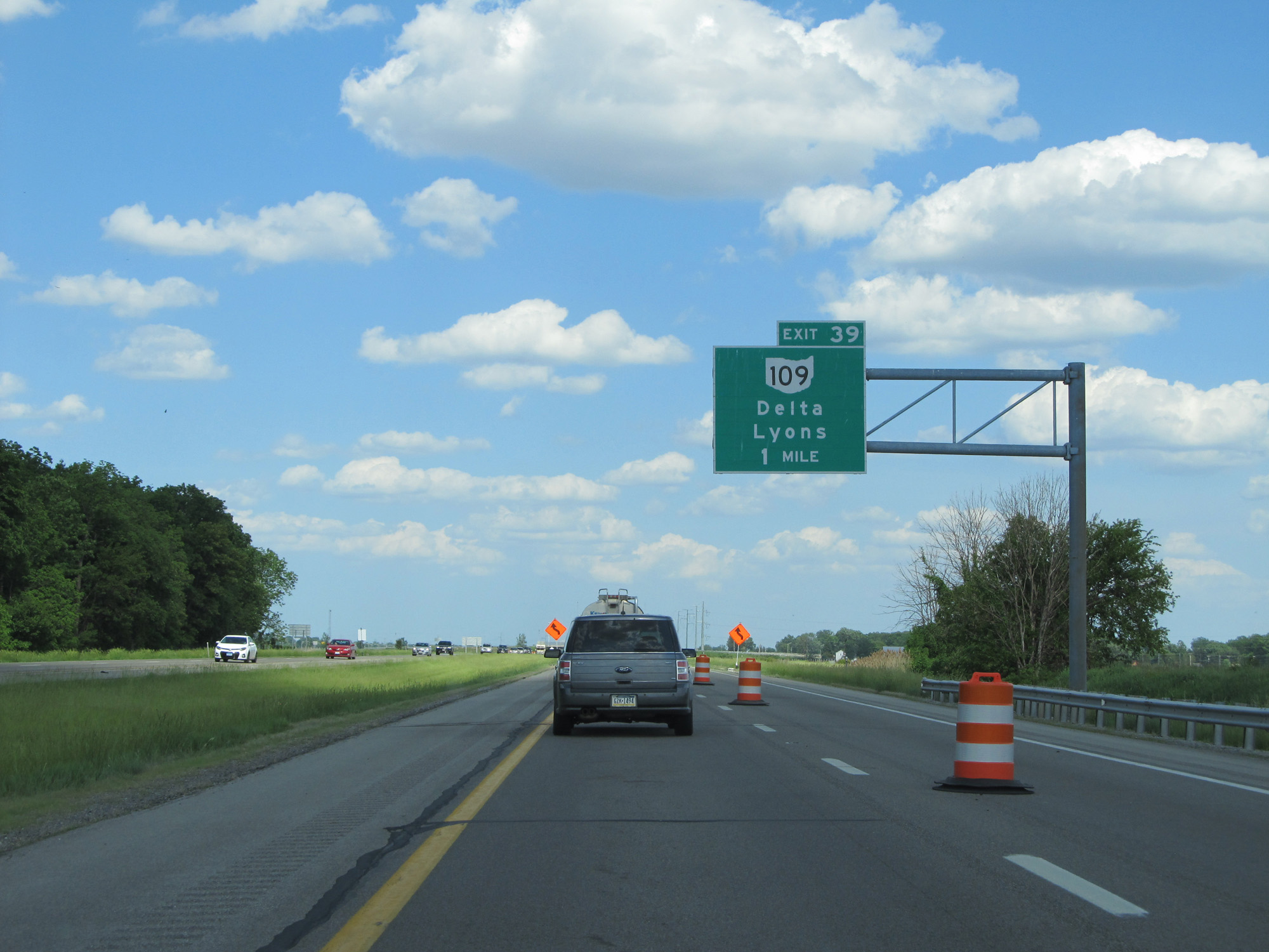
Interstate 80 / Interstate 90 East (Ohio Turnpike) at Exit 39: OH 109 - Delta / Lyons (Photo taken 5/30/16). |
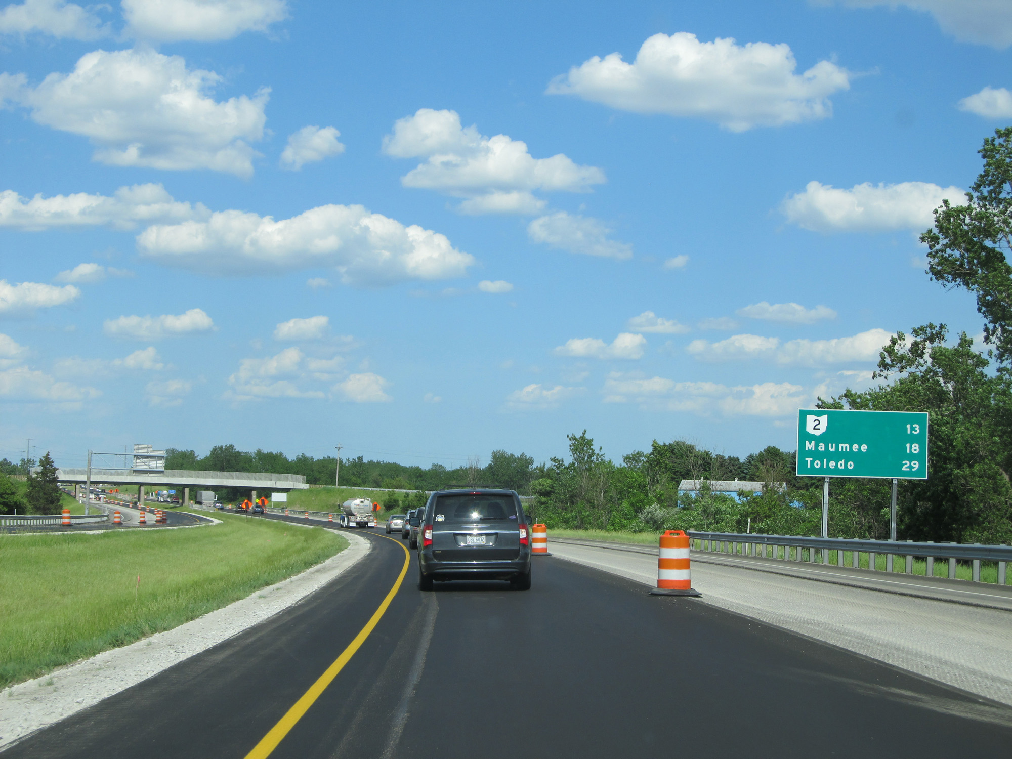 |
Mileage sign on Interstate 80 / Interstate 90 East (Ohio Turnpike). It's 13 miles to the junction of OH 2, 18 miles to Maumee, and 29 miles to Toledo. (Photo taken 5/30/16). |
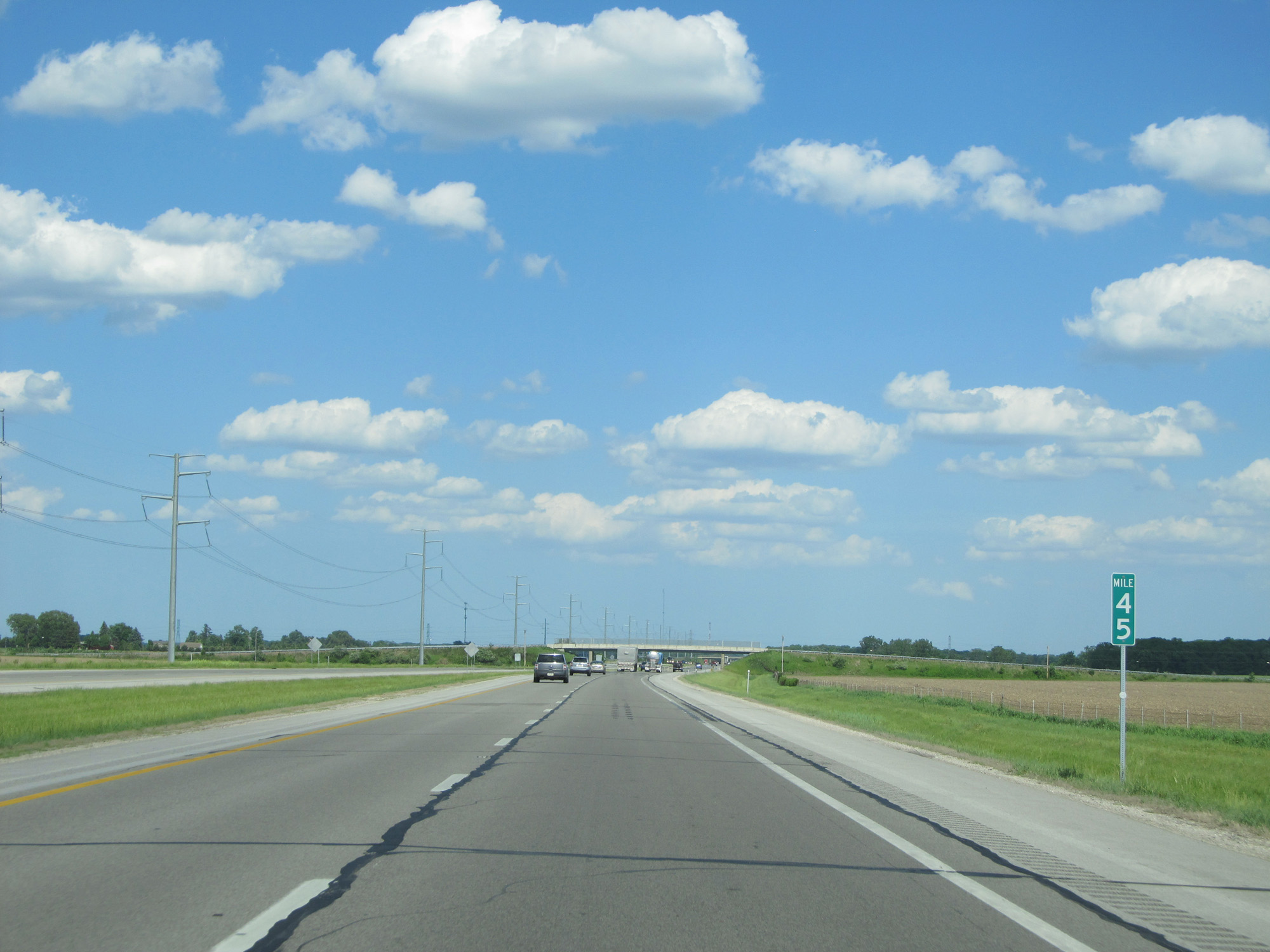 |
Interstate 80 / Interstate 90 East (Ohio Turnpike) at mile marker 45. (Photo taken 5/30/16). |
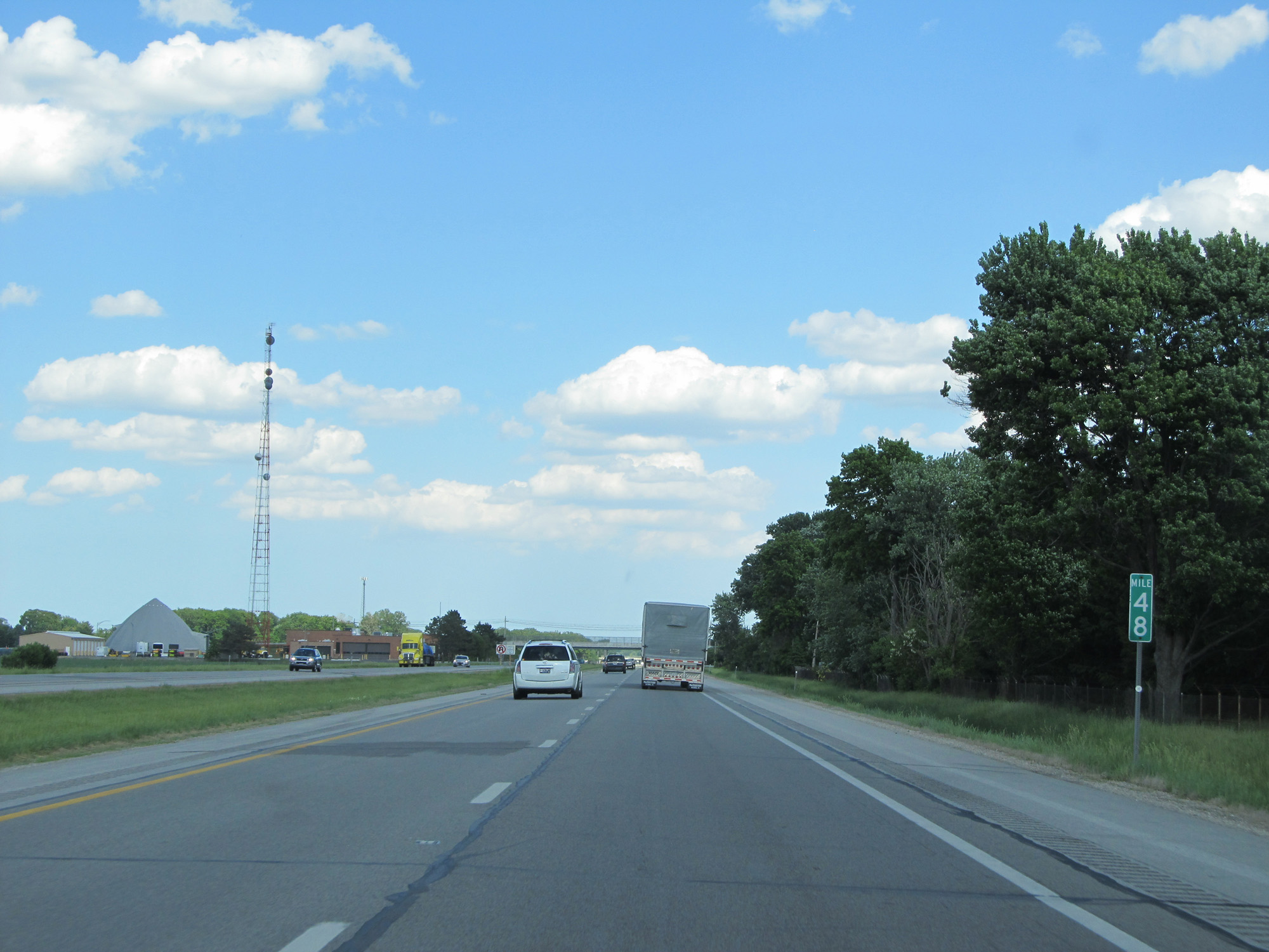 |
Interstate 80 / Interstate 90 East (Ohio Turnpike) at mile marker 48. (Photo taken 5/30/16). |
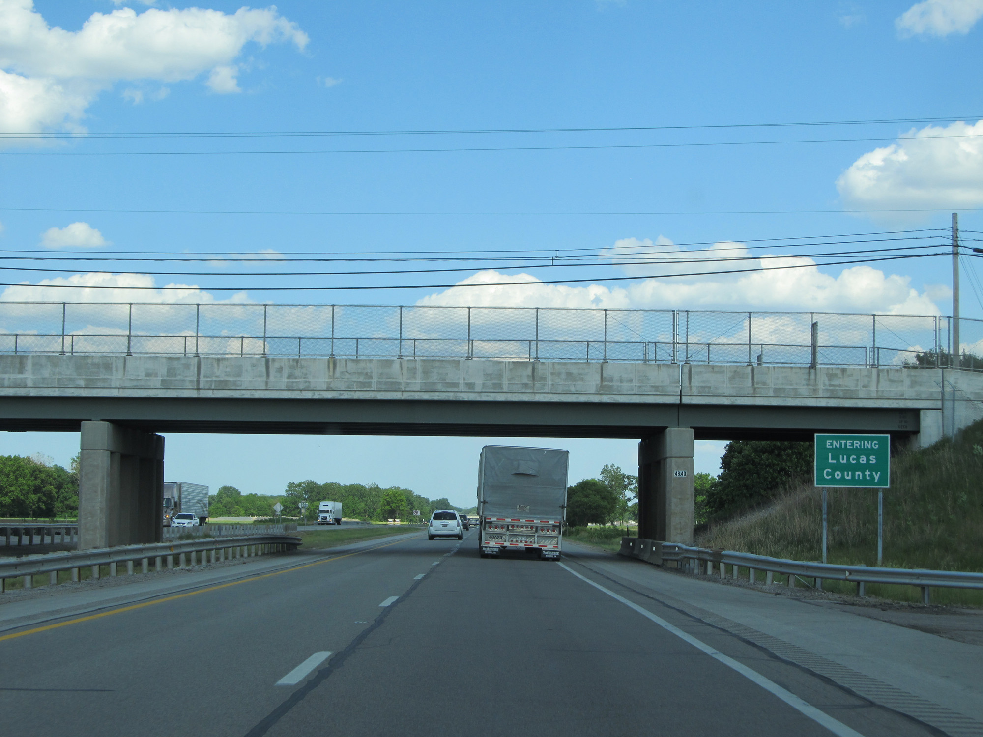 |
Interstate 80 / Interstate 90 East (Ohio Turnpike) entering Lucas County. (Photo taken 5/30/16). |
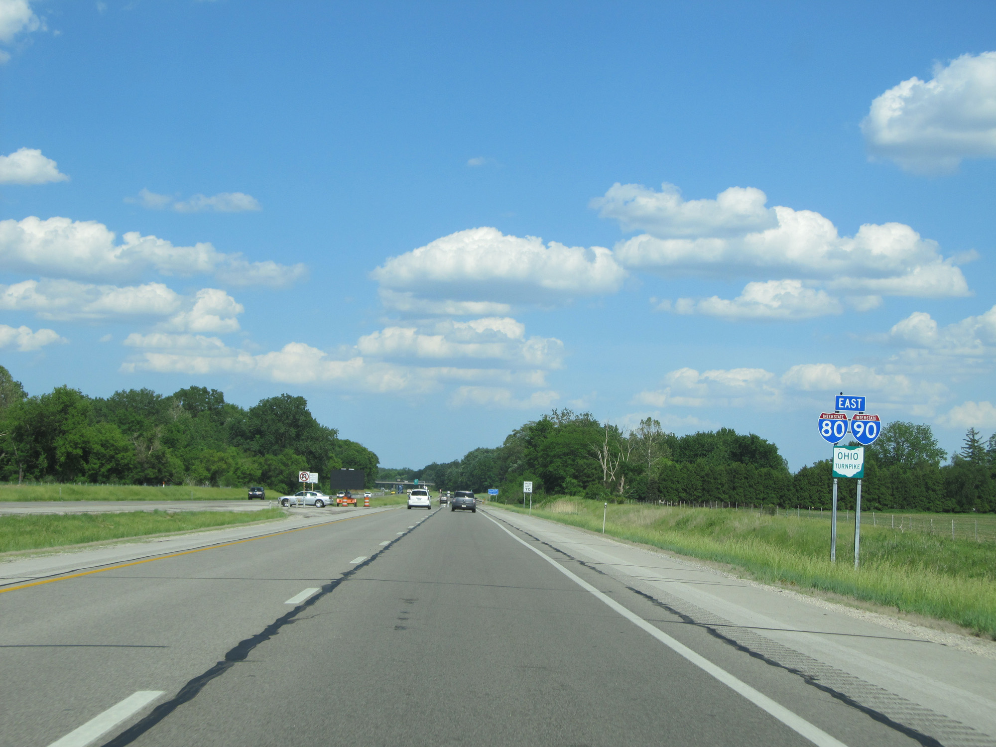 |
Interstate 80 / Interstate 90 East (Ohio Turnpike) reassurance shields. (Photo taken 5/30/16). |
 |
Interstate 80 / Interstate 90 East (Ohio Turnpike) approaching Exit 52 - 1 mile. (Photo taken 5/30/16). |
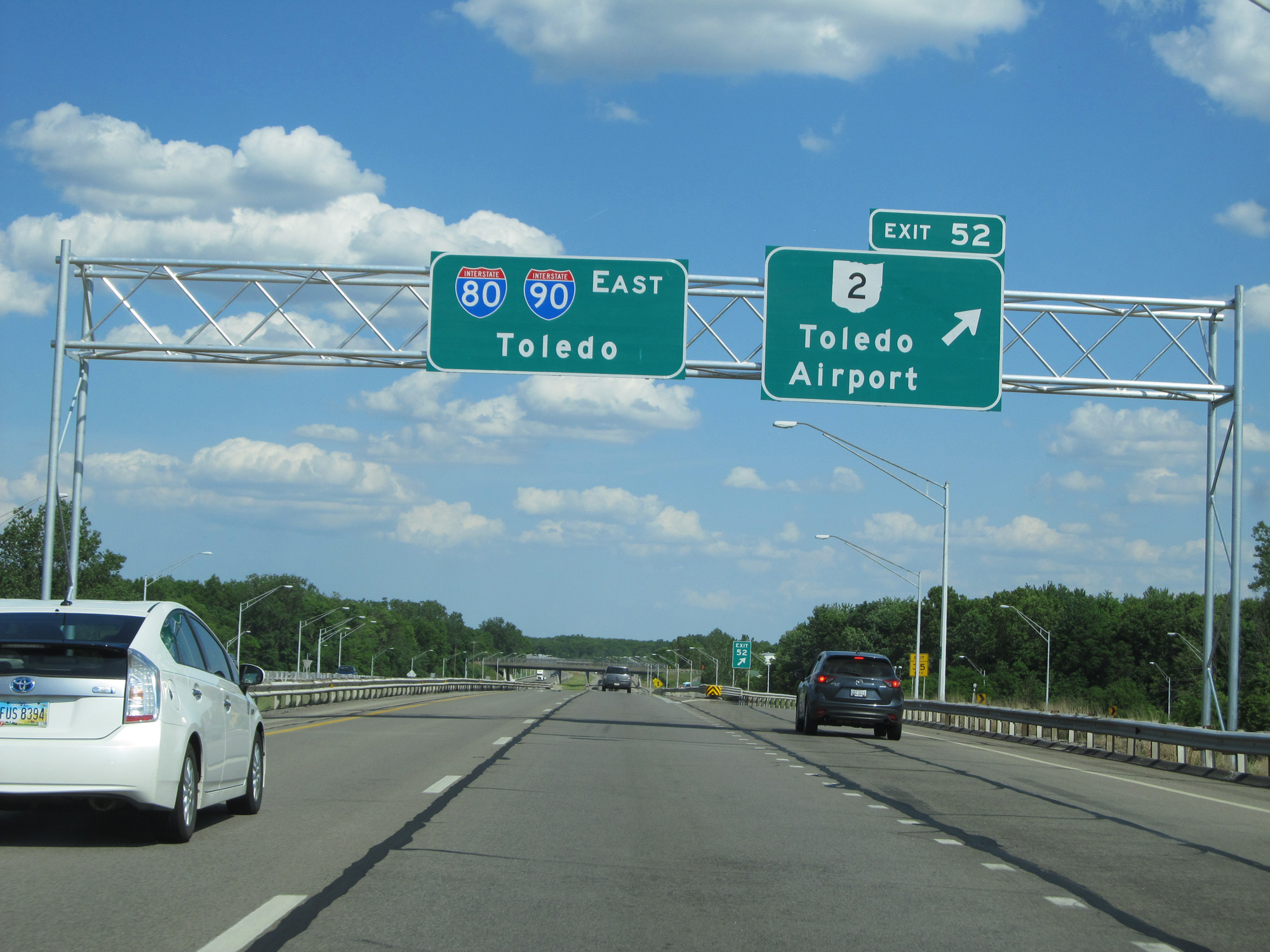 |
Interstate 80 / Interstate 90 East (Ohio Turnpike) at Exit 52: OH 2 - Toledo Airport / Swanton (Photo taken 5/30/16). |
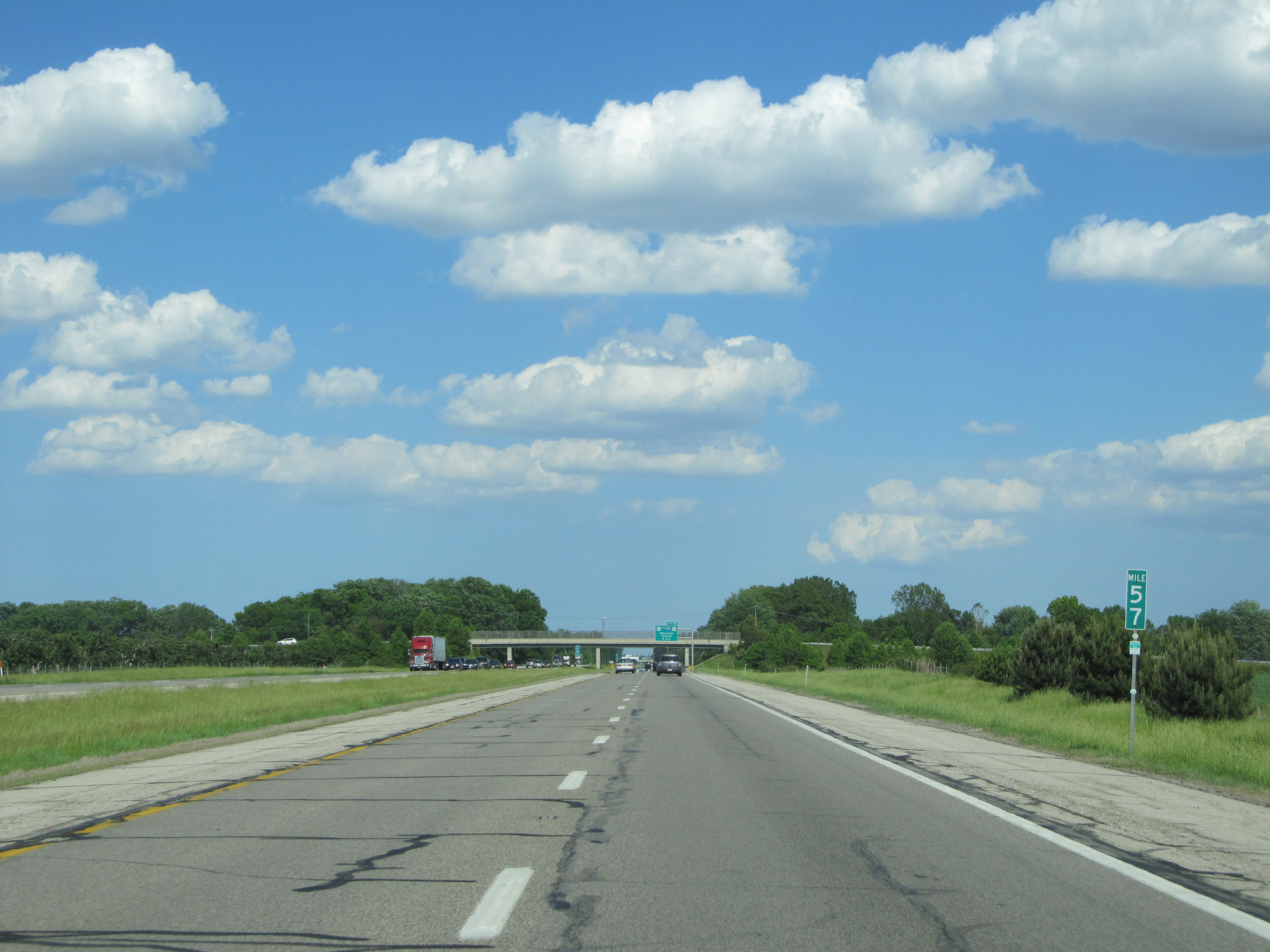 |
Interstate 80 / Interstate 90 East (Ohio Turnpike) at mile marker 57. (Photo taken 5/30/16). |
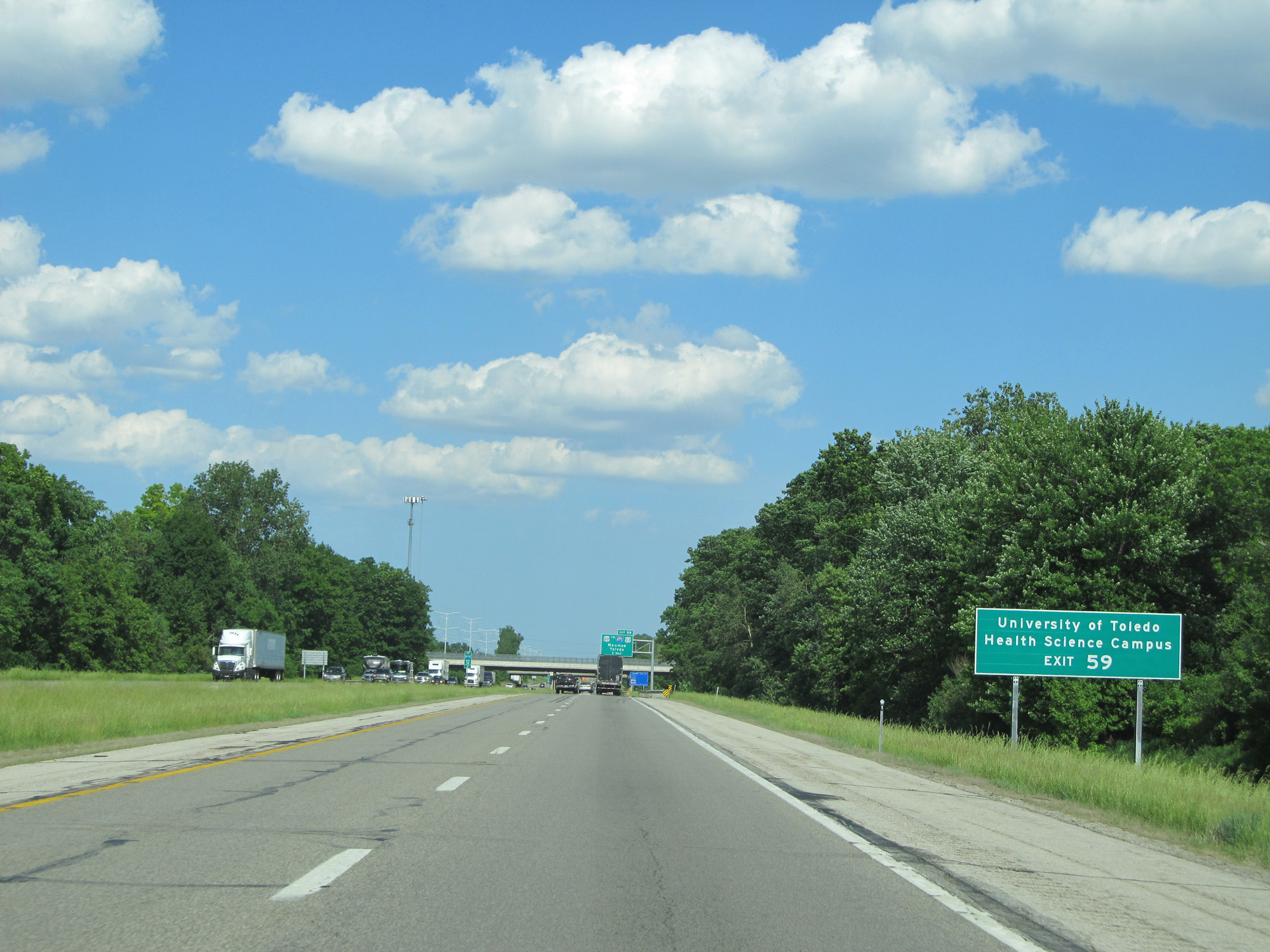 |
Take Exit 59 to the University of Toledo Health Science Campus. (Photo taken 5/30/16). |
 |
Interstate 80 / Interstate 90 East (Ohio Turnpike) approaching Exit 59 - 1 mile. (Photo taken 5/30/16). |
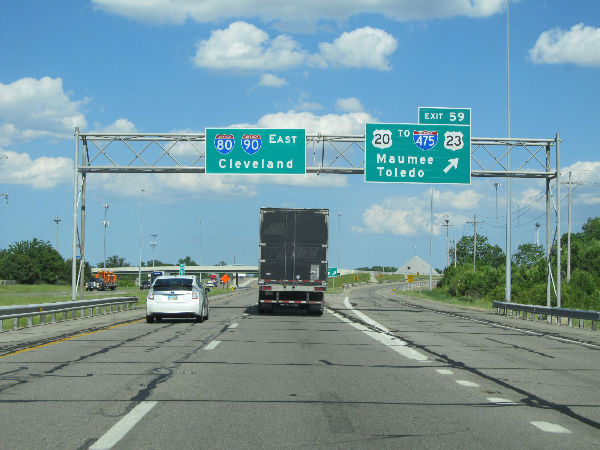 |
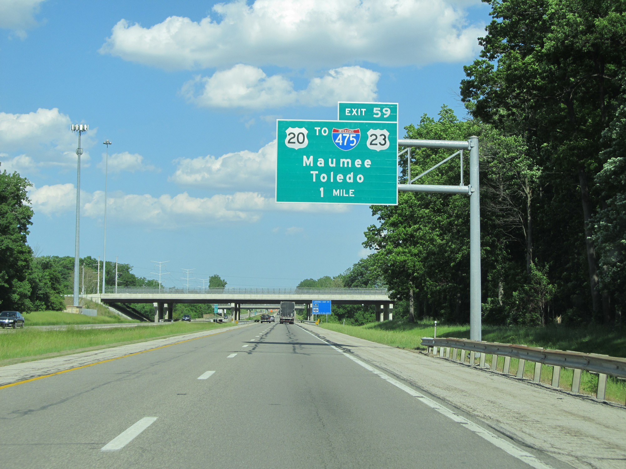
Interstate 80 / Interstate 90 East (Ohio Turnpike) at Exit 59: US 20 / To Interstate 475 / To US 23 - Maumee / Toledo (Photo taken 5/30/16). |
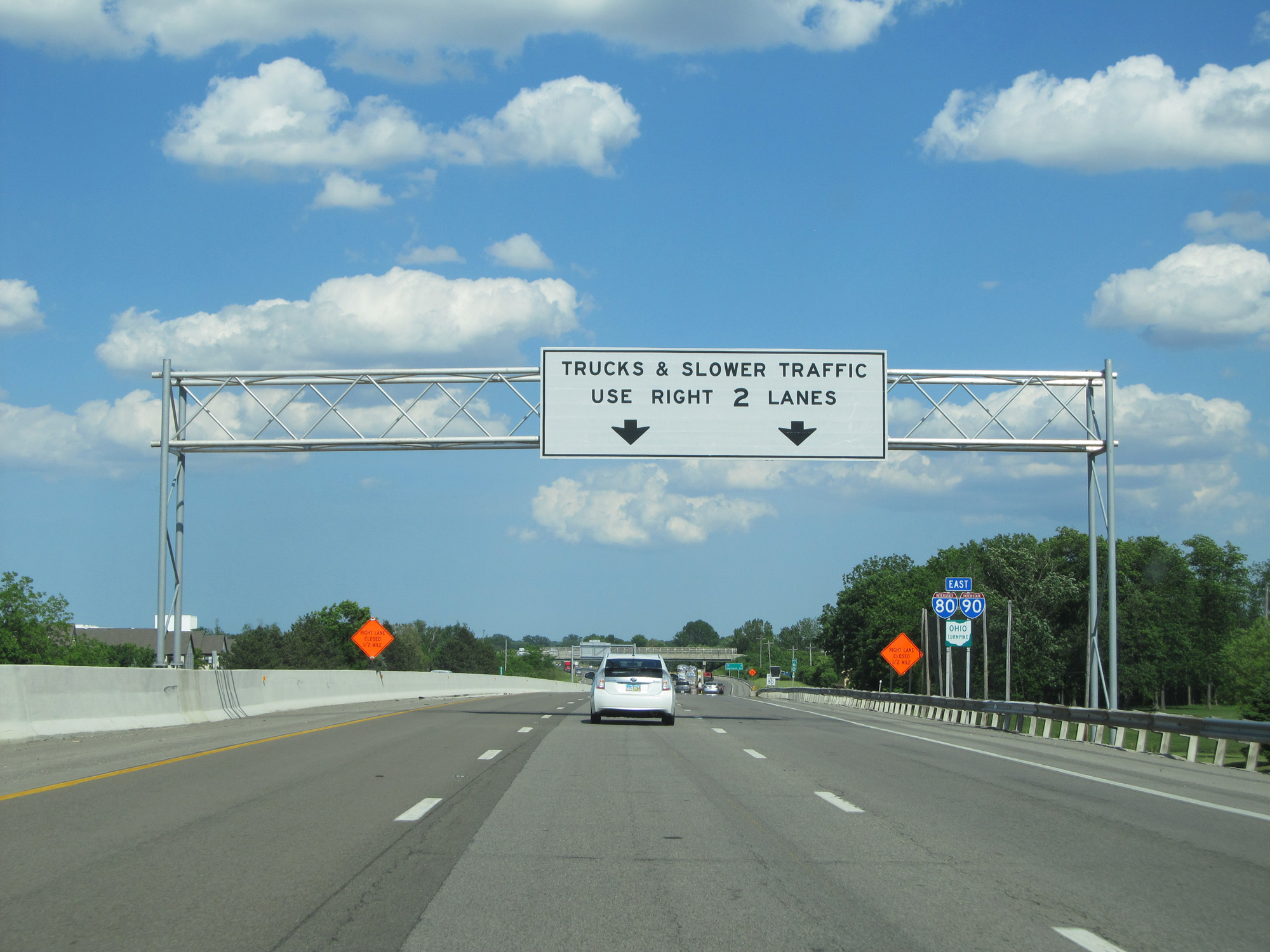 |
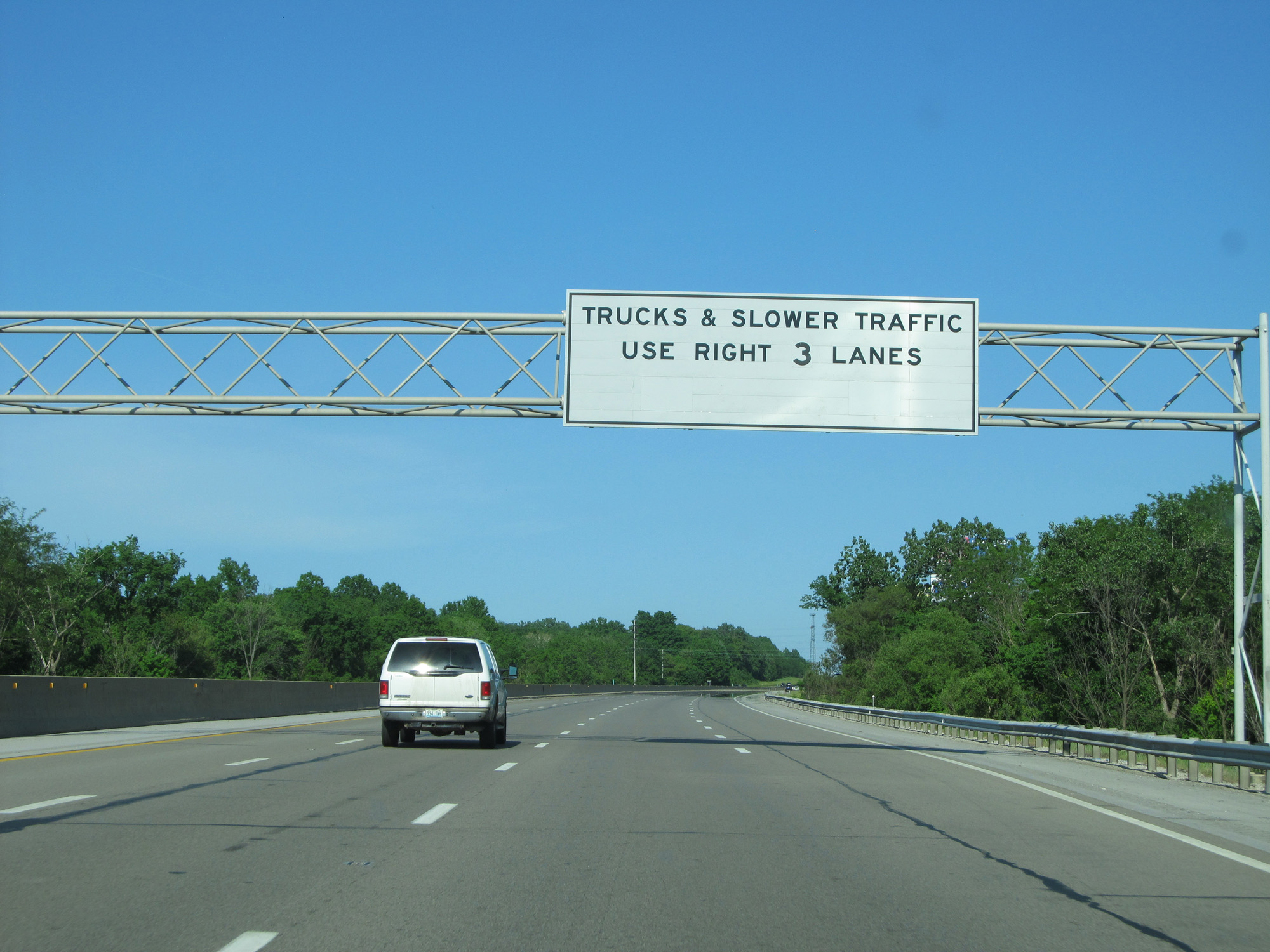
East of Exit 59, Interstate 80 / Interstate 90 East (Ohio Turnpike) is widened to three lanes in each direction. (Photo taken 5/30/16). |
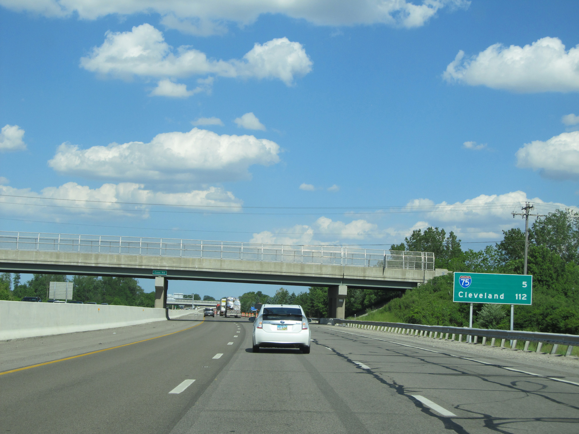 |
Mileage sign on Interstate 80 / Interstate 90 East (Ohio Turnpike). It's 5 miles to the junction of Interstate 75 and 112 miles to Cleveland. (Photo taken 5/30/16). |
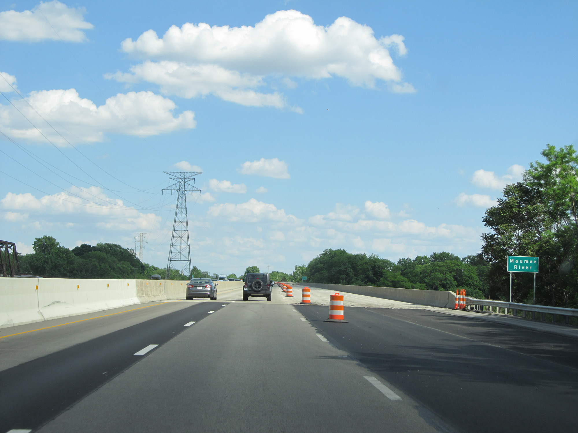 |
Interstate 80 / Interstate 90 East (Ohio Turnpike) crossing the Maumee River. (Photo taken 5/30/16). |
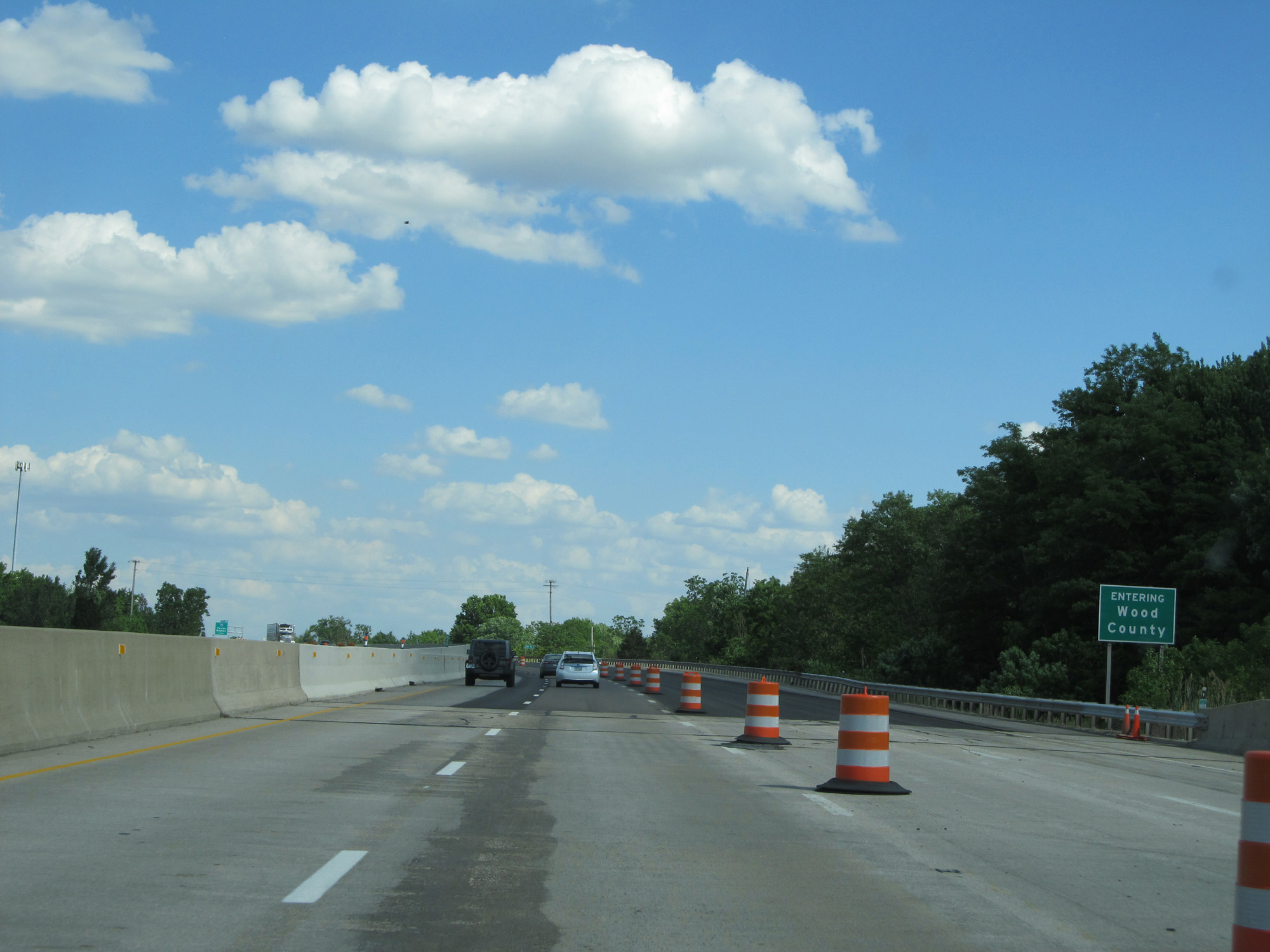 |
Interstate 80 / Interstate 90 East (Ohio Turnpike) enters Wood County on the east side of the Maumee River. (Photo taken 5/30/16). |
 |
Interstate 80 / Interstate 90 East (Ohio Turnpike) approaching Exit 64 - 1 mile. (Photo taken 5/30/16). |
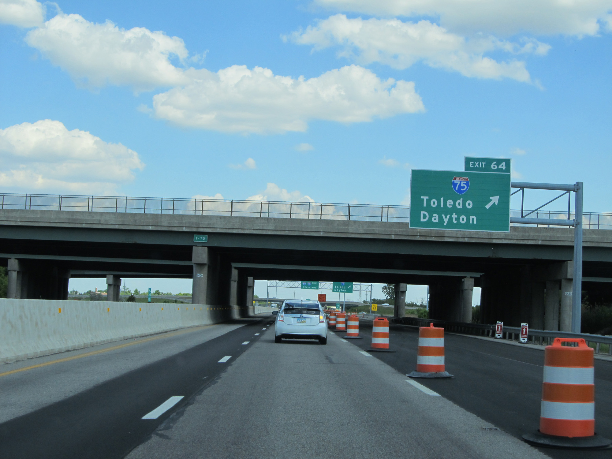 |
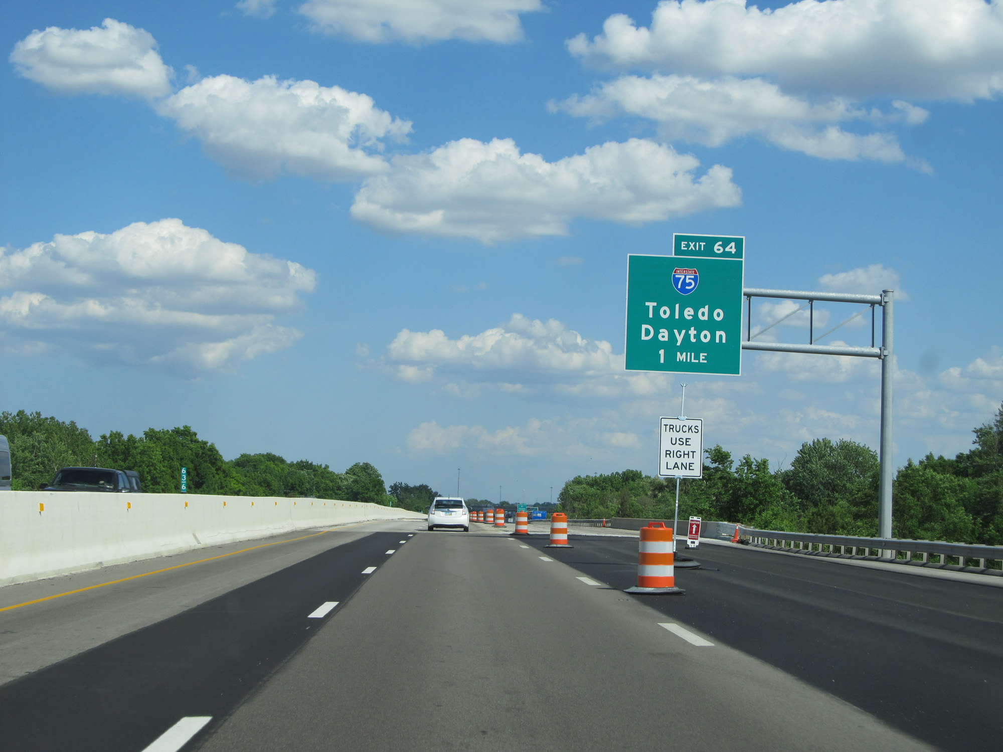
Interstate 80 / Interstate 90 East (Ohio Turnpike) at Exit 64: Interstate 75 - Toledo / Dayton (Photo taken 5/30/16). |
Section 2: Maumee (Exit 64) to Elyria (Exit 142)
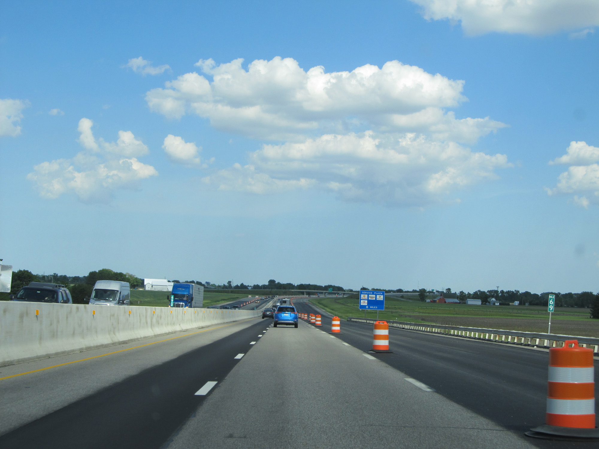 |
Interstate 80 / Interstate 90 East (Ohio Turnpike) at mile marker 69. (Photo taken 5/30/16). |
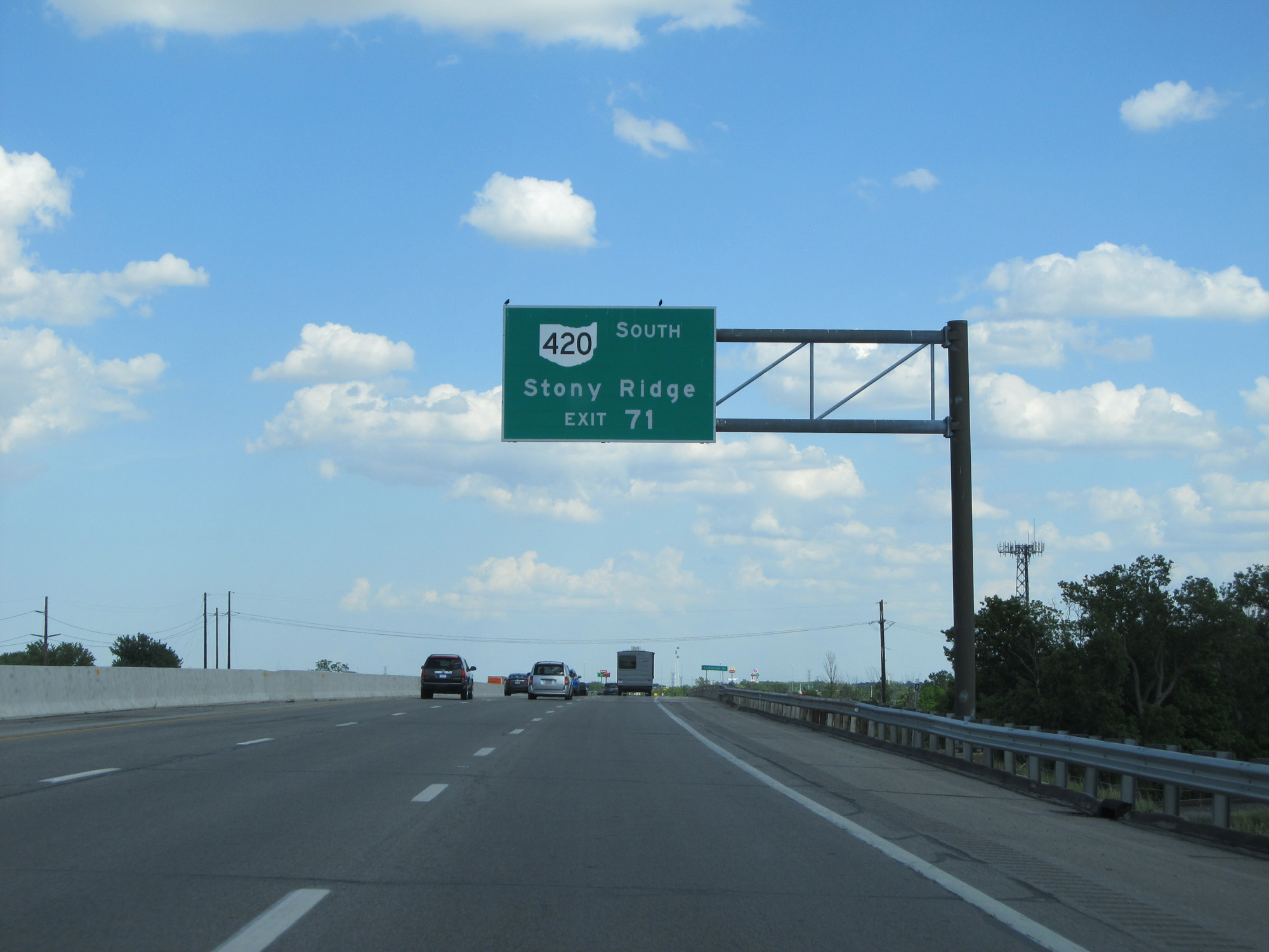 |
Take Exit 71 to OH 420 South toward Stony Ridge. (Photo taken 5/30/16). |
 |
Interstate 80 / Interstate 90 East (Ohio Turnpike) approaching Exit 71 - 1 mile. (Photo taken 5/30/16). |
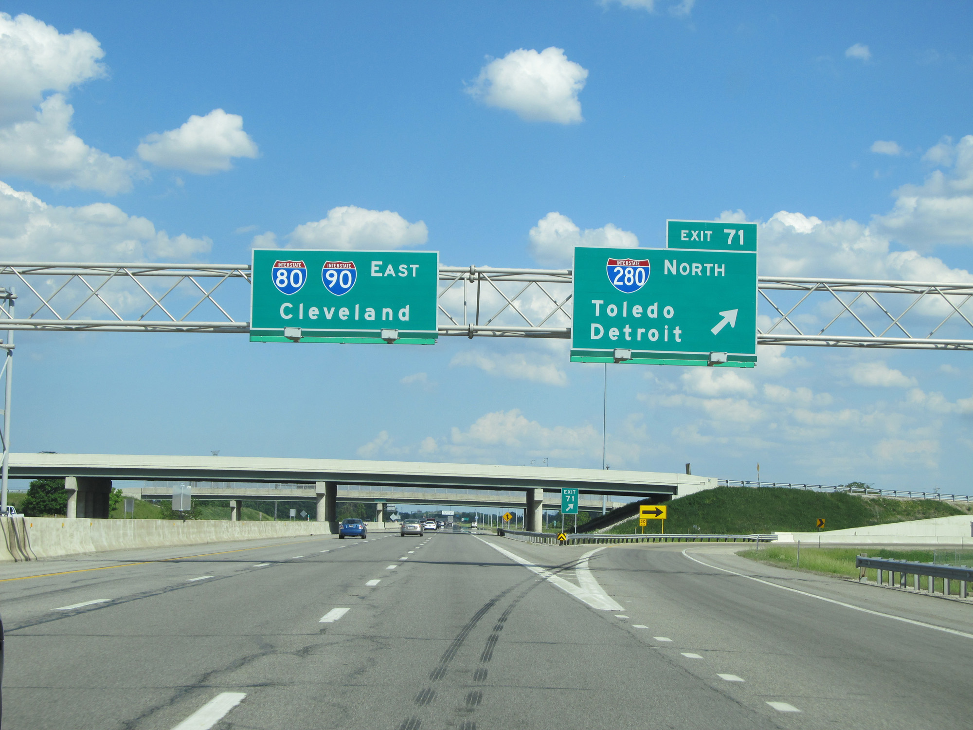 |
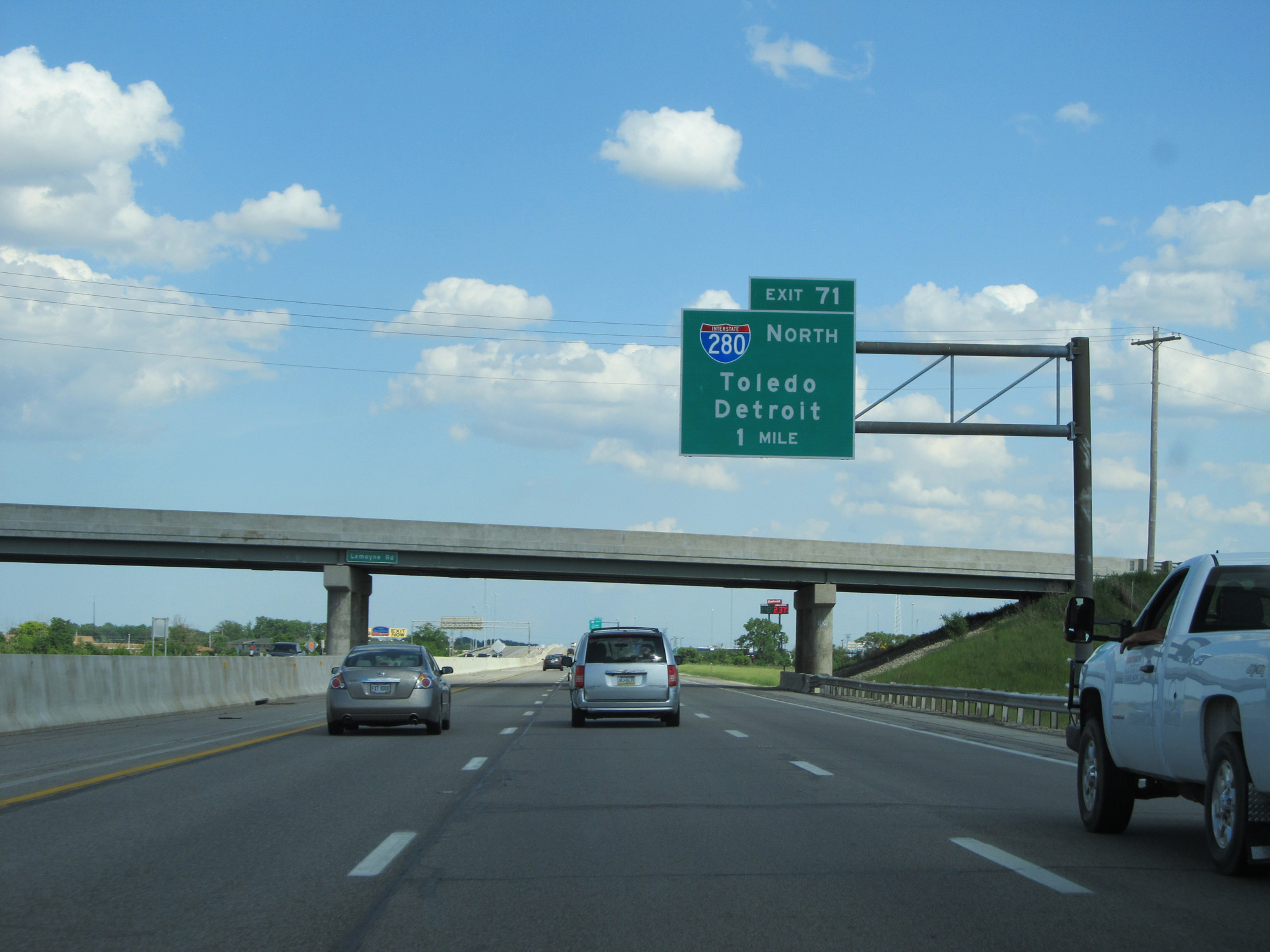
Interstate 80 / Interstate 90 East (Ohio Turnpike) at Exit 71: Interstate 280 North - Toledo / Detroit (Photo taken 5/30/16). |
 |
Interstate 80 / Interstate 90 East (Ohio Turnpike) reassurance shields. (Photo taken 5/30/16). |
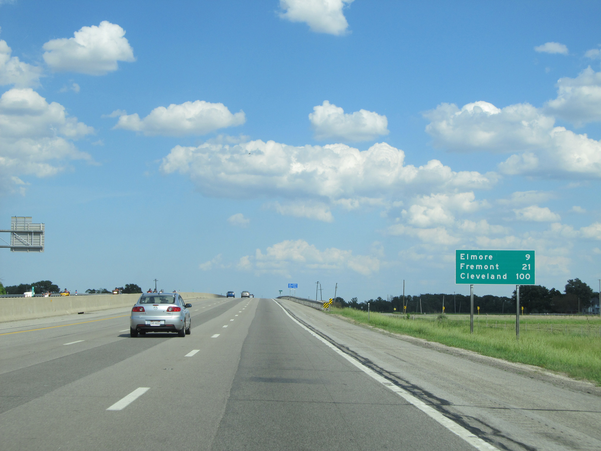 |
Mileage sign on Interstate 80 / Interstate 90 East (Ohio Turnpike). It's 9 miles to Elmore, 21 miles to Fremont, and 100 miles to Cleveland. (Photo taken 5/30/16). |
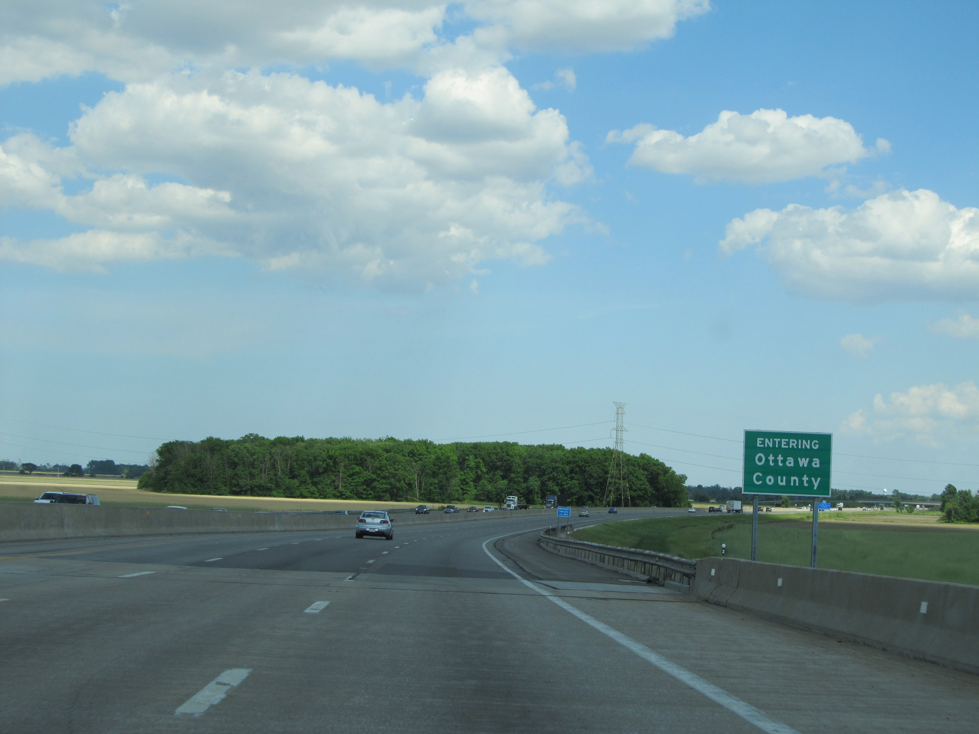 |
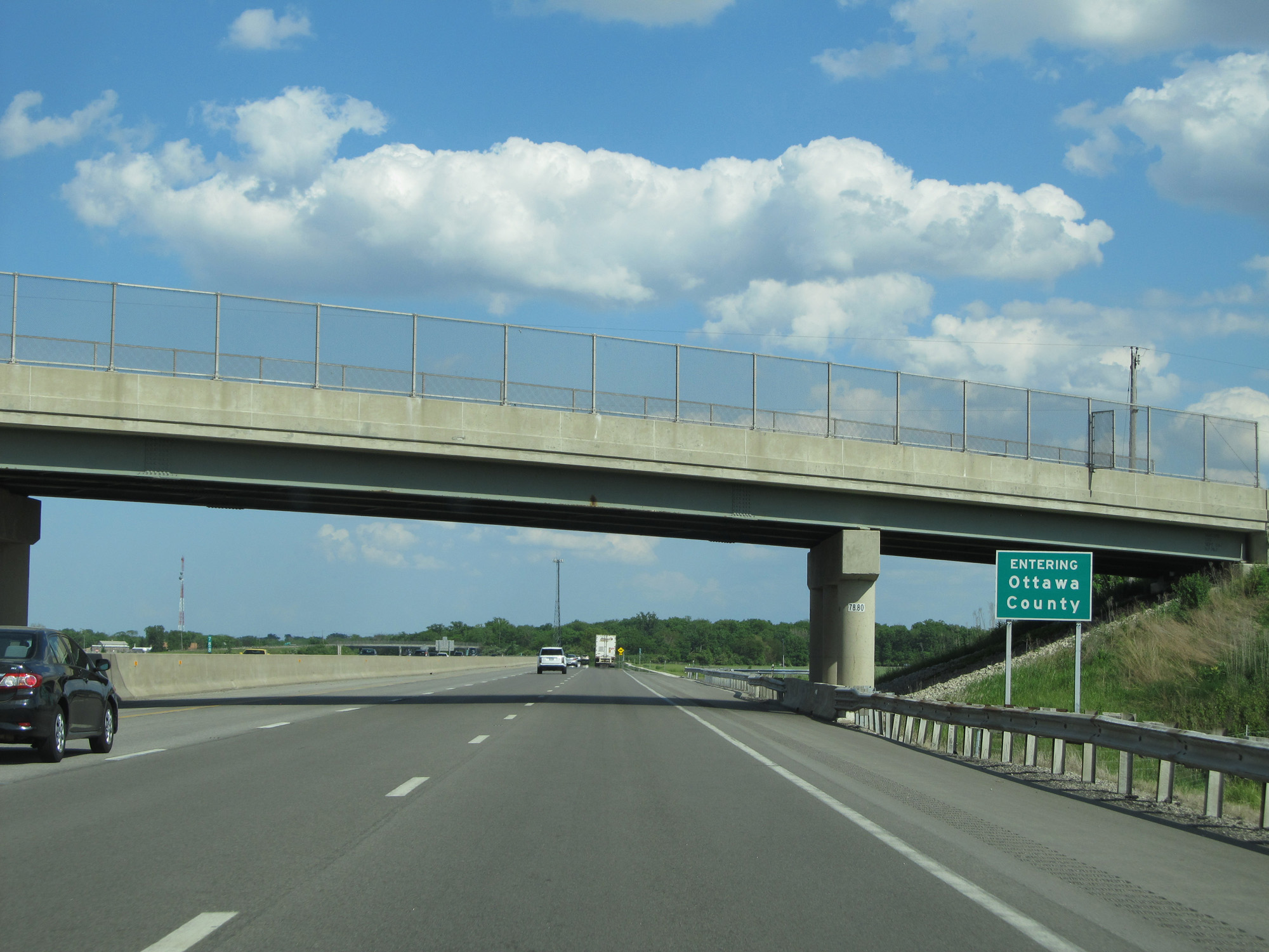
Interstate 80 / Interstate 90 East (Ohio Turnpike) entering Ottawa County. (Photo taken 5/30/16). |
 |
Interstate 80 / Interstate 90 East (Ohio Turnpike) approaching the Wyandot Service Plaza - 2 miles. (Photo taken 5/30/16). |
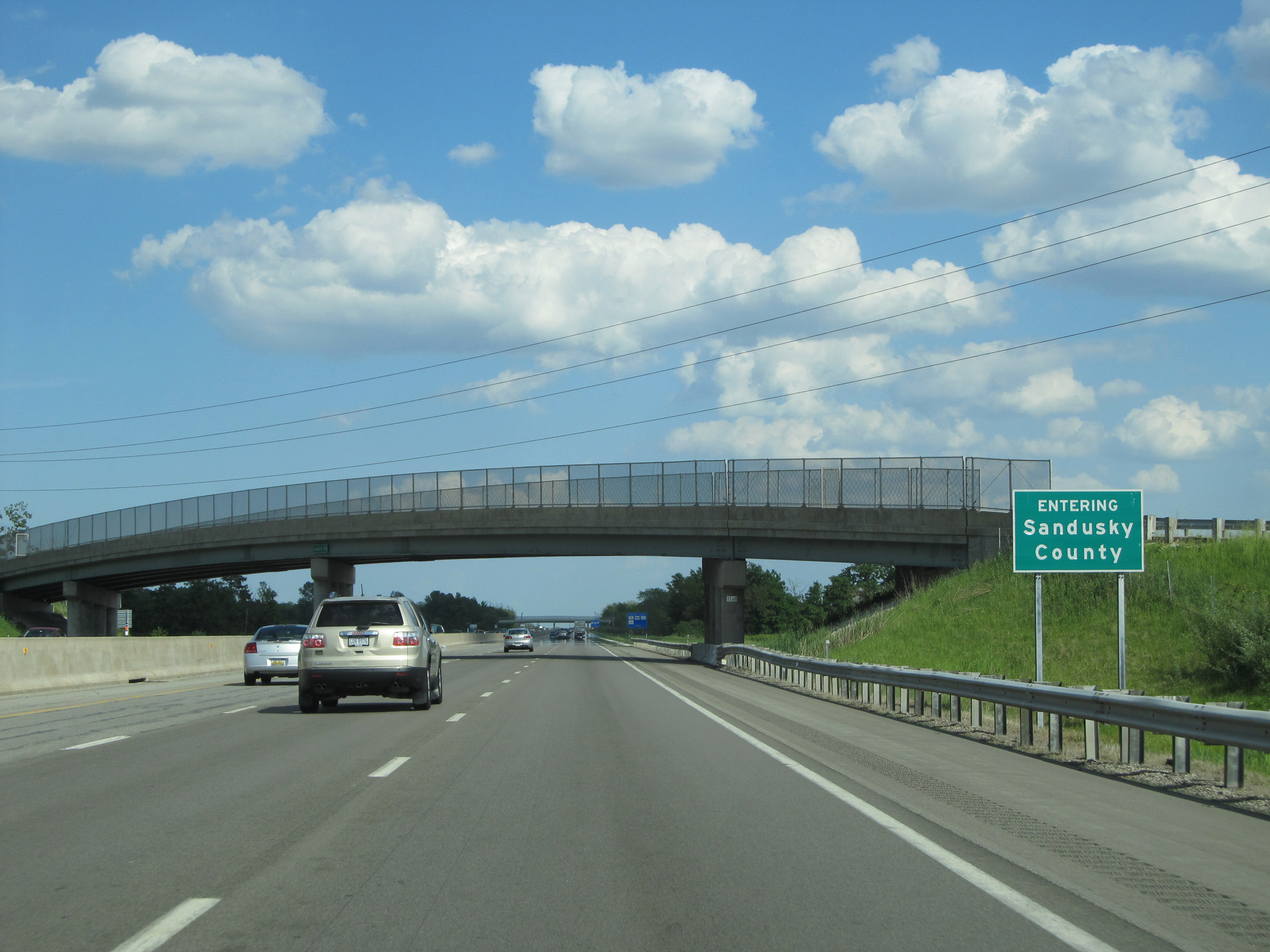 |
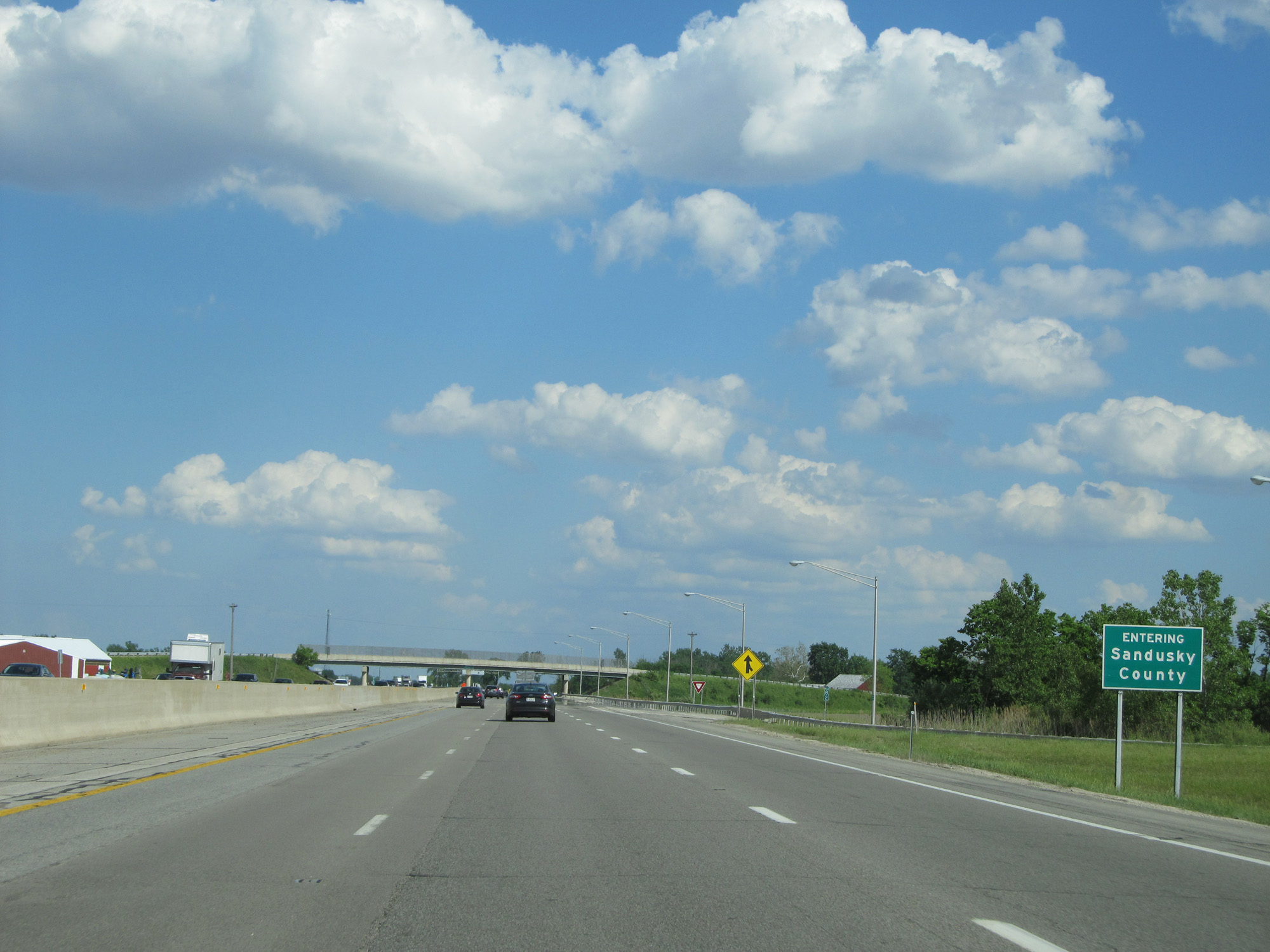
Interstate 80 / Interstate 90 East (Ohio Turnpike) entering Sandusky County. (Photo taken 5/30/16). |
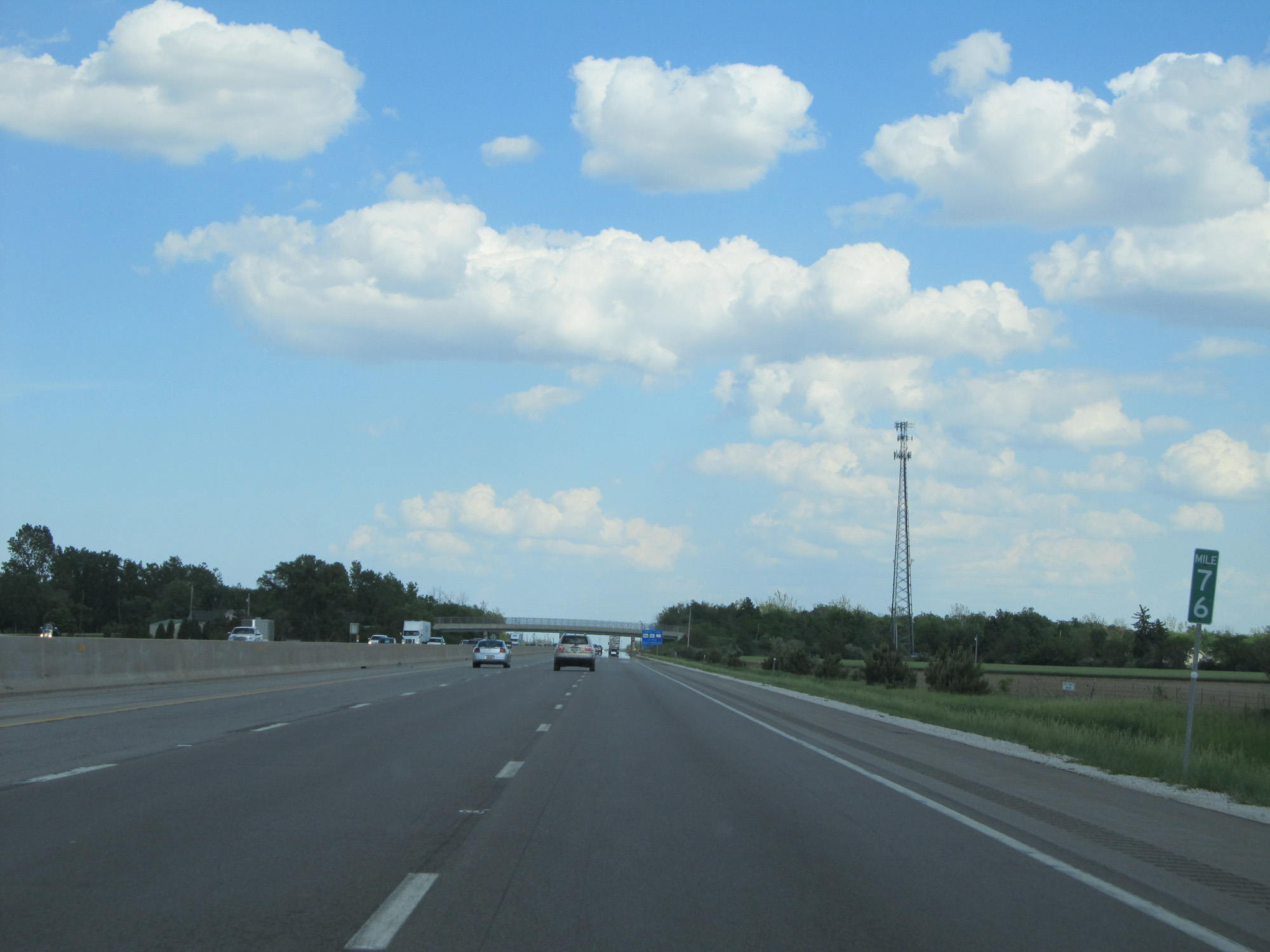 |
Interstate 80 / Interstate 90 East (Ohio Turnpike) at mile marker 76. (Photo taken 5/30/16). |
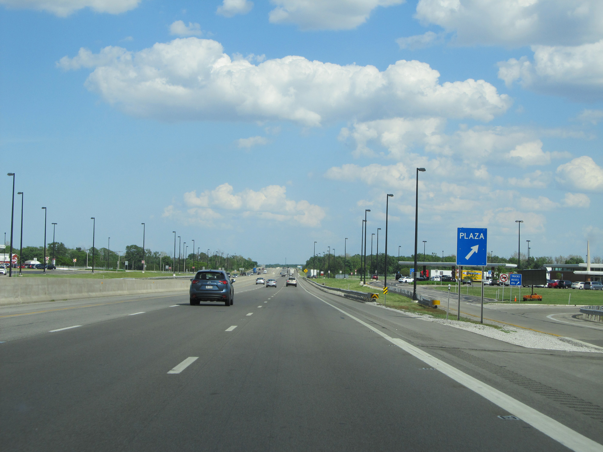 |
Interstate 80 / Interstate 90 East (Ohio Turnpike) at the Wyandot Service Plaza. (Photo taken 5/30/16). |
 |
Interstate 80 / Interstate 90 East (Ohio Turnpike) as it re-enters Ottawa County. (Photo taken 5/30/16). |
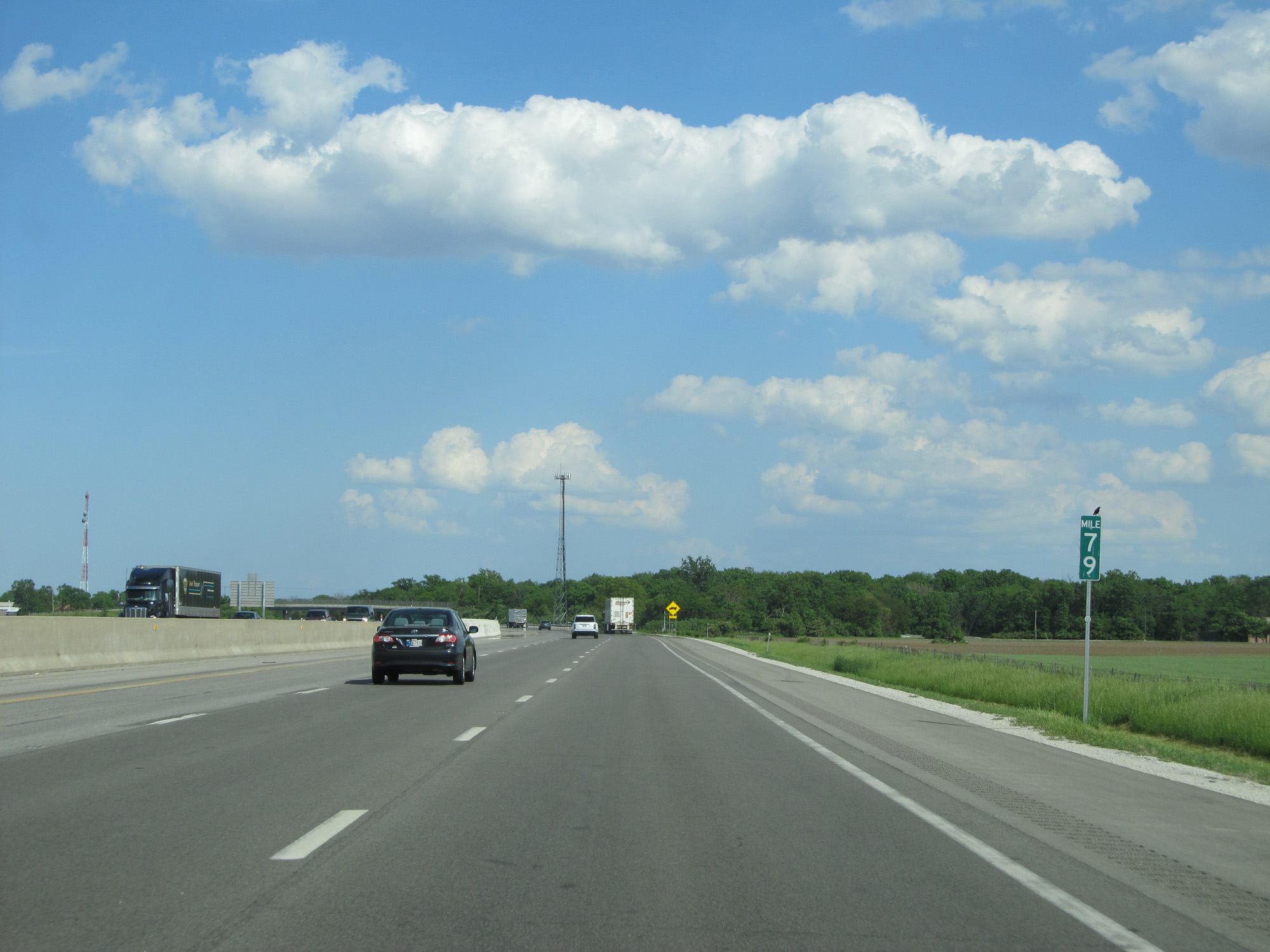 |
Interstate 80 / Interstate 90 East (Ohio Turnpike) at mile marker 79. (Photo taken 5/30/16). |
 |
Interstate 80 / Interstate 90 East (Ohio Turnpike) approaching Exit 81 - 1 mile. (Photo taken 5/30/16). |
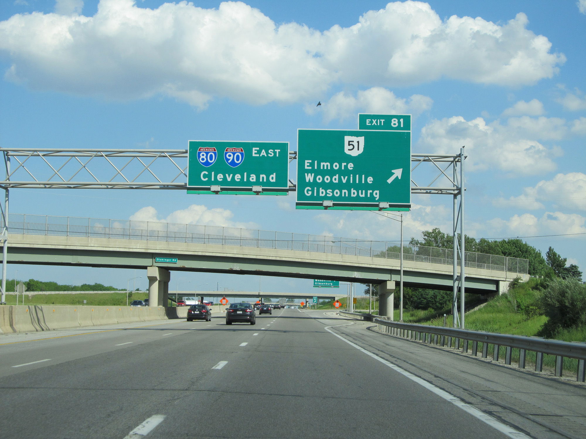 |
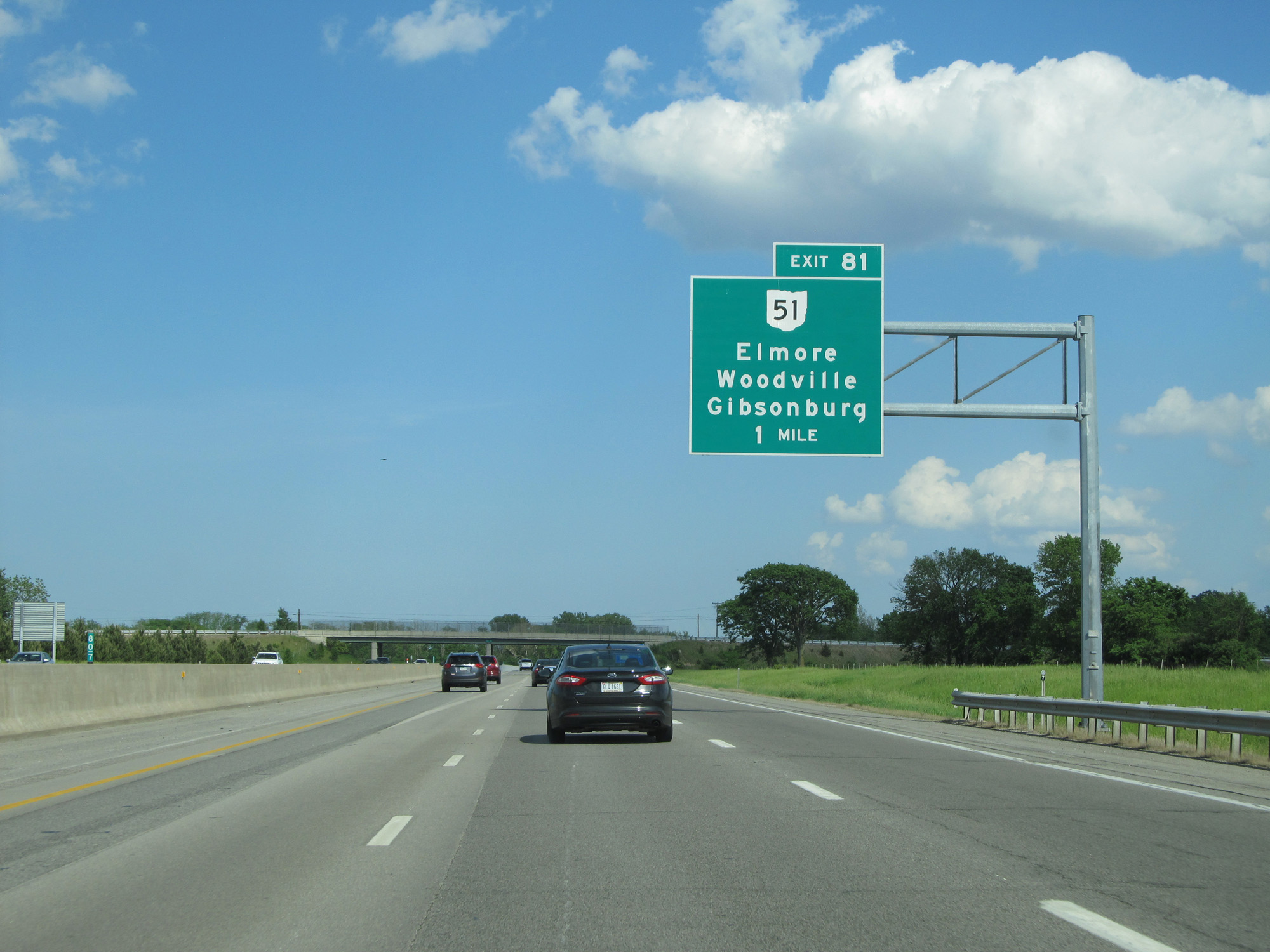
Interstate 80 / Interstate 90 East (Ohio Turnpike) at Exit 81: OH 51 - Elmore / Woodville / Gibsonburg (Photo taken 5/30/16). |
 |
Interstate 80 / Interstate 90 East (Ohio Turnpike) as it re-enters Sandusky County. (Photo taken 5/30/16). |
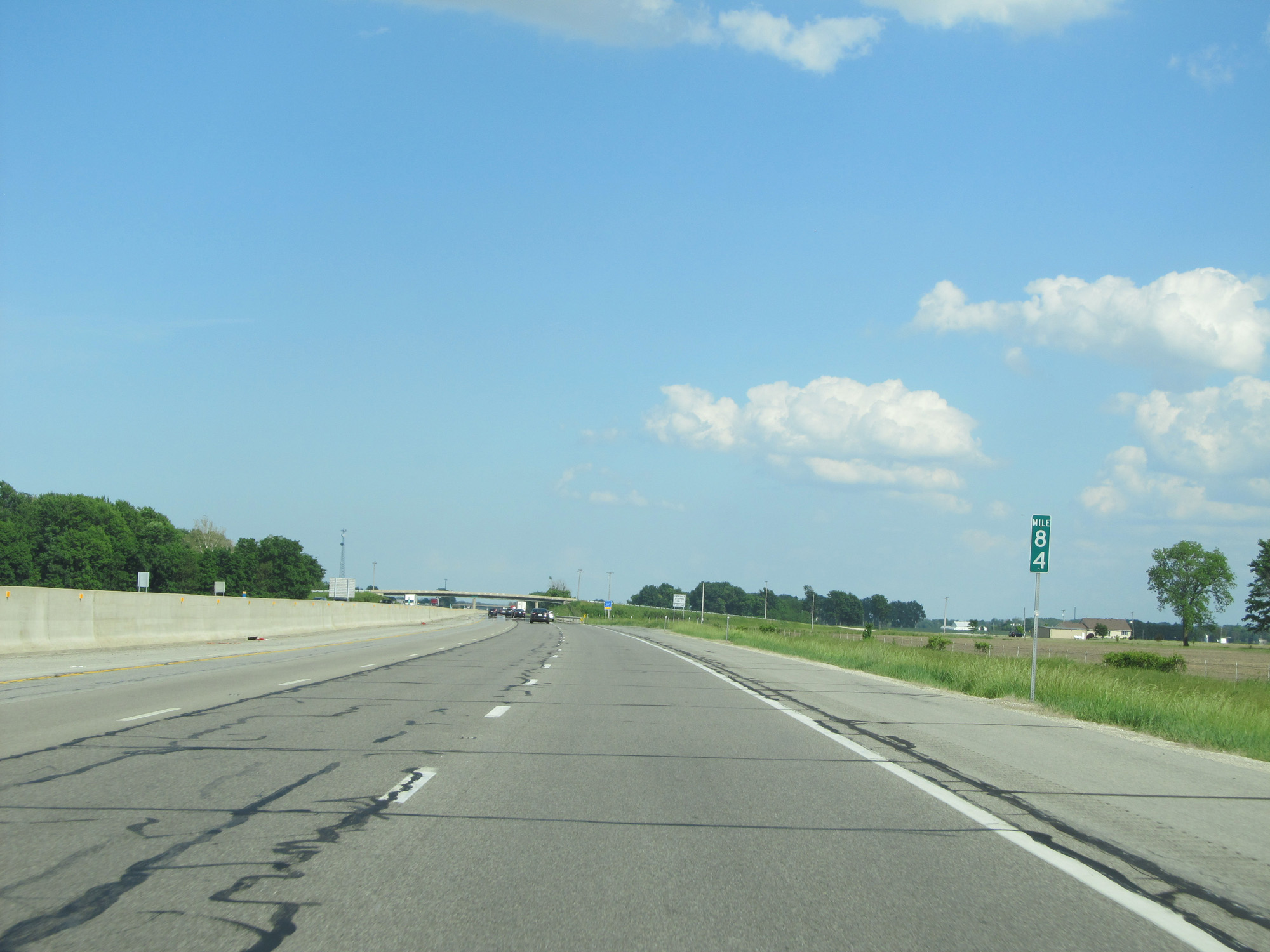 |
Interstate 80 / Interstate 90 East (Ohio Turnpike) at mile marker 84. (Photo taken 5/30/16). |
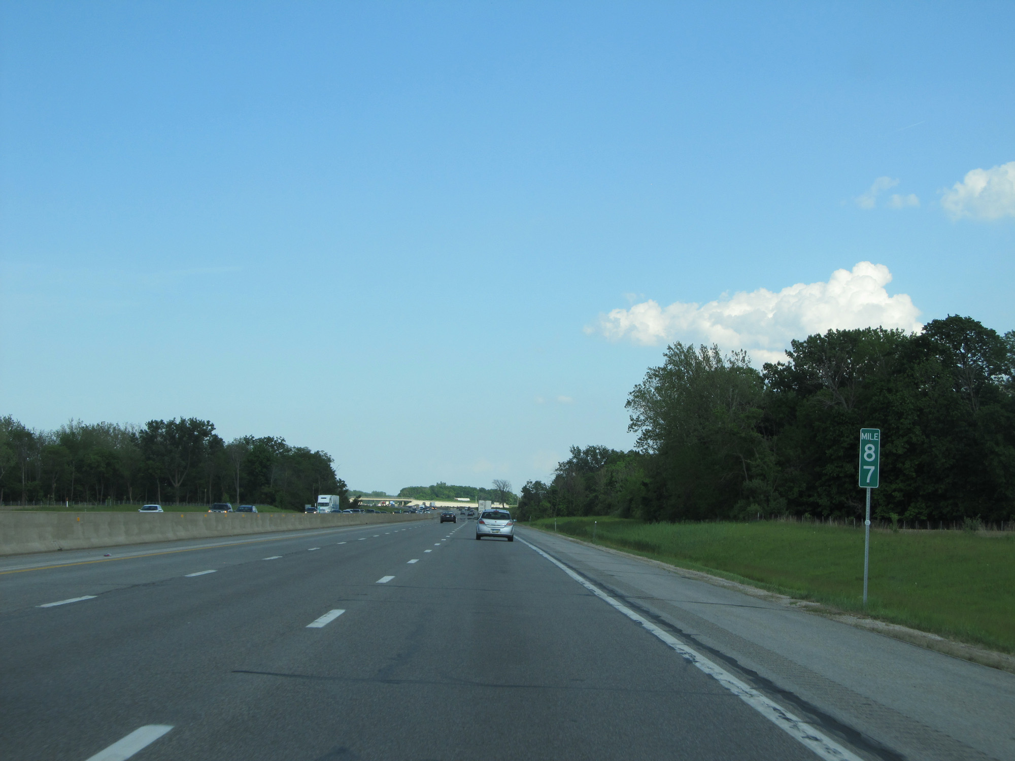 |
Interstate 80 / Interstate 90 East (Ohio Turnpike) at mile marker 87. (Photo taken 5/30/16). |
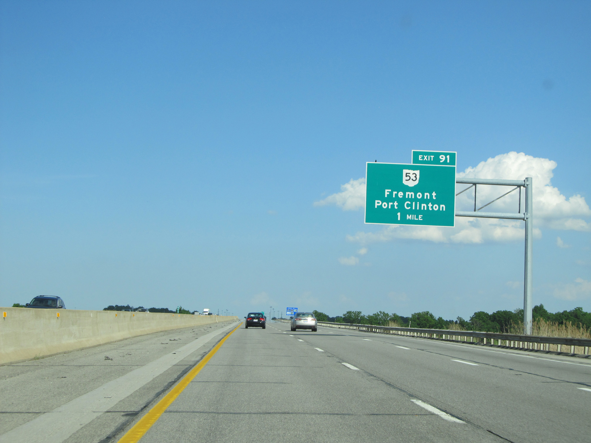 |
Interstate 80 / Interstate 90 East (Ohio Turnpike) approaching Exit 91 - 1 mile. (Photo taken 5/30/16). |
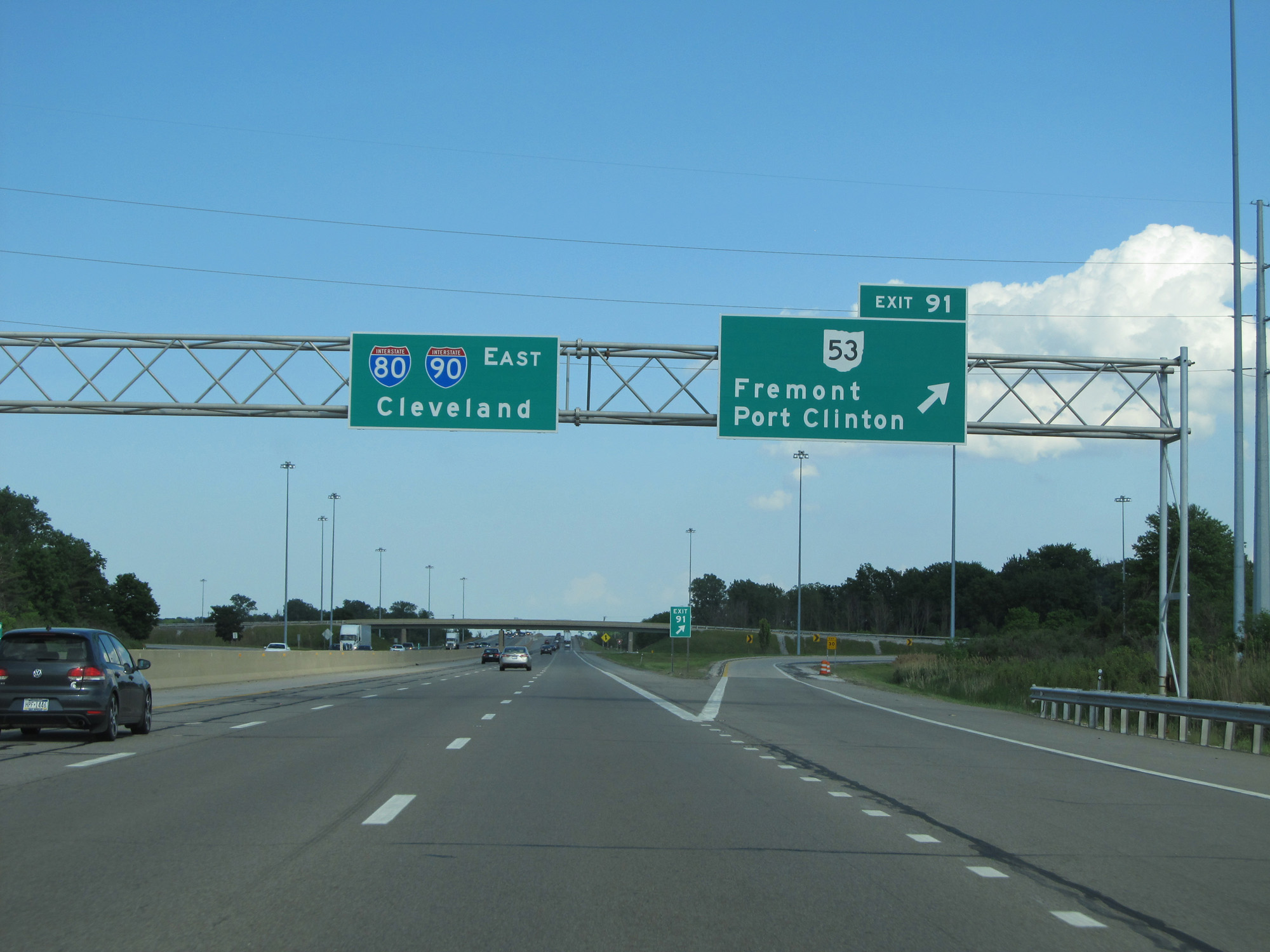 |
Interstate 80 / Interstate 90 East (Ohio Turnpike) at Exit 91: OH 53 - Fremont / Port Clinton (Photo taken 5/30/16). |
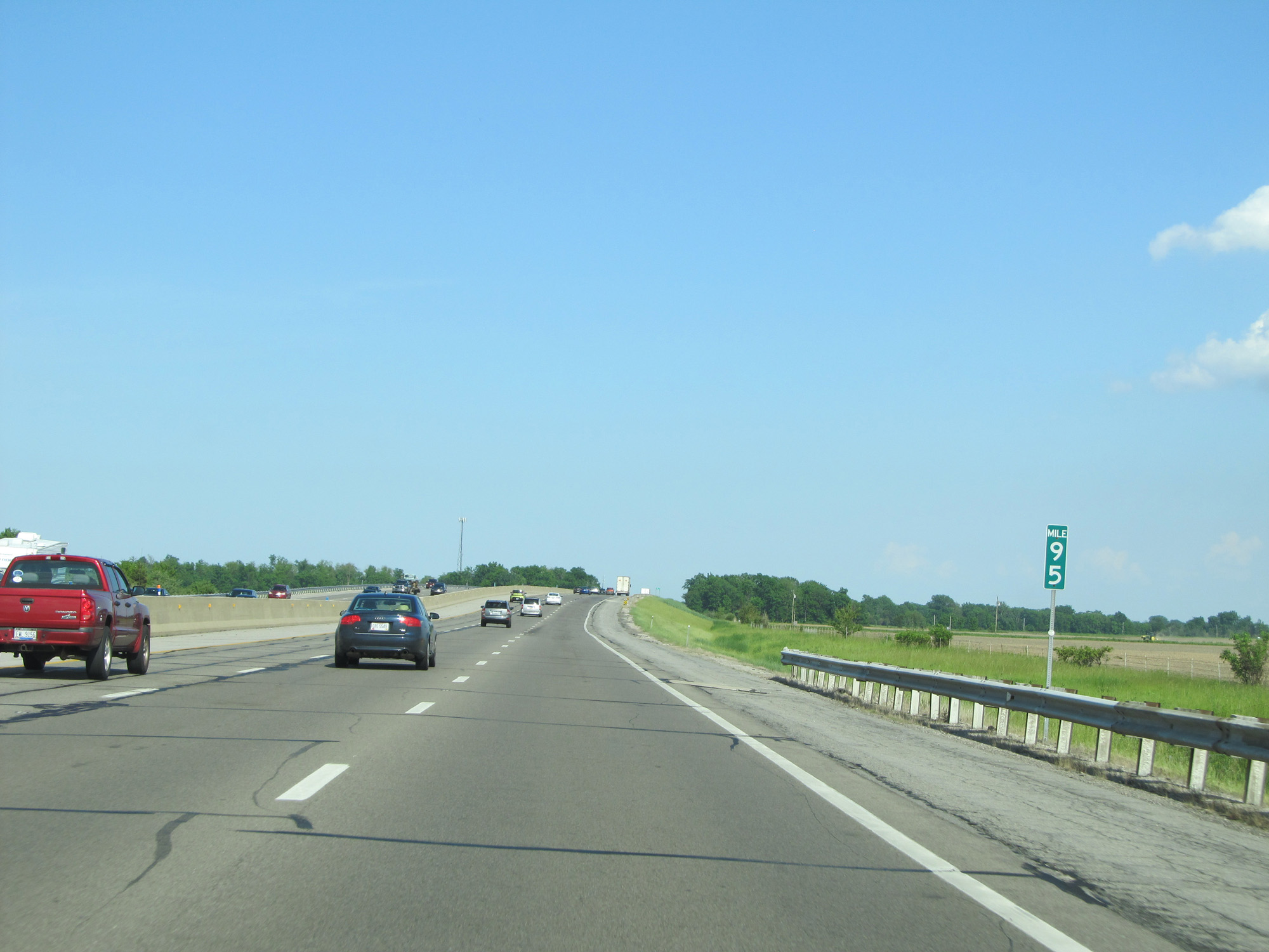 |
Interstate 80 / Interstate 90 East (Ohio Turnpike) at mile marker 95. (Photo taken 5/30/16). |
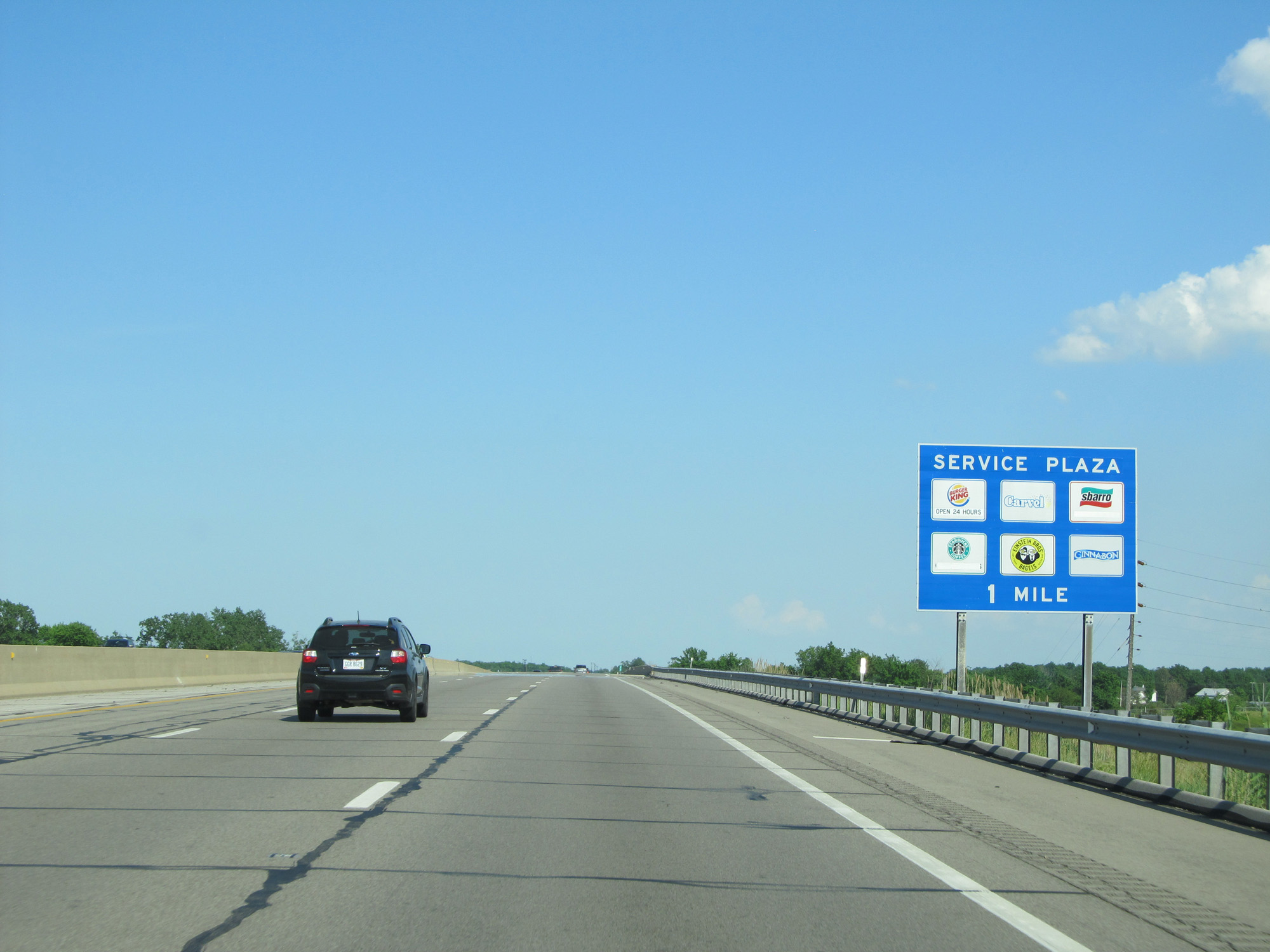 |
Interstate 80 / Interstate 90 East (Ohio Turnpike) approaching the Commodore Perry Service Plaza - 1 mile. (Photo taken 5/30/16). |
 |
Interstate 80 / Interstate 90 East (Ohio Turnpike) at mile marker 99. (Photo taken 5/30/16). |
 |
Interstate 80 / Interstate 90 East (Ohio Turnpike) at the Commodore Perry Service Plaza. (Photo taken 5/30/16). |
 |
Interstate 80 / Interstate 90 East (Ohio Turnpike) at mile marker 105. (Photo taken 5/30/16). |
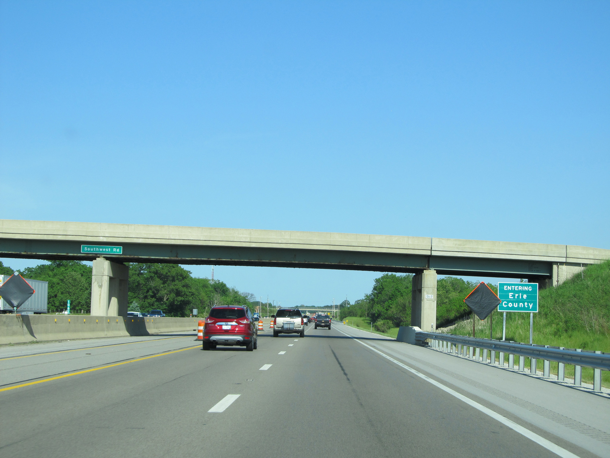 |
Interstate 80 / Interstate 90 East (Ohio Turnpike) entering Erie County. (Photo taken 5/30/16). |
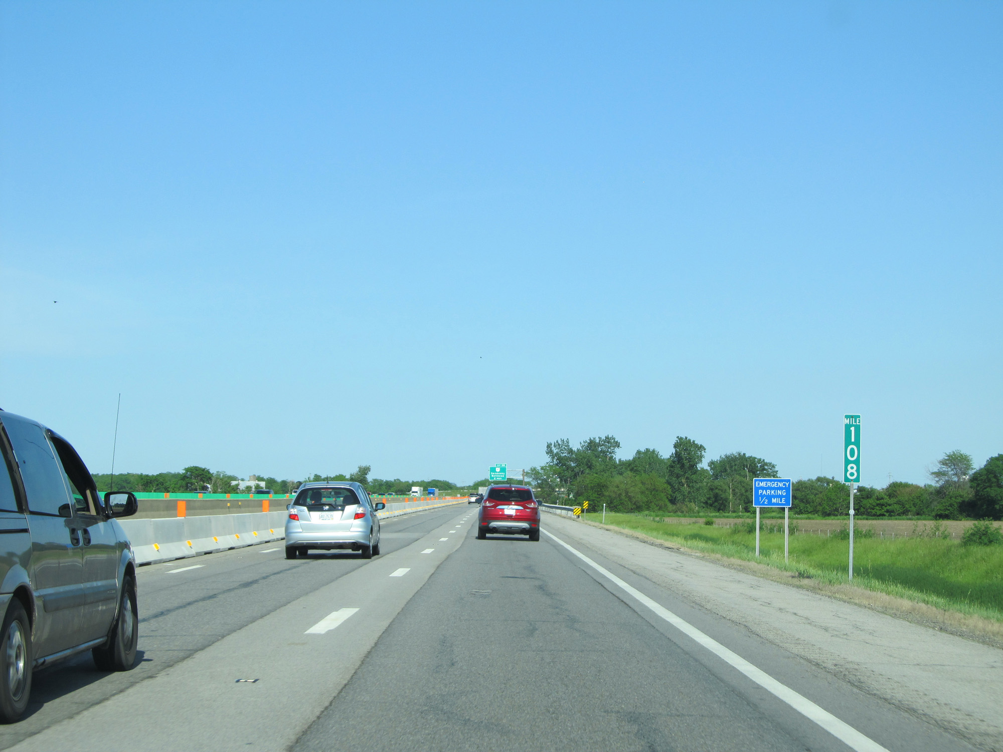 |
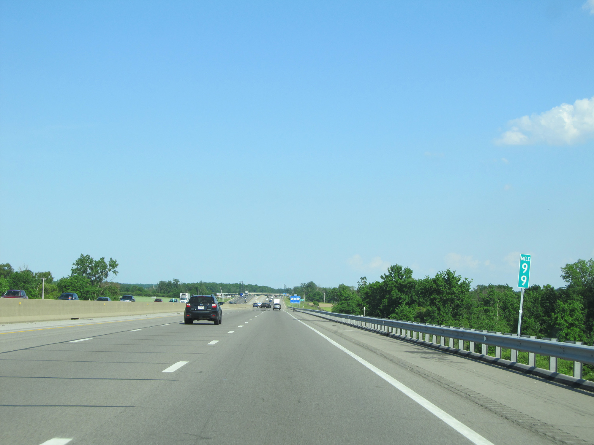
Interstate 80 / Interstate 90 East (Ohio Turnpike) at mile marker 108. (Photo taken 5/30/16). |
 |
Interstate 80 / Interstate 90 East (Ohio Turnpike) approachinig Exit 110 - 1 mile. (Photo taken 5/30/16). |
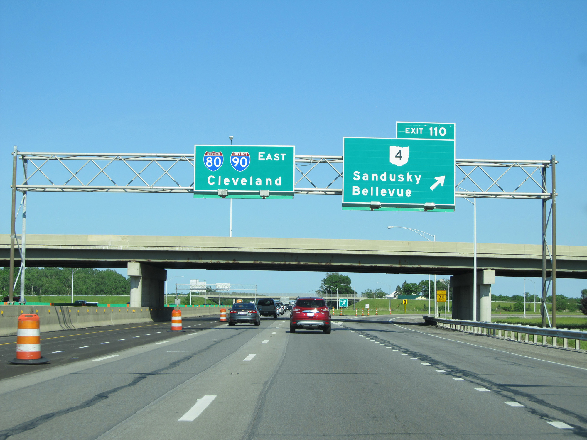 |
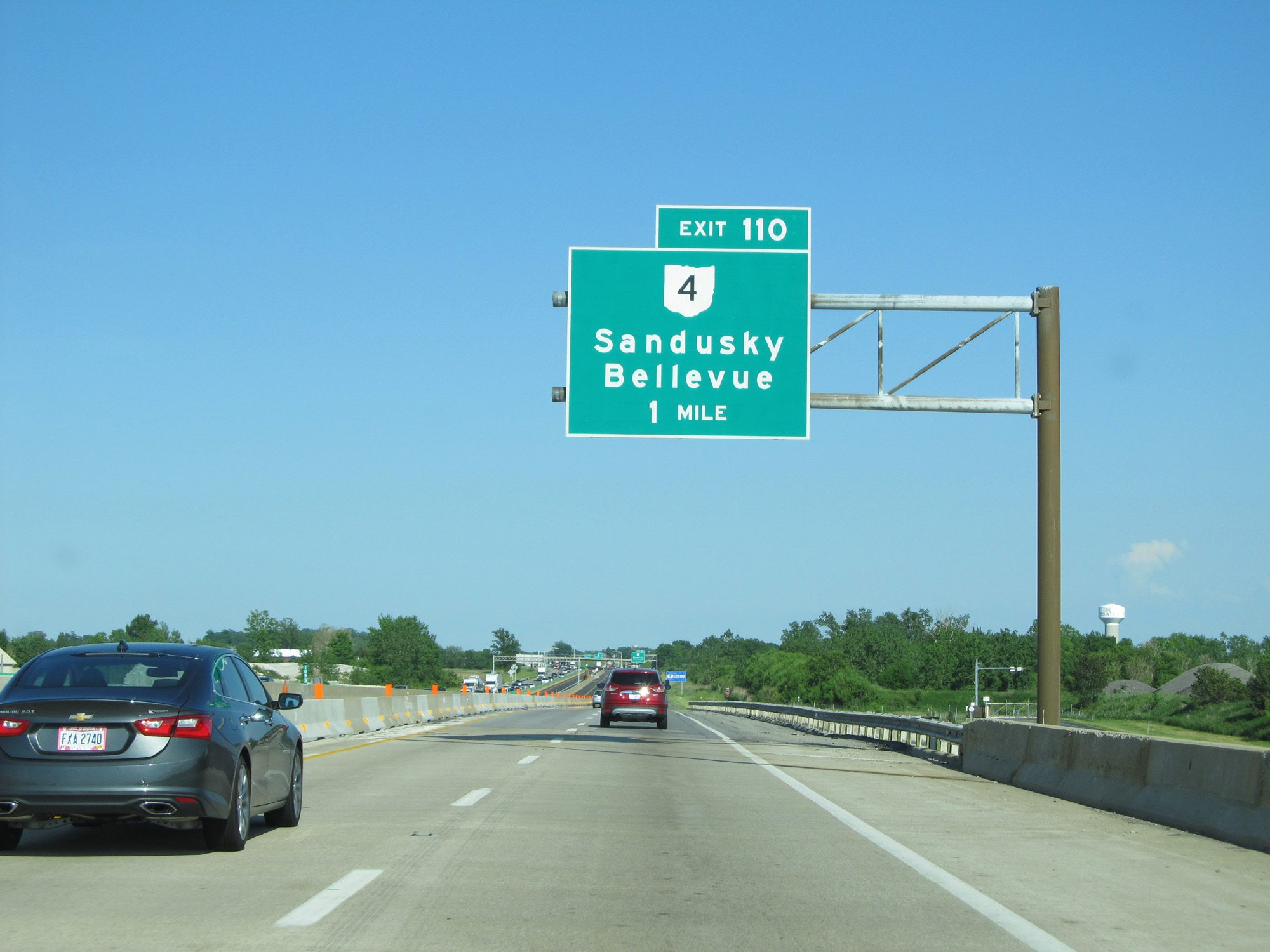
Interstate 80 / Interstate 90 East (Ohio Turnpike) at Exit 110: OH 4 - Sandusky / Bellevue (Photo taken 5/30/16). |
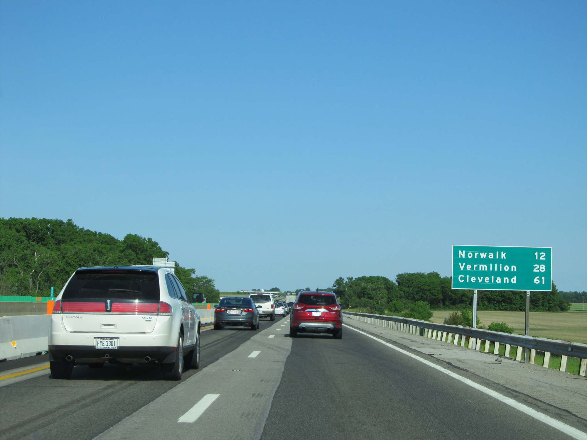 |
Mileage sign on Interstate 80 / Interstate 90 East (Ohio Turnpike). It's 12 miles to Norwalk, 28 miles to Vermilion, and 61 miles to Cleveland. (Photo taken 5/30/16). |
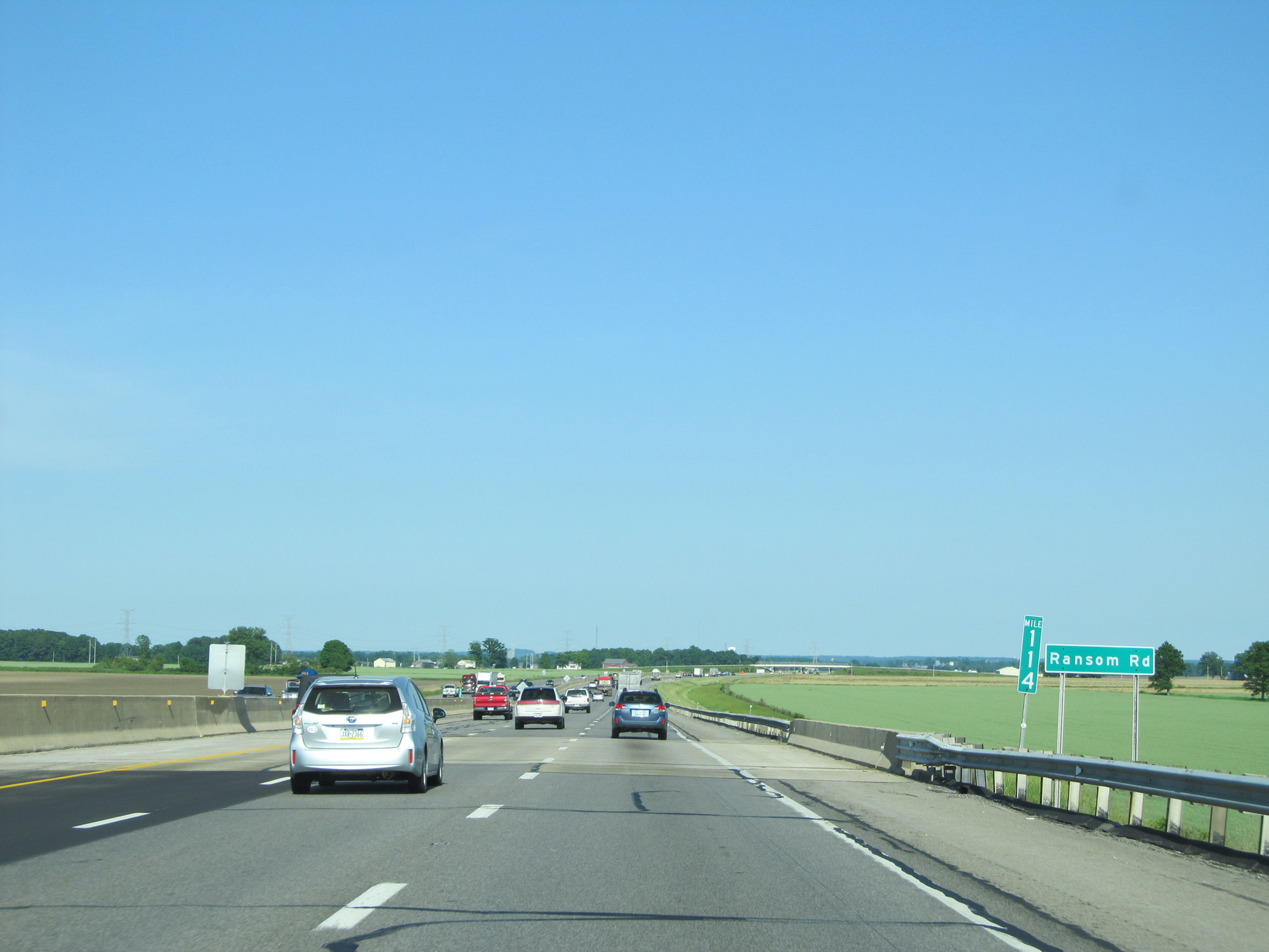 |
Interstate 80 / Interstate 90 East (Ohio Turnpike) at mile marker 114. (Photo taken 5/30/16). |
 |
Interstate 80 / Interstate 90 East (Ohio Turnpike) approaching Exit 118 - 1 mile. (Photo taken 5/30/16). |
 |
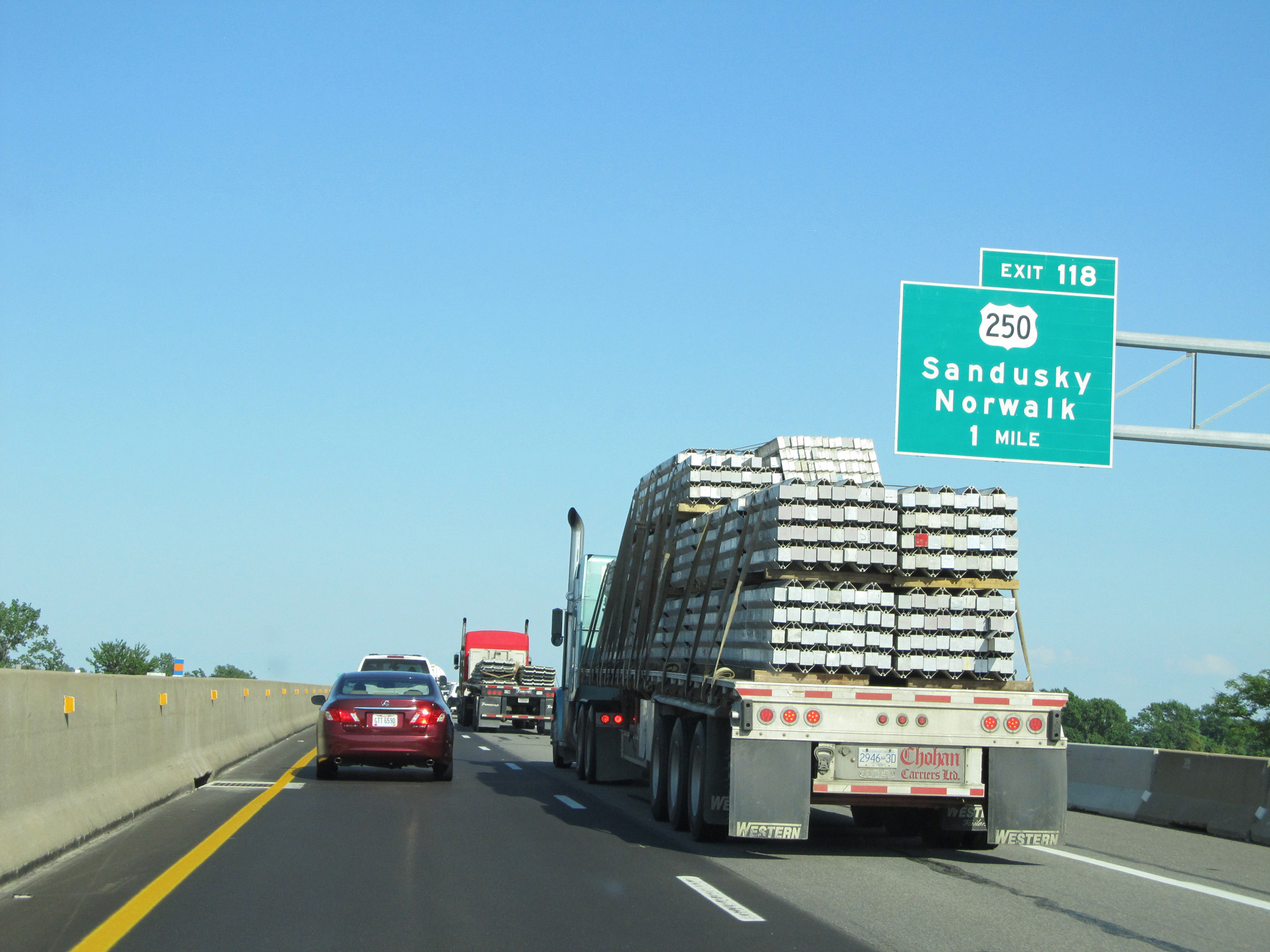
Interstate 80 / Interstate 90 East (Ohio Turnpike) at Exit 118: US 250 - Sandusky / Norwalk (Photo taken 5/30/16). |
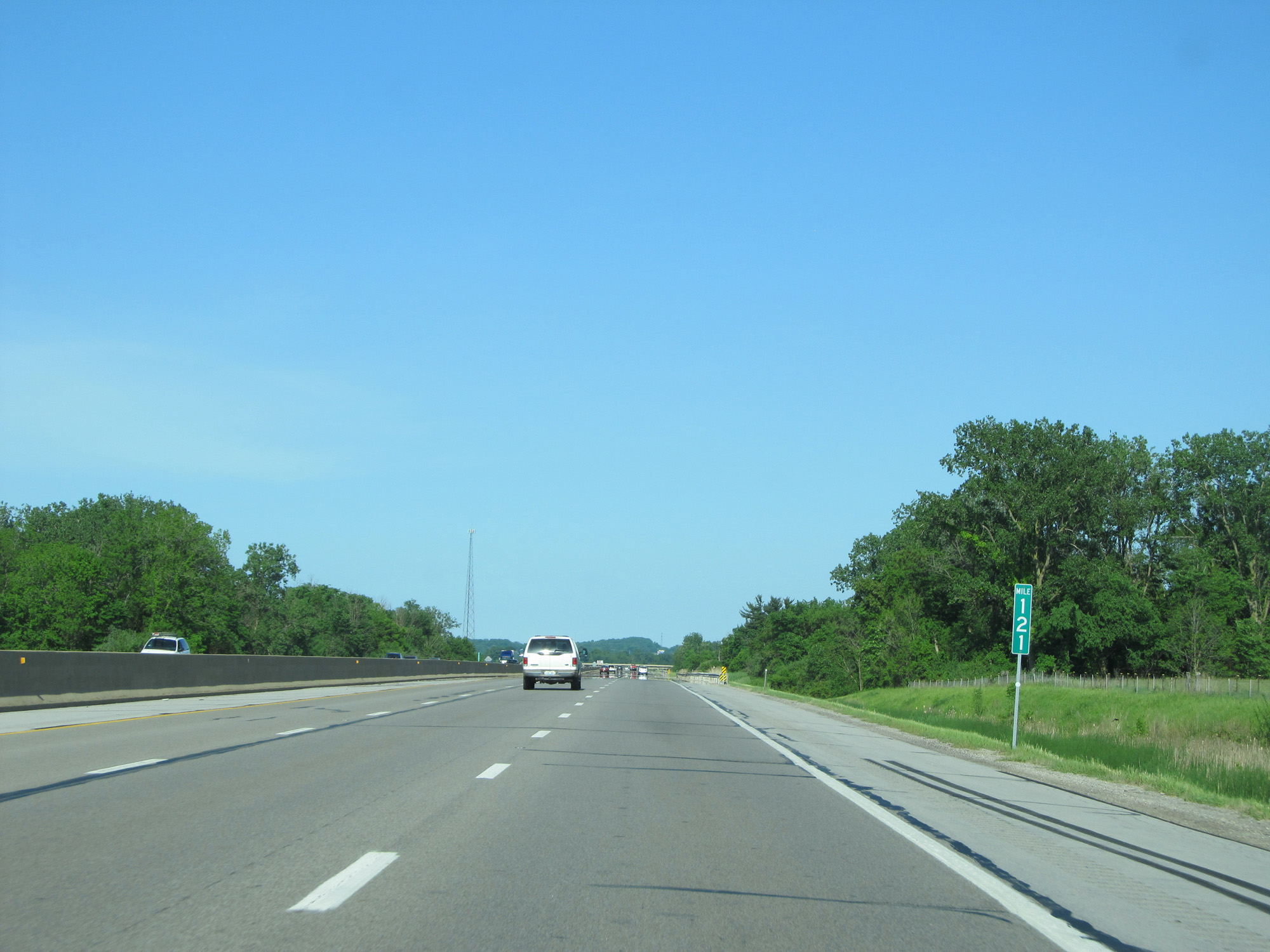 |
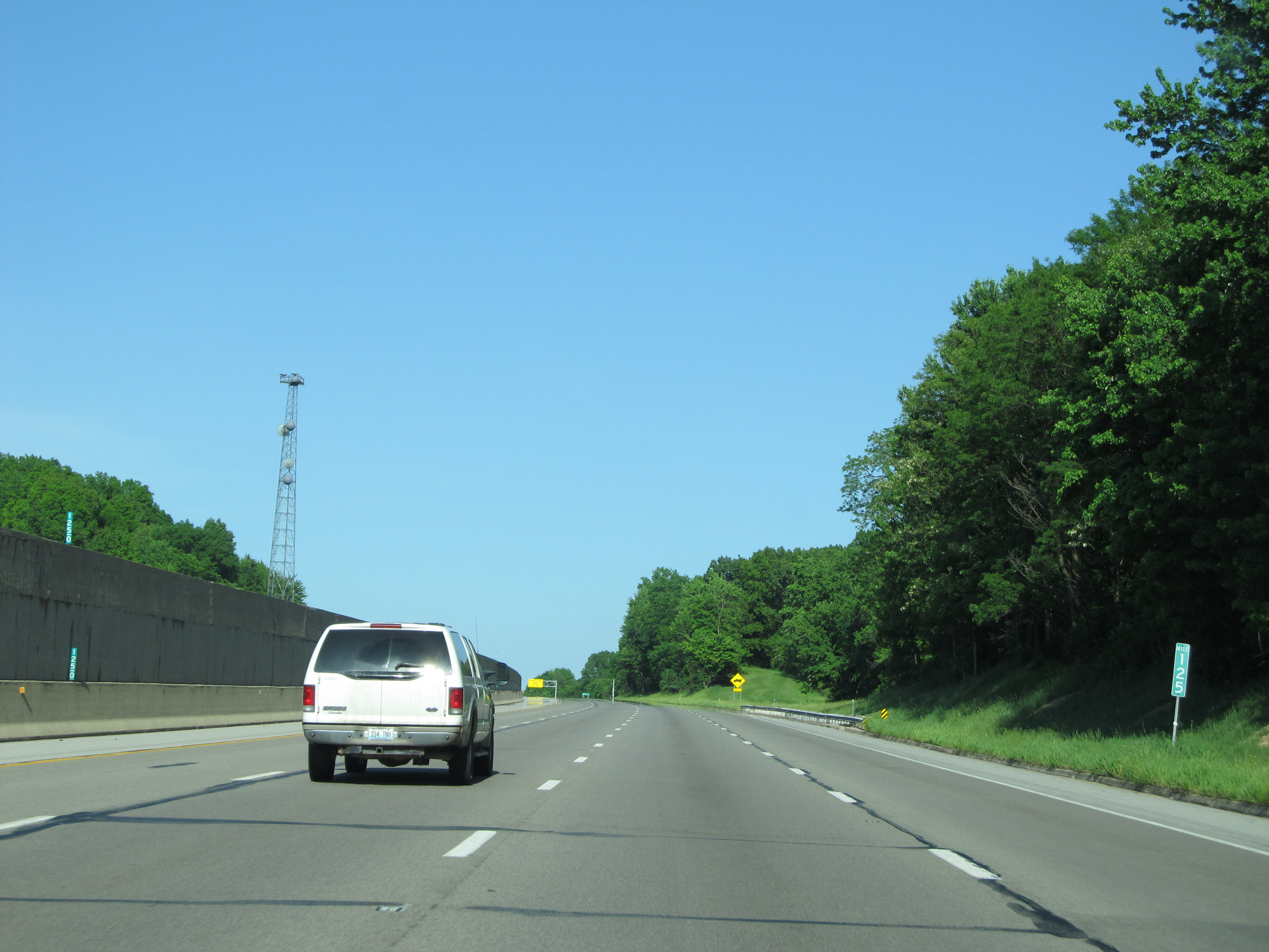
Interstate 80 / Interstate 90 East (Ohio Turnpike) at mile marker 121. (Photo taken 5/30/16). |
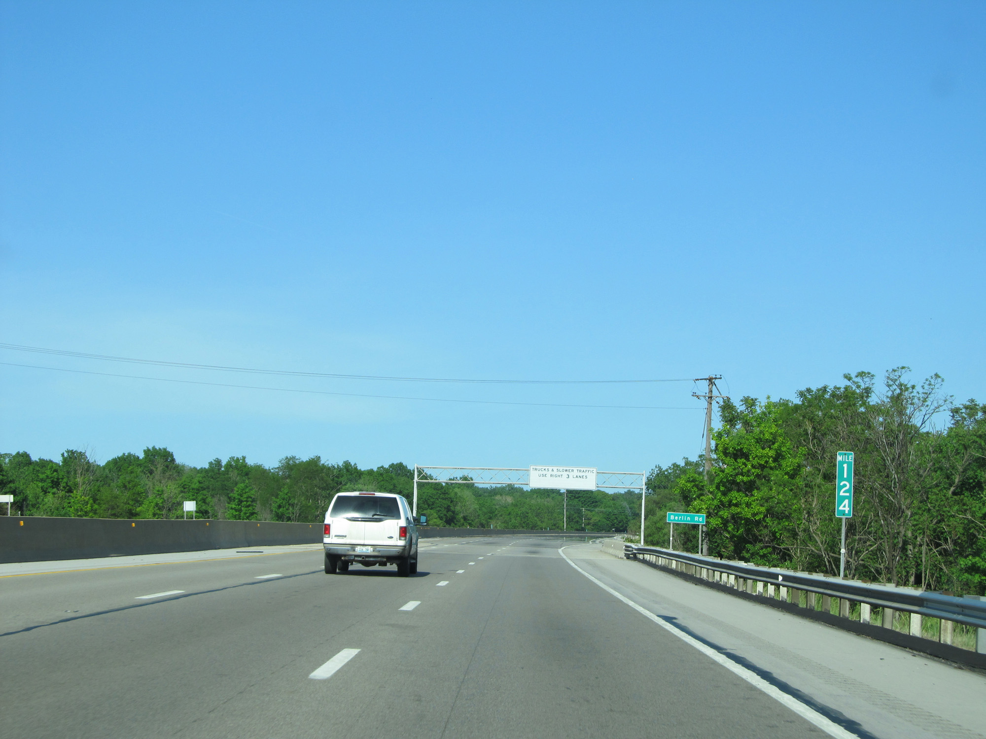 |
Interstate 80 / Interstate 90 East (Ohio Turnpike) at mile marker 124. (Photo taken 5/30/16). |
 |
Interstate 80 / Interstate 90 East (Ohio Turnpike) near mile marker 124.5, as a brief climbing lane appears. (Photo taken 5/30/16). |
 |
Interstate 80 / Interstate 90 East (Ohio Turnpike) at mile marker 125. (Photo taken 5/30/16). |
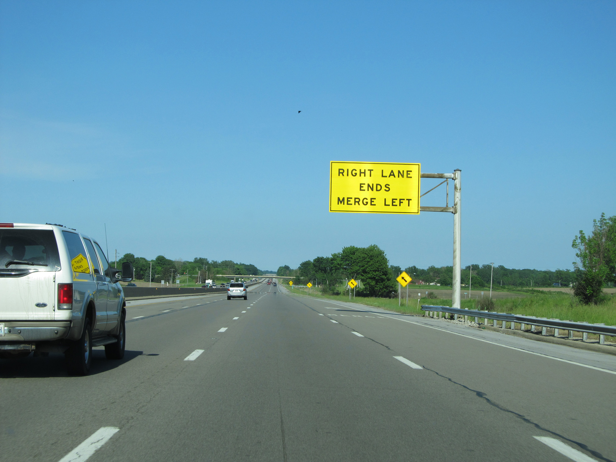 |
Interstate 80 / Interstate 90 East (Ohio Turnpike) as the climbing lane comes to an end on the right. (Photo taken 5/30/16). |
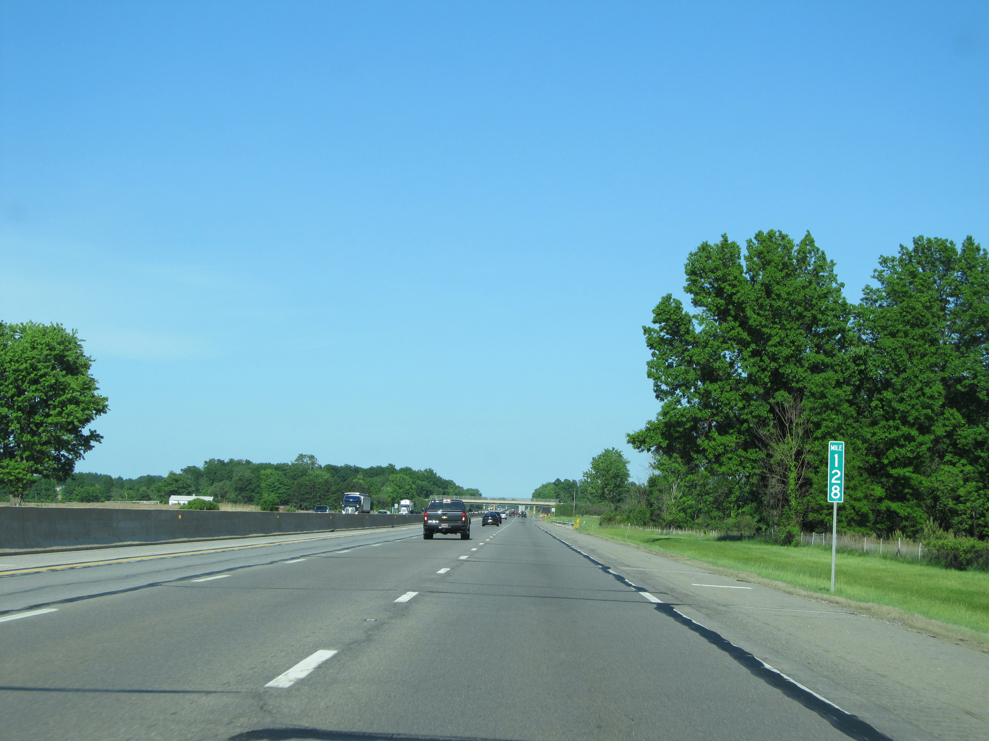 |
Interstate 80 / Interstate 90 East (Ohio Turnpike) at mile marker 128. (Photo taken 5/30/16). |
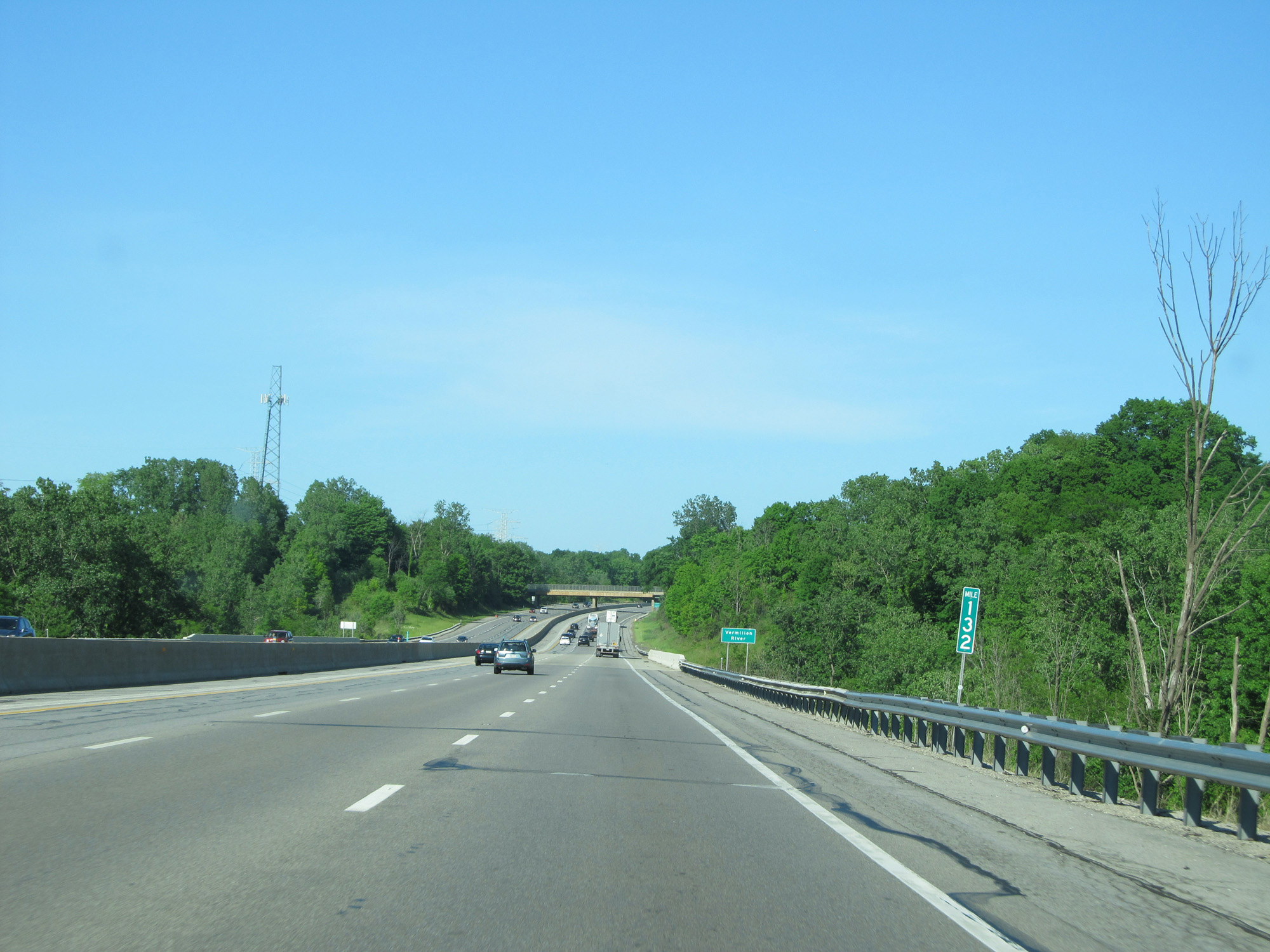 |
Interstate 80 / Interstate 90 East (Ohio Turnpike) at mile marker 132. (Photo taken 5/30/16). |
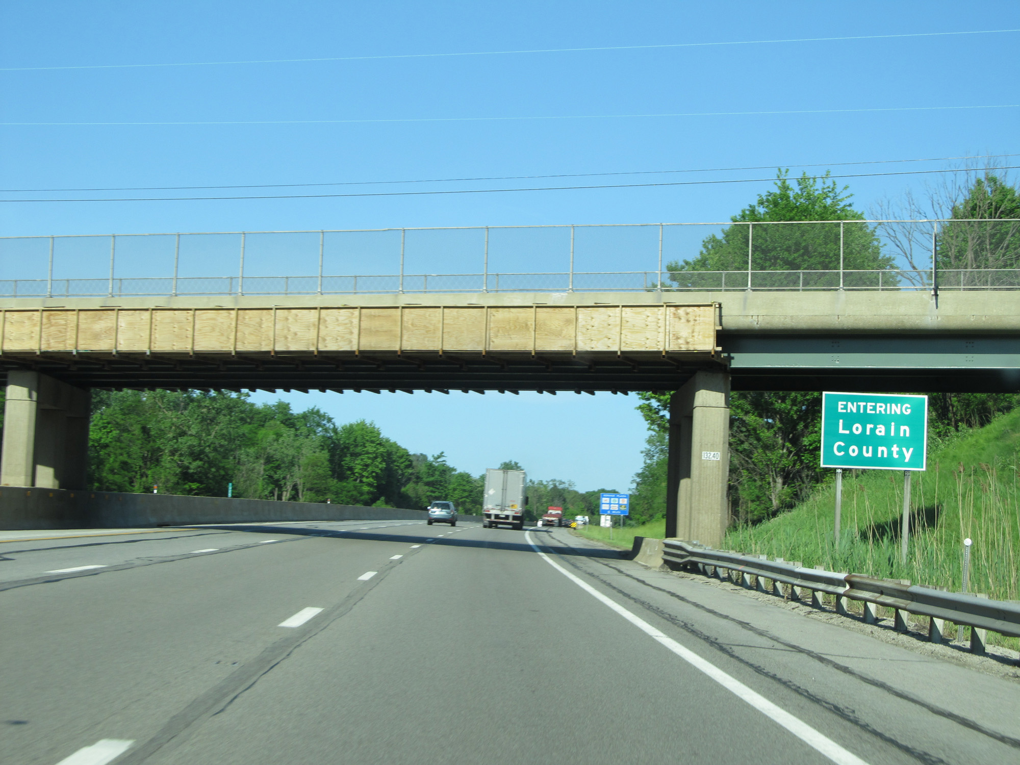 |
Interstate 80 / Interstate 90 East (Ohio Turnpike) entering Lorain County. (Photo taken 5/30/16). |
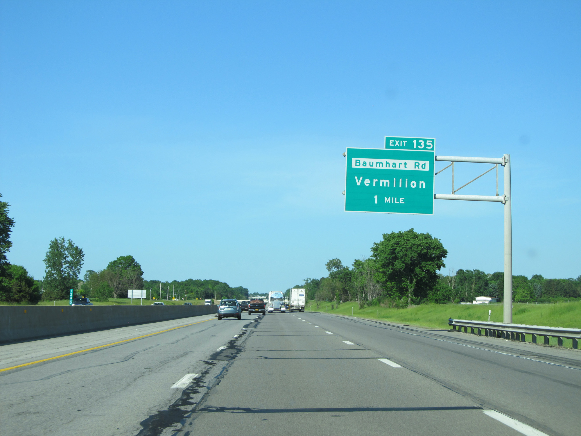 |
Interstate 80 / Interstate 90 East (Ohio Turnpike) approaching Exit 135 - 1 mile. (Photo taken 5/30/16). |
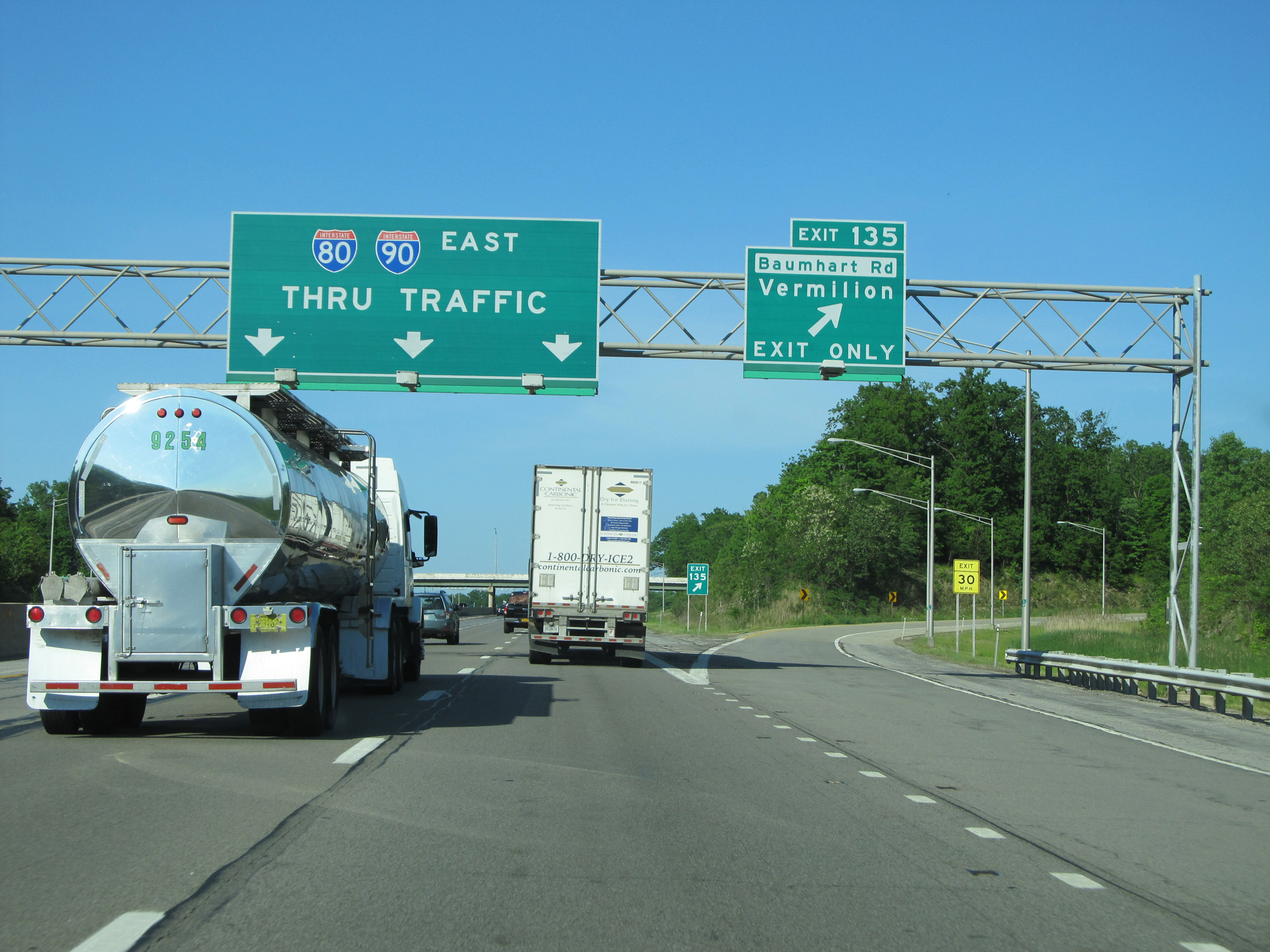 |
Interstate 80 / Interstate 90 East (Ohio Turnpike) at Exit 135: Baumhart Rd / Vermilion (Photo taken 5/30/16). |
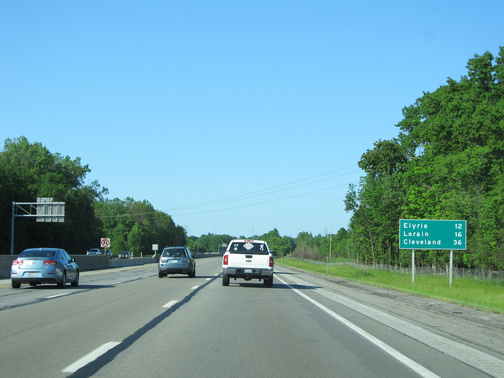 |
Mileage sign on Interstate 80 / Interstate 90 East (Ohio Turnpike). It's 12 miles to Elyria, 16 miles to Lorain, and 36 miles to Cleveland. (Photo taken 5/30/16). |
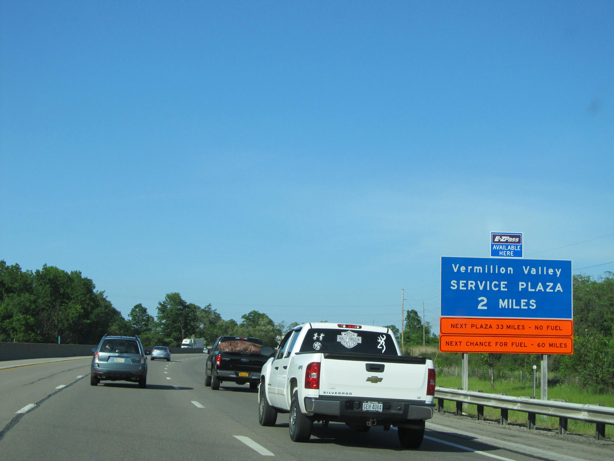 |
Interstate 80 / Interstate 90 East (Ohio Turnpike) approaching the Vermilion Valley Service Plaza - 2 miles. (Photo taken 5/30/16). |
 |
Interstate 80 / Interstate 90 East (Ohio Turnpike) at the Vermilion Valley Service Plaza. (Photo taken 5/30/16). |
 |
Interstate 80 / Interstate 90 East (Ohio Turnpike) approaching Exit 140 - 1/2 mile. (Photo taken 5/30/16). |
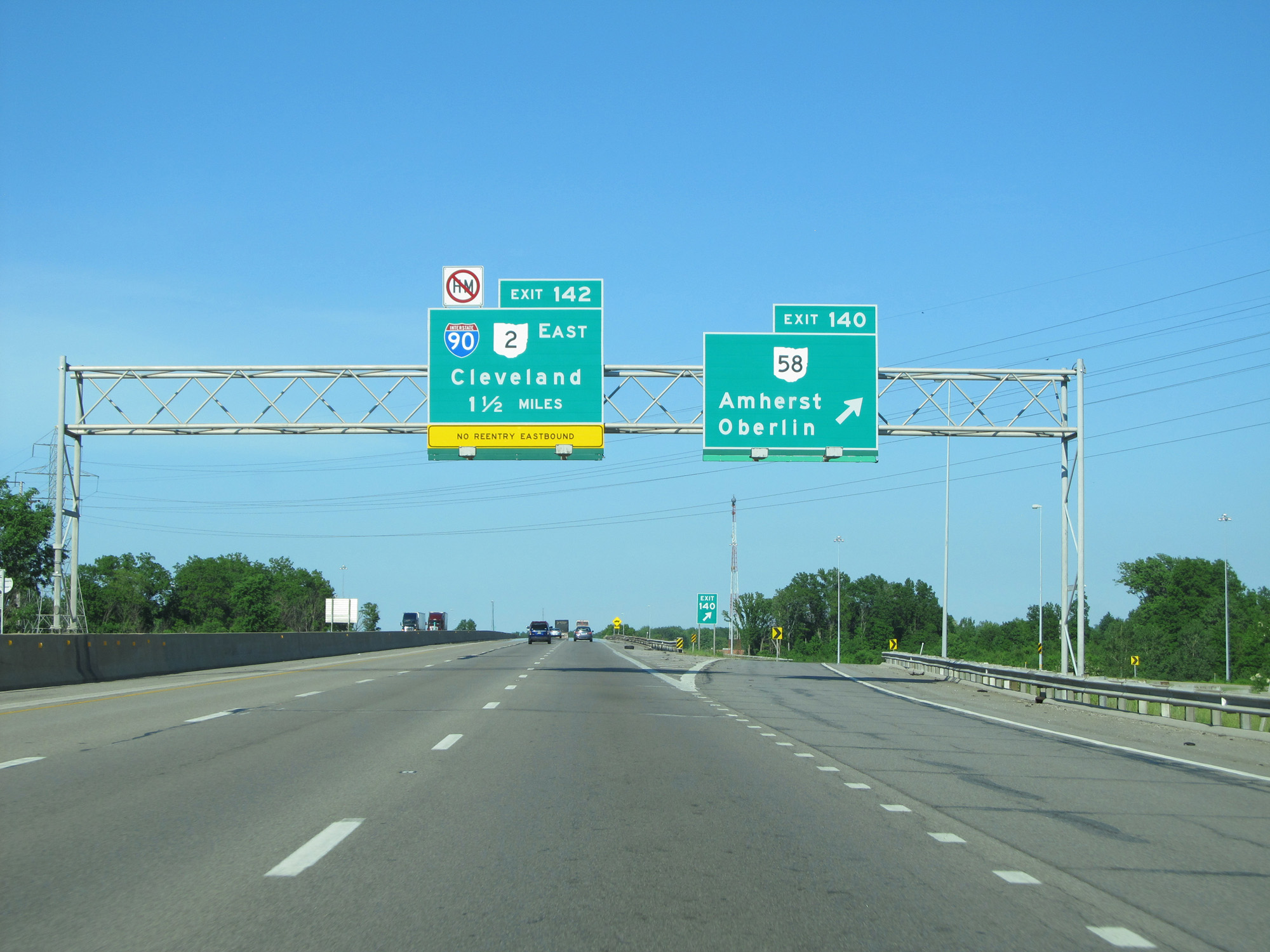 |
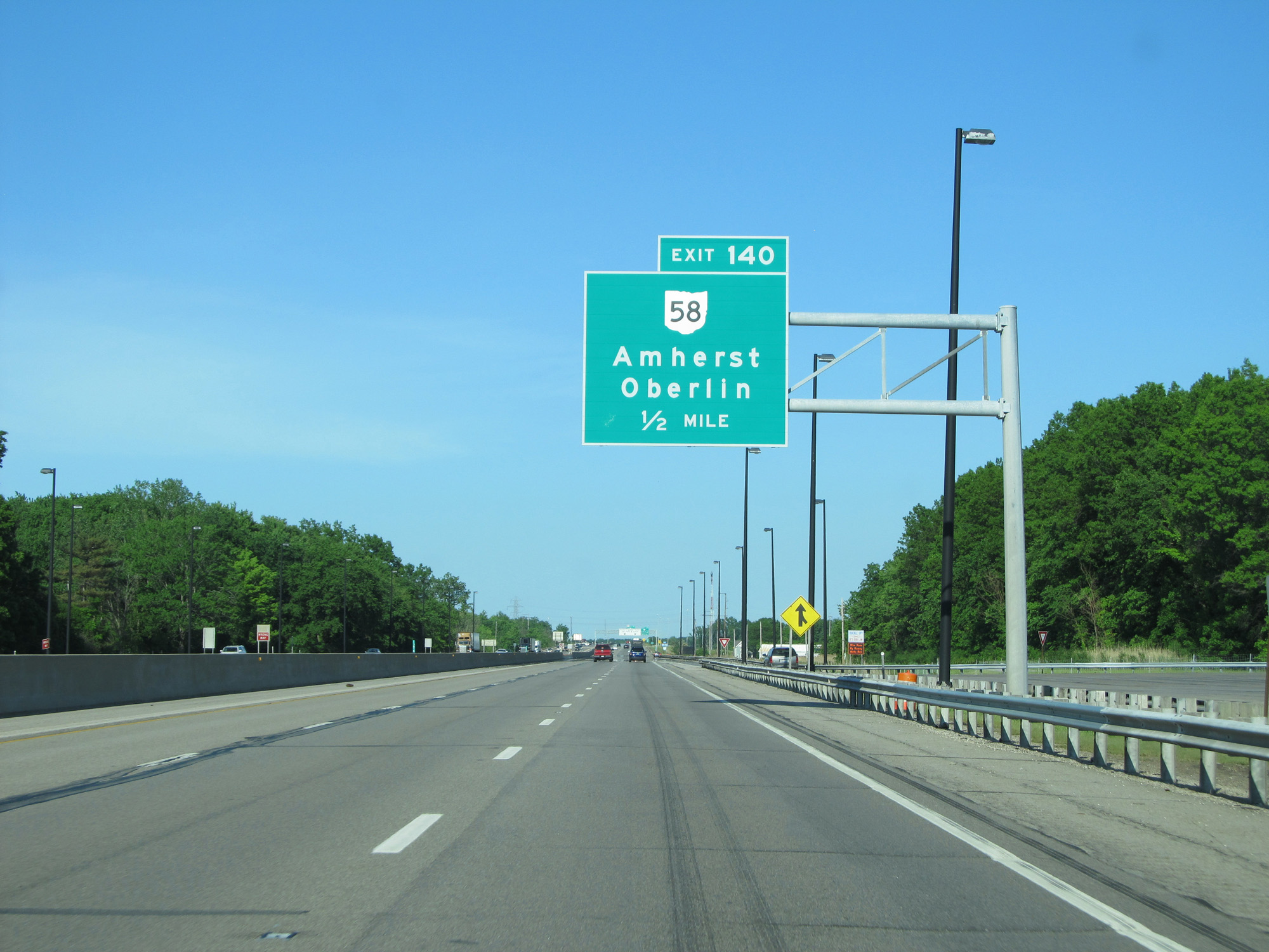
Interstate 80 / Interstate 90 East (Ohio Turnpike) at Exit 140: OH 58 - Amherst / Oberlin (Photo taken 5/30/16). |
 |
Interstate 80 / Interstate 90 East (Ohio Turnpike) approaching Exit 142 - 1 mile. (Photo taken 5/30/16). |
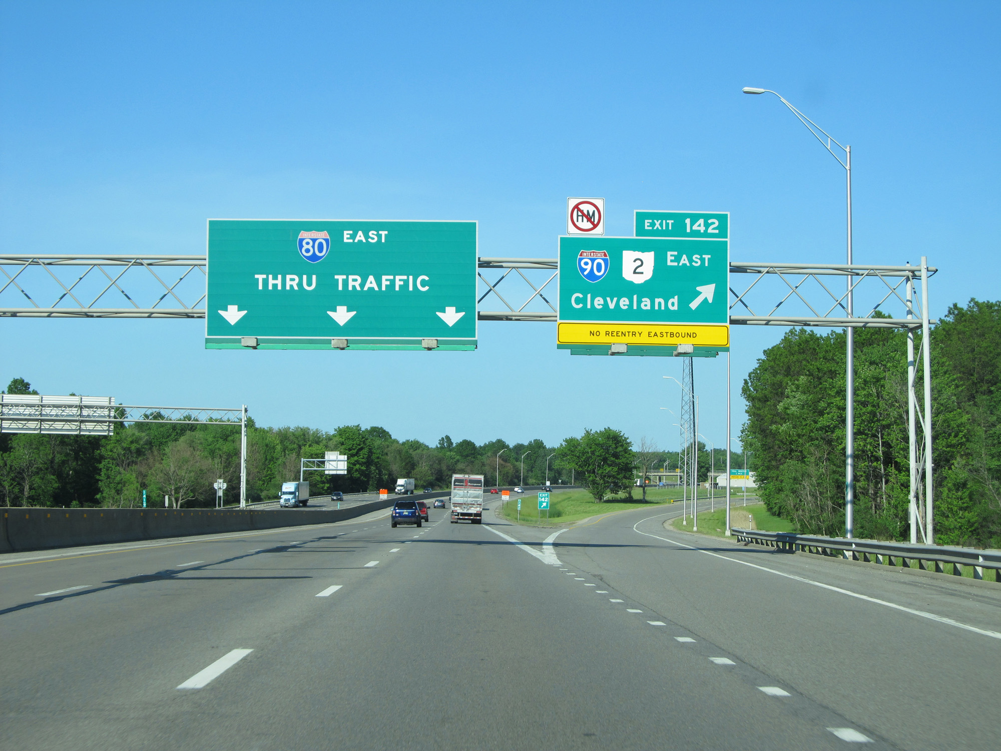 |
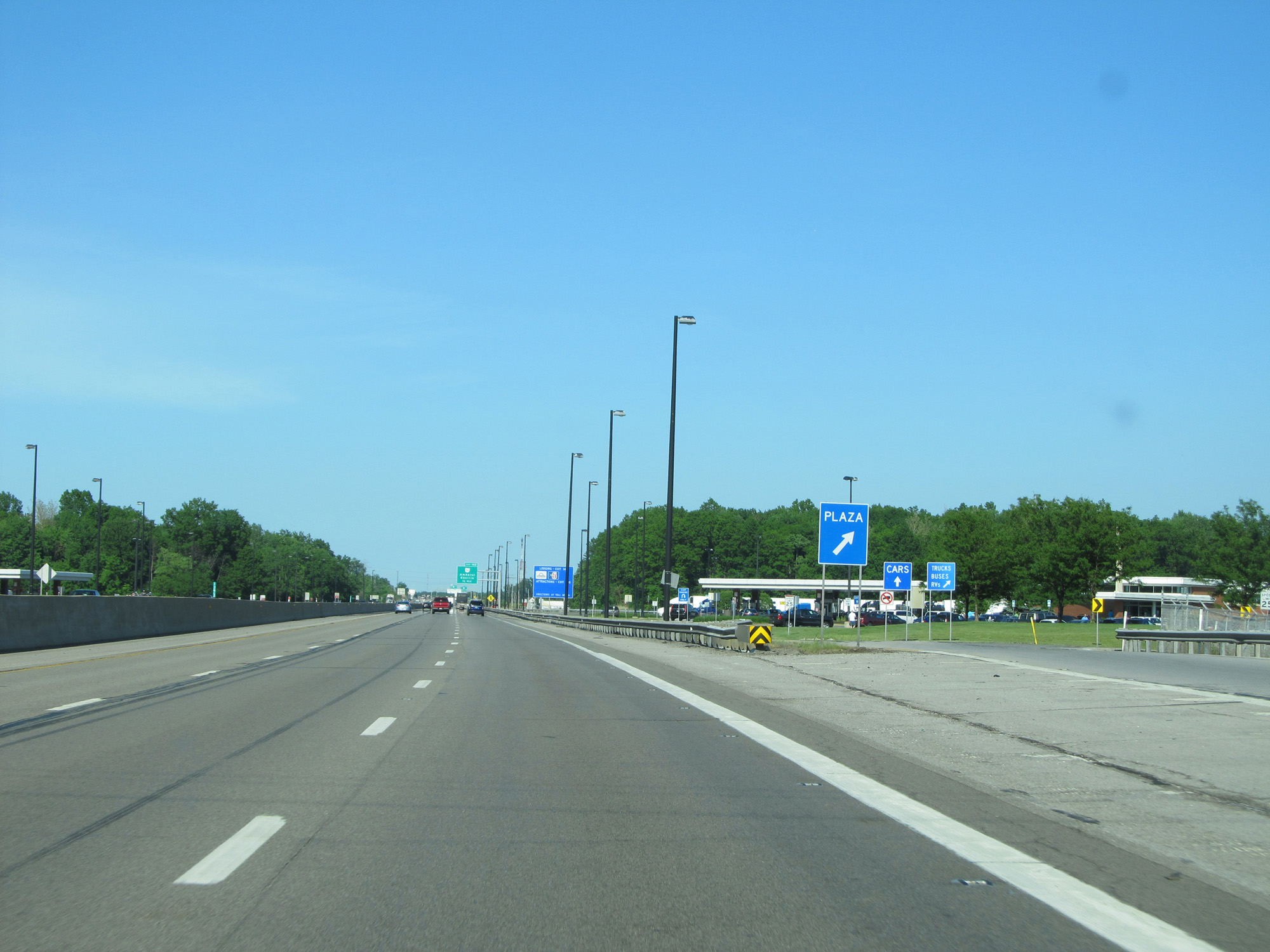
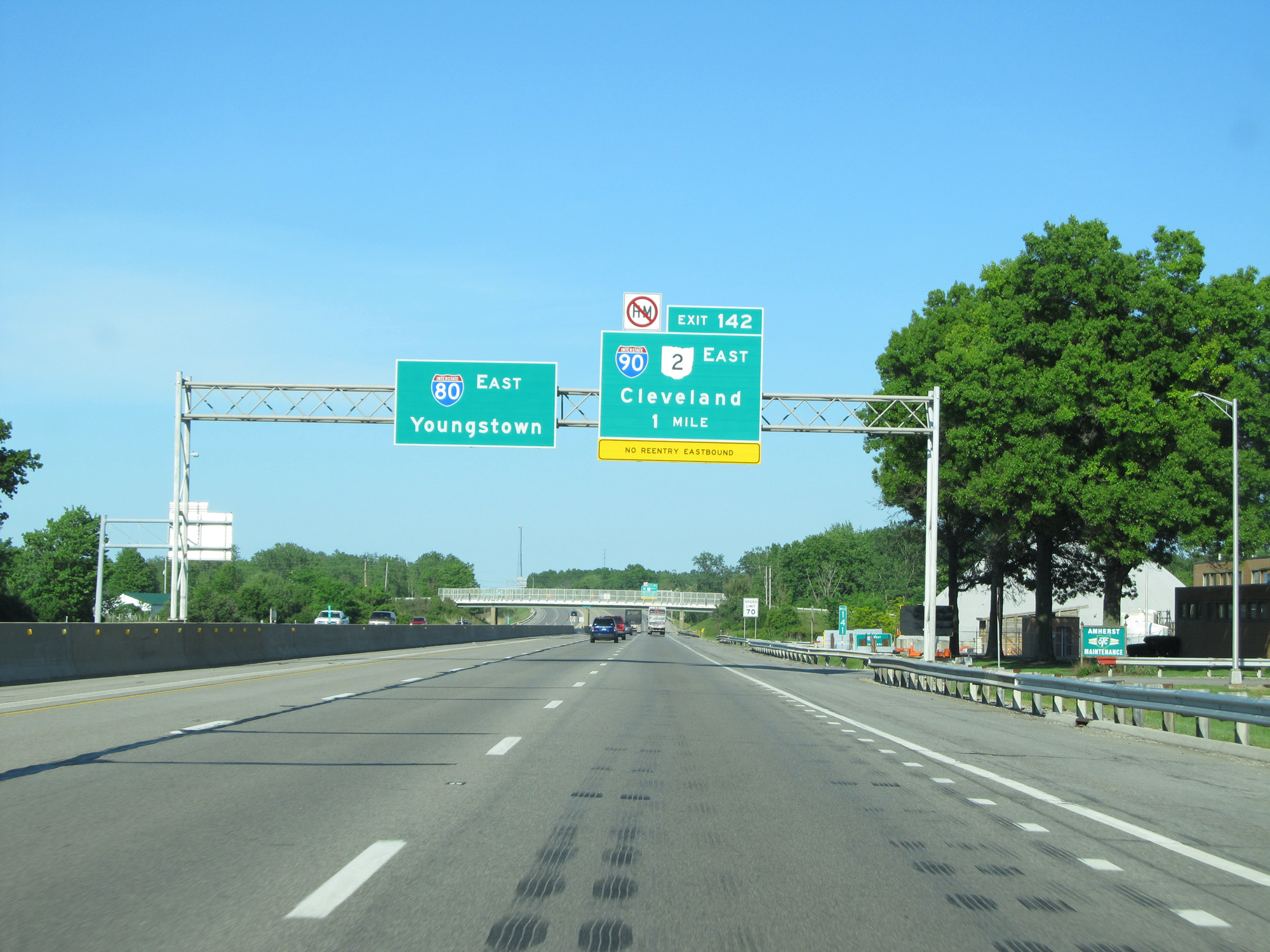
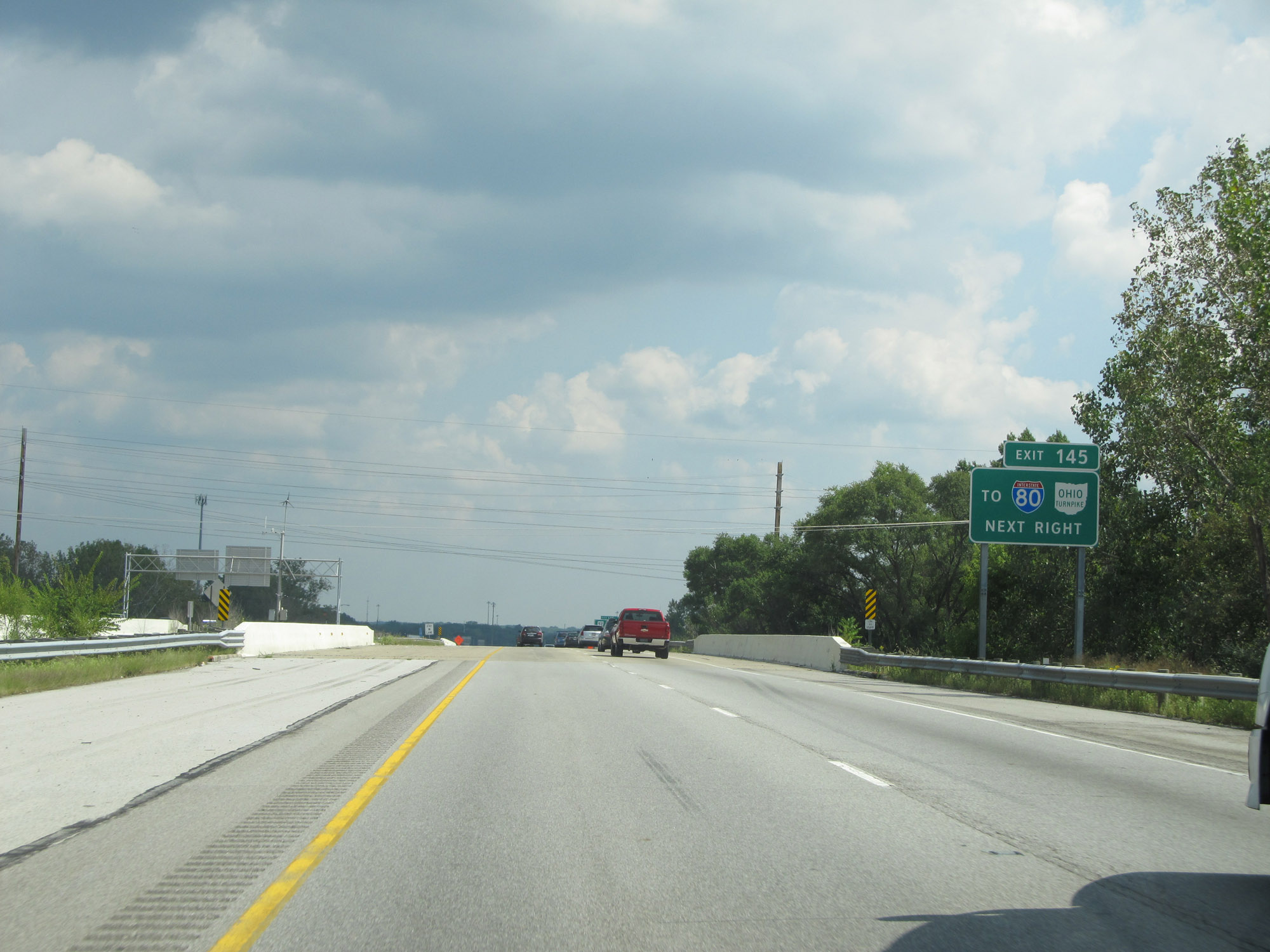
Interstate 80 / Interstate 90 East (Ohio Turnpike) at Exit 142: Interstate 90 East / OH 2 East - Cleveland (Photo taken 5/30/16). |
Section 3: Elyria (Exit 142) to Cleveland (Exit 175)
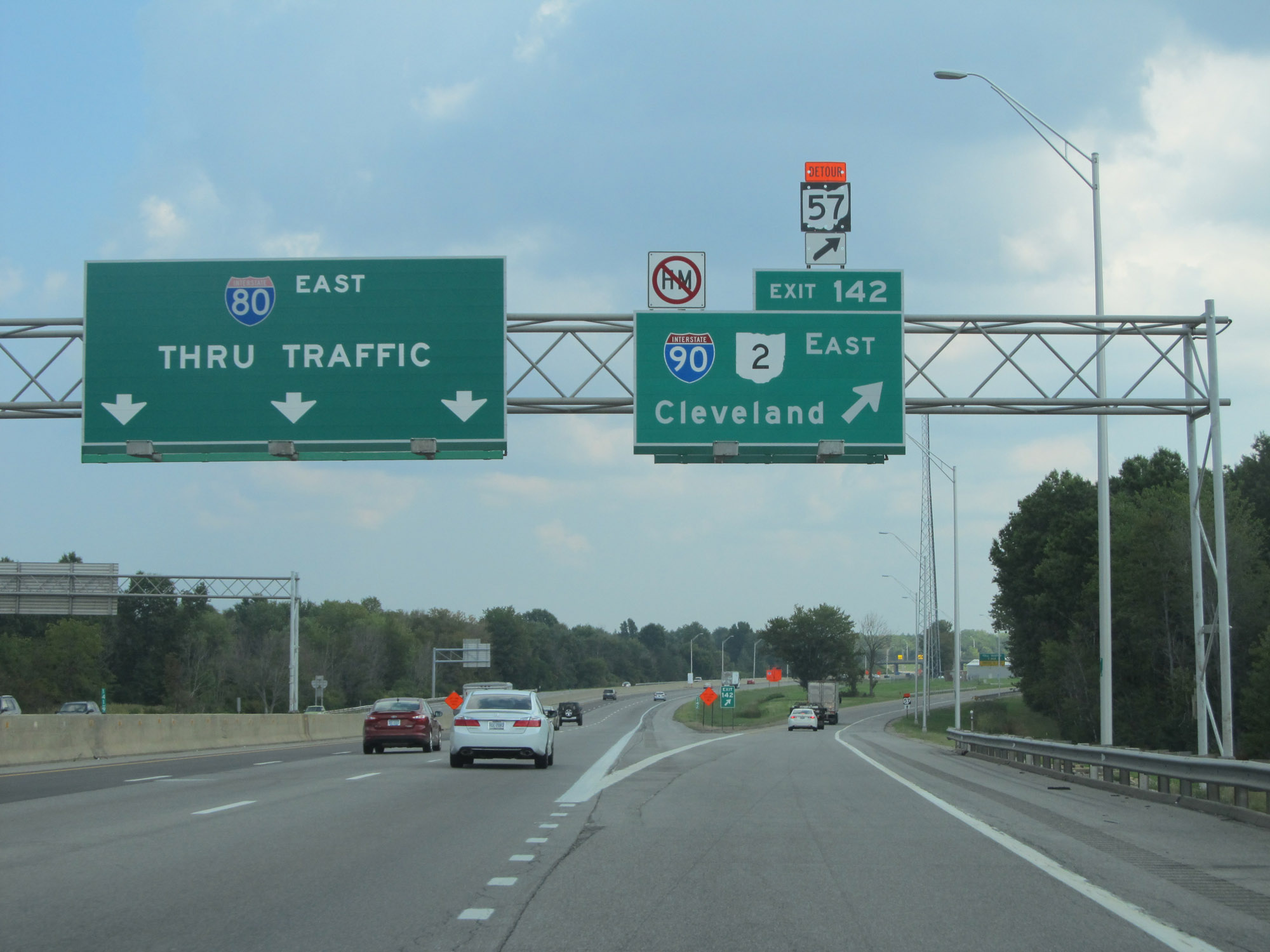 |
Interstate 90 East departs Interstate 80 East and the Ohio Turnpike here at Exit 142 in Elyria. (Photo taken 9/6/15). |
 |
The toll plaza for the Ohio Turnpike after Interstate 90 East departs it is 1 mile ahead. (Photo taken 9/6/15). |
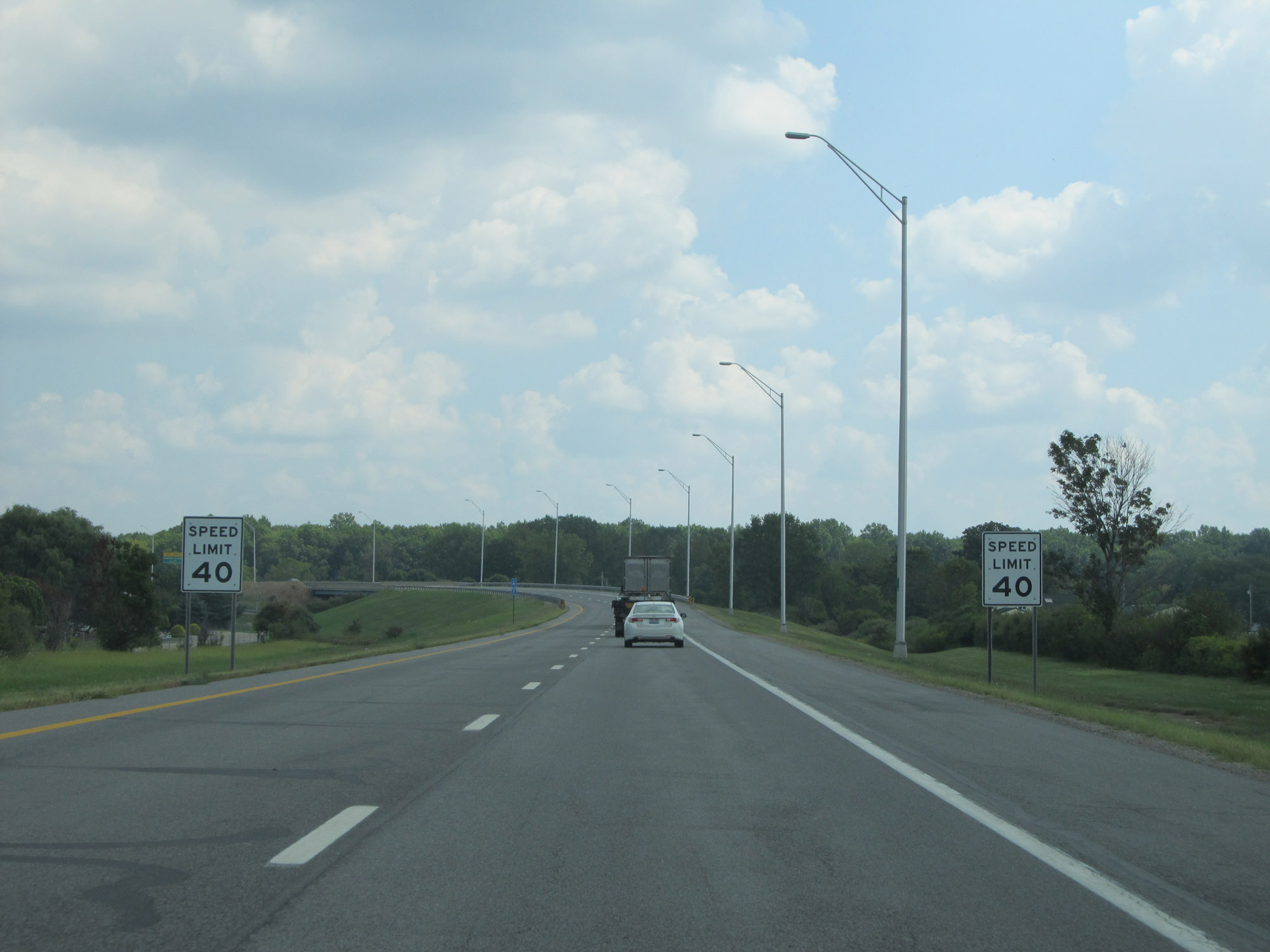 |
The speed limit decreases to 40 mph approaching the toll plaza on Interstate 90 East. (Photo taken 9/6/15). |
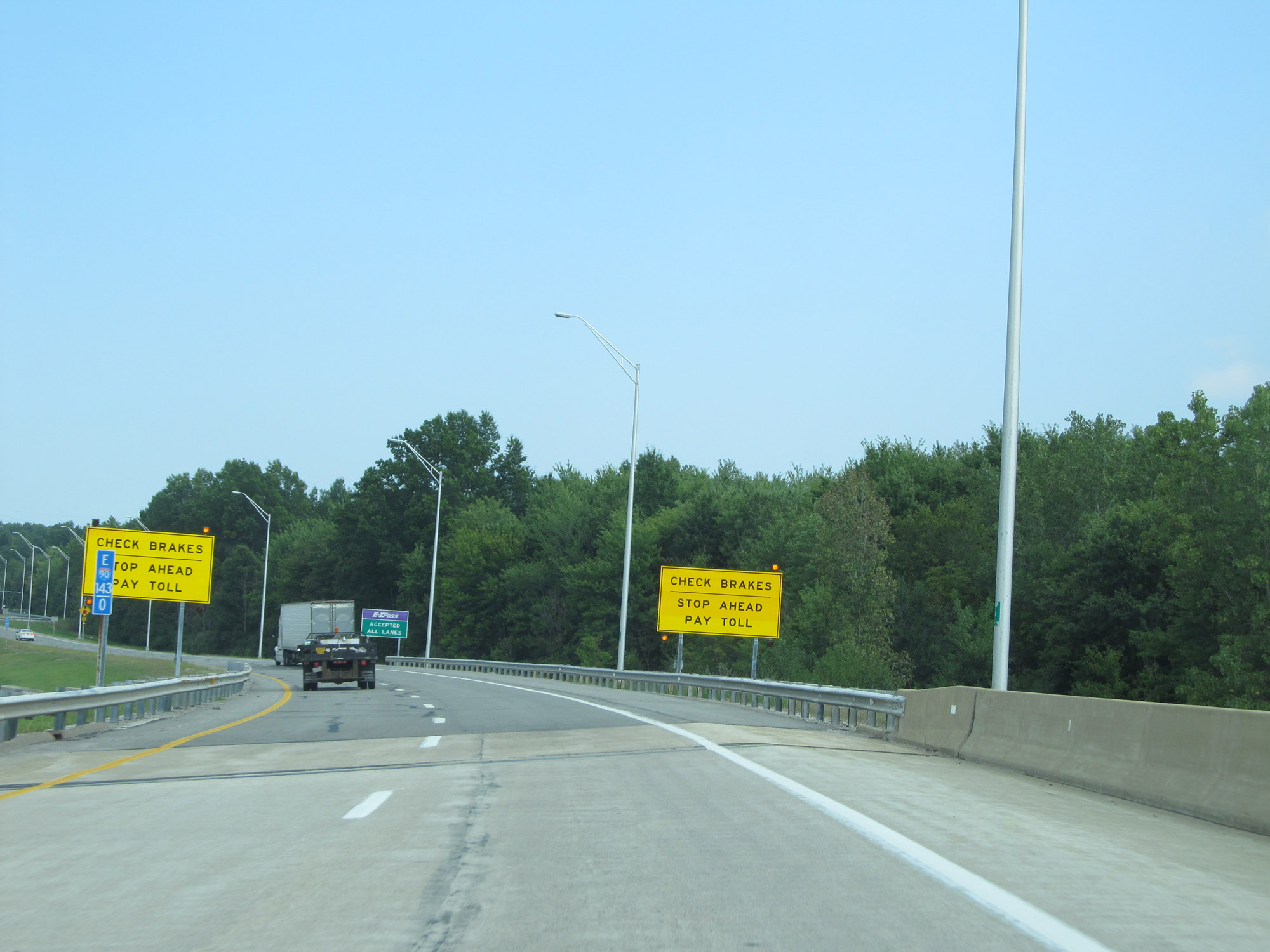 |
Interstate 90 East at mile marker 143, as it approaches the toll plaza. Motorists are advised to check their brakes before the toll plaza. (Photo taken 9/6/15). |
 |
EZ Pass is accepted in all lanes at the toll plaza ahead. (Photo taken 9/6/15). |
 |
Interstate 90 East at the toll plaza for the Ohio Turnpike, 1 mile after its departure. (Photo taken 9/6/15). |
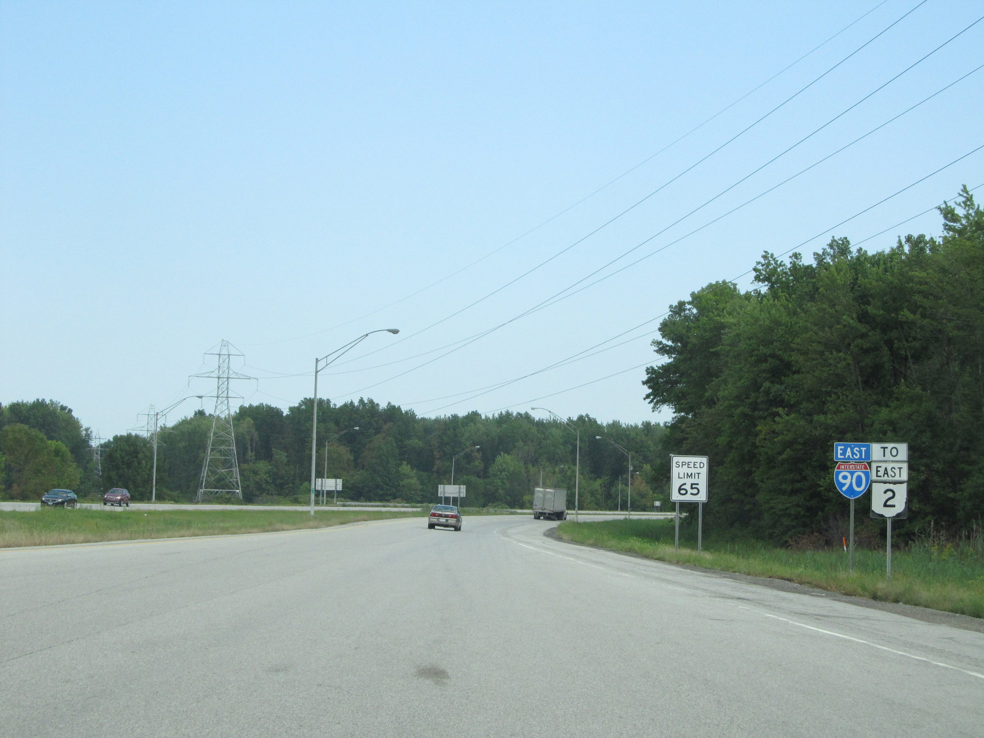 |
Interstate 90 East reassurance shield leaving the toll plaza. The speed limit increases to 65 mph. (Photo taken 9/6/15). |
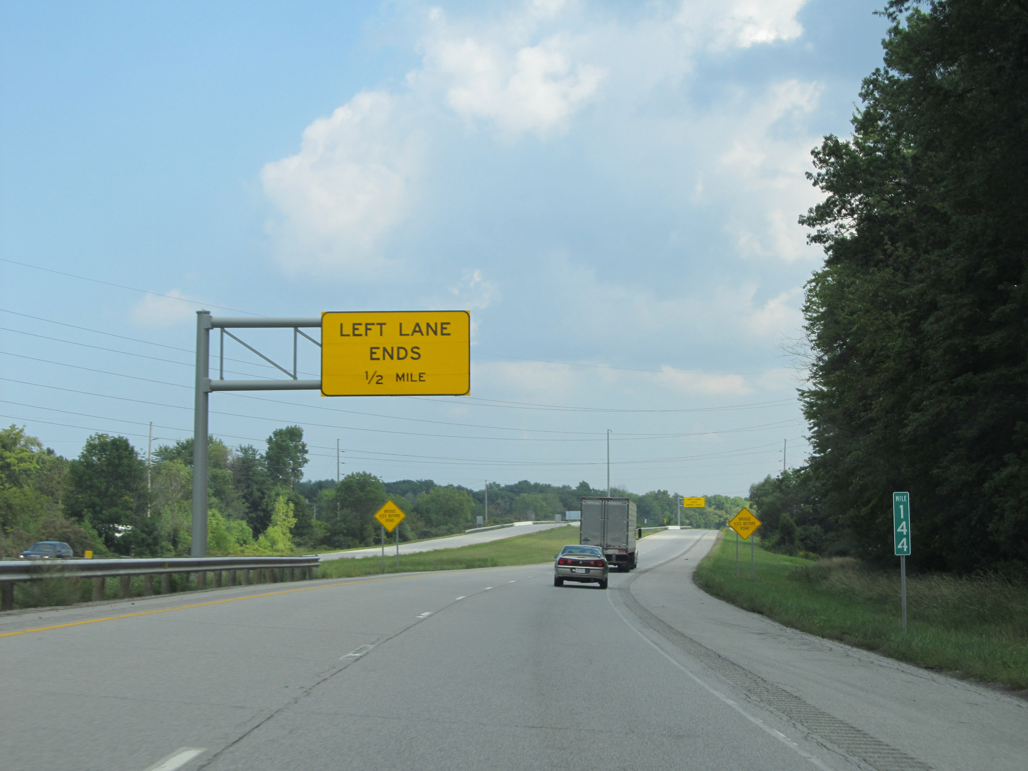 |
View on Interstate 90 East at mile marker 144. (Photo taken 9/6/15). |
 |
Here we see Interstate 90 East briefly reduced to a single lane as OH 2 East traffic joins it on the left. (Photo taken 9/6/15). |
 |
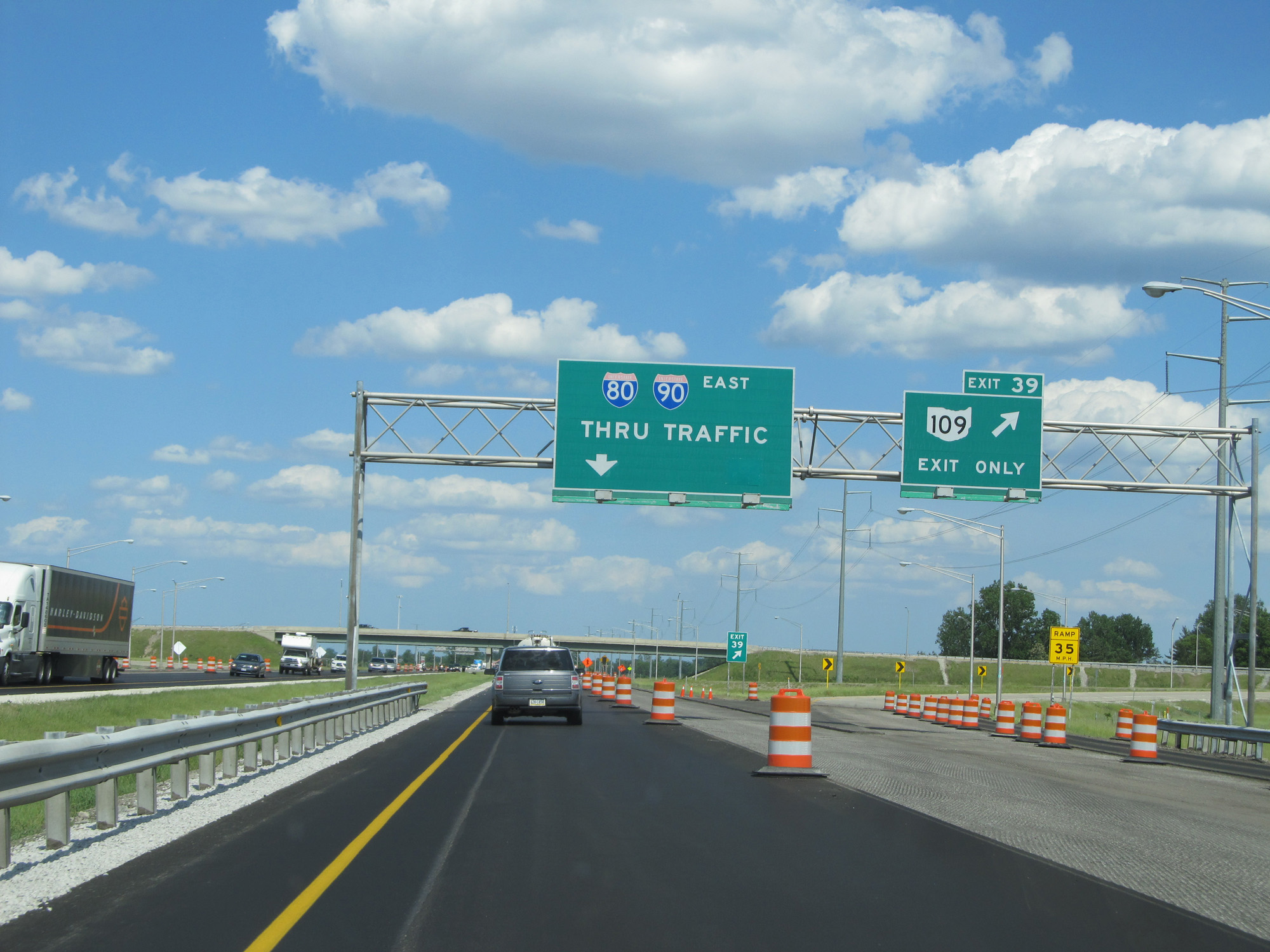
Take Exit 145 to Interstate 80 (Ohio Turnpike). (Photo taken 9/6/15). |
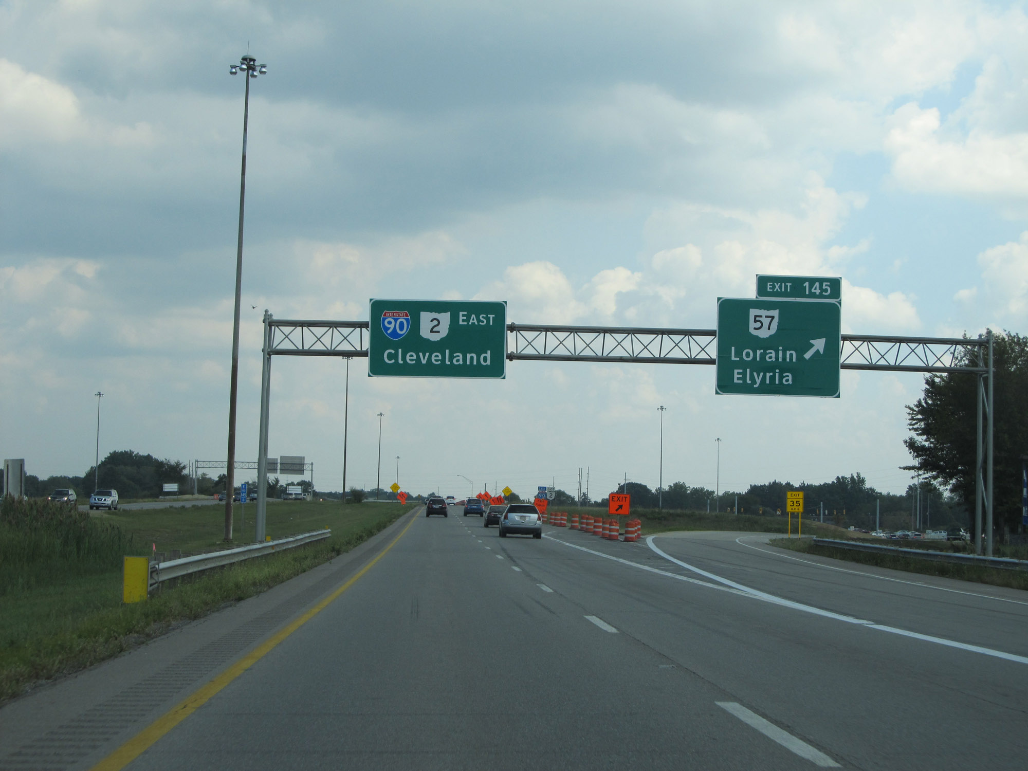 |
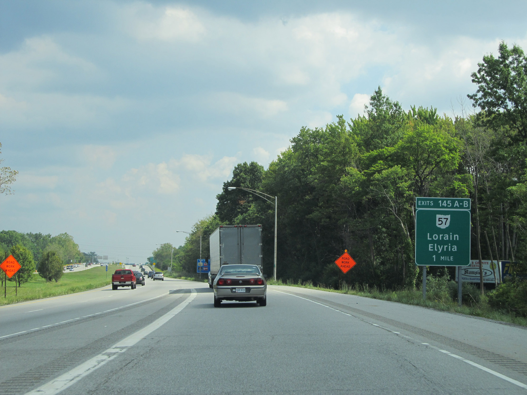
Interstate 90 East at Exit 145: OH 57 - Lorain / Elyria (Photo taken 9/6/15). |
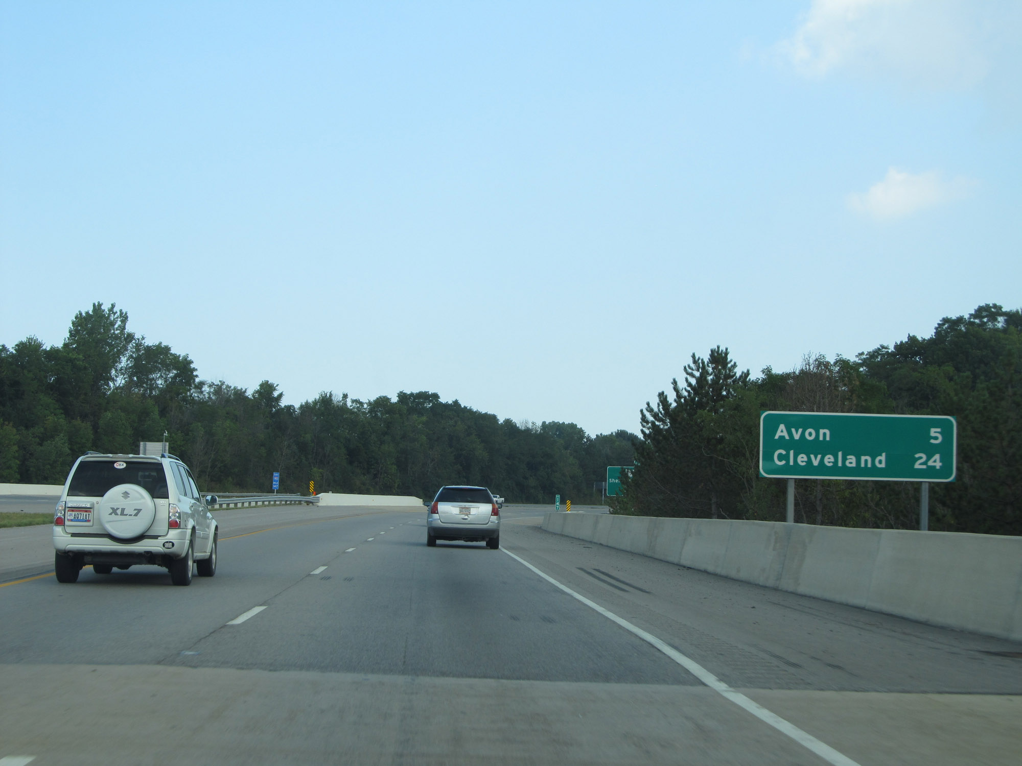 |
Mileage sign on Interstate 90 East. It's 5 miles to Avon and 24 miles to Cleveland. (Photo taken 9/6/15). |
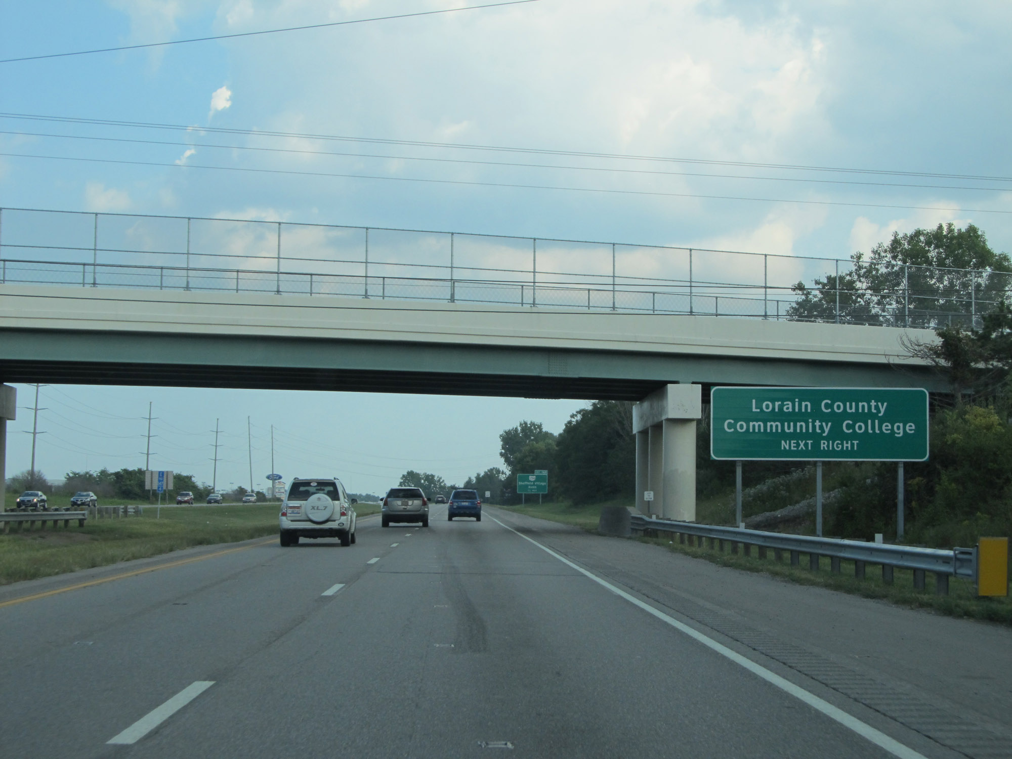 |
Take Exit 148 to Lorain County Community College. (Photo taken 9/6/15). |
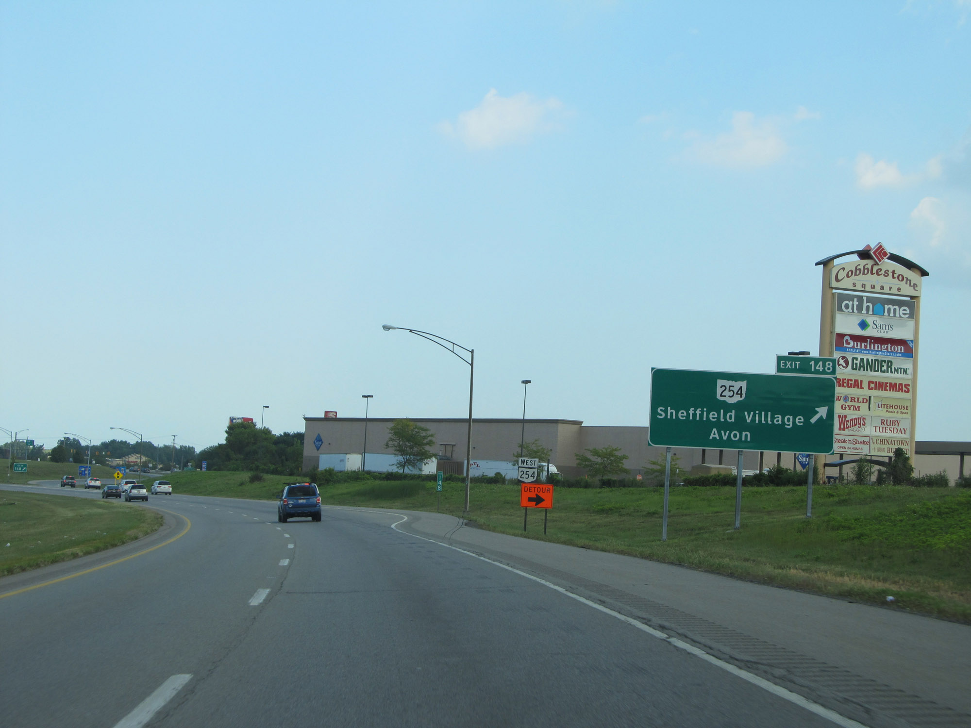 |
Interstate 90 East at Exit 148: OH 254 - Sheffield Village / Avon (Photo taken 9/6/15). |
 |
Another Interstate 90 East reassurance shield. (Photo taken 9/6/15). |
 |
The speed limit remains 65 mph at mile marker 149. (Photo taken 9/6/15). |
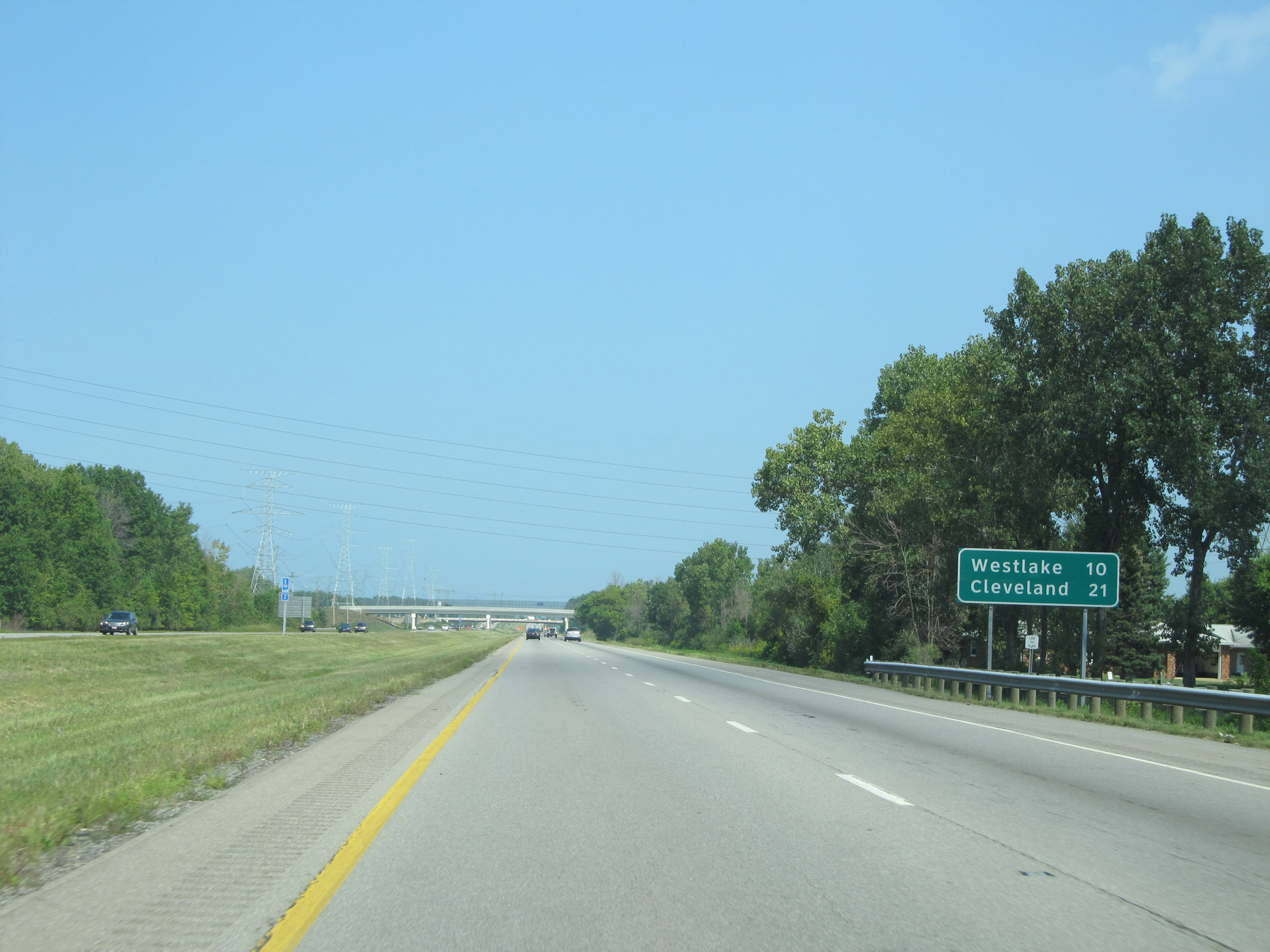 |
Another mileage sign on Interstate 90 East. It's 10 miles to Westlake and 21 miles to Cleveland. (Photo taken 9/6/15). |
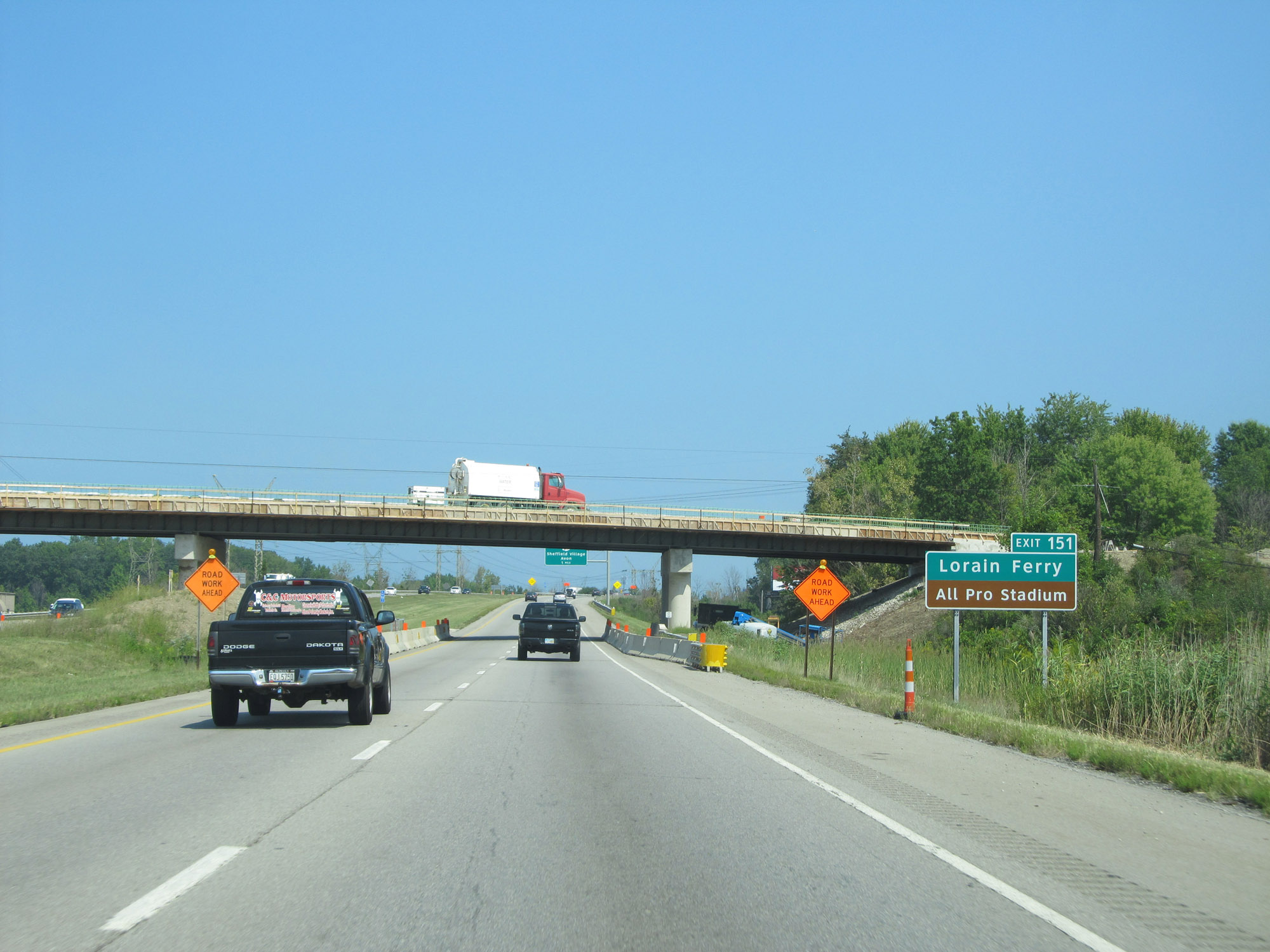 |
Take Exit 151 to Lorain Ferry and All Pro Stadium. (Photo taken 9/6/15). |
 |
Interstate 90 East at Exit 151: OH 611 - Sheffield Village / Avon (Photo taken 9/6/15). |
 |
Take Exit 153 to North Ridgeville. (Photo taken 9/6/15). |
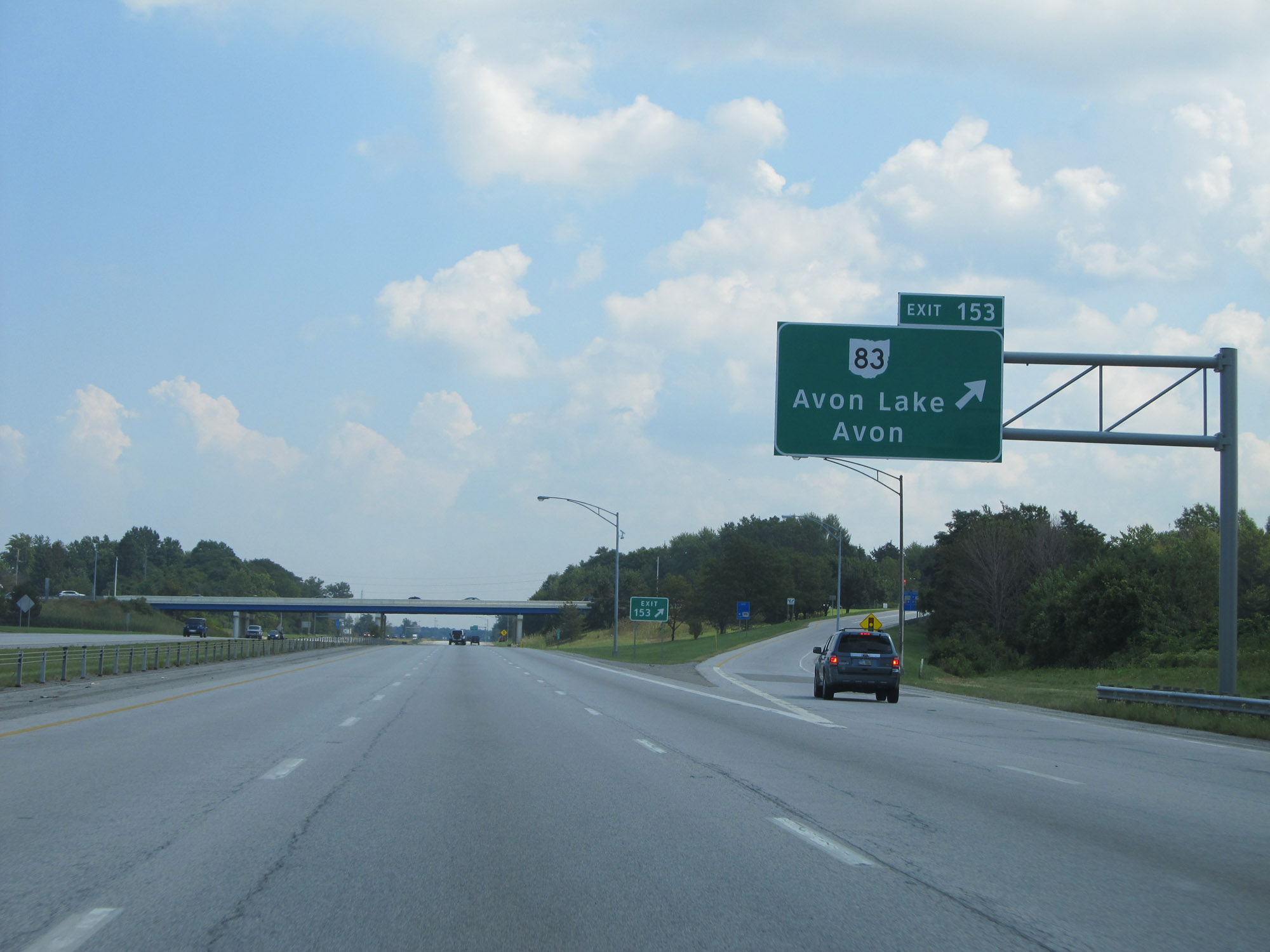 |
Interstate 90 East at Exit 153: OH 83 - Avon Lake / Avon (Photo taken 9/6/15). |
 |
Take Exit 155 to Lear Road and Avon Lake. (Photo taken 9/6/15). |
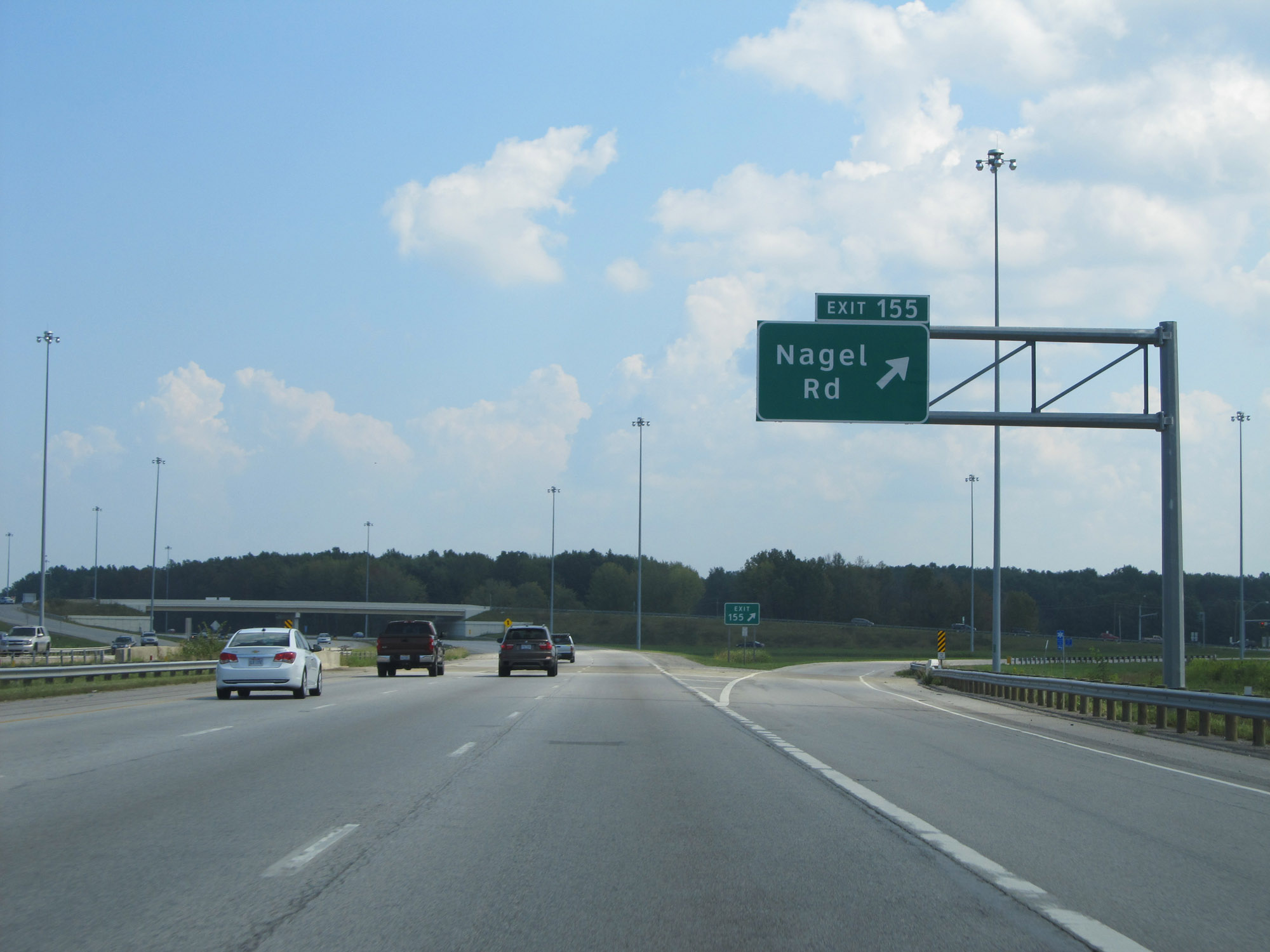 |
Interstate 90 East at Exit 155: Nagel Rd (Photo taken 9/6/15). |
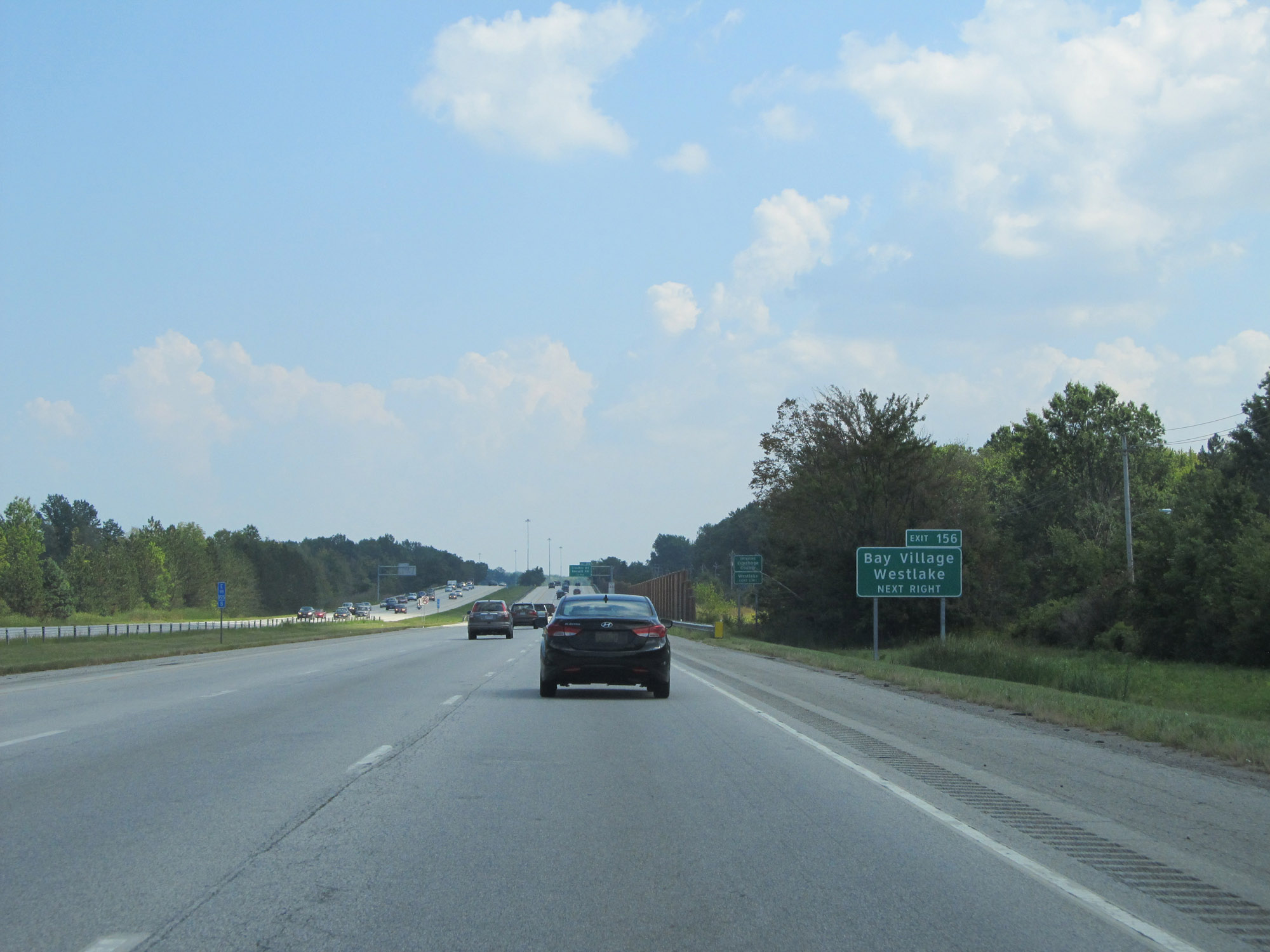 |
Take Exit 156 to Bay Village and Westlake. (Photo taken 9/6/15). |
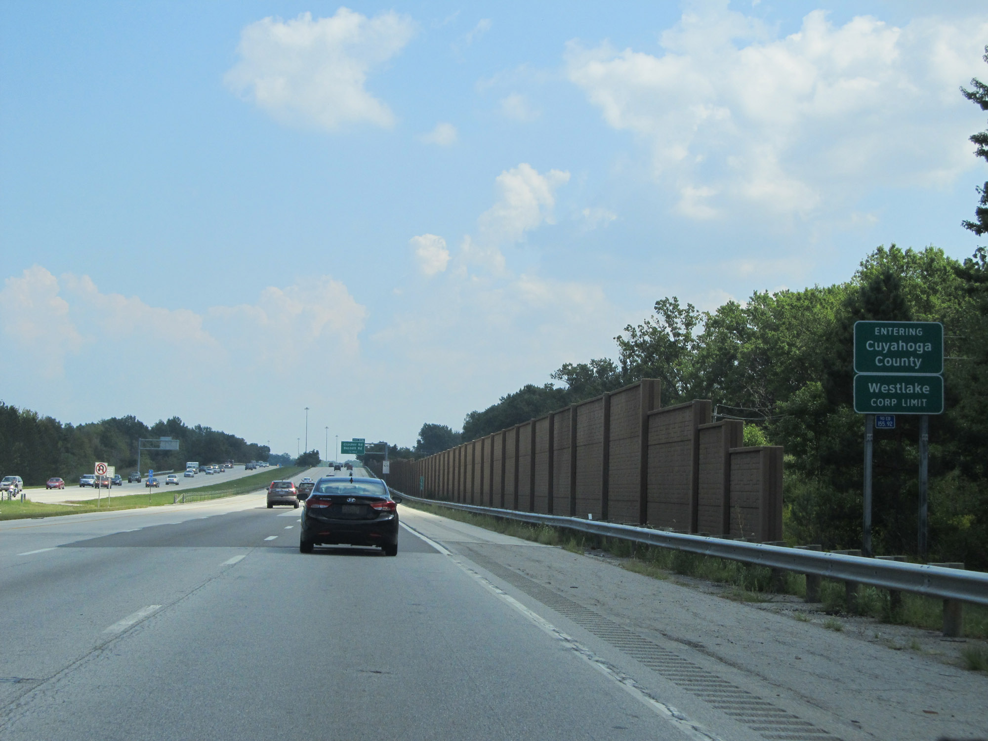 |
Approaching Exit 156, Interstate 90 East enters Cuyahoga County. (Photo taken 9/6/15). |
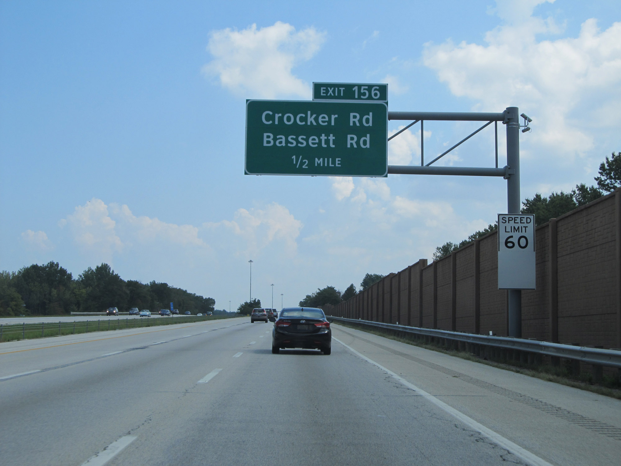 |
Upon entering Cuyahoga County, the speed limit decreases to 60 mph. (Photo taken 9/6/15). |
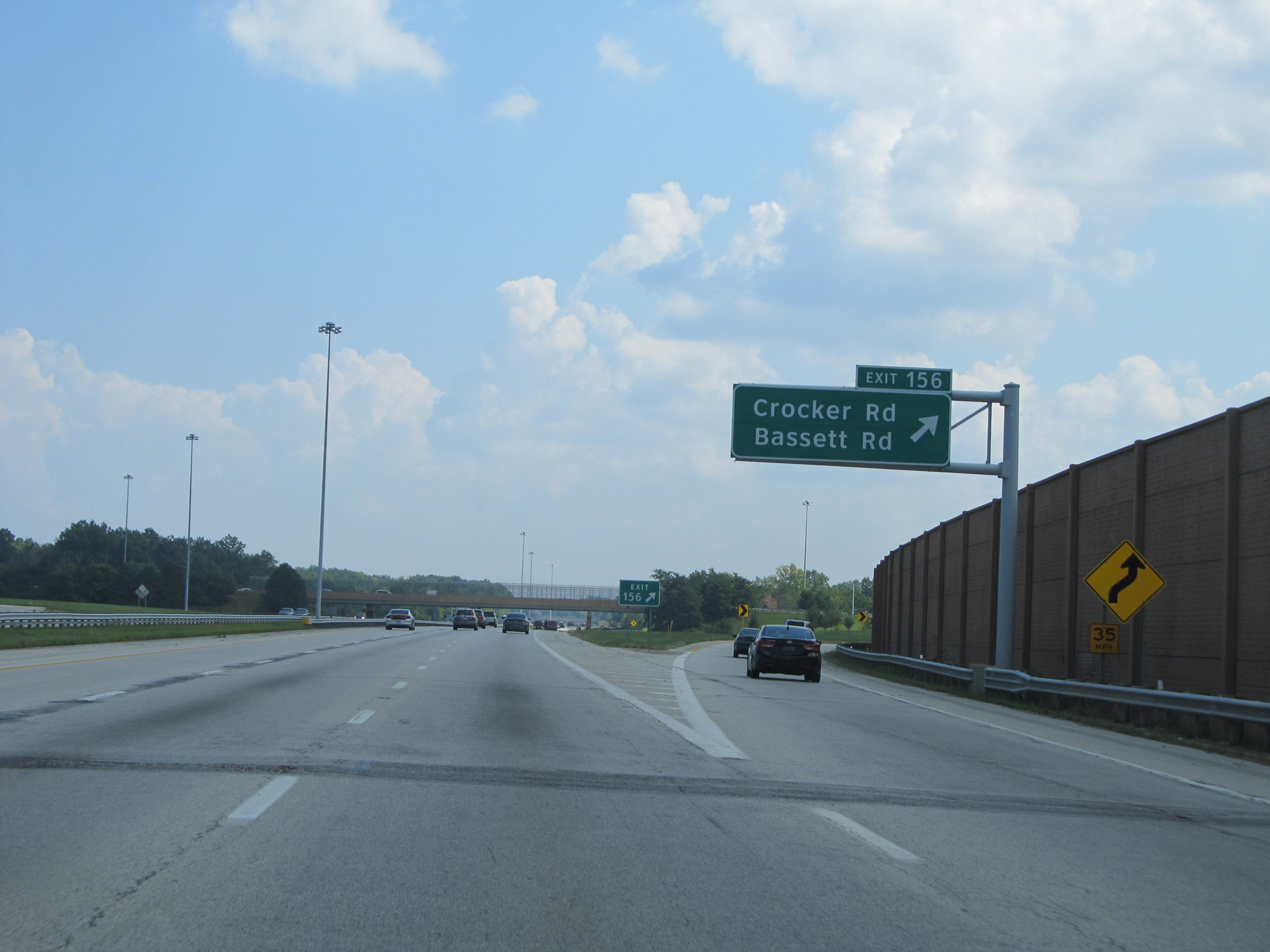 |
Interstate 90 East at Exit 156: Crocker Rd / Bassett Rd (Photo taken 9/6/15). |
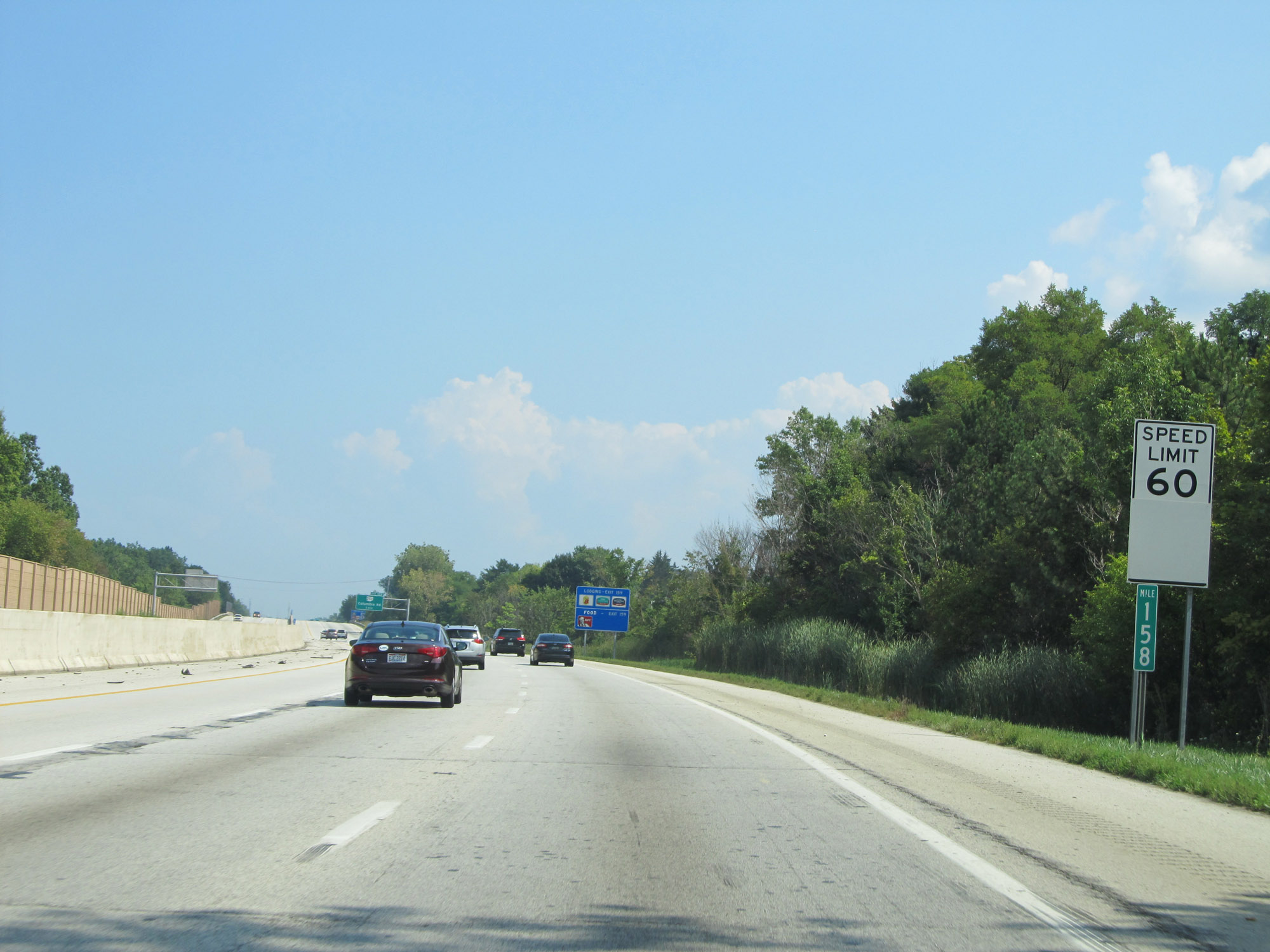 |
View on Interstate 90 East at mile marker 158. (Photo taken 9/6/15). |
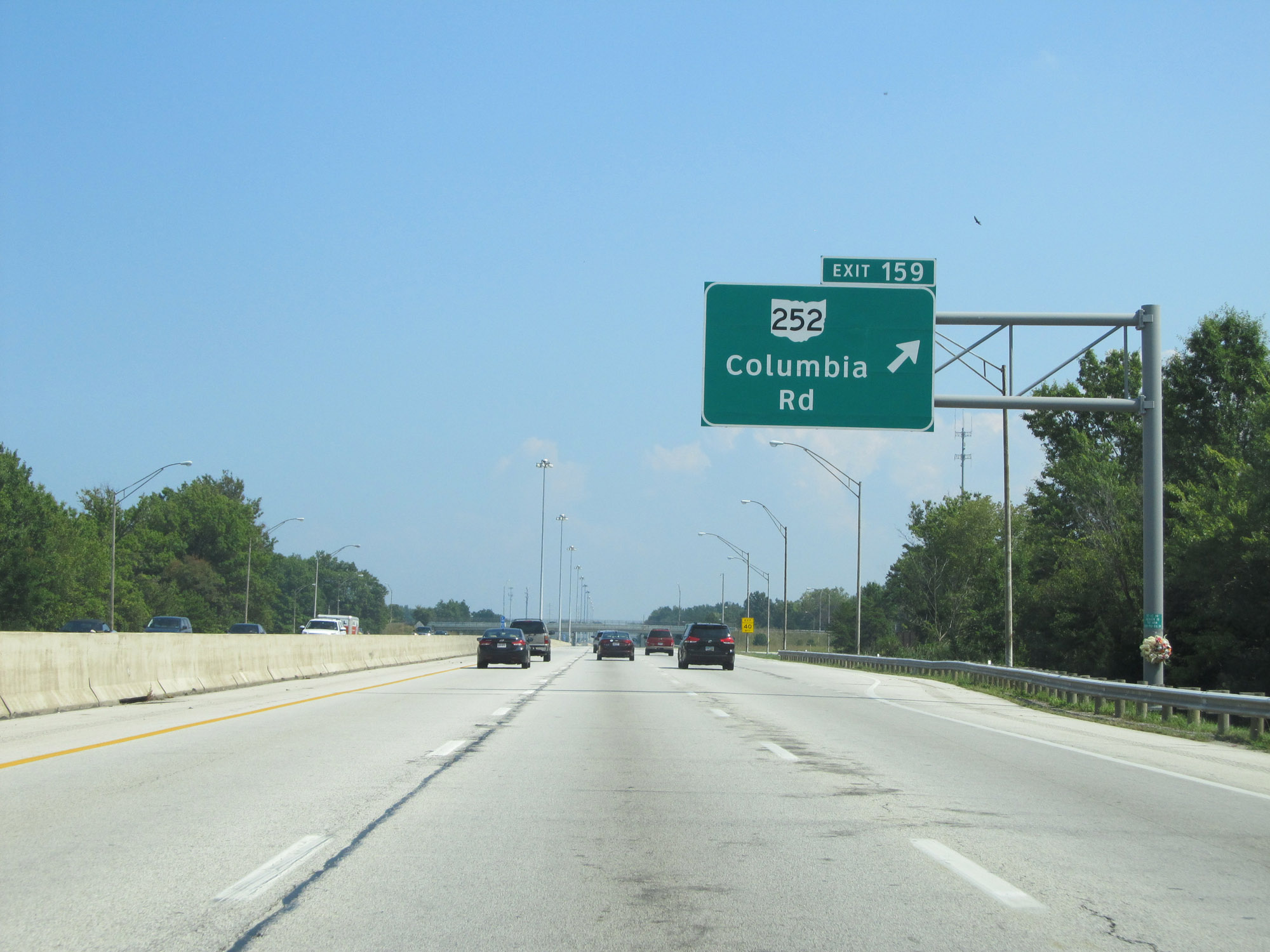 |
Interstate 90 East at Exit 159: OH 252 - Columbia Rd (Photo taken 9/6/15). |
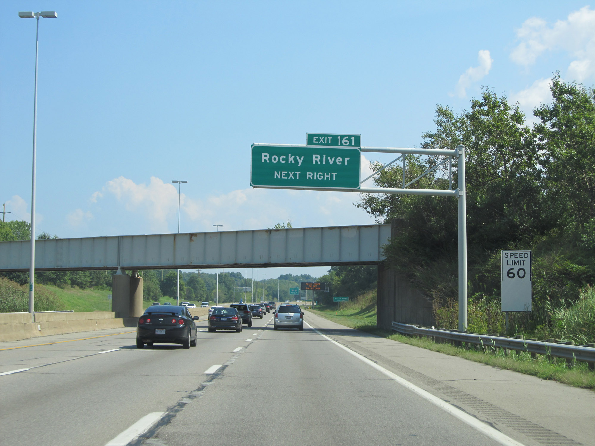 |
Take Exit 161 to Rocky River. (Photo taken 9/6/15). |
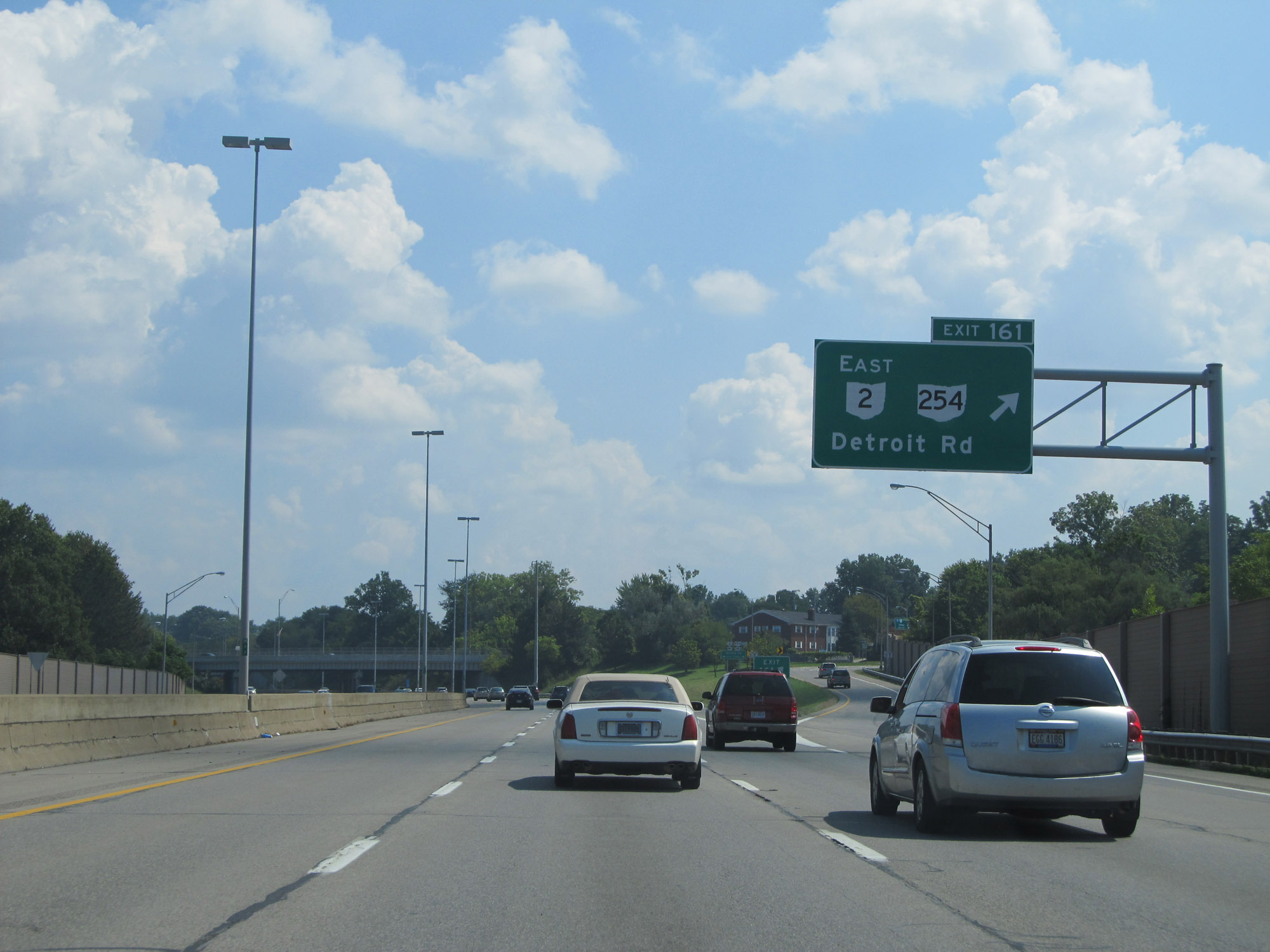 |
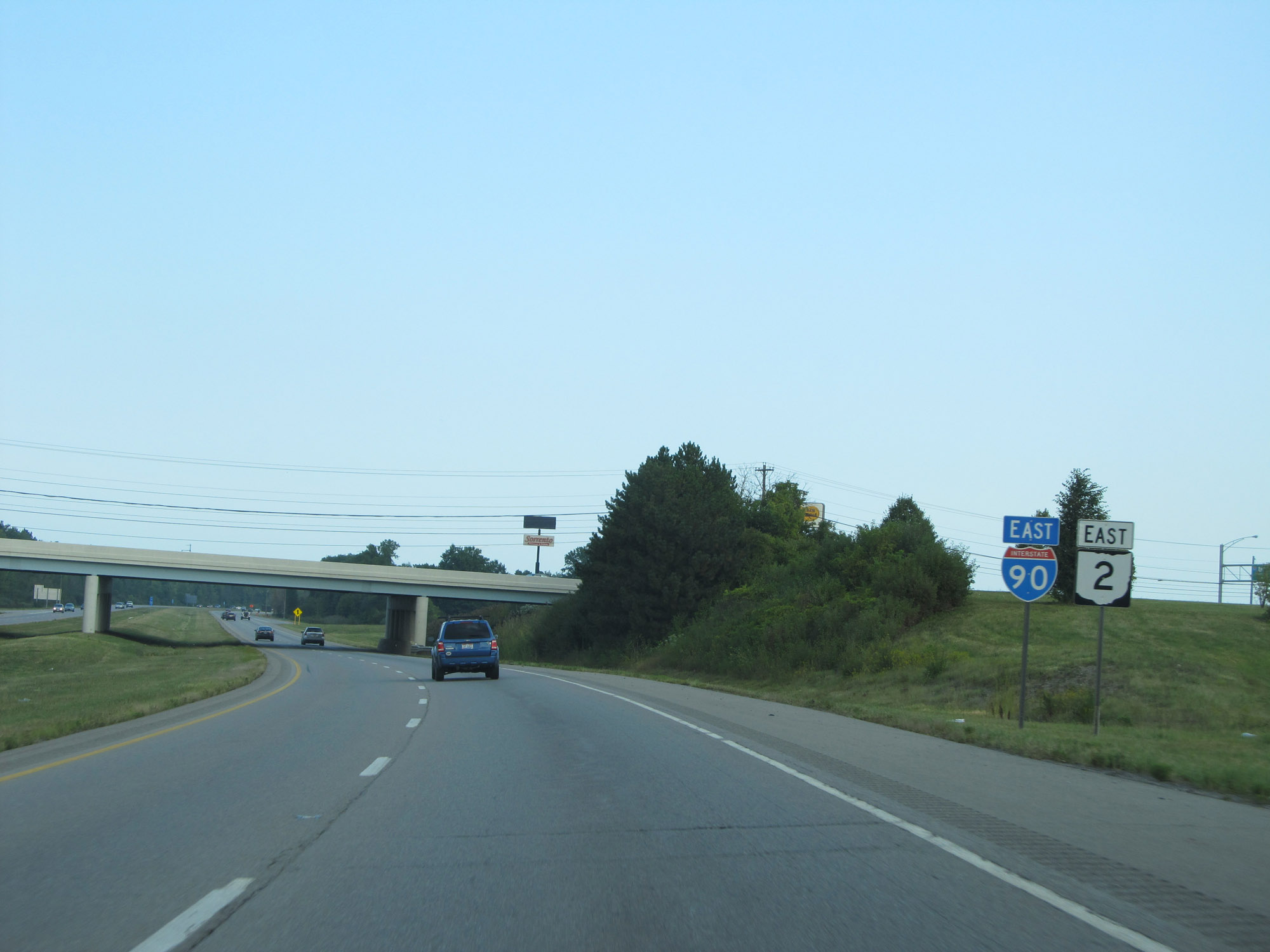
Interstate 90 East at Exit 161: OH 2 East / OH 254 - Detroit Rd (Photo taken 9/6/15). |
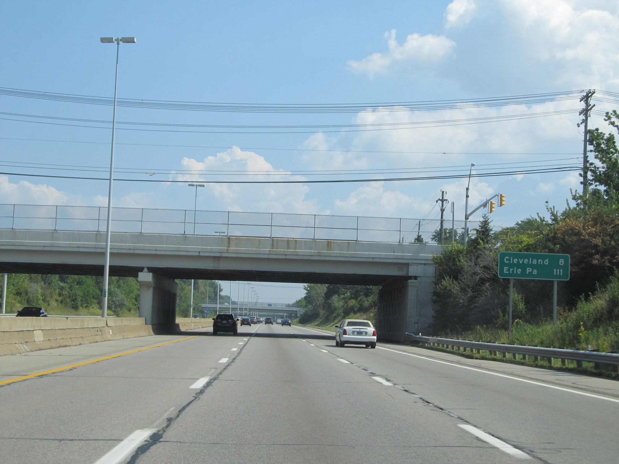 |
Mileage sign on Interstate 90 East. It's 8 miles to Cleveland and 111 miles to Erie, PA. (Photo taken 9/6/15). |
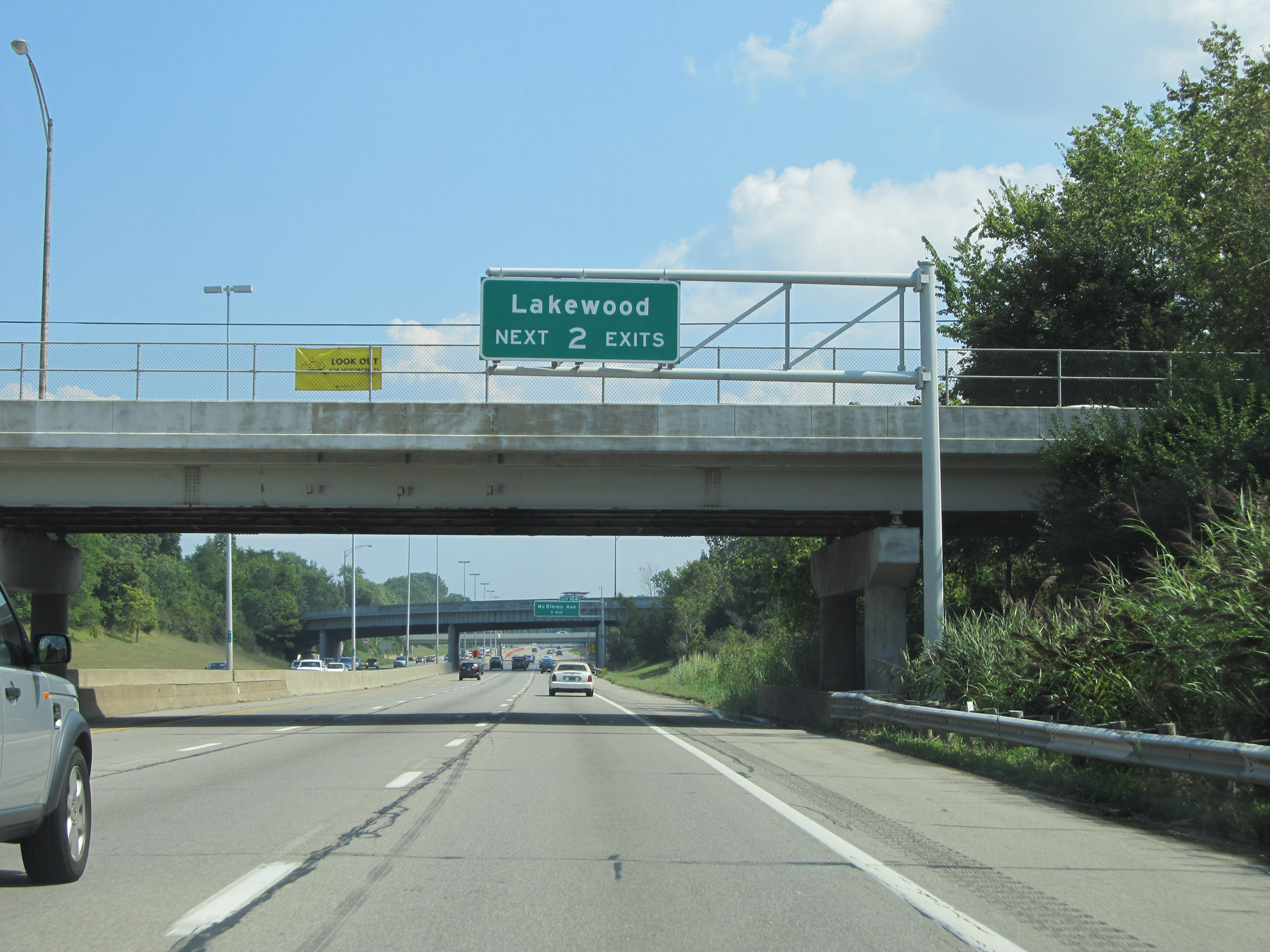 |
Take either of the next 2 exits to Lakewood. (Photo taken 9/6/15). |
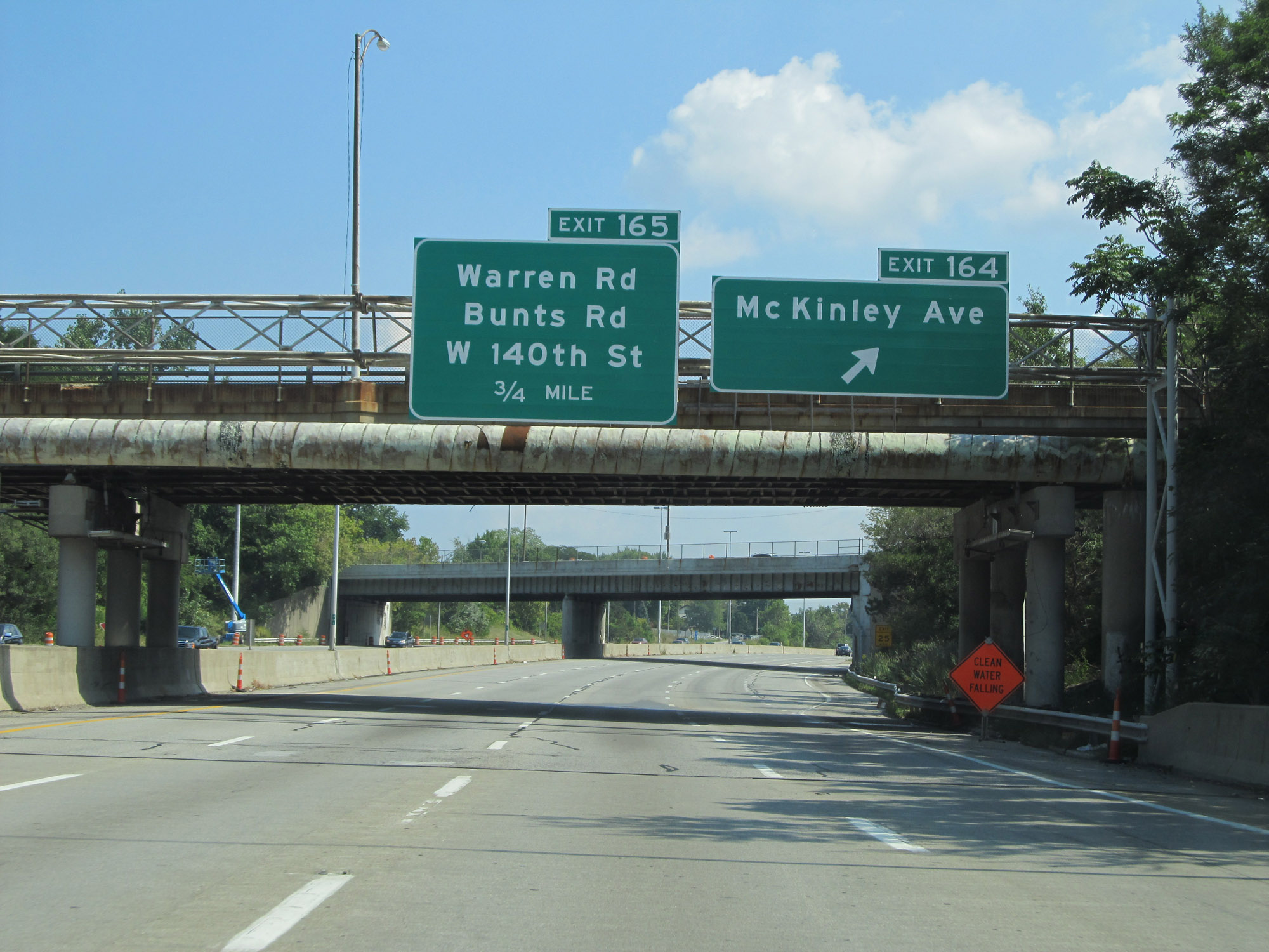 |
Interstate 90 East at Exit 164: McKinley Ave (Photo taken 9/6/15). |
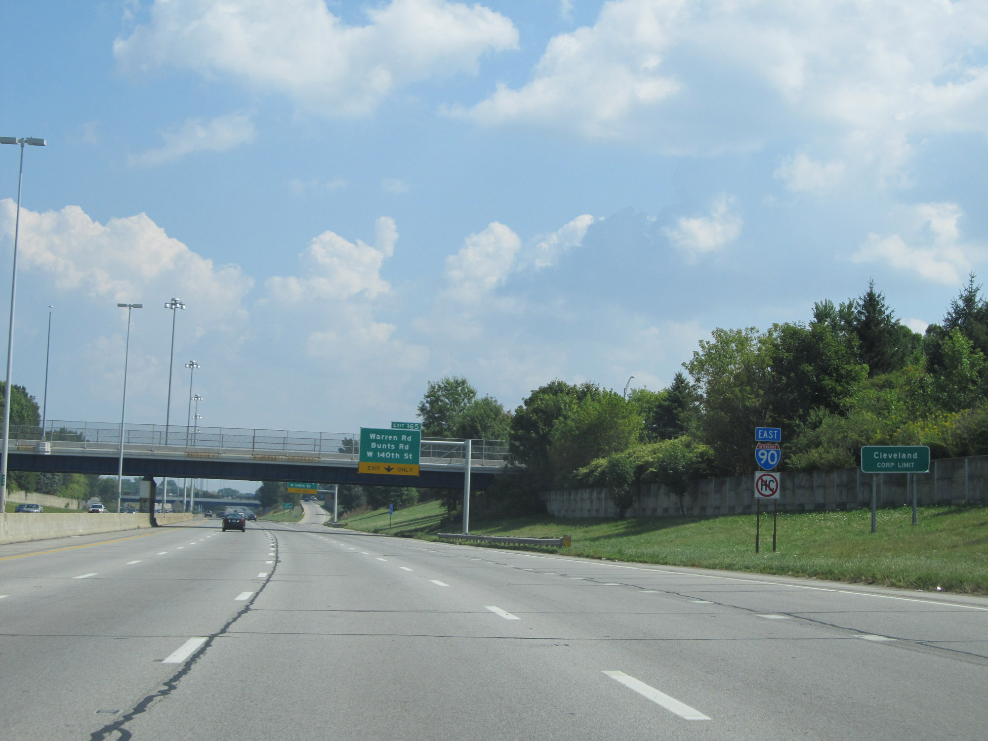 |
Interstate 90 East as it enters the Cleveland corporate limits. (Photo taken 9/6/15). |
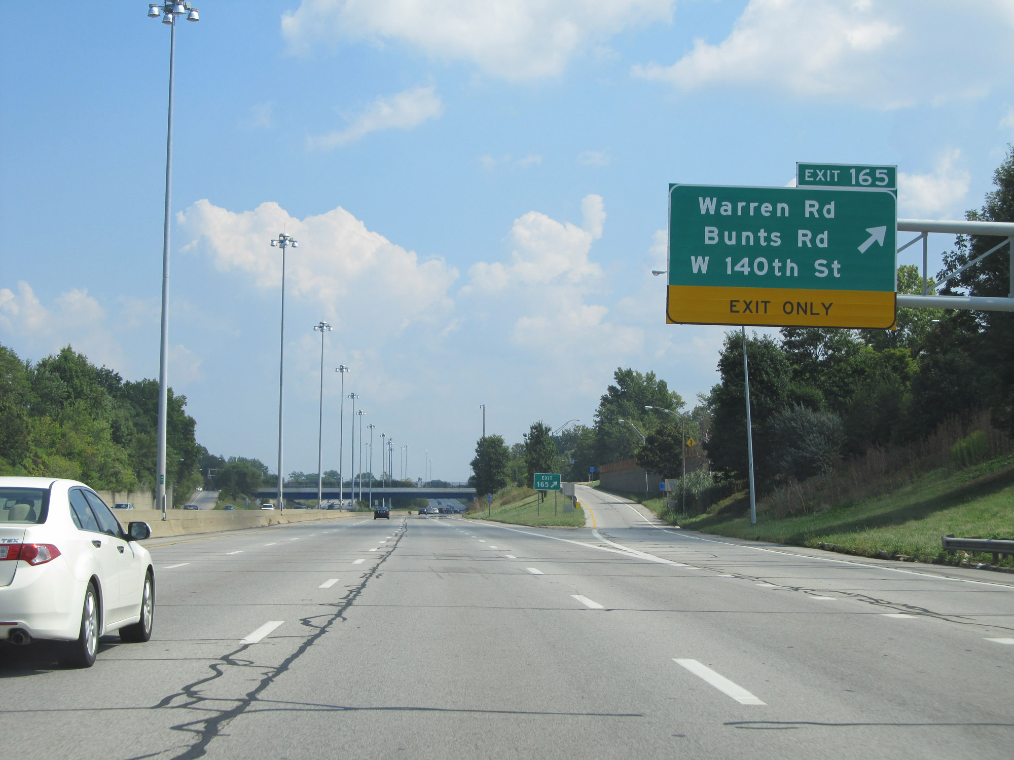 |
Interstate 90 East at Exit 165: Warren Rd / Bunts Rd / W 140th St (Photo taken 9/6/15). |
 |
Interstate 90 East at Exit 166: W 117th St (Photo taken 9/6/15). |
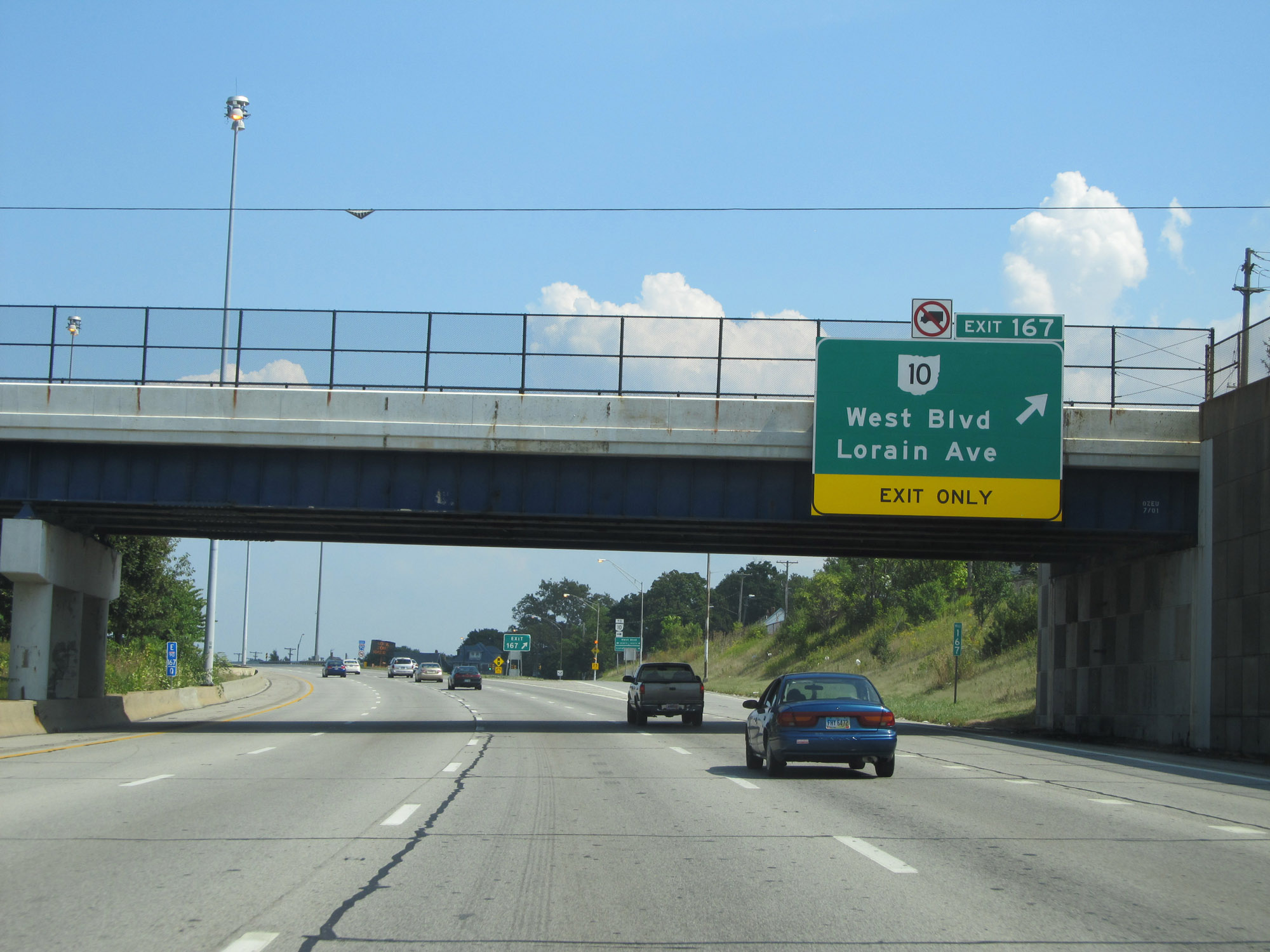 |
Interstate 90 East at Exit 167: OH 10 - West Blvd / Lorain Ave (Photo taken 9/6/15). |
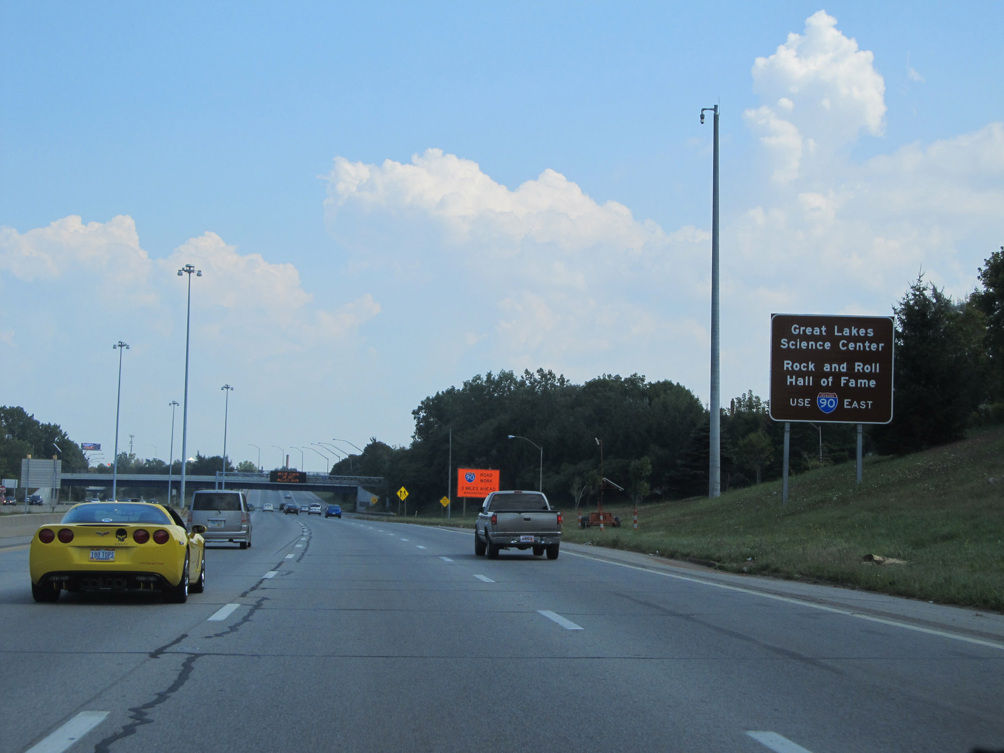 |
Traffic to the Great Lakes Science Center and the Rock and Roll Hall of Fame should continue to follow Interstate 90 East. (Photo taken 9/6/15). |
 |
Interstate 90 East at Exit 169: W 44th St / W 41st St (Photo taken 9/6/15). |
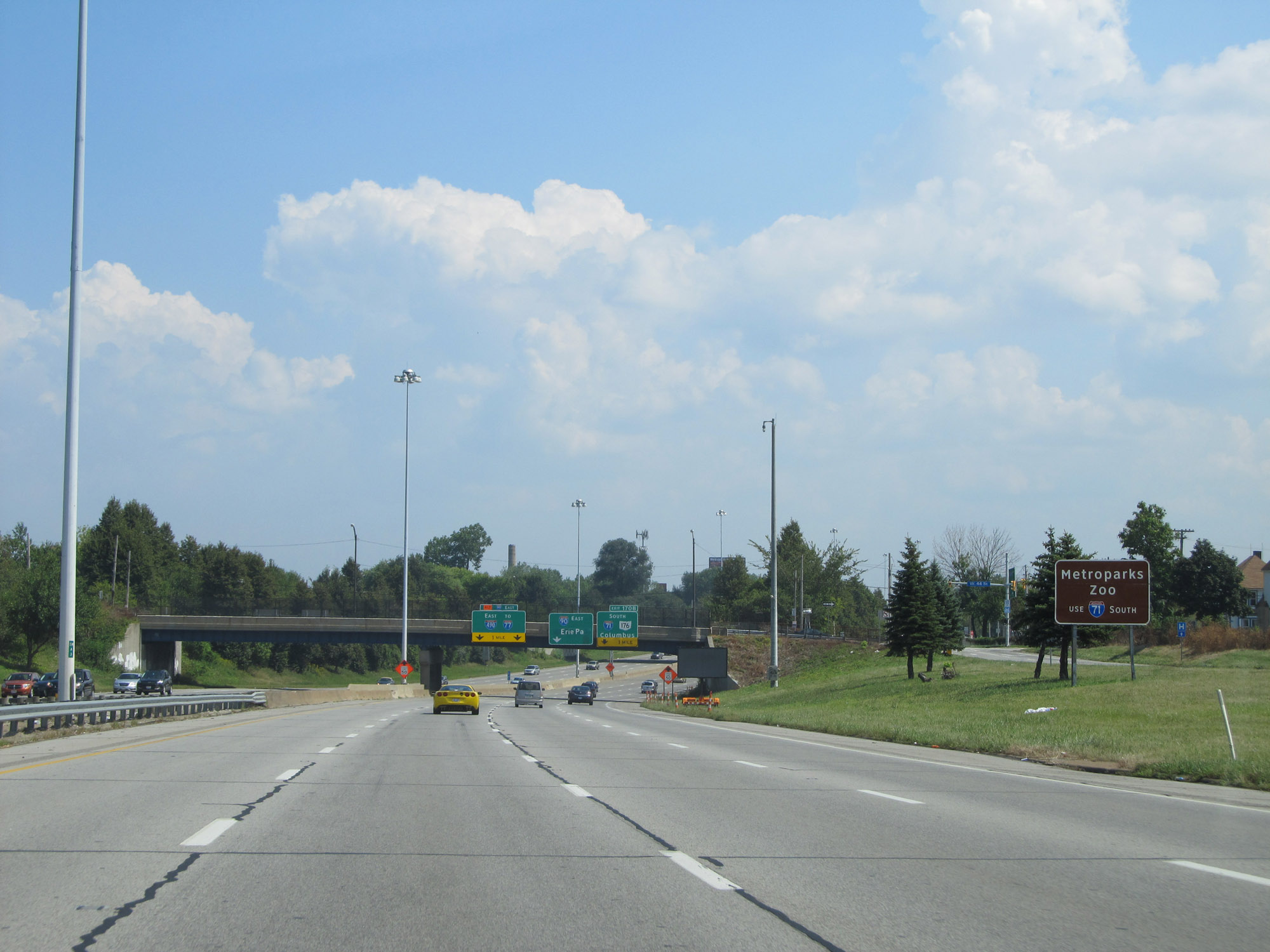 |
Follow Interstate 71 South to Metroparks Zoo. (Photo taken 9/6/15). |
 |
Interstate 90 East approaching Exit 170B - 1 mile. (Photo taken 9/6/15). |
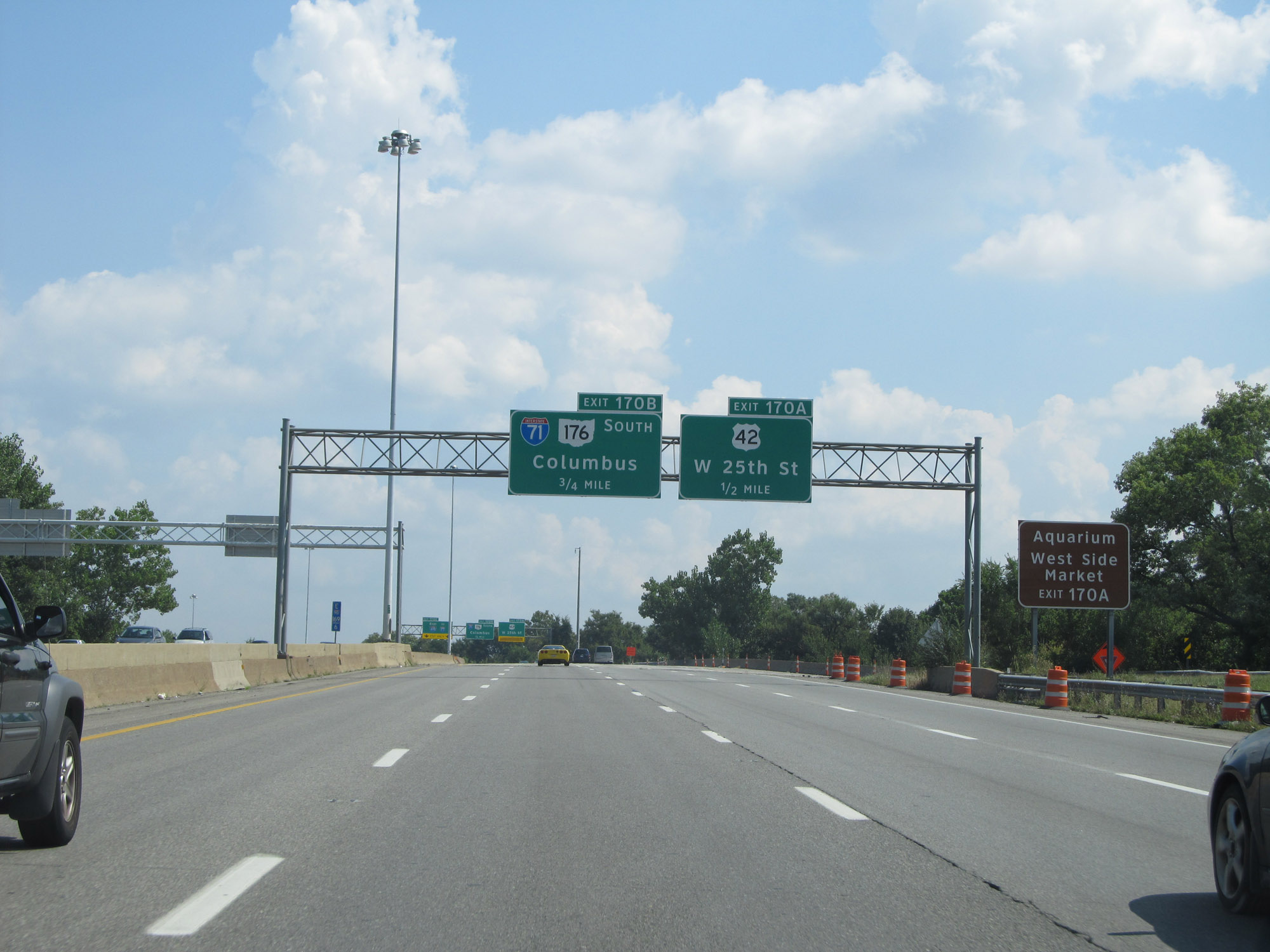 |
Take Exit 170A to the Aquarium and West Side Market. (Photo taken 9/6/15). |
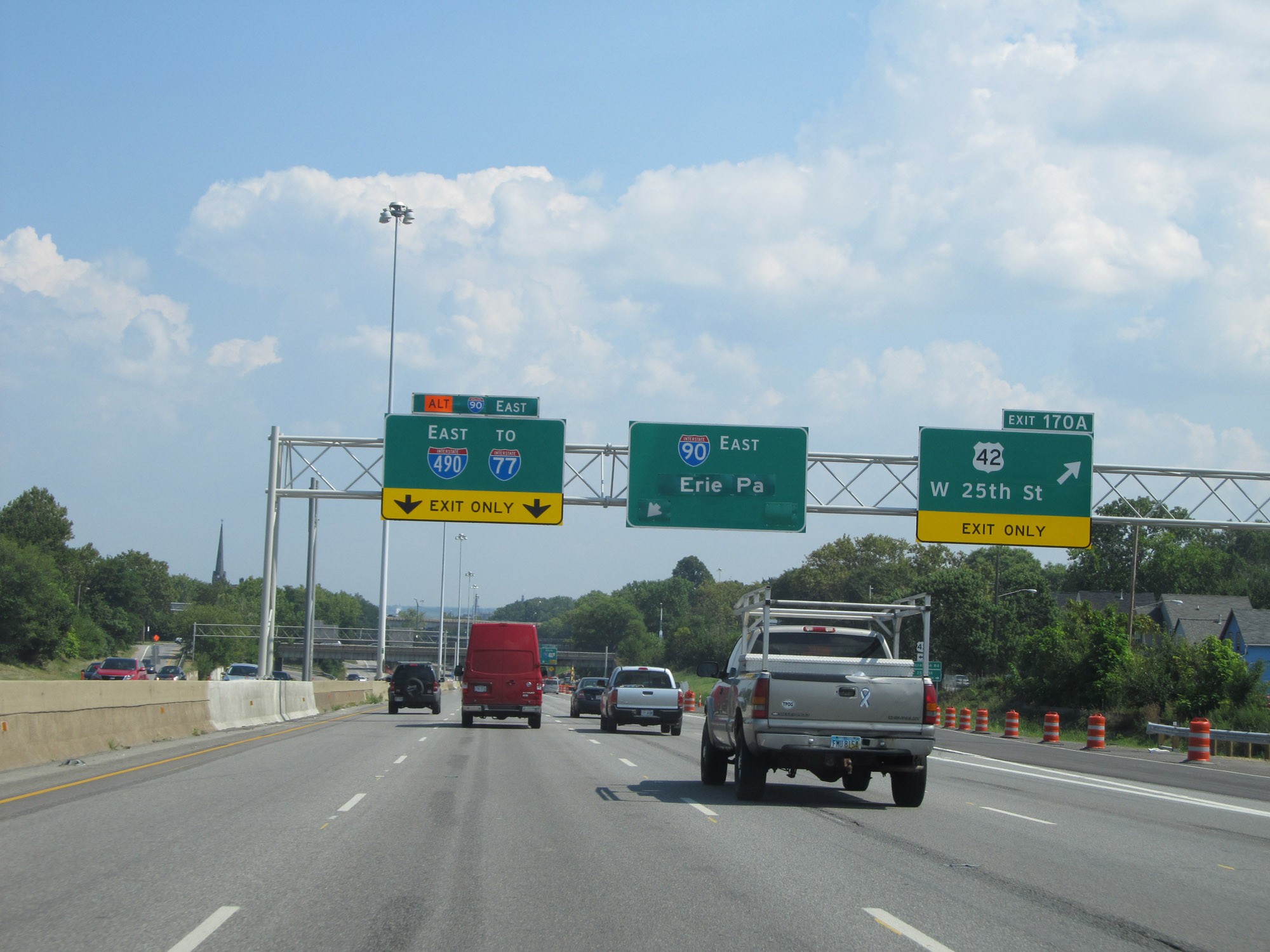 |
Interstate 90 East at Exit 170A: US 42 - W 25th St (Photo taken 9/6/15). |
 |
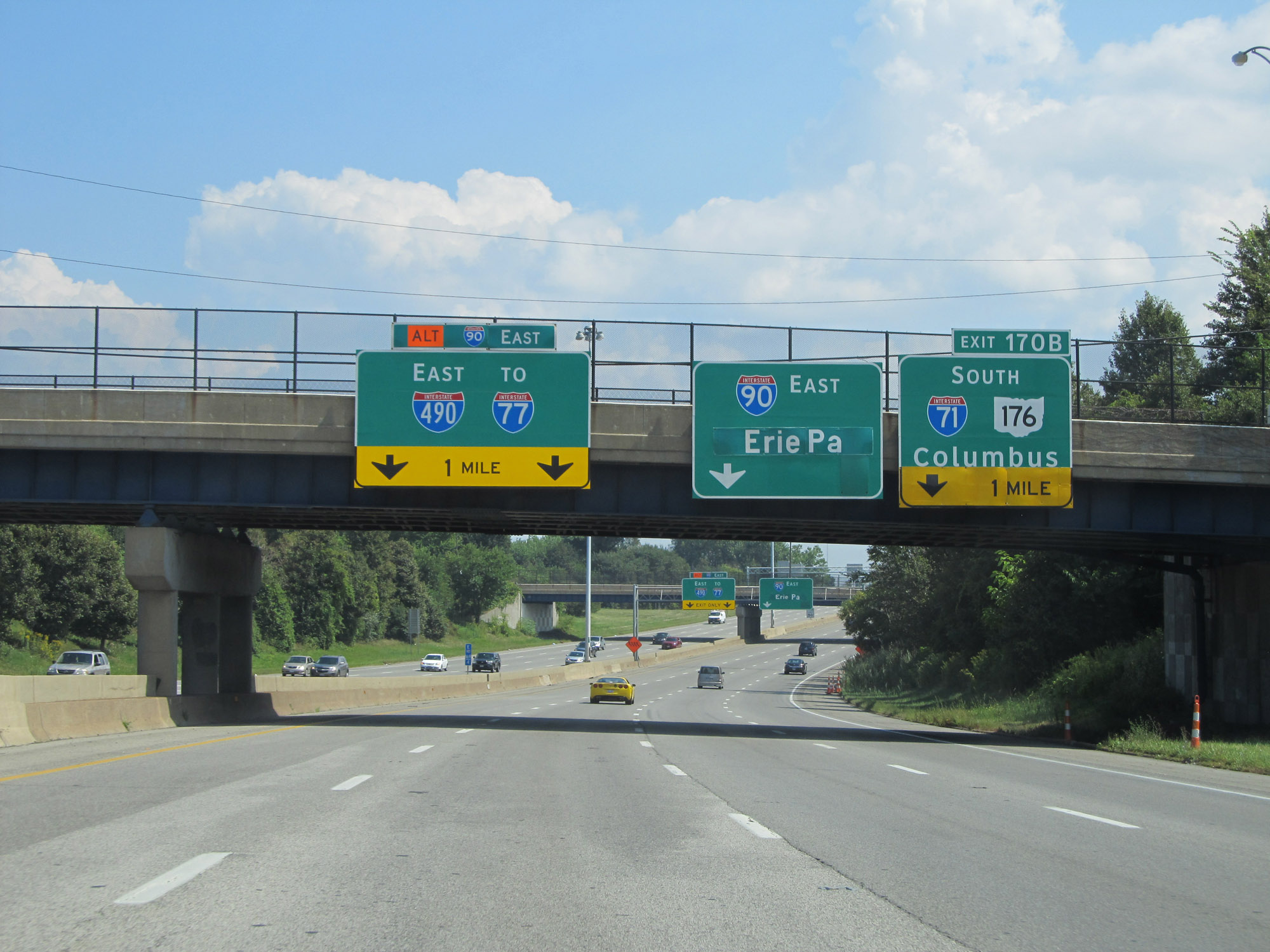
Interstate 90 East approaching Exit 170B and the junction of Interstate 490 East on the left. (Photo taken 9/6/15). |
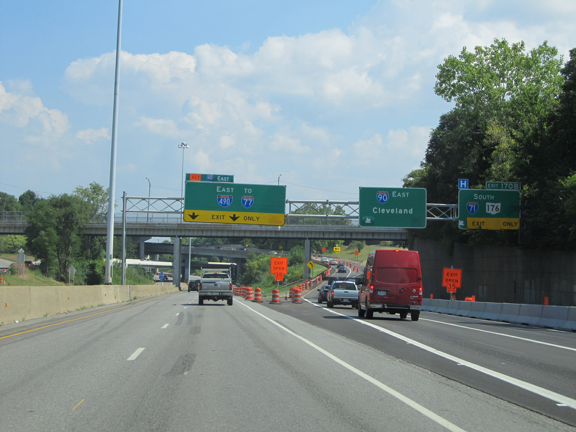 |
Interstate 90 East at Exit: Interstate 490 East / To Interstate 77; Exit 170B: Interstate 71 South / OH 176 South - Columbus (Photo taken 9/6/15). |
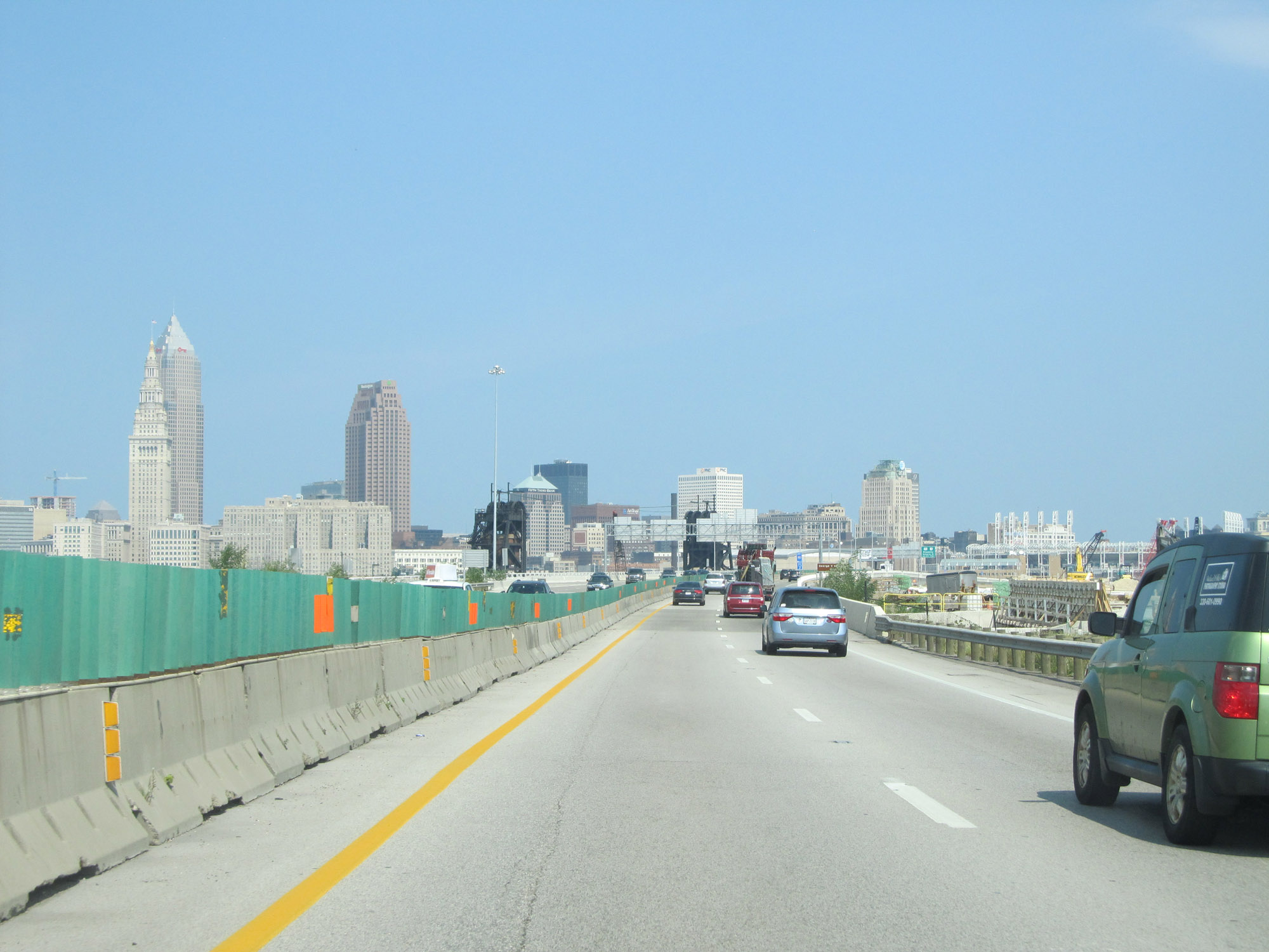 |
Beyond Exit 170B, Interstate 90 East curves to the north to head for downtown Cleveland, seen here. (Photo taken 9/7/15). |
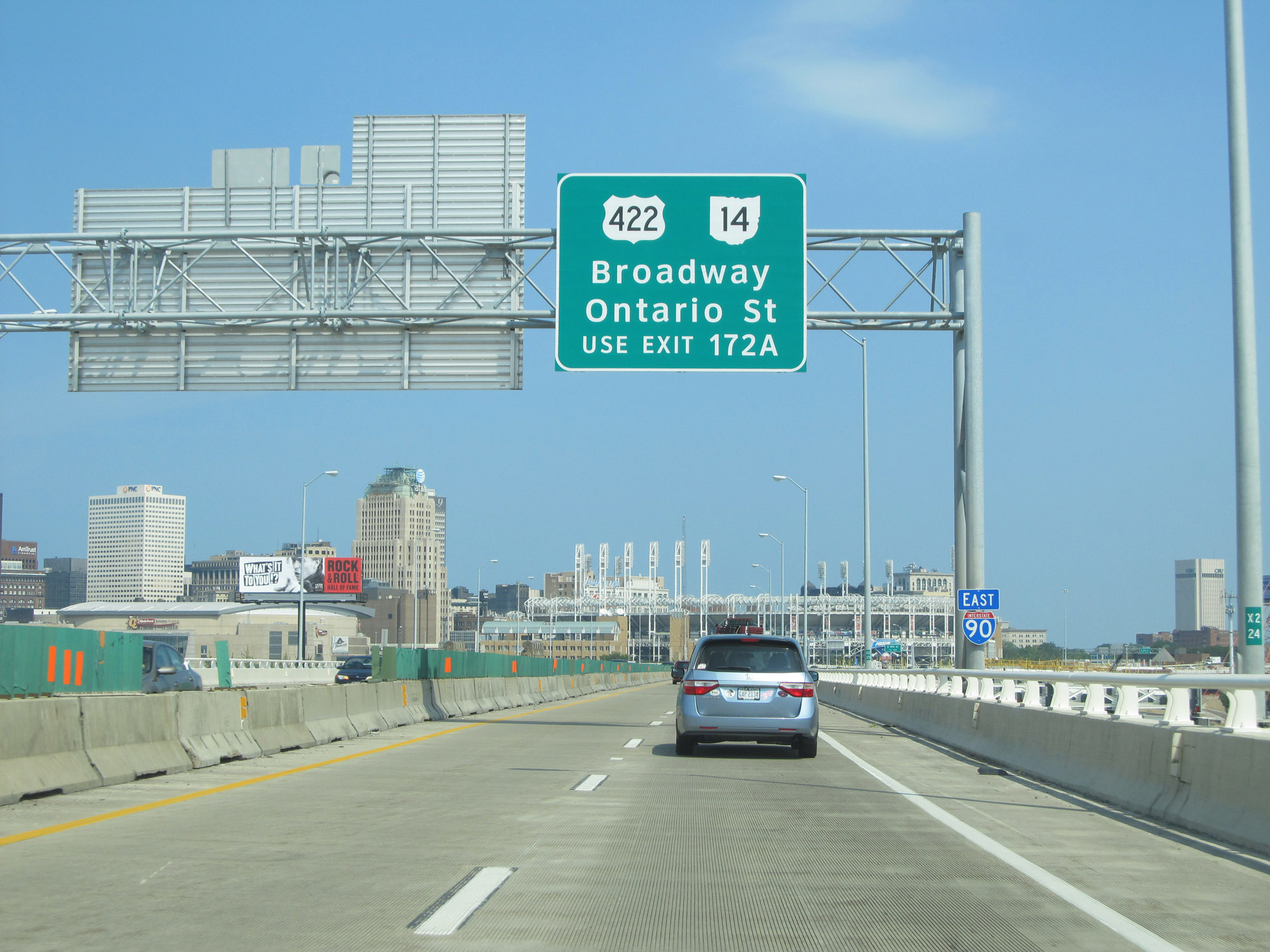 |
Take Exit 172A to US 422 and OH 14 (Broadway and Ontario St). (Photo taken 9/7/15). |
 |
Interstate 90 East at Exit 172A: E 9th St (Photo taken 9/7/15). |
 |
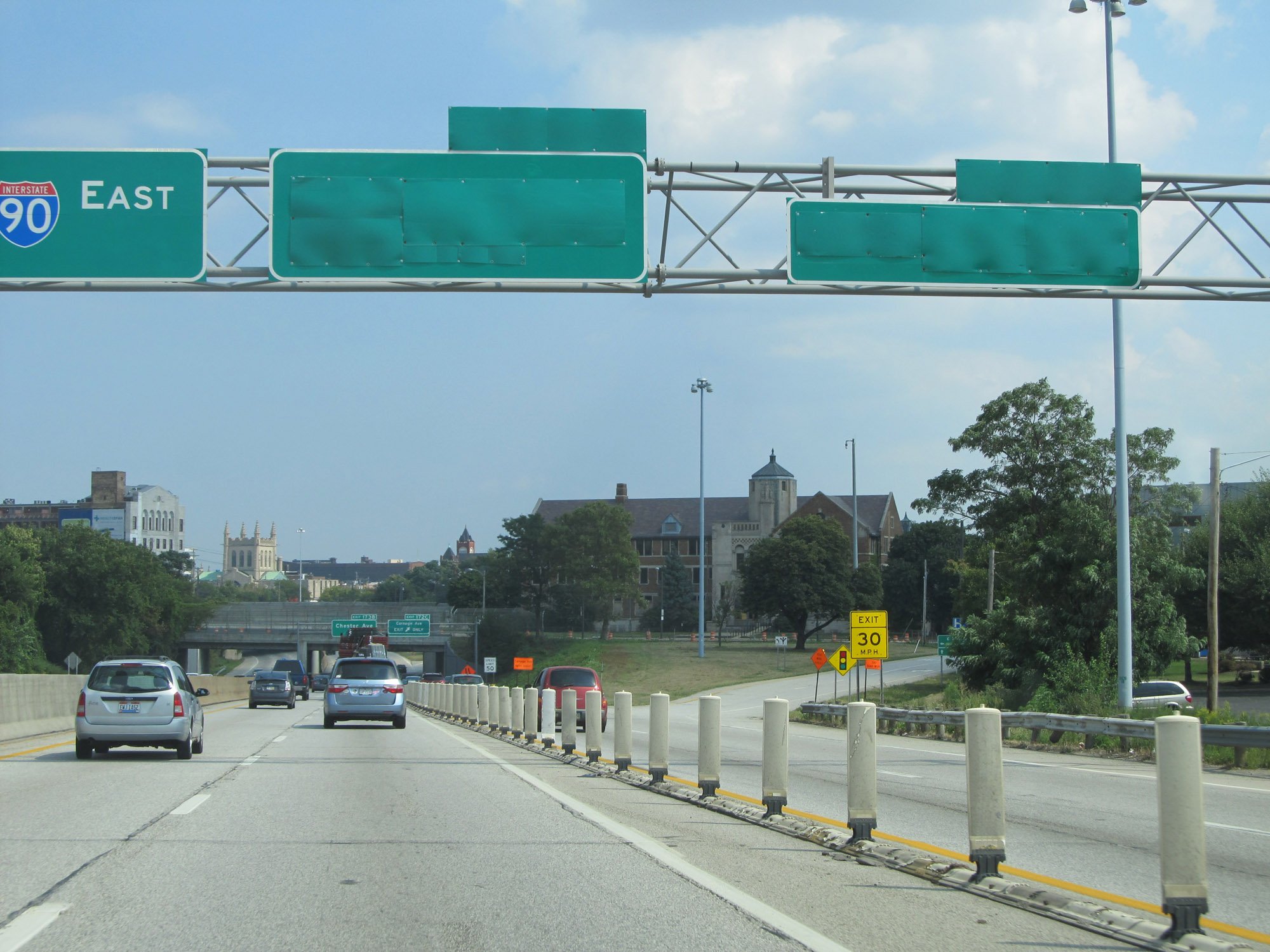
Overhead mileage sign on Interstate 90 East in downtown Cleveland. (Photo taken 9/7/15). |
 |
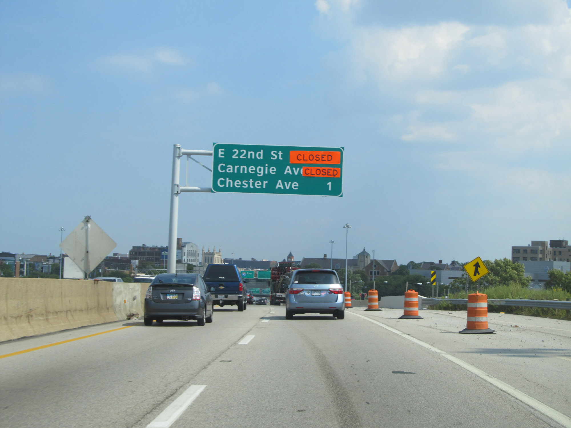
Interstate 90 East at Exit 172B: E 22nd St (Photo taken 9/7/15). |
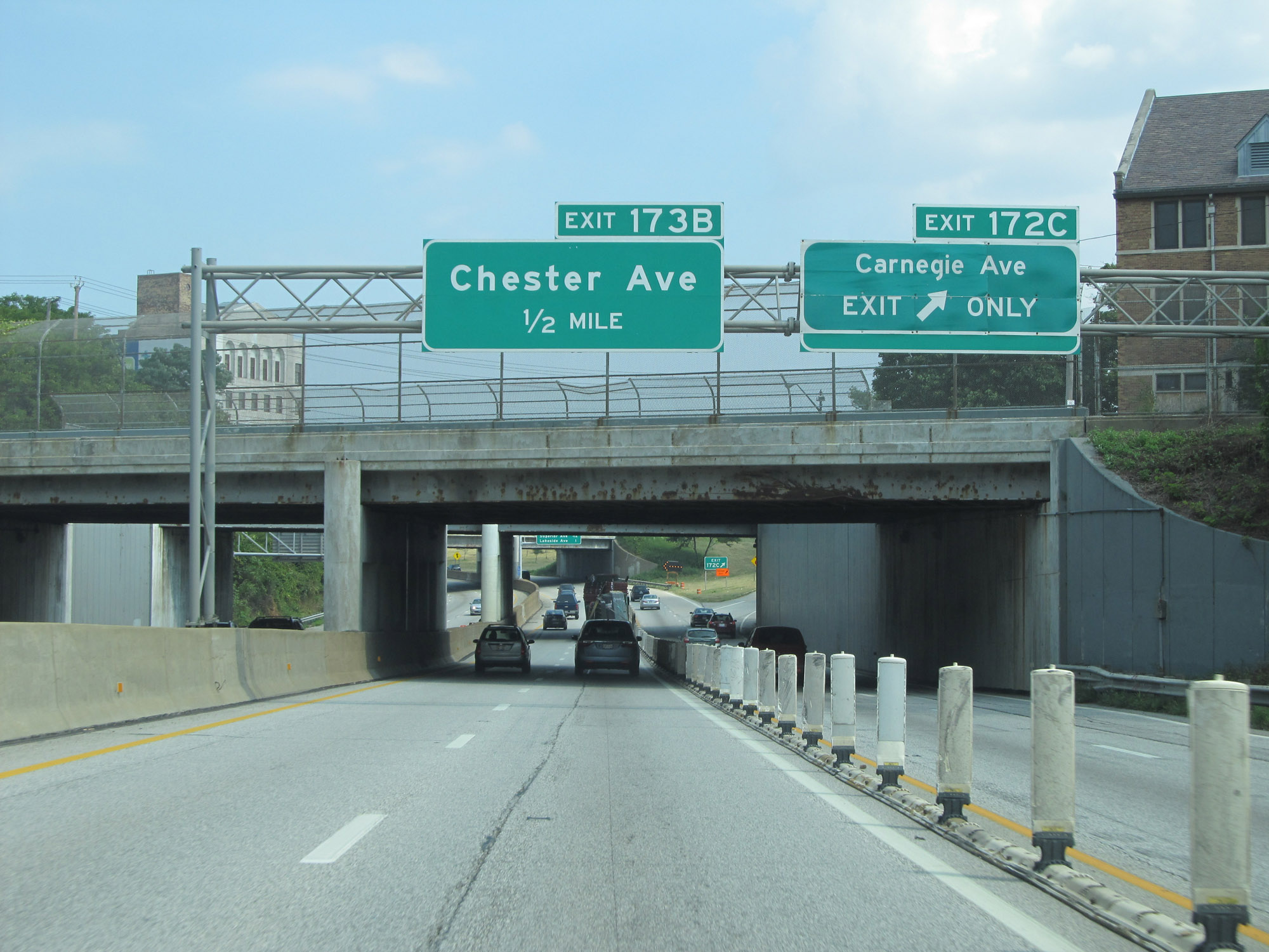 |
Interstate 90 East at Exit 172C: Carnegie Ave (Photo taken 9/7/15). |
 |
Another overhead mileage sign listing the distances to the three upcoming exits on Interstate 90 East in Cleveland. (Photo taken 9/7/15). |
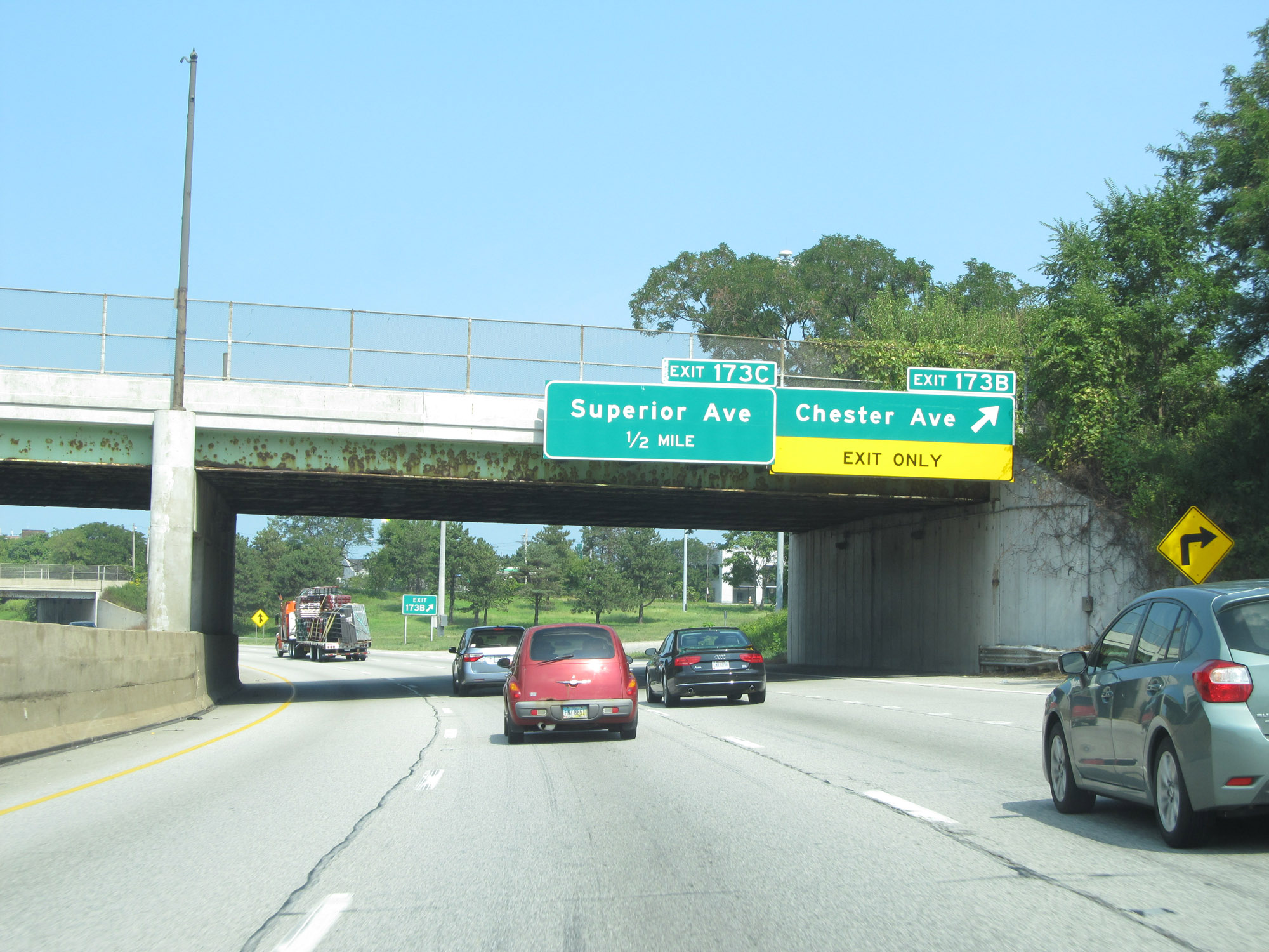 |
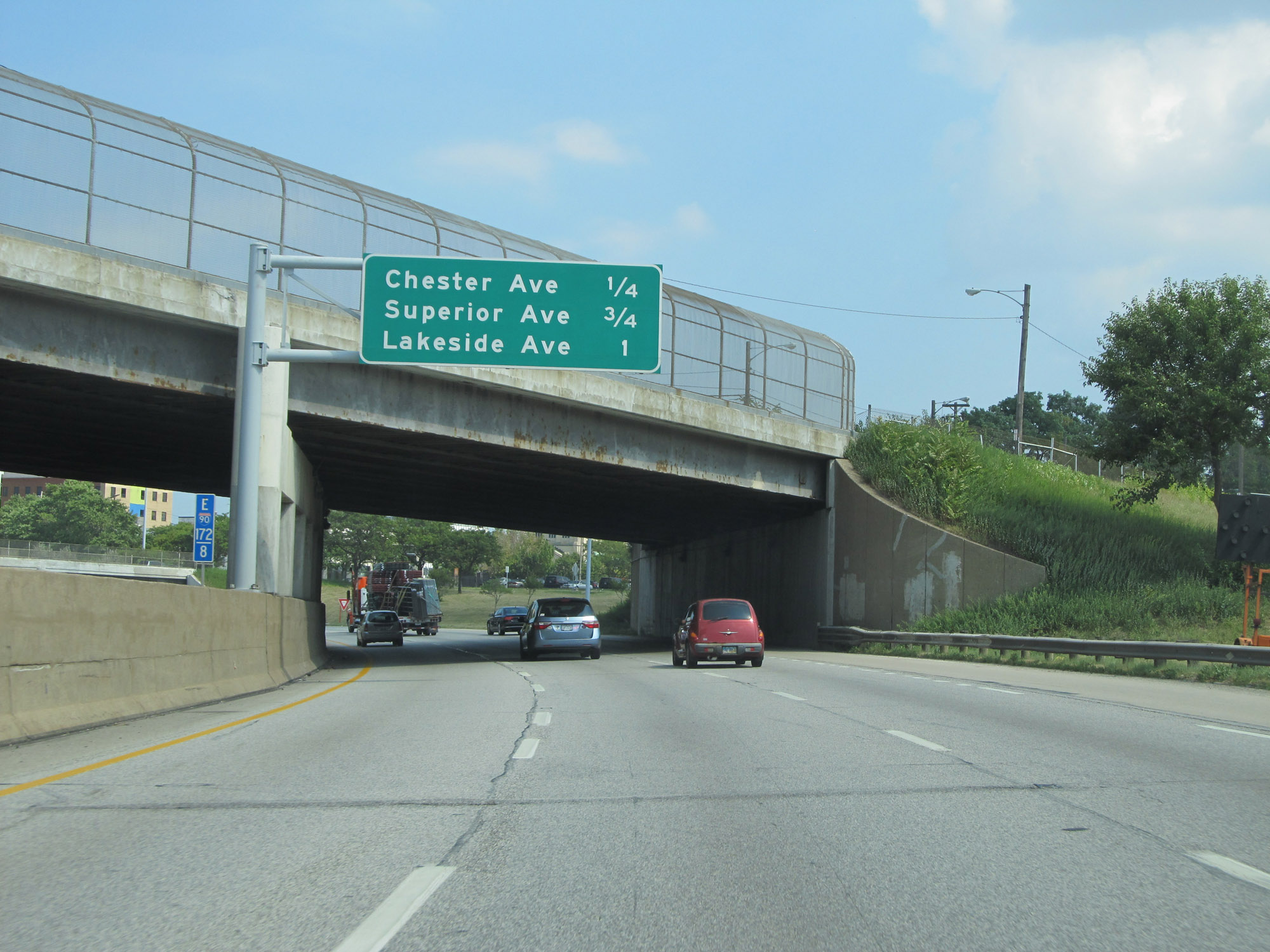
Interstate 90 East at Exit 173B: Chester Ave (Photo taken 9/7/15). |
 |
In downtown Cleveland, the speed limit on Interstate 90 East decreases to 50 mph. (Photo taken 9/7/15). |
 |
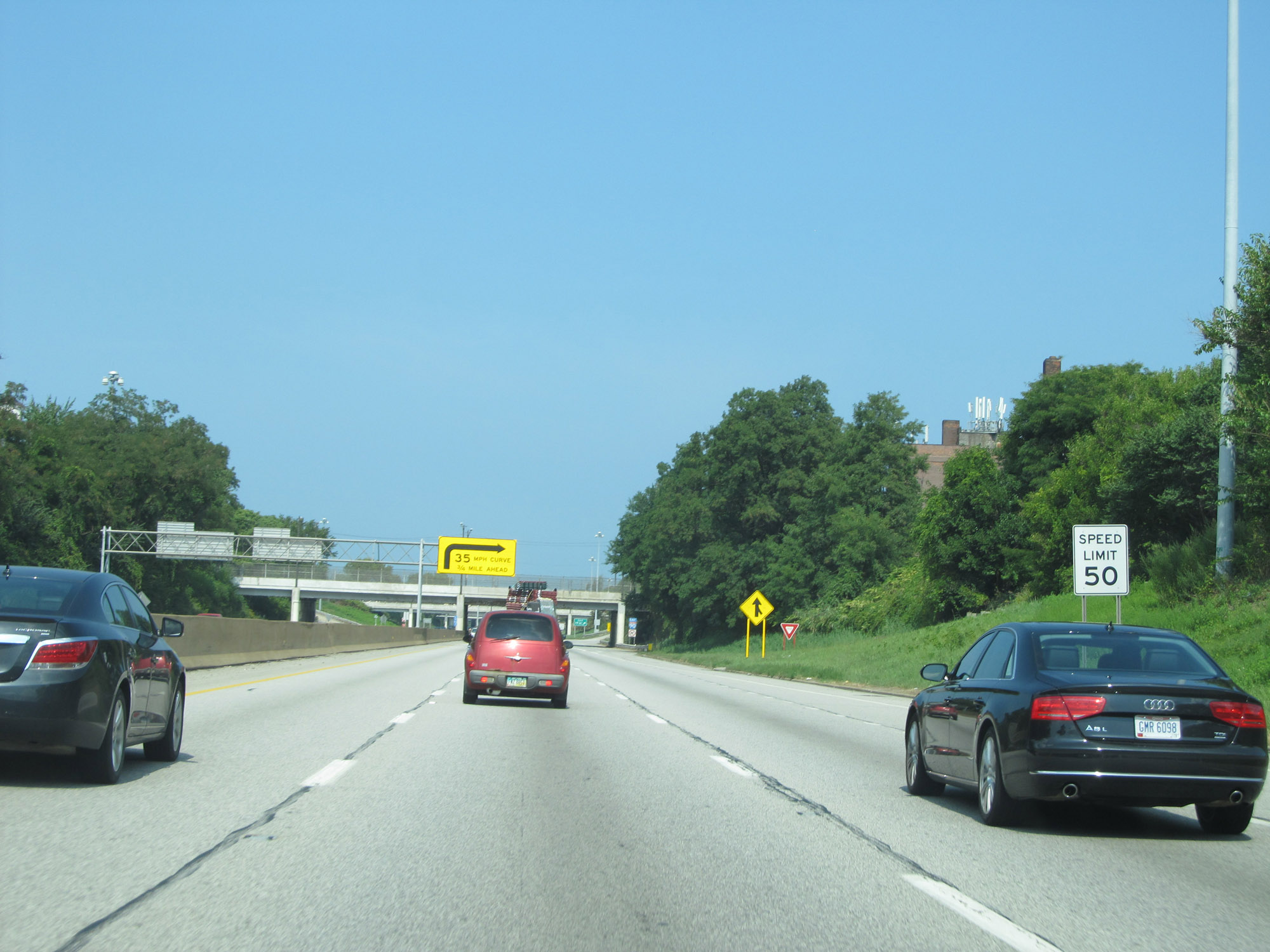
This sign warns that Interstate 90 East will traverse a very sharp 35 mph curve to the right (east) 3/4 mile ahead. This curve is certainly no joke. (Photo taken 9/7/15). |
 |
Interstate 90 East at Exit 173C: Superior Ave (Photo taken 9/7/15). |
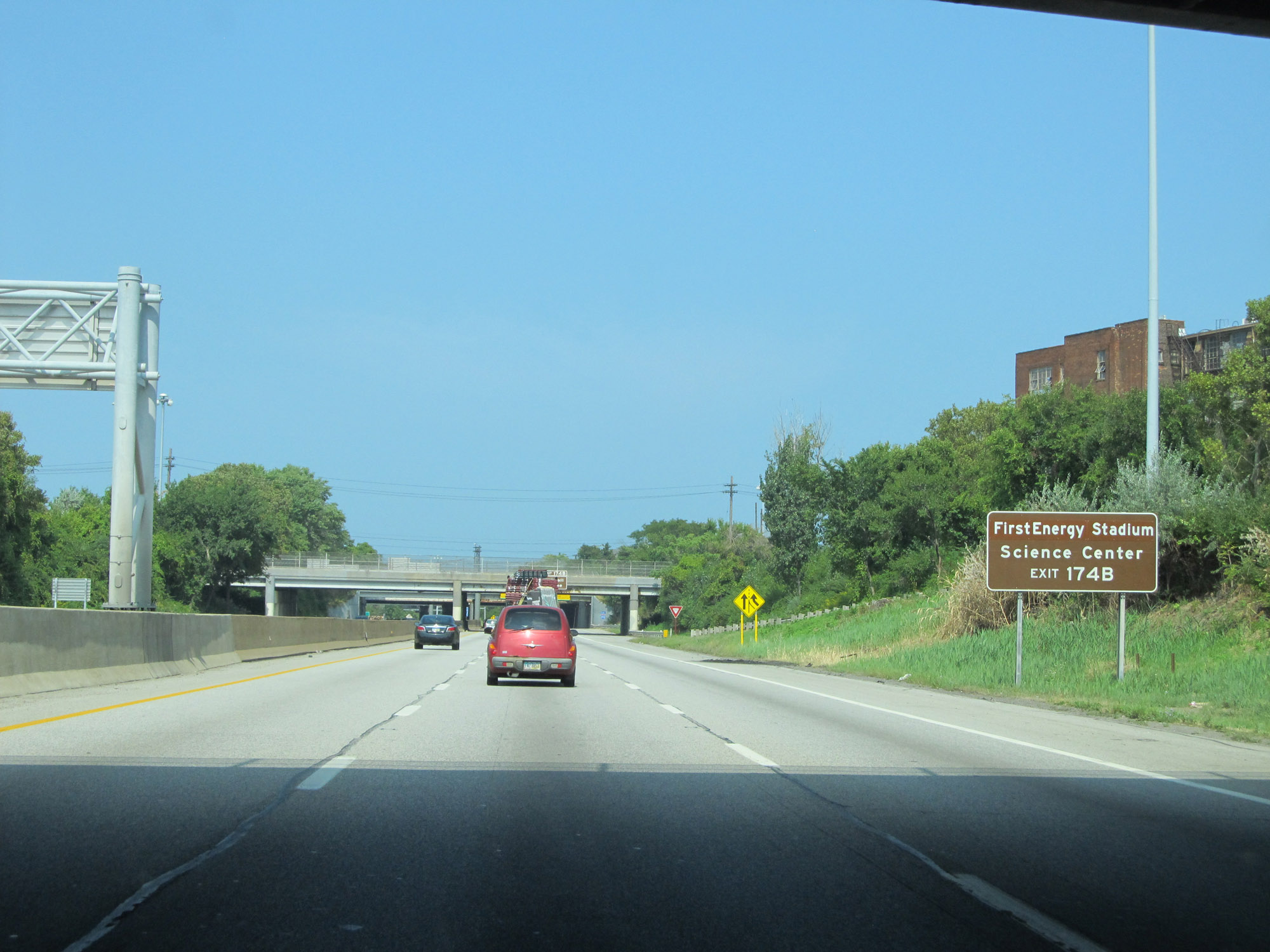 |
Take Exit 174B to First Energy Stadium and the Science Center. (Photo taken 9/7/15). |
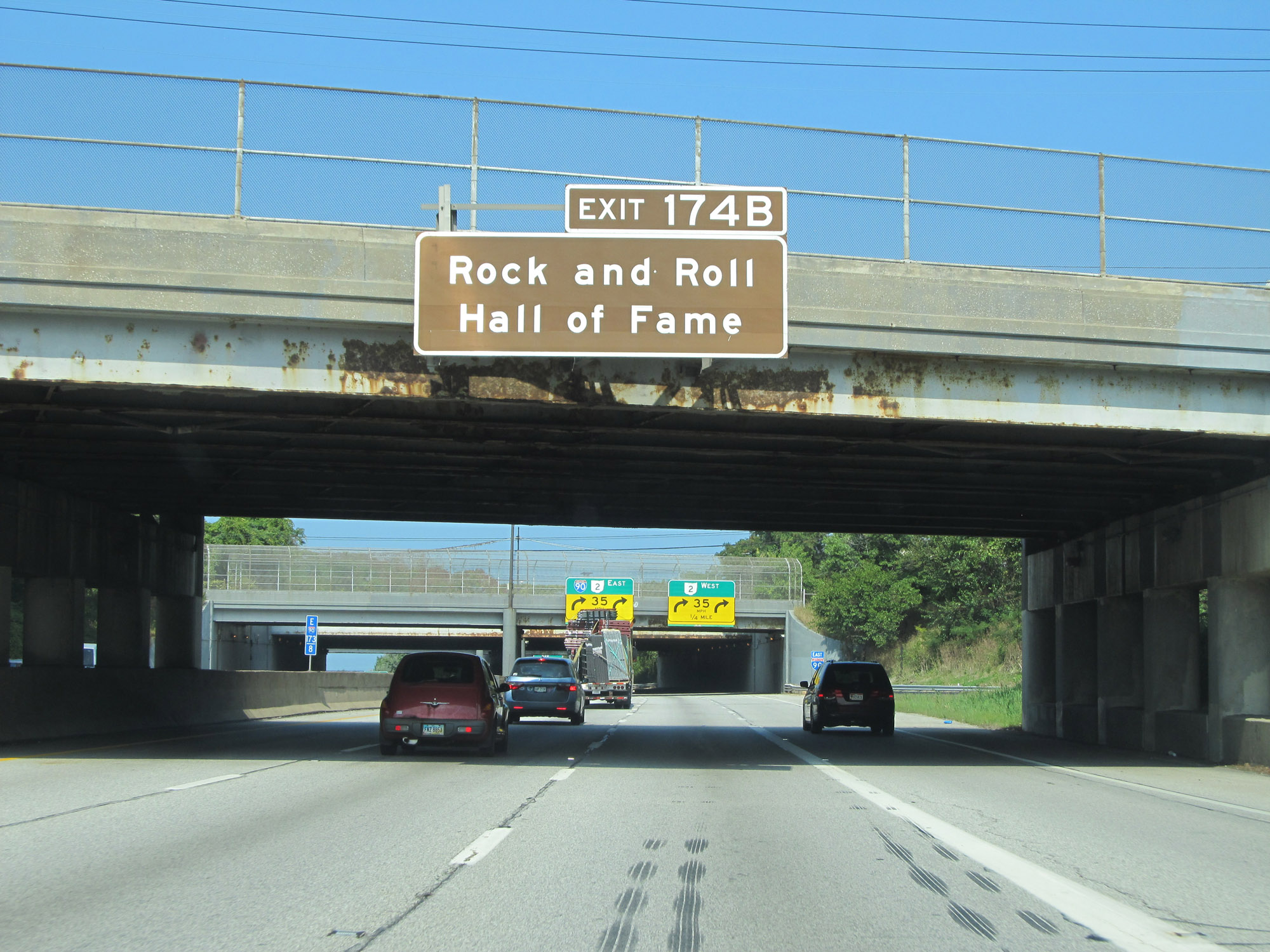 |
Also take Exit 174B to the Rock and Roll Hall of Fame. (Photo taken 9/7/15). |
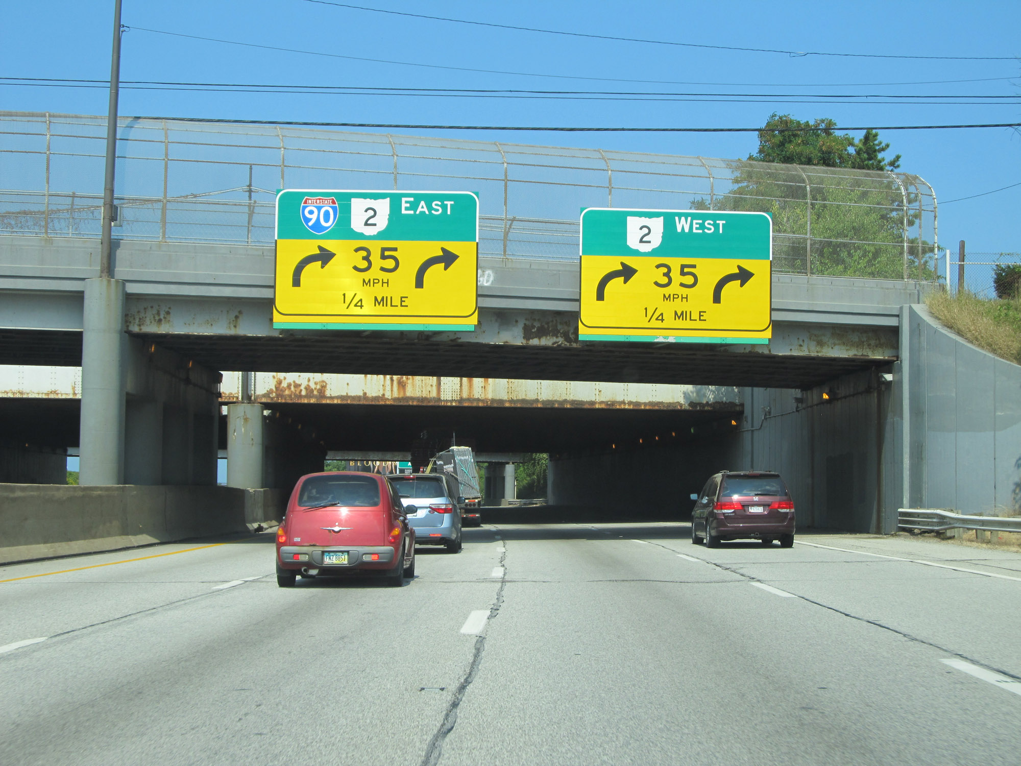 |
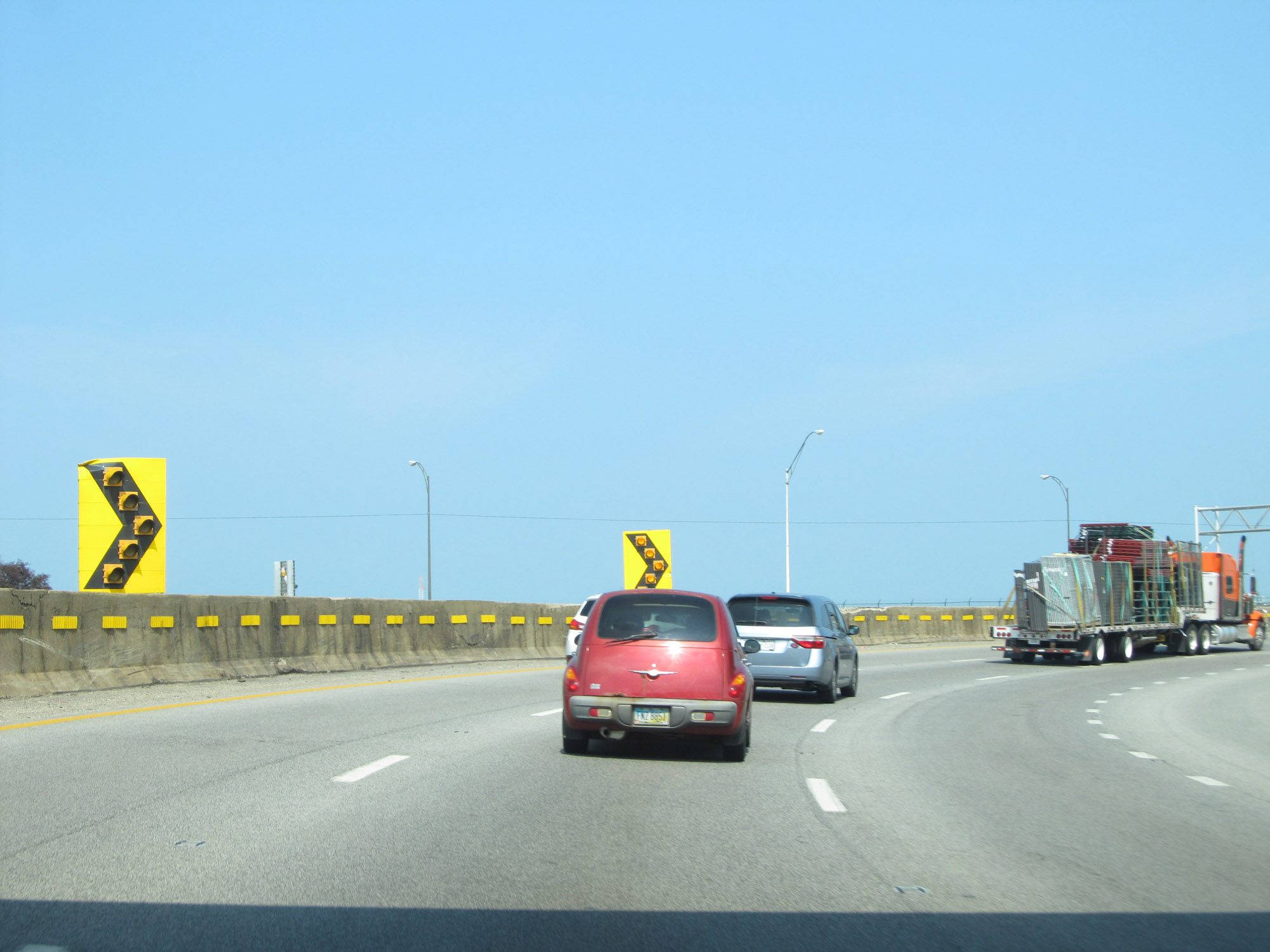
Interstate 90 East approaching the sharp curve to the right (east), also appropriately known as "Dean Man's Curve". Traffic to OH 2 West (Exit 174B) should use the two right lanes, while Interstate 90 East thru traffic should keep left if possible. (Photo taken 9/7/15). |
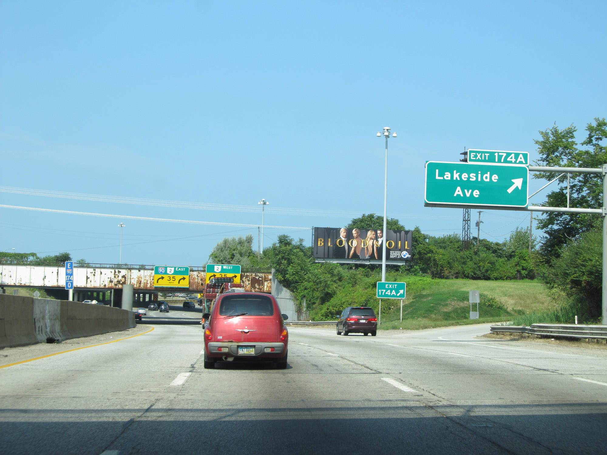 |
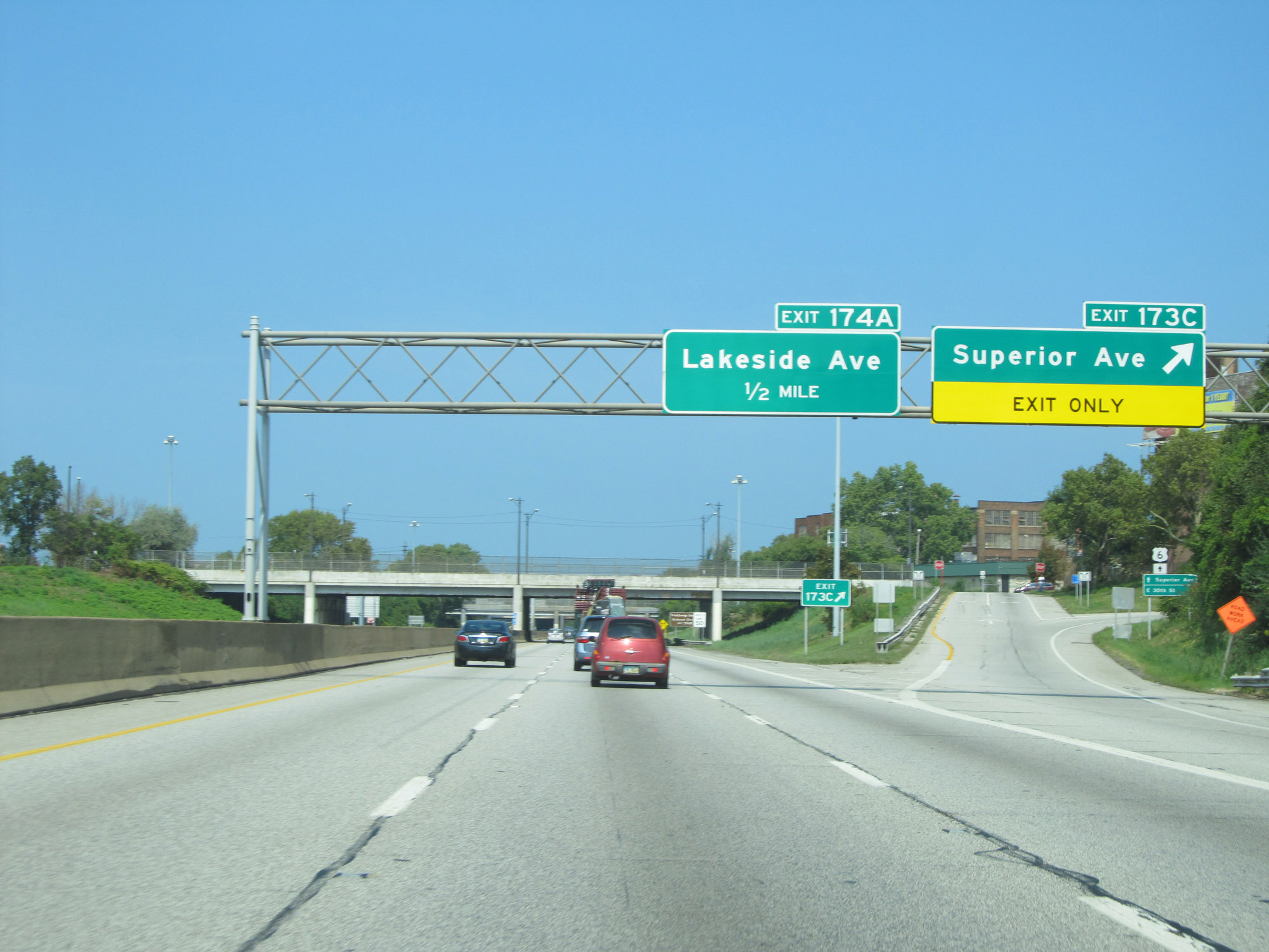
Interstate 90 East at Exit 174A: Lakeside Ave (Photo taken 9/7/15). |
 |
Interstate 90 East as it prepares to enter Dead Man's Curve. (Photo taken 9/7/15). |
 |
View on Interstate 90 East as it traverses Dean Man's Curve, curving sharply to the east. (Photo taken 9/7/15). |
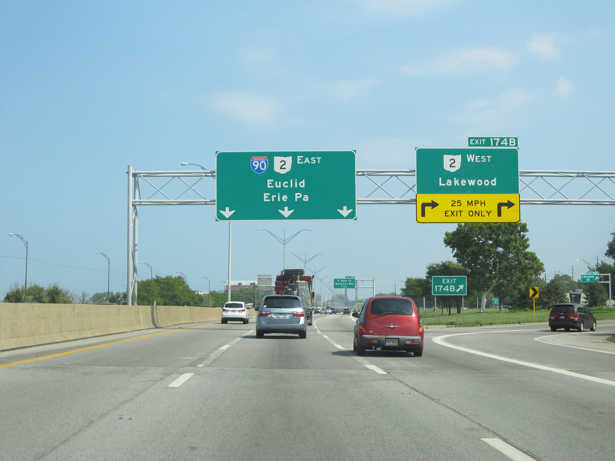 |
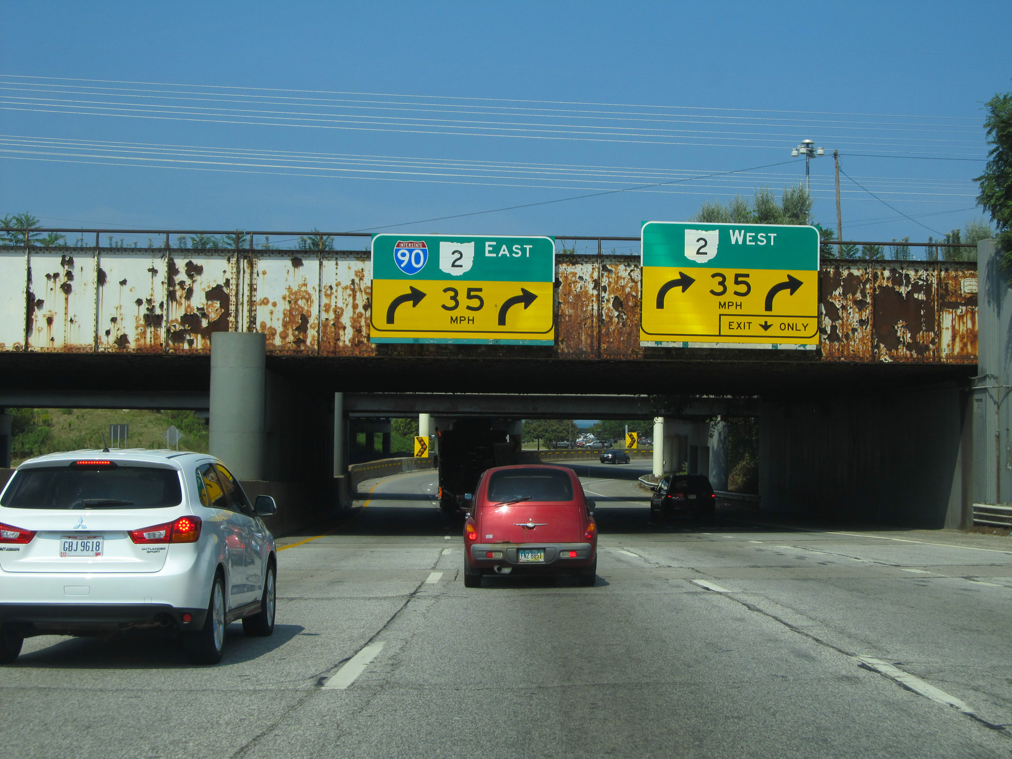
Interstate 90 East at Exit 174B: OH 2 West - Lakewood (Photo taken 9/7/15). |
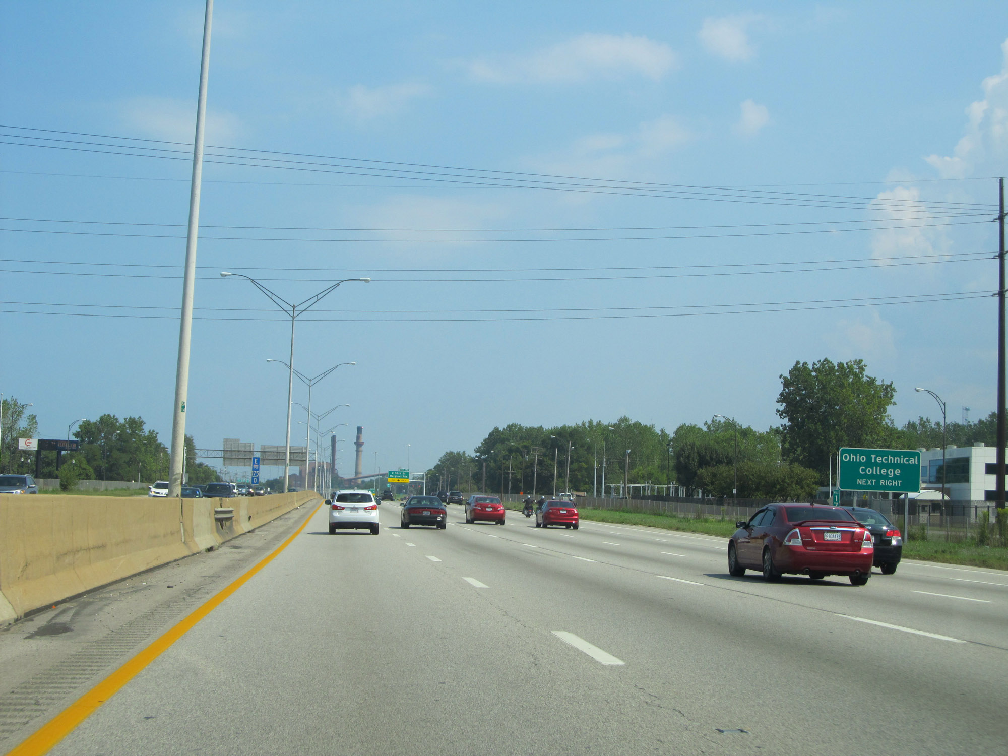 |
Take Exit 175 to Ohio Technical College. (Photo taken 9/7/15). |
 |
Interstate 90 East at Exit 175: E 55th St / Marginal Roads (Photo taken 9/7/15). |
Section 4: Cleveland (Exit 175) to Pennsylvania Border
 |
East of Exit 175, the speed limit increases to 60 mph once again. (Photo taken 9/7/15). |
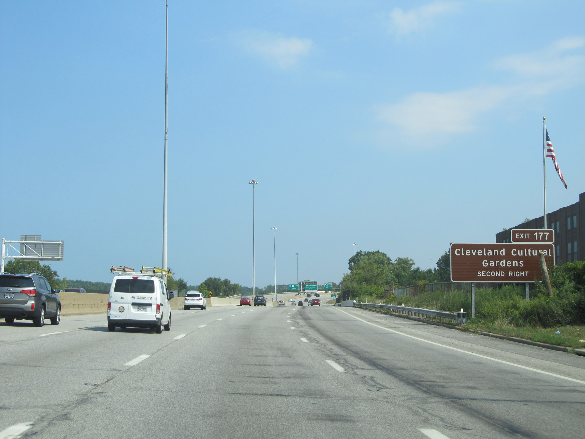 |
Take Exit 177 to Cleveland Cultural Gardens. (Photo taken 9/7/15). |
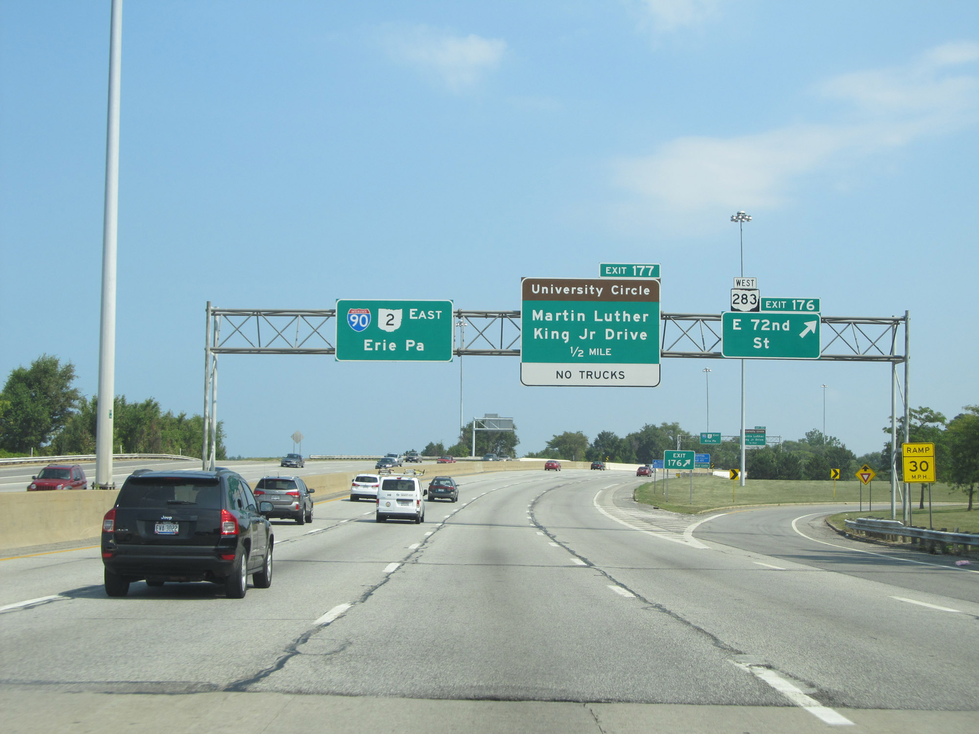 |
Interstate 90 East at Exit 176: OH 283 West - E 72nd St (Photo taken 9/7/15). |
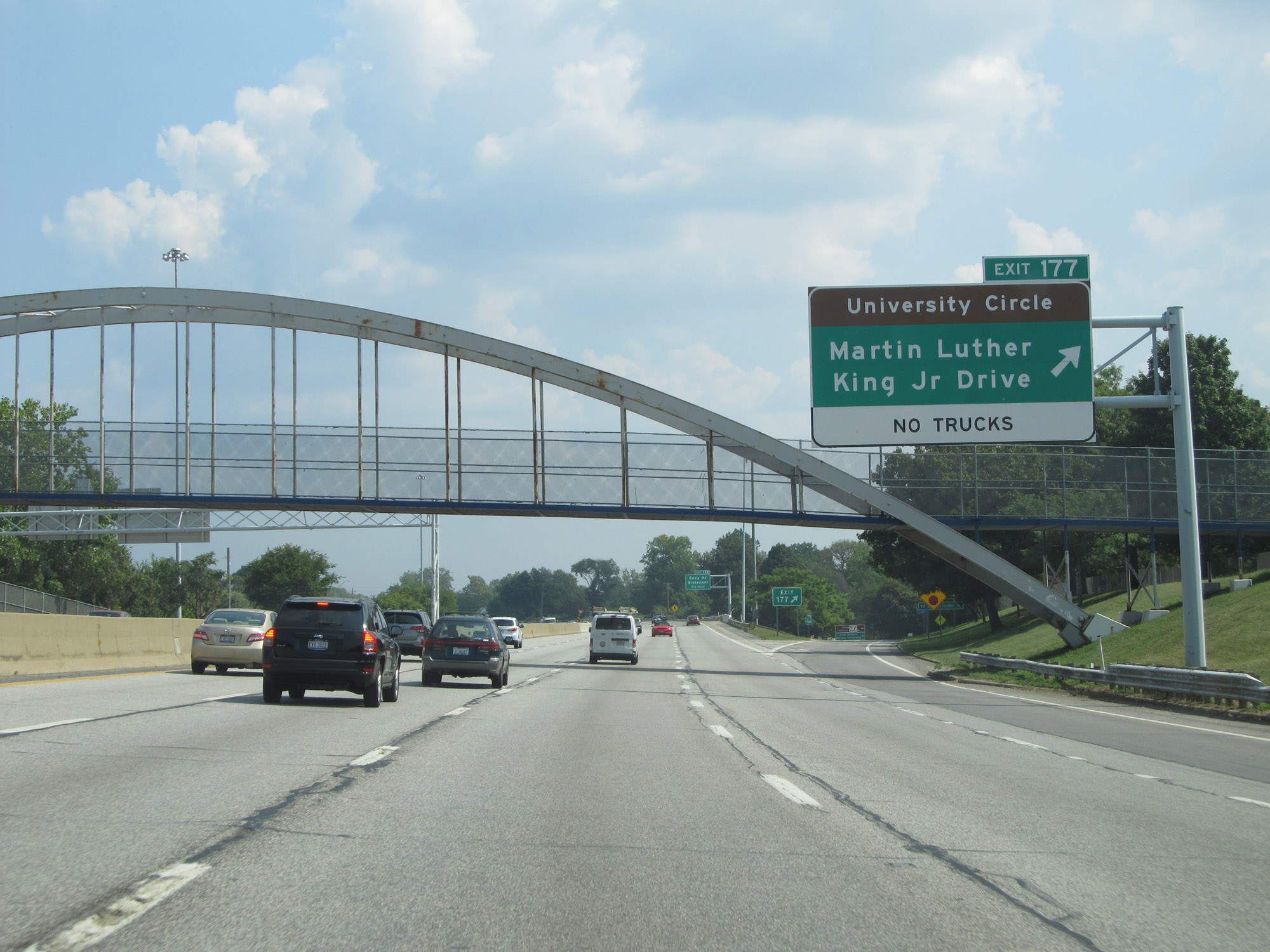 |
Interstate 90 East at Exit 177: University Circle / Martin Luther King Jr. Drive (Photo taken 9/7/15). |
 |
Interstate 90 East at Exit 178: Eddy Rd / Bratenahl (Photo taken 9/7/15). |
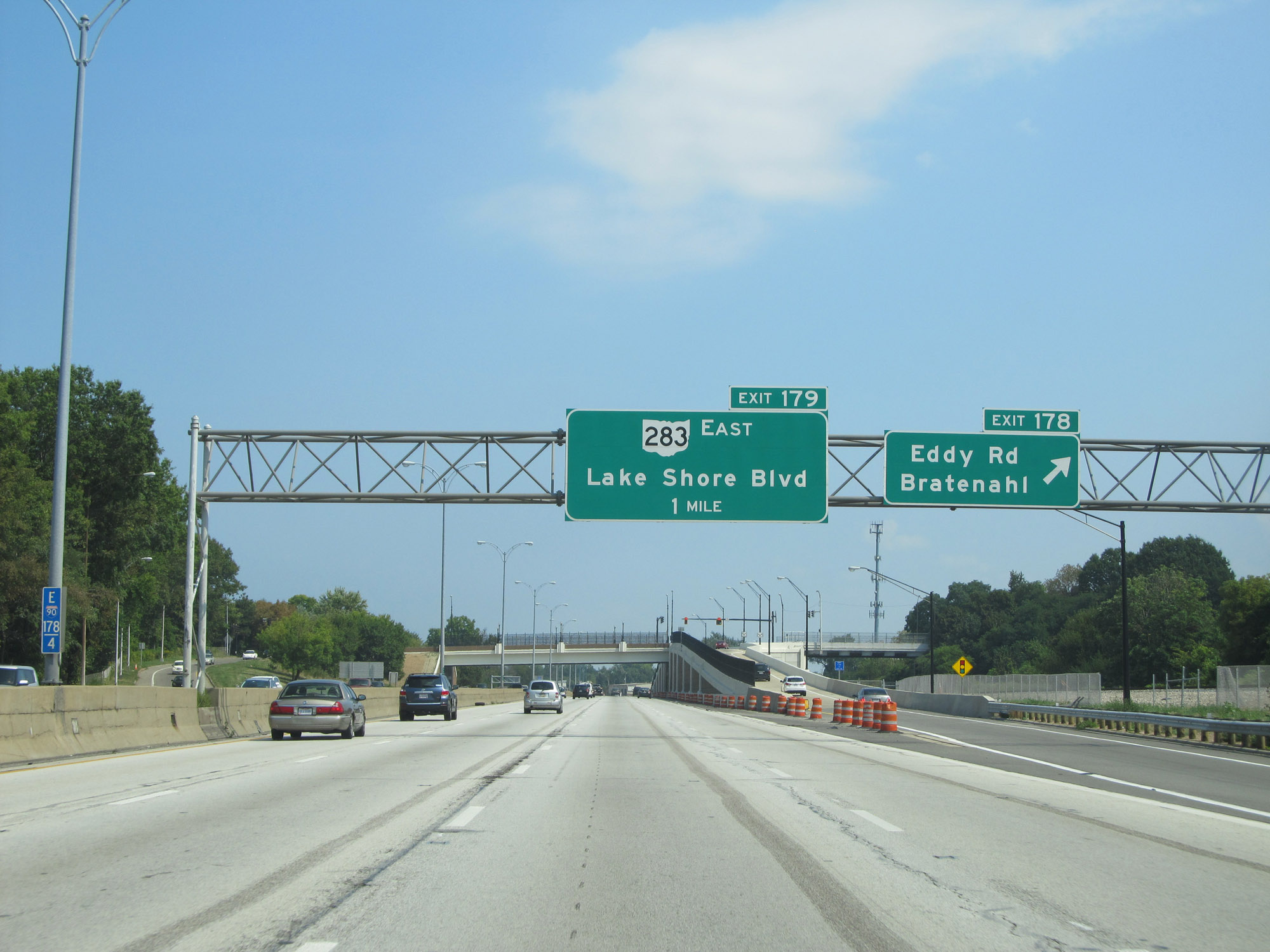
 |
Interstate 90 East at Exit 179: OH 283 East - Lake Shore Blvd (Photo taken 9/7/15). |
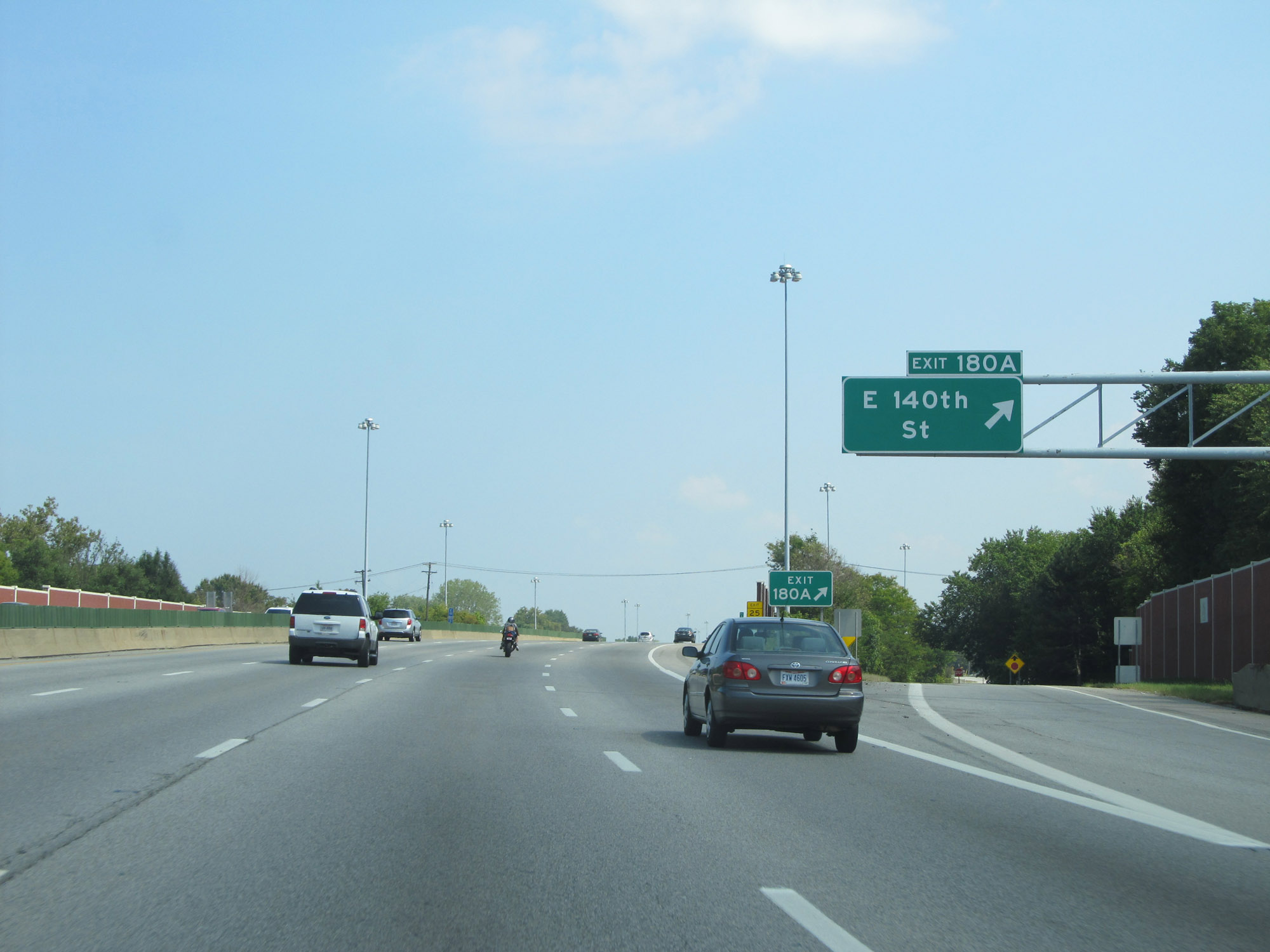 |
Interstate 90 East at Exit 180A: E 140th St (Photo taken 9/7/15). |
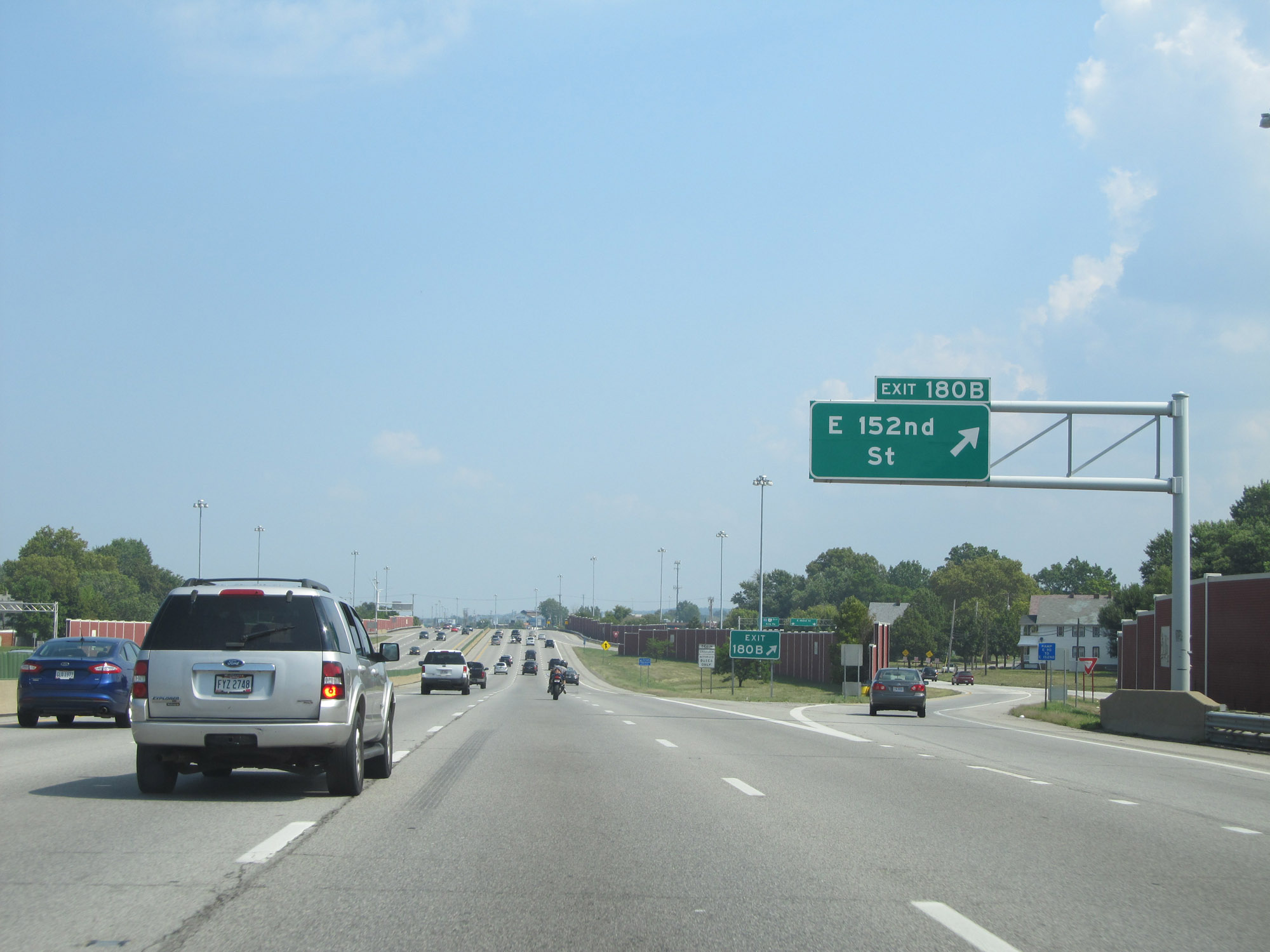 |
Interstate 90 East at Exit 180B: E 152nd St (Photo taken 9/7/15). |
 |
View on Interstate 90 East at mile marker 181. (Photo taken 9/7/15). |
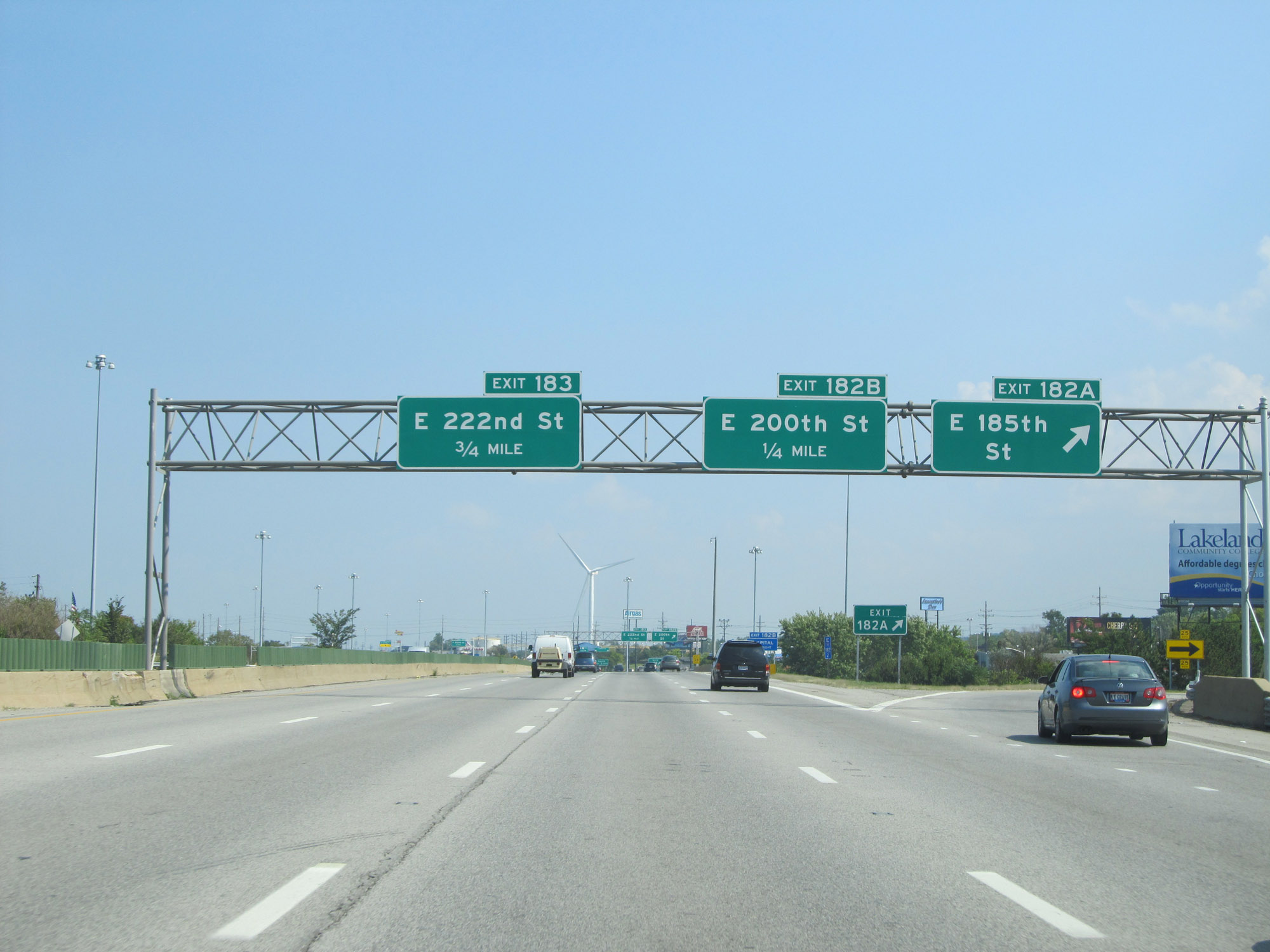 |
Interstate 90 East at Exit 182A: E 185th St (Photo taken 9/7/15). |
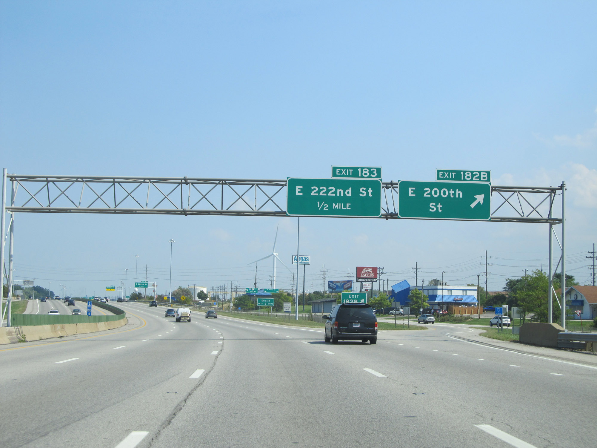 |
Interstate 90 East at Exit 182B: E 200th St (Photo taken 9/7/15). |
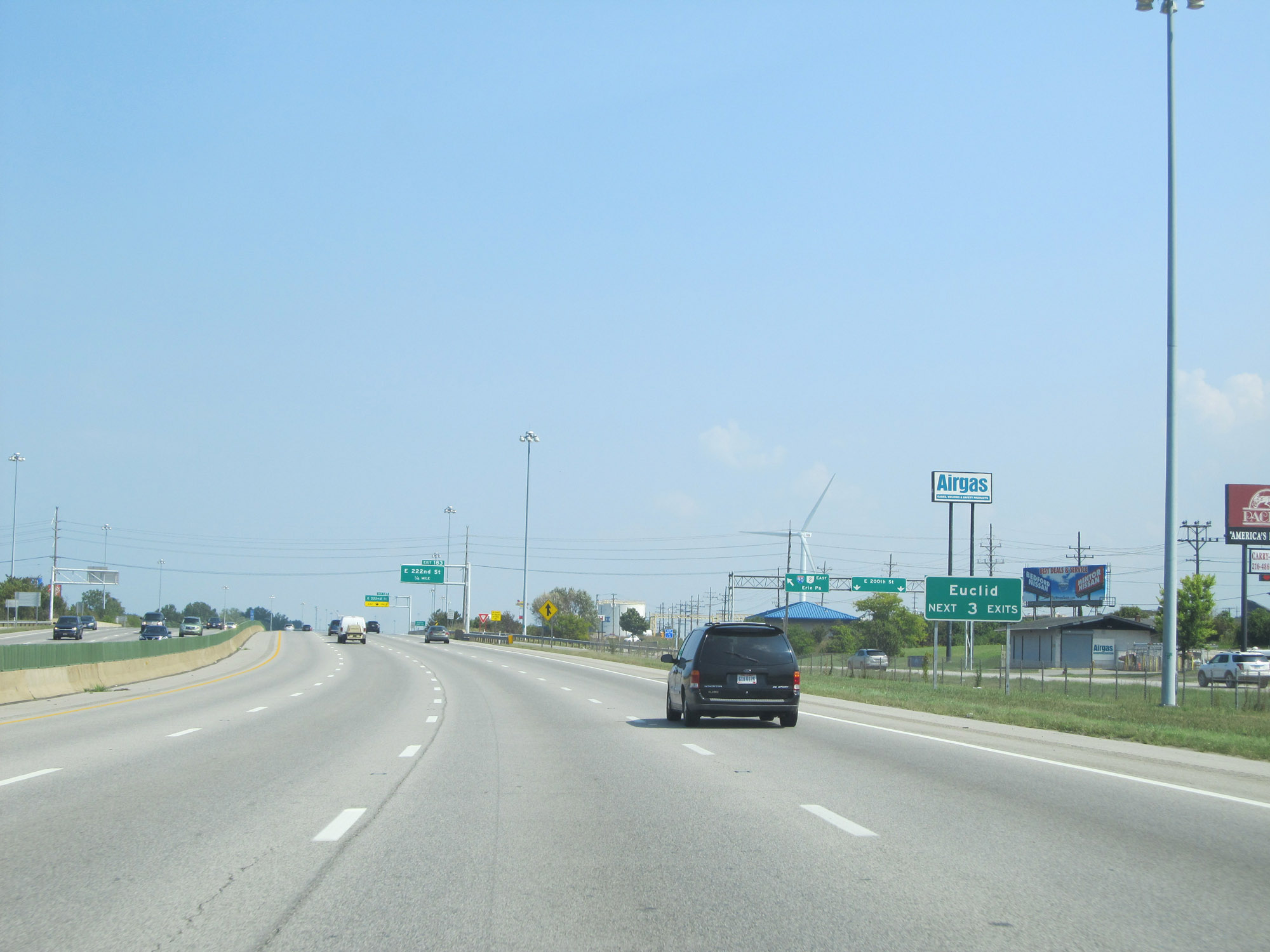 |
Take any of the next 3 exits to Euclid. (Photo taken 9/7/15). |
 |
Interstate 90 East at Exit 183: E 222nd St (Photo taken 9/7/15). |
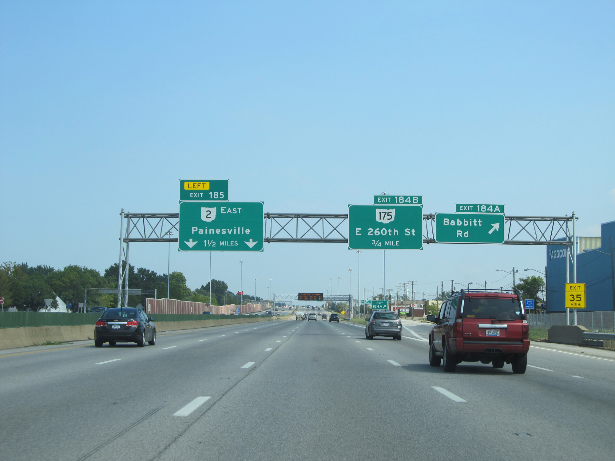 |
Interstate 90 East at Exit 184A: Babbitt Rd (Photo taken 9/7/15). |
 |
Interstate 90 East at Exit 184B: OH 175 - E 260th St (Photo taken 9/7/15). |
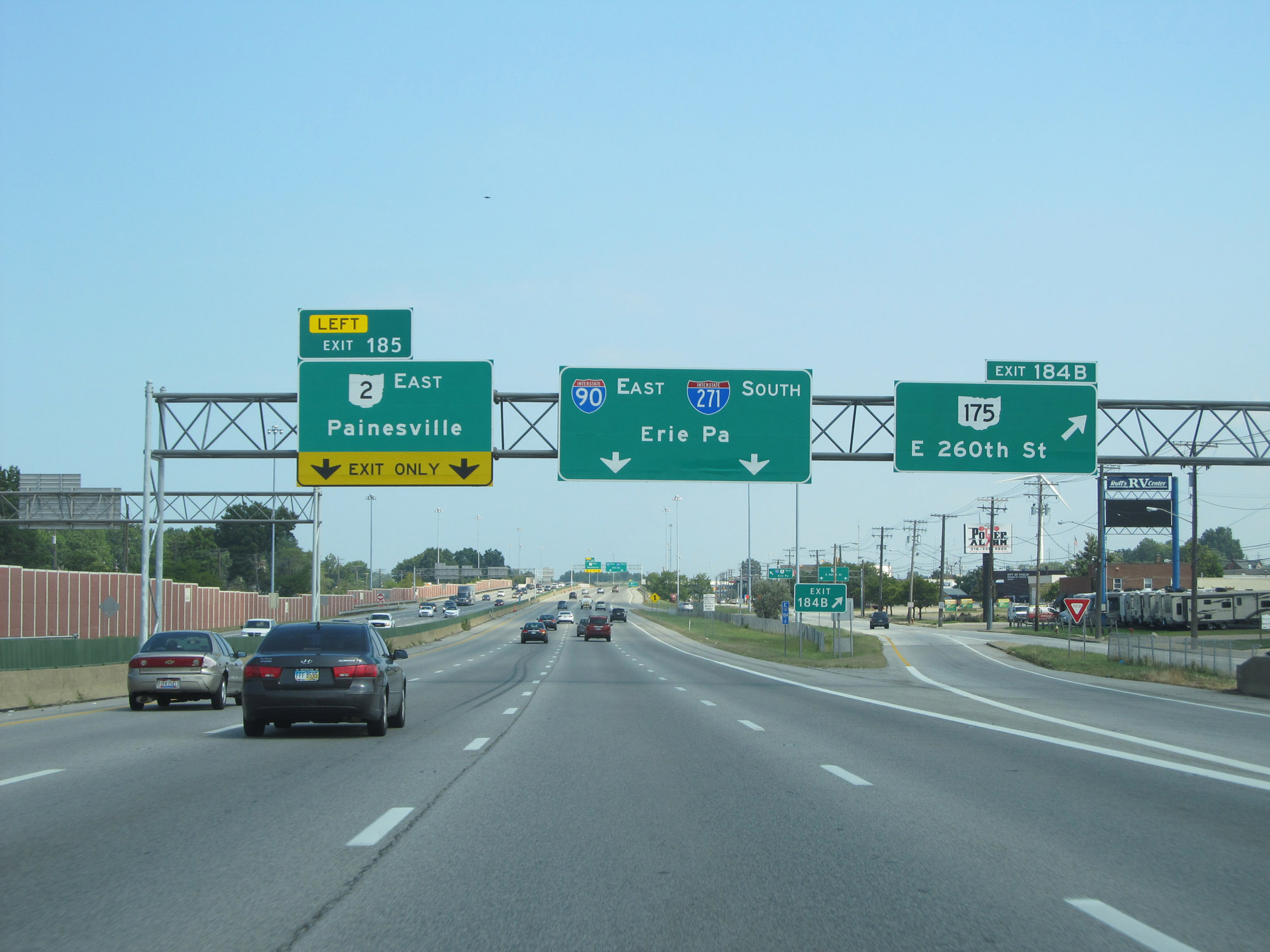
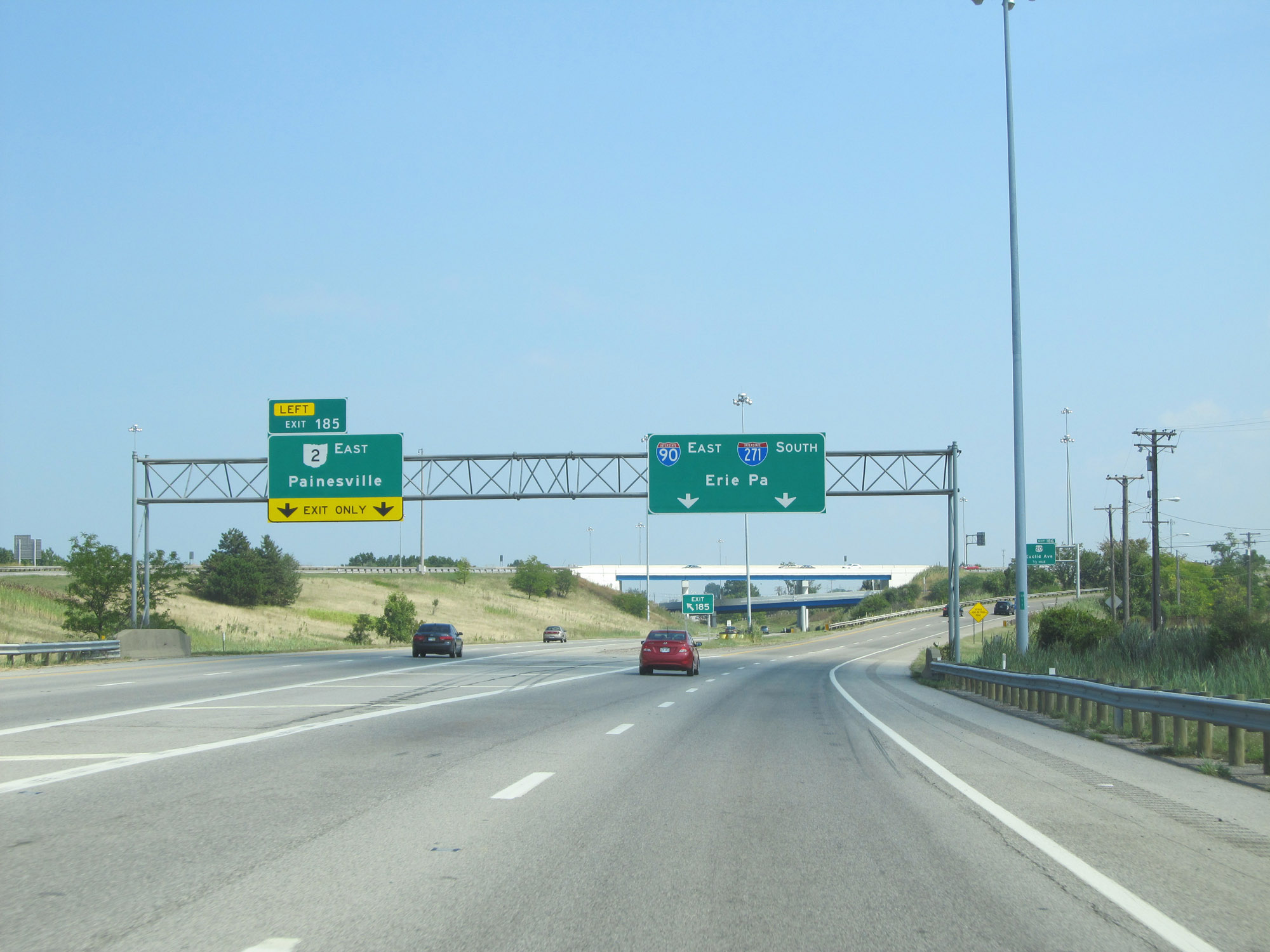 |
Interstate 90 East at Exit 185: OH 2 East - Painesville (Photo taken 9/7/15). |
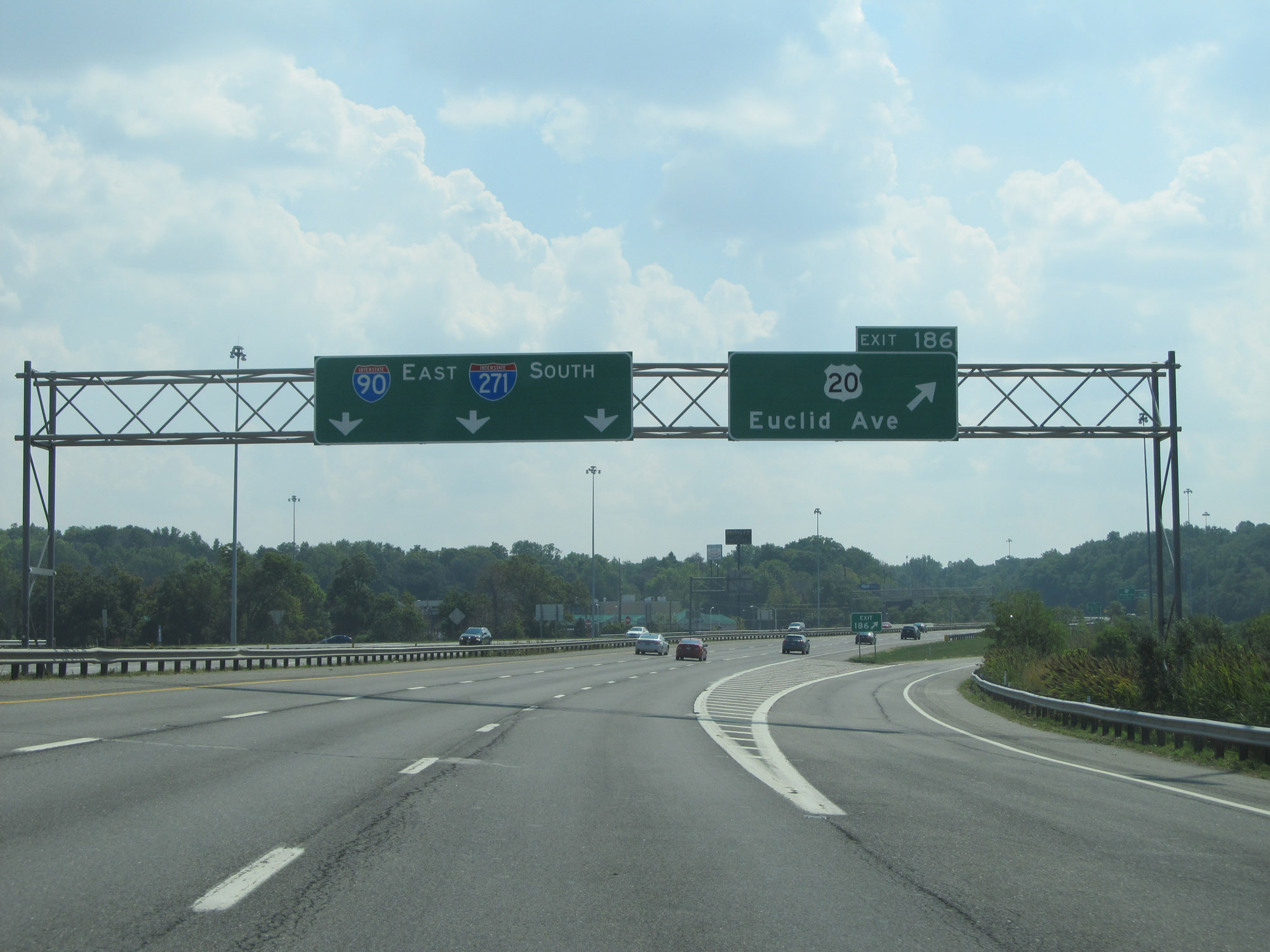 |
Interstate 90 East at Exit 186: US 20 - Euclid Ave (Photo taken 9/7/15). |
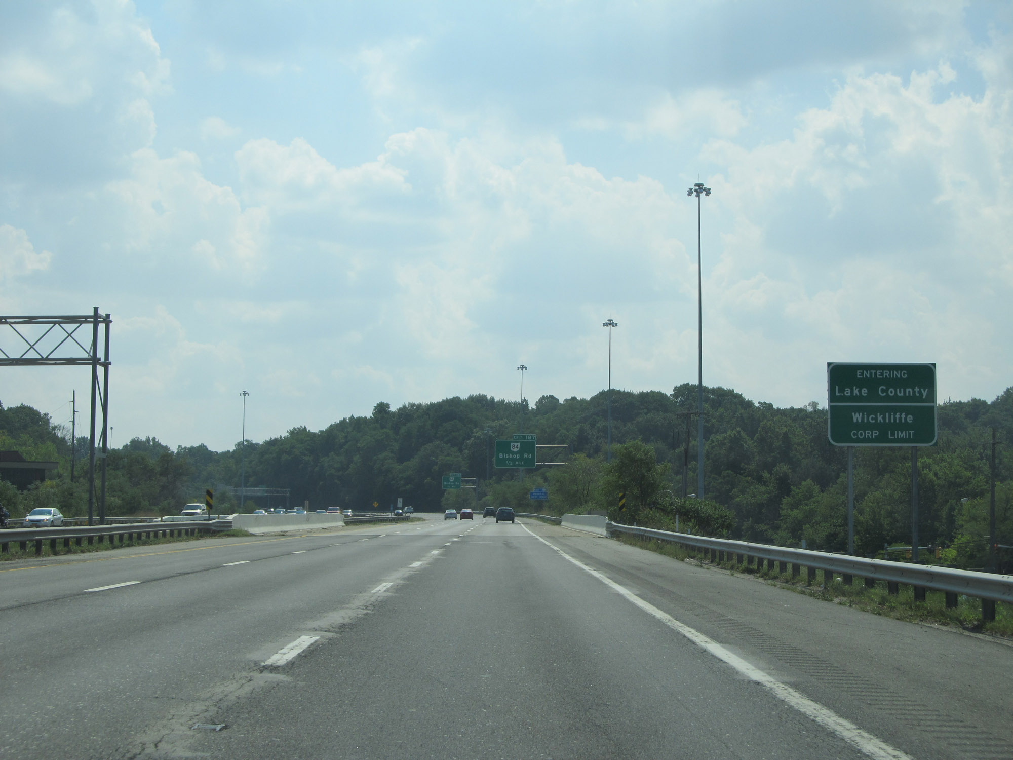 |
East of Exit 186, Interstate 90 East enters Lake County. (Photo taken 9/7/15). |
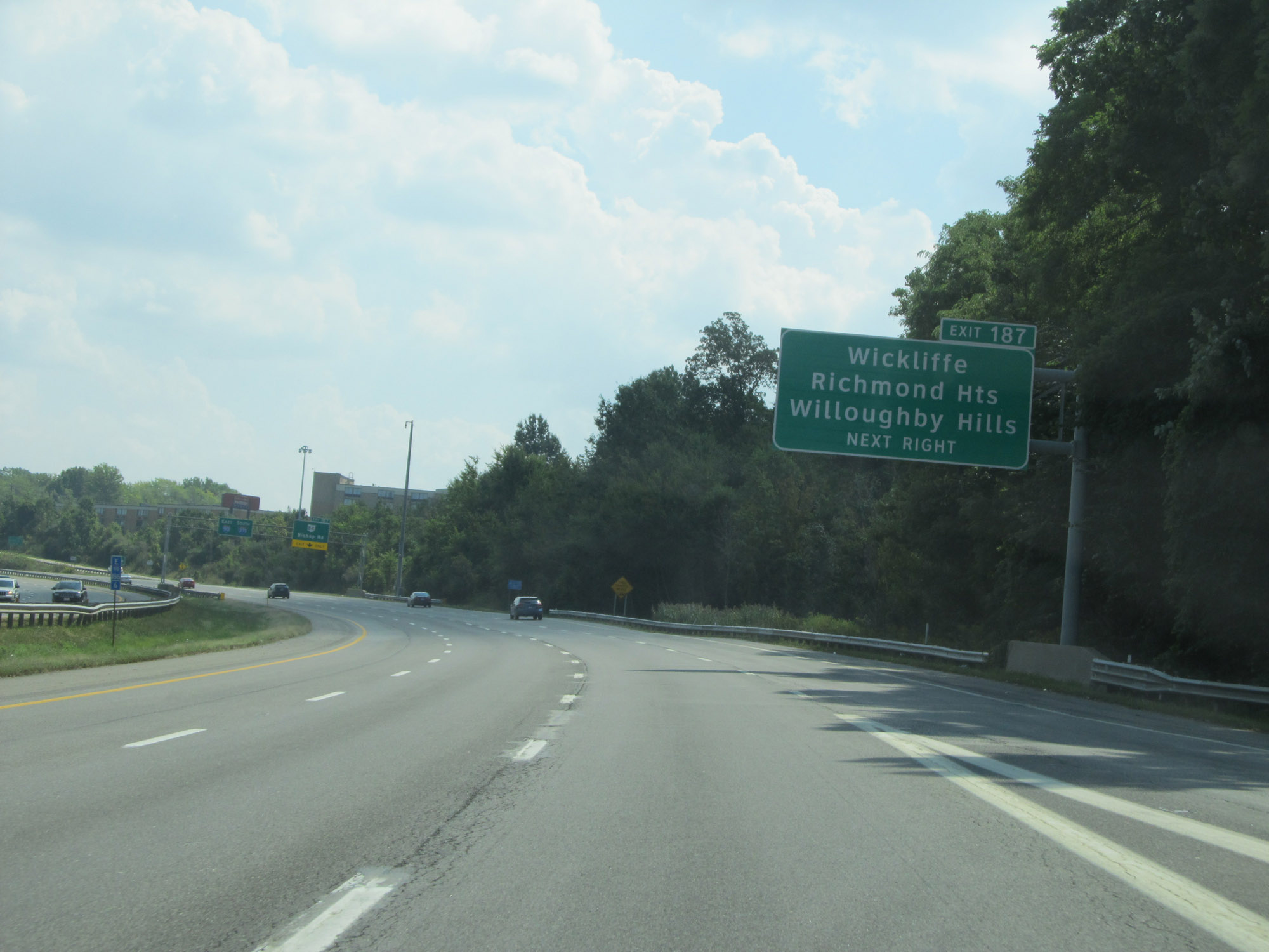 |
Take Exit 187 to Wickliffe, Richmond Heights, and Willoughby Hills (Photo taken 9/7/15). |
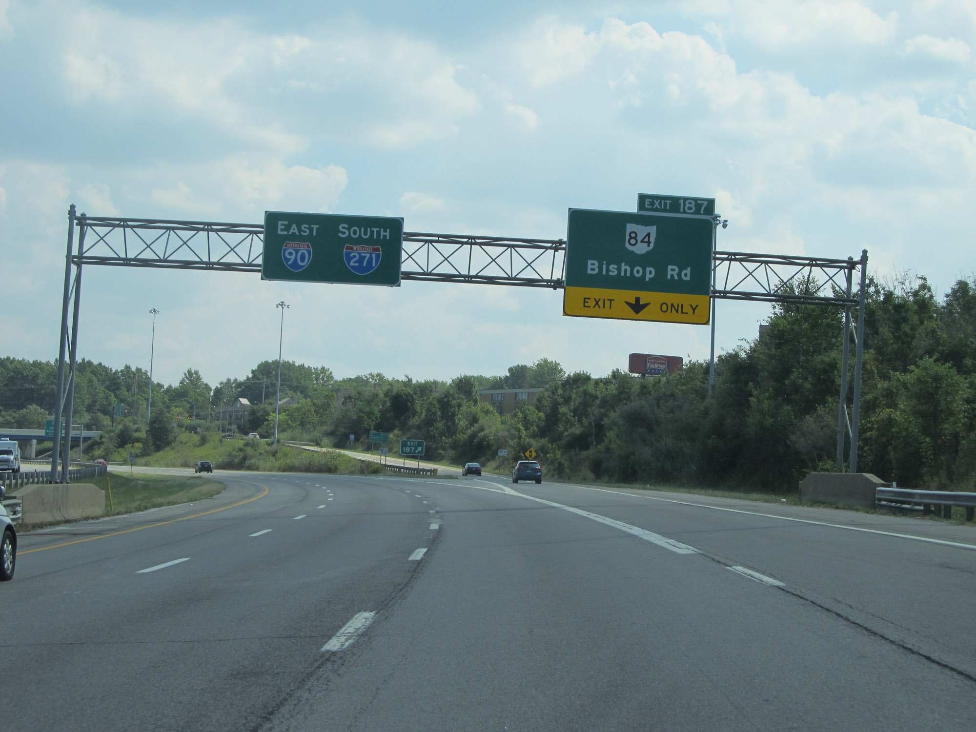 |
Interstate 90 East at Exit 187: OH 84 - Bishop Rd (Photo taken 9/7/15). |
 |
Interstate 90 East approaching Exit 188 - 1 1/2 miles. (Photo taken 9/7/15). |
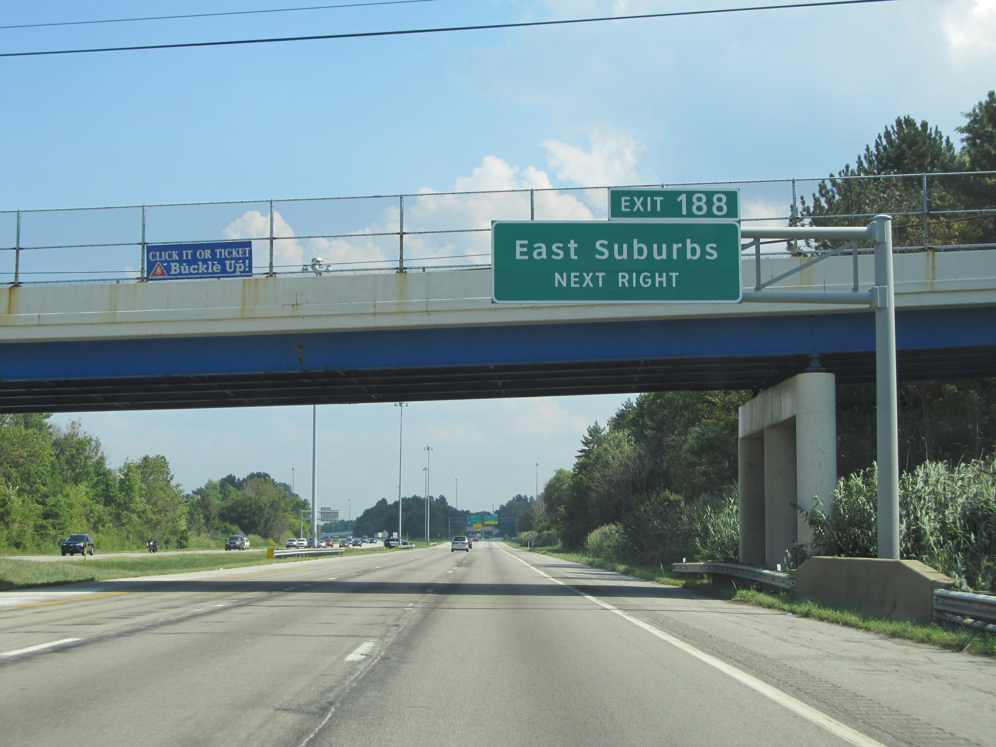 |
Take Exit 188 (Interstate 271 South) to the East Suburbs of Cleveland. (Photo taken 9/7/15). |
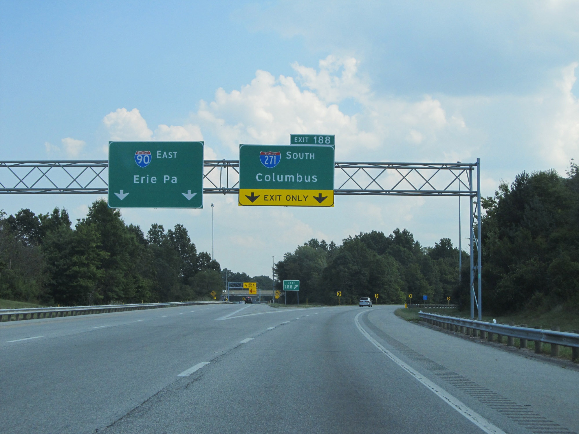 |
Interstate 90 East at Exit 188: Interstate 271 South - Columbus (Photo taken 9/7/15). |
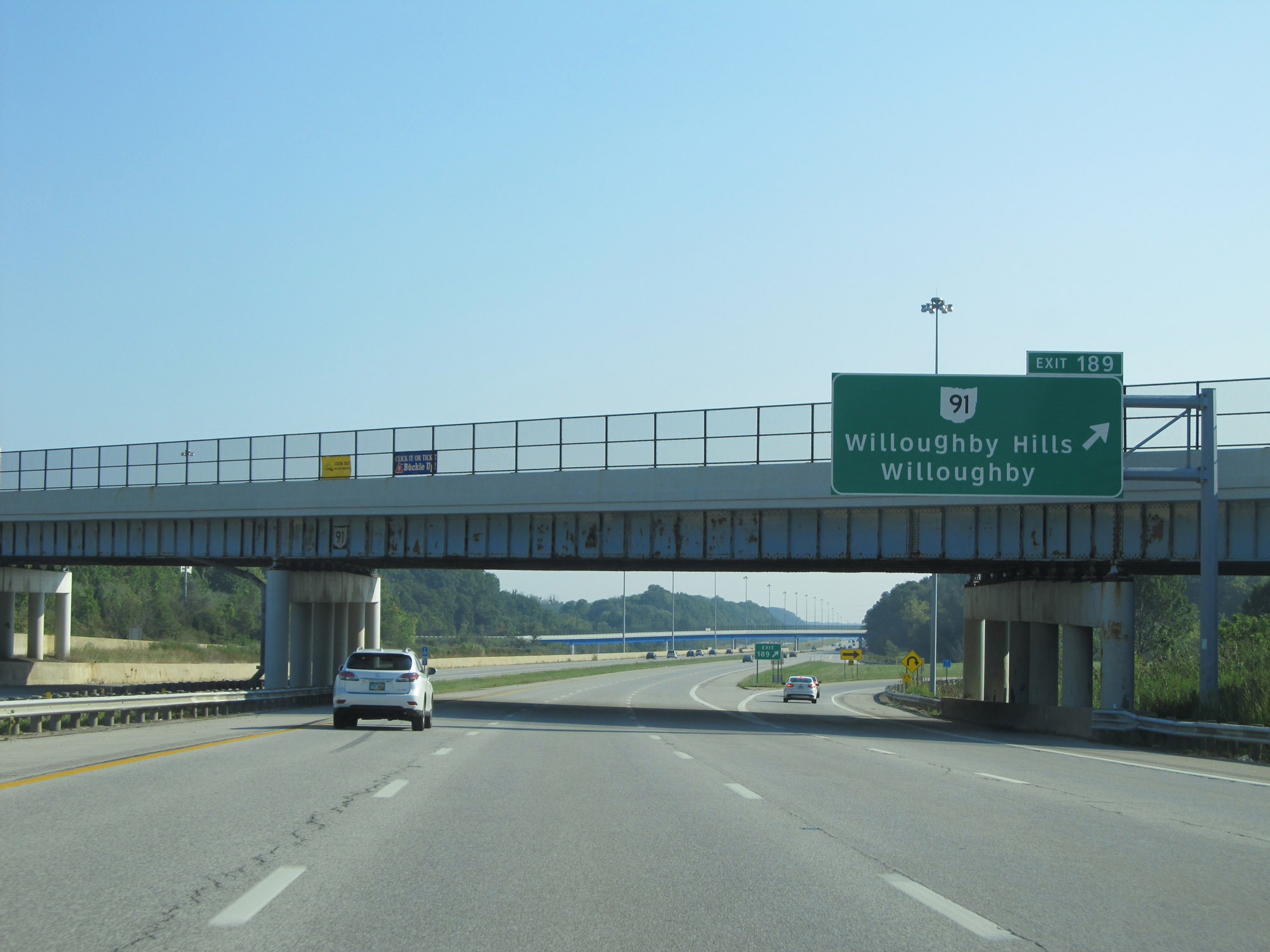 |
Interstate 90 East at Exit 189: OH 91 - Willoughby Hills / Willoughby (Photo taken 9/6/15). |
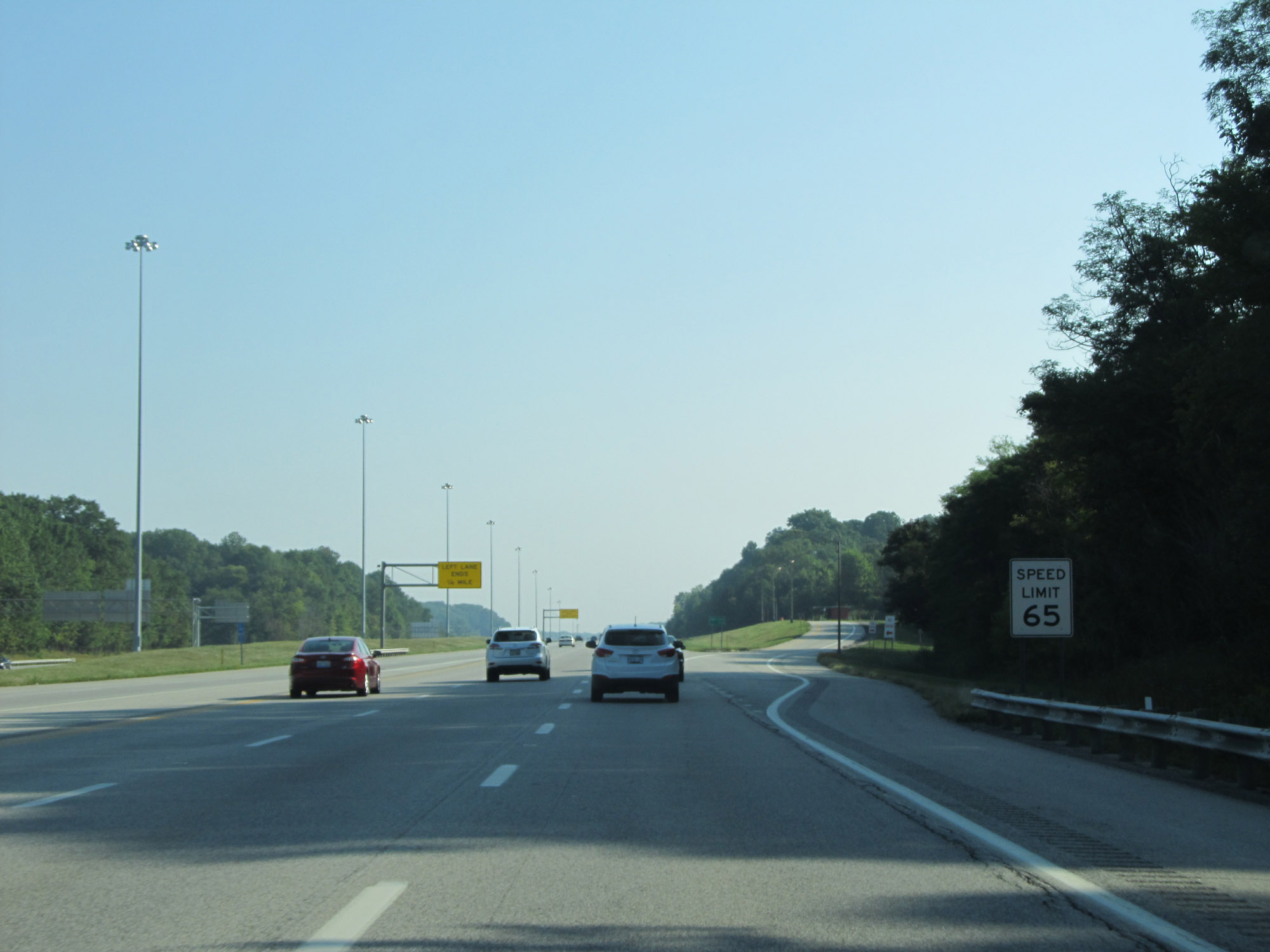 |
East of Exit 189, the speed limit increases to 65 mph. (Photo taken 9/6/15). |
 |
Interstate 90 East reassurance shield. (Photo taken 9/6/15). |
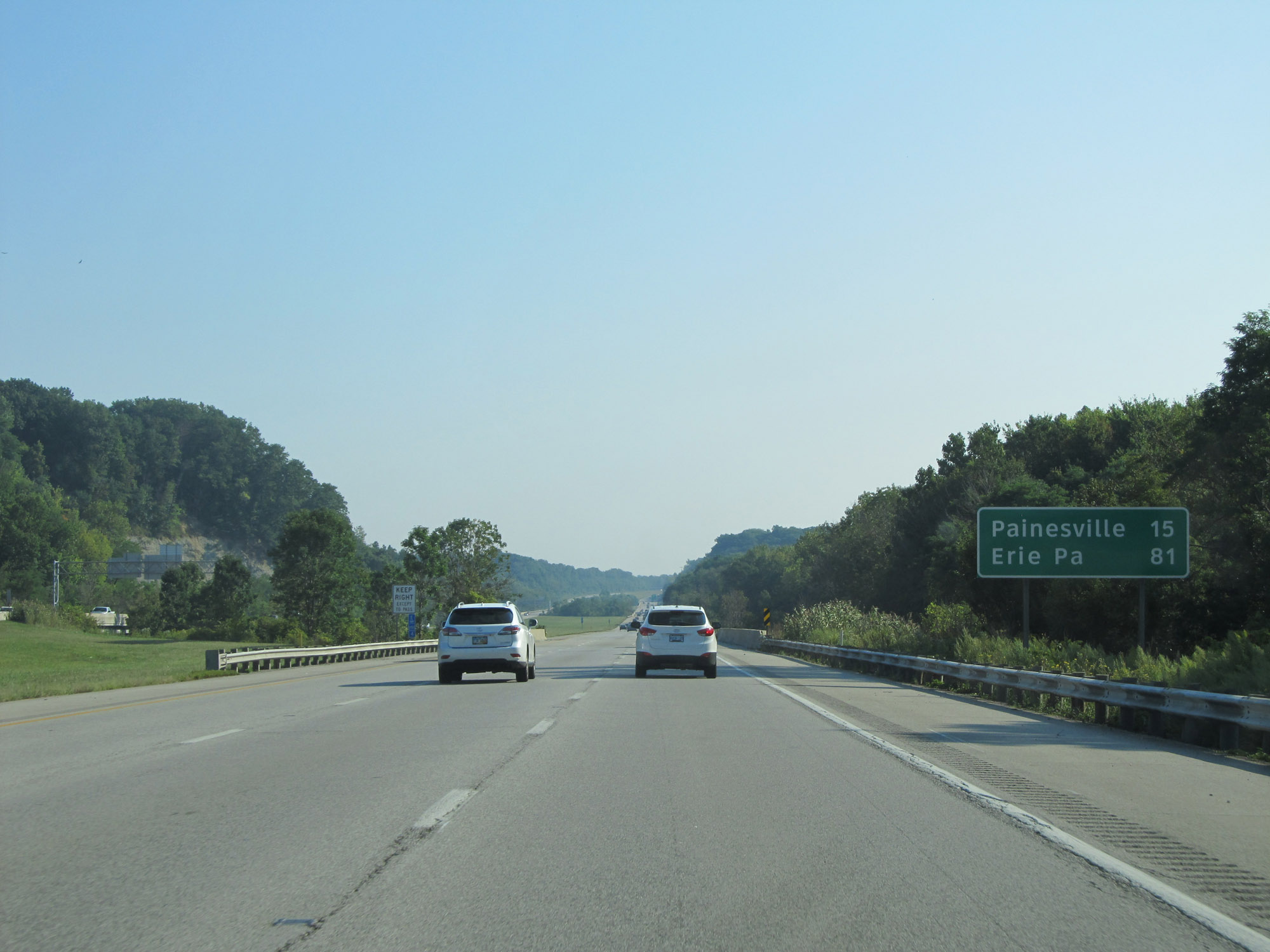 |
Mileage sign on Interstate 90 East. It's 15 miles to Painesville and 81 miles to Erie, PA. (Photo taken 9/6/15). |
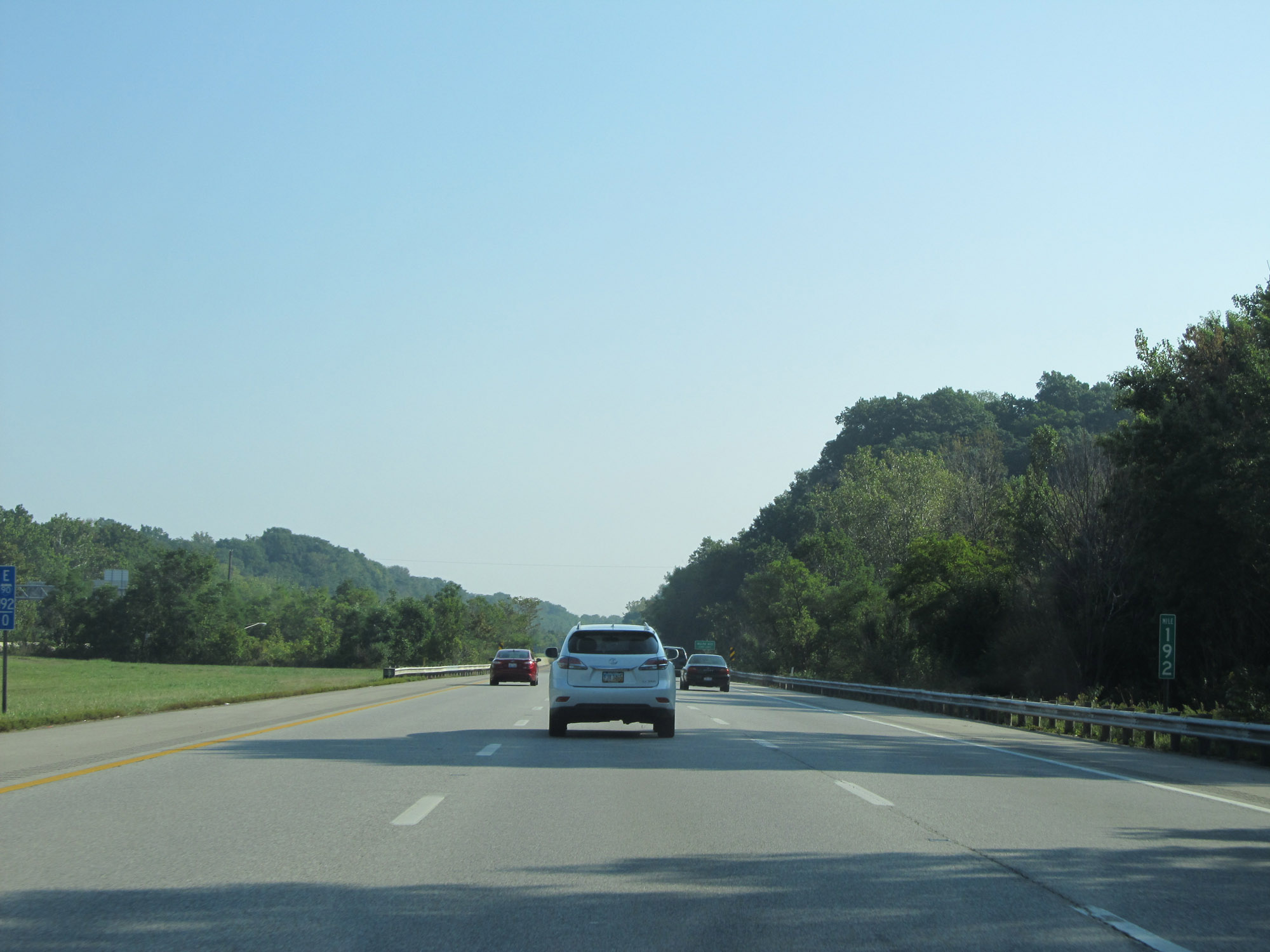 |
Interstate 90 East at mile marker 192. (Photo taken 9/6/15). |
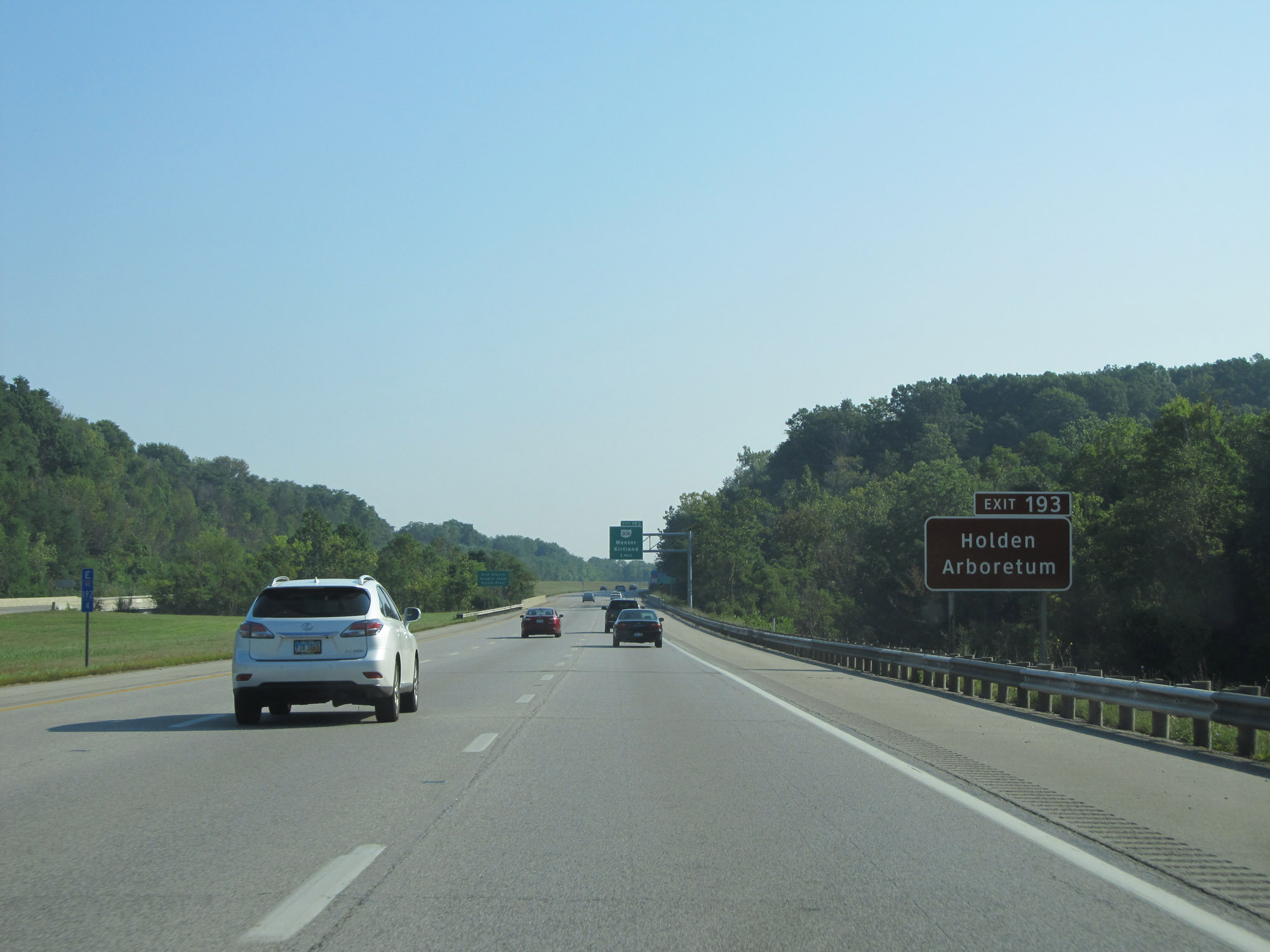 |
Take Exit 193 to Holden Arboretum. (Photo taken 9/6/15). |
 |
Also take Exit 193 to Lakeland Community College, Farmpark, and the James A. Garfield Historical Site. (Photo taken 9/6/15). |
 |
Interstate 90 East at Exit 193: OH 306 - Mentor / Kirtland (Photo taken 9/6/15). |
 |
Take Exit 195 to Mentor Lagoons and Mentor Civic Center. (Photo taken 9/6/15). |
 |
Take Exit 195 to Mentor and Kirtland Hills as well. (Photo taken 9/6/15). |
 |
Interstate 90 East at Exit 195: OH 615 - Center St (Photo taken 9/6/15). |
 |
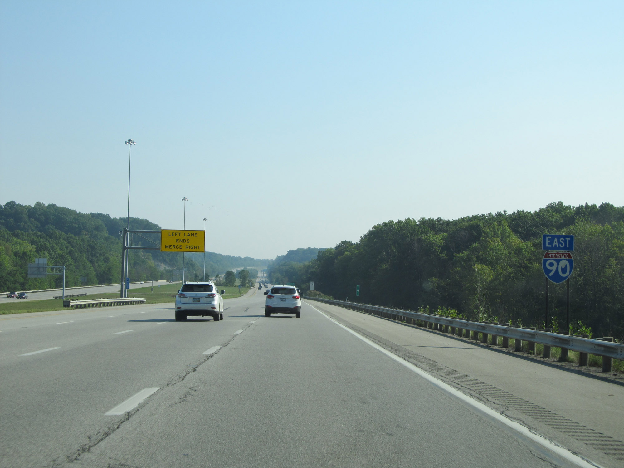
At mile marker 196.4, the left lane prepares to come to an end reducing Interstate 90 East to two lanes. (Photo taken 9/6/15). |
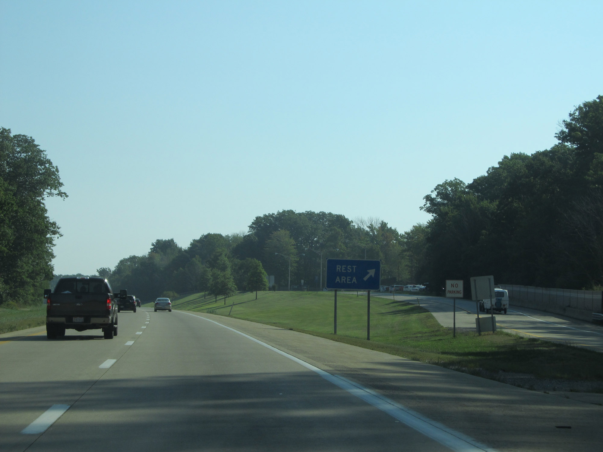 |
Rest Area on Interstate 90 East in Lake County. (Photo taken 9/6/15). |
 |
View on Interstate 90 East at mile marker 199. (Photo taken 9/6/15). |
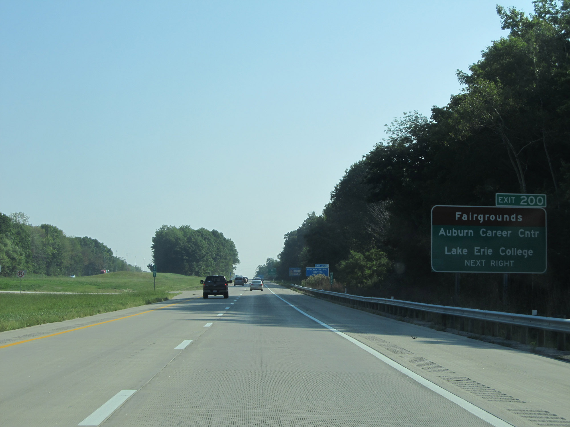 |
Take Exit 200 to the Fairgrounds, Auburn Career Center, and Lake Erie College. (Photo taken 9/6/15). |
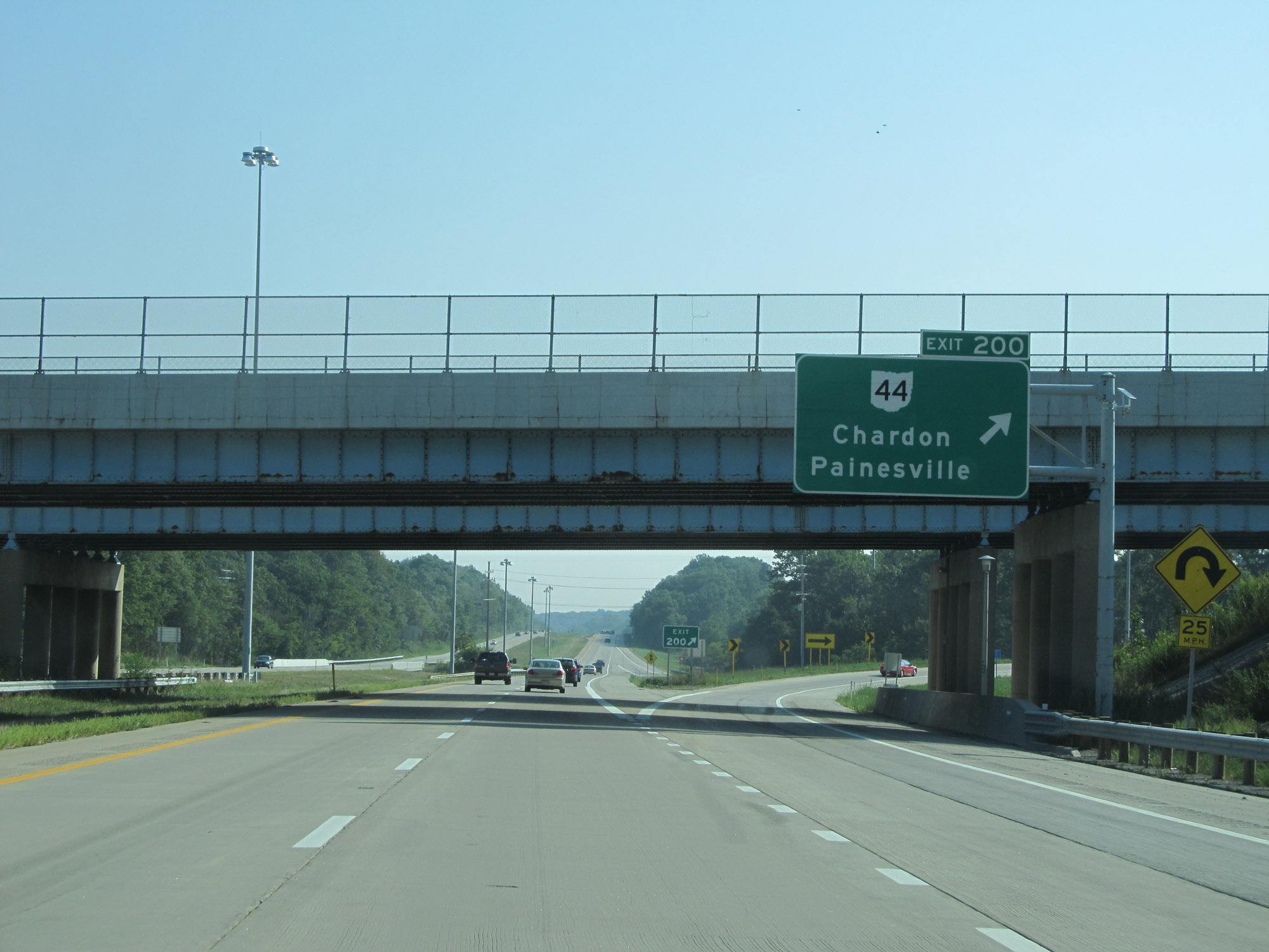 |
Interstate 90 East at Exit 200: OH 44 - Chardon / Painesville (Photo taken 9/6/15). |
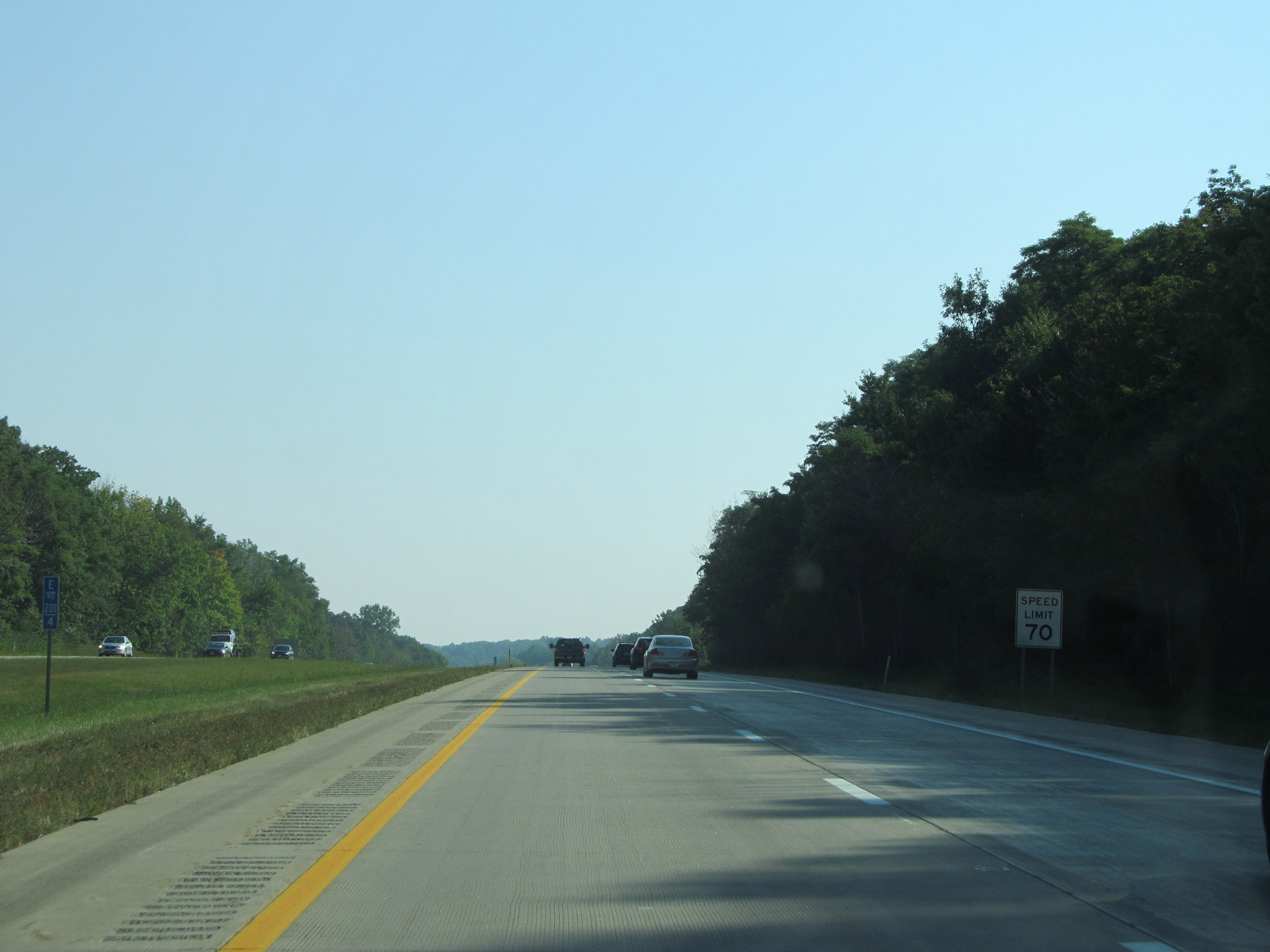 |
East of Exit 200, the speed limit increases to 70 mph. This is the standard speed limit on most rural Interstate highways in Ohio. (Photo taken 9/6/15). |
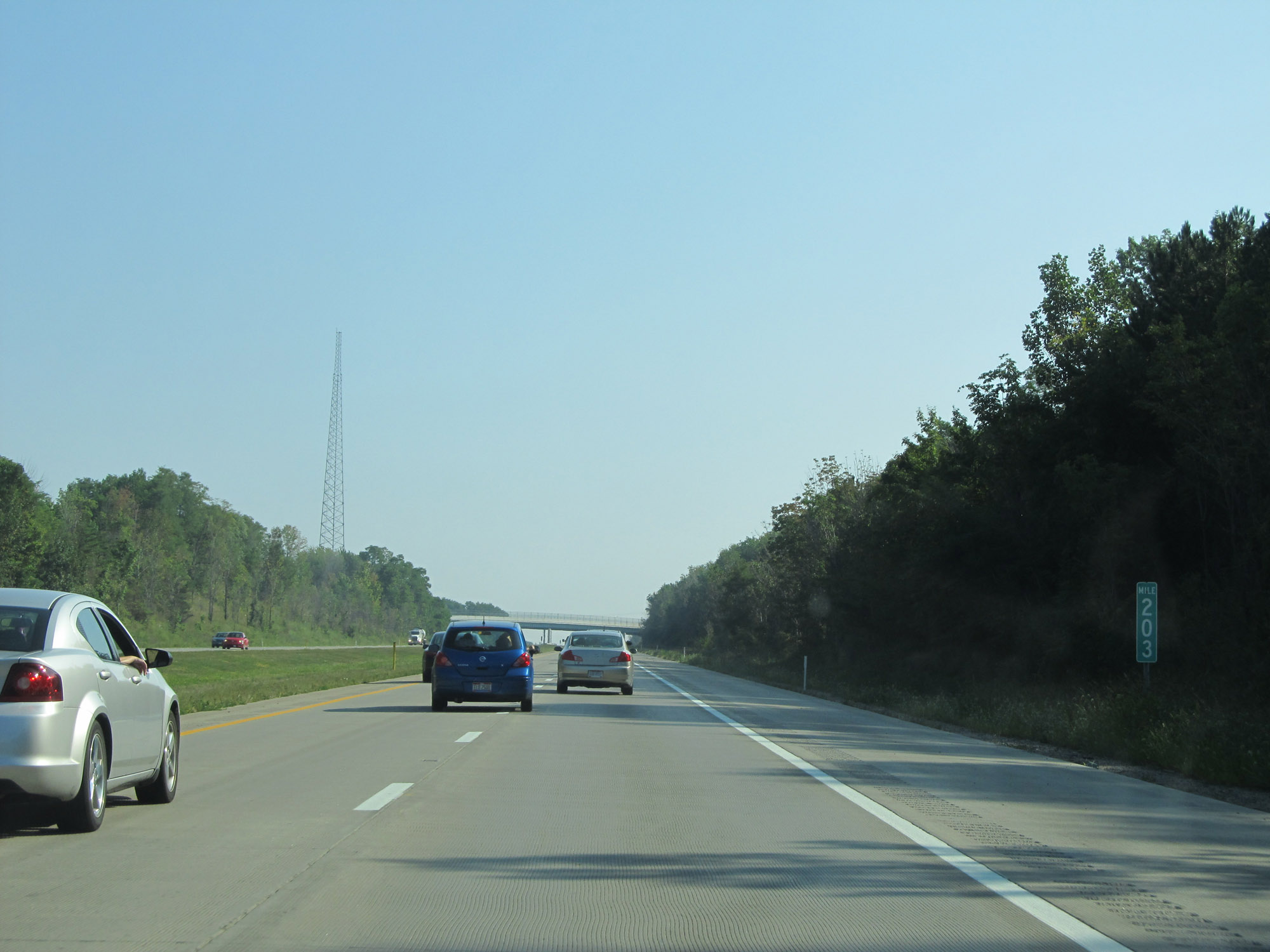 |
View on Interstate 90 East at mile marker 203. (Photo taken 9/6/15). |
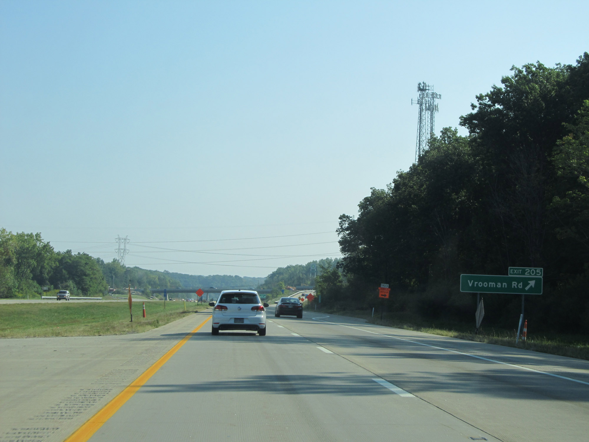 |
Interstate 90 East at Exit 205: Vrooman Rd (Photo taken 9/6/15). |
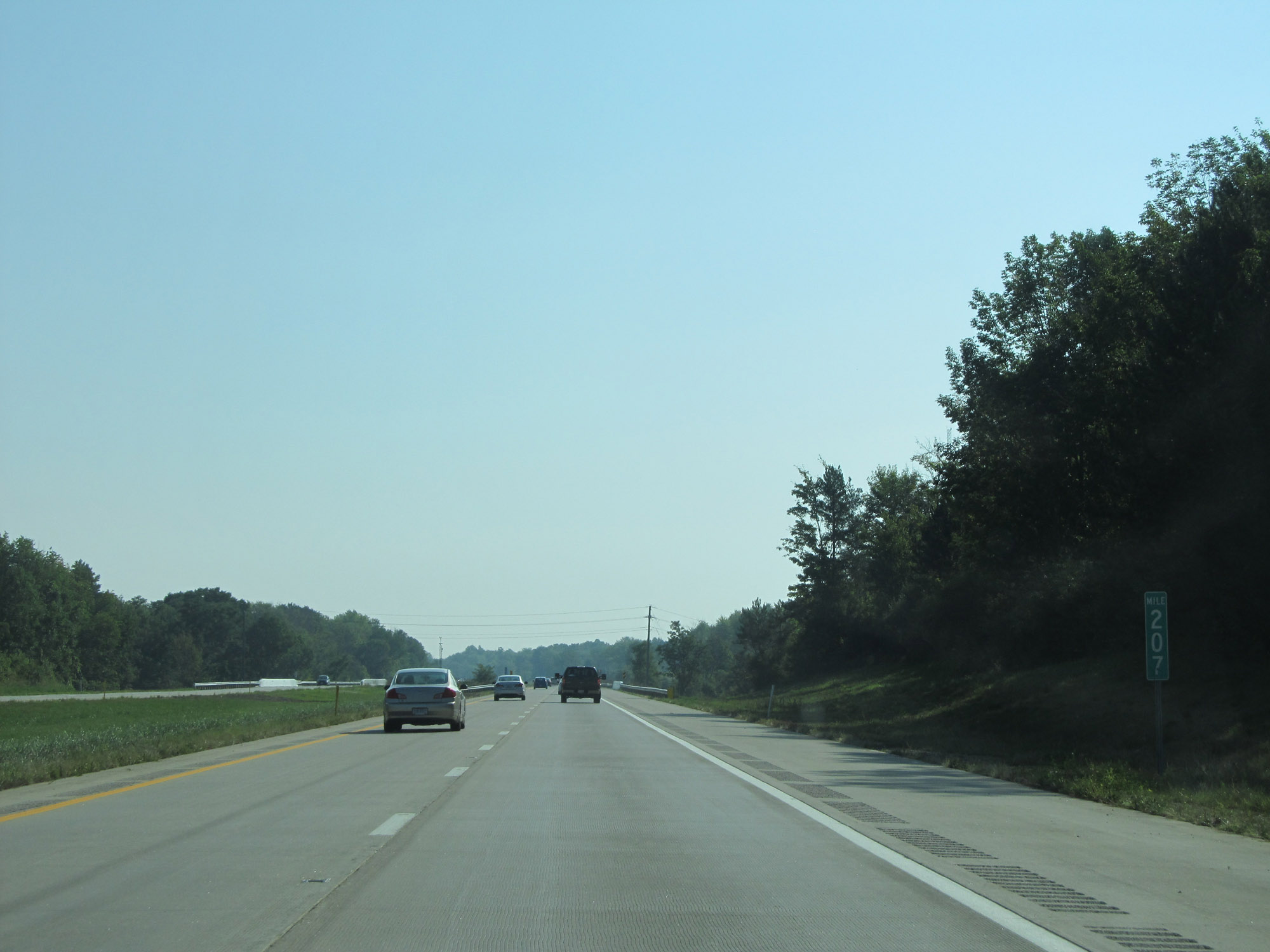 |
Interstate 90 East at mile marker 207. (Photo taken 9/6/15). |
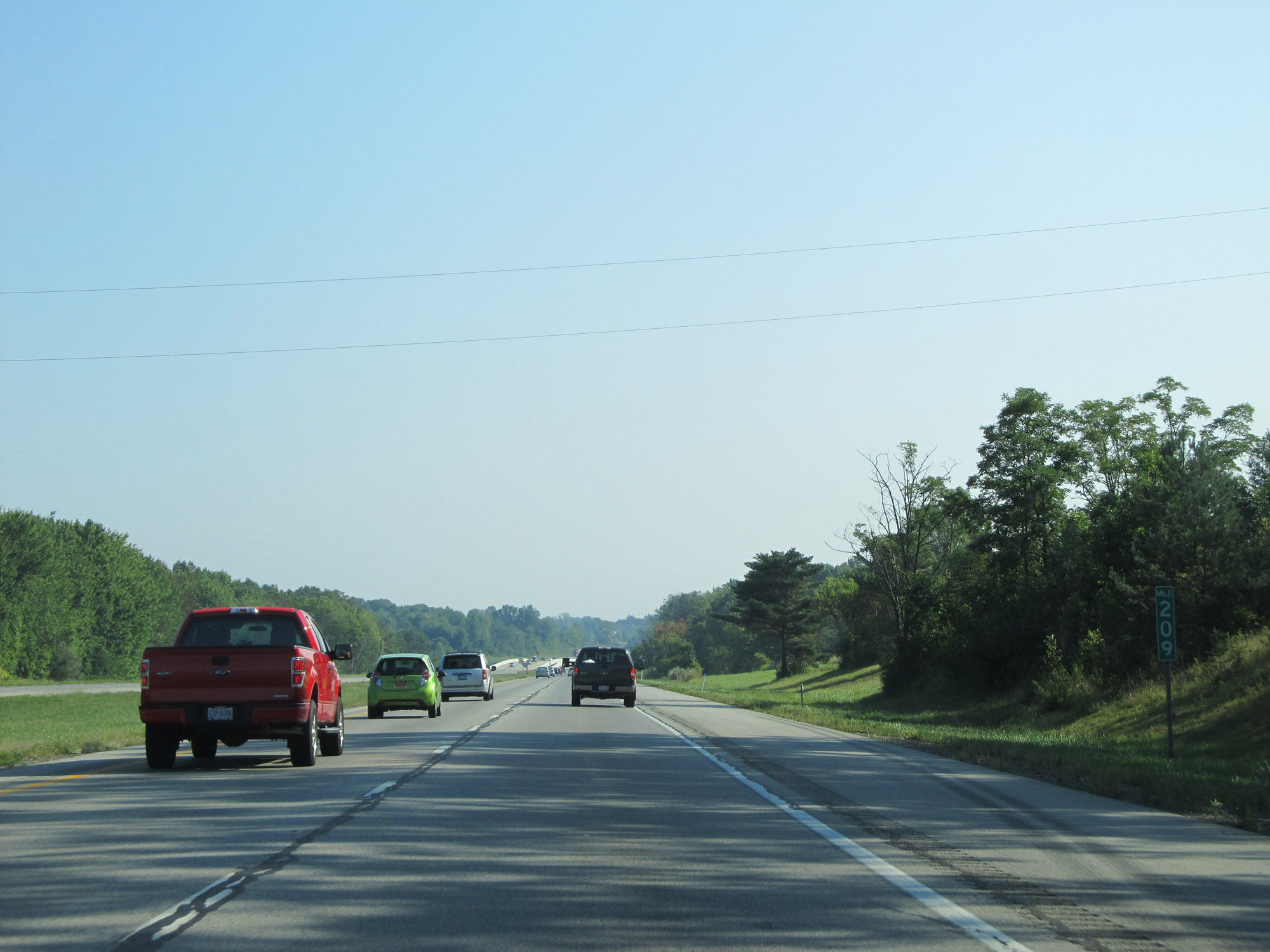 |
View on Interstate 90 East at mile marker 209. (Photo taken 9/6/15). |
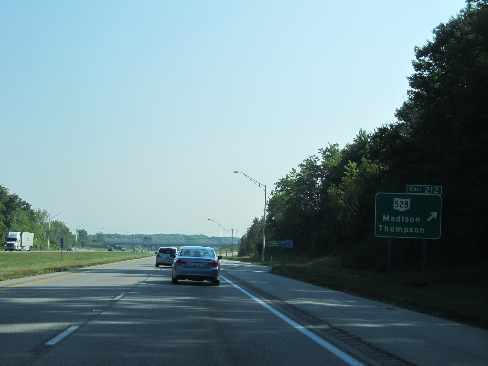 |
Interstate 90 East at Exit 212: OH 528 - Madison / Thompson (Photo taken 9/6/15). |
 |
Interstate 90 East at mile marker 215. (Photo taken 9/6/15). |
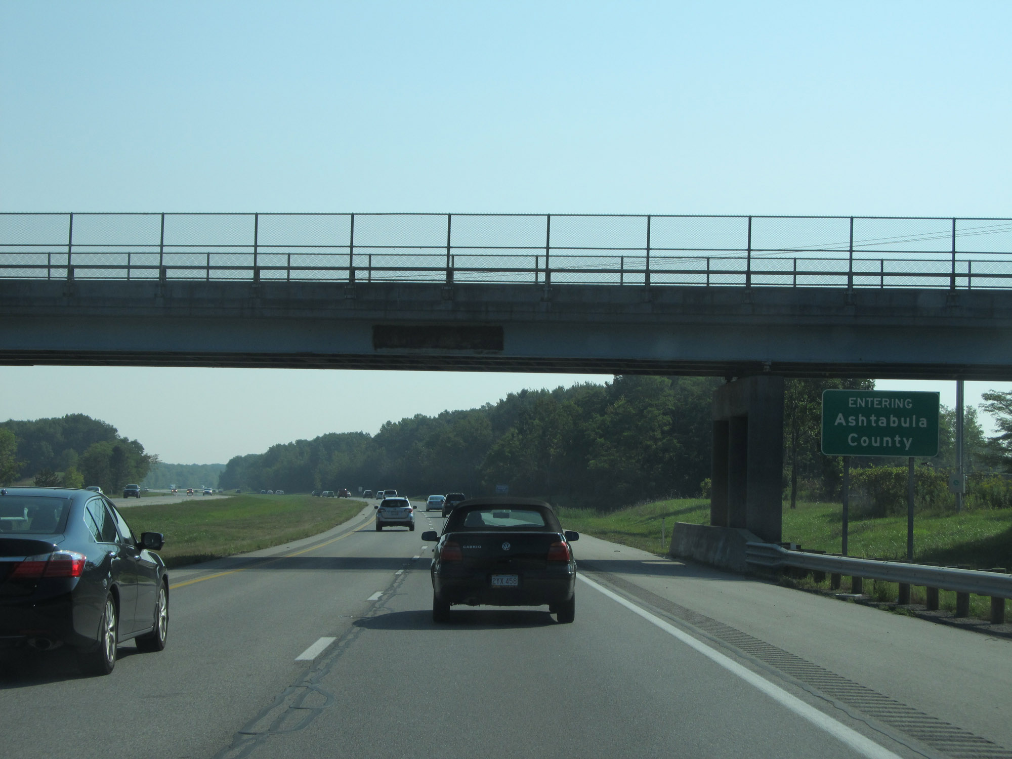 |
Interstate 90 East as it enters Ashtabula County. (Photo taken 9/6/15). |
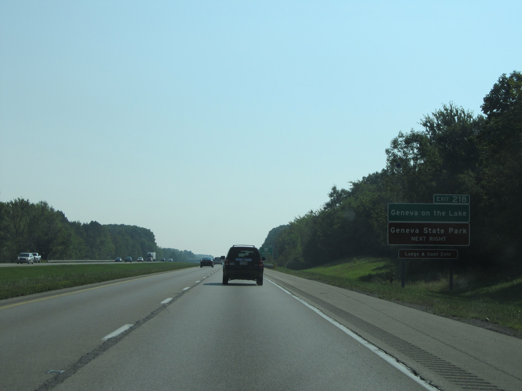 |
Take Exit 218 to Geneva on the Lake and Geneva State Park. (Photo taken 9/6/15). |
 |
Also take Exit 218 to the SPIRE Institute. (Photo taken 9/6/15). |
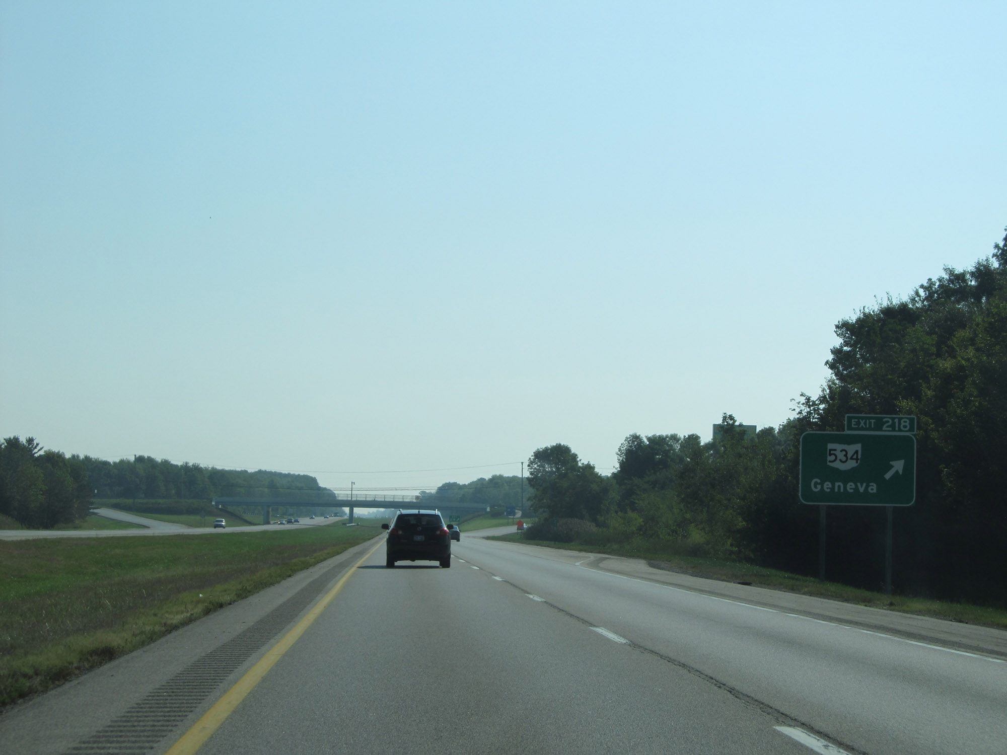 |
Interstate 90 East at Exit 218: OH 534 - Geneva (Photo taken 9/6/15). |
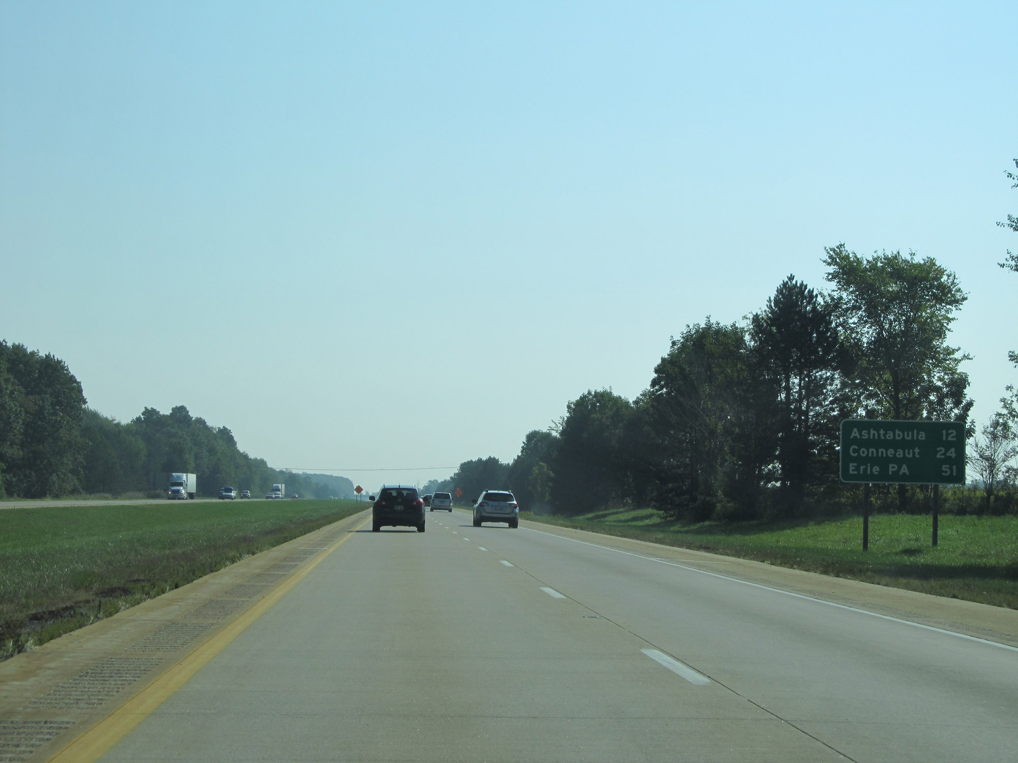 |
Another mileage sign on Interstate 90 East. It's 12 miles to Ashtabula, 24 miles to Conneaut, and 51 miles to Erie, PA. (Photo taken 9/6/15). |
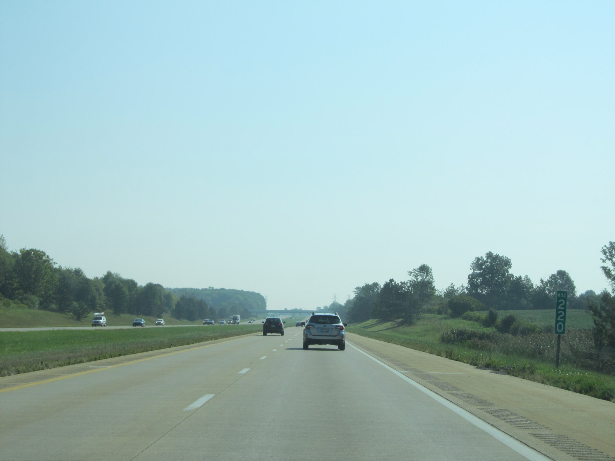 |
View on Interstate 90 East at mile marker 220. (Photo taken 9/6/15). |
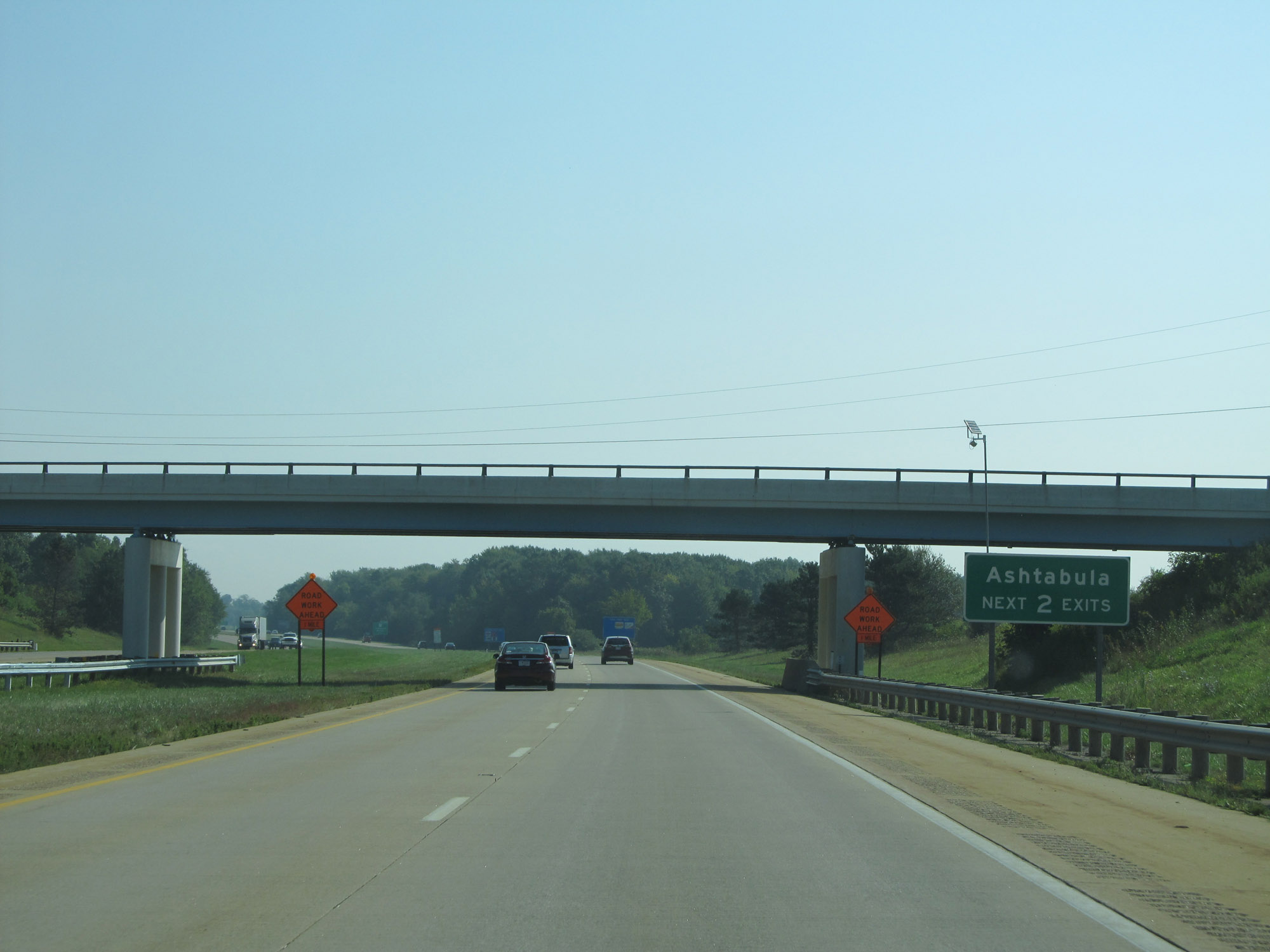 |
Take either of the next 2 exits to Ashtabula. (Photo taken 9/6/15). |
 |
Take Exit 223 to Grand River Academy. (Photo taken 9/6/15). |
 |
Also take Exit 223 to Kent State University Ashtabula Campus. (Photo taken 9/6/15). |
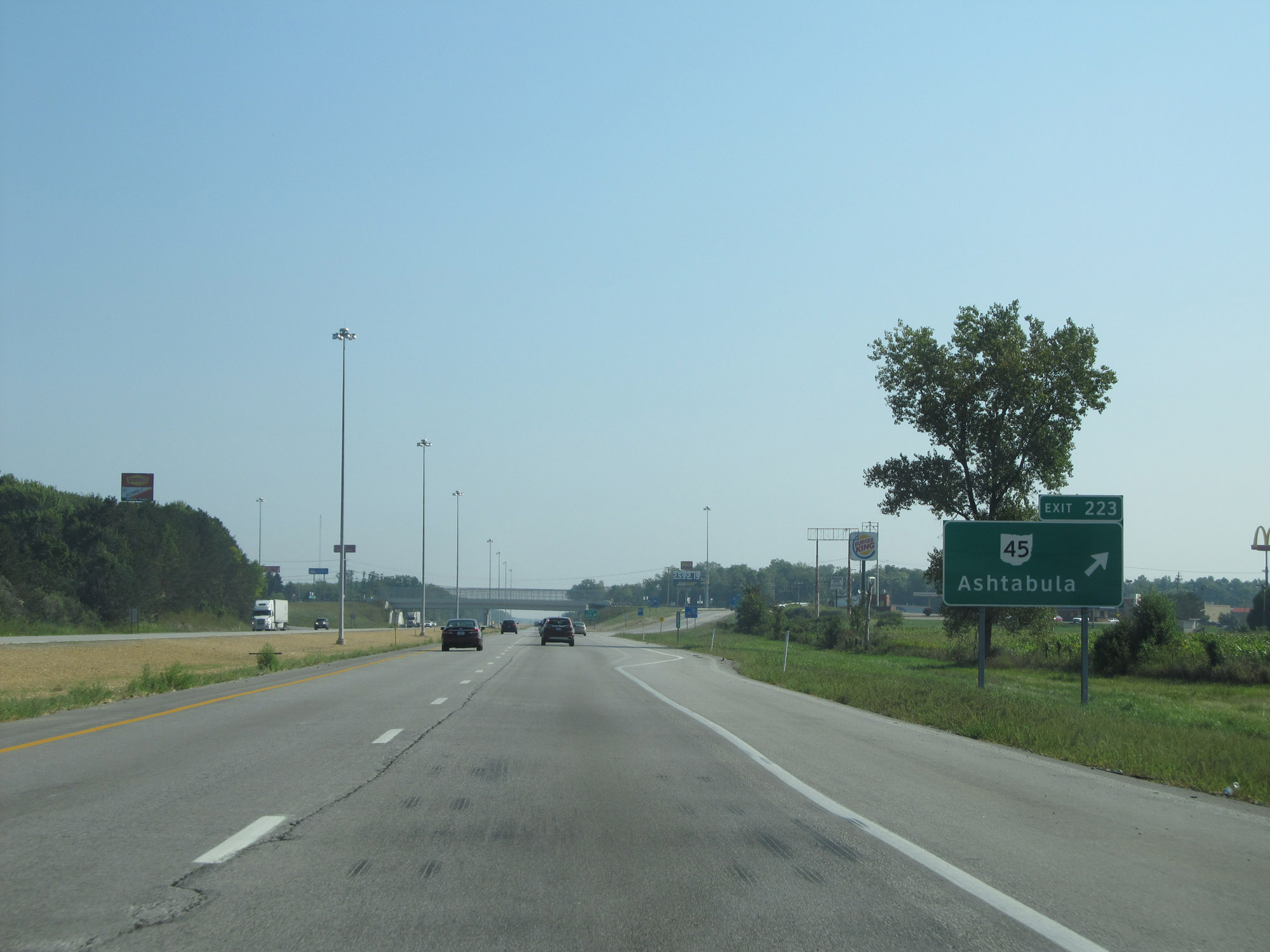 |
Interstate 90 East at Exit 223: OH 45 - Ashtabula (Photo taken 9/6/15). |
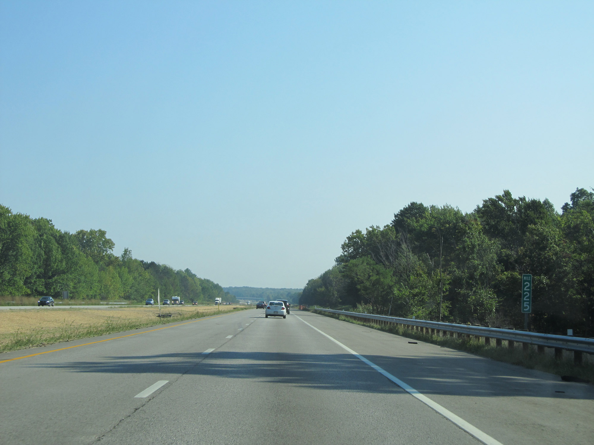 |
View on Interstate 90 East at mile marker 225. (Photo taken 9/6/15). |
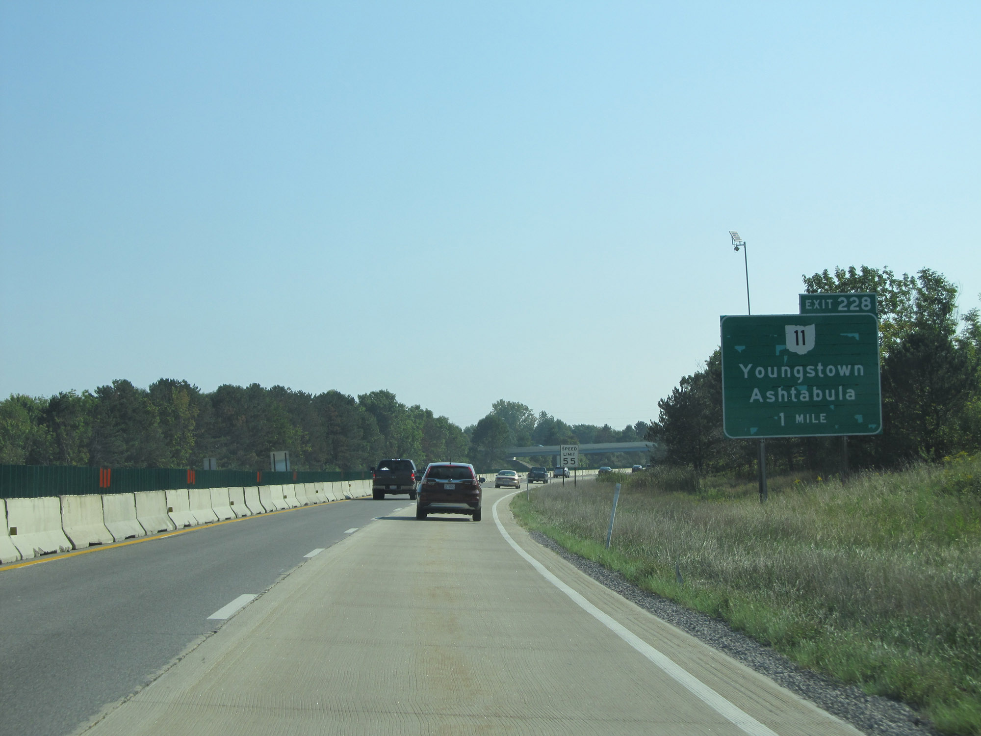 |
Interstate 90 East approaching Exit 228 - 1 mile. (Photo taken 9/6/15). |
 |
Take Exit 228 to OH 46 toward Jefferson. (Photo taken 9/6/15). |
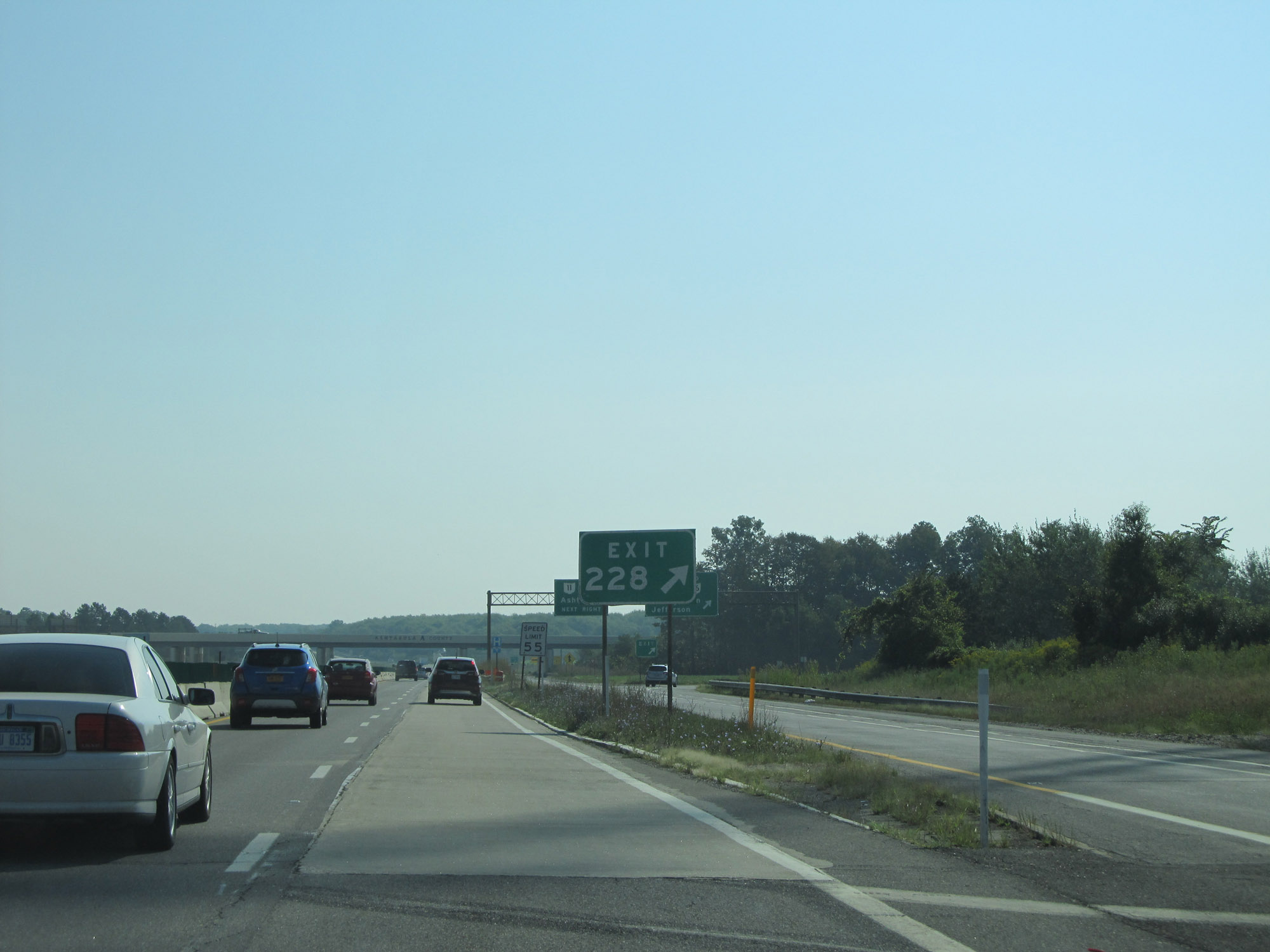 |
Interstate 90 East at Exit 228: OH 11 - Youngstown / Ashtabula (Photo taken 9/6/15). |
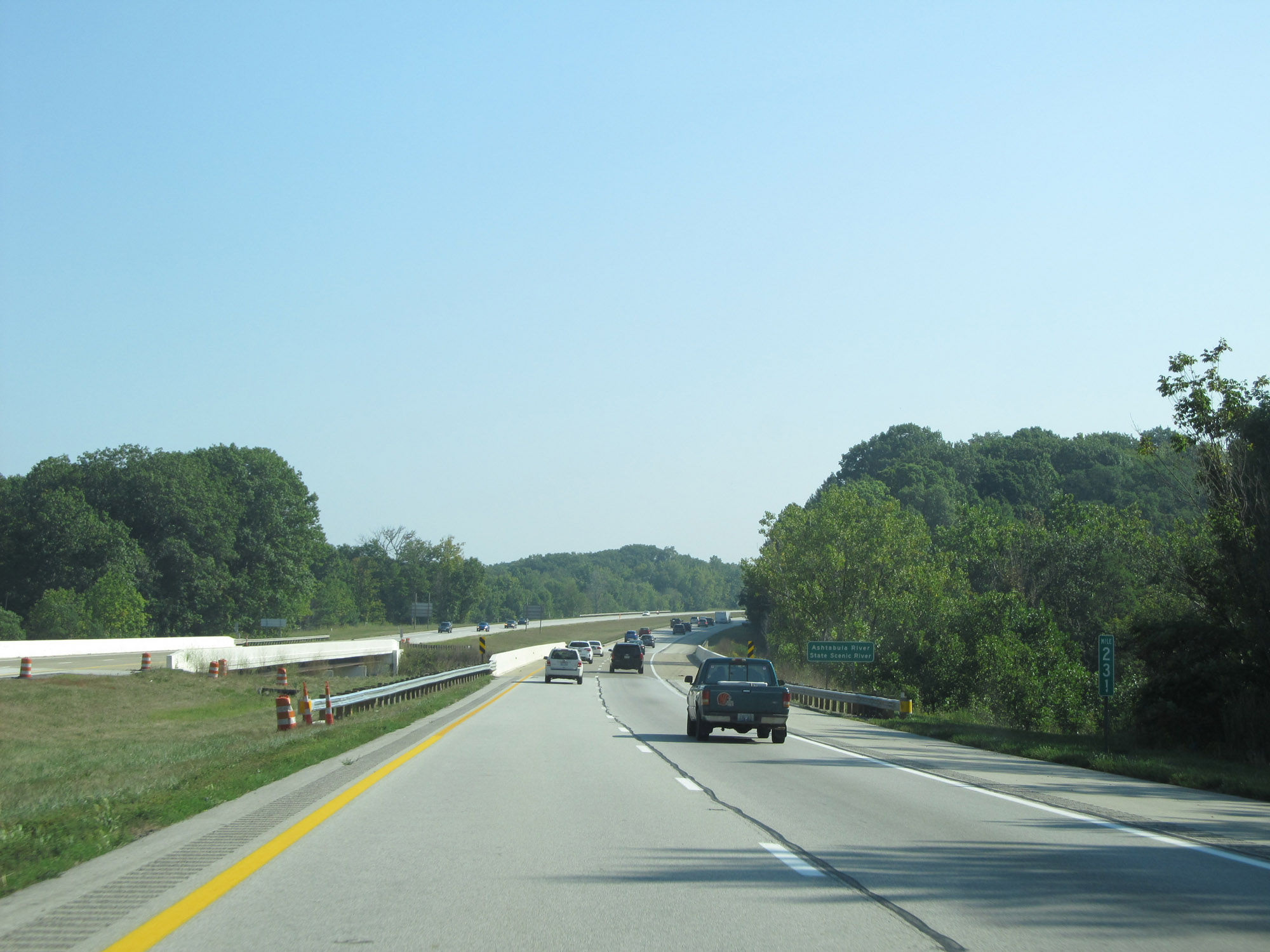 |
Interstate 90 East at mile marker 231. (Photo taken 9/6/15). |
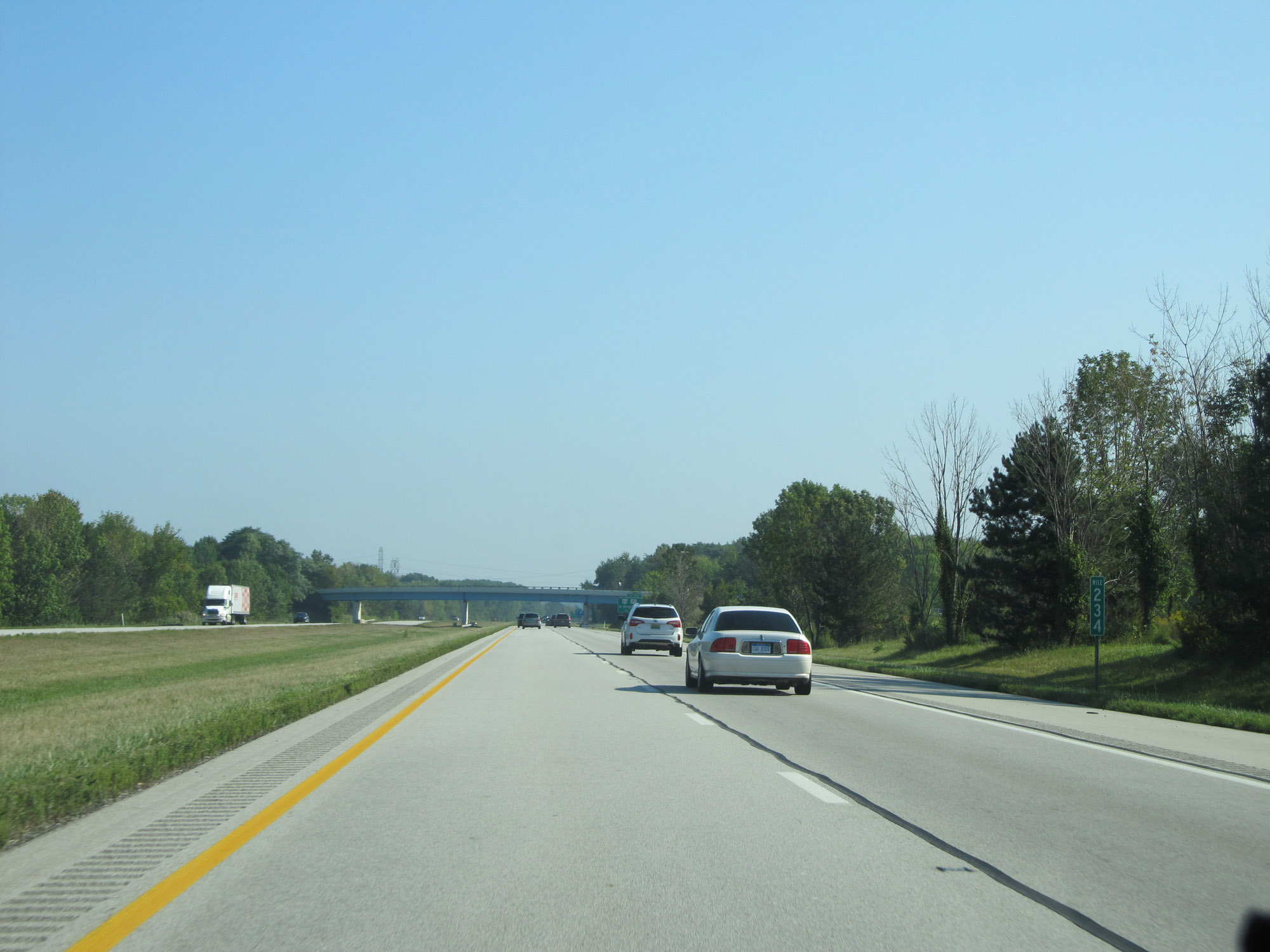 |
View on Interstate 90 East at mile marker 234. (Photo taken 9/6/15). |
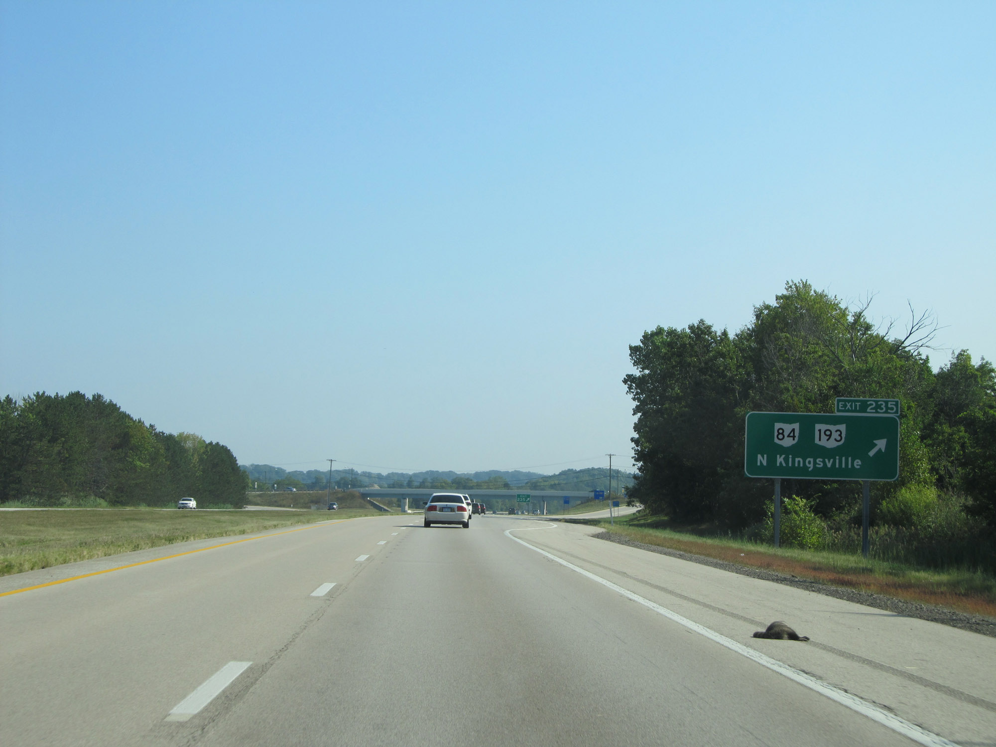 |
Interstate 90 East at Exit 235: OH 84 / OH 193 - North Kingsville (Photo taken 9/6/15). |
 |
Interstate 90 East at mile marker 236. (Photo taken 9/6/15). |
 |
The speed limit remains 70 mph. (Photo taken 9/6/15). |
 |
Another mileage sign on Interstate 90 East. It's 7 miles to Conneaut and 33 miles to Erie, PA. (Photo taken 9/6/15). |
 |
View on Interstate 90 East at mile marker 239. (Photo taken 9/6/15). |
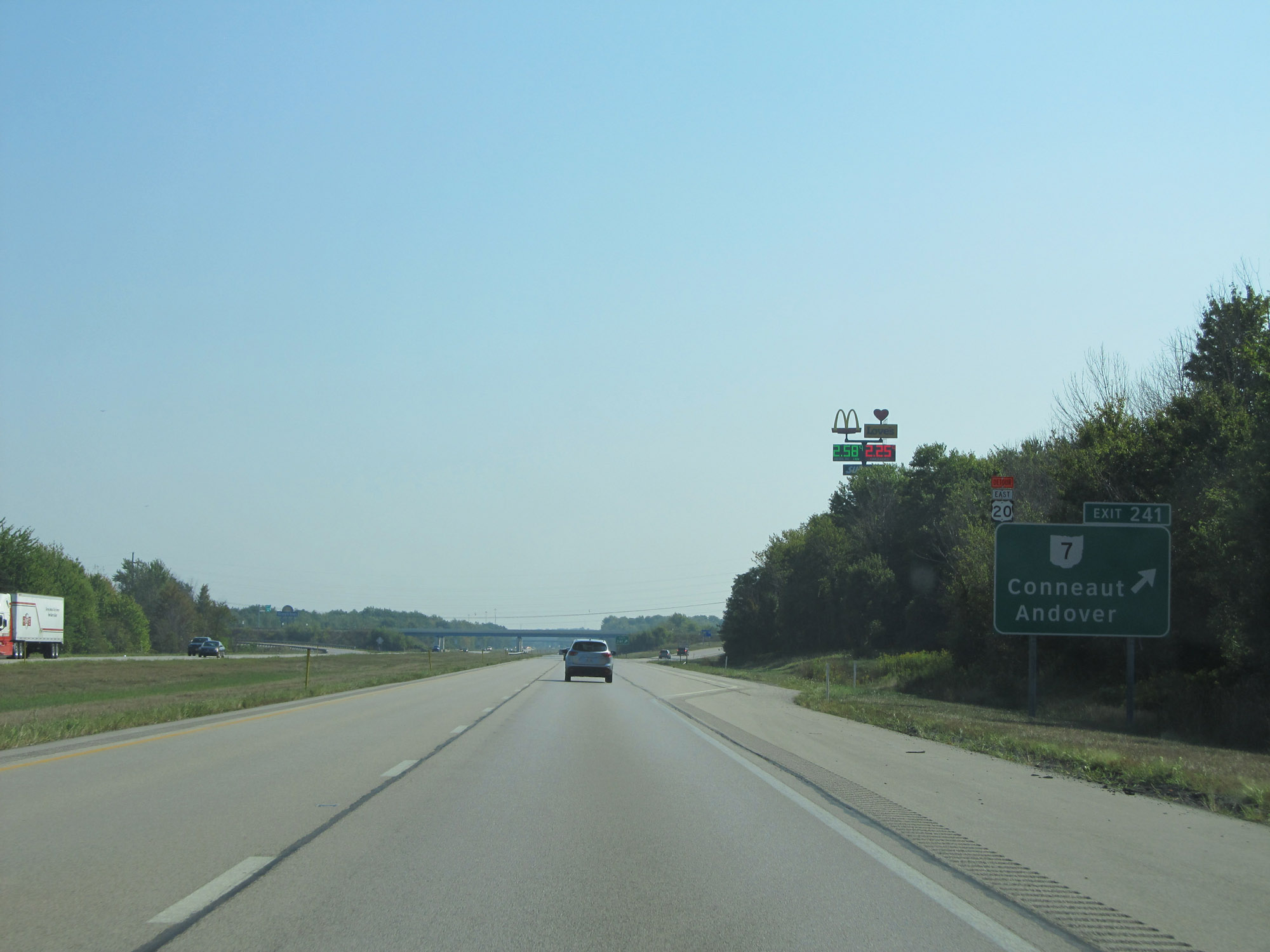 |
Interstate 90 East at Exit 241: OH 7 - Conneaut / Andover (Photo taken 9/6/15). |
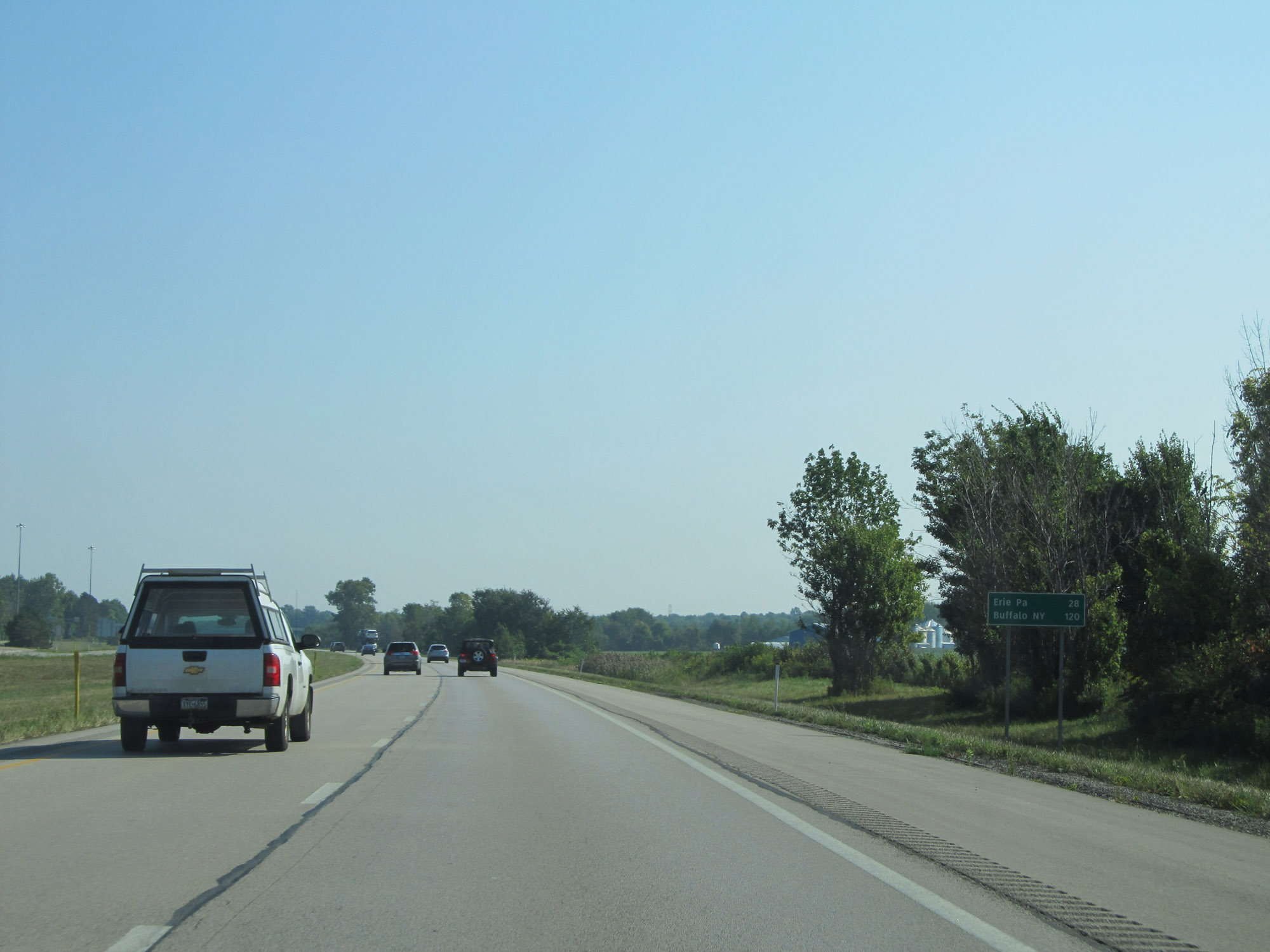 |
One final mileage sign on Interstate 90 East. It's 28 miles to Erie, PA and 120 miles to Buffalo, NY. (Photo taken 9/6/15). |
 |
Interstate 90 East at mile marker 242, as it prepares to cross into Pennsylvania. (Photo taken 9/6/15). |