Road Information |
||
 |
||
| Total Mileage in State: | 154.5 miles | |
| Eastern End: | At Alabama state line | |
| Western End: | At Louisiana state line | |
| Mileage covered in Photos: | 154.5 miles | |
| Counties covered in Photos: | Warren, Hinds, Rankin, Scott, Newton, Lauderdale | |
| Major Junctions in Photos: | I-220, in Jackson I-55, in Jackson I-59, in Meridian |
|
| Control Cities in Photos: | Vicksburg, Jackson, Pearl, Brandon, Meridian | |
Eastbound
- Section 1: Louisiana Border to Jackson (Exit 46)
- Section 2: Jackson (Exit 46) to Meridian (Exit 130)
- Section 3: Meridian (Exit 130) to Alabama Border
Section 1: Louisiana Border to Jackson (Exit 46)
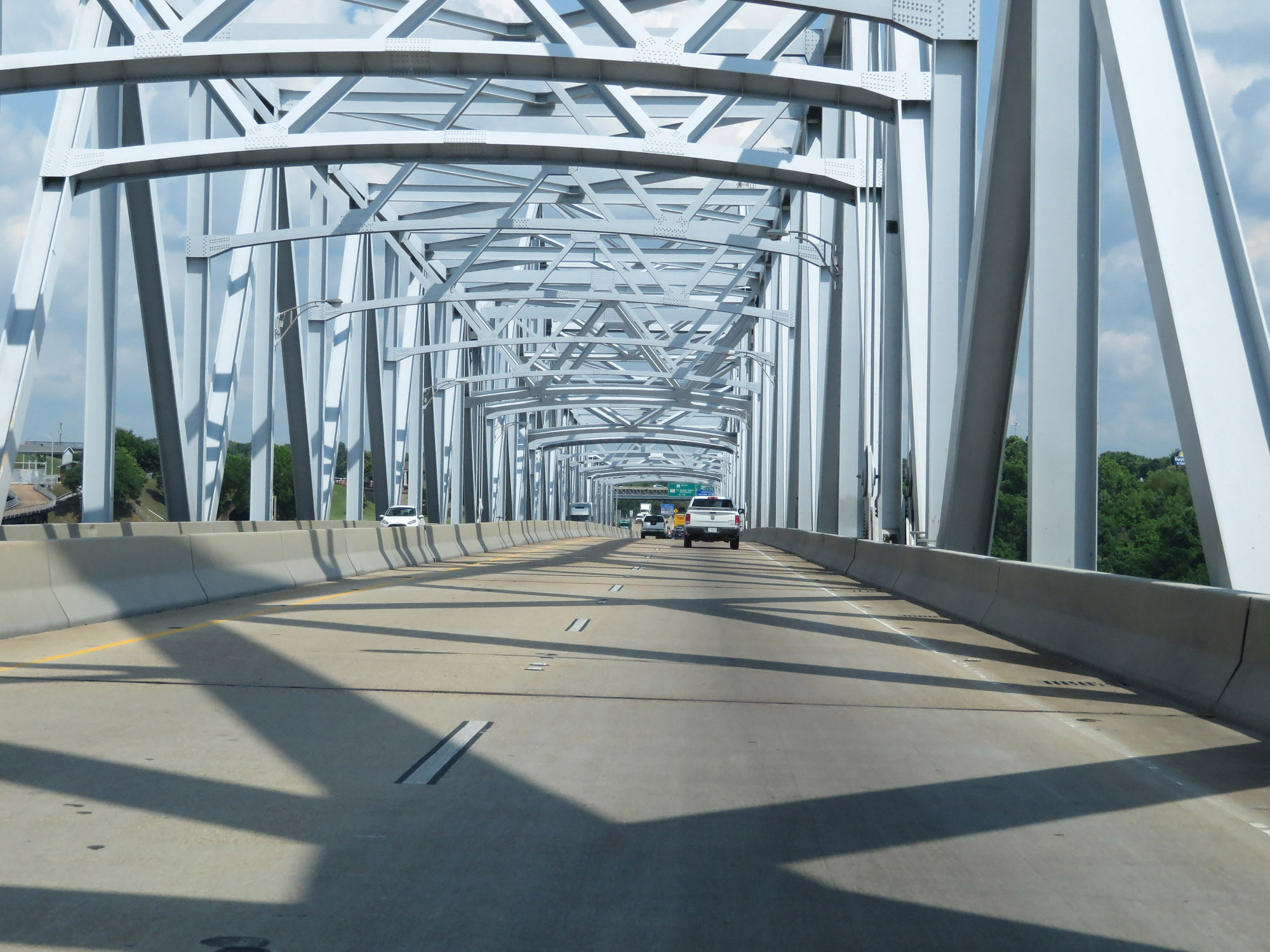 |
Interstate 20 East as it crosses the Vicksburg Bridge over the Mississippi River from Louisiana into the Magnolia State. (Photo taken 5/23/18). |
 |
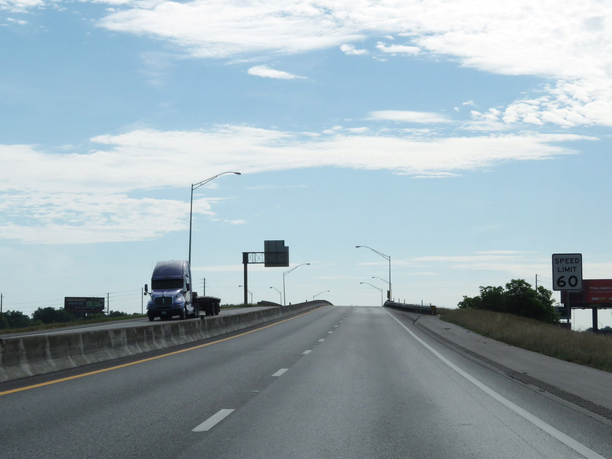
The speed limit on Interstate 20 East in Mississippi starts out at 60 mph in the Vicksburg area. (Photo taken 5/23/18). |
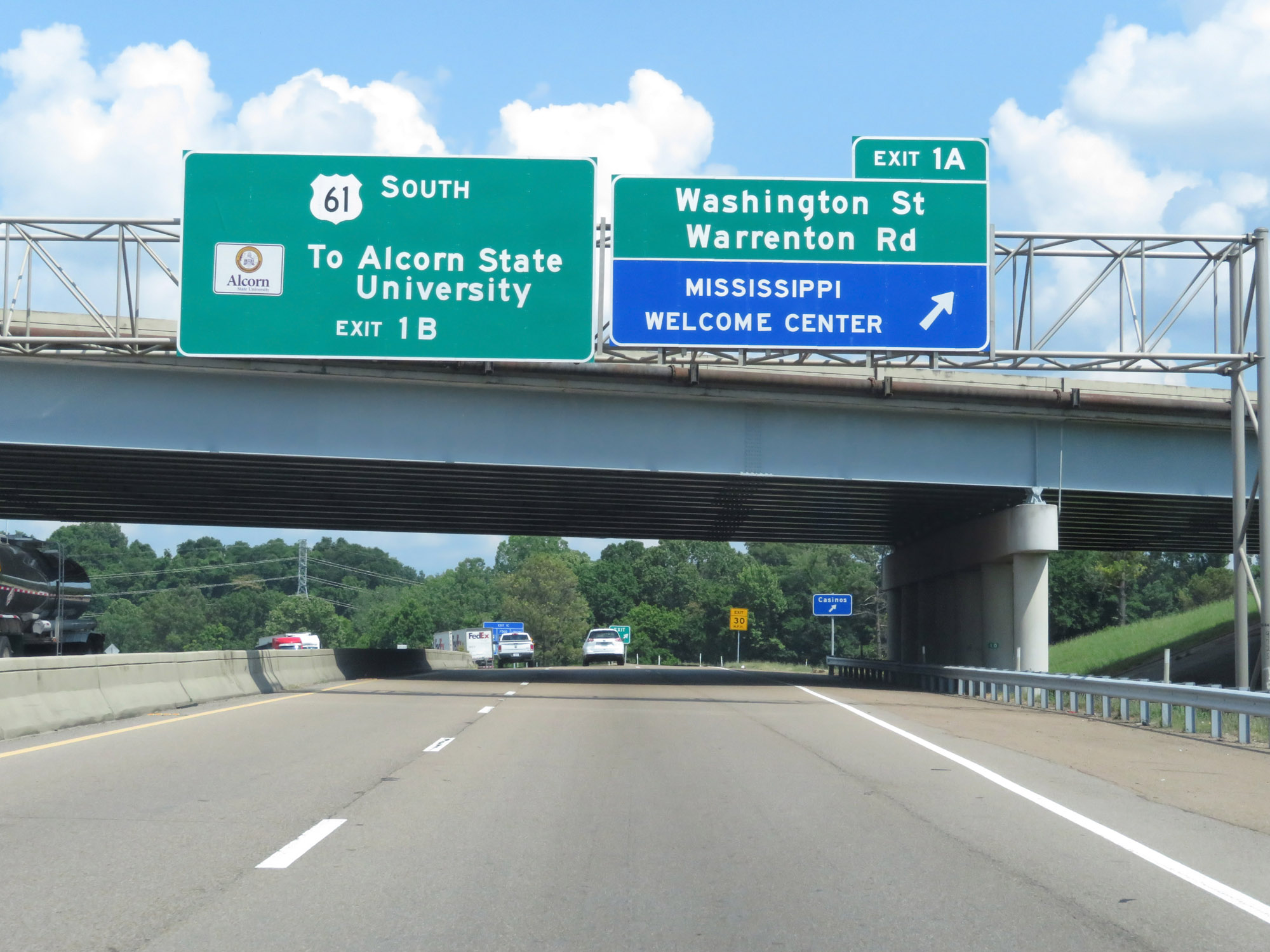 |
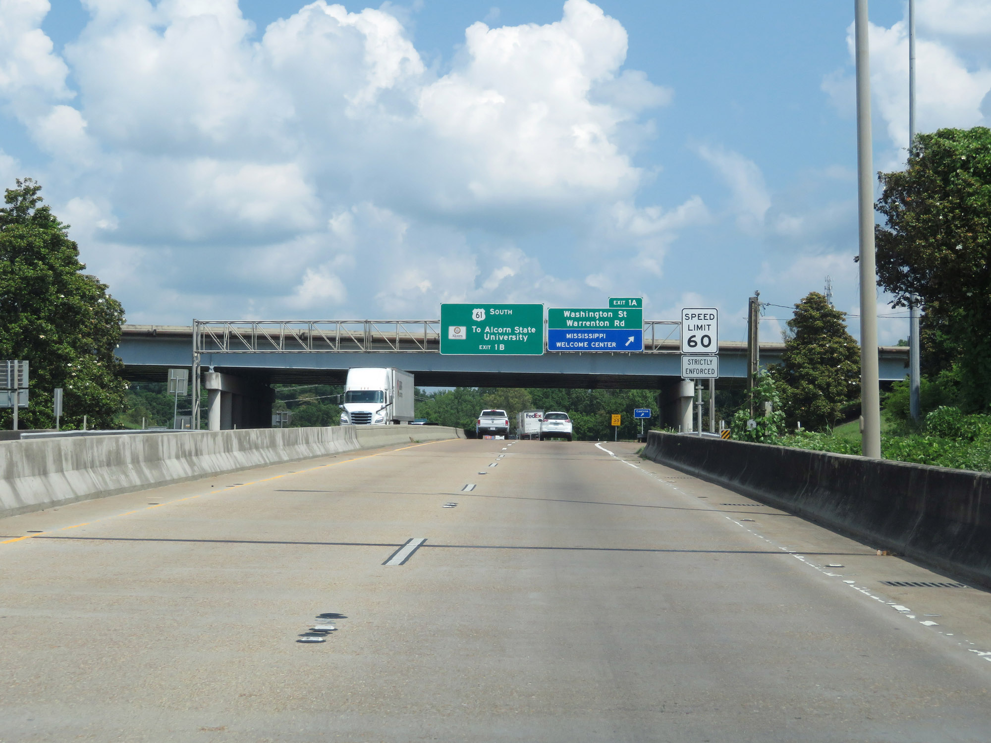
Interstate 20 East at Exit 1A: Washington St / Warrenton Rd / Mississippi Welcome Center (Photo taken 5/23/18). |
 |
Interstate 20 East at Exit 1B: US 61 South - Natchez (Photo taken 5/23/18). |
 |
Mississippi welcome sign on Interstate 20 East in Vicksburg. (Photo taken 5/23/18). |
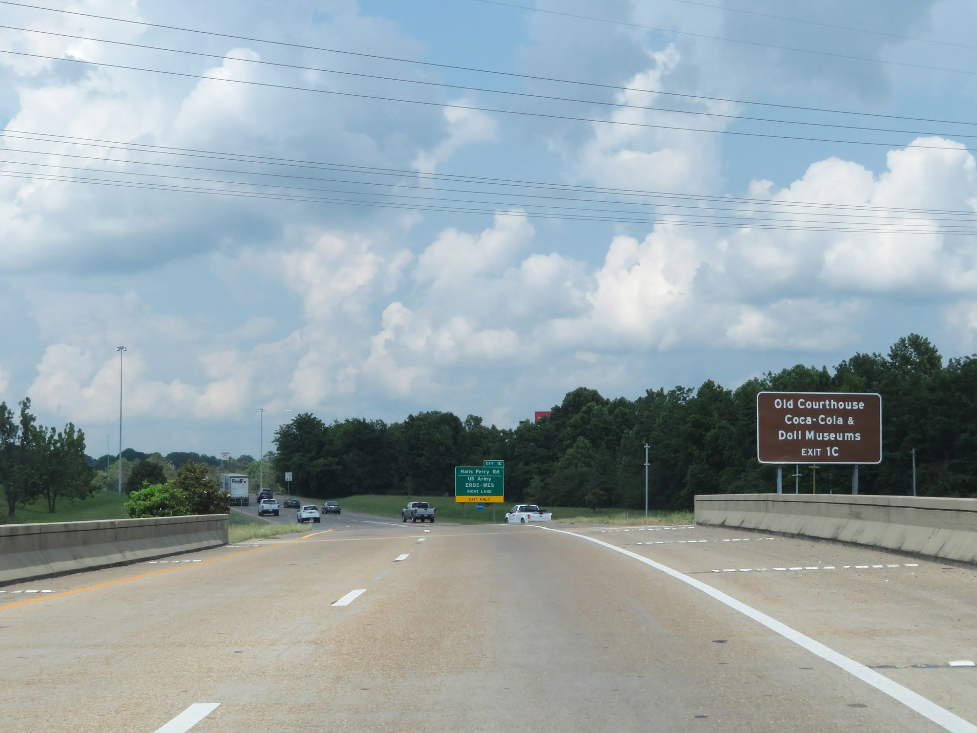 |
Take Exit 1C to the Old Courthouse and Coca-Cola/Doll Museums. (Photo taken 5/23/18). |
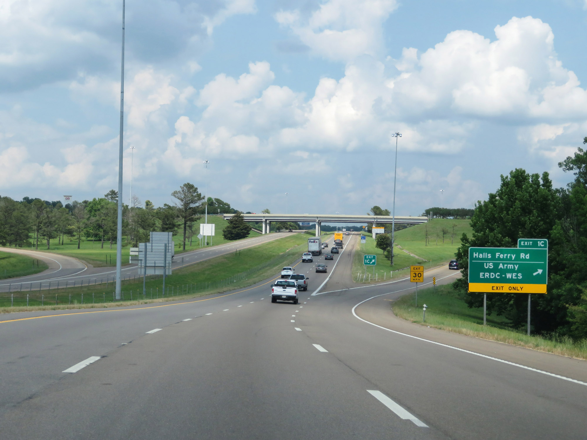 |
Interstate 20 East at Exit 1C: Halls Ferry Rd / US Army ERDC-WES (Photo taken 5/23/18). |
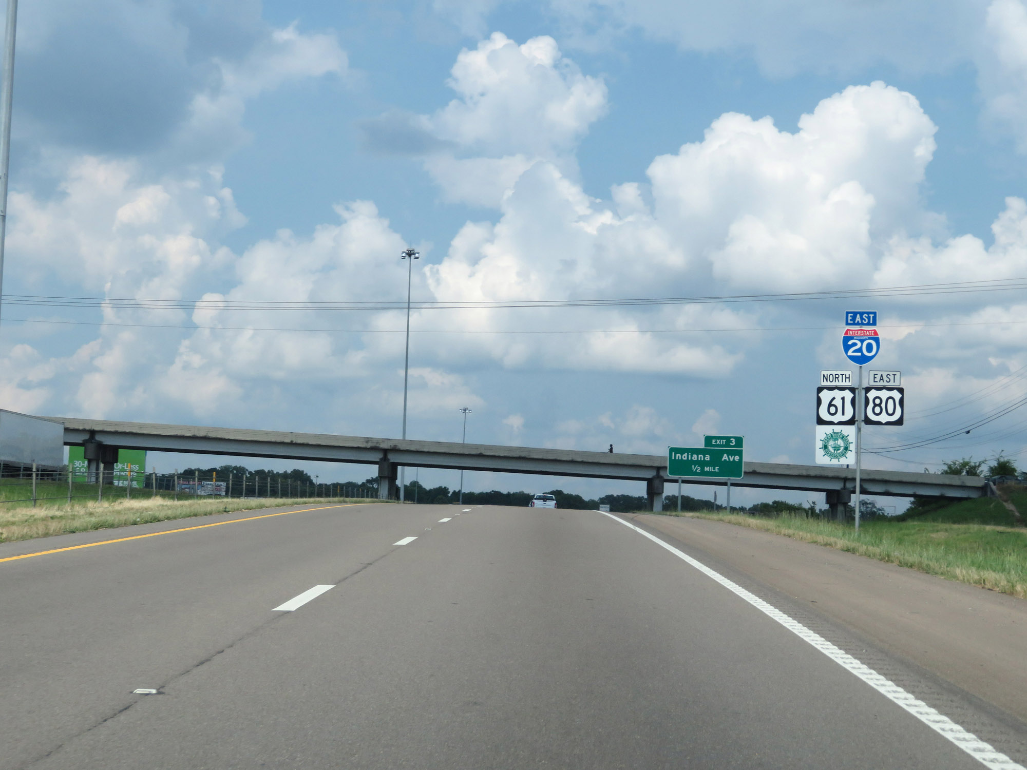 |
State-named Interstate 20 East reassurance shield approaching Exit 3. (Photo taken 5/23/18). |
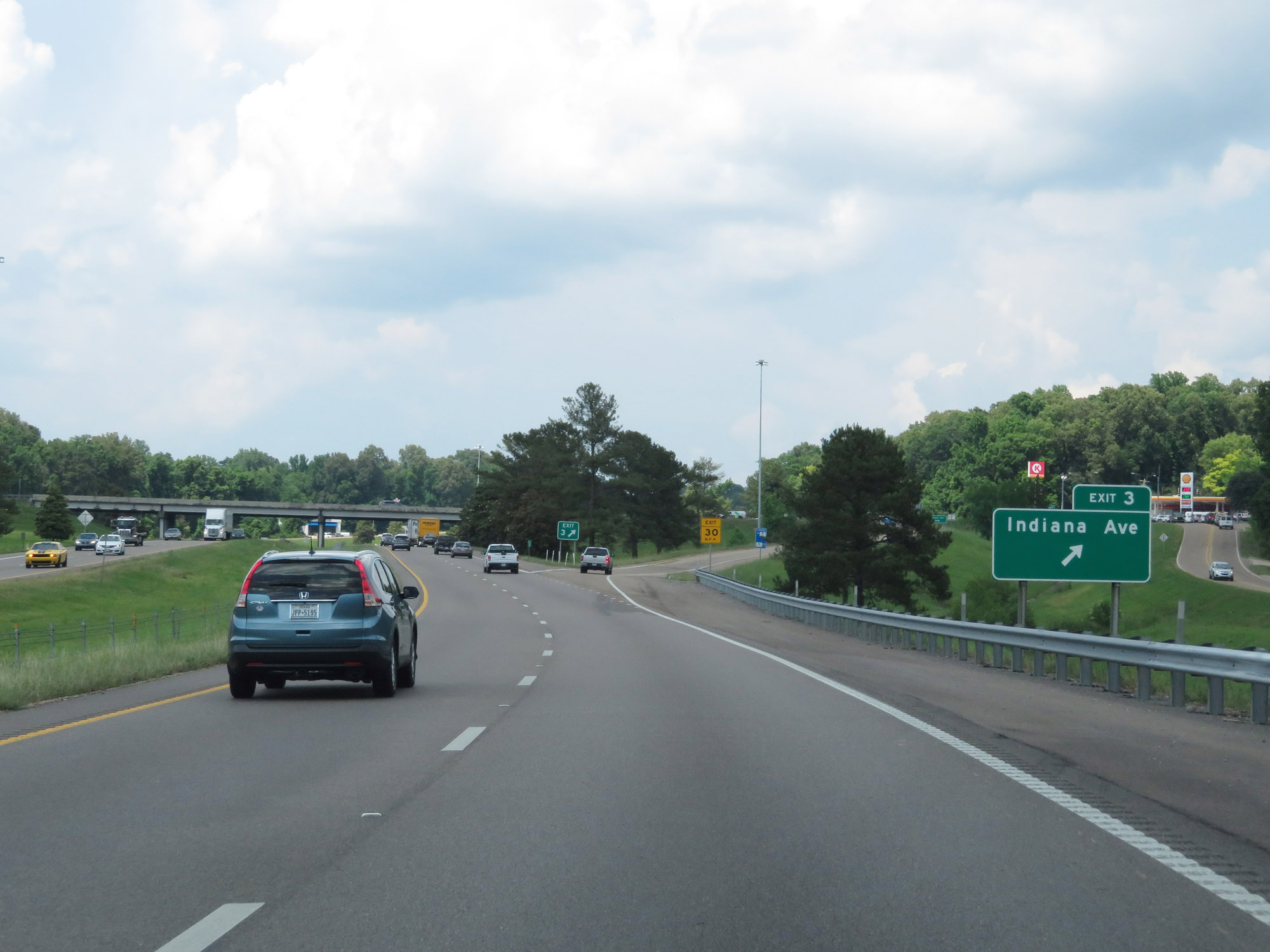 |
Interstate 20 East at Exit 3: Indiana Ave (Photo taken 5/23/18). |
 |
The speed limit remains 60 mph throughout the Vicksburg area. (Photo taken 5/23/18). |
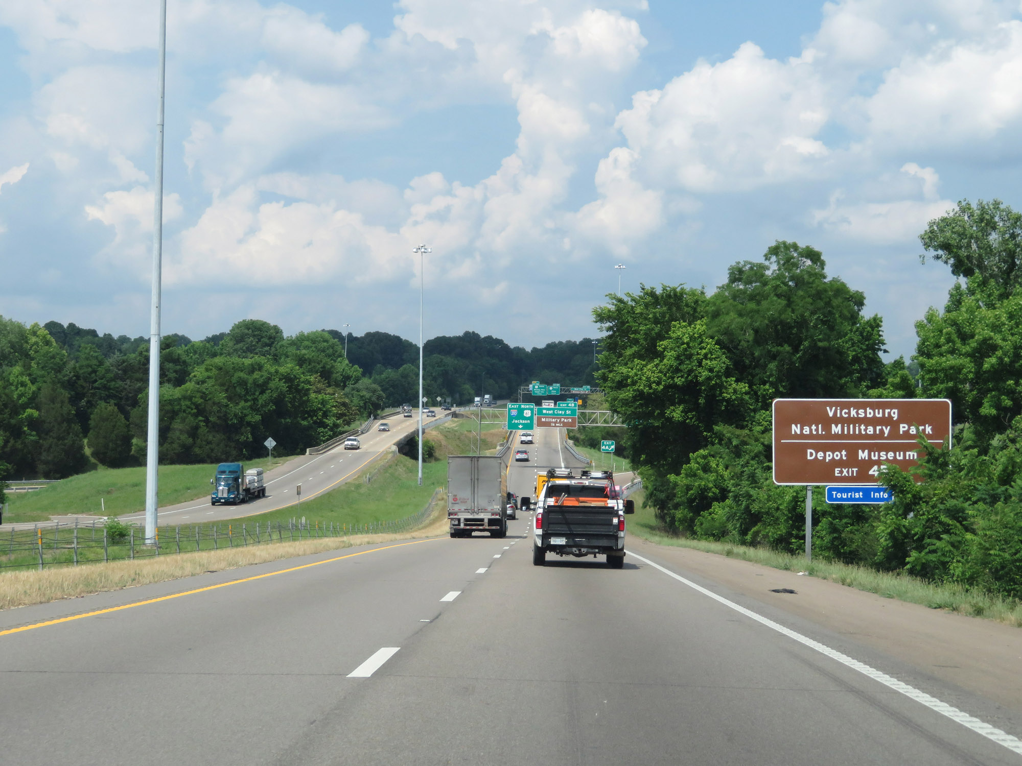 |
Take Exit 4B to Vicksburg National Military Park and the Depot Museum. (Photo taken 5/23/18). |
 |
Interstate 20 East at Exit 4A: East Clay St (Photo taken 5/23/18). |
 |
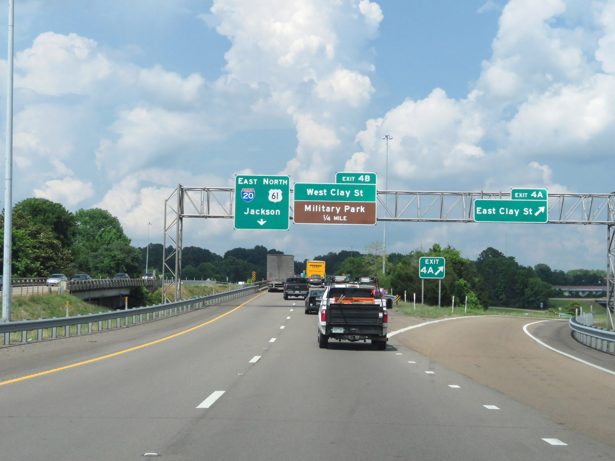
Interstate 20 East at Exit 4B: West Clay St / Military Park (Photo taken 5/23/18). |
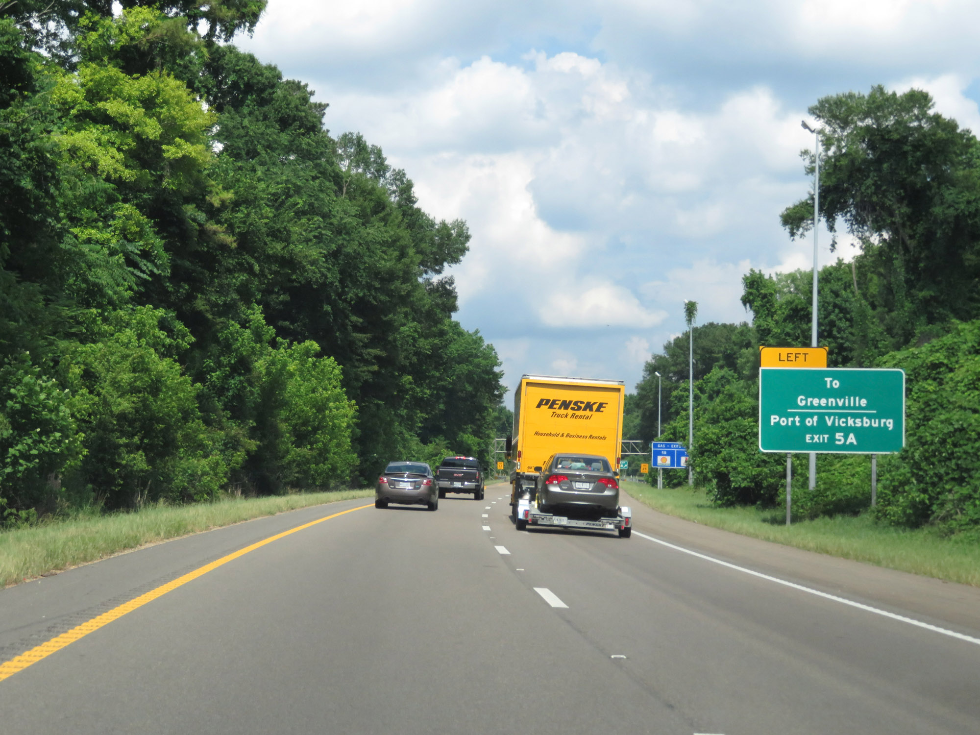 |
Take Exit 5A to Greenville and Port of Vicksburg. (Photo taken 5/23/18). |
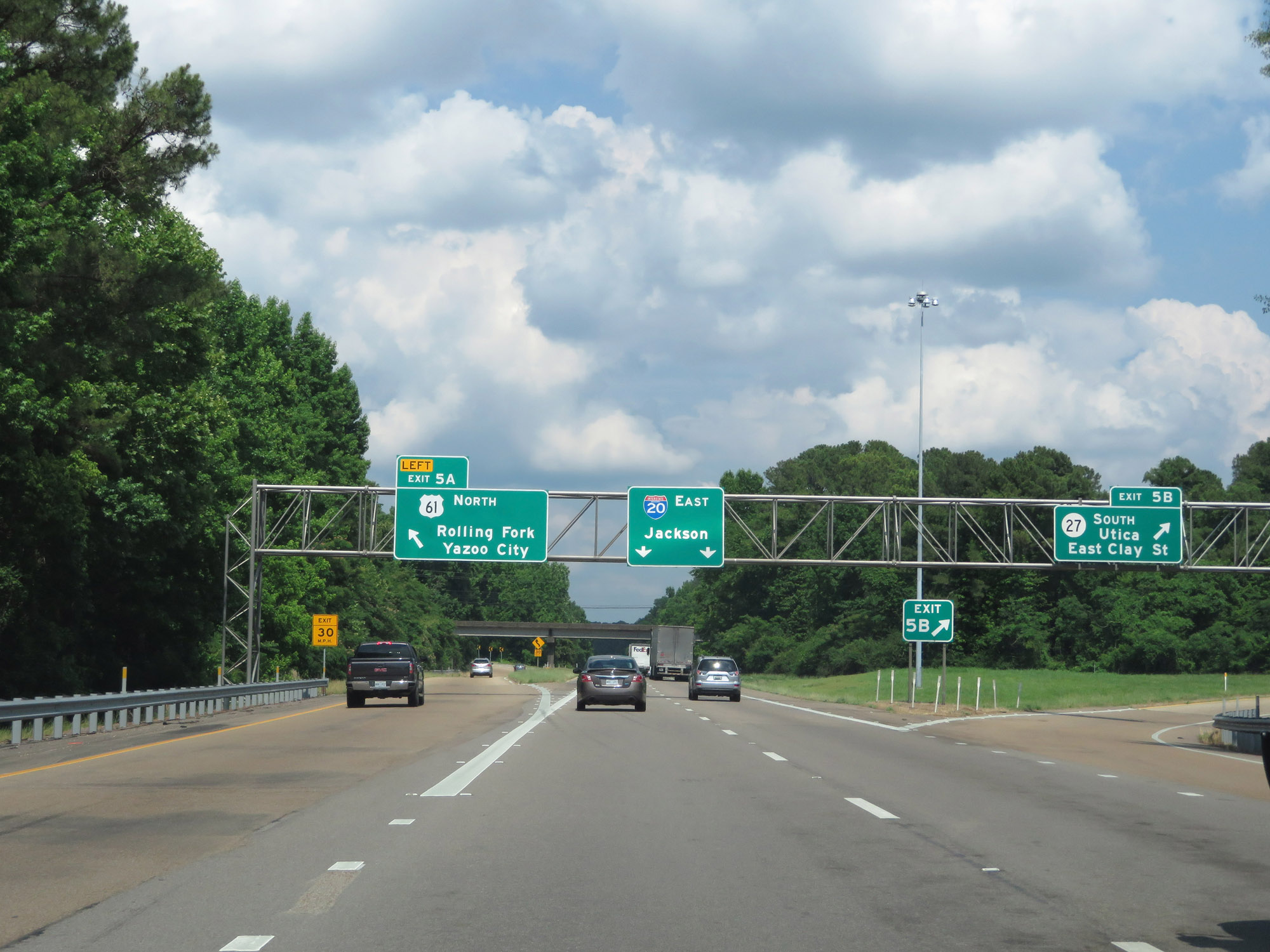 |
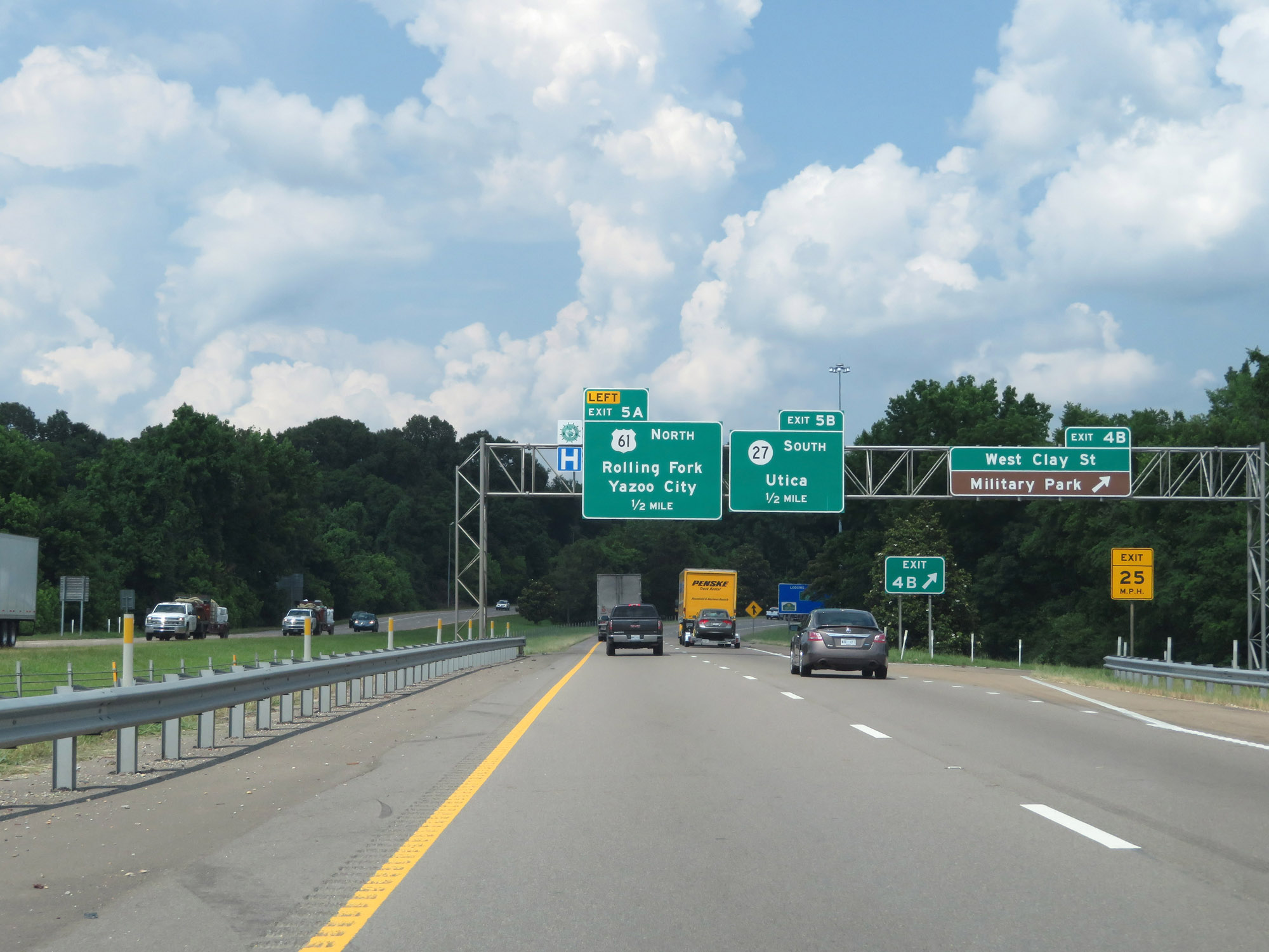
Interstate 20 East at Exit 5A: MS 27 South - Utica / East Clay St (Photo taken 5/23/18). |
 |
Another state-named Interstate 20 East reassurance shield. (Photo taken 5/23/18). |
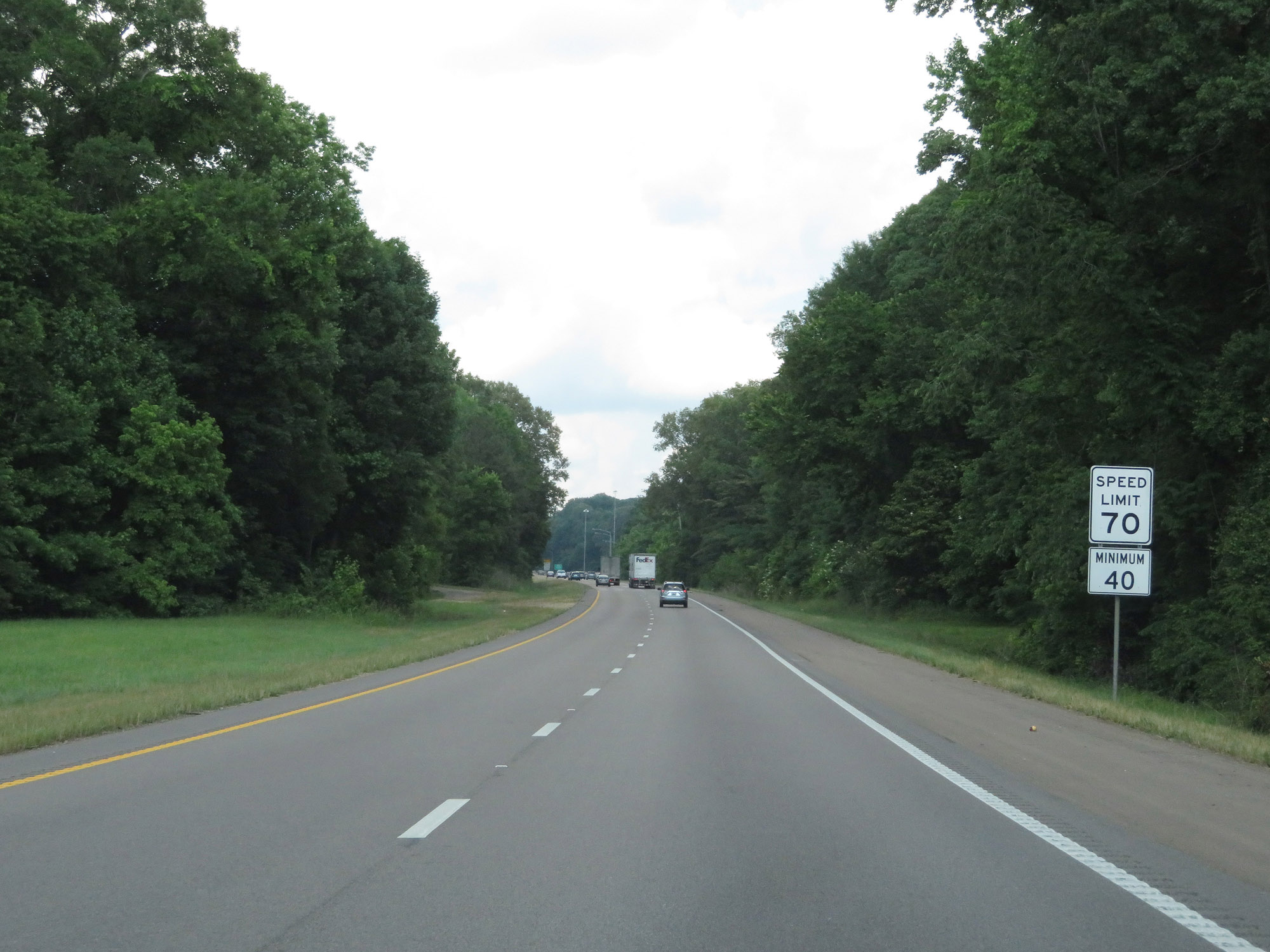 |
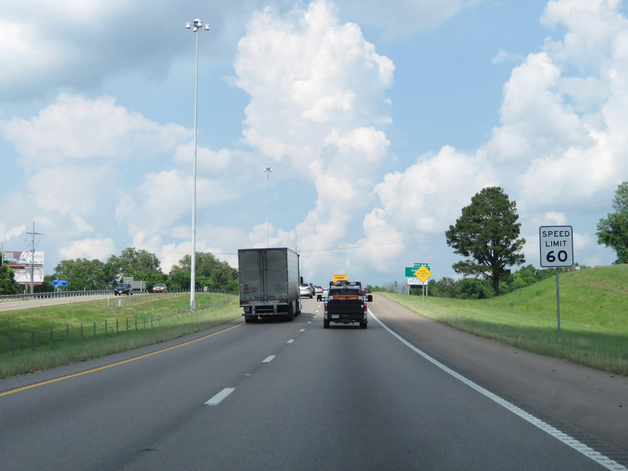
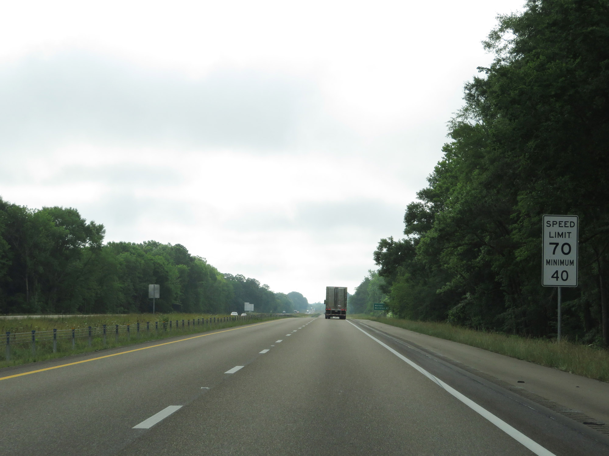
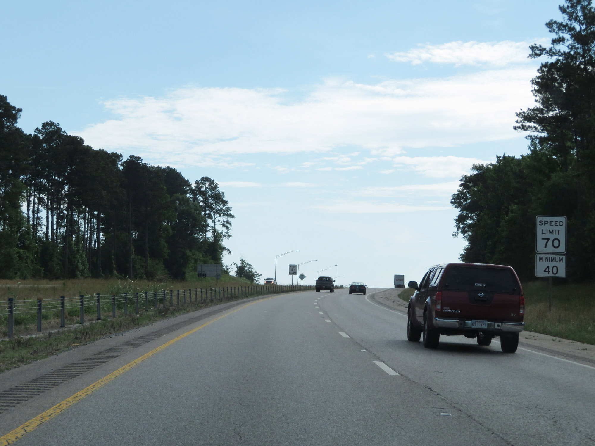
Leaving the Vicksburg area, the speed limit increases to 70 mph with a minimum speed limit of 40 mph. These are the standard speed limits on most rural Interstate highways in Mississippi. (Photo taken 5/23/18). |
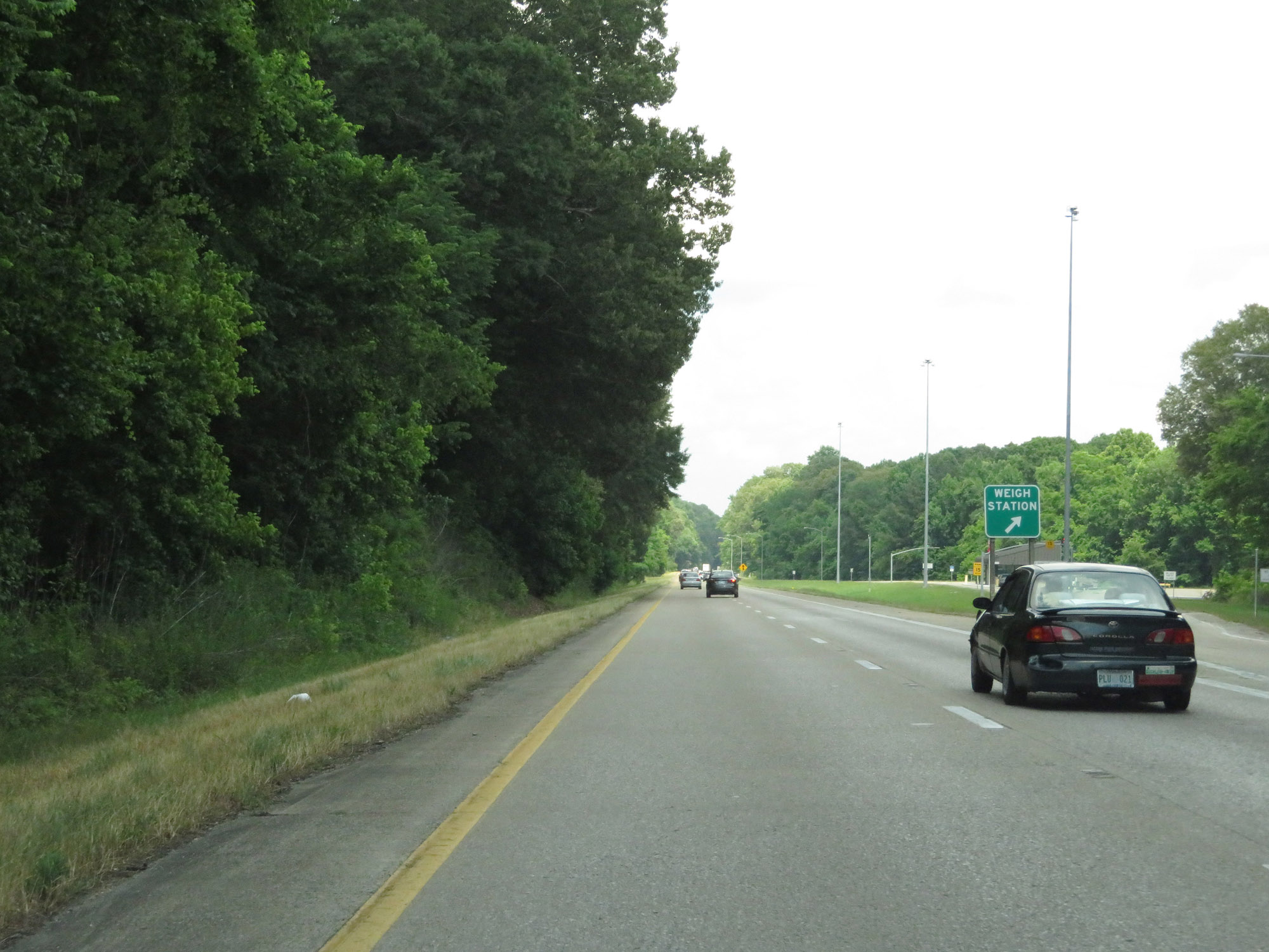 |
Weigh Station on Interstate 20 East in Warren County. (Photo taken 5/23/18). |
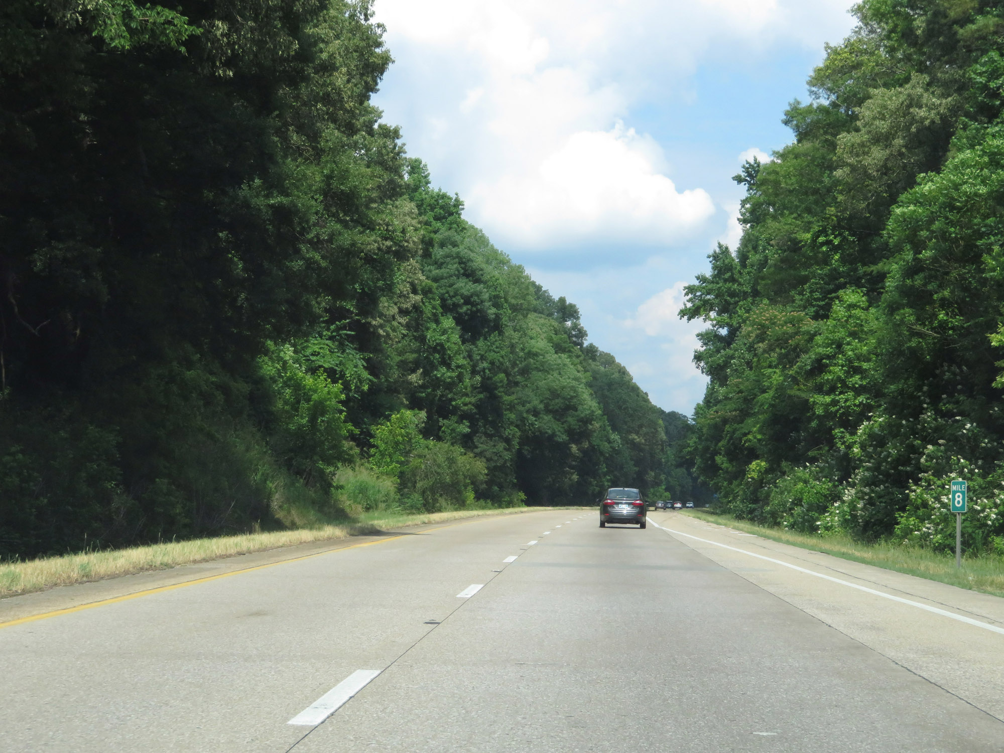 |
View on Interstate 20 East at mile marker 8. (Photo taken 5/23/18). |
 |
Interstate 20 East at mile marker 9. (Photo taken 5/23/18). |
 |
Interstate 20 East at Exit 11: Bovina (Photo taken 5/23/18). |
 |
Mileage sign on Interstate 20 East. It's 3 miles to Flowers and 32 miles to Jackson. (Photo taken 5/23/18). |
 |
Interstate 20 East approaching Exit 15 - 1 mile. (Photo taken 5/23/18). |
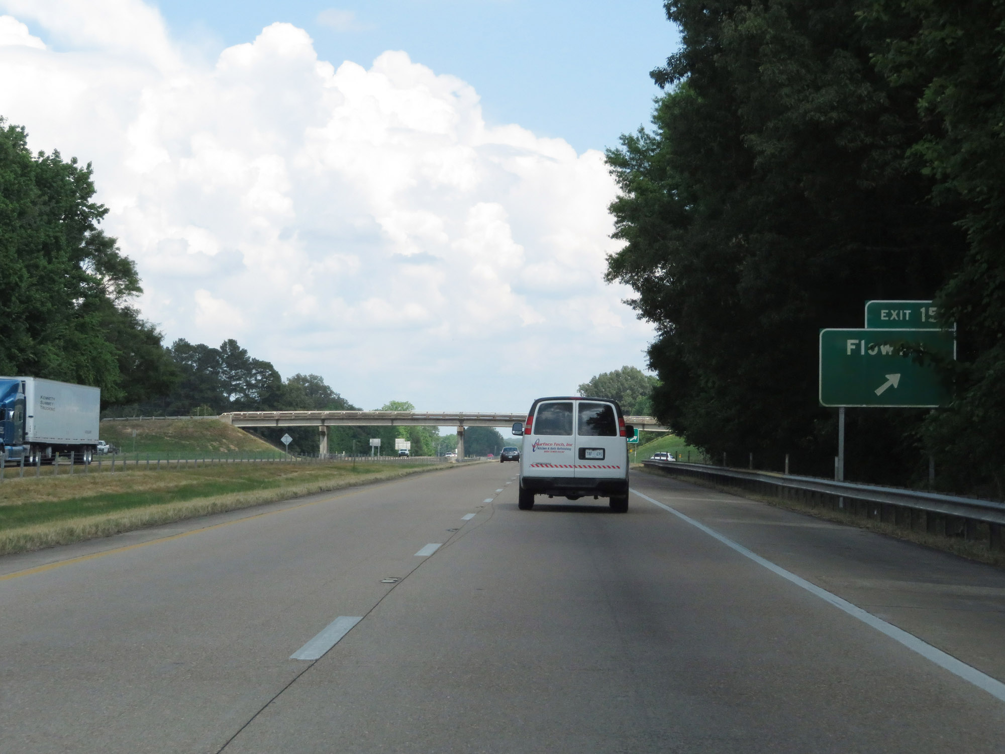 |
Interstate 20 East at Exit 15: Flowers (Photo taken 5/23/18). |
 |
Interstate 20 East as it enters Hinds County by crossing the Big Black River. (Photo taken 5/23/18). |
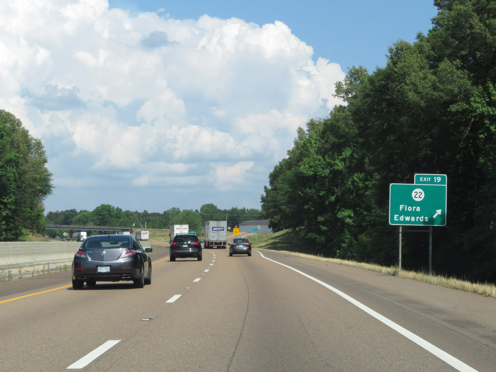 |
Interstate 20 East at Exit 19: MS 22 - Flora / Edwards (Photo taken 5/23/18). |
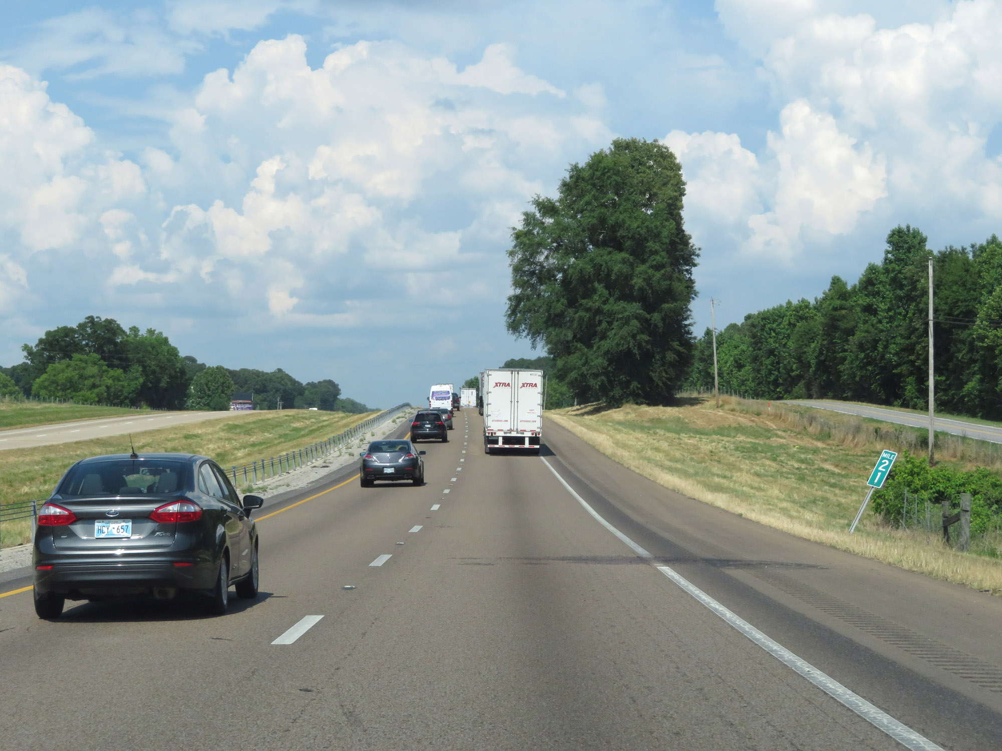 |
Interstate 20 East at mile marker 21. (Photo taken 5/23/18). |
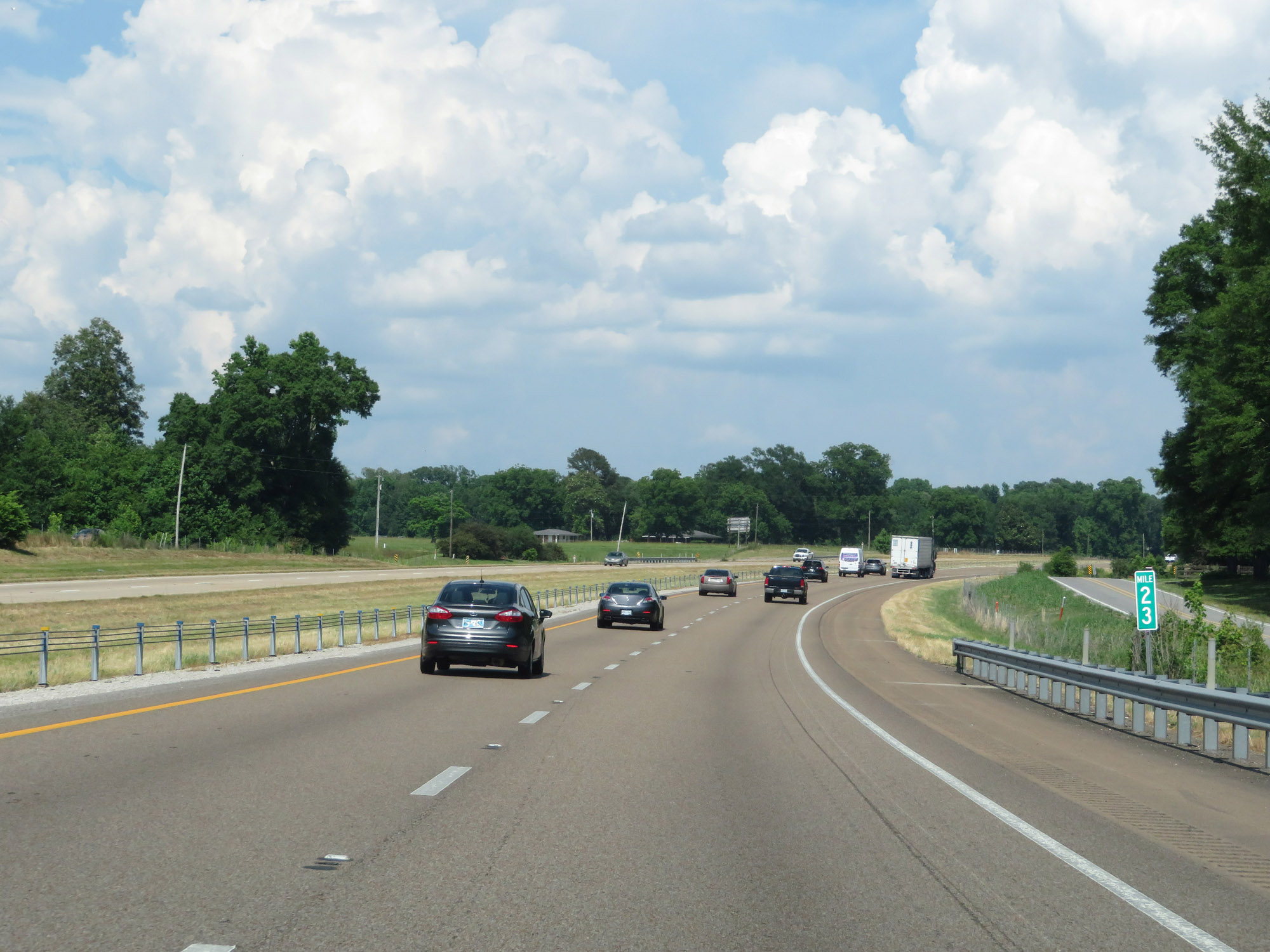 |
View on Interstate 20 East at mile marker 23. (Photo taken 5/23/18). |
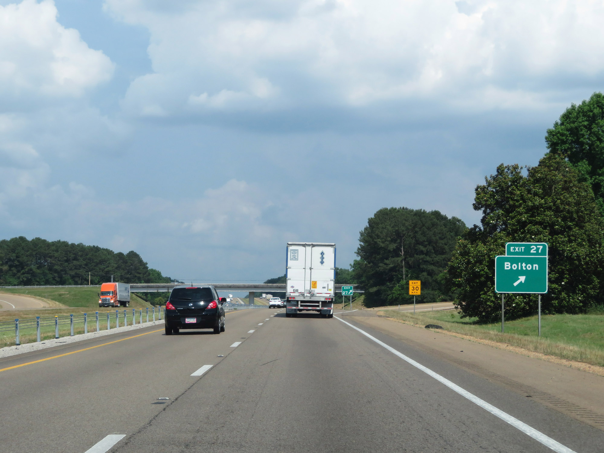 |
Interstate 20 East at Exit 27: Bolton (Photo taken 5/23/18). |
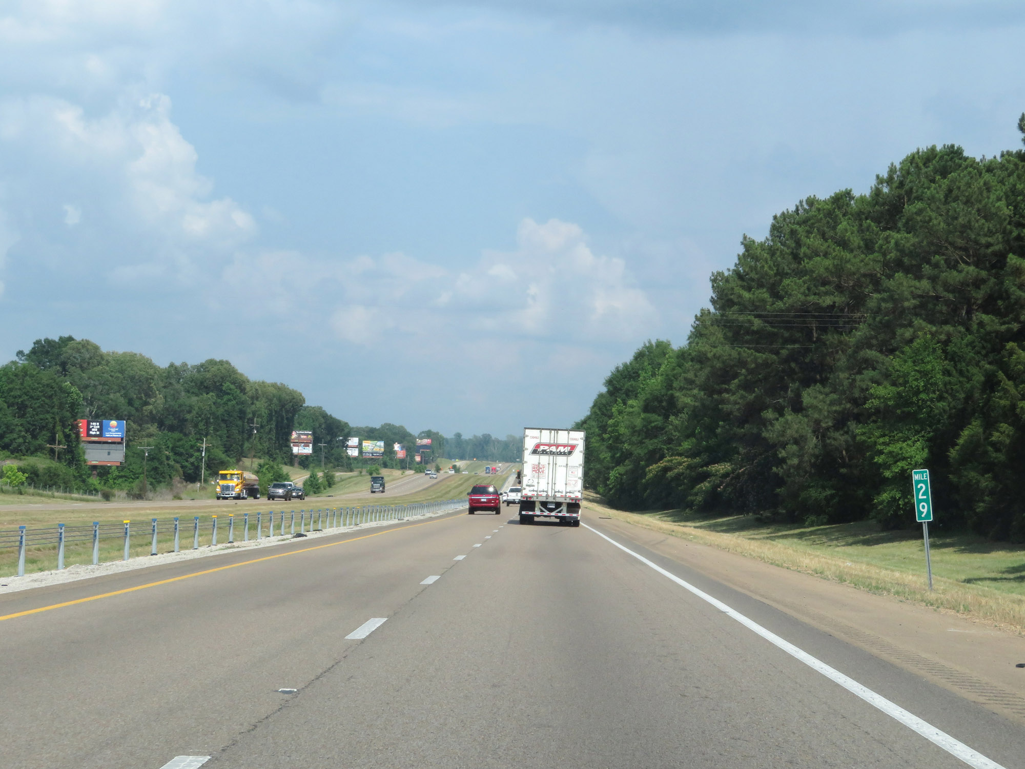 |
Interstate 20 East at mile marker 29. (Photo taken 5/23/18). |
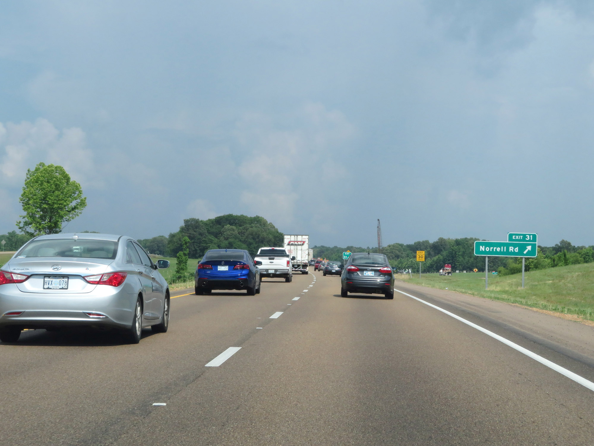 |
Interstate 20 East at Exit 31: Norrell Rd (Photo taken 5/23/18). |
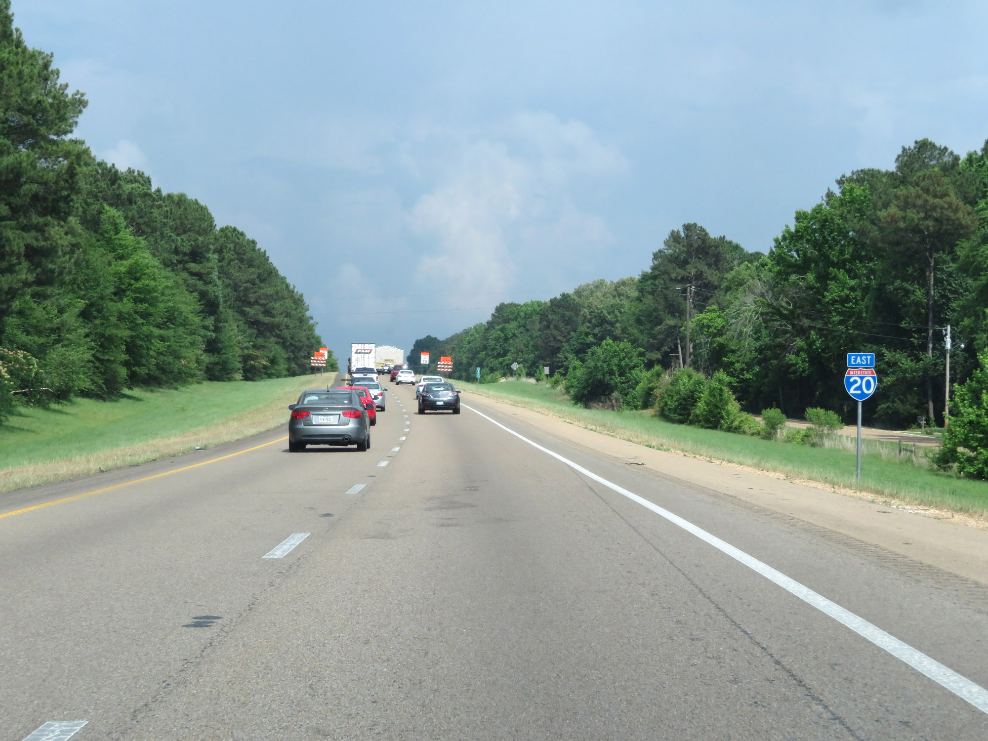 |
Interstate 20 East reassurance shield. (Photo taken 5/23/18). |
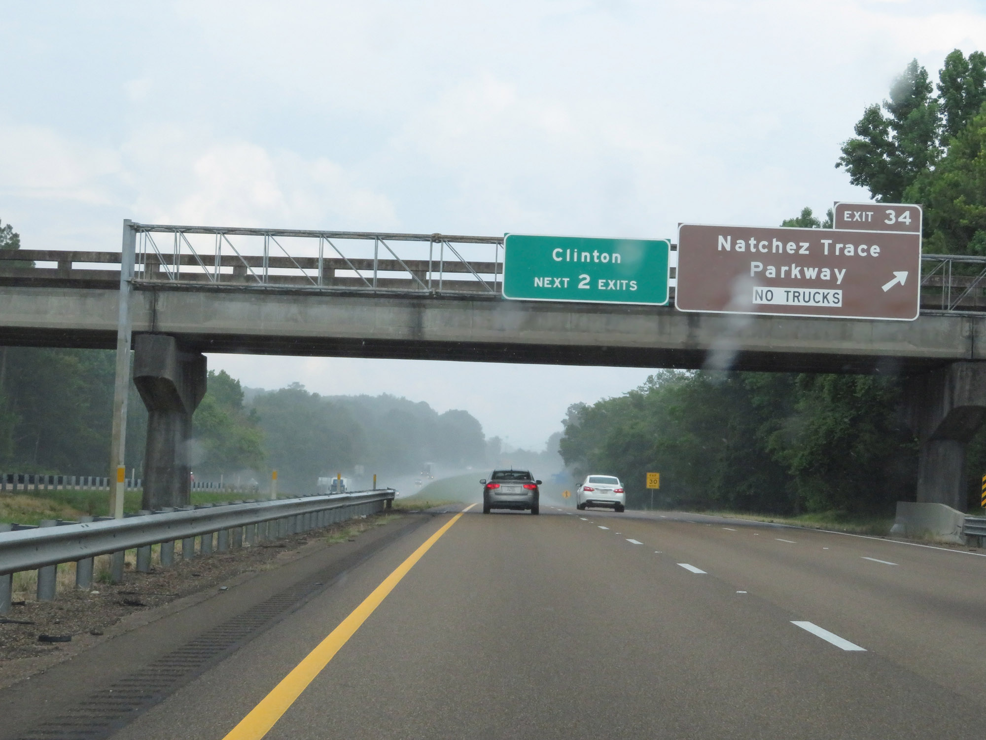 |
Interstate 20 East at Exit 34: Natchez Trace Parkway (Photo taken 5/23/18). |
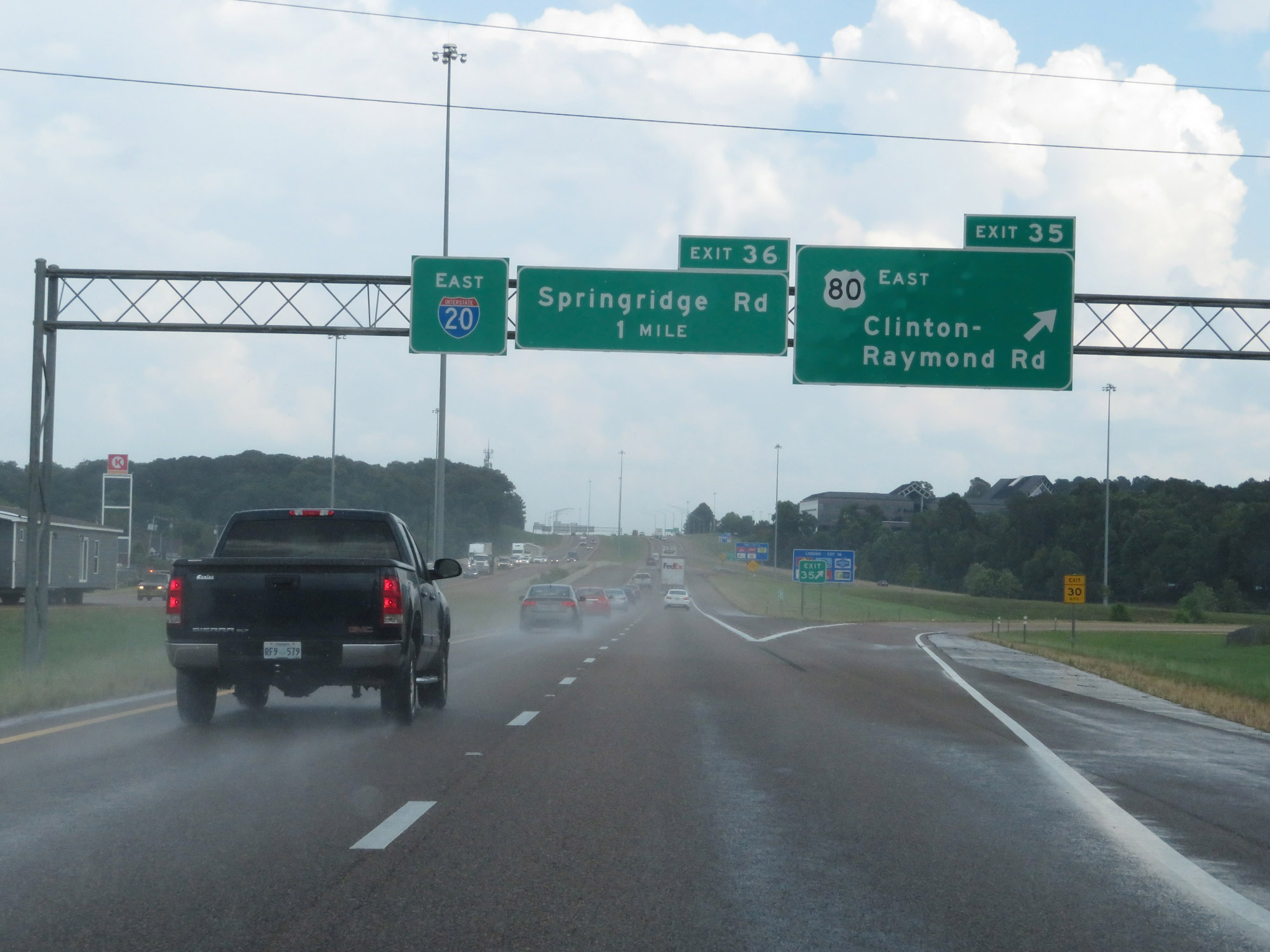 |
Interstate 20 East at Exit 35: US 80 East - Clinton-Raymond Rd (Photo taken 5/23/18). |
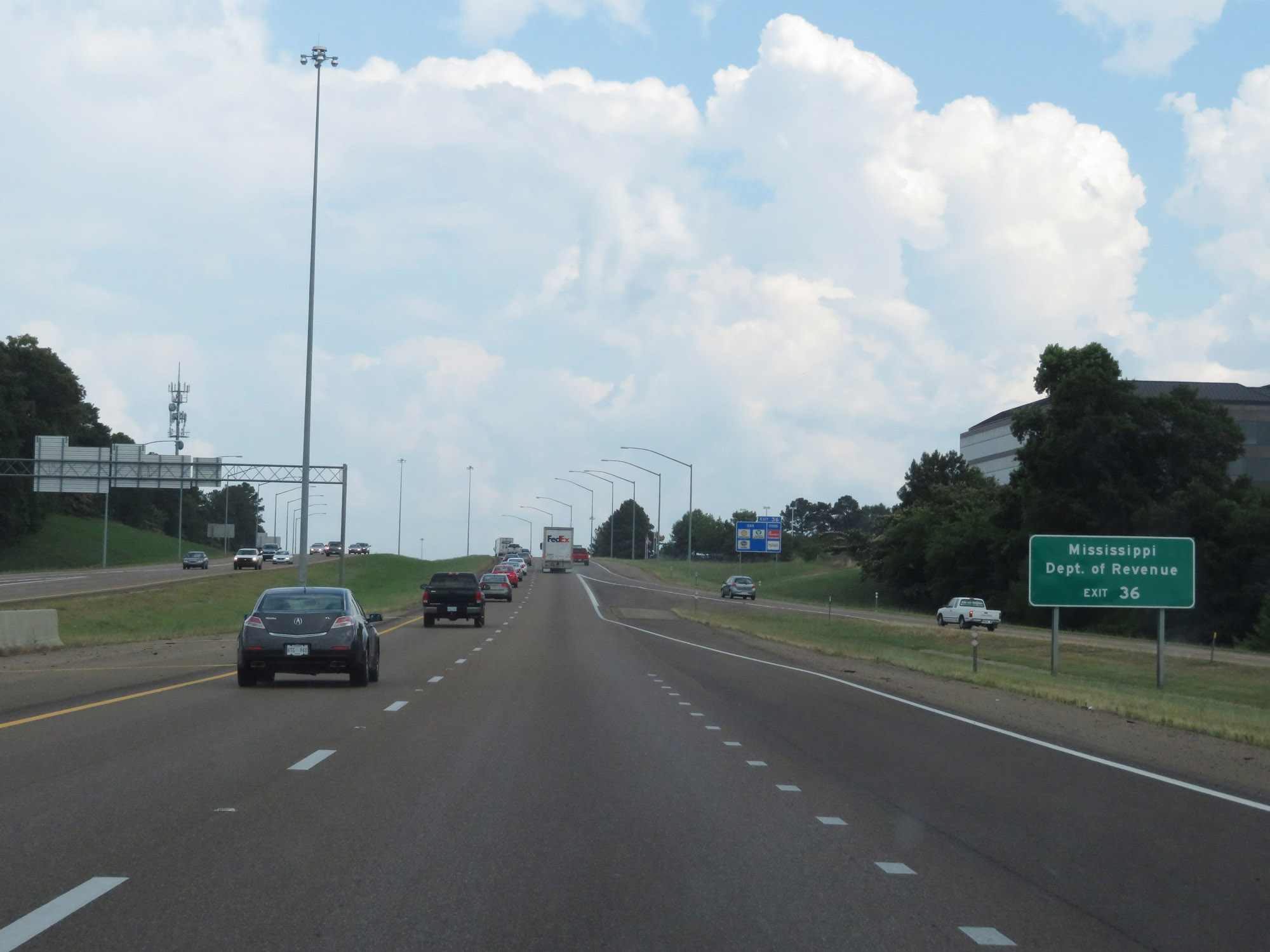 |
Take Exit 36 to the Mississippi Department of Revenue. (Photo taken 5/23/18). |
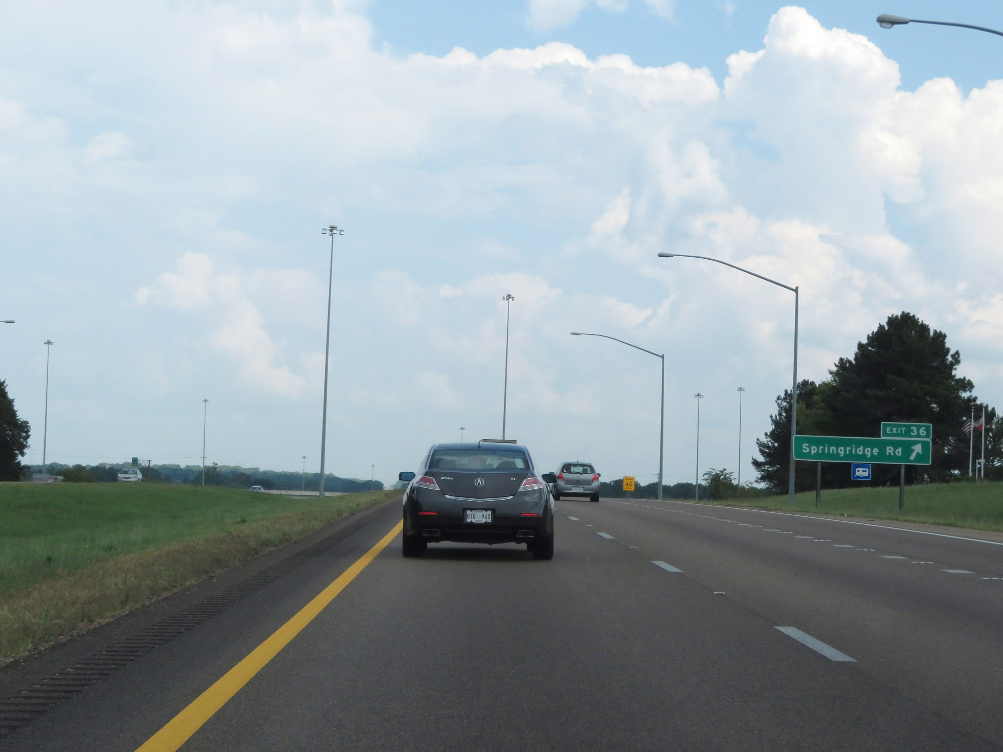 |
Interstate 20 East at Exit 36: Springridge Rd (Photo taken 5/23/18). |
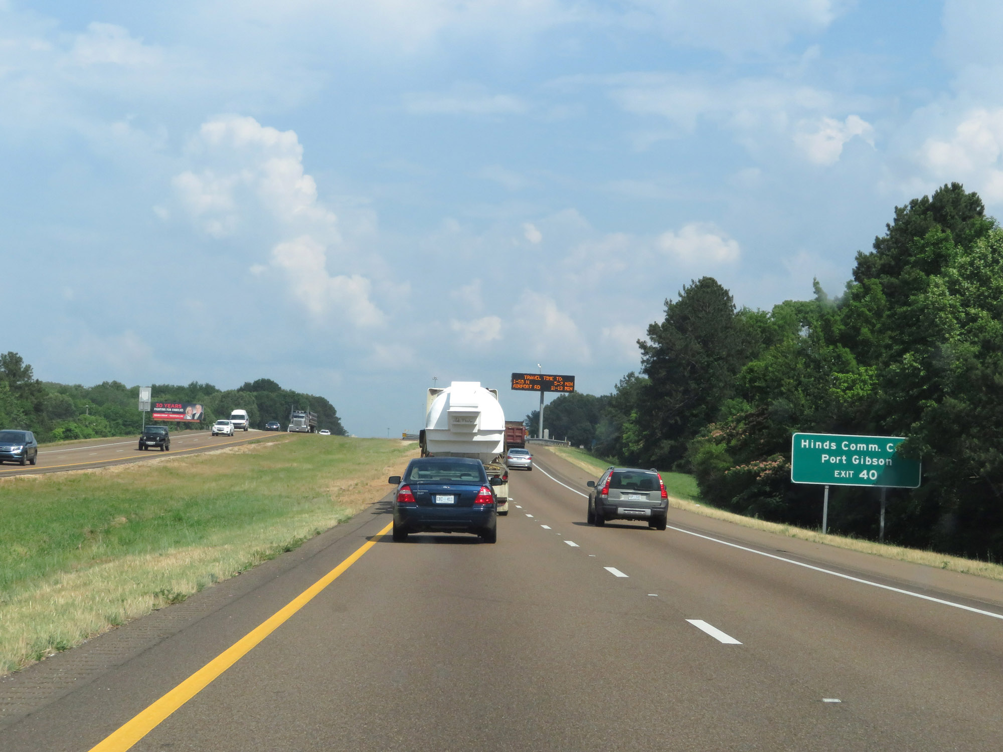 |
Take Exit 40 to Hinds Community College and Port Gibson. (Photo taken 5/23/18). |
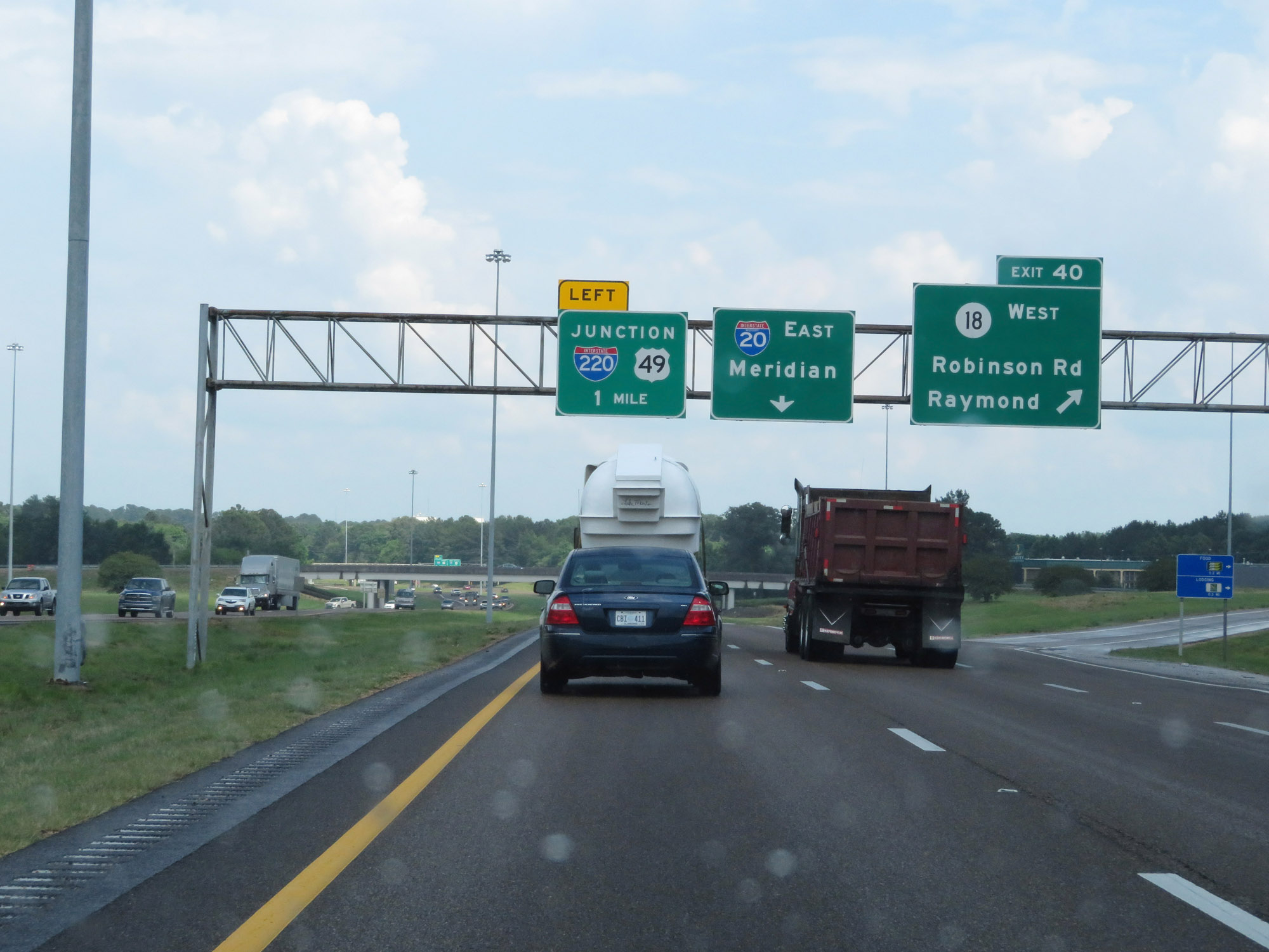 |
Interstate 20 East at Exit 40: MS 18 West - Robinson Rd / Raymond (Photo taken 5/23/18). |
 |
Interstate 20 East approaching Exit 41 - 1/4 mile on the left. (Photo taken 5/23/18). |
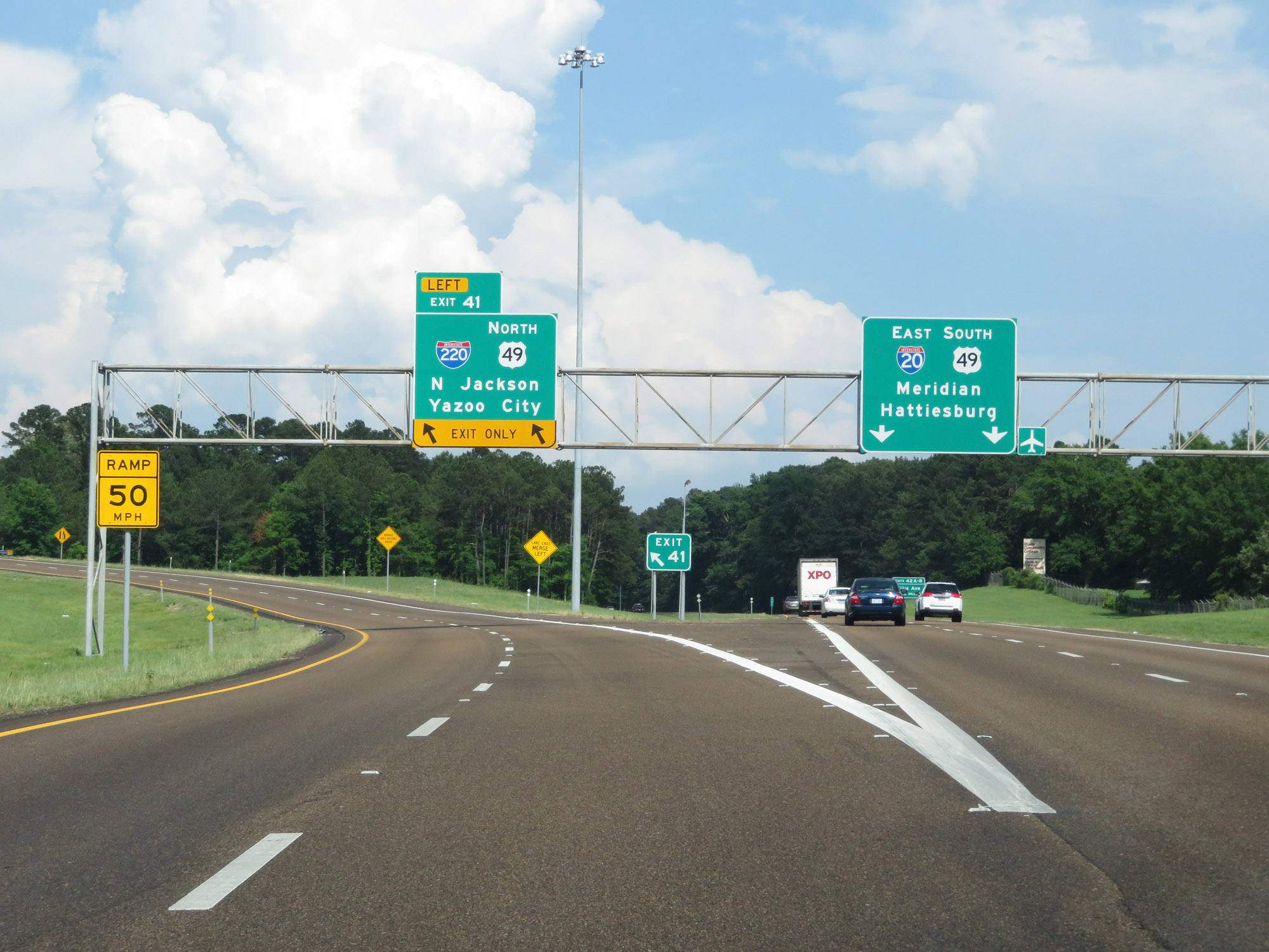 |
Interstate 20 East at Exit 41: Interstate 220 / US 49 North - North Jackson / Yazoo City (Photo taken 5/23/18). |
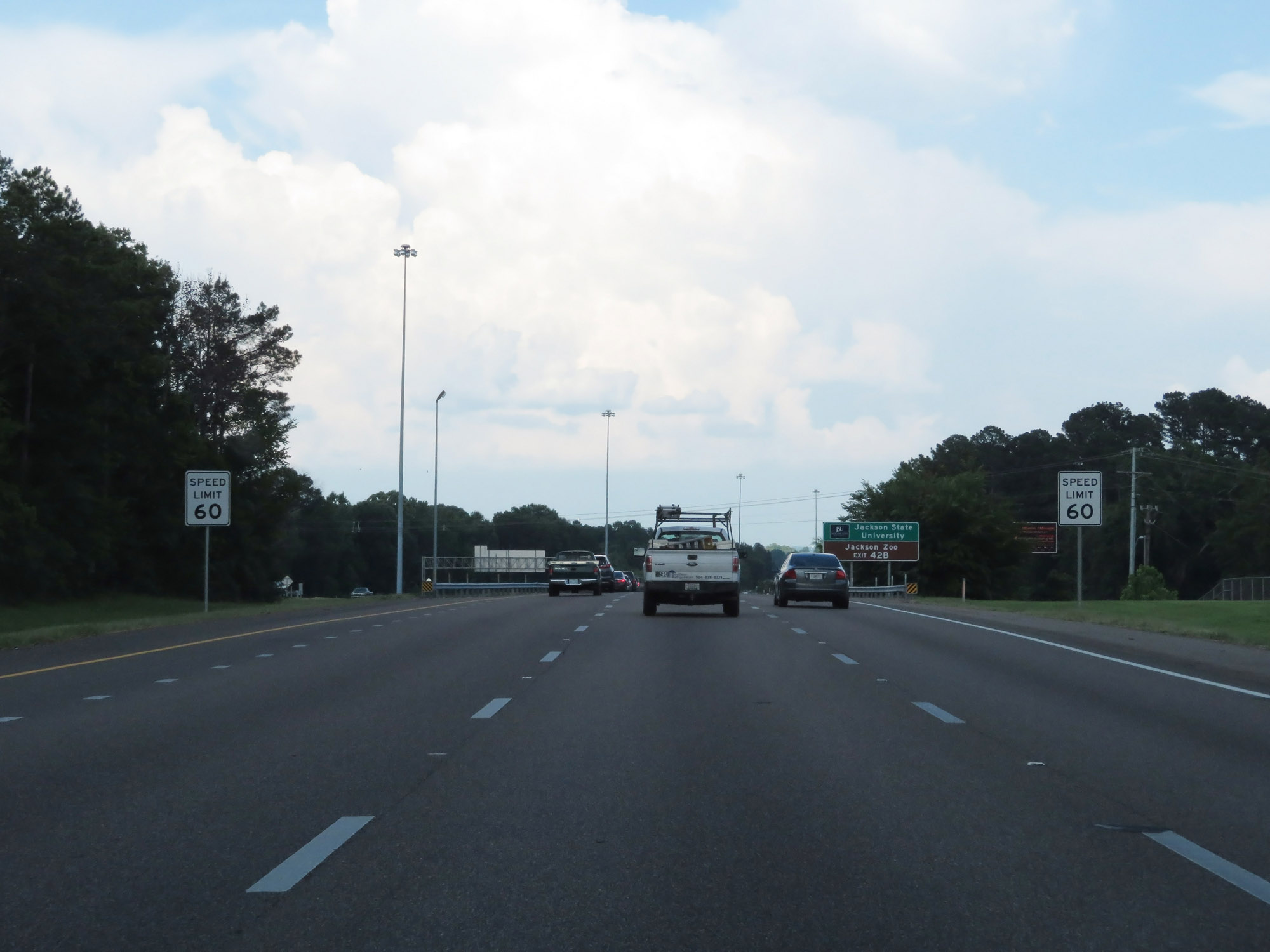 |
Beyond Exit 41, the speed limit decreases to 60 mph as you enter the Jackson area. (Photo taken 5/23/18). |
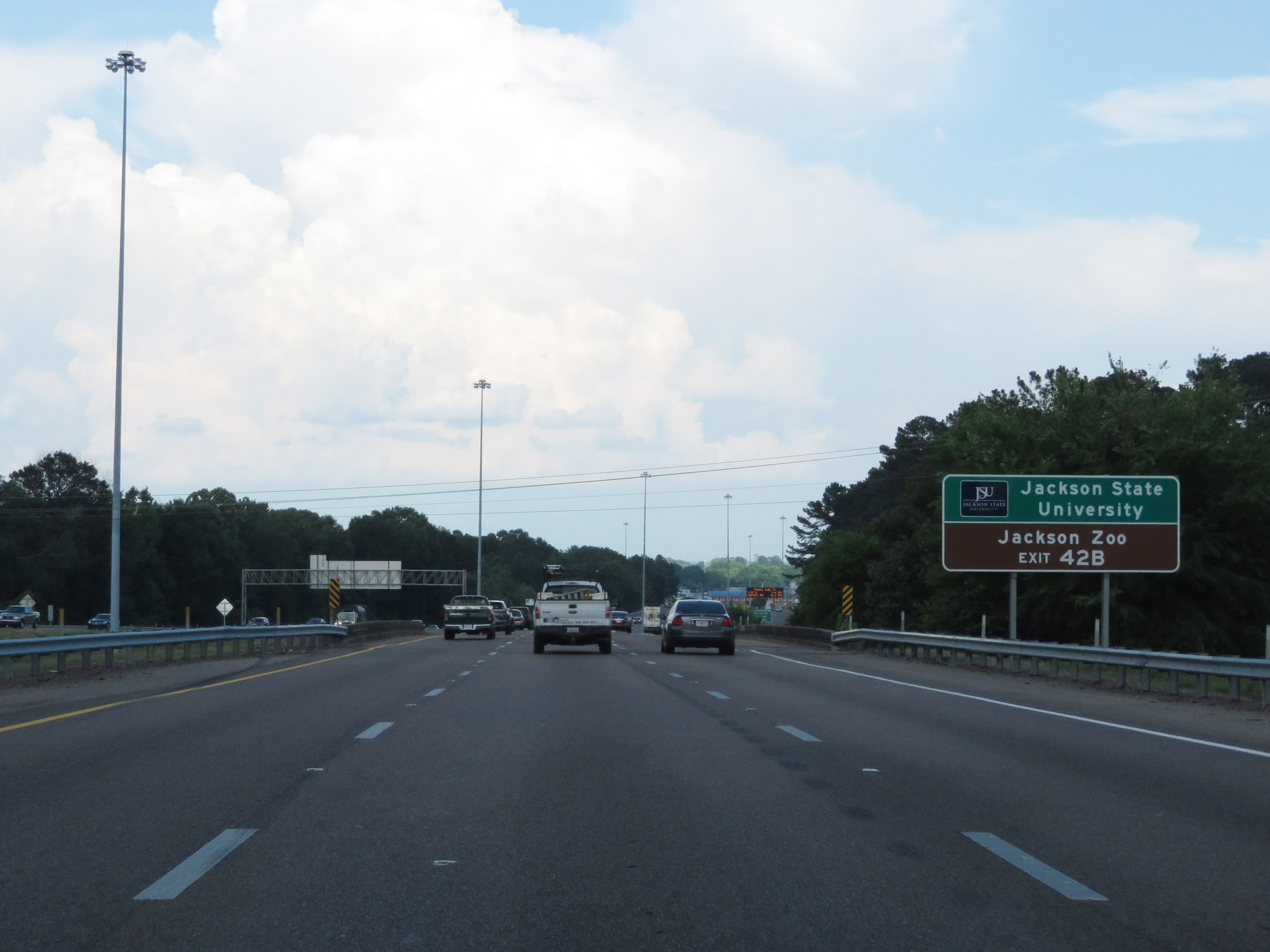 |
Take Exit 42B to Jackson State University and the Jackson Zoo. (Photo taken 5/23/18). |
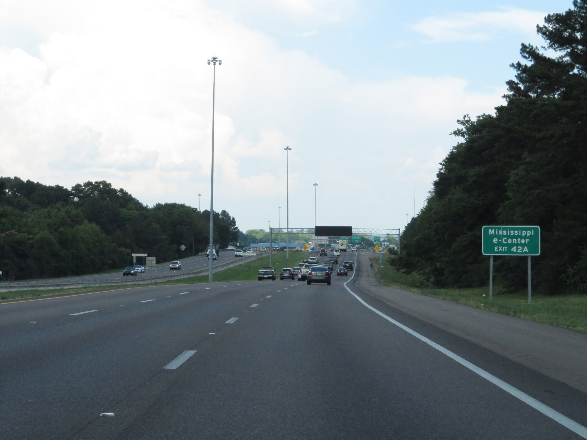 |
Take Exit 42A to Mississippi e-Center. (Photo taken 5/23/18). |
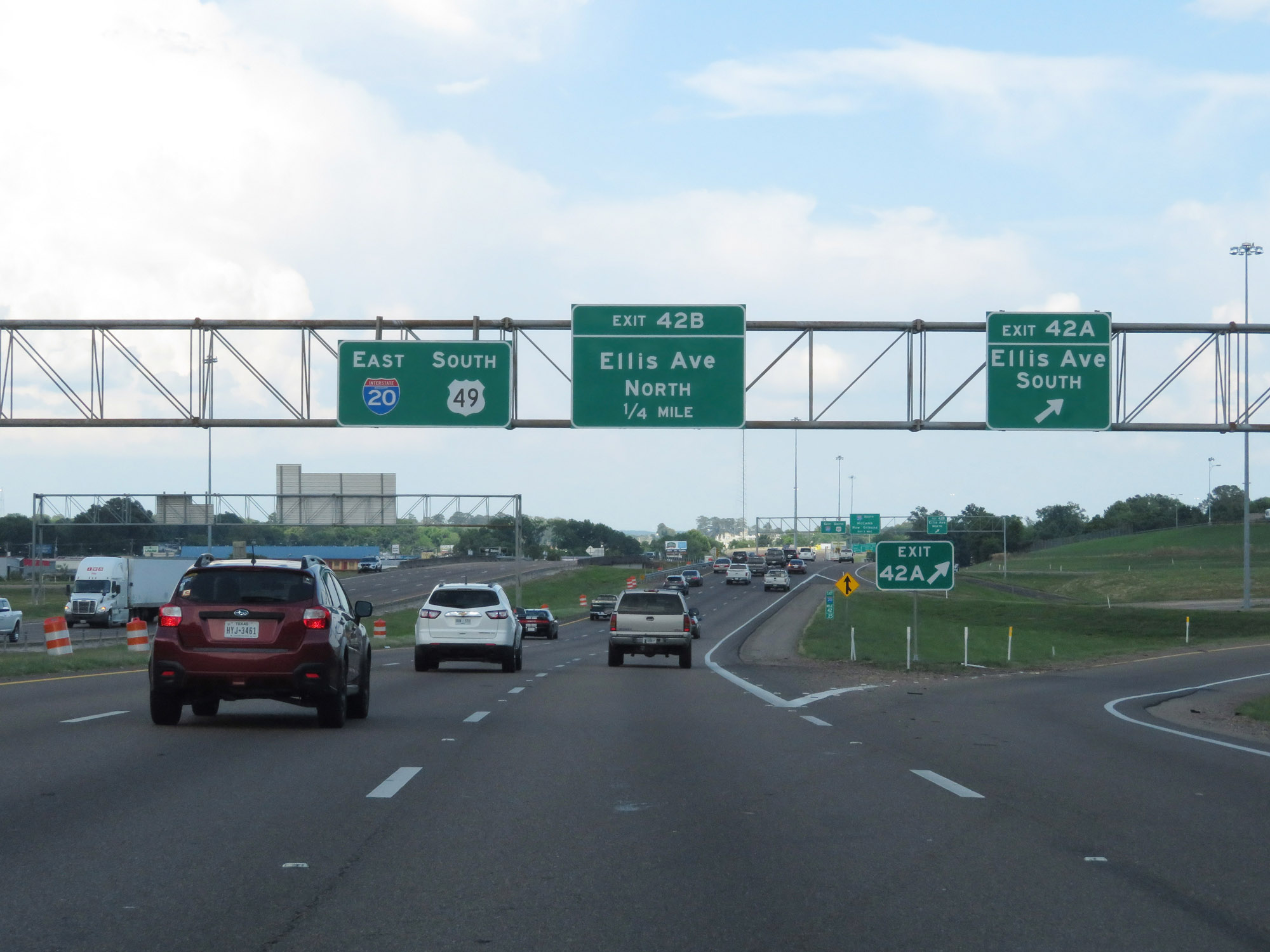 |
Interstate 20 East at Exit 42A: Ellis Ave South (Photo taken 5/23/18). |
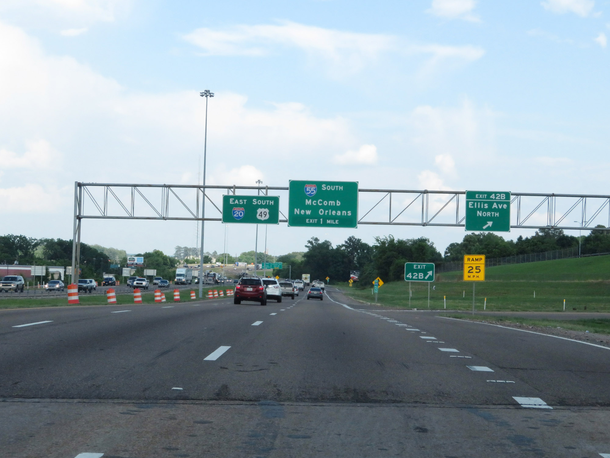 |
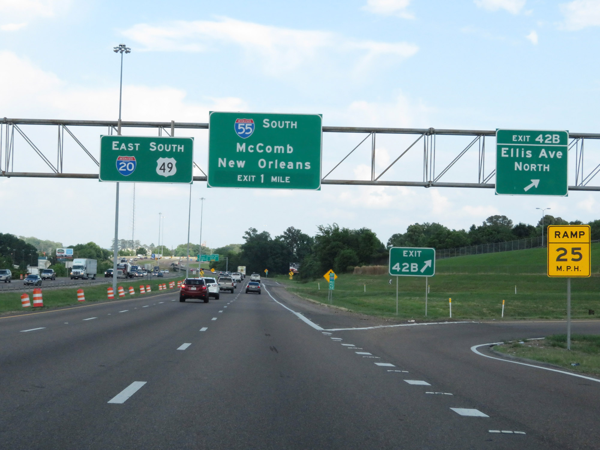
Interstate 20 East at Exit 42B: Ellis Ave North (Photo taken 5/23/18). |
 |
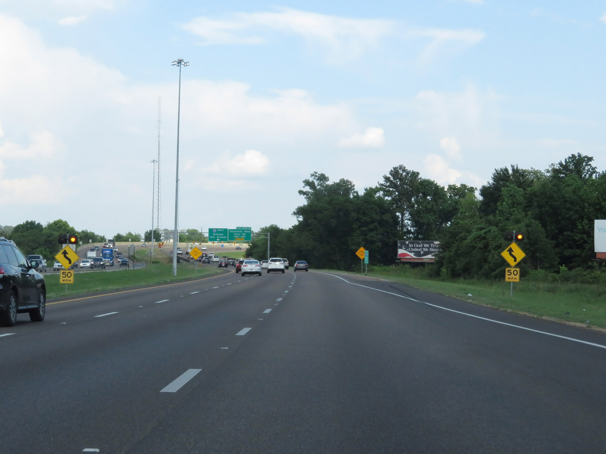
Interstate 20 East approaching the junction of Interstate 55 in Jackson - 1 mile. (Photo taken 5/23/18). |
 |
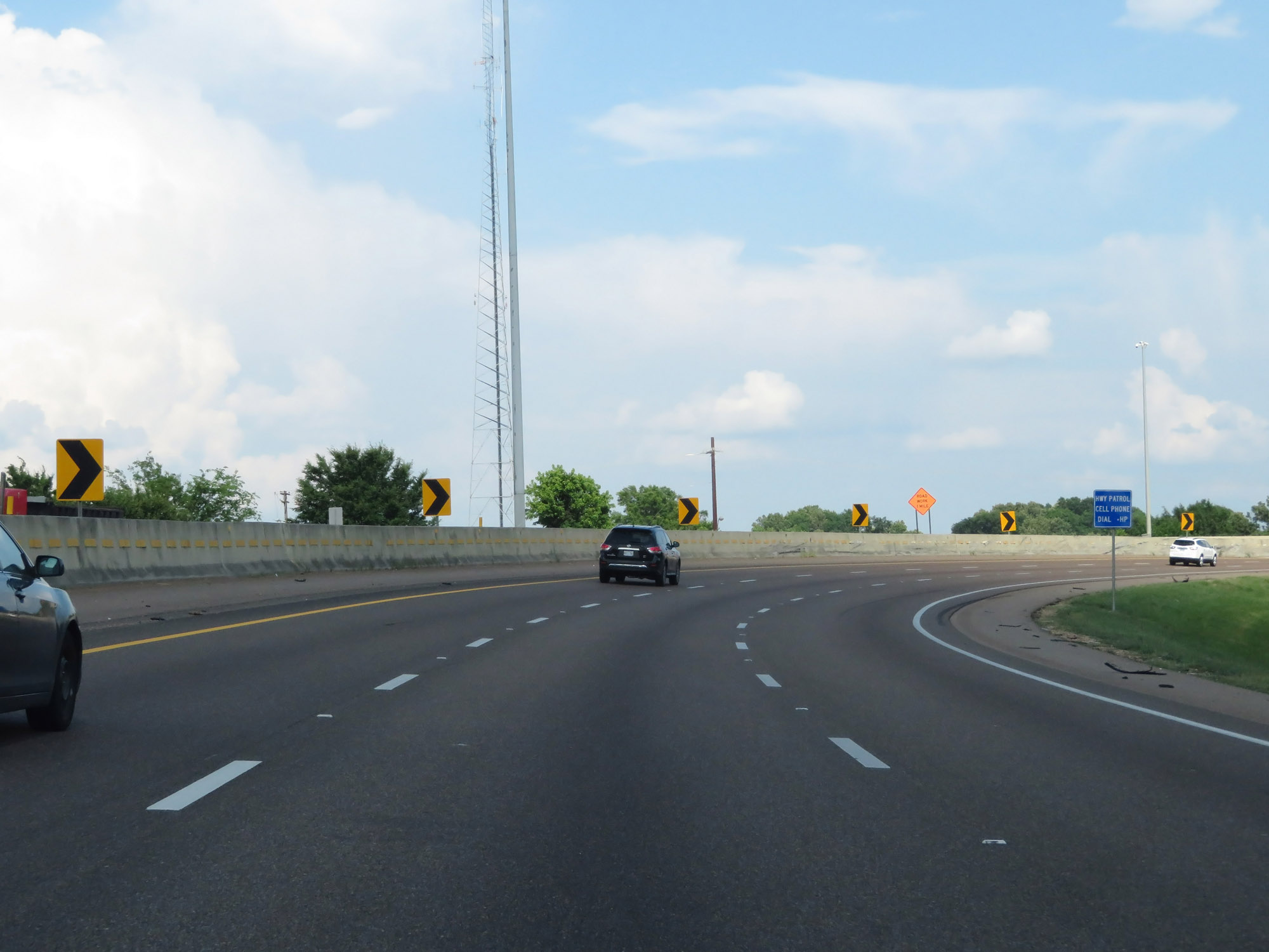
Interstate 20 East will traverse a sharp curve to the right ahead, as these signs warn. (Photo taken 5/23/18). |
 |
Interstate 20 East as it curves sharply to the south, just before it meets Interstate 55. (Photo taken 5/23/18). |
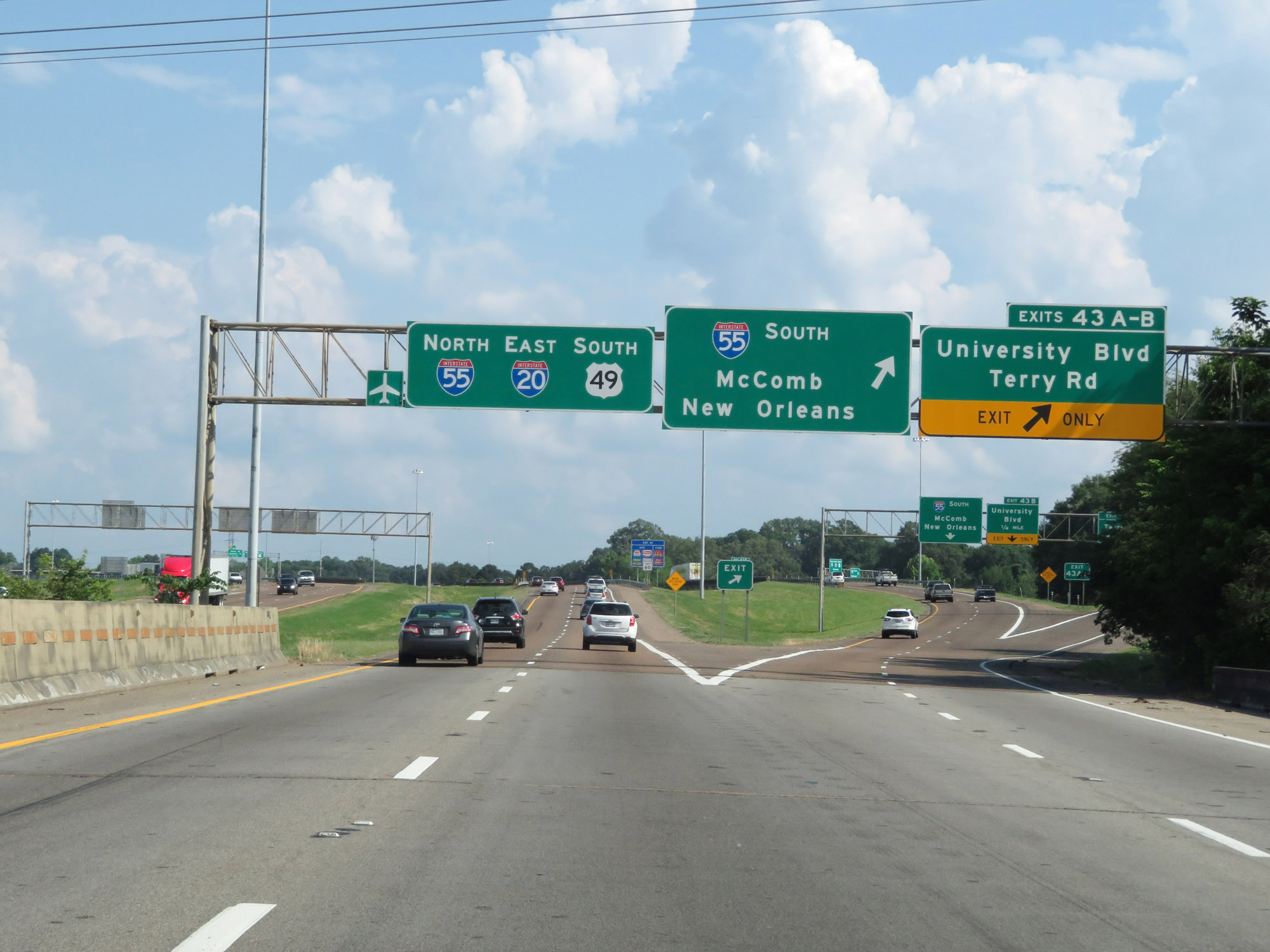 |
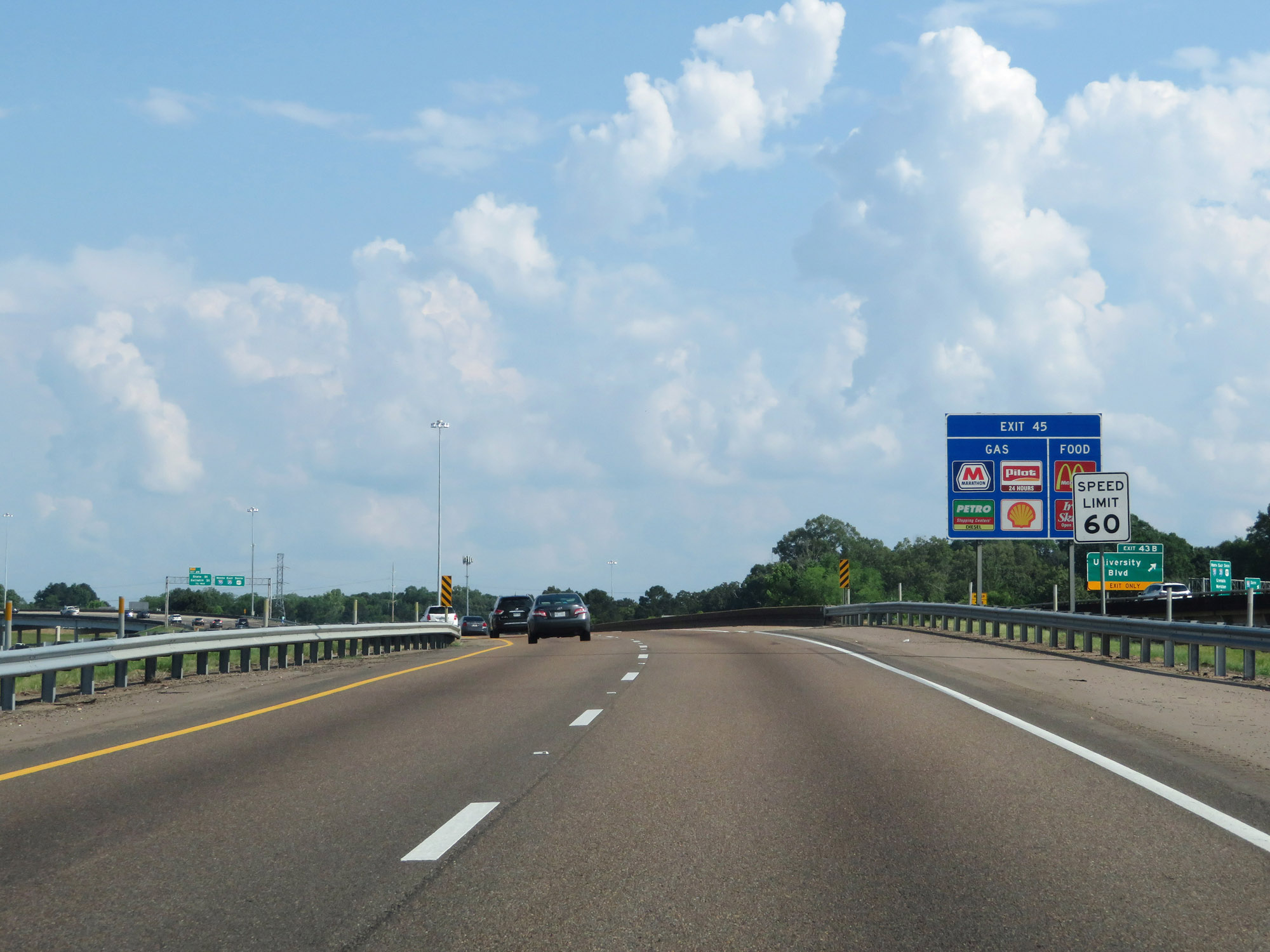
Interstate 20 East at Exit 43A-B: University Blvd / Terry Rd; Exit 44: Interstate 55 South - McComb / New Orleans (Photo taken 5/23/18). |
 |
The speed limit remains 60 mph through the Jackson area. (Photo taken 5/23/18). |
 |
Interstate 20 East at mile marker 44, as it prepares to curve to the north and briefly run concurrently with Interstate 55 North. (Photo taken 5/23/18). |
 |
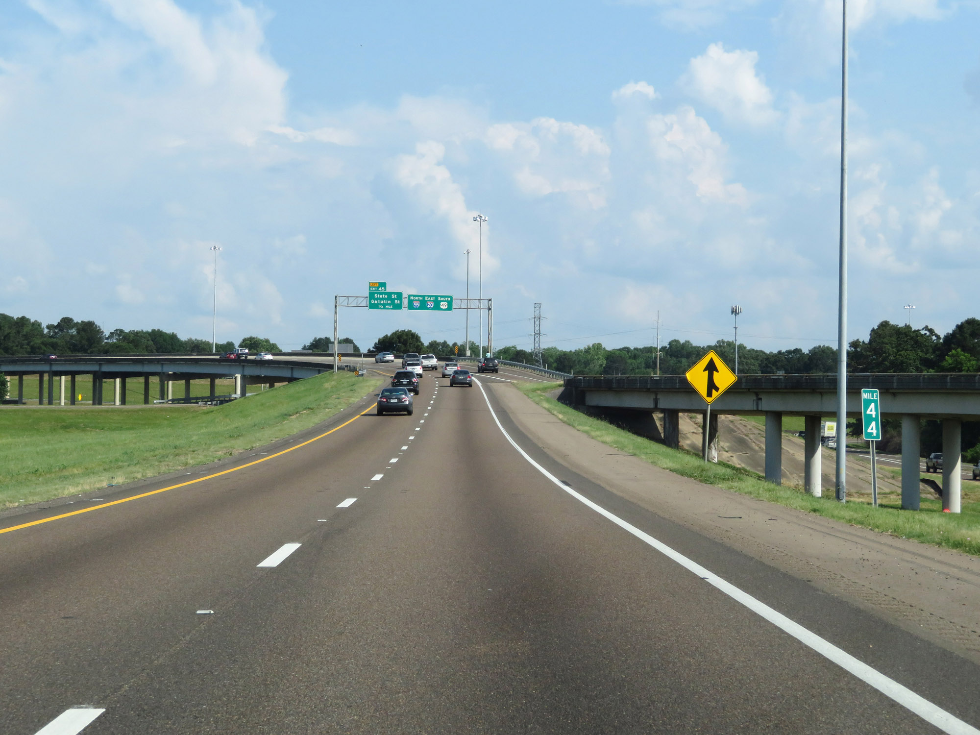
Advance signage for Exit 45, which will be on the left once Interstate 20 East and Interstate 55 North join together ahead. The mileage and exit numbers during the brief I-20/I-55 concurrency are based on those of I-20. (Photo taken 5/23/18). |
 |
Interstate 20 East as it curves to the north in preparation to join Interstate 55 North. (Photo taken 5/23/18). |
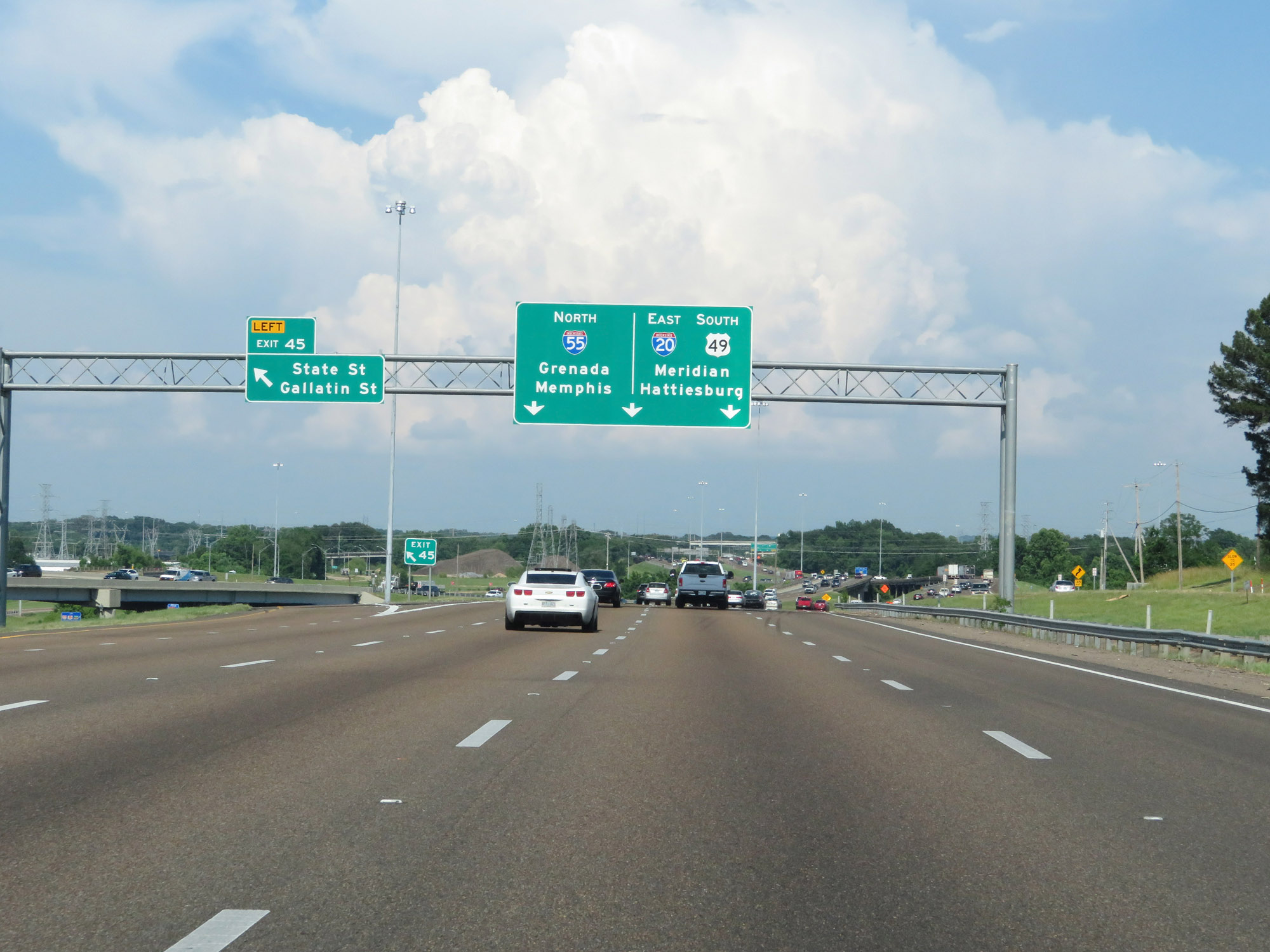 |
Interstate 20 East / Interstate 55 North at Exit 45: State St / Gallatin St (Photo taken 5/23/18). |
 |
Interstate 20 East / Interstate 55 North approaching Exit 46, which is also on the left and will mark the northern end of the I-20/I-55 concurrency ahead. (Photo taken 5/23/18). |
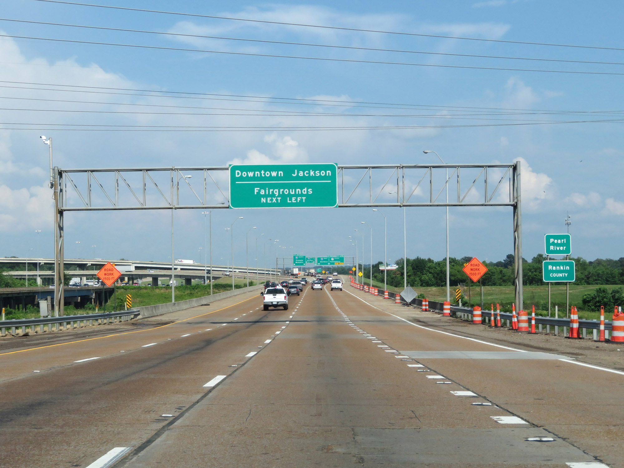 |
Interstate 20 East / Interstate 55 North as they cross the Pearl River and enter Rankin County. Also, take Exit 46 (Interstate 55 North) to downtown Jackson and the Fairgrounds. (Photo taken 5/23/18). |
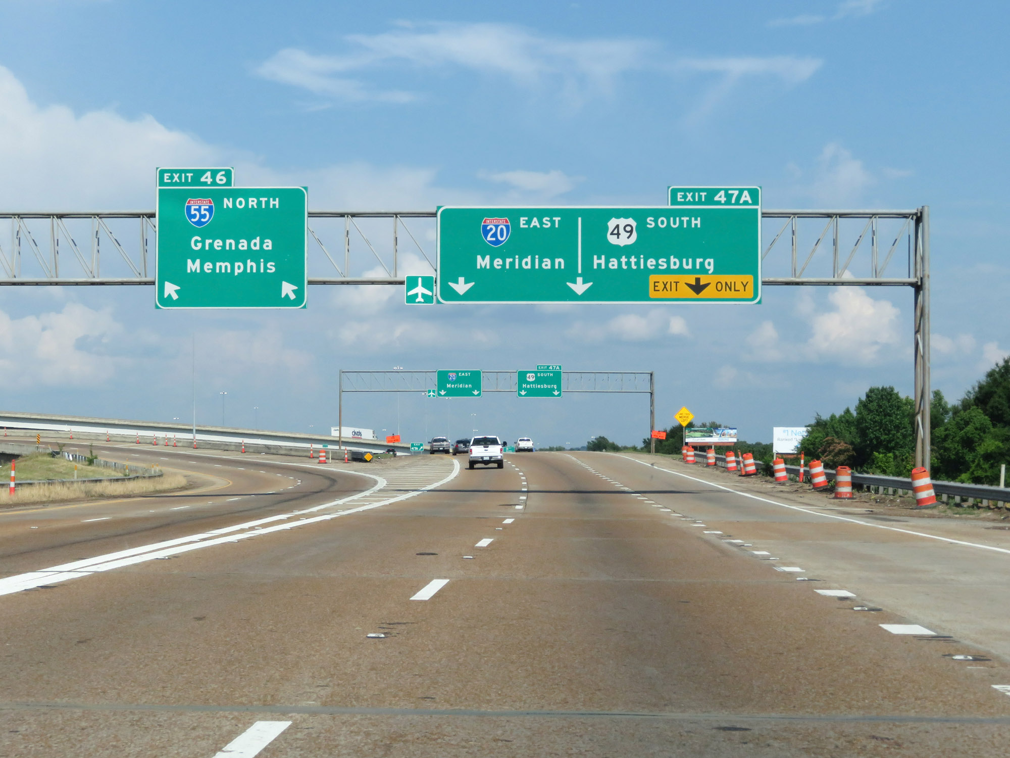 |
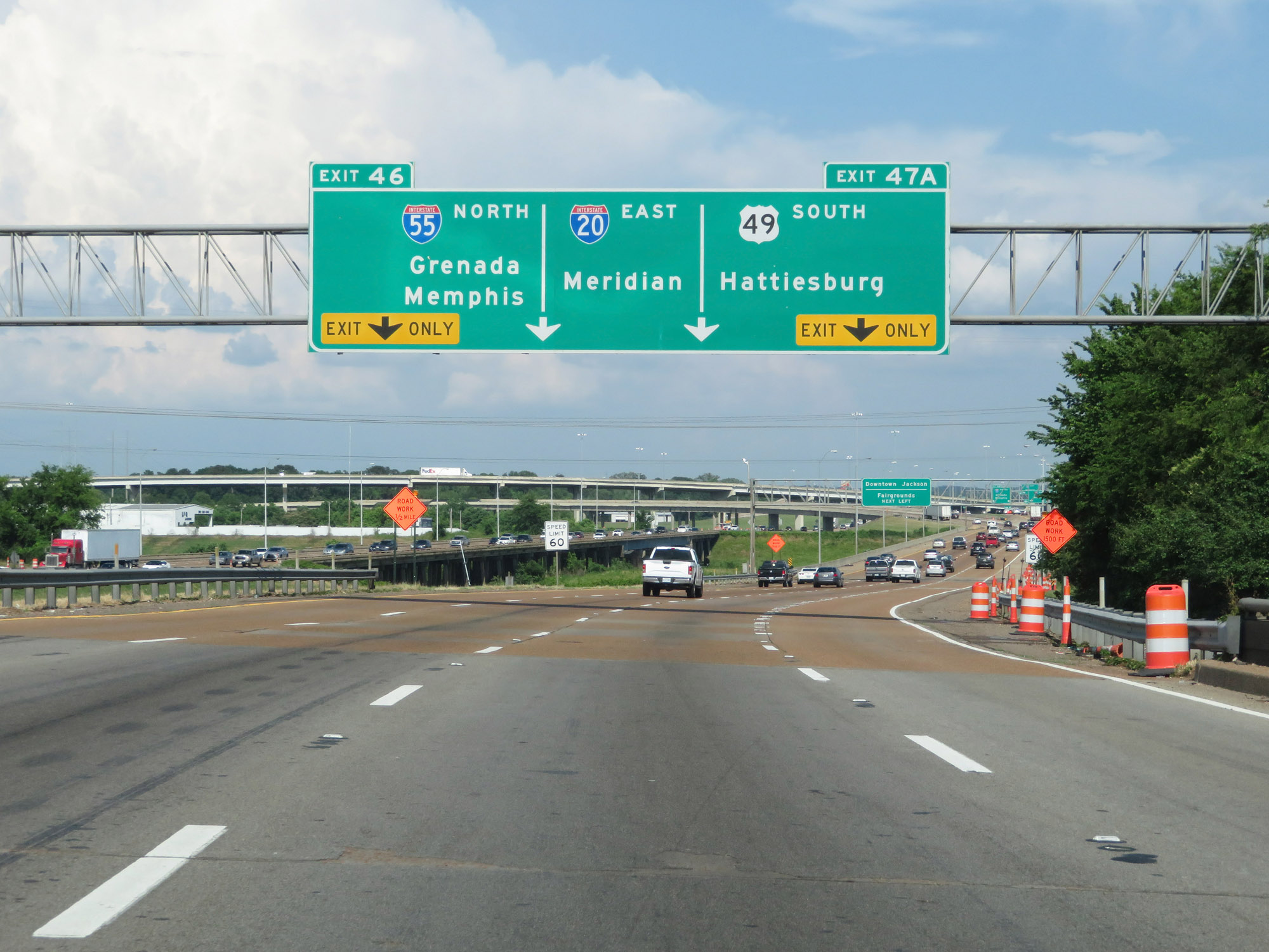
Interstate 20 East / Interstate 55 North at Exit 46: Interstate 55 North - Grenada / Memphis (Photo taken 5/23/18). |
Section 2: Jackson (Exit 46) to Meridian (Exit 130)
 |
Interstate 20 East at Exit 47A: US 49 South - Hattiesburg (Photo taken 5/23/18). |
 |
Interstate 20 East at mile marker 47. (Photo taken 5/23/18). |
 |
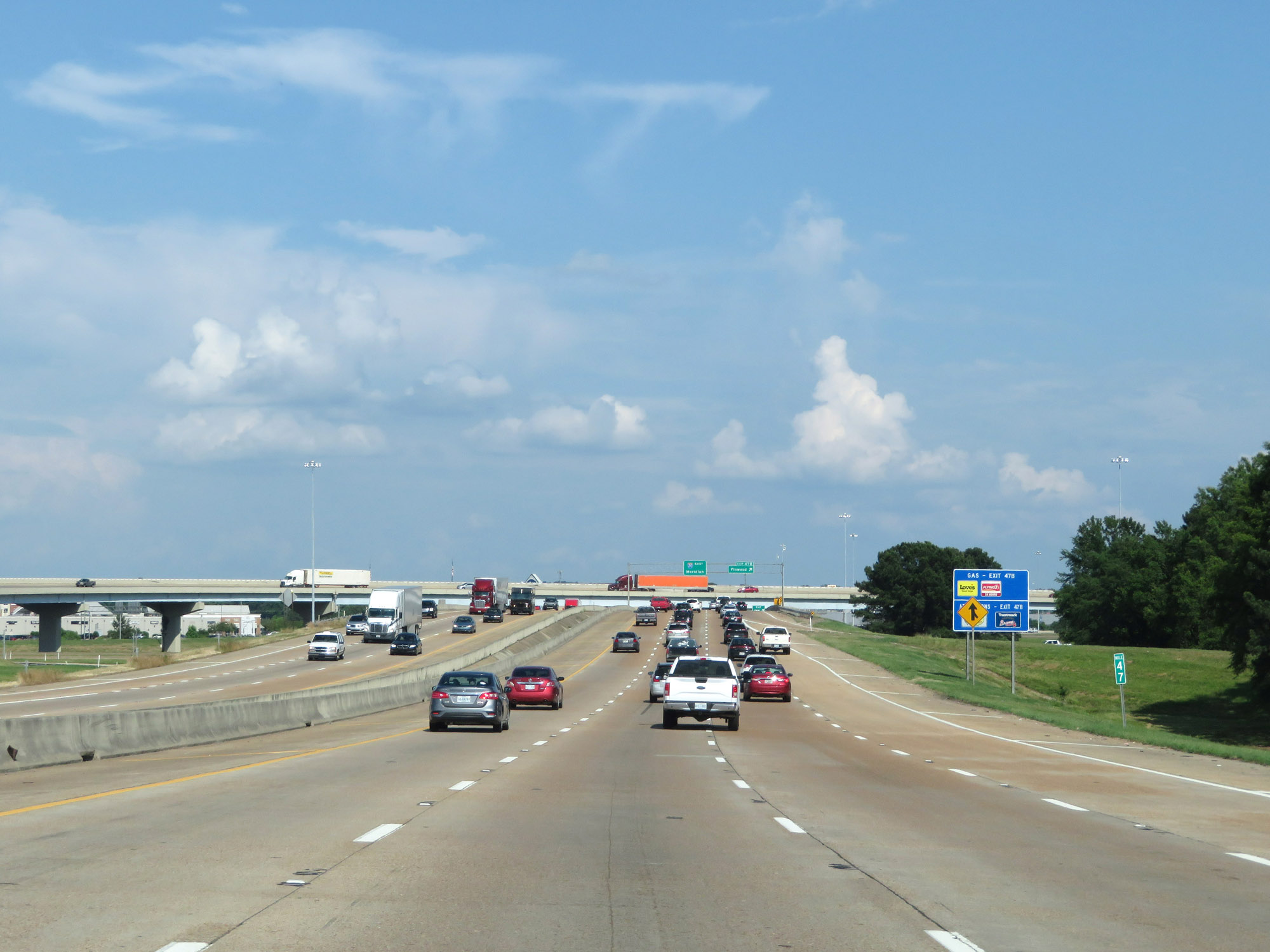
Interstate 20 East at Exit 47B: Flowood (Photo taken 5/23/18). |
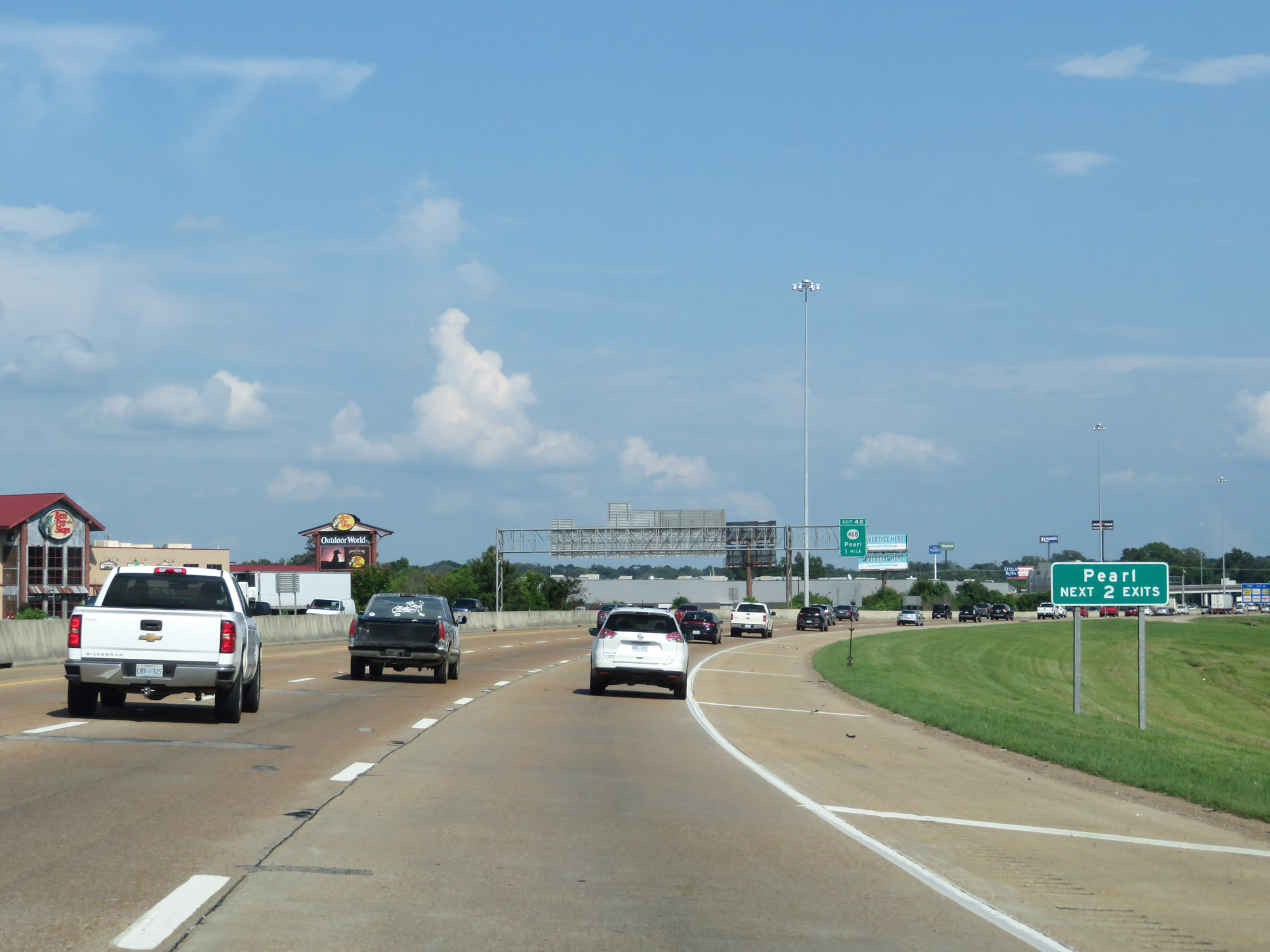 |
Take either of the next 2 exits to Pearl. (Photo taken 5/23/18). |
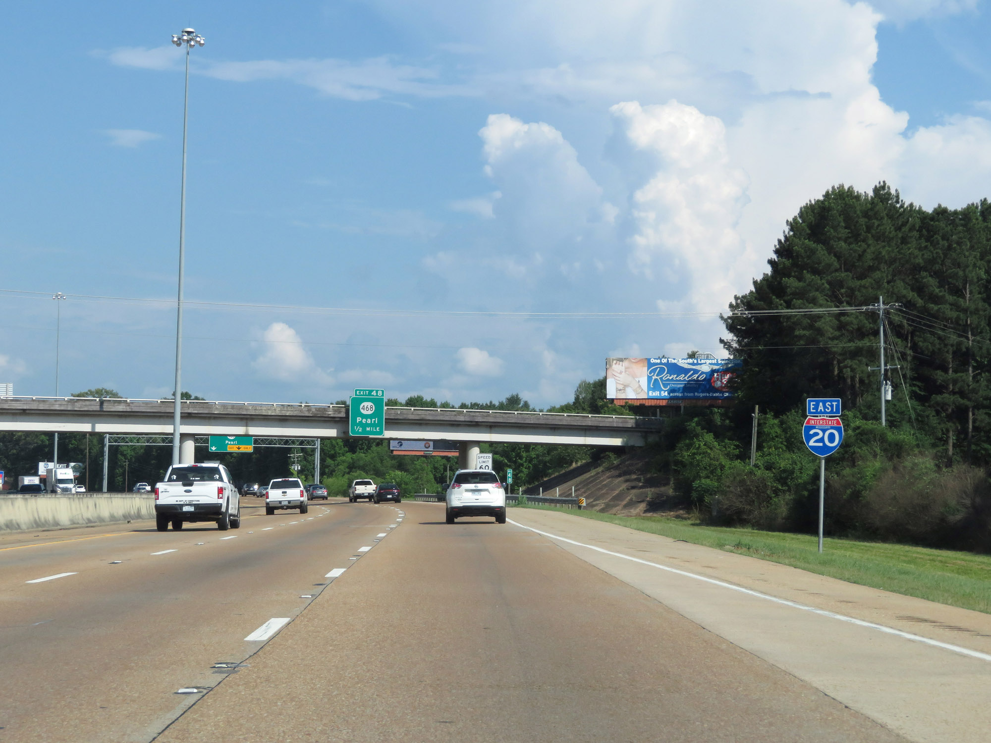 |
State-named Interstate 20 East reassurance shield. (Photo taken 5/23/18). |
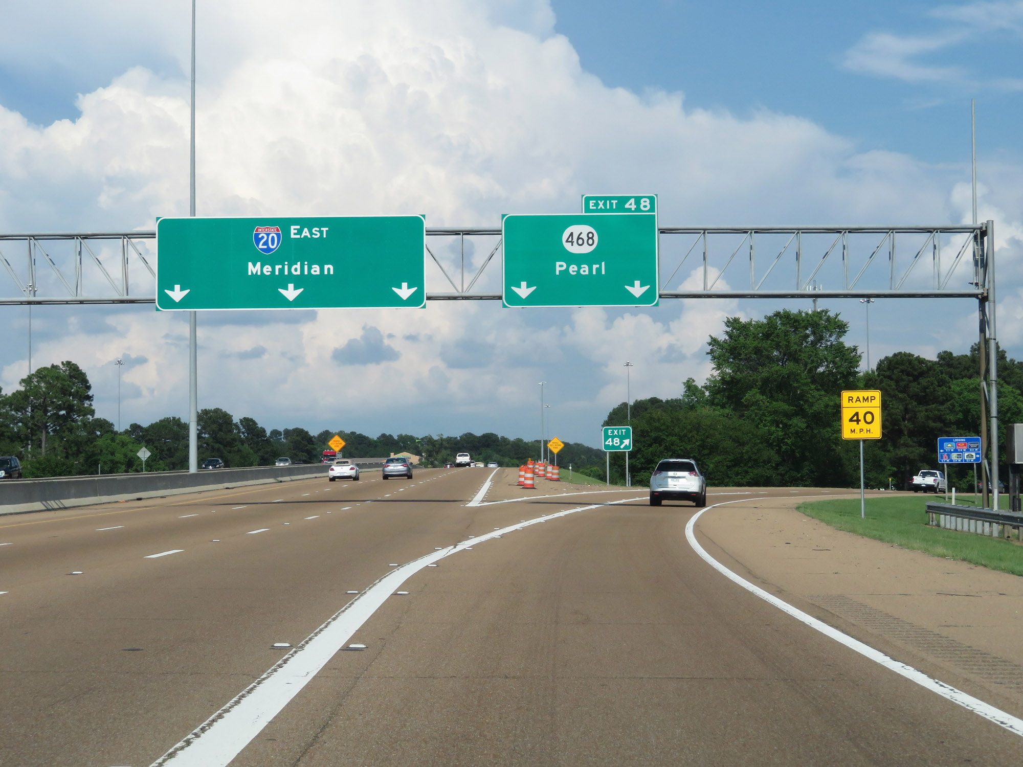 |
Interstate 20 East at Exit 48: MS 468 - Pearl (Photo taken 5/23/18). |
 |
East of Exit 48, the speed limit increases to 70 mph once again. The minimum speed limit is 40 mph as usual. (Photo taken 5/24/18). |
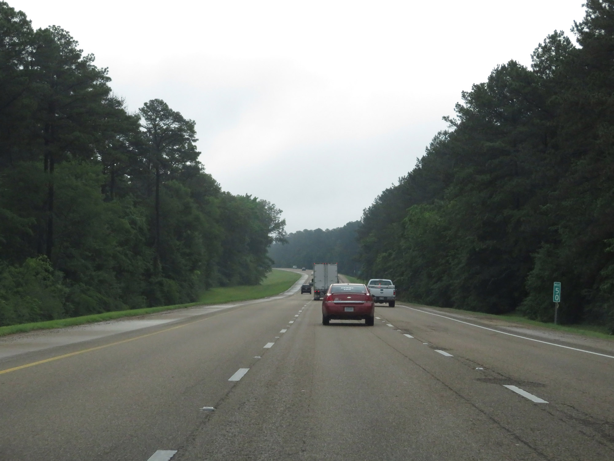 |
Interstate 20 East at mile marker 50. (Photo taken 5/24/18). |
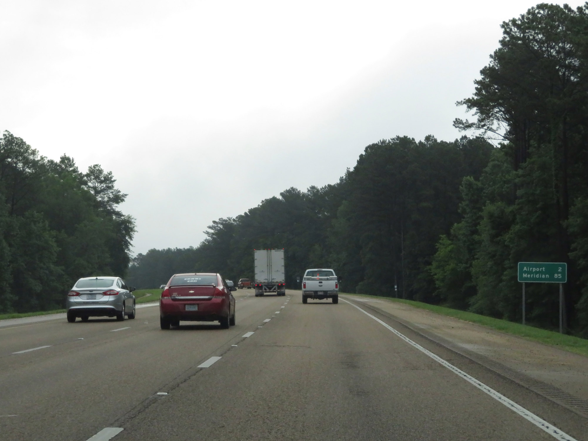 |
Mileage sign on Interstate 20 East. It's 2 miles to Jackson-Evers International Airport and 85 miles to Meridian. (Photo taken 5/24/18). |
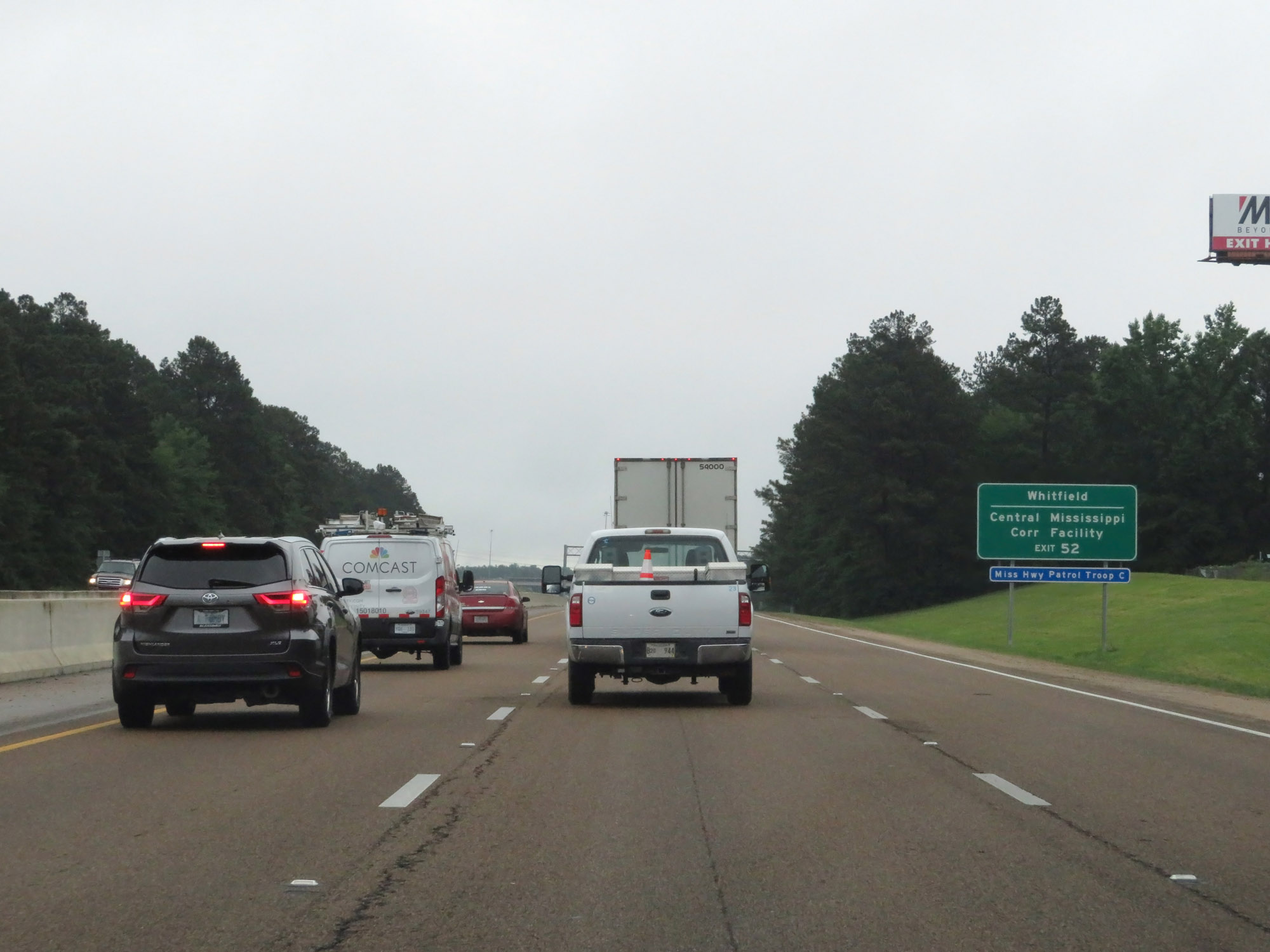 |
Takke Exit 52 to Whitfield and the Central Mississippi Correctional Facility. (Photo taken 5/24/18). |
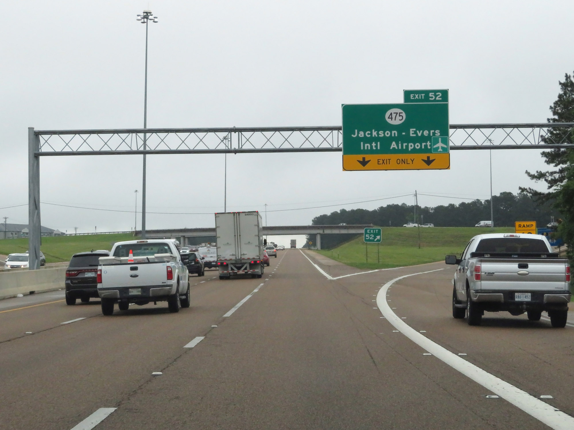 |
Interstate 20 East at Exit 52: MS 475 - Jackson-Evers International Airport (Photo taken 5/24/18). |
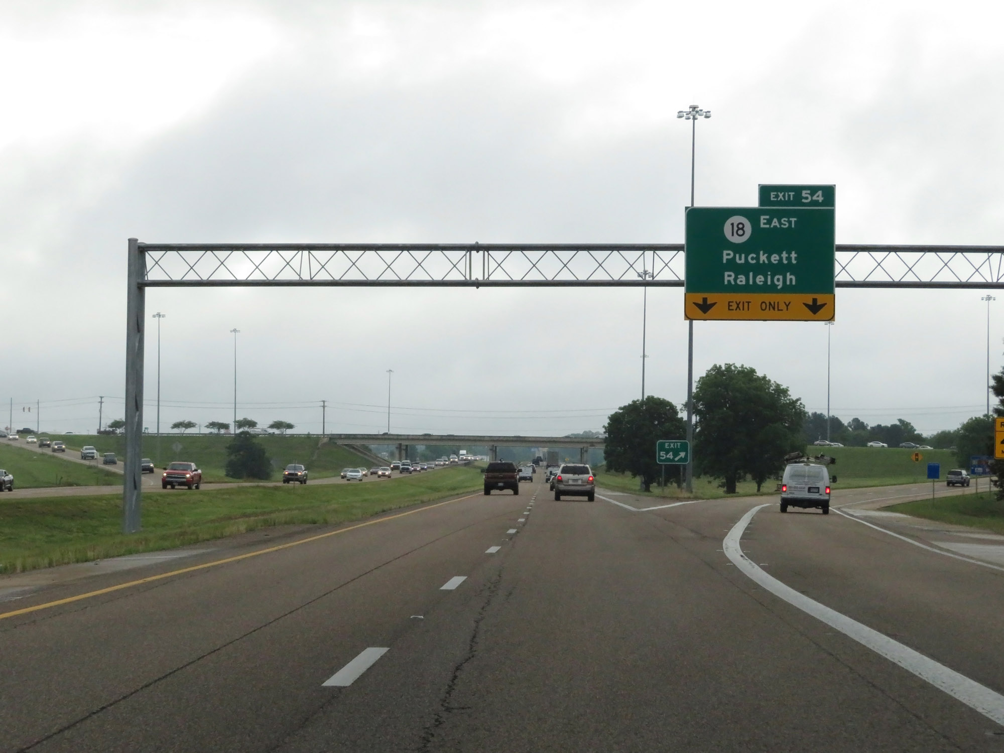 |
Interstate 20 East at Exit 54: MS 18 East - Puckett / Raleigh (Photo taken 5/24/18). |
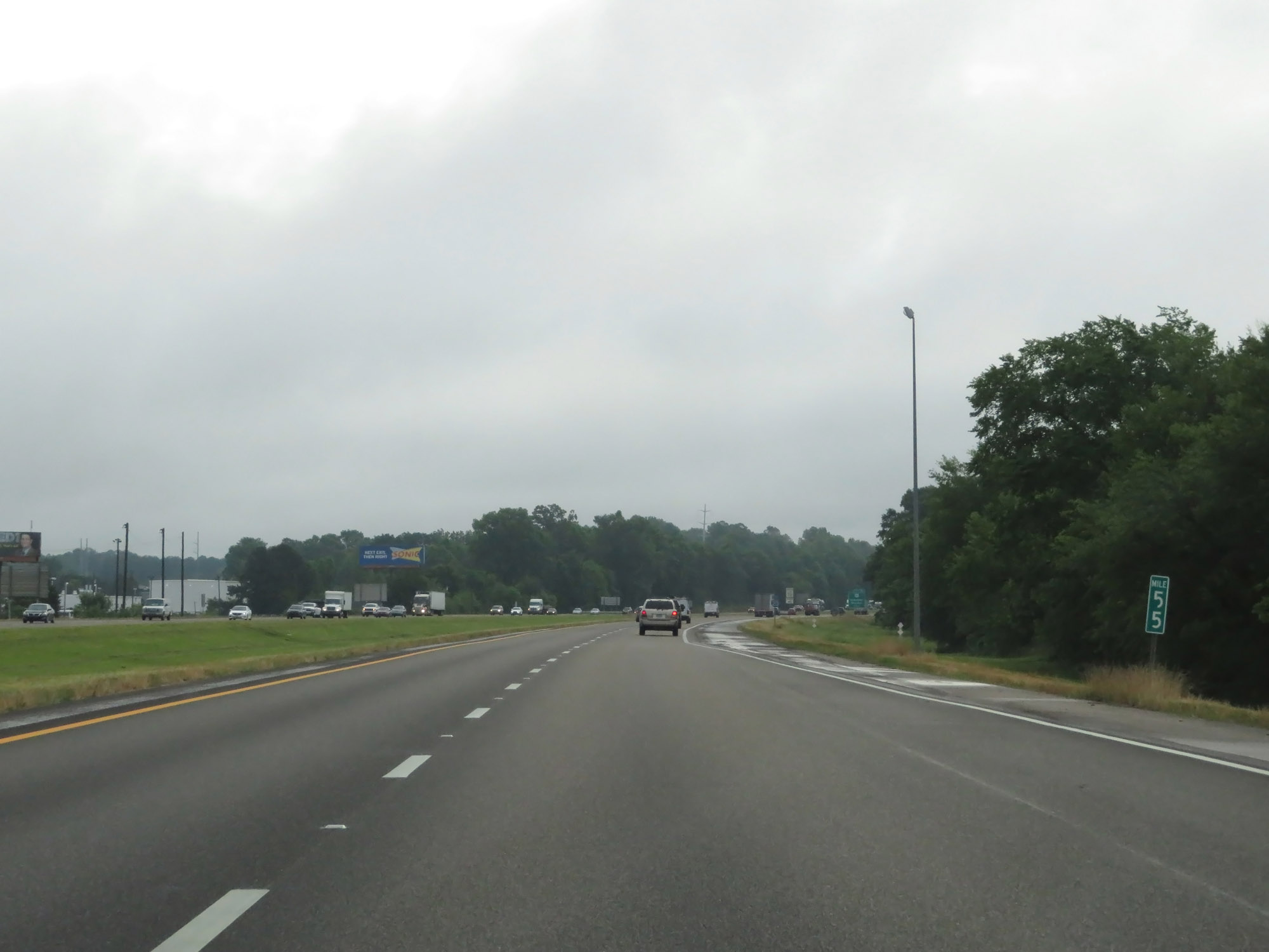 |
Interstate 20 East at mile marker 55. (Photo taken 5/24/18). |
 |
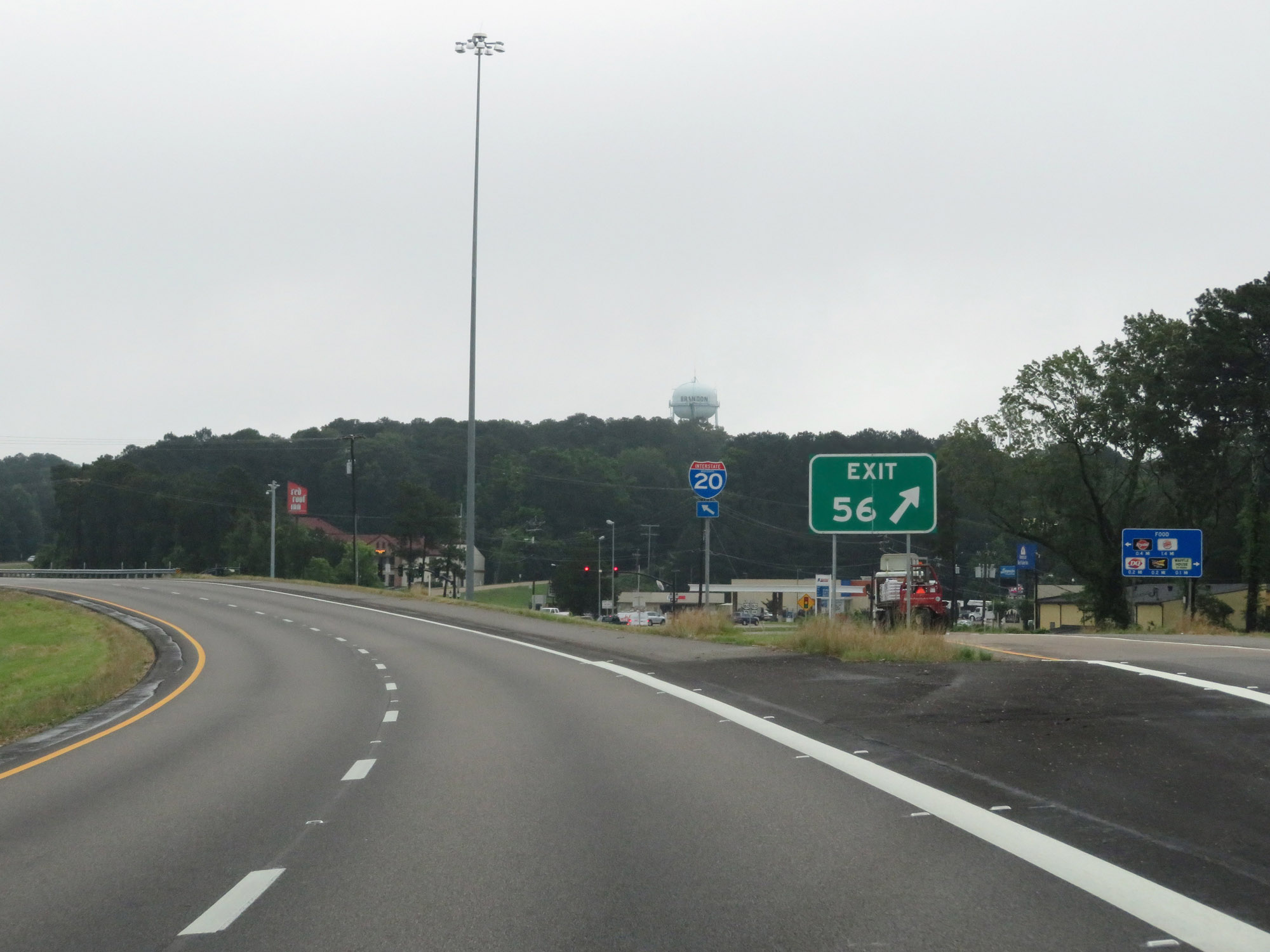
Interstate 20 East approaching Exit 56 - 1 mile. (Photo taken 5/24/18). |
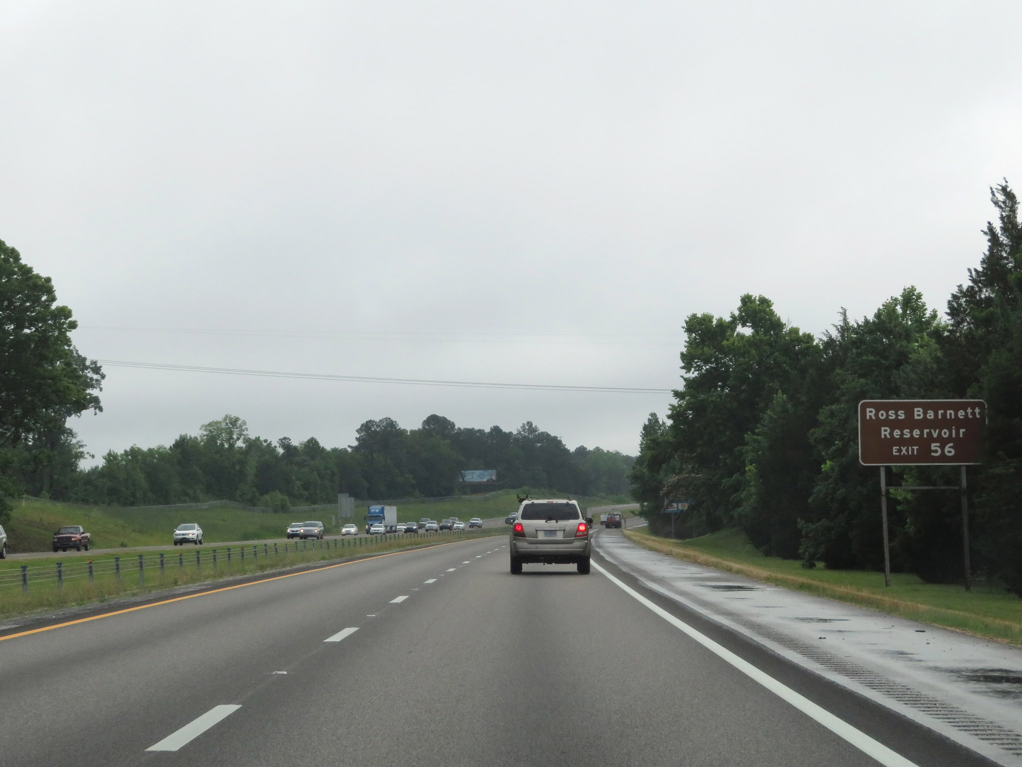 |
Take Exit 56 to Ross Barnett Reservoir. (Photo taken 5/24/18). |
 |
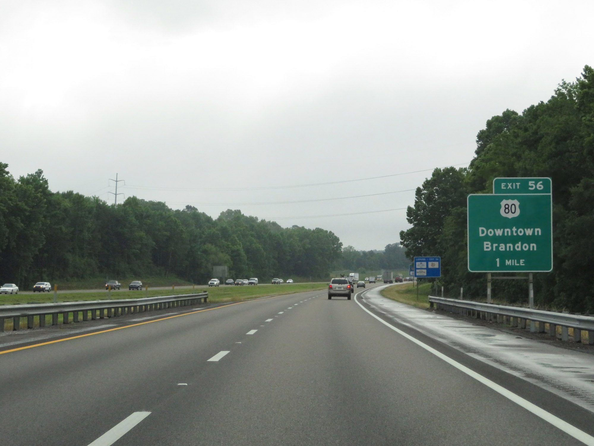
Interstate 20 East at Exit 56: US 80 - Downtown Brandon (Photo taken 5/24/18). |
 |
Interstate 20 East approaching Exit 59 - 1 mile. (Photo taken 5/24/18). |
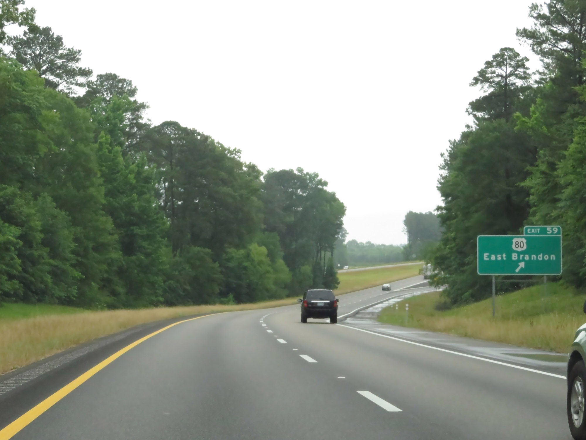 |
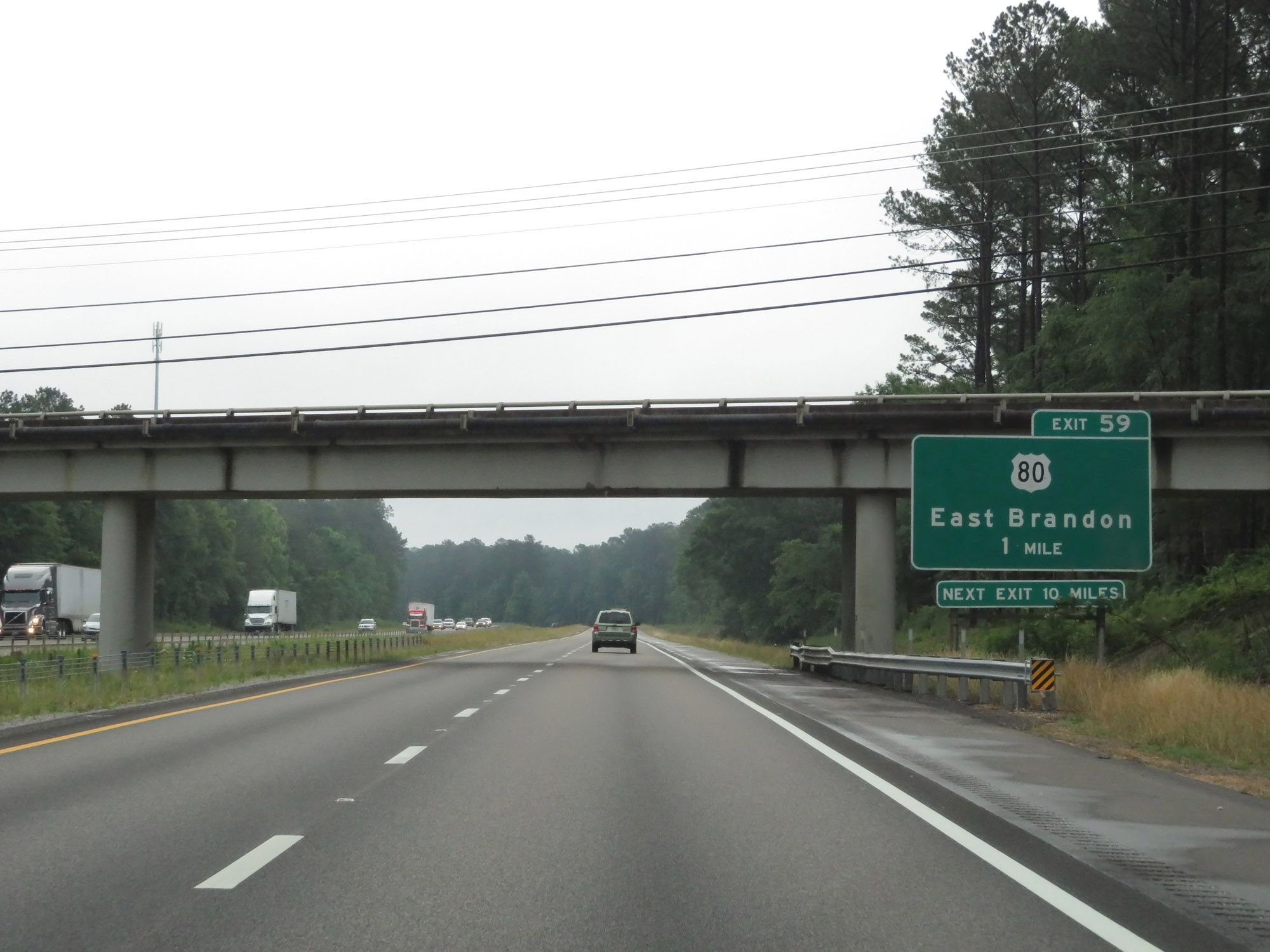
Interstate 20 East at Exit 59: US 80 - East Brandon (Photo taken 5/24/18). |
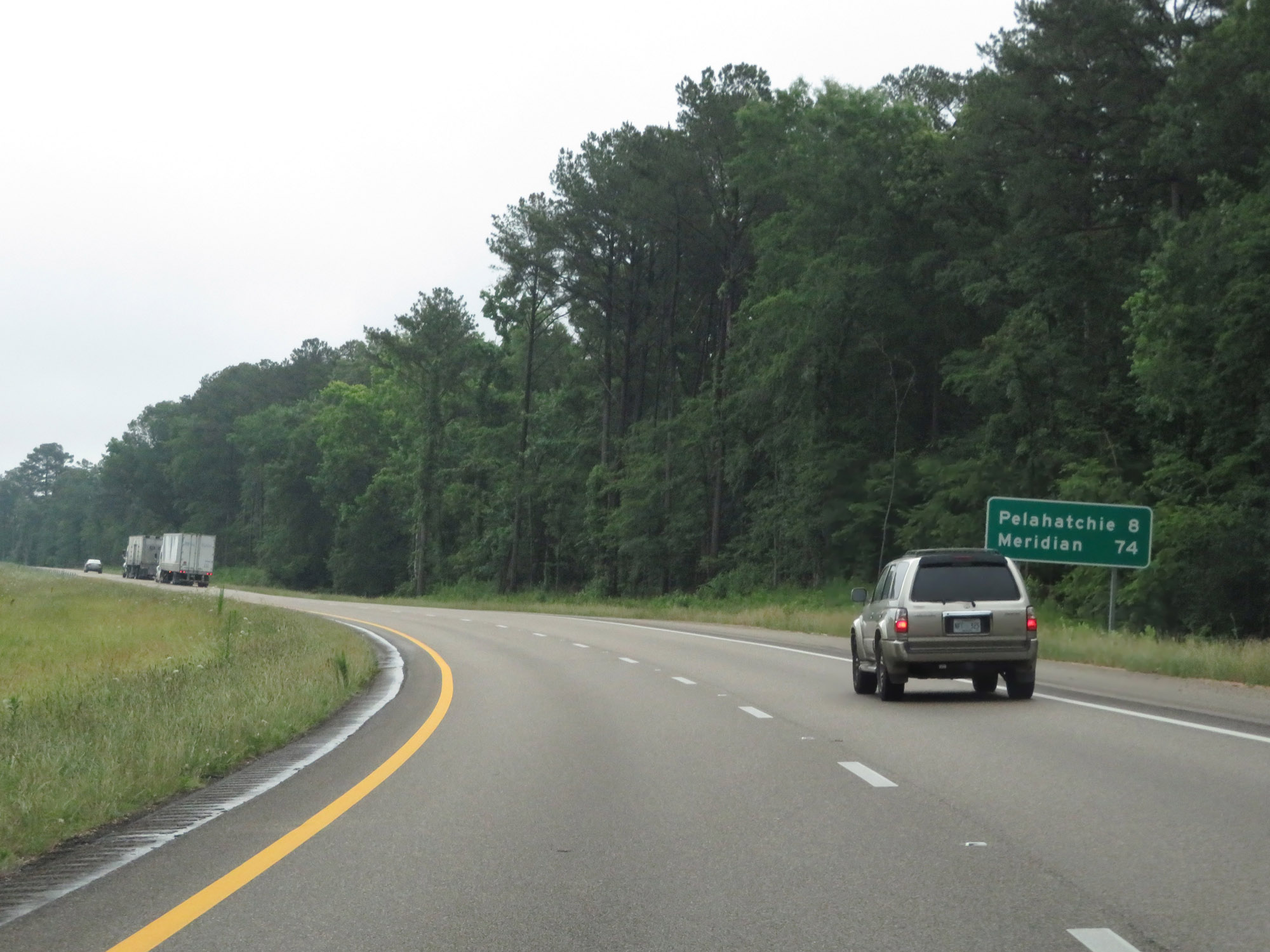 |
Mileage sign on Interstate 20 East. It's 8 miles to Pelahatchie and 74 miles to Meridian. (Photo taken 5/24/18). |
 |
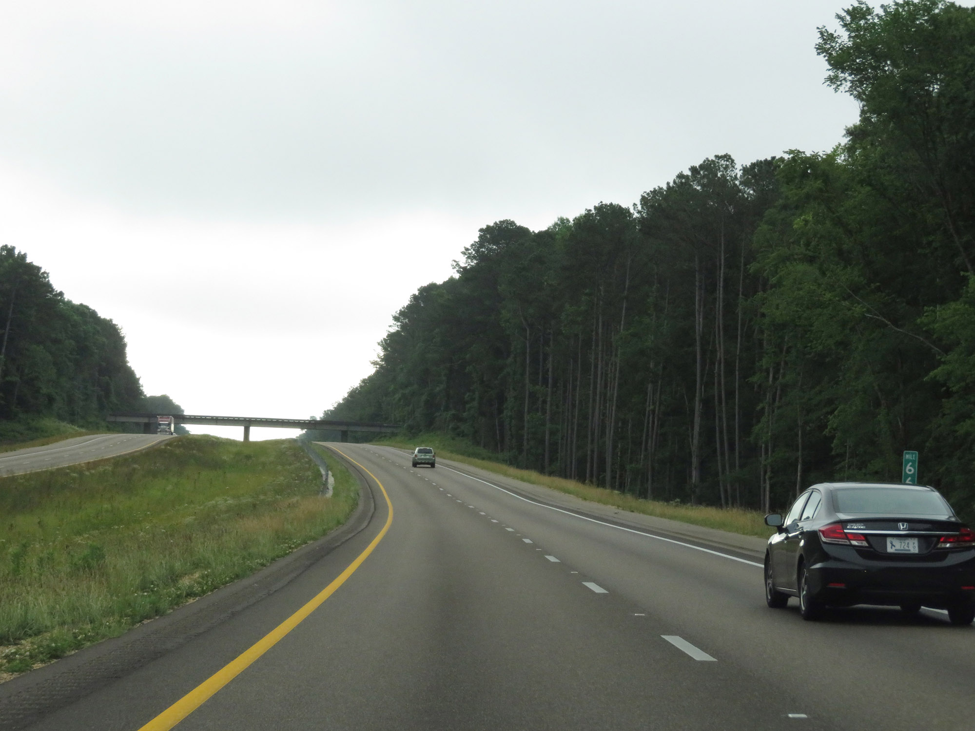
View on Interstate 20 East at mile marker 64. (Photo taken 5/24/18). |
 |
Interstate 20 East at mile marker 66. (Photo taken 5/24/18). |
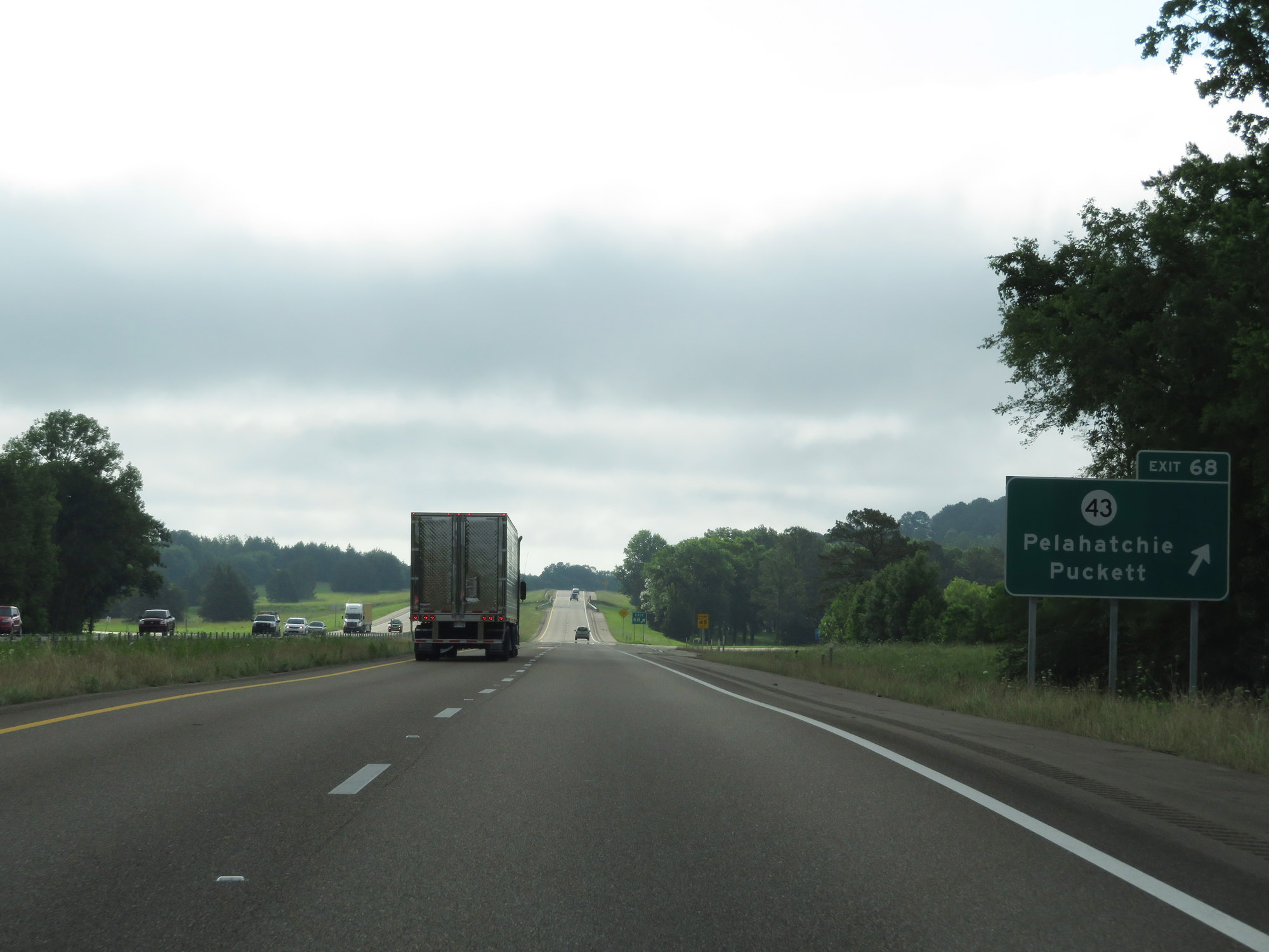 |
Interstate 20 East at Exit 68: MS 43 - Pelahatchie / Puckett (Photo taken 5/24/18). |
 |
The speed limits remain 70 mph maximum and 40 mph minimum. (Photo taken 5/24/18). |
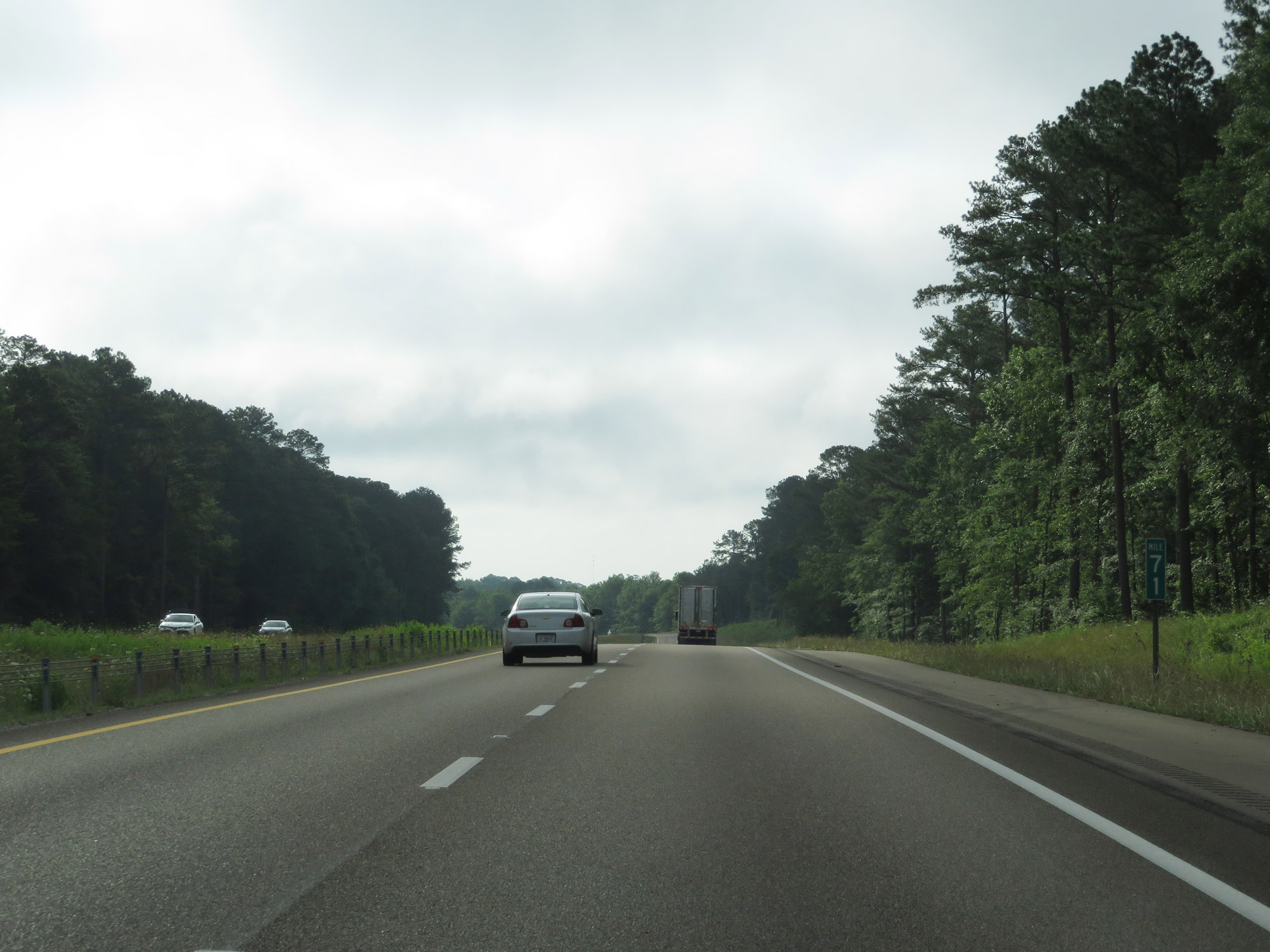 |
Interstate 20 East at mile marker 71. (Photo taken 5/24/18). |
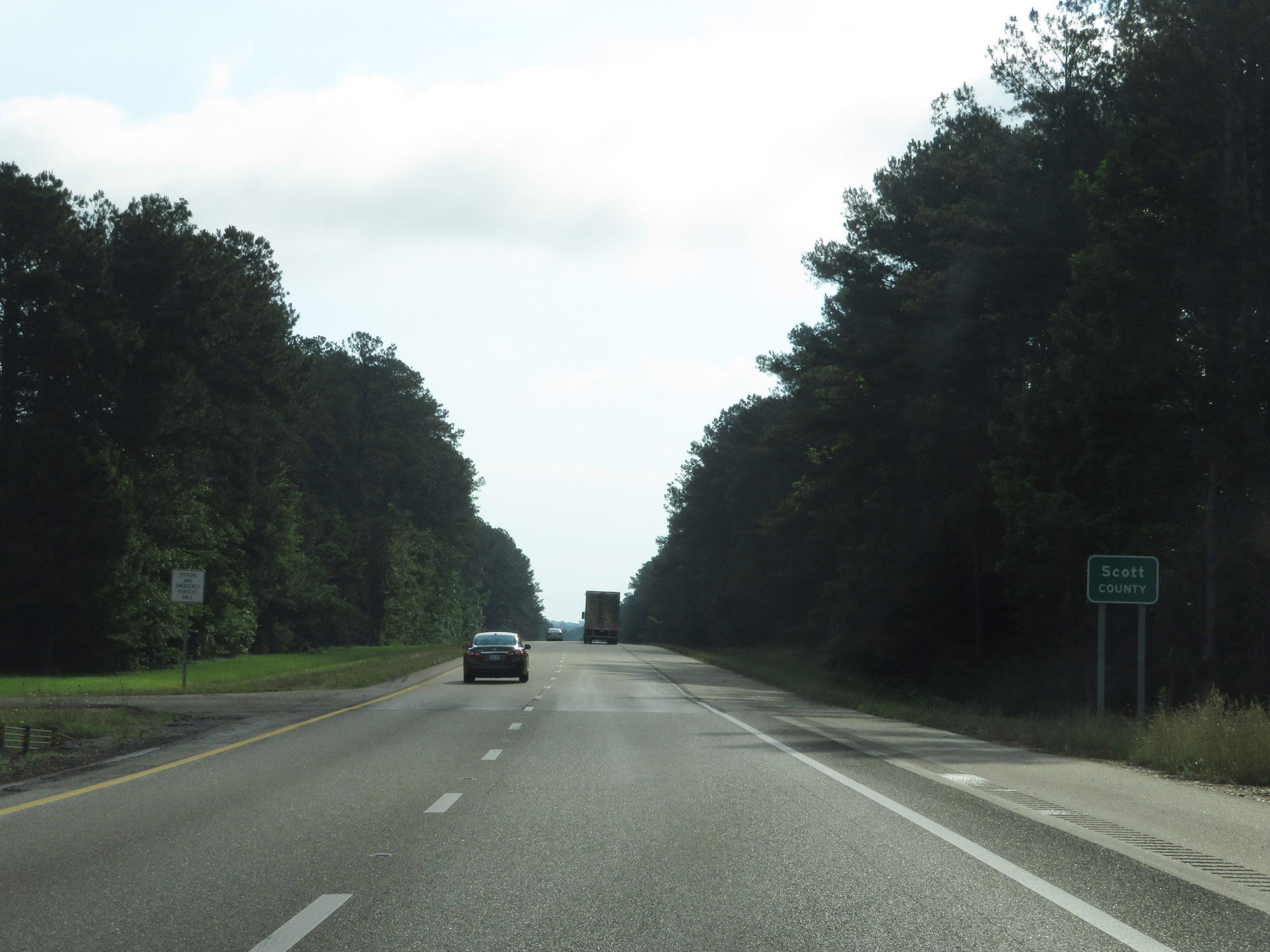 |
Entering Scott County on Interstate 20 East. (Photo taken 5/24/18). |
 |
Interstate 20 East at mile marker 74. (Photo taken 5/24/18). |
 |
Take Exit 77 to Roosevelt State Park and Polkville. (Photo taken 5/24/18). |
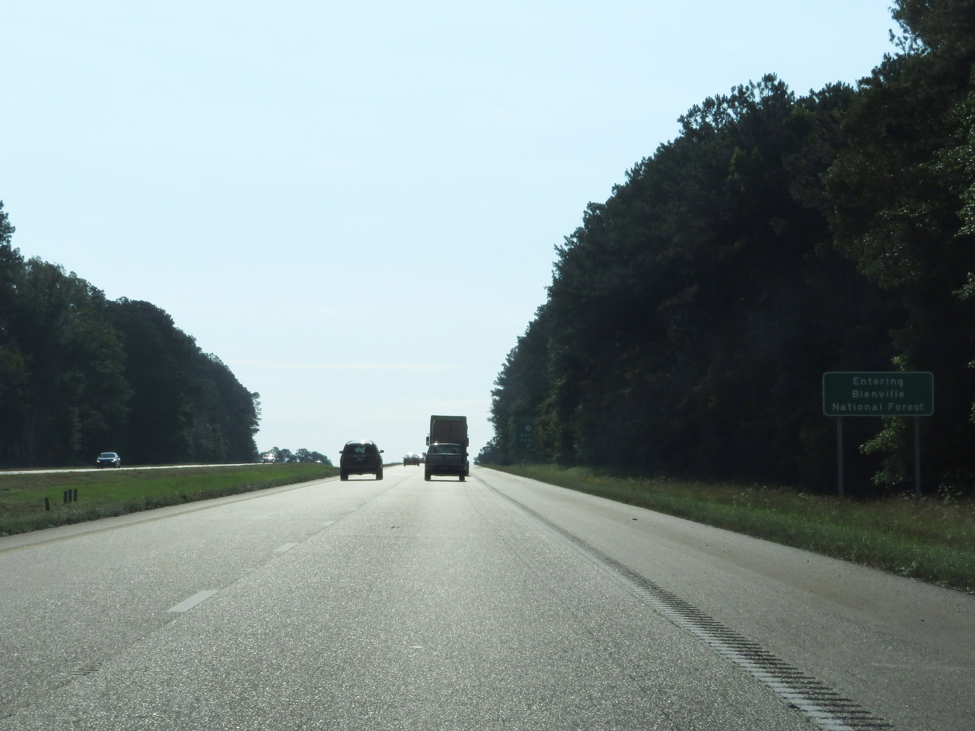 |
Interstate 20 East as it enters Bienville National Forest, just east of Exit 77. (Photo taken 5/24/18). |
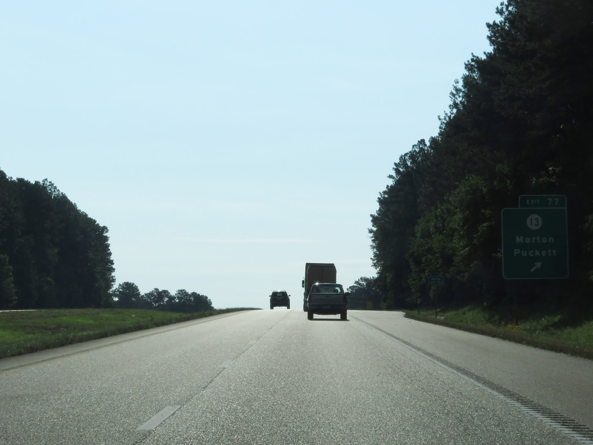 |
Interstate 20 East at Exit 77: MS 13 - Morton / Puckett (Photo taken 5/24/18). |
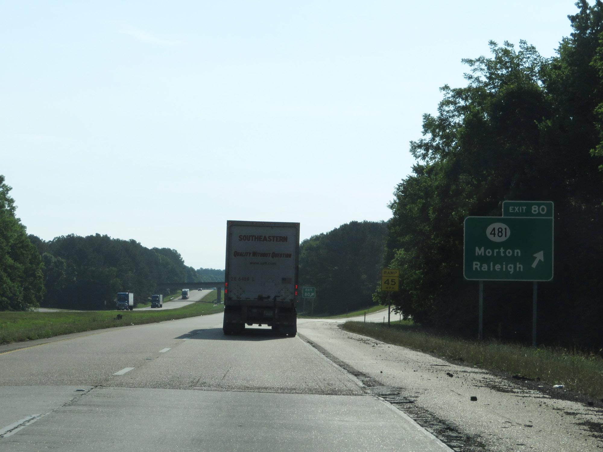 |
Interstate 20 East at Exit 80: MS 481 - Morton / Raleigh (Photo taken 5/24/18). |
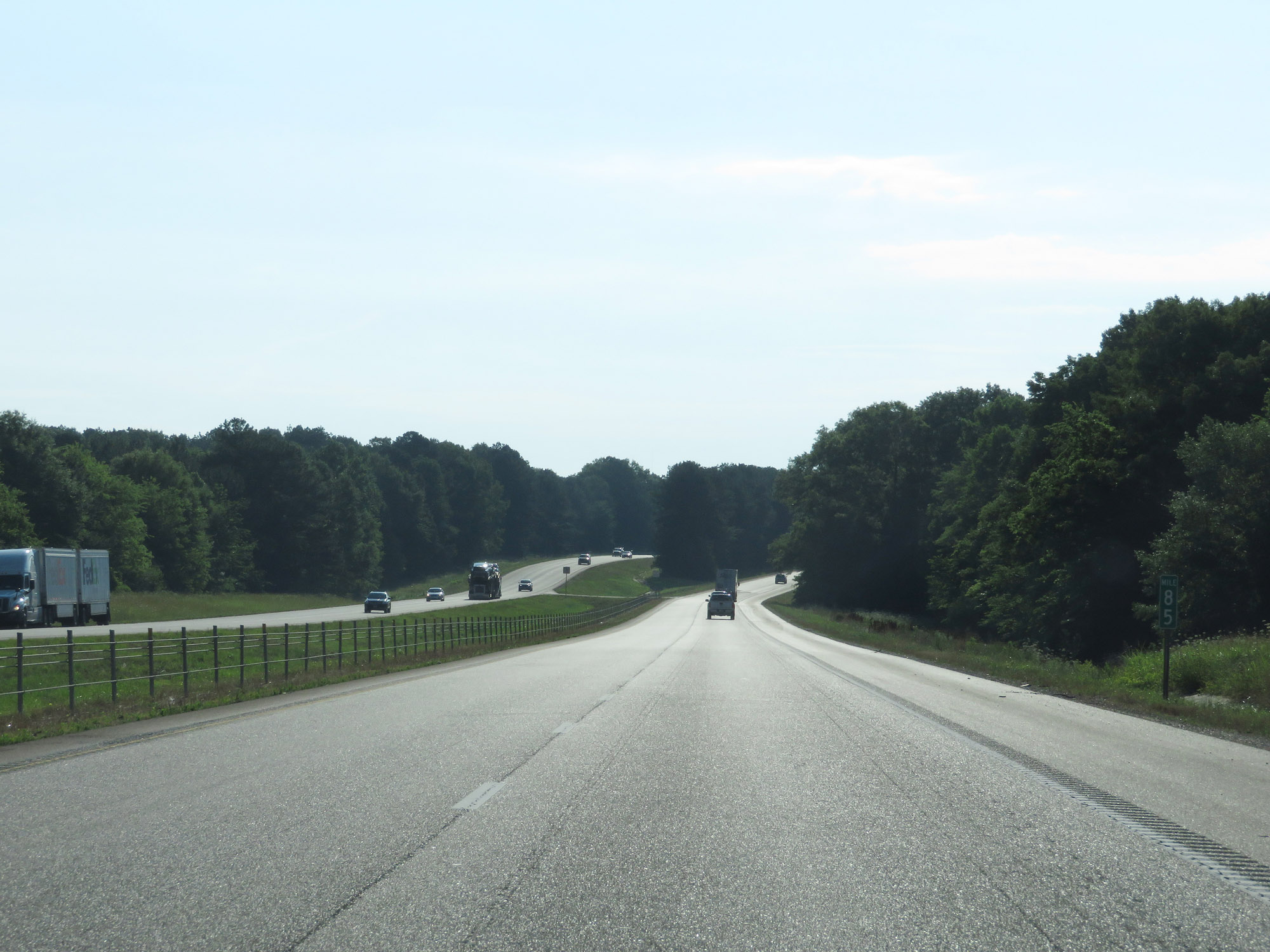 |
Interstate 20 East at mile marker 85. (Photo taken 5/24/18). |
 |
Interstate 20 East approaching Exit 88 - 1 mile. (Photo taken 5/24/18). |
 |
Take Exit 88 to the Bienville National Forest Info Center. (Photo taken 5/24/18). |
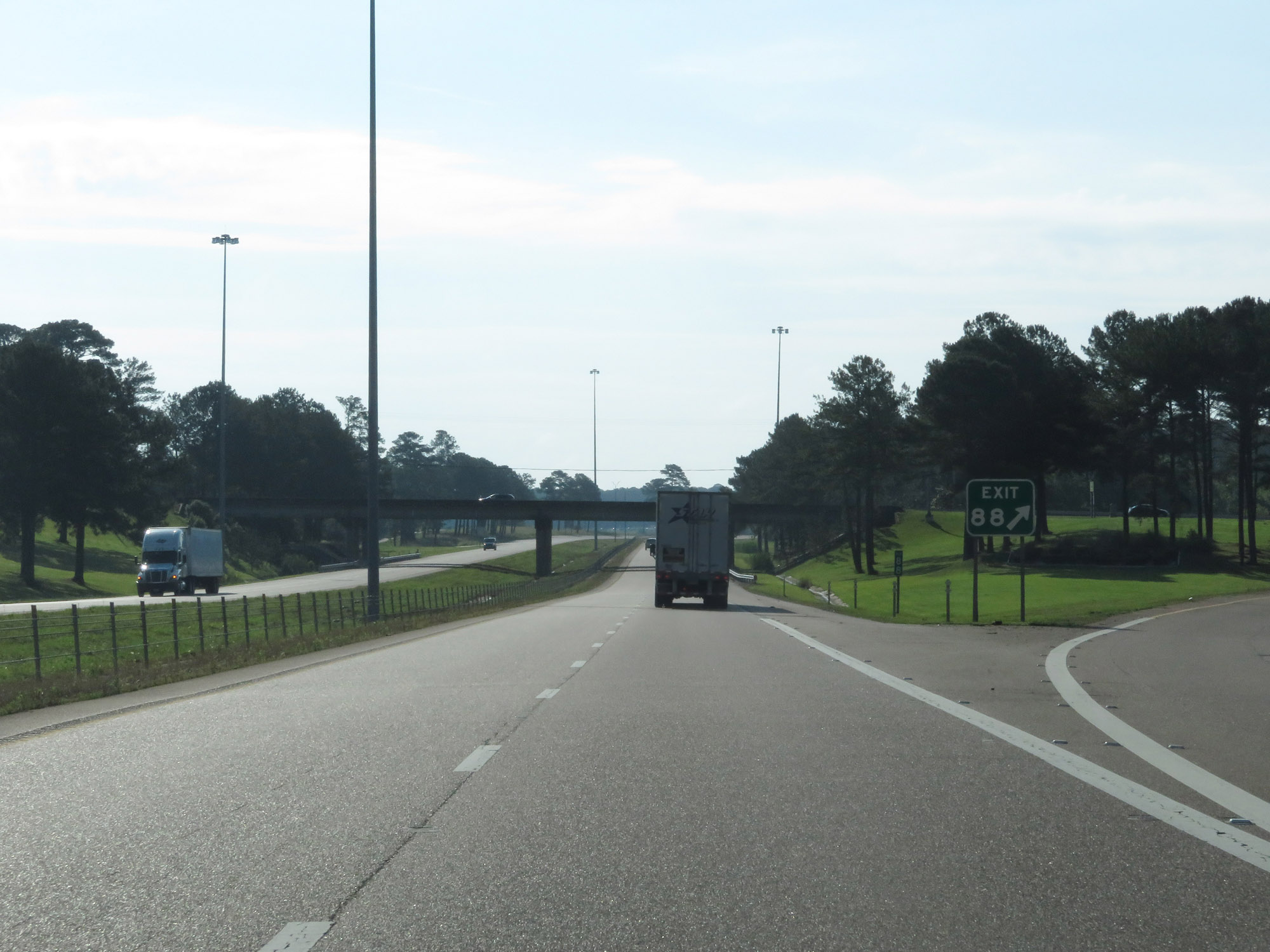 |
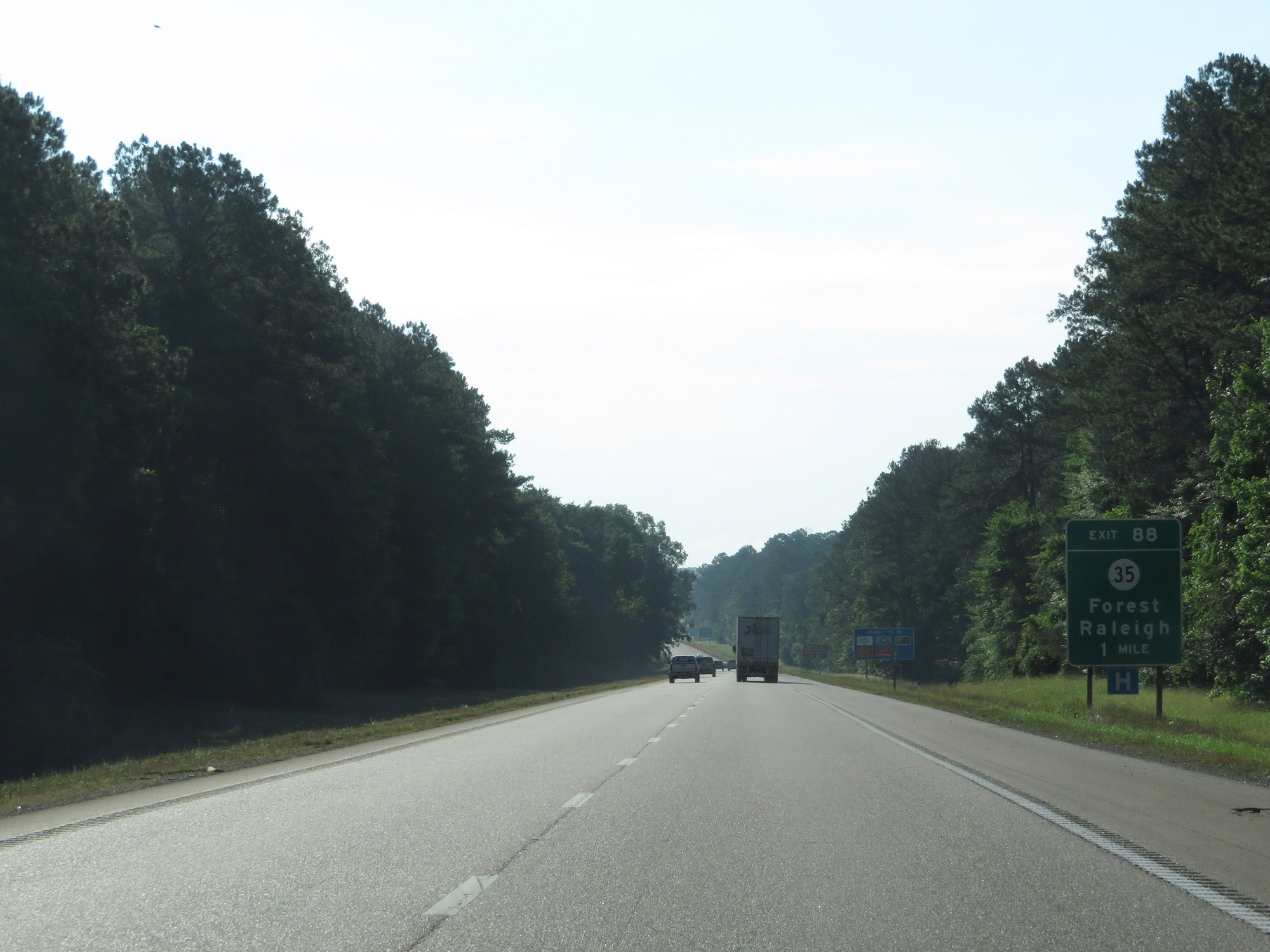
Interstate 20 East at Exit 88: MS 35 - Forest / Raleigh (Photo taken 5/24/18). |
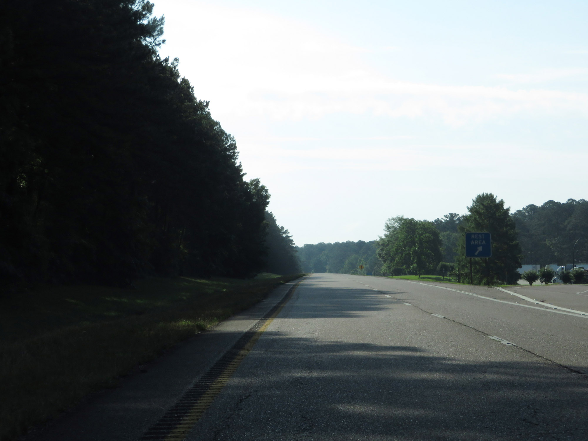 |
Rest Area on Interstate 20 East in Scott County. (Photo taken 5/24/18). |
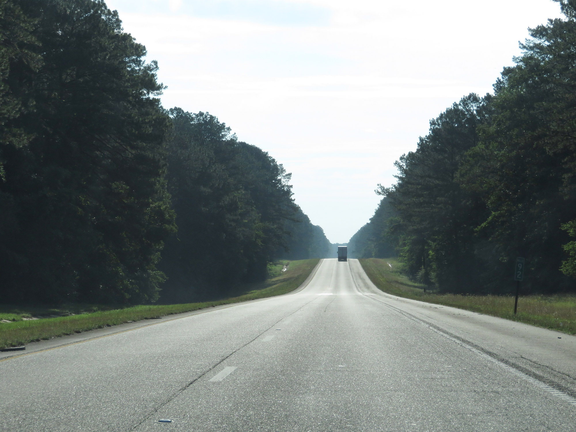 |
View on Interstate 20 East at mile marker 92. (Photo taken 5/24/18). |
 |
Interstate 20 East as it leaves Bienville National Forest. (Photo taken 5/24/18). |
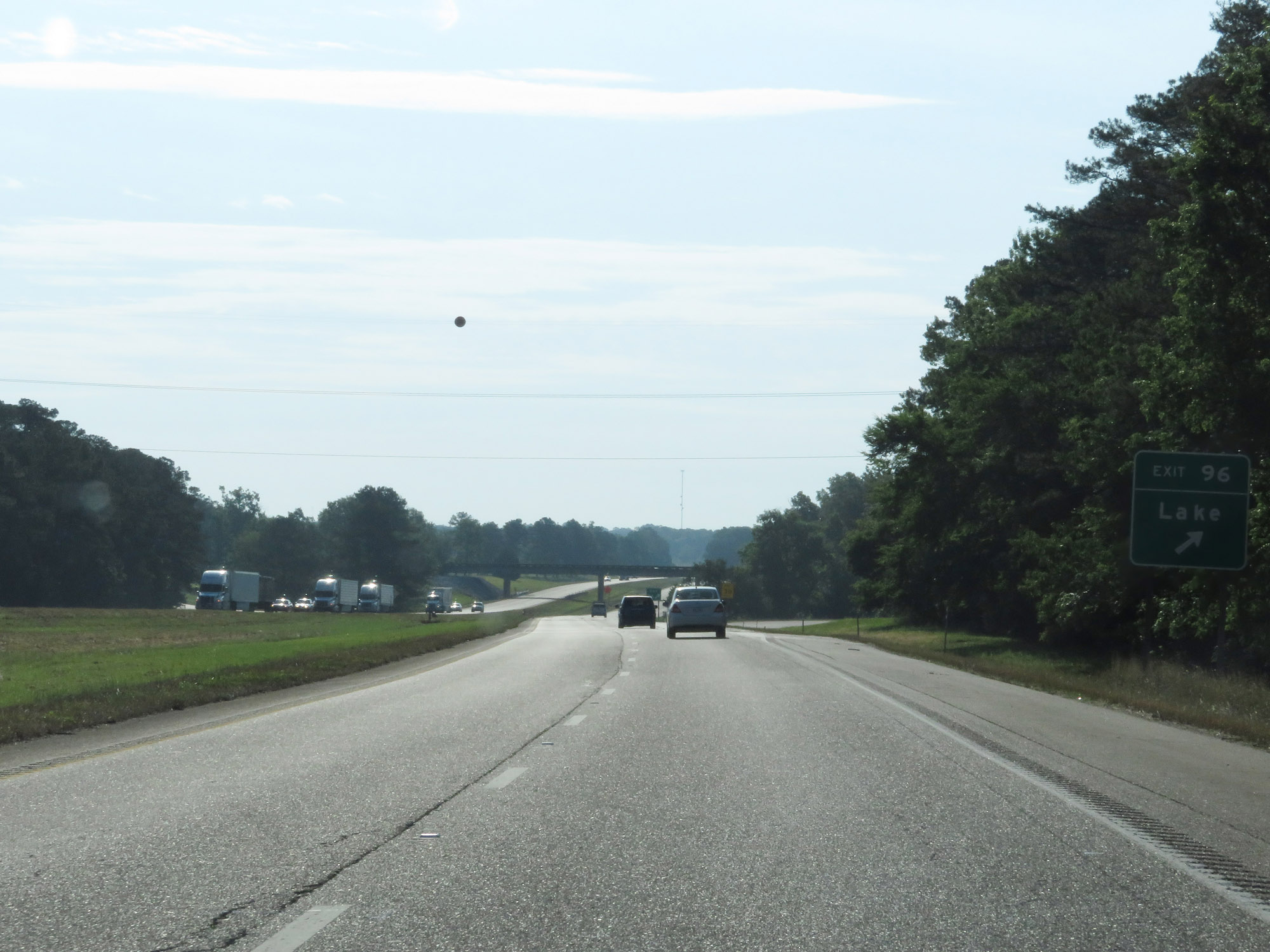 |
Interstate 20 East at Exit 96: Lake (Photo taken 5/24/18). |
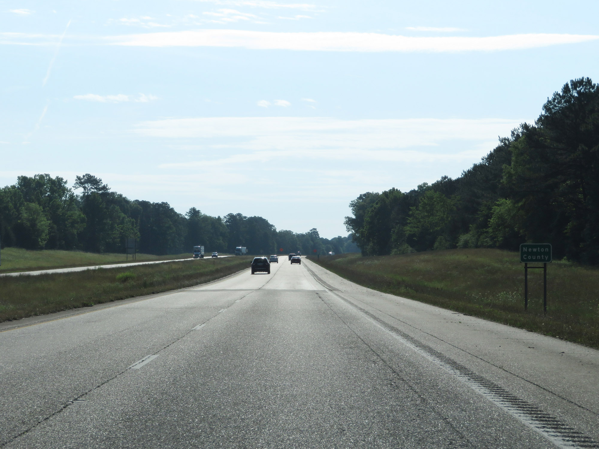 |
Entering Newton County on Interstate 20 East. (Photo taken 5/24/18). |
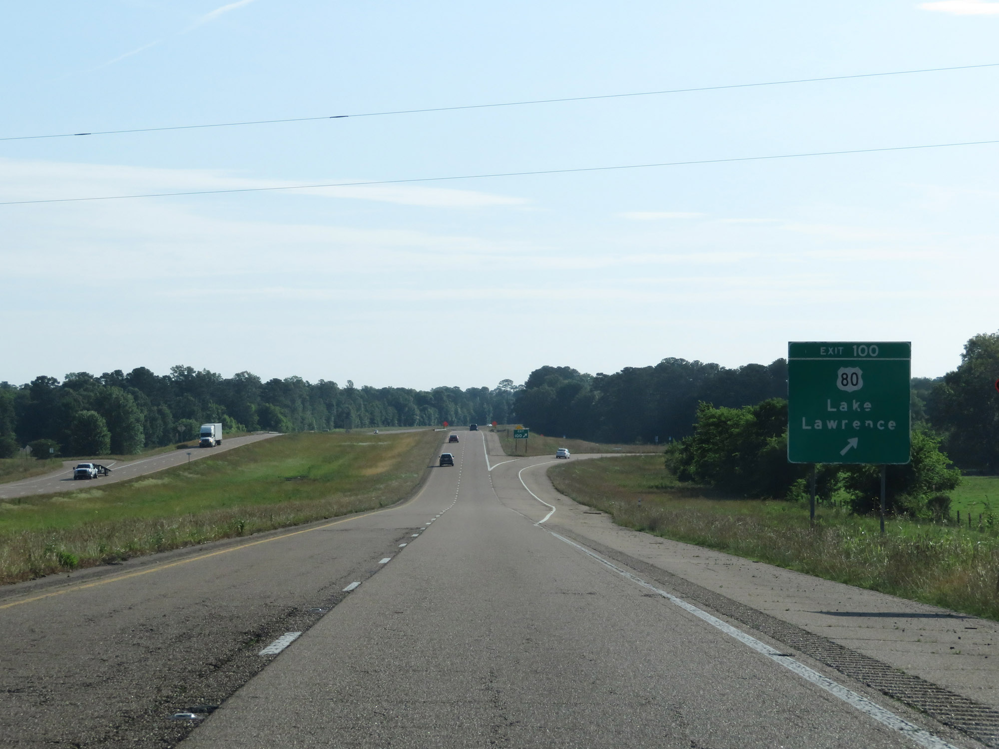 |
Interstate 20 East at Exit 100: US 80 - Lake / Lawrence (Photo taken 5/24/18). |
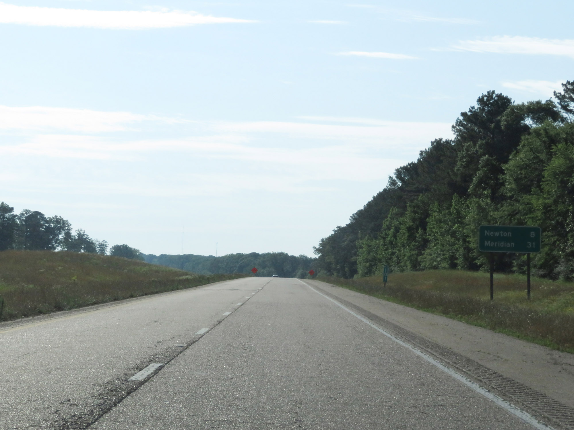 |
Mileage sign on Interstate 20 East at mile marker 101. It's 8 miles to Newton and 31 miles to Meridian. (Photo taken 5/24/18). |
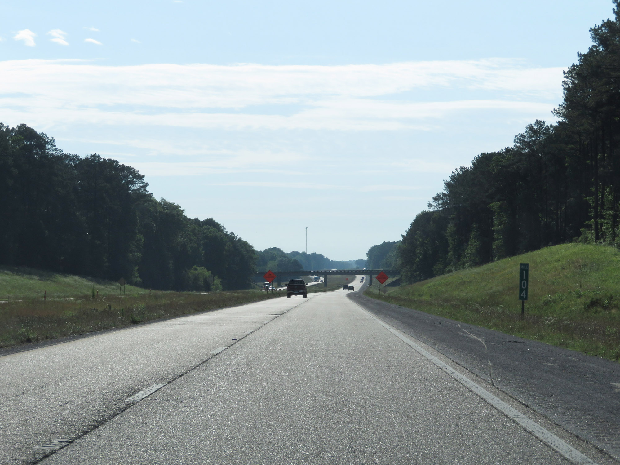 |
Interstate 20 East at mile marker 104. (Photo taken 5/24/18). |
 |
Take Exit 109 to Mississippi Veterans Memorial Cemetery. (Photo taken 5/24/18). |
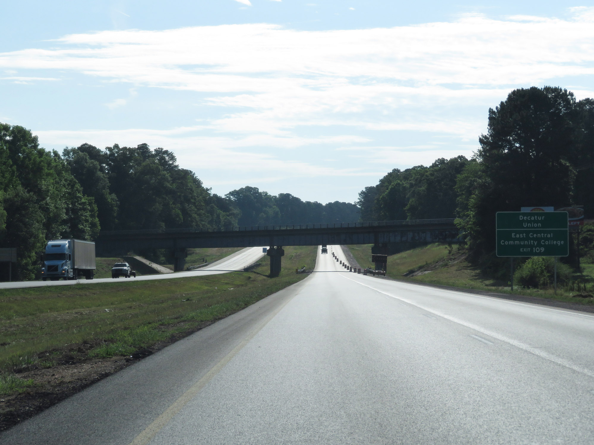 |
Also take Exit 109 to Decatur, Union, and East Central Community College. (Photo taken 5/24/18). |
 |
Interstate 20 East at Exit 109: MS 15 - Newton / Philadelphia (Photo taken 5/24/18). |
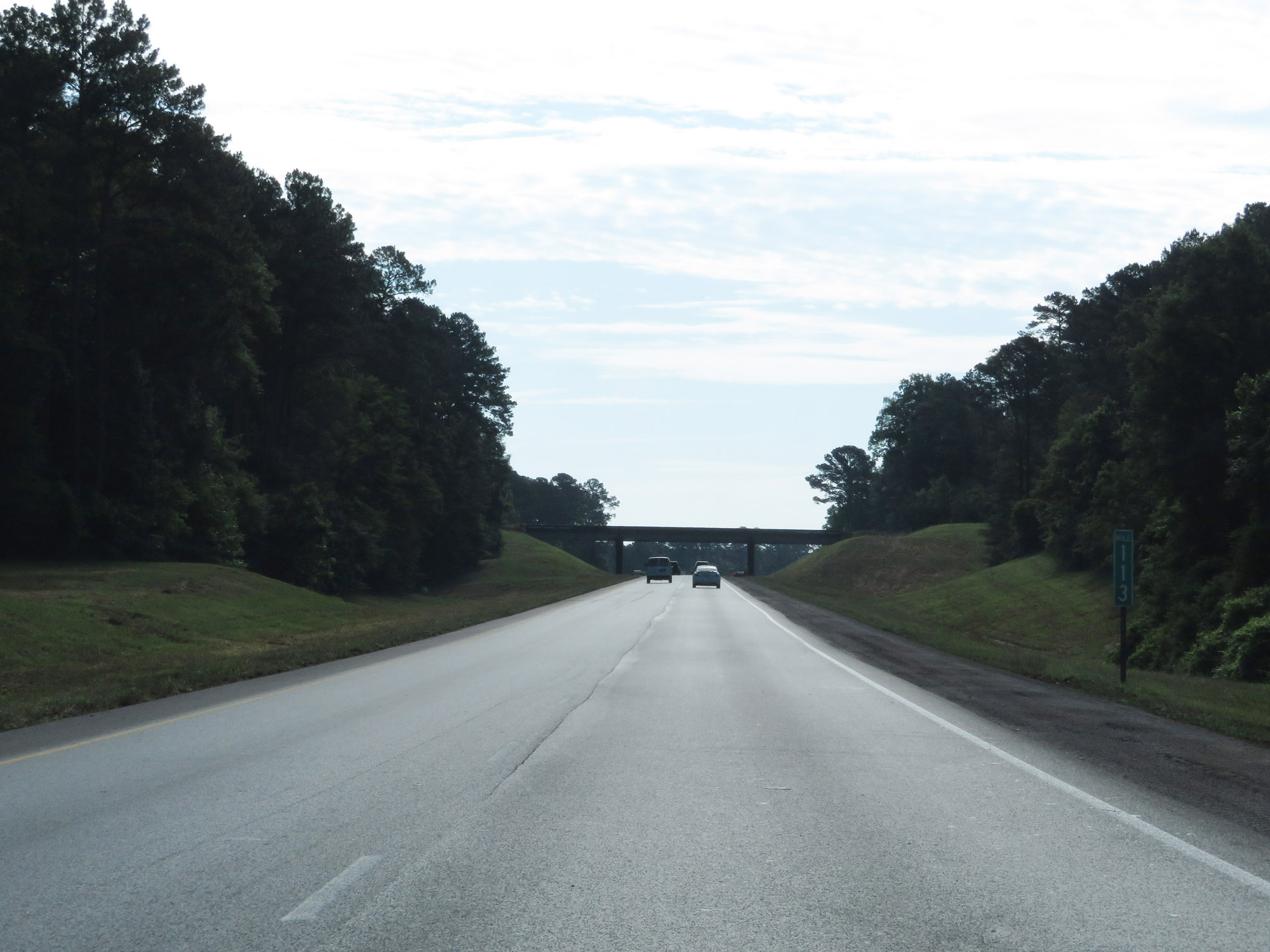 |
View on Interstate 20 East at mile marker 113. (Photo taken 5/24/18). |
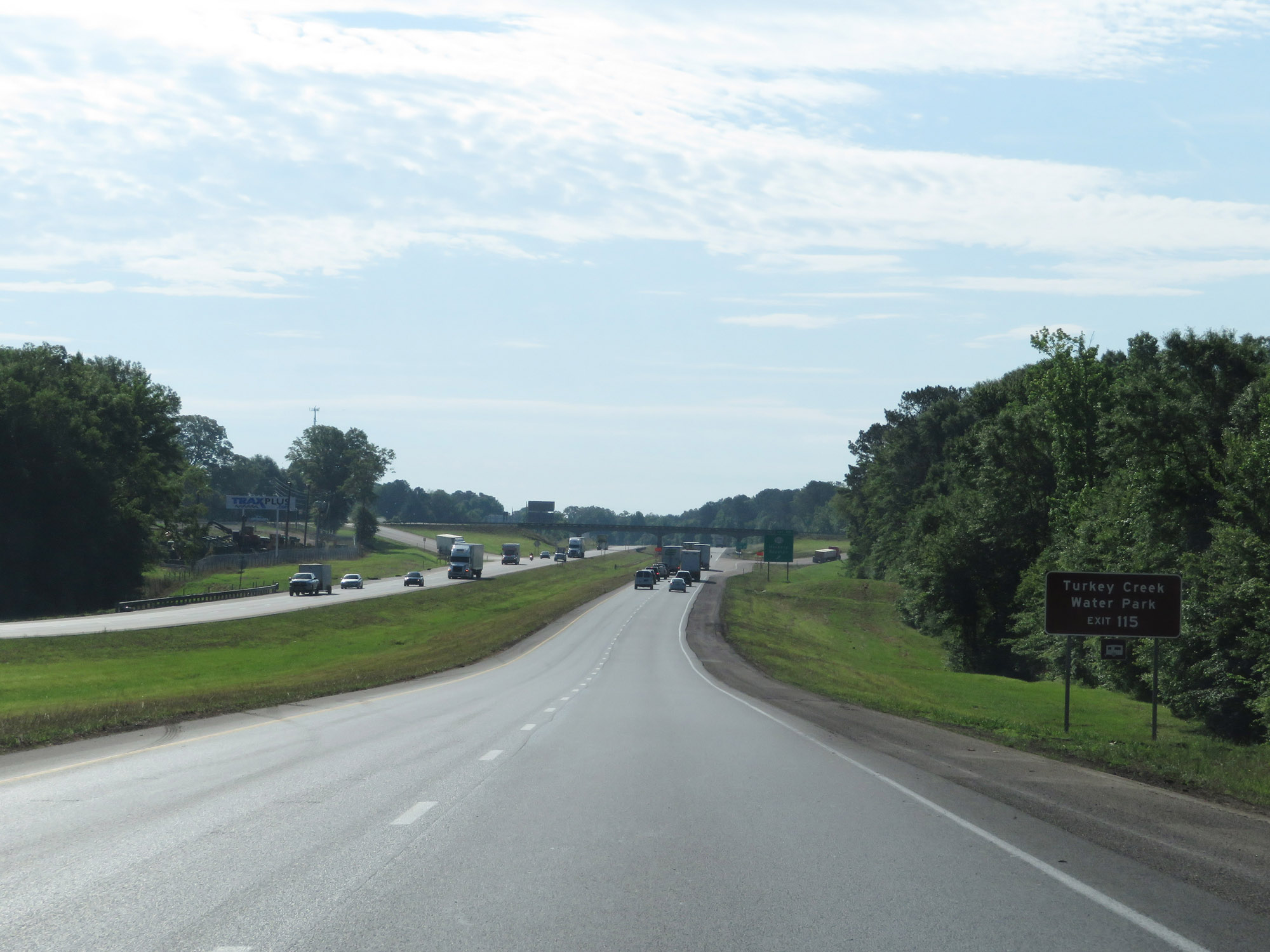 |
Take Exit 115 to Turkey Creek Water Park. (Photo taken 5/24/18). |
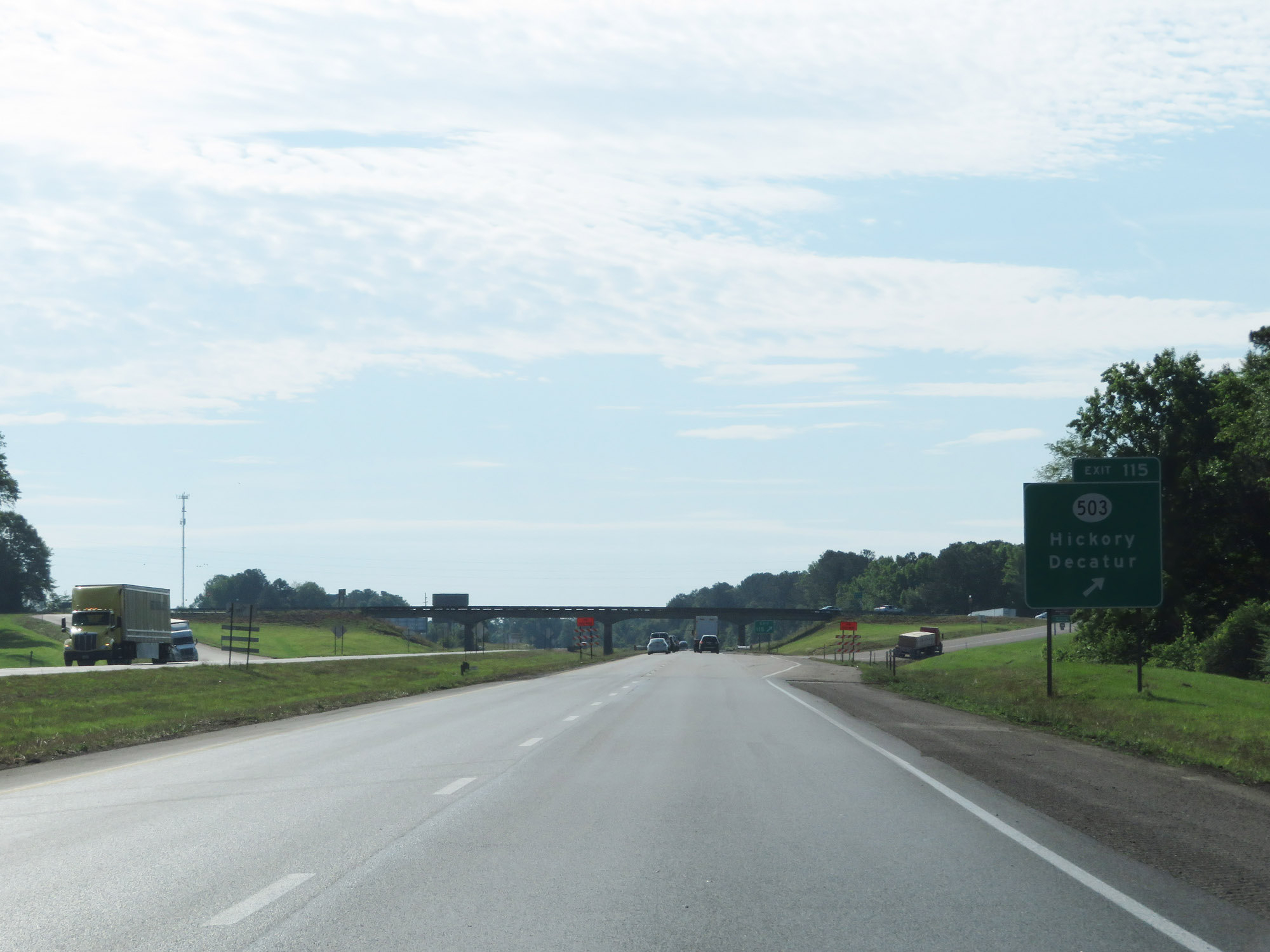 |
Interstate 20 East at Exit 115: MS 503 - Hickory / Decatur (Photo taken 5/24/18). |
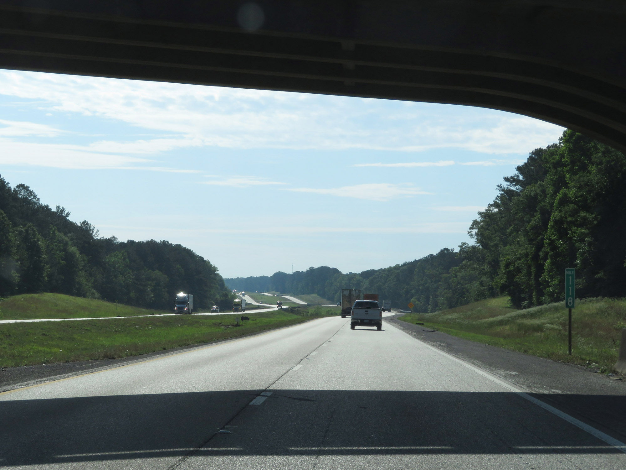 |
Interstate 20 East at mile marker 118. (Photo taken 5/24/18). |
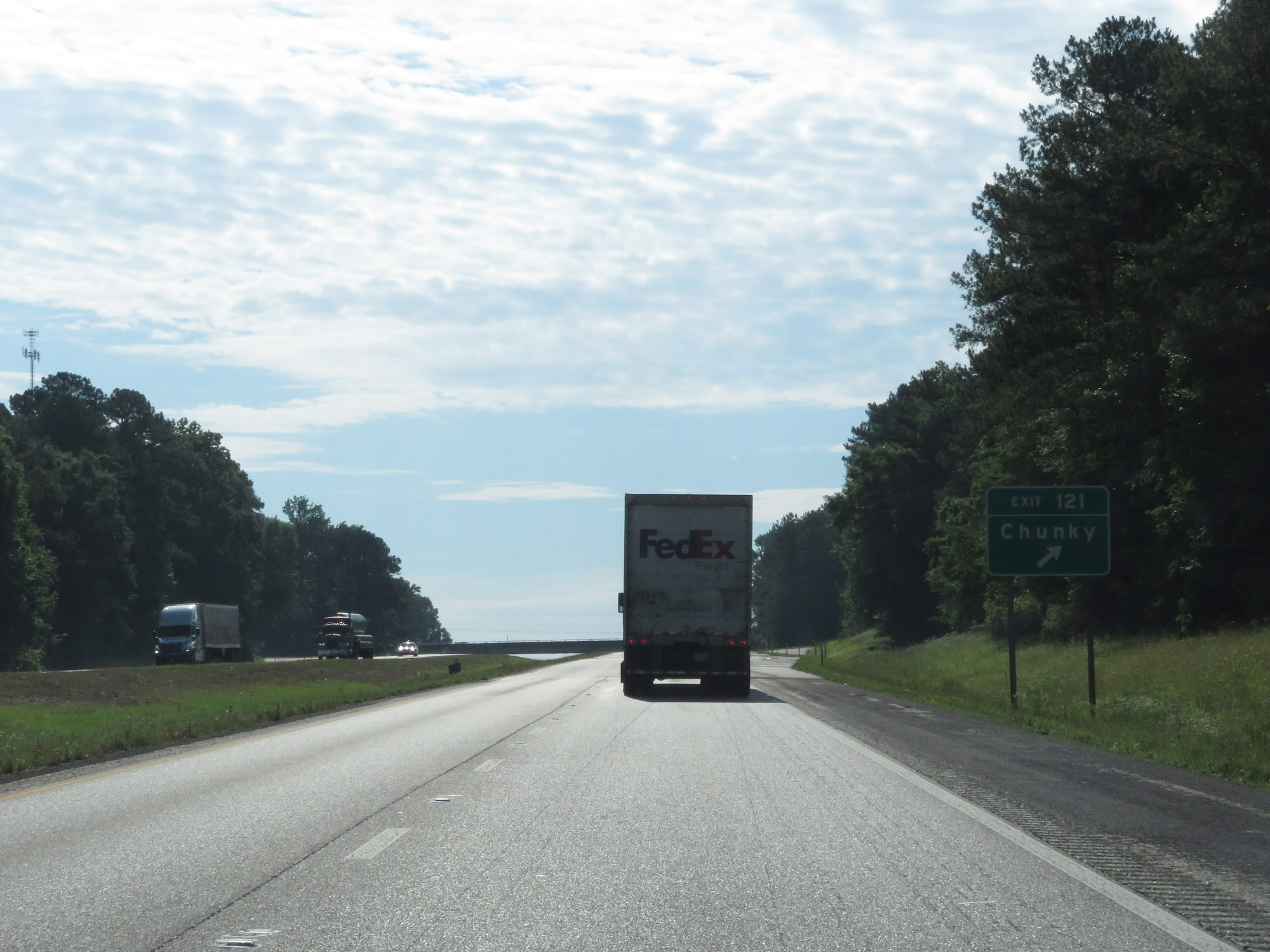 |
Interstate 20 East at Exit 121: Chunky (Photo taken 5/24/18). |
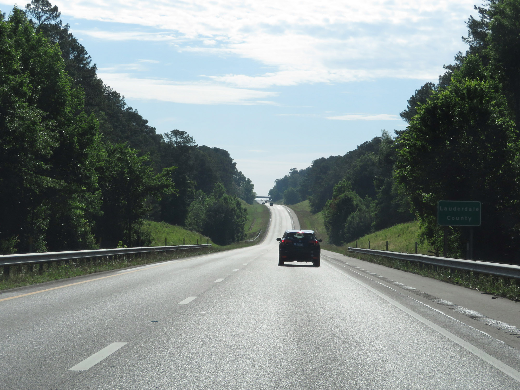 |
Interstate 20 East as it enters Lauderdale County. (Photo taken 5/24/18). |
 |
View on Interstate 20 East at mile marker 124. (Photo taken 5/24/18). |
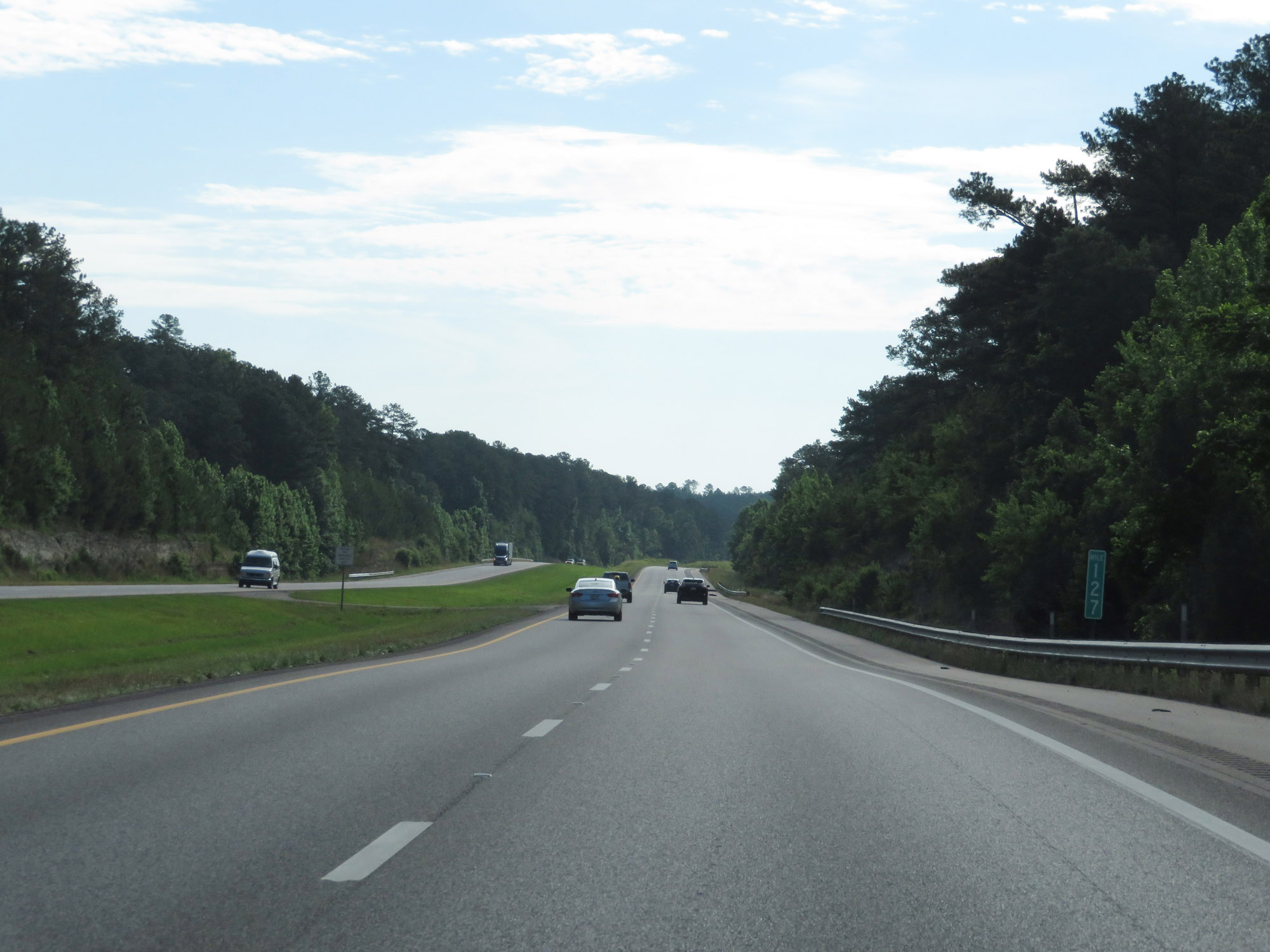 |
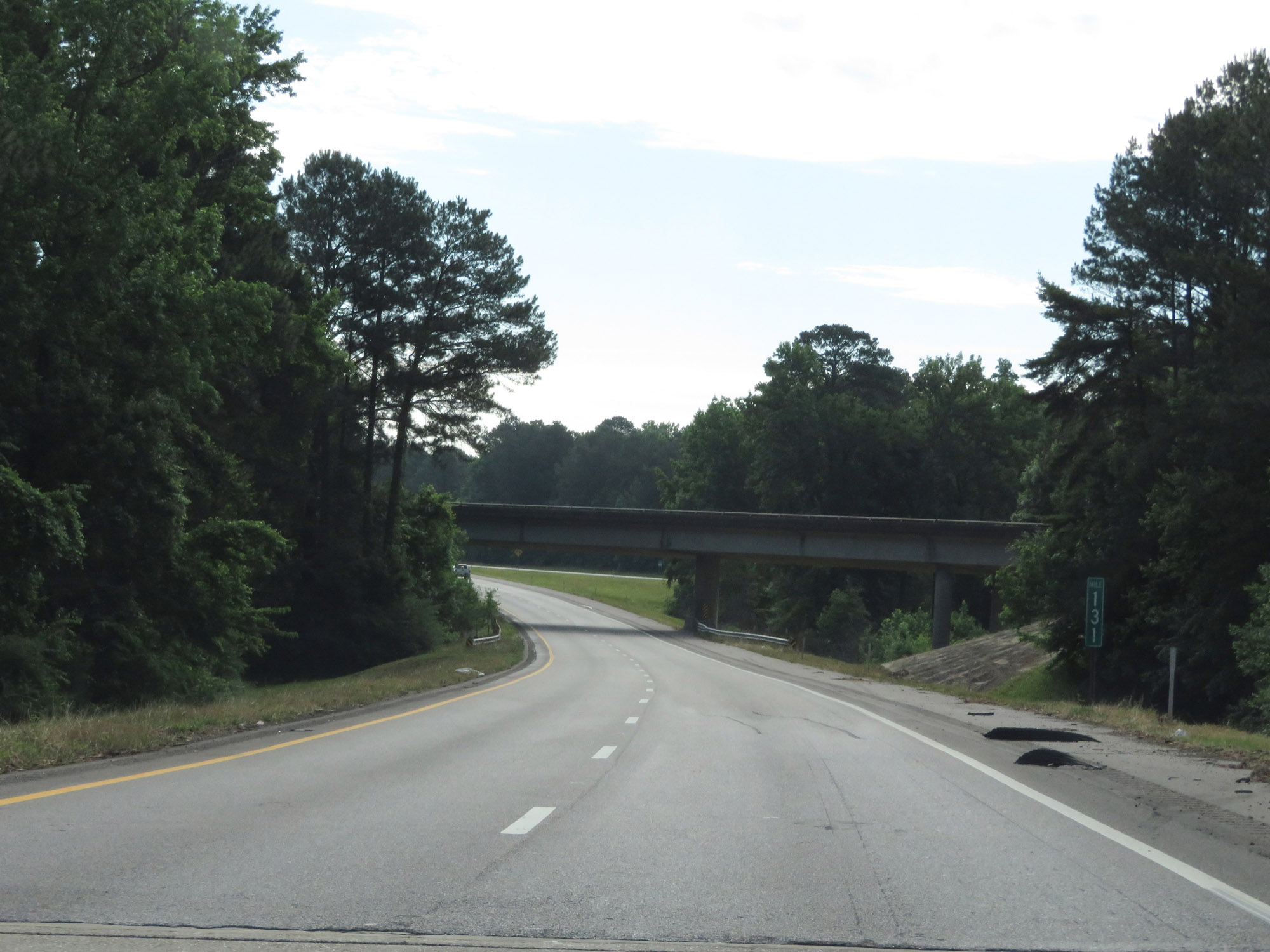
Interstate 20 East at mile marker 127. (Photo taken 5/24/18). |
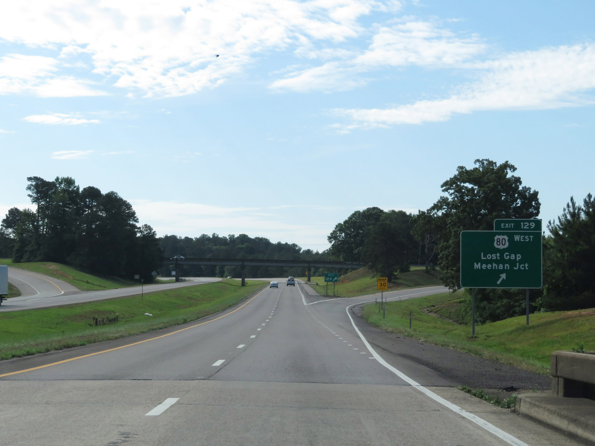 |
Interstate 20 East at Exit 129: US 80 West - Lost Gap / Meehan Jct (Photo taken 5/24/18). |
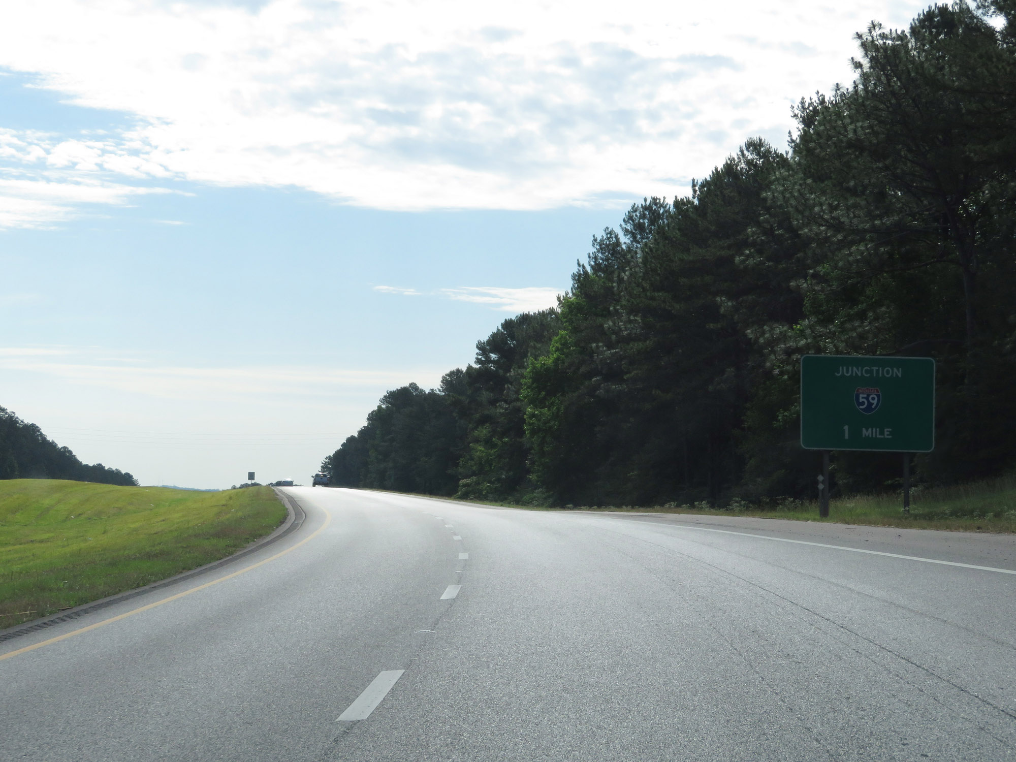 |
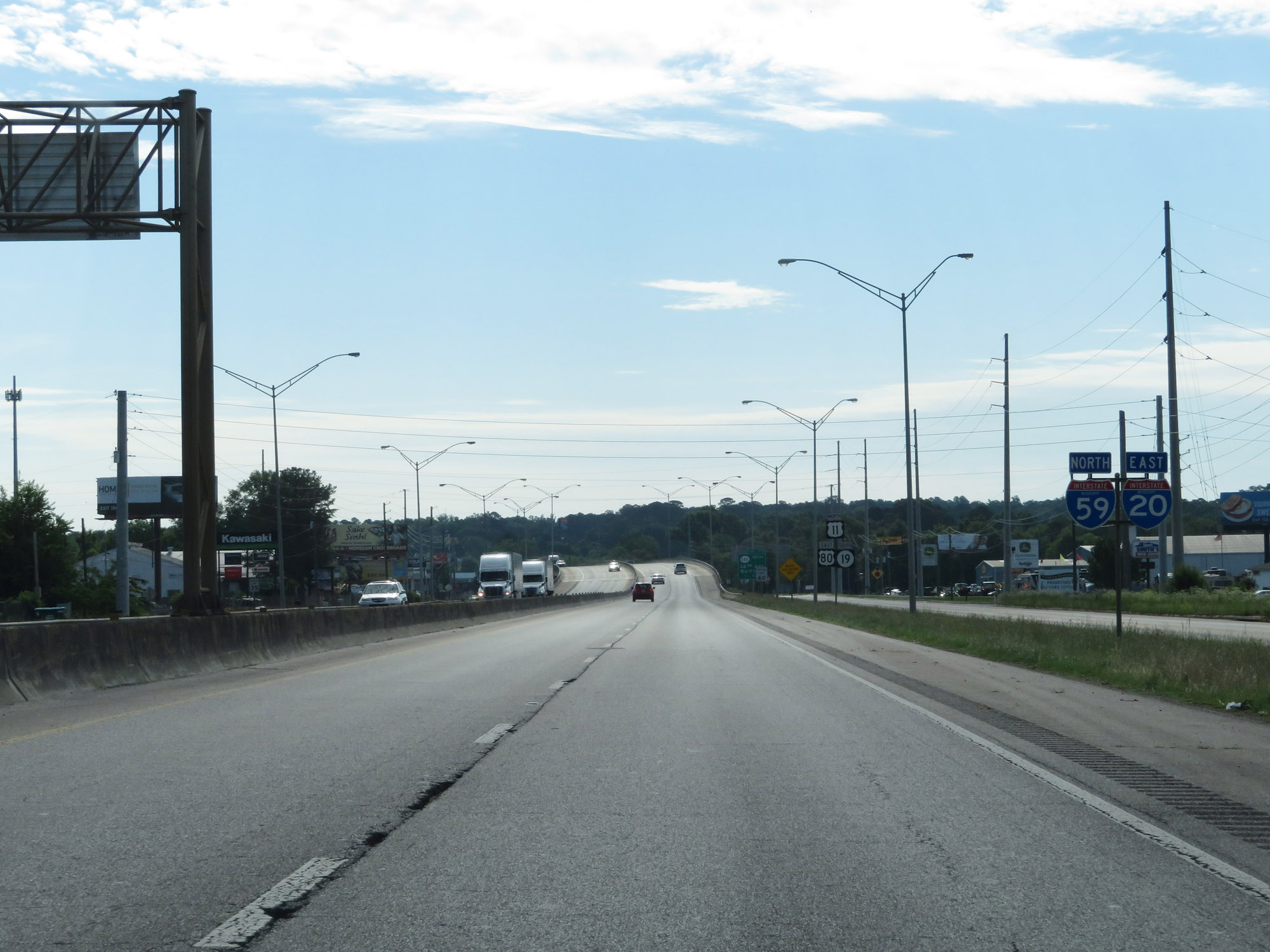
The junction of Interstate 59 now lies 1 mile ahead at Exit 130. (Photo taken 5/24/18). |
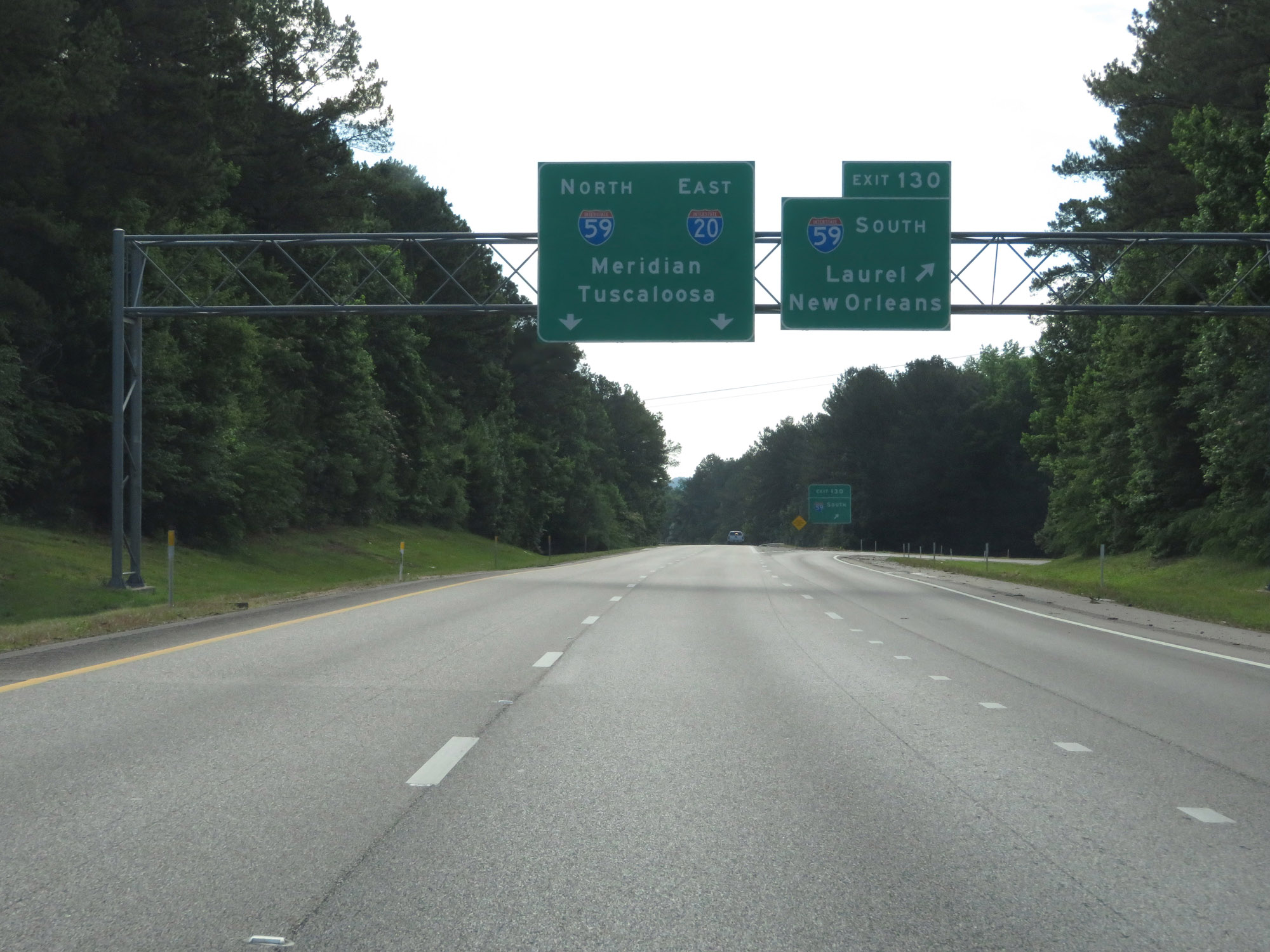 |
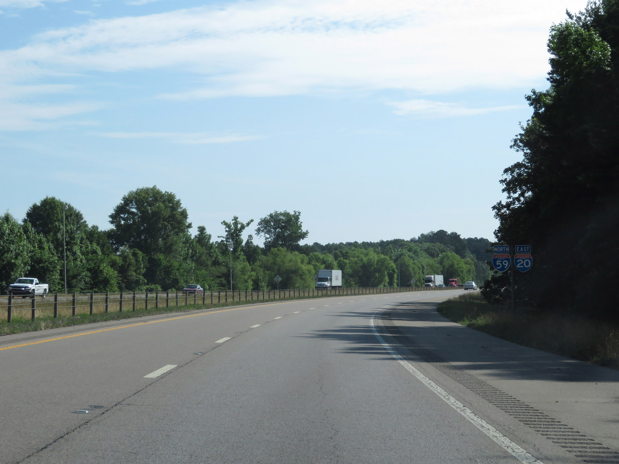
Interstate 20 East at Exit 130: Interstate 59 South - Laurel / New Orleans. Ahead, I-20 East and I-59 North will run concurrently the rest of the way through Mississippi to the Alabama border. (Photo taken 5/24/18). |
Section 3: Meridian (Exit 130) to Alabama Border
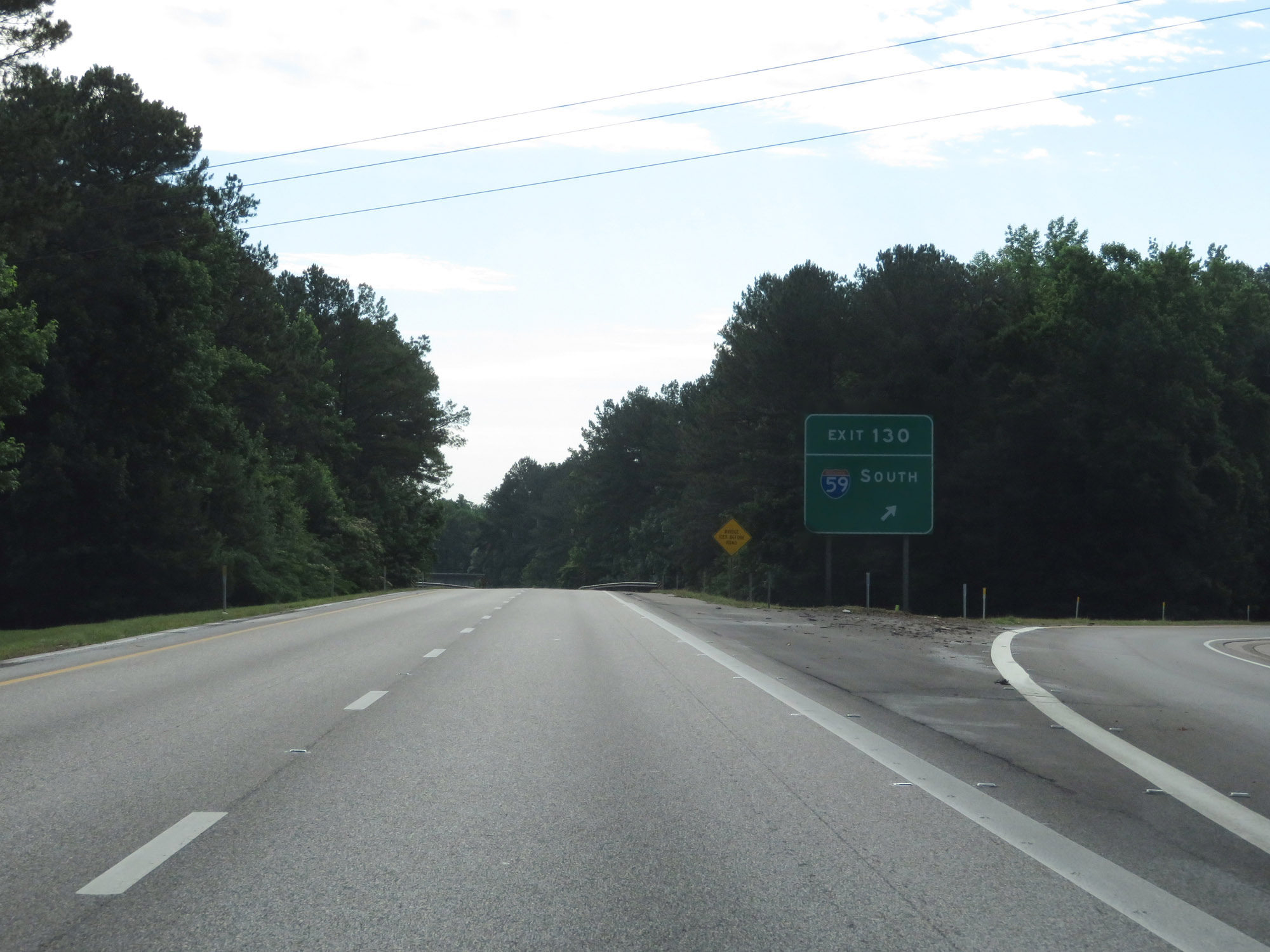 |
View of the ramp for Exit 130 to Interstate 59 South. (Photo taken 5/24/18). |
 |
Interstate 20 East at mile marker 131, as it prepares to pass under the ramp from Interstate 20 West to Interstate 59 South. (Photo taken 5/24/18). |
 |
View on Interstate 20 East as Interstate 59 North traffic merges into it on the right. During this concurrency, which will last well into Alabama, the mileage and exit numbers are based off those of I-59. (Photo taken 5/24/18). |
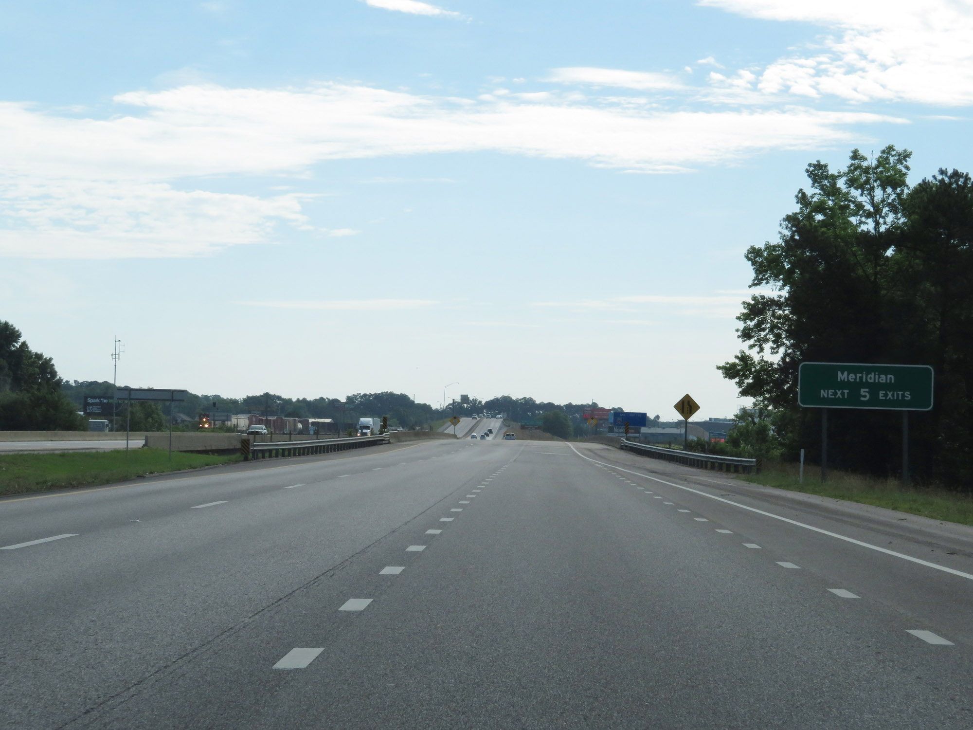 |
Take any of the next 5 exits to Meridian. (Photo taken 5/24/18). |
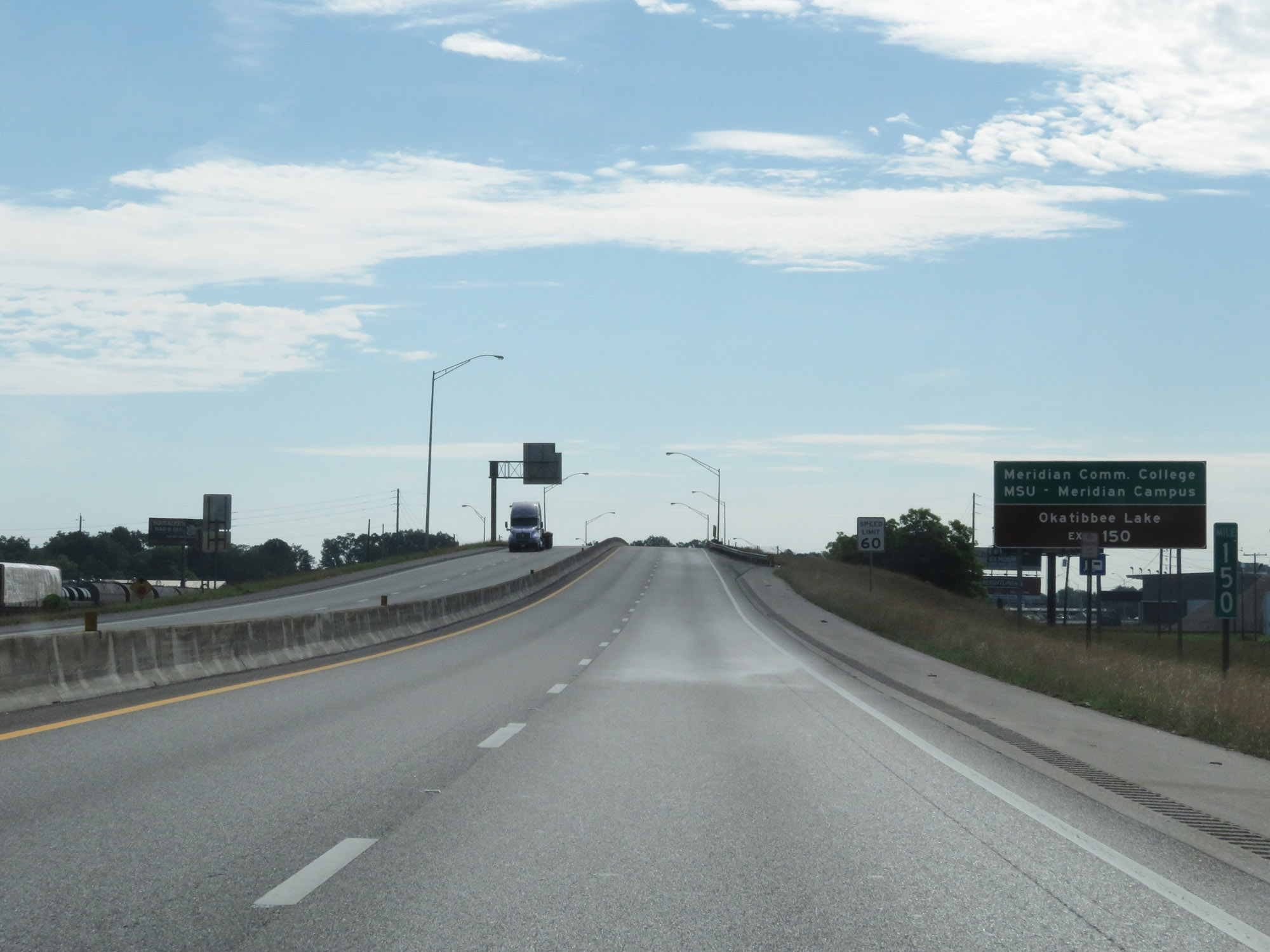 |
Take Exit 150 to Meridian Community College, MSU Meridian Campus, and Okatibbee Lake. (Photo taken 5/24/18). |
 |
The speed limit decreases to 60 mph on Interstate 20 East / Interstate 59 North through the Meridian area. (Photo taken 5/24/18). |
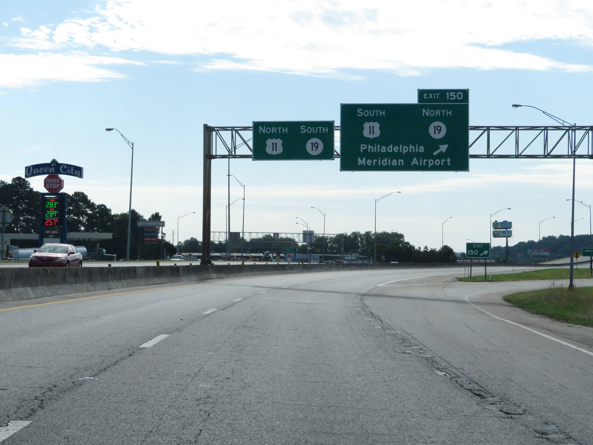 |
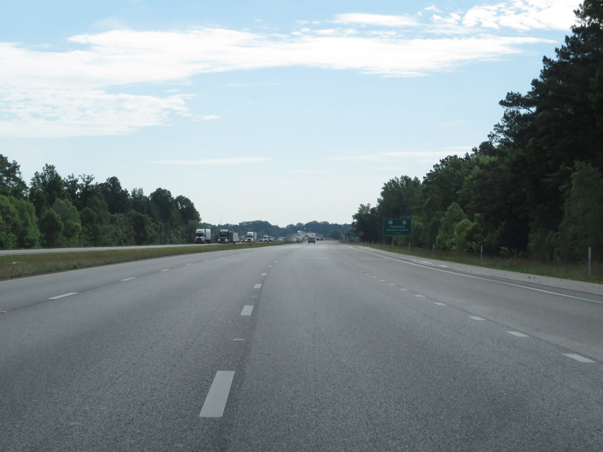
Interstate 20 East / Interstate 59 North at Exit 150: US 11 South / MS 19 North - Philadelphia / Meridian Airport (Photo taken 5/24/18). |
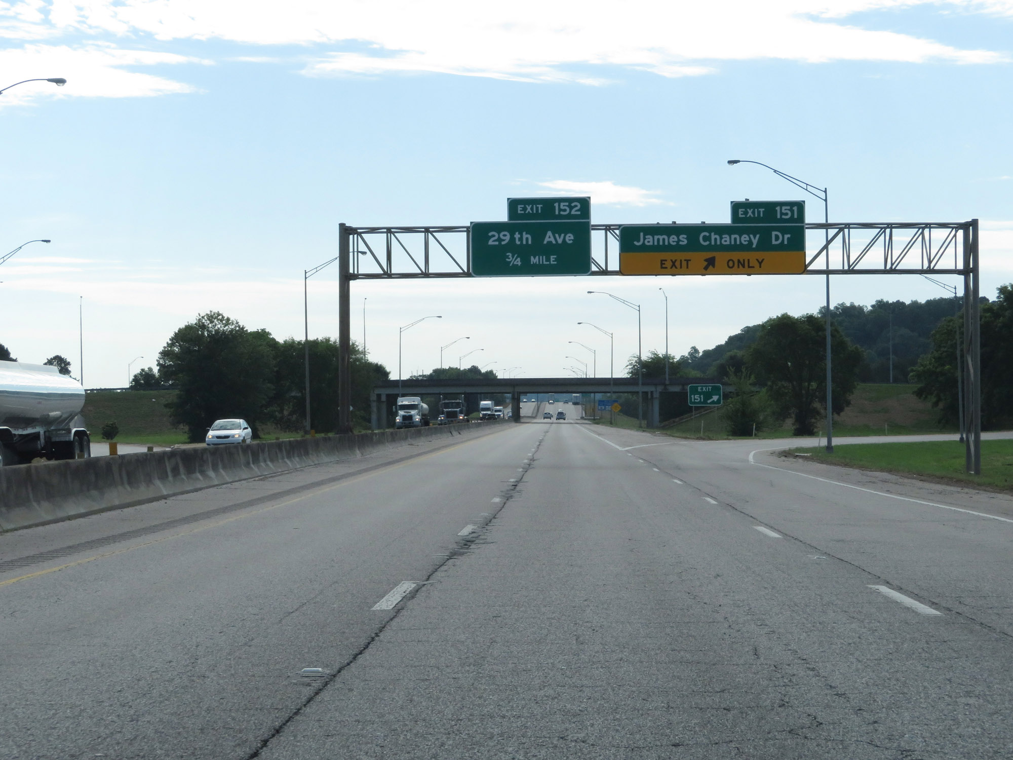 |
Interstate 20 East / Interstate 59 North at Exit 151: James Chaney Dr (Photo taken 5/24/18). |
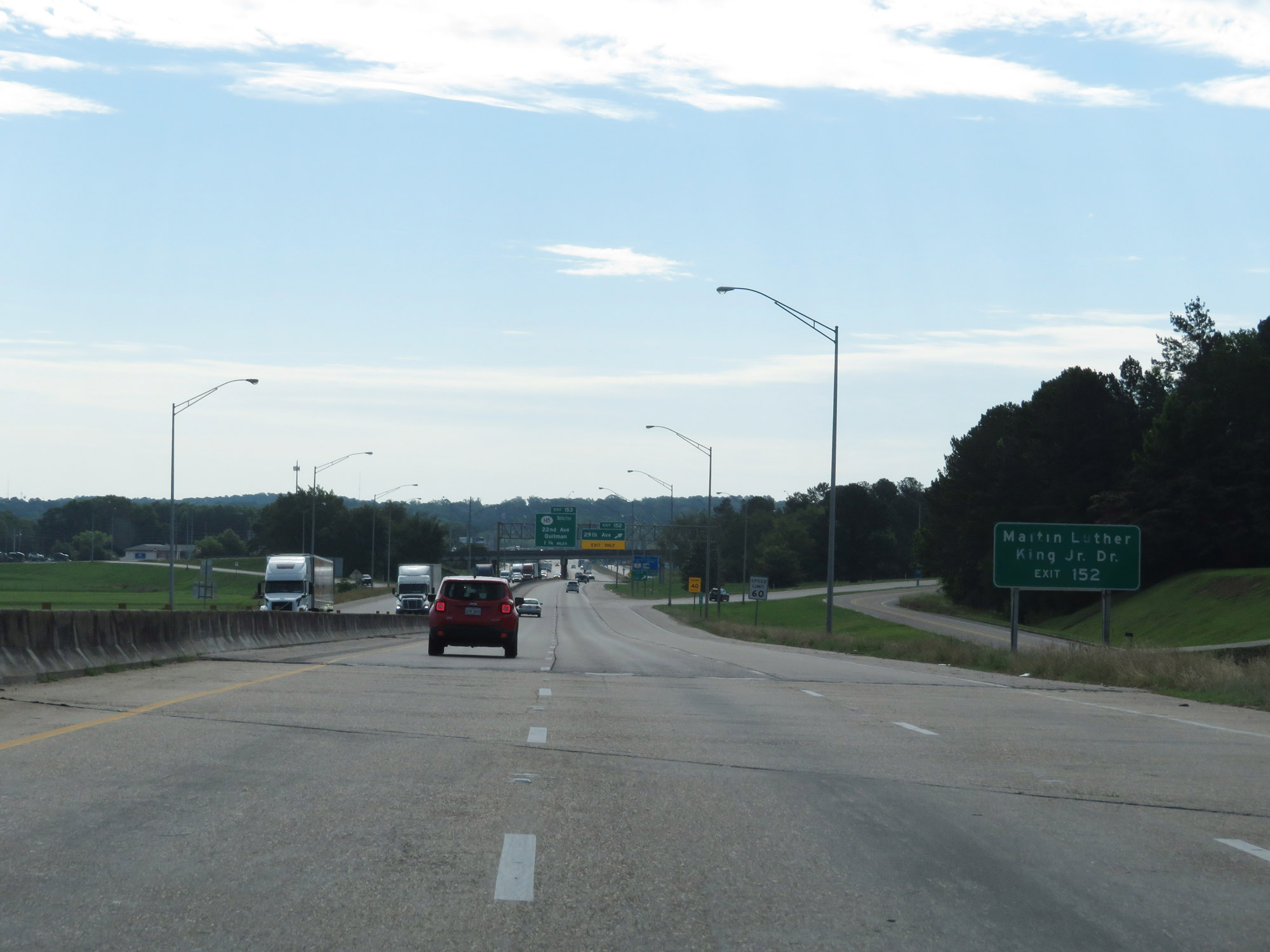 |
Take Exit 152 to Martin Luther King Jr. Dr. (Photo taken 5/24/18). |
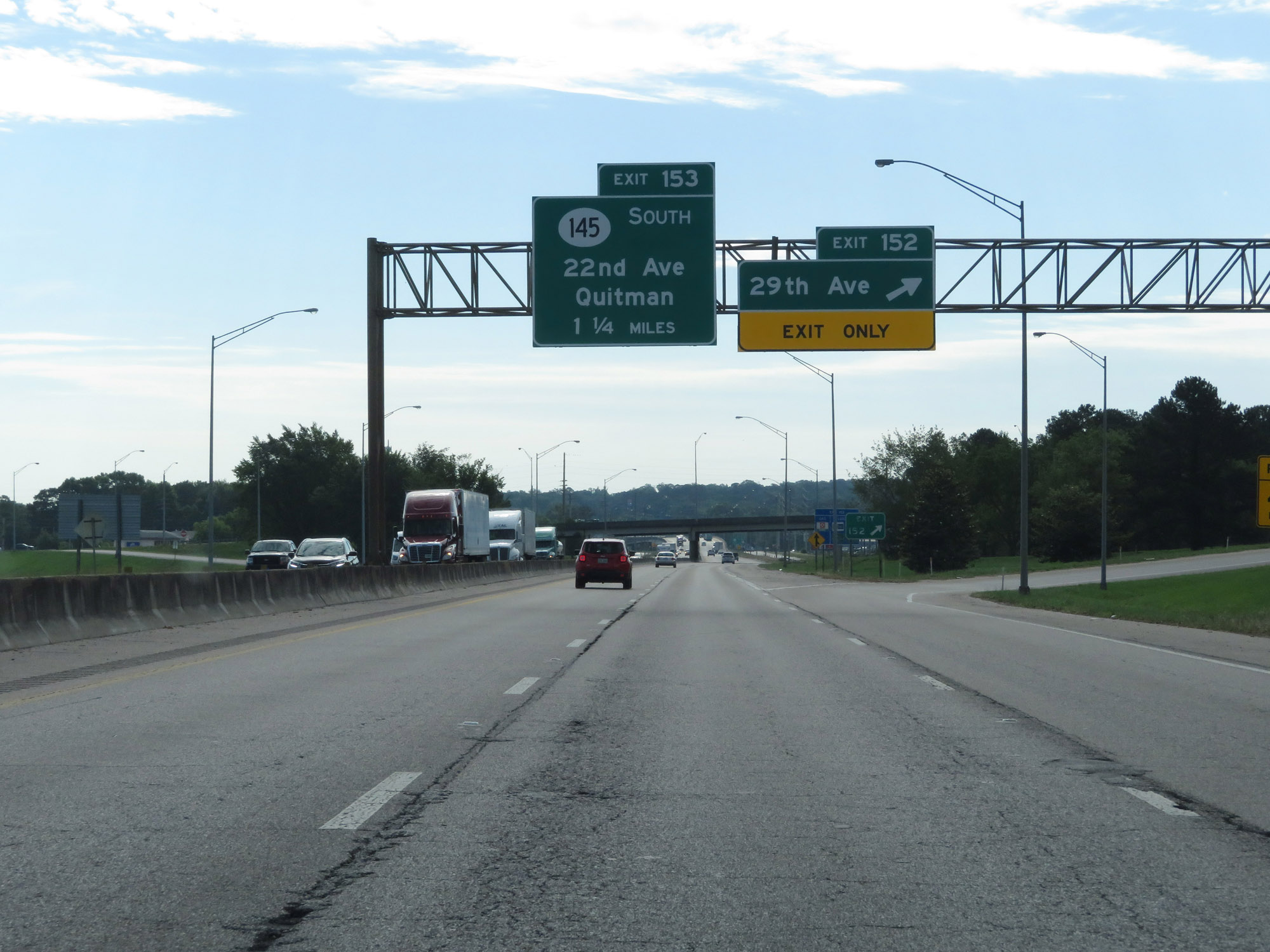 |
Interstate 20 East / Interstate 59 North at Exit 152: 29th Ave (Photo taken 5/24/18). |
 |
Dual state-named Interstate 20 East / Interstate 59 North reassurance shields in Meridian. (Photo taken 5/24/18). |
 |
Take Exit 153 to Downtown Meridian and the Jimmie Rodgers Museum. (Photo taken 5/24/18). |
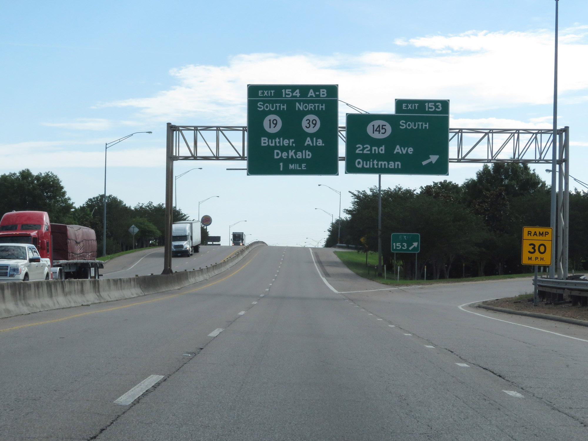 |
Interstate 20 East / Interstate 59 North at Exit 153: MS 145 South - 22nd Ave / Quitman (Photo taken 5/24/18). |
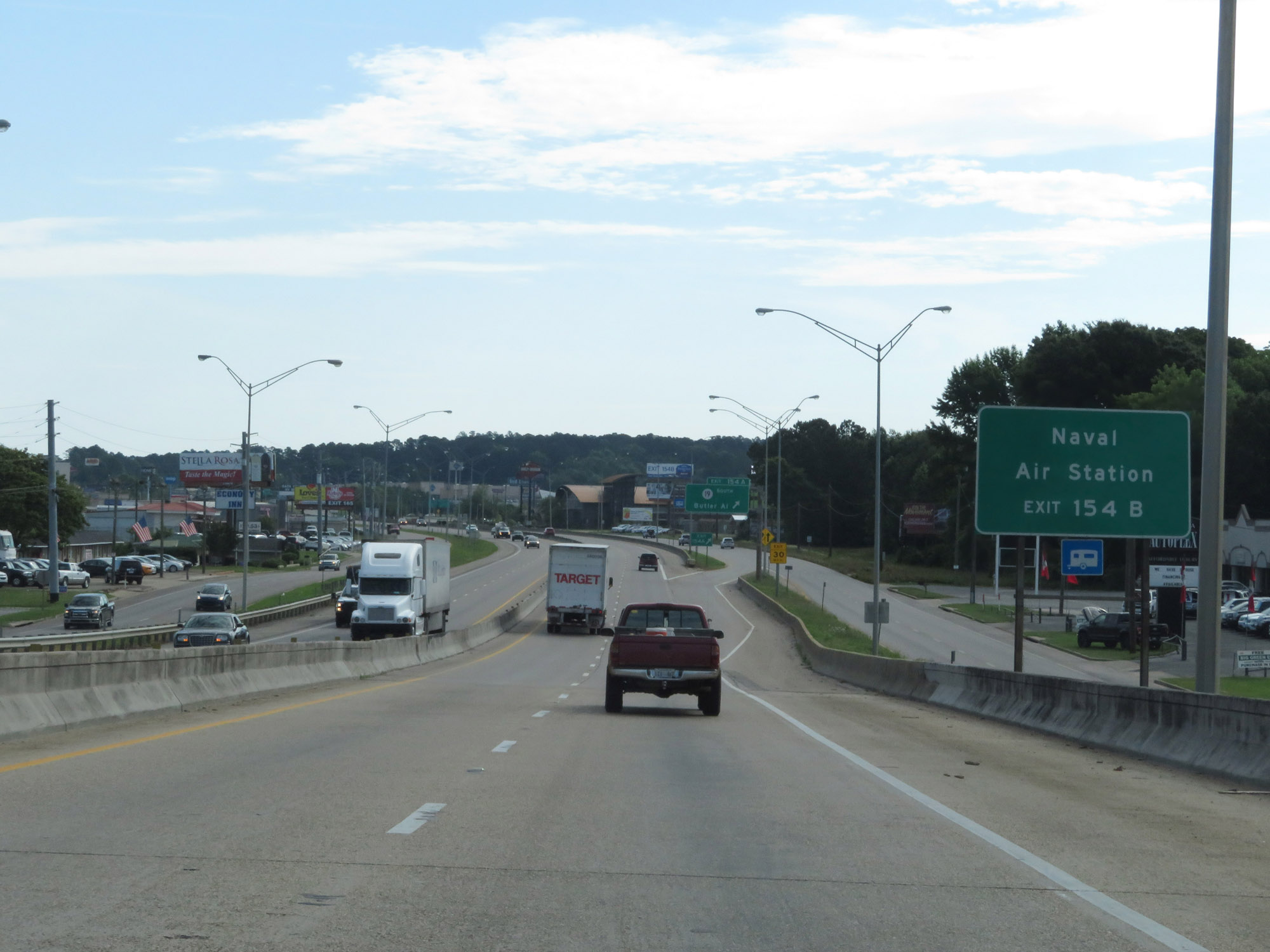 |
Take Exit 154B to the Naval Air Station. (Photo taken 5/24/18). |
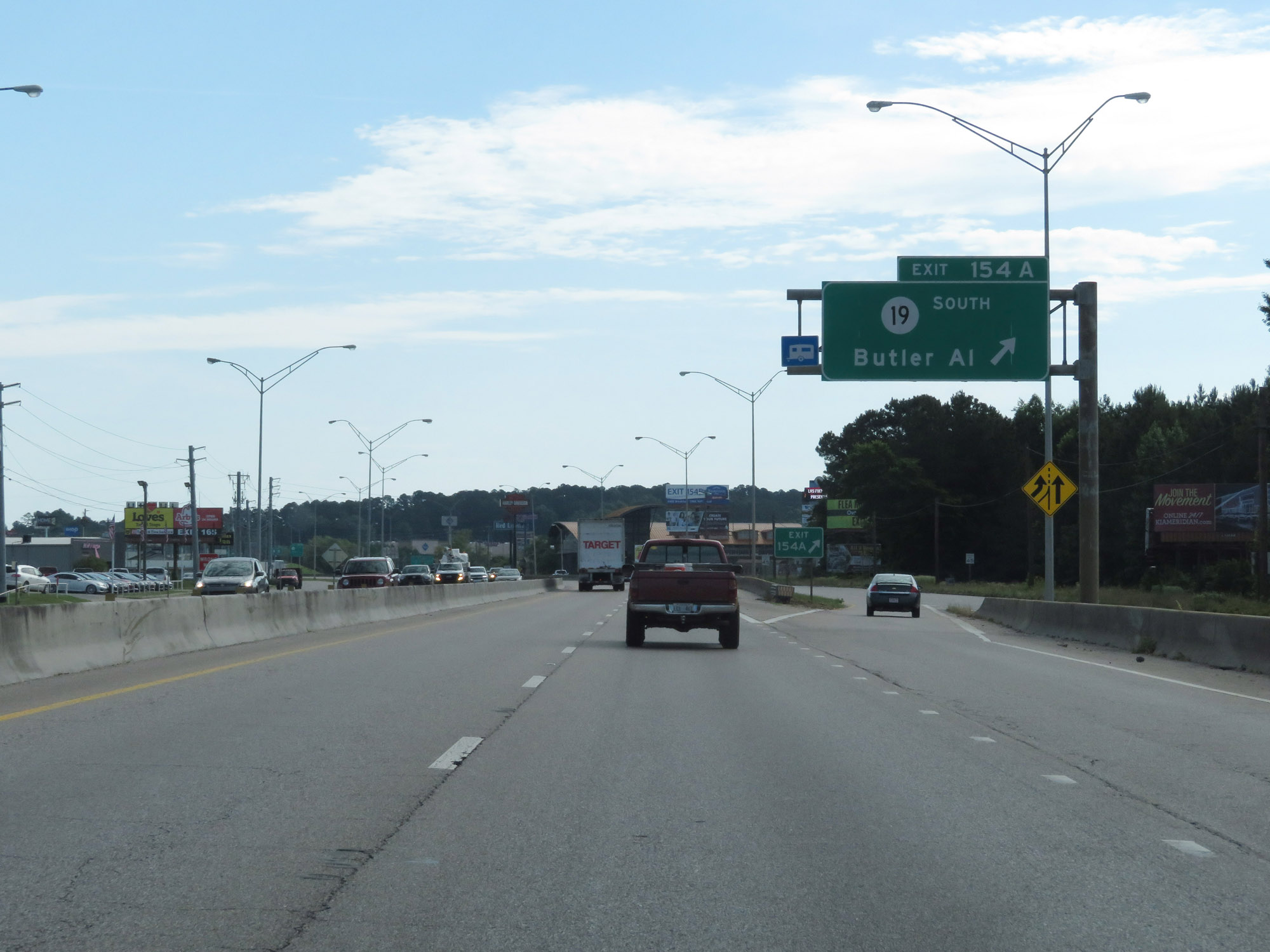 |
Interstate 20 East / Interstate 59 North at Exit 154A: MS 19 South - Butler, AL (Photo taken 5/24/18). |
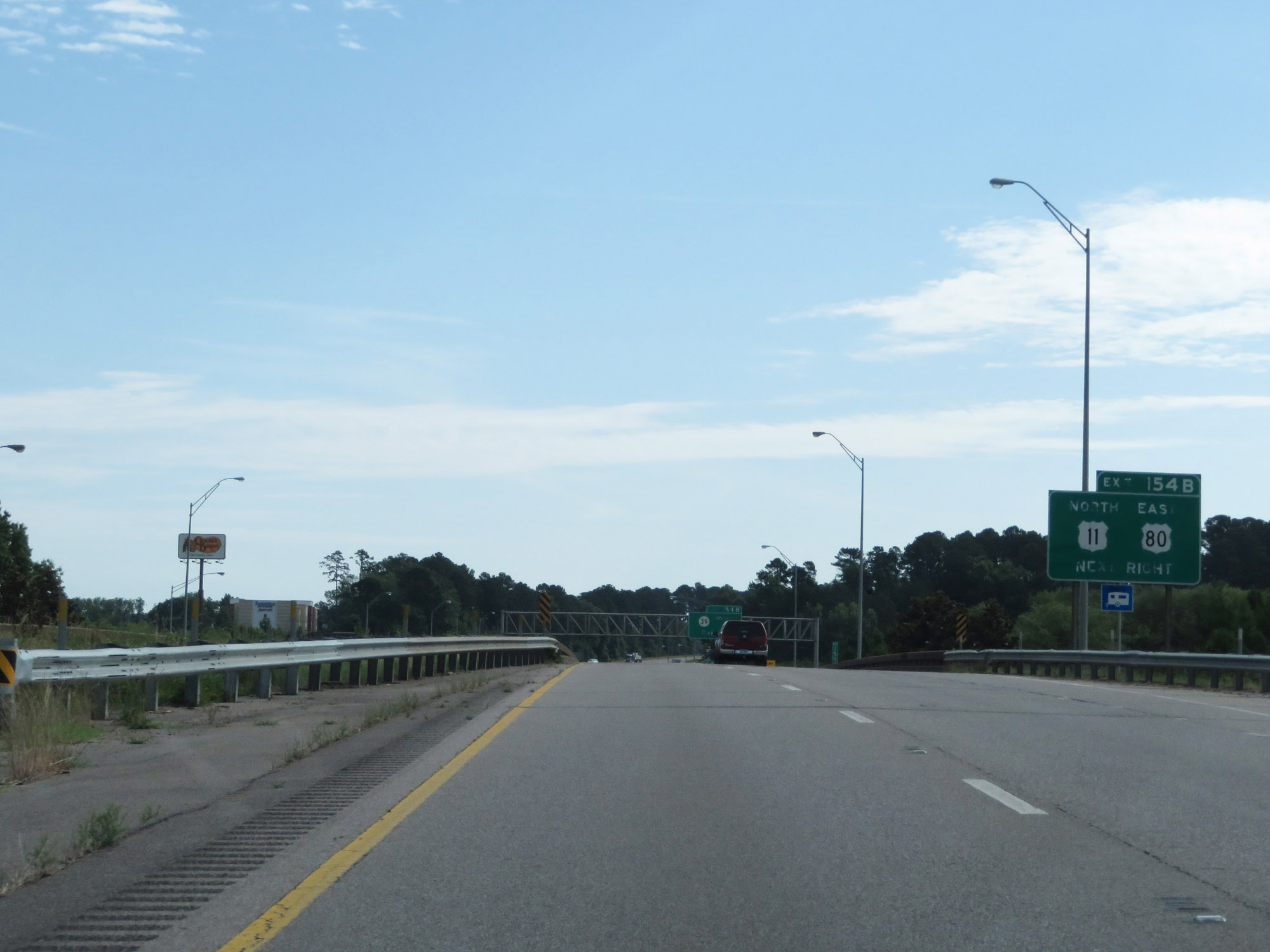 |
Take Exit 154B to US 11 North and US 80 East. (Photo taken 5/24/18). |
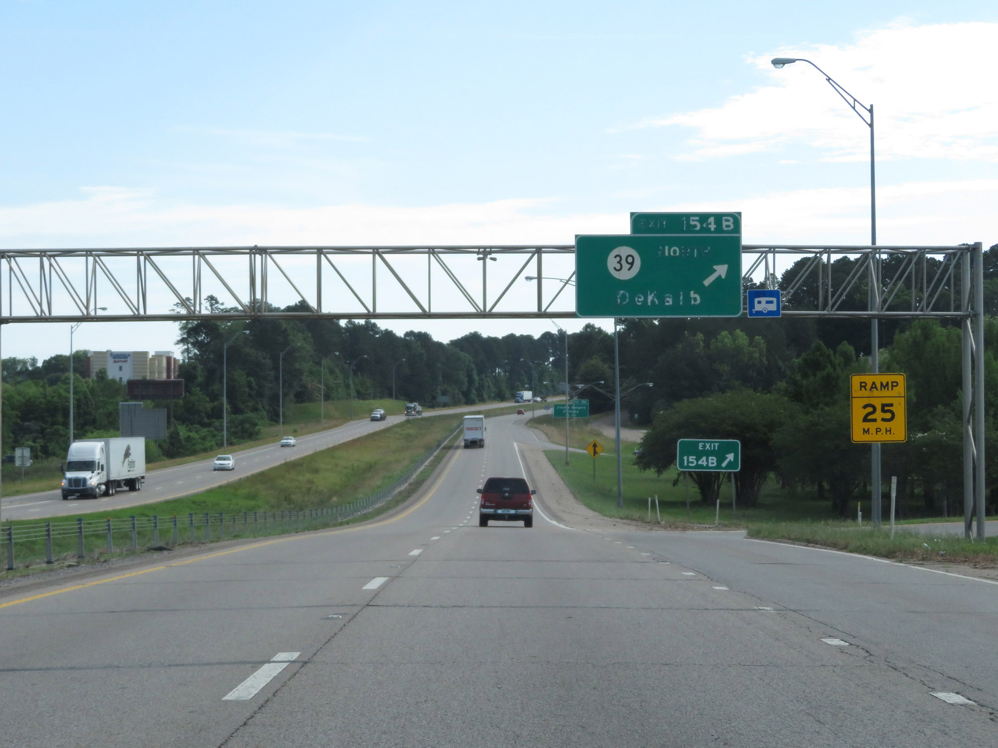 |
Interstate 20 East / Interstate 59 North at Exit 154B: MS 39 North - DeKalb (Photo taken 5/24/18). |
 |
Another set of state-named Interstate 20 East / Interstate 59 North reassurance shields. (Photo taken 5/24/18). |
 |
Leaving the Meridian area, the speed limit increases to 70 mph once again. The minimum speed limit remains 40 mph as usual. (Photo taken 5/24/18). |
 |
Interstate 20 East / Interstate 59 North at Exit 156: Jimmie Rodgers Parkway (Photo taken 5/24/18). |
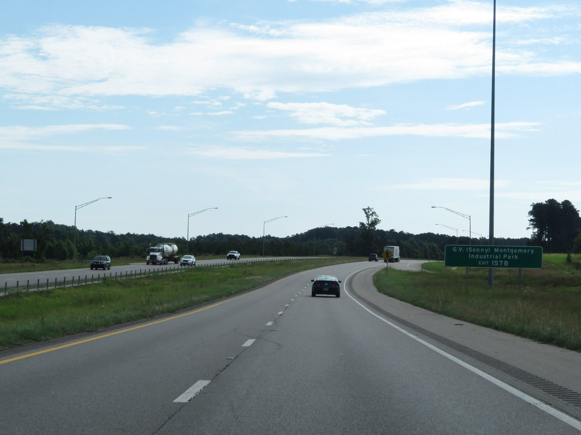 |
Take Exit 157B to G.V. (Sonny) Montgomery Industrial Park. (Photo taken 5/24/18). |
 |
Take Exit 157A to MS 19 South toward Butler, AL. (Photo taken 5/24/18). |
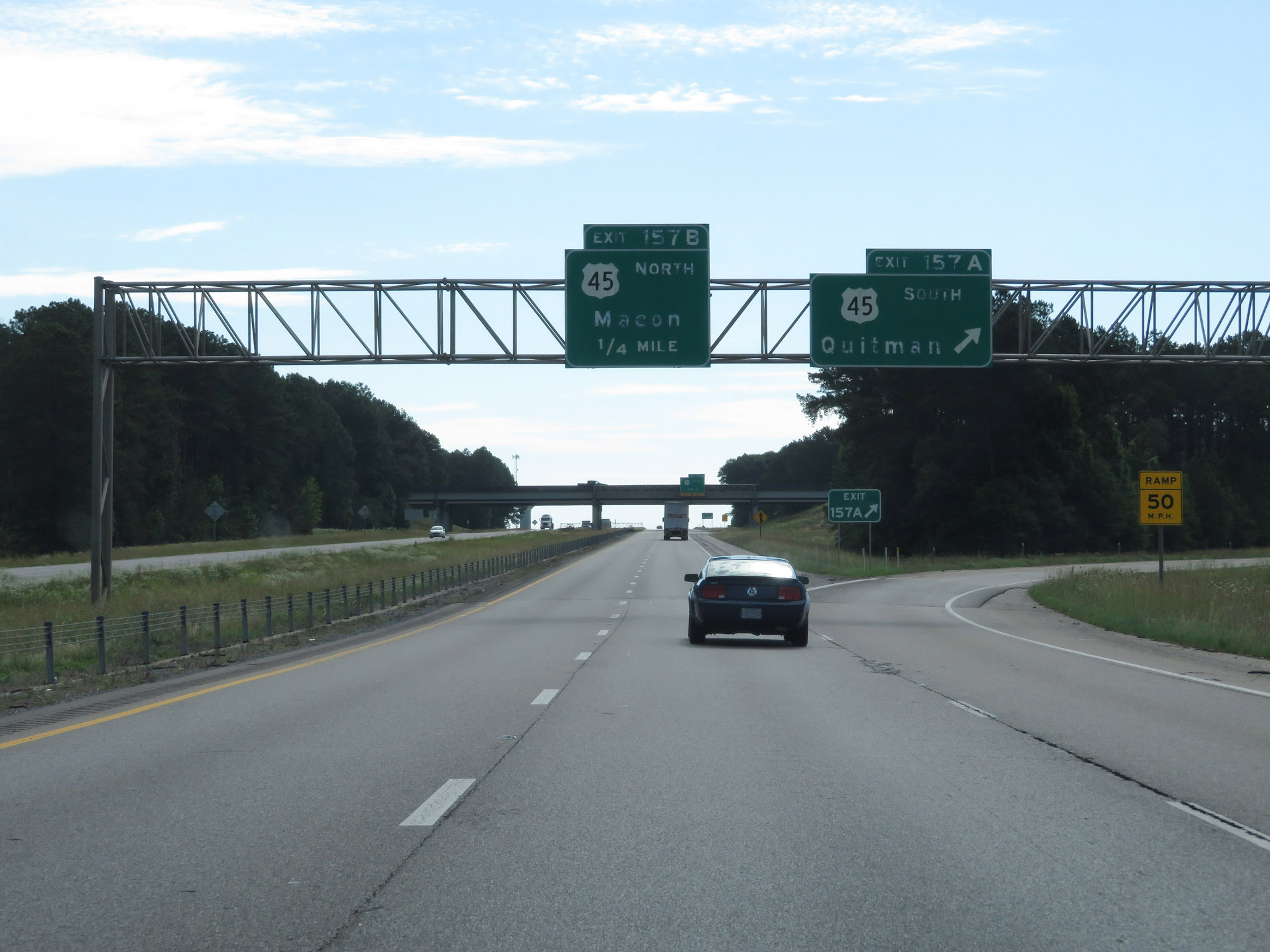 |
Interstate 20 East / Interstate 59 North at Exit 157A: US 45 South - Quitman (Photo taken 5/24/18). |
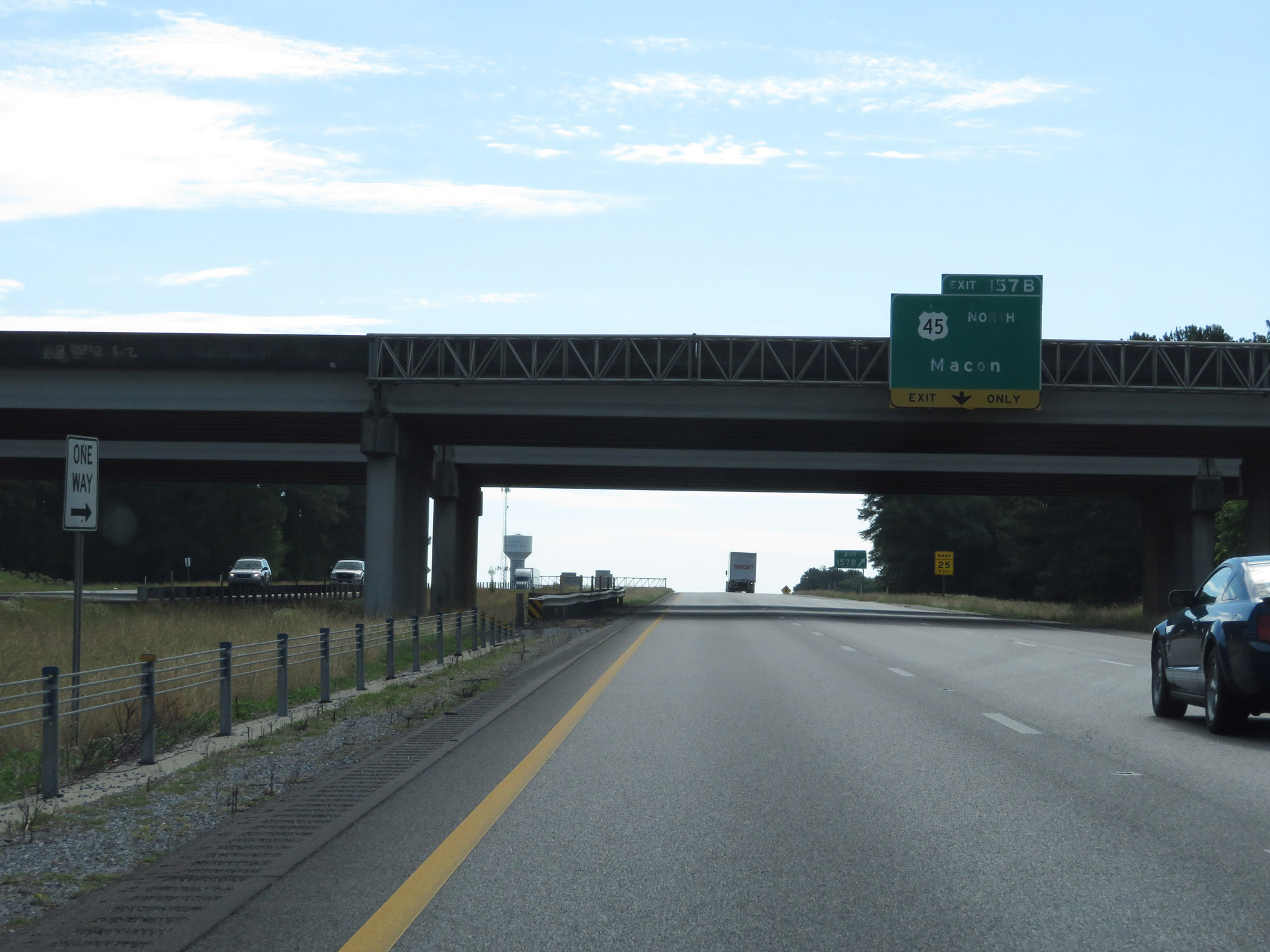 |
Interstate 20 East / Interstate 59 North at Exit 157B: US 45 North - Macon (Photo taken 5/24/18). |
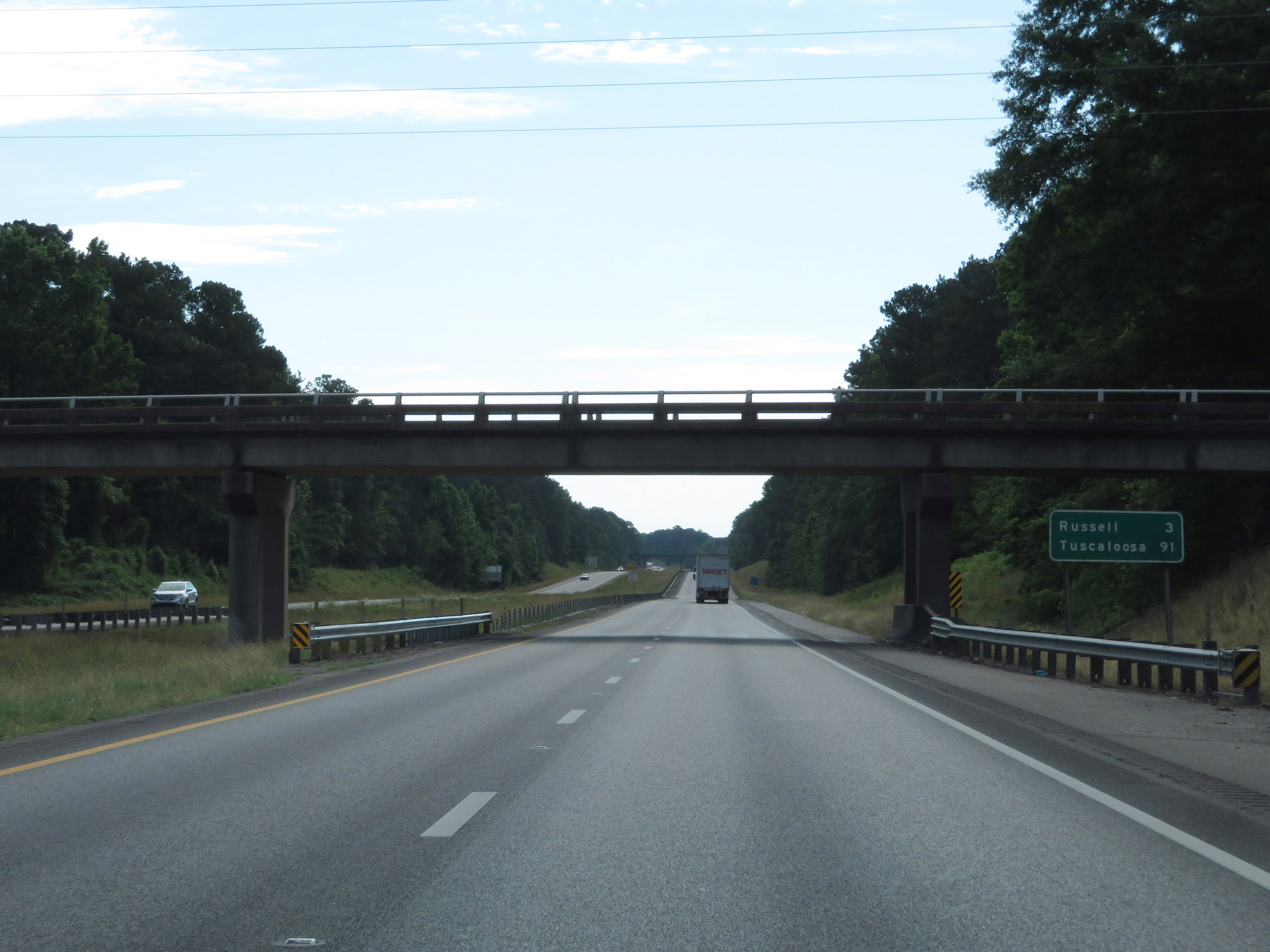 |
Mileage sign on Interstate 20 East / Interstate 59 North. It's 3 miles to Russell and 91 miles to Tuscaloosa. (Photo taken 5/24/18). |
 |
Interstate 20 East / Interstate 59 North at mile marker 159. (Photo taken 5/24/18). |
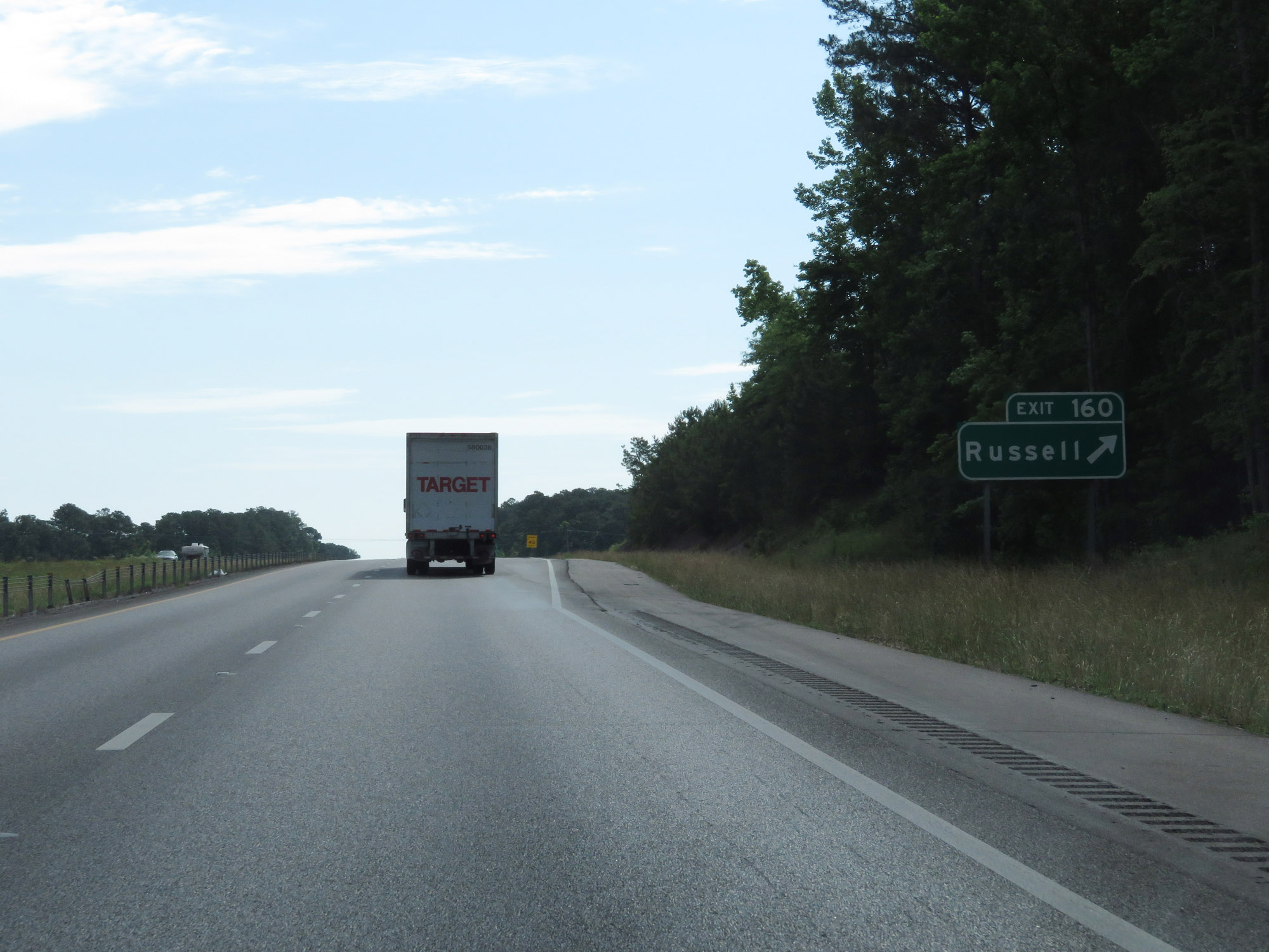 |
Interstate 20 East / Interstate 59 North at Exit 160: Russell (Photo taken 5/24/18). |
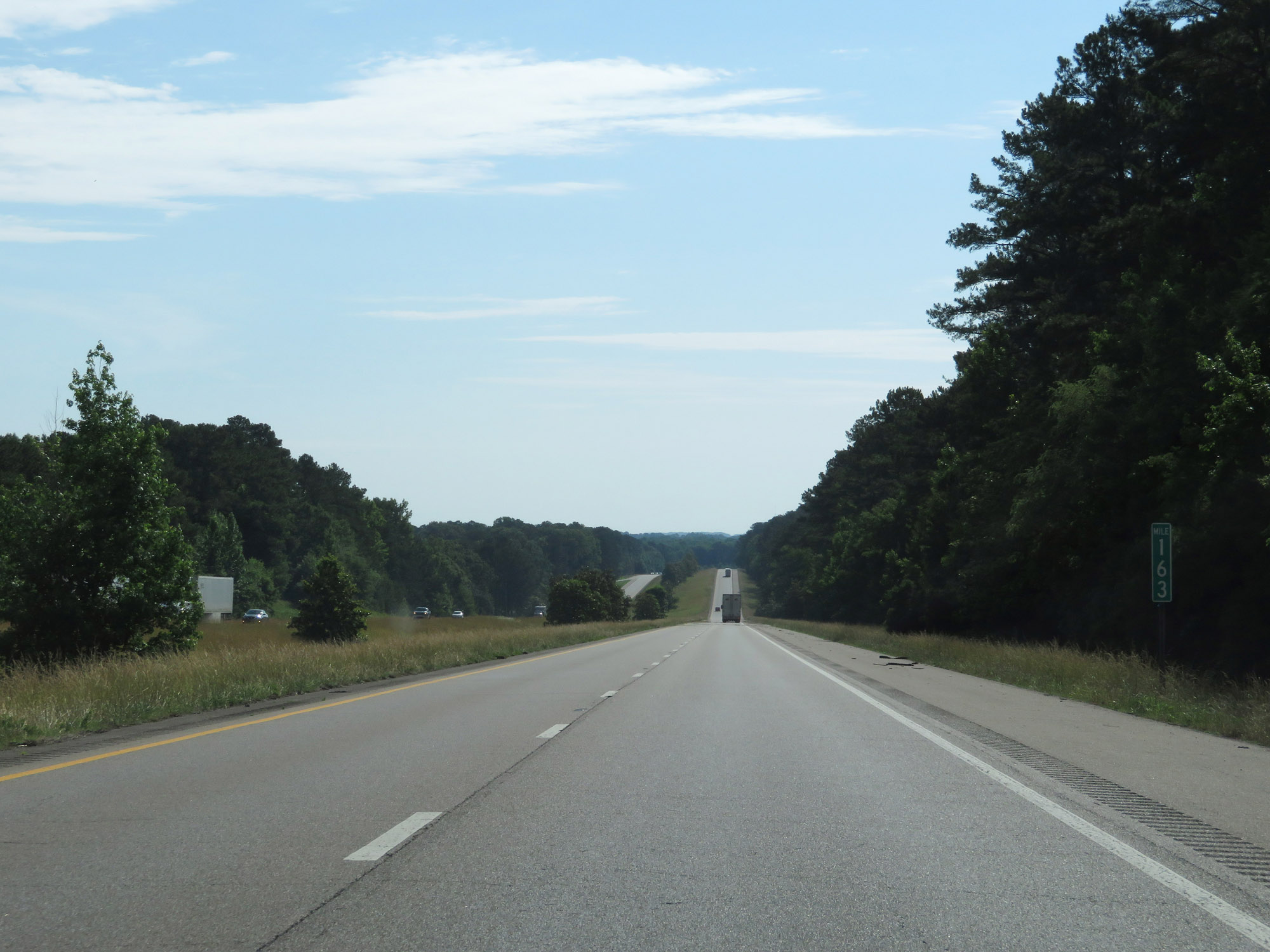 |
View on Interstate 20 East / Interstate 59 North at mile marker 163. (Photo taken 5/24/18). |
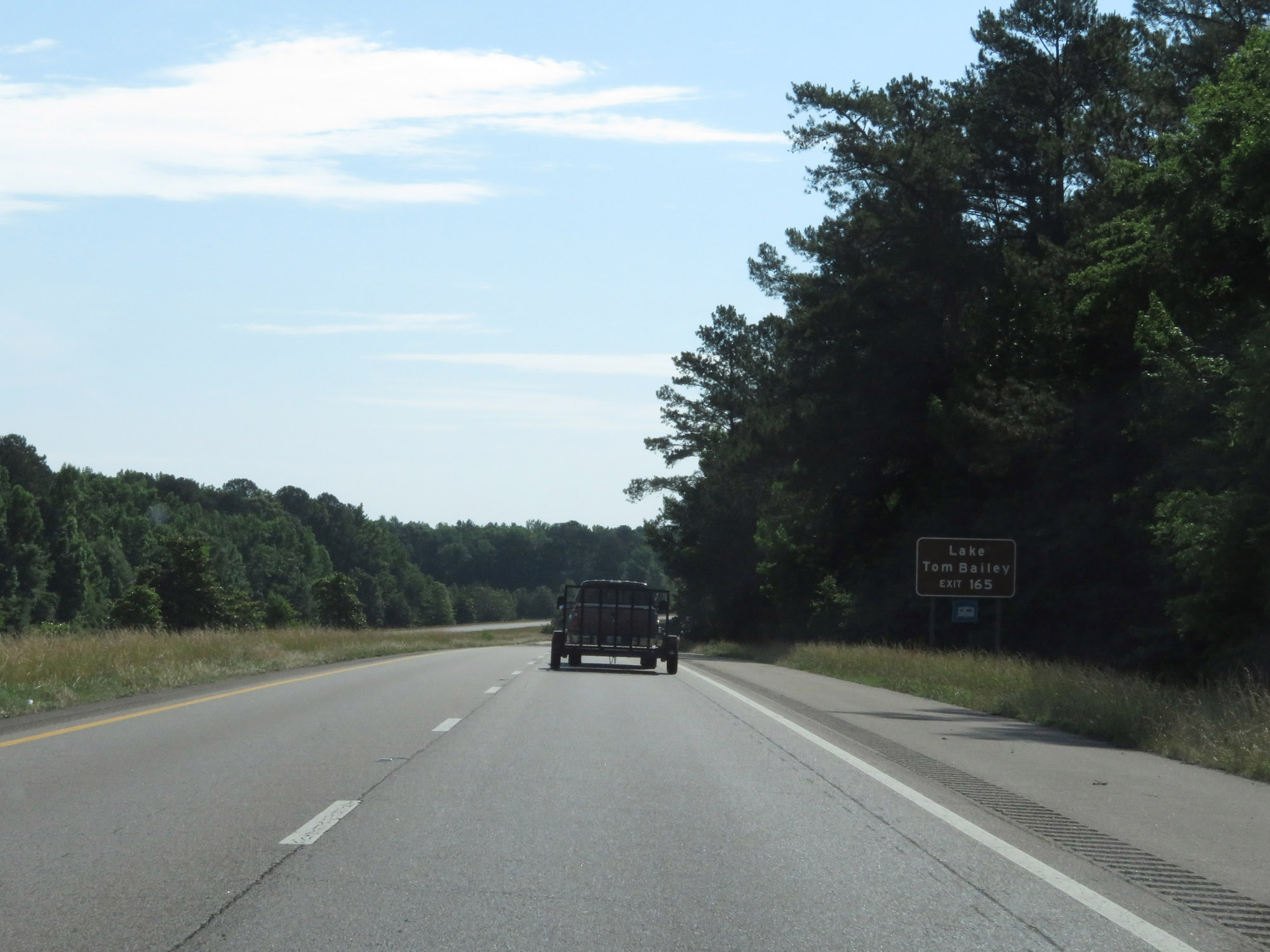 |
Take Exit 165 to Lake Tom Bailey. (Photo taken 5/24/18). |
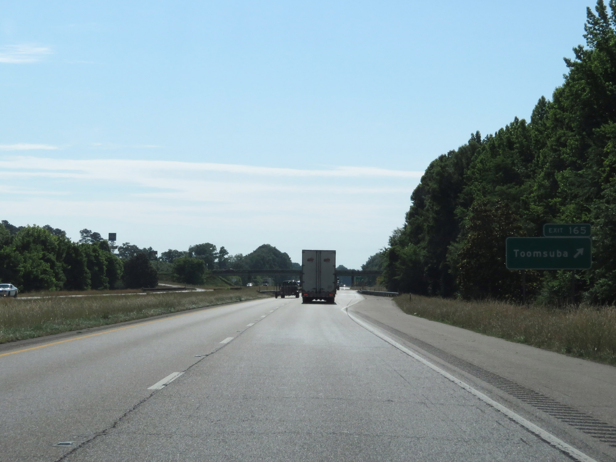 |
Interstate 20 East / Interstate 59 North at Exit 165: Toomsuba (Photo taken 5/24/18). |
 |
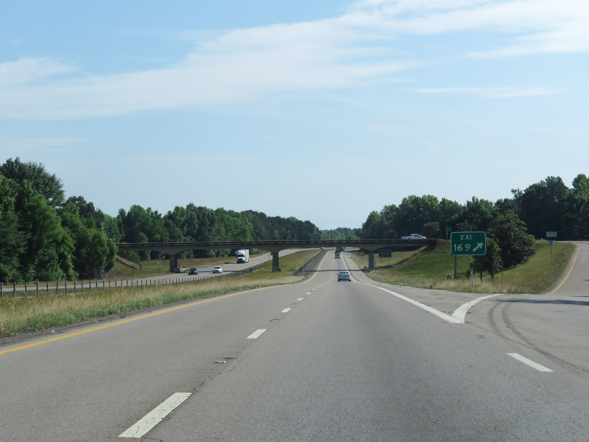
Interstate 20 East / Interstate 59 North approaching Exit 169 - 1 mile. (Photo taken 5/24/18). |
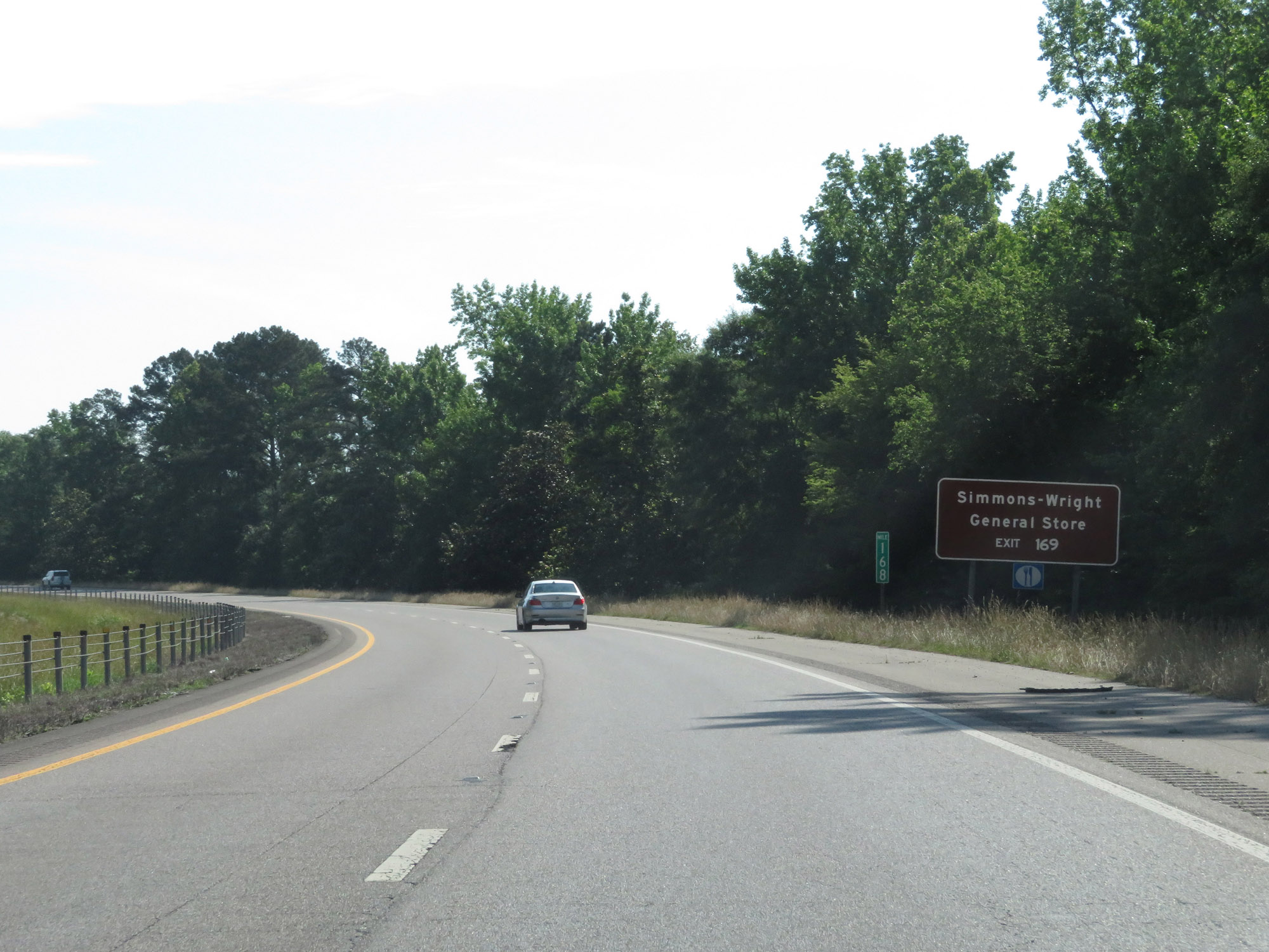 |
Take Exit 169 to Simmons-Wright General Store. (Photo taken 5/24/18). |
 |
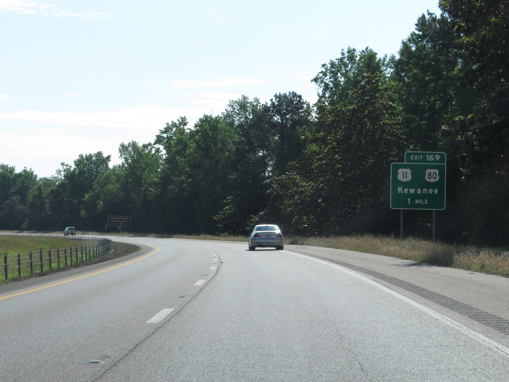
Interstate 20 East / Interstate 59 North at Exit 169: US 11 / US 80 - Kewanee (Photo taken 5/24/18). |
 |
One final set of state-named Interstate 20 East / Interstate 59 North reassurance shields. (Photo taken 5/24/18). |
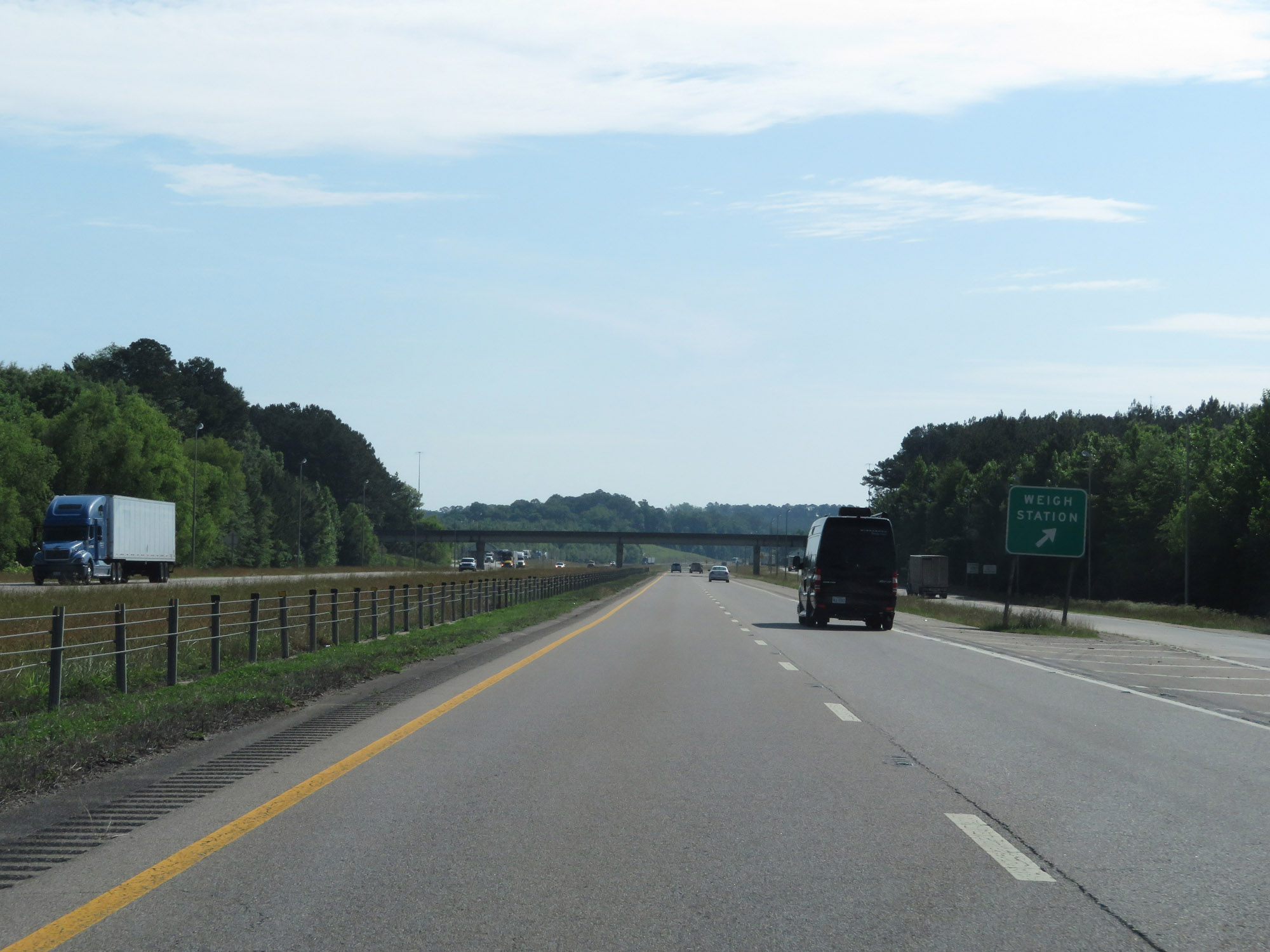 |
Weigh Station on Interstate 20 East / Interstate 59 North in Lauderdale County. (Photo taken 5/24/18). |
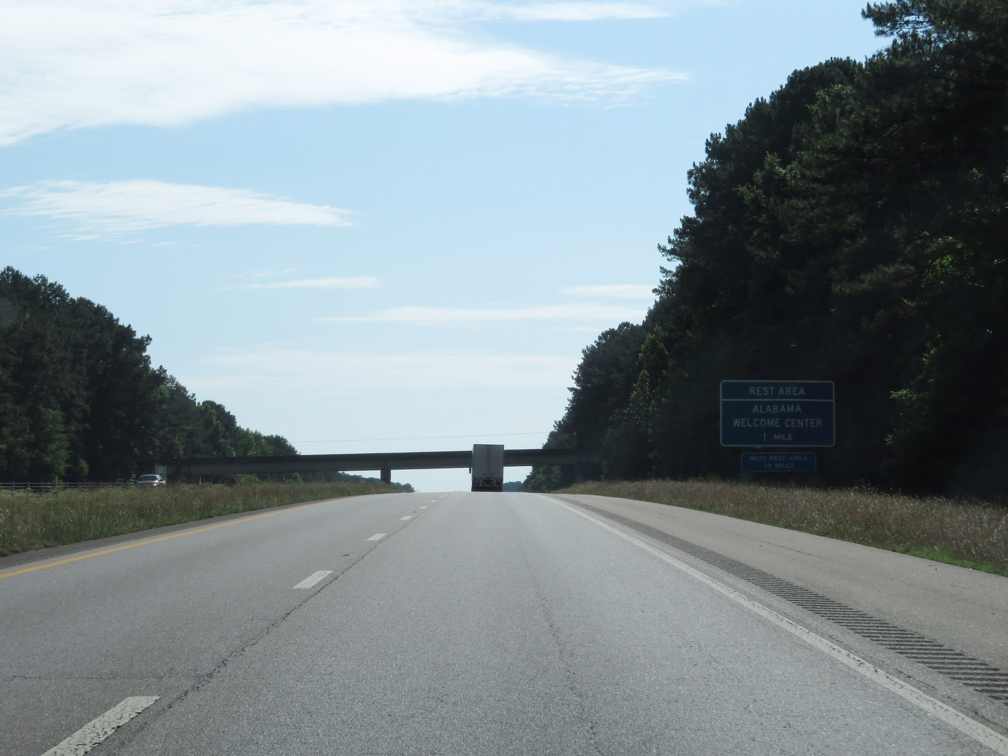 |
The Alabama Welcome Center / Rest Area lies just 1 mile ahead. (Photo taken 5/24/18). |
 |
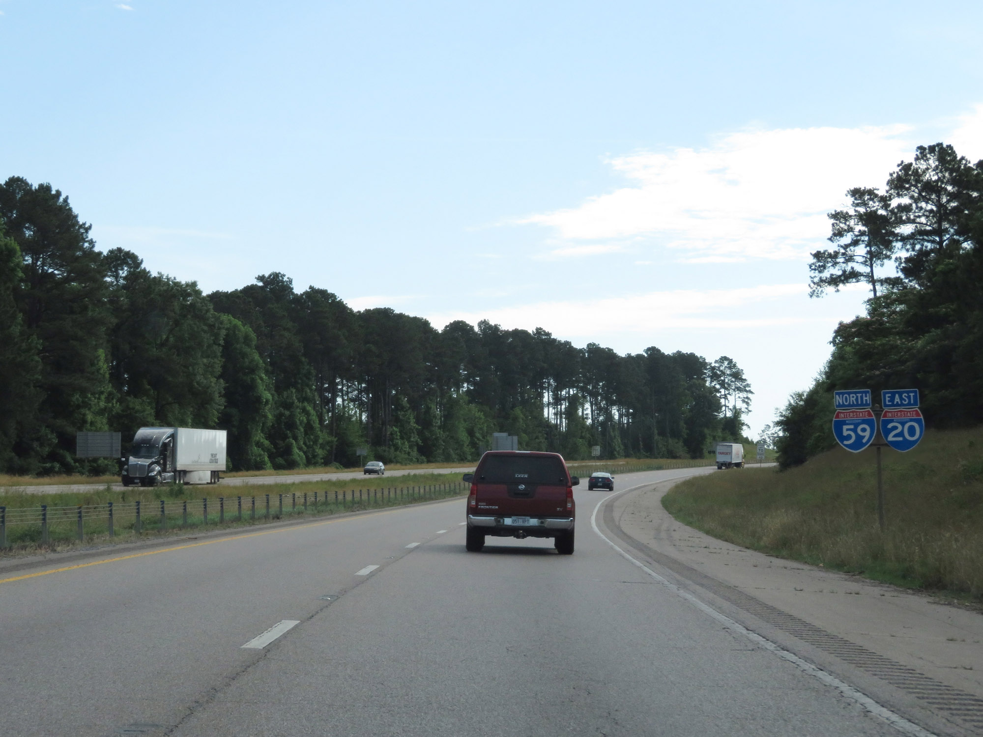
Interstate 20 East / Interstate 59 North at mile marker 172, as the duplex prepares to enter Alabama. (Photo taken 5/24/18). |