Road Information |
||
 |
||
| Total Mileage in State: | 109 miles | |
| Northern End: | At Delaware state line | |
| Southern End: | At Virginia state line | |
| Mileage covered in Photos: | 109 miles | |
| Counties covered in Photos: | Prince George's, Howard, Baltimore, Harford, Cecil | |
| Major Junctions in Photos: | I-295, near Forest Heights US 50, near Glenarden I-895, near Elkridge I-195, near Elkridge I-695, in Halethorpe I-395, in Baltimore I-695, near Baltimore |
|
| Control Cities in Photos: | Oxon Hill, Largo, College Park, Laurel, Baltimore, White Marsh, Edgewood, Aberdeen, Elkton | |
Northbound
- Section 1: Virginia/DC Border to Beltsville (Exit 29A)
- Section 2: Beltsville (Exit 29A) to Baltimore (Exit 53)
- Section 3: Baltimore (Exit 53) to Delaware Border
Section 1: Virginia/DC Border to Beltsville (Exit 29A)
 |
Interstate 95 North / Interstate 495 Outer Loop (East) as they cross the Potomac River into Maryland from the Washington DC / Virginia borders. (Photo taken 11/9/15). |
 |
Interstate 95 North / Interstate 495 Outer Loop (East) at Exits 2A-B: Interstate 295 North - Washington / National Harbor (Photo taken 11/9/15). |
 |
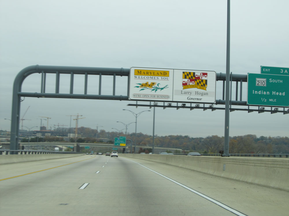
Interstate 95 North / Interstate 495 Outer Loop (East) at Exit 3: MD 210 - Forest Heights / Indian Head (Photo taken 11/9/15). |
 |
Interstate 95 North / Interstate 495 Outer Loop (East) at mile marker 2. (Photo taken 11/9/15). |
 |
Dual Interstate 95 North / Interstate 495 assurance shields. (Photo taken 11/9/15). |
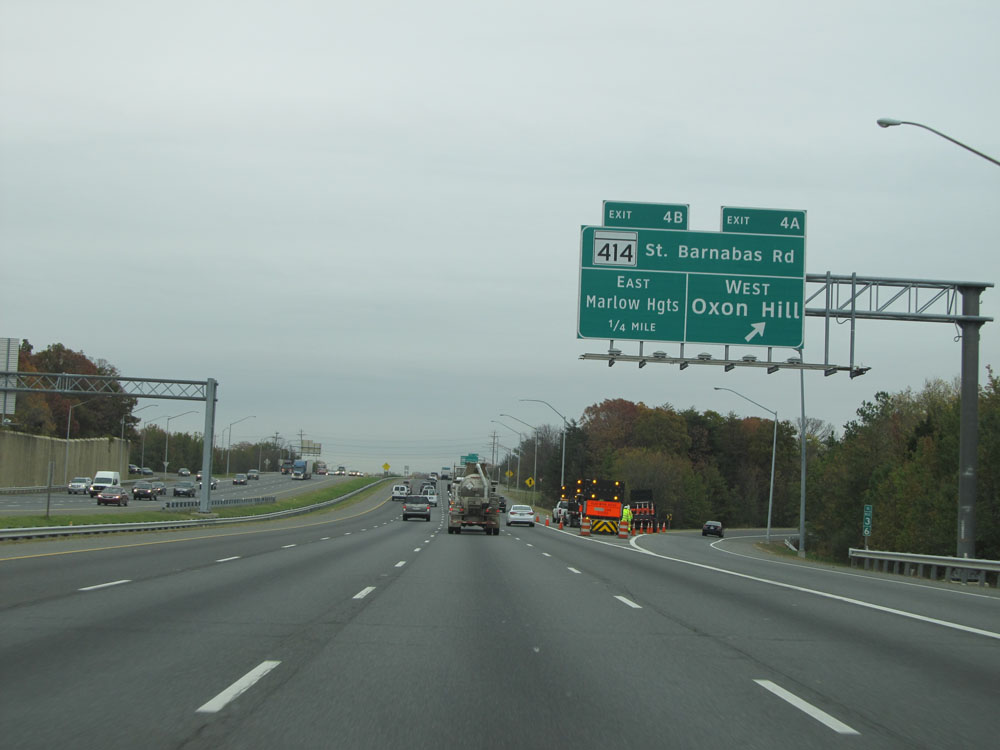 |
Interstate 95 North / Interstate 495 Outer Loop (East) at Exit 4A: MD 414 (St. Barnabas Rd) West - Oxon Hill (Photo taken 11/9/15). |
 |
Interstate 95 North / Interstate 495 Outer Loop (East) at Exit 4B: MD 414 (St. Barnabas Rd) East - Marlow Heights (Photo taken 11/9/15). |
 |
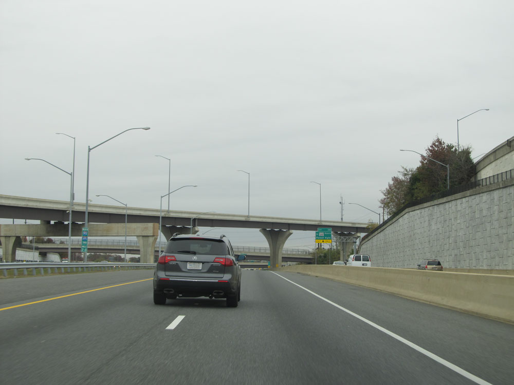
Interstate 95 North / Interstate 495 Outer Loop (East) at mile marker 5. (Photo taken 11/9/15). |
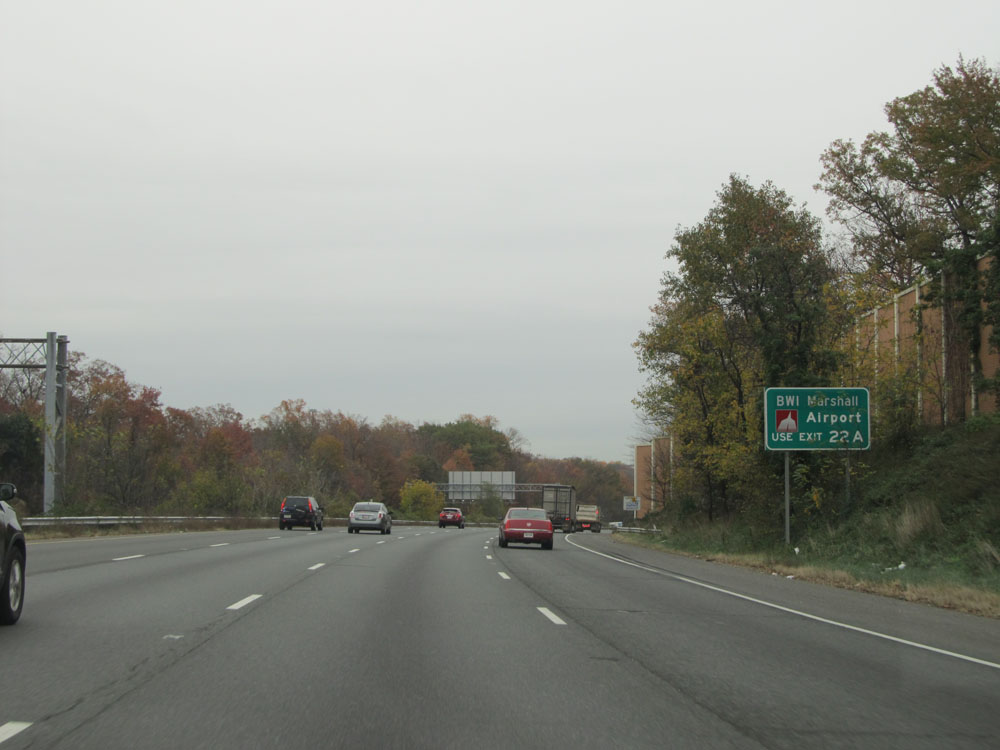 |
Use Exit 22A (16 miles ahead) to BWI Marshall Airport. (Photo taken 11/9/15). |
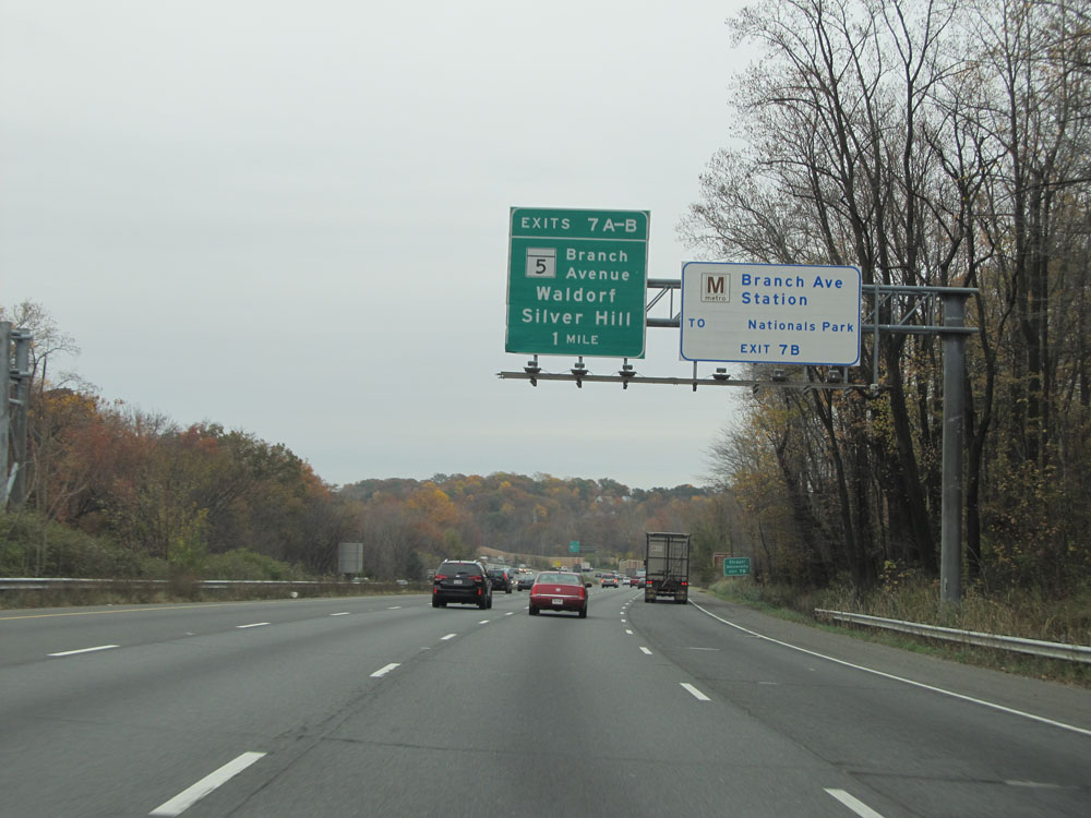 |
Take Exit 7B to the Branch Ave Metro Station to Nationals Park. (Photo taken 11/9/15). |
 |
Take Exit 7A to thePotomac Corridor Colonial and Civil War Sites / Nature Areas. (Photo taken 11/9/15). |
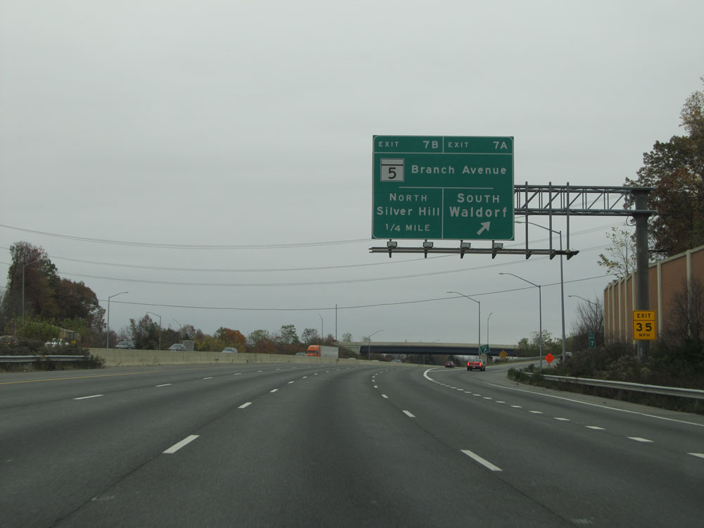 |
Interstate 95 North / Interstate 495 Outer Loop (East) at Exit 7A: MD 5 (Branch Avenue) South - Waldorf (Photo taken 11/9/15). |
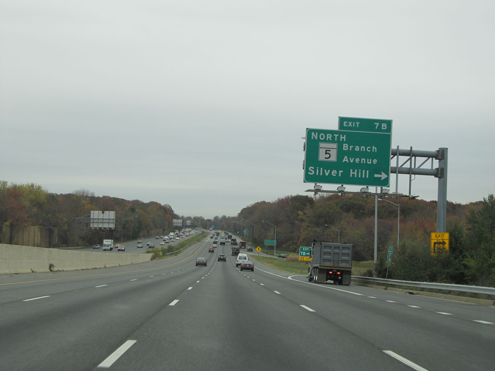 |
Interstate 95 North / Interstate 495 Outer Loop (East) at Exit 7B: MD 5 (Branch Avenue) North - Silver Hill (Photo taken 11/9/15). |
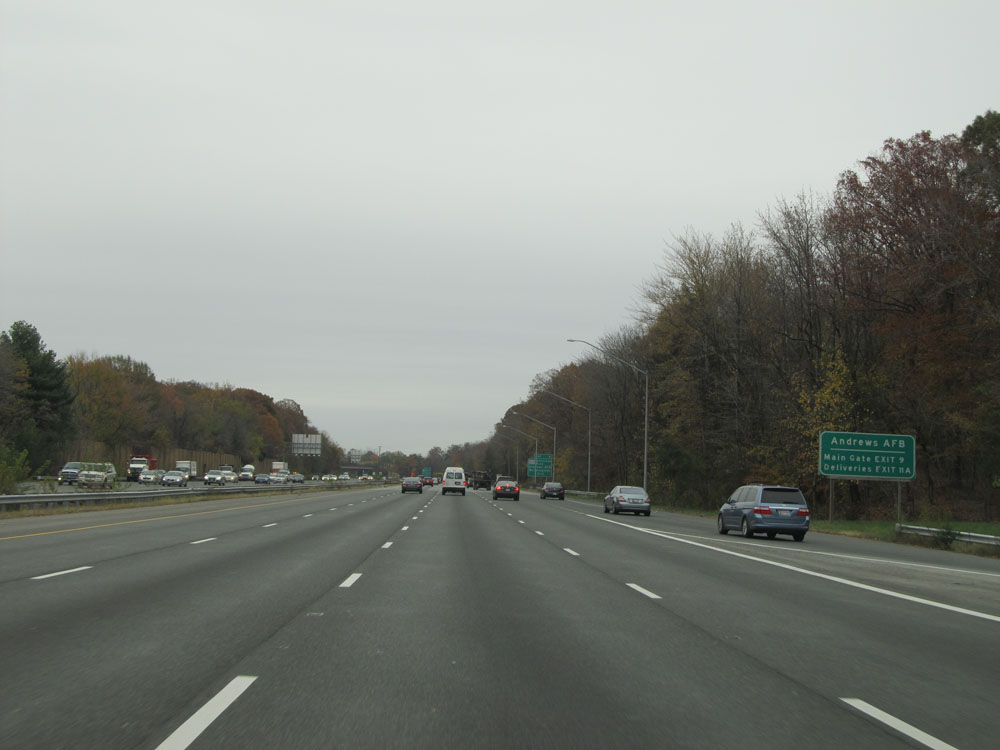 |
Traffic headed to Andrews Air Force Base should use Exit 9 to the Main Gate. Deliveries should use Exit 11A. (Photo taken 11/9/15). |
 |
Interstate 95 North / Interstate 495 Outer Loop (East) at Exit 9: MD 337 (Allentown Road) - Andrews AFB / Morningside (Photo taken 11/9/15). |
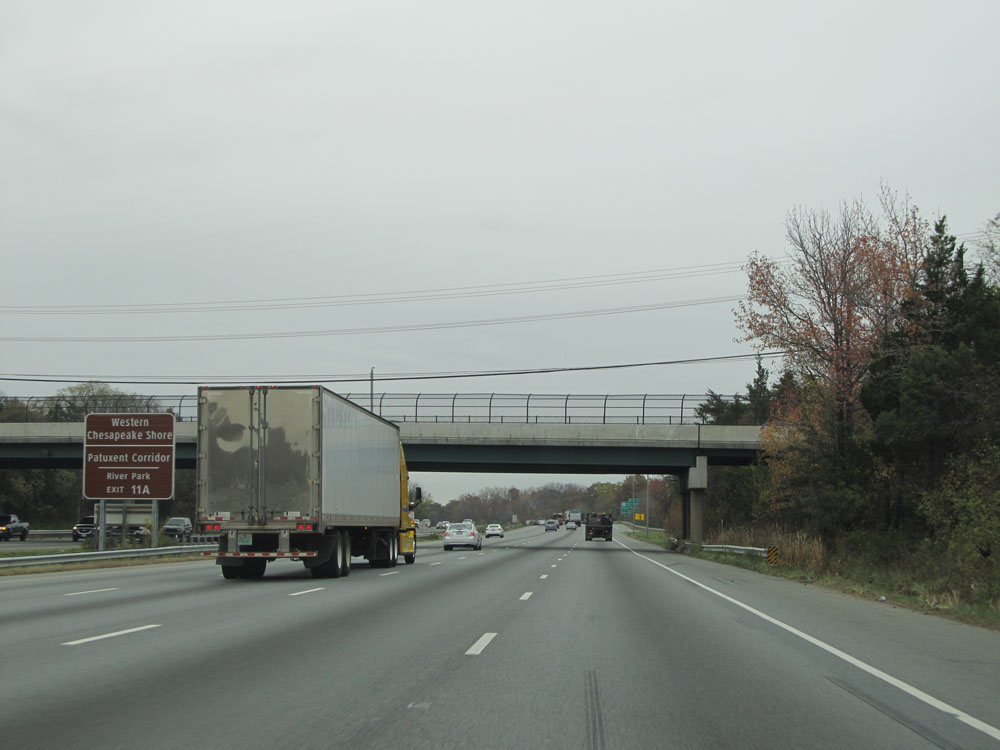 |
Take Exit 11A to Western Chesapeake Shore / Patuxent Corridor / River Park. (Photo taken 11/9/15). |
 |
Take Exit 11B to District Heights. (Photo taken 11/9/15). |
 |
Interstate 95 North / Interstate 495 Outer Loop (North) at Exit 11A: MD 4 (Pennsylvania Ave) South/East - Upper Marlboro (Photo taken 11/9/15). |
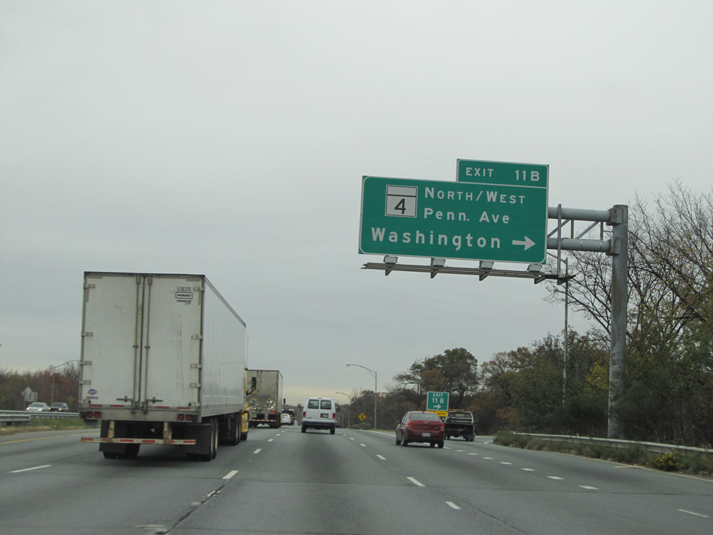 |
Interstate 95 North / Interstate 495 Outer Loop (North) at Exit 11B: MD 4 (Pennsylvania Ave) North/West - Washington (Photo taken 11/9/15). |
 |
Interstate 95 North / Interstate 495 Outer Loop (North): Road view from mile marker 11.5. (Photo taken 11/9/15). |
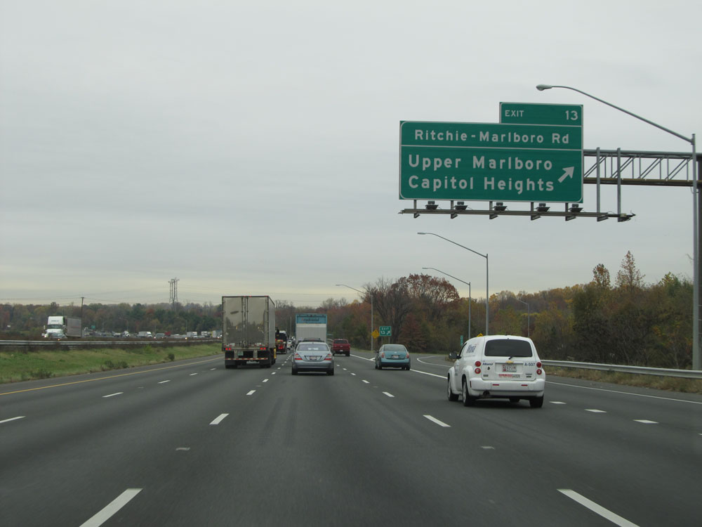 |
Interstate 95 North / Interstate 495 Outer Loop (North) at Exit 13: Ritchie-Marlboro Rd / Upper Marlboro / Capital Heights (Photo taken 11/9/15). |
 |
Take Exit 15 to Six Flags and Nationals Park via the Metro. (Photo taken 11/9/15). |
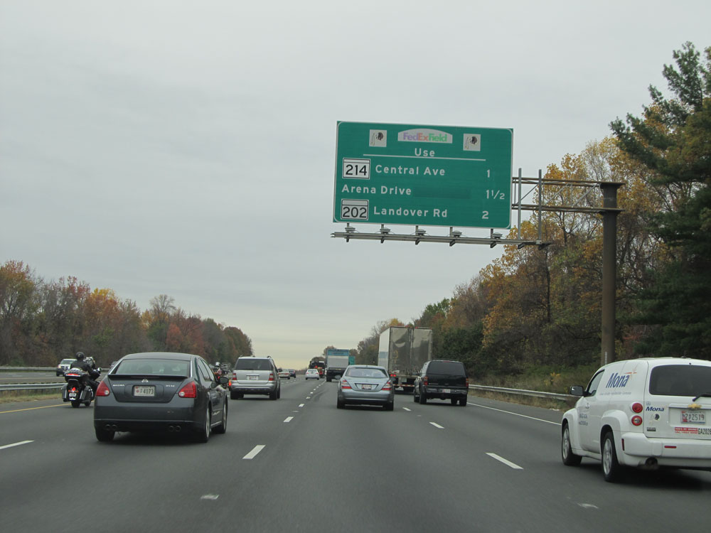 |
Take Exit 15 (MD 214), Exit 16 (Arena Dr), or Exit 17 (MD 202) to FedEx Field. (Photo taken 11/9/15). |
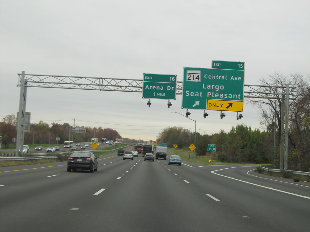 |
Interstate 95 North / Interstate 495 Outer Loop (North) at Exit 15: MD 214 (Central Ave) - Largo / Seat Pleasant (Photo taken 11/9/15). |
 |
Take Exit 16 to Arena Dr and Bishop Peebles Dr. (Photo taken 11/9/15). |
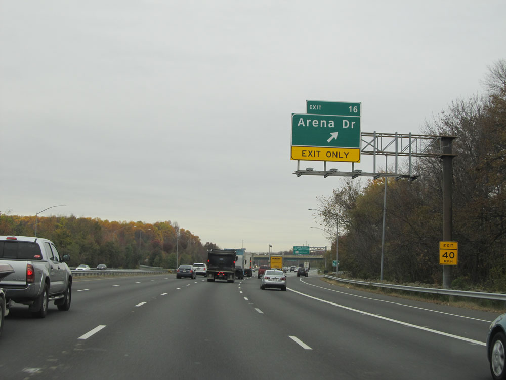 |
Interstate 95 North / Interstate 495 Outer Loop (North) at Exit 16: Arena Dr (Photo taken 11/9/15). |
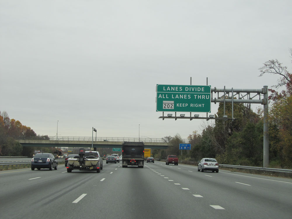 |
The five lanes of Interstate 95 North / Interstate 495 Outer Loop divide into local and express lanes ahead for a brief distance. All lanes go through, but traffic headed to Exit 17 (MD 202) should stay to the right in the local lanes. (Photo taken 11/9/15). |
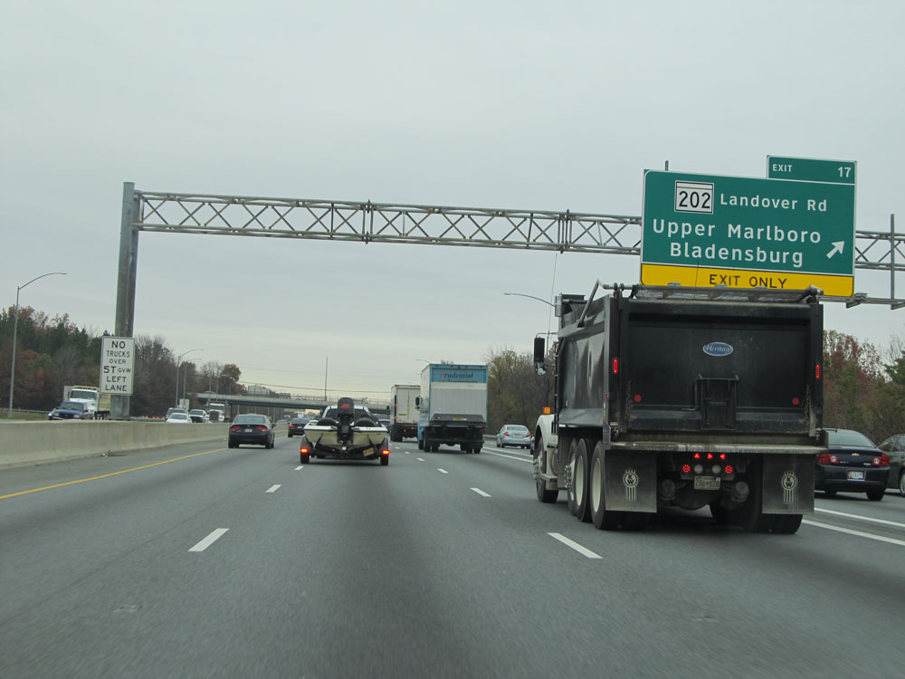 |
Interstate 95 North / Interstate 495 Outer Loop (North) at Exit 17: MD 202 (Landover Rd) - Upper Marlboro / Bladensburg (Photo taken 11/9/15). |
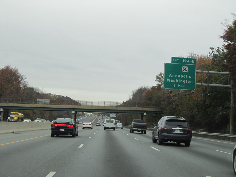 |
Interstate 95 North / Interstate 495 Outer Loop (North) approaching Exits 19A-B - 1 mile. (Photo taken 11/9/15). |
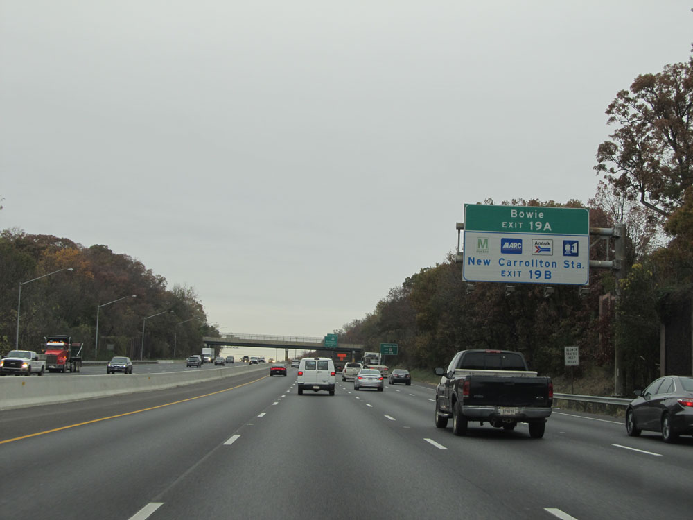 |
Take Exit 19A to Bowie. Take Exit 19B to New Carrollton Metro Station. (Photo taken 11/9/15). |
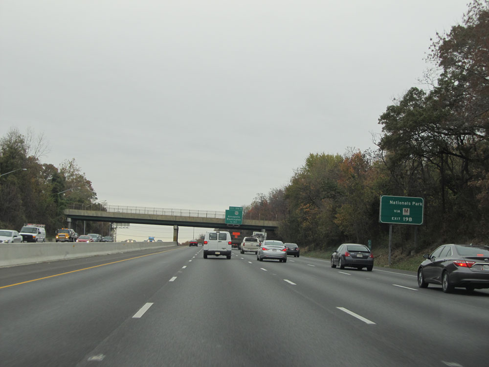 |
Take Exit 19B to Nationals Park via the New Carrollton Metro Station. (Photo taken 11/9/15). |
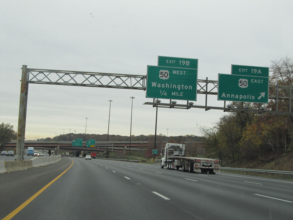 |
Interstate 95 North / Interstate 495 Outer Loop (North) at Exit 19A: US 50 East (Unsigned Interstate 595) - Annapolis (Photo taken 11/9/15). |
 |
Interstate 95 North / Interstate 495 Outer Loop (North) at Exit 19B: US 50 West - Washington (Photo taken 11/9/15). |
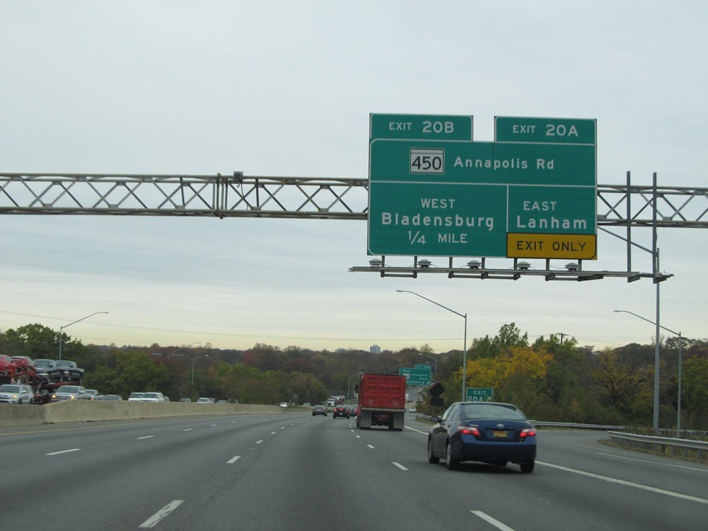 |
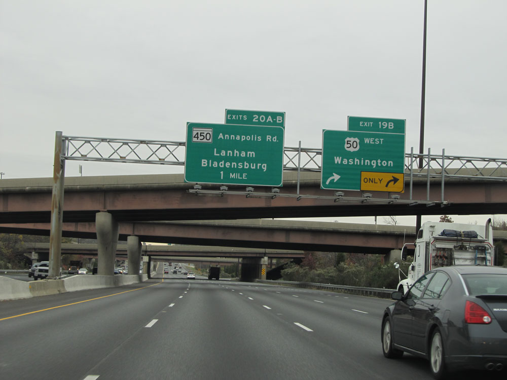
Interstate 95 North / Interstate 495 Outer Loop (North) at Exit 20A: MD 450 (Annapolis Rd) East - Lanham (Photo taken 11/9/15). |
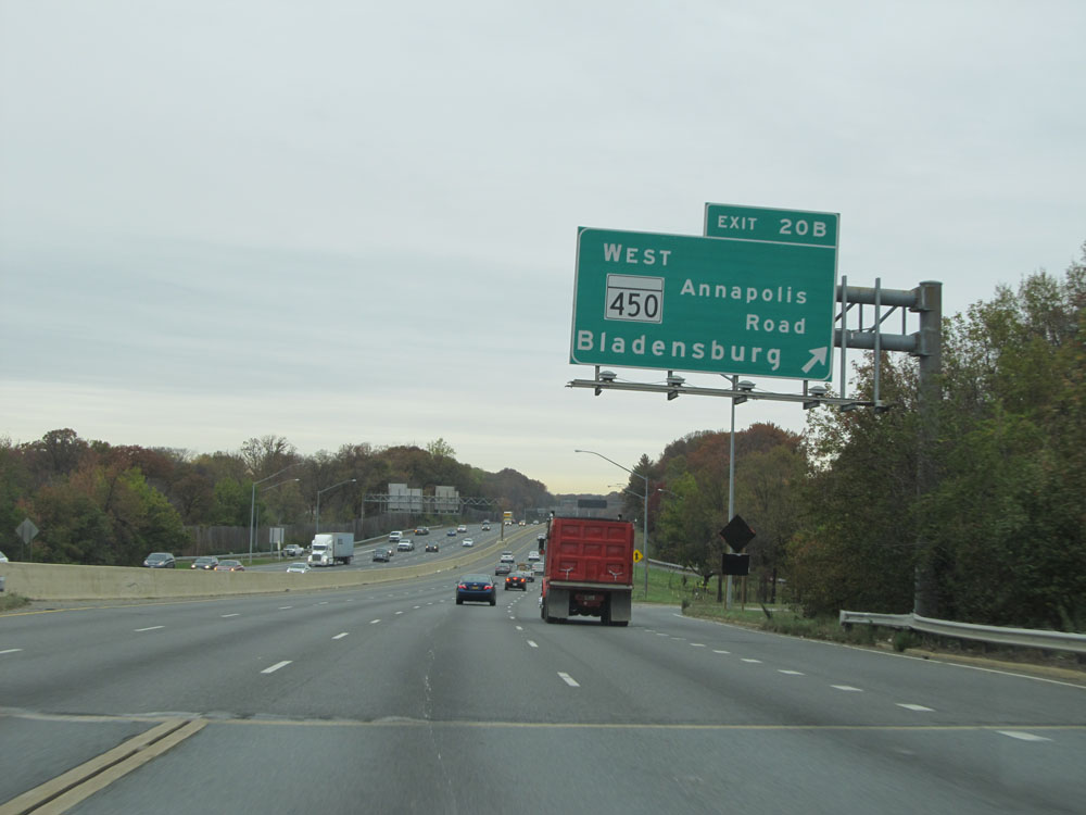 |
Interstate 95 North / Interstate 495 Outer Loop (North) at Exit 20B: MD 450 (Annapolis Rd) West - Bladensburg (Photo taken 11/9/15). |
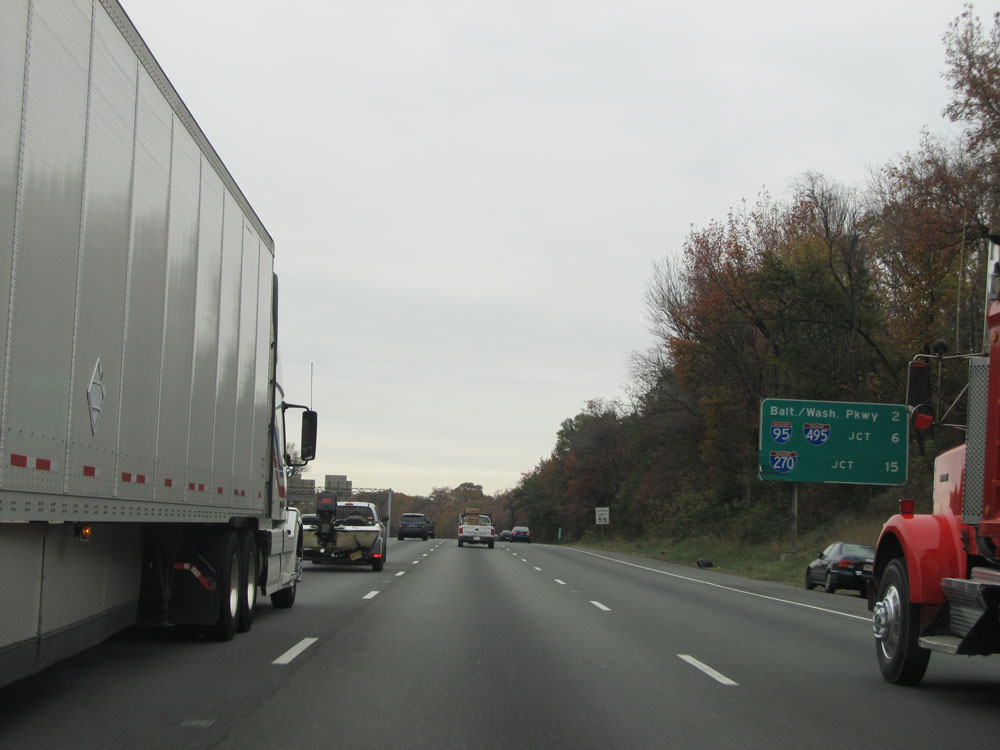 |
Mileage sign north of Exit 20B. It's 2 miles to the interchange for the Baltimore/Washington Pkwy, 6 miles to the split of Interstate 95 / Interstate 495, and 15 miles to the junction of Interstate 270. (Photo taken 11/9/15). |
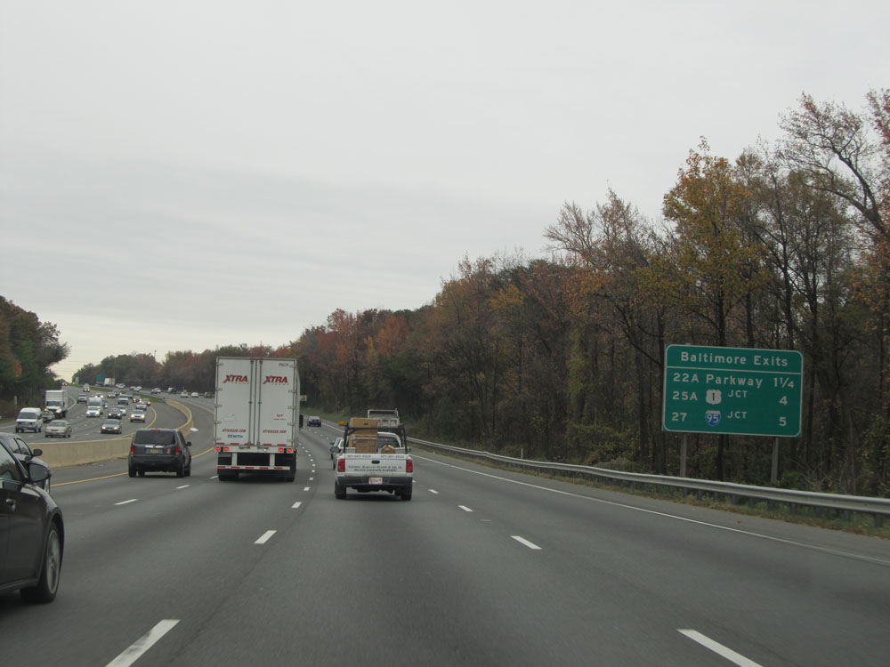 |
Traffic headed to Baltimore can use either of the three exits listed on this sign: Exit 22A, 25A, or 27. (Photo taken 11/9/15). |
 |
Take Exit 22A to MD 295 North toward BWI Marshall Airport, and Exit 22B to MD 295 South. (Photo taken 11/9/15). |
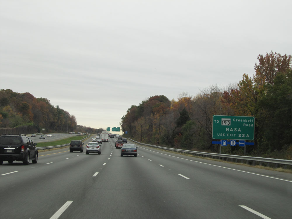 |
Take Exit 22A to MD 193 (Greenbelt Road) - NASA. (Photo taken 11/9/15). |
 |
Interstate 95 North / Interstate 495 Outer Loop (North) at Exit 22A: Baltimore/Washington Pkwy North - Baltimore (Photo taken 11/9/15). |
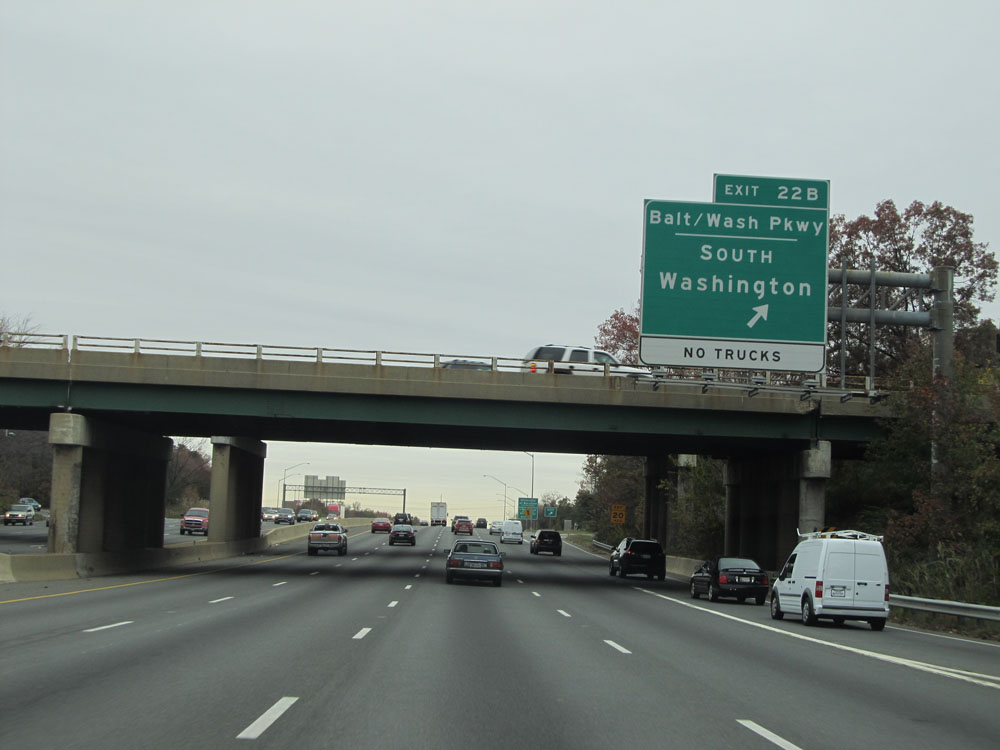 |
Interstate 95 North / Interstate 495 Outer Loop (North) at Exit 22B: Baltimore/Washington Pkwy South - Washington (Photo taken 11/9/15). |
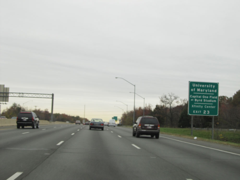 |
Take Exit 23 to the University of Maryland, Capital One Field at Byrd Stadium, and Xfinity Center. (Photo taken 11/9/15). |
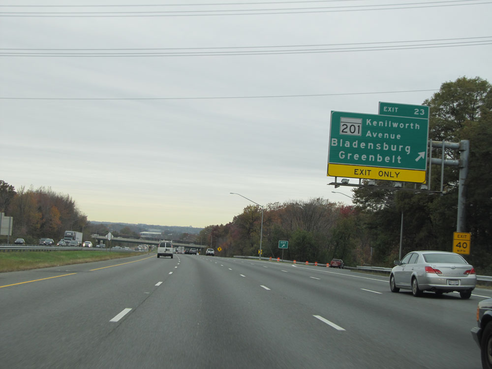 |
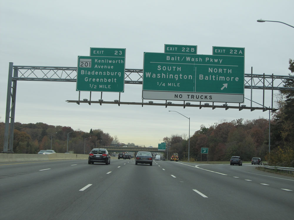
Interstate 95 North / Interstate 495 Outer Loop (North) at Exit 23: MD 201 (Kenilworth Avenue) - Bladensburg / Greenbelt (Photo taken 11/9/15). |
 |
Interstate 95 North / Interstate 495 Outer Loop (North) approaching their split - 2 miles. (Photo taken 11/9/15). |
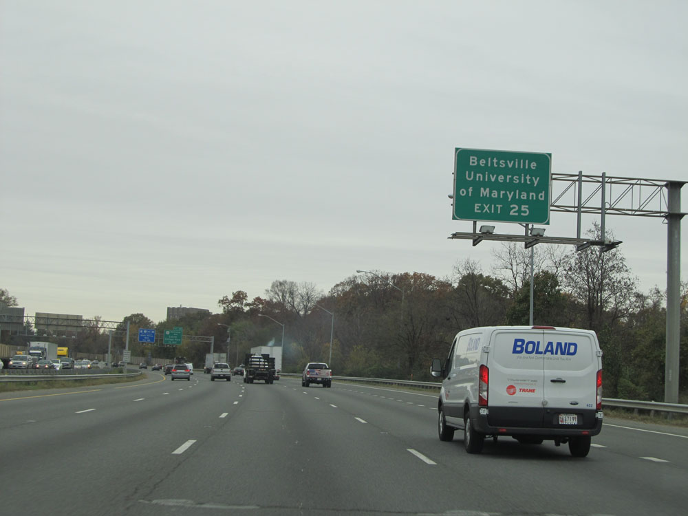 |
Take Exit 25 to Beltsville and the University of Maryland. (Photo taken 11/9/15). |
 |
Interstate 95 North / Interstate 495 Outer Loop (North) at Exit 25: US 1 (Baltimore Ave) - Laurel / College Park (Photo taken 11/9/15). |
 |
Interstate 95 North / Interstate 495 Outer Loop (North) approaching their split - 1 mile. Stay in the three rightmost lanes ahead to remain on Interstate 95 North. (Photo taken 11/9/15). |
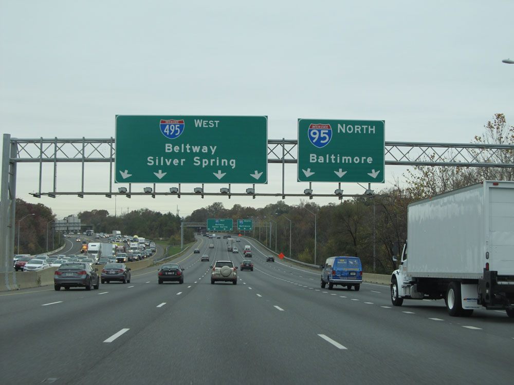 |
Interstate 95 North / Interstate 495 Outer Loop (North) nearing the split. Again, you need to be in the three rightmost lanes to stay on I-95 North. (Photo taken 11/9/15). |
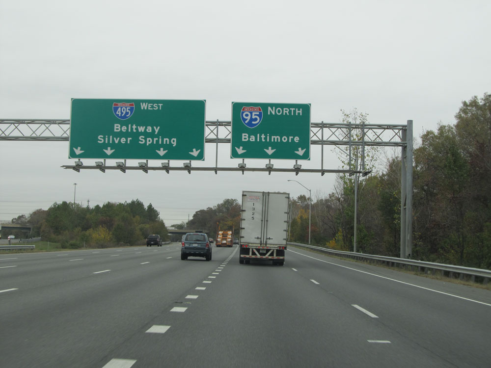 |
Interstate 95 North / Interstate 495 Outer Loop (North) 1/4 mile from their split. (Photo taken 11/9/15). |
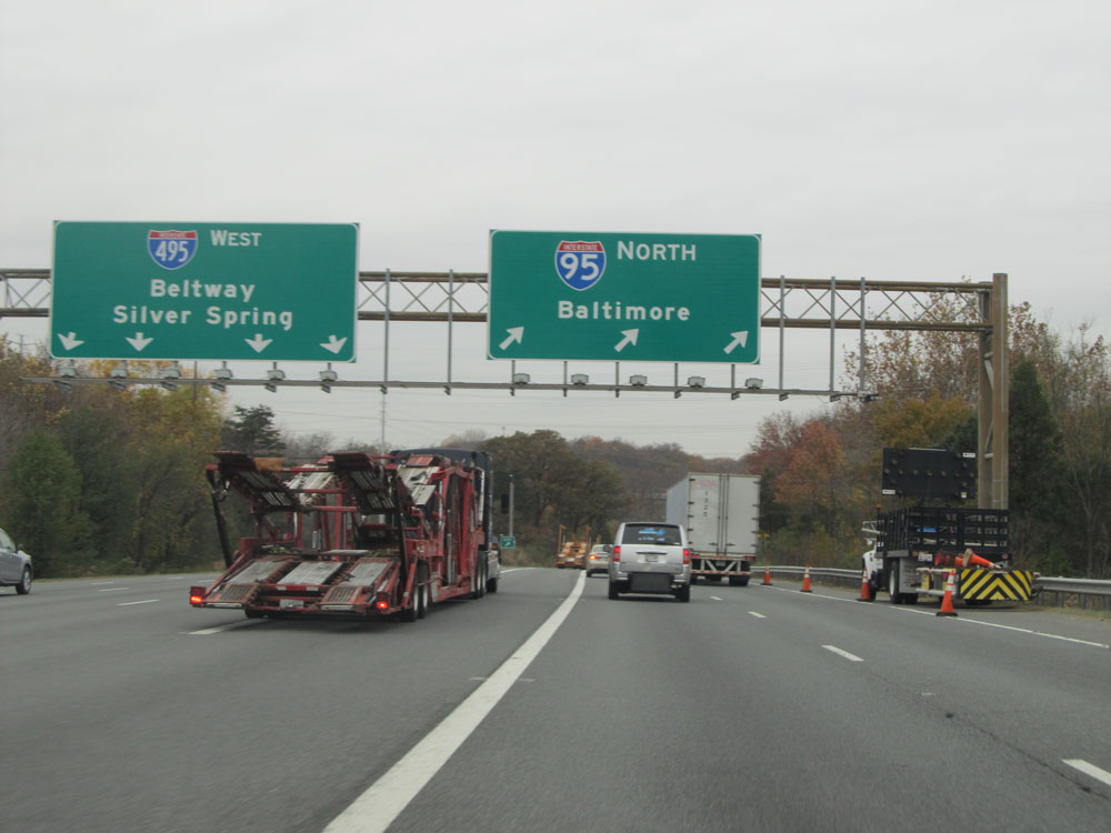 |
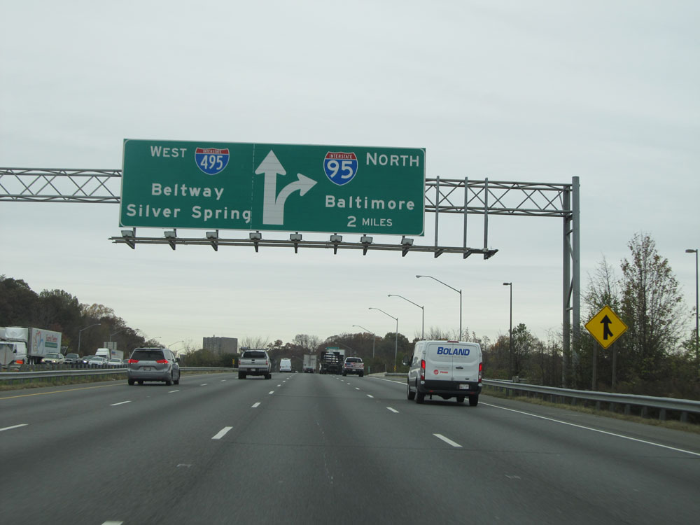
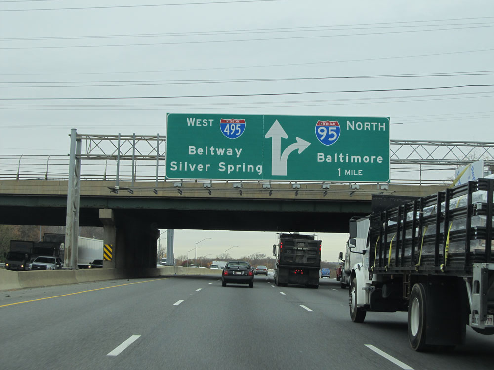
Interstate 95 North / Interstate 495 Outer Loop (North) at their split, as Interstate 95 North departs to the right to head toward Baltimore. (Photo taken 11/9/15). |
 |
Interstate 95 North at the Carpool Parking access ramp on the left, almost immediately after I-95 North departs from Interstate 495. (Photo taken 11/9/15). |
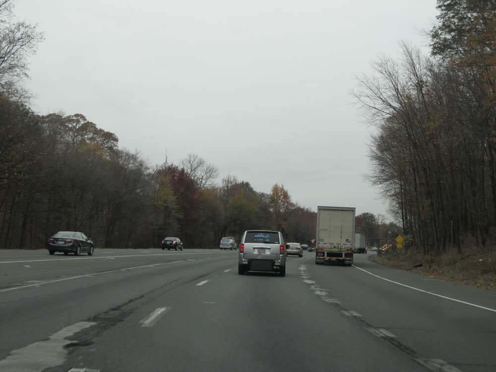 |
View on Interstate 95 North as traffic from Interstate 495 Inner Loop merges from the left. (Photo taken 11/9/15). |
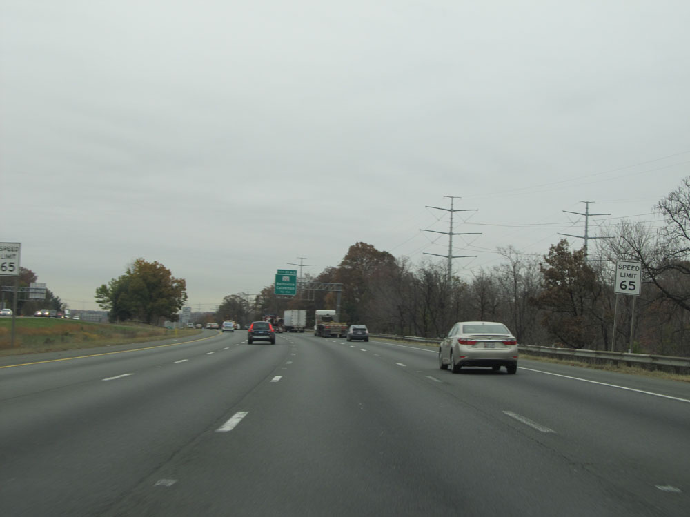 |
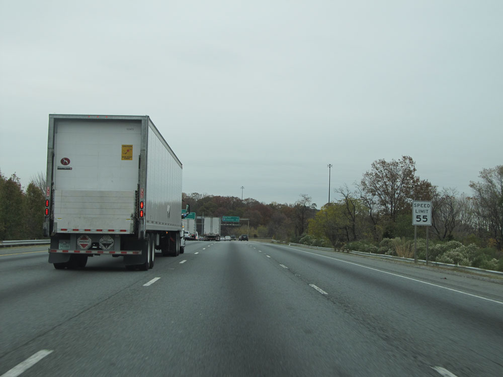
Speed limit signs on Interstate 95 North. The speed limit increases to 65 mph here, after being 55 mph for the entire concurrency with Interstate 495. (Photo taken 11/9/15). |
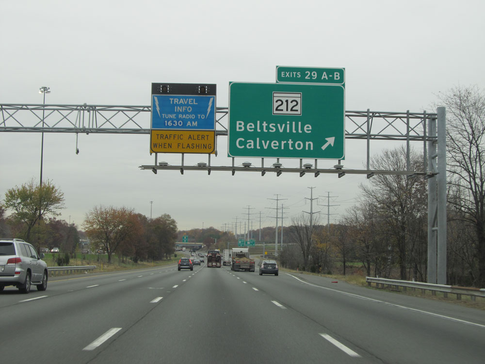 |
Interstate 95 North at Exits 29A-B: MD 212 - Beltsville / Calverton (Photo taken 11/9/15). |
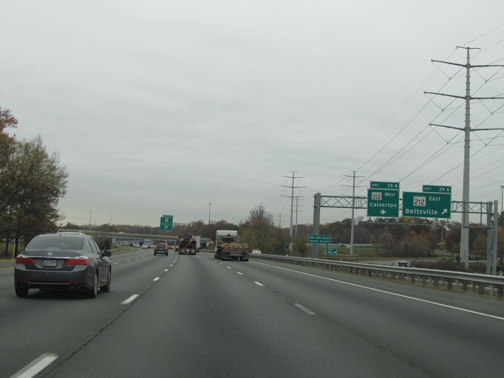 |
A closer view of Exit 29A. (Photo taken 11/9/15). |
Section 2: Beltsville (Exit 29A) to Baltimore (Exit 53)
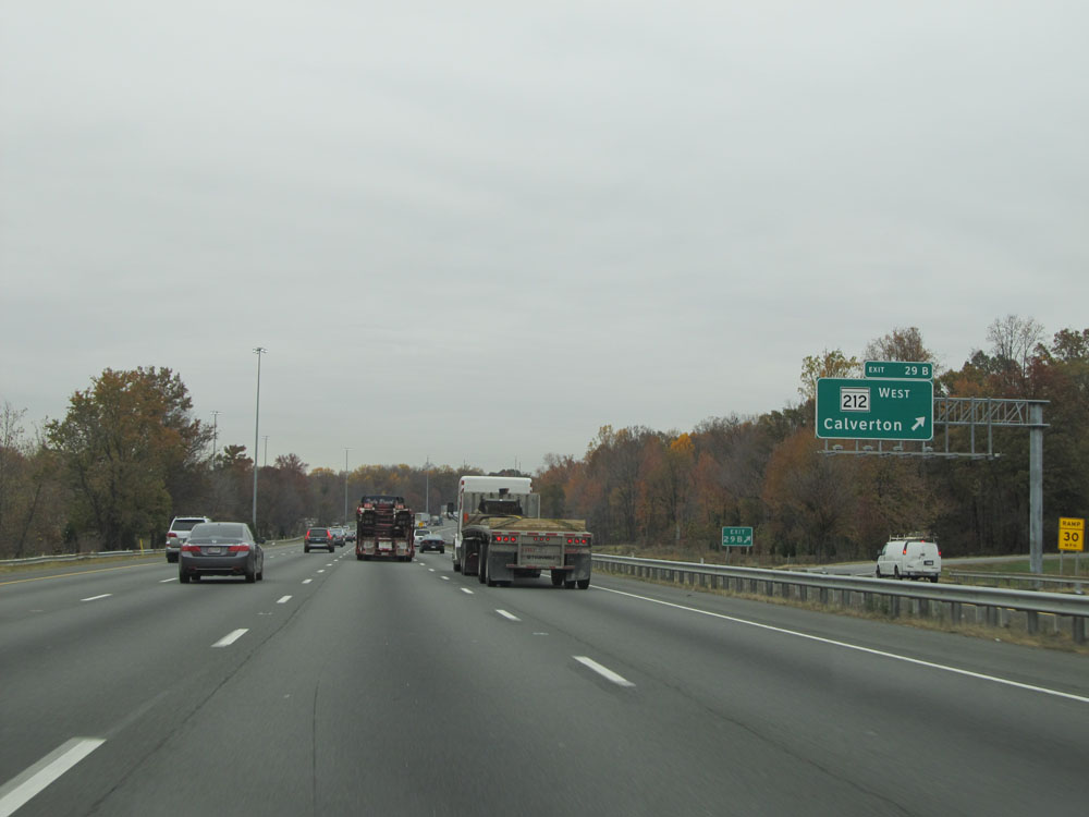 |
And a closer view of Exit 29B as well. (Photo taken 11/9/15). |
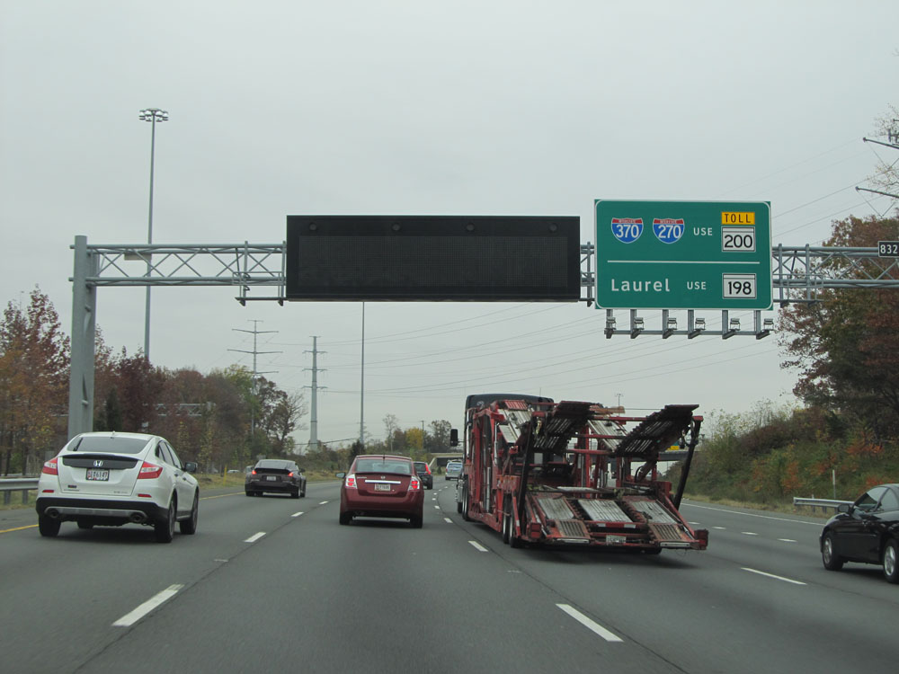 |
This overhead sign states that traffic headed to Interstate 370 / Interstate 270 should use MD 200 Toll while traffic headed to Laurel should use MD 198. (Photo taken 11/9/15). |
 |
Interstate 95 North approaching Exits 31-32-33 - 1/2 mile. (Photo taken 11/9/15). |
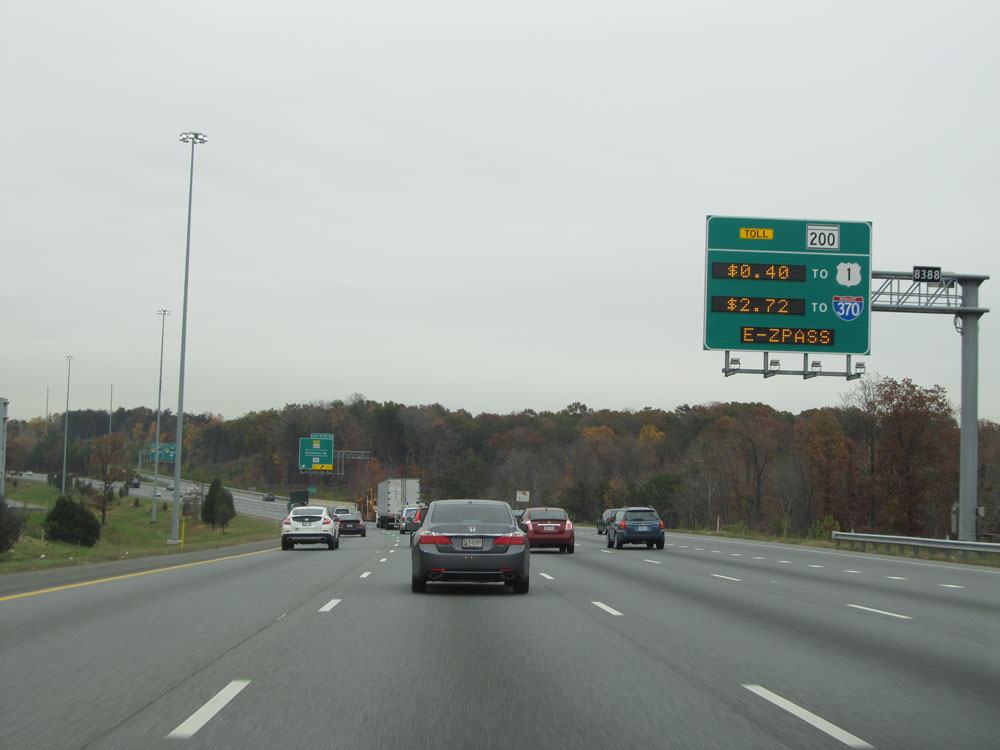 |
This sign electronically lists the current toll rates on MD 200 to US 1 and Interstate 370. The toll rates on MD 200 fluctuate, increasing during peak traffic hours. All tolling is electronic on MD 200; there are no toll plazas or toll collectors. Pay-by-plate is also an option for those without EZ Pass. (Photo taken 11/9/15). |
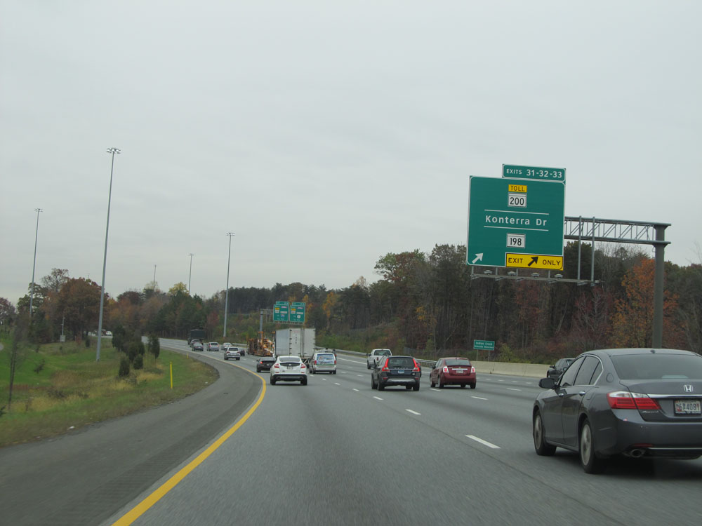 |
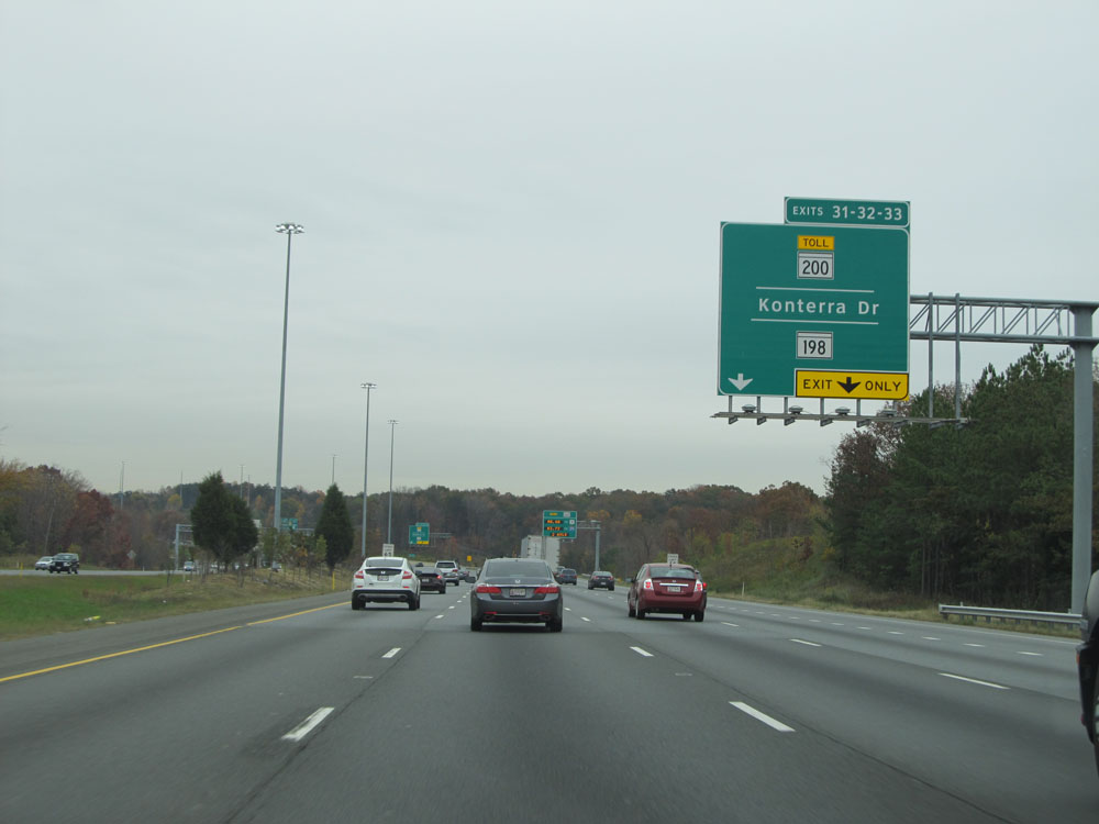
Interstate 95 North at Exits 31-32-33: MD 200 Toll / Konterra Dr / MD 198 (Photo taken 11/9/15). |
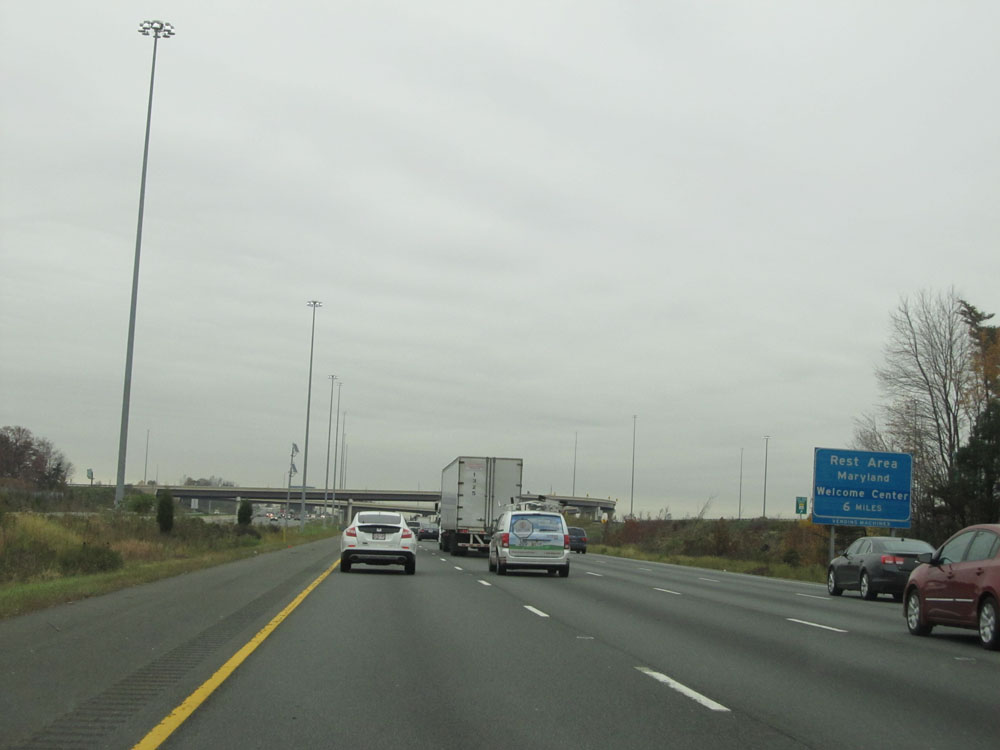 |
The first Rest Area on Interstate 95 North in Maryland, which also serves as a Welcome Center, lies 6 miles ahead. (Photo taken 11/9/15). |
 |
A closer view of Exit 33A: MD 198 East - Laurel (Photo taken 11/9/15). |
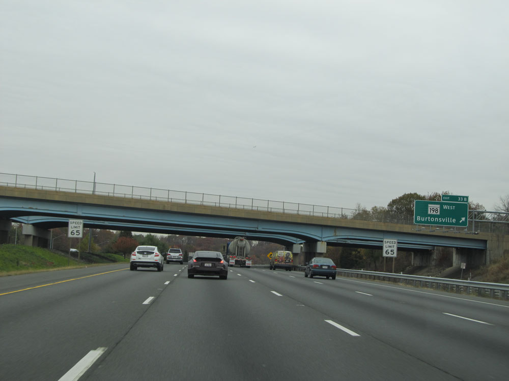 |
A closer view of Exit 33B: MD 198 West - Burtonsville (Photo taken 11/9/15). |
 |
Interstate 95 North assurance shield at mile marker 34. (Photo taken 11/9/15). |
 |
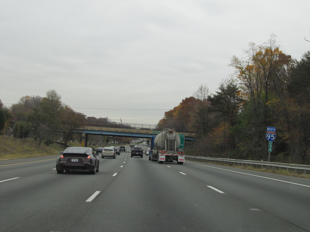
Interstate 95 North entering Howard County. (Photo taken 11/9/15). |
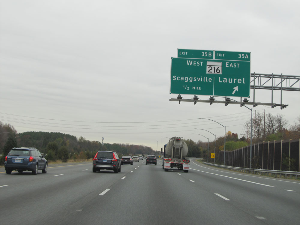 |
Interstate 95 North at Exit 35A: MD 216 East - Laurel (Photo taken 11/9/15). |
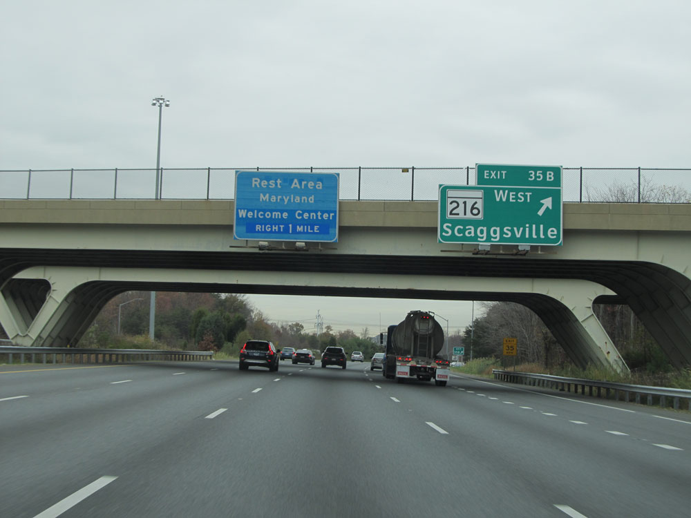 |
Interstate 95 North at Exit 35B: MD 216 West - Scaggsville (Photo taken 11/9/15). |
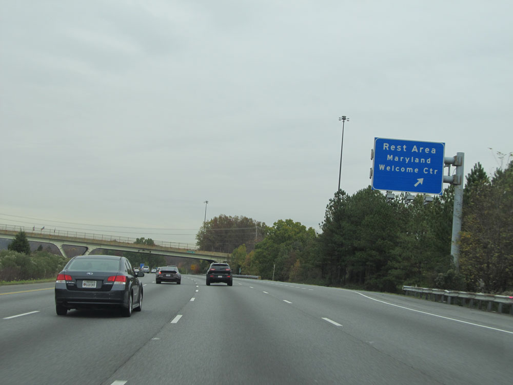 |
Interstate 95 North at the Rest Area / Welcome Center located near mile marker 36.5. (Photo taken 11/9/15). |
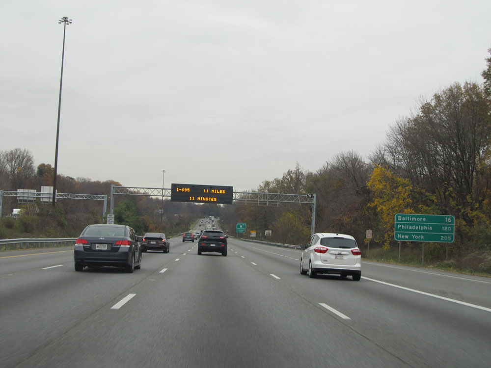 |
Mileage sign near mile marker 37. It's 16 miles to Baltimore, 120 miles to Philadelphia, and 205 miles to New York City. (Photo taken 11/9/15). |
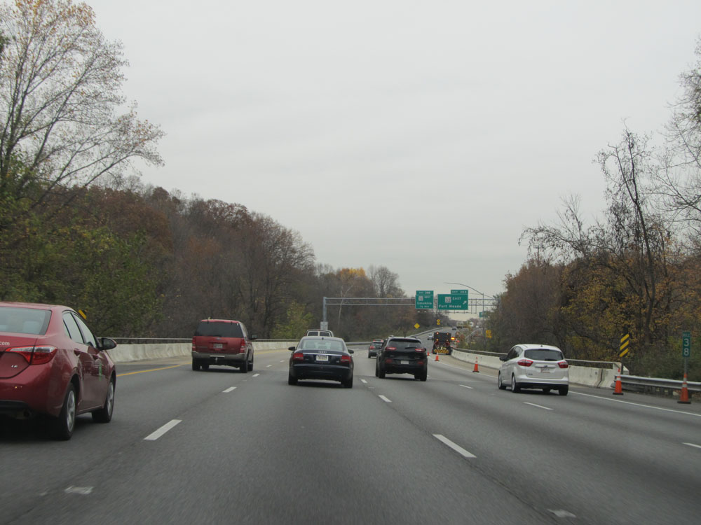 |
Interstate 95 North at mile marker 38. (Photo taken 11/9/15). |
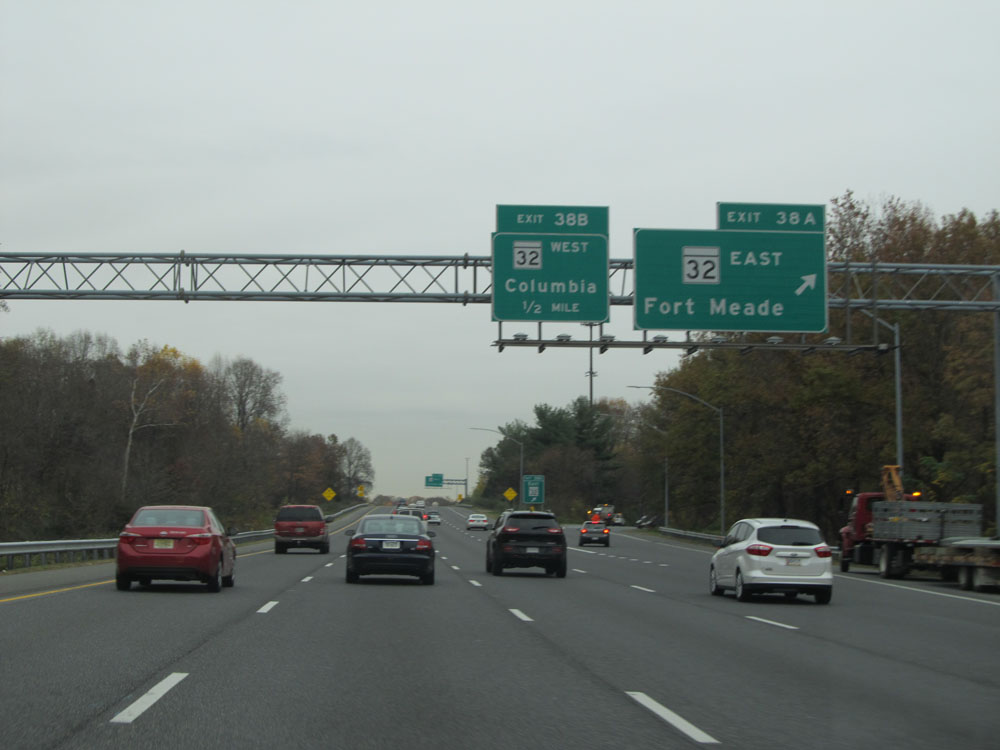 |
Interstate 95 North at Exit 38A: MD 32 East - Fort Meade (Photo taken 11/9/15). |
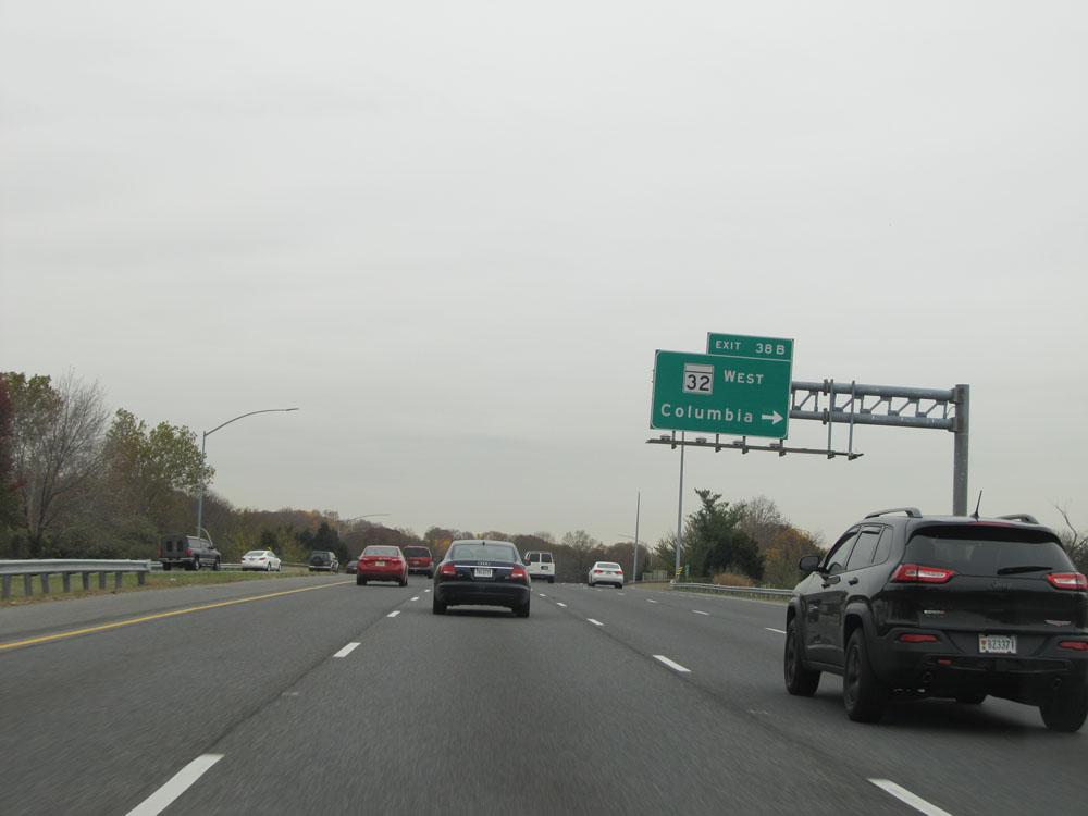 |
Interstate 95 North at Exit 38B: MD 32 West - Columbia (Photo taken 11/9/15). |
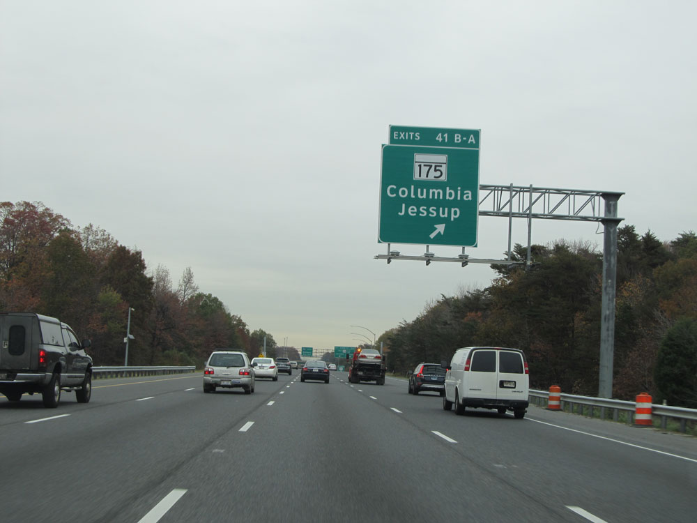 |
Interstate 95 North at Exits 41B-A: MD 175 - Columbia / Jessup (Photo taken 11/9/15). |
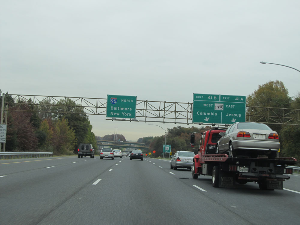 |
A closer view of the ramp to Exits 41B-A. (Photo taken 11/9/15). |
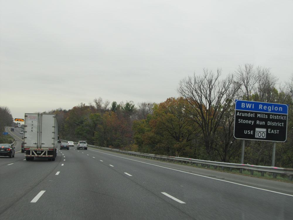 |
Take Exit 43A to the BWI Region, Arundel Mills District, and Stoney Run District. (Photo taken 11/9/15). |
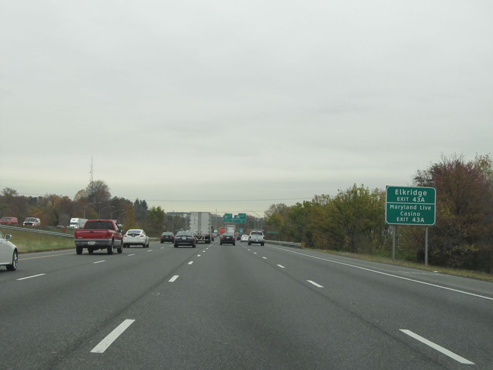 |
Take Exit 43A to Elkridge and Maryland Live Casino. (Photo taken 11/9/15). |
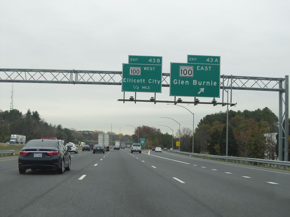 |
Interstate 95 North at Exit 43A: MD 100 East - Glen Burnie (Photo taken 11/9/15). |
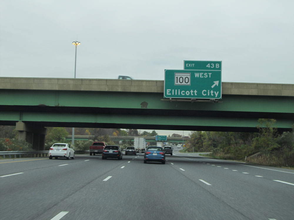 |
Interstate 95 North at Exit 43B: MD 100 West - Ellicott City (Photo taken 11/9/15). |
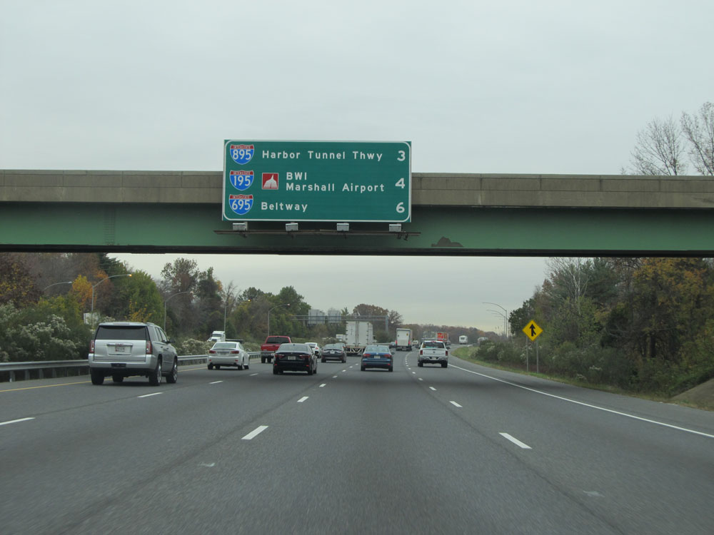 |
This overhead sign lists the distances to the three upcoming major interchanges on Interstate 95 North. (Photo taken 11/9/15). |
 |
Sign listing the Exits to the different Port of Balitmore destinations. (Photo taken 11/9/15). |
 |
Interstate 95 North at mile marker 44. (Photo taken 11/9/15). |
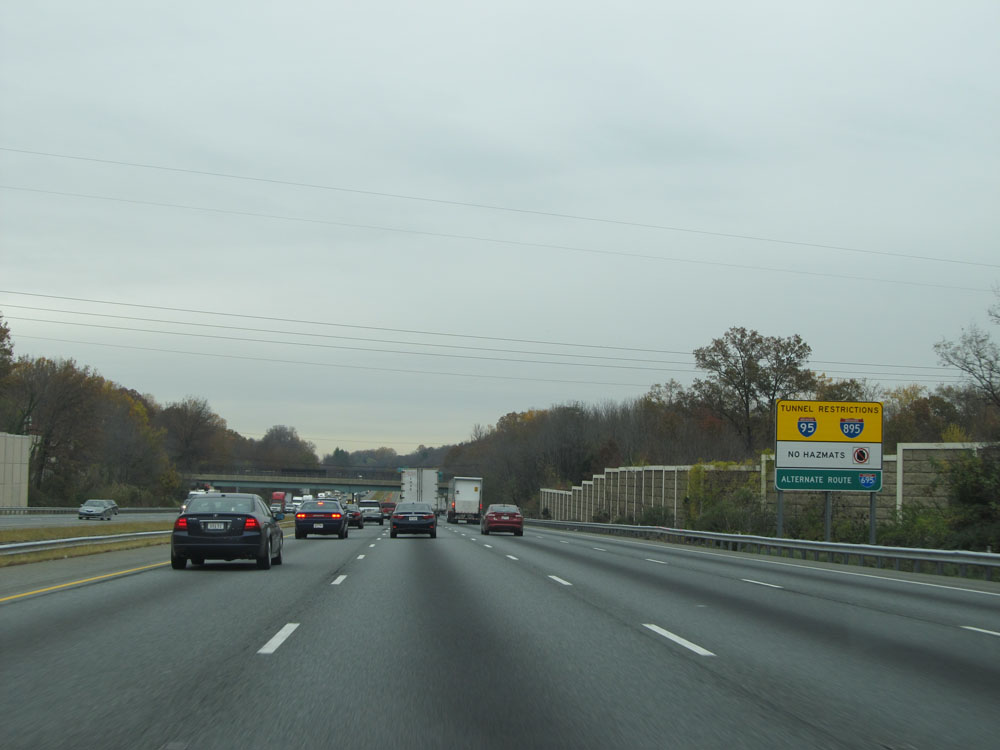 |
Trucks with Hazardous Materials onboard are prohibited from using the Fort McHenry Tunnel on Interstate 95 and the Baltimore Harbor Tunnel on Interstate 895. Therefore, the alternate route listed is Interstate 695. (Photo taken 11/9/15). |
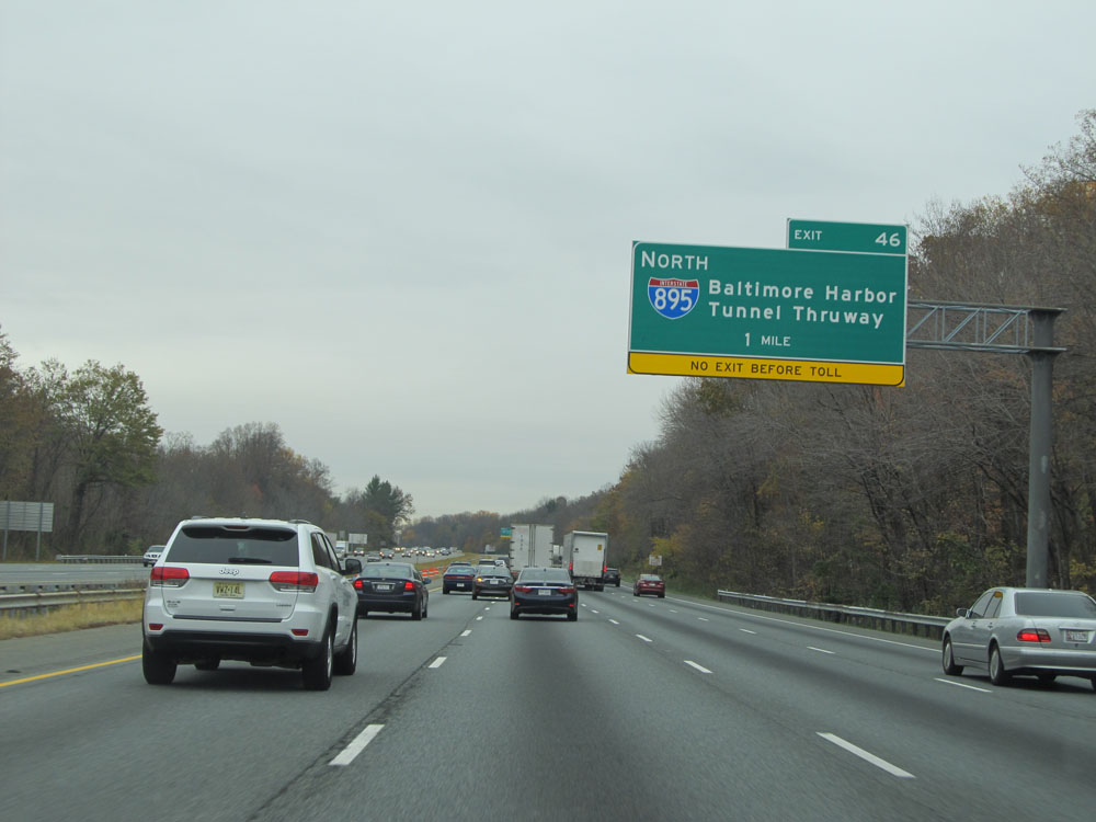 |
Interstate 95 North approaching Exit 46 - 1 mile. (Photo taken 11/9/15). |
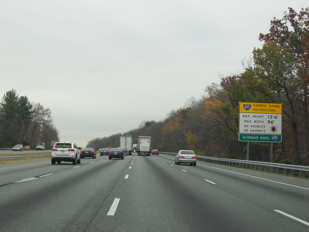 |
This sign lists additional restrictions for the Harbor Tunnel on Interstate 895 North. Again, the alternate route is Interstate 695. (Photo taken 11/9/15). |
 |
Interstate 95 North at Exit 46: Interstate 895 North - Baltimore Harbor Tunnel Thruway (Photo taken 11/9/15). |
 |
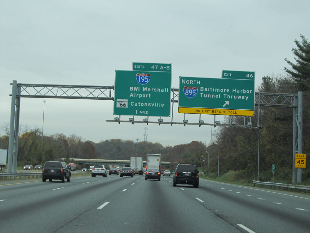
Interstate 95 North approaching Exits 47A-B - 1/2 mile. (Photo taken 11/9/15). |
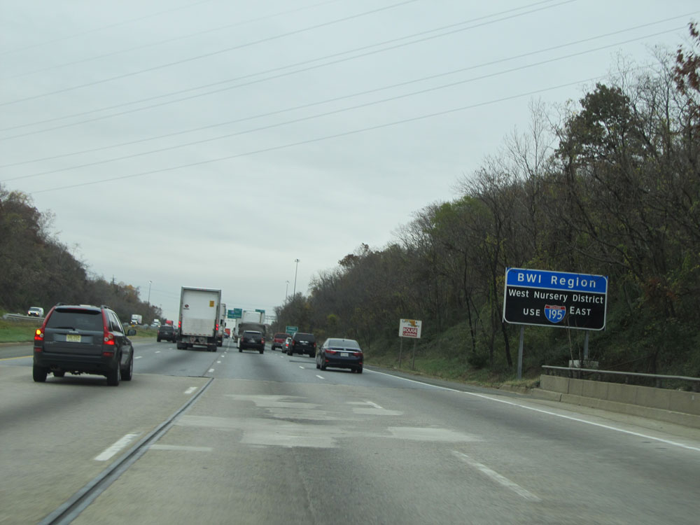 |
Use Interstate 195 East to the BWI Region and West Nursery District. (Photo taken 11/9/15). |
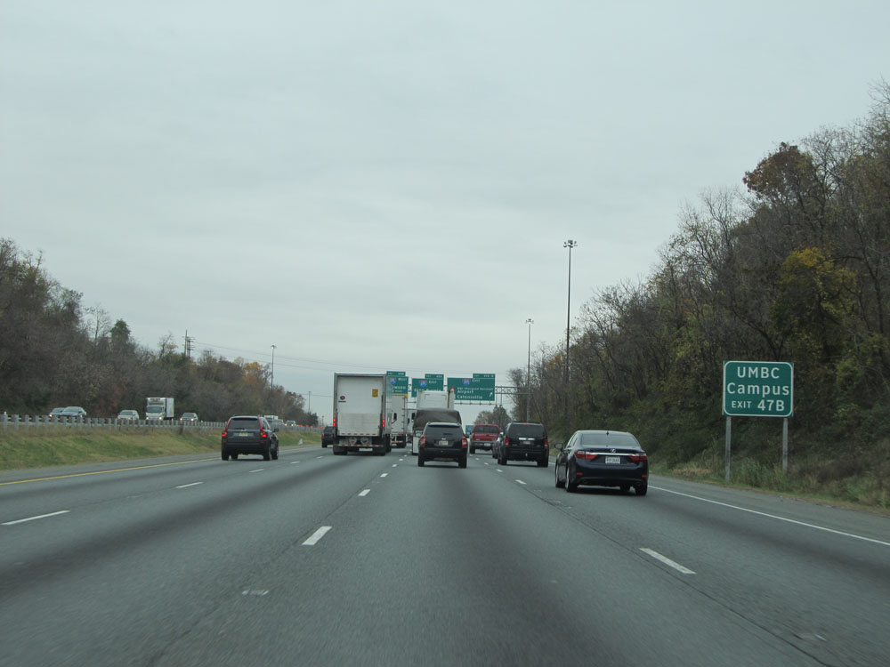 |
Take Exit 47B to UMBC Campus. (Photo taken 11/9/15). |
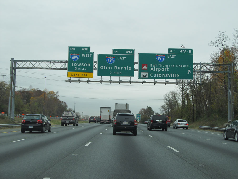 |
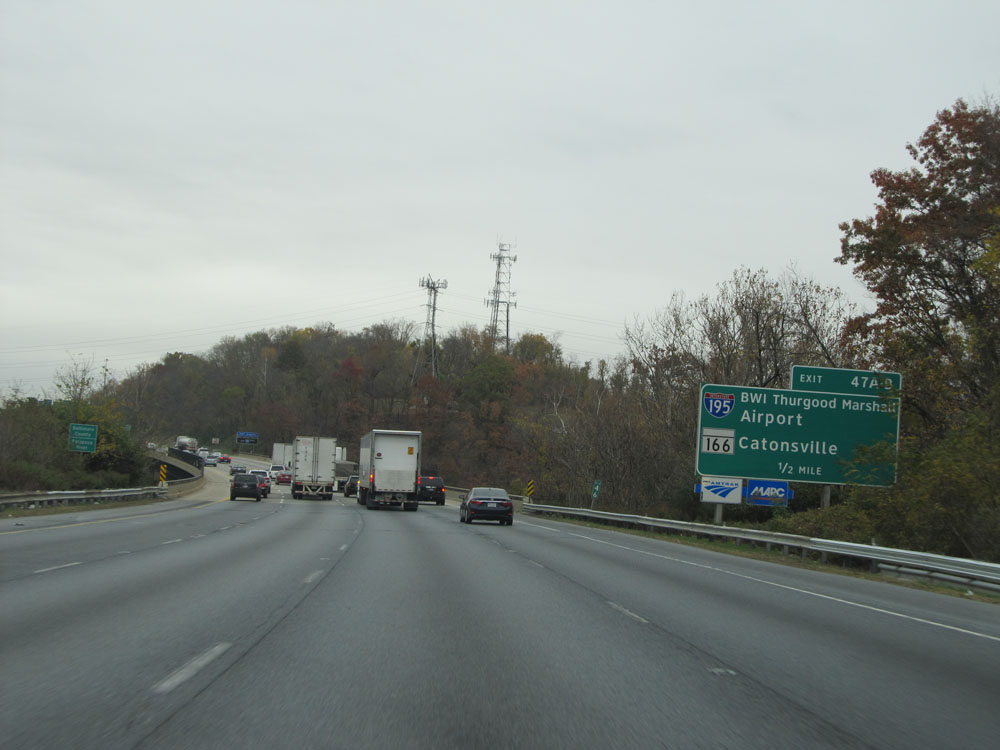
Interstate 95 North at Exits 47A-B: Interstate 195 East - BWI Thurgood Marshall Airport / MD 166 - Catonsville (Photo taken 11/9/15). |
 |
Interstate 95 North approaching Exit 49A - 1 mile. (Photo taken 11/9/15). |
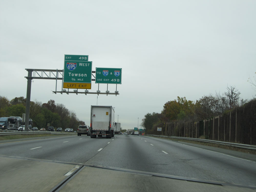 |
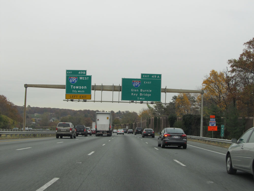
Interstate 95 North approaching Exit 49B - 3/4 mile on the left. Take Exit 49B to Interstate 70 and Interstate 83. (Photo taken 11/9/15). |
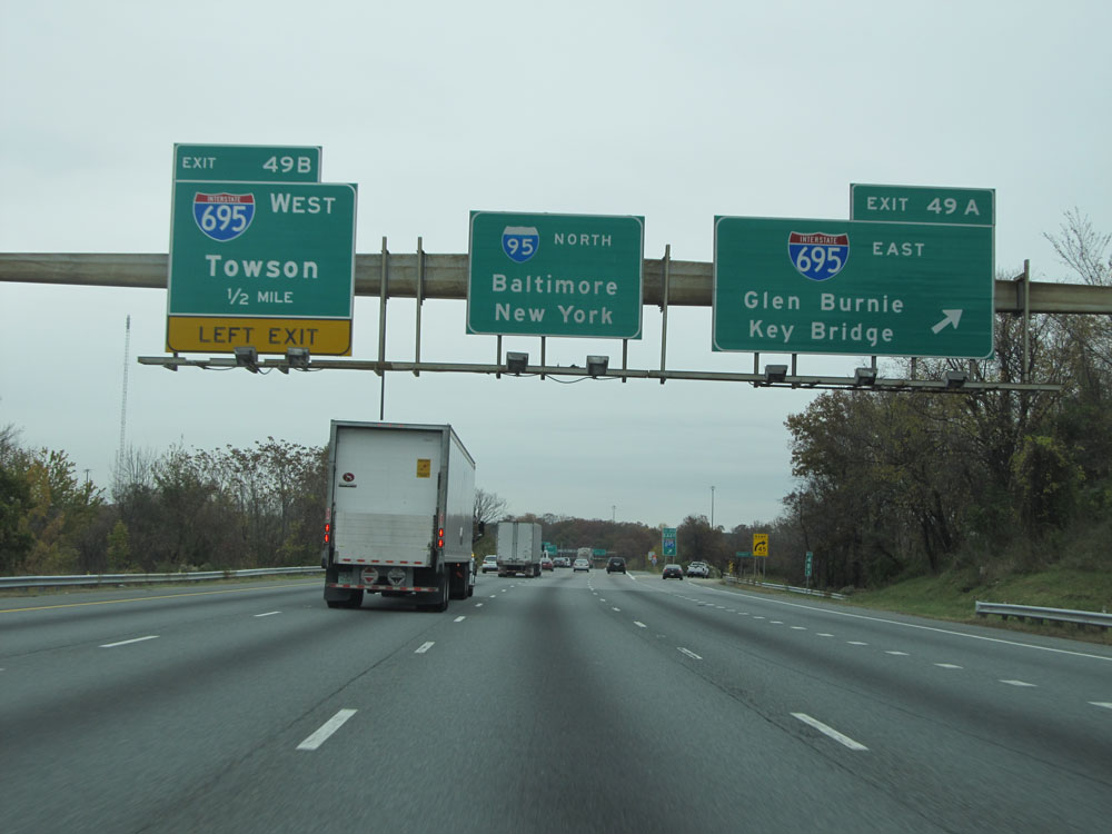 |
Interstate 95 North at Exit 49A: Interstate 695 East - Glen Burnie / Key Bridge (Photo taken 11/9/15). |
 |
Nearing Exit 49B, the speed limit decreases to 55 mph. (Photo taken 11/9/15). |
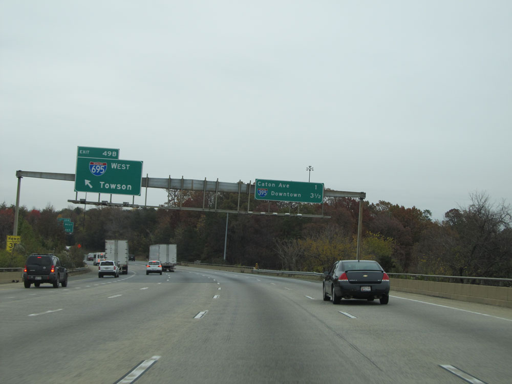 |
Interstate 95 North at Exit 49B: Interstate 695 West - Towson (Photo taken 11/9/15). |
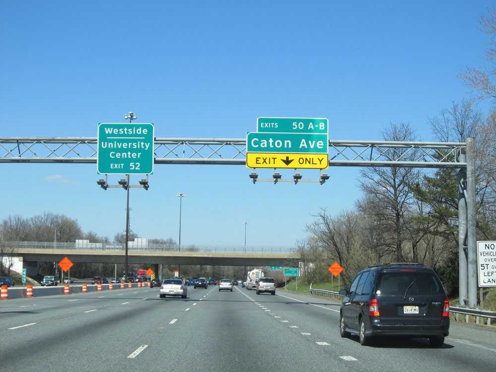 |
Interstate 95 North at Exit 50A-B: Caton Ave (Photo taken 4/11/15). |
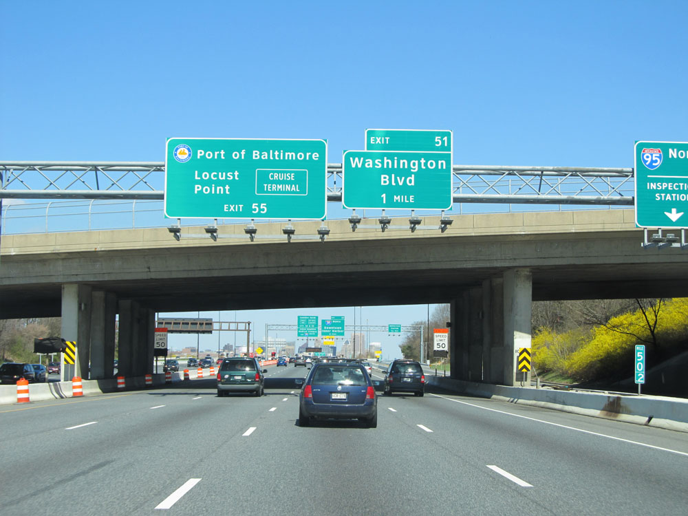 |
Take Exit 55 to Port of Baltimore / Locust Point. (Photo taken 4/11/15). |
 |
Follow Interstate 395 North to Johns Hopkins Medical Campus. (Photo taken 4/11/15). |
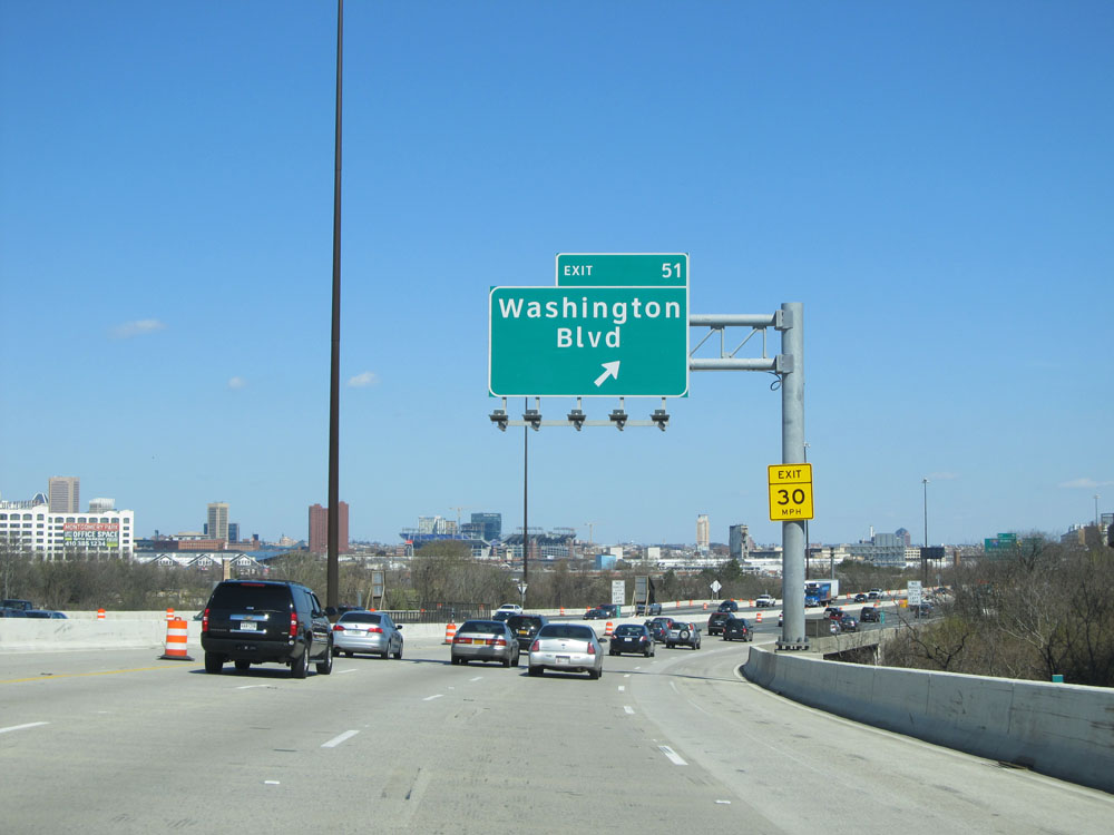 |
Interstate 95 North at Exit 51: Washington Blvd (Photo taken 4/11/15). |
 |
Interstate 95 North approaching Exit 53 - 1 mile. (Photo taken 4/11/15). |
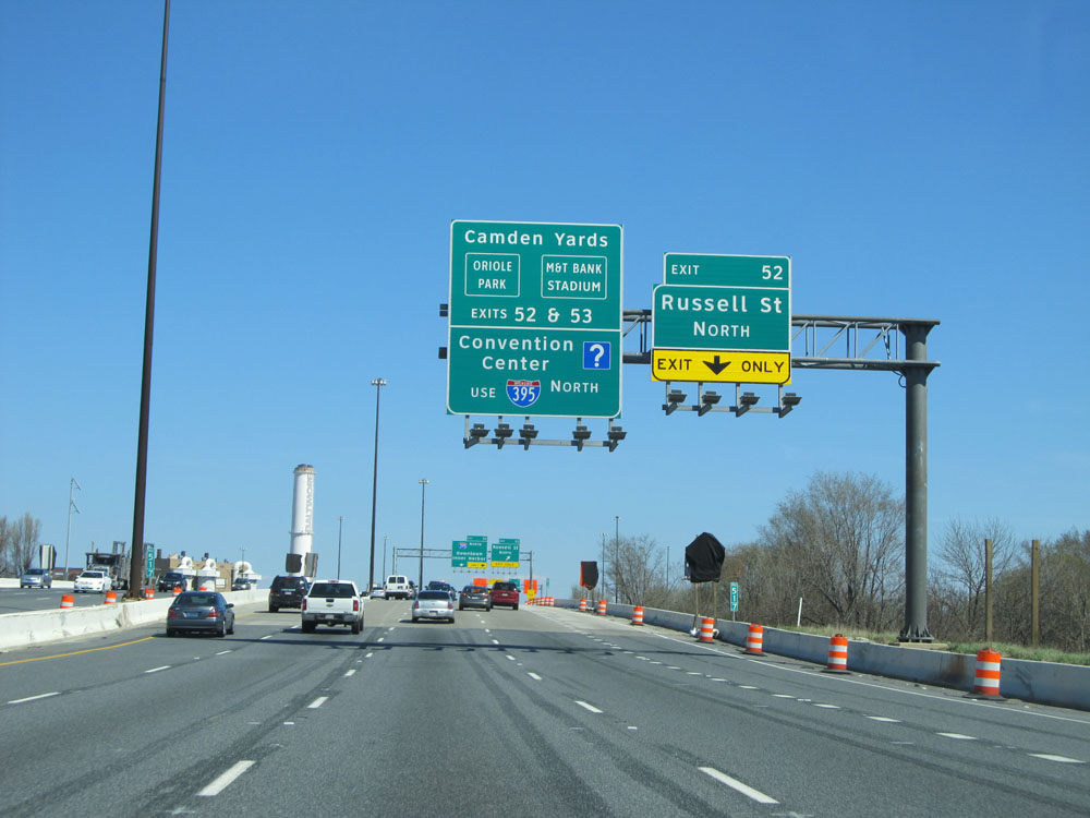 |
Take Exits 52 or 53 to Camden Yards, Oriole Park, and M&T Bank Stadium. Follow Interstate 395 North to the Convention Center. (Photo taken 4/11/15). |
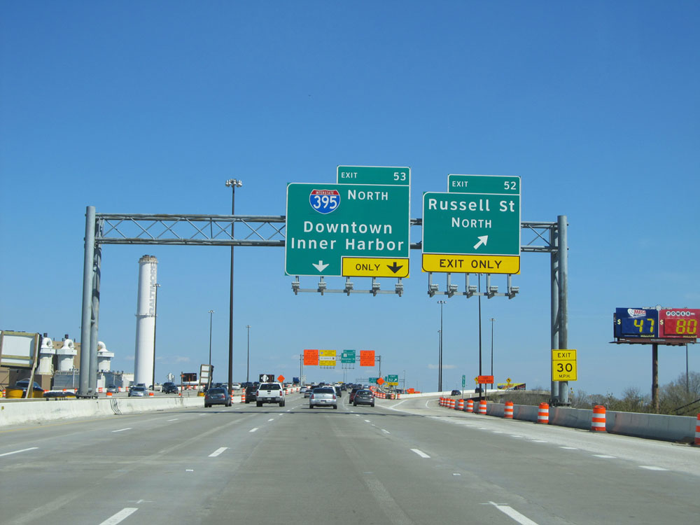 |
Interstate 95 North at Exit 52: Russell St North (Photo taken 4/11/15). |
 |
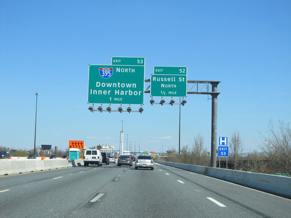
Interstate 95 North at Exit 53: Interstate 395 North - Downtown / Inner Harbor (Photo taken 4/11/15). |
Section 3: Baltimore (Exit 53) to Delaware Border
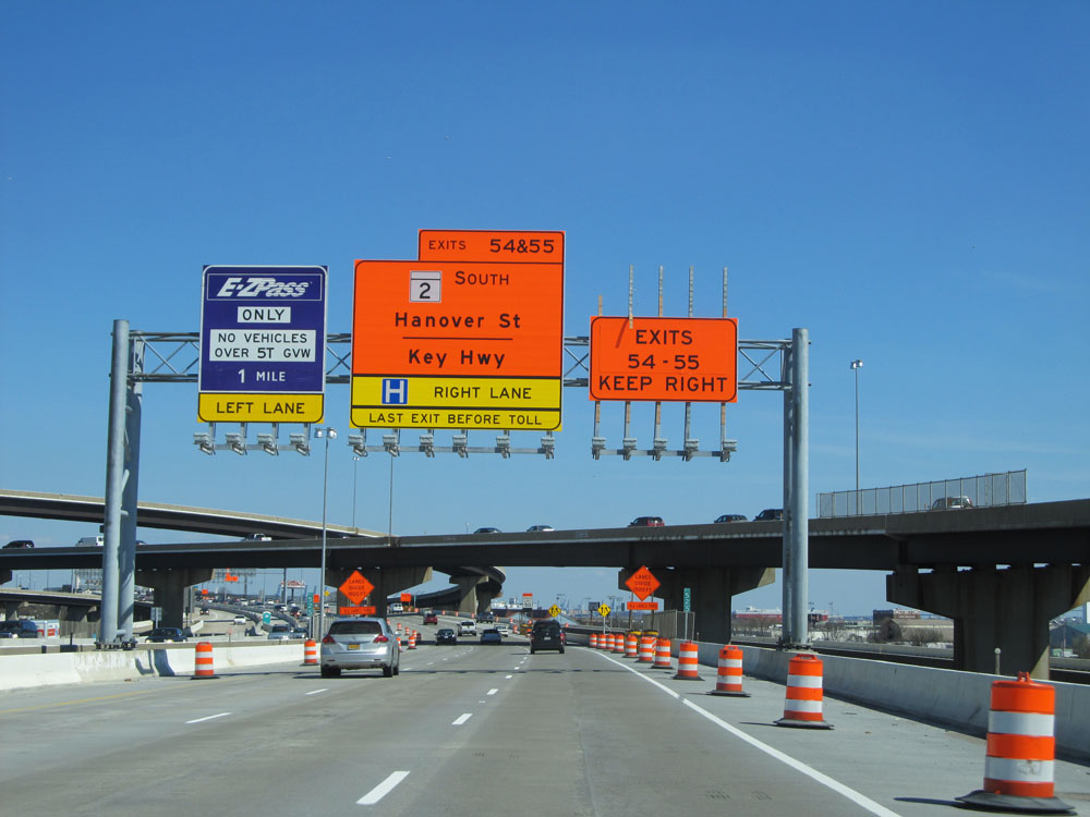 |
Exit 55 is the last exit before the upcoming toll plaza, on the other end of the Fort McHenry Tunnel. (Photo taken 4/11/15). |
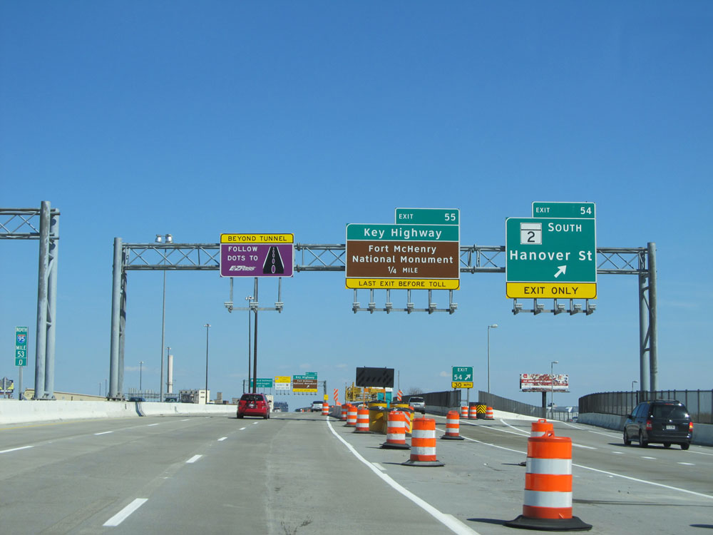 |
Interstate 95 North at Exit 54: MD 2 South - Hanover St (Photo taken 4/11/15). |
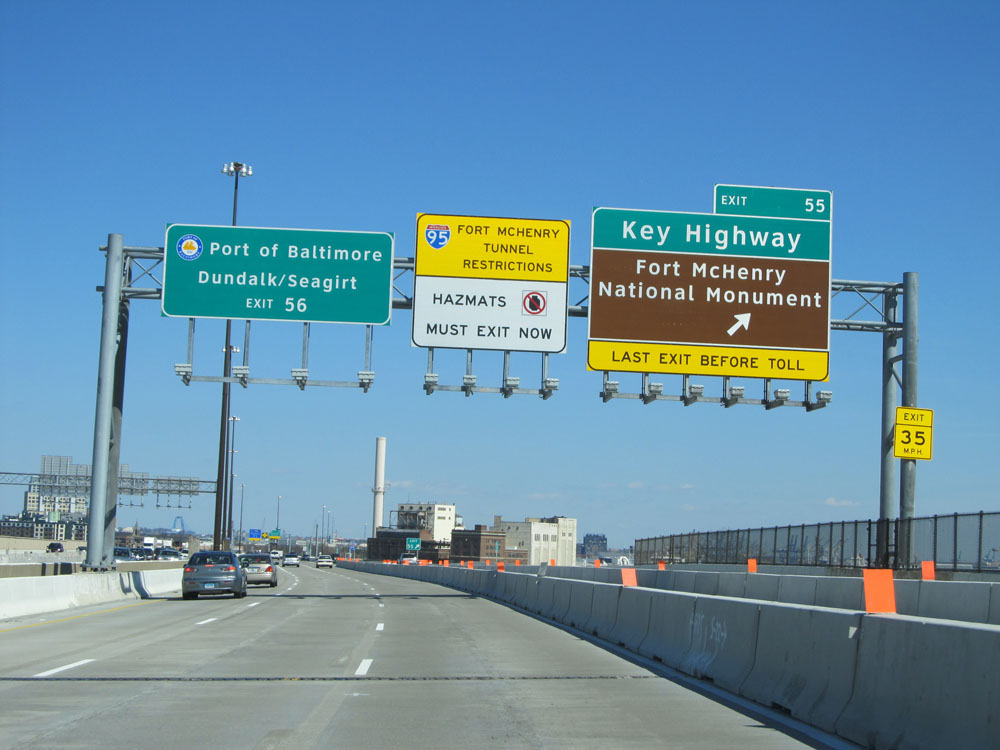 |
Interstate 95 North at Exit 55: Key Highway / Fort McHenry National Monument. Any commercial vehicles with hazardous materials must exit here, as Hazmat is prohibited through the Fort McHenry Tunnel ahead. (Photo taken 4/11/15). |
 |
Interstate 95 North shield located at mile marker 53.4, in downtown Baltimore. (Photo taken 4/11/15). |
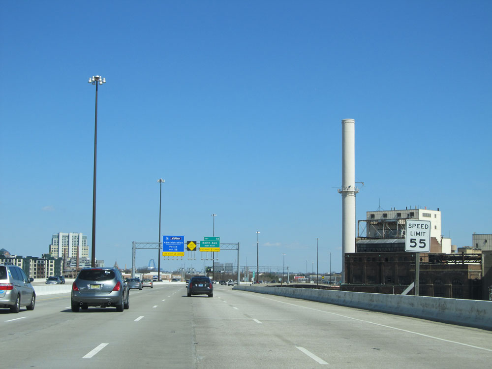 |
Speed limit sign on Interstate 95 North in Baltimore. The speed limit on this urban stretch of I-95 is 55 mph. (Photo taken 4/11/15). |
 |
If taking Exit 56, you will want to stay in the right two lanes. The reason for this is that the lanes split ahead just before entering the Fort McHenry Tunnel. Exit 56 lies just beyond the toll plaza at the other end of the tunnel. (Photo taken 4/11/15). |
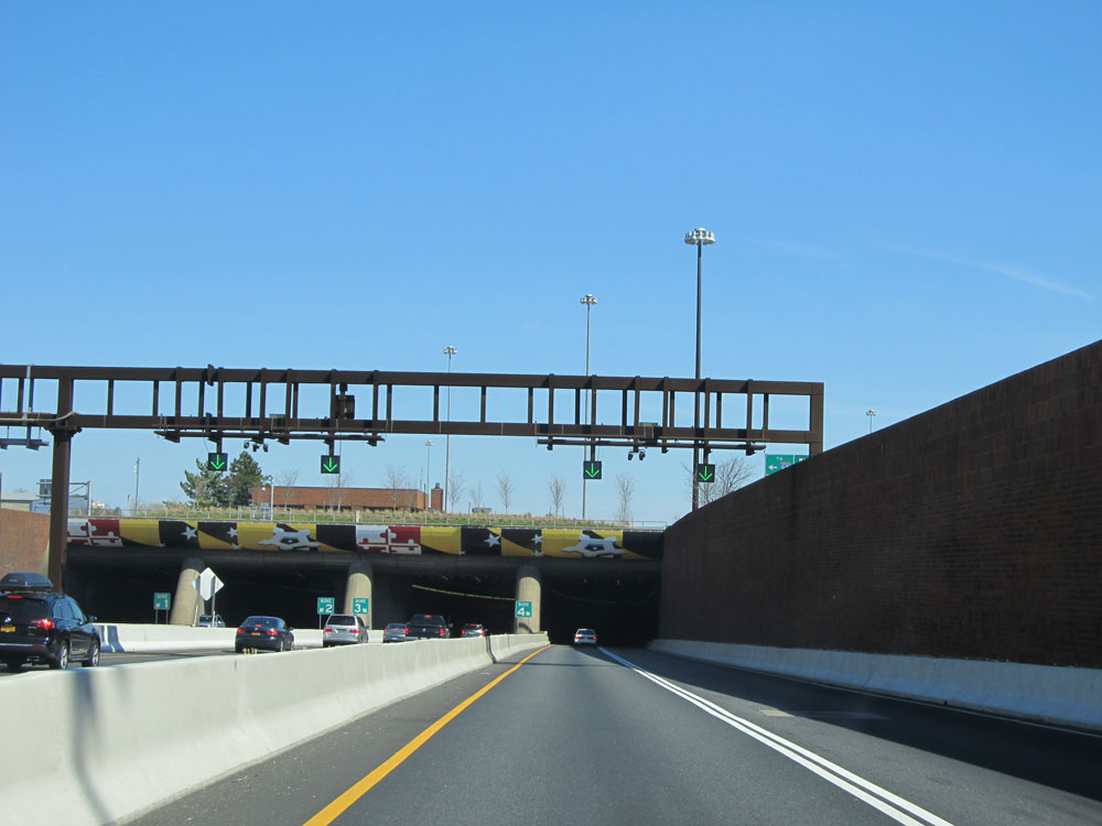 |
Interstate 95 North as it enters the Fort McHenry Tunnel. (Photo taken 4/11/15). |
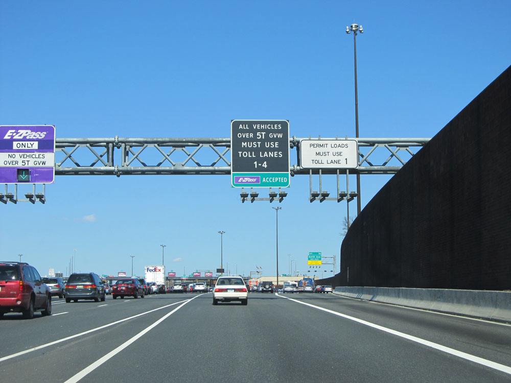 |
Upon exiting the tunnel on Interstate 95 North, there is usually quite a mess. Trucks are restricted to the four rightmost toll lanes. EZ Pass is accepted at all toll lanes, but cash customers must use lanes 1 or 2, which are the ones furthest to the right. At busy times, expect traffic to move slow approaching this toll plaza. (Photo taken 4/11/15). |
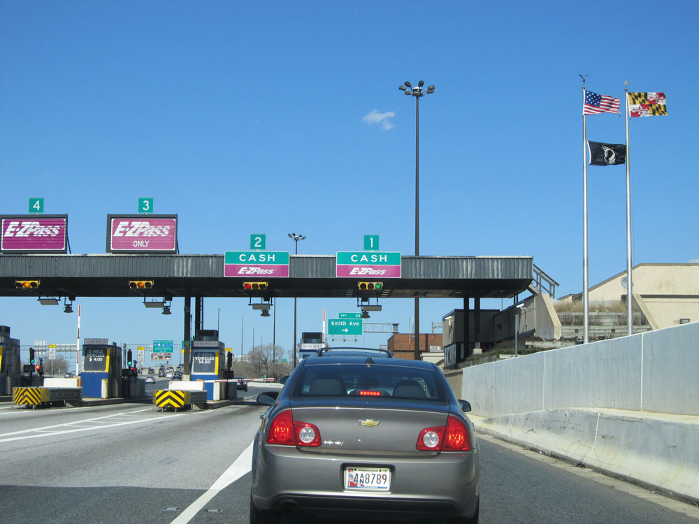 |
A closer view of the toll plaza. Lanes 1 and 2 are where you will want to be if you plan on taking Exit 56 ahead. (Photo taken 4/11/15). |
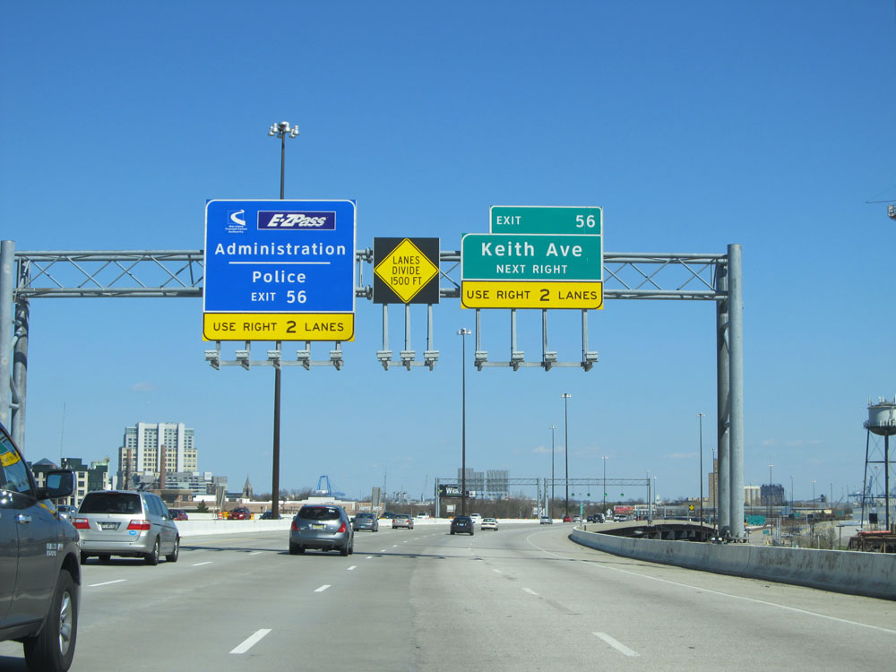
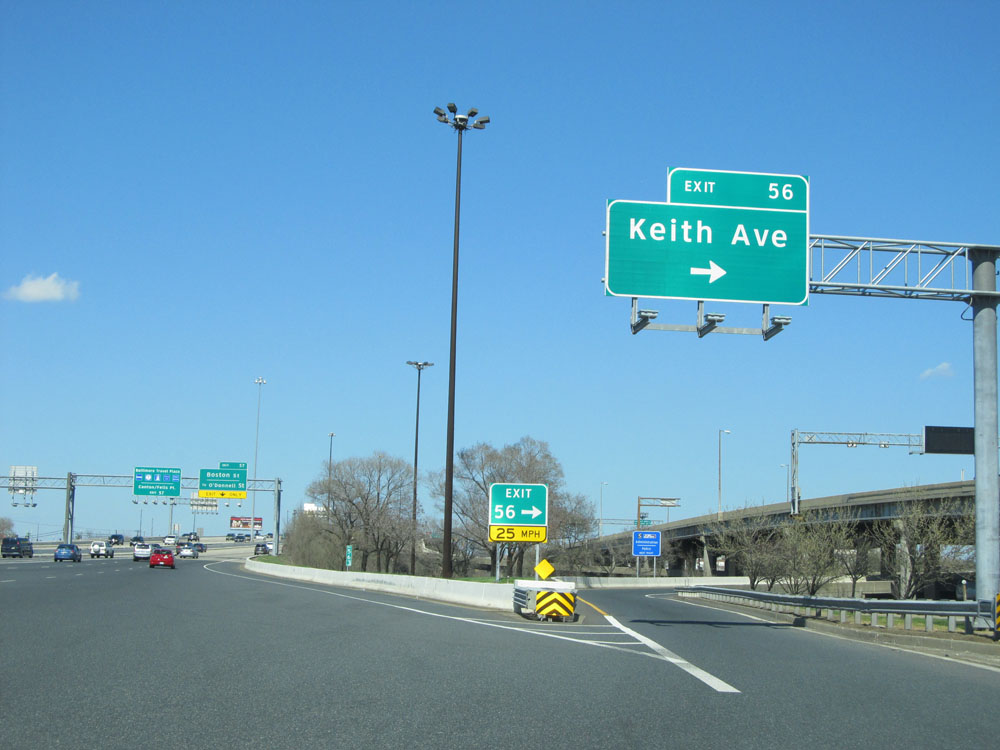 |
Interstate 95 North at Exit 56: Keith Ave. This exit is immediately, and I mean IMMEDIATELY, after the toll plaza. That is why being in the two rightmost toll lanes is crucial for accessing it. (Photo taken 4/11/15). |
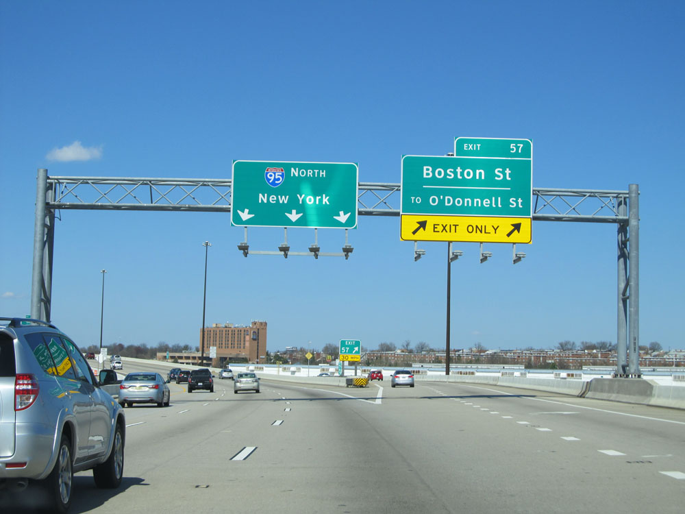 |
Interstate 95 North at Exit 57: Boston St / To O'Donnell St (Photo taken 4/11/15). |
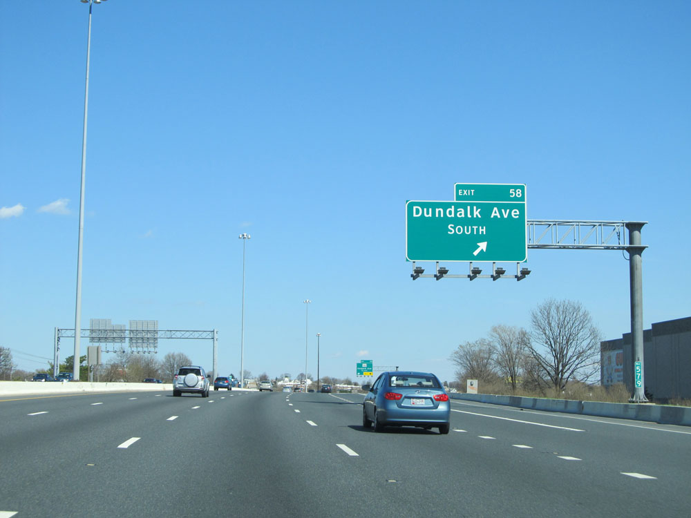 |
Interstate 95 North at Exit 58: Dundalk Ave South (Photo taken 4/11/15). |
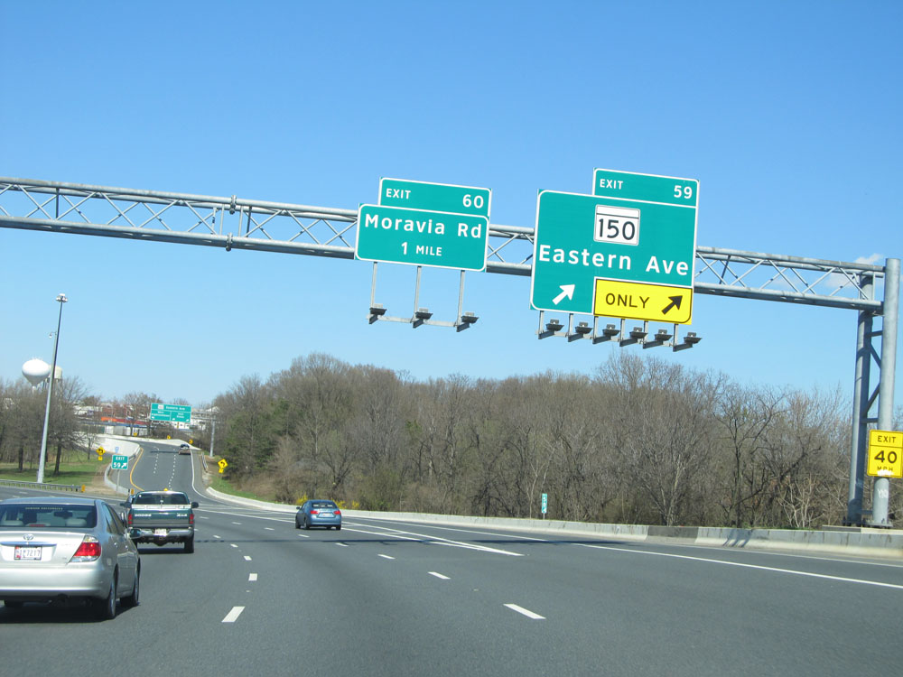 |
Interstate 95 North at Exit 59: MD 150 - Eastern Ave (Photo taken 4/11/15). |
 |
Interstate 95 North at Exit 60: Moravia Rd (Photo taken 4/11/15). |
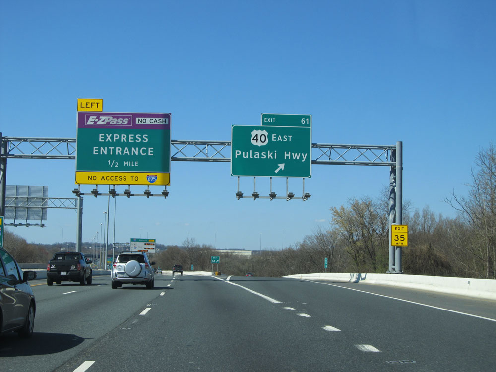 |
Interstate 95 North at Exit 61: US 40 East - Pulaski Hwy. To the left, 1/2 mile ahead, I-95 has express lanes. From these express lanes, there is NO access to Interstate 695. (Photo taken 4/11/15). |
 |
Interstate 95 North at the express lanes entrance to the left. The express lanes are restricted to EZ Pass tagholders only. Again, you CANNOT access Interstate 695 from the express lanes. (Photo taken 4/11/15). |
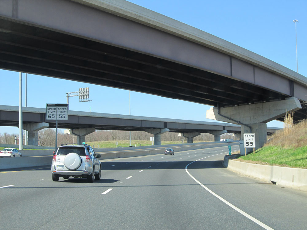 |
Speed limit signs at mile marker 60.7. The speed limit in the express lanes is 65 mph, while the normal lanes are restricted to 55 mph. (Photo taken 4/11/15). |
 |
Interstate 95 North approaching Exit 64 - 1 mile. (Photo taken 4/11/15). |
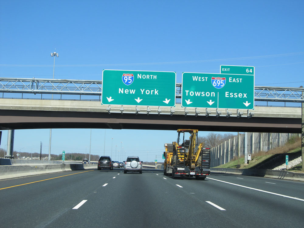 |
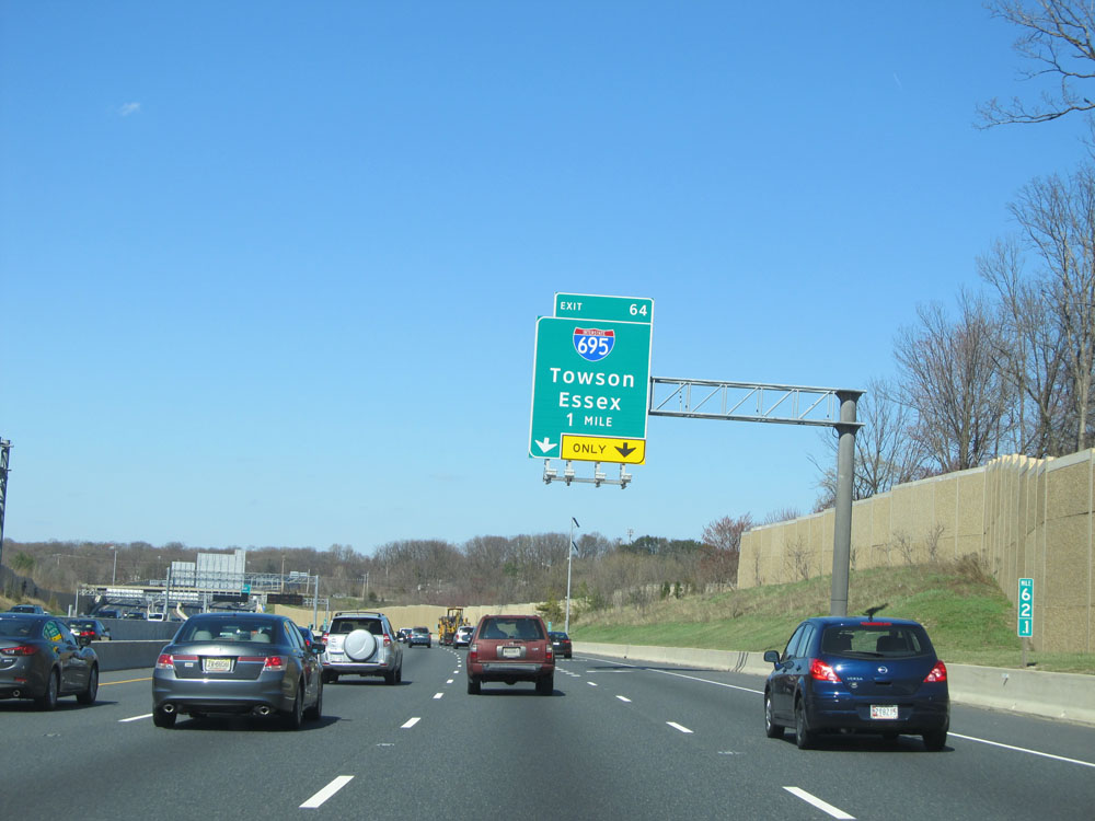
Interstate 95 North at Exit 64: Interstate 695 - Towson / Essex (Photo taken 4/11/15). |
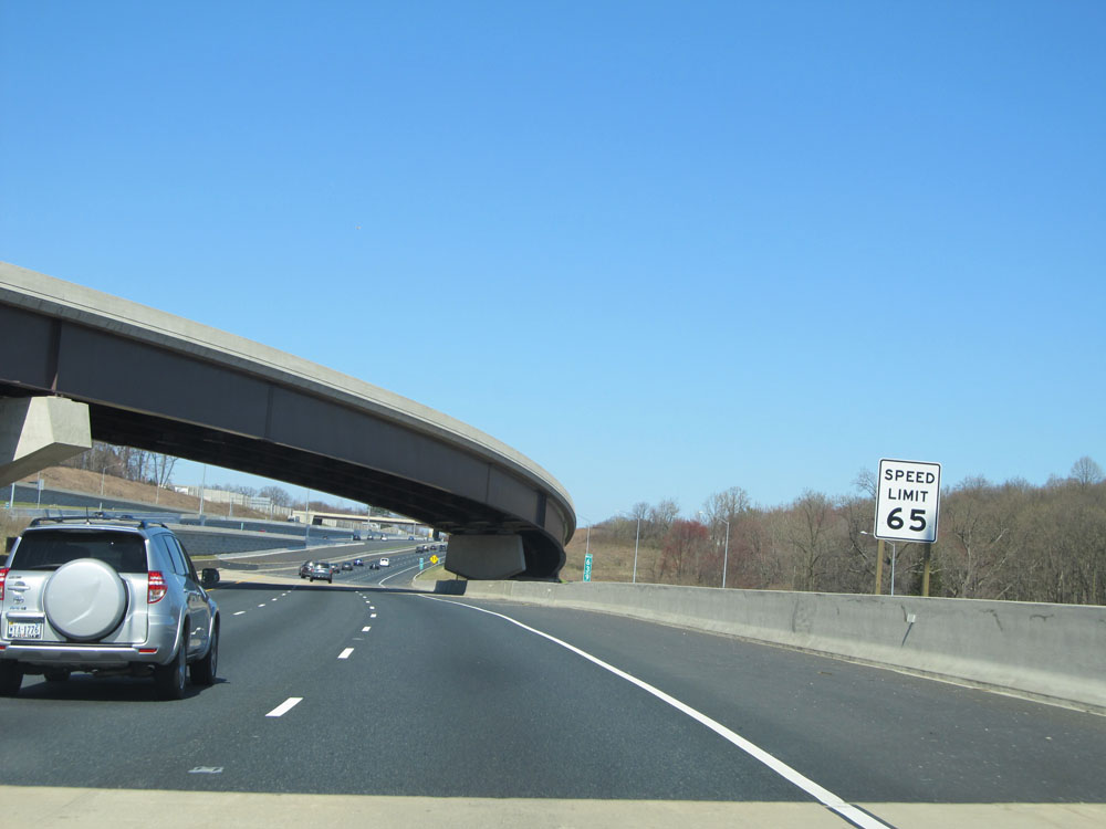 |
Near mile marker 64, the speed limit increases to 65 mph for all lanes. (Photo taken 4/11/15). |
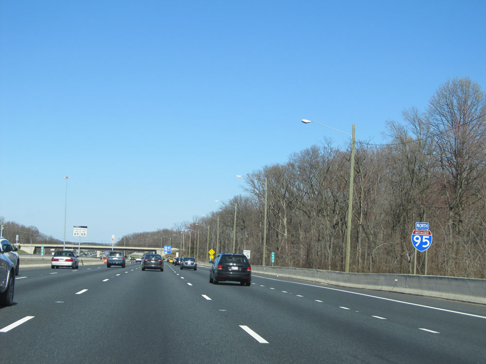 |
Interstate 95 North shield located near mile marker 64.5. (Photo taken 4/11/15). |
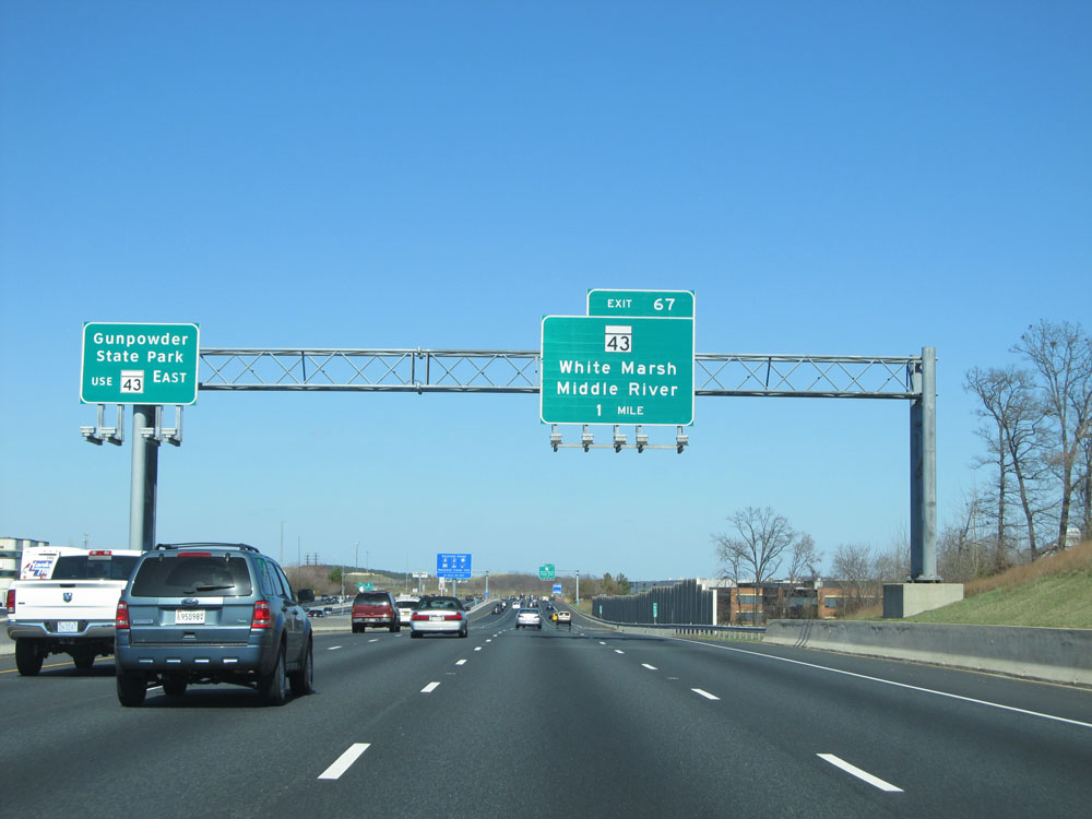 |
Use Exit 67 to Gunpowder State Park via MD 43 East. (Photo taken 4/11/15). |
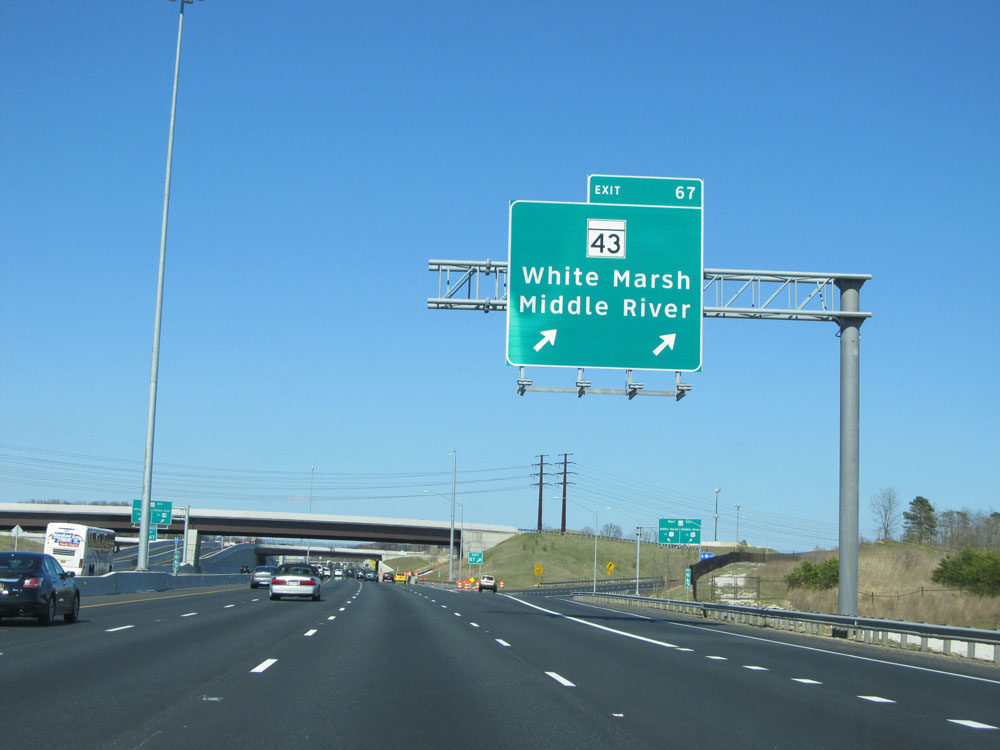 |
Interstate 95 North at Exit 67: MD 43 - White Marsh / Middle River (Photo taken 4/11/15). |
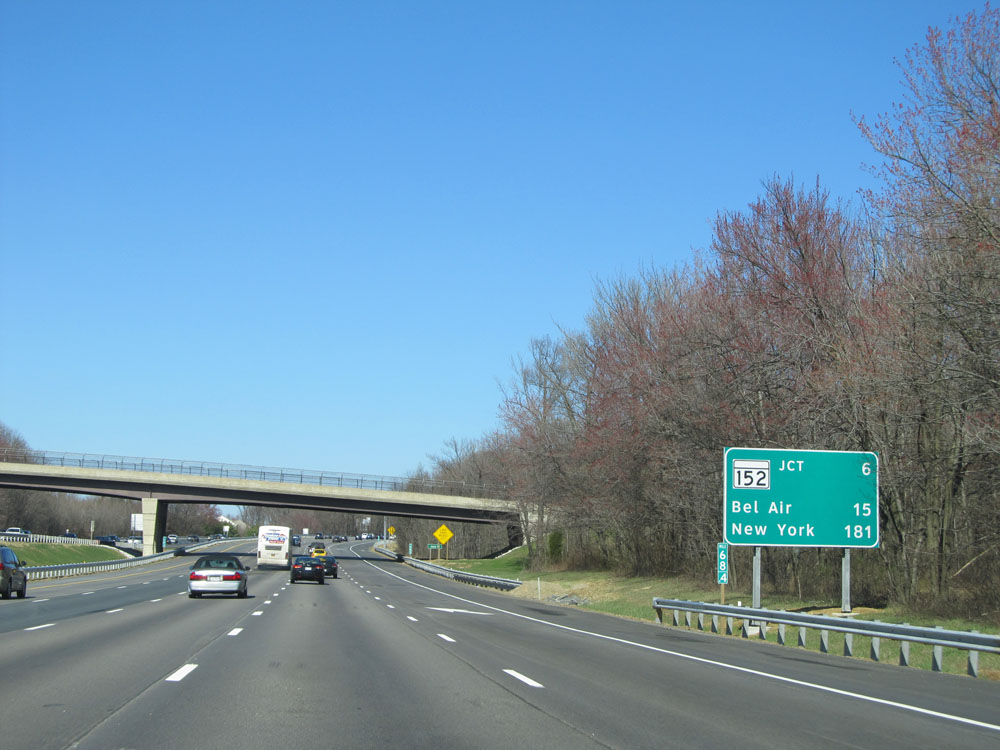 |
Mileage sign at mile marker 68.4. It's 6 miles to the next exit (the junction of MD 152), 15 miles to Bel Air, and 181 miles to New York City. (Photo taken 4/11/15). |
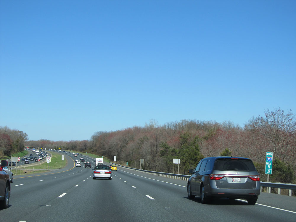 |
Interstate 95 North: Road view from mile marker 71. (Photo taken 4/11/15). |
 |
Interstate 95 North as it enters Harford County. (Photo taken 4/11/15). |
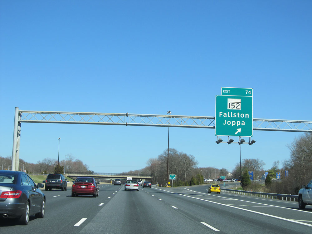 |
Interstate 95 North at Exit 74: MD 152 - Fallston / Joppa (Photo taken 4/11/15). |
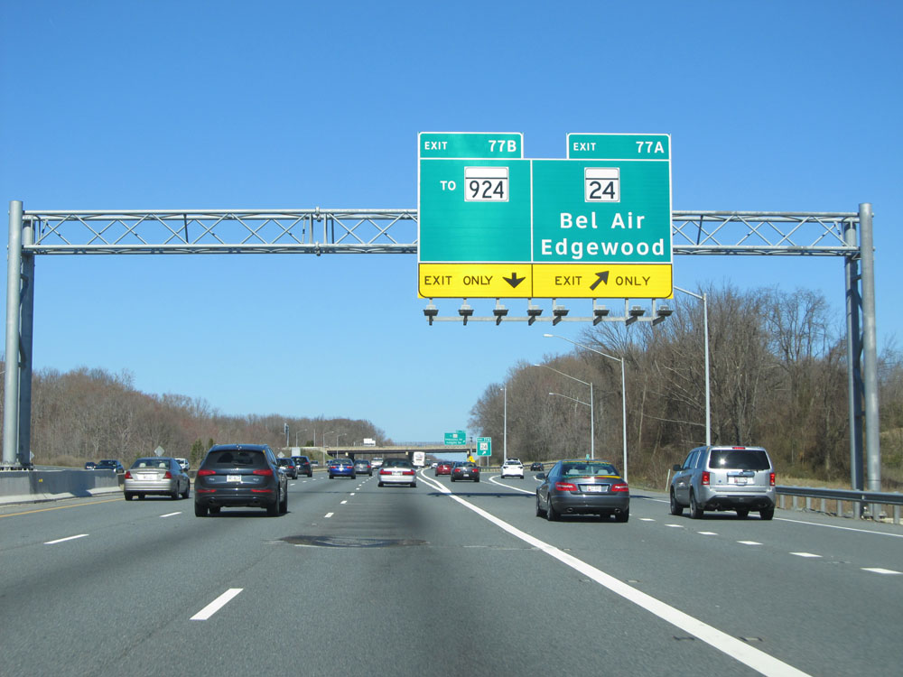 |
Interstate 95 North at Exit 77A: MD 24 - Bel Air / Edgewood (Photo taken 4/11/15). |
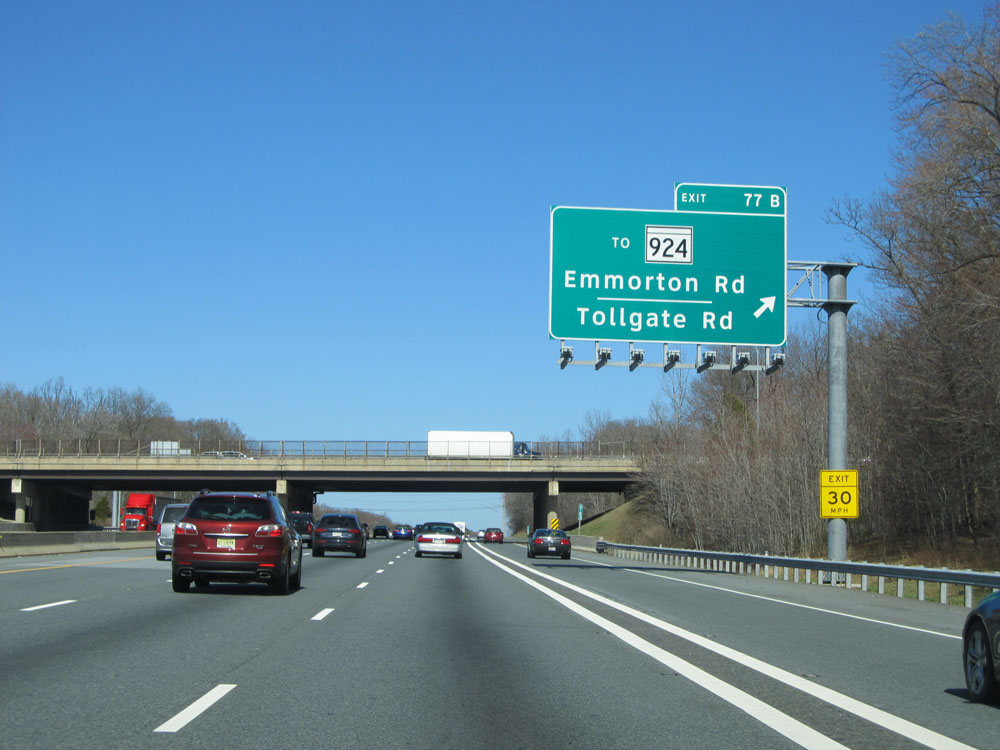 |
Interstate 95 North at Exit 77B: To MD 924 - Emmorton Rd / Tollgate Rd (Photo taken 4/11/15). |
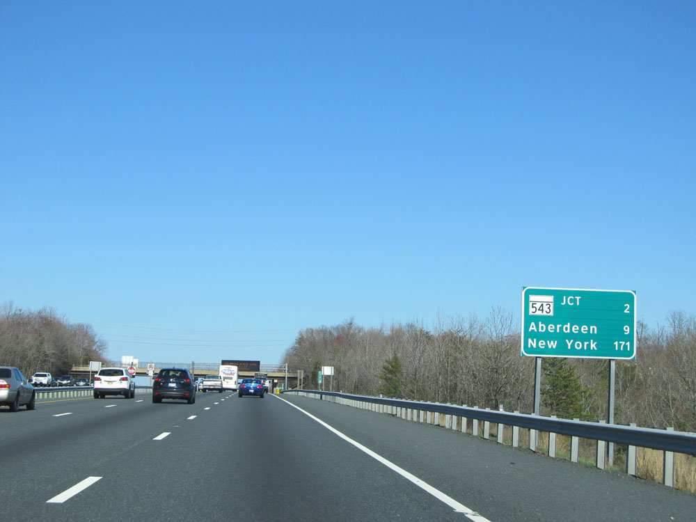 |
Mileage sign located near mile marker 78. It's 2 miles to the next exit (junction of MD 543), 9 miles to Aberdeen, and 171 miles to New York City. (Photo taken 4/11/15). |
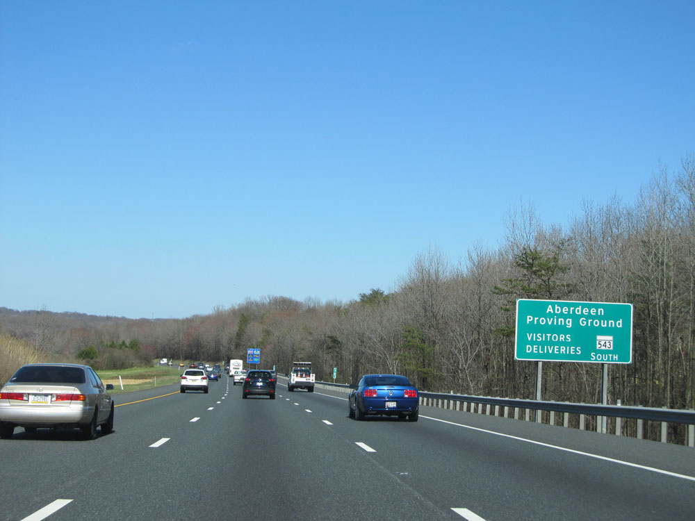 |
For visitors and deliveries to Aberdeen Proving Ground, use Exit 80 and take MD 543 South. (Photo taken 4/11/15). |
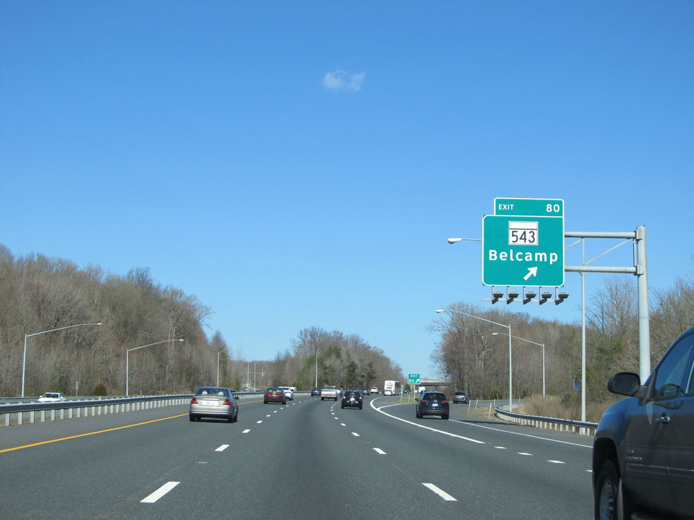 |
Interstate 95 North at Exit 80: MD 543 - Belcamp (Photo taken 4/11/15). |
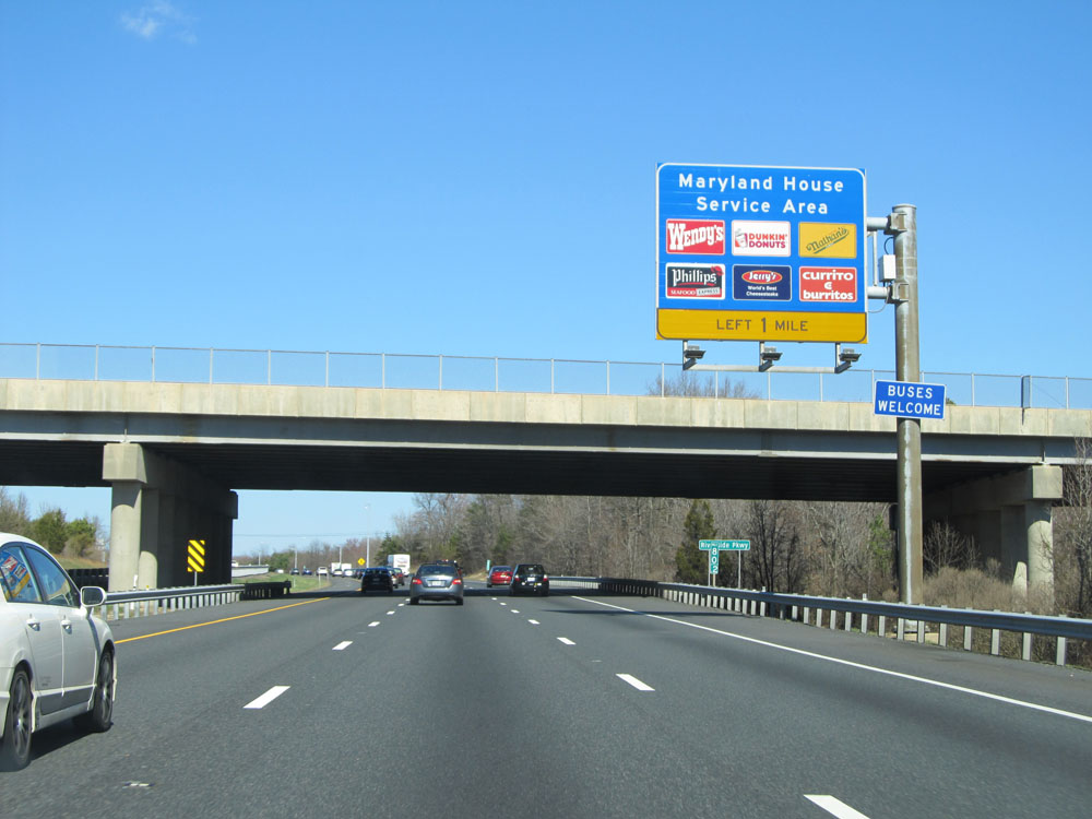 |
Interstate 95 North approaching the Maryland House Service Area - 1 mile on the left. (Photo taken 4/11/15). |
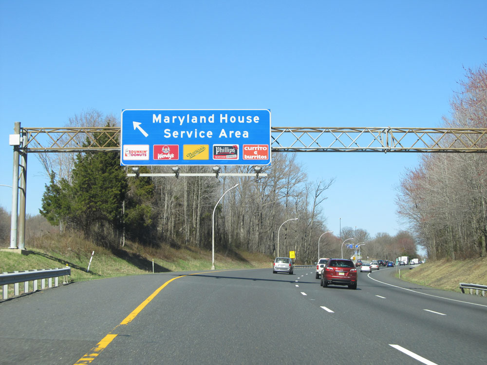 |
Interstate 95 North at the Maryland House Service Area. (Photo taken 4/11/15). |
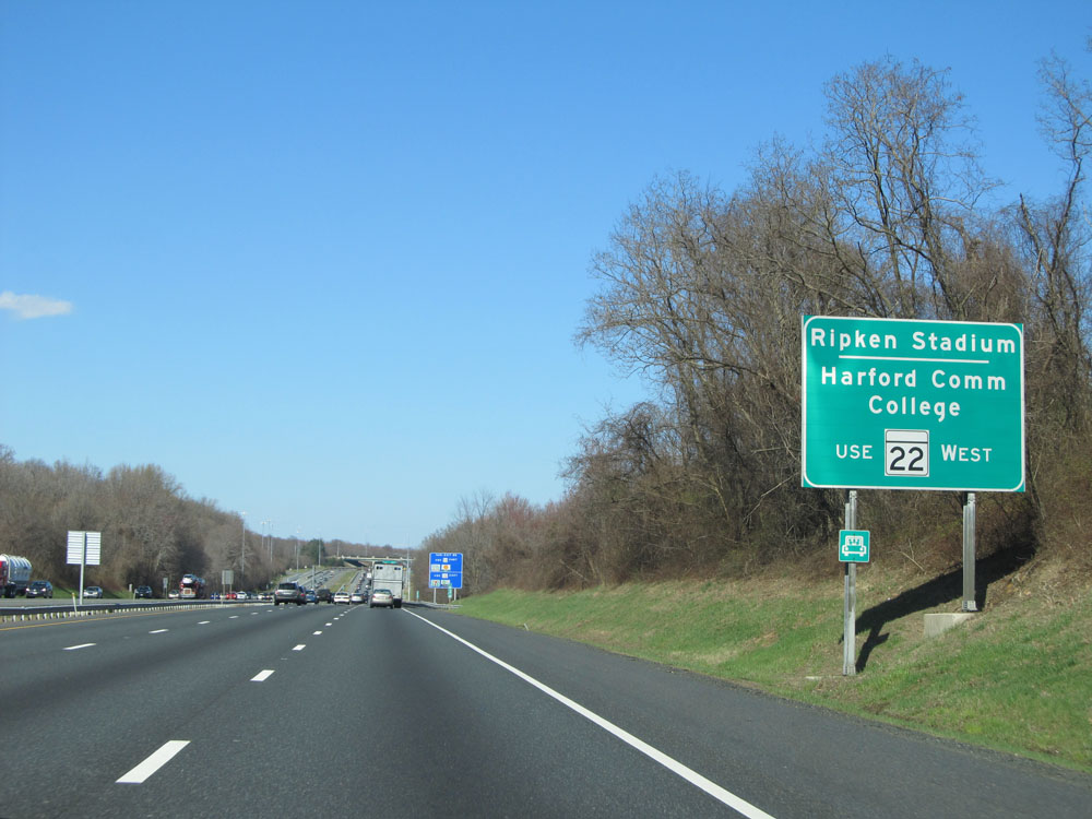 |
Use Exit 85 to Ripken Stadium and Harford Community College via MD 22 West. (Photo taken 4/11/15). |
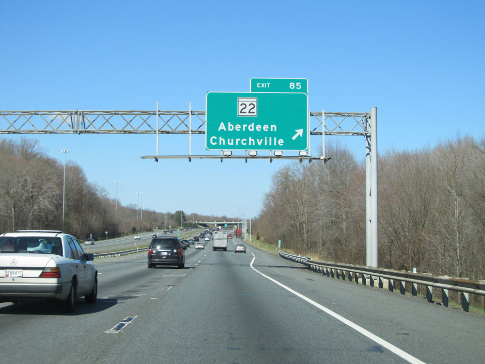 |
Interstate 95 North at Exit 85: MD 22 - Aberdeen / Churchville (Photo taken 4/11/15). |
 |
Interstate 95 North shield located near mile marker 85.3. (Photo taken 4/11/15). |
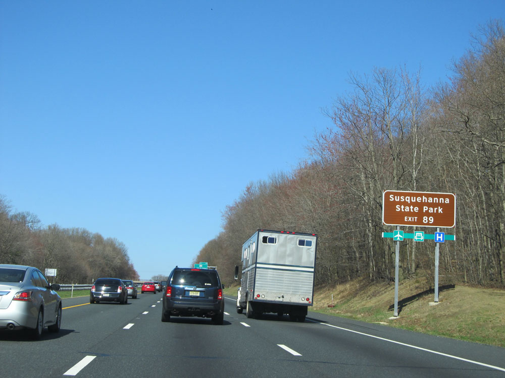 |
Take Exit 89 to Susquehanna State Park. (Photo taken 4/11/15). |
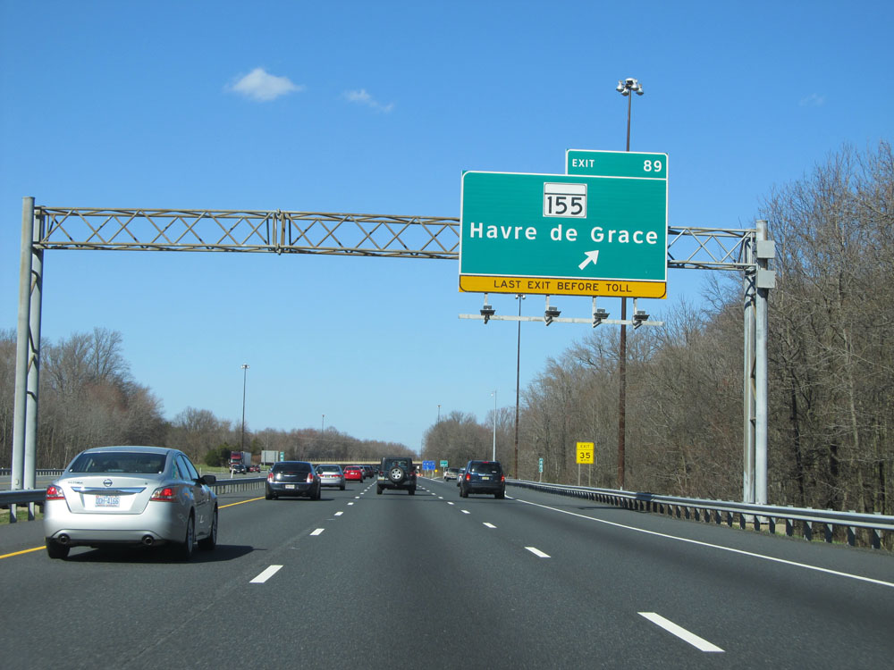 |
Interstate 95 North at Exit 89: MD 155 - Havre de Grace (Photo taken 4/11/15). |
 |
Truck services exist at Exits 93 and 100 ahead. (Photo taken 4/11/15). |
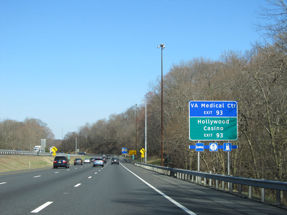 |
Take Exit 93 to the VA Medical Center and Hollywood Casino. (Photo taken 4/11/15). |
 |
Interstate 95 North as it enters Cecil County. (Photo taken 4/11/15). |
 |
At mile marker 91.6, the speed limit decreases to 55 mph as you approach the second and final toll plaza on Interstate 95 in Maryland - 1 mile ahead. Again, cash customers should stay to the right. (Photo taken 4/11/15). |
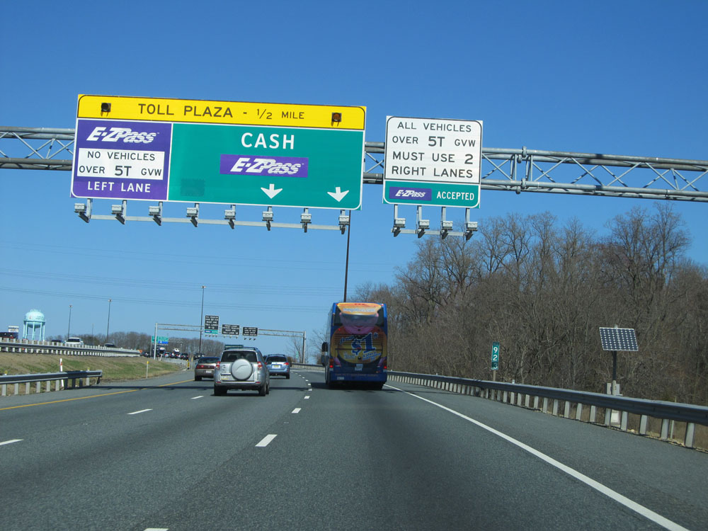 |
Now 1/2 mile from the toll plaza, trucks are warned that they're restricted to the two rightmost toll lanes ahead. (Photo taken 4/11/15). |
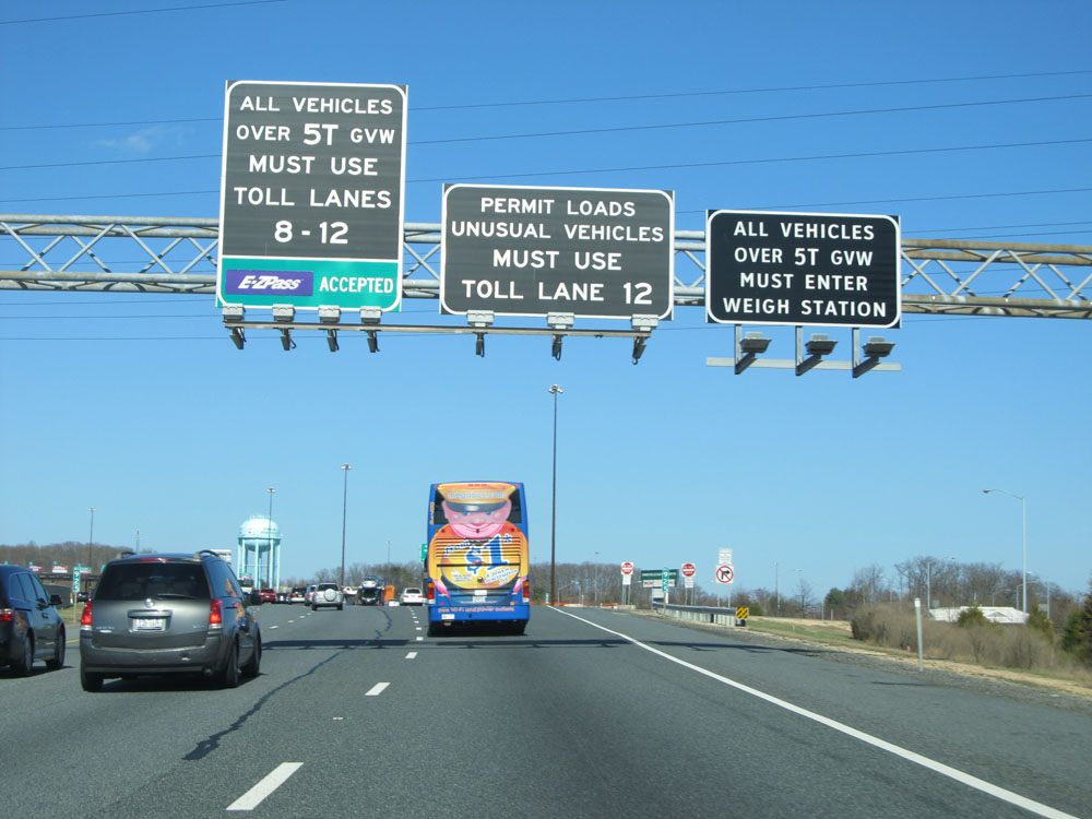 |
Permit loads and "Unusual Vehicles" must use toll lane 12 ahead, which is the rightmost lane. I'm curious as to what their definition of an "unusual vehicle" is, exactly. (Photo taken 4/11/15). |
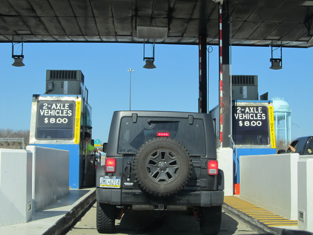 |
Close-up view of the toll plaza. 2-axle vehicles who are paying cash will owe $8.00 as of when this picture was taken. (Photo taken 4/11/15). |
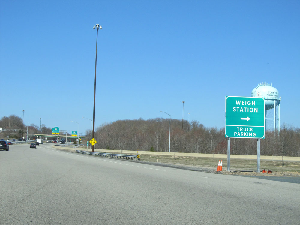 |
Interstate 95 North at the Weigh Station / Truck Parking Area immediately past the toll plaza. (Photo taken 4/11/15). |
 |
Interstate 95 North at Exit 93: MD 222 - Perryville / Port Deposit (Photo taken 4/11/15). |
 |
Another Interstate 95 North shield. (Photo taken 4/11/15). |
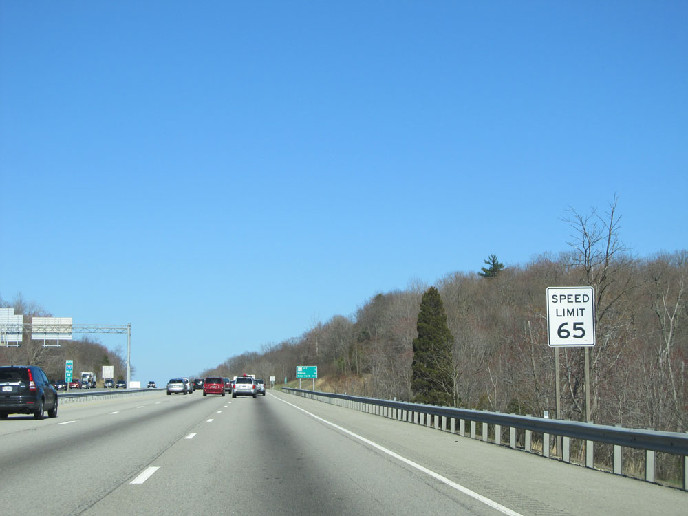 |
Speed limit sign at mile marker 94. Once again, the speed limit on most rural Interstates in Maryland is 65 mph. (Photo taken 4/11/15). |
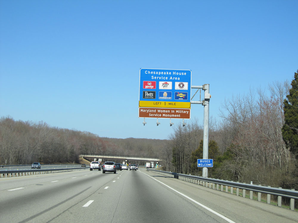 |
Interstate 95 North approaching the Chesapeake House Service Area - 1 mile on the left. (Photo taken 4/11/15). |
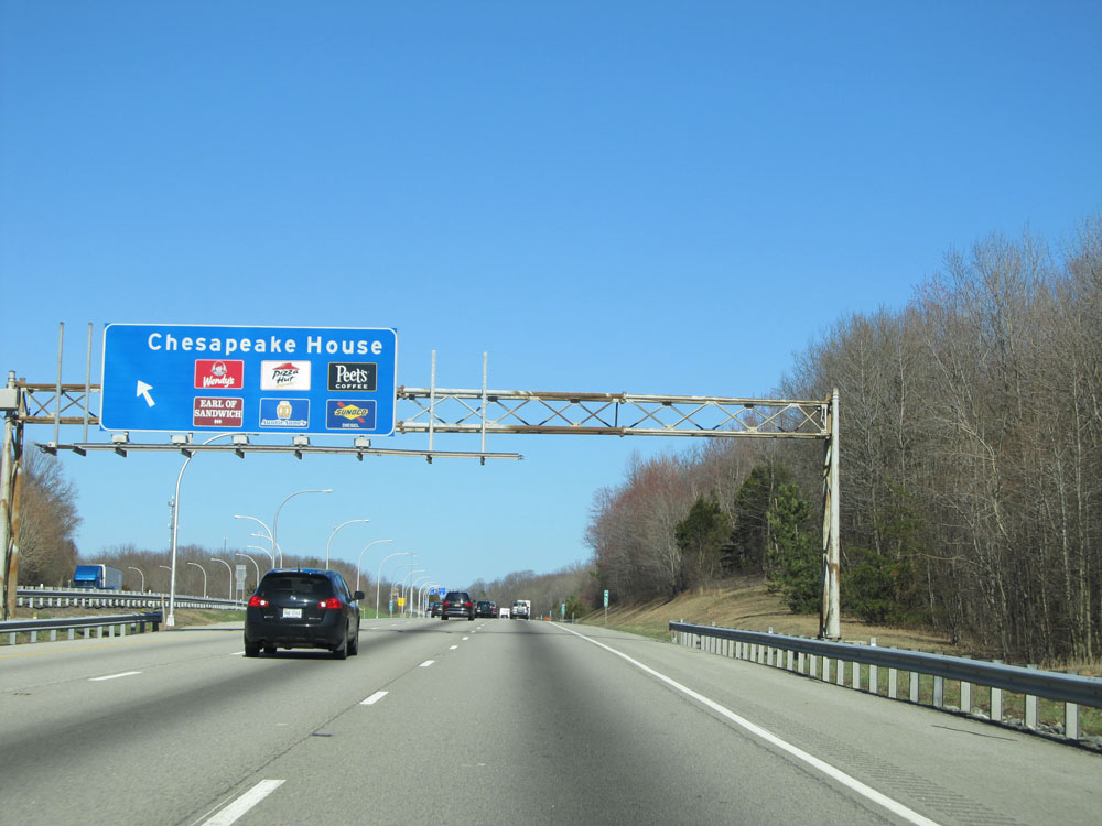 |
Interstate 95 North at the Chesapeake House Service Area, located at mile marker 96. (Photo taken 4/11/15). |
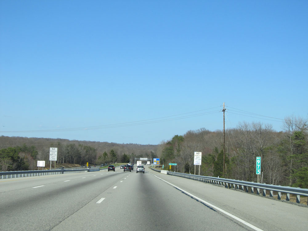 |
Interstate 95 North: Road view from mile marker 97.5. (Photo taken 4/11/15). |
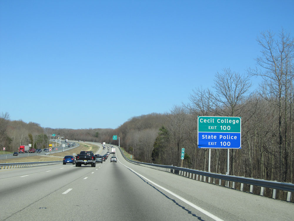 |
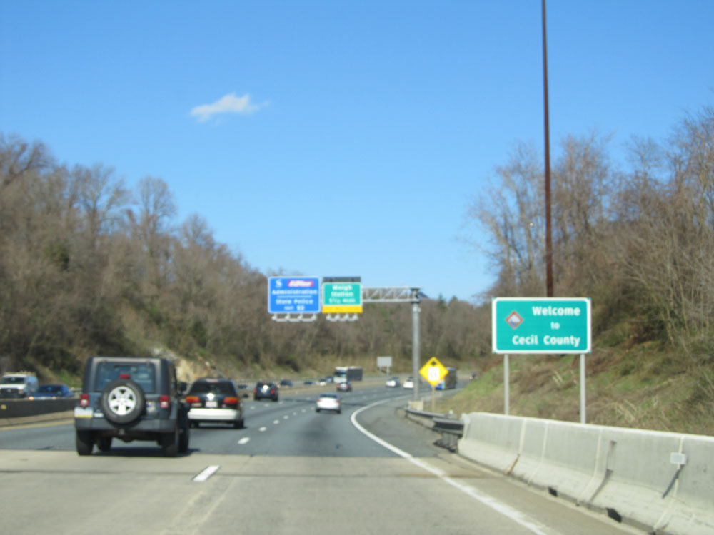
Take Exit 100 to Cecil College and the State Police barracks. (Photo taken 4/11/15). |
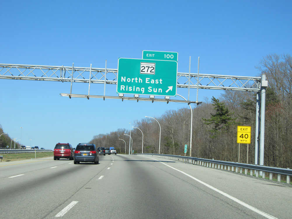 |
Interstate 95 North at Exit 100: MD 272 - North East / Rising Sun (Photo taken 4/11/15). |
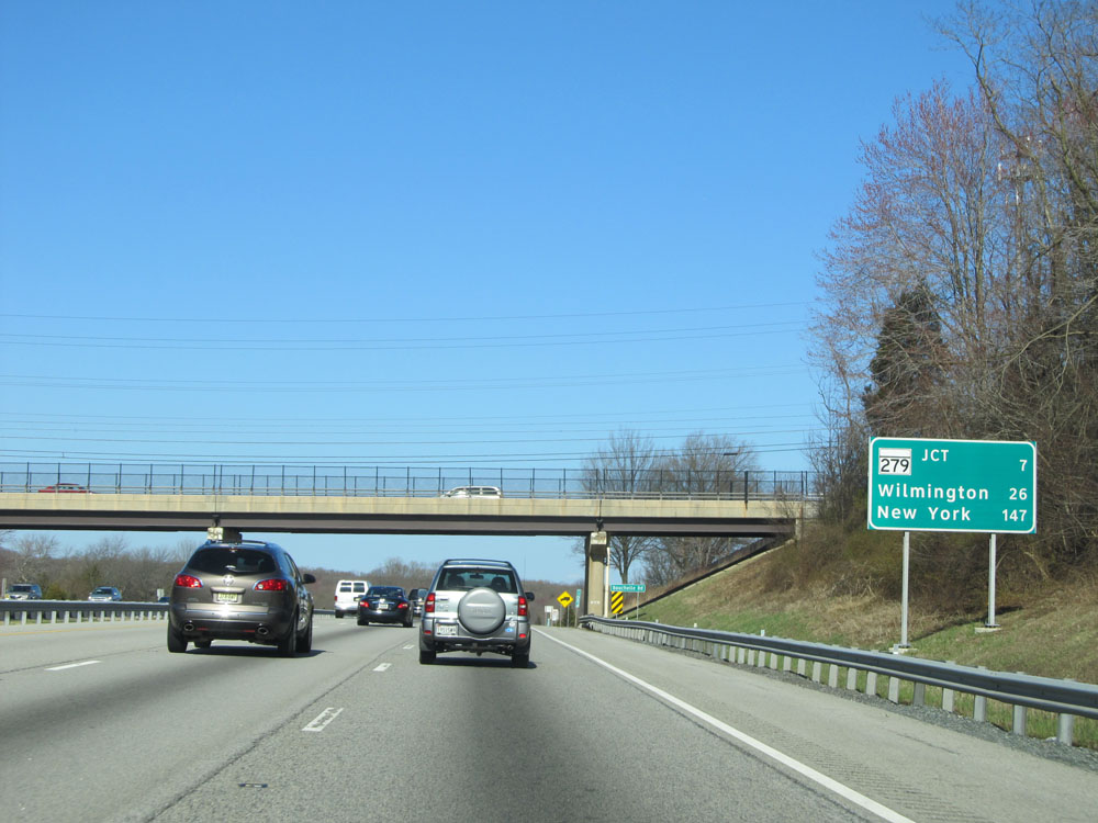 |
Mileage sign on Interstate 95 North. It's 7 miles to the junction of MD 279 (the last exits in Maryland), 26 miles to Wilmington and 147 miles to New York City. (Photo taken 4/11/15). |
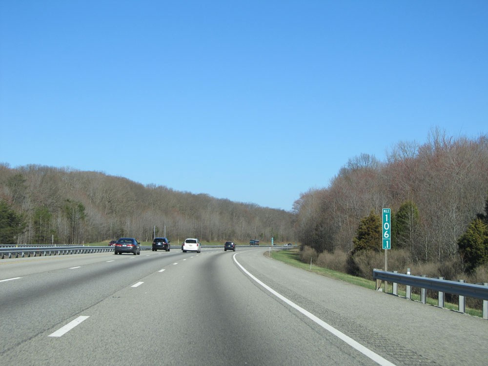 |
Interstate 95 North: Road view from mile marker 106.1. (Photo taken 4/11/15). |
 |
There are truck services off Exits 109A-B. (Photo taken 4/11/15). |
 |
Take Exit 109A to US 40 and Exit 109B to the University of Delaware. (Photo taken 4/11/15). |
 |
Interstate 95 North at Exit 109A: MD 279 South - Elkton (Photo taken 4/11/15). |
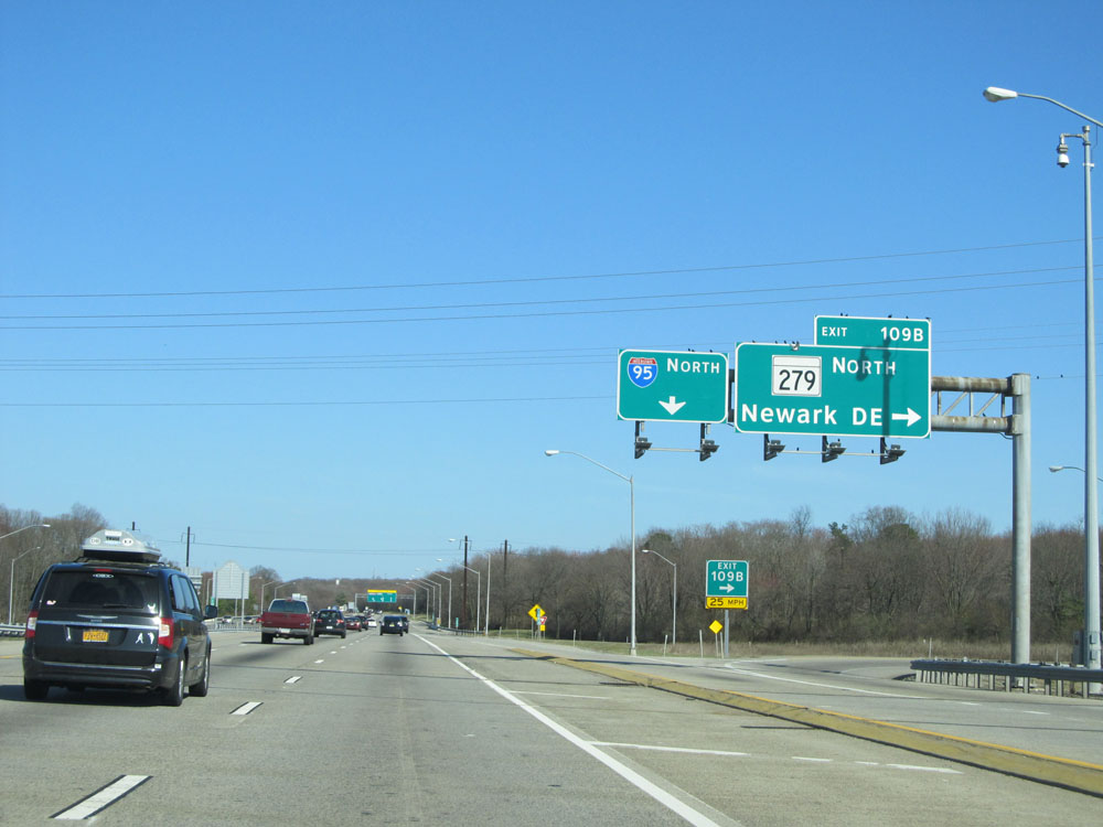 |
Interstate 95 North at Exit 109B: MD 279 North - Newark, DE. Just ahead lies the Delaware border. (Photo taken 4/11/15). |