Road Information |
||
 |
||
| Total Mileage in State: | 51 miles | |
| Beginning/End: | At Curtis Creek Drawbridge | |
| Mileage covered in Photos: | 51 miles | |
| Counties covered in Photos: | Baltimore, Anne Arundel | |
| Major Junctions in Photos: | I-95, near White Marsh I-83, near Timonium I-795, near Pikesville I-70, near Woodlawn I-95, near Arbutus I-97, near Glen Burnie |
|
| Control Cities in Photos: | Baltimore, Dundalk, Towson, Pikesville, Catonsville, Linthicum, Glen Burnie | |
Outer Loop
- Section 1: Mile Marker 0 to Towson (Exit 26)
- Section 2: Towson (Exit 26) to Mile Marker 0
Section 1: Mile Marker 0 to Towson (Exit 26)
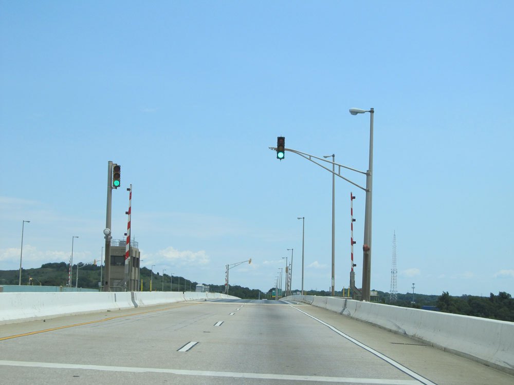 |
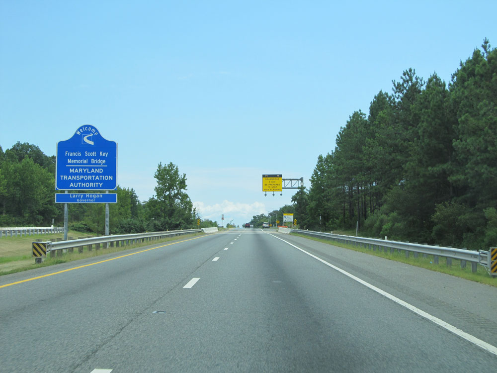
Interstate 695 Outer Loop crossing the Curtis Creek Drawbridge near mile marker 51. This is the point at which Interstate 695's mileage resets to 51.4, which makes it the official beginning/end of this beltway around the Baltimore area. (Photo taken 8/9/15). |
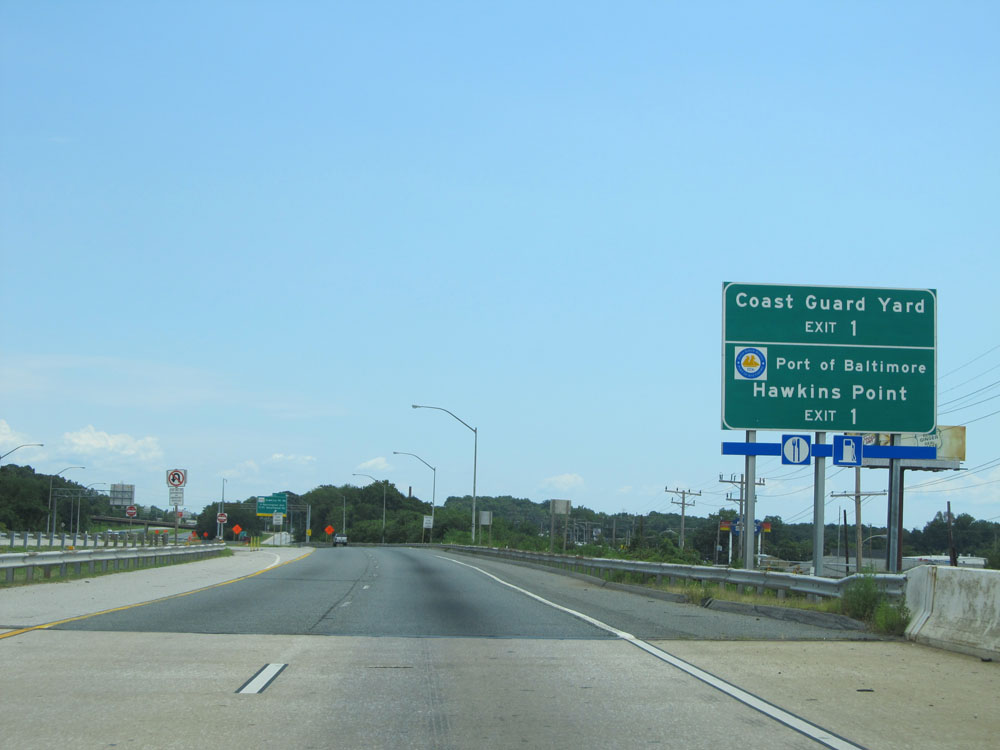 |
Take Exit 1 to the Coast Guard Yard and Hawkins Point. (Photo taken 8/9/15). |
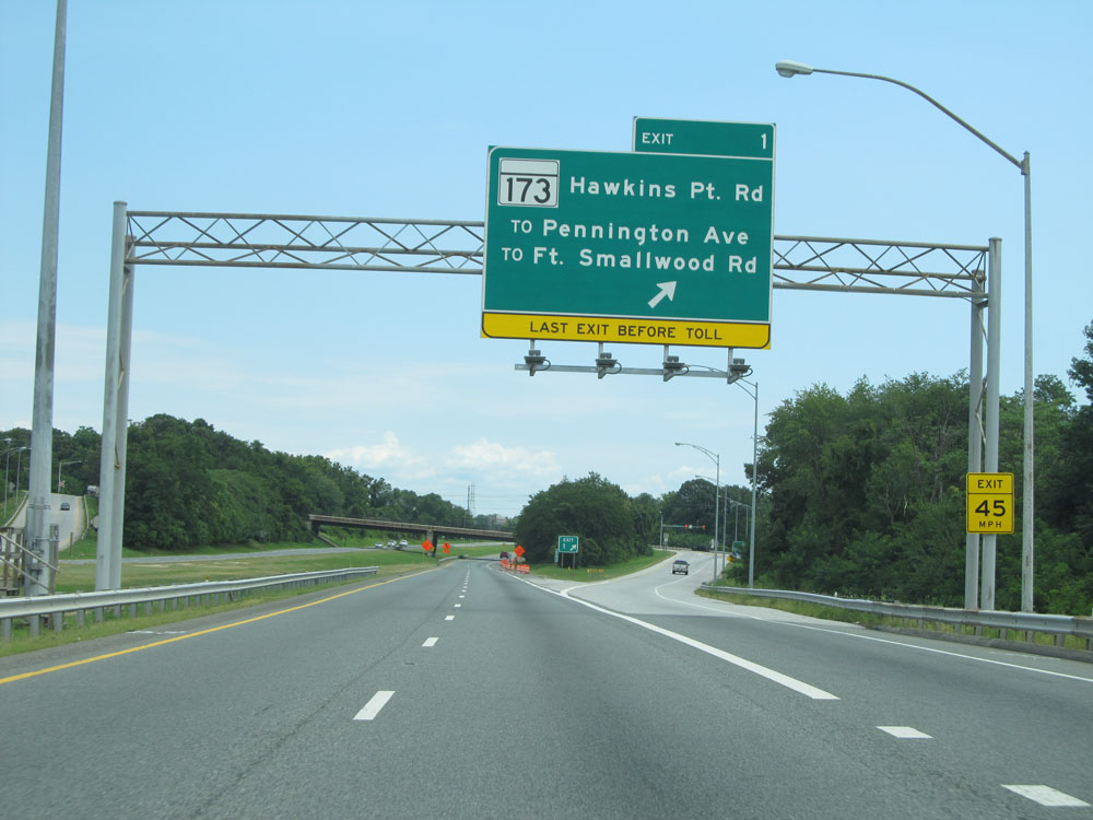 |
Interstate 695 Outer Loop (East) at Exit 1: MD 173 - Hawkins Point Rd / To Pennington Ave / To Ft. Smallwood Rd (Photo taken 8/9/15). |
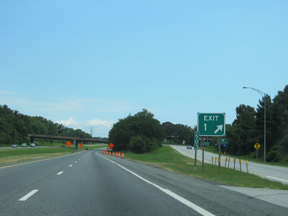 |
As you can see here with the mile marker next to the exit sign, this exit is signed as Exit 1 even though it occurs at mile marker 50.3. (Photo taken 8/9/15). |
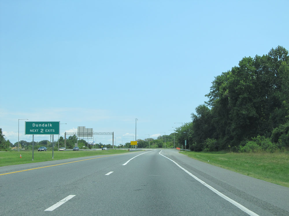 |
Take either of the next 2 exits to Dundalk. (Photo taken 8/9/15). |
 |
This warning sign states that the area leading up to the Key Bridge is subject to dense smoke. (Photo taken 8/9/15). |
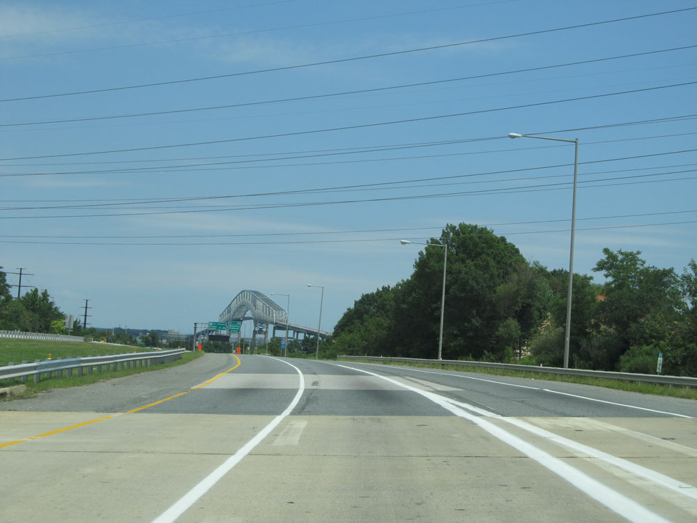 |
At mile marker 49.5, you get a distant view of the Key Bridge. (Photo taken 8/9/15). |
 |
Interstate 695 Outer Loop (East) assurance shield near mile marker 49.2. (Photo taken 8/9/15). |
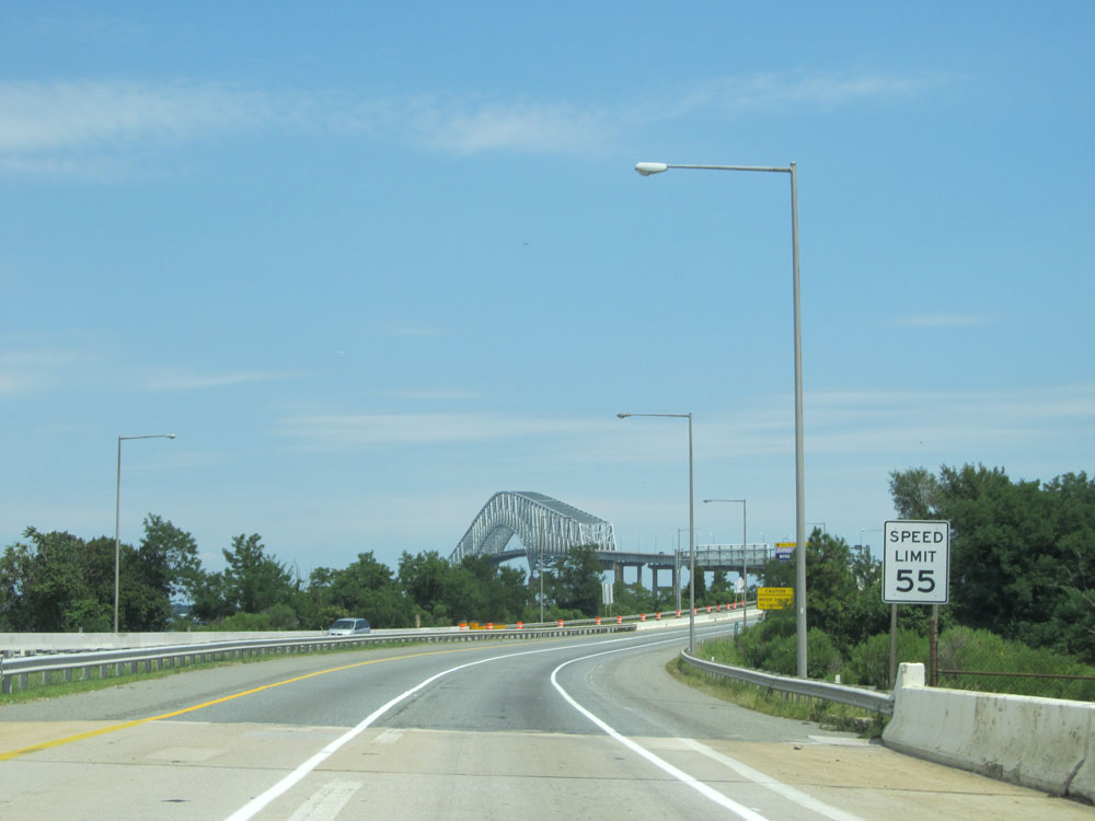 |
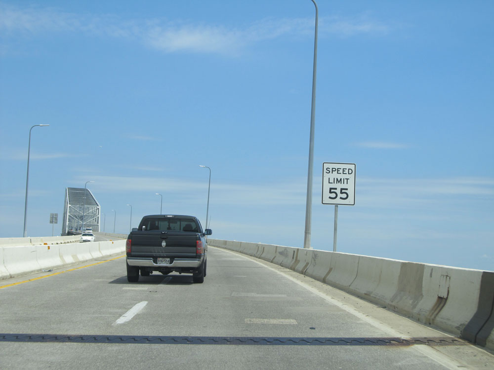
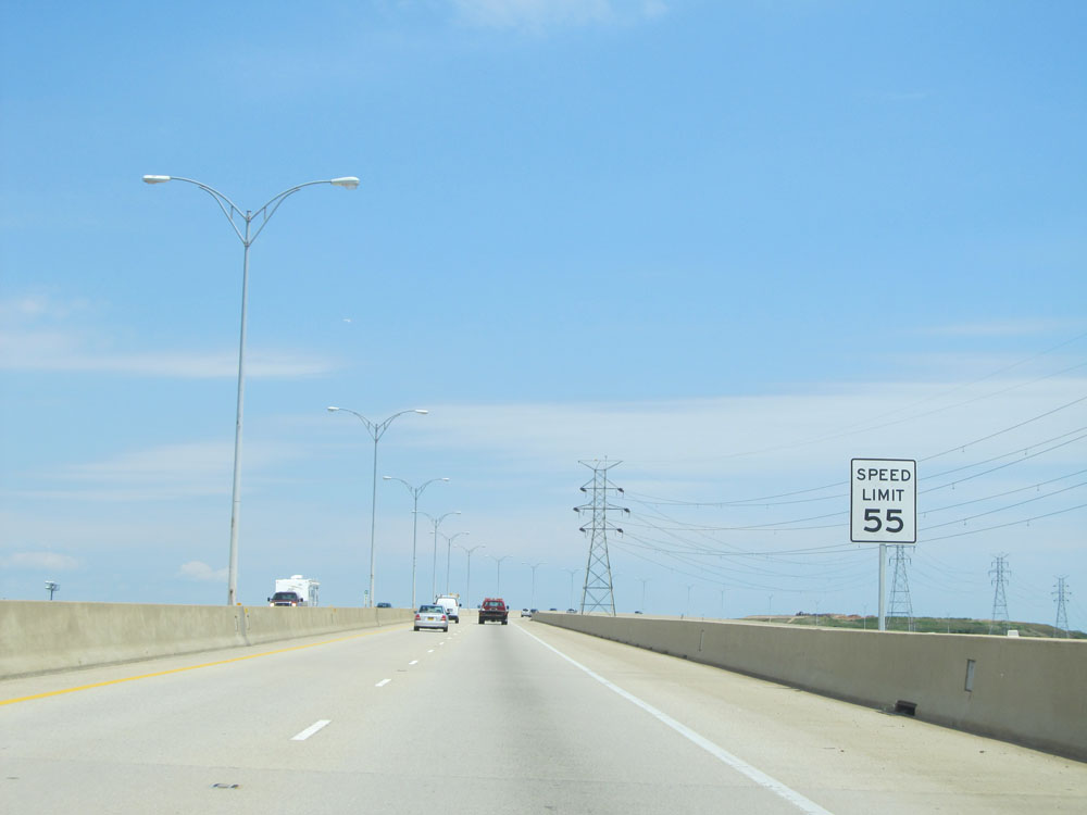
Speed limit sign on Interstate 695 Outer Loop (East). The speed limit approaching the Key Bridge remains 55 mph. In fact, the speed limit on I-695 is 55 mph for its entire 51-mile duration, with the exception of when it approaches the Key Bridge Toll Plaza on the east side of the bridge (as you will see shorty). (Photo taken 8/9/15). |
 |
The Key Bridge crosses the Patapsco River, as this sign leading up to it indicates. (Photo taken 8/9/15). |
 |
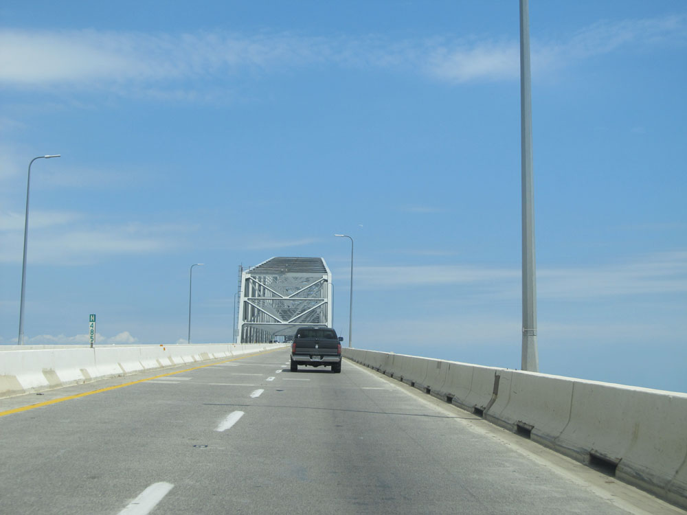
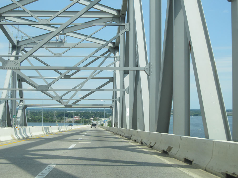
Interstate 695 Outer Loop (East) as it starts across the Francis Scott Key Bridge, near mile marker 48.5. (Photo taken 8/9/15). |
 |
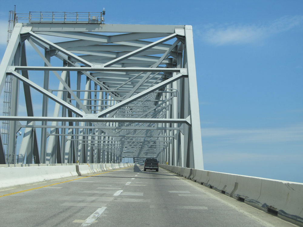
Interstate 695 Outer Loop (East): Bridge view from mile marker 48.5. (Photo taken 8/9/15). |
 |
Another view crossing the Key Bridge, approaching its peak. (Photo taken 8/9/15). |
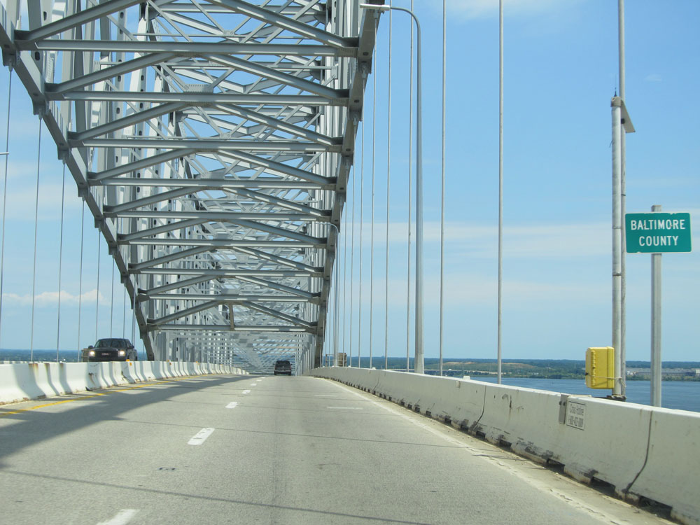 |
Near the peak of the Francis Scott Key Bridge, Interstate 695 Outer Loop (East) enters Baltimore County. (Photo taken 8/9/15). |
 |
View on Interstate 695 Outer Loop (East) at mile marker 47.9, as the Key Bridge starts its descent back down to the toll plaza. (Photo taken 8/9/15). |
 |
Interstate 695 Outer Loop (East): Bridge view from near mile marker 47.5, as the toll plaza comes into view in the distance. (Photo taken 8/9/15). |
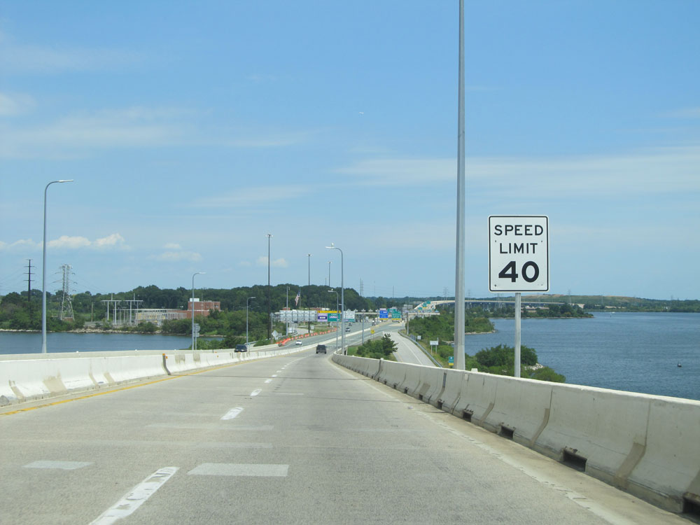 |
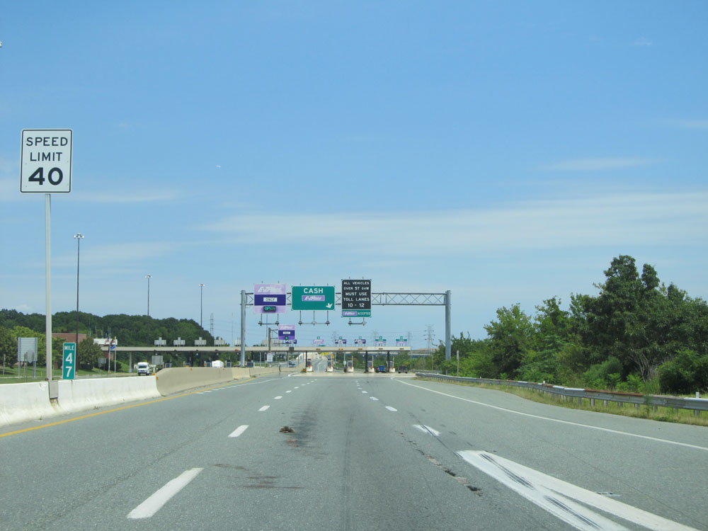
Approaching the toll plaza, the speed limit decreases to 40 mph. (Photo taken 8/9/15). |
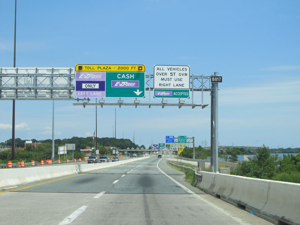 |
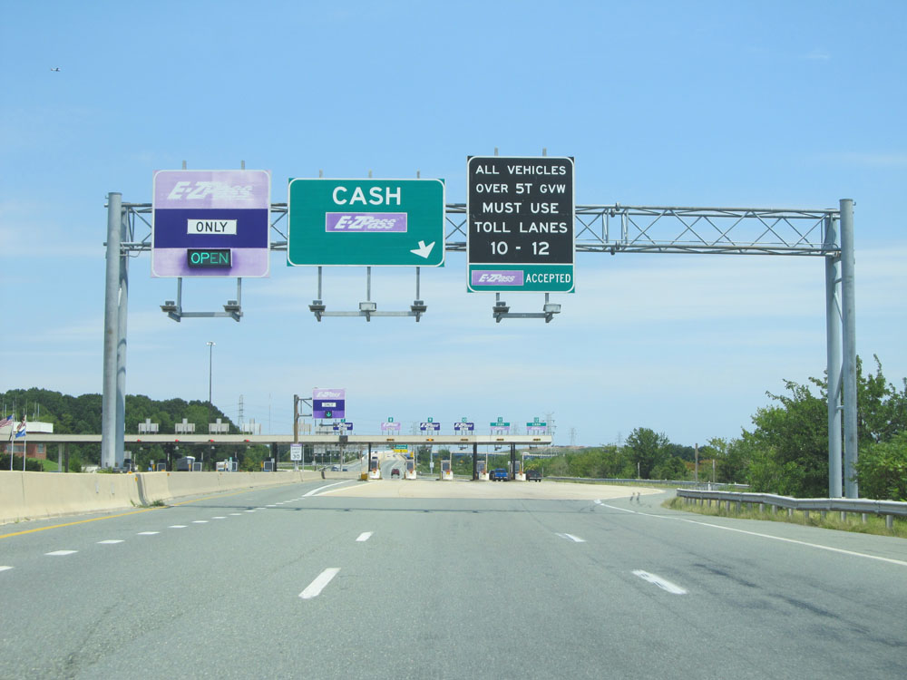
2000 feet from the toll plaza, these signs give toll payment instructions. EZ Pass is accepted in all lanes. Cash customers should keep to the right, while the left 4 lanes are for EZ Pass tagholders only. (Photo taken 8/9/15). |
 |
Keep to the right beyond the toll plaza for Exit 44. (Photo taken 8/9/15). |
 |
At mile marker 47, we're once again reminded that the speed limit is 40 mph approaching the toll plaza. (Photo taken 8/9/15). |
 |
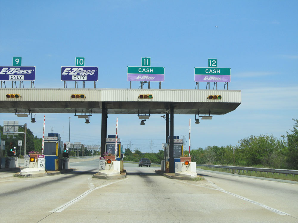
All trucks over 5 tons GVW (Gross Vehicle Weight) must use toll lanes 10-12 at the toll plaza, which are the three rightmost lanes. (Photo taken 8/9/15). |
 |
Interstate 695 Outer Loop (East) at the Key Bridge Toll Plaza, near mile marker 46.8. (Photo taken 8/9/15). |
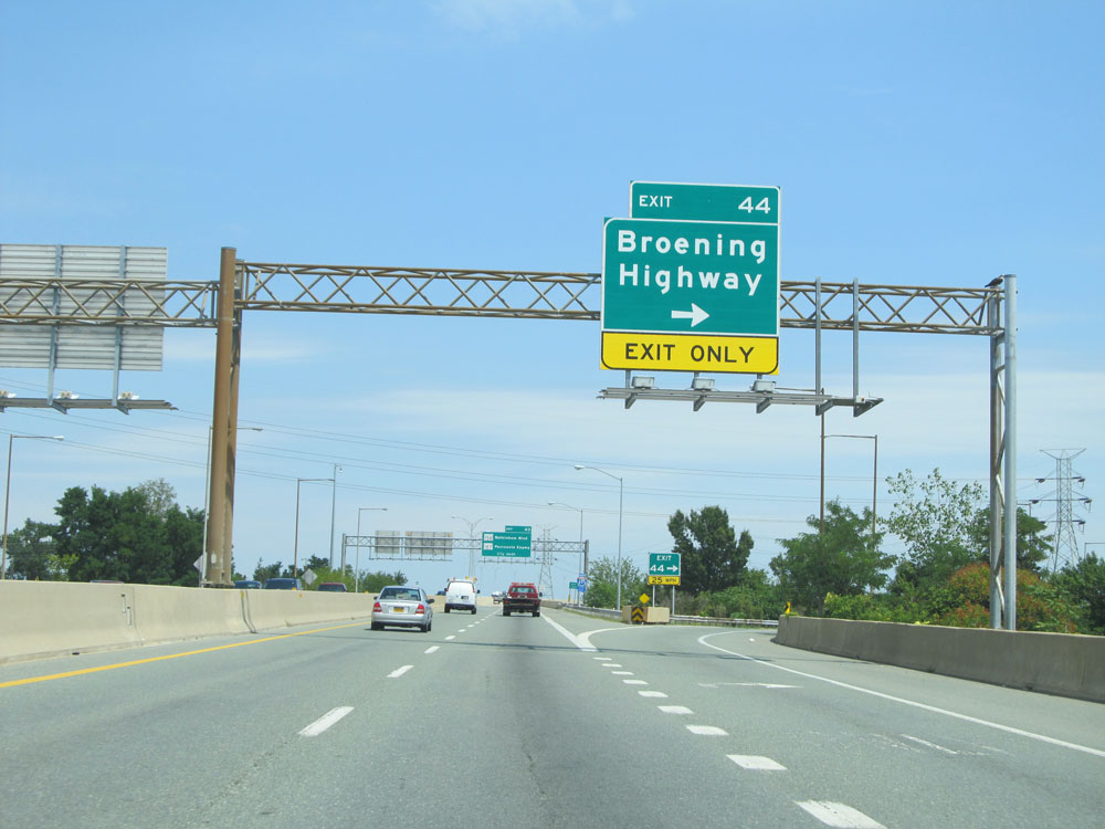 |
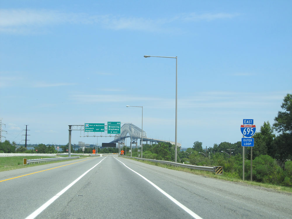
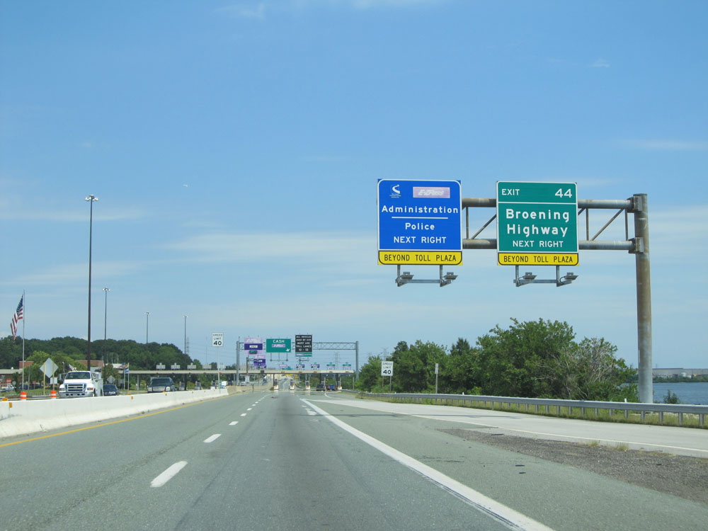
Interstate 695 Outer Loop (East) at Exit 44: Broening Highway (Photo taken 8/9/15). |
 |
Once beyond the Key Bridge Toll Plaza, the speed limit returns to 55 mph and remains that way the whole rest of the way around Interstate 695's Outer Loop. (Photo taken 8/9/15). |
 |
Interstate 695 Outer Loop (East): Road view from mile marker 46. (Photo taken 8/9/15). |
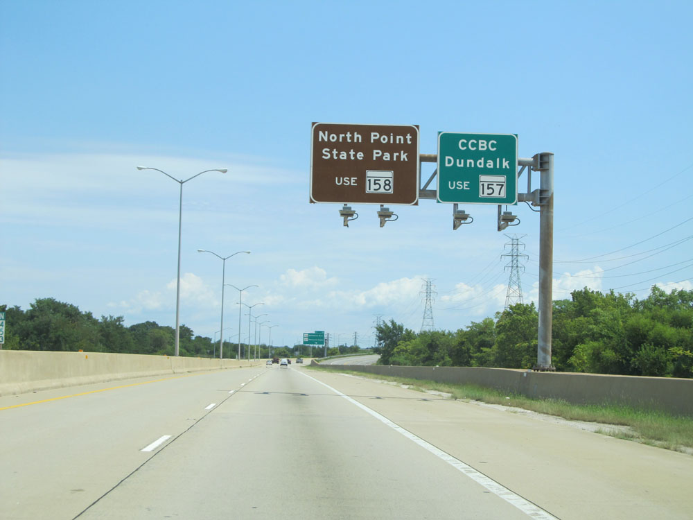 |
Use Exit 43 to North Point State Park via MD 158 and CCBC Dundalk via MD 157. (Photo taken 8/9/15). |
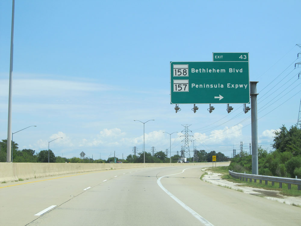 |
Interstate 695 Outer Loop (East) at Exit 43: MD 158 / MD 157 - Bethlehem Blvd / Peninsula Expwy (Photo taken 8/9/15). |
 |
Interstate 695 Outer Loop (North) assurance shield as I-695 curves to the north. (Photo taken 8/9/15). |
 |
Interstate 695 Outer Loop (North) at mile marker 44. (Photo taken 8/9/15). |
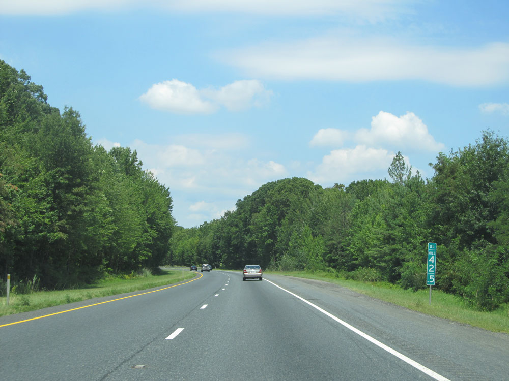 |
Interstate 695 Outer Loop (North): Road view from mile marker 42.5. Once you finally come off the bridge, you get quite the change in scenery as you can see by comparing this picture to the previous one. (Photo taken 8/9/15). |
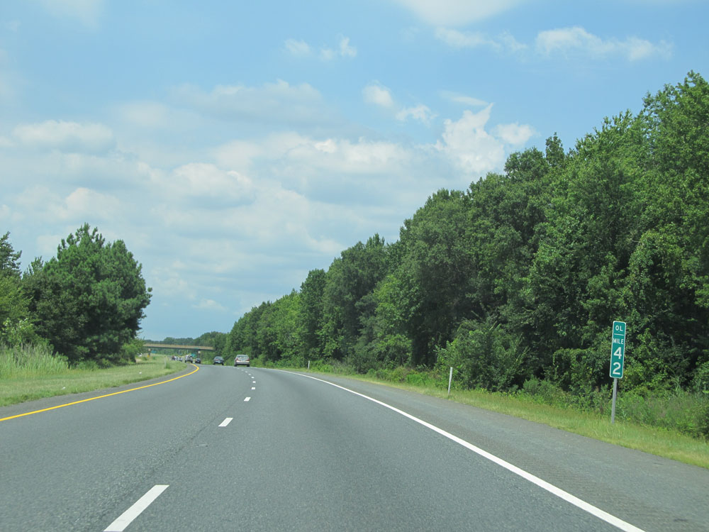 |
Interstate 695 Outer Loop (North) at mile marker 42. (Photo taken 8/9/15). |
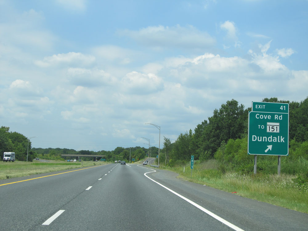 |
Interstate 695 Outer Loop (North) at Exit 41: To MD 151 - Cove Rd / Dundalk (Photo taken 8/9/15). |
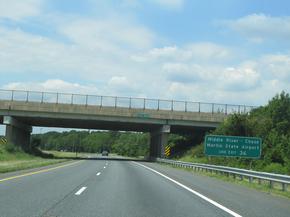 |
Use Exit 36 to Middle River, Chase, and Martin State Airport. (Photo taken 8/9/15). |
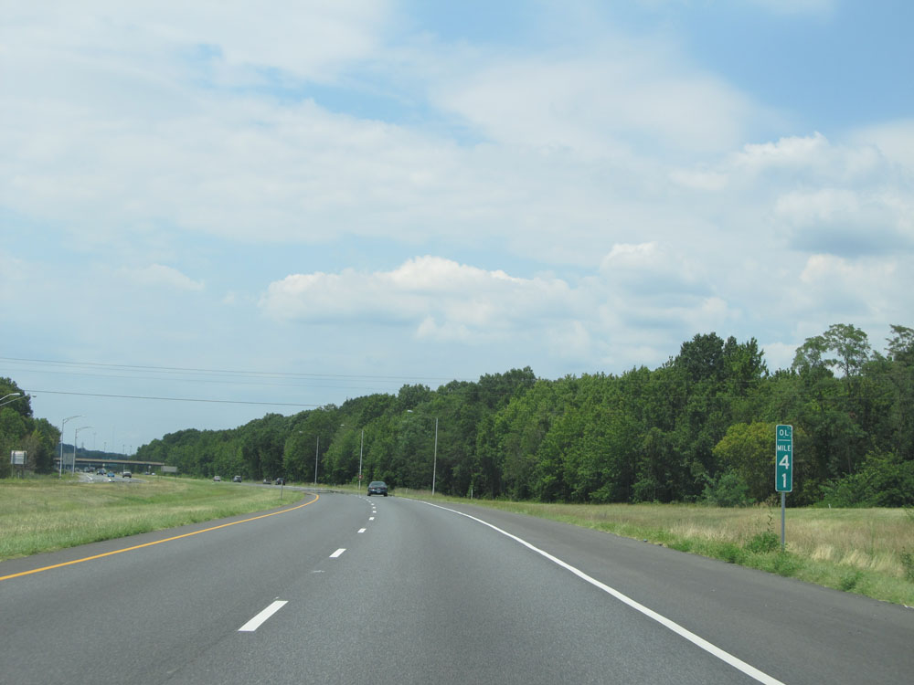 |
Interstate 695 Outer Loop (North) at mile marker 41. (Photo taken 8/9/15). |
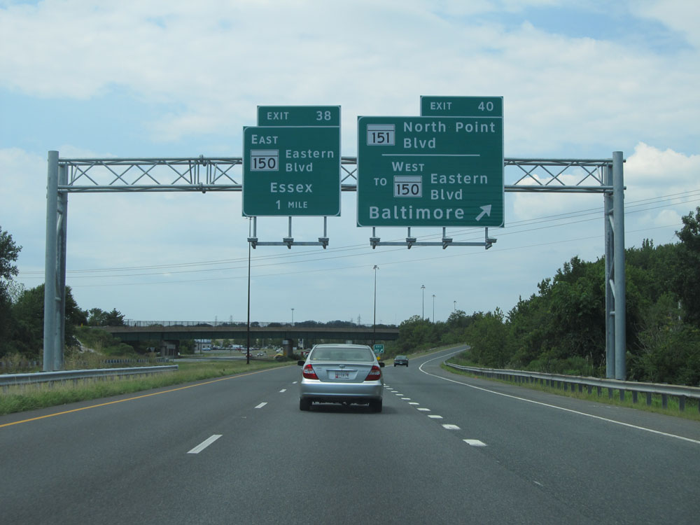 |
Interstate 695 Outer Loop (North) at Exit 40: MD 151 / To MD 150 West - North Point Blvd / Eastern Blvd / Baltimore (Photo taken 8/9/15). |
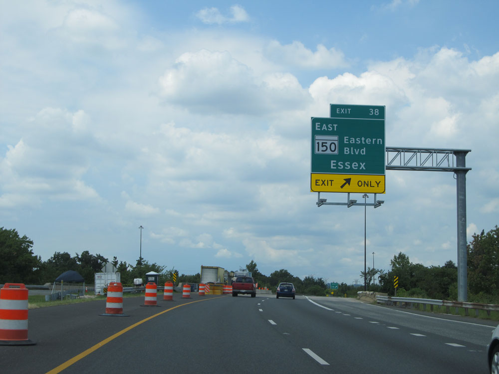 |
Interstate 695 Outer Loop (North) at Exit 38: MD 150 East - Eastern Blvd / Essex (Photo taken 8/9/15). |
 |
Interstate 695 Outer Loop (North) at mile marker 39. (Photo taken 8/9/15). |
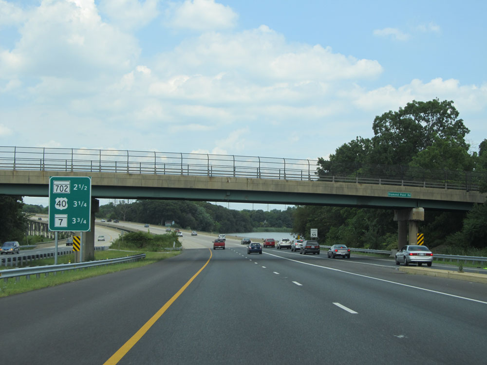 |
Sign listing the distances to the upcoming exits for MD 702, US 40, and MD 7. (Photo taken 8/9/15). |
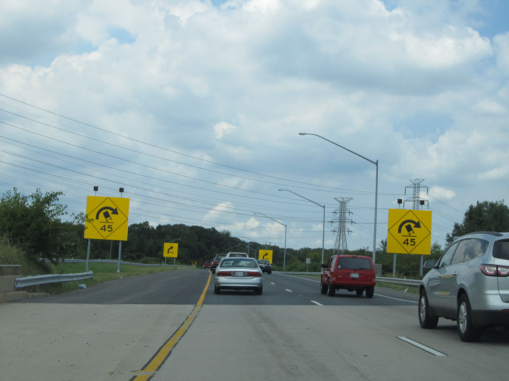 |
Interstate 695 Outer Loop (North) approaching a sharp 45 mph curve ahead. (Photo taken 8/9/15). |
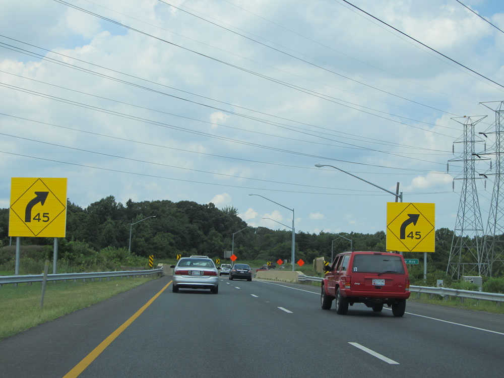 |
Interstate 695 Outer Loop (North) as it prepares to traverse a sharp right curve to the northwest of Essex. (Photo taken 8/9/15). |
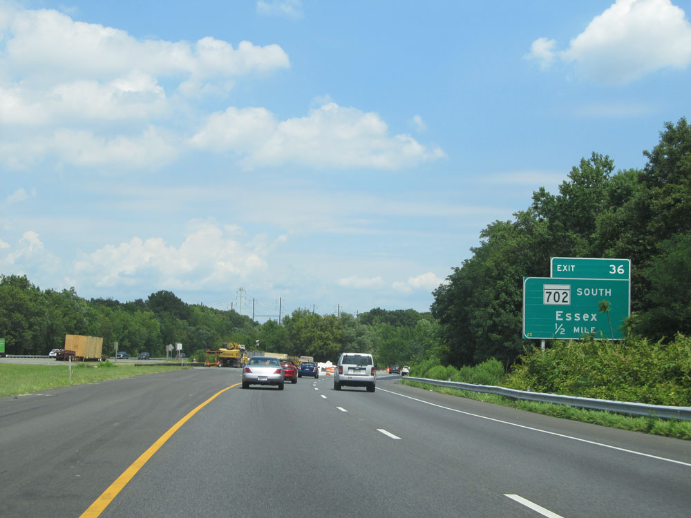 |
Interstate 695 Outer Loop (North) approaching Exit 36 - 1/2 mile. (Photo taken 8/9/15). |
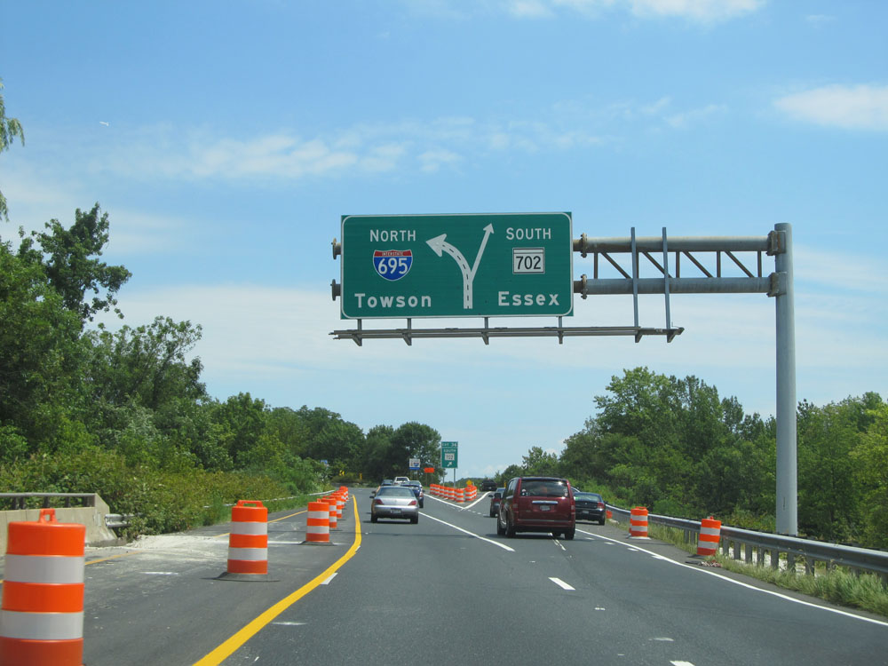 |
Interstate 695 Outer Loop (North) at Exit 36: MD 702 South - Essex (Photo taken 8/9/15). |
 |
A closer view of the Exit sign for Exit 36, since the Exit sign seen in the previous picture was a bit unorthodox. (Photo taken 8/9/15). |
 |
View on Interstate 695 Outer Loop (North) just past Exit 36, as it curves back to the north after heading east and bypassing downtown Essex briefly. (Photo taken 8/9/15). |
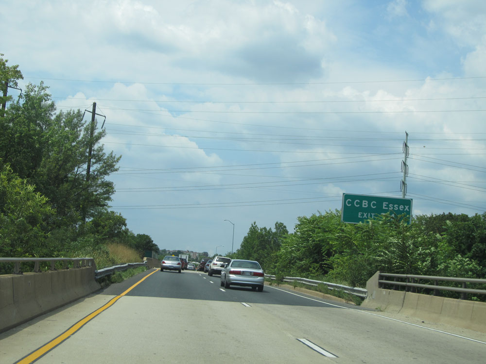 |
Take Exit 34 to CCBC Essex. (Photo taken 8/9/15). |
 |
Interstate 695 Outer Loop (North) at Exit 35B: US 40 East - Pulaski Hwy / Aberdeen (Photo taken 8/9/15). |
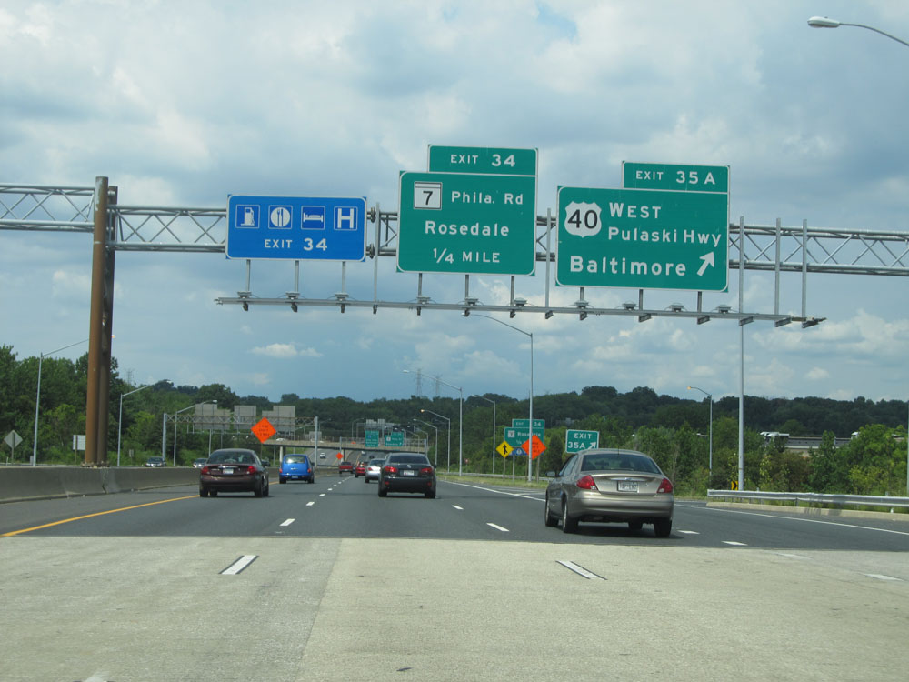 |
Interstate 695 Outer Loop (North) at Exit 35A: US 40 West - Pulaski Hwy / Baltimore (Photo taken 8/9/15). |
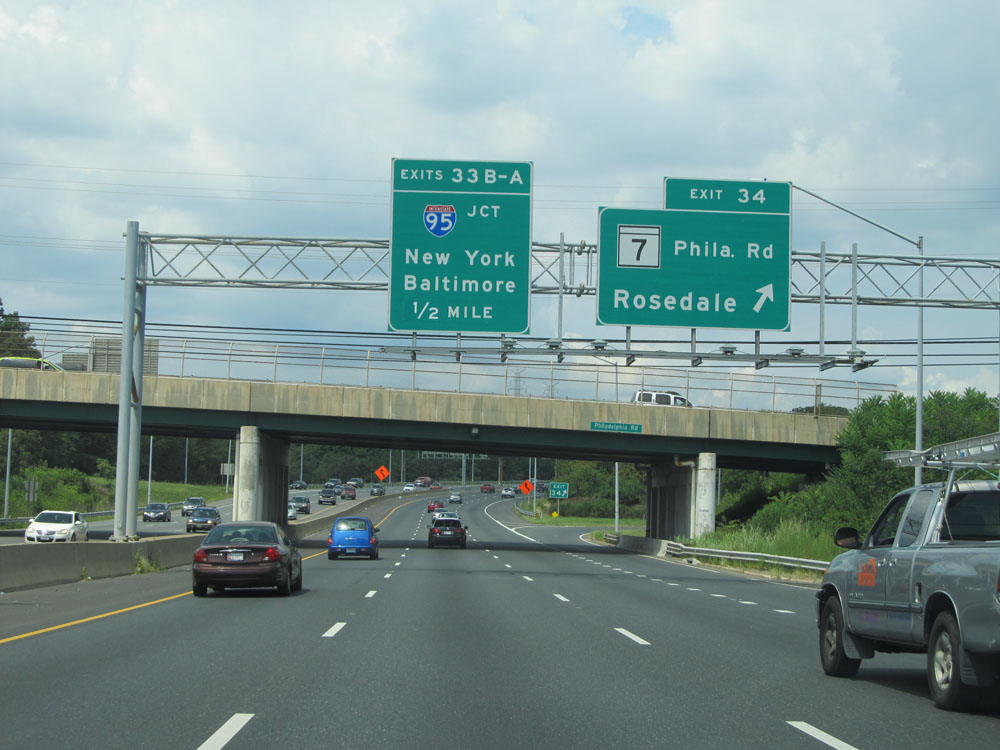 |
Interstate 695 Outer Loop (North) at Exit 34: MD 7 - Philadelphia Rd / Rosedale (Photo taken 8/9/15). |
 |
Interstate 695 Outer Loop (North) approaching Exit 33 - 1/4 mile. (Photo taken 8/9/15). |
 |
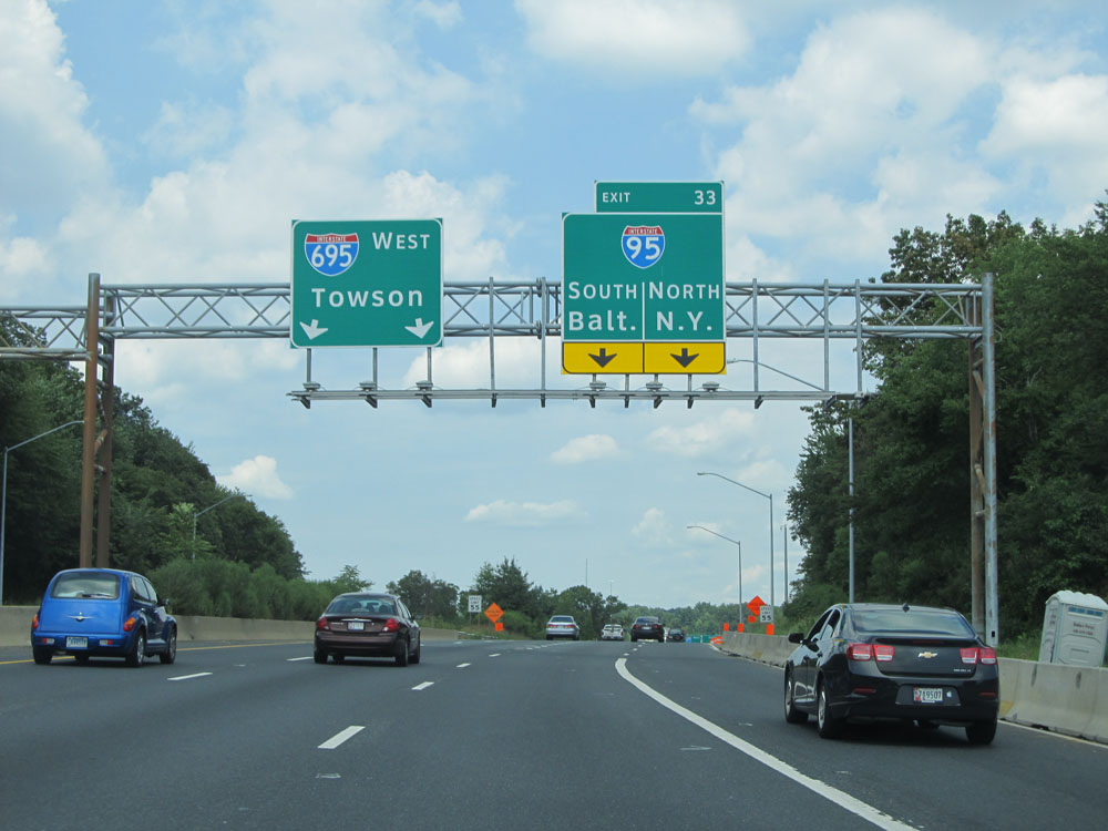
Interstate 695 Outer Loop (North) at Exit 33: Interstate 95 - New York / Baltimore (Photo taken 8/9/15). |
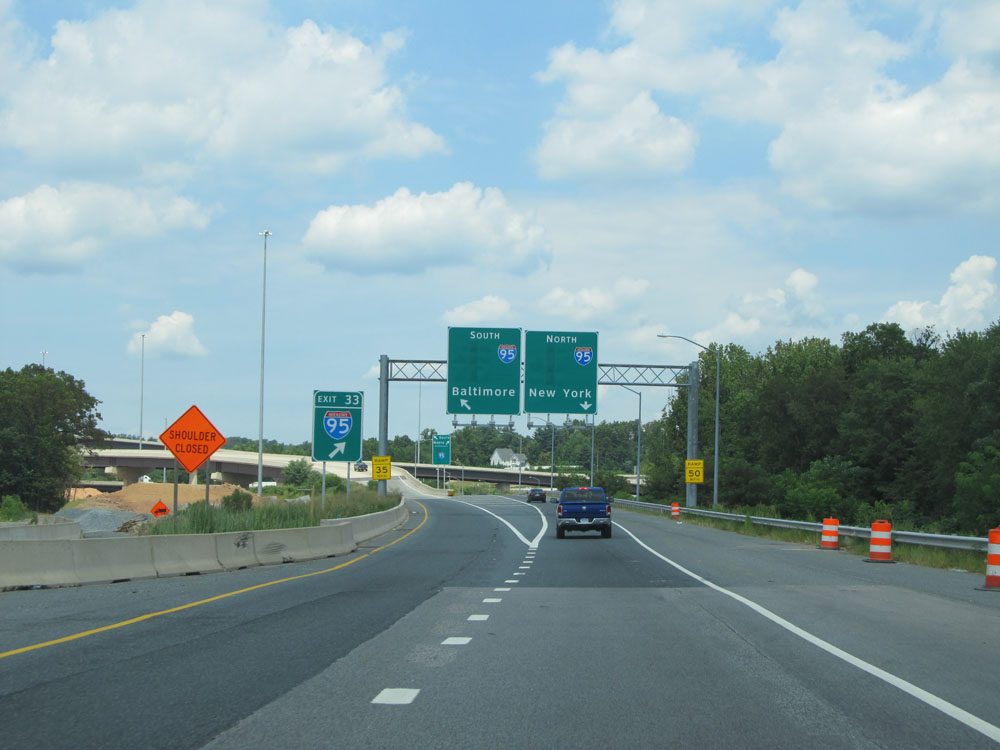 |
A closer view of the off ramp for Exit 33. Keep to the left for Interstate 95 South to Baltimore. Keep to the right for Interstate 95 North toward New York City. (Photo taken 8/9/15). |
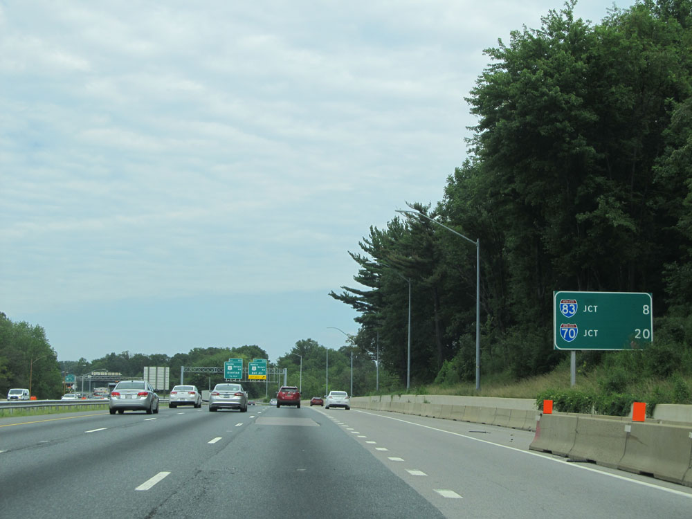 |
Sign listing the distances to the junctions of the next two 2-digit Interstates on I-695 Outer Loop. It's 8 miles to the junction of Interstate 83 and 20 miles to the junction of Interstate 70. (Photo taken 8/7/15). |
 |
Interstate 695 Outer Loop (North) at Exit 32B: US 1 North - Belair Rd / Bel Air (Photo taken 8/7/15). |
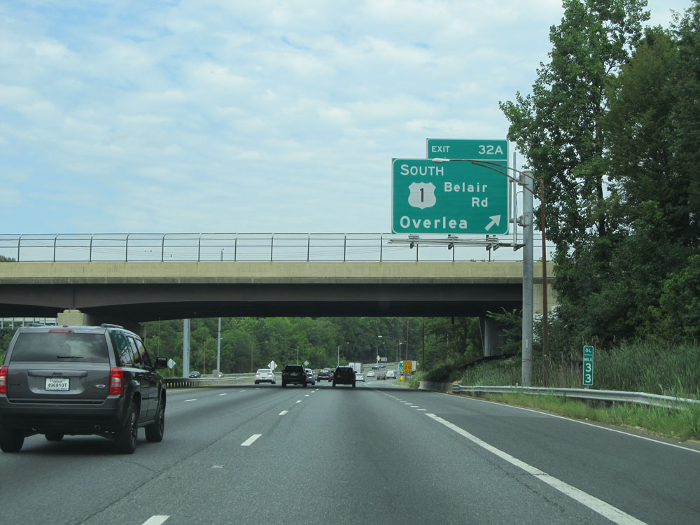 |
Interstate 695 Outer Loop (North) at Exit 32A: US 1 South - Belair Rd / Overlea (Photo taken 8/7/15). |
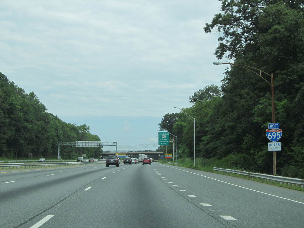 |
Interstate 695 West assurance shield as the Outer Loop finally curves to the west around the northern outskirts of the Baltimore area. (Photo taken 8/7/15). |
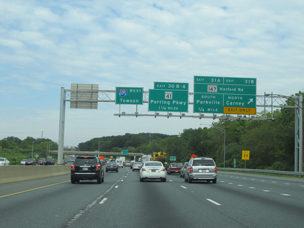 |
Interstate 695 Outer Loop (West) at Exit 31B: MD 147 North - Harford Rd / Carney (Photo taken 8/7/15). |
 |
Interstate 695 Outer Loop (West) at Exit 31A: MD 147 South - Harford Rd / Parkville (Photo taken 8/7/15). |
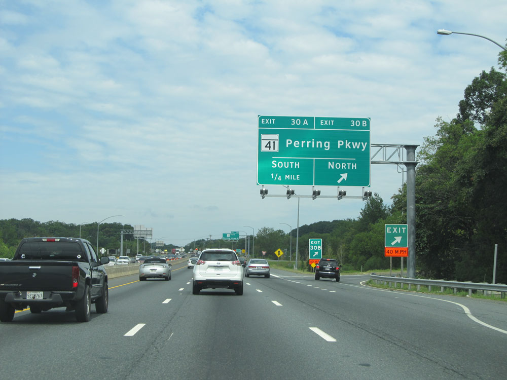 |
Interstate 695 Outer Loop (West) at Exit 30B: MD 41 North - Perring Pkwy (Photo taken 8/7/15). |
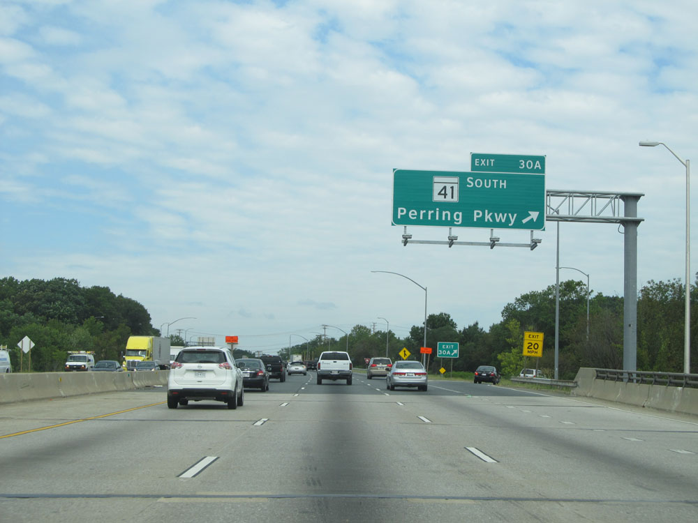 |
Interstate 695 Outer Loop (West) at Exit 30A: MD 41 South - Perring Pkwy (Photo taken 8/7/15). |
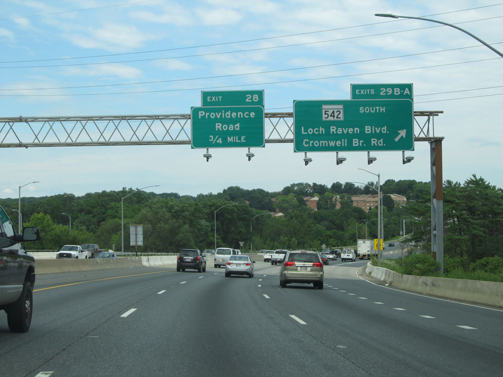 |
Interstate 695 Outer Loop (West) at Exits 29B-A: MD 542 South - Loch Raven Blvd / Cromwell Bridge Rd (Photo taken 8/7/15). |
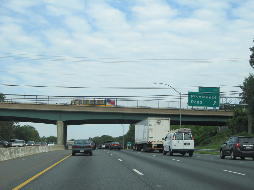 |
Interstate 695 Outer Loop (West) at Exit 28: Providence Road (Photo taken 8/7/15). |
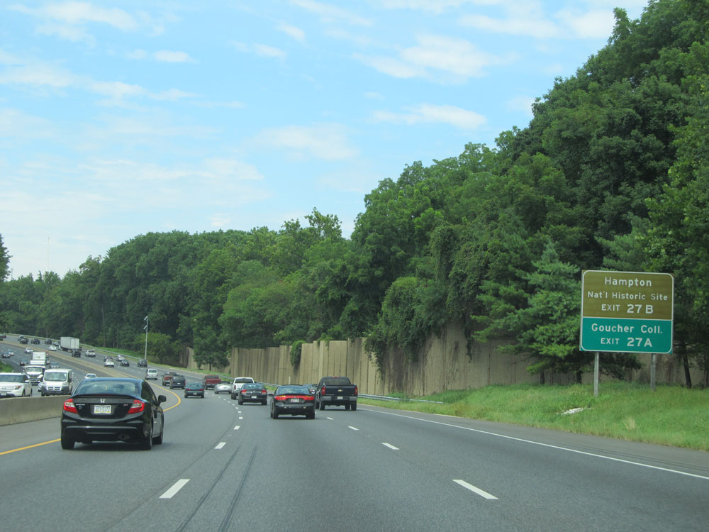 |
Take Exit 27B to Hampton National Historic Site. Take Exit 27A to Goucher College. (Photo taken 8/7/15). |
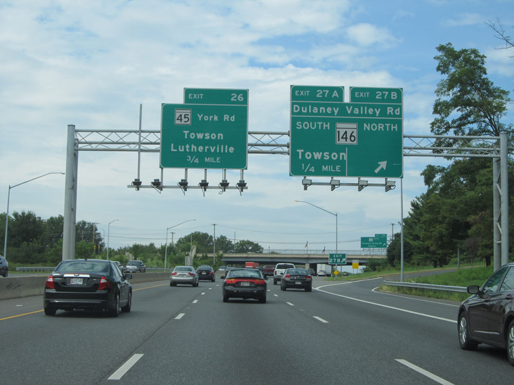 |
Interstate 695 Outer Loop (West) at Exit 27B: MD 146 North - Dulaney Valley Rd (Photo taken 8/7/15). |
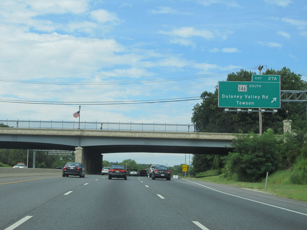 |
Interstate 695 Outer Loop (West) at Exit 27A: MD 146 South - Dulaney Valley Rd / Towson (Photo taken 8/7/15). |
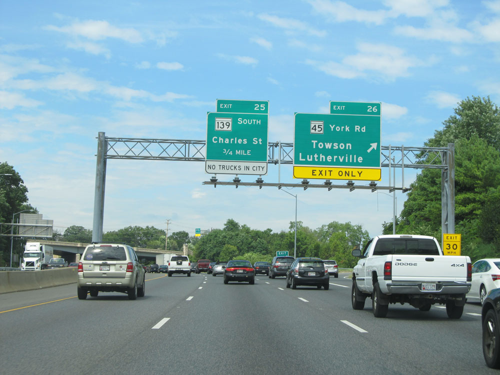 |
Interstate 695 Outer Loop (West) at Exit 26: MD 45 - York Rd / Towson / Lutherville (Photo taken 8/7/15). |
Section 2: Towson (Exit 26) to Mile Marker 0
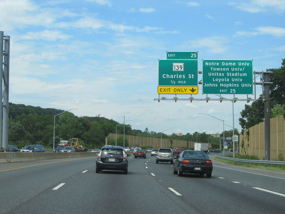 |
Take Exit 25 to Notre Dame of Maryland University, Towson University / Unitas Stadium, Loyola University, and Johns Hopkins University. That's a lot of universities for one exit. (Photo taken 8/7/15). |
 |
Interstate 695 Outer Loop (West) assurance shield approaching Exit 25. (Photo taken 8/7/15). |
 |
Interstate 695 Outer Loop (West) at Exit 25: MD 139 - Charles St (Photo taken 8/7/15). |
 |
Interstate 695 Outer Loop (West) approaching Exit 24 - 1/4 mile. (Photo taken 8/7/15). |
 |
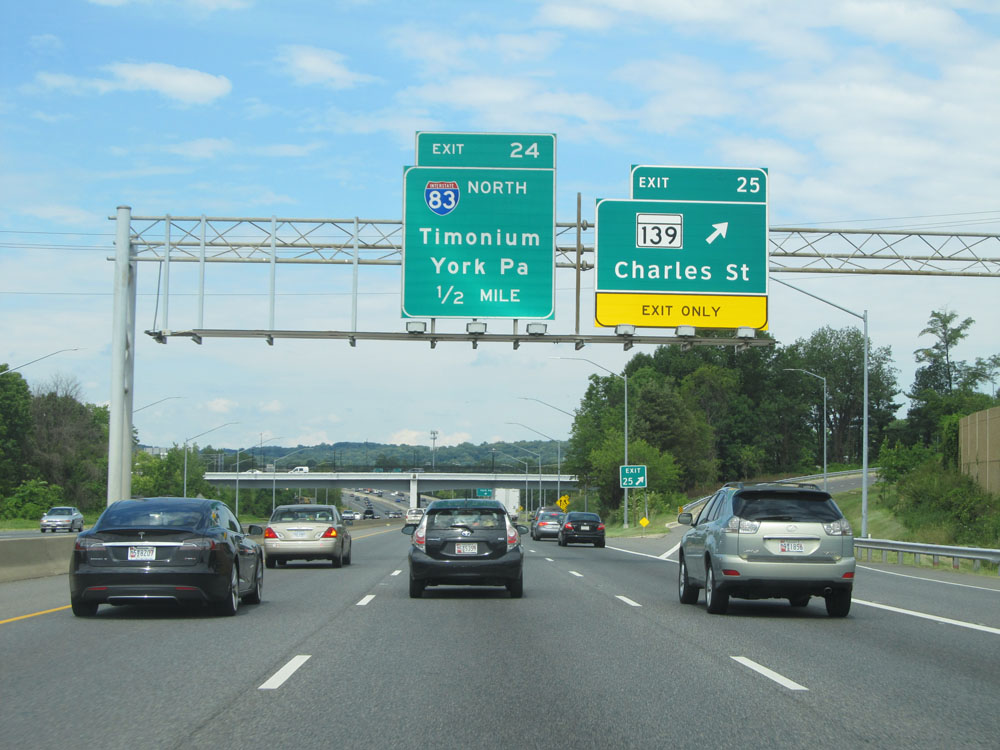
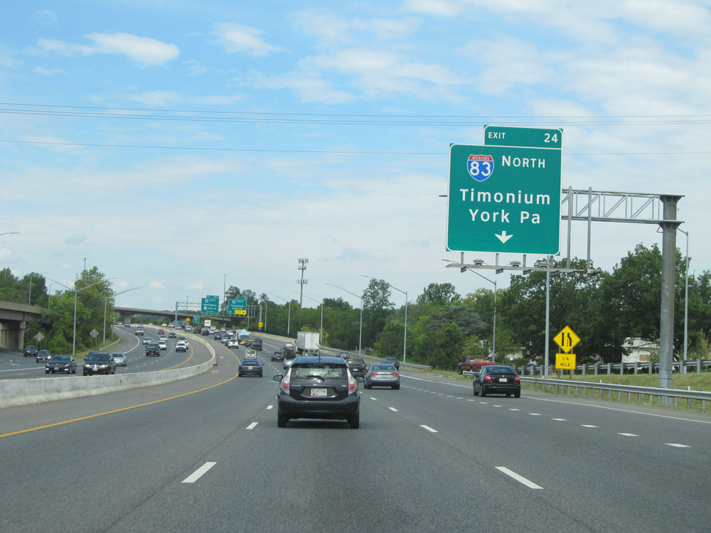
Interstate 695 Outer Loop (West) at Exit 24: Interstate 83 North - Timonium / York, PA. I-695 West and I-83 South run concurrently for about the next mile or so. (Photo taken 8/7/15). |
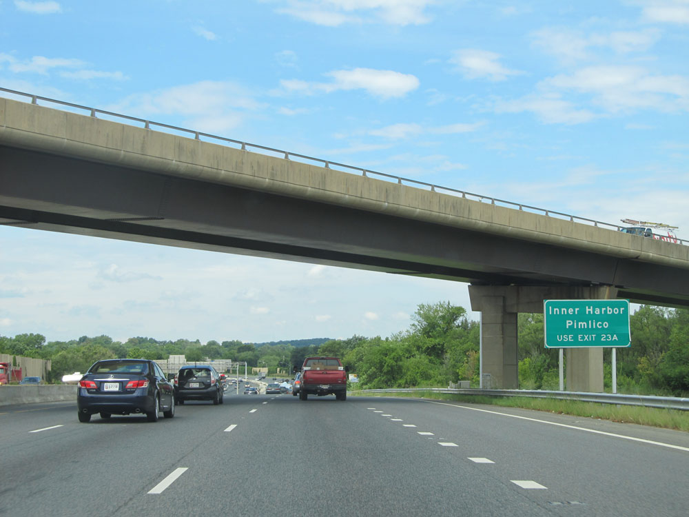 |
Take Exit 23A to Inner Harbor and Pimlico. (Photo taken 8/7/15). |
 |
Interstate 695 Outer Loop (West) approaching Exits 23B-A - 1/2 mile. (Photo taken 8/7/15). |
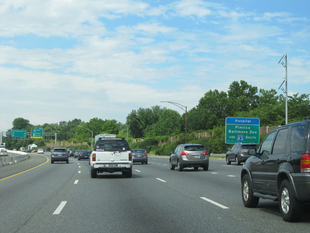 |
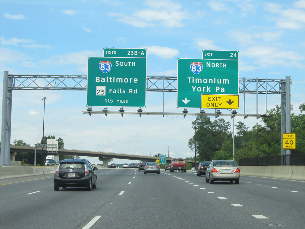
Use Interstate 83 South via Exit 23A to Pimlico and the Baltimore Zoo. (Photo taken 8/7/15). |
 |
Interstate 695 Outer Loop (West) at Exit 23B: MD 25 - Falls Rd; Exit 23A: Interstate 83 South - Baltimore (Photo taken 8/7/15). |
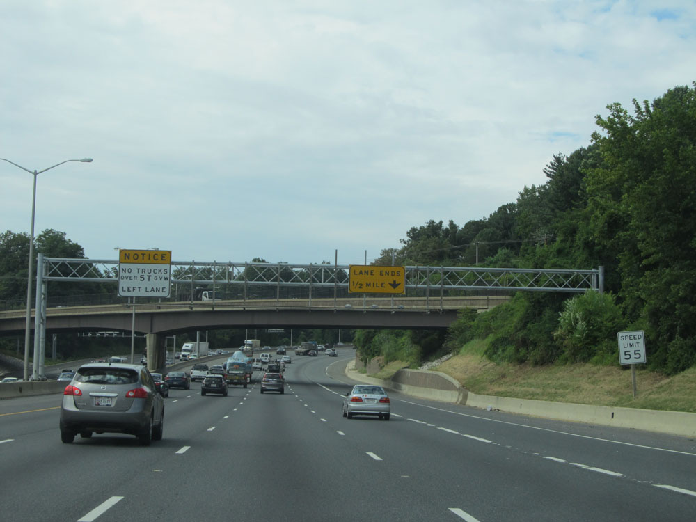 |
Speed limit sign just past Exits 23B-A. As a reminder, the speed limit on almost all of Interstate 695 is 55 mph, with the exception of the brief stretch approaching the Key Bridge Toll Plaza, which is 40 mph. (Photo taken 8/7/15). |
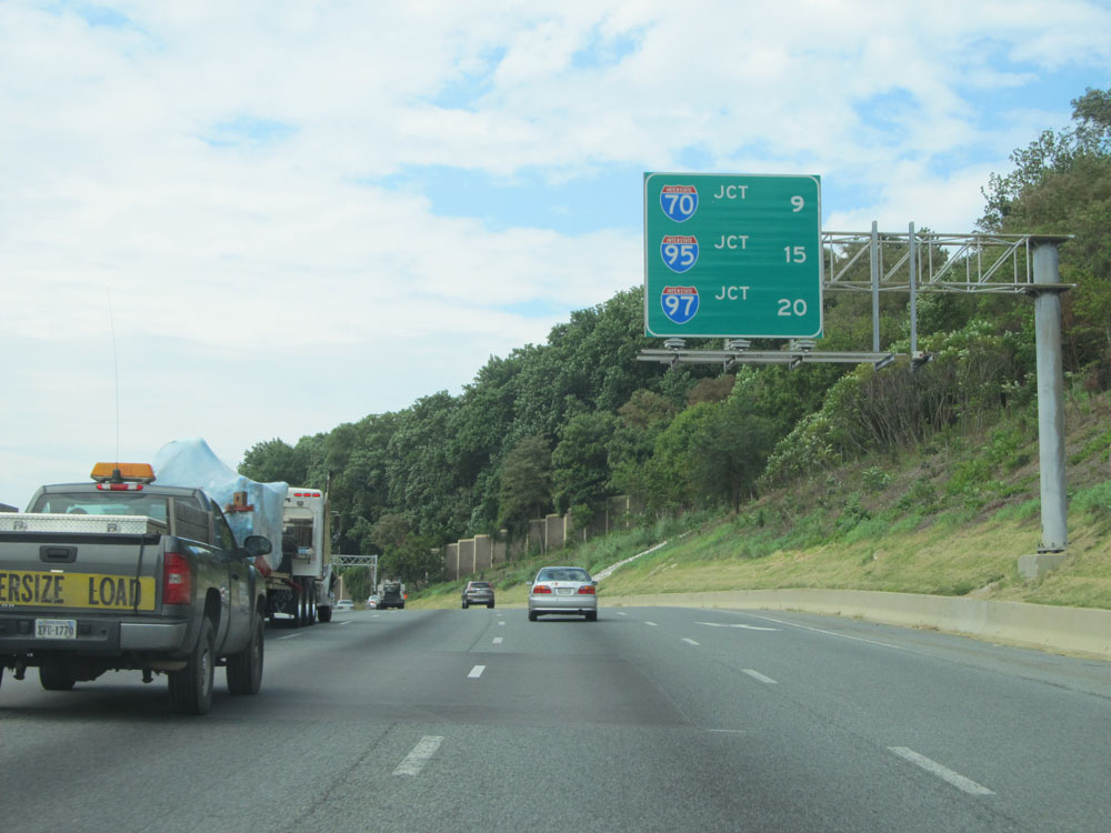 |
This sign lists the distances to the junctions of the next three 2-digit Interstates on Interstate 695 Outer Loop. It's 9 miles to the junction of Interstate 70, 15 miles to the junction of Interstate 95 on the south side of Baltimore, and 20 miles to the junction of Interstate 97. (Photo taken 8/7/15). |
 |
Take Exit 22 to Stevenson University Greenspring Campus. (Photo taken 8/7/15). |
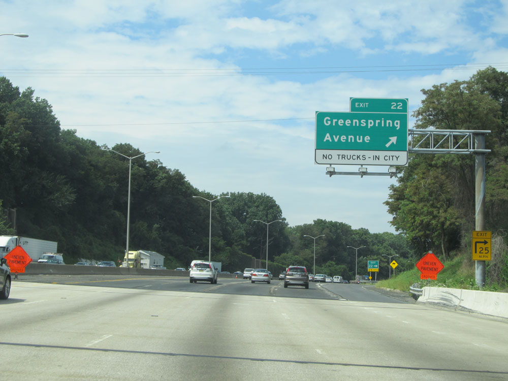 |
Interstate 695 Outer Loop (West) at Exit 22: Greenspring Avenue. No trucks are allowed to use this exit to downtown. (Photo taken 8/7/15). |
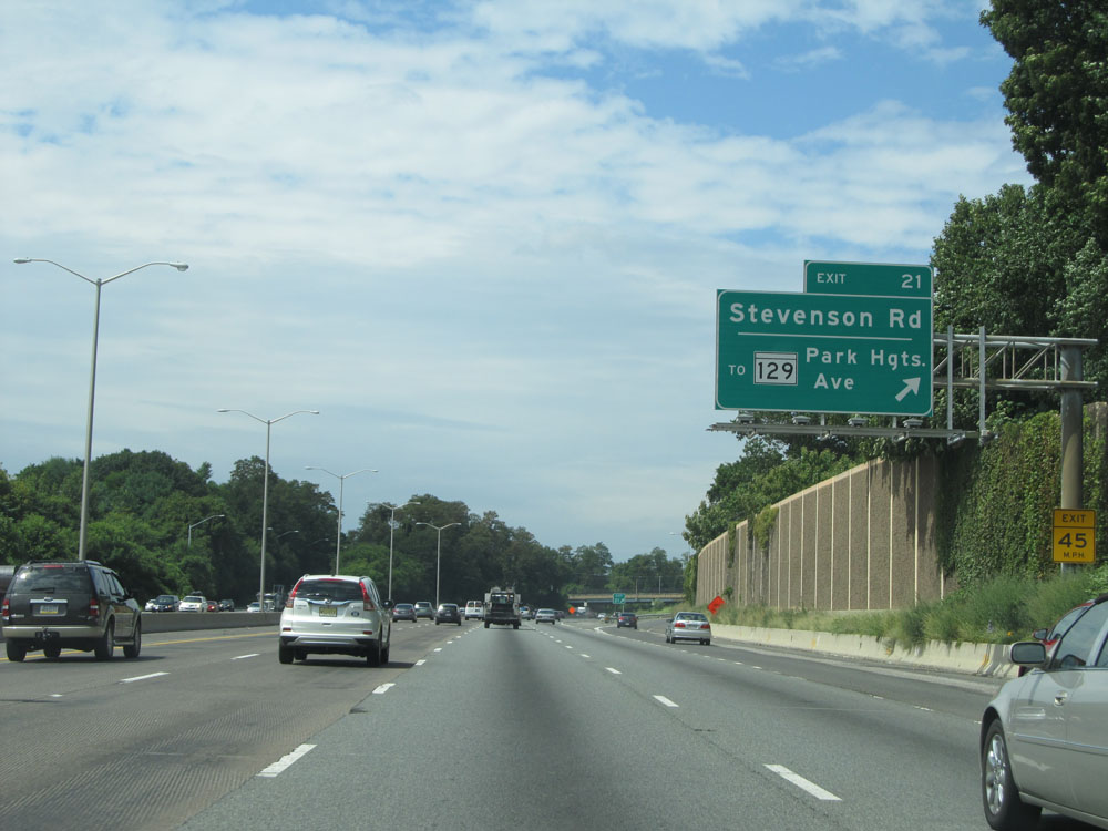 |
Interstate 695 Outer Loop (West) at Exit 21: To MD 129 - Stevenson Rd / Park Heights Ave (Photo taken 8/7/15). |
 |
Sign listing the distances to the three upcoming exits on Interstate 695 Outer Loop. (Photo taken 8/7/15). |
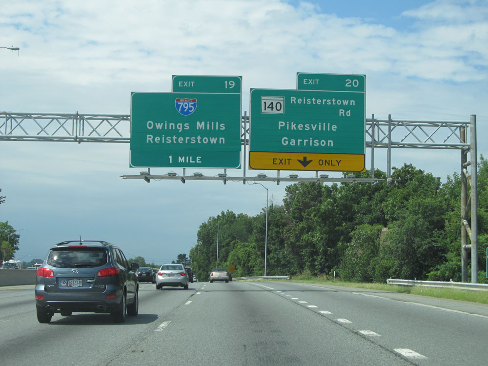 |
Interstate 695 Outer Loop (West) at Exit 20: MD 140 - Reisterstown Rd / Pikesville / Garrison (Photo taken 8/7/15). |
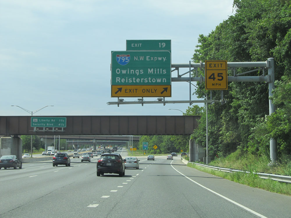 |
Interstate 695 Outer Loop (West) at Exit 19: Interstate 795 (Northwest Expressway) - Owings Mills / Reisterstown (Photo taken 8/7/15). |
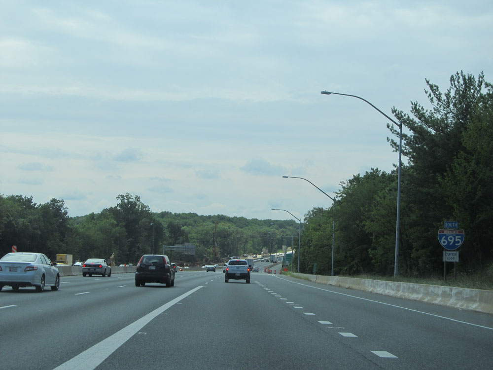 |
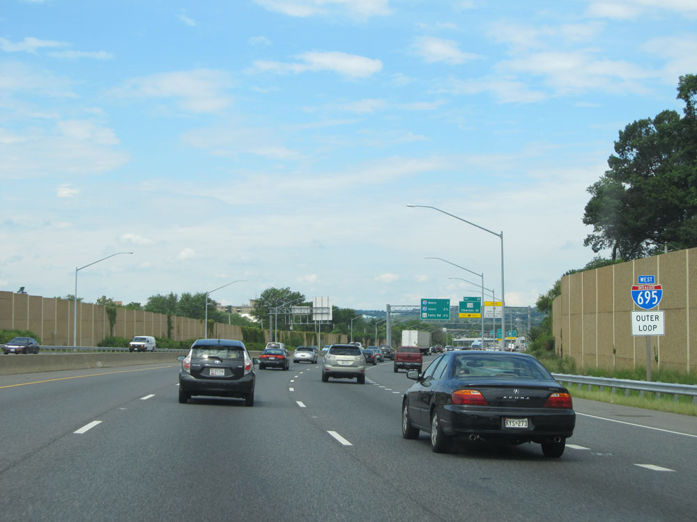
After Exit 19, Interstate 695 curves to the south and we see this Interstate 695 Outer Loop (South) assurance shield. (Photo taken 8/7/15). |
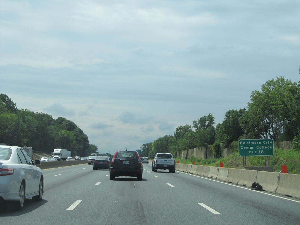 |
Take Exit 18 to Baltimore City Community College. (Photo taken 8/7/15). |
 |
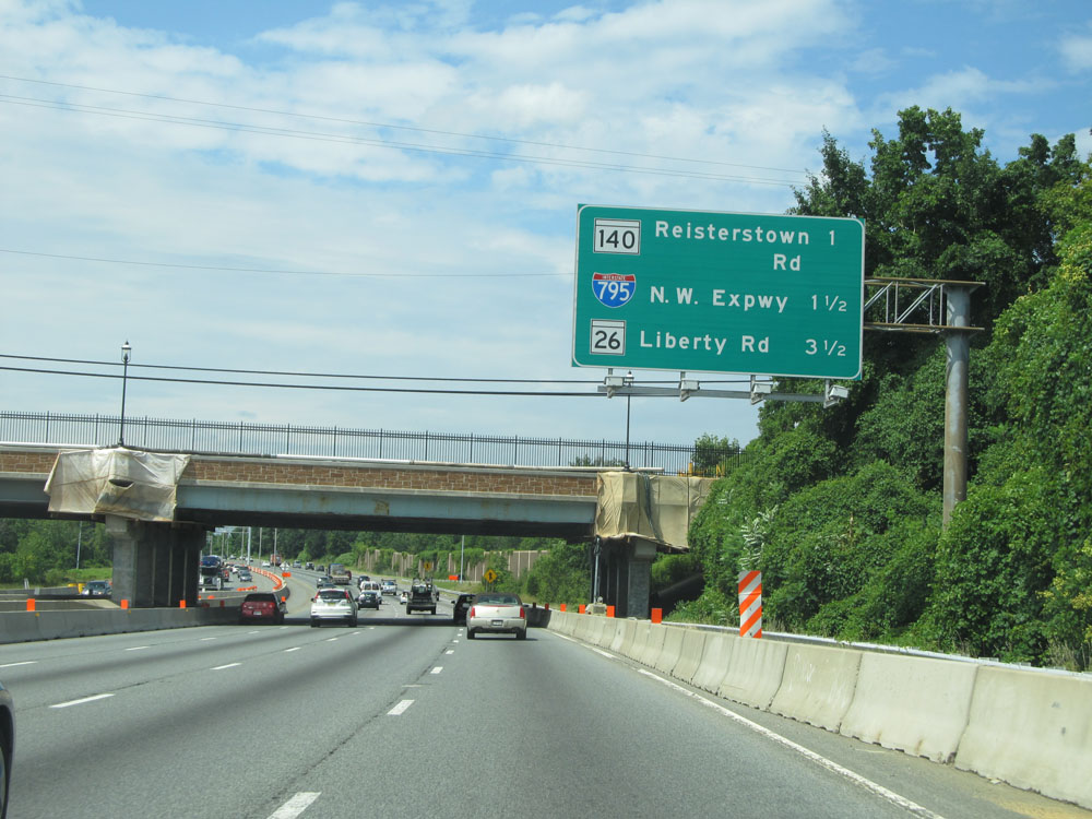
Interstate 695 Outer Loop (South) at Exit 18: MD 26 - Liberty Road / Lochearn / Randallstown (Photo taken 8/7/15). |
 |
Interstate 695 Outer Loop (South) approaching Exits 16B-A - 1 1/4 miles. (Photo taken 8/7/15). |
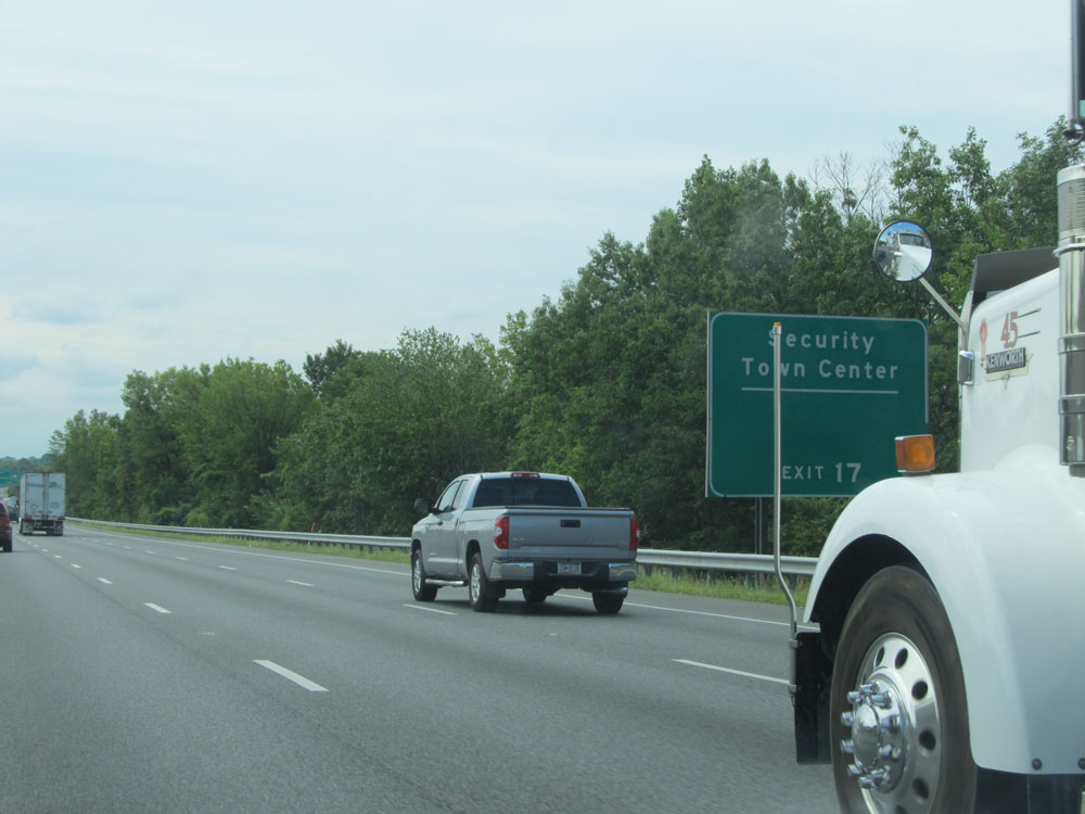 |
Take Exit 17 to Security Town Center. (Photo taken 8/7/15). |
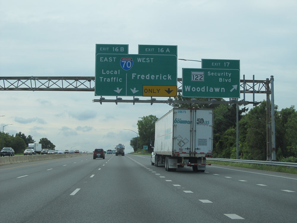 |
Interstate 695 Outer Loop (South) at Exit 17: MD 122 - Security Blvd / Woodlawn (Photo taken 8/7/15). |
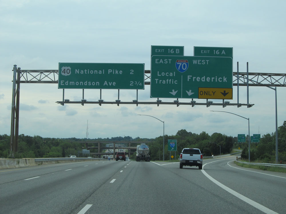 |
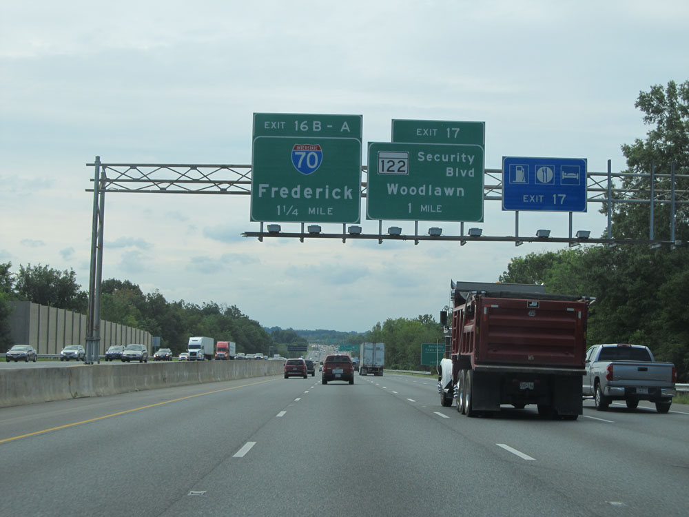
Interstate 695 Outer Loop (South) at Exits 16B-A: Interstate 70 - Local Traffic / Frederick (Photo taken 8/7/15). |
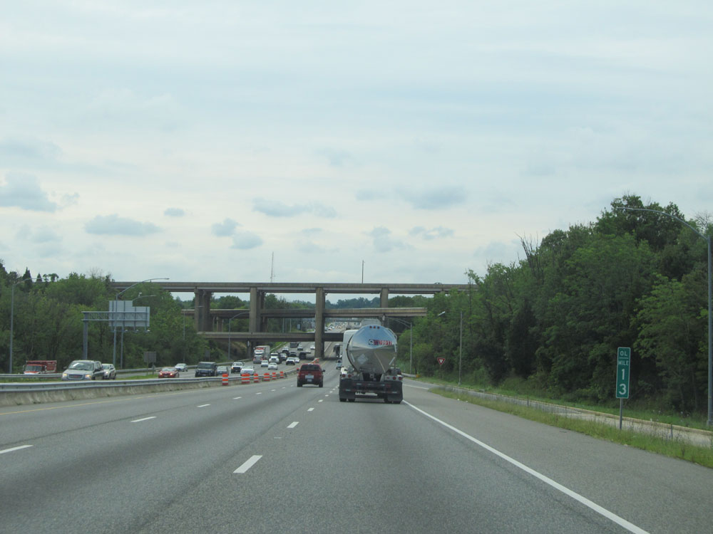 |
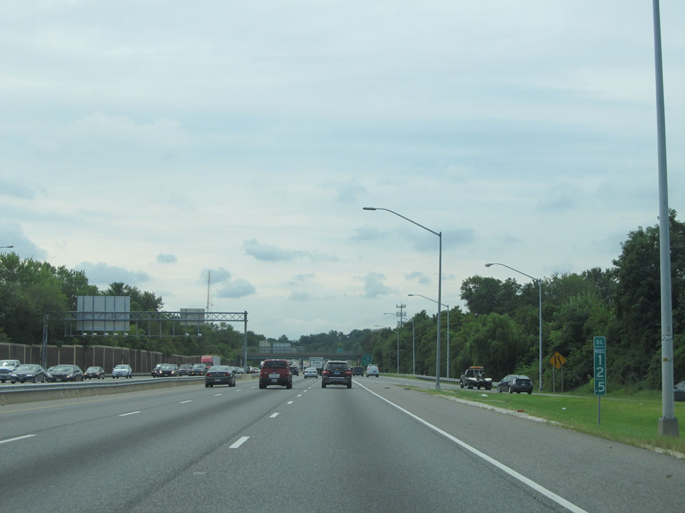
Interstate 695 Outer Loop (South): Road view from mile marker 13. (Photo taken 8/7/15). |
 |
Interstate 695 Outer Loop (South) at mile marker 12.5, as we see traffic from Interstate 70 East merging onto I-695 South. (Photo taken 8/7/15). |
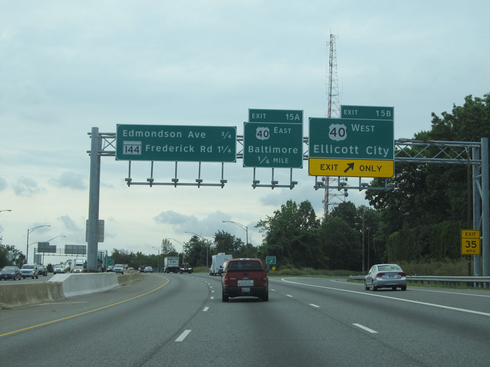 |
Interstate 695 Outer Loop (South) at Exit 15B: US 40 West - Ellicott City (Photo taken 8/7/15). |
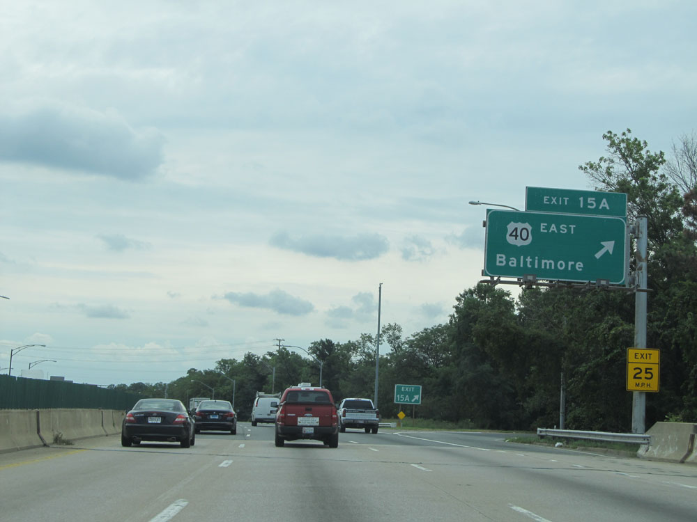 |
Interstate 695 Outer Loop (South) at Exit 15A: US 40 East - Baltimore (Photo taken 8/7/15). |
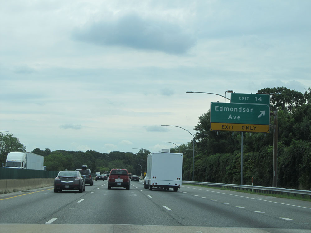 |
Interstate 695 Outer Loop (South) at Exit 14: Edmondson Ave (Photo taken 8/7/15). |
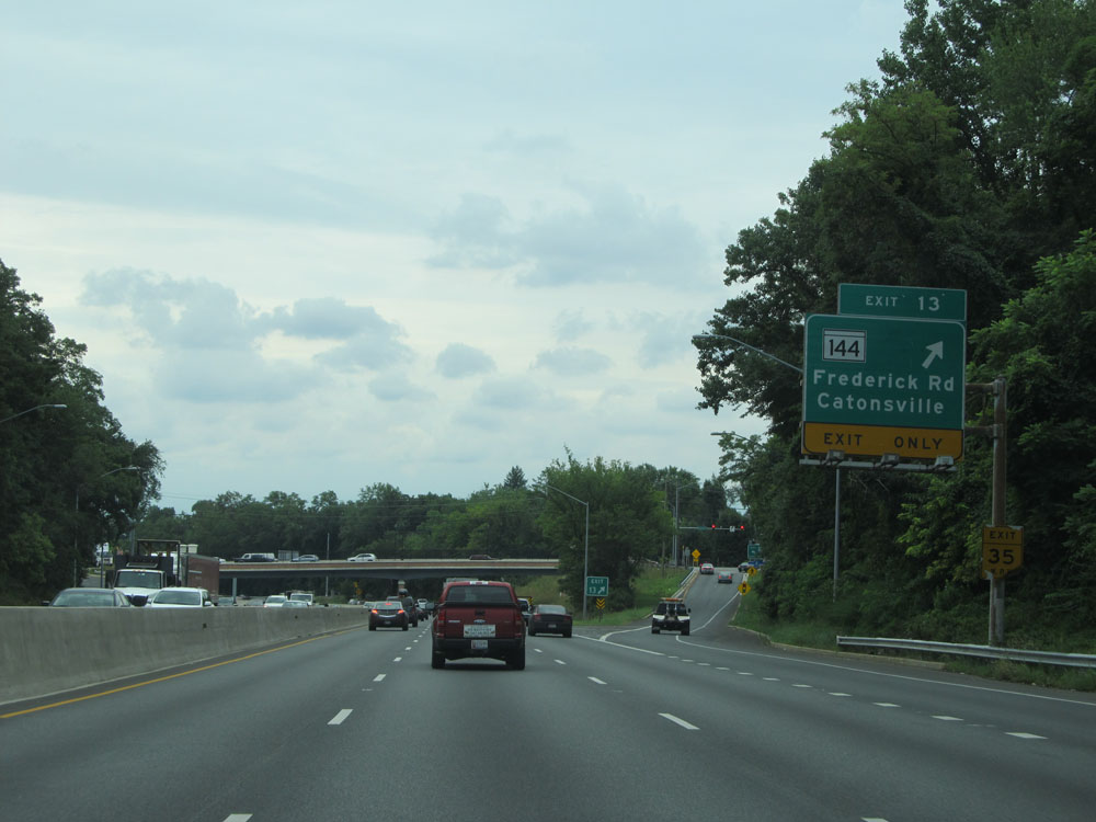 |
Interstate 695 Outer Loop (South) at Exit 13: MD 144 - Frederick Rd / Catonsville (Photo taken 8/7/15). |
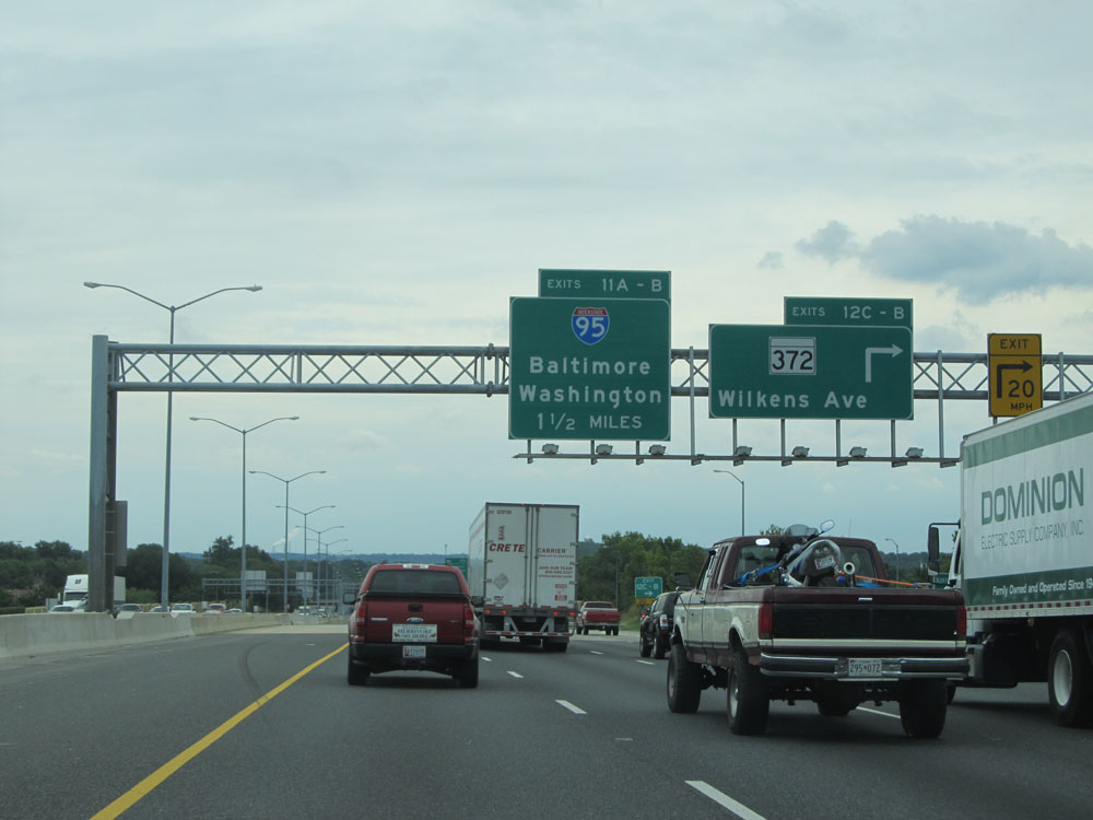 |
Interstate 695 Outer Loop (South) at Exits 12C-B: MD 372 - Wilkens Ave (Photo taken 8/7/15). |
 |
Interstate 695 Outer Loop (South) approaching Exits 11B-A - 1 mile. (Photo taken 8/7/15). |
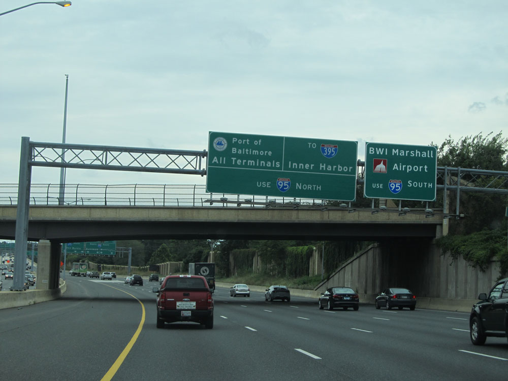 |
Use Exit 11B (Interstate 95 South) to BWI Marshall Airport. Use Exit 11A (Interstate 95 North) to all Port of Baltimore Terminals and Interstate 395 to Inner Harbor. (Photo taken 8/7/15). |
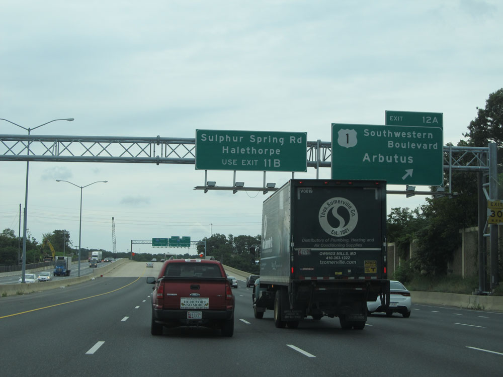 |
Interstate 695 Outer Loop (South) at Exit 12A: US 1 - Southwestern Boulevard / Arbutus (Photo taken 8/7/15). |
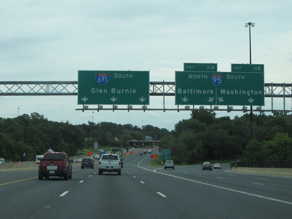 |
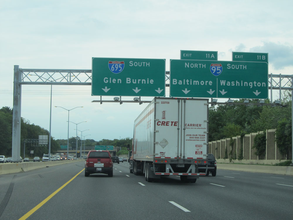
Interstate 695 Outer Loop (South) at Exit 11B: Interstate 95 South - Washington; Exit 11A: Interstate 95 North - Baltimore (Photo taken 8/7/15). |
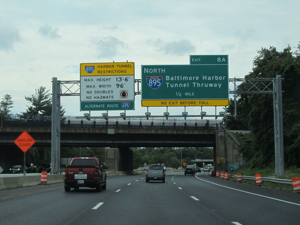 |
Interstate 695 Outer Loop (South) approaching Exit 8A - 1/2 mile. This advance mileage sign is accompanied by a sign to the left listing the restrictions through the Harbor Tunnel on Interstate 895. (Photo taken 8/7/15). |
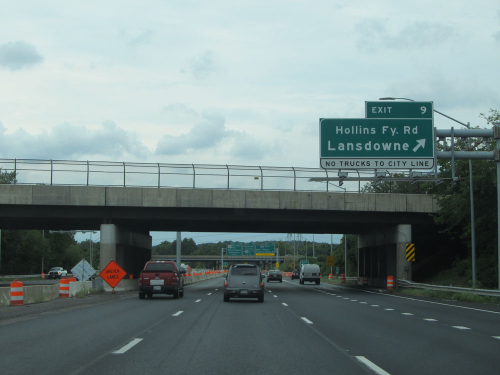 |
Interstate 695 Outer Loop (South) at Exit 9: Hollins Ferry Rd / Lansdowne. Trucks are not allowed to take this exit to the city line. (Photo taken 8/7/15). |
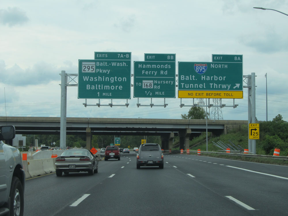 |
Interstate 695 Outer Loop (South) at Exit 8A: Interstate 895 North - Baltimore Harbor Tunnel Thruway (Photo taken 8/7/15). |
 |
Interstate 695 Outer Loop (South) at Exit 8B: MD 168 - Hammonds Ferry Rd / Nursery Rd (Photo taken 8/7/15). |
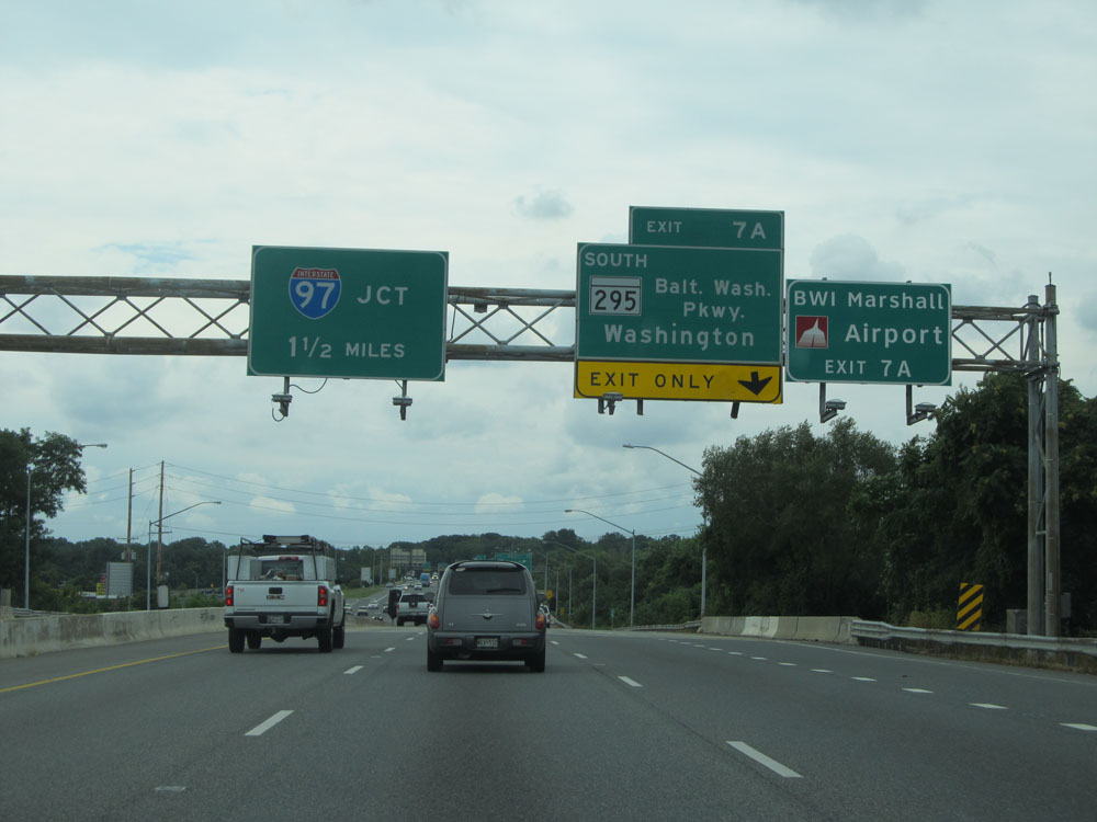 |
Take Exit 7A to BWI Marshall Airport. (Photo taken 8/7/15). |
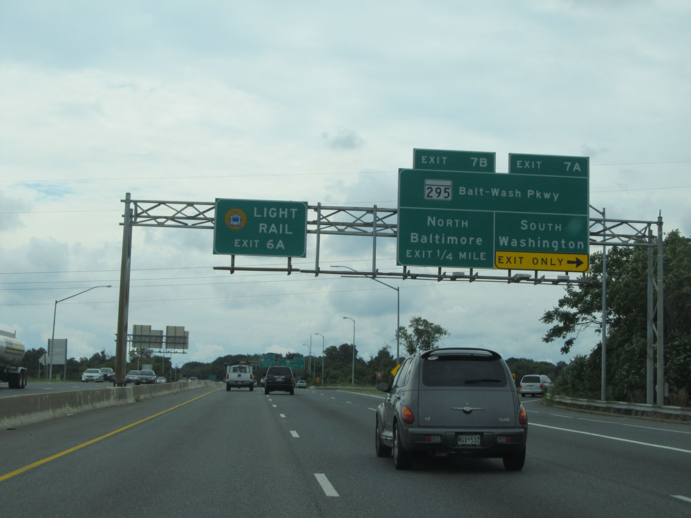 |
Interstate 695 Outer Loop (South) at Exit 7A: MD 295 South - Baltimore-Washington Pkwy / Washington (Photo taken 8/7/15). |
 |
Interstate 695 Outer Loop (South) at Exit 7B: MD 295 North - Baltimore-Washington Pkwy / Baltimore (Photo taken 8/7/15). |
 |
Interstate 695 Outer Loop (South) approaching Exit 4 - 1 mile. (Photo taken 8/7/15). |
 |
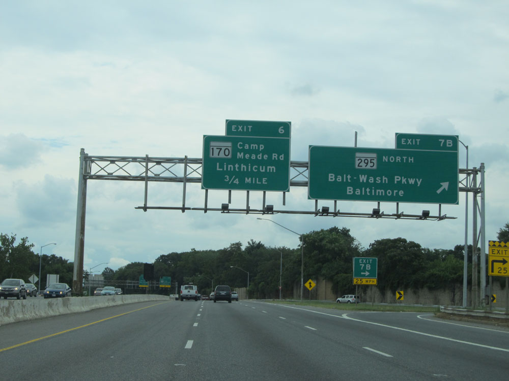
Interstate 695 Outer Loop (South) at Exit 6B: MD 170 South - Camp Meade Rd / Linthicum (Photo taken 8/7/15). |
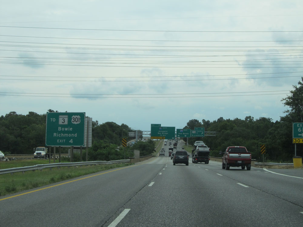 |
Take Exit 4 (on the left ahead) to MD 3 and US 301 toward Bowie and Richmond. (Photo taken 8/7/15). |
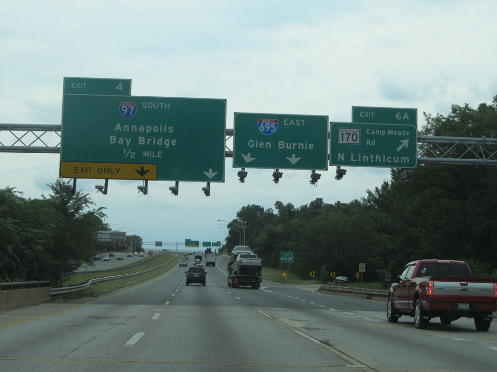 |
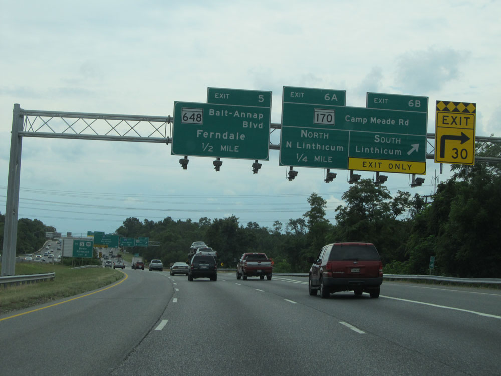
Interstate 695 Outer Loop (South) at Exit 6A: MD 170 North - Camp Meade Rd / North Linthicum (Photo taken 8/7/15). |
 |
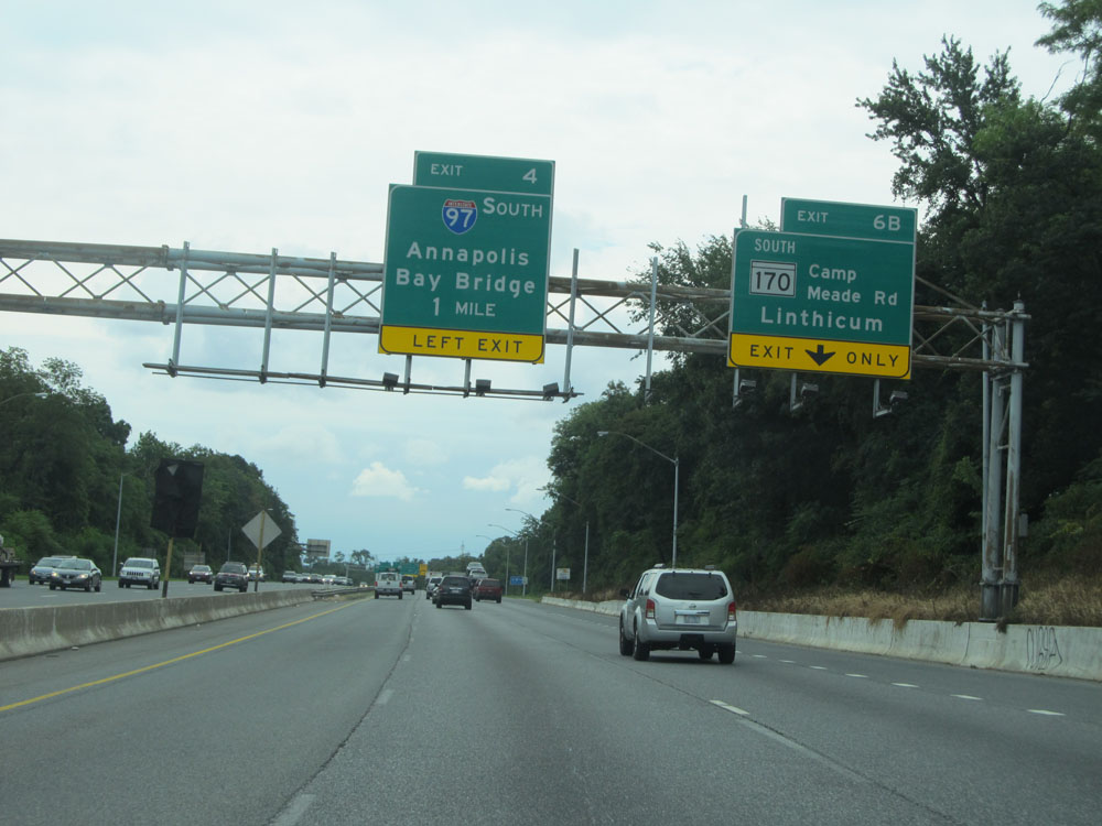
Interstate 695 Outer Loop (South) at Exit 5: MD 648 - Baltimore-Annapolis Blvd / Ferndale; Exit 4: Interstate 97 South - Annapolis / Bay Bridge (Photo taken 8/7/15). |
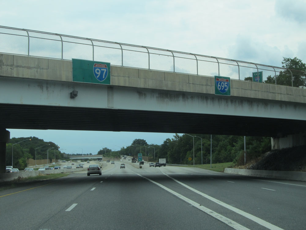 |
Interstate 695 Outer Loop (East) as the ramp to Interstate 97 South exits to the left. (Photo taken 8/7/15). |
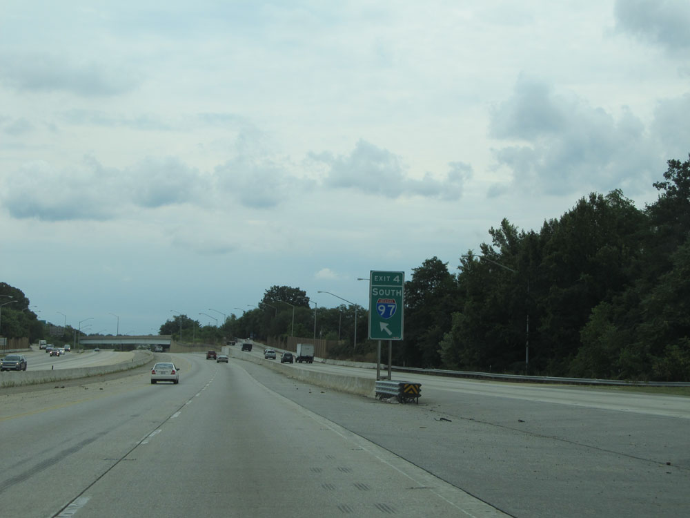 |
A close-up view of the ramp on the left for Exit 4: Interstate 97 South. (Photo taken 8/7/15). |
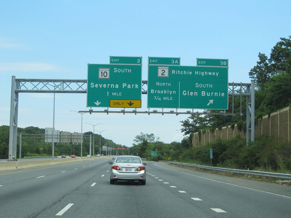 |
Interstate 695 Outer Loop (East) at Exit 3B: MD 2 South - Ritchie Highway / Glen Burnie (Photo taken 8/9/15). |
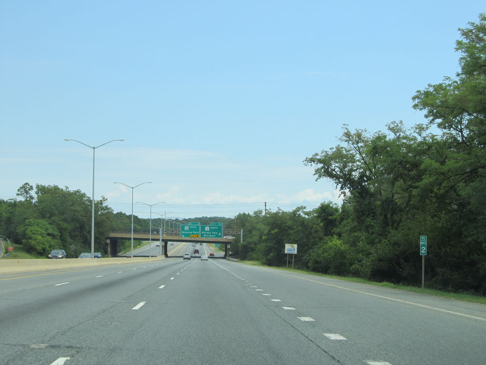 |
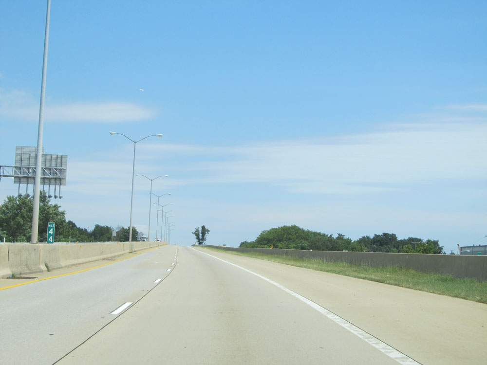
Interstate 695 Outer Loop (East) at mile marker 2. (Photo taken 8/9/15). |
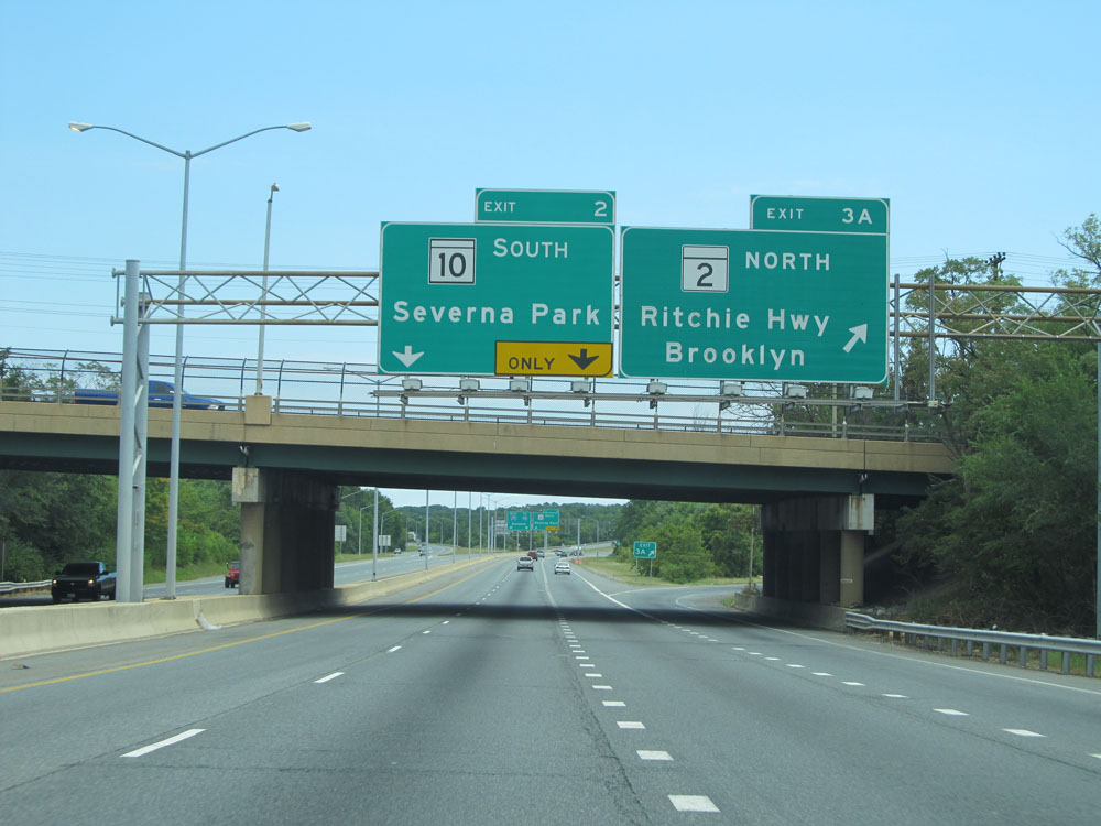 |
Interstate 695 Outer Loop (East) at Exit 3A: MD 2 North - Ritchie Hwy / Brooklyn (Photo taken 8/9/15). |
 |
Interstate 695 Outer Loop (East) at Exit 2: MD 10 South - Saverna Park (Photo taken 8/9/15). |
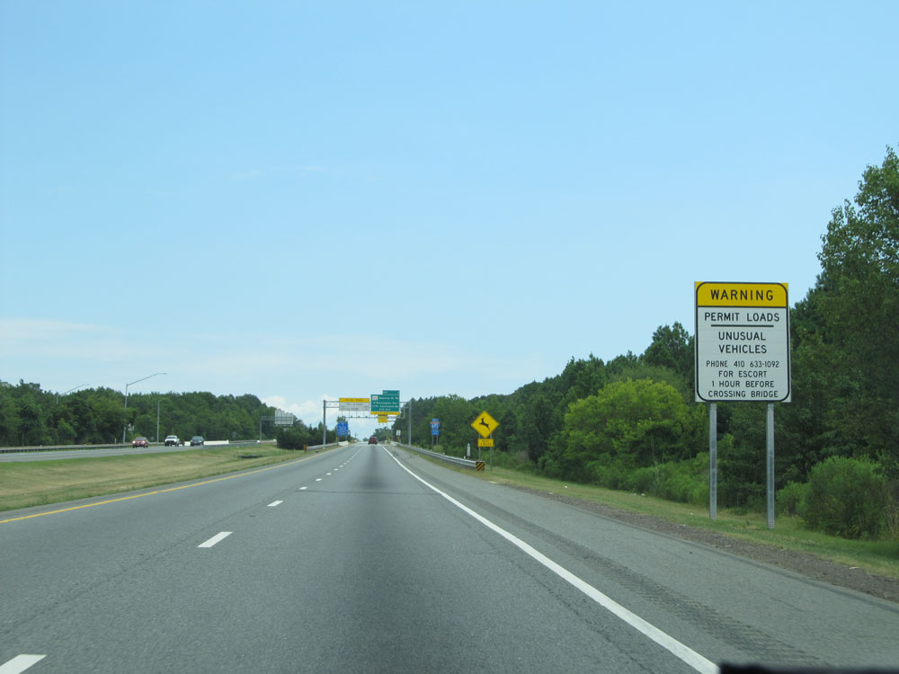 |
This sign warns commercial vehicles that permit loads and unusual vehicles must call the number on this sign 1 hour before crossing the Key Bridge ahead to get an escort. I'm curious what qualifies as an "unusual vehicle". (Photo taken 8/9/15). |
 |
Interstate 695 Outer Loop (East) assurance shield. (Photo taken 8/9/15). |
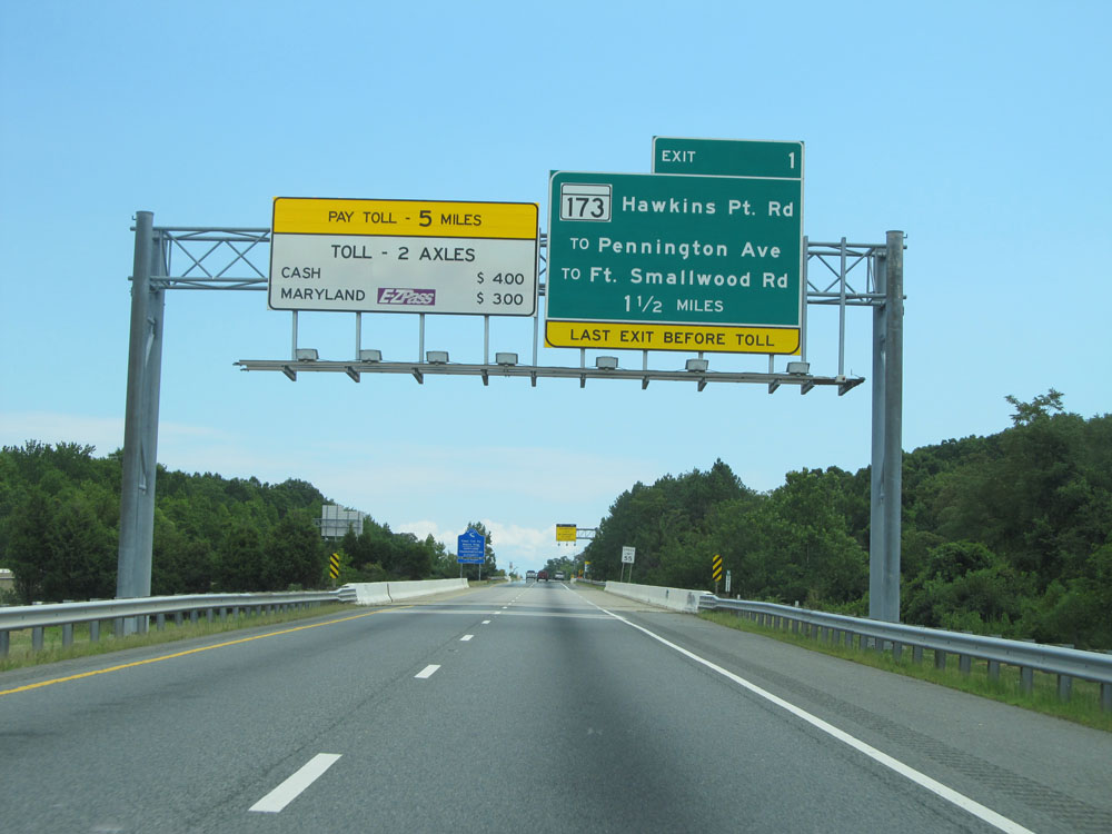 |
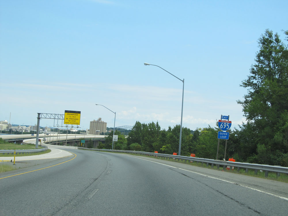
The overhead sign seen on the left here warns of the toll plaza for the Key Bridge, which is 5 miles ahead. It also lists the rates for 2 axle vehicles with or without Maryland EZ Pass. (Photo taken 8/9/15). |
 |
Sign approaching the beginning of the Francis Scott Key Bridge, near mile marker 1. (Photo taken 8/9/15). |
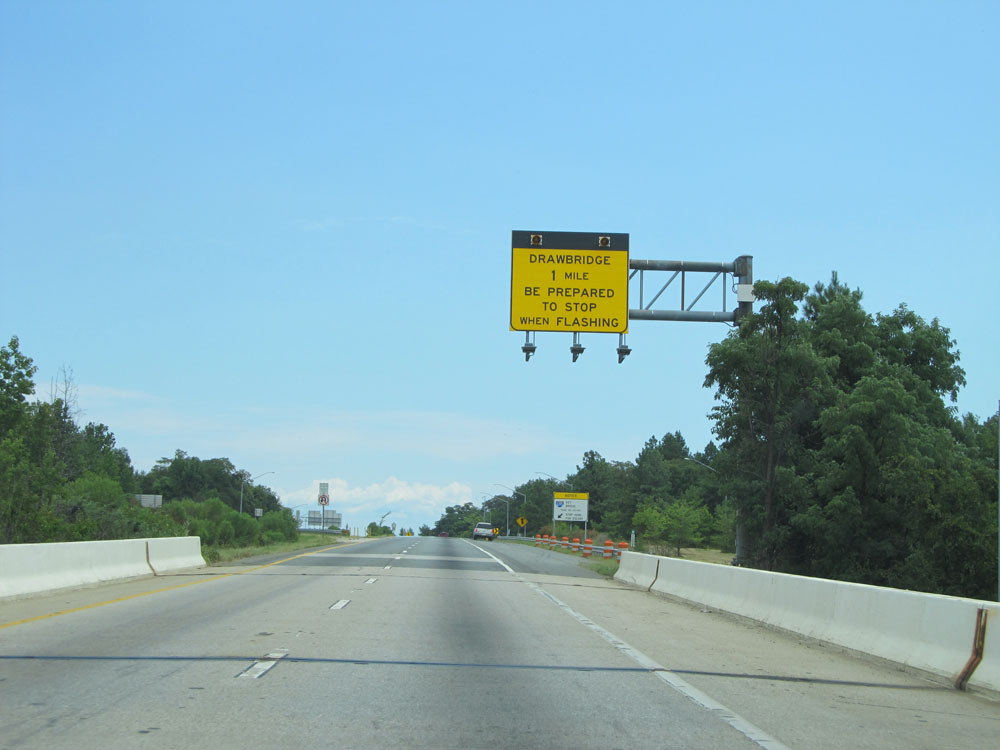 |
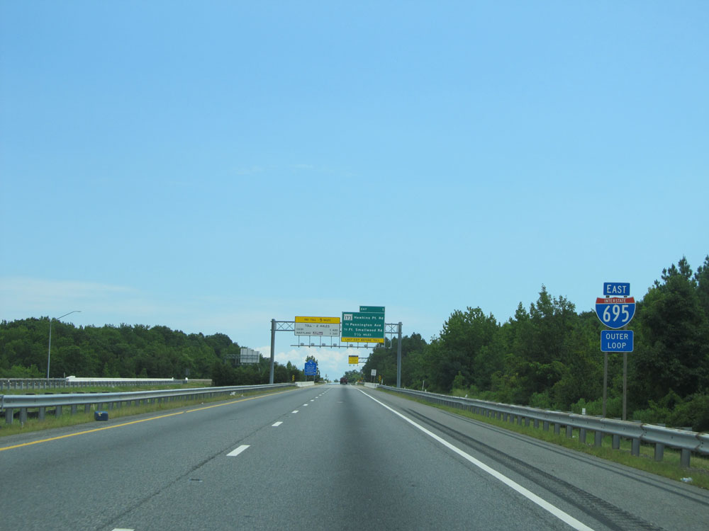
The Curtis Creek Drawbridge lies 1 mile ahead. It is the official point at which Interstate 695 begins or ends, depending on whether you're on the Inner Loop or the Outer Loop. (Photo taken 8/9/15). |
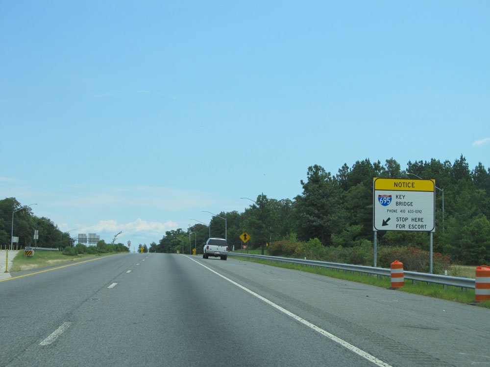 |
This sign marks the point at which permit loads and "unusual vehicles" must pull onto the shoulder and call the number listed on the sign to arrange for an escort across the Key Bridge. (Photo taken 8/9/15). |
 |
Another Interstate 695 Outer Loop (East) assurance shield approaching the drawbridge. (Photo taken 8/9/15). |
 |
Interstate 695 Outer Loop (East) as it prepares to start across the Curtis Creek Drawbridge at mile marker 0.4. Just ahead is the official beginning/end of Interstate 695. (Photo taken 8/9/15). |