| |
|
 |
Interstate 65 South: Road view from mile marker 64. (Photo taken 9/20/11). |
 |
Mammoth Cave National Park lies 15 miles ahead. (Photo taken 9/20/11). |
 |
Interstate 65 South: Road view from mile marker 63. (Photo taken 9/20/11). |
 |
Attractions mileage sign located near mile marker 62. It's 5 miles to Kentucky Down Under, 7 miles to the American Cave Museum, and 16 miles to Diamond Caverns. (Photo taken 9/20/11). |
 |
Interstate 65 South: Road view from mile marker 62. (Photo taken 9/20/11). |
 |
Interstate 65 South at the Rest Area located near mile marker 61. (Photo taken 9/20/11). |
 |
Use Exit 58 for Hidden River Cave and Kentucky Repertory Theater. (Photo taken 9/20/11). |
 |
Also use Exit 58 for Kentucky Down Under and the American Cave Museum. (Photo taken 9/20/11). |
 |
Interstate 65 South: Road view from mile marker 59. (Photo taken 9/20/11). |
 |
Interstate 65 South at Exit 58: KY 218 / To KY 335 - Horse Cave (Photo taken 9/20/11). |
 |
Interstate 65 South: Road view from mile marker 56. (Photo taken 9/20/11). |
 |
Interstate 65 South: Road view from mile marker 55. (Photo taken 9/20/11). |
 |
Use Exit 53 for Dinosaur World and the South Central Kentucky Cultural Center. (Photo taken 9/20/11). |
 |
Also use Exit 53 for Barren River Lake State Resort Park and Mammoth Cave National Park. (Photo taken 9/20/11). |
 |
Interstate 65 South at Exit 53: KY 90 / KY 70 - Cave City / Glasgow (Photo taken 9/20/11). |
 |
Interstate 65 South: Road view from mile marker 51. (Photo taken 9/20/11). |
 |
Interstate 65 South: Road view from mile marker 48.6. (Photo taken 9/20/11). |
 |
Use Exit 48 for Mammoth Cave National Park and Diamond Caverns. (Photo taken 9/20/11). |
 |
Interstate 65 South at Exit 48: KY 255 - Park City / Brownsville (Photo taken 9/20/11). |
 |
Interstate 65 South: Road view from mile marker 45.6. (Photo taken 9/20/11). |
 |
Use Exit 43 for Barren River Lake State Resort Park. (Photo taken 9/20/11). |
 |
Interstate 65 South at Exit 43: Cumberland Parkway - Glasgow / Somerset (Photo taken 9/20/11). |
 |
Interstate 65 South: Road view from mile marker 41. (Photo taken 9/20/11). |
 |
Interstate 65 South: Road view from mile marker 39. (Photo taken 9/20/11). |
 |
Interstate 65 South at Exit 38: KY 101 / To US 68 - Scottsville / Smiths Grove (Photo taken 9/20/11). |
 |
Interstate 65 South: Road view from mile marker 36. (Photo taken 9/20/11). |
 |
Interstate 65 South: Road view from mile marker 34. (Photo taken 9/20/11). |
 |
Interstate 65 South: Road view from mile marker 33. (Photo taken 9/20/11). |
 |
Attractions mileage sign located near mile marker 32. It's 5 miles to the National Corvette Museum and 14 miles to Lost River Cave. (Photo taken 9/20/11). |
 |
Interstate 65 South: Road view from mile marker 31. (Photo taken 9/20/11). |
 |
Use any of the next 4 exits to get to Bowling Green. (Photo taken 9/20/11). |
 |
Use Exit 28 for Beech Bend Park and the National Corvette Museum. (Photo taken 9/20/11). |
 |
Also use Exit 28 for the Historic Railpark & Train Museum. (Photo taken 9/20/11). |
 |
Interstate 65 South at Exit 28: To US 31W / KY 446 - Bowling Green (Photo taken 9/20/11). |
 |
Interstate 65 South: Road view from mile marker 27. (Photo taken 9/20/11). |
 |
Interstate 65 South at Exit 26: KY 234 - Bowling Green (Photo taken 9/20/11). |
 |
Interstate 65 South: Road view from mile marker 25. (Photo taken 9/20/11). |
 |
Use Exit 22 for Sloan Convention Center and Lost River Cave. (Photo taken 9/20/11). |
 |
Interstate 65 South at Exit 22: US 231 - Bowling Green / Scottsville (Photo taken 9/20/11). |
 |
Use Exit 20 for Shaker Museum Historic Site. (Photo taken 9/20/11). |
 |
Interstate 65 South at Exit 20: William H. Natcher Parkway - Bowling Green / Owensboro (Photo taken 9/20/11). |
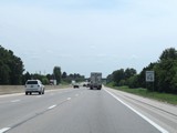 |
The speed limit remains 70 mph on Interstate 65 South. (Photo taken 8/11/19). |
 |
Mileage sign on Interstate 65 South. It's 15 miles to Franklin and 54 miles to Nashville. (Photo taken 8/11/19). |
 |
Interstate 65 South at mile marker 19. (Photo taken 8/11/19). |
 |
View on Interstate 65 South at mile marker 17.8. (Photo taken 8/11/19). |
 |
Interstate 65 South at mile marker 16. (Photo taken 8/11/19). |
 |
Mile marker 15 on Interstate 65 South in Warren County. (Photo taken 8/11/19). |
 |
Interstate 65 South as it enters Simpson County. (Photo taken 8/11/19). |
 |
View on Interstate 65 South at mile marker 12. (Photo taken 8/11/19). |
 |
Mile marker 11 on Interstate 65 South in Simpson County. (Photo taken 8/11/19). |
 |
View on Interstate 65 South at mile marker 10. (Photo taken 8/11/19). |
 |
View on Interstate 65 South at mile marker 9. (Photo taken 8/11/19). |
 |
Interstate 65 South at mile marker 8. (Photo taken 8/11/19). |
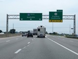 |
Interstate 65 South at Exit 6: KY 100 - Franklin / Scottsville (Photo taken 8/11/19). |
 |
View on Interstate 65 South at mile marker 5. (Photo taken 8/11/19). |
 |
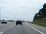
Take Exit 2 to Kenny Perry's Country Creek. (Photo taken 8/11/19). |
 |
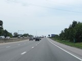
Also take Exit 2 to Kentucky Downs. (Photo taken 8/11/19). |
 |
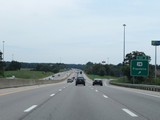
Interstate 65 South at mile marker 3. (Photo taken 8/11/19). |
 |
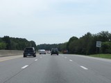
Interstate 65 South at Exit 2: US 31W - Franklin (Photo taken 8/11/19). |
 |
The speed limit remains 70 mph on Interstate 65 South. (Photo taken 8/11/19). |
 |
Interstate 65 South reassurance shield beyond Exit 2. (Photo taken 8/11/19). |
 |
Nashville now lies just 35 miles ahead as Interstate 65 South prepares to enter Tennessee. (Photo taken 8/11/19). |
 |
Interstate 65 South at mile marker 0.6, as it nears the Tennessee state line. (Photo taken 8/11/19). |
 |
View on Interstate 65 South at mile marker 0.2 as it prepares to enter Tennessee. (Photo taken 8/11/19). |
