Road Information |
||
 |
||
| Total Mileage in State: | 29 miles | |
| Northern/Eastern End: | At Indiana state line | |
| Western/Southern End: | At I-65, in Louisville | |
| Mileage covered in Photos: | 29 miles | |
| Counties covered in Photos: | Jefferson | |
| Major Junctions in Photos: | I-71, in Louisville I-64, in Middletown I-65, in Louisville |
|
| Control Cities in Photos: | Louisville | |
Southbound/Westbound
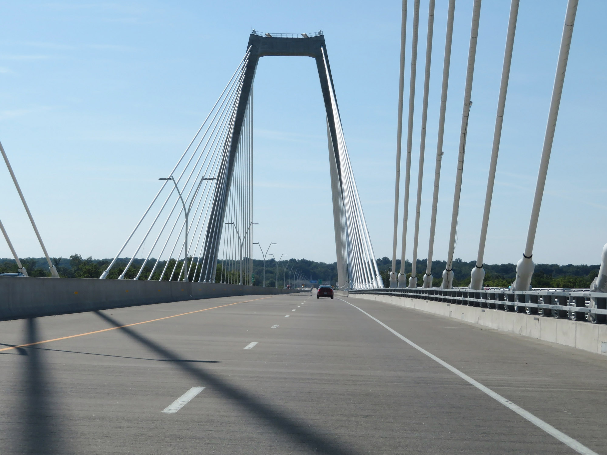 |
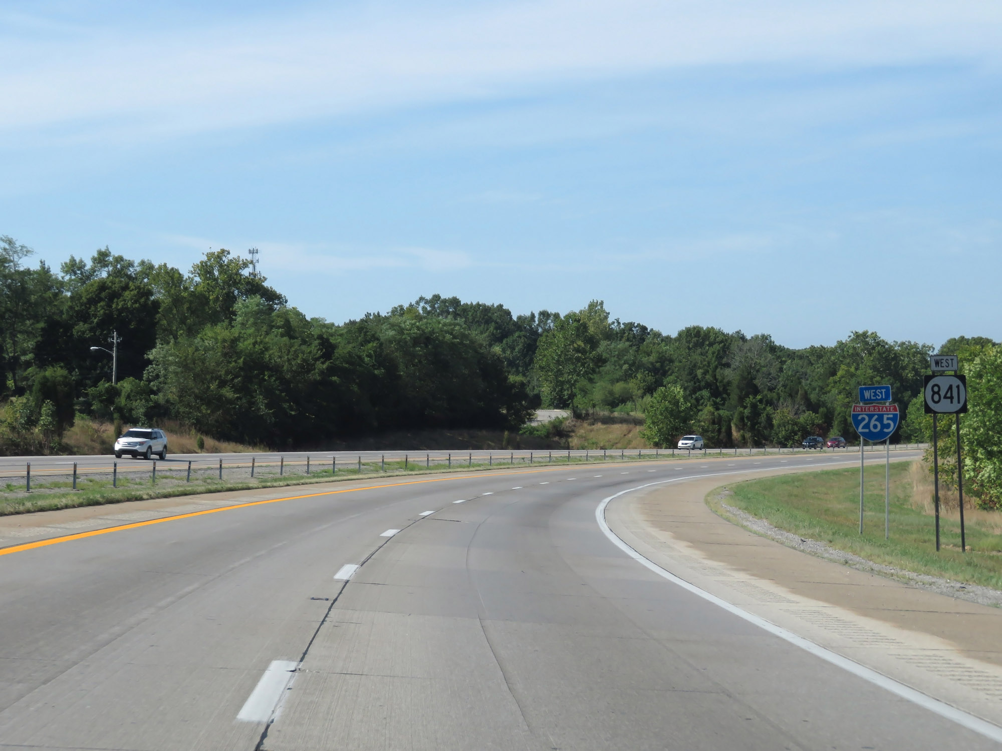
Interstate 265 South enters Kentucky from Indiana by crossing the Lewis and Clark Bridge over the Ohio River. The stretch of I-265 from here to Interstate 71 was designated as part of I-265 in May 2019. Signage along this stretch had not yet been updated at the time of these photos, as it was still signed only as KY 841 which runs concurrently with I-265 in Kentucky for its entire length. (Photo taken 8/10/19). |
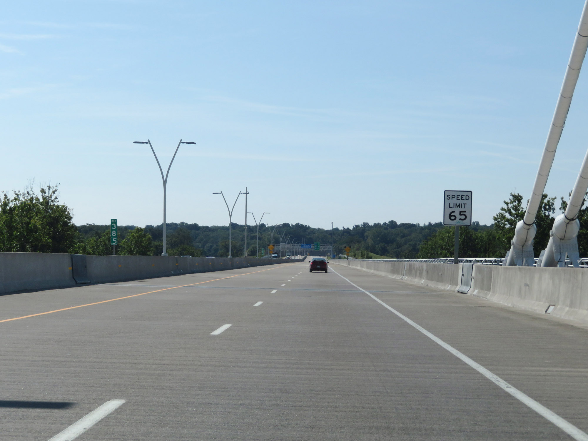 |
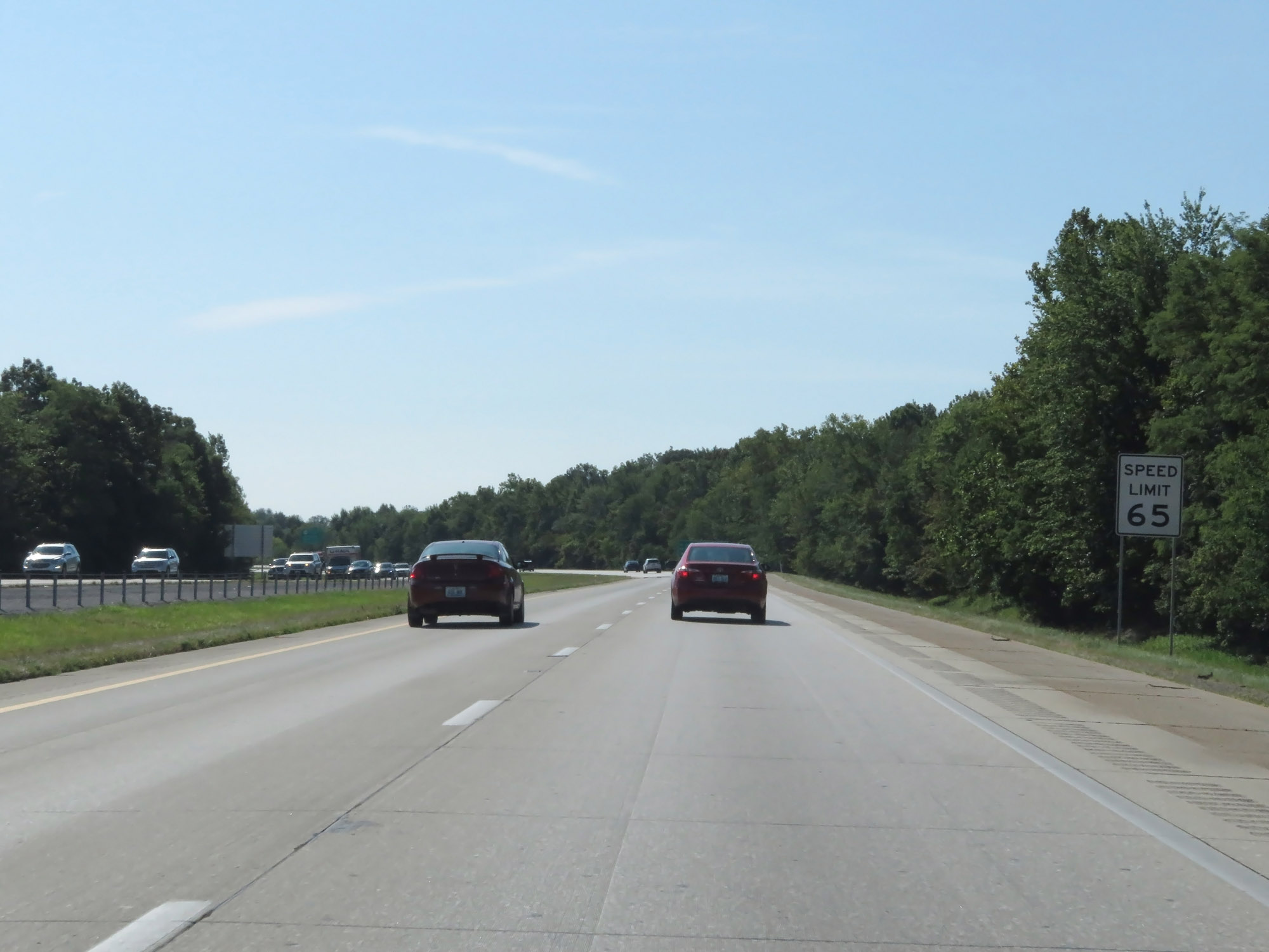
The speed limit on Interstate 265 South in Kentucky starts out at 65 mph. (Photo taken 8/10/19). |
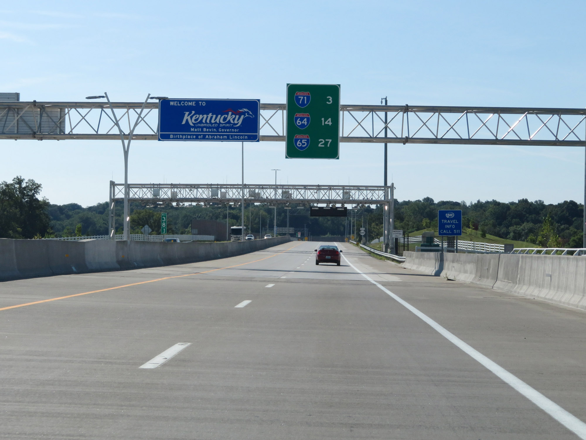 |
Kentucky welcome sign on Interstate 265 South. (Photo taken 8/10/19). |
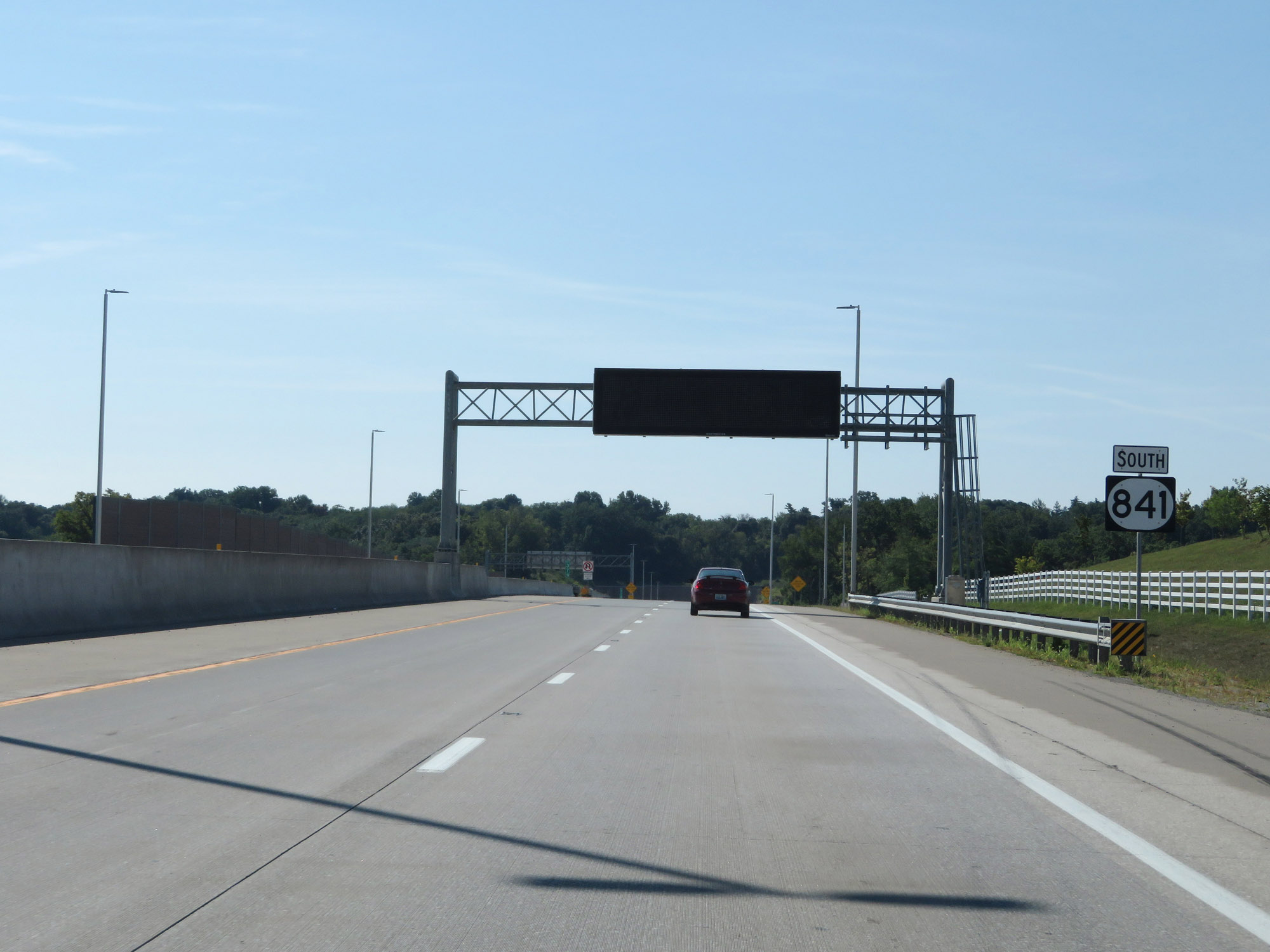 |
KY 841 South reassurance marker. As previously stated, this stretch of KY 841 from the Ohio River to Interstate 71 was designated as Interstate 265 in May 2019, but I-265 signage had not been added at the time. (Photo taken 8/10/19). |
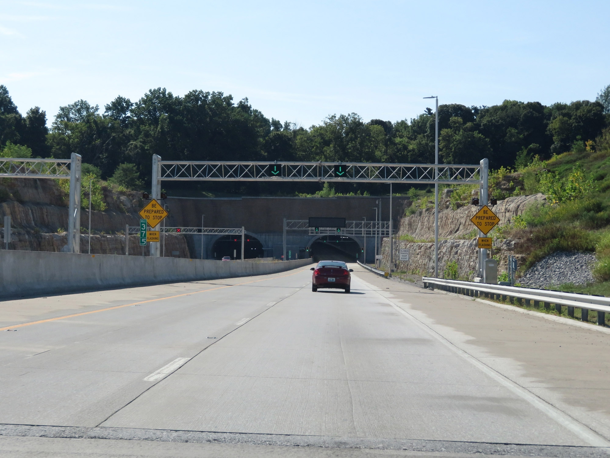 |
Interstate 265 South at mile marker 37.5, nearing the Louisville East End Tunnel. The mileage and exit numbers on I-265 are still based off the mileage of KY 841. (Photo taken 8/10/19). |
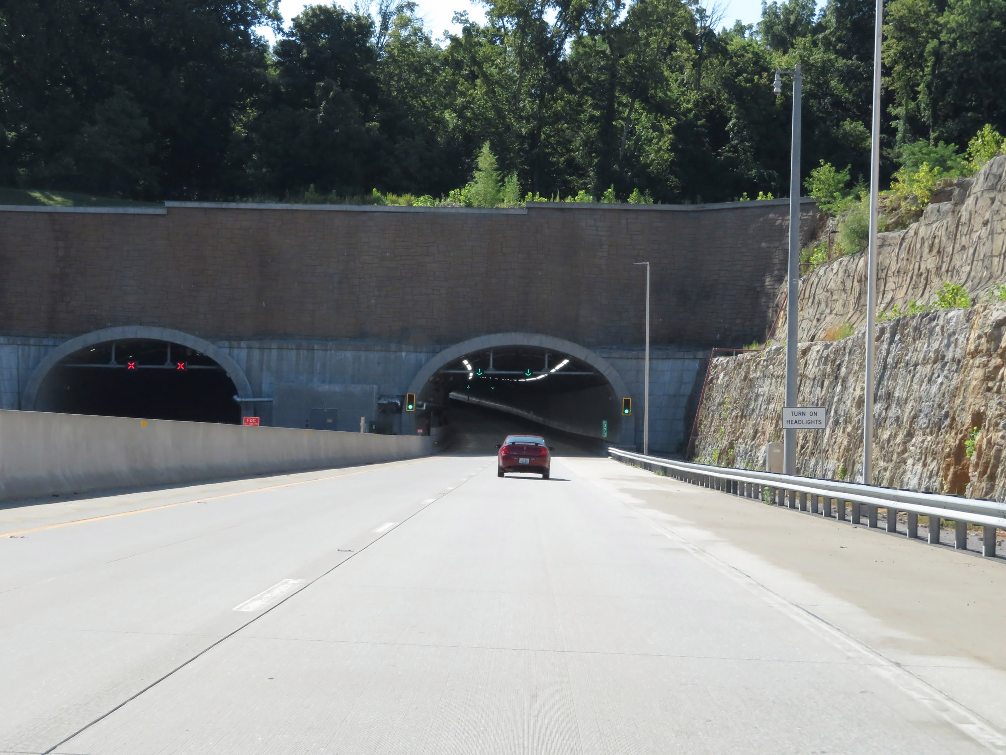 |
Approaching the entrance of the Louisville East End Tunnel, motorists are reminded to turn on their headlights. (Photo taken 8/10/19). |
 |
Interstate 265 South enters the Louisville East End Tunnel at mile marker 37.3. (Photo taken 8/10/19). |
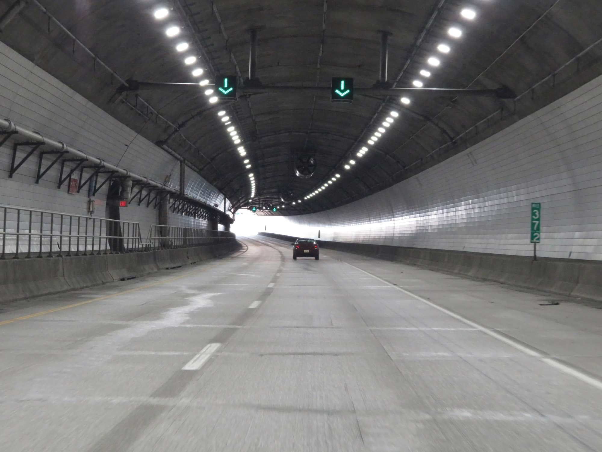 |
View inside the tunnel at mile marker 37.2. (Photo taken 8/10/19). |
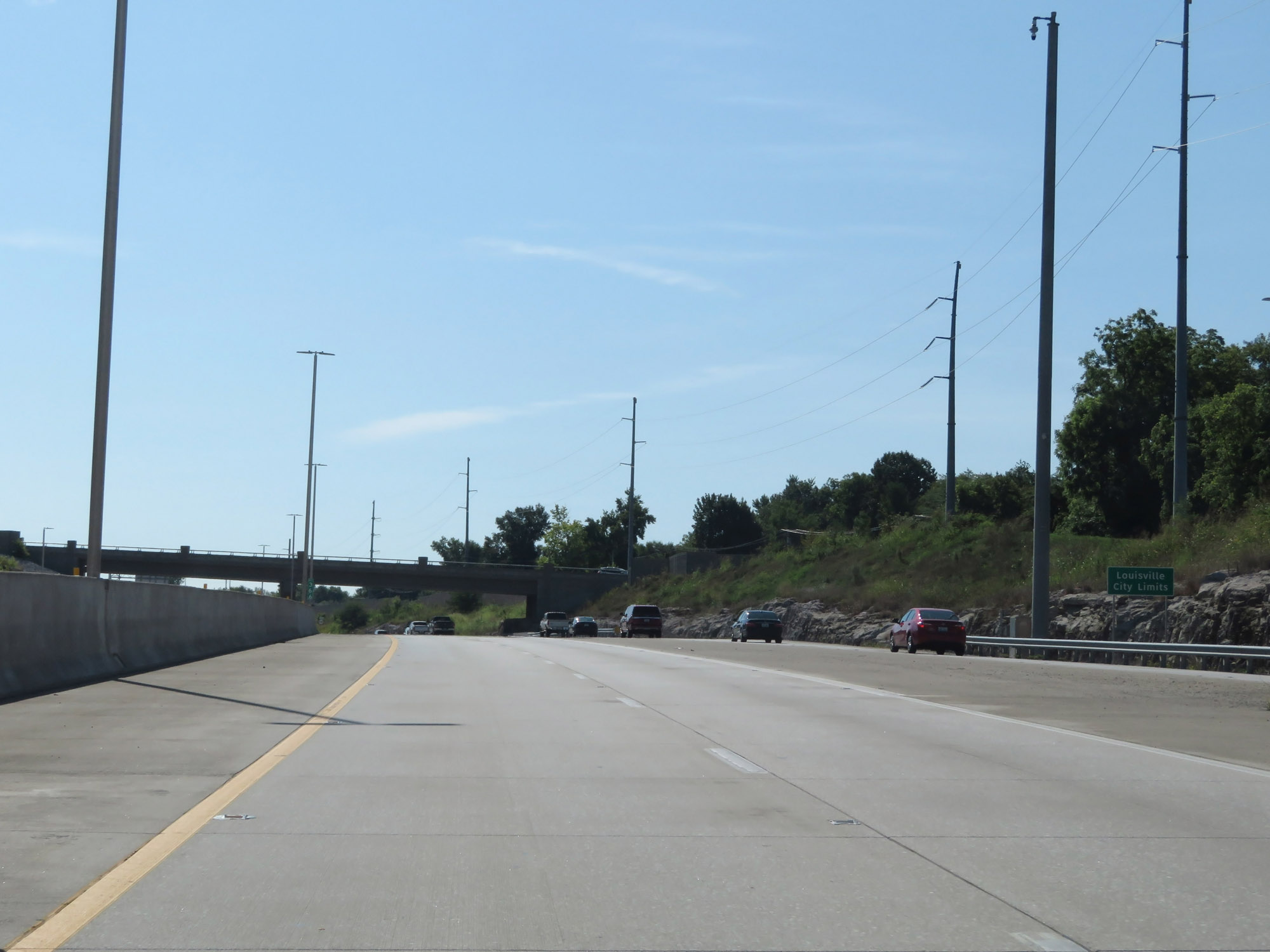 |
Emerging from the Louisville East End Tunnel, Interstate 265 South enters the Louisville city limits. (Photo taken 8/10/19). |
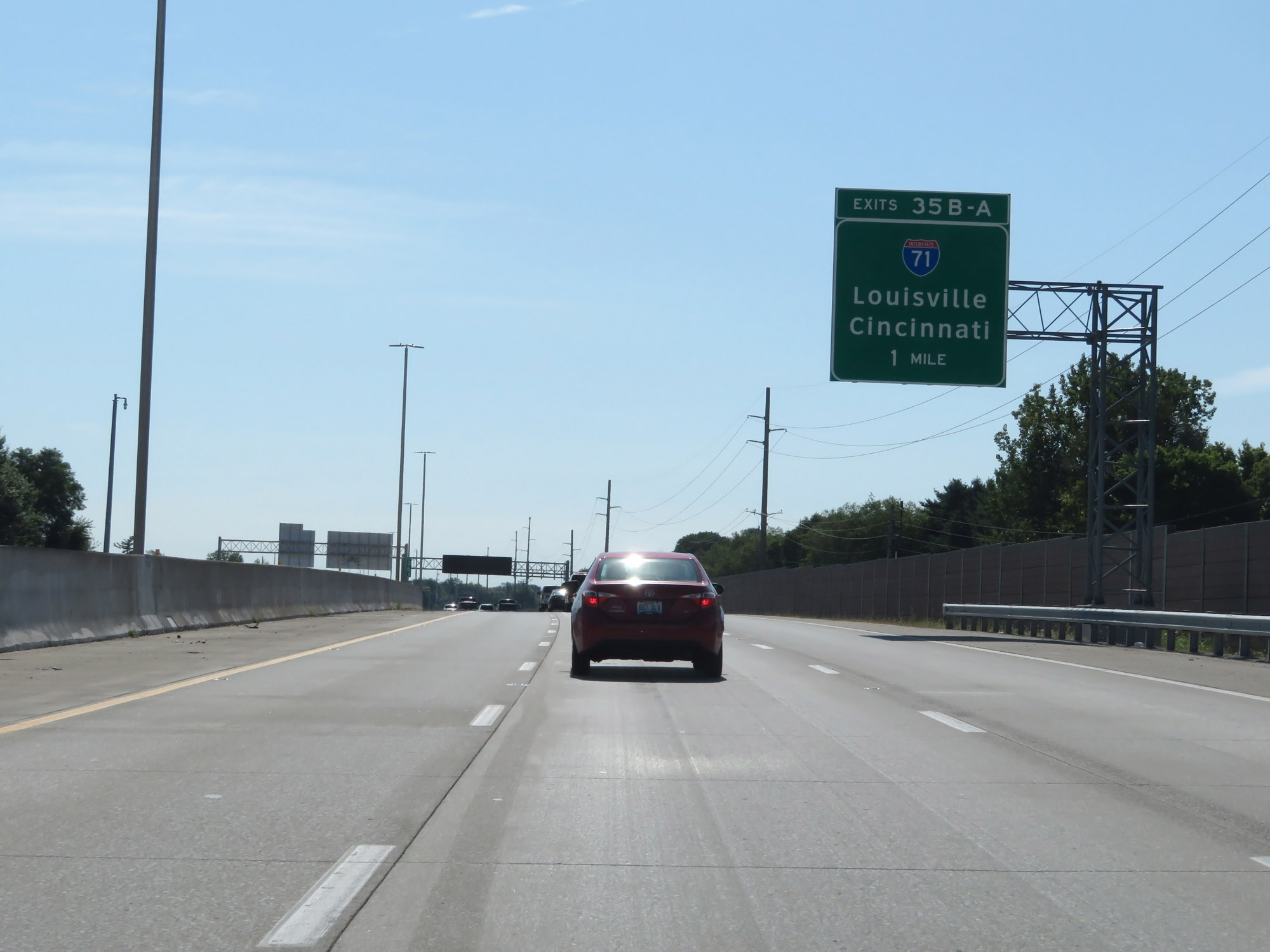 |
Interstate 265 South approaching Exits 35B-A - 1 mile. (Photo taken 8/10/19). |
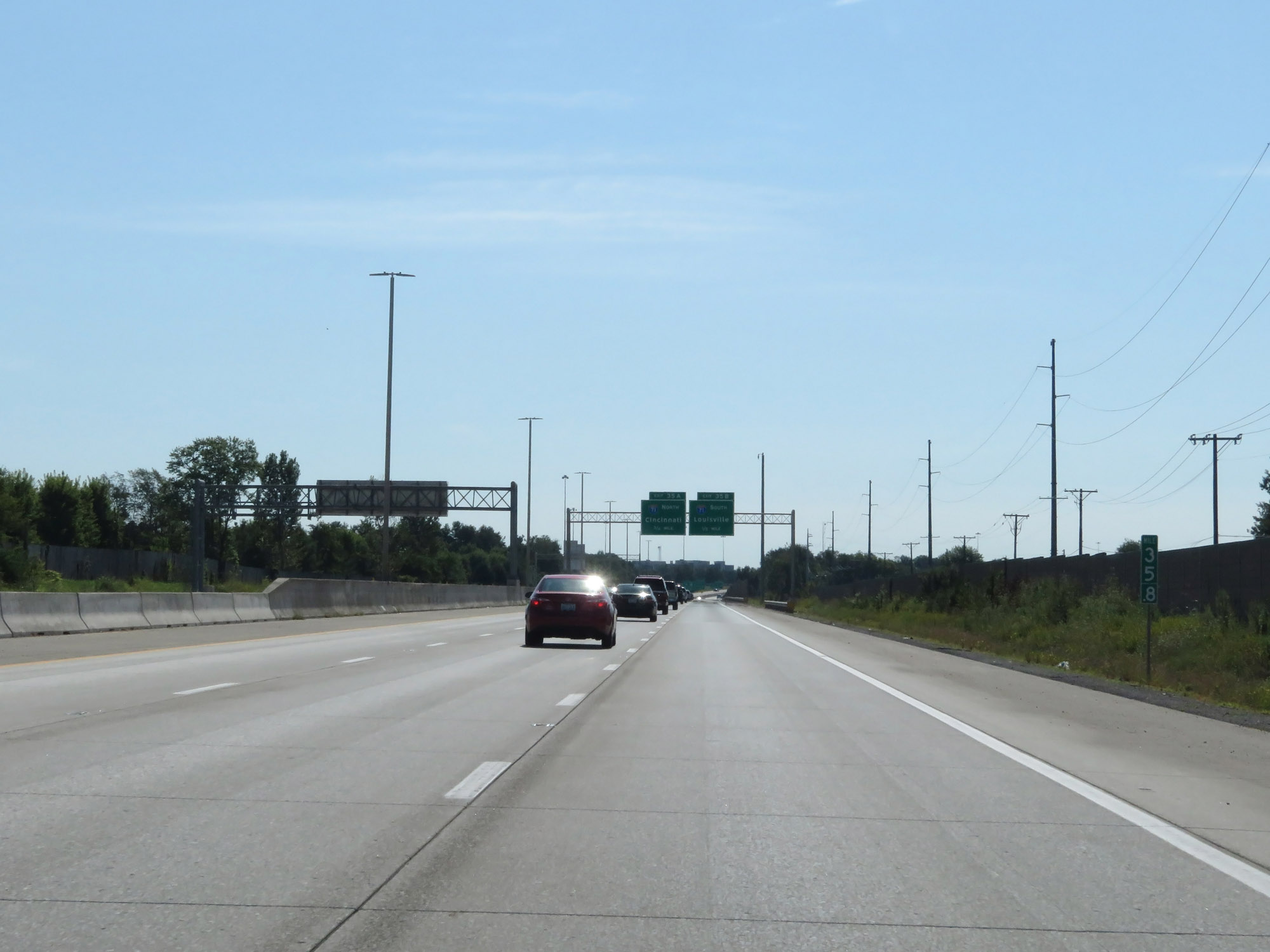 |
Interstate 265 South at mile marker 35.8. (Photo taken 8/10/19). |
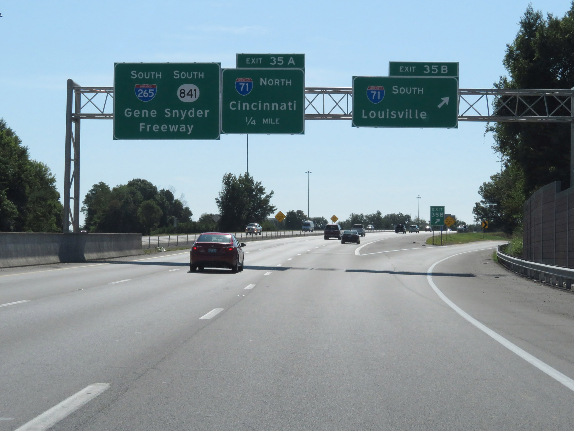 |
Interstate 265 South at Exit 35B: Interstate 71 South - Louisville (Photo taken 8/10/19). |
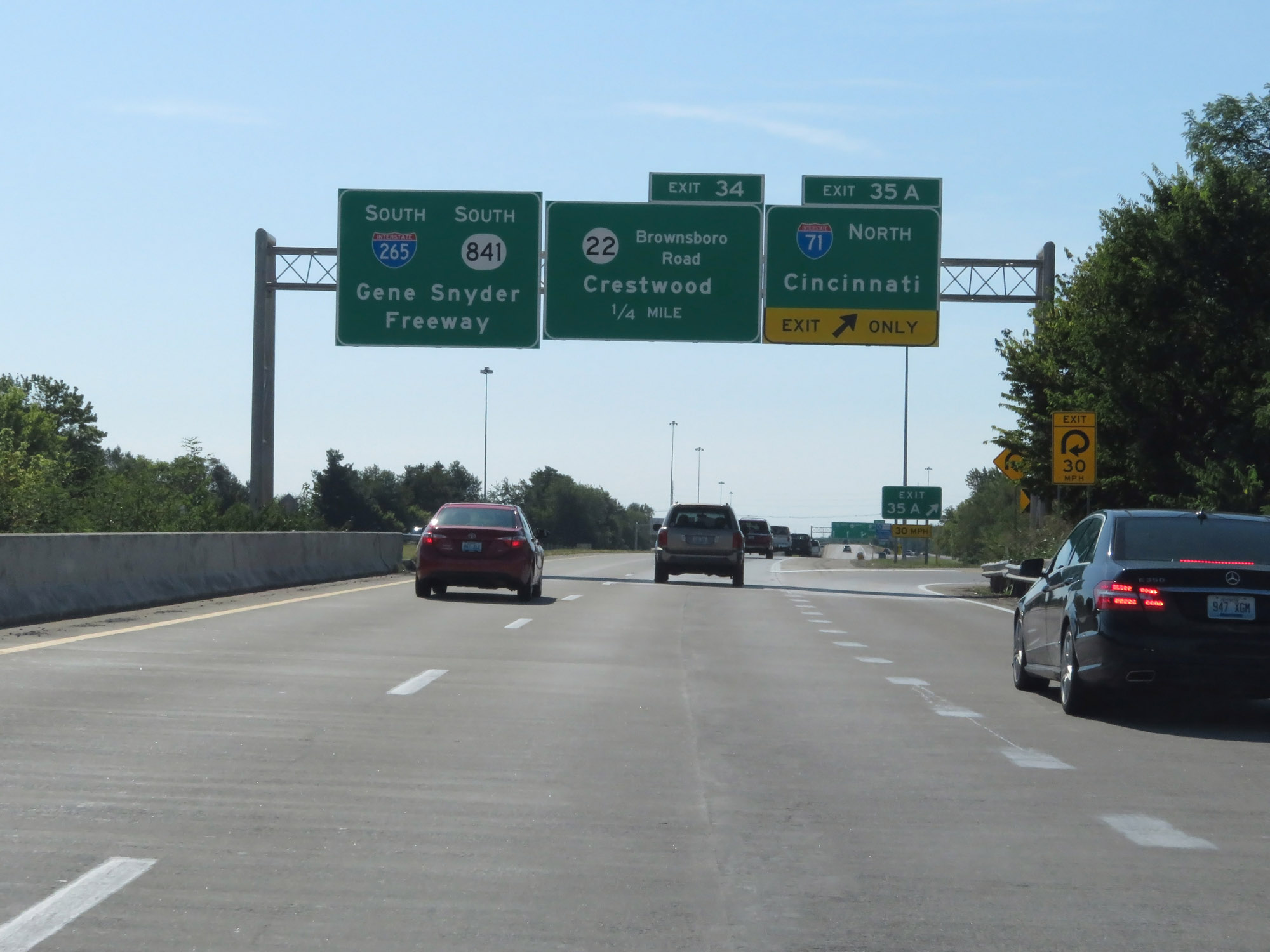 |
Interstate 265 South at Exit 35A: Interstate 71 North - Cincinnati (Photo taken 8/10/19). |
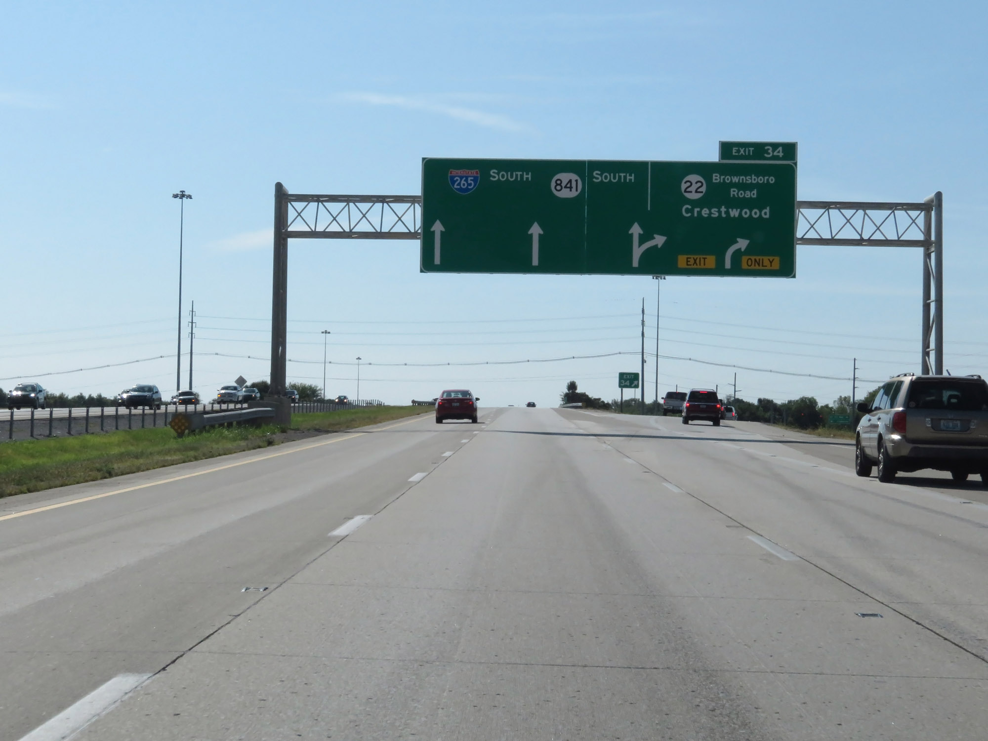 |
Interstate 265 South at Exit 34: KY 22 (Brownsboro Rd) - Crestwood (Photo taken 8/10/19). |
 |
Interstate 265 South reassurance shield. (Photo taken 8/10/19). |
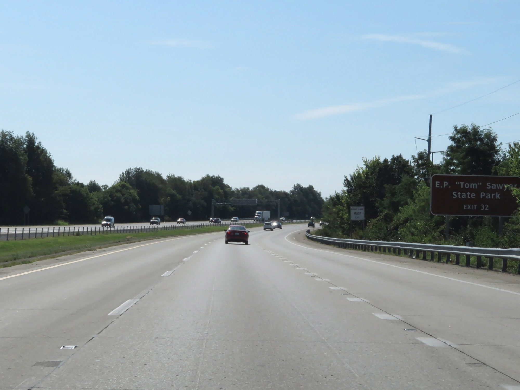 |
Take Exit 32 to E.P. "Tom" Sawyer State Park. (Photo taken 8/10/19). |
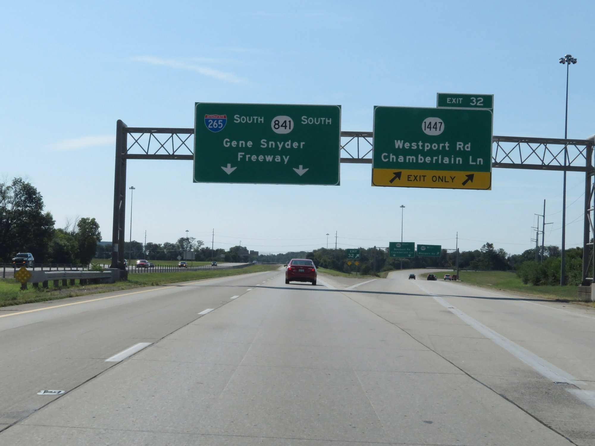 |
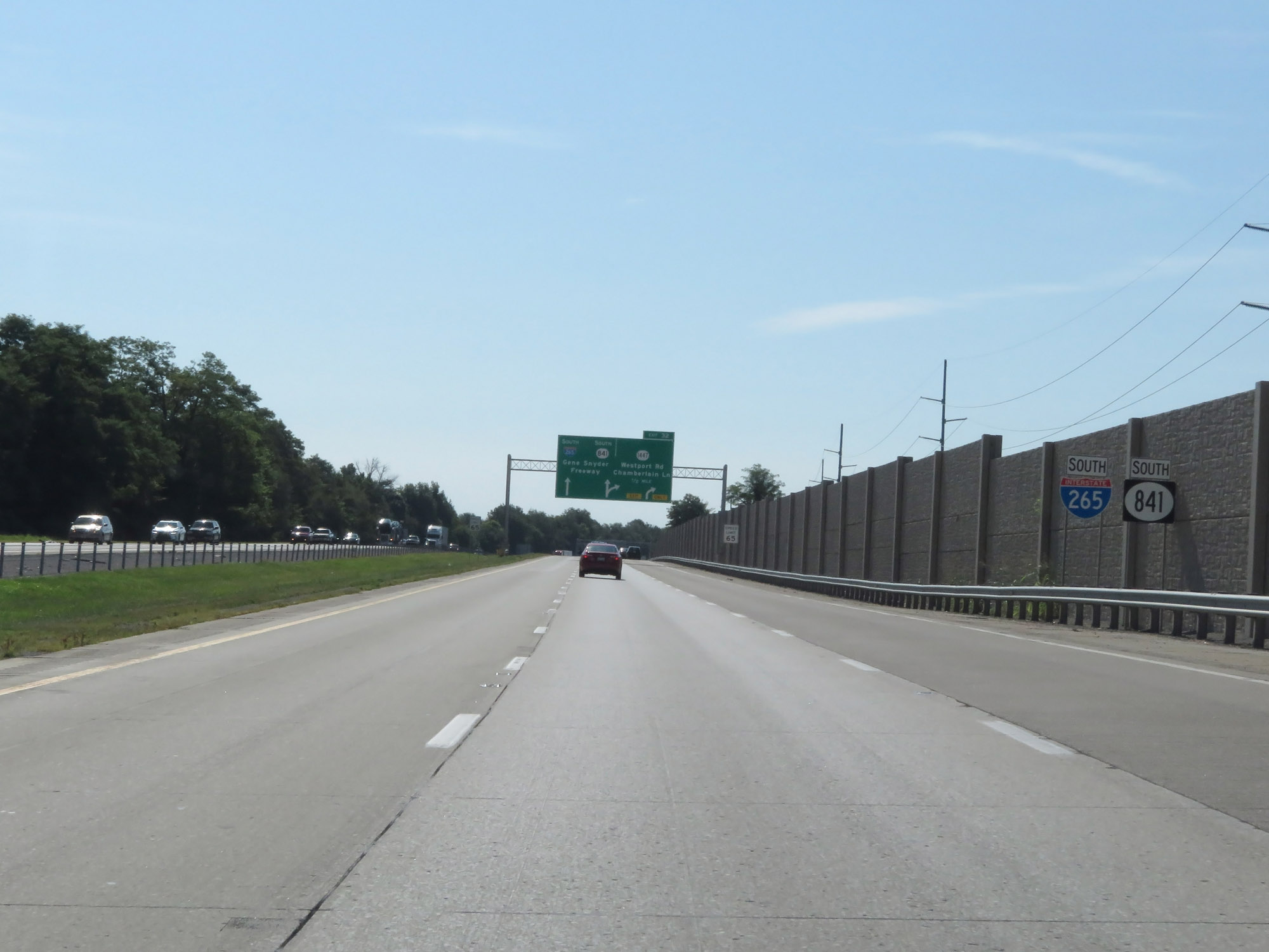
Interstate 265 South at Exit 32: KY 1447 - Westport Rd / Chamberlain Ln (Photo taken 8/10/19). |
 |
The speed limit remains 65 mph. (Photo taken 8/10/19). |
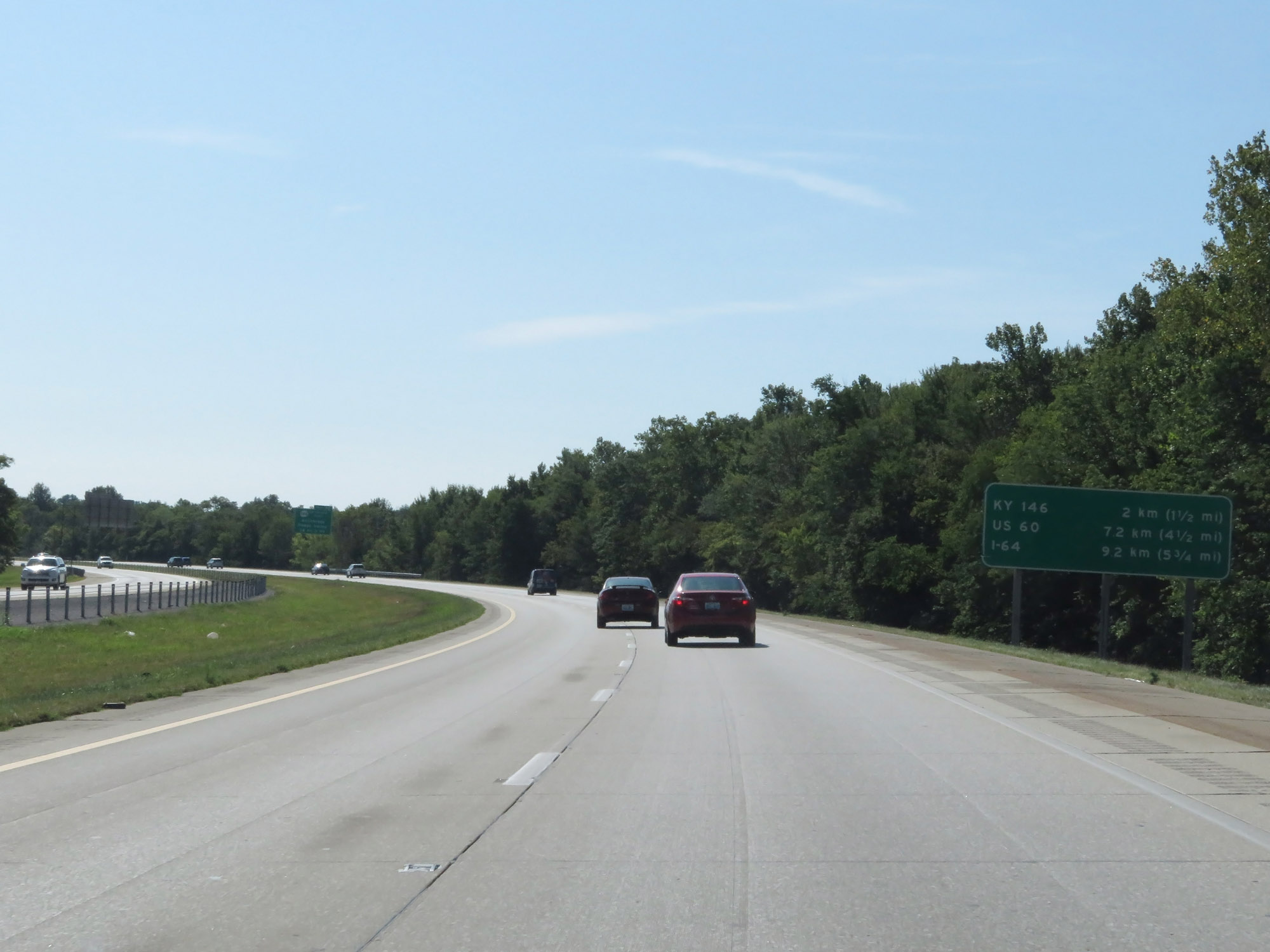 |
Mileage sign on Interstate 265 South. It's 1 1/2 miles to the junction of KY 146, 4 1/2 miles to the junction of US 60, and 5 3/4 miles to the junction of Interstate 64. For whatever reason this distance sign prioritizes kilometers over miles. (Photo taken 8/10/19). |
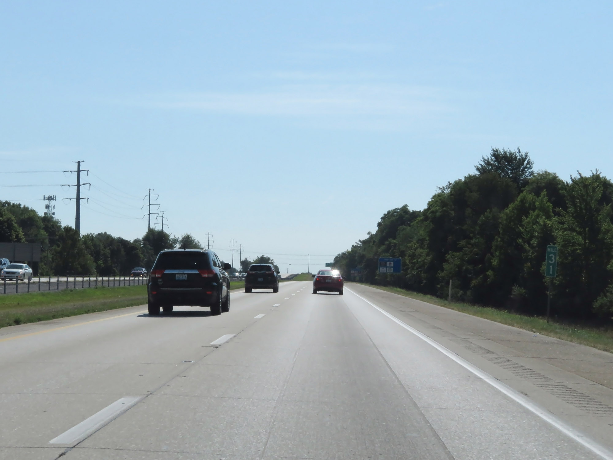 |
Interstate 265 South at mile marker 31. (Photo taken 8/10/19). |
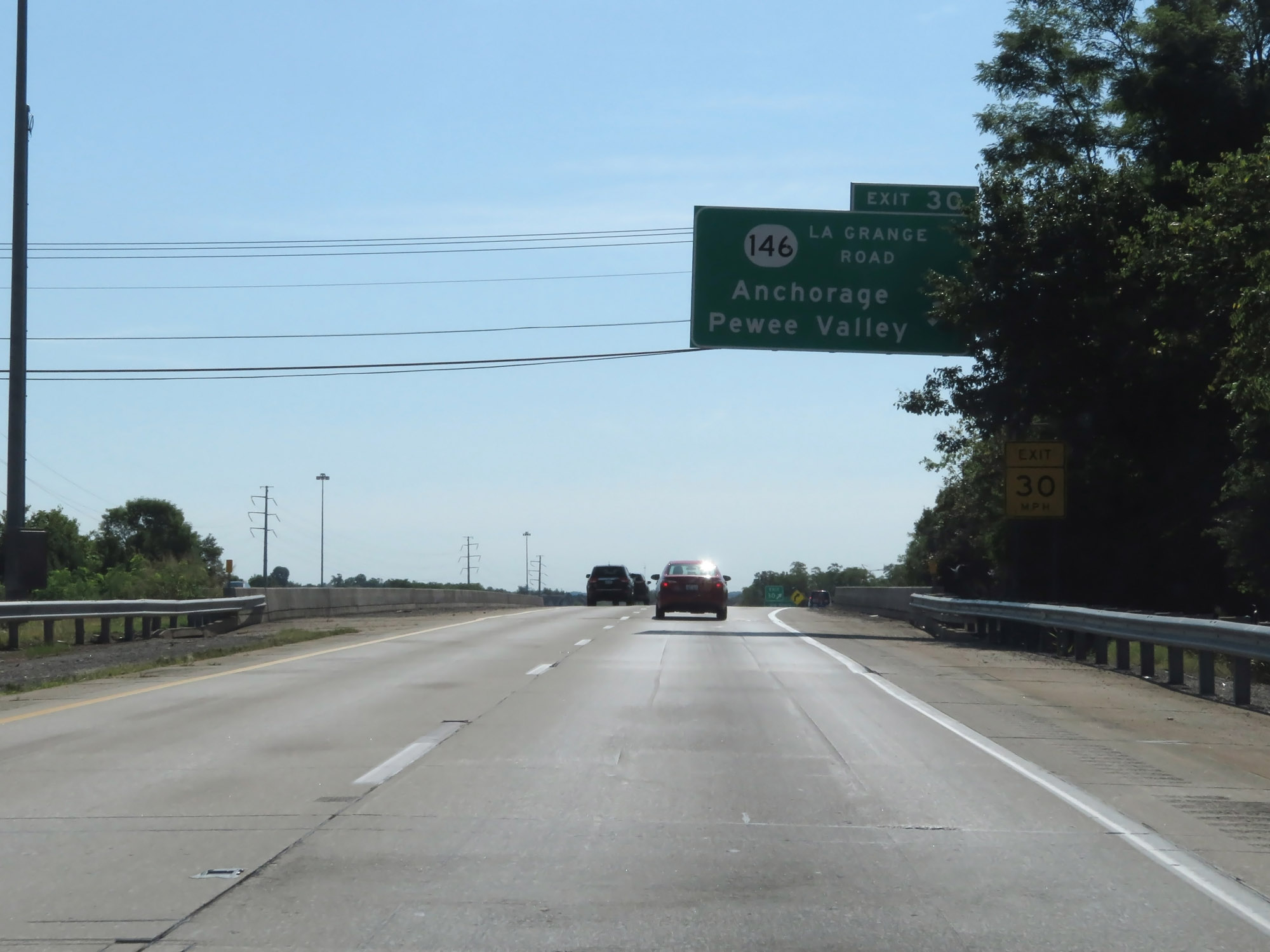 |
Interstate 265 South at Exit 30: KY 146 (La Grange Road) - Anchorage / Pewee Valley (Photo taken 8/10/19). |
 |
Take Exit 29 to access the Industrial Park. (Photo taken 8/10/19). |
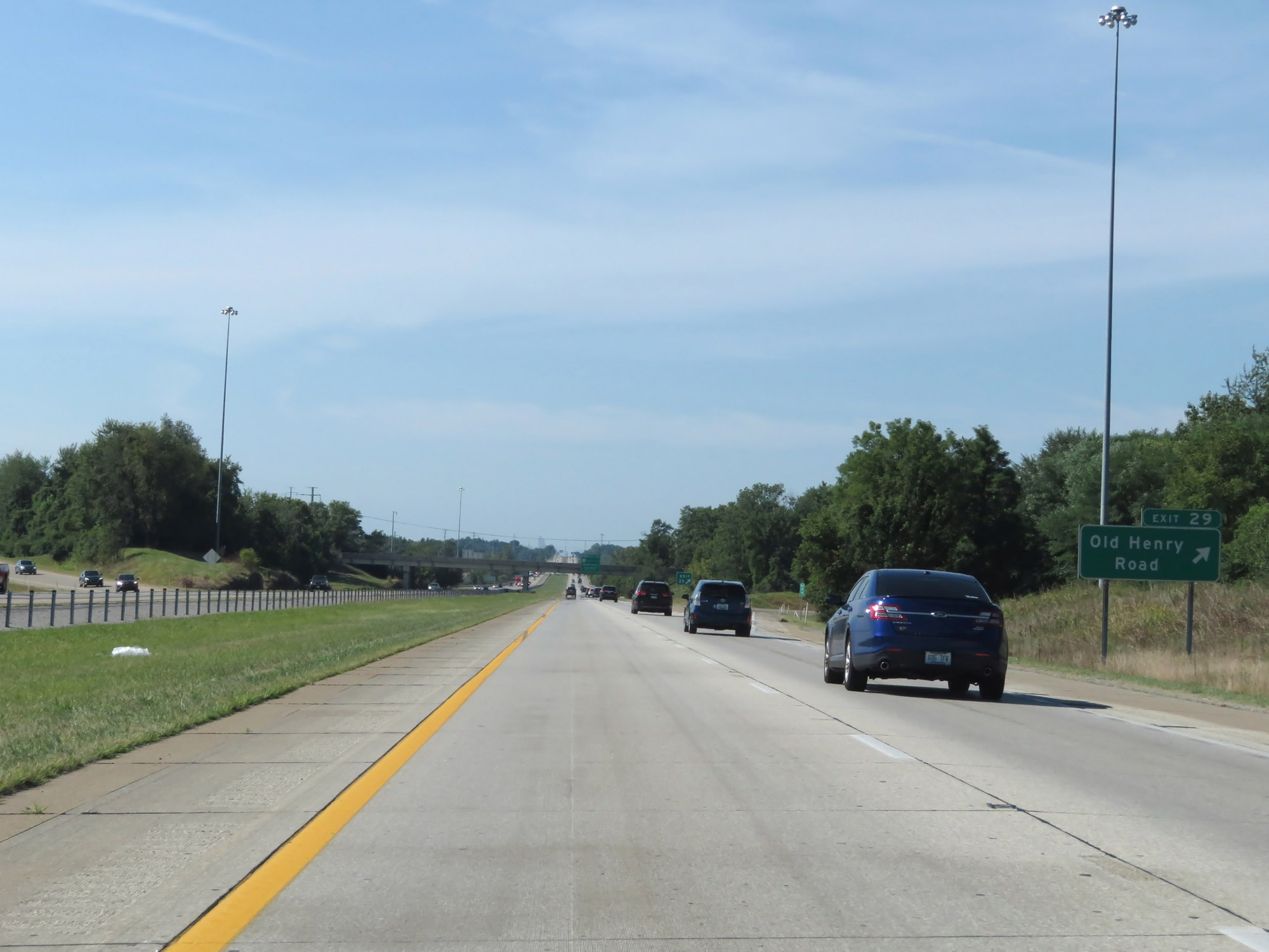 |
Interstate 265 South at Exit 29: Old Henry Road (Photo taken 8/10/19). |
 |
Interstate 265 South at Exit 27: US 60 (Shelbyville Rd) - Middletown / Eastwood (Photo taken 8/10/19). |
 |
Interstate 265 South approaching Exit 25B - 1/2 mile. (Photo taken 8/10/19). |
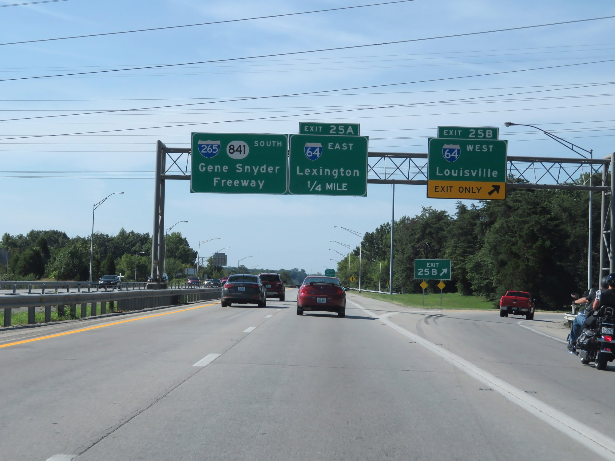 |
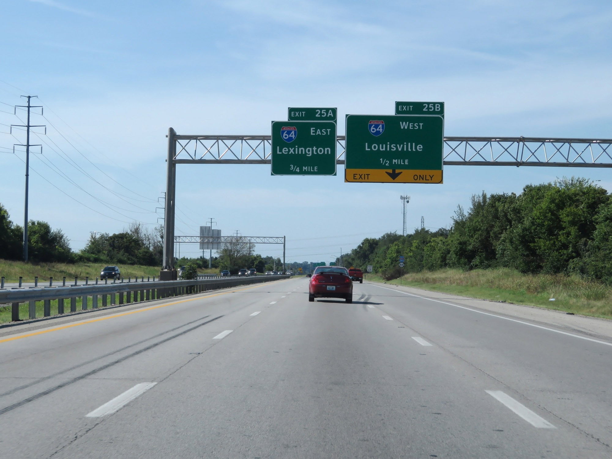
Interstate 265 South at Exit 25B: Interstate 64 West - Louisville (Photo taken 8/10/19). |
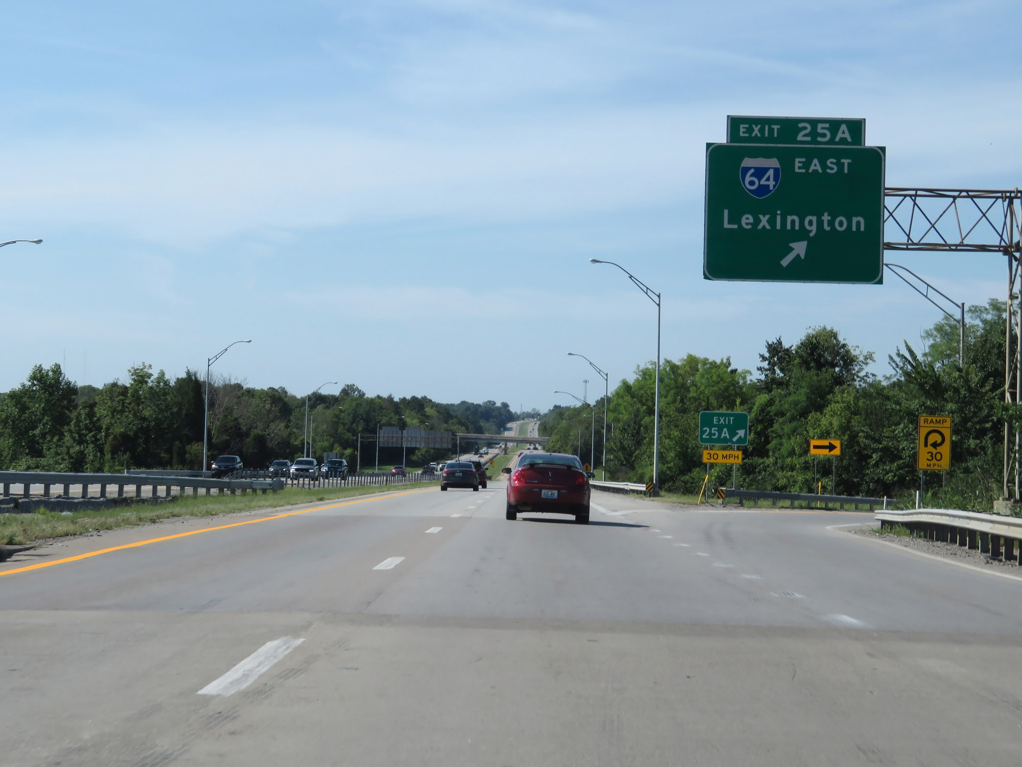 |
Interstate 265 South at Exit 25A: Interstate 64 East - Lexington (Photo taken 8/10/19). |
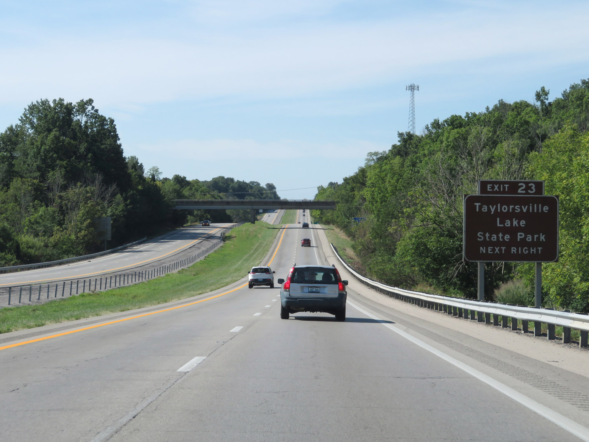 |
Take Exit 23 to Taylorsville Lake State Park. (Photo taken 8/10/19). |
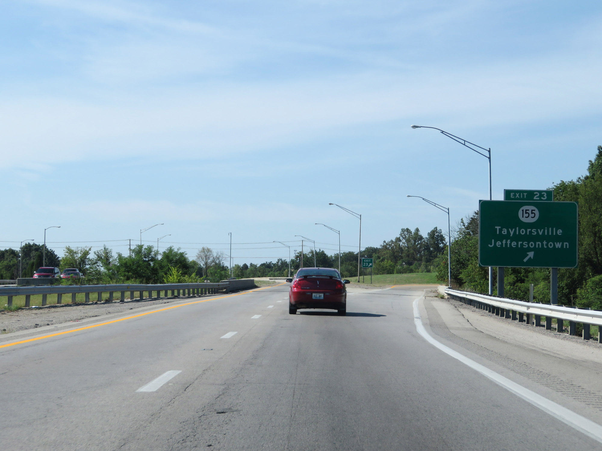 |
Interstate 265 South at Exit 23: KY 155 - Taylorsville / Jeffersontown (Photo taken 8/10/19). |
 |
Beyond Exit 23, Interstate 265 curves to the west. This Interstate 265 West reassurance shield reflects the change in direction. (Photo taken 8/10/19). |
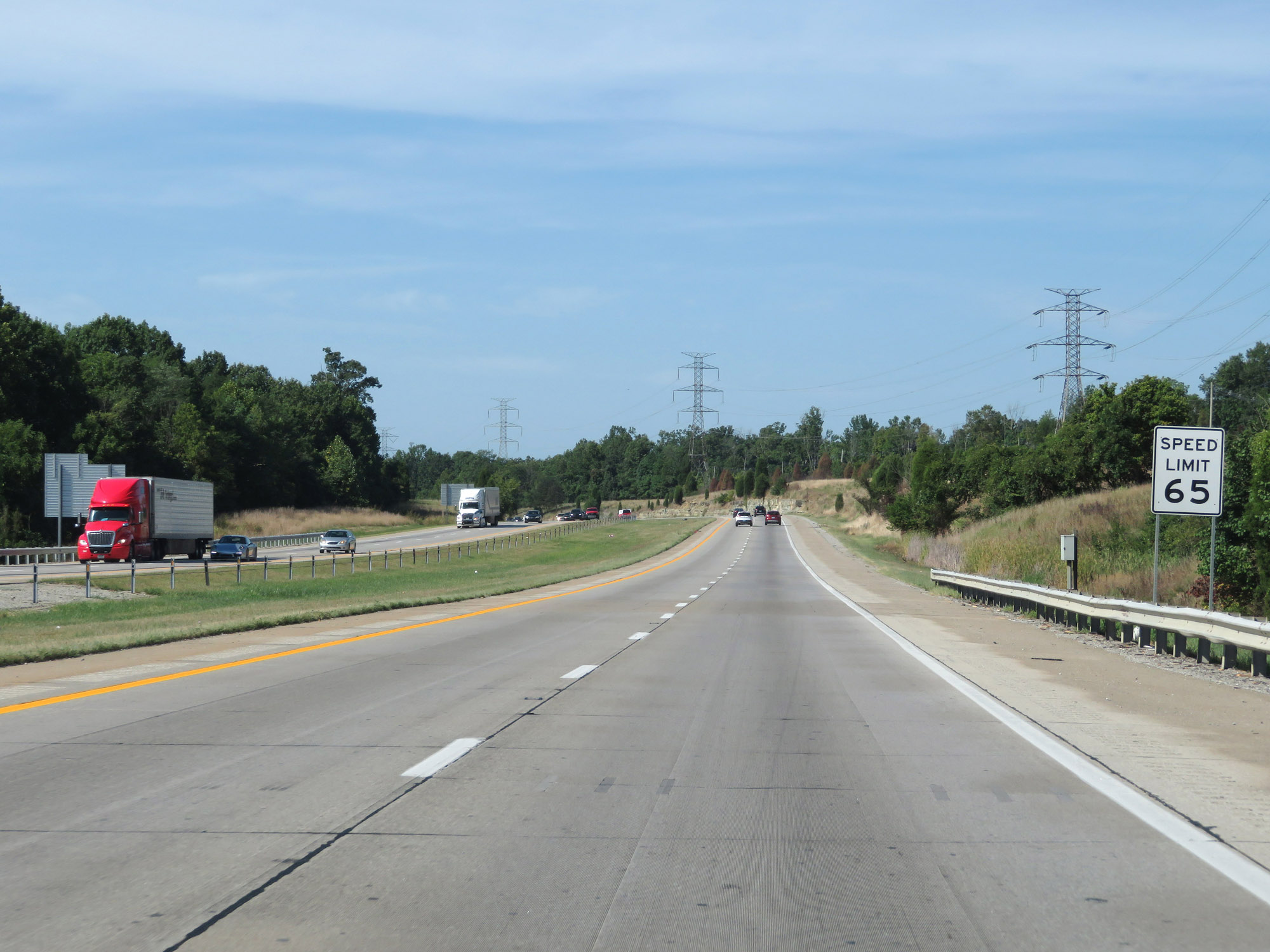 |
The speed limit remains 65 mph. (Photo taken 8/10/19). |
 |
Interstate 265 West at mile marker 21. (Photo taken 8/10/19). |
 |
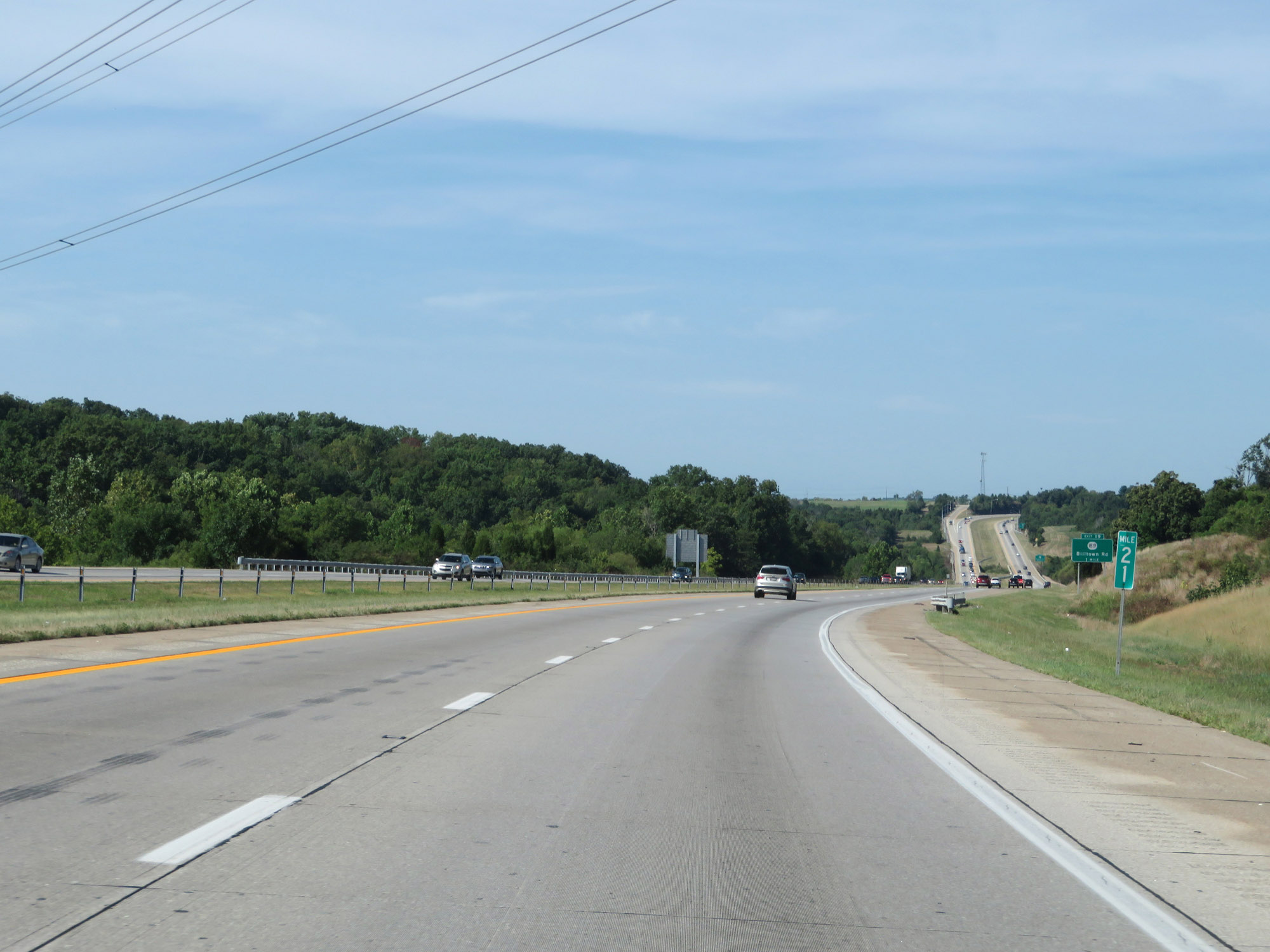
Interstate 265 West at Exit 19: KY 1819 - Billtown Rd (Photo taken 8/10/19). |
 |
Take Exit 17 to Fern Creek and Mt Washington. (Photo taken 8/10/19). |
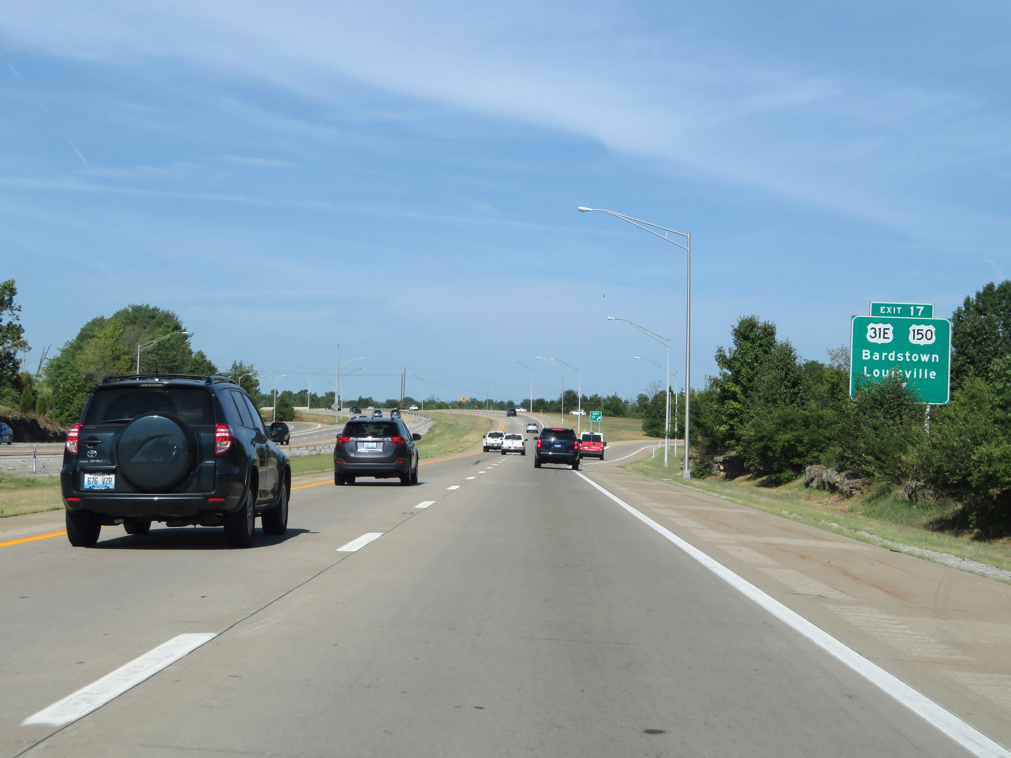 |
Interstate 265 West at Exit 17: US 31E / US 150 - Bardstown / Louisville (Photo taken 8/10/19). |
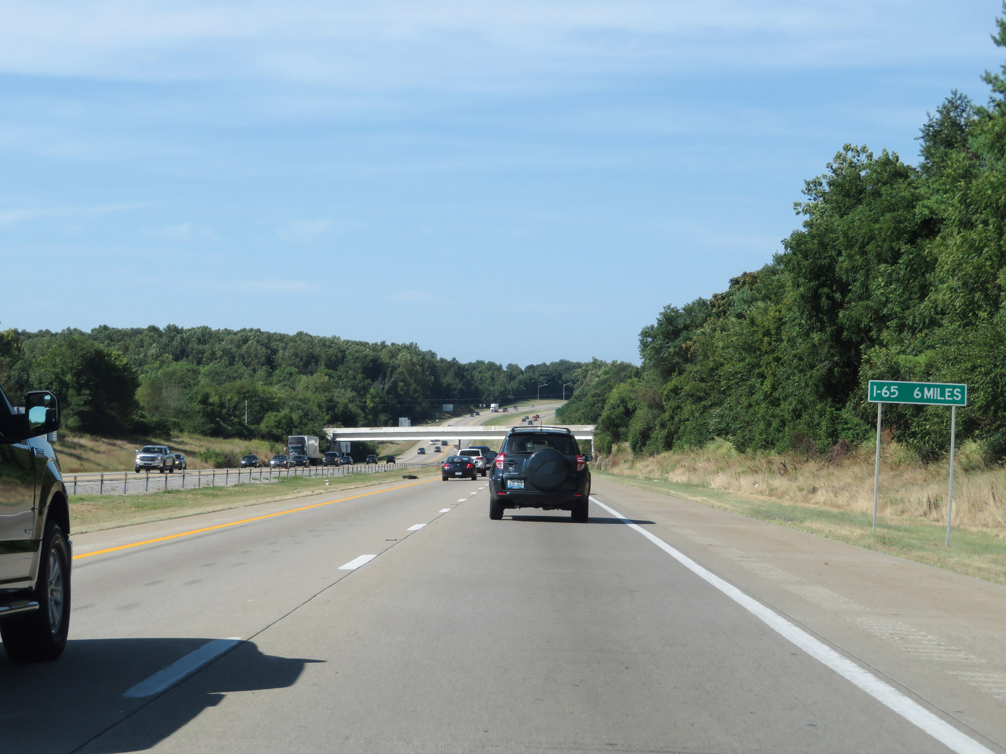 |
The junction of Interstate 65, which will mark the southwestern terminus of Interstate 265's designation, lies 5 miles ahead. (Photo taken 8/10/19). |
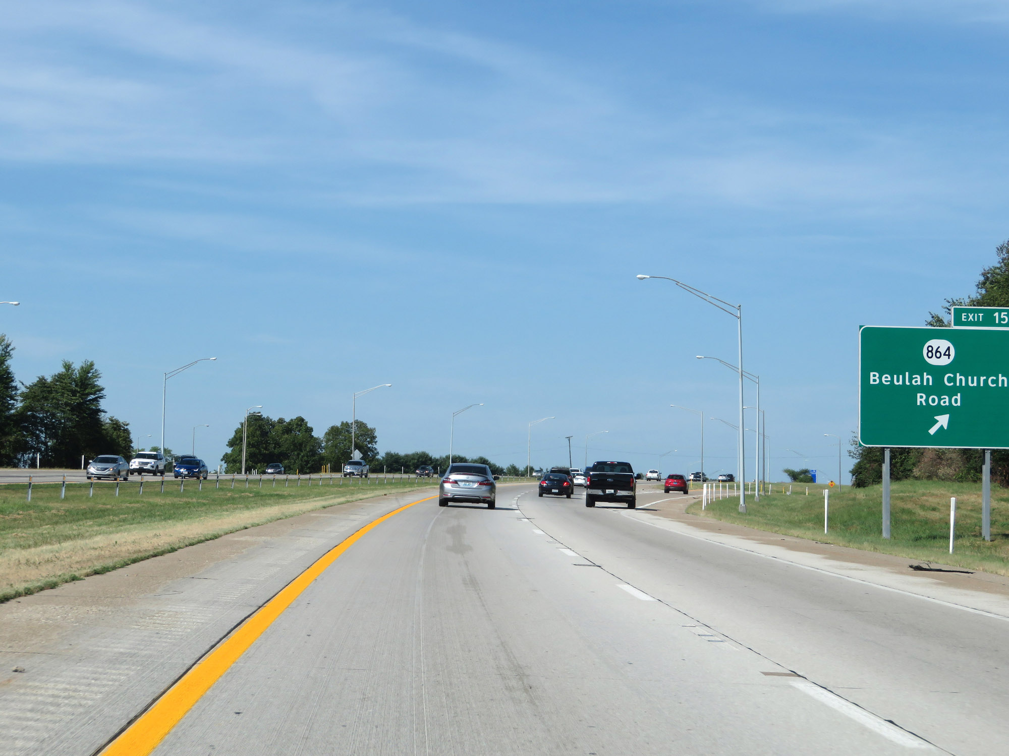 |
Interstate 265 West at Exit 15: KY 864 - Beulah Church Road (Photo taken 8/10/19). |
 |
Interstate 265 West at Exit 14: Smyrna Rd (Photo taken 8/10/19). |
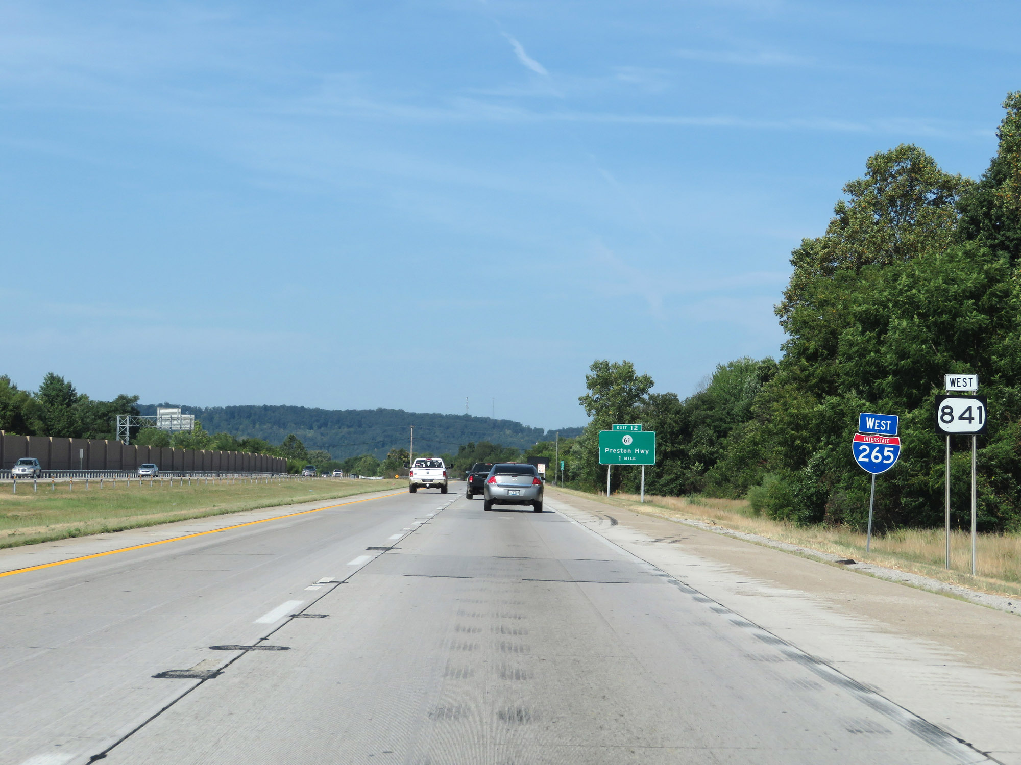 |
Another Interstate 265 West reassurance shield. (Photo taken 8/10/19). |
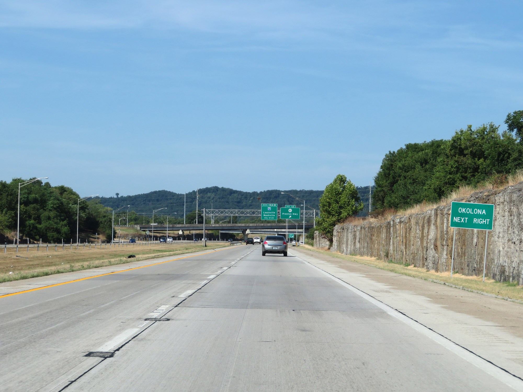 |
Take Exit 12 to Okolona. (Photo taken 8/10/19). |
 |
Interstate 265 West at Exit 12: KY 61 - Preston Hwy (Photo taken 8/10/19). |
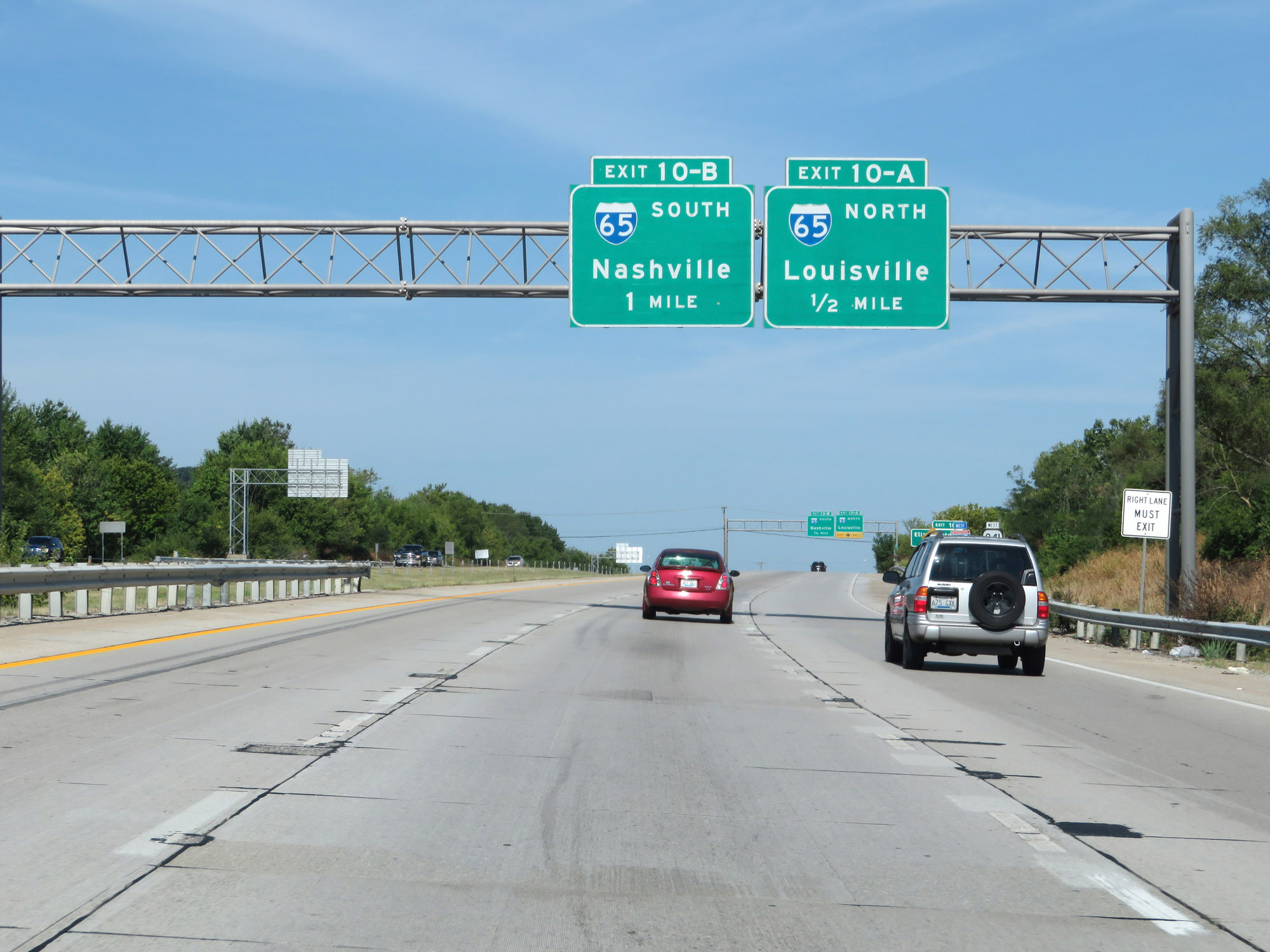 |
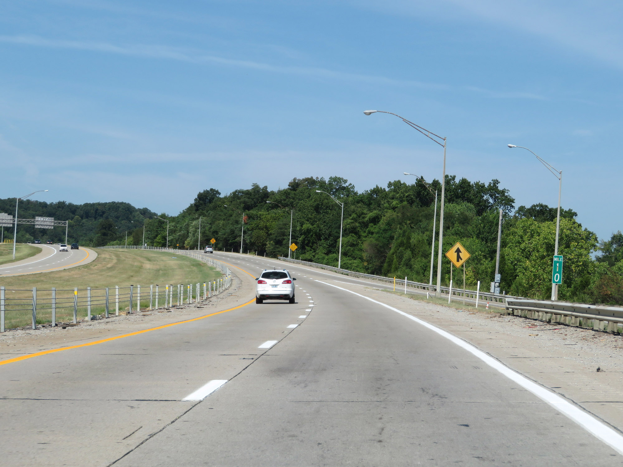
Interstate 265 West approaching Exit 10A - 1/2 mile. (Photo taken 8/10/19). |
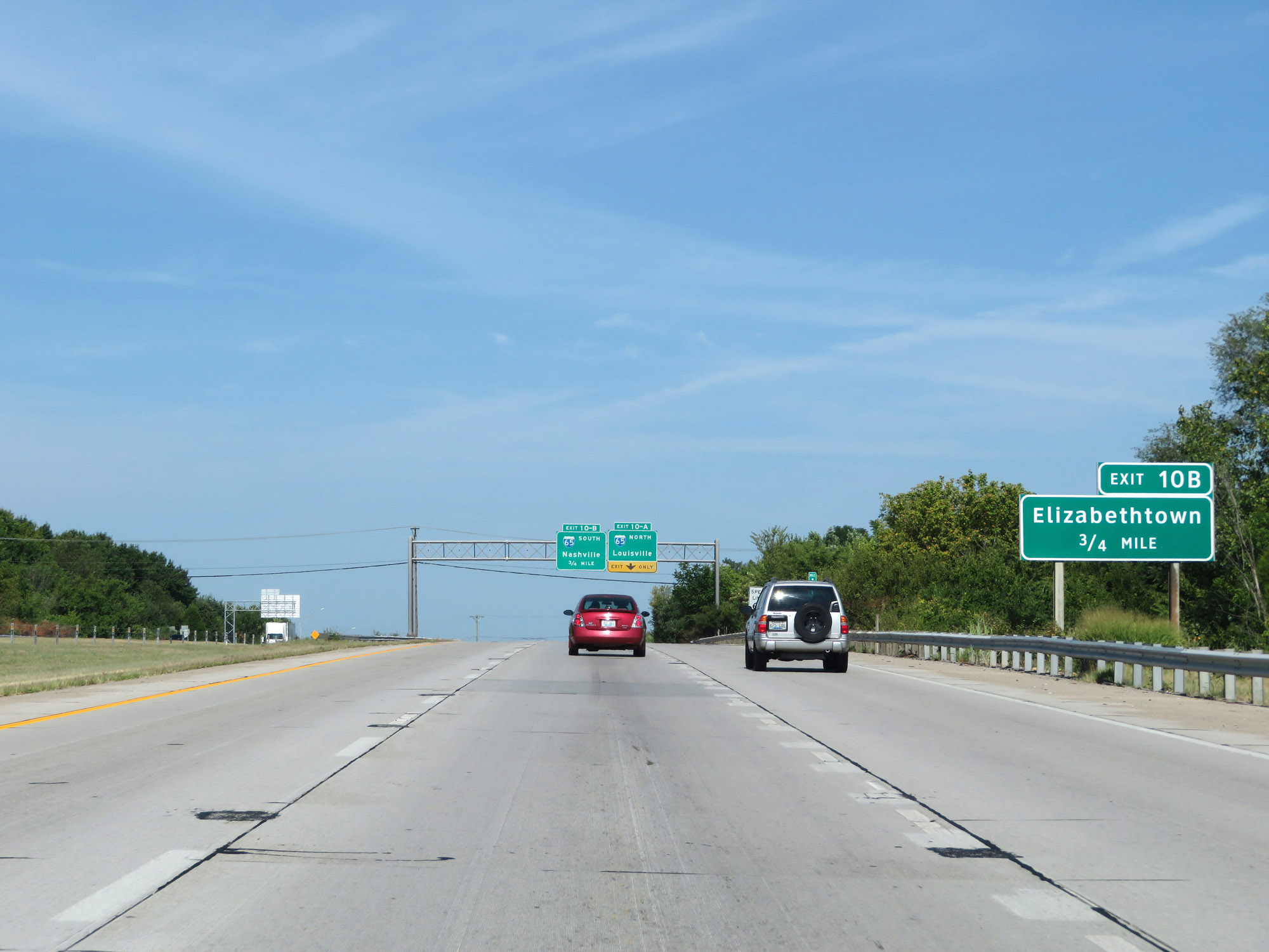 |
Take Exit 10B (Interstate 65 South) to Elizabethtown. (Photo taken 8/10/19). |
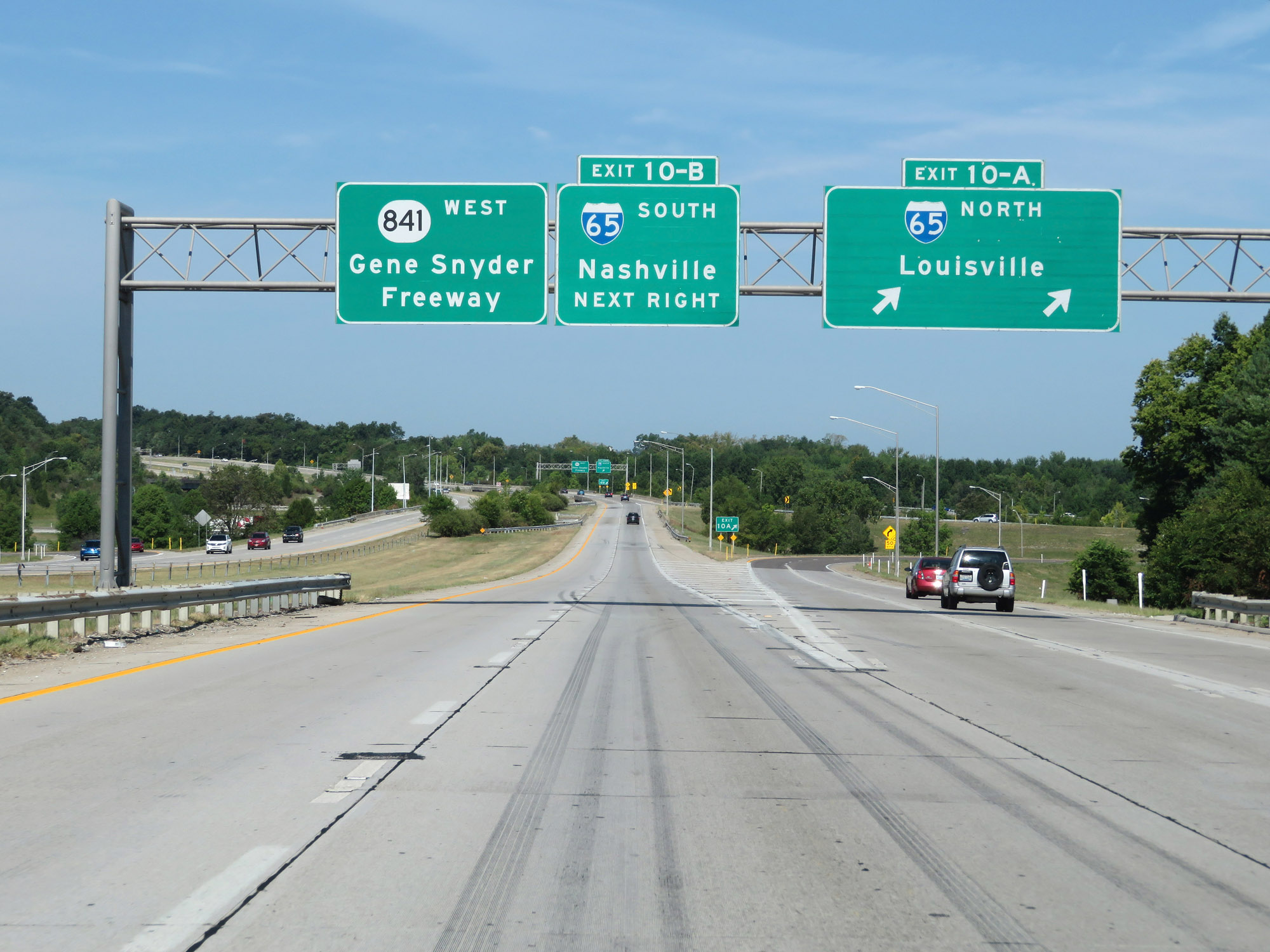 |
Interstate 265 West at Exit 10A: Interstate 65 North - Louisville (Photo taken 8/10/19). |
 |
Interstate 265 West at Exit 10B: Interstate 65 South - Nashville (Photo taken 8/10/19). |
 |
Beyond Exit 10B, KY 841 continues westbound as the Gene Snyder Freeway for 10 more miles as the Interstate 265 designation comes to an end. (Photo taken 8/10/19). |
 |
KY 841 West reassurance marker, signaling the southwestern terminus of Interstate 265. (Photo taken 8/10/19). |