Road Information |
||
 |
||
| Total Mileage in State: | 101 kilometers | |
| Northern End: | At I-10, in Tucson | |
| Southern End: | Near Mexican border, in Nogales | |
| Mileage covered in Photos: | 101 kilometers | |
| Counties covered in Photos: | Pima, Santa Cruz | |
| Major Junctions in Photos: |
AZ 86, in Tucson AZ 189, in Nogales |
|
| Control Cities in Photos: | Tucson, Sahuarita, Green Valley, Rio Rico, Nogales | |
Southbound
- Section 1: Tucson to Green Valley (Exit 56)
- Section 2: Green Valley (Exit 56) to Nogales
Section 1: Tucson to Green Valley (Exit 56)
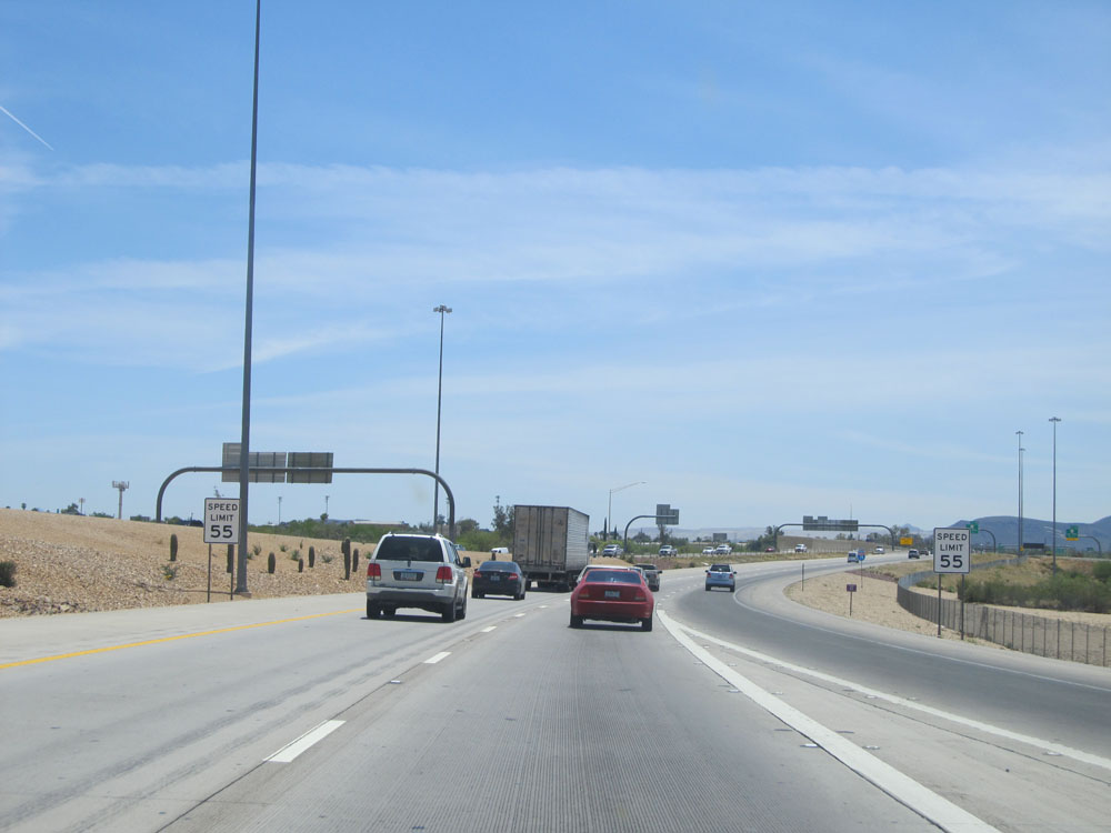 |
Merging onto Interstate 19 South from Interstate 10 in Tucson, these speed limit signs indicate that the speed limit starts out at 55 mph on I-19 as you pass through the Tucson area. (Photo taken 5/20/15). |
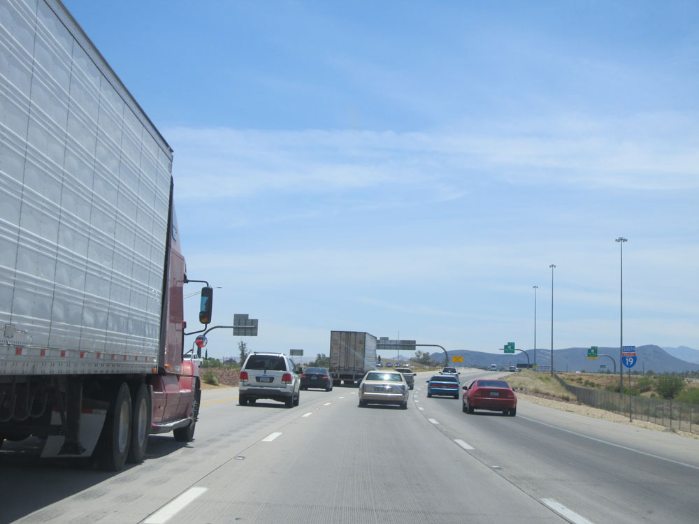 |
Interstate 19 South assurance shield. (Photo taken 5/20/15). |
 |
Take Exit 99 to Desert Museum and Old Tucson. (Photo taken 5/20/15). |
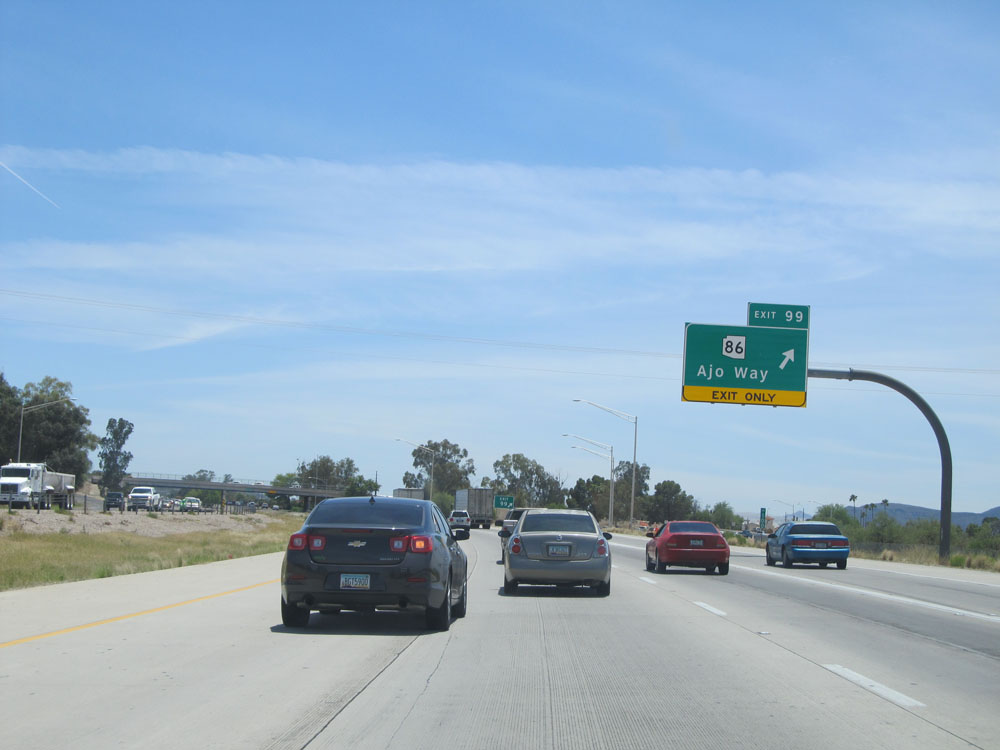 |
Interstate 19 South at Exit 99: AZ 86 - Ajo Way (Photo taken 5/20/15). |
 |
Take Exit 98 to Pima Community College. (Photo taken 5/20/15). |
 |
Interstate 19 South at Exit 98: Irvington Rd (Photo taken 5/20/15). |
 |
Interstate 19 South assurance shield near kilometer marker 98. (Photo taken 5/20/15). |
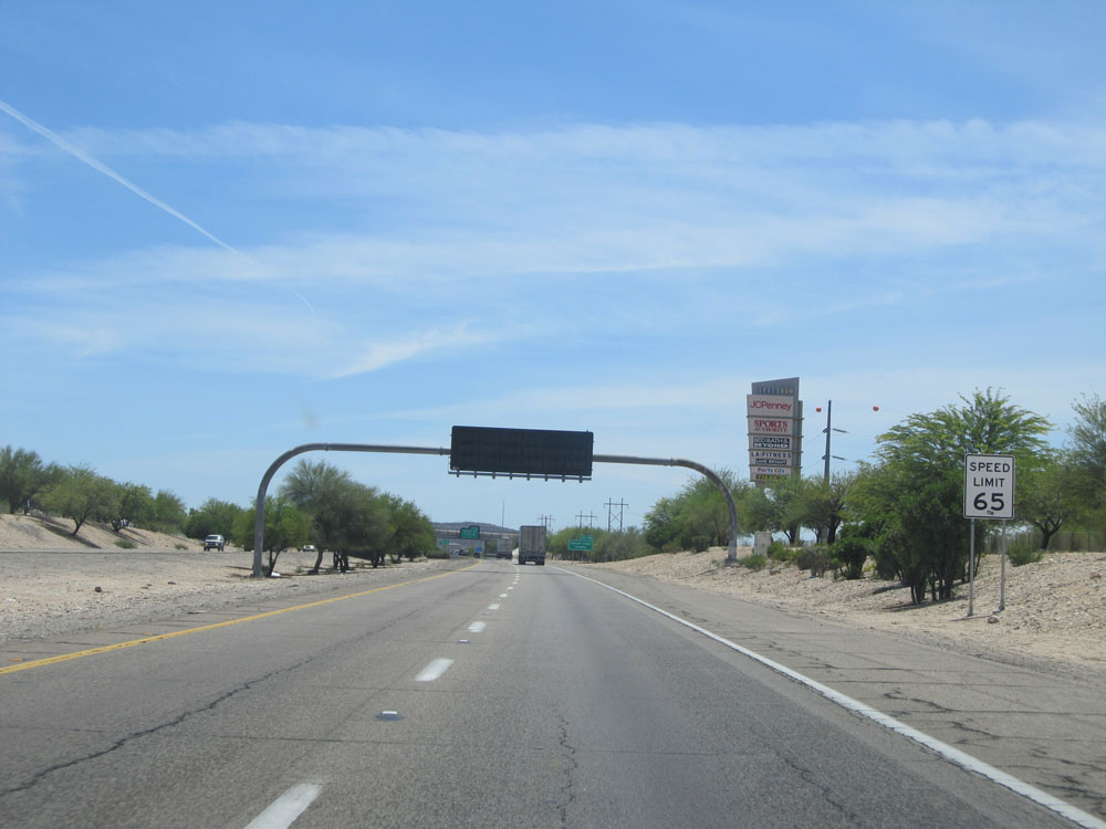 |
Near kilometer marker 97, the speed limit increases to 65 mph. (Photo taken 5/20/15). |
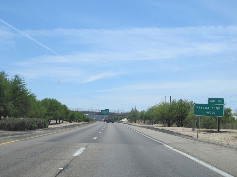 |
Take Exit 95 to Pascua Yaqui and Pueblo. (Photo taken 5/20/15). |
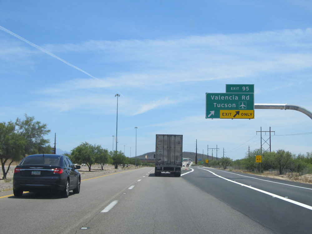 |
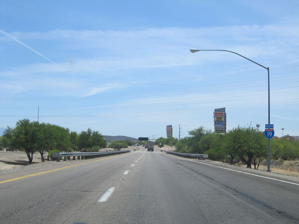
Interstate 19 South at Exit 95: Valencia Rd / Tucson International Airport (Photo taken 5/20/15). |
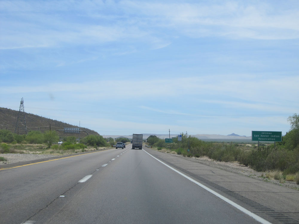 |
Interstate 19 South entering San Xavier Indian Reservation. (Photo taken 5/20/15). |
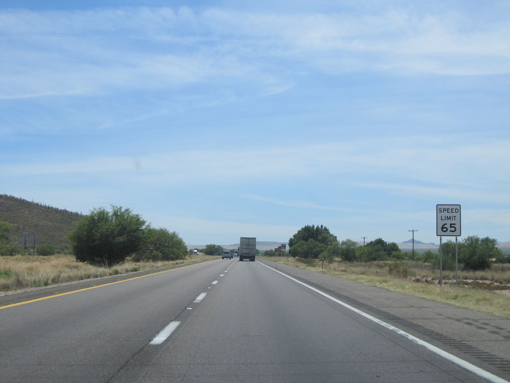 |
The speed limit remains 65 mph for just a bit longer. (Photo taken 5/20/15). |
 |
Take Exit 92 to San Xavier Mission. (Photo taken 5/20/15). |
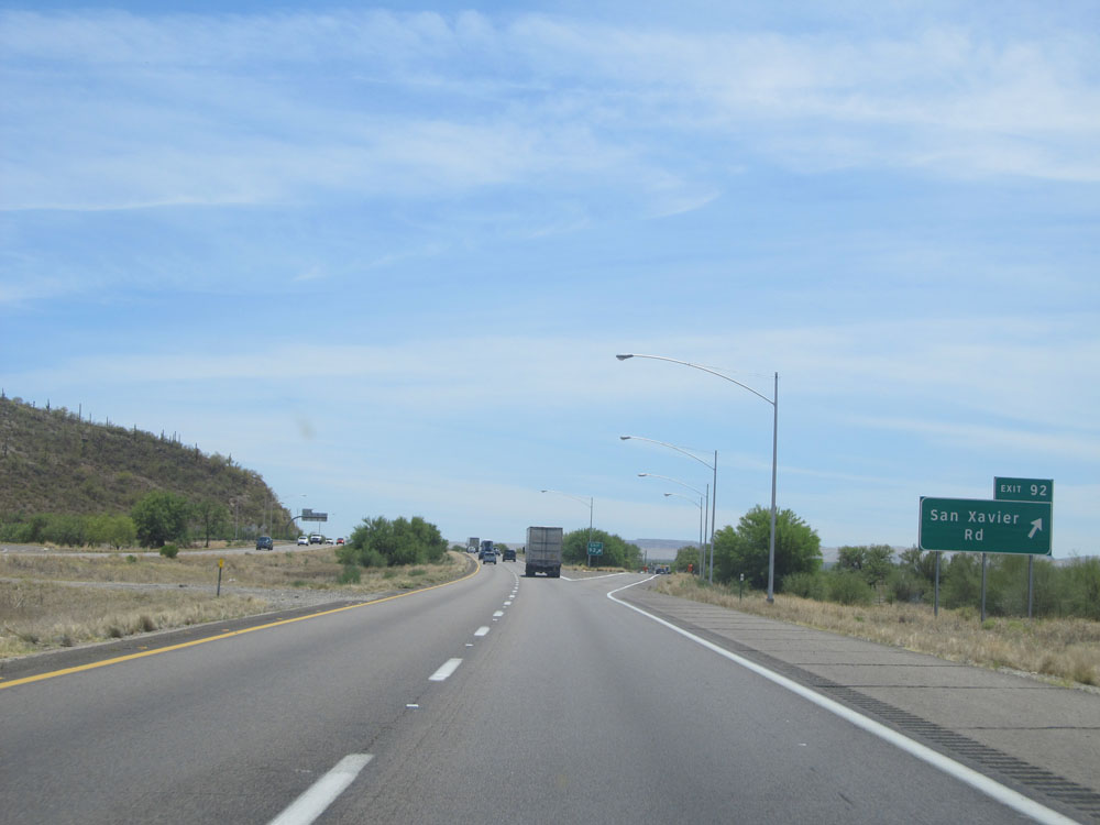 |
Interstate 19 South at Exit 92: San Xavier Rd (Photo taken 5/20/15). |
 |
Another Interstate 19 South assurance shield near kilometer marker 91. (Photo taken 5/20/15). |
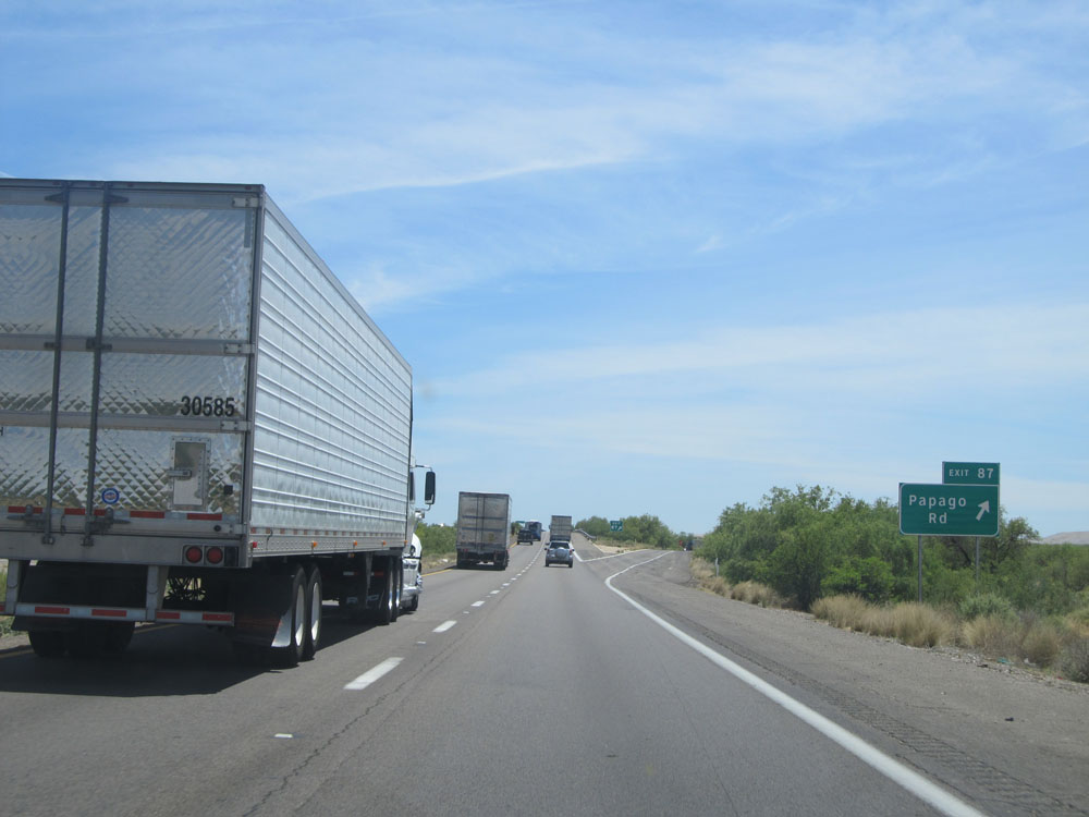 |
Interstate 19 South at Exit 87: Papago Rd (Photo taken 5/20/15). |
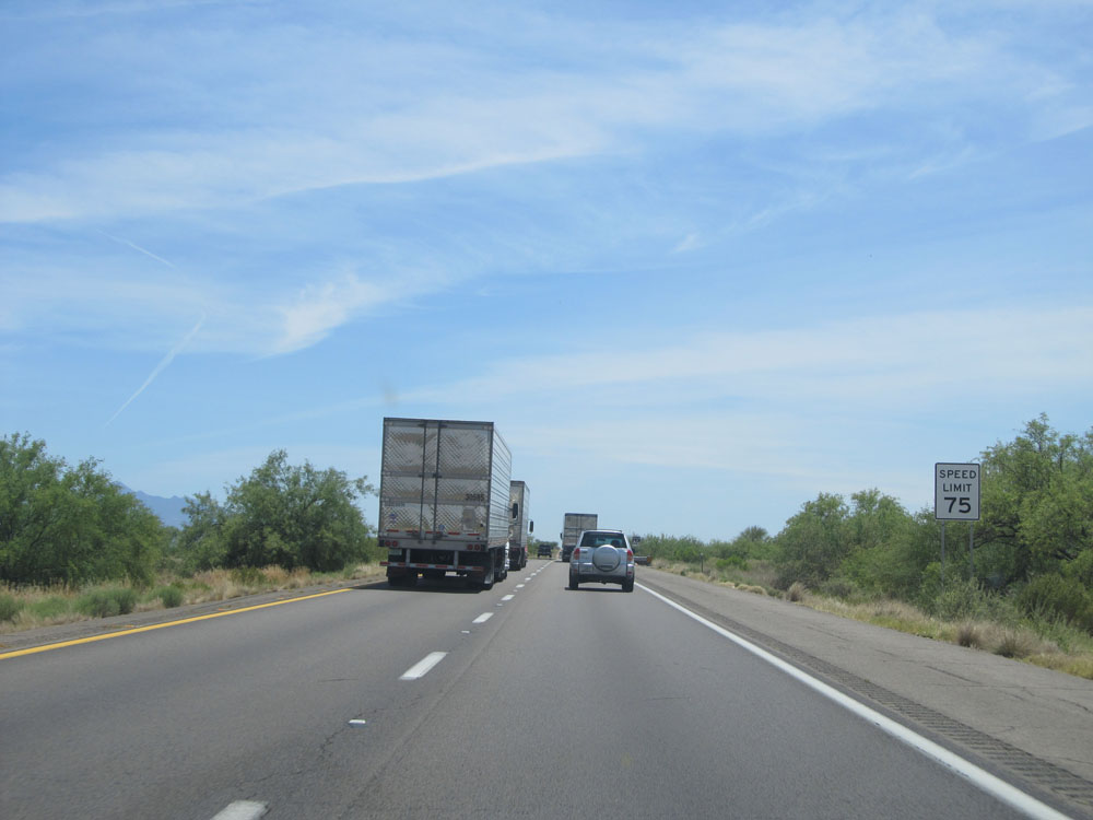 |
Just past Exit 87, the speed limit increases to 75 mph, which is standard on most rural Interstates in Arizona. (Photo taken 5/20/15). |
 |
Distance sign on Interstate 19 South. It's 20 km to Green Valley, 40 km to Amado, and 86 km to Nogales. Interstate 19 in Arizona is the only Interstate in the country to be marked by the kilometer rather than the mile. This decision was the result of a push by the U.S. to go to all metric on the Interstate system several years ago. The fact that I-19 runs down to the Mexican border is apparently just a coincidence and had nothing to do with I-19 being marked by the kilometer rather than the mile. (Photo taken 5/20/15). |
 |
Emergency call boxes are briefly in place on Interstate 19, like the one seen here. (Photo taken 5/20/15). |
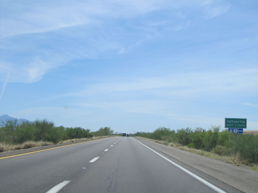 |
Take any of the next 3 exits to Sahuarita. (Photo taken 5/20/15). |
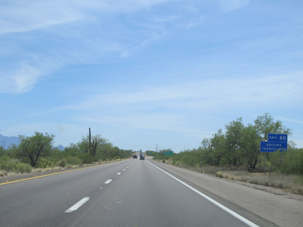 |
Take Exit 80 for Arizona Tourist Info. (Photo taken 5/20/15). |
 |
Interstate 19 South at Exit 80: Pima Mine Rd (Photo taken 5/20/15). |
 |
Interstate 19 South leaves the San Xavier Indian Reservation as it crosses over Pima Mine Rd. (Photo taken 5/20/15). |
 |
Speed Limit - 75 mph sign near kilometer marker 78. (Photo taken 5/20/15). |
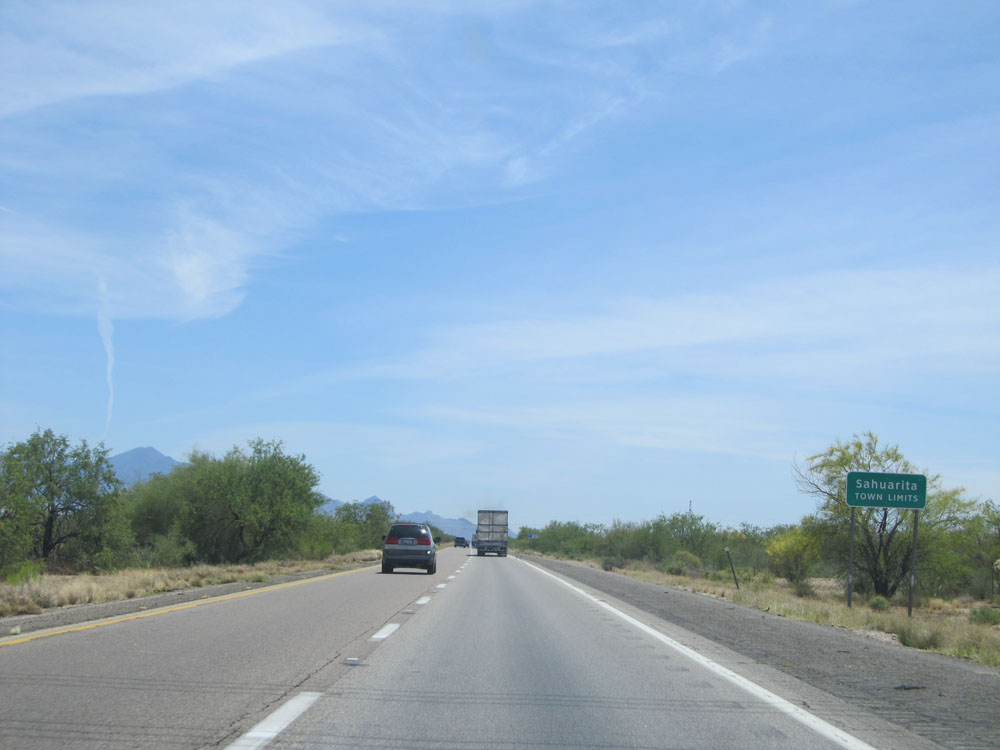 |
Interstate 19 South entering the Sahuarita town limits. (Photo taken 5/20/15). |
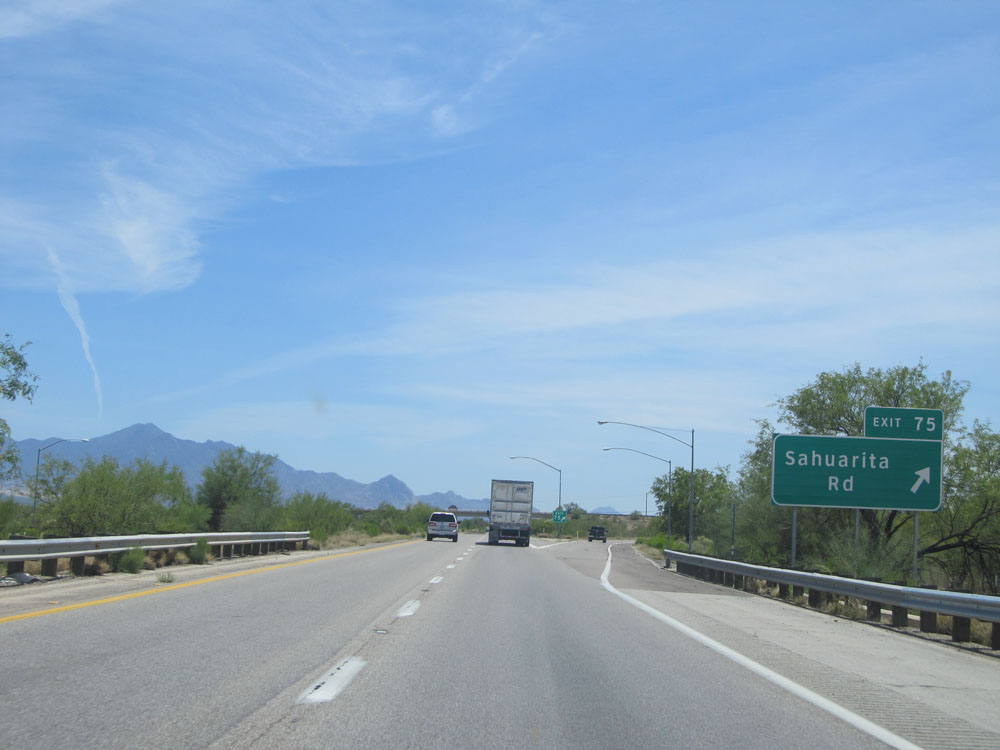 |
Interstate 19 South at Exit 75: Sahuarita Rd (Photo taken 5/20/15). |
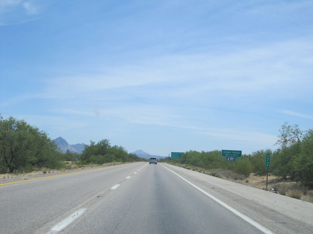 |
Take any of the next 4 exits to Green Valley. (Photo taken 5/20/15). |
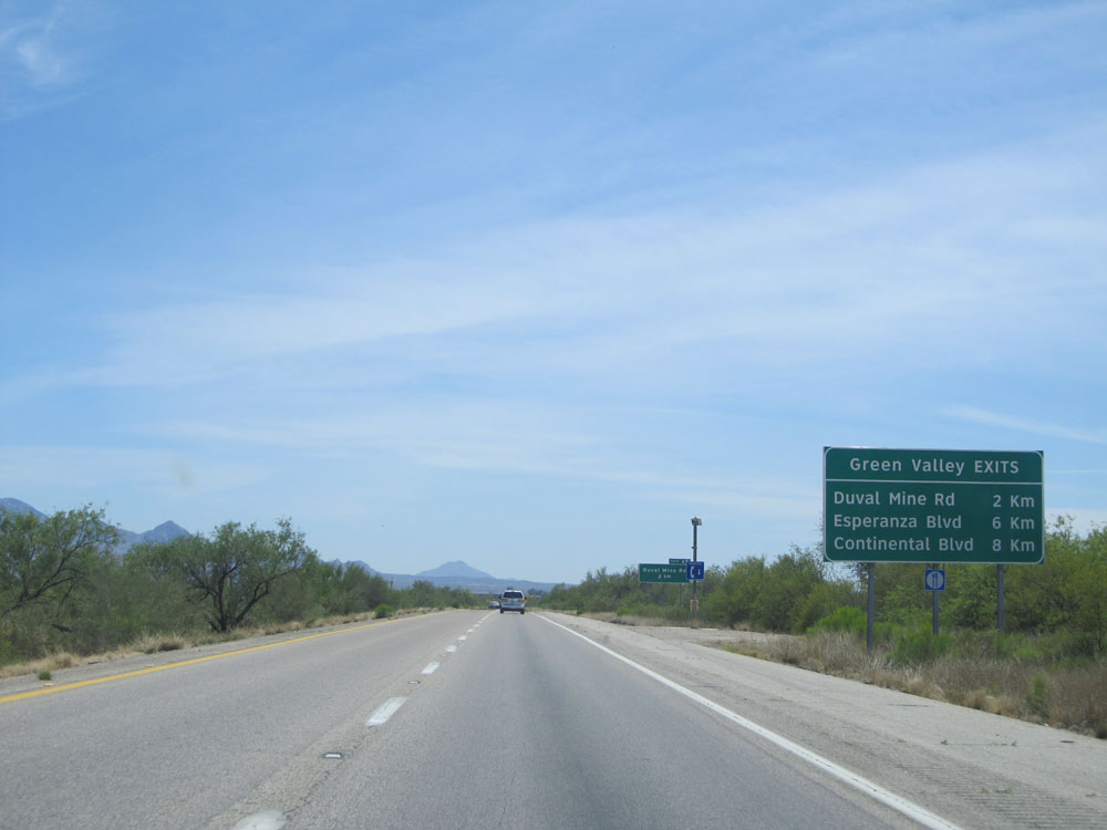 |
Sign listing the distances to the three upcoming exits to Green Valley. (Photo taken 5/20/15). |
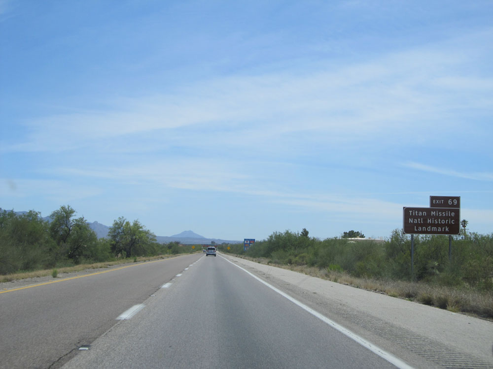 |
Take Exit 69 to Titan Missile National Historic Landmark. (Photo taken 5/20/15). |
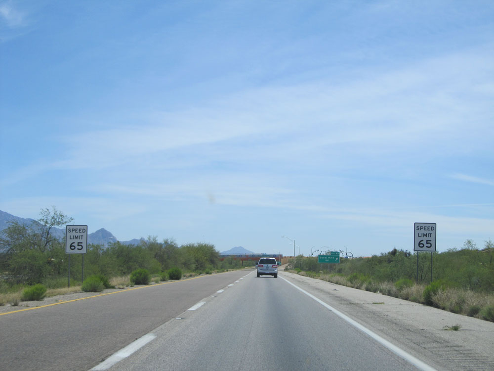 |
Approaching Exit 69, the speed limit decreases to 65 mph as you pass through Green Valley. (Photo taken 5/20/15). |
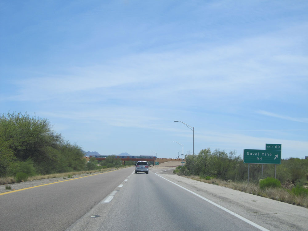 |
Interstate 19 South at Exit 69: Duval Mine Rd (Photo taken 5/20/15). |
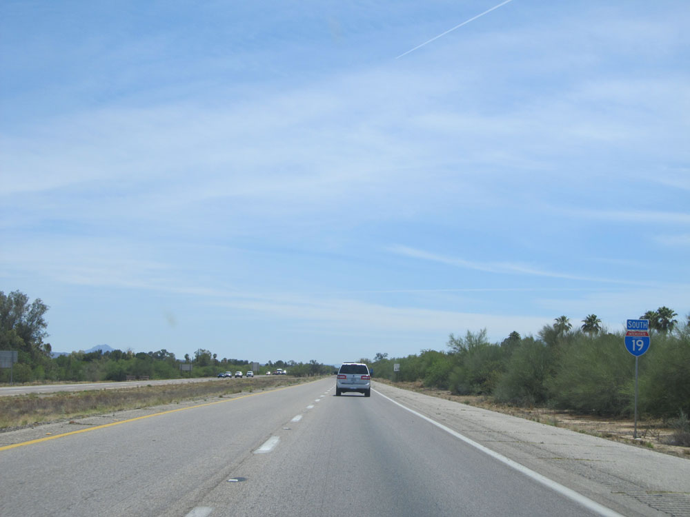 |
Interstate 19 South assurance shield near kilometer marker 69. (Photo taken 5/20/15). |
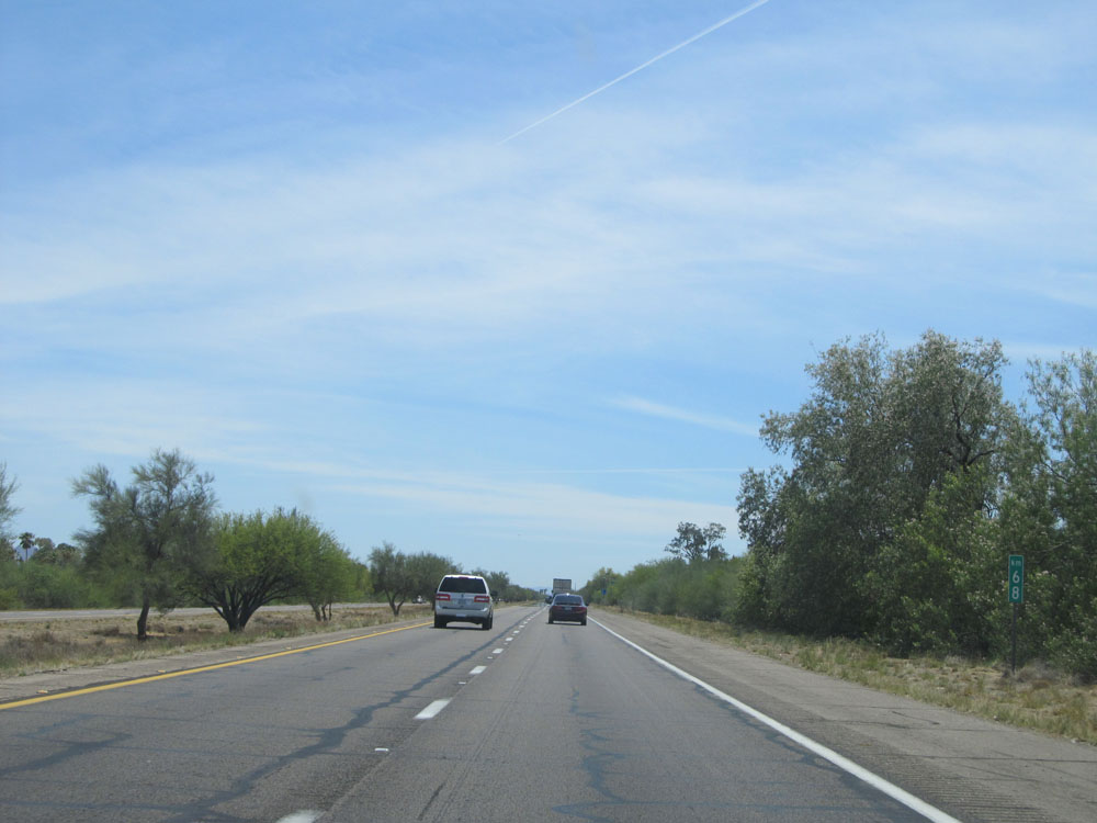 |
Interstate 19 South: Road view from kilometer marker 68. (Photo taken 5/20/15). |
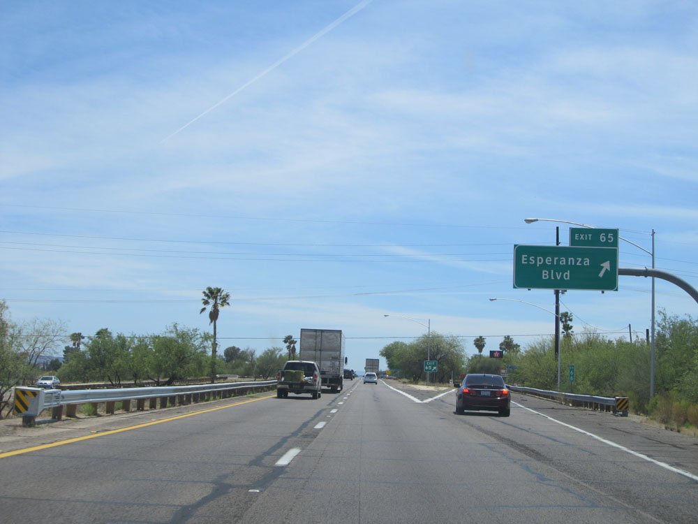 |
Interstate 19 South at Exit 65: Esperanza Blvd (Photo taken 5/20/15). |
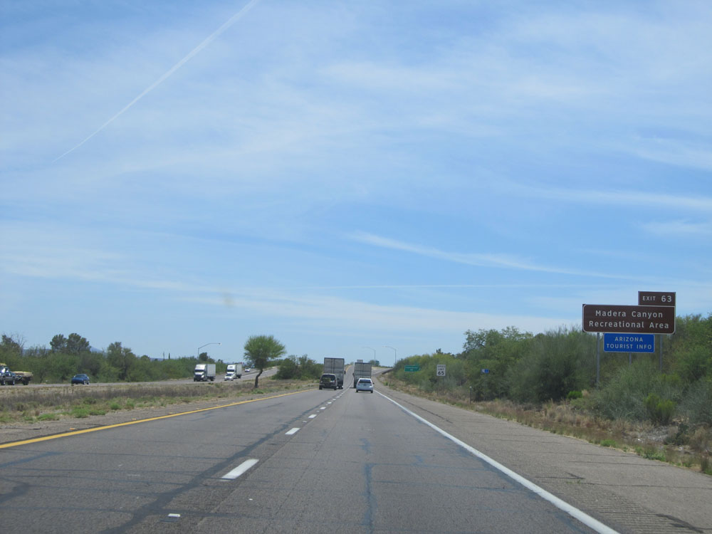 |
Take Exit 63 to Madera Canyon Recreational Area. (Photo taken 5/20/15). |
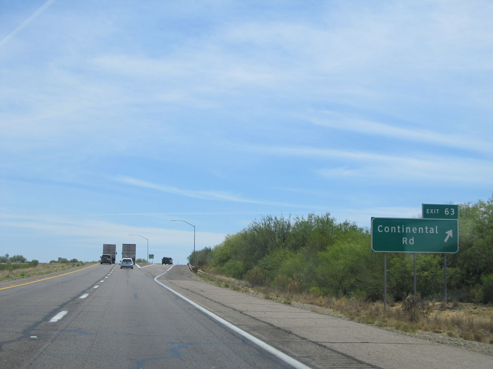 |
Interstate 19 South at Exit 63: Continental Rd (Photo taken 5/20/15). |
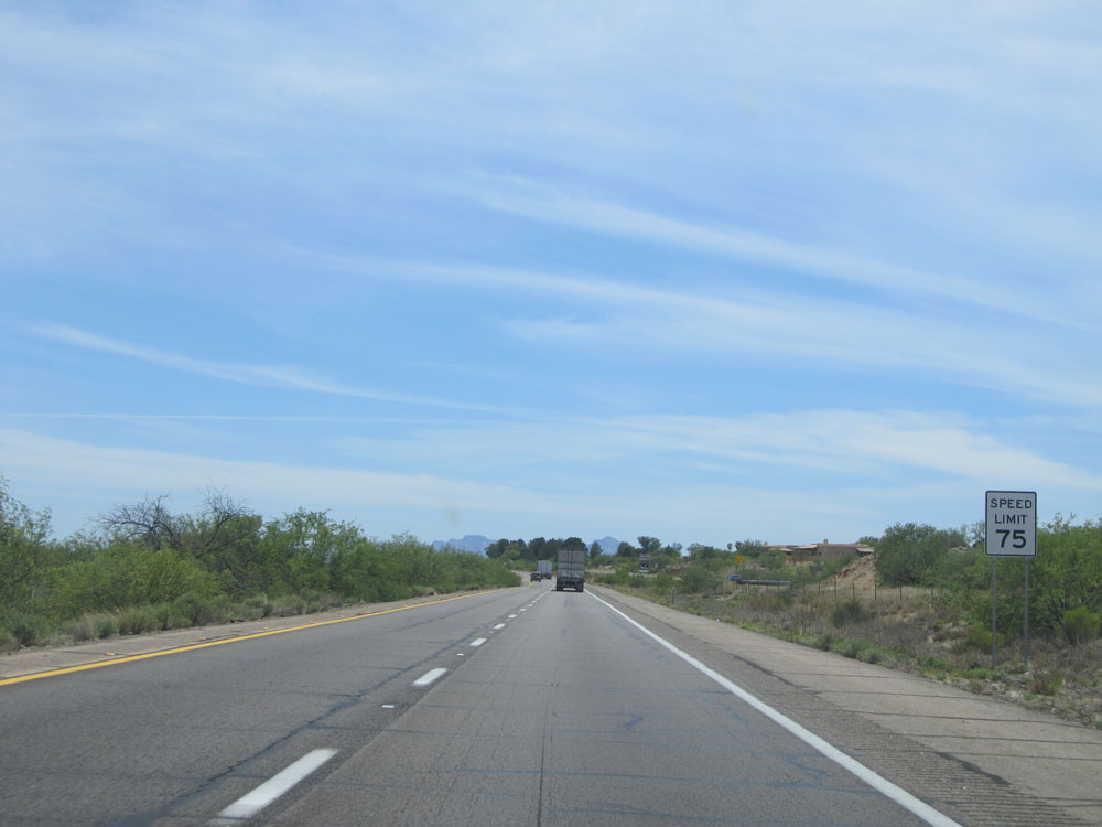 |
Just past Exit 63, the standard speed limit of 75 mph resumes. (Photo taken 5/20/15). |
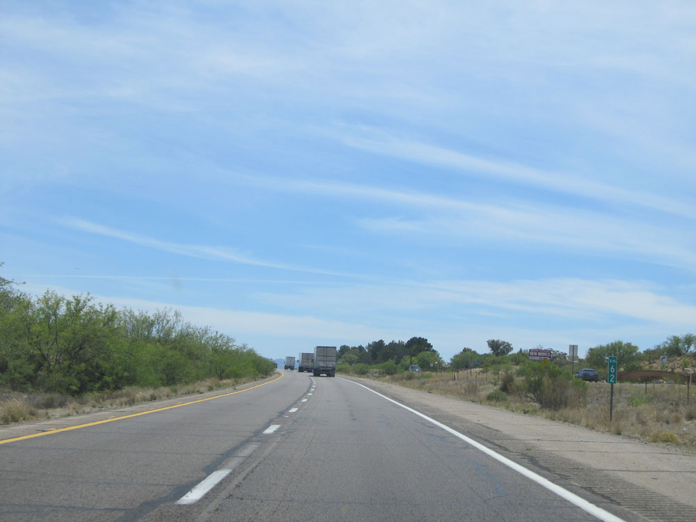 |
Interstate 19 South: Road view from kilometer marker 62. (Photo taken 5/20/15). |
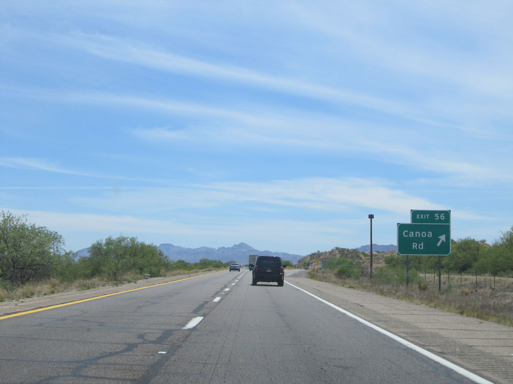 |
Interstate 19 South at Exit 56: Canoa Rd (Photo taken 5/20/15). |
Section 2: Green Valley (Exit 56) to Tucson
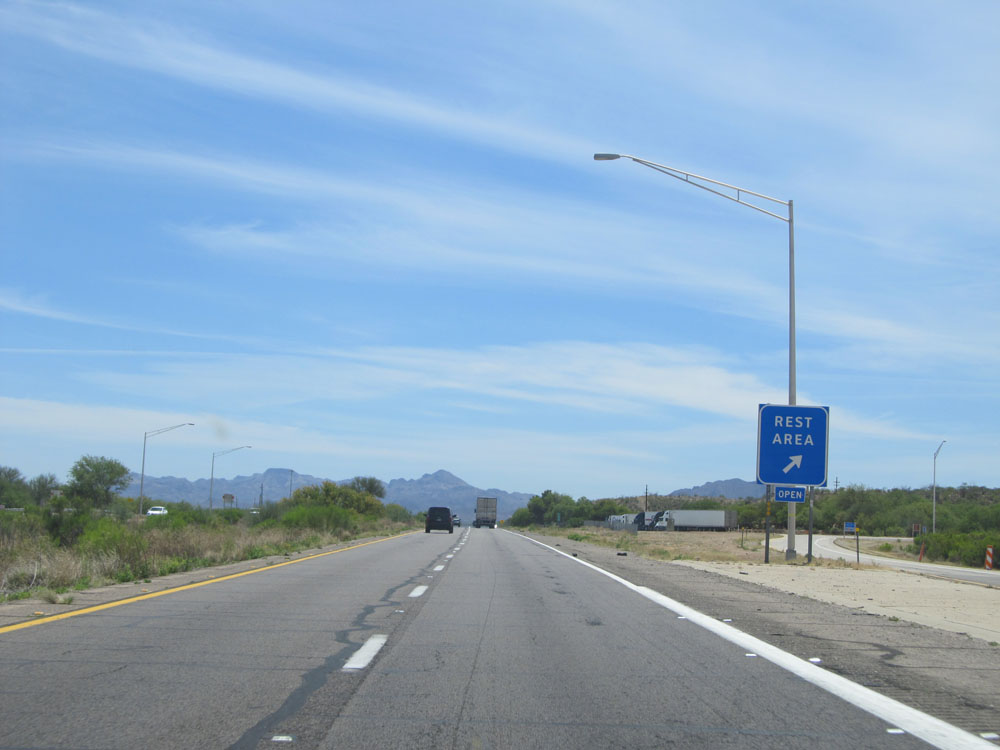 |
Interstate 19 South at the Rest Area located at kilometer marker 54. (Photo taken 5/20/15). |
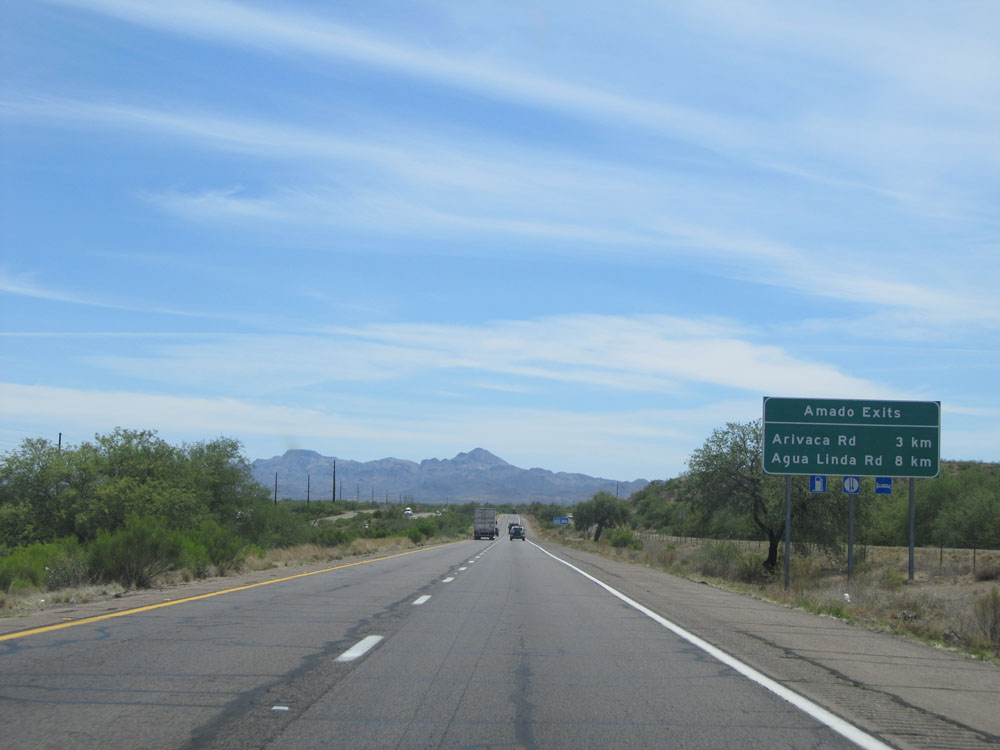 |
Sign listing the distances to the two upcoming exits to Amado. (Photo taken 5/20/15). |
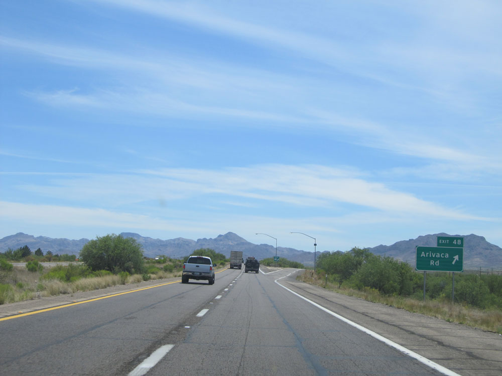 |
Interstate 19 South at Exit 48: Arivaca Rd (Photo taken 5/20/15). |
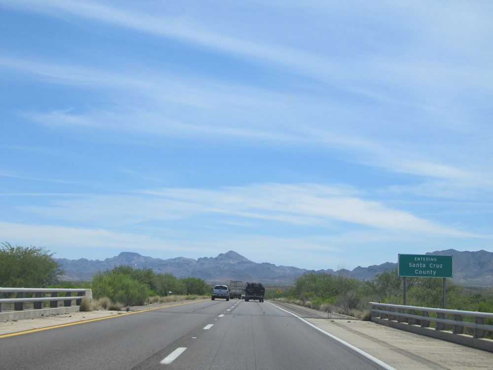 |
Interstate 19 South entering Santa Cruz County. (Photo taken 5/20/15). |
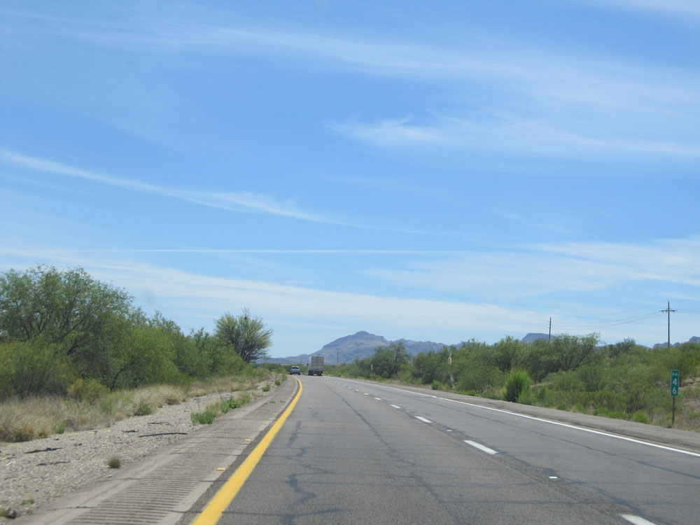 |
Interstate 19 South: Road view from kilometer marker 46. (Photo taken 5/20/15). |
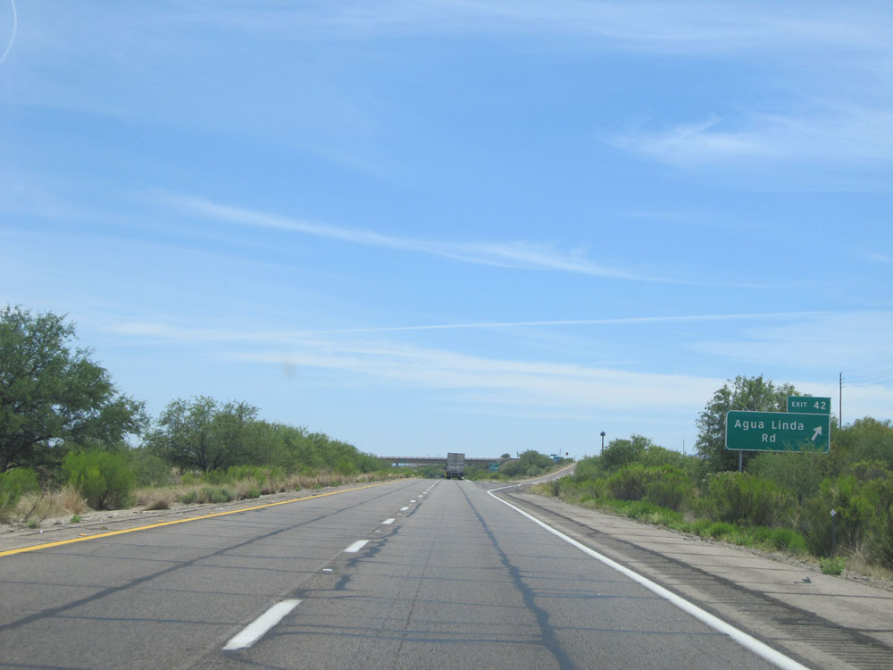 |
Interstate 19 South at Exit 42: Agua Linda Rd (Photo taken 5/20/15). |
 |
Interstate 19 South at Exit 40: Chavez Siding Rd (Photo taken 5/20/15). |
 |
Interstate 19 South: Road view from kilometer marker 37. (Photo taken 5/20/15). |
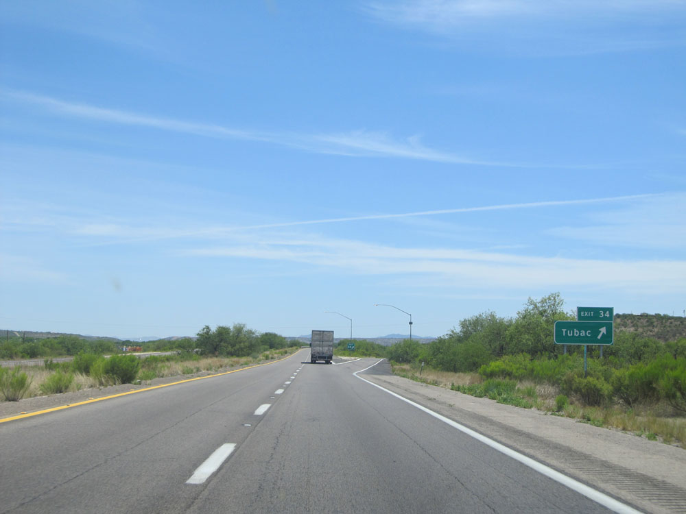 |
Interstate 19 South at Exit 34: Tubac (Photo taken 5/20/15). |
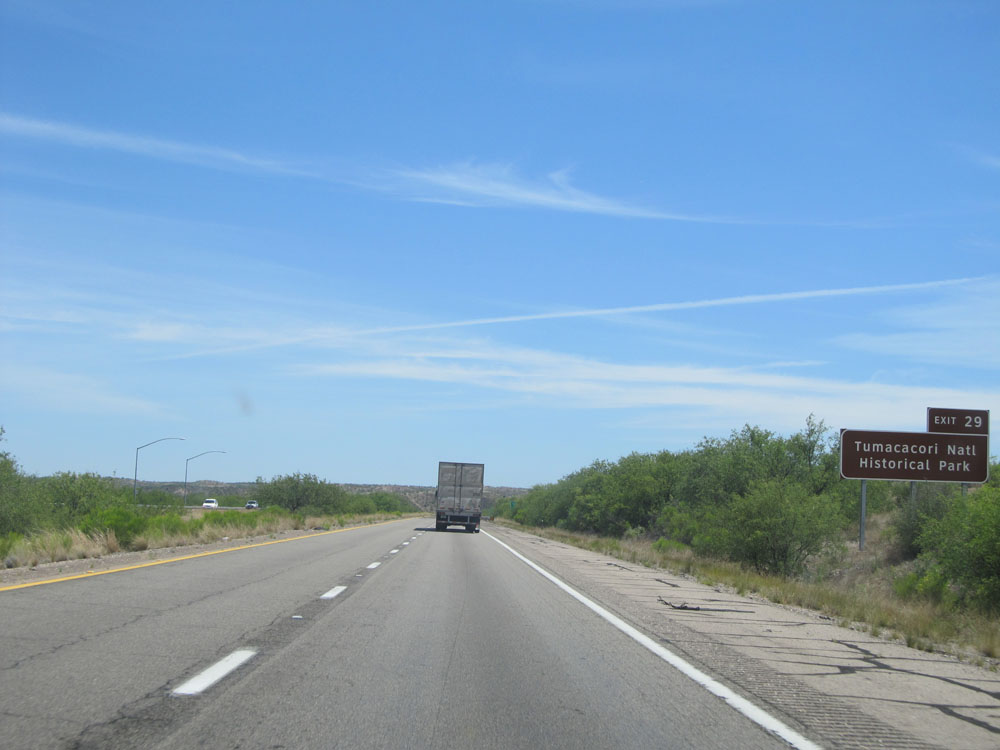 |
Take Exit 29 to Tumacacori National Historic Park. (Photo taken 5/20/15). |
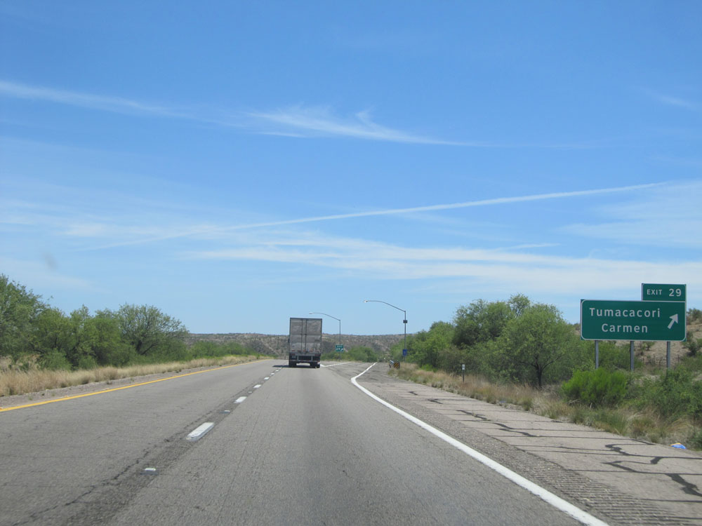 |
Interstate 19 South at Exit 29: Tumacacori / Carmen (Photo taken 5/20/15). |
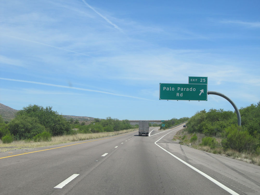 |
Interstate 19 South at Exit 25: Palo Parado Rd (Photo taken 5/20/15). |
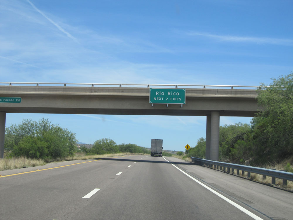 |
Take either of the next 2 exits to Rio Rico. (Photo taken 5/20/15). |
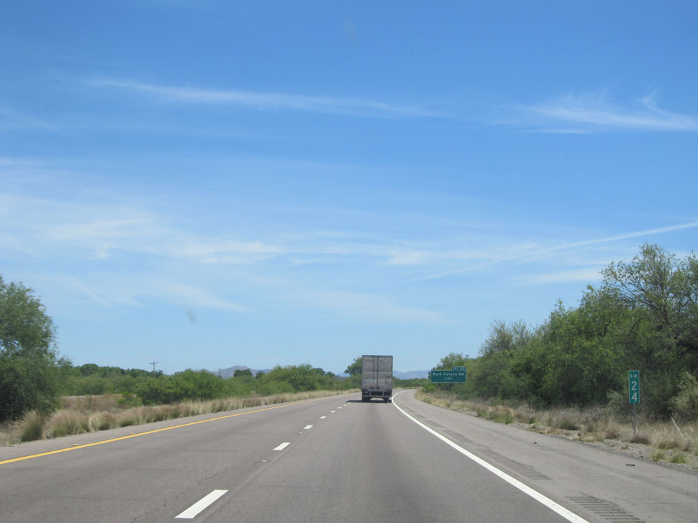 |
Interstate 19 South: Road view from kilometer marker 24. (Photo taken 5/20/15). |
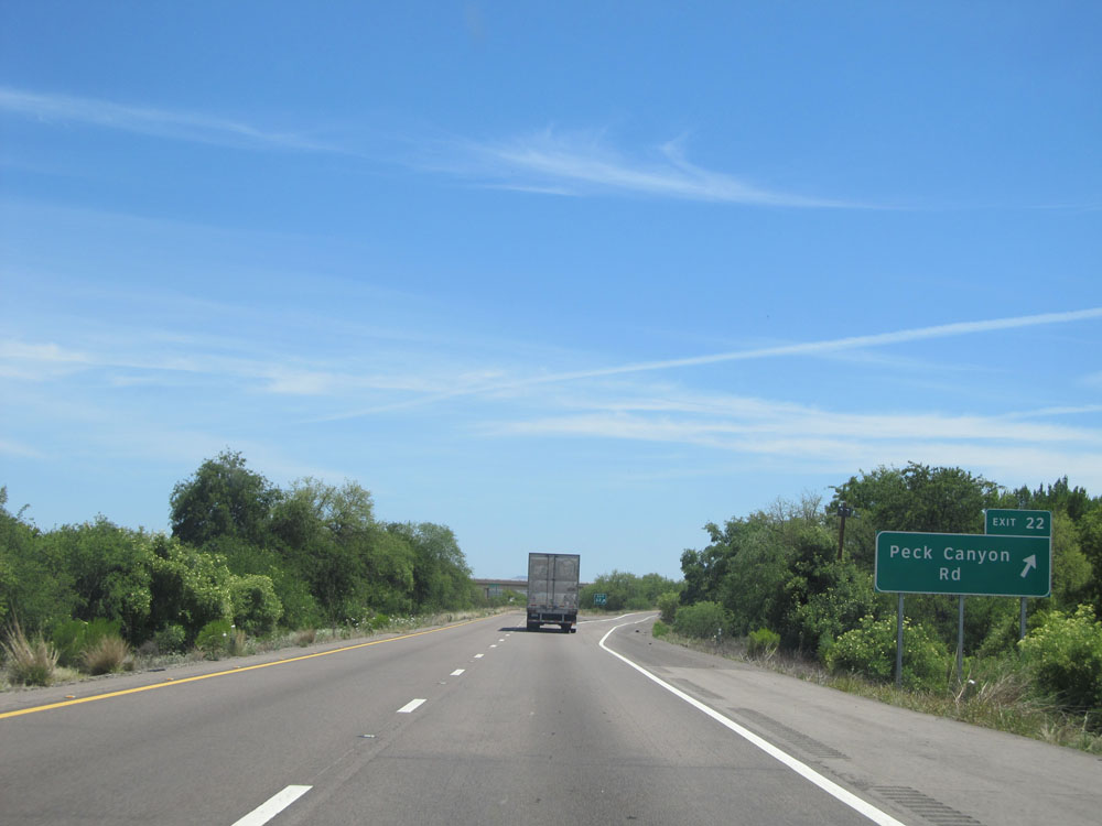 |
Interstate 19 South at Exit 22: Peck Canyon Rd (Photo taken 5/20/15). |
 |
Exit 17 provides no access to Ruby Road. (Photo taken 5/20/15). |
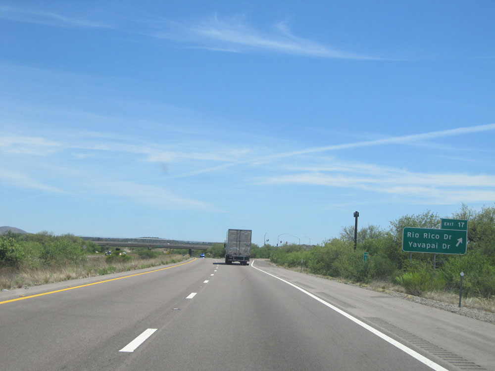 |
Interstate 19 South at Exit 17: Rio Rico Dr / Yavapai Dr (Photo taken 5/20/15). |
 |
Distance sign near kilometer marker 17. It's 3 km to the junction of AZ 289, 16 kilometers to Nogales, and 17 km to the International Border. (Photo taken 5/20/15). |
 |
Take Exit 12 to Pena Blanca Lake Recreational Area. (Photo taken 5/20/15). |
 |
Also take Exit 12 to Ruby Rd and the Nogales Ranger Station. (Photo taken 5/20/15). |
 |
Interstate 19 South at Exit 12: AZ 289 West - Ruby Rd (Photo taken 5/20/15). |
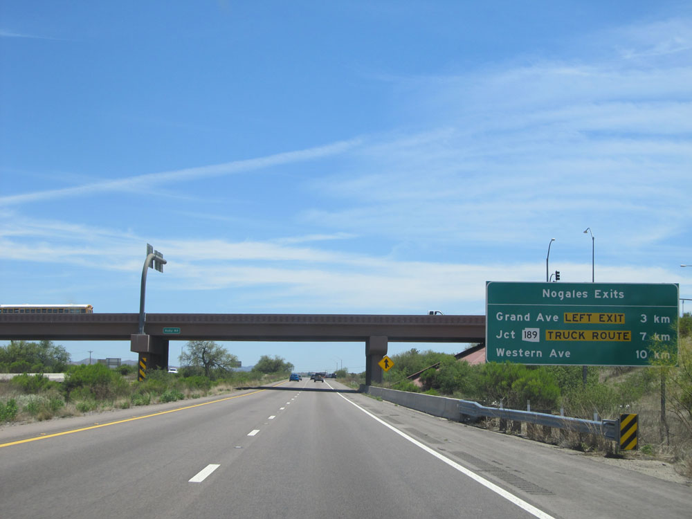 |
Sign listing the distances to the three upcoming exits to Nogales. (Photo taken 5/20/15). |
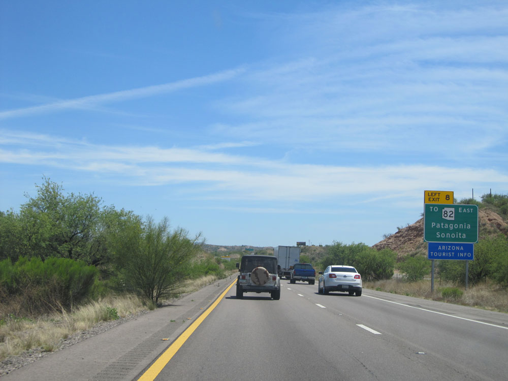 |
Take Exit 8 (on the left) to AZ 82 East toward Patagonia and Sonoita. (Photo taken 5/20/15). |
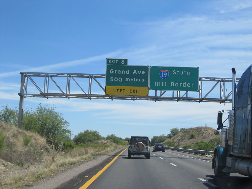 |
Interstate 19 South approaching Exit 8 (left exit) - 500 meters. (Photo taken 5/20/15). |
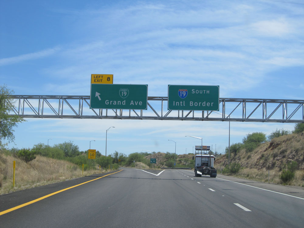 |
Interstate 19 South at Exit 8: Interstate 19 BL - Grand Ave (Photo taken 5/20/15). |
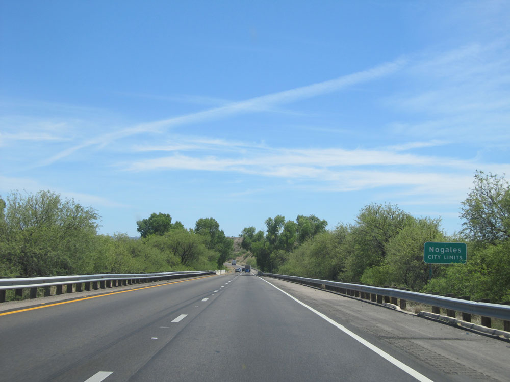 |
Interstate 19 South entering the Nogales city limits. (Photo taken 5/20/15). |
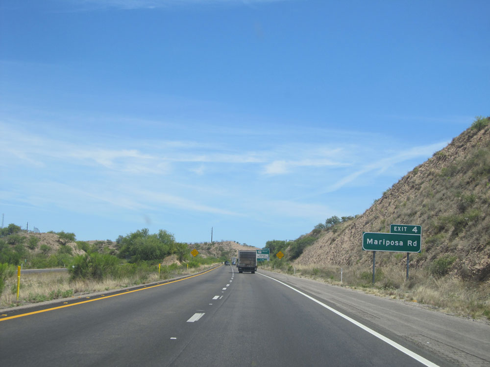 |
Take Exit 4 to Mariposa Rd. (Photo taken 5/20/15). |
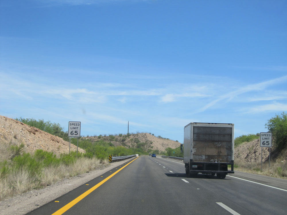 |
Shorty after entering the Nogales city limits, the speed limit drops to 65 mph. (Photo taken 5/20/15). |
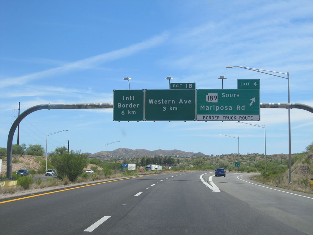 |
Interstate 19 South at Exit 4: AZ 189 South - Mariposa Rd / Border Truck Route (Photo taken 5/20/15). |
 |
Interstate 19 South: Road view from kilometer marker 4. (Photo taken 5/20/15). |
 |
Near kilometer marker 3, the speed limit decreases further to 55 mph. (Photo taken 5/20/15). |
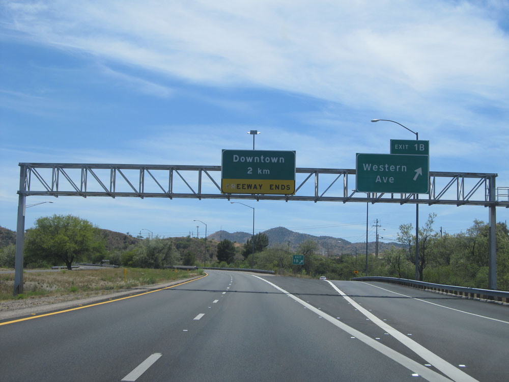 |
Interstate 19 South at Exit 1B: Western Ave (Photo taken 5/20/15). |
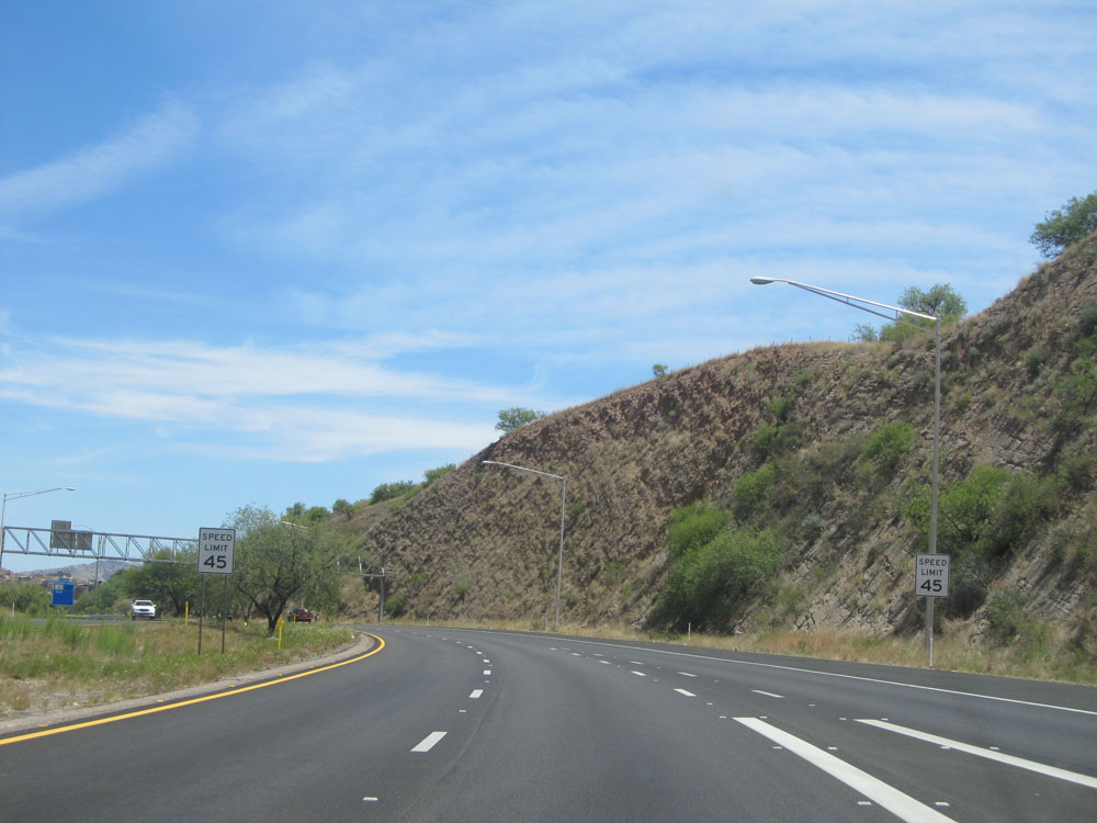 |
Just past Exit 1B, the speed limit drops to 45 mph as we near the southern terminus of Interstate 19 and downtown Nogales. (Photo taken 5/20/15). |
 |
Nearing downtown even more, the speed limit decreases to 35 mph. Those buildings on the mountainside in the distance? Those are in Mexico. (Photo taken 5/20/15). |
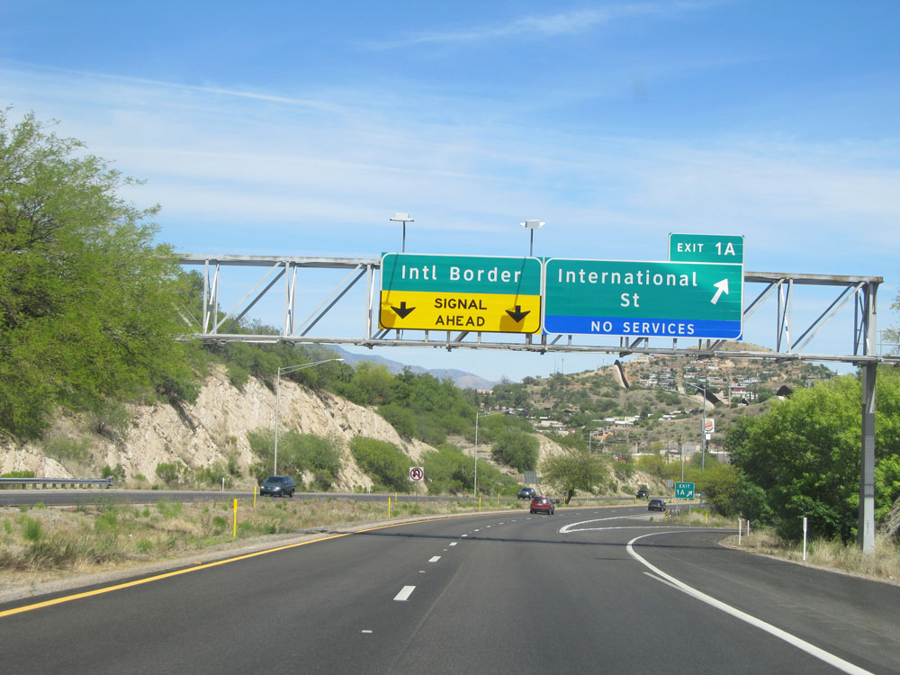 |
Interstate 19 South at Exit 1A: International St (Photo taken 5/20/15). |
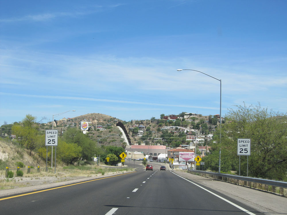 |
As we approach the end of Interstate 19 South just ahead, the speed limit drops to 25 mph as you enter downtown Nogales. (Photo taken 5/20/15). |